
Search Constraints
You searched for:
Provenance
Army Map Service Library, OMAHA, Library of Congress Geography & Map Division
Remove constraint Provenance: Army Map Service Library, OMAHA, Library of Congress Geography & Map Division
« Previous |
1 - 100 of 351
|
Next »
Search Results
-
- Description:
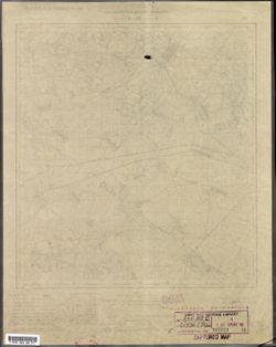
- 1927
- Subject:
- Geographic Subject: Nelidovo, Topical Subject: Soviet Union, and Topical Subject: Maps
- Publisher:
- Военно-топографическое управление
- Language:
- Russian
- Identifier:
- VAC9619-003499
- Genre:
- Military Maps and Topographic Maps
- Geographic Location:
- Coordinates: 56.167, 32.75, 56.333, 33
- Related URL:
- Download GeoTIFF: https://drive.google.com/file/d/1lyldTXRTAWh4xkvxGY4qHYiAm3I1vIe8/view?usp=sharing and Catalog URL: http://iucat.iu.edu/catalog/5020131
- Abstract:
- Modern area represented: Нелидово (Nelidovo), Tverskaya oblast, Russia
- Call Number:
- G7000 s50 .S68 sheet O-36-138-B
- Caption:
- Секретно
- City:
- Нелидово (Nelidovo)
- Copyright Holder:
- No Copyright - United States
- Country:
- СССР (USSR)
- State/Province:
- РСФСР (RSFSR) and Западная область (Western oblast)
- Physical Description:
- Scale: 1:50,000
- Persistent URL:
- http://purl.dlib.indiana.edu/iudl/images/VAC9619/VAC9619-003499
- Provenance:
- Army Map Service Library, OMAHA, Library of Congress Geography & Map Division
-
- Description:
- 1891
- Subject:
- Topical Subject: Maps, Geographic Subject: Korkia-aho, and Topical Subject: Soviet Union
- Publisher:
- Генеральный штаб РККА
- Language:
- Russian
- Identifier:
- VAC9619-002975
- Genre:
- Military Maps and Topographic Maps
- Geographic Location:
- Coordinates: 60.833, 28, 61, 28.25
- Related URL:
- Catalog URL: http://iucat.iu.edu/catalog/5020131 and Download GeoTIFF: https://drive.google.com/file/d/1XQ6m38IdPG84LmHqxFpPWIzLrUEOitzl/view?usp=sharing
- Call Number:
- GM G7000 s50 .S68 sheet P-35-117-A
- Caption:
- Временное издание
- City:
- Коркиаахо (Korkia-aho)
- Copyright Holder:
- No Copyright - United States
- Country:
- Финляндия (Finland)
- Physical Description:
- Scale: 1:50,000
- Persistent URL:
- http://purl.dlib.indiana.edu/iudl/images/VAC9619/VAC9619-002975
- Provenance:
- Army Map Service Library, OMAHA, Library of Congress Geography & Map Division
-

- Description:
- 1937
- Subject:
- Geographic Subject: Gummolovo and Topical Subject: Soviet Union
- Publisher:
- Главное управление государственной съемки и картографии НКВД СССР
- Language:
- Russian
- Date Created:
- 1941
- Identifier:
- VAC9619-000040
- Genre:
- Military Maps and Topographic Maps
- Geographic Location:
- Coordinates: 59.1667, 30.75, 59.3333, 31
- Related URL:
- Catalog URL: http://iucat.iu.edu/catalog/5020131 and Download GeoTIFF: https://drive.google.com/open?id=1Thglq8S3ntpZfPmHWFNFQ1QHmQpoR5Lu
- Abstract:
- Modern area represented: Gummolovo, Russia
- Call Number:
- G7000 s50 .S68 sheet O-36-26-B
- Caption:
- Для служебного пользования
- City:
- Гуммолово (Gummolovo)
- Copyright Holder:
- No Copyright - United States
- Country:
- СССР (USSR)
- State/Province:
- Ленинградская область (Leningrad oblast), Тосненский район (Tosnensky district), and РСФСР (RSFSR)
- Physical Description:
- Scale: 1:50,000
- Persistent URL:
- http://purl.dlib.indiana.edu/iudl/images/VAC9619/VAC9619-000040
- Provenance:
- Army Map Service Library, OMAHA, Library of Congress Geography & Map Division
-

- Subject:
- Topical Subject: Soviet Union, Topical Subject: Maps, and Geographic Subject: Novo-Biyskoye
- Publisher:
- Генеральный штаб РККА
- Language:
- Russian
- Date Created:
- 1940
- Identifier:
- VAC9619-003763
- Genre:
- Military Maps and Topographic Maps
- Geographic Location:
- Coordinates: 54.416667, 21.25, 54.5, 21.375
- Related URL:
- Download GeoTIFF: https://drive.google.com/file/d/12ADQ-KwvRsbz_NrkgrhOE6_uEKunq8Ac/view?usp=sharing and Catalog URL: https://iucat.iu.edu/catalog/14701157
- Abstract:
- Modern area represented: Ново-Бийское (Novo-Biyskoye), Kaliningradskaya oblast, Russia
- Call Number:
- G7063.K2 s25 .S6 sheet N-34-55-D-а
- Caption:
- Captured map
- City:
- Фридрихсвальде (Friedrichswalde)
- Copyright Holder:
- No Copyright - United States
- Country:
- Германия (Восточная Пруссия) (Germany (East Prussia))
- Physical Description:
- Scale: 1:25,000
- Persistent URL:
- http://purl.dlib.indiana.edu/iudl/images/VAC9619/VAC9619-003763
- Provenance:
- Army Map Service Library, OMAHA, Library of Congress Geography & Map Division
-

- Description:
- 1936
- Subject:
- Geographic Subject: Staryya Maksimavichy, Topical Subject: Maps, and Topical Subject: Soviet Union
- Publisher:
- Управление военных топографов РККА
- Language:
- Russian
- Identifier:
- VAC9619-000657
- Genre:
- Topographic Maps and Military Maps
- Geographic Location:
- Coordinates: 53.5, 29, 53.667, 29.25
- Related URL:
- Catalog URL: http://iucat.iu.edu/catalog/5020131 and Download GeoTIFF: https://drive.google.com/open?id=1A2R5hWH6Bx_hws0ztiyXWDWHVavpEUJz
- Abstract:
- Modern area represented: Staryya Maksimavichy, Mogilev oblast, Belarus
- Call Number:
- G7000 s50 .S68 sheet N-35-95-A
- Caption:
- Не подлежит оглашению,Captured map
- City:
- Старые Максимовичи (Starye Maksimovichi)
- Copyright Holder:
- No Copyright - United States
- Country:
- СССР (USSR)
- State/Province:
- Белорусская ССР (Byelorussian Soviet Socialist Republic)
- Physical Description:
- Scale: 1:50,000
- Persistent URL:
- http://purl.dlib.indiana.edu/iudl/images/VAC9619/VAC9619-000657
- Provenance:
- Army Map Service Library, OMAHA, Library of Congress Geography & Map Division
-
- Description:
- 1929
- Subject:
- Topical Subject: Soviet Union, Geographic Subject: Бабровічы (Babrovichy), and Topical Subject: Maps
- Publisher:
- Управление военных топографов
- Language:
- Russian
- Identifier:
- VAC9619-000829
- Genre:
- Military Maps and Topographic Maps
- Geographic Location:
- Coordinates: 52.167, 29.25, 52.333, 29.5
- Related URL:
- Download GeoTIFF: https://drive.google.com/open?id=138VirzeCDx88qbGqK4C2xzo0WKf9yBLV and Catalog URL: http://iucat.iu.edu/catalog/5020131
- Abstract:
- Modern area represented: Бабровічы (Babrovichy), Homyel' oblast, Belarus
- Call Number:
- g7000 s50 .S68 sheet N-35-143-B
- Caption:
- Не подлежит оглашению and Captured map
- City:
- Бобровичи (Bobrovichi)
- Copyright Holder:
- No Copyright - United States
- Country:
- СССР (USSR)
- State/Province:
- Белорусская ССР (Byelorussian Soviet Socialist Republic)
- Physical Description:
- Scale: 1:50,000
- Persistent URL:
- http://purl.dlib.indiana.edu/iudl/images/VAC9619/VAC9619-000829
- Provenance:
- Army Map Service Library, OMAHA, Library of Congress Geography & Map Division
-
- Subject:
- Geographic Subject: Cegłów, Topical Subject: Soviet Union, and Topical Subject: Maps
- Publisher:
- Генеральный штаб Красной Армии
- Language:
- Russian
- Date Created:
- 1941
- Identifier:
- VAC9619-000336
- Genre:
- Military Maps and Topographic Maps
- Geographic Location:
- Coordinates: 52, 21.5, 52.167, 21.75
- Related URL:
- Download GeoTIFF: https://drive.google.com/open?id=1EwlXwAYp5zAgkg8DJ__OMlHFwctYLxzf and Catalog URL: http://iucat.iu.edu/catalog/5020131
- Abstract:
- Modern area represented: Cegłów, Poland
- Call Number:
- G7000 s50 .S68 sheet N-34-140-C
- Caption:
- Captured map
- City:
- Цеглув (Cegłów)
- Copyright Holder:
- No Copyright - United States
- Country:
- Область государственных интересов Германии (Region of German state interest)
- Physical Description:
- Scale: 1:50,000
- Persistent URL:
- http://purl.dlib.indiana.edu/iudl/images/VAC9619/VAC9619-000336
- Provenance:
- Army Map Service Library, OMAHA, Library of Congress Geography & Map Division
-
- Description:
- 1932
- Subject:
- Topical Subject: Soviet Union, Topical Subject: Maps, and Geographic Subject: Parevichi
- Publisher:
- Управление военных топографов
- Language:
- Russian
- Date Created:
- 1935
- Identifier:
- VAC9619-003528
- Genre:
- Topographic Maps and Military Maps
- Geographic Location:
- Coordinates: 57.3333, 30.25, 57.5, 30.5
- Related URL:
- Download GeoTIFF: https://drive.google.com/file/d/1XoJ_B73bclp0wAy4LtwTrHbzPBWOIEMp/view?usp=sharing and Catalog URL: http://iucat.iu.edu/catalog/5020131
- Abstract:
- Modern area represented: Паревичи (Parevichi), Pskovskaya oblast, Russia
- Call Number:
- GM G7000 s50 .S68 sheet O-36-85-D
- Caption:
- Не подлежит оглашению
- City:
- Паревичи (Parevichi)
- Copyright Holder:
- No Copyright - United States
- Country:
- СССР (USSR)
- State/Province:
- Ленинградская область (Leningrad oblast) and РСФСР (RSFSR)
- Physical Description:
- Scale: 1:50,000
- Persistent URL:
- http://purl.dlib.indiana.edu/iudl/images/VAC9619/VAC9619-003528
- Provenance:
- Army Map Service Library, OMAHA, Library of Congress Geography & Map Division
-
- Subject:
- Topical Subject: Soviet Union, Geographic Subject: Cheremukhino, and Topical Subject: Maps
- Publisher:
- Генеральный штаб РККА
- Language:
- Russian
- Identifier:
- VAC9619-002935
- Genre:
- Military Maps and Topographic Maps
- Geographic Location:
- Coordinates: 60.66667, 30.5, 60.83333, 30.75
- Related URL:
- Catalog URL: http://iucat.iu.edu/catalog/5020131 and Download GeoTIFF: https://drive.google.com/file/d/1rbHT4R5Z-niDPPjpInnbfr_wAqF66BuU/view?usp=sharing
- Abstract:
- Modern area represented: Черемухино (Cheremukhino), Leningradskaya oblast, Russia
- Call Number:
- G7000 s50 .S68 sheet P-36-110-C
- City:
- Иляпяя (Ylläppää)
- Copyright Holder:
- No Copyright - United States
- Country:
- Финляндия (Finland)
- Physical Description:
- Scale: 1:50,000
- Persistent URL:
- http://purl.dlib.indiana.edu/iudl/images/VAC9619/VAC9619-002935
- Provenance:
- Army Map Service Library, OMAHA, Library of Congress Geography & Map Division
-
- Subject:
- Topical Subject: Maps, Topical Subject: Soviet Union, and Geographic Subject: Gołymin-Ośrodek
- Publisher:
- Генеральный штаб Красной Армии
- Language:
- Russian
- Date Created:
- 1941
- Identifier:
- VAC9619-000380
- Genre:
- Topographic Maps and Military Maps
- Geographic Location:
- Coordinates: 52.6667, 20.75, 52.8333, 21
- Related URL:
- Download GeoTIFF: https://drive.google.com/open?id=1TK2aF8RMGAbdEVm4XuSX3vzj2tJntdbW and Catalog URL: http://iucat.iu.edu/catalog/5020131
- Abstract:
- Modern area represented: Gołymin-Ośrodek, Poland
- Call Number:
- G7000 s50 .S68 sheet N-114-D
- Caption:
- Captured map
- City:
- Голымин Стары
- Copyright Holder:
- No Copyright - United States
- Country:
- Область государственных интересов Германии (Region of German state interest)
- Physical Description:
- Scale: 1:50,000
- Persistent URL:
- http://purl.dlib.indiana.edu/iudl/images/VAC9619/VAC9619-000380
- Provenance:
- Army Map Service Library, OMAHA, Library of Congress Geography & Map Division
-

- Description:
- 1936
- Subject:
- Topical Subject: Maps, Geographic Subject: Khodtsy, and Topical Subject: Soviet Union
- Publisher:
- Управление военных топографов РККА
- Language:
- Russian
- Identifier:
- VAC9619-000548
- Genre:
- Topographic Maps and Military Maps
- Geographic Location:
- Coordinates: 54.8333, 29.75, 55, 30
- Related URL:
- Catalog URL: http://iucat.iu.edu/catalog/5020131 and Download GeoTIFF: https://drive.google.com/open?id=14tVbXfbqBQ4Pq5qj3INV1DA3AaYwmJ1t
- Abstract:
- Modern area represented: Khodtsy, Vitebsk oblast, Belarus
- Call Number:
- G7000 s50 .S68 sheet N-35-48-B
- Caption:
- Не подлежит оглашению
- City:
- Ходцы (Khodtsy)
- Copyright Holder:
- No Copyright - United States
- Country:
- СССР (USSR)
- State/Province:
- Белорусская ССР (Byelorussian Soviet Socialist Republic)
- Physical Description:
- Scale: 1:50,000
- Persistent URL:
- http://purl.dlib.indiana.edu/iudl/images/VAC9619/VAC9619-000548
- Provenance:
- Army Map Service Library, OMAHA, Library of Congress Geography & Map Division
-
- Subject:
- Topical Subject: Soviet Union, Topical Subject: Maps, and Geographic Subject: Kałuszyn
- Publisher:
- Генеральный штаб Красной Армии
- Language:
- Russian
- Date Created:
- 1941
- Identifier:
- VAC9619-000335
- Genre:
- Military Maps and Topographic Maps
- Geographic Location:
- Coordinates: 52.166667, 21.75, 52.333333, 22.0
- Related URL:
- Download GeoTIFF: https://drive.google.com/open?id=1Sb-EziIgk9d7S9DVnzeYYee0wU_oK9Q9 and Catalog URL: http://iucat.iu.edu/catalog/5020131
- Abstract:
- Modern area represented: Kałuszyn, Poland
- Call Number:
- G7000 s50 .S68 sheet N-34-140-B
- Caption:
- Captured map
- City:
- Калушин (Kałuszyn)
- Copyright Holder:
- No Copyright - United States
- Country:
- Область государственных интересов Германии (Region of German state interest)
- Physical Description:
- Scale: 1:50,000
- Persistent URL:
- http://purl.dlib.indiana.edu/iudl/images/VAC9619/VAC9619-000335
- Provenance:
- Army Map Service Library, OMAHA, Library of Congress Geography & Map Division
-

- Description:
- 1937
- Subject:
- Topical Subject: Maps, Topical Subject: Soviet Union, and Geographic Subject: Sakalishcha
- Publisher:
- Генеральный штаб РККА
- Language:
- Russian
- Identifier:
- VAC9619-000422
- Genre:
- Military Maps and Topographic Maps
- Geographic Location:
- Coordinates: 55.667, 28.5, 55.833, 28.75
- Related URL:
- Catalog URL: http://iucat.iu.edu/catalog/5020131 and Download GeoTIFF: https://drive.google.com/open?id=1DOwYc4lY8SeBKz1Mts6ItDaQcxncviLo
- Abstract:
- Modern area represented: Sakalishcha, Vitebsk oblast, Belarus
- Call Number:
- G7000 s50 .S68 sheet N-35-10-C
- Caption:
- Не подлежит оглашению
- City:
- Соколище (Sokolishche)
- Copyright Holder:
- No Copyright - United States
- Country:
- СССР (USSR)
- State/Province:
- Витебская область (Vitebsk oblast) and Белорусская ССР (Byelorussian Soviet Socialist Republic)
- Physical Description:
- Scale: 1:50,000
- Persistent URL:
- http://purl.dlib.indiana.edu/iudl/images/VAC9619/VAC9619-000422
- Provenance:
- Army Map Service Library, OMAHA, Library of Congress Geography & Map Division
-
- Description:
- 1936
- Subject:
- Geographic Subject: Syanno, Topical Subject: Maps, and Topical Subject: Soviet Union
- Publisher:
- Управление военных топографов РККА
- Language:
- Russian
- Identifier:
- VAC9619-000549
- Genre:
- Military Maps and Topographic Maps
- Geographic Location:
- Coordinates: 54.6667, 29.5, 54.8333, 29.75
- Related URL:
- Catalog URL: http://iucat.iu.edu/catalog/5020131 and Download GeoTIFF: https://drive.google.com/open?id=1VZiA4bKtVsrpc4J7E-2EQjKsHfwe4gkF
- Abstract:
- Modern area represented: Syanno, Vitebsk oblast, Belarus
- Call Number:
- G7000 s50 .S68 sheet N-35-48-C
- Caption:
- Не подлежит оглашению,Captured map
- City:
- Сенно (Senno)
- Copyright Holder:
- No Copyright - United States
- Country:
- СССР (USSR)
- State/Province:
- Белорусская ССР (Byelorussian Soviet Socialist Republic)
- Physical Description:
- Scale: 1:50,000
- Persistent URL:
- http://purl.dlib.indiana.edu/iudl/images/VAC9619/VAC9619-000549
- Provenance:
- Army Map Service Library, OMAHA, Library of Congress Geography & Map Division
-
- Description:
- 1936
- Subject:
- Topical Subject: Soviet Union, Topical Subject: Maps, and Geographic Subject: Borki
- Publisher:
- Управление военных топографов РККА
- Language:
- Russian
- Identifier:
- VAC9619-000663
- Genre:
- Military Maps and Topographic Maps
- Geographic Location:
- Coordinates: 53.333, 29.5, 53.5, 29.75
- Related URL:
- Catalog URL: http://iucat.iu.edu/catalog/5020131 and Download GeoTIFF: https://drive.google.com/open?id=1j1eQx4lz9Gpi5I0vmkJhaZioYJavO2eP
- Abstract:
- Modern area represented: Borki, Mogilev oblast, Belarus
- Call Number:
- G7000 s50 .S68 sheet N-35-96-C
- Caption:
- Не подлежит оглашению,Captured map
- City:
- Борки (Borki)
- Copyright Holder:
- No Copyright - United States
- Country:
- СССР (USSR)
- State/Province:
- Белорусская ССР (Byelorussian Soviet Socialist Republic)
- Physical Description:
- Scale: 1:50,000
- Persistent URL:
- http://purl.dlib.indiana.edu/iudl/images/VAC9619/VAC9619-000663
- Provenance:
- Army Map Service Library, OMAHA, Library of Congress Geography & Map Division
-
- Subject:
- Topical Subject: Maps, Topical Subject: Soviet Union, and Geographic Subject: Vesneri
- Publisher:
- Генеральный штаб РККА
- Language:
- Russian
- Identifier:
- VAC9619-002661
- Genre:
- Topographic Maps and Military Maps
- Geographic Location:
- Coordinates: 58.333, 26.75, 58.5, 27
- Related URL:
- Download GeoTIFF: https://drive.google.com/file/d/1I8RMgYid8hQr1PsM7sc3p7OB4QA3KBu3/view?usp=sharing and Catalog URL: http://iucat.iu.edu/catalog/5020131
- Abstract:
- Modern area represented: Vesneri, Estonia
- Call Number:
- GM G7000 s50 .S68 sheet O-35-54-D
- Caption:
- Не подлежит оглашению,Captured map
- City:
- Вэснэри (Vesneri)
- Copyright Holder:
- No Copyright - United States
- Country:
- Эстония (Estonia)
- Physical Description:
- Scale: 1:50,000
- Persistent URL:
- http://purl.dlib.indiana.edu/iudl/images/VAC9619/VAC9619-002661
- Provenance:
- Army Map Service Library, OMAHA, Library of Congress Geography & Map Division
-
- Description:
- 1937
- Subject:
- Geographic Subject: Rositsa, Topical Subject: Maps, and Topical Subject: Soviet Union
- Publisher:
- Генеральный штаб РККА
- Language:
- Russian
- Identifier:
- VAC9619-000412
- Genre:
- Topographic Maps and Military Maps
- Geographic Location:
- Coordinates: 55.833, 27.75, 56, 28
- Related URL:
- Download GeoTIFF: https://drive.google.com/open?id=1mTY3o9wRNxZ1SdrpfruBIHdg213CK5WC and Catalog URL: http://iucat.iu.edu/catalog/5020131
- Abstract:
- Modern area represented: Rositsa, Vitebsk oblast, Belarus
- Call Number:
- G7000 s50 .S68 sheet N-35-8-B
- Caption:
- Не подлежит оглашению
- City:
- Росица (Rositsa)
- Copyright Holder:
- No Copyright - United States
- Country:
- СССР (USSR) and Латвия (Latvia)
- State/Province:
- Белорусская ССР (Byelorussian Soviet Socialist Republic) and Витебская область (Vitebsk oblast)
- Physical Description:
- Scale: 1:50,000
- Persistent URL:
- http://purl.dlib.indiana.edu/iudl/images/VAC9619/VAC9619-000412
- Provenance:
- Army Map Service Library, OMAHA, Library of Congress Geography & Map Division
-
- Subject:
- Topical Subject: Soviet Union, Geographic Subject: Lebedzeva, and Topical Subject: Maps
- Publisher:
- Генеральный штаб РККА
- Language:
- Russian
- Date Created:
- 1938
- Identifier:
- VAC9619-000583
- Genre:
- Military Maps and Topographic Maps
- Geographic Location:
- Coordinates: 54.167, 26.5, 54.333, 26.75
- Related URL:
- Download GeoTIFF: https://drive.google.com/open?id=1qKWQMoJolU9kKvFFN_MaSiOAnifnI0Hr and Catalog URL: http://iucat.iu.edu/catalog/5020131
- Abstract:
- Modern area represented: Lebedzeva, Minsk oblast, Belarus
- Call Number:
- G7000 s50 .S68 sheet N-35-66-A
- City:
- Лебедзев (Liebiedziew)
- Copyright Holder:
- No Copyright - United States
- Country:
- Польша (Poland)
- Physical Description:
- Scale: 1:50,000
- Persistent URL:
- http://purl.dlib.indiana.edu/iudl/images/VAC9619/VAC9619-000583
- Provenance:
- Army Map Service Library, OMAHA, Library of Congress Geography & Map Division
-
- Description:
- 1936
- Subject:
- Topical Subject: Maps, Geographic Subject: Gverzdon', and Topical Subject: Soviet Union
- Publisher:
- Генеральный штаб РККА
- Language:
- Russian
- Identifier:
- VAC9619-002701
- Genre:
- Topographic Maps and Military Maps
- Geographic Location:
- Coordinates: 58, 28.25, 58.167, 28.5
- Related URL:
- Download GeoTIFF: https://drive.google.com/file/d/1CP-E2i8ApPidjwpZuUS6pyjTpk00XKO4/view?usp=sharing and Catalog URL: http://iucat.iu.edu/catalog/5020131
- Abstract:
- Modern area represented: Гверздонь (Gverzdon'), Псковская область (Pskovskaya oblast), Russia
- Call Number:
- GM G7000 s50 .S68 sheet O-35-69-D
- Caption:
- Не подлежит оглашению and Captured map
- City:
- Гверздонь (Gverzdon')
- Copyright Holder:
- No Copyright - United States
- Country:
- СССР (USSR)
- State/Province:
- Ленинградская область (Leningrad oblast) and РСФСР (RSFSR)
- Physical Description:
- Scale: 1:50,000
- Persistent URL:
- http://purl.dlib.indiana.edu/iudl/images/VAC9619/VAC9619-002701
- Provenance:
- Army Map Service Library, OMAHA, Library of Congress Geography & Map Division
-
- Description:
- 1929
- Subject:
- Geographic Subject: Якімавічы (Yakimavichy), Topical Subject: Soviet Union, and Topical Subject: Maps
- Publisher:
- Управление военных топографов
- Language:
- Russian
- Identifier:
- VAC9619-000828
- Genre:
- Military Maps and Topographic Maps
- Geographic Location:
- Coordinates: 52.167, 29, 52.333, 29.25
- Related URL:
- Catalog URL: http://iucat.iu.edu/catalog/5020131 and Download GeoTIFF: https://drive.google.com/open?id=1hW0JVK_txFGDjpfXu8G4PvC7QH-R8TTL
- Abstract:
- Modern area represented: Якімавічы (Yakimavichy), Homyel' oblast, Belarus
- Call Number:
- g7000 s50 .S68 sheet N-35-143-A
- Caption:
- Не подлежит оглашению
- City:
- Якимовичи (Yakimovichi)
- Copyright Holder:
- No Copyright - United States
- Country:
- СССР (USSR)
- State/Province:
- Белорусская ССР (Byelorussian Soviet Socialist Republic)
- Physical Description:
- Scale: 1:50,000
- Persistent URL:
- http://purl.dlib.indiana.edu/iudl/images/VAC9619/VAC9619-000828
- Provenance:
- Army Map Service Library, OMAHA, Library of Congress Geography & Map Division
-
- Description:
- 1929
- Subject:
- Topical Subject: Maps, Geographic Subject: Калинкавичы (Kalinkavichy), and Topical Subject: Soviet Union
- Publisher:
- Управление военных топографов
- Language:
- Russian
- Identifier:
- VAC9619-000830
- Genre:
- Military Maps and Topographic Maps
- Geographic Location:
- Coordinates: 52.0, 29.25, 52.16667, 29.5
- Related URL:
- Download GeoTIFF: https://drive.google.com/open?id=1nb3LExZESDZr6-VZkFqWAOPiKKhs5k7X and Catalog URL: http://iucat.iu.edu/catalog/5020131
- Abstract:
- Modern area represented: Калинкавичы (Kalinkavichy), Homyel' oblast, Belarus
- Call Number:
- G7000 s50 .S68 sheet N-35-143-D
- Caption:
- Не подлежит оглашению
- City:
- Калинковичи (Kalinkovichi)
- Copyright Holder:
- No Copyright - United States
- Country:
- СССР (USSR)
- State/Province:
- Белорусская ССР (Byelorussian Soviet Socialist Republic)
- Physical Description:
- Scale: 1:50,000
- Persistent URL:
- http://purl.dlib.indiana.edu/iudl/images/VAC9619/VAC9619-000830
- Provenance:
- Army Map Service Library, OMAHA, Library of Congress Geography & Map Division
-
- Subject:
- Topical Subject: Soviet Union, Topical Subject: Maps, and Geographic Subject: Nowy Dwór Mazowiecki
- Publisher:
- Генеральный штаб Красной Армии
- Language:
- Russian
- Date Created:
- 1941
- Identifier:
- VAC9619-000146
- Genre:
- Military Maps and Topographic Maps
- Geographic Location:
- Coordinates: 52.3333, 20.5, 52.5, 20.6667
- Related URL:
- Download GeoTIFF: https://drive.google.com/open?id=1jjJwHRaXBPCIZUG-msLmfYa5McZJk4Zs and Catalog URL: http://iucat.iu.edu/catalog/5020131
- Abstract:
- Modern area represented: Nowy Dwór Mazowiecki, Poland
- Call Number:
- G7000 s50 .S68 sheet N-34-126-C
- Caption:
- Captured map
- City:
- Модлин (Modlin)
- Copyright Holder:
- No Copyright - United States
- Country:
- Область государственных интересов Германии (Region of German state interest)
- Physical Description:
- Scale: 1:50,000
- Persistent URL:
- http://purl.dlib.indiana.edu/iudl/images/VAC9619/VAC9619-000146
- Provenance:
- Army Map Service Library, OMAHA, Library of Congress Geography & Map Division
-
- Description:
- 1937
- Subject:
- Topical Subject: Maps, Topical Subject: Soviet Union, and Geographic Subject: Karamyshevo
- Publisher:
- Генеральный штаб РККА
- Language:
- Russian
- Identifier:
- VAC9619-002809
- Genre:
- Military Maps and Topographic Maps
- Geographic Location:
- Coordinates: 57.667, 28.75, 57.833, 29
- Related URL:
- Catalog URL: http://iucat.iu.edu/catalog/5020131 and Download GeoTIFF: https://drive.google.com/file/d/1JImzUSmwzN59vUFeQ-Jrq0P4f-x20KsC/view?usp=sharing
- Abstract:
- Modern area represented: Карамышево (Karamyshevo), Псковская область (Pskovskaya oblast), Russia
- Call Number:
- GM G7000 s50 .S68 sheet O-35-82-D
- Caption:
- Не подлежит оглашению and Captured map
- City:
- Карамышево (Karamyshevo)
- Copyright Holder:
- No Copyright - United States
- Country:
- СССР (USSR)
- State/Province:
- РСФСР (RSFSR) and Ленинградская область (Leningrad oblast)
- Physical Description:
- Scale: 1:50,000
- Persistent URL:
- http://purl.dlib.indiana.edu/iudl/images/VAC9619/VAC9619-002809
- Provenance:
- Army Map Service Library, OMAHA, Library of Congress Geography & Map Division
-
- Description:
- 1927
- Subject:
- Geographic Subject: Sutrimino, Topical Subject: Maps, and Topical Subject: Soviet Union
- Publisher:
- Военно-топографическое управление
- Language:
- Russian
- Date Created:
- 1931
- Identifier:
- VAC9619-003493
- Genre:
- Military Maps and Topographic Maps
- Geographic Location:
- Coordinates: 56, 31.5, 56.167, 31.75
- Related URL:
- Catalog URL: http://iucat.iu.edu/catalog/5020131 and Download GeoTIFF: https://drive.google.com/file/d/1uE3rahGvu03Kf3HjsBCnvMFHxgTLi5jl/view?usp=sharing
- Abstract:
- Modern area represented: Сутрмино (Sutrimino), Tverskaya oblast, Russia
- Call Number:
- G7000 s50 .S68 sheet O-36-136-C
- Caption:
- Captured map and Секретно
- City:
- Сутрмино (Sutrimino)
- Copyright Holder:
- No Copyright - United States
- Country:
- СССР (USSR)
- State/Province:
- РСФСР (RSFSR) and Западная область (Western oblast)
- Physical Description:
- Scale: 1:50,000
- Persistent URL:
- http://purl.dlib.indiana.edu/iudl/images/VAC9619/VAC9619-003493
- Provenance:
- Army Map Service Library, OMAHA, Library of Congress Geography & Map Division
-
- Subject:
- Topical Subject: Soviet Union, Topical Subject: Maps, and Geographic Subject: Lakhva
- Publisher:
- Генеральный штаб РККА
- Language:
- Russian
- Identifier:
- VAC9619-000801
- Genre:
- Military Maps and Topographic Maps
- Geographic Location:
- Coordinates: 52.167, 27, 52.333, 27.25
- Related URL:
- Catalog URL: http://iucat.iu.edu/catalog/5020131 and Download GeoTIFF: https://drive.google.com/open?id=17puyWsEAXz5ZKb9tTy6_CLYgp8E7I_SZ
- Abstract:
- Modern area represented: Lakhva, Brest oblast, Belarus
- Call Number:
- G7000 s50 .s68 sheet N-35-139-A
- Caption:
- Captured map
- City:
- Лахва (Łachwa)
- Copyright Holder:
- No Copyright - United States
- Country:
- Польша (Poland)
- Physical Description:
- Scale: 1:50,000
- Persistent URL:
- http://purl.dlib.indiana.edu/iudl/images/VAC9619/VAC9619-000801
- Provenance:
- Army Map Service Library, OMAHA, Library of Congress Geography & Map Division
-

- Subject:
- Topical Subject: Maps, Geographic Subject: Valkalata, and Topical Subject: Soviet Union
- Publisher:
- Генеральный штаб РККА
- Language:
- Russian
- Identifier:
- VAC9619-000529
- Genre:
- Military Maps and Topographic Maps
- Geographic Location:
- Coordinates: 54.8333, 27.25, 55, 27.5
- Related URL:
- Catalog URL: http://iucat.iu.edu/catalog/5020131 and Download GeoTIFF: https://drive.google.com/open?id=1o5fFY5Bw5TriFAFU3BbE_3tV99aUavO1
- Abstract:
- Modern area represented: Валкалата (Valkalata), Vitebsk Region, Belarus
- Call Number:
- G7000 s50 .S68 sheet N-35-43-B
- City:
- Волколата (Volkolata)
- Copyright Holder:
- No Copyright - United States
- Country:
- Польша (Poland)
- Physical Description:
- Scale: 1:50,000
- Persistent URL:
- http://purl.dlib.indiana.edu/iudl/images/VAC9619/VAC9619-000529
- Provenance:
- Army Map Service Library, OMAHA, Library of Congress Geography & Map Division
-
- Subject:
- Topical Subject: Soviet Union, Topical Subject: Maps, and Geographic Subject: Sigaste
- Publisher:
- Генеральный штаб РККА
- Language:
- Russian
- Identifier:
- VAC9619-002692
- Genre:
- Military Maps and Topographic Maps
- Geographic Location:
- Coordinates: 58.167, 24.75, 58.333, 25
- Related URL:
- Download GeoTIFF: https://drive.google.com/file/d/1twaJ41LBx-UcxUDlpRvk4t3te-YtoPaz/view?usp=sharing and Catalog URL: http://iucat.iu.edu/catalog/5020131
- Abstract:
- Modern area represented: Sigaste, Estonia
- Call Number:
- GM G7000 s50 .S68 sheet O-35-62-B
- Caption:
- Captured map
- City:
- Сигасте (Sigaste)
- Copyright Holder:
- No Copyright - United States
- Country:
- Эстония (Estonia)
- Physical Description:
- Scale: 1:50,000
- Persistent URL:
- http://purl.dlib.indiana.edu/iudl/images/VAC9619/VAC9619-002692
- Provenance:
- Army Map Service Library, OMAHA, Library of Congress Geography & Map Division
-
- Description:
- 1938
- Subject:
- Topical Subject: Maps, Geographic Subject: Golenishchevo, and Topical Subject: Soviet Union
- Publisher:
- Главное управление геодезии и картографии при СНК СССР
- Language:
- Russian
- Date Created:
- 1941
- Identifier:
- VAC9619-002902
- Genre:
- Topographic Maps and Military Maps
- Geographic Location:
- Coordinates: 56.833, 35, 57, 35.25
- Related URL:
- Download GeoTIFF: https://drive.google.com/file/d/1VtibtoQxHRE70YG4v1Z_BmotZkR5tx_t/view?usp=sharing and Catalog URL: http://iucat.iu.edu/catalog/5020131
- Abstract:
- Modern area represented: Голенищево (Golenishchevo), Tverskaya oblast, Russia
- Call Number:
- GM G7000 s50 .S68 sheet O-36-119-A
- City:
- Голенищево (Golenishchevo)
- Copyright Holder:
- No Copyright - United States
- Country:
- СССР (USSR)
- State/Province:
- Медновский район (Mednovsky district), Калининская область (Kalinin oblast), Новоторжский район (Novotorzhsky district), and Высоковский район (Vysokovsky di...
- Physical Description:
- Scale: 1:50,000
- Persistent URL:
- http://purl.dlib.indiana.edu/iudl/images/VAC9619/VAC9619-002902
- Provenance:
- Army Map Service Library, OMAHA, Library of Congress Geography & Map Division
-
- Subject:
- Topical Subject: Soviet Union, Geographic Subject: Tartu, and Topical Subject: Maps
- Publisher:
- Генеральный штаб РККА
- Language:
- Russian
- Identifier:
- VAC9619-002660
- Genre:
- Topographic Maps and Military Maps
- Geographic Location:
- Coordinates: 58.333, 26.5, 58.5, 26.75
- Related URL:
- Catalog URL: http://iucat.iu.edu/catalog/5020131 and Download GeoTIFF: https://drive.google.com/file/d/1X09f18LOlG5WvLzdN5UcqZuBMttBv02a/view?usp=sharing
- Abstract:
- Modern area represented: Tartu, Estonia
- Call Number:
- GM G7000 s50 .S68 sheet O-35-54-C
- Caption:
- Не подлежит оглашению,Captured map
- City:
- Тарту (Tartu)
- Copyright Holder:
- No Copyright - United States
- Country:
- Эстония (Estonia)
- Physical Description:
- Scale: 1:50,000
- Persistent URL:
- http://purl.dlib.indiana.edu/iudl/images/VAC9619/VAC9619-002660
- Provenance:
- Army Map Service Library, OMAHA, Library of Congress Geography & Map Division
-
- Subject:
- Topical Subject: Maps, Geographic Subject: Surju, and Topical Subject: Soviet Union
- Publisher:
- Генеральный штаб РККА
- Language:
- Russian
- Identifier:
- VAC9619-002691
- Genre:
- Military Maps and Topographic Maps
- Geographic Location:
- Coordinates: 58.167, 24.5, 58.333, 24.75
- Related URL:
- Download GeoTIFF: https://drive.google.com/file/d/1Mgy-7qu9lahfvxXbADUDOZM5Rhfze37F/view?usp=sharing and Catalog URL: http://iucat.iu.edu/catalog/5020131
- Abstract:
- Modern area represented: Surju, Estonia
- Call Number:
- GM G7000 s50 .S68 sheet O-35-62-A
- Caption:
- Captured map
- City:
- Сурью (Surju)
- Copyright Holder:
- No Copyright - United States
- Country:
- Эстония (Estonia)
- Physical Description:
- Scale: 1:50,000
- Persistent URL:
- http://purl.dlib.indiana.edu/iudl/images/VAC9619/VAC9619-002691
- Provenance:
- Army Map Service Library, OMAHA, Library of Congress Geography & Map Division
-
- Description:
- 1937
- Subject:
- Topical Subject: Soviet Union, Topical Subject: Maps, and Geographic Subject: Opukhliki
- Publisher:
- Генеральный штаб РККА
- Language:
- Russian
- Identifier:
- VAC9619-003484
- Genre:
- Topographic Maps and Military Maps
- Geographic Location:
- Coordinates: 56, 30, 56.167, 30.25
- Related URL:
- Download GeoTIFF: https://drive.google.com/file/d/1_e8VIv6WFrIfxi_kOo7Bc_5Tsq8Ppw_P/view?usp=sharing and Catalog URL: http://iucat.iu.edu/catalog/5020131
- Abstract:
- Modern area represented: Опухлики (Opukhliki), Pskovskaya oblast, Russia
- Call Number:
- G7000 s50 .S68 sheet O-36-133-C
- Caption:
- Не подлежит оглашению and Captured map
- City:
- Опухлики (Opukhliki)
- Copyright Holder:
- No Copyright - United States
- Country:
- СССР (USSR)
- State/Province:
- Калининская область (Kalinin oblast) and РСФСР (RSFSR)
- Physical Description:
- Scale: 1:50,000
- Persistent URL:
- http://purl.dlib.indiana.edu/iudl/images/VAC9619/VAC9619-003484
- Provenance:
- Army Map Service Library, OMAHA, Library of Congress Geography & Map Division
-
- Description:
- 1937
- Subject:
- Topical Subject: Maps, Geographic Subject: Pogostye, and Topical Subject: Soviet Union
- Publisher:
- Главное управление государственной съемки и картографии НКВД СССР
- Language:
- Russian
- Date Created:
- 1941
- Identifier:
- VAC9619-003010
- Genre:
- Topographic Maps and Military Maps
- Geographic Location:
- Coordinates: 59.5, 31.5, 59.667, 31.75
- Related URL:
- Download GeoTIFF: https://drive.google.com/file/d/1pUntXRKjdqDtToJwmqYz9UGC_8naXvsZ/view?usp=sharing and Catalog URL: http://iucat.iu.edu/catalog/5020131
- Abstract:
- Modern area represented: Pogostye, Leningrad oblast, Russia
- Call Number:
- G7000 s50 .S68 sheet O-36-16-A
- Caption:
- Для служебного пользования,Captured map
- City:
- Погостье (Pogostye)
- Copyright Holder:
- No Copyright - United States
- Country:
- СССР (USSR)
- State/Province:
- Мгинский район (Mginsky district), Тосненский район (Tosnensky district), Киришский район (Kirishsky district), РСФСР (RSFSR), and Ленинградская область (Len...
- Physical Description:
- Scale: 1:50,000
- Persistent URL:
- http://purl.dlib.indiana.edu/iudl/images/VAC9619/VAC9619-003010
- Provenance:
- Army Map Service Library, OMAHA, Library of Congress Geography & Map Division
-
- Subject:
- Geographic Subject: Dūkštas, Topical Subject: Soviet Union, and Topical Subject: Maps
- Publisher:
- Управление военных топографов РККА
- Language:
- Russian
- Identifier:
- VAC9619-000449
- Genre:
- Military Maps and Topographic Maps
- Geographic Location:
- Coordinates: 55.5, 26.25, 55.6667, 26.5
- Related URL:
- Catalog URL: http://iucat.iu.edu/catalog/5020131 and Download GeoTIFF: https://drive.google.com/open?id=1yO04o0Z7DU5-WfSIYgjYTdjfPW8VRFce
- Abstract:
- Modern area represented: Dūkštas, Lithuania
- Call Number:
- G7000 s50 .S68 sheet N-35-17-B
- City:
- Дукшты (Dukshty)
- Copyright Holder:
- No Copyright - United States
- Country:
- Литва (Lithuania) and Польша (Poland)
- Physical Description:
- Scale: 1:50,000
- Persistent URL:
- http://purl.dlib.indiana.edu/iudl/images/VAC9619/VAC9619-000449
- Provenance:
- Army Map Service Library, OMAHA, Library of Congress Geography & Map Division
-
- Subject:
- Topical Subject: Soviet Union, Topical Subject: Maps, and Geographic Subject: Ostróda
- Publisher:
- Генеральный штаб Красной Армии
- Language:
- Russian
- Date Created:
- 1941
- Identifier:
- VAC9619-003829
- Genre:
- Topographic Maps and Military Maps
- Geographic Location:
- Coordinates: 53.667, 19.875, 53.75, 20
- Related URL:
- Catalog URL: https://iucat.iu.edu/catalog/14701157 and Download GeoTIFF: https://drive.google.com/file/d/1Tg9H2arcre2rZtbfoCZ89T3Kh5Hlu150/view?usp=sharing
- Abstract:
- Modern area represented: Ostróda, Poland
- Call Number:
- G7063.K2 s25 .S6 sheet N-34-76-D-d
- City:
- Остероде (Osterode)
- Copyright Holder:
- No Copyright - United States
- Country:
- Германия (Восточная Пруссия) (Germany (East Prussia))
- Physical Description:
- Scale: 1:25,000
- Persistent URL:
- http://purl.dlib.indiana.edu/iudl/images/VAC9619/VAC9619-003829
- Provenance:
- Army Map Service Library, OMAHA, Library of Congress Geography & Map Division
-
- Description:
- 1932
- Subject:
- Geographic Subject: Soltsy, Topical Subject: Maps, and Topical Subject: Soviet Union
- Publisher:
- Управление военных топографов
- Language:
- Russian
- Identifier:
- VAC9619-000050
- Genre:
- Military Maps and Topographic Maps
- Geographic Location:
- Coordinates: 58, 30.25, 58.1667, 30.5
- Related URL:
- Download GeoTIFF: https://drive.google.com/open?id=1aCY_0sUJK5QGDTJ4vTdtMjEjlQPQo3PE and Catalog URL: http://iucat.iu.edu/catalog/5020131
- Abstract:
- Modern area represented: Soltsy, Novgorod oblast, Russia
- Call Number:
- G7000 s50 .S68 sheet O-36-61-D
- Caption:
- Не подлежит оглашению
- City:
- Сольцы (Soltsy)
- Copyright Holder:
- No Copyright - United States
- Country:
- СССР (USSR)
- State/Province:
- Ленинградская область (Leningrad oblast) and РСФСР (RSFSR)
- Physical Description:
- Scale: 1:50,000
- Persistent URL:
- http://purl.dlib.indiana.edu/iudl/images/VAC9619/VAC9619-000050
- Provenance:
- Army Map Service Library, OMAHA, Library of Congress Geography & Map Division
-
- Description:
- 1929
- Subject:
- Geographic Subject: Gorodnya, Topical Subject: Soviet Union, and Topical Subject: Maps
- Publisher:
- Военно-топографическое управление
- Language:
- Russian
- Identifier:
- VAC9619-003545
- Genre:
- Topographic Maps and Military Maps
- Geographic Location:
- Coordinates: 57.167, 31.25, 57.333, 31.5
- Related URL:
- Download GeoTIFF: https://drive.google.com/file/d/1FjmwidqkMb6yWwdQL_V2TgFIfjKpzItG/view?usp=sharing and Catalog URL: http://iucat.iu.edu/catalog/5020131
- Abstract:
- Modern area represented: Городня (Gorodnya), Novgorodskaya oblast, Russia
- Call Number:
- GM G7000 s50 .S68 sheet O-36-99-B
- Caption:
- Не подлежит оглашению and Captured map
- City:
- Городня (Gorodnya)
- Copyright Holder:
- No Copyright - United States
- Country:
- СССР (USSR)
- State/Province:
- Западная область (Western oblast), Ленинградская область (Leningrad oblast), and РСФСР (RSFSR)
- Physical Description:
- Scale: 1:50,000
- Persistent URL:
- http://purl.dlib.indiana.edu/iudl/images/VAC9619/VAC9619-003545
- Provenance:
- Army Map Service Library, OMAHA, Library of Congress Geography & Map Division
-
- Description:
- 1933
- Subject:
- Topical Subject: Soviet Union, Topical Subject: Maps, and Geographic Subject: Возера (Vozyera)
- Publisher:
- Управление военных топографов РККА
- Language:
- Russian
- Identifier:
- VAC9619-000645
- Genre:
- Topographic Maps and Military Maps
- Geographic Location:
- Coordinates: 53.5, 27.25, 53.667, 27.5
- Related URL:
- Catalog URL: http://iucat.iu.edu/catalog/5020131 and Download GeoTIFF: https://drive.google.com/open?id=12QPpUR0ToPSuHsPoKcfLJSn6k-ToHsah
- Abstract:
- Modern area represented: Возера (Vozyera), Minsk Oblast, Belarus
- Call Number:
- G7000 s50 .S68 sheet N-35-91-B
- Caption:
- Captured map and Не подлежит оглашению
- City:
- Озеро (Ozero)
- Copyright Holder:
- No Copyright - United States
- Country:
- СССР (USSR)
- State/Province:
- Белорусская ССР (Byelorussian Soviet Socialist Republic)
- Physical Description:
- Scale: 1:50,000
- Persistent URL:
- http://purl.dlib.indiana.edu/iudl/images/VAC9619/VAC9619-000645
- Provenance:
- Army Map Service Library, OMAHA, Library of Congress Geography & Map Division
-
- Description:
- 1886
- Subject:
- Geographic Subject: Tiurinsari, Topical Subject: Maps, and Topical Subject: Soviet Union
- Publisher:
- Генеральный штаб РККА
- Language:
- Russian
- Identifier:
- VAC9619-002987
- Genre:
- Military Maps and Topographic Maps
- Geographic Location:
- Coordinates: 60.333, 28.25, 60.5, 28.5
- Related URL:
- Catalog URL: http://iucat.iu.edu/catalog/5020131 and Download GeoTIFF: https://drive.google.com/file/d/1OptUI19bUNk9MNJClN_g2o956sUz3eS1/view?usp=sharing
- Abstract:
- Modern area represented: Tiurinsari, Leningrad oblast, Russia
- Call Number:
- G7000 s50 .S68 sheet P-35-129-D
- Caption:
- Captured map
- City:
- Тиуринсаари (Tiurinsaari)
- Copyright Holder:
- No Copyright - United States
- Country:
- Финляндия (Finland)
- Physical Description:
- Scale: 1:50,000
- Persistent URL:
- http://purl.dlib.indiana.edu/iudl/images/VAC9619/VAC9619-002987
- Provenance:
- Army Map Service Library, OMAHA, Library of Congress Geography & Map Division
-
- Subject:
- Topical Subject: Soviet Union, Geographic Subject: Zarasai, and Topical Subject: Maps
- Publisher:
- Управление военных топографов
- Language:
- Russian
- Date Created:
- 1931
- Identifier:
- VAC9619-000401
- Genre:
- Military Maps and Topographic Maps
- Geographic Location:
- Coordinates: 55.667, 26, 55.833, 26.25
- Related URL:
- Catalog URL: http://iucat.iu.edu/catalog/5020131 and Download GeoTIFF: https://drive.google.com/open?id=15qAUErdyJ7fb_ELG4IgoI3gxwnYVLlQT
- Abstract:
- Modern area represented: Zarasai, Lithuania
- Call Number:
- G7000 s50 .S68 sheet N-35-5-C
- City:
- Зарасай (Zarasai)
- Copyright Holder:
- No Copyright - United States
- Country:
- Литва (Lithuania) and Латвия (Latvia)
- Physical Description:
- Scale: 1:50,000
- Persistent URL:
- http://purl.dlib.indiana.edu/iudl/images/VAC9619/VAC9619-000401
- Provenance:
- Army Map Service Library, OMAHA, Library of Congress Geography & Map Division
-

- Subject:
- Geographic Subject: Slabodka, Topical Subject: Maps, and Topical Subject: Soviet Union
- Publisher:
- Генеральный штаб РККА
- Language:
- Russian
- Identifier:
- VAC9619-000409
- Genre:
- Topographic Maps and Military Maps
- Geographic Location:
- Coordinates: 55.667, 27, 55.833, 27.25
- Related URL:
- Catalog URL: http://iucat.iu.edu/catalog/5020131 and Download GeoTIFF: https://drive.google.com/open?id=1fdIMJEtNK6zMOXUR0MYTBDVrO6OnjhcI
- Abstract:
- Modern area represented: Slabodka, Belarus
- Call Number:
- G7000 s50 .S68 sheet N-35-7-C
- City:
- Слобудка
- Copyright Holder:
- No Copyright - United States
- Country:
- Польша (Poland) and Латвия (Latvia)
- Physical Description:
- Scale: 1:50,000
- Persistent URL:
- http://purl.dlib.indiana.edu/iudl/images/VAC9619/VAC9619-000409
- Provenance:
- Army Map Service Library, OMAHA, Library of Congress Geography & Map Division
-
- Subject:
- Topical Subject: Soviet Union, Topical Subject: Maps, and Geographic Subject: Viešvilė
- Publisher:
- Генеральный штаб Красной Армии
- Language:
- Russian
- Date Created:
- 1941
- Identifier:
- VAC9619-003621
- Genre:
- Military Maps and Topographic Maps
- Geographic Location:
- Coordinates: 55, 22.375, 55.083, 22.5
- Related URL:
- Catalog URL: https://iucat.iu.edu/catalog/14701157 and Download GeoTIFF: https://drive.google.com/file/d/1O1k_CVehwHDFdfHIlpINaO0hxDw_fwx3/view?usp=sharing
- Abstract:
- Modern area represented: Viešvilė, Lithuania
- Call Number:
- G7063.K2 s25 .S6 sheet N-34-33-D-d
- City:
- Вишвилл (Wischwill)
- Copyright Holder:
- No Copyright - United States
- Country:
- Германия (Восточная Пруссия) (Germany (East Prussia))
- Physical Description:
- Scale: 1:25,000
- Persistent URL:
- http://purl.dlib.indiana.edu/iudl/images/VAC9619/VAC9619-003621
- Provenance:
- Army Map Service Library, OMAHA, Library of Congress Geography & Map Division
-
- Description:
- 1929
- Subject:
- Topical Subject: Maps, Topical Subject: Soviet Union, and Geographic Subject: Kakachevo
- Publisher:
- Военно-топографическое управление
- Language:
- Russian
- Identifier:
- VAC9619-003542
- Genre:
- Military Maps and Topographic Maps
- Geographic Location:
- Coordinates: 57.167, 30.75, 57.333, 31
- Related URL:
- Download GeoTIFF: https://drive.google.com/file/d/1YT8nZVeHKlhrNeoy8rtiqLf1NAd8Sj-v/view?usp=sharing and Catalog URL: http://iucat.iu.edu/catalog/5020131
- Abstract:
- Modern area represented: Какачево (Kakachevo), Novgorodskaya oblast, Russia
- Call Number:
- GM G7000 s50 .S68 sheet O-36-98-B
- Caption:
- Не подлежит оглашению and Captured map
- City:
- Какачево (Kakachevo)
- Copyright Holder:
- No Copyright - United States
- Country:
- СССР (USSR)
- State/Province:
- Западная область (Western oblast), РСФСР (RSFSR), and Ленинградская область (Leningrad oblast)
- Physical Description:
- Scale: 1:50,000
- Persistent URL:
- http://purl.dlib.indiana.edu/iudl/images/VAC9619/VAC9619-003542
- Provenance:
- Army Map Service Library, OMAHA, Library of Congress Geography & Map Division
-

- Subject:
- Geographic Subject: Gvardeysk, Topical Subject: Soviet Union, and Topical Subject: Maps
- Publisher:
- Генеральный штаб РККА
- Language:
- Russian
- Date Created:
- 1940
- Identifier:
- VAC9619-003751
- Genre:
- Topographic Maps and Military Maps
- Geographic Location:
- Coordinates: 54.58333, 21.0, 54.6667, 21.125
- Related URL:
- Download GeoTIFF: https://drive.google.com/file/d/1e74kGDF5qBgQZxesWsztwpgEImRgJpYi/view?usp=sharing and Catalog URL: https://iucat.iu.edu/catalog/14701157
- Abstract:
- Modern area represented: Гвардейск (Gvardeysk), Kaliningradskaya oblast, Russia
- Call Number:
- G7063.K2 s25 .S6 sheet N-34-55-A-а
- City:
- Тапиау (Tapiau)
- Copyright Holder:
- No Copyright - United States
- Country:
- Германия (Восточная Пруссия) (Germany (East Prussia))
- Physical Description:
- Scale: 1:25,000
- Persistent URL:
- http://purl.dlib.indiana.edu/iudl/images/VAC9619/VAC9619-003751
- Provenance:
- Army Map Service Library, OMAHA, Library of Congress Geography & Map Division
-
- Subject:
- Geographic Subject: Krāslava, Topical Subject: Soviet Union, and Topical Subject: Maps
- Publisher:
- Управление военных топографов
- Language:
- Russian
- Identifier:
- VAC9619-000407
- Genre:
- Military Maps and Topographic Maps
- Geographic Location:
- Coordinates: 55.833, 27, 56, 27.25
- Related URL:
- Catalog URL: http://iucat.iu.edu/catalog/5020131 and Download GeoTIFF: https://drive.google.com/open?id=1usZIkyV3inrjIj0i5v0i9LHGzhuPLiuk
- Abstract:
- Modern area represented: Krāslava, Latvia
- Call Number:
- G7000 s50 .S68 sheet N-35-7-A
- City:
- Креславль (Kreslavl)
- Copyright Holder:
- No Copyright - United States
- Country:
- Латвия (Latvia) and Польша (Poland)
- Physical Description:
- Scale: 1:50,000
- Persistent URL:
- http://purl.dlib.indiana.edu/iudl/images/VAC9619/VAC9619-000407
- Provenance:
- Army Map Service Library, OMAHA, Library of Congress Geography & Map Division
-
- Description:
- 1936
- Subject:
- Topical Subject: Maps, Topical Subject: Soviet Union, and Geographic Subject: Shyshchytsy
- Publisher:
- Управление военных топографов РККА
- Language:
- Russian
- Identifier:
- VAC9619-000674
- Genre:
- Military Maps and Topographic Maps
- Geographic Location:
- Coordinates: 53.167, 27.5, 53.333, 27.75
- Related URL:
- Catalog URL: http://iucat.iu.edu/catalog/5020131 and Download GeoTIFF: https://drive.google.com/open?id=1Oa5MHTg9Dt0KYKBFQsi5HfsnmXyg4W63
- Abstract:
- Modern area represented: Shyshchytsy, Minsk oblast, Belarus
- Call Number:
- G7000 s50 .S68 sheet N-35-104-A
- Caption:
- Не подлежит оглашению
- City:
- Шищицы (Shishchitsy)
- Copyright Holder:
- No Copyright - United States
- Country:
- СССР (USSR)
- State/Province:
- Белорусская ССР (Byelorussian Soviet Socialist Republic)
- Physical Description:
- Scale: 1:50,000
- Persistent URL:
- http://purl.dlib.indiana.edu/iudl/images/VAC9619/VAC9619-000674
- Provenance:
- Army Map Service Library, OMAHA, Library of Congress Geography & Map Division
-
- Description:
- 1937
- Subject:
- Geographic Subject: Valyntsy, Topical Subject: Soviet Union, and Topical Subject: Maps
- Publisher:
- Генеральный штаб РККА
- Language:
- Russian
- Identifier:
- VAC9619-000418
- Genre:
- Topographic Maps and Military Maps
- Geographic Location:
- Coordinates: 55.667, 28, 55.833, 28.25
- Related URL:
- Download GeoTIFF: https://drive.google.com/open?id=1UhnM0lUTKvGO0RVbIKmew9dfpjIc-cjf and Catalog URL: http://iucat.iu.edu/catalog/5020131
- Abstract:
- Modern area represented: Valyntsy, Vitebsk oblast, Belarus
- Call Number:
- G7000 s50 .S68 sheet N-35-9-C
- Caption:
- Не подлежит оглашению
- City:
- Волынцы (Volyntsy)
- Copyright Holder:
- No Copyright - United States
- Country:
- Польша (Poland) and СССР (USSR)
- State/Province:
- Витебская область (Vitebsk oblast) and Белорусская ССР (Byelorussian Soviet Socialist Republic)
- Physical Description:
- Scale: 1:50,000
- Persistent URL:
- http://purl.dlib.indiana.edu/iudl/images/VAC9619/VAC9619-000418
- Provenance:
- Army Map Service Library, OMAHA, Library of Congress Geography & Map Division
-

- Subject:
- Geographic Subject: Sukhodol’ye, Topical Subject: Soviet Union, and Topical Subject: Maps
- Publisher:
- Генеральный штаб РККА
- Language:
- Russian
- Date Created:
- 1940
- Identifier:
- VAC9619-003757
- Genre:
- Topographic Maps and Military Maps
- Geographic Location:
- Coordinates: 54.5, 21.25, 54.583333, 21.375
- Related URL:
- Download GeoTIFF: https://drive.google.com/file/d/14jGcncKoDrk02oM3Vjf7feRtsNIx-vFJ/view?usp=sharing and Catalog URL: https://iucat.iu.edu/catalog/14701157
- Abstract:
- Modern area represented: Суходолье (Sukhodol’ye), Kaliningradskaya oblast, Russia
- Call Number:
- G7063.K2 s25 .S6 sheet N-34-55-B-c
- City:
- Клайн Нур (Klein Nuhr)
- Copyright Holder:
- No Copyright - United States
- Country:
- Германия (Восточная Пруссия) (Germany (East Prussia))
- Physical Description:
- Scale: 1:25,000
- Persistent URL:
- http://purl.dlib.indiana.edu/iudl/images/VAC9619/VAC9619-003757
- Provenance:
- Army Map Service Library, OMAHA, Library of Congress Geography & Map Division
-
- Description:
- 1939
- Subject:
- Topical Subject: Maps, Topical Subject: Soviet Union, and Geographic Subject: Staritsa
- Publisher:
- Главное управление геодезии и картографии при СНК СССР
- Language:
- Russian
- Date Created:
- 1941
- Identifier:
- VAC9619-002834
- Genre:
- Military Maps and Topographic Maps
- Geographic Location:
- Coordinates: 57.167, 31.75, 57.333, 32
- Related URL:
- Catalog URL: http://iucat.iu.edu/catalog/5020131 and Download GeoTIFF: https://drive.google.com/file/d/1fl4L7GVIlX3UXBuwHrA6QVyThKUkZMBU/view?usp=sharing
- Abstract:
- Modern area represented: Старица (Staritsa), Марёвский район (Marevskiy Rayon), Новгородская область (Novgorodskaya oblast), Russia
- Call Number:
- GM G7000 s50 .S68 sheet O-36-100-B
- Caption:
- Captured map
- City:
- Старица (Staritsa)
- Copyright Holder:
- No Copyright - United States
- Country:
- СССР (USSR)
- State/Province:
- Ленинградская область (Leningrad oblast) and Молвотицкий район (Molvotitsky district)
- Physical Description:
- Scale: 1:50,000
- Persistent URL:
- http://purl.dlib.indiana.edu/iudl/images/VAC9619/VAC9619-002834
- Provenance:
- Army Map Service Library, OMAHA, Library of Congress Geography & Map Division
-
- Subject:
- Topical Subject: Maps, Topical Subject: Soviet Union, and Geographic Subject: Bartąg
- Publisher:
- Генеральный штаб Красной Армии
- Language:
- Russian
- Date Created:
- 1941
- Identifier:
- VAC9619-003841
- Genre:
- Topographic Maps and Military Maps
- Geographic Location:
- Coordinates: 53.667, 20.375, 53.75, 20.5
- Related URL:
- Catalog URL: https://iucat.iu.edu/catalog/14701157 and Download GeoTIFF: https://drive.google.com/file/d/1WqR5LD2-Xg0o_vwwCyYI4QcDwq26aY7c/view?usp=sharing
- Abstract:
- Modern area represented: Bartąg, Poland
- Call Number:
- G7063.K2 s25 .S6 sheet N-34-77-D-d
- City:
- Гросс Бертунг (Gross Bertung)
- Copyright Holder:
- No Copyright - United States
- Country:
- Германия (Восточная Пруссия) (Germany (East Prussia))
- Physical Description:
- Scale: 1:25,000
- Persistent URL:
- http://purl.dlib.indiana.edu/iudl/images/VAC9619/VAC9619-003841
- Provenance:
- Army Map Service Library, OMAHA, Library of Congress Geography & Map Division
-
- Subject:
- Topical Subject: Soviet Union, Topical Subject: Maps, and Geographic Subject: Kolno
- Publisher:
- Генеральный штаб Красной Армии
- Language:
- Russian
- Date Created:
- 1940
- Identifier:
- VAC9619-003847
- Genre:
- Military Maps and Topographic Maps
- Geographic Location:
- Coordinates: 53.913, 20.875, 54, 21
- Related URL:
- Download GeoTIFF: https://drive.google.com/file/d/1uStdeTNr1-57qca3X-EimLVaT_kNL9eV/view?usp=sharing and Catalog URL: https://iucat.iu.edu/catalog/14701157
- Abstract:
- Modern area represented: Kolno, Poland
- Call Number:
- G7063.K2 s25 .S6 sheet N-34-78-B-b
- City:
- Гросс Кёллен (Gross Köllen)
- Copyright Holder:
- No Copyright - United States
- Country:
- Германия (Восточная Пруссия) (Germany (East Prussia))
- Physical Description:
- Scale: 1:25,000
- Persistent URL:
- http://purl.dlib.indiana.edu/iudl/images/VAC9619/VAC9619-003847
- Provenance:
- Army Map Service Library, OMAHA, Library of Congress Geography & Map Division
-

- Description:
- 1939
- Subject:
- Topical Subject: Soviet Union, Topical Subject: Maps, and Geographic Subject: Pushkin
- Publisher:
- Генеральный штаб Красной Армии
- Language:
- Russian
- Date Created:
- 1941
- Identifier:
- VAC9619-000004
- Genre:
- Military Maps and Topographic Maps
- Geographic Location:
- Coordinates: 59.6667, 30.25, 59.8333, 30.5
- Related URL:
- Catalog URL: http://iucat.iu.edu/catalog/5020131 and Download GeoTIFF: https://drive.google.com/open?id=1xwf8d0kvCigjOtqFgrlqyY6TvkRzyFLT
- Abstract:
- Modern area represented: Pushkin, Russia
- Call Number:
- G7000 s50 .S68 sheet O-36-1-D
- Caption:
- Секретно
- City:
- Пушкин (Pushkin)
- Copyright Holder:
- No Copyright - United States
- Country:
- СССР (USSR)
- State/Province:
- РСФСР (RSFSR) and Ленинградская область (Leningrad oblast)
- Physical Description:
- Scale: 1:50,000
- Persistent URL:
- http://purl.dlib.indiana.edu/iudl/images/VAC9619/VAC9619-000004
- Provenance:
- Army Map Service Library, OMAHA, Library of Congress Geography & Map Division
-
- Description:
- 1936
- Subject:
- Topical Subject: Soviet Union, Topical Subject: Maps, and Geographic Subject: Glutno
- Publisher:
- Главное управление государственной съемки и картографии НКВД СССР
- Language:
- Russian
- Date Created:
- 1941
- Identifier:
- VAC9619-003352
- Genre:
- Military Maps and Topographic Maps
- Geographic Location:
- Coordinates: 58.667, 32, 58.833, 32.25
- Related URL:
- Download GeoTIFF: https://drive.google.com/file/d/1--cVDDhZJZlZhbOr4z4CmcrTGL8dblq0/view?usp=sharing and Catalog URL: http://iucat.iu.edu/catalog/5020131
- Abstract:
- Modern area represented: Глутно (Glutno), Novgorodskaya oblast, Russia
- Call Number:
- G7000 s50 .S68 sheet O-36-41-C
- Caption:
- Для служебного пользования and Captured map
- City:
- Глутно (Glutno)
- Copyright Holder:
- No Copyright - United States
- Country:
- СССР (USSR)
- State/Province:
- Маловишерский район (Malovishersky district), РСФСР (RSFSR), and Ленинградская область (Leningrad oblast)
- Physical Description:
- Scale: 1:50,000
- Persistent URL:
- http://purl.dlib.indiana.edu/iudl/images/VAC9619/VAC9619-003352
- Provenance:
- Army Map Service Library, OMAHA, Library of Congress Geography & Map Division
-
- Description:
- 1914
- Subject:
- Topical Subject: Soviet Union, Geographic Subject: Slavsk, and Topical Subject: Maps
- Publisher:
- Генеральный штаб Красной Армии
- Language:
- Russian
- Date Created:
- 1941
- Identifier:
- VAC9619-003609
- Genre:
- Topographic Maps and Military Maps
- Geographic Location:
- Coordinates: 55, 21.625, 55.083, 21.75
- Related URL:
- Catalog URL: https://iucat.iu.edu/catalog/14701157 and Download GeoTIFF: https://drive.google.com/file/d/1x1VgR8u3f03mn6RvyevTmWFYrkMbCafa/view?usp=sharing
- Abstract:
- Modern area represented: Славск (Slavsk), Kaliningradskaya oblast, Russia
- Call Number:
- G7063.K2 s25 .S6 sheet N-34-32-C-d
- City:
- Хайнрихсвальде (Heinrichswalde)
- Copyright Holder:
- No Copyright - United States
- Country:
- Германия (Восточная Пруссия) (Germany (East Prussia))
- Physical Description:
- Scale: 1:25,000
- Persistent URL:
- http://purl.dlib.indiana.edu/iudl/images/VAC9619/VAC9619-003609
- Provenance:
- Army Map Service Library, OMAHA, Library of Congress Geography & Map Division
-
- Subject:
- Topical Subject: Soviet Union, Geographic Subject: Tori, and Topical Subject: Maps
- Publisher:
- Генеральный штаб РККА
- Language:
- Russian
- Identifier:
- VAC9619-002645
- Genre:
- Topographic Maps and Military Maps
- Geographic Location:
- Coordinates: 58.333, 24.75, 58.5, 25
- Related URL:
- Download GeoTIFF: https://drive.google.com/file/d/1dPBoZGGEhBPCQRogqKFTyvC2wOTNgduY/view?usp=sharing and Catalog URL: http://iucat.iu.edu/catalog/5020131
- Abstract:
- Modern area represented: Tori, Estonia
- Call Number:
- GM G7000 S50 .S68 sheet O-35-50-D
- Caption:
- Captured map
- City:
- Тори (Tori)
- Copyright Holder:
- No Copyright - United States
- Country:
- Эстония (Estonia)
- Physical Description:
- Scale: 1:50,000
- Persistent URL:
- http://purl.dlib.indiana.edu/iudl/images/VAC9619/VAC9619-002645
- Provenance:
- Army Map Service Library, OMAHA, Library of Congress Geography & Map Division
-
- Description:
- 1936
- Subject:
- Topical Subject: Maps, Topical Subject: Soviet Union, and Geographic Subject: Kapyl
- Publisher:
- Управление военных топографов РККА
- Language:
- Russian
- Identifier:
- VAC9619-000672
- Genre:
- Military Maps and Topographic Maps
- Geographic Location:
- Coordinates: 53, 27, 53.167, 27.25
- Related URL:
- Download GeoTIFF: https://drive.google.com/open?id=11e2ZtLH9wfsEGtZPrIJ-krRFzvy9CV4X and Catalog URL: http://iucat.iu.edu/catalog/5020131
- Abstract:
- Modern area represented: Kapyl, Minsk oblast, Belarus
- Call Number:
- G7000 s50 .S68 sheet N-35-103-С
- Caption:
- Не подлежит оглашению,Captured map
- City:
- Копыль (Kopylʹ)
- Copyright Holder:
- No Copyright - United States
- Country:
- СССР (USSR)
- State/Province:
- Белорусская ССР (Byelorussian Soviet Socialist Republic)
- Physical Description:
- Scale: 1:50,000
- Persistent URL:
- http://purl.dlib.indiana.edu/iudl/images/VAC9619/VAC9619-000672
- Provenance:
- Army Map Service Library, OMAHA, Library of Congress Geography & Map Division
-
- Subject:
- Topical Subject: Soviet Union, Geographic Subject: Вялікія Аўцюкі (Vyalikiya Awtsyuki), and Topical Subject: Maps
- Publisher:
- Управление военных топографов
- Language:
- Russian
- Identifier:
- VAC9619-000833
- Genre:
- Topographic Maps and Military Maps
- Geographic Location:
- Coordinates: 52, 29.5, 52.167, 29.75
- Related URL:
- Catalog URL: http://iucat.iu.edu/catalog/5020131 and Download GeoTIFF: https://drive.google.com/open?id=1ztK2Ovv5QfZ34BTZTfK5-oaIqu5P_LU8
- Abstract:
- Modern area represented: Вялікія Аўцюкі (Vyalikiya Awtsyuki), Homyel' oblast, Belarus
- Call Number:
- g7000 s50 .S68 sheet N-35-144-C
- Caption:
- Не подлежит оглашению and Captured map
- City:
- Большие Автюки (Bol’shiye Avtyuki)
- Copyright Holder:
- No Copyright - United States
- Country:
- СССР (USSR)
- State/Province:
- Белорусская ССР (Byelorussian Soviet Socialist Republic)
- Physical Description:
- Scale: 1:50,000
- Persistent URL:
- http://purl.dlib.indiana.edu/iudl/images/VAC9619/VAC9619-000833
- Provenance:
- Army Map Service Library, OMAHA, Library of Congress Geography & Map Division
-
- Subject:
- Topical Subject: Soviet Union, Geographic Subject: Jonkowo, and Topical Subject: Maps
- Publisher:
- Генеральный штаб Красной Армии
- Language:
- Russian
- Date Created:
- 1941
- Identifier:
- VAC9619-003839
- Genre:
- Topographic Maps and Military Maps
- Geographic Location:
- Coordinates: 53.75, 20.25, 53.833, 20.375
- Related URL:
- Download GeoTIFF: https://drive.google.com/file/d/1g3sxaVqrYRrajuHqvWERy69v1uHLd7LC/view?usp=sharing and Catalog URL: https://iucat.iu.edu/catalog/14701157
- Abstract:
- Modern area represented: Jonkowo, Poland
- Call Number:
- G7063.K2 s25 .S6 sheet N-34-77-D-а
- City:
- Йокендорф (Jonkendorf)
- Copyright Holder:
- No Copyright - United States
- Country:
- Германия (Восточная Пруссия) (Germany (East Prussia))
- Physical Description:
- Scale: 1:25,000
- Persistent URL:
- http://purl.dlib.indiana.edu/iudl/images/VAC9619/VAC9619-003839
- Provenance:
- Army Map Service Library, OMAHA, Library of Congress Geography & Map Division
-
- Description:
- 1937
- Subject:
- Geographic Subject: Ostrov, Topical Subject: Maps, and Topical Subject: Soviet Union
- Publisher:
- Главное управление государственной съемки и картографии НКВД СССР
- Language:
- Russian
- Identifier:
- VAC9619-003362
- Genre:
- Military Maps and Topographic Maps
- Geographic Location:
- Coordinates: 58.5, 30.5, 58.667, 30.75
- Related URL:
- Download GeoTIFF: https://drive.google.com/file/d/13LX8EyiqOj0sl16DafCY3HH7ggfcsfqX/view?usp=sharing and Catalog URL: http://iucat.iu.edu/catalog/5020131
- Abstract:
- Modern area represented: Остров (Ostrov), Novgorodskaya oblast, Russia
- Call Number:
- G7000 s50 .S68 sheet O-36-50-A
- Caption:
- Для служебного пользования
- City:
- Остров (Ostrov)
- Copyright Holder:
- No Copyright - United States
- Country:
- СССР (USSR)
- State/Province:
- Батецкий район (Batetsky district), Ленинградская область (Leningrad oblast), РСФСР (RSFSR), and Новгородский район (Novgorod district)
- Physical Description:
- Scale: 1:50,000
- Persistent URL:
- http://purl.dlib.indiana.edu/iudl/images/VAC9619/VAC9619-003362
- Provenance:
- Army Map Service Library, OMAHA, Library of Congress Geography & Map Division
-
- Subject:
- Geographic Subject: Kosów Lacki, Topical Subject: Maps, and Topical Subject: Soviet Union
- Publisher:
- Генеральный штаб Красной Армии
- Language:
- Russian
- Date Created:
- 1941
- Identifier:
- VAC9619-000300
- Genre:
- Military Maps and Topographic Maps
- Geographic Location:
- Coordinates: 52.5, 22, 52.667, 22.25
- Related URL:
- Download GeoTIFF: https://drive.google.com/open?id=1RbDJ2uN84rX-cIfifoA_mSEM0R8L6Jgd and Catalog URL: http://iucat.iu.edu/catalog/5020131
- Abstract:
- Modern area represented: Kosów Lacki, Poland
- Call Number:
- G7000 s50 .S68 sheet N-34-129-A
- Caption:
- Captured map
- City:
- Коссув (Kosów)
- Copyright Holder:
- No Copyright - United States
- Country:
- Область государственных интересов Германии (Region of German state interest)
- Physical Description:
- Scale: 1:50,000
- Persistent URL:
- http://purl.dlib.indiana.edu/iudl/images/VAC9619/VAC9619-000300
- Provenance:
- Army Map Service Library, OMAHA, Library of Congress Geography & Map Division
-

- Subject:
- Geographic Subject: Nasielsk, Topical Subject: Soviet Union, and Topical Subject: Maps
- Publisher:
- Генеральный штаб Красной Армии
- Language:
- Russian
- Date Created:
- 1941
- Identifier:
- VAC9619-000350
- Genre:
- Military Maps and Topographic Maps
- Geographic Location:
- Coordinates: 52.5, 20.75, 52.666667, 21.0
- Related URL:
- Download GeoTIFF: https://drive.google.com/open?id=1j4KIcDQOqpPMkMy-n2Pr6cSGIWrGggEl and Catalog URL: http://iucat.iu.edu/catalog/5020131
- Abstract:
- Modern area represented: Nasielsk, Poland
- Call Number:
- G7000 s50 .S68 sheet N-34-126-B
- Caption:
- Captured map
- City:
- Насельск (Nasielsk)
- Copyright Holder:
- No Copyright - United States
- Country:
- Область государственных интересов Германии (Region of German state interest)
- Physical Description:
- Scale: 1:50,000
- Persistent URL:
- http://purl.dlib.indiana.edu/iudl/images/VAC9619/VAC9619-000350
- Provenance:
- Army Map Service Library, OMAHA, Library of Congress Geography & Map Division
-
- Description:
- 1929
- Subject:
- Topical Subject: Maps, Geographic Subject: Grukhovka, and Topical Subject: Soviet Union
- Publisher:
- Военно-топографическое управление
- Language:
- Russian
- Date Created:
- 1931
- Identifier:
- VAC9619-003543
- Genre:
- Military Maps and Topographic Maps
- Geographic Location:
- Coordinates: 57, 30.75, 57.167, 31
- Related URL:
- Catalog URL: http://iucat.iu.edu/catalog/5020131 and Download GeoTIFF: https://drive.google.com/file/d/10cBEg6wt7rsu8y81pFFEQTVI_l7MGGPb/view?usp=sharing
- Abstract:
- Modern area represented: Груховка (Grukhovka), Novgorodskaya oblast, Russia
- Call Number:
- GM G7000 s50 .S68 sheet O-36-98-D
- Caption:
- Captured map and Не подлежит оглашению
- City:
- Груховка (Grukhovka)
- Copyright Holder:
- No Copyright - United States
- Country:
- СССР (USSR)
- State/Province:
- РСФСР (RSFSR) and Западная область (Western oblast)
- Physical Description:
- Scale: 1:50,000
- Persistent URL:
- http://purl.dlib.indiana.edu/iudl/images/VAC9619/VAC9619-003543
- Provenance:
- Army Map Service Library, OMAHA, Library of Congress Geography & Map Division
-
- Description:
- 1937
- Subject:
- Topical Subject: Soviet Union, Geographic Subject: Plyussa, and Topical Subject: Maps
- Publisher:
- Генеральный штаб РККА
- Language:
- Russian
- Identifier:
- VAC9619-000030
- Genre:
- Topographic Maps and Military Maps
- Geographic Location:
- Coordinates: 58.333, 29.25, 58.5, 29.5
- Related URL:
- Catalog URL: http://iucat.iu.edu/catalog/5020131 and Download GeoTIFF: https://drive.google.com/open?id=1OP_m9uayq_QWeJiS3O7i54yLcEGmsrUr
- Abstract:
- Modern area represented: Plyussa, Pskov oblast, Russia
- Call Number:
- G7000 s50 .S68 sheet O-35-59-D
- Caption:
- Не подлежит оглашению,Captured map
- City:
- Плюсса (Plyussa)
- Copyright Holder:
- No Copyright - United States
- Country:
- СССР (USSR)
- State/Province:
- РСФСР (RSFSR) and Ленинградская область (Leningrad oblast)
- Physical Description:
- Scale: 1:50,000
- Persistent URL:
- http://purl.dlib.indiana.edu/iudl/images/VAC9619/VAC9619-000030
- Provenance:
- Army Map Service Library, OMAHA, Library of Congress Geography & Map Division
-
- Description:
- 1902
- Subject:
- Geographic Subject: Langerma, Topical Subject: Soviet Union, and Topical Subject: Maps
- Publisher:
- Генеральный штаб РККА
- Language:
- Russian
- Date Created:
- 1939
- Identifier:
- VAC9619-001855
- Genre:
- Topographic Maps and Military Maps
- Geographic Location:
- Coordinates: 58.5, 24.25, 58.667, 24.5
- Related URL:
- Download GeoTIFF: https://drive.google.com/open?id=1yi-XMVkEEwcipgPQyrxpjItHMWy1fgOj and Catalog URL: http://iucat.iu.edu/catalog/5020131
- Abstract:
- Modern area represented: Langerma, Estonia
- Call Number:
- G7000 s50 .S68 sheet O-35-49-B
- Caption:
- Captured map
- City:
- Лангерма (Langerma)
- Copyright Holder:
- No Copyright - United States
- Country:
- Эстония (Estonia)
- Physical Description:
- Scale: 1:50,000
- Persistent URL:
- http://purl.dlib.indiana.edu/iudl/images/VAC9619/VAC9619-001855
- Provenance:
- Army Map Service Library, OMAHA, Library of Congress Geography & Map Division
-
- Description:
- 1936
- Subject:
- Topical Subject: Soviet Union, Geographic Subject: Motokhovo, and Topical Subject: Maps
- Publisher:
- Главное управление государственной съемки и картографии НКВД СССР
- Language:
- Russian
- Identifier:
- VAC9619-003055
- Genre:
- Topographic Maps and Military Maps
- Geographic Location:
- Coordinates: 59.5, 32.25, 59.667, 32.5
- Related URL:
- Download GeoTIFF: https://drive.google.com/file/d/1OSXXWrNmak2flUfvvQS3WZsIMOH68RHQ/view?usp=sharing and Catalog URL: http://iucat.iu.edu/catalog/5020131
- Abstract:
- Modern area represented: Motokhovo, Leningrad oblast, Russia
- Call Number:
- GM G7000 s50 .S68 sheet O-36-17-B
- Caption:
- Для служебного пользования,Captured map
- City:
- Мотохово (Motokhovo)
- Copyright Holder:
- No Copyright - United States
- Country:
- СССР (USSR)
- State/Province:
- Киришский район (Kirishsky district), Ленинградская область (Leningrad oblast), Волховский район (Volkhov district), and РСФСР (RSFSR)
- Physical Description:
- Scale: 1:50,000
- Persistent URL:
- http://purl.dlib.indiana.edu/iudl/images/VAC9619/VAC9619-003055
- Provenance:
- Army Map Service Library, OMAHA, Library of Congress Geography & Map Division
-
- Subject:
- Topical Subject: Soviet Union, Geographic Subject: Urochishche Rakitino, and Topical Subject: Maps
- Publisher:
- Генеральный штаб РККА
- Language:
- Russian
- Date Created:
- 1940
- Identifier:
- VAC9619-003638
- Genre:
- Topographic Maps and Military Maps
- Geographic Location:
- Coordinates: 54.75, 19.875, 54.833, 20
- Related URL:
- Catalog URL: https://iucat.iu.edu/catalog/14701157 and Download GeoTIFF: https://drive.google.com/file/d/1FEk7tYmp_00J8YHN6z2jA8d3qQ8A9xzA/view?usp=sharing
- Abstract:
- Modern area represented: Урочище Ракитино (Urochishche Rakitino), Kaliningradskaya oblast, Russia
- Call Number:
- G7063.K2 s25 .S6 sheet N-34-40-D-b
- City:
- Ротенен (Rothenen)
- Copyright Holder:
- No Copyright - United States
- Country:
- Германия (Восточная Пруссия) (Germany (East Prussia))
- Physical Description:
- Scale: 1:25,000
- Persistent URL:
- http://purl.dlib.indiana.edu/iudl/images/VAC9619/VAC9619-003638
- Provenance:
- Army Map Service Library, OMAHA, Library of Congress Geography & Map Division
-

- Description:
- 1901
- Subject:
- Topical Subject: Soviet Union, Topical Subject: Maps, and Geographic Subject: Põltsamaa
- Publisher:
- Генеральный штаб РККА
- Language:
- Russian
- Identifier:
- VAC9619-002651
- Genre:
- Military Maps and Topographic Maps
- Geographic Location:
- Coordinates: 58.5, 25.75, 58.667, 26
- Related URL:
- Catalog URL: http://iucat.iu.edu/catalog/5020131 and Download GeoTIFF: https://drive.google.com/file/d/1DDGFwVua69zCGceLbCEKu_61-OFcFILF/view?usp=sharing
- Abstract:
- Modern area represented: Põltsamaa, Estonia
- Call Number:
- GM G7000 s50 .S68 sheet M-35-52-B
- Caption:
- Captured map
- City:
- Пыльтсама (Põltsamaa)
- Copyright Holder:
- No Copyright - United States
- Country:
- Эстония (Estonia)
- Physical Description:
- Scale: 1:50,000
- Persistent URL:
- http://purl.dlib.indiana.edu/iudl/images/VAC9619/VAC9619-002651
- Provenance:
- Army Map Service Library, OMAHA, Library of Congress Geography & Map Division
-
- Description:
- 1928
- Subject:
- Geographic Subject: Vyazhishchi, Topical Subject: Maps, and Topical Subject: Soviet Union
- Publisher:
- Управление военных топографов
- Language:
- Russian
- Identifier:
- VAC9619-000046
- Genre:
- Topographic Maps and Military Maps
- Geographic Location:
- Coordinates: 58.5, 31, 58.6667, 31.25
- Related URL:
- Download GeoTIFF: https://drive.google.com/open?id=1fTO8da-CzgfqJ7FJX9cFxL8pxyFtmEZO and Catalog URL: http://iucat.iu.edu/catalog/5020131
- Abstract:
- Modern area represented: Vyazhishchi, Novgorod oblast, Russia
- Call Number:
- G7000 s50 .S68 sheet O-36-51-A
- Caption:
- Не подлежит оглашению,Captured map
- City:
- Вяжищи (Vyazhishchi)
- Copyright Holder:
- No Copyright - United States
- Country:
- СССР (USSR)
- State/Province:
- РСФСР (RSFSR) and Ленинградская область (Leningrad oblast)
- Physical Description:
- Scale: 1:50,000
- Persistent URL:
- http://purl.dlib.indiana.edu/iudl/images/VAC9619/VAC9619-000046
- Provenance:
- Army Map Service Library, OMAHA, Library of Congress Geography & Map Division
-

- Description:
- 1914
- Subject:
- Topical Subject: Soviet Union, Topical Subject: Maps, and Geographic Subject: Zakhonye
- Publisher:
- Управление военных топографов
- Language:
- Russian
- Date Created:
- 1925
- Identifier:
- VAC9619-001851
- Genre:
- Military Maps and Topographic Maps
- Geographic Location:
- Coordinates: 58.833, 29.25, 59, 29.5
- Related URL:
- Download GeoTIFF: https://drive.google.com/open?id=13eq_cnnXj2y4sziLGe95t8EKFYpjTMdS and Catalog URL: http://iucat.iu.edu/catalog/5020131
- Abstract:
- Modern area represented: Zakhonye, Russia
- Call Number:
- G7000 s50 .S68 sheet O-35-47-B
- Caption:
- Не подлежит оглашению,Captured map
- City:
- Захоноье (Zakhonye)
- Copyright Holder:
- No Copyright - United States
- Country:
- СССР (USSR)
- State/Province:
- РСФСР (RSFSR) and Ленинградская область (Leningrad oblast)
- Physical Description:
- Scale: 1:50,000
- Persistent URL:
- http://purl.dlib.indiana.edu/iudl/images/VAC9619/VAC9619-001851
- Provenance:
- Army Map Service Library, OMAHA, Library of Congress Geography & Map Division
-
- Description:
- 1929
- Subject:
- Topical Subject: Maps, Topical Subject: Soviet Union, and Geographic Subject: Пціч (Ptsich)
- Publisher:
- Управление военных топографов
- Language:
- Russian
- Identifier:
- VAC9619-000825
- Genre:
- Military Maps and Topographic Maps
- Geographic Location:
- Coordinates: 52.167, 28.75, 52.333, 29
- Related URL:
- Download GeoTIFF: https://drive.google.com/open?id=1F2__JylZmCOd8Wwv8FUwI5h_svoWUhoS and Catalog URL: http://iucat.iu.edu/catalog/5020131
- Abstract:
- Modern area represented: Пціч (Ptsich), Homyel' oblast, Belarus
- Call Number:
- g7000 s50 .S68 sheet N-35-142-B
- Caption:
- Не подлежит оглашению
- City:
- Птичь (Ptich')
- Copyright Holder:
- No Copyright - United States
- Country:
- СССР (USSR)
- State/Province:
- Белорусская ССР (Byelorussian Soviet Socialist Republic)
- Physical Description:
- Scale: 1:50,000
- Persistent URL:
- http://purl.dlib.indiana.edu/iudl/images/VAC9619/VAC9619-000825
- Provenance:
- Army Map Service Library, OMAHA, Library of Congress Geography & Map Division
-
- Description:
- 1925
- Subject:
- Topical Subject: Soviet Union, Topical Subject: Maps, and Geographic Subject: Toroshino
- Publisher:
- Управление военных топографов РККА
- Language:
- Russian
- Identifier:
- VAC9619-002805
- Genre:
- Topographic Maps and Military Maps
- Geographic Location:
- Coordinates: 57.833, 28.5, 58, 28.75
- Related URL:
- Catalog URL: http://iucat.iu.edu/catalog/5020131 and Download GeoTIFF: https://drive.google.com/file/d/16m4yVOZ7I4bSBmsyfeZN91b-4I5KJCog/view?usp=sharing
- Abstract:
- Modern area represented: Торошино (Toroshino), Псковская область (Pskovskaya oblast), Russia
- Call Number:
- GM G7000 s50 .S68 sheet O-35-82-A
- Caption:
- Captured map and Не подлежит оглашению
- City:
- Торошино (Toroshino)
- Copyright Holder:
- No Copyright - United States
- Country:
- СССР (USSR)
- State/Province:
- Ленинградская область (Leningrad oblast) and РСФСР (RSFSR)
- Physical Description:
- Scale: 1:50,000
- Persistent URL:
- http://purl.dlib.indiana.edu/iudl/images/VAC9619/VAC9619-002805
- Provenance:
- Army Map Service Library, OMAHA, Library of Congress Geography & Map Division
-
- Subject:
- Topical Subject: Soviet Union, Topical Subject: Maps, and Geographic Subject: Miejska Wieś
- Publisher:
- Генеральный штаб Красной Армии
- Language:
- Russian
- Date Created:
- 1940
- Identifier:
- VAC9619-003846
- Genre:
- Topographic Maps and Military Maps
- Geographic Location:
- Coordinates: 53.913, 20.75, 54, 20.875
- Related URL:
- Catalog URL: https://iucat.iu.edu/catalog/14701157 and Download GeoTIFF: https://drive.google.com/file/d/1WqkOKwlyd7YOTSbtD8mkzjtOpQ3Qs4Dy/view?usp=sharing
- Abstract:
- Modern area represented: Miejska Wieś, Poland
- Call Number:
- G7063.K2 s25 .S6 sheet N-34-78-B-а
- City:
- Бюргерсдорф (Bürgerdorf)
- Copyright Holder:
- No Copyright - United States
- Country:
- Германия (Восточная Пруссия) (Germany (East Prussia))
- Physical Description:
- Scale: 1:25,000
- Persistent URL:
- http://purl.dlib.indiana.edu/iudl/images/VAC9619/VAC9619-003846
- Provenance:
- Army Map Service Library, OMAHA, Library of Congress Geography & Map Division
-
- Description:
- 1933
- Subject:
- Topical Subject: Maps, Topical Subject: Soviet Union, and Geographic Subject: Zembin
- Publisher:
- Управление военных топографов РККА
- Language:
- Russian
- Date Created:
- 1937
- Identifier:
- VAC9619-000568
- Genre:
- Military Maps and Topographic Maps
- Geographic Location:
- Coordinates: 54.333, 28, 54.5, 28.25
- Related URL:
- Download GeoTIFF: https://drive.google.com/open?id=1rwwVK0vXb4_ePYGis1SCFQTSj3dLIwd5 and Catalog URL: http://iucat.iu.edu/catalog/5020131
- Abstract:
- Modern area represented: Zembin, Minsk oblast, Belarus
- Call Number:
- G7000 s50 .S68 sheet N-35-57-C
- Caption:
- Не подлежит оглашению
- City:
- Зембин (Zembin)
- Copyright Holder:
- No Copyright - United States
- Country:
- СССР (USSR)
- State/Province:
- Белорусская ССР (Byelorussian Soviet Socialist Republic)
- Physical Description:
- Scale: 1:50,000
- Persistent URL:
- http://purl.dlib.indiana.edu/iudl/images/VAC9619/VAC9619-000568
- Provenance:
- Army Map Service Library, OMAHA, Library of Congress Geography & Map Division
-
- Subject:
- Topical Subject: Soviet Union, Geographic Subject: Zalivnoye, and Topical Subject: Maps
- Publisher:
- Генеральный штаб РККА
- Language:
- Russian
- Date Created:
- 1940
- Identifier:
- VAC9619-003660
- Genre:
- Military Maps and Topographic Maps
- Geographic Location:
- Coordinates: 54.833, 20.75, 54.913, 20.875
- Related URL:
- Catalog URL: https://iucat.iu.edu/catalog/14701157 and Download GeoTIFF: https://drive.google.com/file/d/1xH82dsY0fzs2LsfQM3IduqqoYKbdHXmu/view?usp=sharing
- Abstract:
- Modern area represented: Заливное (Zalivnoye), Kaliningradskaya oblast, Russia
- Call Number:
- G7063.K2 s25 .S6 sheet N-34-42-B-c
- City:
- Постниккен (Postincken)
- Copyright Holder:
- No Copyright - United States
- Country:
- Германия (Восточная Пруссия) (Germany (East Prussia))
- Physical Description:
- Scale: 1:25,000
- Persistent URL:
- http://purl.dlib.indiana.edu/iudl/images/VAC9619/VAC9619-003660
- Provenance:
- Army Map Service Library, OMAHA, Library of Congress Geography & Map Division
-
- Description:
- 1913
- Subject:
- Topical Subject: Maps, Topical Subject: Soviet Union, and Geographic Subject: Lipno
- Publisher:
- Управление военных топографов РККА
- Language:
- Russian
- Identifier:
- VAC9619-002699
- Genre:
- Topographic Maps and Military Maps
- Geographic Location:
- Coordinates: 58, 27.75, 58.167, 28
- Related URL:
- Download GeoTIFF: https://drive.google.com/file/d/1rdc-ReSIFnRX1fgG2tME10GEQ-MMXhVa/view?usp=sharing and Catalog URL: http://iucat.iu.edu/catalog/5020131
- Abstract:
- Modern area represented: Lipno, Pskov oblast, Russia
- Call Number:
- GM G7000 s50 .S68 sheet O-35-68-D
- Caption:
- Не подлежит оглашению,Captured map
- City:
- Липно (Lipno)
- Copyright Holder:
- No Copyright - United States
- Country:
- СССР (USSR)
- State/Province:
- Ленинградская область (Leningrad oblast) and РСФСР (RSFSR)
- Physical Description:
- Scale: 1:50,000
- Persistent URL:
- http://purl.dlib.indiana.edu/iudl/images/VAC9619/VAC9619-002699
- Provenance:
- Army Map Service Library, OMAHA, Library of Congress Geography & Map Division
-

- Subject:
- Geographic Subject: Võõpsu, Topical Subject: Maps, and Topical Subject: Soviet Union
- Publisher:
- Управление военных топографов РККА
- Language:
- Russian
- Identifier:
- VAC9619-002698
- Genre:
- Topographic Maps and Military Maps
- Geographic Location:
- Coordinates: 58, 27.5, 58.167, 27.75
- Related URL:
- Download GeoTIFF: https://drive.google.com/file/d/1DwXYqze1ajIh0fD04IN23YEIUj2NDF0V/view?usp=sharing and Catalog URL: http://iucat.iu.edu/catalog/5020131
- Abstract:
- Modern area represented: Võõpsu, Estonia
- Call Number:
- GM G7000 s50 .S68 sheet O-35-68-C
- Caption:
- Не подлежит оглашению,Captured map
- City:
- Выпсу (Võõpsu)
- Copyright Holder:
- No Copyright - United States
- Country:
- СССР (USSR) and Эстония (Estonia)
- State/Province:
- Ленинградская область (Leningrad oblast) and РСФСР (RSFSR)
- Physical Description:
- Scale: 1:50,000
- Persistent URL:
- http://purl.dlib.indiana.edu/iudl/images/VAC9619/VAC9619-002698
- Provenance:
- Army Map Service Library, OMAHA, Library of Congress Geography & Map Division
-
- Subject:
- Geographic Subject: Ilūkste, Topical Subject: Soviet Union, and Topical Subject: Maps
- Publisher:
- Управление военных топографов РККА
- Language:
- Russian
- Identifier:
- VAC9619-000400
- Genre:
- Military Maps and Topographic Maps
- Geographic Location:
- Coordinates: 55.833, 26.25, 56, 26.5
- Related URL:
- Catalog URL: http://iucat.iu.edu/catalog/5020131 and Download GeoTIFF: https://drive.google.com/open?id=12qIjQwgiMa_JxcrCbCWazfnDqDGEOmx4
- Abstract:
- Modern area represented: Ilūkste, Latvia
- Call Number:
- G7000 s50 .S68 sheet N-35-5-B
- Caption:
- Captured map
- City:
- Иллукст (Illukst)
- Copyright Holder:
- No Copyright - United States
- Country:
- Латвия (Latvia)
- Physical Description:
- Scale: 1:50,000
- Persistent URL:
- http://purl.dlib.indiana.edu/iudl/images/VAC9619/VAC9619-000400
- Provenance:
- Army Map Service Library, OMAHA, Library of Congress Geography & Map Division
-
- Subject:
- Topical Subject: Maps, Topical Subject: Soviet Union, and Geographic Subject: Tarda
- Publisher:
- Генеральный штаб Красной Армии
- Language:
- Russian
- Date Created:
- 1941
- Identifier:
- VAC9619-003827
- Genre:
- Topographic Maps and Military Maps
- Geographic Location:
- Coordinates: 53.75, 19.875, 53.833, 20
- Related URL:
- Catalog URL: https://iucat.iu.edu/catalog/14701157 and Download GeoTIFF: https://drive.google.com/file/d/1jl4lb0tGIrYt6WstCnyjI61fpo0zA9Pt/view?usp=sharing
- Abstract:
- Modern area represented: Tarda, Poland
- Call Number:
- G7063.K2 s25 .S6 sheet N-34-76-D-b
- City:
- Тарден (Tharden)
- Copyright Holder:
- No Copyright - United States
- Country:
- Германия (Восточная Пруссия) (Germany (East Prussia))
- Physical Description:
- Scale: 1:25,000
- Persistent URL:
- http://purl.dlib.indiana.edu/iudl/images/VAC9619/VAC9619-003827
- Provenance:
- Army Map Service Library, OMAHA, Library of Congress Geography & Map Division
-
- Description:
- 1924
- Subject:
- Topical Subject: Maps, Geographic Subject: Omut, and Topical Subject: Soviet Union
- Publisher:
- Управление военных топографов РККА
- Language:
- Russian
- Date Created:
- 1936
- Identifier:
- VAC9619-000020
- Genre:
- Military Maps and Topographic Maps
- Geographic Location:
- Coordinates: 59, 27.75, 59.167, 28
- Related URL:
- Download GeoTIFF: https://drive.google.com/open?id=1x6coF_bFqa5VyWZ_JSrewAbtpu4RSn_0 and Catalog URL: http://iucat.iu.edu/catalog/5020131
- Abstract:
- Modern area represented: Omut, Russia
- Call Number:
- G7000 s50 .S68 sheet O-35-32-D
- Caption:
- Секретно,Captured map
- City:
- Омути (Omut)
- Copyright Holder:
- No Copyright - United States
- Country:
- СССР (USSR) and Эстония (Estonia)
- State/Province:
- РСФСР (RSFSR) and Ленинградская область (Leningrad oblast)
- Physical Description:
- Scale: 1:50,000
- Persistent URL:
- http://purl.dlib.indiana.edu/iudl/images/VAC9619/VAC9619-000020
- Provenance:
- Army Map Service Library, OMAHA, Library of Congress Geography & Map Division
-
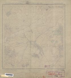
- Description:
- 1923
- Subject:
- Topical Subject: Maps, Topical Subject: Soviet Union, and Geographic Subject: Holiaky
- Publisher:
- Военно-топографическое управление
- Language:
- Russian
- Identifier:
- VAC9619-001023
- Genre:
- Topographic Maps and Military Maps
- Geographic Location:
- Coordinates: 49.5, 31, 49.6667, 31.25
- Related URL:
- Catalog URL: http://iucat.iu.edu/catalog/5020131 and Download GeoTIFF: https://drive.google.com/open?id=16ivYn1q7J_YABL6h_TwzsD9VGIVLFCwZ
- Abstract:
- Modern area represented: Holiaky, Cherkasy oblast, Ukraine
- Call Number:
- G7000 s50 .S68 sheet M-36-87-A
- Caption:
- Секретно,Для служебного пользования,Captured map
- Copyright Holder:
- No Copyright - United States
- Country:
- СССР (USSR)
- State/Province:
- Белоцерковский округ (Belotserkov district), Шевченковский округ (Shevchenko district), and Украинская ССР (Ukrainian Soviet Socialist Republic)
- Physical Description:
- Scale: 1:50,000
- Persistent URL:
- http://purl.dlib.indiana.edu/iudl/images/VAC9619/VAC9619-001023
- Provenance:
- Army Map Service Library, OMAHA, Library of Congress Geography & Map Division
-
- Description:
- 1932
- Subject:
- Topical Subject: Soviet Union, Geographic Subject: Veliky Novgorod, and Topical Subject: Maps
- Publisher:
- Управление военных топографов РККА
- Language:
- Russian
- Identifier:
- VAC9619-000047
- Genre:
- Topographic Maps and Military Maps
- Geographic Location:
- Coordinates: 58.5, 31.25, 58.6667, 31.5
- Related URL:
- Download GeoTIFF: https://drive.google.com/open?id=1cRxd5k5Bef2UXHMEyeJHhVslovNMHpFf and Catalog URL: http://iucat.iu.edu/catalog/5020131
- Abstract:
- Modern area represented: Veliky Novgorod, Novgorod oblast, Russia
- Call Number:
- G7000 s50 .S68 sheet O-36-51-B
- Caption:
- Не подлежит оглашению,Captured map
- City:
- Новгород (Novgorod)
- Copyright Holder:
- No Copyright - United States
- Country:
- СССР (USSR)
- State/Province:
- РСФСР (RSFSR) and Ленинградская область (Leningrad oblast)
- Physical Description:
- Scale: 1:50,000
- Persistent URL:
- http://purl.dlib.indiana.edu/iudl/images/VAC9619/VAC9619-000047
- Provenance:
- Army Map Service Library, OMAHA, Library of Congress Geography & Map Division
-
- Subject:
- Topical Subject: Soviet Union, Geographic Subject: Žygaičiai, and Topical Subject: Maps
- Publisher:
- Генеральный штаб Красной Армии
- Language:
- Russian
- Date Created:
- 1941
- Identifier:
- VAC9619-003614
- Genre:
- Topographic Maps and Military Maps
- Geographic Location:
- Coordinates: 55.25, 22, 55.333, 22.125
- Related URL:
- Catalog URL: https://iucat.iu.edu/catalog/14701157 and Download GeoTIFF: https://drive.google.com/file/d/1AfnFUQTWFntXQE9JPCrFqh4wZvi9INAa/view?usp=sharing
- Abstract:
- Modern area represented: Žygaičiai, Lithuania
- Call Number:
- G7063.K2 s25 .S6 sheet N-34-33-A-а
- Caption:
- Секретно
- City:
- Жигайце (Zhigaytse)
- Copyright Holder:
- No Copyright - United States
- Country:
- СССР (USSR)
- State/Province:
- Литовская ССР (Lithuanian Soviet Socialist Republic)
- Physical Description:
- Scale: 1:25,000
- Persistent URL:
- http://purl.dlib.indiana.edu/iudl/images/VAC9619/VAC9619-003614
- Provenance:
- Army Map Service Library, OMAHA, Library of Congress Geography & Map Division
-
- Subject:
- Topical Subject: Soviet Union, Topical Subject: Maps, and Geographic Subject: Barczewo
- Publisher:
- Генеральный штаб Красной Армии
- Language:
- Russian
- Date Created:
- 1941
- Identifier:
- VAC9619-003851
- Genre:
- Military Maps and Topographic Maps
- Geographic Location:
- Coordinates: 53.75, 20.625, 53.833, 20.75
- Related URL:
- Catalog URL: https://iucat.iu.edu/catalog/14701157 and Download GeoTIFF: https://drive.google.com/file/d/1qZDnTeGOS2_kUhEoyXcdprDKgWIp0boO/view?usp=sharing
- Abstract:
- Modern area represented: Barczewo, Poland
- Call Number:
- G7063.K2 s25 .S6 sheet N-34-78-C-b
- City:
- Вартенбург (Wartenburg)
- Copyright Holder:
- No Copyright - United States
- Country:
- Германия (Восточная Пруссия) (Germany (East Prussia))
- Physical Description:
- Scale: 1:25,000
- Persistent URL:
- http://purl.dlib.indiana.edu/iudl/images/VAC9619/VAC9619-003851
- Provenance:
- Army Map Service Library, OMAHA, Library of Congress Geography & Map Division
-
- Description:
- 1902
- Subject:
- Topical Subject: Soviet Union, Topical Subject: Maps, and Geographic Subject: Ellamaa
- Publisher:
- Генеральный штаб РККА
- Language:
- Russian
- Date Created:
- 1939
- Identifier:
- VAC9619-001856
- Genre:
- Topographic Maps and Military Maps
- Geographic Location:
- Coordinates: 58.333, 24, 58.5, 24.25
- Related URL:
- Catalog URL: http://iucat.iu.edu/catalog/5020131 and Download GeoTIFF: https://drive.google.com/open?id=1q4q1qPzenOiYeYKmnenCZCInkf_Tal3O
- Abstract:
- Modern area represented: Ellamaa, Estonia
- Call Number:
- G7000 s50 .S68 sheet O-35-49-C
- City:
- Эллама (Ellamaa)
- Copyright Holder:
- No Copyright - United States
- Country:
- Эстония (Estonia)
- Physical Description:
- Scale: 1:50,000
- Persistent URL:
- http://purl.dlib.indiana.edu/iudl/images/VAC9619/VAC9619-001856
- Provenance:
- Army Map Service Library, OMAHA, Library of Congress Geography & Map Division
-
- Subject:
- Geographic Subject: Bagrationovsk, Topical Subject: Maps, and Topical Subject: Soviet Union
- Publisher:
- Генеральный штаб Красной Армии
- Language:
- Russian
- Date Created:
- 1941
- Identifier:
- VAC9619-003746
- Genre:
- Military Maps and Topographic Maps
- Geographic Location:
- Coordinates: 54.3333, 20.625, 54.416667, 20.75
- Related URL:
- Download GeoTIFF: https://drive.google.com/file/d/1_09K1x3iGG35_Uo2XQW8nQtB_a94SkR8/view?usp=sharing and Catalog URL: https://iucat.iu.edu/catalog/14701157
- Abstract:
- Modern area represented: Bagrationovsk, Kaliningrad oblast, Russia
- Call Number:
- G7063.K2 s25 .S6 sheet N-34-54-C-d
- Caption:
- Captured map
- City:
- Прейсиш-Айлау (Preussisch-Eylau)
- Copyright Holder:
- No Copyright - United States
- Country:
- Восточная Пруссия (East Prussia) and Германия (Germany)
- Physical Description:
- Scale: 1:25,000
- Persistent URL:
- http://purl.dlib.indiana.edu/iudl/images/VAC9619/VAC9619-003746
- Provenance:
- Army Map Service Library, OMAHA, Library of Congress Geography & Map Division
-
- Description:
- 1936
- Subject:
- Topical Subject: Maps, Topical Subject: Soviet Union, and Geographic Subject: Novyya Valosavichy
- Publisher:
- Управление военных топографов РККА
- Language:
- Russian
- Identifier:
- VAC9619-000543
- Genre:
- Topographic Maps and Military Maps
- Geographic Location:
- Coordinates: 54.6667, 28.75, 54.8333, 29
- Related URL:
- Catalog URL: http://iucat.iu.edu/catalog/5020131 and Download GeoTIFF: https://drive.google.com/open?id=1b-YWRB3l3J91PnRwBeg4LHSD8TnkXITZ
- Abstract:
- Modern area represented: Novyya Valosavichy, Vitebsk oblast, Belarus
- Call Number:
- G7000 s50 .S68 sheet N-35-46-D
- Caption:
- Не подлежит оглашению
- City:
- Волосовичи (Volosovichi)
- Copyright Holder:
- No Copyright - United States
- Country:
- СССР (USSR)
- State/Province:
- Белорусская ССР (Byelorussian Soviet Socialist Republic)
- Physical Description:
- Scale: 1:50,000
- Persistent URL:
- http://purl.dlib.indiana.edu/iudl/images/VAC9619/VAC9619-000543
- Provenance:
- Army Map Service Library, OMAHA, Library of Congress Geography & Map Division
-
- Subject:
- Geographic Subject: Hańcza, Topical Subject: Soviet Union, and Topical Subject: Maps
- Publisher:
- Генеральный штаб Красной Армии
- Language:
- Russian
- Date Created:
- 1941
- Identifier:
- VAC9619-003820
- Genre:
- Military Maps and Topographic Maps
- Geographic Location:
- Coordinates: 54.25, 22.75, 54.333, 22.875
- Related URL:
- Download GeoTIFF: https://drive.google.com/file/d/1th8Iaf_12VIyaDIU0NaPb09nIh7q0PuH/view?usp=sharing and Catalog URL: https://iucat.iu.edu/catalog/14701157
- Abstract:
- Modern area represented: Hańcza, Poland
- Call Number:
- G7063.K2 s25 .S6 sheet N-34-70-B-а
- City:
- Ганьча (Hańcza)
- Copyright Holder:
- No Copyright - United States
- Country:
- Область государственных интересов Германии (Region of German state interest) and Германия (Восточная Пруссия) (Germany (East Prussia))
- Physical Description:
- Scale: 1:25,000
- Persistent URL:
- http://purl.dlib.indiana.edu/iudl/images/VAC9619/VAC9619-003820
- Provenance:
- Army Map Service Library, OMAHA, Library of Congress Geography & Map Division
-
- Subject:
- Geographic Subject: Khittolovo, Topical Subject: Soviet Union, and Topical Subject: Maps
- Publisher:
- Управление военных топографов
- Language:
- Russian
- Identifier:
- VAC9619-002946
- Genre:
- Military Maps and Topographic Maps
- Geographic Location:
- Coordinates: 60.167, 30.5, 60.333, 30.75
- Related URL:
- Download GeoTIFF: https://drive.google.com/file/d/1P7zMAUo2gLBMZ8O525znL1A6JUK0ILjp/view?usp=sharing and Catalog URL: http://iucat.iu.edu/catalog/5020131
- Abstract:
- Modern area represented: Khittolovo, Leningrad oblast, Russia
- Call Number:
- G7000 s50 .S68 sheet P-36-134-A
- Caption:
- Не подлежит оглашению
- City:
- Хиттолово (Khittolovo)
- Copyright Holder:
- No Copyright - United States
- Country:
- СССР (USSR)
- State/Province:
- Ленинградская область (Leningrad oblast) and РСФСР (RSFSR)
- Physical Description:
- Scale: 1:50,000
- Persistent URL:
- http://purl.dlib.indiana.edu/iudl/images/VAC9619/VAC9619-002946
- Provenance:
- Army Map Service Library, OMAHA, Library of Congress Geography & Map Division
-
- Subject:
- Topical Subject: Maps, Geographic Subject: Grabnik, and Topical Subject: Soviet Union
- Publisher:
- Генеральный штаб Красной Армии
- Language:
- Russian
- Date Created:
- 1941
- Identifier:
- VAC9619-003864
- Genre:
- Military Maps and Topographic Maps
- Geographic Location:
- Coordinates: 53.833, 22.125, 53.917, 22.25
- Related URL:
- Catalog URL: https://iucat.iu.edu/catalog/14701157 and Download GeoTIFF: https://drive.google.com/file/d/1dqiIb0H3Fm4WqZc2KmBvWjKxfuivh1T0/view?usp=sharing
- Abstract:
- Modern area represented: Grabnik, Poland
- Call Number:
- G7063.K2 s25 .S6 sheet N-34-81-A-d
- City:
- Грабник (Grabnick)
- Copyright Holder:
- No Copyright - United States
- Country:
- Германия (Восточная Пруссия) (Germany (East Prussia))
- Physical Description:
- Scale: 1:25,000
- Persistent URL:
- http://purl.dlib.indiana.edu/iudl/images/VAC9619/VAC9619-003864
- Provenance:
- Army Map Service Library, OMAHA, Library of Congress Geography & Map Division
-
- Subject:
- Topical Subject: Maps, Topical Subject: Soviet Union, and Geographic Subject: Gatchina
- Publisher:
- Генеральный штаб РККА
- Language:
- Russian
- Identifier:
- VAC9619-003005
- Genre:
- Topographic Maps and Military Maps
- Geographic Location:
- Coordinates: 59.5, 30, 59.667, 30.25
- Related URL:
- Catalog URL: http://iucat.iu.edu/catalog/5020131 and Download GeoTIFF: https://drive.google.com/file/d/1NZX0kxs4KpGSKi97f1249iL-cHrjd8bD/view?usp=sharing
- Abstract:
- Modern area represented: Гатчина (Gatchina), Leningradskaya oblast, Russia
- Call Number:
- G7000 s50 .S68 sheet O-36-13-A
- Caption:
- Captured map and Не подлежит оглашению
- City:
- Красногвардейск (Krasnogvardeysk)
- Copyright Holder:
- No Copyright - United States
- Country:
- СССР (USSR)
- State/Province:
- РСФСР (RSFSR) and Ленинградская область (Leningrad oblast)
- Physical Description:
- Scale: 1:50,000
- Persistent URL:
- http://purl.dlib.indiana.edu/iudl/images/VAC9619/VAC9619-003005
- Provenance:
- Army Map Service Library, OMAHA, Library of Congress Geography & Map Division
-
- Subject:
- Topical Subject: Soviet Union, Topical Subject: Maps, and Geographic Subject: Russkoye
- Publisher:
- Генеральный штаб РККА
- Language:
- Russian
- Date Created:
- 1940
- Identifier:
- VAC9619-003642
- Genre:
- Topographic Maps and Military Maps
- Geographic Location:
- Coordinates: 54.833, 20, 54.913, 20.125
- Related URL:
- Catalog URL: https://iucat.iu.edu/catalog/14701157 and Download GeoTIFF: https://drive.google.com/file/d/1VSSF7XSIhoqBE57vgJGRWH9RFFpiQ7nb/view?usp=sharing
- Abstract:
- Modern area represented: Русское (Russkoye), Kaliningradskaya oblast, Russia
- Call Number:
- G7063.K2 s25 .S6 sheet N-34-41-A-c
- City:
- Гермау (Germau)
- Copyright Holder:
- No Copyright - United States
- Country:
- Германия (Восточная Пруссия) (Germany (East Prussia))
- Physical Description:
- Scale: 1:25,000
- Persistent URL:
- http://purl.dlib.indiana.edu/iudl/images/VAC9619/VAC9619-003642
- Provenance:
- Army Map Service Library, OMAHA, Library of Congress Geography & Map Division
-
- Subject:
- Geographic Subject: Nikulyasy, Topical Subject: Soviet Union, and Topical Subject: Maps
- Publisher:
- Управление военных топографов
- Language:
- Russian
- Identifier:
- VAC9619-002944
- Genre:
- Topographic Maps and Military Maps
- Geographic Location:
- Coordinates: 60.333, 30.75, 60.5, 31
- Related URL:
- Catalog URL: http://iucat.iu.edu/catalog/5020131 and Download GeoTIFF: https://drive.google.com/file/d/17zBIHYv3seM7415lxAWZRx_FsJLmESxp/view?usp=sharing
- Abstract:
- Modern area represented: Nikulyasy, Leningrad oblast, Russia
- Call Number:
- G7000 s50 .S68 sheet P-36-122-D
- Caption:
- Не подлежит оглашению,Временное издание
- City:
- Никулясы (Nikulyasy)
- Copyright Holder:
- No Copyright - United States
- Country:
- СССР (USSR)
- State/Province:
- РСФСР (RSFSR) and Ленинградская область (Leningrad oblast)
- Physical Description:
- Scale: 1:50,000
- Persistent URL:
- http://purl.dlib.indiana.edu/iudl/images/VAC9619/VAC9619-002944
- Provenance:
- Army Map Service Library, OMAHA, Library of Congress Geography & Map Division
-
- Description:
- 1939
- Subject:
- Geographic Subject: Dudino, Topical Subject: Maps, and Topical Subject: Soviet Union
- Publisher:
- Главное управление геодезии и картографии при СНК СССР
- Language:
- Russian
- Identifier:
- VAC9619-002889
- Genre:
- Military Maps and Topographic Maps
- Geographic Location:
- Coordinates: 56.667, 32, 56.833, 32.25
- Related URL:
- Download GeoTIFF: https://drive.google.com/file/d/1Py3jDGm2QyjkNIWE8MgDv-5TtIaWklTa/view?usp=sharing and Catalog URL: http://iucat.iu.edu/catalog/5020131
- Abstract:
- Modern area represented: Дудино (Dudino), Tverskaya oblast, Russia
- Call Number:
- GM G7000 s50 .S68 sheet O-36-113-C
- Caption:
- Captured map and Для служебного пользования
- City:
- Дудино (Dudino)
- Copyright Holder:
- No Copyright - United States
- Country:
- СССР (USSR)
- State/Province:
- Калининская область (Kalinin oblast), Ленинский район (Leninsky district), and Пеновский район (Penovsky district)
- Physical Description:
- Scale: 1:50,000
- Persistent URL:
- http://purl.dlib.indiana.edu/iudl/images/VAC9619/VAC9619-002889
- Provenance:
- Army Map Service Library, OMAHA, Library of Congress Geography & Map Division
-
- Subject:
- Topical Subject: Maps, Topical Subject: Soviet Union, and Geographic Subject: Ruszajny
- Publisher:
- Генеральный штаб Красной Армии
- Language:
- Russian
- Date Created:
- 1941
- Identifier:
- VAC9619-003845
- Genre:
- Military Maps and Topographic Maps
- Geographic Location:
- Coordinates: 53.833, 20.625, 53.913, 20.75
- Related URL:
- Catalog URL: https://iucat.iu.edu/catalog/14701157 and Download GeoTIFF: https://drive.google.com/file/d/1UTwgGHVK2kIxV06XJJoGQznCwFNhZ9qB/view?usp=sharing
- Abstract:
- Modern area represented: Ruszajny, Poland
- Call Number:
- G7063.K2 s25 .S6 sheet N-34-78-A-d
- City:
- Ройшгаген (Reuschhagen)
- Copyright Holder:
- No Copyright - United States
- Country:
- Германия (Восточная Пруссия) (Germany (East Prussia))
- Physical Description:
- Scale: 1:25,000
- Persistent URL:
- http://purl.dlib.indiana.edu/iudl/images/VAC9619/VAC9619-003845
- Provenance:
- Army Map Service Library, OMAHA, Library of Congress Geography & Map Division
-
- Subject:
- Topical Subject: Maps, Topical Subject: Soviet Union, and Geographic Subject: Wipsowo
- Publisher:
- Генеральный штаб Красной Армии
- Language:
- Russian
- Date Created:
- 1940
- Identifier:
- VAC9619-003848
- Genre:
- Topographic Maps and Military Maps
- Geographic Location:
- Coordinates: 53.833, 20.75, 53.913, 20.875
- Related URL:
- Download GeoTIFF: https://drive.google.com/file/d/1JhRBqsg1tIs_iMj_4P7lUuGTmiI3bTuM/view?usp=sharing and Catalog URL: https://iucat.iu.edu/catalog/14701157
- Abstract:
- Modern area represented: Wipsowo, Poland
- Call Number:
- G7063.K2 s25 .S6 sheet N-34-78-B-c
- City:
- Випс (Wieps)
- Copyright Holder:
- No Copyright - United States
- Country:
- Германия (Восточная Пруссия) (Germany (East Prussia))
- Physical Description:
- Scale: 1:25,000
- Persistent URL:
- http://purl.dlib.indiana.edu/iudl/images/VAC9619/VAC9619-003848
- Provenance:
- Army Map Service Library, OMAHA, Library of Congress Geography & Map Division
-
- Subject:
- Geographic Subject: Kurgolovo, Topical Subject: Maps, and Topical Subject: Soviet Union
- Publisher:
- Управление военных топографов
- Language:
- Russian
- Date Created:
- 1930
- Identifier:
- VAC9619-002643
- Genre:
- Military Maps and Topographic Maps
- Geographic Location:
- Coordinates: 59.667, 28, 59.833, 28.25
- Related URL:
- Catalog URL: http://iucat.iu.edu/catalog/5020131 and Download GeoTIFF: https://drive.google.com/file/d/1TMQIN6mjxb72bXCZWjieR5pgWRwY1VaN/view?usp=sharing
- Abstract:
- Modern area represented: Kurgolovo, Leningrad oblast, Russia
- Call Number:
- GM G7000 s50 .S68 sheet M-35-9-C
- Caption:
- Не подлежит оглашению
- City:
- Курголово (Kurgolovo)
- Copyright Holder:
- No Copyright - United States
- Country:
- СССР (USSR)
- State/Province:
- РСФСР (RSFSR) and Ленинградская область (Leningrad oblast)
- Physical Description:
- Scale: 1:50,000
- Persistent URL:
- http://purl.dlib.indiana.edu/iudl/images/VAC9619/VAC9619-002643
- Provenance:
- Army Map Service Library, OMAHA, Library of Congress Geography & Map Division
-
- Subject:
- Topical Subject: Maps, Topical Subject: Soviet Union, and Geographic Subject: Mokobody
- Publisher:
- Генеральный штаб Красной Армии
- Language:
- Russian
- Date Created:
- 1941
- Identifier:
- VAC9619-000381
- Genre:
- Topographic Maps and Military Maps
- Geographic Location:
- Coordinates: 52.1667, 22, 52.3333, 22.25
- Related URL:
- Catalog URL: http://iucat.iu.edu/catalog/5020131 and Download GeoTIFF: https://drive.google.com/open?id=1ouJ804ACOTOR3T2kEqiiASXr2R4REZAh
- Abstract:
- Modern area represented: Mokobody, Poland
- Call Number:
- G7000 s50 .S68 sheet N-34-141-A
- Caption:
- Captured map
- City:
- Мокободы (Mokobody)
- Copyright Holder:
- No Copyright - United States
- Country:
- Область государственных интересов Германии (Region of German state interest)
- Physical Description:
- Scale: 1:50,000
- Persistent URL:
- http://purl.dlib.indiana.edu/iudl/images/VAC9619/VAC9619-000381
- Provenance:
- Army Map Service Library, OMAHA, Library of Congress Geography & Map Division
-
- Subject:
- Topical Subject: Maps, Topical Subject: Soviet Union, and Geographic Subject: Silene
- Publisher:
- Генеральный штаб РККА
- Language:
- Russian
- Identifier:
- VAC9619-000406
- Genre:
- Topographic Maps and Military Maps
- Geographic Location:
- Coordinates: 55.667, 26.75, 55.833, 27
- Related URL:
- Catalog URL: http://iucat.iu.edu/catalog/5020131 and Download GeoTIFF: https://drive.google.com/open?id=1xEJ5djb-mBmrgLy5ppbK6C9w_f3CLnHT
- Abstract:
- Modern area represented: Silene, Skrudaliena parish, Latvia
- Call Number:
- G7000 s50 .S68 sheet N-35-6-D
- Caption:
- Captured map
- City:
- Боровка (Borovka)
- Copyright Holder:
- No Copyright - United States
- Country:
- Польша (Poland) and Латвия (Latvia)
- Physical Description:
- Scale: 1:50,000
- Persistent URL:
- http://purl.dlib.indiana.edu/iudl/images/VAC9619/VAC9619-000406
- Provenance:
- Army Map Service Library, OMAHA, Library of Congress Geography & Map Division
-
- Subject:
- Geographic Subject: Voldi, Topical Subject: Soviet Union, and Topical Subject: Maps
- Publisher:
- Генеральный штаб РККА
- Language:
- Russian
- Date Created:
- 1939
- Identifier:
- VAC9619-002658
- Genre:
- Military Maps and Topographic Maps
- Geographic Location:
- Coordinates: 58.5, 26.5, 58.667, 26.75
- Related URL:
- Download GeoTIFF: https://drive.google.com/file/d/1KkaRDk4oXNRvlsgWflyo_xv2-TfUFFrQ/view?usp=sharing, https://drive.google.com/file/d/1NktOabiNuUHOx1FEz4eiaQ...
- Abstract:
- Modern area represented: Voldi, Estonia
- Call Number:
- GM G7000 s50 .S68 sheet O-35-54-A
- City:
- Волди (Voldi)
- Copyright Holder:
- No Copyright - United States
- Country:
- Эстония (Estonia)
- Physical Description:
- Scale: 1:50,000
- Persistent URL:
- http://purl.dlib.indiana.edu/iudl/images/VAC9619/VAC9619-002658
- Provenance:
- Army Map Service Library, OMAHA, Library of Congress Geography & Map Division
-
- Subject:
- Topical Subject: Soviet Union, Geographic Subject: Antropshino, and Topical Subject: Maps
- Publisher:
- Генеральный штаб Красной Армии
- Language:
- Russian
- Identifier:
- VAC9619-003006
- Genre:
- Military Maps and Topographic Maps
- Geographic Location:
- Coordinates: 59.5, 30.25, 59.667, 30.5
- Related URL:
- Download GeoTIFF: https://drive.google.com/file/d/1l5ugH5T0QxRDucVj8VYvVW6DjvnJiKdO/view?usp=sharing and Catalog URL: http://iucat.iu.edu/catalog/5020131
- Abstract:
- Modern area represented: Antropshino, Leningrad oblast, Russia
- Call Number:
- G7000 s50 .S68 sheet O-36-13-B
- Caption:
- Для служебного пользования
- City:
- Антропшино (Antropshino)
- Copyright Holder:
- No Copyright - United States
- Country:
- СССР (USSR)
- State/Province:
- РСФСР (RSFSR) and Ленинградская область (Leningrad oblast)
- Physical Description:
- Scale: 1:50,000
- Persistent URL:
- http://purl.dlib.indiana.edu/iudl/images/VAC9619/VAC9619-003006
- Provenance:
- Army Map Service Library, OMAHA, Library of Congress Geography & Map Division
-
- Subject:
- Geographic Subject: Zapovednik Ozerskiy, Topical Subject: Maps, and Topical Subject: Soviet Union
- Publisher:
- Генеральный штаб РККА
- Language:
- Russian
- Date Created:
- 1940
- Identifier:
- VAC9619-003742
- Genre:
- Military Maps and Topographic Maps
- Geographic Location:
- Coordinates: 54.5, 20.875, 54.583333, 21.0
- Related URL:
- Catalog URL: https://iucat.iu.edu/catalog/14701157 and Download GeoTIFF: https://drive.google.com/file/d/1SQM97nR68S5YmMH2vmlUBuQhWpn55DgJ/view?usp=sharing
- Abstract:
- Modern area represented: Заповедник Озёрский (Zapovednik Ozerskiy), Kaliningradskaya oblast, Russia
- Call Number:
- G7063.K2 s25 .S6 sheet N-34-54-B-d
- Caption:
- Captured map
- City:
- Заповедник Целяу-Брух (Zapovednik Zehlau-Bruch)
- Copyright Holder:
- No Copyright - United States
- Country:
- Германия (Восточная Пруссия) (Germany (East Prussia))
- Physical Description:
- Scale: 1:25,000
- Persistent URL:
- http://purl.dlib.indiana.edu/iudl/images/VAC9619/VAC9619-003742
- Provenance:
- Army Map Service Library, OMAHA, Library of Congress Geography & Map Division

- « Previous
- Next »
- 1
- 2
- 3
- 4