Indiana University
Indiana University
IU
Skip to Content
Digital Collections
Toggle navigation
Digital
Collections
Switch language
English
Switch language
Deutsch
English
Español
Français
Italiano
Português do Brasil
中文
Login
Home
About
Contact
Search Digital Collections
Go
×
Search Constraints
Start Over
You searched for:
State/Province
Colorado
Remove constraint State/Province: Colorado
« Previous |
1
-
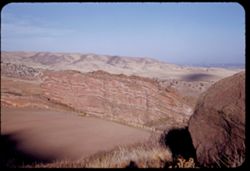
100
of
476
|
Next »
Sort by title ▼
relevance ▼
recently updated
title ▲
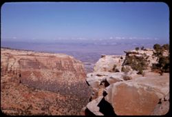
title ▼
date created ▲
date created ▼
pages ▲
pages ▼
collection size ▲
collection size ▼
Number of results to display per page
100 per page
10
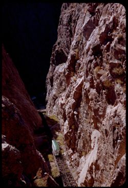
per page
20
per page
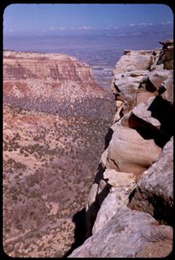
50
per page
100
per page
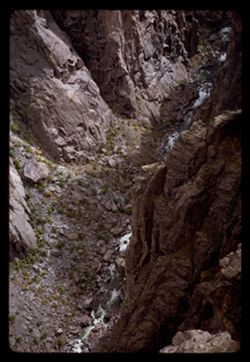
View results as:
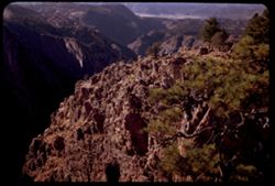
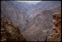
List
Gallery
Masonry
Search Results
1.
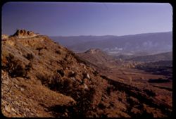
in Red Rocks Park west of Denver
2.
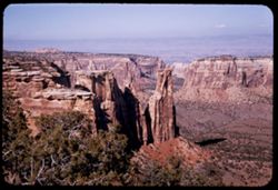
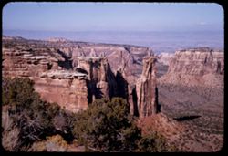
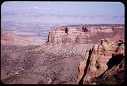
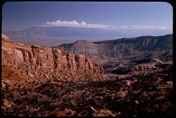
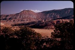
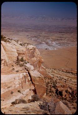
in Colorado National Monument near Grand Junction.
3.
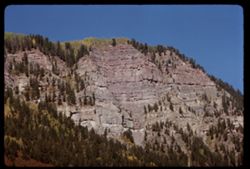
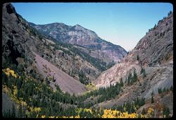
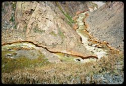
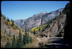
from US Hwy 550 between Silverton and Ouray
4.
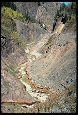
from Rabbit Ears Pass U.S. 40 - Colorado
5.
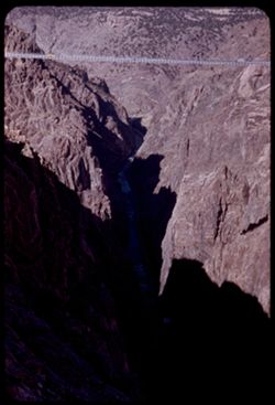
from Point Sublime view is upstream the Royal Gorge
6.
east of Hwy 666 south of Cortez, Colo.
7.
east of Hwy 666 south of Cortez, Colo.
8.
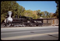
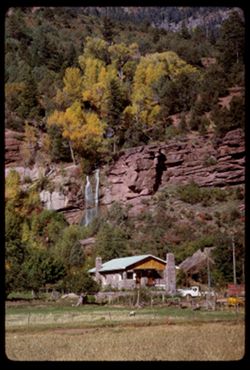
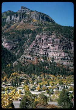
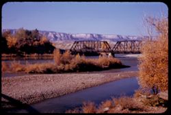
at Durango, Colo.
9.
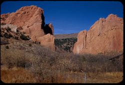
at Durango, Colo.
10.
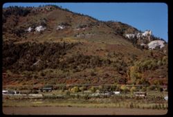
along Hwy. North of Durango, Colo.
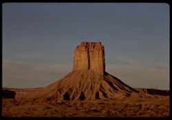
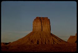
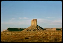
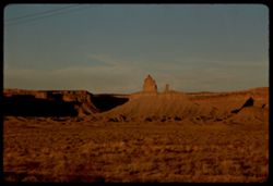
11.
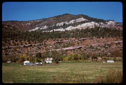
along Hwy north of Durango, Colo.
12.
along Hwy north of Durango, Colo.
13.
along Hwy north of Durango, Colo.
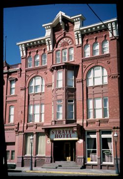
14.
along Hwy north of Durango, Colo.
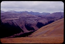
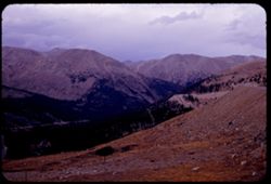
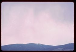
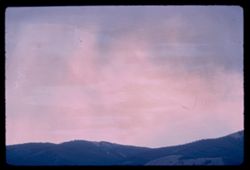
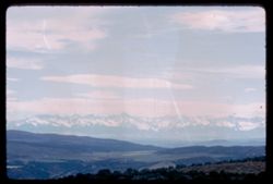
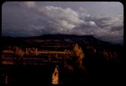
15.
along Hwy north of Durango, Colo.
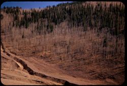
16.
along Hwy 666 in S.W. Colorado.
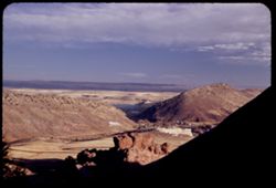
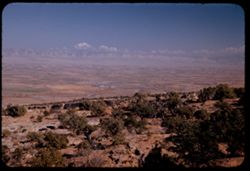
17.
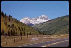
along Colo. Hwy north of Durango
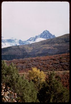
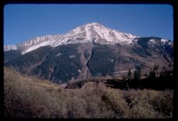
18.
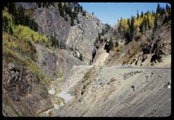
above US. Hwy 550 between Silverton and Ouray, Colorado
19.
above US Hwy 550 between Durango and Ouray, Colo.
20.
above Red Mtn. Pass U.S. 550 - Silverton to Ouray
21.
above Hwy between Durango & Silverton Colo.
22.
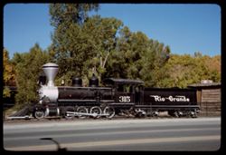
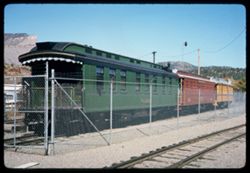
Wood passenger cars of narrow gauge Rio Grande R.R. at Durango, Colo.
23.
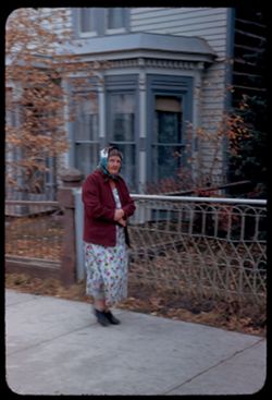
Woman on a Leadville Street
24.
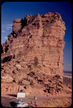
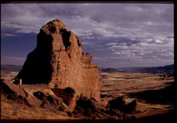
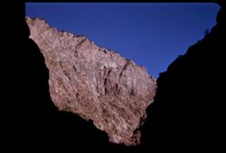
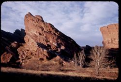
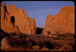
West face of a large rock Red Rocks Park west of Denver Colorado
25.
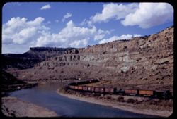
West bound freight train of D & R.G.W. in Horseshoe canyon of Colorado river 28 mi. east of Grand Junction
26.
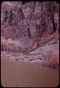
Wall of Glenwood canyon. Colorado river east of Glenwood Springs, Colo.
27.
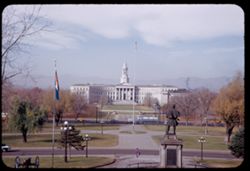
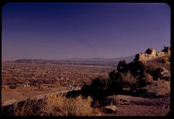
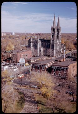
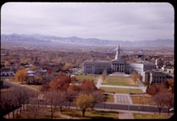
View west toward Civic Center from Colorado Capitol at a mile high
28.
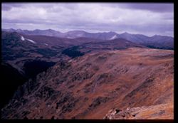
View west from 12,110 ft. elevation along US Hwy across Rocky Mtn. Nat'l Park.
29.
View west along U.S. 50 from Grand Junction, Colorado.
30.
View west across top of Rocky Mtn. Nat'l Pk. from one high point of Highway at pass = 12,110 ft.
31.
View up in Red Mtn. Pass on US Hwy 550 from 11,018 ft. elev.
32.
View up from Red Mountain Pass (11,018' elev.) between Silverton and Ouray
33.
View up Colorado river in Horseshoe curve canyon 28 miles of Grand Junction, Colo.
34.
View soutwest from Colorado's Red Rock Park
35.
View southeast from amphitheatre of Red Rocks Park Colorado
36.
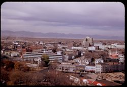
View southeast across Canon City, Colorado from Skyline Drive
37.
View south from Garden of the Gods over Manitou Springs
38.
View south along right side of comb carrying Skyline Drive above Canon City, Colorado
39.
View over Ouray Colo. - to N.W.
40.
View northwest from tip of Royal Gorge
41.
View northwest from height over 12,000 ft. along US highway across Rocky Mtn. National Park.
42.
View northward from top of Loveland Pass - elev. 11,992 ft. Colorado.
43.
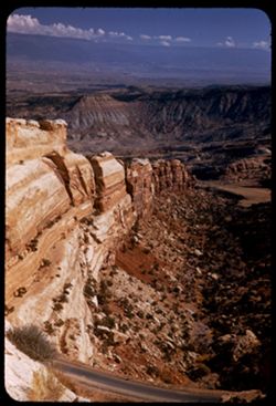
View northward from Grandview Overlook - Colorado National Mon.
44.
View northward from Cold Shivers Point. Colorado Nat'l Mon.
45.
View northeast over Denver from dome of Capitol
46.
View northeast from Red Rocks Park Colorado west of Denver
47.
View north up Colorado river around bend east of Grand Junction, Colo.
48.
View north from summit of Loveland Pass
49.
View north from road through Colorado National Monument.
50.
View north from Colorado Nat'l. Mon. across valley of Colorado river below Grand Junction.
51.
View north down canyon from Cold Shivers Point - Colorado Nat'l Mon.
52.
View north down Uncompahgre canyon toward Ouray, Colo.
53.
View from top down into Royal Gorge as car of incline railway moves up
54.
View from bottom of Royal Gorge at left bank sunlighted
55.
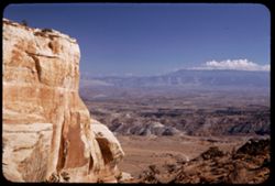
View eastward from a height of Colorado Nat'l Mon. near Grand Junction, Colo.
56.
View eastward along high rock wall of Colorado Nat'l Mon.
57.
View eastward across desert flat and over Grand Junction from heights of Colorado, Nat'l. Mon.
58.
View east across juniper tops from heights in Colorado National Monument near Grand Junction.
59.
View downstream from north end of US Hwy 50 bridge over Colorado river at Grand Junction, Colo.
60.
View downstream from Sunset View. Black Canyon of the Gunnison.
61.
View down into the Chasm. Black Canyon of the Gunnison.
62.
View down across buttes and Colorado river valley from heights of Colorado Nat'l Mon.
63.
View across Colorado river valley from Distant View Overlook in Colorado Nat'l Mon.
64.
View WNW from Capitol dome, Denver
65.
View W by S from dome of Colorado's Capitol
66.
View South east from Red Rocks Park west of Denver
67.
View SW from road over 10,000 ft. elevation NE of Cripple Creek Colorado
68.
View NW from Hwy through Rocky Mtn. Nat'l Pk. toward Mummy Mtns.
69.
View NE from Kenosha Pass Colorado
70.
Vendome Hotel. Leadville, Colo.
71.
Uncompahgre river below US Hwy 550 south of Ouray, Colo.
72.
US Hwy 550 in canyon of Uncompahgre river in S.W. Colo.
73.
U.S. Hwy 550 through narrow canyon between Silverton and Ouray, Colo.
74.
U.S. Hwy 550 built on shelf in canyon of Uncompahgre river south of Ouray, Colo.
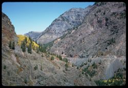
75.
U S Hwy 550 follows narrow canyon between Silverton and Ouray, Colo.
76.
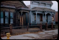
Two houses Leadville, Colorado
77.
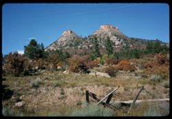
Truncated pyramids west of Durango, Colo.
78.
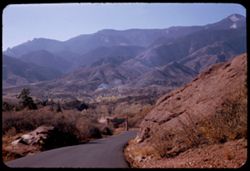
Trees along Colorado Hwy 62 northwest of Ouray.
79.
Toward Mount Sneffels (14,150') from Colo. Hwy 62, San Miguel county.
80.
Tilted rock on road down from top of Red Rocks Park Colorado
81.
The larger of Twin Lakes south of Leadville Colo.
82.
The Gateway to Garden of the Gods
83.
The Gateway seen from the west in late afternoon Garden of the Gods
84.
The Gateway Garden of the Gods
85.
The Four Corners.
86.
The 4 Corners.
87.
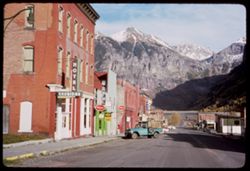
Telluride, Colorado.
88.
Telluride, Colorado.
89.
Stringtown a suburb SW of Leadville, Colo.
90.
Street in Leadville, Colo.
91.
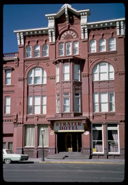
Strater Hotel Durango, Colo. O & C
92.
Strater Hotel Durango, Colo.
93.
Storm clouds above Rocky Mtns east of Granby Colo.
94.
Storm clouds above Rocky Mtns east of Granby Colo
95.
Stand of birch in canyon aove Cripple Creek, Colo.
96.
Squaw and Papoose along Hwy 666 south of Cortez, Colo.
97.
South toward Uncompahgre Mtns of Colorado from 8 mi. NE of Montrose.
98.
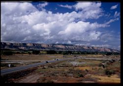
Sopris Peak capped with cloud form Colo. Hwy 82 southeast of Glenwood Springs
99.
Snowy peak seen from U.S. Hwy 550 from Durango to Silverton, Colo.
100.
Snowy peak above US Hwy 550 between Ouray and Durango
« Previous
Next »
1
2
3
4
5
Toggle facets
Limit your search
Type
Image
476
Creator
Cushman, Charles W., 1896-1972
456
Subject
Mountains
303
Trees
249
Cliffs
160
Shrubs
137
Rock formations
115
Hills
112
Rocks
104
Roads
97
Grasses
96
Clouds
90
more
Subjects
»
Language
English
1
Date Created
1965-10-02
56
1952-10-27
43
1965-10-05
41
1952-10-28
29
1953-10-15
28
1965-10-04
27
1952-11-03
25
1965-10-03
22
1953-10-13
21
1952-10-31
20
more
Date Createds
»
Pages
0-99 pages
476
Collections
Charles W. Cushman Kodachrome Slides
456
Glenn A. Black Laboratory of Archaeology Photographs
15
Black Filmmakers Hall of Fame Photograph Collection
3
Roy W. Howard Photograph Collection
1
Black Film Center & Archive General Collection
1
State
deposited
476
Campus
IUB
476
Frame Number
17
14
11
13
12
13
13
13
14
13
16
13
18
13
19
13
2
13
20
13
County
La Plata
54
El Paso
47
San Juan
44
Ouray
43
Lake
36
Mesa
31
Fremont
28
Montrose
25
Montezuma
23
Teller
19
Series
10-53
39
22-52
39
23-52
38
24-52
38
25-52
38
34-65
38
35-65
38
33-65
37
9-66
30
32-65
24
City
Durango
54
Colorado Springs
43
Silverton
42
Ouray
37
Leadville
31
Grand Junction
30
Denver
19
Cripple Creek
18
Georgetown
14
Morrison
12
Country
United States
476
State/Province
Colorado
[remove]
476
Arizona
4
New Mexico
4
Utah
4
Holding Location
B-ARCHIVES
456
B-IUMAA
15
B-BFCA
4
B-MEDIASCHOOL
1