Geographic Subject: Posey County (Ind.), Geographic Subject: White County (Ill.), and Geographic Subject: Gallatin County (Ill.)
Creator:
Lloyd, W. J. (Topographer), Kentucky Geological Survey, Smith, L. Scott, Ellis, J. R. (Topographer), Cooke, Chas. E. (Charles E.), Illinois State Geological ...
Publisher:
Geological Survey (U.S.)
Date Created:
1920
Identifier:
VAC3073-M-01358
Genre:
Topographic maps, 15 minute topographic maps, and Quadrangle maps
H. M. Wilson, chief geographer , Chas. E. Cooke, in charge of section , topography by W. J. Lloyd and L. Scott Smith , control by J. R. Ellis , engraved Aug....
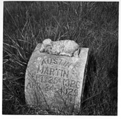
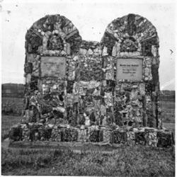
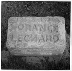
or north of the grave marker seen here. It is also unclear if the word "Orange" on the grave marker seen here is part of that person's name or ...
Caption:
Ledger Page/ Entry Number: 39/7, Donor's Image Number: 411, Personal Name, Age/Gender: Orange, Leonard ?, Adult/M, and Death Date: 1920
![Illinois-Indiana-Kentucky, New Haven quadrangle : topography [1920 reprint without vegetation]](https://iiif.uits.iu.edu/iiif/2/pz50hz88n%2Ffiles%2Ff9ee1b77-e188-458e-ba78-5dd112ba1556/full/250,/0/default.jpg)