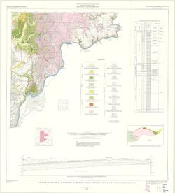
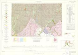
By Henry H. Gray. Compiled by H. H. Gray and A. M. Burger. Drafted by J. R. Tolen. Base map modified from Army Map Service Map NJ16-6, 1964. Transverse Merca...
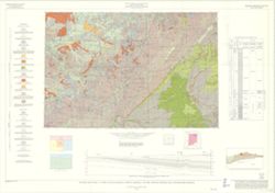
By Gerald H. Johnson and Stanley J. Keller. transverse Mercator projection. Regional geologic map , no. 8. Relief shown by profile. Includes columnar section...
Schneider, Allan F. (Allan Frank), 1926-, Gooding, Ansel Miller, Forsyth, Jane L. (Jane Louise), 1921-, Gray, Henry Hamilton, 1922-, and Indiana. Geological ...
Publisher:
Indiana. Geological Survey
Date Created:
1972
Identifier:
VAC3073-M-01245
Genre:
Geological maps, Geological cross-sections, and Quadrangle maps
By Henry H. Gray, Jane L. Forsyth, Allan F. Schneider, and Ansel M. Gooding. Transverse Mercator projection. "Base map modified from Army Map Service, M...
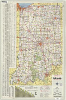
Panel title: 1972-73 Indiana official highway map. Relief shown by spot heights. Includes index, distance chart, and text. Indexed chart of state recreation ...
Call Number:
G1403 .S7 1972-1973
Caption:
Imprint: [Indianapolis] : State Highway Commission, [1972]
Physical Description:
Dimensions: 94 x 59 cm and Scale: Approximately 1:633,600