Geographic Subject: Indiana and Topical Subject: Rivers
Creator:
Indiana Waters Association
Publisher:
Indiana Waters Association
Date Created:
1960
Identifier:
VAC3073-M-00092
Genre:
Thematic maps
Geographic Location:
Coordinates: W0880500 W0844700 N0414500 N0374600
Related URL:
Catalog URL: https://iucat.iu.edu/catalog/7355175
Abstract:
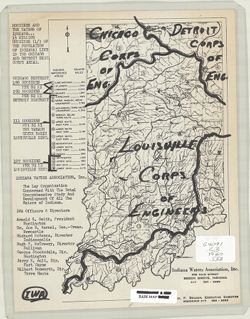
Shows Corps of Engineers district boundaries drawn on a drainage map of Indiana and includes population density for each district. "1 1/2 million Hoosie...
Call Number:
G4091.C3 1960 .I53
Caption:
Imprint: Beech Grove, Ind.: Indiana Waters Association, [196?]
Physical Description:
Scale: Scale not given. and Dimensions: 27 x 17 cm