
Search Constraints
You searched for:
Date Created
1942
Remove constraint Date Created: 1942
Pages
0-99 pages
Remove constraint Pages: 0-99 pages
Subject
Topical Subject: Maps
Remove constraint Subject: Topical Subject: Maps
Search Results
-
- Description:
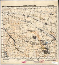
- 1928
- Subject:
- Topical Subject: Maps, Geographic Subject: Vorovskolesskaya, Topical Subject: Soviet Union, and Geographic Subject: Stavropol' Krai
- Publisher:
- Генеральный штаб Красной Армии
- Language:
- Russian
- Date Created:
- 1942
- Identifier:
- VAC9619-002207
- Genre:
- Military Maps and Topographic Maps
- Geographic Location:
- Coordinates: 44.3333, 42, 44.6667, 42.5
- Related URL:
- DataCORE Dataset Download: https://datacore.iu.edu/concern/data_sets/jh343t11f
- Abstract:
- Modern area represented: Воровсколесская (Vorovskolesskaya), Stavropol' Krai, Russia
- Call Number:
- G7000 s100 .S7 sheet L-38-121
- Caption:
- Для cлужебного пользования
- City:
- Воровсколесская (Vorovskolesskaya)
- Copyright Holder:
- No Copyright - United States
- Country:
- СССР (USSR)
- State/Province:
- РСФСР (RSFSR), Орджоникидзевский край (Ordzhonikidze kray), and Черкесская автономная область (Cherkess Autonomous Oblast)
- Physical Description:
- Scale: 1:100,000
- Persistent URL:
- http://purl.dlib.indiana.edu/iudl/images/VAC9619/VAC9619-002207
- Provenance:
- CIA Map Library
-
- Description:
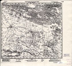
- 1931
- Subject:
- Topical Subject: Maps, Topical Subject: Soviet Union, and Geographic Subject: Andratinskiy
- Publisher:
- Генеральный штаб Красной Армии
- Language:
- Russian
- Date Created:
- 1942
- Identifier:
- VAC9619-002205
- Genre:
- Military Maps and Topographic Maps
- Geographic Location:
- Coordinates: 44.6667, 46, 45, 46.5
- Related URL:
- DataCORE Dataset Download: https://datacore.iu.edu/concern/data_sets/5x21tg04h
- Abstract:
- Modern area represented: Andratinskiy, Kalmykiya Republic, Russia
- Call Number:
- G7000 s100 .S7 sheet L-38-117
- Caption:
- Для служебного пользования
- City:
- Андра-Ата (Andra-Ata)
- Copyright Holder:
- No Copyright - United States
- Country:
- СССР (USSR)
- State/Province:
- РСФСР (RSFSR), Орджоникидзевский край (Ordzhonikidze kray), and Калмыцкая АССР (Kalmyk Autonomous Soviet Socialist Republic)
- Physical Description:
- Scale: 1:100,000
- Persistent URL:
- http://purl.dlib.indiana.edu/iudl/images/VAC9619/VAC9619-002205
- Provenance:
- DMA Topographic Center, Army Map Service Library
-
- Description:
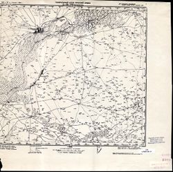
- 1941
- Subject:
- Topical Subject: Soviet Union, Geographic Subject: Bakres, and Topical Subject: Maps
- Publisher:
- Генеральный штаб Красной Армии
- Language:
- Russian
- Date Created:
- 1942
- Identifier:
- VAC9619-002204
- Genre:
- Topographic Maps and Military Maps
- Geographic Location:
- Coordinates: 44.6667, 45.5, 45, 46
- Related URL:
- DataCORE Dataset Download: https://datacore.iu.edu/concern/data_sets/g158bh86k
- Abstract:
- Modern area represented: Bakres, Stavropol kray, Russia
- Call Number:
- G7000 s100 .S7 sheet L-38-116
- Caption:
- Для служебного пользования
- City:
- Бакрес (Bakres)
- Copyright Holder:
- No Copyright - United States
- Country:
- СССР (USSR)
- State/Province:
- Калмыцкая АССР (Kalmyk Autonomous Soviet Socialist Republic), Орджоникидзевский край (Ordzhonikidze kray), and РСФСР (RSFSR)
- Physical Description:
- Scale: 1:100,000
- Persistent URL:
- http://purl.dlib.indiana.edu/iudl/images/VAC9619/VAC9619-002204
- Provenance:
- CIA Map Library
-
- Description:
- 1931
- Subject:
- Topical Subject: Maps, Topical Subject: Soviet Union, and Geographic Subject: Velichayevskoye
- Publisher:
- Генеральный штаб Красной Армии
- Language:
- Russian
- Date Created:
- 1942
- Identifier:
- VAC9619-002203
- Genre:
- Topographic Maps and Military Maps
- Geographic Location:
- Coordinates: 44.6667, 45, 45, 45.5
- Related URL:
- DataCORE Dataset Download: https://datacore.iu.edu/concern/data_sets/9880vr75m
- Abstract:
- Modern area represented: Velichayevskoye, Stavropol kray, Russia
- Call Number:
- G7000 s100 .S7 sheet L-38-115
- Caption:
- Для служебного пользования
- City:
- Величаевское (Velichayevskoye)
- Copyright Holder:
- No Copyright - United States
- Country:
- СССР (USSR)
- State/Province:
- РСФСР (RSFSR), Кизлярский округ (Kizlyar district), and Орджоникидзевский край (Ordzhonikidze kray)
- Physical Description:
- Scale: 1:100,000
- Persistent URL:
- http://purl.dlib.indiana.edu/iudl/images/VAC9619/VAC9619-002203
- Provenance:
- CIA Map Library
-
- Description:
- 1927
- Subject:
- Geographic Subject: Budennovsk, Topical Subject: Maps, Geographic Subject: Stavropol' Krai, and Topical Subject: Soviet Union
- Publisher:
- Генеральный штаб Красной Армии
- Language:
- Russian
- Date Created:
- 1942
- Identifier:
- VAC9619-002201
- Genre:
- Military Maps and Topographic Maps
- Geographic Location:
- Coordinates: 44.6667, 44, 45, 44.5
- Related URL:
- DataCORE Dataset Download: https://datacore.iu.edu/concern/data_sets/44558f01z
- Abstract:
- Modern area represented: Буденновск (Budennovsk), Stavropol’ Krai, Russia,
- Call Number:
- G7000 s100 .S7 sheet L-38-113
- Caption:
- Для cлужебного пользования
- City:
- Буденновск (Budennovsk)
- Copyright Holder:
- No Copyright - United States
- Country:
- СССР (USSR)
- State/Province:
- Орджоникидзевский край (Ordzhonikidze kray) and РСФСР (RSFSR)
- Physical Description:
- Scale: 1:100,000
- Persistent URL:
- http://purl.dlib.indiana.edu/iudl/images/VAC9619/VAC9619-002201
- Provenance:
- DMA Topographic Center, Army Map Service Library
-
- Description:
- 1927
- Subject:
- Topical Subject: Soviet Union, Topical Subject: Maps, and Geographic Subject: Levokumskoye
- Publisher:
- Генеральный штаб Красной Армии
- Language:
- Russian
- Date Created:
- 1942
- Identifier:
- VAC9619-002202
- Genre:
- Topographic Maps and Military Maps
- Geographic Location:
- Coordinates: 44.6667, 44.5, 45, 45
- Related URL:
- DataCORE Dataset Download: https://datacore.iu.edu/concern/data_sets/5t34sk294
- Abstract:
- Modern area represented: Levokumskoye, Stavropol kray, Russia
- Call Number:
- G7000 s100 .S7 sheet L-38-114
- Caption:
- Для служебного пользования
- City:
- Левокумское (Levokumskoye)
- Copyright Holder:
- No Copyright - United States
- Country:
- СССР (USSR)
- State/Province:
- Кизлярский округ (Kizlyar district), РСФСР (RSFSR), and Орджоникидзевский край (Ordzhonikidze kray)
- Physical Description:
- Scale: 1:100,000
- Persistent URL:
- http://purl.dlib.indiana.edu/iudl/images/VAC9619/VAC9619-002202
- Provenance:
- CIA Map Library
-
- Description:
- 1938
- Subject:
- Geographic Subject: Chernolesskoye, Topical Subject: Soviet Union, Geographic Subject: Stavropol' Krai, and Topical Subject: Maps
- Publisher:
- Генеральный штаб Красной Армии
- Language:
- Russian
- Date Created:
- 1942
- Identifier:
- VAC9619-002200
- Genre:
- Military Maps and Topographic Maps
- Geographic Location:
- Coordinates: 44.6667, 43.5, 45, 44
- Related URL:
- DataCORE Dataset Download: https://datacore.iu.edu/concern/data_sets/v405sb103
- Abstract:
- Modern area represented: Чернолесское (Chernolesskoye), Stavropol' Krai, Russia
- Call Number:
- G7000 s100 .S7 sheet L-38-112
- Caption:
- Для cлужебного пользования
- City:
- Чернолесское (Chernolesskoye)
- Copyright Holder:
- No Copyright - United States
- Country:
- СССР (USSR)
- State/Province:
- РСФСР (RSFSR) and Орджоникидзевский край (Ordzhonikidze kray)
- Physical Description:
- Scale: 1:100,000
- Persistent URL:
- http://purl.dlib.indiana.edu/iudl/images/VAC9619/VAC9619-002200
- Provenance:
- Geographic Names Branch
-
- Description:
- 1936
- Subject:
- Topical Subject: Soviet Union, Geographic Subject: Aleksandrovskoye, Geographic Subject: Stavropol' Krai, and Topical Subject: Maps
- Publisher:
- Генеральный штаб Красной Армии
- Language:
- Russian
- Date Created:
- 1942
- Identifier:
- VAC9619-002199
- Genre:
- Military Maps and Topographic Maps
- Geographic Location:
- Coordinates: 44.6667, 43, 45, 43.5
- Related URL:
- DataCORE Dataset Download: https://datacore.iu.edu/concern/data_sets/wd375w99w
- Abstract:
- Modern area represented: Александровское (Aleksandrovskoye), Stavropol' Krai, Russia
- Call Number:
- G7000 s100 .S7 sheet L-38-111
- Caption:
- Для cлужебного пользования
- City:
- Александровское (Aleksandrovskoye)
- Copyright Holder:
- No Copyright - United States
- Country:
- СССР (USSR)
- State/Province:
- РСФСР (RSFSR) and Орджоникидзевский край (Ordzhonikidze kray)
- Physical Description:
- Scale: 1:100,000
- Persistent URL:
- http://purl.dlib.indiana.edu/iudl/images/VAC9619/VAC9619-002199
- Provenance:
- DMA Topographic Center, OMAHA
-
- Description:
- 1941
- Subject:
- Topical Subject: Soviet Union, Geographic Subject: Ulan Khol, and Topical Subject: Maps
- Publisher:
- Генеральный штаб Красной Армии
- Language:
- Russian
- Date Created:
- 1942
- Identifier:
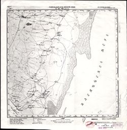
- VAC9619-002196
- Genre:
- Topographic Maps and Military Maps
- Geographic Location:
- Coordinates: 45, 47, 45.3333, 47.5
- Related URL:
- DataCORE Dataset Download: https://datacore.iu.edu/concern/data_sets/bz60cx079
- Abstract:
- Modern area represented: Ulan Khol, Kalmykiya Republic, Russia
- Call Number:
- G7000 s100 .S7 sheet L-38-107
- Caption:
- Для служебного пользования
- City:
- Улан Хол (Ulan Khol)
- Copyright Holder:
- No Copyright - United States
- Country:
- СССР (USSR)
- State/Province:
- Калмыцкая АССР (Kalmyk Autonomous Soviet Socialist Republic) and РСФСР (RSFSR)
- Physical Description:
- Scale: 1:100,000
- Persistent URL:
- http://purl.dlib.indiana.edu/iudl/images/VAC9619/VAC9619-002196
- Provenance:
- CIA Map Library, Library of Congress Geography & Map Division
-
- Description:
- 1931
- Subject:
- Topical Subject: Maps, Geographic Subject: Lagansky district, and Topical Subject: Soviet Union
- Publisher:
- Генеральный штаб Красной Армии
- Language:
- Russian
- Date Created:
- 1942
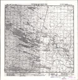
- Identifier:
- VAC9619-002195
- Genre:
- Topographic Maps and Military Maps
- Geographic Location:
- Coordinates: 45, 46.5, 45.3333, 47
- Related URL:
- DataCORE Dataset Download: https://datacore.iu.edu/concern/data_sets/2514nm25x
- Abstract:
- Modern area represented: Lagansky district, Kalmykiya Republic, Russia
- Call Number:
- G7000 s100 .S7 sheet L-38-106
- Caption:
- Для служебного пользования
- City:
- Цекерта (Tsekerta)
- Copyright Holder:
- No Copyright - United States
- Country:
- СССР (USSR)
- State/Province:
- Калмыцкая АССР (Kalmyk Autonomous Soviet Socialist Republic) and РСФСР (RSFSR)
- Physical Description:
- Scale: 1:100,000
- Persistent URL:
- http://purl.dlib.indiana.edu/iudl/images/VAC9619/VAC9619-002195
- Provenance:
- CIA Map Library
