
![Monroe County, Indiana, existing use of land. Sheet 1 [Index map]](https://iiif.uits.iu.edu/iiif/2/m039m802g%2Ffiles%2F61ffcc89-f677-469c-9d08-e45a2fe17a72/full/250,/0/default.jpg)

![[Monroe County, Indiana, existing use of land.] Sheet 7. Indian Creek Township, Monroe County, Indiana, existing use of land](https://iiif.uits.iu.edu/iiif/2/k356b6509%2Ffiles%2Fb57dc2b2-49f8-4d22-945b-30cd2e61374f/full/250,/0/default.jpg)
![[Monroe County, Indiana, existing use of land.] Sheet 8. Clear Creek Township, Monroe County, Indiana, existing use of land](https://iiif.uits.iu.edu/iiif/2/3r075z830%2Ffiles%2F6624980a-c7ac-4eaf-bb62-798890fa2939/full/250,/0/default.jpg)
![[Monroe County, Indiana, existing use of land.] Sheet 2. Bloomington Township, Monroe County, Indiana, existing use of land](https://iiif.uits.iu.edu/iiif/2/cr56p471g%2Ffiles%2F05a45fb1-c37c-4705-9f7e-ec975807ea66/full/250,/0/default.jpg)
![[Monroe County, Indiana, existing use of land.] Sheet 12. Benton Township, Monroe County, Indiana, existing use of land](https://iiif.uits.iu.edu/iiif/2/pk02dg046%2Ffiles%2F21334cc8-1ad7-4a01-9cda-637ff6bf681d/full/250,/0/default.jpg)
![[Monroe County, Indiana, existing use of land.] Sheet 11. Benton Township, Monroe County, Indiana, existing use of land](https://iiif.uits.iu.edu/iiif/2/t722jd621%2Ffiles%2Fcfcb861c-4fcf-48b8-852c-58224d757b56/full/250,/0/default.jpg)
![[Monroe County, Indiana, existing use of land.] Sheet 4. Bean Blossom Township, Monroe County, Indiana, existing use of land](https://iiif.uits.iu.edu/iiif/2/f4753k30w%2Ffiles%2F29aed0b2-c53e-484c-98d7-132971e3ecce/full/250,/0/default.jpg)
Limit your search
- 1961[remove]157
- 0-99 pages157
- Schellie Associates. Monroe County Indiana, Existing Use of Land. [Bloomington, Indiana] : Monroe County Plan Commission, 1961.11
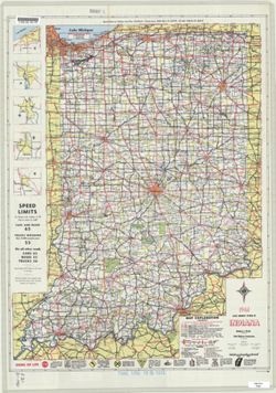
- Indiana state highway system1
- Indiana. Geological Survey. Regional geologic map.1
- Monroe County, Indiana, Existing Use of Land1
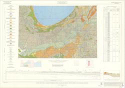
- Regional geologic map.1
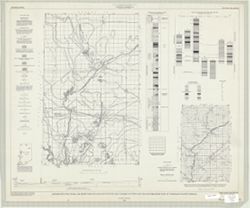
- Salt Creek Township, Monroe County, Indiana, Existing Use of Land1