
Search Constraints
You searched for:
Date Created
1942
Remove constraint Date Created: 1942
State/Province
РСФСР (RSFSR)
Remove constraint State/Province: РСФСР (RSFSR)
« Previous |
1 - 10 of 82
|
Next »
Search Results
-
- Subject:
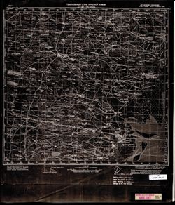
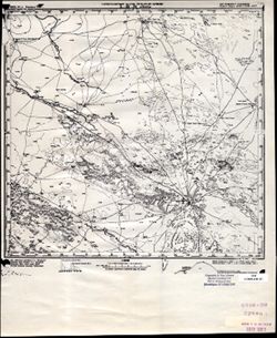
- Topical Subject: Maps, Topical Subject: Soviet Union, and Geographic Subject: Krasnaya Yaruga
- Publisher:
- Генеральный штаб Красной Армии
- Language:
- Russian
- Date Created:
- 1942
- Identifier:
- VAC9619-000959
- Genre:
- Military Maps and Topographic Maps
- Geographic Location:
- Coordinates: 50.666667, 35.5, 50.833333, 35.75
- Related URL:
- Download GeoTIFF: https://drive.google.com/open?id=1BJIPfz02R2AFxruama-IzsC5YbGAZYgh and Catalog URL: http://iucat.iu.edu/catalog/5020131
- Abstract:
- Modern area represented: Krasnaya Yaruga, Belgorod oblast, Russia
- Call Number:
- G7000 s50 .S68 sheet M-36-48-C
- Caption:
- Для служебного пользования
- City:
- Красная Яруга (Krasnaya Yaruga)
- Copyright Holder:
- No Copyright - United States
- Country:
- СССР (USSR)
- State/Province:
- РСФСР (RSFSR) and Курская область (Kursk oblast)
- Physical Description:
- Scale: 1:50,000
- Persistent URL:
- http://purl.dlib.indiana.edu/iudl/images/VAC9619/VAC9619-000959
- Provenance:
- DMA Topographic Center, Army Map Service Library, Library of Congress Geography & Map Division
-
- Description:
- 1940
- Subject:
- Geographic Subject: Большое Долженково (Bol'shoye Dolzhenkovo), Topical Subject: Soviet Union, and Topical Subject: Maps
- Publisher:
- Генеральный штаб Красной Армии
- Language:
- Russian
- Date Created:
- 1942
- Identifier:
- VAC9619-000909
- Genre:
- Military Maps and Topographic Maps
- Geographic Location:
- Coordinates: 51.6667, 35.75, 51.8333, 36
- Related URL:
- Download GeoTIFF: https://drive.google.com/open?id=1I_PZoicERa23WIF-eI38Fy6a-63UULx5 and Catalog URL: http://iucat.iu.edu/catalog/5020131
- Abstract:
- Modern area represented: Большое Долженково (Bol'shoye Dolzhenkovo), Kurskaya oblast, Russia
- Call Number:
- G7000 s50 .S68 sheet M-36-12-D
- Caption:
- Для служебного пользования
- City:
- Большое Должонково (Bol'shoye Dolzhonkovo)
- Copyright Holder:
- No Copyright - United States
- Country:
- СССР (USSR)
- State/Province:
- РСФСР (RSFSR) and Курская область (Kursk oblast)
- Physical Description:
- Scale: 1:50,000
- Persistent URL:
- http://purl.dlib.indiana.edu/iudl/images/VAC9619/VAC9619-000909
- Provenance:
- DMA Topographic Center, Army Map Service Library, OMAHA, Library of Congress Geography & Map Division
-
- Description:
- 1941
- Subject:
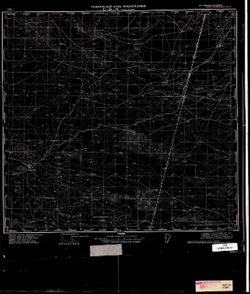
- Topical Subject: Maps, Geographic Subject: Zimnyatskiy, and Topical Subject: Soviet Union
- Publisher:
- Генеральный штаб Красной Армии
- Language:
- Russian
- Date Created:
- 1942
- Identifier:
- VAC9619-003412
- Genre:
- Military Maps and Topographic Maps
- Geographic Location:
- Coordinates: 49.667, 42.5, 50, 43
- Related URL:
- Catalog URL: https://iucat.iu.edu/catalog/5020129 and Download GeoTIFF: https://drive.google.com/file/d/1q_AeD7k13JW_DXMeMLlinHDmFTbUx0Xl/view?usp=sharing
- Abstract:
- Modern area represented: Zimnyatskiy, Volgograd oblast, Russia
- Call Number:
- G7000 s100 .S7 sheet M-38-74
- Caption:
- Для служебного пользования
- City:
- Зимняцкий (Zimnyatskiy)
- Copyright Holder:
- No Copyright - United States
- Country:
- СССР (USSR)
- State/Province:
- РСФСР (RSFSR) and Сталинградская область (Stalingrad oblast)
- Physical Description:
- Scale: 1:100,000
- Persistent URL:
- http://purl.dlib.indiana.edu/iudl/images/VAC9619/VAC9619-003412
- Provenance:
- DMA Topographic Center, Army Map Service Library, OMAHA
-
- Description:
- 1941
- Subject:
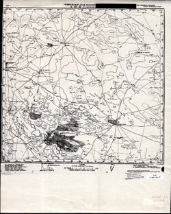
- Topical Subject: Soviet Union, Topical Subject: Maps, and Geographic Subject: Solodniki
- Publisher:
- Генеральный штаб Красной Армии
- Language:
- Russian
- Date Created:
- 1942
- Identifier:
- VAC9619-003438
- Genre:
- Military Maps and Topographic Maps
- Geographic Location:
- Coordinates: 48.333, 45, 48.667, 45.5
- Related URL:
- Download GeoTIFF: https://drive.google.com/file/d/1a5TQnKjgcqg2QHo-YuNpfeESpk4HhggC/view?usp=sharing and Catalog URL: https://iucat.iu.edu/catalog/5020129
- Abstract:
- Modern area represented: Solodniki, Astrakhan oblast, Russia
- Call Number:
- G7000 s100 .S7 sheet M-38-127
- Caption:
- Для служебного пользования
- City:
- Солодники (Solodniki)
- Copyright Holder:
- No Copyright - United States
- Country:
- СССР (USSR)
- State/Province:
- РСФСР (RSFSR) and Сталинградская область (Stalingrad oblast)
- Physical Description:
- Scale: 1:100,000
- Persistent URL:
- http://purl.dlib.indiana.edu/iudl/images/VAC9619/VAC9619-003438
- Provenance:
- DMA Topographic Center, Army Map Service Library, OMAHA, Atlasblatt
-
- Description:
- 1928
- Subject:
- Topical Subject: Soviet Union, Geographic Subject: Zhitkur, and Topical Subject: Maps
- Publisher:
- Генеральный штаб Красной Армии
- Language:
- Russian
- Date Created:
- 1942
- Identifier:
- VAC9619-003432
- Genre:
- Topographic Maps and Military Maps
- Geographic Location:
- Coordinates: 48.667, 46, 49, 46.5
- Related URL:
- Download GeoTIFF: https://drive.google.com/file/d/10XXUwJCtHnwqXdw2f29tipW879A-nsOm/view?usp=sharing and Catalog URL: https://iucat.iu.edu/catalog/5020129
- Abstract:
- Modern area represented: Zhitkur, Volgograd oblast, Russia
- Call Number:
- G7000 s100 .S7 sheet M-38-117
- Caption:
- Для служебного пользования
- City:
- Житкур (Zhitkur)
- Copyright Holder:
- No Copyright - United States
- Country:
- СССР (USSR)
- State/Province:
- Сталинградская область (Stalingrad oblast) and РСФСР (RSFSR)
- Physical Description:
- Scale: 1:100,000
- Persistent URL:
- http://purl.dlib.indiana.edu/iudl/images/VAC9619/VAC9619-003432
- Provenance:
- DMA Topographic Center, Army Map Service Library, OMAHA, Library of Congress Geography & Map Division
-
- Description:
- 1940
- Subject:
- Topical Subject: Soviet Union, Topical Subject: Maps, and Geographic Subject: Lagan
- Publisher:
- Генеральный штаб Красной Армии
- Language:
- Russian
- Date Created:
- 1942
- Identifier:
- VAC9619-002597
- Genre:
- Military Maps and Topographic Maps
- Geographic Location:
- Coordinates: 45.333, 47, 45.667, 47.5
- Related URL:
- Catalog URL: https://iucat.iu.edu/catalog/5020129 and Download GeoTIFF: https://drive.google.com/file/d/118xqIxVJbCLMYzPknJMFF-ICTqV1twyN/view?usp=sharing
- Abstract:
- Modern area represented: Lagan, Kalmykiya Republic, Russia
- Call Number:
- G7000 s100 .S7 sheet L-38-95
- Caption:
- Для служебного пользования
- City:
- Лагань (Lagan)
- Copyright Holder:
- No Copyright - United States
- Country:
- СССР (USSR)
- State/Province:
- РСФСР (RSFSR), Сталинградская область (Stalingrad oblast), and Калмыцкая АССР (Kalmyk Autonomous Soviet Socialist Republic)
- Physical Description:
- Scale: 1:100,000
- Persistent URL:
- http://purl.dlib.indiana.edu/iudl/images/VAC9619/VAC9619-002597
- Provenance:
- CIA Map Library
-
- Description:
- 1941
- Subject:
- Topical Subject: Soviet Union, Geographic Subject: Naryn Khuduk, and Topical Subject: Maps
- Publisher:
- Генеральный штаб Красной Армии
- Language:
- Russian
- Date Created:
- 1942
- Identifier:
- VAC9619-002596
- Genre:
- Topographic Maps and Military Maps
- Geographic Location:
- Coordinates: 45.333, 46.5, 45.667, 47
- Related URL:
- Catalog URL: https://iucat.iu.edu/catalog/5020129 and Download GeoTIFF: https://drive.google.com/file/d/1V21zweeUxfPtxEE1eyaHMGOZBg7JZ5Ds/view?usp=sharing
- Abstract:
- Modern area represented: Naryn Khuduk, Kalmykiya Republic, Russia
- Call Number:
- G7000 s100 .S7 sheet L-38-94
- Caption:
- Для служебного пользования
- City:
- Нарын-Худук (Naryn-Khuduk)
- Copyright Holder:
- No Copyright - United States
- Country:
- СССР (USSR)
- State/Province:
- РСФСР (RSFSR) and Калмыцкая АССР (Kalmyk Autonomous Soviet Socialist Republic)
- Physical Description:
- Scale: 1:100,000
- Persistent URL:
- http://purl.dlib.indiana.edu/iudl/images/VAC9619/VAC9619-002596
- Provenance:
- CIA Map Library
-
- Description:
- 1941
- Subject:
- Topical Subject: Maps, Topical Subject: Soviet Union, and Geographic Subject: Koltan-Nur lake
- Publisher:
- Генеральный штаб Красной Армии
- Language:
- Russian
- Date Created:
- 1942
- Identifier:
- VAC9619-002166
- Genre:
- Military Maps and Topographic Maps
- Geographic Location:
- Coordinates: 45.3333, 45.5, 45.6667, 46
- Related URL:
- Download GeoTIFF: https://drive.google.com/open?id=1TbdH0pLoQrfNjccE9h9zqh8Dh0XLyveo and Catalog URL: https://iucat.iu.edu/catalog/5020129
- Abstract:
- Modern area represented: Koltan-Nur lake, Kalmykiya Republic, Russia
- Call Number:
- G7000 s100 .S7 sheet L-38-92
- Caption:
- Для служебного пользования
- City:
- Оз. Колтан-Нур (Koltan-Nur lake)
- Copyright Holder:
- No Copyright - United States
- Country:
- СССР (USSR)
- State/Province:
- Калмыцкая АССР (Kalmyk Autonomous Soviet Socialist Republic) and РСФСР (RSFSR)
- Physical Description:
- Scale: 1:100,000
- Persistent URL:
- http://purl.dlib.indiana.edu/iudl/images/VAC9619/VAC9619-002166
- Provenance:
- CIA Map Library
-
- Description:
- 1932
- Subject:
- Topical Subject: Soviet Union, Geographic Subject: Sostinskiy, and Topical Subject: Maps
- Publisher:
- Генеральный штаб Красной Армии
- Language:
- Russian
- Date Created:
- 1942
- Identifier:
- VAC9619-002165
- Genre:
- Topographic Maps and Military Maps
- Geographic Location:
- Coordinates: 45.3333, 45, 45.6667, 45.5
- Related URL:
- Download GeoTIFF: https://drive.google.com/open?id=1mPzTxGKH5jVyadj_6X9zxs5fzkbRDVmU and Catalog URL: https://iucat.iu.edu/catalog/5020129
- Abstract:
- Modern area represented: Sostinskiy, Kalmykiya Republic, Russia
- Call Number:
- G7000 s100 .S7 sheet L-38-91
- Caption:
- Для служебного пользования
- City:
- Ачинеры (Achinery)
- Copyright Holder:
- No Copyright - United States
- Country:
- СССР (USSR)
- State/Province:
- РСФСР (RSFSR), Калмыцкая АССР (Kalmyk Autonomous Soviet Socialist Republic), and Орджоникидзевский край (Ordzhonikidze kray)
- Physical Description:
- Scale: 1:100,000
- Persistent URL:
- http://purl.dlib.indiana.edu/iudl/images/VAC9619/VAC9619-002165
- Provenance:
- CIA Map Library
-
- Description:
- 1927
- Subject:
- Topical Subject: Maps and Topical Subject: Soviet Union
- Publisher:
- Генеральный штаб Красной Армии
- Language:
- Russian
- Date Created:
- 1942
- Identifier:
- VAC9619-002164
- Genre:
- Topographic Maps and Military Maps
- Geographic Location:
- Coordinates: 45.3333, 44.5, 45.6667, 45
- Related URL:
- Catalog URL: https://iucat.iu.edu/catalog/5020129 and Download GeoTIFF: https://drive.google.com/open?id=10x7gtyFMb3-LHQ-wgNBMLfYtkf3w11nn
- Call Number:
- G7000 s100 .S7 sheet L-38-90
- Caption:
- Для служебного пользования
- City:
- Колхоз Красный Маныч (Krasniy Manich Collective Farm)
- Copyright Holder:
- No Copyright - United States
- Country:
- СССР (USSR)
- State/Province:
- Орджоникидзевский край (Ordzhonikidze kray), Калмыцкая АССР (Kalmyk Autonomous Soviet Socialist Republic), and РСФСР (RSFSR)
- Physical Description:
- Scale: 1:100,000
- Persistent URL:
- http://purl.dlib.indiana.edu/iudl/images/VAC9619/VAC9619-002164
- Provenance:
- DMA Topographic Center, Army Map Service Library
