
Search Constraints
« Previous |
1 - 10 of 33
|
Next »
Search Results
-
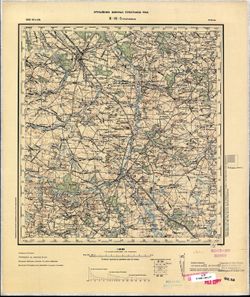
- Description:
- 1892
- Subject:
- Topical Subject: Maps, Topical Subject: Soviet Union, and Geographic Subject: Krakės
- Publisher:
- Управление военных топографов РККА
- Language:
- Russian
- Date Created:
- 1898
- Identifier:
- VAC9619-003904
- Genre:
- Topographic Maps and Military Maps
- Geographic Location:
- Coordinates: 55.333, 23.5, 55.667, 24
- Related URL:
- DataCORE Dataset Download: https://datacore.iu.edu/concern/data_sets/9w0323837
- Abstract:
- Modern area represented: Krakės, Lithuania
- Call Number:
- G7000 s100 .S7 sheet N-34-24
- City:
- Кроки (Kroki)
- Copyright Holder:
- No Copyright - United States
- Country:
- Литва (Lithuania)
- Physical Description:
- Scale: 1:100,000
- Persistent URL:
- http://purl.dlib.indiana.edu/iudl/images/VAC9619/VAC9619-003904
- Provenance:
- DMA Topographic Center, Army Map Service Library, Auswärtiges Amt. Geographischer Dienst
-
- Description:
- 1894
- Subject:
- Topical Subject: Maps, Geographic Subject: Tarnobrzeg, and Topical Subject: Soviet Union
- Publisher:
- Управление военных топографов РККА
- Language:
- Russian
- Date Created:
- 1898
- Identifier:
- VAC9619-002857
- Genre:
- Topographic Maps and Military Maps
- Geographic Location:
- Coordinates: 50.333, 21.5, 50.667, 22
- Related URL:
- DataCORE Dataset Download: https://datacore.iu.edu/concern/data_sets/76537196t
- Abstract:
- Modern area represented: Tarnobrzeg, Subcarpathian province, Poland
- Call Number:
- G7000 s100 .S7 sheet M-34-56
- City:
- Тарнобжег (Tarnobrzeg)
- Copyright Holder:
- No Copyright - United States
- Country:
- Польша (Poland)
- Physical Description:
- Scale: 1:100,000
- Persistent URL:
- http://purl.dlib.indiana.edu/iudl/images/VAC9619/VAC9619-002857
- Provenance:
- CIA Map Library
-
- Description:
- 1894
- Subject:
- Topical Subject: Soviet Union, Geographic Subject: Szydłowiec, and Topical Subject: Maps
- Publisher:
- Управление военных топографов РККА
- Language:
- Russian
- Date Created:
- 1898
- Identifier:
- VAC9619-002772
- Genre:
- Military Maps and Topographic Maps
- Geographic Location:
- Coordinates: 51, 20.5, 51.333, 21
- Related URL:
- DataCORE Dataset Download: https://datacore.iu.edu/concern/data_sets/8g84mn04r
- Abstract:
- Modern area represented: Szydłowiec, Mazovia province, Poland
- Call Number:
- G7000 s100 .S7 sheet M-34-30
- City:
- Шидловец (Szydłowiec)
- Copyright Holder:
- No Copyright - United States
- Country:
- Польша (Poland)
- Physical Description:
- Scale: 1:100,000
- Persistent URL:
- http://purl.dlib.indiana.edu/iudl/images/VAC9619/VAC9619-002772
- Provenance:
- CIA Map Library, Geogr. Seminar Stuttgart
-
- Description:
- 1893
- Subject:
- Topical Subject: Soviet Union, Topical Subject: Maps, and Geographic Subject: Końskie
- Publisher:
- Генеральный штаб РККА
- Language:
- Russian
- Date Created:
- 1898
- Identifier:
- VAC9619-002770
- Genre:
- Military Maps and Topographic Maps
- Geographic Location:
- Coordinates: 51, 20, 51.333, 20.5
- Related URL:
- DataCORE Dataset Download: https://datacore.iu.edu/concern/data_sets/1j92g831d
- Abstract:
- Modern area represented: Końskie, Świętokrzyskie province, Poland
- Call Number:
- G7000 s100 .S7 sheet M-34-29
- City:
- Коньске (Końskie)
- Copyright Holder:
- No Copyright - United States
- Physical Description:
- Scale: 1:100,000
- Persistent URL:
- http://purl.dlib.indiana.edu/iudl/images/VAC9619/VAC9619-002770
- Provenance:
- CIA Map Library, CIA Map Branch -- Received, FEM Austria
-
- Description:
- 1888
- Subject:
- Geographic Subject: Skierniewice, Topical Subject: Soviet Union, and Topical Subject: Maps
- Publisher:
- Управление военных топографов РККА
- Language:
- Russian
- Date Created:
- 1898
- Identifier:
- VAC9619-002727
- Genre:
- Topographic Maps and Military Maps
- Geographic Location:
- Coordinates: 51.667, 20, 52, 20.5
- Related URL:
- DataCORE Dataset Download: https://datacore.iu.edu/concern/data_sets/8c97kr08m
- Abstract:
- Modern area represented: Skierniewice, Łódź province, Poland
- Call Number:
- G7000 s100 .S7 sheet M-34-5
- City:
- Скерневицэ (Skierniewice)
- Copyright Holder:
- No Copyright - United States
- Country:
- Польша (Poland)
- Physical Description:
- Scale: 1:100,000
- Persistent URL:
- http://purl.dlib.indiana.edu/iudl/images/VAC9619/VAC9619-002727
- Provenance:
- CIA Map Library
-

- Description:
- 1897
- Subject:
- Topical Subject: Soviet Union, Topical Subject: Maps, and Geographic Subject: Järva-Jaani
- Publisher:
- Генеральный штаб РККА
- Language:
- Russian
- Date Created:
- 1898
- Identifier:
- VAC9619-001835
- Genre:
- Topographic Maps and Military Maps
- Geographic Location:
- Coordinates: 59, 25.75, 59.167, 26
- Related URL:
- DataCORE Dataset Download: https://datacore.iu.edu/concern/data_sets/bg257f85d
- Abstract:
- Modern area represented: Järva-Jaani, Järva county, Estonia
- Call Number:
- G7000 s50 .S68 sheet O-35-28-Г
- City:
- Ярва-Яни (Järva-Jaani)
- Copyright Holder:
- No Copyright - United States
- Country:
- Эстония (Estonia)
- Physical Description:
- Scale: 1:50,000
- Persistent URL:
- http://purl.dlib.indiana.edu/iudl/images/VAC9619/VAC9619-001835
- Provenance:
- Army Map Service Library, Library of Congress Geography & Map Division, OMAHA
-

- Description:
- 1897
- Subject:
- Topical Subject: Soviet Union, Topical Subject: Maps, and Geographic Subject: Tapa
- Publisher:
- Генеральный штаб РККА
- Language:
- Russian
- Date Created:
- 1898
- Identifier:
- VAC9619-001833
- Genre:
- Military Maps and Topographic Maps
- Geographic Location:
- Coordinates: 59.167, 25.75, 59.333, 26
- Related URL:
- DataCORE Dataset Download: https://datacore.iu.edu/concern/data_sets/j67314509
- Abstract:
- Modern area represented: Tapa, Lääne-Viru county, Estonia
- Call Number:
- G7000 s50 .S68 sheet O-35-28-Б
- City:
- Тапа (Tapa)
- Copyright Holder:
- No Copyright - United States
- Country:
- Эстония (Estonia)
- Physical Description:
- Scale: 1:50,000
- Persistent URL:
- http://purl.dlib.indiana.edu/iudl/images/VAC9619/VAC9619-001833
- Provenance:
- Army Map Service Library, Library of Congress Geography & Map Division, OMAHA
-
- Description:
- 1897
- Subject:
- Geographic Subject: Vanakyula, Topical Subject: Soviet Union, and Topical Subject: Maps
- Publisher:
- Генеральный штаб РККА
- Language:
- Russian
- Date Created:
- 1898
- Identifier:
- VAC9619-001793
- Genre:
- Topographic Maps and Military Maps
- Geographic Location:
- Coordinates: 59.333, 25.75, 59.5, 26
- Related URL:
- DataCORE Dataset Download: https://datacore.iu.edu/concern/data_sets/3f462607r
- Abstract:
- Modern area represented: Vanakyula, Leningrad oblast, Russia
- Call Number:
- G7000 s50 .S68 sheet O-35-16-D
- City:
- Ванакюла (Vanakyula)
- Copyright Holder:
- No Copyright - United States
- Country:
- Эстония (Estonia)
- Physical Description:
- Scale: 1:50,000
- Persistent URL:
- http://purl.dlib.indiana.edu/iudl/images/VAC9619/VAC9619-001793
- Provenance:
- Army Map Service Library, Library of Congress Geography & Map Division, OMAHA
-
- Description:
- 1897
- Subject:
- Topical Subject: Soviet Union, Geographic Subject: Võsu, and Topical Subject: Maps
- Publisher:
- Генеральный штаб РККА
- Language:
- Russian
- Date Created:
- 1898
- Identifier:
- VAC9619-001791
- Genre:
- Topographic Maps and Military Maps
- Geographic Location:
- Coordinates: 59.5, 25.75, 59.692, 26
- Related URL:
- DataCORE Dataset Download: https://datacore.iu.edu/concern/data_sets/dn39x2192
- Abstract:
- Modern area represented: Võsu, Lääne-Viru county, Estonia
- Call Number:
- G7000 s50 .S68 sheet O-35-16-Б
- City:
- Высу (Võsu
- Copyright Holder:
- No Copyright - United States
- Country:
- Эстония (Estonia)
- Physical Description:
- Scale: 1:50,000
- Persistent URL:
- http://purl.dlib.indiana.edu/iudl/images/VAC9619/VAC9619-001791
- Provenance:
- Army Map Service Library, Library of Congress Geography & Map Division, OMAHA
-
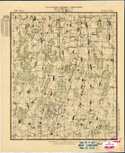
- Description:
- 1897
- Subject:
- Topical Subject: Maps, Topical Subject: Soviet Union, and Geographic Subject: Kruki
- Publisher:
- Управление военных топографов
- Language:
- Russian
- Date Created:
- 1898
- Identifier:
- VAC9619-001767
- Genre:
- Military Maps and Topographic Maps
- Geographic Location:
- Coordinates: 59.167, 23.75, 59.333, 24
- Related URL:
- DataCORE Dataset Download: https://datacore.iu.edu/concern/data_sets/8k71nh868
- Abstract:
- Modern area represented: Kruki, Latvia
- Call Number:
- G7000 s50 .S68 sheet O-34-144-B
- City:
- Круки (Kruki)
- Copyright Holder:
- No Copyright - United States
- Country:
- Латвия (Latvia) and Литва (Lithuania)
- Physical Description:
- Scale: 1:50,000
- Persistent URL:
- http://purl.dlib.indiana.edu/iudl/images/VAC9619/VAC9619-001767
- Provenance:
- M. I. Map Library

- « Previous
- Next »
- 1
- 2
- 3
- 4