
Search Constraints
You searched for:
Subject
Mountains
Remove constraint Subject: Mountains
State/Province
Nevada
Remove constraint State/Province: Nevada
« Previous |
1 - 100 of 117
|
Next »
Search Results
-
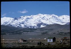
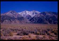
- Description:
- 100 f 11 TL
- Subject:
- Snow, Houses, Mountains, Fences, and Hills
- Series:
- 2-63
- Creator:
- Cushman, Charles W., 1896-1972
- Date Created:
- 1963-05-08
- Genre:
- Landscape photographs
- Frame Number:
- 1
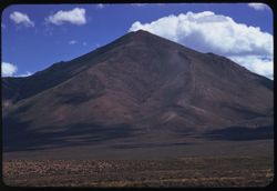
- County:
- Elko
- Abstract:
- Mtn. South of Wells
- Call Number:
- P12826
- City:
- Wells
- Country:
- United States
- State/Province:
- Nevada
- Alternate Identifier:
- 263.1
- Persistent URL:
- http://purl.dlib.indiana.edu/iudl/archives/cushman/P12826
- Holding Location:
- Bloomington - University Archives
Wells Library E460
1320 E 10th St.
Bloomington, IN 47405
Contact at archives@indiana.edu, 812-855-1127
-
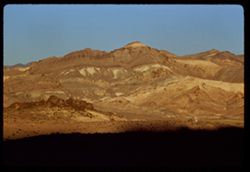
- Description:
- 100 f 8 TL
- Subject:
- Mountains, Rock formations, and Sunrises & sunsets
- Series:
- 4-62
- Creator:
- Cushman, Charles W., 1896-1972
- Date Created:
- 1962-09-30
- Genre:
- Landscape photographs
- Frame Number:
- 8
- County:
- Nye
- Abstract:
- Mtns above Beatty at sunset.
- Call Number:
- P12737
- City:
- Beatty
- Country:
- United States
- State/Province:
- Nevada
- Alternate Identifier:
- 462.8
- Persistent URL:
- http://purl.dlib.indiana.edu/iudl/archives/cushman/P12737
- Holding Location:
- Bloomington - University Archives
Wells Library E460
1320 E 10th St.
Bloomington, IN 47405
Contact at archives@indiana.edu, 812-855-1127
-
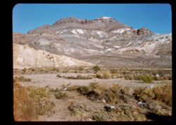
- Description:
- 50 f 9 SL
- Subject:
- Hills, Mountains, Rock formations, and Grasses
- Series:
- 4-62
- Creator:
- Cushman, Charles W., 1896-1972
- Date Created:
- 1962-09-30
- Genre:
- Landscape photographs
- Frame Number:
- 7
- County:
- Nye
- Abstract:
- Beatty, Nevada.
- Call Number:
- P12736
- City:
- Beatty
- Country:
- United States
- State/Province:
- Nevada
- Physical Description:
- masked.
- Alternate Identifier:
- 462.7
- Persistent URL:
- http://purl.dlib.indiana.edu/iudl/archives/cushman/P12736
- Holding Location:
- Bloomington - University Archives
Wells Library E460
1320 E 10th St.
Bloomington, IN 47405
Contact at archives@indiana.edu, 812-855-1127
-
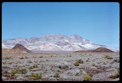
- Description:
- 100 f 8 TL
- Subject:
- Rock Candy Mountain (Calif.), Plains, Hills, Mountains, and Grasses
- Series:
- 3-62
- Creator:
- Cushman, Charles W., 1896-1972
- Date Created:
- 1962-09-30
- Genre:
- Landscape photographs
- Frame Number:
- 38
- County:
- Nye
- Abstract:
- Rock candy mountain along US 95, 24 mi. west of Tonopah.
- Call Number:
- P12735
- City:
- Tonopah
- Country:
- United States
- State/Province:
- Nevada
- Alternate Identifier:
- 362.38
- Persistent URL:
- http://purl.dlib.indiana.edu/iudl/archives/cushman/P12735
- Holding Location:
- Bloomington - University Archives
Wells Library E460
1320 E 10th St.
Bloomington, IN 47405
Contact at archives@indiana.edu, 812-855-1127
-
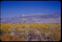
- Description:
- 100 f 8 TL
- Subject:
- Snow, Grasses, White Mountains (Calif. and Nev.), Plains, Mountains, and Hills
- Series:
- 3-62
- Creator:
- Cushman, Charles W., 1896-1972
- Date Created:
- 1962-09-30
- Genre:
- Landscape photographs
- Frame Number:
- 37
- Street Address:
- United States Highway 95
- County:
- Mineral
- Abstract:
- Snow-capped mtns SW of US 95.
- Call Number:
- P12734
- City:
- Mina
- Country:
- United States
- State/Province:
- Nevada
- Alternate Identifier:
- 362.37
- Persistent URL:
- http://purl.dlib.indiana.edu/iudl/archives/cushman/P12734
- Holding Location:
- Bloomington - University Archives
Wells Library E460
1320 E 10th St.
Bloomington, IN 47405
Contact at archives@indiana.edu, 812-855-1127
-
- Description:
- 100 f 8 TL
- Subject:
- Snow, Grasses, White Mountains (Calif. and Nev.), Plains, Mountains, and Hills
- Series:
- 3-62
- Creator:
- Cushman, Charles W., 1896-1972
- Date Created:
- 1962-09-30
- Genre:
- Landscape photographs
- Frame Number:
- 36
- Street Address:
- United States Highway 95
- County:
- Mineral
- Abstract:
- Snow-capped mtns SW of US 95.
- Call Number:
- P12733
- City:
- Mina
- Country:
- United States
- State/Province:
- Nevada
- Alternate Identifier:
- 362.36
- Persistent URL:
- http://purl.dlib.indiana.edu/iudl/archives/cushman/P12733
- Holding Location:
- Bloomington - University Archives
Wells Library E460
1320 E 10th St.
Bloomington, IN 47405
Contact at archives@indiana.edu, 812-855-1127
-
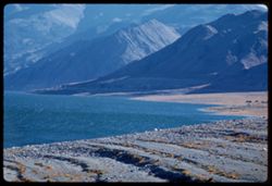
- Description:
- 100 f 8 TL
- Subject:
- Lakes & ponds, Hills, Mountains, Walker Lake (Nev. : Lake), Rocks, Coastlines, and Grasses
- Series:
- 3-62
- Creator:
- Cushman, Charles W., 1896-1972
- Date Created:
- 1962-09-29
- Genre:
- Landscape photographs
- Frame Number:
- 35
- County:
- Mineral
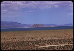
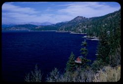
- Abstract:
- Walker Lake.
- Call Number:
- P12732
- Country:
- United States
- State/Province:
- Nevada
- Alternate Identifier:
- 362.35
- Persistent URL:
- http://purl.dlib.indiana.edu/iudl/archives/cushman/P12732
- Holding Location:
- Bloomington - University Archives
Wells Library E460
1320 E 10th St.
Bloomington, IN 47405
Contact at archives@indiana.edu, 812-855-1127
-
- Description:
- 100 f 6.3 TL
- Subject:
- Lakes & ponds, Hills, Mountains, Walker Lake (Nev. : Lake), and Coastlines
- Series:
- 3-62
- Creator:
- Cushman, Charles W., 1896-1972
- Date Created:
- 1962-09-29
- Genre:
- Landscape photographs
- Frame Number:
- 34
- County:
- Mineral
- Abstract:
- Walker Lake.
- Call Number:
- P12731
- Country:
- United States
- State/Province:
- Nevada
- Alternate Identifier:
- 362.34
- Persistent URL:
- http://purl.dlib.indiana.edu/iudl/archives/cushman/P12731
- Holding Location:
- Bloomington - University Archives
Wells Library E460
1320 E 10th St.
Bloomington, IN 47405
Contact at archives@indiana.edu, 812-855-1127
-
- Description:
- 100 f 8 TL
- Subject:
- Snow, Coastlines, Mountains, Walker Lake (Nev. : Lake), Lakes & ponds, and Hills
- Series:
- 3-62
- Creator:
- Cushman, Charles W., 1896-1972
- Date Created:
- 1962-09-29
- Genre:
- Landscape photographs
- Frame Number:
- 33
- County:
- Mineral
- Abstract:
- Walker Lake toward Mt.
- Call Number:
- P12730
- Country:
- United States
- State/Province:
- Nevada
- Alternate Identifier:
- 362.33
- Persistent URL:
- http://purl.dlib.indiana.edu/iudl/archives/cushman/P12730
- Holding Location:
- Bloomington - University Archives
Wells Library E460
1320 E 10th St.
Bloomington, IN 47405
Contact at archives@indiana.edu, 812-855-1127
-
- Description:
- 100 f 5.6 TL
- Subject:
- Lakes & ponds, Hills, Mountains, Walker Lake (Nev. : Lake), Rocks, and Coastlines
- Series:
- 3-62
- Creator:
- Cushman, Charles W., 1896-1972
- Date Created:
- 1962-09-29
- Genre:
- Landscape photographs
- Frame Number:
- 32
- County:
- Mineral
- Abstract:
- Walker Lake.
- Call Number:
- P12729
- Country:
- United States
- State/Province:
- Nevada
- Alternate Identifier:
- 362.32
- Persistent URL:
- http://purl.dlib.indiana.edu/iudl/archives/cushman/P12729
- Holding Location:
- Bloomington - University Archives
Wells Library E460
1320 E 10th St.
Bloomington, IN 47405
Contact at archives@indiana.edu, 812-855-1127
-
- Description:
- 100 f 8 TL
- Subject:
- Lakes & ponds, Hills, Mountains, Walker Lake (Nev. : Lake), Coastlines, and Grasses
- Series:
- 3-62
- Creator:
- Cushman, Charles W., 1896-1972
- Date Created:
- 1962-09-29
- Genre:
- Landscape photographs
- Frame Number:
- 31
- County:
- Mineral
- Abstract:
- Walker Lake.
- Call Number:
- P12728
- Country:
- United States
- State/Province:
- Nevada
- Alternate Identifier:
- 362.31
- Persistent URL:
- http://purl.dlib.indiana.edu/iudl/archives/cushman/P12728
- Holding Location:
- Bloomington - University Archives
Wells Library E460
1320 E 10th St.
Bloomington, IN 47405
Contact at archives@indiana.edu, 812-855-1127
-
- Description:
- 100 f 8 TL
- Subject:
- Rocks, Grasses, Mountains, Shrubs, and Hills
- Series:
- 3-62
- Creator:
- Cushman, Charles W., 1896-1972
- Date Created:
- 1962-09-29
- Genre:
- Landscape photographs
- Frame Number:
- 30
- County:
- Storey
- Abstract:
- View east from [dome]
- Call Number:
- P12727
- City:
- Virginia City
- Country:
- United States
- State/Province:
- Nevada
- Alternate Identifier:
- 362.30
- Persistent URL:
- http://purl.dlib.indiana.edu/iudl/archives/cushman/P12727
- Holding Location:
- Bloomington - University Archives
Wells Library E460
1320 E 10th St.
Bloomington, IN 47405
Contact at archives@indiana.edu, 812-855-1127
-
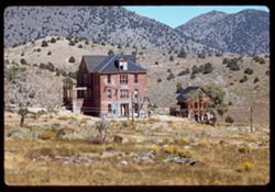
- Description:
- 100 f 6.3 TL
- Subject:
- Grasses, Houses, Outbuildings, Porticoes (Porches), Trees, Brick houses, Mountains, Dormers, Dwellings, and Doors & doorways
- Series:
- 3-62
- Creator:
- Cushman, Charles W., 1896-1972
- Date Created:
- 1962-09-29
- Genre:
- Architectural photographs
- Frame Number:
- 29
- County:
- Storey
- Abstract:
- Old Suburban brick house.
- Call Number:
- P12726
- City:
- Virginia City
- Country:
- United States
- State/Province:
- Nevada
- Alternate Identifier:
- 362.29
- Persistent URL:
- http://purl.dlib.indiana.edu/iudl/archives/cushman/P12726
- Holding Location:
- Bloomington - University Archives
Wells Library E460
1320 E 10th St.
Bloomington, IN 47405
Contact at archives@indiana.edu, 812-855-1127
-
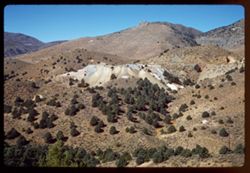
- Description:
- 100 f 6.3 SL
- Subject:
- Hills, Mining, Mountains, Trees, and Abandoned mines
- Series:
- 3-62
- Creator:
- Cushman, Charles W., 1896-1972
- Date Created:
- 1962-09-29
- Genre:
- Identification photographs and Landscape photographs
- Frame Number:
- 23
- County:
- Storey
- Abstract:
- Scene nearby.
- Call Number:
- P12721
- City:
- Virginia City
- Country:
- United States
- State/Province:
- Nevada
- Alternate Identifier:
- 362.23
- Persistent URL:
- http://purl.dlib.indiana.edu/iudl/archives/cushman/P12721
- Holding Location:
- Bloomington - University Archives
Wells Library E460
1320 E 10th St.
Bloomington, IN 47405
Contact at archives@indiana.edu, 812-855-1127
-
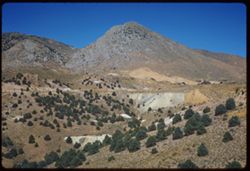
- Description:
- 100 f 8 SL
- Subject:
- Hills, Mining, Roads, Mountains, and Trees
- Series:
- 3-62
- Creator:
- Cushman, Charles W., 1896-1972
- Date Created:
- 1962-09-29
- Genre:
- Landscape photographs
- Frame Number:
- 22
- County:
- Storey
- Abstract:
- Toward Virginia Cy. from SE.
- Call Number:
- P12720
- City:
- Virginia City
- Country:
- United States
- State/Province:
- Nevada
- Alternate Identifier:
- 362.22
- Persistent URL:
- http://purl.dlib.indiana.edu/iudl/archives/cushman/P12720
- Holding Location:
- Bloomington - University Archives
Wells Library E460
1320 E 10th St.
Bloomington, IN 47405
Contact at archives@indiana.edu, 812-855-1127
-
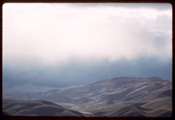
- Description:
- 100 f 4.5 TL
- Subject:
- Valleys, Mountains, Clouds, and Hills
- Series:
- 3-62
- Creator:
- Cushman, Charles W., 1896-1972
- Date Created:
- 1962-09-28
- Genre:
- Landscape photographs
- Frame Number:
- 21
- County:
- Washoe and Carson City
- Abstract:
- Pleasant Valley.
- Call Number:
- P12719
- City:
- Pleasant Valley, Carson City, and Reno
- Country:
- United States
- State/Province:
- Nevada
- Alternate Identifier:
- 362.21
- Persistent URL:
- http://purl.dlib.indiana.edu/iudl/archives/cushman/P12719
- Holding Location:
- Bloomington - University Archives
Wells Library E460
1320 E 10th St.
Bloomington, IN 47405
Contact at archives@indiana.edu, 812-855-1127
-
- Description:
- 100 f 8 TL
- Subject:
- Hills, Mountains, Shrubs, and Clouds
- Series:
- 3-62
- Creator:
- Cushman, Charles W., 1896-1972
- Date Created:
- 1962-09-28
- Genre:
- Landscape photographs
- Frame Number:
- 20
- County:
- Storey
- Abstract:
- View east from Va. Cy.
- Call Number:
- P12718
- City:
- Virginia City
- Country:
- United States
- State/Province:
- Nevada
- Alternate Identifier:
- 362.20
- Persistent URL:
- http://purl.dlib.indiana.edu/iudl/archives/cushman/P12718
- Holding Location:
- Bloomington - University Archives
Wells Library E460
1320 E 10th St.
Bloomington, IN 47405
Contact at archives@indiana.edu, 812-855-1127
-
- Description:
- 100 f 6.3 TL
- Subject:
- Roads, Mountains, Shrubs, Clouds, Hills, and Utility poles
- Series:
- 3-62
- Creator:
- Cushman, Charles W., 1896-1972
- Date Created:
- 1962-09-28
- Genre:
- Landscape photographs
- Frame Number:
- 19
- County:
- Storey
- Abstract:
- View east from Va. Cy.
- Call Number:
- P12717
- City:
- Virginia City
- Country:
- United States
- State/Province:
- Nevada
- Alternate Identifier:
- 362.19
- Persistent URL:
- http://purl.dlib.indiana.edu/iudl/archives/cushman/P12717
- Holding Location:
- Bloomington - University Archives
Wells Library E460
1320 E 10th St.
Bloomington, IN 47405
Contact at archives@indiana.edu, 812-855-1127
-
- Description:
- 100 f 4? TL
- Subject:
- Trees, Mountains, Shrubs, Clouds, and Utility poles
- Series:
- 3-62
- Creator:
- Cushman, Charles W., 1896-1972
- Date Created:
- 1962-09-28
- Genre:
- Landscape photographs
- Frame Number:
- 18
- County:
- Storey
- Abstract:
- View east from Va. Cy.
- Call Number:
- P12716
- City:
- Virginia City
- Country:
- United States
- State/Province:
- Nevada
- Alternate Identifier:
- 362.18
- Persistent URL:
- http://purl.dlib.indiana.edu/iudl/archives/cushman/P12716
- Holding Location:
- Bloomington - University Archives
Wells Library E460
1320 E 10th St.
Bloomington, IN 47405
Contact at archives@indiana.edu, 812-855-1127
-
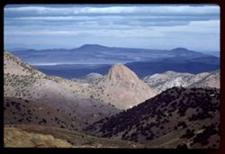
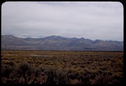
- Description:
- 100 f 8 tl
- Subject:
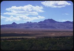
- Plains, Pilot Peak (Elko County, Nev.), and Mountains
- Series:
- 16-58
- Creator:
- Cushman, Charles W., 1896-1972
- Date Created:
- 1958-08-23
- Genre:
- Landscape photographs
- Frame Number:
- 1
- County:
- Elko
- Abstract:
- Pilot Pk.
- Call Number:
- P10127
- Country:
- United States
- State/Province:
- Nevada
- Alternate Identifier:
- 1658.1
- Persistent URL:
- http://purl.dlib.indiana.edu/iudl/archives/cushman/P10127
- Holding Location:
- Bloomington - University Archives
Wells Library E460
1320 E 10th St.
Bloomington, IN 47405
Contact at archives@indiana.edu, 812-855-1127
-
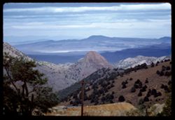
- Description:
- 100 f 8 tl
- Subject:
- Plains, Mountains, and Pilot Peak (Elko County, Nev.)
- Series:
- 15-58
- Creator:
- Cushman, Charles W., 1896-1972
- Date Created:
- 1958-08-23
- Genre:
- Landscape photographs
- Frame Number:
- 20
- County:
- Elko
- Abstract:
- Pilot Peak
- Call Number:
- P10126
- Country:
- United States
- State/Province:
- Nevada
- Alternate Identifier:
- 1558.20
- Persistent URL:
- http://purl.dlib.indiana.edu/iudl/archives/cushman/P10126
- Holding Location:
- Bloomington - University Archives
Wells Library E460
1320 E 10th St.
Bloomington, IN 47405
Contact at archives@indiana.edu, 812-855-1127
-
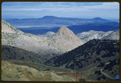
- Description:
- 100 f 8 tl
- Subject:
- Grasses, Plains, Mountains, Rock formations, Clouds, Pilot Peak (Elko County, Nev.), and Shrubs
- Series:
- 15-58
- Creator:
- Cushman, Charles W., 1896-1972
- Date Created:
- 1958-08-23
- Genre:
- Landscape photographs
- Frame Number:
- 19
- Street Address:
- United States Highway 40
- County:
- Elko
- Abstract:
- Interesting granite double peak no. of US 40 between Wells & Wendover (Pilot Peak)
- Call Number:
- P10125
- City:
- Eastline and Wells
- Country:
- United States
- State/Province:
- Nevada
- Alternate Identifier:
- 1558.19
- Persistent URL:
- http://purl.dlib.indiana.edu/iudl/archives/cushman/P10125
- Holding Location:
- Bloomington - University Archives
Wells Library E460
1320 E 10th St.
Bloomington, IN 47405
Contact at archives@indiana.edu, 812-855-1127
-
- Description:
- 50 f 8 sl
- Subject:
- Humboldt River (Nev.), Mountains, Shrubs, People, and Rivers
- Series:
- 15-58
- Creator:
- Cushman, Charles W., 1896-1972
- Date Created:
- 1958-08-23
- Genre:
- Landscape photographs
- Frame Number:
- 17
- County:
- Elko
- Abstract:
- Horseshoe Bend of Humboldt river
- Call Number:
- P10123
- Country:
- United States
- State/Province:
- Nevada
- Alternate Identifier:
- 1558.17
- Persistent URL:
- http://purl.dlib.indiana.edu/iudl/archives/cushman/P10123
- Holding Location:
- Bloomington - University Archives
Wells Library E460
1320 E 10th St.
Bloomington, IN 47405
Contact at archives@indiana.edu, 812-855-1127
-
- Description:
- 50 f 8 sl
- Subject:
- Grasses, Trees, Plains, Mountains, and Winnemucca Mountain (Nev.)
- Series:
- 15-58
- Creator:
- Cushman, Charles W., 1896-1972
- Date Created:
- 1958-08-23
- Genre:
- Landscape photographs
- Frame Number:
- 16
- County:
- Humboldt
- Abstract:
- Winnemucca Mtn.
- Call Number:
- P10122
- Country:
- United States
- State/Province:
- Nevada
- Alternate Identifier:
- 1558.16
- Persistent URL:
- http://purl.dlib.indiana.edu/iudl/archives/cushman/P10122
- Holding Location:
- Bloomington - University Archives
Wells Library E460
1320 E 10th St.
Bloomington, IN 47405
Contact at archives@indiana.edu, 812-855-1127
-
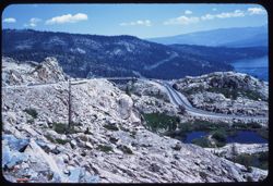
- Description:
- 50 f 9 sl
- Subject:
- Rocks, Roads, Automobiles, Trees, Donner Summit (Calif.), Mountains, Rock formations, Lakes & ponds, Sierra Nevada (Calif. and Nev.), and Donner Lake (Ca...
- Series:
- 15-58
- Creator:
- Cushman, Charles W., 1896-1972
- Date Created:
- 1958-08-22
- Genre:
- Landscape photographs
- Frame Number:
- 12
- Abstract:
- East toward Lake
- Call Number:
- P10118
- Country:
- United States
- State/Province:
- California and Nevada
- Alternate Identifier:
- 1558.12
- Persistent URL:
- http://purl.dlib.indiana.edu/iudl/archives/cushman/P10118
- Holding Location:
- Bloomington - University Archives
Wells Library E460
1320 E 10th St.
Bloomington, IN 47405
Contact at archives@indiana.edu, 812-855-1127
-
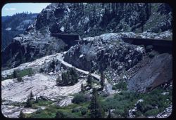
- Description:
- 50 f 6.3 sl
- Subject:
- Rocks, Southern Pacific Railroad Company, Donner Summit (Calif.), Mountains, Shrubs, Sierra Nevada (Calif. and Nev.), Snowsheds, Trees, and Rock formations
- Series:
- 15-58
- Creator:
- Cushman, Charles W., 1896-1972
- Date Created:
- 1958-08-22
- Genre:
- Landscape photographs
- Frame Number:
- 13
- Abstract:
- Snow sheds
- Call Number:
- P10119
- Country:
- United States
- State/Province:
- California and Nevada
- Alternate Identifier:
- 1558.13
- Persistent URL:
- http://purl.dlib.indiana.edu/iudl/archives/cushman/P10119
- Holding Location:
- Bloomington - University Archives
Wells Library E460
1320 E 10th St.
Bloomington, IN 47405
Contact at archives@indiana.edu, 812-855-1127
-
- Description:
- 50 f 8 sl
- Subject:
- Lakes & ponds, Automobiles, Roads, Donner Lake (Calif.), Mountains, Sierra Nevada (Calif. and Nev.), Trees, Rocks, Rock formations, and Donner Summit (Ca...
- Series:
- 15-58
- Creator:
- Cushman, Charles W., 1896-1972
- Date Created:
- 1958-08-22
- Genre:
- Landscape photographs
- Frame Number:
- 11
- Abstract:
- East toward Lake
- Call Number:
- P10117
- Country:
- United States
- State/Province:
- Nevada and California
- Alternate Identifier:
- 1558.11
- Persistent URL:
- http://purl.dlib.indiana.edu/iudl/archives/cushman/P10117
- Holding Location:
- Bloomington - University Archives
Wells Library E460
1320 E 10th St.
Bloomington, IN 47405
Contact at archives@indiana.edu, 812-855-1127
-
- Description:
- 50 f 8 sl
- Subject:
- Rocks, Roads, Automobiles, Trees, Donner Summit (Calif.), Mountains, Rock formations, Lakes & ponds, Sierra Nevada (Calif. and Nev.), and Donner Lake (Ca...
- Series:
- 15-58
- Creator:
- Cushman, Charles W., 1896-1972
- Date Created:
- 1958-08-22
- Genre:
- Landscape photographs
- Frame Number:
- 10
- Street Address:
- United States Highway 40
- Abstract:
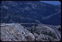
- NE from Donner Summit
- Call Number:
- P10116
- Country:
- United States
- State/Province:
- California and Nevada
- Alternate Identifier:
- 1558.10
- Persistent URL:
- http://purl.dlib.indiana.edu/iudl/archives/cushman/P10116
- Holding Location:
- Bloomington - University Archives
Wells Library E460
1320 E 10th St.
Bloomington, IN 47405
Contact at archives@indiana.edu, 812-855-1127
-
- Description:
- 100 f 8 tl
- Subject:
- Rocks, Roads, Automobiles, Trees, Donner Summit (Calif.), Mountains, and Sierra Nevada (Calif. and Nev.)
- Series:
- 15-58
- Creator:
- Cushman, Charles W., 1896-1972
- Date Created:
- 1958-08-22
- Genre:
- Landscape photographs
- Frame Number:
- 9
- Street Address:
- United States Highway 40
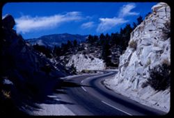
- Abstract:
- Hwy curve
- Call Number:
- P10115
- Country:
- United States
- State/Province:
- California and Nevada
- Alternate Identifier:
- 1558.9
- Persistent URL:
- http://purl.dlib.indiana.edu/iudl/archives/cushman/P10115
- Holding Location:
- Bloomington - University Archives
Wells Library E460
1320 E 10th St.
Bloomington, IN 47405
Contact at archives@indiana.edu, 812-855-1127
-
- Description:
- 100 f 8 tl
- Subject:
- Reservoirs, Emigrant Gap (Calif. : Gap), Trees, Donner Summit (Calif.), Mountains, Lakes & ponds, and Sierra Nevada (Calif. and Nev.)
- Series:
- 15-58
- Creator:
- Cushman, Charles W., 1896-1972
- Date Created:
- 1958-08-22
- Genre:
- Landscape photographs
- Frame Number:
- 7
- Abstract:
- Mtns above Donner Summit
- Call Number:
- P10113
- Country:
- United States
- State/Province:
- California and Nevada
- Alternate Identifier:
- 1558.7
- Persistent URL:
- http://purl.dlib.indiana.edu/iudl/archives/cushman/P10113
- Holding Location:
- Bloomington - University Archives
Wells Library E460
1320 E 10th St.
Bloomington, IN 47405
Contact at archives@indiana.edu, 812-855-1127
-
- Description:
- 100 f 8 tl
- Subject:
- Emigrant Gap (Calif. : Gap), Trees, Mountains, and Sierra Nevada (Calif. and Nev.)
- Series:
- 15-58
- Creator:
- Cushman, Charles W., 1896-1972
- Date Created:
- 1958-08-22
- Genre:
- Landscape photographs
- Frame Number:
- 6
- Abstract:
- A Broke off
- Call Number:
- P10112
- Country:
- United States
- State/Province:
- California and Nevada
- Alternate Identifier:
- 1558.6
- Persistent URL:
- http://purl.dlib.indiana.edu/iudl/archives/cushman/P10112
- Holding Location:
- Bloomington - University Archives
Wells Library E460
1320 E 10th St.
Bloomington, IN 47405
Contact at archives@indiana.edu, 812-855-1127
-
- Description:
- 100 f 5.6 tl
- Subject:
- Lakes & ponds, Mountains, Sierra Nevada (Calif. and Nev.), Trees, Emigrant Gap (Calif. : Gap), and Reservoirs
- Series:
- 15-58
- Creator:
- Cushman, Charles W., 1896-1972
- Date Created:
- 1958-08-22
- Genre:
- Landscape photographs
- Frame Number:
- 4
- Abstract:
- Lake
- Call Number:
- P10110
- Country:
- United States
- State/Province:
- Nevada and California
- Alternate Identifier:
- 1558.4
- Persistent URL:
- http://purl.dlib.indiana.edu/iudl/archives/cushman/P10110
- Holding Location:
- Bloomington - University Archives
Wells Library E460
1320 E 10th St.
Bloomington, IN 47405
Contact at archives@indiana.edu, 812-855-1127
-
- Description:
- 100 f 5.6 tl
- Subject:
- Emigrant Gap (Calif. : Gap), Automobiles, Southern Pacific Railroad Company, Mountains, Sierra Nevada (Calif. and Nev.), Utility poles, Railroads, Roads, and...
- Series:
- 15-58
- Creator:
- Cushman, Charles W., 1896-1972
- Date Created:
- 1958-08-22
- Genre:
- Landscape photographs
- Frame Number:
- 5
- Street Address:
- United States Highway 40
- Abstract:
- Hwy 40 to SP eastward from Emigrant Gap
- Call Number:
- P10111
- Country:
- United States
- State/Province:
- California and Nevada
- Alternate Identifier:
- 1558.5
- Persistent URL:
- http://purl.dlib.indiana.edu/iudl/archives/cushman/P10111
- Holding Location:
- Bloomington - University Archives
Wells Library E460
1320 E 10th St.
Bloomington, IN 47405
Contact at archives@indiana.edu, 812-855-1127
-
- Description:
- 100 f 6.3 tl
- Subject:
- Emigrant Gap (Calif. : Gap), Trees, Mountains, Lakes & ponds, Sierra Nevada (Calif. and Nev.), and Plants
- Series:
- 15-58
- Creator:
- Cushman, Charles W., 1896-1972
- Date Created:
- 1958-08-22
- Genre:
- Landscape photographs
- Frame Number:
- 3
- Abstract:
- Toward mtns east of Emigrant Gap
- Call Number:
- P10109
- Country:
- United States
- State/Province:
- California and Nevada
- Alternate Identifier:
- 1558.3
- Persistent URL:
- http://purl.dlib.indiana.edu/iudl/archives/cushman/P10109
- Holding Location:
- Bloomington - University Archives
Wells Library E460
1320 E 10th St.
Bloomington, IN 47405
Contact at archives@indiana.edu, 812-855-1127
-
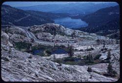
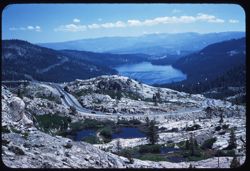
- Description:
- 100 f 5.6 TL HF
- Subject:
- Snow, Trees, Meadows, Mountains, Tahoe, Lake (Calif. and Nev.), and Lakes & ponds
- Series:
- 13-58
- Creator:
- Cushman, Charles W., 1896-1972
- Date Created:
- 1958-06-19
- Genre:
- Landscape photographs
- Frame Number:
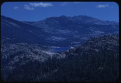
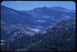
- 10
- Abstract:
- West across lower part of Lake Tahoe
- Call Number:
- P10058
- Country:
- United States
- State/Province:
- California and Nevada
- Alternate Identifier:
- 1358.10
- Persistent URL:
- http://purl.dlib.indiana.edu/iudl/archives/cushman/P10058
- Holding Location:
- Bloomington - University Archives
Wells Library E460
1320 E 10th St.
Bloomington, IN 47405
Contact at archives@indiana.edu, 812-855-1127
-
- Description:
- 100 f 5.6 TL HF
- Subject:
- Rocks, Pines, Mountains, Tahoe, Lake (Calif. and Nev.), Lakes & ponds, and Firs
- Series:
- 13-58
- Creator:
- Cushman, Charles W., 1896-1972
- Date Created:
- 1958-06-19
- Genre:
- Landscape photographs
- Frame Number:
- 5
- Abstract:
- Toward Tahoe & mtns across -
- Call Number:
- P10053
- Country:
- United States
- State/Province:
- California and Nevada
- Alternate Identifier:
- 1358.5
- Persistent URL:
- http://purl.dlib.indiana.edu/iudl/archives/cushman/P10053
- Holding Location:
- Bloomington - University Archives
Wells Library E460
1320 E 10th St.
Bloomington, IN 47405
Contact at archives@indiana.edu, 812-855-1127
-
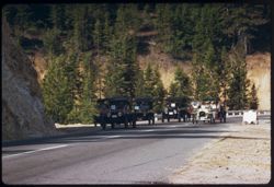
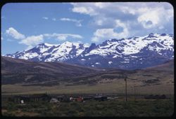
- Description:
- 100 f TL
- Subject:
- Roads, Automobiles, Horseless Carriage Club of America, Mountains, Firs, Spooner Pass (Nev.), and Carson Range (Nev.)
- Series:
- 13-58
- Creator:
- Cushman, Charles W., 1896-1972
- Date Created:
- 1958-06-19
- Genre:
- Snapshots
- Frame Number:
- 2
- Street Address:
- United States Highway 50
- County:
- Washoe
- Abstract:
- Old automobile caravan (horseless carriage clubs) cross Carson Mtns. On way to Reno
- Call Number:
- P10050
- City:
- Reno
- Country:
- United States
- State/Province:
- Nevada
- Alternate Identifier:
- 1358.2
- Persistent URL:
- http://purl.dlib.indiana.edu/iudl/archives/cushman/P10050
- Holding Location:
- Bloomington - University Archives
Wells Library E460
1320 E 10th St.
Bloomington, IN 47405
Contact at archives@indiana.edu, 812-855-1127
-
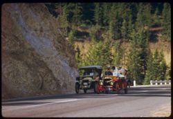
- Description:
- 100 f TL
- Subject:
- Roads, Automobiles, Horseless Carriage Club of America, Mountains, Firs, Carson Range (Nev.), and Spooner Pass (Nev.)
- Series:
- 13-58
- Creator:
- Cushman, Charles W., 1896-1972
- Date Created:
- 1958-06-19
- Genre:
- Snapshots
- Frame Number:
- 1
- Street Address:
- United States Highway 50
- County:
- Washoe
- Abstract:
- Old automobile caravan (horseless Carriage Clubs) cross Carson Mtns. On way to Reno
- Call Number:
- P10049
- City:
- Reno
- Country:
- United States
- State/Province:
- Nevada
- Alternate Identifier:
- 1358.1
- Persistent URL:
- http://purl.dlib.indiana.edu/iudl/archives/cushman/P10049
- Holding Location:
- Bloomington - University Archives
Wells Library E460
1320 E 10th St.
Bloomington, IN 47405
Contact at archives@indiana.edu, 812-855-1127
-
- Description:
- 100 f 8 TL HF
- Subject:
- Snow, Mountains, and Plants
- Series:
- 12-58
- Creator:
- Cushman, Charles W., 1896-1972
- Date Created:
- 1958-06-19
- Genre:
- Landscape photographs
- Frame Number:
- 37
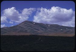
- County:
- Carson City
- Abstract:
- Snow-capped mtn south of Carson City
- Call Number:
- P10048
- City:
- Carson City
- Country:
- United States
- State/Province:
- Nevada
- Alternate Identifier:
- 1258.37
- Persistent URL:
- http://purl.dlib.indiana.edu/iudl/archives/cushman/P10048
- Holding Location:
- Bloomington - University Archives
Wells Library E460
1320 E 10th St.
Bloomington, IN 47405
Contact at archives@indiana.edu, 812-855-1127
-
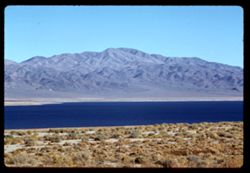
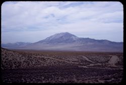
- Description:
- 100 f 8 TL HF
- Subject:
- Deserts, Pyramid Lake (Nev.), Mountains, Shrubs, Lakes & ponds, Clouds, and Islands
- Series:
- 12-58
- Creator:
- Cushman, Charles W., 1896-1972
- Date Created:
- 1958-06-18
- Genre:
- Landscape photographs
- Frame Number:
- 36
- Abstract:
- Pyramid Lake
- Call Number:
- P10047
- Country:
- United States
- State/Province:
- Nevada
- Alternate Identifier:
- 1258.36
- Persistent URL:
- http://purl.dlib.indiana.edu/iudl/archives/cushman/P10047
- Holding Location:
- Bloomington - University Archives
Wells Library E460
1320 E 10th St.
Bloomington, IN 47405
Contact at archives@indiana.edu, 812-855-1127
-
- Description:
- 100 f 8 TL HF
- Subject:
- Deserts, Pyramid Lake (Nev.), Mountains, Shrubs, Lakes & ponds, and Islands
- Series:
- 12-58
- Creator:
- Cushman, Charles W., 1896-1972
- Date Created:
- 1958-06-18
- Genre:
- Landscape photographs
- Frame Number:
- 35
- Abstract:
- Pyramid Lake
- Call Number:
- P10046
- Country:
- United States
- State/Province:
- Nevada
- Alternate Identifier:
- 1258.35
- Persistent URL:
- http://purl.dlib.indiana.edu/iudl/archives/cushman/P10046
- Holding Location:
- Bloomington - University Archives
Wells Library E460
1320 E 10th St.
Bloomington, IN 47405
Contact at archives@indiana.edu, 812-855-1127
-
- Description:
- 100 f 8 TL
- Subject:
- Pyramid Lake (Nev.), Mountains, and Shrubs
- Series:
- 12-58
- Creator:
- Cushman, Charles W., 1896-1972
- Date Created:
- 1958-06-18
- Genre:
- Landscape photographs
- Frame Number:
- 34
- County:
- Washoe
- Abstract:
- Mtn. North of Wadsworth
- Call Number:
- P10045
- City:
- Wadsworth
- Country:
- United States
- State/Province:
- Nevada
- Alternate Identifier:
- 1258.34
- Persistent URL:
- http://purl.dlib.indiana.edu/iudl/archives/cushman/P10045
- Holding Location:
- Bloomington - University Archives
Wells Library E460
1320 E 10th St.
Bloomington, IN 47405
Contact at archives@indiana.edu, 812-855-1127
-
- Description:
- 100 f 6.3 TL
- Subject:
- Pyramid Lake (Nev.), Hills, Mountains, and Shrubs
- Series:
- 12-58
- Creator:
- Cushman, Charles W., 1896-1972
- Date Created:
- 1958-06-18
- Genre:
- Landscape photographs
- Frame Number:
- 33
- County:
- Washoe
- Abstract:
- Mtn. North of Wadsworth
- Call Number:
- P10044
- City:
- Wadsworth
- Country:
- United States
- State/Province:
- Nevada
- Alternate Identifier:
- 1258.33
- Persistent URL:
- http://purl.dlib.indiana.edu/iudl/archives/cushman/P10044
- Holding Location:
- Bloomington - University Archives
Wells Library E460
1320 E 10th St.
Bloomington, IN 47405
Contact at archives@indiana.edu, 812-855-1127
-
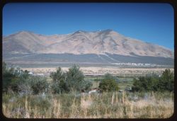
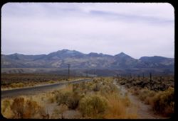
- Description:
- 100 f 6.3 TL
- Subject:
- Snow, Houses, Automobiles, Mountains, Shrubs, Clouds, and East Humboldt Range (Nev.)
- Series:
- 12-58
- Creator:
- Cushman, Charles W., 1896-1972
- Date Created:
- 1958-06-17
- Genre:
- Landscape photographs
- Frame Number:
- 32
- County:
- Elko
- Abstract:
- From Wells, Nevada, a view of snow-capped Humbolat range at 2 PM
- Call Number:
- P10043
- City:
- Wells
- Country:
- United States
- State/Province:
- Nevada
- Alternate Identifier:
- 1258.32
- Persistent URL:
- http://purl.dlib.indiana.edu/iudl/archives/cushman/P10043
- Holding Location:
- Bloomington - University Archives
Wells Library E460
1320 E 10th St.
Bloomington, IN 47405
Contact at archives@indiana.edu, 812-855-1127
-

- Description:
- 100 f 5.6 TL
- Subject:
- Roads, Mountains, Shrubs, Snow, Trees, Clouds, and East Humboldt Range (Nev.)
- Series:
- 12-58
- Creator:
- Cushman, Charles W., 1896-1972
- Date Created:
- 1958-06-17
- Genre:
- Landscape photographs
- Frame Number:
- 31
- County:
- Elko
- Abstract:
- Large snow-covered ridge west of pt. 7105 mi. (on 93 - 10 mi n. of Wells)
- Call Number:
- P10042
- City:
- Wells
- Country:
- United States
- State/Province:
- Nevada
- Alternate Identifier:
- 1258.31
- Persistent URL:
- http://purl.dlib.indiana.edu/iudl/archives/cushman/P10042
- Holding Location:
- Bloomington - University Archives
Wells Library E460
1320 E 10th St.
Bloomington, IN 47405
Contact at archives@indiana.edu, 812-855-1127
-
- Description:
- 100 f 8 TL
- Subject:
- Plains, Mountains, Shrubs, and Clouds
- Series:
- 12-58
- Creator:
- Cushman, Charles W., 1896-1972
- Date Created:
- 1958-06-17
- Genre:
- Landscape photographs
- Frame Number:
- 29
- Street Address:
- United States Highway 93
- County:
- Elko
- Abstract:
- Pyramid Mtn. Off 93 @ 7068 mi.
- Call Number:
- P10041
- City:
- Contact
- Country:
- United States
- State/Province:
- Nevada
- Alternate Identifier:
- 1258.29
- Persistent URL:
- http://purl.dlib.indiana.edu/iudl/archives/cushman/P10041
- Holding Location:
- Bloomington - University Archives
Wells Library E460
1320 E 10th St.
Bloomington, IN 47405
Contact at archives@indiana.edu, 812-855-1127
-
- Description:
- 100 f 6.7 TL
- Subject:
- Plains, Mountains, Shrubs, Clouds, and Hills
- Series:
- 12-58
- Creator:
- Cushman, Charles W., 1896-1972
- Date Created:
- 1958-06-17
- Genre:
- Landscape photographs
- Frame Number:
- 28
- County:
- Elko
- Abstract:
- Fine saw-tooth ridge to the SE (near Contact)
- Call Number:
- P10040
- City:
- Contact
- Country:
- United States
- State/Province:
- Nevada
- Alternate Identifier:
- 1258.28
- Persistent URL:
- http://purl.dlib.indiana.edu/iudl/archives/cushman/P10040
- Holding Location:
- Bloomington - University Archives
Wells Library E460
1320 E 10th St.
Bloomington, IN 47405
Contact at archives@indiana.edu, 812-855-1127
-
- Description:
- 100 f 8 TL
- Subject:
- Mountains, Shrubs, and Clouds
- Series:
- 12-58
- Creator:
- Cushman, Charles W., 1896-1972
- Date Created:
- 1958-06-17
- Genre:
- Landscape photographs
- Frame Number:
- 27
- Street Address:
- United States Highway 93
- County:
- Twin Falls and Elko
- Abstract:
- Snow-flecked Mtn. Sw of 93 @ 7058 mi.
- Call Number:
- P10039
- City:
- Twin Falls and Wells
- Country:
- United States
- State/Province:
- Idaho and Nevada
- Alternate Identifier:
- 1258.27
- Persistent URL:
- http://purl.dlib.indiana.edu/iudl/archives/cushman/P10039
- Holding Location:
- Bloomington - University Archives
Wells Library E460
1320 E 10th St.
Bloomington, IN 47405
Contact at archives@indiana.edu, 812-855-1127
-
- Description:
- 100 f 6.3 SL
- Subject:
- Plains, Mountains, Shrubs, and Clouds
- Series:
- 12-58
- Creator:
- Cushman, Charles W., 1896-1972
- Date Created:
- 1958-06-17
- Genre:
- Landscape photographs
- Frame Number:
- 25
- Street Address:
- United States Highway 93
- County:
- Twin Falls
- Abstract:
- @ 7055 miles east of 93
- Call Number:
- P10037
- City:
- Twin Falls
- Country:
- United States
- State/Province:
- Idaho and Nevada
- Alternate Identifier:
- 1258.25
- Persistent URL:
- http://purl.dlib.indiana.edu/iudl/archives/cushman/P10037
- Holding Location:
- Bloomington - University Archives
Wells Library E460
1320 E 10th St.
Bloomington, IN 47405
Contact at archives@indiana.edu, 812-855-1127
-
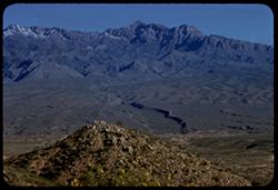
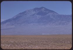
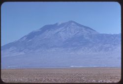
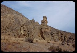
- Description:
- 100 f 8 tl
- Subject:
- Rocks, Mountains, Shrubs, and Virgin Peak (Nev.)
- Series:
- 3-58
- Creator:
- Cushman, Charles W., 1896-1972
- Date Created:
- 1958-04-25
- Genre:
- Landscape photographs
- Frame Number:
- 33
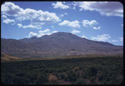
- County:
- Clark
- Abstract:
- Virgin Peak (8028')
- Call Number:
- P09749
- Country:
- United States
- State/Province:
- Nevada
- Alternate Identifier:
- 358.33
- Persistent URL:
- http://purl.dlib.indiana.edu/iudl/archives/cushman/P09749
- Holding Location:
- Bloomington - University Archives
Wells Library E460
1320 E 10th St.
Bloomington, IN 47405
Contact at archives@indiana.edu, 812-855-1127
-
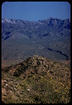
- Description:
- 100 f 8 tl
- Subject:
- Rocks, Mountains, Shrubs, Wildflowers, and Virgin Peak (Nev.)
- Series:
- 3-58
- Creator:
- Cushman, Charles W., 1896-1972
- Date Created:
- 1958-04-25
- Genre:
- Landscape photographs
- Frame Number:
- 32
- County:
- Clark
- Abstract:
- Virgin Peak (8028')
- Call Number:
- P09748
- Country:
- United States
- State/Province:
- Nevada
- Alternate Identifier:
- 358.32
- Persistent URL:
- http://purl.dlib.indiana.edu/iudl/archives/cushman/P09748
- Holding Location:
- Bloomington - University Archives
Wells Library E460
1320 E 10th St.
Bloomington, IN 47405
Contact at archives@indiana.edu, 812-855-1127
-
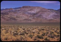
- Description:
- 100 f 8 tl
- Subject:
- Grasses, Dirt roads, Trees, Mountains, Shrubs, Mormon Mountains (Nev.), and Rock formations
- Series:
- 3-58
- Creator:
- Cushman, Charles W., 1896-1972
- Date Created:
- 1958-04-25
- Genre:
- Landscape photographs
- Frame Number:
- 31
- County:
- Clark
- Abstract:
- Mormon Range from Glendale
- Call Number:
- P09747
- City:
- Glendale
- Country:
- United States
- State/Province:
- Nevada
- Alternate Identifier:
- 358.31
- Persistent URL:
- http://purl.dlib.indiana.edu/iudl/archives/cushman/P09747
- Holding Location:
- Bloomington - University Archives
Wells Library E460
1320 E 10th St.
Bloomington, IN 47405
Contact at archives@indiana.edu, 812-855-1127
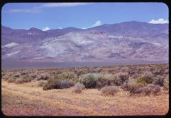
-
- Description:
- 100 f 8 tl
- Subject:
- Mountains, Rock formations, Mormon Mountains (Nev.), and Plants
- Series:
- 3-58
- Creator:
- Cushman, Charles W., 1896-1972
- Date Created:
- 1958-04-25
- Genre:
- Landscape photographs
- Frame Number:
- 30
- Abstract:
- Mormon Range from distance
- Call Number:
- P09746
- Country:
- United States
- State/Province:
- Nevada
- Alternate Identifier:
- 358.30
- Persistent URL:
- http://purl.dlib.indiana.edu/iudl/archives/cushman/P09746
- Holding Location:
- Bloomington - University Archives
Wells Library E460
1320 E 10th St.
Bloomington, IN 47405
Contact at archives@indiana.edu, 812-855-1127
-
- Description:
- 100 f 8 tl
- Subject:
- Roads, Automobiles, Mountains, Buildings, Anderson Dairy (Las Vegas, Nev.), and Dairy products industry
- Series:
- 3-58
- Creator:
- Cushman, Charles W., 1896-1972
- Date Created:
- 1958-04-25
- Genre:
- Views
- Frame Number:
- 29
- County:
- Clark
- Abstract:
- Mtn east of North Las Vegas
- Call Number:
- P09745
- City:
- Las Vegas
- Country:
- United States
- State/Province:
- Nevada
- Alternate Identifier:
- 358.29
- Persistent URL:
- http://purl.dlib.indiana.edu/iudl/archives/cushman/P09745
- Holding Location:
- Bloomington - University Archives
Wells Library E460
1320 E 10th St.
Bloomington, IN 47405
Contact at archives@indiana.edu, 812-855-1127
-
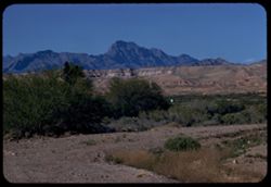
- Description:
- 100 f 8 + t
- Subject:
- Deserts, Spring Mountains (Nev.), Charleston Peak (Nev.), Mountains, Shrubs, and Rock formations
- Series:
- 3-58
- Creator:
- Cushman, Charles W., 1896-1972
- Date Created:
- 1958-04-25
- Genre:
- Landscape photographs
- Frame Number:
- 28
- Street Address:
- United States Highway 95
- County:
- Clark
- Abstract:
- Another view of Charleston Pk from Hwy north of Sloan
- Call Number:
- P09744
- City:
- Sloan
- Country:
- United States
- State/Province:
- Nevada
- Alternate Identifier:
- 358.28
- Persistent URL:
- http://purl.dlib.indiana.edu/iudl/archives/cushman/P09744
- Holding Location:
- Bloomington - University Archives
Wells Library E460
1320 E 10th St.
Bloomington, IN 47405
Contact at archives@indiana.edu, 812-855-1127
-
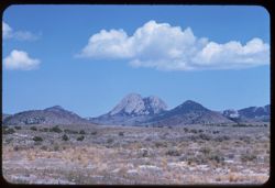
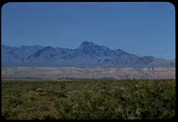
- Description:
- 100 f 9 t
- Subject:
- Wildflowers, Grasses, Charleston Peak (Nev.), Spring Mountains (Nev.), Mountains, Rock formations, Hills, and Shrubs
- Series:
- 3-58
- Creator:
- Cushman, Charles W., 1896-1972
- Date Created:
- 1958-04-25
- Genre:
- Landscape photographs
- Frame Number:
- 27
- Street Address:
- United States Highway 95
- County:
- Clark
- Abstract:
- Distant view of Spring Mtns (Charleston Peak) from Hwy near Sloan
- Call Number:
- P09743
- City:
- Sloan
- Country:
- United States
- State/Province:
- Nevada
- Alternate Identifier:
- 358.27
- Persistent URL:
- http://purl.dlib.indiana.edu/iudl/archives/cushman/P09743
- Holding Location:
- Bloomington - University Archives
Wells Library E460
1320 E 10th St.
Bloomington, IN 47405
Contact at archives@indiana.edu, 812-855-1127
-
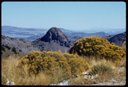
- Description:
- 100 f 9 t
- Subject:
- Spring Mountains (Nev.), Mountains, and Devil Peak (Nev.)
- Series:
- 3-58
- Creator:
- Cushman, Charles W., 1896-1972
- Date Created:
- 1958-04-25
- Genre:
- Landscape photographs
- Frame Number:
- 26
- Street Address:
- United States Highway 95
- County:
- Clark
- Abstract:
- Devil Peak w. of hwy (Spring Mtns)
- Call Number:
- P09742
- Country:
- United States
- State/Province:
- Nevada
- Alternate Identifier:
- 358.26
- Persistent URL:
- http://purl.dlib.indiana.edu/iudl/archives/cushman/P09742
- Holding Location:
- Bloomington - University Archives
Wells Library E460
1320 E 10th St.
Bloomington, IN 47405
Contact at archives@indiana.edu, 812-855-1127
-
- Description:
- 100 f 5.6 tl
- Subject:
- Deserts, Mountains, Shrubs, McCullough Range (Nev.), and Wildflowers
- Series:
- 3-58
- Creator:
- Cushman, Charles W., 1896-1972
- Date Created:
- 1958-04-25
- Genre:
- Landscape photographs
- Frame Number:
- 25
- County:
- Clark
- Abstract:
- East toward McCollough Range across carpet of green and orange flowers
- Call Number:
- P09741
- Country:
- United States
- State/Province:
- Nevada
- Alternate Identifier:
- 358.25
- Persistent URL:
- http://purl.dlib.indiana.edu/iudl/archives/cushman/P09741
- Holding Location:
- Bloomington - University Archives
Wells Library E460
1320 E 10th St.
Bloomington, IN 47405
Contact at archives@indiana.edu, 812-855-1127
-
- Description:
- 100 f 6.3 tl
- Subject:
- Wildflowers, Flowers, Mountains, Shrubs, McCullough Range (Nev.), and Deserts
- Series:
- 3-58
- Creator:
- Cushman, Charles W., 1896-1972
- Date Created:
- 1958-04-25
- Genre:
- Landscape photographs
- Frame Number:
- 24
- County:
- Clark
- Abstract:
- East toward McCollough Range across carpet of green and orange flowers
- Call Number:
- P09740
- Country:
- United States
- State/Province:
- Nevada
- Alternate Identifier:
- 358.24
- Persistent URL:
- http://purl.dlib.indiana.edu/iudl/archives/cushman/P09740
- Holding Location:
- Bloomington - University Archives
Wells Library E460
1320 E 10th St.
Bloomington, IN 47405
Contact at archives@indiana.edu, 812-855-1127
-
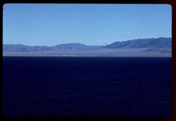
- Description:
- 200 f 5.6
- Subject:
- Valleys, Death Valley (Calif. and Nev.), Mountains, Shrubs, Rocks, and Clouds
- Series:
- 3-55
- Creator:
- Cushman, Charles W., 1896-1972
- Date Created:
- 1955-02-27
- Genre:
- Landscape photographs
- Frame Number:
- 14
- Abstract:
- Toward D Valley from 100 ft. elev.
- Call Number:
- P07606
- Country:
- United States
- State/Province:
- Nevada and California
- Alternate Identifier:
- 355.14
- Persistent URL:
- http://purl.dlib.indiana.edu/iudl/archives/cushman/P07606
- Holding Location:
- Bloomington - University Archives
Wells Library E460
1320 E 10th St.
Bloomington, IN 47405
Contact at archives@indiana.edu, 812-855-1127
-
- Description:
- 50 f 11
- Subject:
- Poplars, Ranches, White Mountains (Calif. and Nev.), Trees, Owens Valley (Calif.), Mountains, Shrubs, and Lombardy poplar
- Series:
- 12-54
- Creator:
- Cushman, Charles W., 1896-1972
- Date Created:
- 1954-09-17
- Genre:
- Landscape photographs
- Frame Number:
- 5
- County:
- Esmeralda and Inyo
- Abstract:
- Ranch with rows of Lombardy poplars below backdrop of White Mtns.
- Call Number:
- P07395
- Country:
- United States
- State/Province:
- California and Nevada
- Physical Description:
- masked.
- Alternate Identifier:
- 1254.5
- Persistent URL:
- http://purl.dlib.indiana.edu/iudl/archives/cushman/P07395
- Holding Location:
- Bloomington - University Archives
Wells Library E460
1320 E 10th St.
Bloomington, IN 47405
Contact at archives@indiana.edu, 812-855-1127
-
- Description:
- 50 f 11
- Subject:
- Mountains, Deserts, Shrubs, and Boundary Peak (Nev.)
- Series:
- 12-54
- Creator:
- Cushman, Charles W., 1896-1972
- Date Created:
- 1954-09-17
- Genre:
- Landscape photographs
- Frame Number:
- 4
- Street Address:
- United States Highway 6
- County:
- Esmeralda
- Abstract:
- Boundary Line Peak from north, just inside Nevada.
- Call Number:
- P07394
- Country:
- United States
- State/Province:
- Nevada
- Physical Description:
- Image was originally mounted in a glass enclosure. Before digitization, the image was removed and placed in a Wess Plastic, Inc. brand, 2" x 2", pl...
- Alternate Identifier:
- 1254.4
- Persistent URL:
- http://purl.dlib.indiana.edu/iudl/archives/cushman/P07394
- Holding Location:
- Bloomington - University Archives
Wells Library E460
1320 E 10th St.
Bloomington, IN 47405
Contact at archives@indiana.edu, 812-855-1127
-
- Description:
- 50 f 11 HF
- Subject:
- Valleys, Grasses, White Mountains (Calif. and Nev.), Trees, Owens Valley (Calif.), Mountains, and Shrubs
- Series:
- 11-54
- Creator:
- Cushman, Charles W., 1896-1972
- Date Created:
- 1954-09-17
- Genre:
- Landscape photographs
- Frame Number:
- 20
- County:
- Inyo
- Abstract:
- White Mtns east wall of Owens Valley with 2 bare trees.
- Call Number:
- P07389
- Country:
- United States
- State/Province:
- California and Nevada
- Alternate Identifier:
- 1154.20
- Persistent URL:
- http://purl.dlib.indiana.edu/iudl/archives/cushman/P07389
- Holding Location:
- Bloomington - University Archives
Wells Library E460
1320 E 10th St.
Bloomington, IN 47405
Contact at archives@indiana.edu, 812-855-1127
-
- Description:
- 50 f 9
- Subject:
- Silver Zone Pass (Nev.), Grasses, Dirt roads, Mountains, Clouds, Silver Zone (Nev.), Hills, and Pilot Peak (Elko County, Nev.)
- Series:
- 9-53
- Creator:
- Cushman, Charles W., 1896-1972
- Date Created:
- 1953-10-10
- Genre:
- Landscape photographs
- Frame Number:
- 8
- Street Address:
- United States Highway 40
- County:
- Elko
- Abstract:
- Pilot Pk. 10704 fromUS 40 below Silver Zone Pass. Overcast.
- Call Number:
- P06809
- Country:
- United States
- State/Province:
- Nevada
- Alternate Identifier:
- 953.8
- Persistent URL:
- http://purl.dlib.indiana.edu/iudl/archives/cushman/P06809
- Holding Location:
- Bloomington - University Archives
Wells Library E460
1320 E 10th St.
Bloomington, IN 47405
Contact at archives@indiana.edu, 812-855-1127
-
- Description:
- 25 f 6.3 Pola
- Subject:
- Grasses, Roads, Trails & paths, Ruby Mountains (Nev.), Mountains, Shrubs, Hills, Utility poles, Wood poles, and Plains
- Series:
- 9-53
- Creator:
- Cushman, Charles W., 1896-1972
- Date Created:
- 1953-10-10
- Genre:
- Landscape photographs
- Frame Number:
- 7
- Street Address:
- United States Highway 40
- County:
- Elko
- Abstract:
- Ruby range from nr. Deeth.
- Call Number:
- P06808
- City:
- Deeth
- Country:
- United States
- State/Province:
- Nevada
- Alternate Identifier:
- 953.7
- Persistent URL:
- http://purl.dlib.indiana.edu/iudl/archives/cushman/P06808
- Holding Location:
- Bloomington - University Archives
Wells Library E460
1320 E 10th St.
Bloomington, IN 47405
Contact at archives@indiana.edu, 812-855-1127
-
- Description:
- 50 f 5.6 Pola
- Subject:
- Grasses, Plains, Mountains, Shrubs, Clouds, Hills, Utility poles, and Ruby Mountains (Nev.)
- Series:
- 9-53
- Creator:
- Cushman, Charles W., 1896-1972
- Date Created:
- 1953-10-10
- Genre:
- Landscape photographs
- Frame Number:
- 6
- Street Address:
- United States Highway 40
- County:
- Elko
- Abstract:
- Ruby Mtns. from US 40 between Elko + Wells. Overcast.
- Call Number:
- P06807
- City:
- Wells and Elko
- Country:
- United States
- State/Province:
- Nevada
- Alternate Identifier:
- 953.6
- Persistent URL:
- http://purl.dlib.indiana.edu/iudl/archives/cushman/P06807
- Holding Location:
- Bloomington - University Archives
Wells Library E460
1320 E 10th St.
Bloomington, IN 47405
Contact at archives@indiana.edu, 812-855-1127
-
- Description:
- 50 f 11
- Subject:
- Rocks, Grasses, Dirt, Mountains, Shrubs, Wood poles, and Rock formations
- Series:
- 9-53
- Creator:
- Cushman, Charles W., 1896-1972
- Date Created:
- 1953-10-10
- Genre:
- Landscape photographs
- Frame Number:
- 5
- Street Address:
- United States Highway 40
- County:
- Elko
- Abstract:
- Strange rock shapes US 40 w. of Elko.
- Call Number:
- P06806
- City:
- Elko
- Country:
- United States
- State/Province:
- Nevada
- Alternate Identifier:
- 953.5
- Persistent URL:
- http://purl.dlib.indiana.edu/iudl/archives/cushman/P06806
- Holding Location:
- Bloomington - University Archives
Wells Library E460
1320 E 10th St.
Bloomington, IN 47405
Contact at archives@indiana.edu, 812-855-1127
-
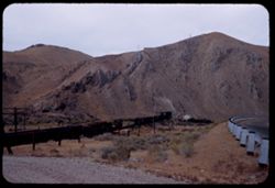
- Description:
- 50 f 9
- Subject:
- Rocks, Railings, Grasses, Roads, Railroad freight cars, Dirt roads, Southern Pacific Railroad Company, Mountains, Shrubs, Wood poles, Railroads, and Tunnels
- Series:
- 9-53
- Creator:
- Cushman, Charles W., 1896-1972
- Date Created:
- 1953-10-10
- Genre:
- Views
- Frame Number:
- 4
- County:
- Elko
- Abstract:
- SP freight at tunnel 20 mi. west of Elko.
- Call Number:
- P06805
- City:
- Elko
- Country:
- United States
- State/Province:
- Nevada
- Alternate Identifier:
- 953.4
- Persistent URL:
- http://purl.dlib.indiana.edu/iudl/archives/cushman/P06805
- Holding Location:
- Bloomington - University Archives
Wells Library E460
1320 E 10th St.
Bloomington, IN 47405
Contact at archives@indiana.edu, 812-855-1127
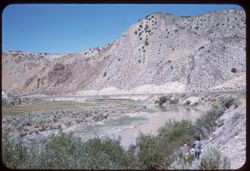
-
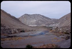
- Description:
- 50 f 9+
- Subject:
- Canyons, Grasses, Roads, Dirt, Humboldt River (Nev.), Mountains, Shrubs, Humboldt River Valley (Nev.), Rivers, and Valleys
- Series:
- 9-53
- Creator:
- Cushman, Charles W., 1896-1972
- Date Created:
- 1953-10-10
- Genre:
- Landscape photographs
- Frame Number:
- 3
- Street Address:
- United States Highway 40
- County:
- Elko
- Abstract:
- Another angle of Humboldt river gorge about 20 mi. west of Elko
- Call Number:
- P06804
- City:
- Elko
- Country:
- United States
- State/Province:
- Nevada
- Alternate Identifier:
- 953.3
- Persistent URL:
- http://purl.dlib.indiana.edu/iudl/archives/cushman/P06804
- Holding Location:
- Bloomington - University Archives
Wells Library E460
1320 E 10th St.
Bloomington, IN 47405
Contact at archives@indiana.edu, 812-855-1127
-
- Description:
- 50 f 8
- Subject:
- Canyons, Valleys, Humboldt River Valley (Nev.), Roads, Dirt, Mountains, Shrubs, Humboldt River (Nev.), Grasses, Fences, and Rivers
- Series:
- 9-53
- Creator:
- Cushman, Charles W., 1896-1972
- Date Created:
- 1953-10-10
- Genre:
- Landscape photographs
- Frame Number:
- 2
- Street Address:
- United States Highway 40
- County:
- Elko
- Abstract:
- Humboldt river gorge about 20 mi. west of Elko (overcast).
- Call Number:
- P06803
- City:
- Elko
- Country:
- United States
- State/Province:
- Nevada
- Alternate Identifier:
- 953.2
- Persistent URL:
- http://purl.dlib.indiana.edu/iudl/archives/cushman/P06803
- Holding Location:
- Bloomington - University Archives
Wells Library E460
1320 E 10th St.
Bloomington, IN 47405
Contact at archives@indiana.edu, 812-855-1127
-
- Description:
- 50 f 8
- Subject:
- Grasses, Grazing, Mountains, Fences, Shrubs, Cows, Clouds, Winnemucca Mountain (Nev.), Haystacks, and Hay
- Series:
- 9-53
- Creator:
- Cushman, Charles W., 1896-1972
- Date Created:
- 1953-10-10
- Genre:
- Landscape photographs
- Frame Number:
- 1
- County:
- Humboldt
- Abstract:
- Winnemucca Mtn. Under cloudy sky.
- Call Number:
- P06802
- Country:
- United States
- State/Province:
- Nevada
- Alternate Identifier:
- 953.1
- Persistent URL:
- http://purl.dlib.indiana.edu/iudl/archives/cushman/P06802
- Holding Location:
- Bloomington - University Archives
Wells Library E460
1320 E 10th St.
Bloomington, IN 47405
Contact at archives@indiana.edu, 812-855-1127
-
- Description:
- 50 f 8 Pola
- Subject:
- Hills, Roads, Dirt, Mountains, Shrubs, Trees, Grasses, and Clouds
- Series:
- 8-53
- Creator:
- Cushman, Charles W., 1896-1972
- Date Created:
- 1953-10-09
- Genre:
- Landscape photographs
- Frame Number:
- 38
- Street Address:
- United States Highway 50
- County:
- Lyon
- Abstract:
- View east from US 50 near Dayton.
- Call Number:
- P06800
- City:
- Dayton
- Country:
- United States
- State/Province:
- Nevada
- Alternate Identifier:
- 853.38
- Persistent URL:
- http://purl.dlib.indiana.edu/iudl/archives/cushman/P06800
- Holding Location:
- Bloomington - University Archives
Wells Library E460
1320 E 10th St.
Bloomington, IN 47405
Contact at archives@indiana.edu, 812-855-1127
-
- Description:
- 50 f 11
- Subject:
- Sheds, Grasses, Trees, Abandoned buildings, Mountains, Shrubs, and Loading docks
- Series:
- 8-53
- Creator:
- Cushman, Charles W., 1896-1972
- Date Created:
- 1953-10-09
- Genre:
- Snapshots
- Frame Number:
- 37
- Street Address:
- United States Highway 50
- County:
- Carson City
- Abstract:
- Shed + old loading chute east of Carson City.
- Call Number:
- P06799
- City:
- Carson City
- Country:
- United States
- State/Province:
- Nevada
- Alternate Identifier:
- 853.37
- Persistent URL:
- http://purl.dlib.indiana.edu/iudl/archives/cushman/P06799
- Holding Location:
- Bloomington - University Archives
Wells Library E460
1320 E 10th St.
Bloomington, IN 47405
Contact at archives@indiana.edu, 812-855-1127
-
- Description:
- 50 f 11
- Subject:
- Rocks, Roads, Dirt, Mountains, Shrubs, Clouds, Forests, and Shadows
- Series:
- 8-53
- Creator:
- Cushman, Charles W., 1896-1972
- Date Created:
- 1953-10-09
- Genre:
- Views
- Frame Number:
- 35
- Street Address:
- United States Highway 50
- County:
- Carson City
- Abstract:
- Looking back.
- Call Number:
- P06797
- City:
- Carson City
- Country:
- United States
- State/Province:
- Nevada
- Alternate Identifier:
- 853.35
- Persistent URL:
- http://purl.dlib.indiana.edu/iudl/archives/cushman/P06797
- Holding Location:
- Bloomington - University Archives
Wells Library E460
1320 E 10th St.
Bloomington, IN 47405
Contact at archives@indiana.edu, 812-855-1127
-
- Description:
- 50 f 11
- Subject:
- Rocks, Grasses, Shadows, Rock slopes, Tree limbs, Mountains, and Shrubs
- Series:
- 8-53
- Creator:
- Cushman, Charles W., 1896-1972
- Date Created:
- 1953-10-09
- Frame Number:
- 34
- Street Address:
- United States Highway 50
- County:
- Carson City
- Abstract:
- Rock + rock.
- Call Number:
- P06796
- City:
- Carson City
- Country:
- United States
- State/Province:
- Nevada
- Alternate Identifier:
- 853.34
- Persistent URL:
- http://purl.dlib.indiana.edu/iudl/archives/cushman/P06796
- Holding Location:
- Bloomington - University Archives
Wells Library E460
1320 E 10th St.
Bloomington, IN 47405
Contact at archives@indiana.edu, 812-855-1127
-
- Description:
- 50 f 11
- Subject:
- Dirt, Mountains, Shrubs, Trees, Rocks, Rock slopes, and Grasses
- Series:
- 8-53
- Creator:
- Cushman, Charles W., 1896-1972
- Date Created:
- 1953-10-09
- Genre:
- Landscape photographs
- Frame Number:
- 33
- Street Address:
- United States Highway 50
- County:
- Carson City
- Abstract:
- Mtns along US 50 down bound to Carson City.
- Call Number:
- P06795
- City:
- Carson City
- Country:
- United States
- State/Province:
- Nevada
- Alternate Identifier:
- 853.33
- Persistent URL:
- http://purl.dlib.indiana.edu/iudl/archives/cushman/P06795
- Holding Location:
- Bloomington - University Archives
Wells Library E460
1320 E 10th St.
Bloomington, IN 47405
Contact at archives@indiana.edu, 812-855-1127
-
- Description:
- 50 f 8
- Subject:
- Bodies of water, Houses, Trees, Coastlines, Tree limbs, Mountains, Shrubs, Lakes & ponds, Waterfronts, Forests, and Tahoe, Lake (Calif. and Nev.)
- Series:
- 8-53
- Creator:
- Cushman, Charles W., 1896-1972
- Date Created:
- 1953-10-09
- Genre:
- Landscape photographs
- Frame Number:
- 32
- Abstract:
- SE shore of L Tahoe.
- Call Number:
- P06794
- Country:
- United States
- State/Province:
- Nevada
- Alternate Identifier:
- 853.32
- Persistent URL:
- http://purl.dlib.indiana.edu/iudl/archives/cushman/P06794
- Holding Location:
- Bloomington - University Archives
Wells Library E460
1320 E 10th St.
Bloomington, IN 47405
Contact at archives@indiana.edu, 812-855-1127
-
- Description:
- 50 f 8
- Subject:
- Grasses, Roads, Trees, Dirt, Mountains, Tahoe, Lake (Calif. and Nev.), Traffic signs & signals, Clouds, Tunnels, Shrubs, and Rock formations
- Series:
- 8-53
- Creator:
- Cushman, Charles W., 1896-1972
- Date Created:
- 1953-10-09
- Genre:
- Snapshots
- Frame Number:
- 31
- Street Address:
- United States Highway 50
- Abstract:
- Mouth of tunnel on US 50 along SE shore of L. Tahoe in Nevada.
- Call Number:
- P06793
- Country:
- United States
- State/Province:
- Nevada
- Physical Description:
- masked.
- Alternate Identifier:
- 853.31
- Persistent URL:
- http://purl.dlib.indiana.edu/iudl/archives/cushman/P06793
- Holding Location:
- Bloomington - University Archives
Wells Library E460
1320 E 10th St.
Bloomington, IN 47405
Contact at archives@indiana.edu, 812-855-1127
-
- Description:
- 50 f 8
- Subject:
- Roads, Trees, Mountains, Tahoe, Lake (Calif. and Nev.), Traffic signs & signals, Clouds, and Forests
- Series:
- 8-53
- Creator:
- Cushman, Charles W., 1896-1972
- Date Created:
- 1953-10-09
- Genre:
- Landscape photographs
- Frame Number:
- 30
- Street Address:
- United States Highway 50
- Abstract:
- High comb at curve of US 50 along SE edge L. Tahoe.
- Call Number:
- P06792
- Country:
- United States
- State/Province:
- Nevada
- Alternate Identifier:
- 853.30
- Persistent URL:
- http://purl.dlib.indiana.edu/iudl/archives/cushman/P06792
- Holding Location:
- Bloomington - University Archives
Wells Library E460
1320 E 10th St.
Bloomington, IN 47405
Contact at archives@indiana.edu, 812-855-1127
-
- Description:
- 50 f 8
- Subject:
- Lakes & ponds, Tree limbs, Bodies of water, Forests, Mountains, Waterfronts, Trees, Clouds, Tahoe, Lake (Calif. and Nev.), and Pines
- Series:
- 8-53
- Creator:
- Cushman, Charles W., 1896-1972
- Date Created:
- 1953-10-09
- Genre:
- Landscape photographs
- Frame Number:
- 29
- Abstract:
- Lake Tahoe - Nevada side.
- Call Number:
- P06791
- Country:
- United States
- State/Province:
- Nevada
- Alternate Identifier:
- 853.29
- Persistent URL:
- http://purl.dlib.indiana.edu/iudl/archives/cushman/P06791
- Holding Location:
- Bloomington - University Archives
Wells Library E460
1320 E 10th St.
Bloomington, IN 47405
Contact at archives@indiana.edu, 812-855-1127
-
- Description:
- 50 f 6.3
- Subject:
- Lakes & ponds, Tree limbs, Hills, Forests, Mountains, Shrubs, Piers & wharves, and Tahoe, Lake (Calif. and Nev.)
- Series:
- 28-52
- Creator:
- Cushman, Charles W., 1896-1972
- Date Created:
- 1952-11-08
- Genre:
- Landscape photographs
- Frame Number:
- 21
- Abstract:
- Lake Tahoe.
- Call Number:
- P06505
- Country:
- United States
- State/Province:
- Nevada and California
- Alternate Identifier:
- 2852.21
- Persistent URL:
- http://purl.dlib.indiana.edu/iudl/archives/cushman/P06505
- Holding Location:
- Bloomington - University Archives
Wells Library E460
1320 E 10th St.
Bloomington, IN 47405
Contact at archives@indiana.edu, 812-855-1127
-
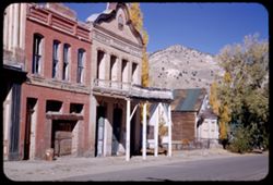
- Description:
- 25 f 10
- Subject:
- Balconies, Facades, Miners' unions, Signs (Notices), Streets, Mountains, Sidewalks, Miner's Union Hall (Virginia City, Nev.), Hills, Building deterio...
- Series:
- 28-52
- Creator:
- Cushman, Charles W., 1896-1972
- Date Created:
- 1952-11-08
- Genre:
- Architectural photographs
- Frame Number:
- 18
- County:
- Storey
- Abstract:
- Miners Union Hall.
- Call Number:
- P06502
- City:
- Virginia City
- Country:
- United States
- State/Province:
- Nevada
- Alternate Identifier:
- 2852.18
- Persistent URL:
- http://purl.dlib.indiana.edu/iudl/archives/cushman/P06502
- Holding Location:
- Bloomington - University Archives
Wells Library E460
1320 E 10th St.
Bloomington, IN 47405
Contact at archives@indiana.edu, 812-855-1127
-

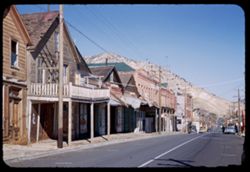
- Description:
- 25 f 6.3 Pola
- Subject:
- Deserts, Mining, Mountains, Shrubs, Hills, and Mining equipment
- Series:
- 28-52
- Creator:
- Cushman, Charles W., 1896-1972
- Date Created:
- 1952-11-08
- Genre:
- Landscape photographs
- Frame Number:
- 15
- County:
- Storey
- Abstract:
- Panorama east from Va. City.
- Call Number:
- P06499
- City:
- Virginia City
- Country:
- United States
- State/Province:
- Nevada
- Alternate Identifier:
- 2852.15
- Persistent URL:
- http://purl.dlib.indiana.edu/iudl/archives/cushman/P06499
- Holding Location:
- Bloomington - University Archives
Wells Library E460
1320 E 10th St.
Bloomington, IN 47405
Contact at archives@indiana.edu, 812-855-1127
-
- Description:
- 25 f 9
- Subject:
- Balconies, Electric lines, Automobiles, Streets, Cities & towns, Buildings, Mercantile facilities, Hills, Utility poles, Building deterioration, Mountain...
- Series:
- 28-52
- Creator:
- Cushman, Charles W., 1896-1972
- Date Created:
- 1952-11-08
- Genre:
- Views
- Frame Number:
- 16
- Street Address:
- Main Street
- County:
- Storey
- Abstract:
- Down Main St.
- Call Number:
- P06500
- City:
- Virginia City
- Country:
- United States
- State/Province:
- Nevada
- Alternate Identifier:
- 2852.16
- Persistent URL:
- http://purl.dlib.indiana.edu/iudl/archives/cushman/P06500
- Holding Location:
- Bloomington - University Archives
Wells Library E460
1320 E 10th St.
Bloomington, IN 47405
Contact at archives@indiana.edu, 812-855-1127
-
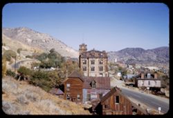
- Description:
- 25 f 11
- Subject:
- Cities & towns, Streets, Hills, Mountains, Utility poles, Building deterioration, Trees, Buildings, Towers, Barns, Dwellings, and Shrubs
- Series:
- 28-52
- Creator:
- Cushman, Charles W., 1896-1972
- Date Created:
- 1952-11-08
- Genre:
- Views
- Frame Number:
- 14
- County:
- Storey
- Abstract:
- Virginia City.
- Call Number:
- P06498
- City:
- Virginia City
- Country:
- United States
- State/Province:
- Nevada
- Alternate Identifier:
- 2852.14
- Persistent URL:
- http://purl.dlib.indiana.edu/iudl/archives/cushman/P06498
- Holding Location:
- Bloomington - University Archives
Wells Library E460
1320 E 10th St.
Bloomington, IN 47405
Contact at archives@indiana.edu, 812-855-1127
-
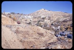
- Description:
- 25 f 11
- Subject:
- Gold mining equipment, Gold mining, Mine buildings, Trees, Mining, Retaining walls, Mountains, Buildings, Headframes (Mining), Hills, Mining equipment, and H...
- Series:
- 28-52
- Creator:
- Cushman, Charles W., 1896-1972
- Date Created:
- 1952-11-08
- Genre:
- Views
- Frame Number:
- 12
- County:
- Storey
- Abstract:
- Mtn scene - across old town of Gold Hill.
- Call Number:
- P06496
- City:
- Gold Hill and Virginia City
- Country:
- United States
- State/Province:
- Nevada
- Alternate Identifier:
- 2852.12
- Persistent URL:
- http://purl.dlib.indiana.edu/iudl/archives/cushman/P06496
- Holding Location:
- Bloomington - University Archives
Wells Library E460
1320 E 10th St.
Bloomington, IN 47405
Contact at archives@indiana.edu, 812-855-1127
-
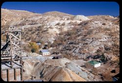
- Description:
- 25 f 6.3 Pola
- Subject:
- Towers, Gold mining equipment, Gold mining, Mine buildings, Trees, Mining, Mountains, Shrubs, Headframes (Mining), Hills, Mining equipment, and Houses
- Series:
- 28-52
- Creator:
- Cushman, Charles W., 1896-1972
- Date Created:
- 1952-11-08
- Genre:
- Views
- Frame Number:
- 11
- County:
- Storey
- Abstract:
- Mtn scene - across old town of Gold Hill.
- Call Number:
- P06495
- City:
- Gold Hill
- Country:
- United States
- State/Province:
- Nevada
- Alternate Identifier:
- 2852.11
- Persistent URL:
- http://purl.dlib.indiana.edu/iudl/archives/cushman/P06495
- Holding Location:
- Bloomington - University Archives
Wells Library E460
1320 E 10th St.
Bloomington, IN 47405
Contact at archives@indiana.edu, 812-855-1127
-
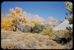
- Description:
- 25 f 11
- Subject:
- Wildflowers, Gold mining equipment, Gold mining, Mine buildings, Trees, Mining, Mountains, Shrubs, Headframes (Mining), Hills, Mining equipment, and Towers
- Series:
- 28-52
- Creator:
- Cushman, Charles W., 1896-1972
- Date Created:
- 1952-11-08
- Genre:
- Landscape photographs
- Frame Number:
- 10
- County:
- Storey
- Abstract:
- Trees + Mtns near Gold Hill.
- Call Number:
- P06494
- City:
- Gold Hill
- Country:
- United States
- State/Province:
- Nevada
- Alternate Identifier:
- 2852.10
- Persistent URL:
- http://purl.dlib.indiana.edu/iudl/archives/cushman/P06494
- Holding Location:
- Bloomington - University Archives
Wells Library E460
1320 E 10th St.
Bloomington, IN 47405
Contact at archives@indiana.edu, 812-855-1127
-
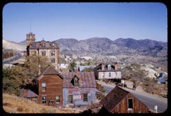
- Description:
- 25 f 11
- Subject:
- Towers, Barns, Mine buildings, Trees, Streets, Mountains, Buildings, Dwellings, Hills, Utility poles, Building deterioration, and Cities & towns
- Series:
- 28-52
- Creator:
- Cushman, Charles W., 1896-1972
- Date Created:
- 1952-11-08
- Genre:
- Views
- Frame Number:
- 13
- County:
- Storey
- Abstract:
- Virginia City.
- Call Number:
- P06497
- City:
- Virginia City
- Country:
- United States
- State/Province:
- Nevada
- Alternate Identifier:
- 2852.13
- Persistent URL:
- http://purl.dlib.indiana.edu/iudl/archives/cushman/P06497
- Holding Location:
- Bloomington - University Archives
Wells Library E460
1320 E 10th St.
Bloomington, IN 47405
Contact at archives@indiana.edu, 812-855-1127
-
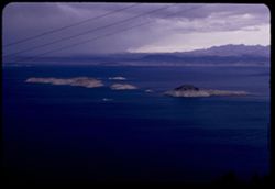
- Description:
- 25 f 6.3
- Subject:
- Mead, Lake (Ariz. and Nev.), Electric lines, Boats, Mountains, Lakes & ponds, and Islands
- Series:
- 16-52
- Creator:
- Cushman, Charles W., 1896-1972
- Date Created:
- 1952-04-10
- Genre:
- Landscape photographs and Seascapes
- Frame Number:
- 4
- County:
- Clark
- Abstract:
- Small boat in Lake Mead
- Call Number:
- P06063
- Country:
- United States
- State/Province:
- Nevada
- Alternate Identifier:
- 1652.4
- Persistent URL:
- http://purl.dlib.indiana.edu/iudl/archives/cushman/P06063
- Holding Location:
- Bloomington - University Archives
Wells Library E460
1320 E 10th St.
Bloomington, IN 47405
Contact at archives@indiana.edu, 812-855-1127
-
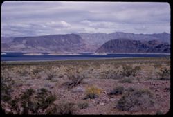
- Description:
- 50 f 11
- Subject:
- Rocks, Mead, Lake (Ariz. and Nev.), Mountains, Shrubs, Lakes & ponds, Islands, and Wildflowers
- Series:
- 16-52
- Creator:
- Cushman, Charles W., 1896-1972
- Date Created:
- 1952-04-10
- Genre:
- Landscape photographs
- Frame Number:
- 2
- Abstract:
- Lake Mead-an arm
- Call Number:
- P06062
- Country:
- United States
- State/Province:
- Arizona and Nevada
- Alternate Identifier:
- 1652.2
- Persistent URL:
- http://purl.dlib.indiana.edu/iudl/archives/cushman/P06062
- Holding Location:
- Bloomington - University Archives
Wells Library E460
1320 E 10th St.
Bloomington, IN 47405
Contact at archives@indiana.edu, 812-855-1127
-
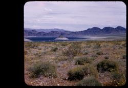
- Description:
- 50 f 9
- Subject:
- Wildflowers, Bays (Bodies of water), Hoover Dam (Ariz. and Nev.), Mountains, Shrubs, Lakes & ponds, Islands, Hills, and Mead, Lake (Ariz. and Nev.)
- Series:
- 16-52
- Creator:
- Cushman, Charles W., 1896-1972
- Date Created:
- 1952-04-10
- Genre:
- Landscape photographs
- Frame Number:
- 1
- County:
- Clark
- Abstract:
- Mtn top in bay of L. Mead.
- Call Number:
- P06061
- Country:
- United States
- State/Province:
- Nevada
- Physical Description:
- masked.
- Alternate Identifier:
- 1652.1
- Persistent URL:
- http://purl.dlib.indiana.edu/iudl/archives/cushman/P06061
- Holding Location:
- Bloomington - University Archives
Wells Library E460
1320 E 10th St.
Bloomington, IN 47405
Contact at archives@indiana.edu, 812-855-1127
-
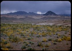
- Description:
- 25 f 8
- Subject:
- Wildflowers, Mead, Lake (Ariz. and Nev.), Mountains, Rock formations, Clouds, Hills, Deserts, Pyramidal mountain, and Shrubs
- Series:
- 15-52
- Creator:
- Cushman, Charles W., 1896-1972
- Date Created:
- 1952-04-10
- Genre:
- Landscape photographs
- Frame Number:
- 41
- County:
- Clark
- Abstract:
- Yellow desert flowers + pyramidal mtn. near Lake Mead.
- Call Number:
- P06060
- Country:
- United States
- State/Province:
- Nevada
- Alternate Identifier:
- 1542.41
- Persistent URL:
- http://purl.dlib.indiana.edu/iudl/archives/cushman/P06060
- Holding Location:
- Bloomington - University Archives
Wells Library E460
1320 E 10th St.
Bloomington, IN 47405
Contact at archives@indiana.edu, 812-855-1127
-
- Subject:
- Automobiles, Trees, Walkways, Mountains, Facilities, Virginia and Truckee Railroad, Utility poles, Railroad employees, and Railroads
- Series:
- 23-40
- Creator:
- Cushman, Charles W., 1896-1972
- Date Created:
- 1940-07-07
- Frame Number:
- 2
- County:
- Carson City
- Abstract:
- 40-J-2=at Carson City, Nev.-Virginia & Truckee RR
- Call Number:
- P01951
- City:
- Carson City
- Country:
- United States
- State/Province:
- Nevada
- Physical Description:
- black & white .
- Alternate Identifier:
- 2340.2
- Persistent URL:
- http://purl.dlib.indiana.edu/iudl/archives/cushman/P01951
- Holding Location:
- Bloomington - University Archives
Wells Library E460
1320 E 10th St.
Bloomington, IN 47405
Contact at archives@indiana.edu, 812-855-1127
-
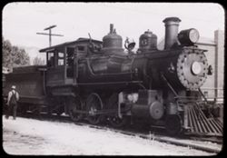
- Subject:
- Railroad locomotives, Trees, Mountains, Bells, Facilities, Virginia and Truckee Railroad, Utility poles, and Railroad employees
- Series:
- 23-40
- Creator:
- Cushman, Charles W., 1896-1972
- Date Created:
- 1940-07-07
- Frame Number:
- 3
- County:
- Carson City
- Abstract:
- 40-J-3=at Carson City, Nev.-Virginia & Truckee RR
- Call Number:
- P01950
- City:
- Carson City
- Country:
- United States
- State/Province:
- Nevada
- Physical Description:
- black & white .
- Alternate Identifier:
- 2340.3
- Persistent URL:
- http://purl.dlib.indiana.edu/iudl/archives/cushman/P01950
- Holding Location:
- Bloomington - University Archives
Wells Library E460
1320 E 10th St.
Bloomington, IN 47405
Contact at archives@indiana.edu, 812-855-1127
-
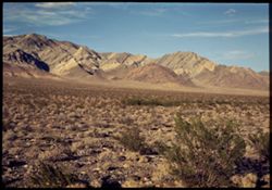
- Subject:
- Deserts, Yucca Mountain (Nev.), Mountains, Shrubs, and Clouds
- Series:
- 10-40
- Creator:
- Cushman, Charles W., 1896-1972
- Date Created:
- 1940-07-09
- Genre:
- Landscape photographs
- Frame Number:
- 14
- County:
- Nye
- Abstract:
- Yucca Mtns. further south.
- Call Number:
- P01936
- Country:
- United States
- State/Province:
- Nevada
- Physical Description:
- Image was originally mounted in a glass enclosure. Before digitization, the image was removed and placed in a Wess Plastic, Inc. brand, 2" x 2", pl...
- Alternate Identifier:
- 1040.14
- Persistent URL:
- http://purl.dlib.indiana.edu/iudl/archives/cushman/P01936
- Holding Location:
- Bloomington - University Archives
Wells Library E460
1320 E 10th St.
Bloomington, IN 47405
Contact at archives@indiana.edu, 812-855-1127
-
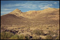
- Subject:
- Deserts, Yucca Mountain (Nev.), Mountains, Shrubs, and Clouds
- Series:
- 10-40
- Creator:
- Cushman, Charles W., 1896-1972
- Date Created:
- 1940-07-09
- Genre:
- Landscape photographs
- Frame Number:
- 13
- County:
- Nye
- Abstract:
- Yucca Mtns. south of Beatty
- Call Number:
- P01935
- City:
- Beatty
- Country:
- United States
- State/Province:
- Nevada
- Physical Description:
- Image was originally mounted in a glass enclosure. Before digitization, the image was removed and placed in a Wess Plastic, Inc. brand, 2" x 2", pl...
- Alternate Identifier:
- 1040.13
- Persistent URL:
- http://purl.dlib.indiana.edu/iudl/archives/cushman/P01935
- Holding Location:
- Bloomington - University Archives
Wells Library E460
1320 E 10th St.
Bloomington, IN 47405
Contact at archives@indiana.edu, 812-855-1127
-
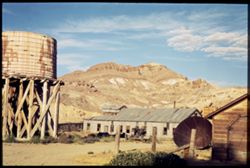
- Subject:
- Yucca Mountain (Nev.), Dirt roads, Mountains, Shrubs, Clouds, and Water tanks
- Series:
- 10-40
- Creator:
- Cushman, Charles W., 1896-1972
- Date Created:
- 1940-07-09
- Genre:
- Landscape photographs
- Frame Number:
- 12
- County:
- Nye
- Abstract:
- Yucca Mtns., from Beatty, Nev.
- Call Number:
- P01934
- City:
- Beatty
- Country:
- United States
- State/Province:
- Nevada
- Physical Description:
- Image was originally mounted in a glass enclosure. Before digitization, the image was removed and placed in a Wess Plastic, Inc. brand, 2" x 2", pl...
- Alternate Identifier:
- 1040.12
- Persistent URL:
- http://purl.dlib.indiana.edu/iudl/archives/cushman/P01934
- Holding Location:
- Bloomington - University Archives
Wells Library E460
1320 E 10th St.
Bloomington, IN 47405
Contact at archives@indiana.edu, 812-855-1127
-
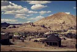
- Subject:
- Roads, Mine buildings, Mountains, Fences, Clouds, and Dwellings
- Series:
- 10-40
- Creator:
- Cushman, Charles W., 1896-1972
- Date Created:
- 1940-07-09
- Genre:
- Cityscape photographs
- Frame Number:
- 11
- County:
- Nye
- Abstract:
- Tonopah, Nev.
- Call Number:
- P01933
- City:
- Tonopah
- Country:
- United States
- State/Province:
- Nevada
- Physical Description:
- Image was originally mounted in a glass enclosure. Before digitization, the image was removed and placed in a Wess Plastic, Inc. brand, 2" x 2", pl...
- Alternate Identifier:
- 1040.11
- Persistent URL:
- http://purl.dlib.indiana.edu/iudl/archives/cushman/P01933
- Holding Location:
- Bloomington - University Archives
Wells Library E460
1320 E 10th St.
Bloomington, IN 47405
Contact at archives@indiana.edu, 812-855-1127
-
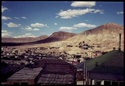
- Subject:
- Roads, Shadows, Mountains, Clouds, and Dwellings
- Series:
- 10-40
- Creator:
- Cushman, Charles W., 1896-1972
- Date Created:
- 1940-07-09
- Genre:
- Cityscape photographs
- Frame Number:
- 10
- County:
- Nye
- Abstract:
- Tonopah, Nev.
- Call Number:
- P01932
- City:
- Tonopah
- Country:
- United States
- State/Province:
- Nevada
- Alternate Identifier:
- 1040.10
- Persistent URL:
- http://purl.dlib.indiana.edu/iudl/archives/cushman/P01932
- Holding Location:
- Bloomington - University Archives
Wells Library E460
1320 E 10th St.
Bloomington, IN 47405
Contact at archives@indiana.edu, 812-855-1127