
Search Constraints
Search Results
-
- Subject:
- Canyons, Mohave Point (Ariz.), Shadows, Tree limbs, Shrubs, Grand Canyon (Ariz.), and Rock formations
- Series:
- 13-40
- Creator:
- Cushman, Charles W., 1896-1972
- Date Created:
- 1940-07-16
- Genre:
- Landscape photographs
- Frame Number:
- 12
- County:
- Coconino
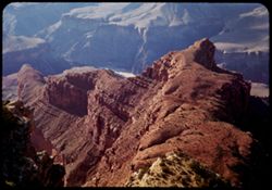
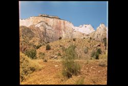
- Abstract:
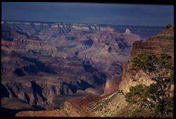
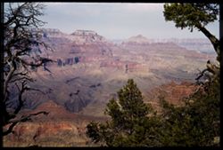
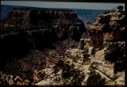
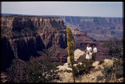
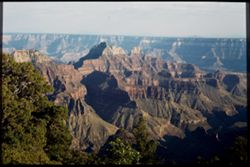
- Looking up Grand Canyon past Mohave Pt. at right
- Call Number:
- P02012
- Country:
- United States
- State/Province:
- Arizona
- Physical Description:
- Image was originally mounted in a glass enclosure. Before digitization, the image was removed and placed in a Wess Plastic, Inc. brand, 2" x 2", pl...
- Alternate Identifier:
- 1340.12
- Persistent URL:
- http://purl.dlib.indiana.edu/iudl/archives/cushman/P02012
- Holding Location:
- Bloomington - University Archives
Wells Library E460
1320 E 10th St.
Bloomington, IN 47405
Contact at archives@indiana.edu, 812-855-1127
-
- Subject:
- Canyons, Shadows, Tree limbs, Rock formations, Clouds, and Grand Canyon (Ariz.)
- Series:
- 13-40
- Creator:
- Cushman, Charles W., 1896-1972
- Date Created:
- 1940-07-16
- Genre:
- Landscape photographs
- Frame Number:
- 11
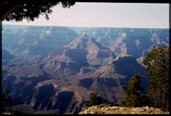
- Abstract:
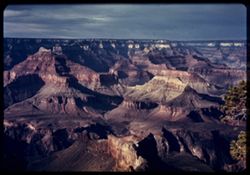
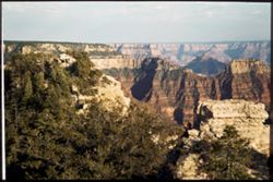
- Afternoon shadows throw Canyon's temples and pyramids into relief. In Triplicate
- Call Number:
- P02011
- Country:
- United States
- State/Province:
- Arizona
- Physical Description:
- Image was originally mounted in a glass enclosure. Before digitization, the image was removed and placed in a Wess Plastic, Inc. brand, 2" x 2", pl...
- Alternate Identifier:
- 1340.11
- Persistent URL:
- http://purl.dlib.indiana.edu/iudl/archives/cushman/P02011
- Holding Location:
- Bloomington - University Archives
Wells Library E460
1320 E 10th St.
Bloomington, IN 47405
Contact at archives@indiana.edu, 812-855-1127
-
- Subject:
- Canyons, Shadows, Tree limbs, Rock formations, Clouds, and Grand Canyon (Ariz.)
- Series:
- 13-40
- Creator:
- Cushman, Charles W., 1896-1972
- Date Created:
- 1940-07-16
- Genre:
- Landscape photographs
- Frame Number:
- 11
- County:
- Coconino
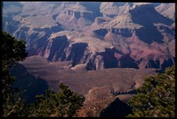
- Abstract:
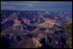
- Afternoon shadows throw Canyon's temples and pyramids into relief. In Triplicate
- Call Number:
- P02010
- Country:
- United States
- State/Province:
- Arizona
- Physical Description:
- Image was originally mounted in a glass enclosure. Before digitization, the image was removed and placed in a Wess Plastic, Inc. brand, 2" x 2", pl...
- Alternate Identifier:
- 1340.11
- Persistent URL:
- http://purl.dlib.indiana.edu/iudl/archives/cushman/P02010
- Holding Location:
- Bloomington - University Archives
Wells Library E460
1320 E 10th St.
Bloomington, IN 47405
Contact at archives@indiana.edu, 812-855-1127
-
- Subject:
- Canyons, Vishnu Temple (Ariz.), Wotans Throne (Ariz.), Shadows, Tree limbs, Rock formations, Clouds, Grand Canyon (Ariz.), and Shrubs
- Series:
- 13-40
- Creator:
- Cushman, Charles W., 1896-1972
- Date Created:
- 1940-07-16
- Genre:
- Landscape photographs
- Frame Number:
- 10
- County:
- Coconino
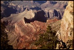
- Abstract:
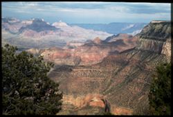
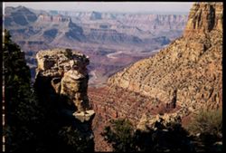
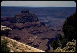
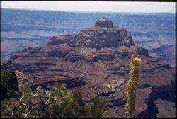
- Far vistas of Canyon. South rim at right. Wotan's Throne and Vishnu Temple at left.
- Call Number:
- P02009
- Country:
- United States
- State/Province:
- Arizona
- Physical Description:
- Image was originally mounted in a glass enclosure. Before digitization, the image was removed and placed in a Wess Plastic, Inc. brand, 2" x 2", pl...
- Alternate Identifier:
- 1340.10
- Persistent URL:
- http://purl.dlib.indiana.edu/iudl/archives/cushman/P02009
- Holding Location:
- Bloomington - University Archives
Wells Library E460
1320 E 10th St.
Bloomington, IN 47405
Contact at archives@indiana.edu, 812-855-1127
-
- Subject:
- Canyons, Mohave Point (Ariz.), Tree limbs, Rock formations, Grand Canyon (Ariz.), Rivers, and Shrubs
- Series:
- 13-40
- Creator:
- Cushman, Charles W., 1896-1972
- Date Created:
- 1940-07-16
- Genre:
- Landscape photographs
- Frame Number:
- 9
- County:
- Coconino
- Abstract:
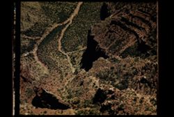
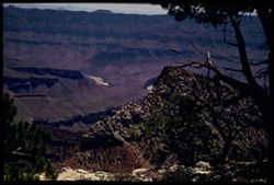
- Rock below Mojave Pt. Glimpse of river in center
- Call Number:
- P02008
- Country:
- United States
- State/Province:
- Arizona
- Alternate Identifier:
- 1340.9
- Persistent URL:
- http://purl.dlib.indiana.edu/iudl/archives/cushman/P02008
- Holding Location:
- Bloomington - University Archives
Wells Library E460
1320 E 10th St.
Bloomington, IN 47405
Contact at archives@indiana.edu, 812-855-1127
-
- Subject:
- Rocks, Canyons, Cliffs, Granite Gorge (Ariz.), Shadows, Tree limbs, and Shrubs
- Series:
- 13-40
- Creator:
- Cushman, Charles W., 1896-1972
- Date Created:
- 1940-07-15
- Genre:
- Landscape photographs
- Frame Number:
- 8
- Street Address:
- Hermit Rim Drive
- Abstract:
- Looking down on rocks below Hermit Rim Drive.
- Call Number:
- P02007
- Country:
- United States
- State/Province:
- Arizona
- Physical Description:
- Image was originally mounted in a glass enclosure. Before digitization, the image was removed and placed in a Wess Plastic, Inc. brand, 2" x 2", pl...
- Alternate Identifier:
- 1340.8
- Persistent URL:
- http://purl.dlib.indiana.edu/iudl/archives/cushman/P02007
- Holding Location:
- Bloomington - University Archives
Wells Library E460
1320 E 10th St.
Bloomington, IN 47405
Contact at archives@indiana.edu, 812-855-1127
-
- Subject:
- Tree limbs, Canyons, Cheops Pyramid (Ariz.), Isis Temple (Ariz.), Yavapai Point (Ariz.), Rock formations, and Granite Gorge (Ariz.)
- Series:
- 13-40
- Creator:
- Cushman, Charles W., 1896-1972
- Date Created:
- 1940-07-15
- Genre:
- Landscape photographs
- Frame Number:
- 7
- County:
- Coconino
- Abstract:
- From Yavapai Pt., looking past Cheops pyramid to Isis Temple. Granite Gorge at lower left.
- Call Number:
- P02006
- Country:
- United States
- State/Province:
- Arizona
- Physical Description:
- Image was originally mounted in a glass enclosure. Before digitization, the image was removed and placed in a Wess Plastic, Inc. brand, 2" x 2", pl...
- Alternate Identifier:
- 1340.7
- Persistent URL:
- http://purl.dlib.indiana.edu/iudl/archives/cushman/P02006
- Holding Location:
- Bloomington - University Archives
Wells Library E460
1320 E 10th St.
Bloomington, IN 47405
Contact at archives@indiana.edu, 812-855-1127
-
- Subject:
- Granite Gorge (Ariz.), Cheops Pyramid (Ariz.), Shrubs, Yavapai Point (Ariz.), Trees, Rock formations, and Canyons
- Series:
- 13-40
- Creator:
- Cushman, Charles W., 1896-1972
- Date Created:
- 1940-07-15
- Genre:
- Landscape photographs
- Frame Number:
- 6
- Abstract:
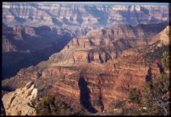
- Looking down on Granite Gorge from Yavapai Pt. Monday afternoon.
- Call Number:
- P02005
- Country:
- United States
- State/Province:
- Arizona
- Physical Description:
- Image was originally mounted in a glass enclosure. Before digitization, the image was removed and placed in a Wess Plastic, Inc. brand, 2" x 2", pl...
- Alternate Identifier:
- 1340.6
- Persistent URL:
- http://purl.dlib.indiana.edu/iudl/archives/cushman/P02005
- Holding Location:
- Bloomington - University Archives
Wells Library E460
1320 E 10th St.
Bloomington, IN 47405
Contact at archives@indiana.edu, 812-855-1127
-
- Subject:
- Canyons, Vishnu Temple (Ariz.), Wotans Throne (Ariz.), Rock formations, Grand Canyon (Ariz.), and Trees
- Series:
- 13-40
- Creator:
- Cushman, Charles W., 1896-1972
- Date Created:
- 1940-07-14
- Genre:
- Landscape photographs
- Frame Number:
- 5
- Abstract:
- Wotan's Throne and Vishnu Temple, far away, dominate this canyon scene from South Rim
- Call Number:
- P02004
- Country:
- United States
- State/Province:
- Arizona
- Physical Description:
- Image was originally mounted in a glass enclosure. Before digitization, the image was removed and placed in a Wess Plastic, Inc. brand, 2" x 2", pl...
- Alternate Identifier:
- 1340.5
- Persistent URL:
- http://purl.dlib.indiana.edu/iudl/archives/cushman/P02004
- Holding Location:
- Bloomington - University Archives
Wells Library E460
1320 E 10th St.
Bloomington, IN 47405
Contact at archives@indiana.edu, 812-855-1127
-
- Subject:
- Shields, Indigenous peoples, Dance, Spectators, Grand Canyon National Park (Ariz.), Trees, Shadows, El Tovar Hotel (Grand Canyon, Ariz.), Drums, and Hopi Ind...
- Series:
- 13-40
- Creator:
- Cushman, Charles W., 1896-1972
- Date Created:
- 1940-07-14
- Frame Number:
- 4
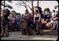
- Abstract:
- Hopi Indian dance - El Tovar.
- Call Number:
- P02003
- Country:
- United States
- State/Province:
- Arizona
- Alternate Identifier:
- 1340.4
- Persistent URL:
- http://purl.dlib.indiana.edu/iudl/archives/cushman/P02003
- Holding Location:
- Bloomington - University Archives
Wells Library E460
1320 E 10th St.
Bloomington, IN 47405
Contact at archives@indiana.edu, 812-855-1127
-
- Subject:
- Spectators, Dance, El Tovar Hotel (Grand Canyon, Ariz.), Grand Canyon National Park (Ariz.), Indians of North America, Drums, Grand Canyon (Ariz.), Hopi Indi...
- Series:
- 13-40
- Creator:
- Cushman, Charles W., 1896-1972
- Date Created:
- 1940-07-14
- Genre:
- Ethnographic photographs
- Frame Number:
- 3
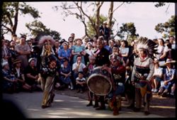
- Abstract:
- Hopi Indian dance- El Tovar
- Call Number:
- P02002
- Country:
- United States
- State/Province:
- Arizona
- Physical Description:
- Image was originally mounted in a glass enclosure. Before digitization, the image was removed and placed in a Wess Plastic, Inc. brand, 2" x 2", pl...
- Alternate Identifier:
- 1340.3
- Persistent URL:
- http://purl.dlib.indiana.edu/iudl/archives/cushman/P02002
- Holding Location:
- Bloomington - University Archives
Wells Library E460
1320 E 10th St.
Bloomington, IN 47405
Contact at archives@indiana.edu, 812-855-1127
-
- Subject:
- Canyons, Grand Canyon (Ariz.), Shrubs, Trees, Colorado River (Colo.-Mexico), Rock formations, and Rivers
- Series:
- 13-40
- Creator:
- Cushman, Charles W., 1896-1972
- Date Created:
- 1940-07-14
- Genre:
- Landscape photographs
- Frame Number:
- 2
- Abstract:
- Colorado from South Rim. Sunday afternoon
- Call Number:
- P02001
- Country:
- United States
- State/Province:
- Arizona
- Physical Description:
- Image was originally mounted in a glass enclosure. Before digitization, the image was removed and placed in a Wess Plastic, Inc. brand, 2" x 2", pl...
- Alternate Identifier:
- 1340.2
- Persistent URL:
- http://purl.dlib.indiana.edu/iudl/archives/cushman/P02001
- Holding Location:
- Bloomington - University Archives
Wells Library E460
1320 E 10th St.
Bloomington, IN 47405
Contact at archives@indiana.edu, 812-855-1127
-
- Subject:
- Canyons, Cape Royal (Ariz.), Wotans Throne (Ariz.), Shrubs, Grand Canyon (Ariz.), Trees, and Rock formations
- Series:
- 12-40
- Creator:
- Cushman, Charles W., 1896-1972
- Date Created:
- 1940-07-01
- Genre:
- Landscape photographs
- Frame Number:
- 20
- County:
- Coconino
- Abstract:
- Wotan's Throne at left and Part of cape Royal at right
- Call Number:
- P02000
- Country:
- United States
- State/Province:
- Arizona
- Physical Description:
- Image was originally mounted in a glass enclosure. Before digitization, the image was removed and placed in a Wess Plastic, Inc. brand, 2" x 2", pl...
- Alternate Identifier:
- 1240.20
- Persistent URL:
- http://purl.dlib.indiana.edu/iudl/archives/cushman/P02000
- Holding Location:
- Bloomington - University Archives
Wells Library E460
1320 E 10th St.
Bloomington, IN 47405
Contact at archives@indiana.edu, 812-855-1127
-
- Subject:
- Rocks, Angels Window (Ariz.), Cliffs, Trails & paths, Shadows, Shrubs, Canyons, and Cape Royal (Ariz.)
- Series:
- 12-40
- Creator:
- Cushman, Charles W., 1896-1972
- Date Created:
- 1940-07-01
- Genre:
- Views
- Frame Number:
- 21
- County:
- Coconino
- Abstract:
- Floor of Canyon from Angel's Window , Cape Royal
- Call Number:
- P01999
- Country:
- United States
- State/Province:
- Arizona
- Physical Description:
- masked. Image was originally mounted in a glass enclosure. Before digitization, the image was removed and placed in a Wess Plastic, Inc. brand, 2" x 2&q...
- Alternate Identifier:
- 1240.21
- Persistent URL:
- http://purl.dlib.indiana.edu/iudl/archives/cushman/P01999
- Holding Location:
- Bloomington - University Archives
Wells Library E460
1320 E 10th St.
Bloomington, IN 47405
Contact at archives@indiana.edu, 812-855-1127
-
- Subject:
- Rock formations, Tree limbs, Canyons, Cape Royal (Ariz.), San Francisco Peaks (Ariz.), Shrubs, Grand Canyon (Ariz.), and Vishnu Temple (Ariz.)
- Series:
- 12-40
- Creator:
- Cushman, Charles W., 1896-1972
- Date Created:
- 1940-07-01
- Genre:
- Landscape photographs
- Frame Number:
- 19
- County:
- Coconino
- Abstract:
- Vishnu Temple from Cape Royal. San Francisco peaks on horizon.
- Call Number:
- P01998
- Country:
- United States
- State/Province:
- Arizona
- Alternate Identifier:
- 1240.19
- Persistent URL:
- http://purl.dlib.indiana.edu/iudl/archives/cushman/P01998
- Holding Location:
- Bloomington - University Archives
Wells Library E460
1320 E 10th St.
Bloomington, IN 47405
Contact at archives@indiana.edu, 812-855-1127
-
- Subject:
- Canyons, Cape Royal (Ariz.), Tree limbs, Mountains, and Shrubs
- Series:
- 12-40
- Creator:
- Cushman, Charles W., 1896-1972
- Date Created:
- 1940-07-13
- Genre:
- Landscape photographs
- Frame Number:
- 18
- County:
- Coconino
- Abstract:
- Looking across to East Rim from Cape Royal.
- Call Number:
- P01997
- Country:
- United States
- State/Province:
- Arizona
- Physical Description:
- Image was originally mounted in a glass enclosure. Before digitization, the image was removed and placed in a Wess Plastic, Inc. brand, 2" x 2", pl...
- Alternate Identifier:
- 1240.18
- Persistent URL:
- http://purl.dlib.indiana.edu/iudl/archives/cushman/P01997
- Holding Location:
- Bloomington - University Archives
Wells Library E460
1320 E 10th St.
Bloomington, IN 47405
Contact at archives@indiana.edu, 812-855-1127
-
- Subject:
- Rocks, Canyons, Cliffs, Cape Royal (Ariz.), Wotans Throne (Ariz.), Tree limbs, Shrubs, and People
- Series:
- 12-40
- Creator:
- Cushman, Charles W., 1896-1972
- Date Created:
- 1940-07-13
- Genre:
- Landscape photographs
- Frame Number:
- 17
- County:
- Coconino
- Abstract:
- Past Wotan's Throne, across canyon, from Cape Royal
- Call Number:
- P01996
- Country:
- United States
- State/Province:
- Arizona
- Physical Description:
- Image was originally mounted in a glass enclosure. Before digitization, the image was removed and placed in a Wess Plastic, Inc. brand, 2" x 2", pl...
- Alternate Identifier:
- 1240.17
- Persistent URL:
- http://purl.dlib.indiana.edu/iudl/archives/cushman/P01996
- Holding Location:
- Bloomington - University Archives
Wells Library E460
1320 E 10th St.
Bloomington, IN 47405
Contact at archives@indiana.edu, 812-855-1127
-
- Subject:
- Tree limbs, Canyons, Vishnu Temple (Ariz.), Grand Canyon (Ariz.), Shrubs, Rock formations, and Cape Royal (Ariz.)
- Series:
- 12-40
- Creator:
- Cushman, Charles W., 1896-1972
- Date Created:
- 1940-07-13
- Genre:
- Landscape photographs
- Frame Number:
- 16
- County:
- Coconino
- Abstract:
- Vishnu Temple from Cape Royal
- Call Number:
- P01995
- Country:
- United States
- State/Province:
- Arizona
- Physical Description:
- Image was originally mounted in a glass enclosure. Before digitization, the image was removed and placed in a Wess Plastic, Inc. brand, 2" x 2", pl...
- Alternate Identifier:
- 1240.16
- Persistent URL:
- http://purl.dlib.indiana.edu/iudl/archives/cushman/P01995
- Holding Location:
- Bloomington - University Archives
Wells Library E460
1320 E 10th St.
Bloomington, IN 47405
Contact at archives@indiana.edu, 812-855-1127
-
- Subject:
- Bright Angel Point (Ariz.), Canyons, Cliffs, Trees, Shadows, Mountains, National parks & reserves, and Grand Canyon (Ariz.)
- Series:
- 12-40
- Creator:
- Cushman, Charles W., 1896-1972
- Date Created:
- 1940-07-13
- Genre:
- Landscape photographs
- Frame Number:
- 15
- County:
- Coconino
- Abstract:
- View south from B.A. Pt. In morning. B.A. canyon at left.
- Call Number:
- P01994
- Country:
- United States
- State/Province:
- Arizona
- Physical Description:
- Image was originally mounted in a glass enclosure. Before digitization, the image was removed and placed in a Wess Plastic, Inc. brand, 2" x 2", pl...
- Alternate Identifier:
- 1240.15
- Persistent URL:
- http://purl.dlib.indiana.edu/iudl/archives/cushman/P01994
- Holding Location:
- Bloomington - University Archives
Wells Library E460
1320 E 10th St.
Bloomington, IN 47405
Contact at archives@indiana.edu, 812-855-1127
-
- Subject:
- National parks & reserves, Canyons, Bright Angel Point (Ariz.), Cliffs, Shrubs, Trees, and Grand Canyon (Ariz.)
- Series:
- 12-40
- Creator:
- Cushman, Charles W., 1896-1972
- Date Created:
- 1940-07-12
- Genre:
- Landscape photographs
- Frame Number:
- 14
- County:
- Coconino
- Abstract:
- Across tip of B.A.Pt., past temples to opp. Rim.
- Call Number:
- P01993
- Country:
- United States
- State/Province:
- Arizona
- Physical Description:
- Image was originally mounted in a glass enclosure. Before digitization, the image was removed and placed in a Wess Plastic, Inc. brand, 2" x 2", pl...
- Alternate Identifier:
- 1240.14
- Persistent URL:
- http://purl.dlib.indiana.edu/iudl/archives/cushman/P01993
- Holding Location:
- Bloomington - University Archives
Wells Library E460
1320 E 10th St.
Bloomington, IN 47405
Contact at archives@indiana.edu, 812-855-1127
-
- Subject:
- Bright Angel Point (Ariz.), Canyons, Trees, Shadows, Mountains, National parks & reserves, Zoroaster Temple (Ariz.), and Grand Canyon (Ariz.)
- Series:
- 12-40
- Creator:
- Cushman, Charles W., 1896-1972
- Date Created:
- 1940-07-19
- Genre:
- Landscape photographs
- Frame Number:
- 13
- County:
- Coconino
- Abstract:
- GRAND CANYON. Zoroaster Temple from Bright Angel Pt. Evening.
- Call Number:
- P01992
- Country:
- United States
- State/Province:
- Arizona
- Physical Description:
- Image was originally mounted in a glass enclosure. Before digitization, the image was removed and placed in a Wess Plastic, Inc. brand, 2" x 2", pl...
- Alternate Identifier:
- 1240.13
- Persistent URL:
- http://purl.dlib.indiana.edu/iudl/archives/cushman/P01992
- Holding Location:
- Bloomington - University Archives
Wells Library E460
1320 E 10th St.
Bloomington, IN 47405
Contact at archives@indiana.edu, 812-855-1127
-
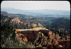
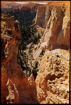
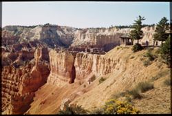
- Subject:
- Bryce Point (Utah), Canyons, Cliffs, Bryce Canyon National Park (Utah), Trees, Shrubs, Bryce Canyon (Utah : Valley), and National parks & reserves
- Series:
- 12-40
- Creator:
- Cushman, Charles W., 1896-1972
- Date Created:
- 1940-07-12
- Genre:
- Landscape photographs
- Frame Number:
- 12
- County:
- Garfield
- Abstract:
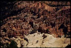
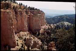
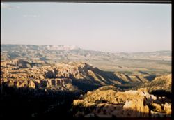
- Looking down from Bryce Pt.
- Call Number:
- P01991
- Country:
- United States
- State/Province:
- Utah
- Physical Description:
- Image was originally mounted in a glass enclosure. Before digitization, the image was removed and placed in a Wess Plastic, Inc. brand, 2" x 2", pl...
- Alternate Identifier:
- 1240.12
- Persistent URL:
- http://purl.dlib.indiana.edu/iudl/archives/cushman/P01991
- Holding Location:
- Bloomington - University Archives
Wells Library E460
1320 E 10th St.
Bloomington, IN 47405
Contact at archives@indiana.edu, 812-855-1127
-
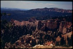
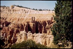
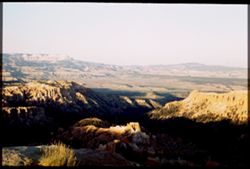
- Subject:
- Bryce Point (Utah), Canyons, Cliffs, Bryce Canyon National Park (Utah), Trees, National parks & reserves, and Bryce Canyon (Utah : Valley)
- Series:
- 12-40
- Creator:
- Cushman, Charles W., 1896-1972
- Date Created:
- 1940-07-12/1940-07-12
- Genre:
- Landscape photographs
- Frame Number:
- 11
- County:
- Garfield
- Abstract:
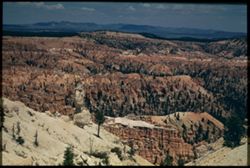
- Panorama (eastward) from Bryce Pt.
- Call Number:
- P01990
- Country:
- United States
- State/Province:
- Utah
- Physical Description:
- Image was originally mounted in a glass enclosure. Before digitization, the image was removed and placed in a Wess Plastic, Inc. brand, 2" x 2", pl...
- Alternate Identifier:
- 1240.11
- Persistent URL:
- http://purl.dlib.indiana.edu/iudl/archives/cushman/P01990
- Holding Location:
- Bloomington - University Archives
Wells Library E460
1320 E 10th St.
Bloomington, IN 47405
Contact at archives@indiana.edu, 812-855-1127
-
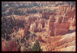
- Subject:
- Rocks, Bryce Point (Utah), Canyons, Cliffs, Bryce Canyon National Park (Utah), Trees, Mountains, Shrubs, Bryce Canyon (Utah : Valley), National parks & r...
- Series:
- 12-40
- Creator:
- Cushman, Charles W., 1896-1972
- Date Created:
- 1940-07-01
- Genre:
- Landscape photographs
- Frame Number:
- 10
- County:
- Garfield
- Abstract:
- view from trail below Bryce Pt.
- Call Number:
- P01989
- Country:
- United States
- State/Province:
- Utah
- Physical Description:
- Image was originally mounted in a glass enclosure. Before digitization, the image was removed and placed in a Wess Plastic, Inc. brand, 2" x 2", pl...
- Alternate Identifier:
- 1240.10
- Persistent URL:
- http://purl.dlib.indiana.edu/iudl/archives/cushman/P01989
- Holding Location:
- Bloomington - University Archives
Wells Library E460
1320 E 10th St.
Bloomington, IN 47405
Contact at archives@indiana.edu, 812-855-1127
-
- Subject:
- Cliffs, Mountains, Shrubs, Trees, and Rocks
- Series:
- 12-40
- Creator:
- Cushman, Charles W., 1896-1972
- Date Created:
- 1940-07-12
- Genre:
- Landscape photographs
- Frame Number:
- 9
- Abstract:
- Looking east across tree clad mountains.
- Call Number:
- P01988
- Country:
- United States
- State/Province:
- Utah
- Alternate Identifier:
- 1240.9
- Persistent URL:
- http://purl.dlib.indiana.edu/iudl/archives/cushman/P01988
- Holding Location:
- Bloomington - University Archives
Wells Library E460
1320 E 10th St.
Bloomington, IN 47405
Contact at archives@indiana.edu, 812-855-1127
-
- Subject:
- Cliffs, Bryce Canyon National Park (Utah), Trees, Mountains, National parks & reserves, Clouds, Shrubs, and Bryce Canyon (Utah : Valley)
- Series:
- 12-40
- Creator:
- Cushman, Charles W., 1896-1972
- Date Created:
- 1940-07-12
- Genre:
- Landscape photographs
- Frame Number:
- 8
- County:
- Garfield
- Abstract:
- Distant view across southern part of Bryce Canyon
- Call Number:
- P01987
- Country:
- United States
- State/Province:
- Utah
- Physical Description:
- Image was originally mounted in a glass enclosure. Before digitization, the image was removed and placed in a Wess Plastic, Inc. brand, 2" x 2", pl...
- Alternate Identifier:
- 1240.8
- Persistent URL:
- http://purl.dlib.indiana.edu/iudl/archives/cushman/P01987
- Holding Location:
- Bloomington - University Archives
Wells Library E460
1320 E 10th St.
Bloomington, IN 47405
Contact at archives@indiana.edu, 812-855-1127
-
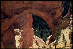
- Subject:
- Canyons, Bryce Natural Bridge (Utah), Trees, Arches, National parks & reserves, Bryce Canyon (Utah : Valley), Bryce Canyon National Park (Utah), Shrubs, ...
- Series:
- 12-40
- Creator:
- Cushman, Charles W., 1896-1972
- Date Created:
- 1940-07-01
- Genre:
- Landscape photographs
- Frame Number:
- 7
- County:
- Garfield
- Abstract:
- Great arch of Natural Bridge from Road.
- Call Number:
- P01986
- Country:
- United States
- State/Province:
- Utah
- Physical Description:
- Image was originally mounted in a glass enclosure. Before digitization, the image was removed and placed in a Wess Plastic, Inc. brand, 2" x 2", pl...
- Alternate Identifier:
- 1240.7
- Persistent URL:
- http://purl.dlib.indiana.edu/iudl/archives/cushman/P01986
- Holding Location:
- Bloomington - University Archives
Wells Library E460
1320 E 10th St.
Bloomington, IN 47405
Contact at archives@indiana.edu, 812-855-1127
-
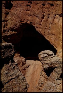
- Subject:
- Canyons, Bryce Natural Bridge (Utah), Arches, Rock formations, Bryce Canyon (Utah : Valley), Bryce Canyon National Park (Utah), and National parks & rese...
- Series:
- 12-40
- Creator:
- Cushman, Charles W., 1896-1972
- Date Created:
- 1940-07-12
- Genre:
- Landscape photographs
- Frame Number:
- 6
- County:
- Garfield
- Abstract:
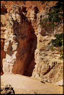
- Looking down at arch of Natural Bridge
- Call Number:
- P01985
- Country:
- United States
- State/Province:
- Utah
- Physical Description:
- Image was originally mounted in a glass enclosure. Before digitization, the image was removed and placed in a Wess Plastic, Inc. brand, 2" x 2", pl...
- Alternate Identifier:
- 1240.6
- Persistent URL:
- http://purl.dlib.indiana.edu/iudl/archives/cushman/P01985
- Holding Location:
- Bloomington - University Archives
Wells Library E460
1320 E 10th St.
Bloomington, IN 47405
Contact at archives@indiana.edu, 812-855-1127
-
- Subject:
- National parks & reserves, Bryce Natural Bridge (Utah), Canyons, Bryce Canyon National Park (Utah), Cliffs, Mountains, Bryce Canyon (Utah : Valley), Shru...
- Series:
- 12-40
- Creator:
- Cushman, Charles W., 1896-1972
- Date Created:
- 1940-07-12
- Genre:
- Landscape photographs
- Frame Number:
- 5
- County:
- Garfield
- Abstract:
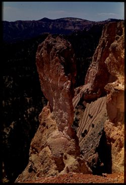
- Tall rock spire near Natural Bridge
- Call Number:
- P01984
- Country:
- United States
- State/Province:
- Utah
- Physical Description:
- Image was originally mounted in a glass enclosure. Before digitization, the image was removed and placed in a Wess Plastic, Inc. brand, 2" x 2", pl...
- Alternate Identifier:
- 1240.5
- Persistent URL:
- http://purl.dlib.indiana.edu/iudl/archives/cushman/P01984
- Holding Location:
- Bloomington - University Archives
Wells Library E460
1320 E 10th St.
Bloomington, IN 47405
Contact at archives@indiana.edu, 812-855-1127
-
- Subject:
- Canyons, Cliffs, Bryce Canyon National Park (Utah), Trees, Mountains, National parks & reserves, Bryce Canyon (Utah : Valley), Bryce Natural Bridge (Utah...
- Series:
- 12-40
- Creator:
- Cushman, Charles W., 1896-1972
- Date Created:
- 1940-07-12
- Genre:
- Landscape photographs
- Frame Number:
- 4
- County:
- Garfield
- Abstract:
- Part of canyon wall from topo f Natural Bridge
- Call Number:
- P01983
- Country:
- United States
- State/Province:
- Utah
- Physical Description:
- Image was originally mounted in a glass enclosure. Before digitization, the image was removed and placed in a Wess Plastic, Inc. brand, 2" x 2", pl...
- Alternate Identifier:
- 1240.4
- Persistent URL:
- http://purl.dlib.indiana.edu/iudl/archives/cushman/P01983
- Holding Location:
- Bloomington - University Archives
Wells Library E460
1320 E 10th St.
Bloomington, IN 47405
Contact at archives@indiana.edu, 812-855-1127
-
- Subject:
- Rocks, Canyons, Cliffs, Bryce Canyon National Park (Utah), Trees, Mountains, National parks & reserves, and Bryce Canyon (Utah : Valley)
- Series:
- 12-40
- Creator:
- Cushman, Charles W., 1896-1972
- Date Created:
- 1940-07-12
- Genre:
- Landscape photographs
- Frame Number:
- 3
- County:
- Garfield
- Abstract:
- Great clump of colored rock.
- Call Number:
- P01982
- Country:
- United States
- State/Province:
- Utah
- Physical Description:
- Image was originally mounted in a glass enclosure. Before digitization, the image was removed and placed in a Wess Plastic, Inc. brand, 2" x 2", pl...
- Alternate Identifier:
- 1240.3
- Persistent URL:
- http://purl.dlib.indiana.edu/iudl/archives/cushman/P01982
- Holding Location:
- Bloomington - University Archives
Wells Library E460
1320 E 10th St.
Bloomington, IN 47405
Contact at archives@indiana.edu, 812-855-1127
-
- Subject:
- National parks & reserves, Bryce Natural Bridge (Utah), Canyons, Bryce Canyon National Park (Utah), Cliffs, Bryce Canyon (Utah : Valley), Trees, Trails &...
- Series:
- 12-40
- Creator:
- Cushman, Charles W., 1896-1972
- Date Created:
- 1940-07-01
- Genre:
- Landscape photographs
- Frame Number:
- 2
- County:
- Garfield
- Abstract:
- View from Top of rocks near Natural Bridge
- Call Number:
- P01981
- Country:
- United States
- State/Province:
- Utah
- Physical Description:
- Image was originally mounted in a glass enclosure. Before digitization, the image was removed and placed in a Wess Plastic, Inc. brand, 2" x 2", pl...
- Alternate Identifier:
- 1240.2
- Persistent URL:
- http://purl.dlib.indiana.edu/iudl/archives/cushman/P01981
- Holding Location:
- Bloomington - University Archives
Wells Library E460
1320 E 10th St.
Bloomington, IN 47405
Contact at archives@indiana.edu, 812-855-1127
-
- Subject:
- Canyons, Cliffs, Bryce Natural Bridge (Utah), Trees, Mountains, Shrubs, Bryce Canyon (Utah : Valley), Bryce Canyon National Park (Utah), and National parks &...
- Series:
- 12-40
- Creator:
- Cushman, Charles W., 1896-1972
- Date Created:
- 1940-07-12
- Genre:
- Landscape photographs
- Frame Number:
- 1
- County:
- Garfield
- Abstract:
- Tall rocks at Natural bridge.
- Call Number:
- P01980
- Country:
- United States
- State/Province:
- Utah
- Physical Description:
- Image was originally mounted in a glass enclosure. Before digitization, the image was removed and placed in a Wess Plastic, Inc. brand, 2" x 2", pl...
- Alternate Identifier:
- 1240.1
- Persistent URL:
- http://purl.dlib.indiana.edu/iudl/archives/cushman/P01980
- Holding Location:
- Bloomington - University Archives
Wells Library E460
1320 E 10th St.
Bloomington, IN 47405
Contact at archives@indiana.edu, 812-855-1127
-
- Subject:
- Canyons, Cliffs, Bryce Canyon National Park (Utah), Trees, Mountains, National parks & reserves, Bryce Canyon (Utah : Valley), and Sunset Point (Utah)
- Series:
- 11-40
- Creator:
- Cushman, Charles W., 1896-1972
- Date Created:
- 1940-07-12
- Genre:
- Landscape photographs
- Frame Number:
- 19
- County:
- Garfield
- Abstract:
- West rim from sunset pt.
- Call Number:
- P01979
- Country:
- United States
- State/Province:
- Utah
- Physical Description:
- Image was originally mounted in a glass enclosure. Before digitization, the image was removed and placed in a Wess Plastic, Inc. brand, 2" x 2", pl...
- Alternate Identifier:
- 1140.19
- Persistent URL:
- http://purl.dlib.indiana.edu/iudl/archives/cushman/P01979
- Holding Location:
- Bloomington - University Archives
Wells Library E460
1320 E 10th St.
Bloomington, IN 47405
Contact at archives@indiana.edu, 812-855-1127
-
- Subject:
- Canyons, Cliffs, Bryce Canyon National Park (Utah), Sunset Point (Utah), Mountains, National parks & reserves, Bryce Canyon (Utah : Valley), Queen's ...
- Series:
- 11-40
- Creator:
- Cushman, Charles W., 1896-1972
- Date Created:
- 1940-07-12
- Genre:
- Landscape photographs
- Frame Number:
- 18
- County:
- Garfield
- Abstract:
- Queen's Garden , from Sunset pt.
- Call Number:
- P01978
- Country:
- United States
- State/Province:
- Utah
- Physical Description:
- Image was originally mounted in a glass enclosure. Before digitization, the image was removed and placed in a Wess Plastic, Inc. brand, 2" x 2", pl...
- Alternate Identifier:
- 1140.18
- Persistent URL:
- http://purl.dlib.indiana.edu/iudl/archives/cushman/P01978
- Holding Location:
- Bloomington - University Archives
Wells Library E460
1320 E 10th St.
Bloomington, IN 47405
Contact at archives@indiana.edu, 812-855-1127
-
- Subject:
- Wildflowers, Cliffs, Bryce Canyon National Park (Utah), Trails & paths, Trees, Mountains, National parks & reserves, Bryce Canyon (Utah : Valley), Pa...
- Series:
- 11-40
- Creator:
- Cushman, Charles W., 1896-1972
- Date Created:
- 1940-07-12
- Genre:
- Landscape photographs
- Frame Number:
- 17
- County:
- Garfield
- Abstract:
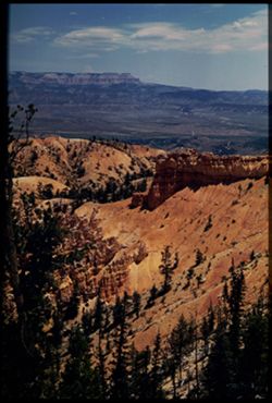
- Bryce Canyon. Looking at sunset Pt. In morning light.
- Call Number:
- P01977
- Country:
- United States
- State/Province:
- Utah
- Physical Description:
- Image was originally mounted in a glass enclosure. Before digitization, the image was removed and placed in a Wess Plastic, Inc. brand, 2" x 2", pl...
- Alternate Identifier:
- 1140.17
- Persistent URL:
- http://purl.dlib.indiana.edu/iudl/archives/cushman/P01977
- Holding Location:
- Bloomington - University Archives
Wells Library E460
1320 E 10th St.
Bloomington, IN 47405
Contact at archives@indiana.edu, 812-855-1127
-
- Subject:
- Canyons, Cliffs, Bryce Canyon National Park (Utah), Trees, Shadows, Inspiration Point (Utah), Mountains, Shrubs, Bryce Canyon (Utah : Valley), Sunrises &...
- Series:
- 11-40
- Creator:
- Cushman, Charles W., 1896-1972
- Date Created:
- 1940-07-11
- Genre:
- Landscape photographs
- Frame Number:
- 16
- County:
- Garfield
- Abstract:
- Bryce Canyon at sunset, from Inspiration Pt.
- Call Number:
- P01976
- Country:
- United States
- State/Province:
- Utah
- Physical Description:
- Image was originally mounted in a glass enclosure. Before digitization, the image was removed and placed in a Wess Plastic, Inc. brand, 2" x 2", pl...
- Alternate Identifier:
- 1140.16
- Persistent URL:
- http://purl.dlib.indiana.edu/iudl/archives/cushman/P01976
- Holding Location:
- Bloomington - University Archives
Wells Library E460
1320 E 10th St.
Bloomington, IN 47405
Contact at archives@indiana.edu, 812-855-1127
-
- Subject:
- Canyons, Bryce Canyon National Park (Utah), Trees, Shadows, Mountains, Shrubs, Bryce Canyon (Utah : Valley), Sunrises & sunsets, and National parks &...
- Series:
- 11-40
- Creator:
- Cushman, Charles W., 1896-1972
- Date Created:
- 1940-07-11
- Genre:
- Landscape photographs
- Frame Number:
- 15
- County:
- Garfield
- Abstract:
- Bryce Canyon at sunset, from west rim.
- Call Number:
- P01975
- Country:
- United States
- State/Province:
- Utah
- Physical Description:
- Image was originally mounted in a glass enclosure. Before digitization, the image was removed and placed in a Wess Plastic, Inc. brand, 2" x 2", pl...
- Alternate Identifier:
- 1140.15
- Persistent URL:
- http://purl.dlib.indiana.edu/iudl/archives/cushman/P01975
- Holding Location:
- Bloomington - University Archives
Wells Library E460
1320 E 10th St.
Bloomington, IN 47405
Contact at archives@indiana.edu, 812-855-1127
-
- Subject:
- Rocks, Roads, Trees, Mountains, National parks & reserves, Zion National Park (Utah), and Shrubs
- Series:
- 11-40
- Creator:
- Cushman, Charles W., 1896-1972
- Date Created:
- 1940-07-11
- Genre:
- Landscape photographs
- Frame Number:
- 14
- Street Address:
- Mt. Carmel Road
- County:
- Washington
- Abstract:
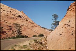
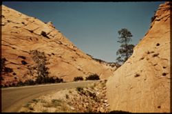
- Mt. Carmel Road - east of Zion tunnel.
- Call Number:
- P01974
- Country:
- United States
- State/Province:
- Utah
- Physical Description:
- Image was originally mounted in a glass enclosure. Before digitization, the image was removed and placed in a Wess Plastic, Inc. brand, 2" x 2", pl...
- Alternate Identifier:
- 1140.14
- Persistent URL:
- http://purl.dlib.indiana.edu/iudl/archives/cushman/P01974
- Holding Location:
- Bloomington - University Archives
Wells Library E460
1320 E 10th St.
Bloomington, IN 47405
Contact at archives@indiana.edu, 812-855-1127
-
- Subject:
- Rocks, Roads, Trees, Mountains, Shrubs, Zion National Park (Utah), and National parks & reserves
- Series:
- 11-40
- Creator:
- Cushman, Charles W., 1896-1972
- Date Created:
- 1940-07-11
- Genre:
- Landscape photographs
- Frame Number:
- 14
- Street Address:
- Mt. Carmel Road
- County:
- Washington
- Abstract:
- Mt. Carmel Road - east of Zion tunnel.
- Call Number:
- P01973
- Country:
- United States
- State/Province:
- Utah
- Physical Description:
- Image was originally mounted in a glass enclosure. Before digitization, the image was removed and placed in a Wess Plastic, Inc. brand, 2" x 2", pl...
- Alternate Identifier:
- 1140.14
- Persistent URL:
- http://purl.dlib.indiana.edu/iudl/archives/cushman/P01973
- Holding Location:
- Bloomington - University Archives
Wells Library E460
1320 E 10th St.
Bloomington, IN 47405
Contact at archives@indiana.edu, 812-855-1127
-
- Subject:
- Cliffs, Trees, Mountains, Shrubs, Zion National Park (Utah), Clouds, East Temple (Utah), National parks & reserves, and Tunnels
- Series:
- 11-40
- Creator:
- Cushman, Charles W., 1896-1972
- Date Created:
- 1940-07-11/1940-07-12
- Genre:
- Landscape photographs
- Frame Number:
- 13
- Street Address:
- Mt. Carmel Road
- County:
- Washington
- Abstract:
- East Temple from tunnel window
- Call Number:
- P01972
- Country:
- United States
- State/Province:
- Utah
- Physical Description:
- Image was originally mounted in a glass enclosure. Before digitization, the image was removed and placed in a Wess Plastic, Inc. brand, 2" x 2", pl...
- Alternate Identifier:
- 1140.13
- Persistent URL:
- http://purl.dlib.indiana.edu/iudl/archives/cushman/P01972
- Holding Location:
- Bloomington - University Archives
Wells Library E460
1320 E 10th St.
Bloomington, IN 47405
Contact at archives@indiana.edu, 812-855-1127
-
- Subject:
- Cliffs, Trees, Mountains, National parks & reserves, Zion National Park (Utah), Clouds, East Temple (Utah), and Shrubs
- Series:
- 11-40
- Creator:
- Cushman, Charles W., 1896-1972
- Date Created:
- 1940-07-11
- Genre:
- Landscape photographs
- Frame Number:
- 11
- County:
- Washington
- Abstract:
- Zion's East Temple from tunnel window.
- Call Number:
- P01971
- Country:
- United States
- State/Province:
- Utah
- Physical Description:
- Image was originally mounted in a glass enclosure. Before digitization, the image was removed and placed in a Wess Plastic, Inc. brand, 2" x 2", pl...
- Alternate Identifier:
- 1140.11
- Persistent URL:
- http://purl.dlib.indiana.edu/iudl/archives/cushman/P01971
- Holding Location:
- Bloomington - University Archives
Wells Library E460
1320 E 10th St.
Bloomington, IN 47405
Contact at archives@indiana.edu, 812-855-1127
-
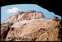
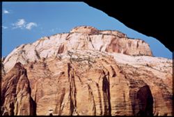
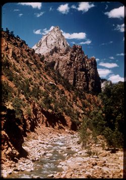
- Subject:
- Cliffs, Great White Throne (Utah), Trees, Shadows, Mountains, National parks & reserves, Zion National Park (Utah), and Clouds
- Series:
- 11-40
- Creator:
- Cushman, Charles W., 1896-1972
- Date Created:
- 1940-07-11
- Genre:
- Landscape photographs
- Frame Number:
- 10
- County:
- Washington
- Abstract:
- The Great White Throne.
- Call Number:
- P01970
- Country:
- United States
- State/Province:
- Utah
- Physical Description:
- Image was originally mounted in a glass enclosure. Before digitization, the image was removed and placed in a Wess Plastic, Inc. brand, 2" x 2", pl...
- Alternate Identifier:
- 1140.10
- Persistent URL:
- http://purl.dlib.indiana.edu/iudl/archives/cushman/P01970
- Holding Location:
- Bloomington - University Archives
Wells Library E460
1320 E 10th St.
Bloomington, IN 47405
Contact at archives@indiana.edu, 812-855-1127
-
- Subject:
- Cliffs, Trees, Mountains, Shrubs, Zion National Park (Utah), Temple of Sinawava (Utah), and National parks & reserves
- Series:
- 11-40
- Creator:
- Cushman, Charles W., 1896-1972
- Date Created:
- 1940-07-11
- Genre:
- Landscape photographs
- Frame Number:
- 9
- County:
- Washington
- Abstract:
- Temple of Sinawara - the Attar.
- Call Number:
- P01969
- Country:
- United States
- State/Province:
- Utah
- Alternate Identifier:
- 1140.9
- Persistent URL:
- http://purl.dlib.indiana.edu/iudl/archives/cushman/P01969
- Holding Location:
- Bloomington - University Archives
Wells Library E460
1320 E 10th St.
Bloomington, IN 47405
Contact at archives@indiana.edu, 812-855-1127
-
- Subject:
- National parks & reserves, Zion National Park (Utah), Temple of Sinawava (Utah), Cliffs, Mountains, Shrubs, Trees, and Clouds
- Series:
- 11-40
- Creator:
- Cushman, Charles W., 1896-1972
- Date Created:
- 1940-07-11/1940-07-12
- Genre:
- Landscape photographs
- Frame Number:
- 8
- County:
- Washington
- Abstract:
- Temple of Sinawara.
- Call Number:
- P01968
- Country:
- United States
- State/Province:
- Utah
- Physical Description:
- Image was originally mounted in a glass enclosure. Before digitization, the image was removed and placed in a Wess Plastic, Inc. brand, 2" x 2", pl...
- Alternate Identifier:
- 1140.8
- Persistent URL:
- http://purl.dlib.indiana.edu/iudl/archives/cushman/P01968
- Holding Location:
- Bloomington - University Archives
Wells Library E460
1320 E 10th St.
Bloomington, IN 47405
Contact at archives@indiana.edu, 812-855-1127
-
- Subject:
- National parks & reserves, Canyons, Zion National Park (Utah), Cliffs, Mountains, Shrubs, and Trees
- Series:
- 11-40
- Creator:
- Cushman, Charles W., 1896-1972
- Date Created:
- 1940-07-11/1940-07-12
- Genre:
- Landscape photographs
- Frame Number:
- 7
- County:
- Washington
- Abstract:
- Part of canyon wall. Northend.
- Call Number:
- P01967
- Country:
- United States
- State/Province:
- Utah
- Physical Description:
- Image was originally mounted in a glass enclosure. Before digitization, the image was removed and placed in a Wess Plastic, Inc. brand, 2" x 2", pl...
- Alternate Identifier:
- 1140.7
- Persistent URL:
- http://purl.dlib.indiana.edu/iudl/archives/cushman/P01967
- Holding Location:
- Bloomington - University Archives
Wells Library E460
1320 E 10th St.
Bloomington, IN 47405
Contact at archives@indiana.edu, 812-855-1127
-
- Subject:
- Canyons, Cliffs, Trees, Mountains, National parks & reserves, Zion National Park (Utah), Clouds, Temple of Sinawava (Utah), and Shrubs
- Series:
- 11-40
- Creator:
- Cushman, Charles W., 1896-1972
- Date Created:
- 1940-07-11
- Genre:
- Landscape photographs
- Frame Number:
- 6
- County:
- Washington
- Abstract:
- Looking down canyon from Temple of Siniwara.
- Call Number:
- P01966
- Country:
- United States
- State/Province:
- Utah
- Physical Description:
- Image was originally mounted in a glass enclosure. Before digitization, the image was removed and placed in a Wess Plastic, Inc. brand, 2" x 2", pl...
- Alternate Identifier:
- 1140.6
- Persistent URL:
- http://purl.dlib.indiana.edu/iudl/archives/cushman/P01966
- Holding Location:
- Bloomington - University Archives
Wells Library E460
1320 E 10th St.
Bloomington, IN 47405
Contact at archives@indiana.edu, 812-855-1127
-
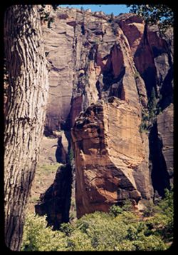
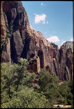
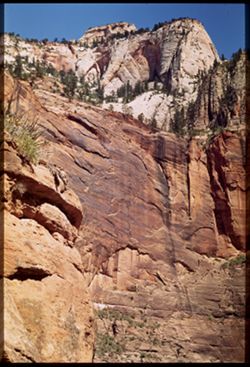
- Subject:
- Rocks, Cliffs, Trees, Virgin River, Mountains, Shrubs, Zion National Park (Utah), Clouds, Zion Canyon (Utah), Rivers, and National parks & reserves
- Series:
- 11-40
- Creator:
- Cushman, Charles W., 1896-1972
- Date Created:
- 1940-07-11/1940-07-12
- Genre:
- Landscape photographs
- Frame Number:
- 5
- County:
- Washington
- Abstract:
- Looking up the Virgin river
- Call Number:
- P01965
- Country:
- United States
- State/Province:
- Utah
- Physical Description:
- Image was originally mounted in a glass enclosure. Before digitization, the image was removed and placed in a Wess Plastic, Inc. brand, 2" x 2", pl...
- Alternate Identifier:
- 1140.5
- Persistent URL:
- http://purl.dlib.indiana.edu/iudl/archives/cushman/P01965
- Holding Location:
- Bloomington - University Archives
Wells Library E460
1320 E 10th St.
Bloomington, IN 47405
Contact at archives@indiana.edu, 812-855-1127
-
- Subject:
- Cliffs, Trees, Boulders, Mountains, Shrubs, Zion National Park (Utah), Zion Canyon (Utah), and National parks & reserves
- Series:
- 11-40
- Creator:
- Cushman, Charles W., 1896-1972
- Date Created:
- 1940-07-11
- Genre:
- Landscape photographs
- Frame Number:
- 4
- County:
- Washington
- Abstract:
- Looking up at east rim of Zion canyon.
- Call Number:
- P01964
- Country:
- United States
- State/Province:
- Utah
- Physical Description:
- Image was originally mounted in a glass enclosure. Before digitization, the image was removed and placed in a Wess Plastic, Inc. brand, 2" x 2", pl...
- Alternate Identifier:
- 1140.4
- Persistent URL:
- http://purl.dlib.indiana.edu/iudl/archives/cushman/P01964
- Holding Location:
- Bloomington - University Archives
Wells Library E460
1320 E 10th St.
Bloomington, IN 47405
Contact at archives@indiana.edu, 812-855-1127
-
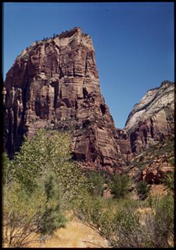
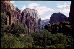
- Subject:
- Angels Landing (Utah), Cliffs, Trees, Virgin River, Mountains, Shrubs, Zion National Park (Utah), and National parks & reserves
- Series:
- 11-40
- Creator:
- Cushman, Charles W., 1896-1972
- Date Created:
- 1940-07-11
- Genre:
- Landscape photographs
- Frame Number:
- 3
- County:
- Washington
- Abstract:
- Angel's Landing. View is north from river bank.
- Call Number:
- P01963
- Country:
- United States
- State/Province:
- Utah
- Physical Description:
- Image was originally mounted in a glass enclosure. Before digitization, the image was removed and placed in a Wess Plastic, Inc. brand, 2" x 2", pl...
- Alternate Identifier:
- 1140.3
- Persistent URL:
- http://purl.dlib.indiana.edu/iudl/archives/cushman/P01963
- Holding Location:
- Bloomington - University Archives
Wells Library E460
1320 E 10th St.
Bloomington, IN 47405
Contact at archives@indiana.edu, 812-855-1127
-
- Subject:
- Weeping Rock (Utah), Mountains, Trees, Temple of Sinawava (Utah), Zion Canyon (Utah), Zion National Park (Utah), Cliffs, Roads, National parks & reserves...
- Series:
- 11-40
- Creator:
- Cushman, Charles W., 1896-1972
- Date Created:
- 1940-07-11/1940-07-12
- Genre:
- Landscape photographs
- Frame Number:
- 2
- County:
- Washington
- Abstract:
- Bed of mountain stream below Weeping Rock.
- Call Number:
- P01962
- Country:
- United States
- State/Province:
- Utah
- Physical Description:
- Image was originally mounted in a glass enclosure. Before digitization, the image was removed and placed in a Wess Plastic, Inc. brand, 2" x 2", pl...
- Alternate Identifier:
- 1140.2
- Persistent URL:
- http://purl.dlib.indiana.edu/iudl/archives/cushman/P01962
- Holding Location:
- Bloomington - University Archives
Wells Library E460
1320 E 10th St.
Bloomington, IN 47405
Contact at archives@indiana.edu, 812-855-1127
-
- Subject:
- Cliffs, Weeping Rock (Utah), Trees, Mountains, Shrubs, Zion National Park (Utah), Temple of Sinawava (Utah), Zion Canyon (Utah), and National parks & res...
- Series:
- 11-40
- Creator:
- Cushman, Charles W., 1896-1972
- Date Created:
- 1940-07-11
- Genre:
- Landscape photographs
- Frame Number:
- 0
- County:
- Washington
- Abstract:
- At Zion canyon. From trail to Weeping Rock.
- Call Number:
- P01961
- Country:
- United States
- State/Province:
- Utah
- Physical Description:
- masked. Image was originally mounted in a glass enclosure. Before digitization, the image was removed and placed in a Wess Plastic, Inc. brand, 2" x 2&q...
- Alternate Identifier:
- 1140.0
- Persistent URL:
- http://purl.dlib.indiana.edu/iudl/archives/cushman/P01961
- Holding Location:
- Bloomington - University Archives
Wells Library E460
1320 E 10th St.
Bloomington, IN 47405
Contact at archives@indiana.edu, 812-855-1127
-
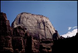
- Subject:
- Rocks, Cliffs, Trees, Mountains, National parks & reserves, Zion National Park (Utah), and Shrubs
- Series:
- 11-40
- Creator:
- Cushman, Charles W., 1896-1972
- Date Created:
- 1940-07-11
- Genre:
- Landscape photographs
- Frame Number:
- 1
- County:
- Washington
- Abstract:
- Zion's West Temple in the Morning Sun
- Call Number:
- P01960
- Country:
- United States
- State/Province:
- Utah
- Physical Description:
- masked. Image was originally mounted in a glass enclosure. Before digitization, the image was removed and placed in a Wess Plastic, Inc. brand, 2" x 2&q...
- Alternate Identifier:
- 1140.00
- Persistent URL:
- http://purl.dlib.indiana.edu/iudl/archives/cushman/P01960
- Holding Location:
- Bloomington - University Archives
Wells Library E460
1320 E 10th St.
Bloomington, IN 47405
Contact at archives@indiana.edu, 812-855-1127
-
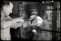
- Subject:
- Men, Gloves, and Kilns
- Series:
- 24-40
- Creator:
- Cushman, Charles W., 1896-1972
- Date Created:
- 1940-07-08
- Frame Number:
- 8
- County:
- Storey
- Abstract:
- 40-K-8=Scenes in Virginia City, Nev.
- Call Number:
- P01959
- City:
- Virginia City
- Country:
- United States
- State/Province:
- Nevada
- Physical Description:
- black & white .
- Alternate Identifier:
- 2440.8
- Persistent URL:
- http://purl.dlib.indiana.edu/iudl/archives/cushman/P01959
- Holding Location:
- Bloomington - University Archives
Wells Library E460
1320 E 10th St.
Bloomington, IN 47405
Contact at archives@indiana.edu, 812-855-1127
-
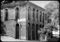
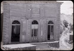
- Subject:
- Trees, Shadows, Signs (Notices), Piper's Opera House (Virginia City, Nev.), Arcades (Architectural components), and Opera houses
- Series:
- 24-40
- Creator:
- Cushman, Charles W., 1896-1972
- Date Created:
- 1940-07-08
- Genre:
- Architectural photographs
- Frame Number:
- 9
- County:
- Storey
- Abstract:
- 40-K-9=Scenes in Virginia City, Nev.
- Call Number:
- P01958
- City:
- Virginia City
- Country:
- United States
- State/Province:
- Nevada
- Physical Description:
- black & white .
- Alternate Identifier:
- 2440.9
- Persistent URL:
- http://purl.dlib.indiana.edu/iudl/archives/cushman/P01958
- Holding Location:
- Bloomington - University Archives
Wells Library E460
1320 E 10th St.
Bloomington, IN 47405
Contact at archives@indiana.edu, 812-855-1127
-

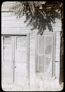
- Subject:
- Signs (Notices), Tree limbs, Windows, Opera houses, Doors & doorways, Piper's Opera House (Virginia City, Nev.), and Arcades (Architectural components)
- Series:
- 24-40
- Creator:
- Cushman, Charles W., 1896-1972
- Date Created:
- 1940-07-08
- Genre:
- Architectural photographs
- Frame Number:
- 10
- County:
- Storey
- Abstract:
- 40-K-10=Scenes in Virginia City, Nev.
- Call Number:
- P01957
- City:
- Virginia City
- Country:
- United States
- State/Province:
- Nevada
- Physical Description:
- black & white .
- Alternate Identifier:
- 2440.10
- Persistent URL:
- http://purl.dlib.indiana.edu/iudl/archives/cushman/P01957
- Holding Location:
- Bloomington - University Archives
Wells Library E460
1320 E 10th St.
Bloomington, IN 47405
Contact at archives@indiana.edu, 812-855-1127
-
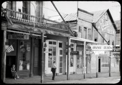
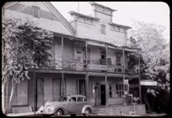
- Subject:
- Old Virginia Kitchen (Virginia City, Nev.), Balconies, Flags, Signs (Notices), Streets, Buildings, Windows, People, Reflections, Doors & doorways, Stores...
- Series:
- 24-40
- Creator:
- Cushman, Charles W., 1896-1972
- Date Created:
- 1940-07-08
- Genre:
- Cityscape photographs
- Frame Number:
- 11
- Street Address:
- Main Street
- County:
- Storey
- Abstract:
- 40-K-11=Scenes in Virginia City, Nev.
- Call Number:
- P01956
- City:
- Virginia City
- Country:
- United States
- State/Province:
- Nevada
- Physical Description:
- black & white .
- Alternate Identifier:
- 2440.11
- Persistent URL:
- http://purl.dlib.indiana.edu/iudl/archives/cushman/P01956
- Holding Location:
- Bloomington - University Archives
Wells Library E460
1320 E 10th St.
Bloomington, IN 47405
Contact at archives@indiana.edu, 812-855-1127
-
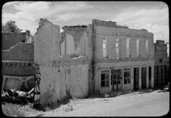
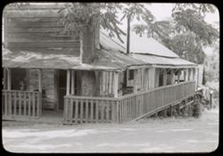
- Subject:
- Weeds, Streets, Abandoned buildings, Clouds, Building deterioration, and Maynard House (Gold Hill, Nev.)
- Series:
- 24-40
- Creator:
- Cushman, Charles W., 1896-1972
- Date Created:
- 1940-07-08
- Genre:
- Cityscape photographs
- Frame Number:
- 28
- County:
- Storey
- Abstract:
- 40-K- 28=old bldgs. In Gold Hill, Nev.
- Call Number:
- P01955
- City:
- Gold Hill
- Country:
- United States
- State/Province:
- Nevada
- Physical Description:
- black & white .
- Alternate Identifier:
- 2440.28
- Persistent URL:
- http://purl.dlib.indiana.edu/iudl/archives/cushman/P01955
- Holding Location:
- Bloomington - University Archives
Wells Library E460
1320 E 10th St.
Bloomington, IN 47405
Contact at archives@indiana.edu, 812-855-1127
-
- Subject:
- Trees, Abandoned buildings, Shrubs, Railroad tracks, Hills, and Building deterioration
- Series:
- 24-40
- Creator:
- Cushman, Charles W., 1896-1972
- Date Created:
- 1940-07-08
- Frame Number:
- 29
- County:
- Storey
- Abstract:
- 40-K-29=old bldgs. In Gold Hill, Nev.
- Call Number:
- P01954
- City:
- Gold Hill
- Country:
- United States
- State/Province:
- Nevada
- Physical Description:
- black & white .
- Alternate Identifier:
- 2440.29
- Persistent URL:
- http://purl.dlib.indiana.edu/iudl/archives/cushman/P01954
- Holding Location:
- Bloomington - University Archives
Wells Library E460
1320 E 10th St.
Bloomington, IN 47405
Contact at archives@indiana.edu, 812-855-1127
-
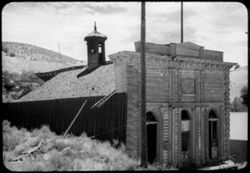
- Subject:
- Abandoned buildings, Hills, Weeds, Ladders, Shrubs, Building deterioration, Trees, Towers, and Clouds
- Series:
- 24-40
- Creator:
- Cushman, Charles W., 1896-1972
- Date Created:
- 1940-07-08
- Genre:
- Architectural photographs
- Frame Number:
- 30
- County:
- Storey
- Abstract:
- 40-K-30=old bldgs. In Gold Hill, Nev.
- Call Number:
- P01953
- City:
- Gold Hill
- Country:
- United States
- State/Province:
- Nevada
- Physical Description:
- black & white .
- Alternate Identifier:
- 2440.30
- Persistent URL:
- http://purl.dlib.indiana.edu/iudl/archives/cushman/P01953
- Holding Location:
- Bloomington - University Archives
Wells Library E460
1320 E 10th St.
Bloomington, IN 47405
Contact at archives@indiana.edu, 812-855-1127
-

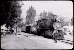
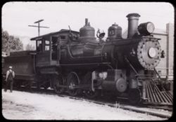
- Subject:
- Railroad locomotives, Buildings, and Virginia and Truckee Railroad
- Series:
- 23-40
- Creator:
- Cushman, Charles W., 1896-1972
- Date Created:
- 1940-07-07
- Frame Number:
- 1
- County:
- Carson City
- Abstract:
- 40-J-1=at Carson City, Nev.-Virginia & Truckee RR
- Call Number:
- P01952
- City:
- Carson City
- Country:
- United States
- State/Province:
- Nevada
- Physical Description:
- black & white .
- Alternate Identifier:
- 40-J-1
- Persistent URL:
- http://purl.dlib.indiana.edu/iudl/archives/cushman/P01952
- Holding Location:
- Bloomington - University Archives
Wells Library E460
1320 E 10th St.
Bloomington, IN 47405
Contact at archives@indiana.edu, 812-855-1127
-
- Subject:
- Automobiles, Trees, Walkways, Mountains, Facilities, Virginia and Truckee Railroad, Utility poles, Railroad employees, and Railroads
- Series:
- 23-40
- Creator:
- Cushman, Charles W., 1896-1972
- Date Created:
- 1940-07-07
- Frame Number:
- 2
- County:
- Carson City
- Abstract:
- 40-J-2=at Carson City, Nev.-Virginia & Truckee RR
- Call Number:
- P01951
- City:
- Carson City
- Country:
- United States
- State/Province:
- Nevada
- Physical Description:
- black & white .
- Alternate Identifier:
- 2340.2
- Persistent URL:
- http://purl.dlib.indiana.edu/iudl/archives/cushman/P01951
- Holding Location:
- Bloomington - University Archives
Wells Library E460
1320 E 10th St.
Bloomington, IN 47405
Contact at archives@indiana.edu, 812-855-1127
-
- Subject:
- Railroad locomotives, Trees, Mountains, Bells, Facilities, Virginia and Truckee Railroad, Utility poles, and Railroad employees
- Series:
- 23-40
- Creator:
- Cushman, Charles W., 1896-1972
- Date Created:
- 1940-07-07
- Frame Number:
- 3
- County:
- Carson City
- Abstract:
- 40-J-3=at Carson City, Nev.-Virginia & Truckee RR
- Call Number:
- P01950
- City:
- Carson City
- Country:
- United States
- State/Province:
- Nevada
- Physical Description:
- black & white .
- Alternate Identifier:
- 2340.3
- Persistent URL:
- http://purl.dlib.indiana.edu/iudl/archives/cushman/P01950
- Holding Location:
- Bloomington - University Archives
Wells Library E460
1320 E 10th St.
Bloomington, IN 47405
Contact at archives@indiana.edu, 812-855-1127
-
- Subject:
- Weeds, Signs (Notices), Tree limbs, Windows, Dwellings, and Doors & doorways
- Series:
- 23-40
- Creator:
- Cushman, Charles W., 1896-1972
- Date Created:
- 1940-07-06
- Frame Number:
- 16
- County:
- Tuolumne
- Abstract:
- 40-J-16=in Columbia, Calif. And adjacent district , Mother Lode country.
- Call Number:
- P01949
- City:
- Columbia
- Country:
- United States
- State/Province:
- California
- Physical Description:
- black & white .
- Alternate Identifier:
- 2340.16
- Persistent URL:
- http://purl.dlib.indiana.edu/iudl/archives/cushman/P01949
- Holding Location:
- Bloomington - University Archives
Wells Library E460
1320 E 10th St.
Bloomington, IN 47405
Contact at archives@indiana.edu, 812-855-1127
-

- Subject:
- Wildflowers, Trees, Abandoned buildings, Shrubs, Building deterioration, and Weeds
- Series:
- 23-40
- Creator:
- Cushman, Charles W., 1896-1972
- Date Created:
- 1940-07-06
- Frame Number:
- 17
- County:
- Tuolumne
- Abstract:
- 40-J-17=in Columbia, Calif. And adjacent district , Mother Lode country.
- Call Number:
- P01948
- City:
- Columbia
- Country:
- United States
- State/Province:
- California
- Physical Description:
- black & white .
- Alternate Identifier:
- 2340.17
- Persistent URL:
- http://purl.dlib.indiana.edu/iudl/archives/cushman/P01948
- Holding Location:
- Bloomington - University Archives
Wells Library E460
1320 E 10th St.
Bloomington, IN 47405
Contact at archives@indiana.edu, 812-855-1127
-
- Subject:
- Automobiles, Roads, Benches, Trees, Buildings, Signs (Notices), Porches, Doors & doorways, and Windows
- Series:
- 23-40
- Creator:
- Cushman, Charles W., 1896-1972
- Date Created:
- 1940-07-06
- Frame Number:
- 18
- County:
- Tuolumne
- Abstract:
- 40-J-18=in Columbia, Calif. And adjacent district , Mother Lode country.
- Call Number:
- P01947
- City:
- Columbia
- Country:
- United States
- State/Province:
- California
- Physical Description:
- black & white .
- Alternate Identifier:
- 2340.18
- Persistent URL:
- http://purl.dlib.indiana.edu/iudl/archives/cushman/P01947
- Holding Location:
- Bloomington - University Archives
Wells Library E460
1320 E 10th St.
Bloomington, IN 47405
Contact at archives@indiana.edu, 812-855-1127
-
- Subject:
- Houses, Trees, Flowers, Flowerpots, Windows, Porches, Doors & doorways, and Roads
- Series:
- 23-40
- Creator:
- Cushman, Charles W., 1896-1972
- Date Created:
- 1940-07-06
- Genre:
- Architectural photographs
- Frame Number:
- 19
- County:
- Tuolumne
- Abstract:
- 40-J-19=in Columbia, Calif. And adjacent district , Mother Lode country.
- Call Number:
- P01946
- City:
- Columbia
- Country:
- United States
- State/Province:
- California
- Physical Description:
- black & white .
- Alternate Identifier:
- 2340.19
- Persistent URL:
- http://purl.dlib.indiana.edu/iudl/archives/cushman/P01946
- Holding Location:
- Bloomington - University Archives
Wells Library E460
1320 E 10th St.
Bloomington, IN 47405
Contact at archives@indiana.edu, 812-855-1127
-
- Subject:
- Balconies, Light fixtures, Trees, Signs (Notices), Streets, Shutters, Sidewalks, Windows, Dwellings, People, Vines, and Doors & doorways
- Series:
- 23-40
- Creator:
- Cushman, Charles W., 1896-1972
- Date Created:
- 1940-07-06
- Genre:
- Architectural photographs
- Frame Number:
- 20
- County:
- Tuolumne
- Abstract:
- 40-J-20=in Columbia, Calif. And adjacent district , Mother Lode country.
- Call Number:
- P01945
- City:
- Columbia
- Country:
- United States
- State/Province:
- California
- Physical Description:
- black & white .
- Alternate Identifier:
- 2340.20
- Persistent URL:
- http://purl.dlib.indiana.edu/iudl/archives/cushman/P01945
- Holding Location:
- Bloomington - University Archives
Wells Library E460
1320 E 10th St.
Bloomington, IN 47405
Contact at archives@indiana.edu, 812-855-1127
-
- Subject:
- Houses, Trees, Facilities, Doors & doorways, and Fences
- Series:
- 23-40
- Creator:
- Cushman, Charles W., 1896-1972
- Date Created:
- 1940-07-06
- Frame Number:
- 22
- County:
- Tuolumne
- Abstract:
- 40-J-22=in Columbia, Calif. And adjacent district , Mother Lode country.
- Call Number:
- P01944
- City:
- Columbia
- Country:
- United States
- State/Province:
- California
- Physical Description:
- black & white .
- Alternate Identifier:
- 2340.22
- Persistent URL:
- http://purl.dlib.indiana.edu/iudl/archives/cushman/P01944
- Holding Location:
- Bloomington - University Archives
Wells Library E460
1320 E 10th St.
Bloomington, IN 47405
Contact at archives@indiana.edu, 812-855-1127
-
- Subject:
- Benches, Windows, Reflections, and Jukeboxes
- Series:
- 23-40
- Creator:
- Cushman, Charles W., 1896-1972
- Date Created:
- 1940-07-06
- Frame Number:
- 23
- County:
- Tuolumne
- Abstract:
- 40-J-23=in Columbia, Calif. And adjacent district , Mother Lode country.
- Call Number:
- P01943
- City:
- Columbia
- Country:
- United States
- State/Province:
- California
- Physical Description:
- black & white .
- Alternate Identifier:
- 2340.23
- Persistent URL:
- http://purl.dlib.indiana.edu/iudl/archives/cushman/P01943
- Holding Location:
- Bloomington - University Archives
Wells Library E460
1320 E 10th St.
Bloomington, IN 47405
Contact at archives@indiana.edu, 812-855-1127
-
- Subject:
- Trees, Shadows, National parks & reserves, Zion National Park (Utah), and Rock formations
- Series:
- 10-40
- Creator:
- Cushman, Charles W., 1896-1972
- Date Created:
- 1940-07-10
- Genre:
- Landscape photographs
- Frame Number:
- 20
- County:
- Washington
- Abstract:
- Evening light on a great white pillar.
- Call Number:
- P01942
- Country:
- United States
- State/Province:
- Utah
- Alternate Identifier:
- 1040.20
- Persistent URL:
- http://purl.dlib.indiana.edu/iudl/archives/cushman/P01942
- Holding Location:
- Bloomington - University Archives
Wells Library E460
1320 E 10th St.
Bloomington, IN 47405
Contact at archives@indiana.edu, 812-855-1127
-
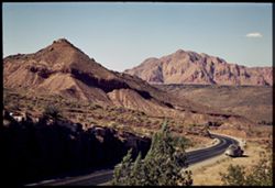
- Subject:
- Rocks, Roads, Mountains, Shrubs, Zion National Park (Utah), Clouds, Zion Canyon (Utah), and National parks & reserves
- Series:
- 10-40
- Creator:
- Cushman, Charles W., 1896-1972
- Date Created:
- 1940-07-10
- Genre:
- Landscape photographs
- Frame Number:
- 19
- County:
- Washington
- Abstract:
- Zion's West Temple, late afternoon.
- Call Number:
- P01941
- Country:
- United States
- State/Province:
- Utah
- Physical Description:
- Image was originally mounted in a glass enclosure. Before digitization, the image was removed and placed in a Wess Plastic, Inc. brand, 2" x 2", pl...
- Alternate Identifier:
- 1040.19
- Persistent URL:
- http://purl.dlib.indiana.edu/iudl/archives/cushman/P01941
- Holding Location:
- Bloomington - University Archives
Wells Library E460
1320 E 10th St.
Bloomington, IN 47405
Contact at archives@indiana.edu, 812-855-1127
-
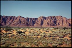
- Subject:
- Trees, Sagebrush, Mountains, Shrubs, Zion National Park (Utah), and National parks & reserves
- Series:
- 10-40
- Creator:
- Cushman, Charles W., 1896-1972
- Date Created:
- 1940-07-10
- Genre:
- Landscape photographs
- Frame Number:
- 18
- County:
- Washington
- Abstract:
- Sage + red earth, en route to Zion.
- Call Number:
- P01940
- Country:
- United States
- State/Province:
- Utah
- Physical Description:
- Image was originally mounted in a glass enclosure. Before digitization, the image was removed and placed in a Wess Plastic, Inc. brand, 2" x 2", pl...
- Alternate Identifier:
- 1040.18
- Persistent URL:
- http://purl.dlib.indiana.edu/iudl/archives/cushman/P01940
- Holding Location:
- Bloomington - University Archives
Wells Library E460
1320 E 10th St.
Bloomington, IN 47405
Contact at archives@indiana.edu, 812-855-1127
-
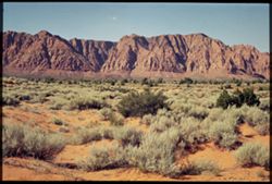
- Subject:
- Trees, Sagebrush, Mountains, National parks & reserves, Zion National Park (Utah), and Shrubs
- Series:
- 10-40
- Creator:
- Cushman, Charles W., 1896-1972
- Date Created:
- 1940-07-10
- Genre:
- Landscape photographs
- Frame Number:
- 17
- County:
- Washington
- Abstract:
- Sage + red earth, en route to Zion.
- Call Number:
- P01939
- Country:
- United States
- State/Province:
- Utah
- Physical Description:
- Image was originally mounted in a glass enclosure. Before digitization, the image was removed and placed in a Wess Plastic, Inc. brand, 2" x 2", pl...
- Alternate Identifier:
- 1040.17
- Persistent URL:
- http://purl.dlib.indiana.edu/iudl/archives/cushman/P01939
- Holding Location:
- Bloomington - University Archives
Wells Library E460
1320 E 10th St.
Bloomington, IN 47405
Contact at archives@indiana.edu, 812-855-1127
-
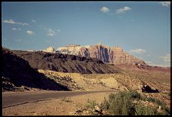
- Subject:
- Rocks, Roads, Automobiles, Trees, Mountains, Fences, National parks & reserves, Zion National Park (Utah), and Shrubs
- Series:
- 10-40
- Creator:
- Cushman, Charles W., 1896-1972
- Date Created:
- 1940-07-10
- Genre:
- Landscape photographs
- Frame Number:
- 16
- County:
- Washington
- Abstract:
- Near St. George, Utah, en route to Zion.
- Call Number:
- P01938
- City:
- Saint George
- Country:
- United States
- State/Province:
- Utah
- Physical Description:
- Image was originally mounted in a glass enclosure. Before digitization, the image was removed and placed in a Wess Plastic, Inc. brand, 2" x 2", pl...
- Alternate Identifier:
- 1040.16
- Persistent URL:
- http://purl.dlib.indiana.edu/iudl/archives/cushman/P01938
- Holding Location:
- Bloomington - University Archives
Wells Library E460
1320 E 10th St.
Bloomington, IN 47405
Contact at archives@indiana.edu, 812-855-1127
-
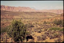
- Subject:
- Trees, Mountains, Fences, Shrubs, and Zion National Park (Utah)
- Series:
- 10-40
- Creator:
- Cushman, Charles W., 1896-1972
- Date Created:
- 1940-07-10
- Genre:
- Landscape photographs
- Frame Number:
- 15
- County:
- Washington
- Abstract:
- Mtns. Of S.W. Utah. On road to Zion.
- Call Number:
- P01937
- City:
- Saint George
- Country:
- United States
- State/Province:
- Utah
- Physical Description:
- Image was originally mounted in a glass enclosure. Before digitization, the image was removed and placed in a Wess Plastic, Inc. brand, 2" x 2", pl...
- Alternate Identifier:
- 1040.15
- Persistent URL:
- http://purl.dlib.indiana.edu/iudl/archives/cushman/P01937
- Holding Location:
- Bloomington - University Archives
Wells Library E460
1320 E 10th St.
Bloomington, IN 47405
Contact at archives@indiana.edu, 812-855-1127
-
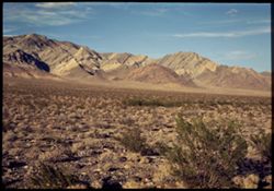
- Subject:
- Deserts, Yucca Mountain (Nev.), Mountains, Shrubs, and Clouds
- Series:
- 10-40
- Creator:
- Cushman, Charles W., 1896-1972
- Date Created:
- 1940-07-09
- Genre:
- Landscape photographs
- Frame Number:
- 14
- County:
- Nye
- Abstract:
- Yucca Mtns. further south.
- Call Number:
- P01936
- Country:
- United States
- State/Province:
- Nevada
- Physical Description:
- Image was originally mounted in a glass enclosure. Before digitization, the image was removed and placed in a Wess Plastic, Inc. brand, 2" x 2", pl...
- Alternate Identifier:
- 1040.14
- Persistent URL:
- http://purl.dlib.indiana.edu/iudl/archives/cushman/P01936
- Holding Location:
- Bloomington - University Archives
Wells Library E460
1320 E 10th St.
Bloomington, IN 47405
Contact at archives@indiana.edu, 812-855-1127
-
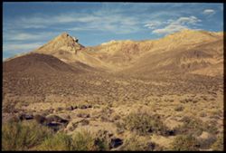
- Subject:
- Deserts, Yucca Mountain (Nev.), Mountains, Shrubs, and Clouds
- Series:
- 10-40
- Creator:
- Cushman, Charles W., 1896-1972
- Date Created:
- 1940-07-09
- Genre:
- Landscape photographs
- Frame Number:
- 13
- County:
- Nye
- Abstract:
- Yucca Mtns. south of Beatty
- Call Number:
- P01935
- City:
- Beatty
- Country:
- United States
- State/Province:
- Nevada
- Physical Description:
- Image was originally mounted in a glass enclosure. Before digitization, the image was removed and placed in a Wess Plastic, Inc. brand, 2" x 2", pl...
- Alternate Identifier:
- 1040.13
- Persistent URL:
- http://purl.dlib.indiana.edu/iudl/archives/cushman/P01935
- Holding Location:
- Bloomington - University Archives
Wells Library E460
1320 E 10th St.
Bloomington, IN 47405
Contact at archives@indiana.edu, 812-855-1127
-
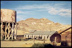
- Subject:
- Yucca Mountain (Nev.), Dirt roads, Mountains, Shrubs, Clouds, and Water tanks
- Series:
- 10-40
- Creator:
- Cushman, Charles W., 1896-1972
- Date Created:
- 1940-07-09
- Genre:
- Landscape photographs
- Frame Number:
- 12
- County:
- Nye
- Abstract:
- Yucca Mtns., from Beatty, Nev.
- Call Number:
- P01934
- City:
- Beatty
- Country:
- United States
- State/Province:
- Nevada
- Physical Description:
- Image was originally mounted in a glass enclosure. Before digitization, the image was removed and placed in a Wess Plastic, Inc. brand, 2" x 2", pl...
- Alternate Identifier:
- 1040.12
- Persistent URL:
- http://purl.dlib.indiana.edu/iudl/archives/cushman/P01934
- Holding Location:
- Bloomington - University Archives
Wells Library E460
1320 E 10th St.
Bloomington, IN 47405
Contact at archives@indiana.edu, 812-855-1127
-
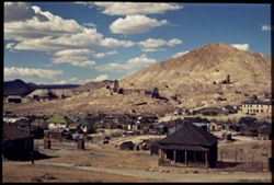
- Subject:
- Roads, Mine buildings, Mountains, Fences, Clouds, and Dwellings
- Series:
- 10-40
- Creator:
- Cushman, Charles W., 1896-1972
- Date Created:
- 1940-07-09
- Genre:
- Cityscape photographs
- Frame Number:
- 11
- County:
- Nye
- Abstract:
- Tonopah, Nev.
- Call Number:
- P01933
- City:
- Tonopah
- Country:
- United States
- State/Province:
- Nevada
- Physical Description:
- Image was originally mounted in a glass enclosure. Before digitization, the image was removed and placed in a Wess Plastic, Inc. brand, 2" x 2", pl...
- Alternate Identifier:
- 1040.11
- Persistent URL:
- http://purl.dlib.indiana.edu/iudl/archives/cushman/P01933
- Holding Location:
- Bloomington - University Archives
Wells Library E460
1320 E 10th St.
Bloomington, IN 47405
Contact at archives@indiana.edu, 812-855-1127
-
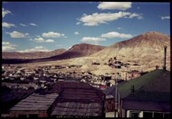
- Subject:
- Roads, Shadows, Mountains, Clouds, and Dwellings
- Series:
- 10-40
- Creator:
- Cushman, Charles W., 1896-1972
- Date Created:
- 1940-07-09
- Genre:
- Cityscape photographs
- Frame Number:
- 10
- County:
- Nye
- Abstract:
- Tonopah, Nev.
- Call Number:
- P01932
- City:
- Tonopah
- Country:
- United States
- State/Province:
- Nevada
- Alternate Identifier:
- 1040.10
- Persistent URL:
- http://purl.dlib.indiana.edu/iudl/archives/cushman/P01932
- Holding Location:
- Bloomington - University Archives
Wells Library E460
1320 E 10th St.
Bloomington, IN 47405
Contact at archives@indiana.edu, 812-855-1127
-
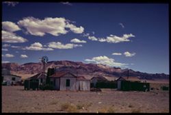
- Subject:
- Trailers, Trees, Silver Peak Mountains (Nev.), Mountains, Clouds, and Dwellings
- Series:
- 10-40
- Creator:
- Cushman, Charles W., 1896-1972
- Date Created:
- 1940-07-09
- Genre:
- Landscape photographs
- Frame Number:
- 9
- County:
- Mineral
- Abstract:
- Coaldale, Nev.= Silver Peak Mtns. beyond..
- Call Number:
- P01931
- City:
- Coaldale
- Country:
- United States
- State/Province:
- Nevada
- Physical Description:
- Image was originally mounted in a glass enclosure. Before digitization, the image was removed and placed in a Wess Plastic, Inc. brand, 2" x 2", pl...
- Alternate Identifier:
- 1040.9
- Persistent URL:
- http://purl.dlib.indiana.edu/iudl/archives/cushman/P01931
- Holding Location:
- Bloomington - University Archives
Wells Library E460
1320 E 10th St.
Bloomington, IN 47405
Contact at archives@indiana.edu, 812-855-1127
-
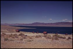
- Subject:
- Vessels, Roads, Walker Lake, Mountains, Shrubs, Lakes & ponds, Dwellings, and Coastlines
- Series:
- 10-40
- Creator:
- Cushman, Charles W., 1896-1972
- Date Created:
- 1940-07-09
- Genre:
- Landscape photographs
- Frame Number:
- 8
- County:
- Mineral
- Call Number:
- P01930
- Country:
- United States
- State/Province:
- Nevada
- Physical Description:
- Image was originally mounted in a glass enclosure. Before digitization, the image was removed and placed in a Wess Plastic, Inc. brand, 2" x 2", pl...
- Alternate Identifier:
- 1040.8
- Persistent URL:
- http://purl.dlib.indiana.edu/iudl/archives/cushman/P01930
- Holding Location:
- Bloomington - University Archives
Wells Library E460
1320 E 10th St.
Bloomington, IN 47405
Contact at archives@indiana.edu, 812-855-1127
-
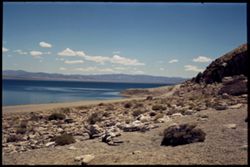
- Subject:
- Lakes & ponds, Mountains, Dirt roads, Shrubs, Rocks, Coastlines, Clouds, and Walker Lake
- Series:
- 10-40
- Creator:
- Cushman, Charles W., 1896-1972
- Date Created:
- 1940-07-09
- Genre:
- Landscape photographs
- Frame Number:
- 5
- County:
- Mineral
- Call Number:
- P01927
- Country:
- United States
- State/Province:
- Nevada
- Physical Description:
- Image was originally mounted in a glass enclosure. Before digitization, the image was removed and placed in a Wess Plastic, Inc. brand, 2" x 2", pl...
- Alternate Identifier:
- 1040.5
- Persistent URL:
- http://purl.dlib.indiana.edu/iudl/archives/cushman/P01927
- Holding Location:
- Bloomington - University Archives
Wells Library E460
1320 E 10th St.
Bloomington, IN 47405
Contact at archives@indiana.edu, 812-855-1127
-
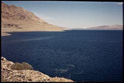
- Subject:
- Lakes & ponds, Mountains, Shrubs, Rocks, Coastlines, and Walker Lake
- Series:
- 10-40
- Creator:
- Cushman, Charles W., 1896-1972
- Date Created:
- 1940-07-09
- Genre:
- Landscape photographs
- Frame Number:
- 6
- County:
- Mineral
- Call Number:
- P01928
- Country:
- United States
- State/Province:
- Nevada
- Physical Description:
- Image was originally mounted in a glass enclosure. Before digitization, the image was removed and placed in a Wess Plastic, Inc. brand, 2" x 2", pl...
- Alternate Identifier:
- 1040.6
- Persistent URL:
- http://purl.dlib.indiana.edu/iudl/archives/cushman/P01928
- Holding Location:
- Bloomington - University Archives
Wells Library E460
1320 E 10th St.
Bloomington, IN 47405
Contact at archives@indiana.edu, 812-855-1127
-
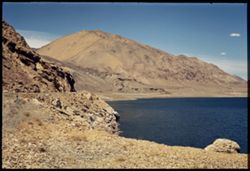
- Subject:
- Rocks, Coastlines, Mountains, Lakes & ponds, Clouds, and Walker Lake
- Series:
- 10-40
- Creator:
- Cushman, Charles W., 1896-1972
- Date Created:
- 1940-07-09
- Genre:
- Landscape photographs
- Frame Number:
- 7
- County:
- Mineral
- Call Number:
- P01929
- Country:
- United States
- State/Province:
- Nevada
- Physical Description:
- Image was originally mounted in a glass enclosure. Before digitization, the image was removed and placed in a Wess Plastic, Inc. brand, 2" x 2", pl...
- Alternate Identifier:
- 1040.7
- Persistent URL:
- http://purl.dlib.indiana.edu/iudl/archives/cushman/P01929
- Holding Location:
- Bloomington - University Archives
Wells Library E460
1320 E 10th St.
Bloomington, IN 47405
Contact at archives@indiana.edu, 812-855-1127
-
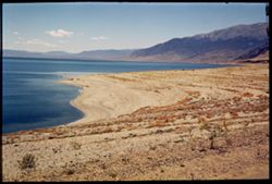
- Subject:
- Coastlines, Mountains, Shrubs, Lakes & ponds, Clouds, and Walker Lake
- Series:
- 10-40
- Creator:
- Cushman, Charles W., 1896-1972
- Date Created:
- 1940-07-09
- Genre:
- Landscape photographs
- Frame Number:
- 4
- County:
- Mineral
- Call Number:
- P01926
- Country:
- United States
- State/Province:
- Nevada
- Physical Description:
- Image was originally mounted in a glass enclosure. Before digitization, the image was removed and placed in a Wess Plastic, Inc. brand, 2" x 2", pl...
- Alternate Identifier:
- 1040.4
- Persistent URL:
- http://purl.dlib.indiana.edu/iudl/archives/cushman/P01926
- Holding Location:
- Bloomington - University Archives
Wells Library E460
1320 E 10th St.
Bloomington, IN 47405
Contact at archives@indiana.edu, 812-855-1127
-
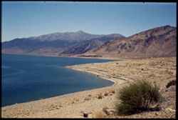
- Subject:
- Walker Lake, Mountains, Shrubs, Lakes & ponds, and Coastlines
- Series:
- 10-40
- Creator:
- Cushman, Charles W., 1896-1972
- Date Created:
- 1940-07-09
- Genre:
- Landscape photographs
- Frame Number:
- 3
- County:
- Mineral
- Call Number:
- P01925
- Country:
- United States
- State/Province:
- Nevada
- Physical Description:
- Image was originally mounted in a glass enclosure. Before digitization, the image was removed and placed in a Wess Plastic, Inc. brand, 2" x 2", pl...
- Alternate Identifier:
- 1040.3
- Persistent URL:
- http://purl.dlib.indiana.edu/iudl/archives/cushman/P01925
- Holding Location:
- Bloomington - University Archives
Wells Library E460
1320 E 10th St.
Bloomington, IN 47405
Contact at archives@indiana.edu, 812-855-1127
-
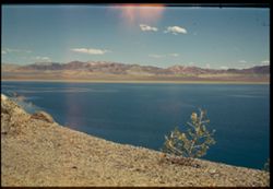
- Subject:
- Walker Lake, Mountains, Shrubs, Lakes & ponds, and Clouds
- Series:
- 10-40
- Creator:
- Cushman, Charles W., 1896-1972
- Date Created:
- 1940-07-09
- Genre:
- Landscape photographs
- Frame Number:
- 2
- County:
- Mineral
- Abstract:
- Walker Lake, Nevada, along road from Reno to Tonopah.
- Call Number:
- P01924
- Country:
- United States
- State/Province:
- Nevada
- Physical Description:
- Image was originally mounted in a glass enclosure. Before digitization, the image was removed and placed in a Wess Plastic, Inc. brand, 2" x 2", pl...
- Alternate Identifier:
- 1040.2
- Persistent URL:
- http://purl.dlib.indiana.edu/iudl/archives/cushman/P01924
- Holding Location:
- Bloomington - University Archives
Wells Library E460
1320 E 10th St.
Bloomington, IN 47405
Contact at archives@indiana.edu, 812-855-1127
-
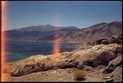
- Subject:
- Walker Lake, Mountains, and Lakes & ponds
- Series:
- 10-40
- Creator:
- Cushman, Charles W., 1896-1972
- Date Created:
- 1940-07-09
- Genre:
- Landscape photographs
- Frame Number:
- 1
- County:
- Mineral
- Abstract:
- Walker Lake, Nevada, along road from Reno to Tonopah.
- Call Number:
- P01923
- Country:
- United States
- State/Province:
- Nevada
- Physical Description:
- Image was originally mounted in a glass enclosure. Before digitization, the image was removed and placed in a Wess Plastic, Inc. brand, 2" x 2", pl...
- Alternate Identifier:
- 1040.1
- Persistent URL:
- http://purl.dlib.indiana.edu/iudl/archives/cushman/P01923
- Holding Location:
- Bloomington - University Archives
Wells Library E460
1320 E 10th St.
Bloomington, IN 47405
Contact at archives@indiana.edu, 812-855-1127
-
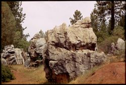
- Subject:
- Rocks, Trees, Boulders, and Shrubs
- Series:
- 9-40
- Creator:
- Cushman, Charles W., 1896-1972
- Date Created:
- 1940-07-06
- Genre:
- Landscape photographs
- Frame Number:
- 20
- County:
- Tuolumne
- Abstract:
- Rocks left by the 49-ers.
- Call Number:
- P01922
- City:
- Sonora and Columbia
- Country:
- United States
- State/Province:
- California
- Physical Description:
- Image was originally mounted in a glass enclosure. Before digitization, the image was removed and placed in a Wess Plastic, Inc. brand, 2" x 2", pl...
- Alternate Identifier:
- 940.20
- Persistent URL:
- http://purl.dlib.indiana.edu/iudl/archives/cushman/P01922
- Holding Location:
- Bloomington - University Archives
Wells Library E460
1320 E 10th St.
Bloomington, IN 47405
Contact at archives@indiana.edu, 812-855-1127
-
- Subject:
- Crosses, Churches, People, Shrubs, Trees, Towers, Fences, and Flowers
- Series:
- 9-40
- Creator:
- Cushman, Charles W., 1896-1972
- Date Created:
- 1940-07-06
- Genre:
- Architectural photographs
- Frame Number:
- 19
- County:
- Tuolumne
- Abstract:
- Old red church. Sonora
- Call Number:
- P01921
- City:
- Sonora
- Country:
- United States
- State/Province:
- California
- Alternate Identifier:
- 940.19
- Persistent URL:
- http://purl.dlib.indiana.edu/iudl/archives/cushman/P01921
- Holding Location:
- Bloomington - University Archives
Wells Library E460
1320 E 10th St.
Bloomington, IN 47405
Contact at archives@indiana.edu, 812-855-1127
-
- Subject:
- Men, Trees, Flowers, Shadows, Wooden fences, Crape myrtle, Common, and Fences
- Series:
- 9-40
- Creator:
- Cushman, Charles W., 1896-1972
- Date Created:
- 1940-07-06
- Genre:
- Identification photographs
- Frame Number:
- 18
- County:
- Tuolumne
- Abstract:
- Crepe myrtle. Sonora
- Call Number:
- P01920
- City:
- Sonora
- Country:
- United States
- State/Province:
- California
- Alternate Identifier:
- 940.18
- Persistent URL:
- http://purl.dlib.indiana.edu/iudl/archives/cushman/P01920
- Holding Location:
- Bloomington - University Archives
Wells Library E460
1320 E 10th St.
Bloomington, IN 47405
Contact at archives@indiana.edu, 812-855-1127
-
- Subject:
- Trees, Old Columbia Hotel (Columbia, Calif.), Shadows, Signs (Notices), Arches, Chairs, Hotels, Windows, and Doors & doorways
- Series:
- 9-40
- Creator:
- Cushman, Charles W., 1896-1972
- Date Created:
- 1940-07-05
- Genre:
- Architectural photographs
- Frame Number:
- 16
- County:
- Tuolumne
- Abstract:
- Old Columbia Hotel. Columbia.
- Call Number:
- P01918
- City:
- Columbia
- Country:
- United States
- State/Province:
- California
- Physical Description:
- Image was originally mounted in a glass enclosure. Before digitization, the image was removed and placed in a Wess Plastic, Inc. brand, 2" x 2", pl...
- Alternate Identifier:
- 940.16
- Persistent URL:
- http://purl.dlib.indiana.edu/iudl/archives/cushman/P01918
- Holding Location:
- Bloomington - University Archives
Wells Library E460
1320 E 10th St.
Bloomington, IN 47405
Contact at archives@indiana.edu, 812-855-1127
-
- Subject:
- Hills, Trees, Clouds, and Sunrises & sunsets
- Series:
- 9-40
- Creator:
- Cushman, Charles W., 1896-1972
- Date Created:
- 1940-07-05
- Genre:
- Landscape photographs
- Frame Number:
- 17
- County:
- Tuolumne
- Abstract:
- Sunset over Sonora.
- Call Number:
- P01919
- City:
- Sonora
- Country:
- United States
- State/Province:
- California
- Physical Description:
- Image was originally mounted in a glass enclosure. Before digitization, the image was removed and placed in a Wess Plastic, Inc. brand, 2" x 2", pl...
- Alternate Identifier:
- 940.17
- Persistent URL:
- http://purl.dlib.indiana.edu/iudl/archives/cushman/P01919
- Holding Location:
- Bloomington - University Archives
Wells Library E460
1320 E 10th St.
Bloomington, IN 47405
Contact at archives@indiana.edu, 812-855-1127
-
- Subject:
- Hotels, Balconies, Streets, Automobiles, Arches, Old Columbia Hotel (Columbia, Calif.), People, Trees, Shadows, Doors & doorways, and Sidewalks
- Series:
- 9-40
- Creator:
- Cushman, Charles W., 1896-1972
- Date Created:
- 1940-07-05
- Frame Number:
- 15
- County:
- Tuolumne
- Abstract:
- Old Columbia Hotel. Columbia.
- Call Number:
- P01917
- City:
- Columbia
- Country:
- United States
- State/Province:
- California
- Physical Description:
- Image was originally mounted in a glass enclosure. Before digitization, the image was removed and placed in a Wess Plastic, Inc. brand, 2" x 2", pl...
- Alternate Identifier:
- 940.15
- Persistent URL:
- http://purl.dlib.indiana.edu/iudl/archives/cushman/P01917
- Holding Location:
- Bloomington - University Archives
Wells Library E460
1320 E 10th St.
Bloomington, IN 47405
Contact at archives@indiana.edu, 812-855-1127
-
- Subject:
- Crowds, Wheelchairs, Flags, Buildings, Fairs, Golden Gate International Exposition (1939-1940 : San Francisco, Calif, Treasure Island (San Francisco, Calif.)...
- Series:
- 9-40
- Creator:
- Cushman, Charles W., 1896-1972
- Date Created:
- 1940-07-04
- Genre:
- Night photographs
- Frame Number:
- 13
- County:
- San Francisco
- Abstract:
- The Fair. Gayway at night.
- Call Number:
- P01915
- City:
- San Francisco
- Country:
- United States
- State/Province:
- California
- Physical Description:
- Image was originally mounted in a glass enclosure. Before digitization, the image was removed and placed in a Wess Plastic, Inc. brand, 2" x 2", pl...
- Alternate Identifier:
- 940.13
- Persistent URL:
- http://purl.dlib.indiana.edu/iudl/archives/cushman/P01915
- Holding Location:
- Bloomington - University Archives
Wells Library E460
1320 E 10th St.
Bloomington, IN 47405
Contact at archives@indiana.edu, 812-855-1127
-
- Subject:
- Trees, Shadows, Roofs, Golden Gate International Exposition (1939-1940 : San Francisco, Calif, and Lamps
- Series:
- 9-40
- Creator:
- Cushman, Charles W., 1896-1972
- Date Created:
- 1940-07-04
- Genre:
- Architectural photographs
- Frame Number:
- 12
- County:
- San Francisco
- Abstract:
- Roof from the Indies. G.G.I.E.
- Call Number:
- P01914
- City:
- San Francisco
- Country:
- United States
- State/Province:
- California
- Physical Description:
- Image was originally mounted in a glass enclosure. Before digitization, the image was removed and placed in a Wess Plastic, Inc. brand, 2" x 2", pl...
- Alternate Identifier:
- 940.12
- Persistent URL:
- http://purl.dlib.indiana.edu/iudl/archives/cushman/P01914
- Holding Location:
- Bloomington - University Archives
Wells Library E460
1320 E 10th St.
Bloomington, IN 47405
Contact at archives@indiana.edu, 812-855-1127
-
- Subject:
- Rocks, Trees, Churches, Shrubs, and Clouds
- Series:
- 9-40
- Creator:
- Cushman, Charles W., 1896-1972
- Date Created:
- 1940-07-05
- Genre:
- Landscape photographs
- Frame Number:
- 14
- County:
- Tuolumne
- Abstract:
- Country of the 49-ers.
- Call Number:
- P01916
- City:
- Columbia
- Country:
- United States
- State/Province:
- California
- Physical Description:
- Image was originally mounted in a glass enclosure. Before digitization, the image was removed and placed in a Wess Plastic, Inc. brand, 2" x 2", pl...
- Alternate Identifier:
- 940.14
- Persistent URL:
- http://purl.dlib.indiana.edu/iudl/archives/cushman/P01916
- Holding Location:
- Bloomington - University Archives
Wells Library E460
1320 E 10th St.
Bloomington, IN 47405
Contact at archives@indiana.edu, 812-855-1127
-
- Subject:
- Balconies, Vessels, Electric lines, Flowers, Telegraph Hill (San Francisco, Calif.), Street lights, Bridges, Dwellings, Utility poles, and Bodies of water
- Series:
- 9-40
- Creator:
- Cushman, Charles W., 1896-1972
- Date Created:
- 1940-07-04
- Genre:
- Cityscape photographs
- Frame Number:
- 11
- County:
- San Francisco
- Abstract:
- Houses- Telegraph Hill.
- Call Number:
- P01913
- City:
- San Francisco
- Country:
- United States
- State/Province:
- California
- Physical Description:
- Image was originally mounted in a glass enclosure. Before digitization, the image was removed and placed in a Wess Plastic, Inc. brand, 2" x 2", pl...
- Alternate Identifier:
- 940.11
- Persistent URL:
- http://purl.dlib.indiana.edu/iudl/archives/cushman/P01913
- Holding Location:
- Bloomington - University Archives
Wells Library E460
1320 E 10th St.
Bloomington, IN 47405
Contact at archives@indiana.edu, 812-855-1127