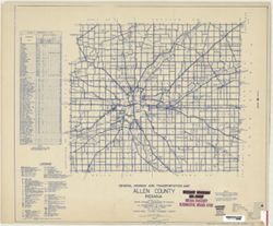
Topical Subject: Roads and Geographic Subject: Adams County (Ind.)
Creator:
Indiana. State Highway Commission (1919-1953)
Publisher:
Indiana. State Highway Commission (1919-1953)
Date Created:
1941
Identifier:
VAC3073-M-00767
Genre:
Road maps
Geographic Location:
Coordinates: W0850400 W0844800 N0405500 N0403400
Related URL:
Catalog URL: https://iucat.iu.edu/catalog/5726499
Abstract:
Blue line print. "Corrected to May 1, 1941." "Data obtained from State-wide Highway Planning Survey." Includes location map and charts &q...
Topical Subject: Land use and Geographic Subject: Gibson County (Ind.)
Creator:
Gibson County (Ind.). Land Use Planning Committee
Publisher:
United States. Bureau of Agricultural Economics
Date Created:
1941
Identifier:
VAC3073-M-00705
Genre:
Thematic maps
Geographic Location:
Coordinates: W0875917 W0871856 N0383200 N0380955
Related URL:
Catalog URL: https://iucat.iu.edu/catalog/5126313
Abstract:
"Color reproduction by Bureau of Agricultural Economics, U.S.D.A." "7-31-41". Includes chart showing type of land use, acreage, and recom...
Call Number:
G4093.G5G4 1941 .G53
Caption:
Imprint: [Washington, D.C.?] : U.S. Bureau of Agricultural Economics, [1941]
Physical Description:
Dimensions: 18 x 26 cm, on sheet 38 x 28 cm and Scale: Scale not given.

![Gibson County [Indiana] preliminary land use map](https://iiif.uits.iu.edu/iiif/2/f7624g240%2Ffiles%2F91ddcfae-bfc8-40ae-a801-4b23f126742f/full/250,/0/default.jpg)
![Bartholomew County [Indiana] preliminary land use map](https://iiif.uits.iu.edu/iiif/2/05742t46j%2Ffiles%2Fd91da533-b380-4311-a36b-84729f4dd8f8/full/250,/0/default.jpg)
