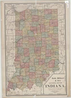
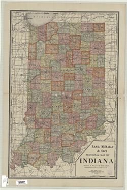
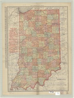
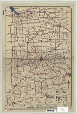
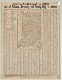
Relief shown by hachures. Includes index to cities and towns, with population, in left margin and index to railroads. On verso: index to Indiana counties, cr...
Topical Subject: Roads and Geographic Subject: Indiana
Creator:
Rand McNally and Company
Publisher:
Rand McNally and Company
Date Created:
1930
Identifier:
VAC3073-M-00774
Genre:
Road maps
Geographic Location:
Coordinates: W0880500 W0844700 N0414500 N0374600
Related URL:
Catalog URL: https://iucat.iu.edu/catalog/5273354
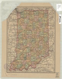
Abstract:
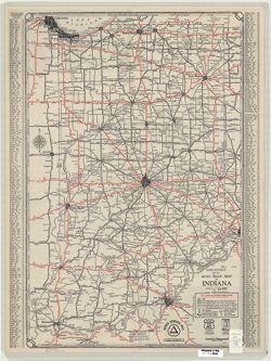
Includes "Index to cities & towns with populations." "Cities Service mileage chart" and "Cities Service road map North-Central S...
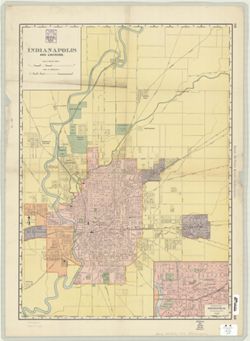
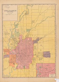
From Rand, McNally & Company's Indexed atlas of the world, 1902, p.203-206. Includes inset of "Business portion of Indianapolis." A portion...
Geographic Subject: New Orleans (La.), Geographic Subject: Louisville (Ky.), and Geographic Subject: Indianapolis (Ind.)
Creator:
Rand McNally and Company
Publisher:
Rand McNally and Company
Date Created:
1898
Identifier:
VAC3073-M-00365
Genre:
Maps
Geographic Location:
Coordinates: W0861941 W0855614 N0395538 N0393755
Related URL:
Catalog URL: https://iucat.iu.edu/catalog/2831377
Abstract:
From Rand, McNally & Company's Indexed atlas of the world, 1898, p. 332-333. Includes inset of "Business portion of Indianapolis." Maps ...
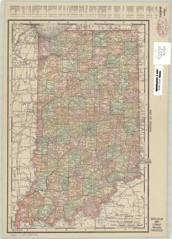
Topical Subject: Railroads and Geographic Subject: Indiana
Creator:
Rand McNally and Company
Publisher:
Rand McNally and Company
Date Created:
1877
Identifier:
VAC3073-M-00257
Genre:
Thematic maps
Geographic Location:
Coordinates: W0880700 W0843000 N0420000 N0375200
Related URL:
Catalog URL: https://iucat.iu.edu/catalog/4663706
Abstract:
Prime meridians: Greenwich and Washington. Includes list of railroads and express lines, indexes to counties, townships, lakes rivers and towns, with populat...
Call Number:
G4091 .P3 1877 .R36
Caption:
Imprint: Chicago : Rand McNally, [1877]
Physical Description:
Scale: 1:1,030,000 and Dimensions: 48 x 31 cm, on sheet 94 x 72 cm