Topical Subject: Physical geography and Geographic Subject: Corydon (Ind.)
Creator:
Geological Survey (U.S.)
Publisher:
Geological Survey (U.S.)
Date Created:
1959
Identifier:
VAC3073-M-01319
Genre:
Quadrangle maps and Topographic maps
Geographic Location:
Coordinates: W0861500 W0860000 N0381500 N0380000
Related URL:
Catalog URL: https://iucat.iu.edu/catalog/2863930
Abstract:
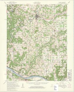
Relief shown by contours and spot heights. Shows portions of Harrison County, Indiana, and Meade County, Kentucky. Compiled in 1956 from 1:25,000-scale maps ...
Call Number:
G4090 s62 .G4 Corydon 1950 rep1959
Caption:
Imprint: Washington, D.C. : United States, Department of the Interior, Geological Survey, 1959