
Search Constraints
You searched for:
Creator
Geological Survey (U.S.)
Remove constraint Creator: Geological Survey (U.S.)
Date Created
1959
Remove constraint Date Created: 1959
1 - 8 of 8
Search Results
-
![Vandalia quadrangle, Michigan-Indiana : 15 minute series (topographic) [1959 reprint without vegetation]](https://iiif.uits.iu.edu/iiif/2/9593vz28s%2Ffiles%2F4f6d2df8-a9b9-45fc-993f-1949cda1ffbb/full/250,/0/default.jpg)
- Subject:
- Geographic Subject: Saint Joseph County (Mich.), Geographic Subject: Elkhart County (Ind.), and Geographic Subject: Cass County (Mich.)
- Creator:
- Geological Survey (U.S.) and Michigan. State Highway Department
- Publisher:
- Geological Survey (U.S.)
- Date Created:
- 1959
- Identifier:
- VAC3073-M-01506
- Genre:
- 15 minute topographic maps, Quadrangle maps, and Topographic maps
- Geographic Location:
- Coordinates: W0860000 W0854500 N0420000 N0414500
- Related URL:
- Catalog URL: https://iucat.iu.edu/catalog/18415471
- Abstract:
- Mapped, edited, and published by the Geological Survey. Filing title: Vandalia, Mich.-Ind. Standard map series designation: AMS (Series) V762 3867 IV. [Editi...
- Call Number:
- G4090 s62 .G4 Vandalia 1948
- Caption:
- Imprint: Washington, D.C. : Interior--U.S. Geological Survey, [1959]
- Physical Description:
- Scale: 1:62,500 and Dimensions: 45 x 42 cm or smaller
- Alternate Identifier:
- Title Control Number: a18415471
- Persistent URL:
- https://purl.dlib.indiana.edu/iudl/images/VAC3073/VAC3073-M-01506
- Provenance:
- Part of Geological Survey (U.S.). Indiana 1:62,500.
-
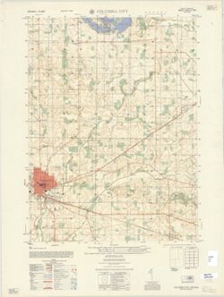
- Subject:
- Geographic Subject: Whitley County (Ind.)
- Creator:
- United States. Army Map Service and Geological Survey (U.S.)
- Publisher:
- United States. Army Map Service
- Date Created:
- 1959
- Identifier:
- VAC3073-M-01424
- Genre:
- Topographic maps, 7.5 minute topographic maps, and Quadrangle maps
- Geographic Location:
- Coordinates: W0853000 W0852230 N0411500 N0410730
- Related URL:
- Catalog URL: https://iucat.iu.edu/catalog/18375983
- Abstract:
- Prepared by the Army Map Service (GE), Corps of Engineers, U.S. Army, Washington, D.C. , original map compiled by U.S. Geological Survey. Variant title: Ind...
- Call Number:
- G4090 s25 .U5 Columbia City 1959 V
- Caption:
- Imprint: Washington, D.C. : Army Map Service, Corps of Engineers, Department of the Army, 1959.
- Physical Description:
- Dimensions: 56 x 45 cm or smaller and Scale: 1:25,000
- Alternate Identifier:
- Title Control Number: a18375983
- Persistent URL:
- https://purl.dlib.indiana.edu/iudl/images/VAC3073/VAC3073-M-01424
- Provenance:
- Part of United States. Army Map Service, Indiana 1:25,000.
-
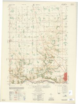
- Subject:
- Geographic Subject: Huntington County (Ind.)
- Creator:
- Geological Survey (U.S.) and United States. Army Map Service
- Publisher:
- United States. Army Map Service
- Date Created:
- 1959
- Identifier:
- VAC3073-M-01422
- Genre:
- 7.5 minute topographic maps, Quadrangle maps, and Topographic maps
- Geographic Location:
- Coordinates: W0853730 W0853000 N0410000 N0405230
- Related URL:
- Catalog URL: https://iucat.iu.edu/catalog/18375875
- Abstract:
- Prepared by the Army Map Service (GE), Corps of Engineers, U. S. Army, Washington D.C. , original map compiled by US Geological Survey. Alternate title: Ind...
- Call Number:
- G4090 s25 .U5 Bippus 1959 V
- Caption:
- Imprint: Washington, D.C. : Army Map Service, Corps of Engineers, 1959.
- Physical Description:
- Dimensions: 56 x 45 cm or smaller and Scale: 1:25,000
- Alternate Identifier:
- Title Control Number: a18375875
- Persistent URL:
- https://purl.dlib.indiana.edu/iudl/images/VAC3073/VAC3073-M-01422
- Provenance:
- Part of United States. Army Map Service, Indiana 1:25,000.
-
![Kosmosdale quadrangle, Kentucky-Indiana : 15 minute series (topographic) [1959 reprint with vegetation]](https://iiif.uits.iu.edu/iiif/2/mk61sm253%2Ffiles%2Fd8ce10eb-c8cf-4182-bd5a-13d2fee0e97a/full/250,/0/default.jpg)
- Subject:
- Geographic Subject: Floyd County (Ind.), Geographic Subject: Jefferson County (Ky.), Geographic Subject: Bullitt County (Ky.), Geographic Subject: Harrison C...
- Creator:
- United States. Army. Corps of Engineers and Geological Survey (U.S.)
- Publisher:
- Geological Survey (U.S.)
- Date Created:
- 1959
- Identifier:
- VAC3073-M-01348
- Genre:
- 15 minute topographic maps, Photogrammetric maps, Quadrangle maps, and Topographic maps
- Geographic Location:
- Coordinates: W0860000 W0854500 N0381500 N0380000
- Related URL:
- Catalog URL: https://iucat.iu.edu/catalog/18412709
- Abstract:
- Mapped by the Geological Survey and the Army Map Service , published for civil use by the Geological Survey. Filing title: Kosmodale, Ky.-Ind. Polyconic proj...
- Call Number:
- G4090 s62 .G4 Kosmosdale 1950 rep 1959 V
- Caption:
- Imprint: Washington, D.C. : Interior--Geological Survey, 1959
- Physical Description:
- Scale: 1:62,500 and Dimensions: 45 x 42 cm or smaller
- Alternate Identifier:
- Title Control Number: a18412709
- Persistent URL:
- https://purl.dlib.indiana.edu/iudl/images/VAC3073/VAC3073-M-01348
- Provenance:
- Part of Geological Survey (U.S.). Indiana 1:62,500.
-
![Vandalia quadrangle, Michigan-Indiana : 15 minute series (topographic) [1959 reprint with vegetation]](https://iiif.uits.iu.edu/iiif/2/9019t543m%2Ffiles%2Fd71ad7ee-44b6-4efe-9cbc-388b2c880604/full/250,/0/default.jpg)
- Subject:
- Geographic Subject: Saint Joseph County (Mich.), Geographic Subject: Cass County (Mich.), Topical Subject: Vegetation mapping, and Geographic Subject: Elkhar...
- Creator:
- Geological Survey (U.S.) and Michigan. State Highway Department
- Publisher:
- Geological Survey (U.S.)
- Date Created:
- 1959
- Identifier:
- VAC3073-M-01337
- Genre:
- 15 minute topographic maps, Topographic maps, and Quadrangle maps
- Geographic Location:
- Coordinates: W0860000 W0854500 N0420000 N0414500
- Related URL:
- Catalog URL: https://iucat.iu.edu/catalog/18415471
- Abstract:
- Mapped, edited, and published by the Geological Survey. Filing title: Vandalia, Mich.-Ind. Standard map series designation: AMS (Series) V762 3867 IV. [Editi...
- Call Number:
- G4090 s62 .G4 Vandalia 1948 rep 1959 V
- Caption:
- Imprint: Washington, D.C. : Interior--U.S. Geological Survey, 1959
- Physical Description:
- Dimensions: 45 x 42 cm or smaller and Scale: 1:62,500
- Alternate Identifier:
- Title Control Number: a18415471
- Persistent URL:
- https://purl.dlib.indiana.edu/iudl/images/VAC3073/VAC3073-M-01337
- Provenance:
- Part of Geological Survey (U.S.). Indiana 1:62,500.
-
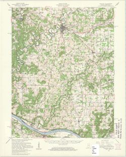
- Subject:
- Topical Subject: Physical geography and Geographic Subject: Corydon (Ind.)
- Creator:
- Geological Survey (U.S.)
- Publisher:
- Geological Survey (U.S.)
- Date Created:
- 1959
- Identifier:
- VAC3073-M-01319
- Genre:
- Quadrangle maps and Topographic maps
- Geographic Location:
- Coordinates: W0861500 W0860000 N0381500 N0380000
- Related URL:
- Catalog URL: https://iucat.iu.edu/catalog/2863930
- Abstract:
- Relief shown by contours and spot heights. Shows portions of Harrison County, Indiana, and Meade County, Kentucky. Compiled in 1956 from 1:25,000-scale maps ...
- Call Number:
- G4090 s62 .G4 Corydon 1950 rep1959
- Caption:
- Imprint: Washington, D.C. : United States, Department of the Interior, Geological Survey, 1959
- Physical Description:
- Scale: 1:62,500 and Dimensions: 45 x 36 cm
- Persistent URL:
- https://purl.dlib.indiana.edu/iudl/images/VAC3073/VAC3073-M-01319
- Provenance:
- USGS 15 minute series (topographic)
-
![Alton quadrangle, Indiana--Kentucky : 15 minute series (topographic) [Vegetation version]](https://iiif.uits.iu.edu/iiif/2/ng452m33b%2Ffiles%2F49c9606f-c7c7-4f10-807b-1b5949009698/full/250,/0/default.jpg)
- Subject:
- Geographic Subject: Crawford County (Ind.), Topical Subject: Vegetation mapping, Geographic Subject: Breckinridge County (Ky.), Geographic Subject: Meade Cou...
- Creator:
- Geological Survey (U.S.) and United States. Army Map Service
- Publisher:
- Geological Survey (U.S.)
- Date Created:
- 1959
- Identifier:
- VAC3073-M-01313
- Genre:
- Quadrangle maps, 15 minute topographic maps, and Topographic maps
- Geographic Location:
- Coordinates: W0863000 W0861500 N0381500 N0380000
- Related URL:
- Catalog URL: https://iucat.iu.edu/catalog/18406357
- Abstract:
- Mapped by the Geological Survey and the Army Map Service. Filing title: Alton, Ind.--Ky. Polyconic projection. Relief shown by contours and spot heights. Inc...
- Call Number:
- G4090 s62 .G4 Alton 1950 rep1959 V
- Caption:
- Imprint: Washington, D.C. : Interior--Geological Survey, 1959.
- Physical Description:
- Dimensions: 45 x 42 cm or smaller and Scale: 1:62,500
- Alternate Identifier:
- Title Control Number: a18406357
- Persistent URL:
- https://purl.dlib.indiana.edu/iudl/images/VAC3073/VAC3073-M-01313
- Provenance:
- Part of Geological Survey (U.S.). Indiana 1:62,500.
-
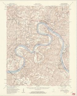
- Subject:
- Geographic Subject: Breckinridge County (Ky.), Geographic Subject: Perry County (Ind.), Geographic Subject: Harrison County (Ind.), Geographic Subject: Meade...
- Creator:
- United States. Army Map Service and Geological Survey (U.S.)
- Publisher:
- Geological Survey (U.S.)
- Date Created:
- 1959
- Identifier:
- VAC3073-M-01312
- Genre:
- Topographic maps, Quadrangle maps, and 15 minute topographic maps
- Geographic Location:
- Coordinates: W0863000 W0861500 N0381500 N0380000
- Related URL:
- Catalog URL: https://iucat.iu.edu/catalog/18406357
- Abstract:
- Mapped by the Geological Survey and the Army Map Service. Filing title: Alton, Ind.--Ky. Polyconic projection. Relief shown by contours and spot heights. Inc...
- Call Number:
- G4090 s62 .G4 Alton 1950 R1959
- Caption:
- Imprint: Washington, D.C. : Interior--Geological Survey, 1959.
- Physical Description:
- Scale: 1:62,500 and Dimensions: 45 x 42 cm or smaller
- Alternate Identifier:
- Title Control Number: a18406357
- Persistent URL:
- https://purl.dlib.indiana.edu/iudl/images/VAC3073/VAC3073-M-01312
- Provenance:
- Part of Geological Survey (U.S.). Indiana 1:62,500.
