Search Constraints
You searched for:
Holding Location
B-WELLS
Remove constraint Holding Location: B-WELLS
Provenance
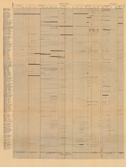
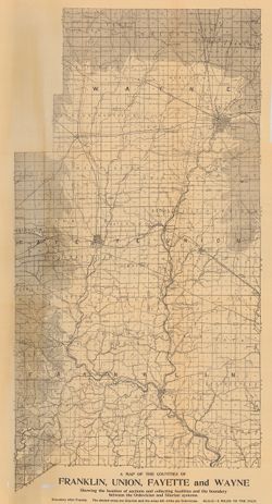
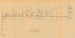
32nd Annual Report (1907) / Indiana. Department of Geology and Natural Resources.
Remove constraint Provenance: 32nd Annual Report (1907) / Indiana. Department of Geology and Natural Resources.
Subject
Geographic Subject: Indiana
Remove constraint Subject: Geographic Subject: Indiana