
Search Constraints
You searched for:
Provenance
Part of Geological Survey (U.S.). Indiana 1:62,500.
Remove constraint Provenance: Part of Geological Survey (U.S.). Indiana 1:62,500.
Subject
Geographic Subject: Gibson County (Ind.)
Remove constraint Subject: Geographic Subject: Gibson County (Ind.)
« Previous |
21 - 30 of 30
|
Next »
Search Results
-
- Subject:
- Geographic Subject: Edwards County (Ill.), Geographic Subject: Gibson County (Ind.), Geographic Subject: Wabash County (Ill.), and Topical Subject: Vegetatio...
- Creator:
- Geological Survey (U.S.)
- Publisher:
- Geological Survey (U.S.)
- Date Created:
- 1963
- Identifier:
- VAC3073-M-01353
- Genre:
- 15 minute topographic maps, Quadrangle maps, and Topographic maps
- Geographic Location:
- Coordinates: W0880000 W0874500 N0383000 N0381500
- Related URL:
- Catalog URL: https://iucat.iu.edu/catalog/18412729
- Abstract:
- Mapped, edited, and published by the Geological Survey. Filing title: Mount Carmel, Ill.-Ind. Standard map series designation: AMS (Series) V763 3460 IV. Pol...
- Call Number:
- G4090 s62 .G4 Mount Carmel 1959 rep 1963 V
- Caption:
- Imprint: Washington, D.C. : The Survey, 1963.
- Physical Description:
- Dimensions: 45 x 42 cm or smaller and Scale: 1:62,500
- Alternate Identifier:
- Title Control Number: a18412729
- Persistent URL:
- https://purl.dlib.indiana.edu/iudl/images/VAC3073/VAC3073-M-01353
- Provenance:
- Part of Geological Survey (U.S.). Indiana 1:62,500.
-
![Indiana-Illinois, New Harmony quadrangle [1925 reprint without vegetation]](https://iiif.uits.iu.edu/iiif/2/s4656k46j%2Ffiles%2F298a4b2a-341d-4dde-b5f8-f3216aba32b4/full/250,/0/default.jpg)
- Subject:
- Geographic Subject: White County (Ill.), Geographic Subject: Wabash County (Ill.), Geographic Subject: Posey County (Ind.), and Geographic Subject: Gibson Co...
- Creator:
- Renshawe, John H., Goodlove, C. W., Geological Survey (U.S.), and Hawkins, Geo. T. (George T.)
- Publisher:
- Geological Survey (U.S.)
- Date Created:
- 1925
- Identifier:
- VAC3073-M-01354
- Genre:
- Topographic maps, 15 minute topographic maps, and Quadrangle maps
- Geographic Location:
- Coordinates: W0880000 W0874500 N0381500 N0380000
- Related URL:
- Catalog URL: https://iucat.iu.edu/catalog/18412806
- Abstract:
- John. H. Renshawe, geographer in charge , control by Geo. T. Hawkins , topography by Chas. W. Goodlove , engraved April 1903 by U.S.G.S. Filing title: New Ha...
- Call Number:
- G4090 s62 .G4 1903 rep 1925
- Caption:
- Imprint: [Washington, D.C.] : U.S. Geological Survey, 1925
- Physical Description:
- Scale: 1:62,500 and Dimensions: 45 x 42 cm or smaller
- Alternate Identifier:
- Title Control Number: a18412806
- Persistent URL:
- https://purl.dlib.indiana.edu/iudl/images/VAC3073/VAC3073-M-01354
- Provenance:
- Part of Geological Survey (U.S.). Indiana 1:62,500.
-
- Subject:
- Geographic Subject: Gibson County (Ind.), Geographic Subject: Edwards County (Ill.), and Geographic Subject: Wabash County (Ind.)
- Creator:
- Geological Survey (U.S.)
- Publisher:
- Geological Survey (U.S.)
- Date Created:
- 1946
- Identifier:
- VAC3073-M-01351
- Genre:
- Topographic maps, 15 minute topographic maps, and Quadrangle maps
- Geographic Location:
- Coordinates: W0880000 W0874500 N0383000 N0381500
- Related URL:
- Catalog URL: https://iucat.iu.edu/catalog/18412720
- Abstract:
- Filing title: Mount Carmel, Ill.-Ind. Edition of 1904, reprinted 1946 with corrections. Polyconic projection. Relief shown by contours and spot heights. Cont...
- Call Number:
- G4090 s62 .G4 Mount Carmel 1904 rep 1946
- Caption:
- Imprint: [Washington, D.C.] : U.S. Geological Survey, 1946
- Physical Description:
- Scale: 1:62,500 and Dimensions: 45 x 42 cm or smaller
- Alternate Identifier:
- Title Control Number: a18412720
- Persistent URL:
- https://purl.dlib.indiana.edu/iudl/images/VAC3073/VAC3073-M-01351
- Provenance:
- Part of Geological Survey (U.S.). Indiana 1:62,500.
-
![Indiana Haubstadt quadrangle [1903 printing]](https://iiif.uits.iu.edu/iiif/2/mw22w891g%2Ffiles%2F3f2a82be-5754-4703-989d-ede2f3a3b596/full/250,/0/default.jpg)
- Subject:
- Geographic Subject: Posey County (Ind.), Geographic Subject: Gibson County (Ind.), and Geographic Subject: Vanderburgh County (Ind.)
- Creator:
- Renshawe, John H., Goodlove, C. W., Hawkins, Geo. T. (George T.), and Geological Survey (U.S.)
- Publisher:
- Geological Survey (U.S.)
- Date Created:
- 1903
- Identifier:
- VAC3073-M-01342
- Genre:
- Quadrangle maps, 15 minute topographic maps, and Topographic maps
- Geographic Location:
- Coordinates: W0874500 W0873000 N0381500 N0380000
- Related URL:
- Catalog URL: https://iucat.iu.edu/catalog/18408287
- Abstract:
- Engraved Mar. 1903 by U.S.G.S. , Jno. H. Renshawe, geographer in charge , control by Geo. T. Hawkins , topography by Chas. W. Goodlove. Relief shown by conto...
- Call Number:
- G4090 s62 .G4 Haubstadt 1903
- Caption:
- Imprint: [Washington, D.C.] : U.S. Geological Survey, 1903
- Physical Description:
- Dimensions: 45 x 42 cm or smaller and Scale: 1:62,500
- Alternate Identifier:
- Title Control Number: a18408287
- Persistent URL:
- https://purl.dlib.indiana.edu/iudl/images/VAC3073/VAC3073-M-01342
- Provenance:
- Part of Geological Survey (U.S.). Indiana 1:62,500.
-
![Indiana Boonville quadrangle [1925 reprint]](https://iiif.uits.iu.edu/iiif/2/1j92hc14j%2Ffiles%2Fb2be9690-7880-4ed7-9803-bf40e2d9f165/full/250,/0/default.jpg)
- Subject:
- Geographic Subject: Warrick County (Ind.), Geographic Subject: Pike County (Ind.), Geographic Subject: Vanderburgh County (Ind.), and Geographic Subject: Gib...
- Creator:
- McKinney, R. C. (Robert C.), Blair, H. B. (Herbert Buxton), 1860-1905, Hawkins, Geo. T. (George T.), and Renshawe, John H.
- Publisher:
- Geological Survey (U.S.)
- Date Created:
- 1925
- Identifier:
- VAC3073-M-01338
- Genre:
- 15 minute topographic maps, Topographic maps, and Quadrangle maps
- Geographic Location:
- Coordinates: W0873000 W0871500 N0381500 N0380000
- Related URL:
- Catalog URL: https://iucat.iu.edu/catalog/18408288
- Abstract:
- Engraved Oct. 1902 by U.S.G.S. , Jno. H. Renshawe, geographer in charge , control by Geo. T. Hawkins , topography by R.C. McKinney and H.B. Blair. Edition of...
- Call Number:
- G4090 s62 .G4 Boonville 1902 rep1925
- Caption:
- Imprint: [Washington, D.C.] : U.S. Geological Survey, [1925]
- Physical Description:
- Dimensions: 45 x 42 cm or smaller and Scale: 1:62,500
- Alternate Identifier:
- Title Control Number: a18408288
- Persistent URL:
- https://purl.dlib.indiana.edu/iudl/images/VAC3073/VAC3073-M-01338
- Provenance:
- Part of Geological Survey (U.S.). Indiana 1:62,500.
-
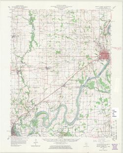
![Indiana-Illinois Princeton quadrangle [1942 print with corrections]](https://iiif.uits.iu.edu/iiif/2/9c67xs27g%2Ffiles%2F3b41e866-678d-4037-bcb6-7d00a8c69e5b/full/250,/0/default.jpg)
- Subject:
- Geographic Subject: Knox County (Ind.), Geographic Subject: Wabash County (Ill.), and Geographic Subject: Gibson County (Ind.)
- Creator:
- Geological Survey (U.S.), Goodlove, C. W., Hawkins, Geo. T. (George T.), and Renshawe, John H.
- Publisher:
- Geological Survey (U.S.)
- Date Created:
- 1942
- Identifier:
- VAC3073-M-01303
- Genre:
- Quadrangle maps, 15 minute topographic maps, and Topographic maps
- Geographic Location:
- Coordinates: W0874500 W0873000 N0383000 N0381500
- Related URL:
- Catalog URL: https://iucat.iu.edu/catalog/a18413584
- Abstract:
- Jno. H. Renshawe, geographer in charge , control by Geo. T. Hawkins , topography by Chas. W. Goodlove. Filing title: Princeton, Ind.-Ill. Edition of 1903, re...
- Call Number:
- G4090 s62 .G4 Princeton 1903 R1942
- Caption:
- Imprint: [Washington, D.C.] : U.S. Geological Survey, 1942
- Physical Description:
- Scale: 1:62,500 and Dimensions: 45 x 42 cm or smaller
- Alternate Identifier:
- Title Control Number: a18413585
- Persistent URL:
- https://purl.dlib.indiana.edu/iudl/images/VAC3073/VAC3073-M-01303
- Provenance:
- Part of Geological Survey (U.S.). Indiana 1:62,500.
-
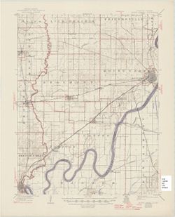
![Indiana-Illinois Princeton quadrangle [1922 reprint without vegetation]](https://iiif.uits.iu.edu/iiif/2/6h441w77c%2Ffiles%2F986f1cc4-da3e-4f00-892e-f811ead944f8/full/250,/0/default.jpg)
- Subject:
- Geographic Subject: Gibson County (Ind.), Geographic Subject: Knox County (Ind.), and Geographic Subject: Wabash County (Ill.)
- Creator:
- Renshawe, John H., Hawkins, Geo. T. (George T.), Geological Survey (U.S.), and Goodlove, C. W.
- Publisher:
- Geological Survey (U.S.)
- Identifier:
- VAC3073-M-01302
- Genre:
- 15 minute topographic maps, Quadrangle maps, and Topographic maps
- Geographic Location:
- Coordinates: W0874500 W0873000 N0383000 N0381500
- Related URL:
- Catalog URL: https://iucat.iu.edu/catalog/a18413584
- Abstract:
- Jno. H. Renshawe, geographer in charge , control by Geo. T. Hawkins , topography by Chas. W. Goodlove. Filing title: Princeton, Ind.-Ill. Edition of 1903. Re...
- Call Number:
- G4090 s62 .G4 Princeton 1903 R1922
- Caption:
- Imprint: Washington, D.C. : U.S. Geological Survey, 1922
- Physical Description:
- Dimensions: 45 x 42 cm or smaller and Scale: 1:62,500
- Alternate Identifier:
- Title Control Number: a18413584
- Persistent URL:
- https://purl.dlib.indiana.edu/iudl/images/VAC3073/VAC3073-M-01302
- Provenance:
- Part of Geological Survey (U.S.). Indiana 1:62,500.
-
![Indiana-Illinois Princeton quadrangle [1918 reprint without vegetation]](https://iiif.uits.iu.edu/iiif/2/4j03f204d%2Ffiles%2Ff6858e73-7524-45b9-95f0-84b35f918de9/full/250,/0/default.jpg)
- Subject:
- Geographic Subject: Gibson County (Ind.), Geographic Subject: Knox County (Ind.), and Geographic Subject: Wabash County (Ill.)
- Creator:
- Goodlove, C. W., Hawkins, Geo. T. (George T.), Renshawe, John H., and Geological Survey (U.S.)
- Publisher:
- Geological Survey (U.S.)
- Date Created:
- 1918
- Identifier:
- VAC3073-M-01300
- Genre:
- Quadrangle maps, Topographic maps, and 15 minute topographic maps
- Geographic Location:
- Coordinates: W0874500 W0873000 N0383000 N0381500
- Related URL:
- Catalog URL: https://iucat.iu.edu/catalog/18413584
- Abstract:
- Jno. H. Renshawe, geographer in charge , control by Geo. T. Hawkins , topography by Chas. W. Goodlove. Filing title: Princeton, Ind.-Ill. Edition of 1903. Re...
- Call Number:
- G4090 s62 .G4 Princeton 1903 R1918
- Caption:
- Imprint: Washington, D.C. : U.S. Geological Survey, 1918
- Physical Description:
- Dimensions: 45 x 42 cm or smaller and Scale: 1:62,500
- Alternate Identifier:
- Title Control Number: a18413584
- Persistent URL:
- https://purl.dlib.indiana.edu/iudl/images/VAC3073/VAC3073-M-01300
- Provenance:
- Part of Geological Survey (U.S.). Indiana 1:62,500.
-
![Indiana Petersburg quadrangle [1903 printing]](https://iiif.uits.iu.edu/iiif/2/kh04fs60m%2Ffiles%2Fe9278477-8060-4cc8-9b43-6722c928737e/full/250,/0/default.jpg)
- Subject:
- Geographic Subject: Pike County (Ind.) and Geographic Subject: Gibson County (Ind.)
- Creator:
- Blair, H. B. (Herbert Buxton), 1860-1905, Geological Survey (U.S.), Renshawe, John H., McKinney, R. C. (Robert C.), and Hawkins, Geo. T. (George T.)
- Publisher:
- Geological Survey (U.S.)
- Identifier:
- VAC3073-M-01298
- Genre:
- Topographic maps, Quadrangle maps, and 15 minute topographic maps
- Geographic Location:
- Coordinates: W0873000 W0871500 N0383000 N0381500
- Related URL:
- Catalog URL: https://iucat.iu.edu/catalog/18408289
- Abstract:
- Engraved Nov. 1902 by U.S.G.S , Jno. H. Renshawe, geographer in charge, control by Geo. T. Hawkins, topography by R.C. McKinney and H.B. Blair. Relief shown ...
- Call Number:
- G4090 s62 .G4 Petersburg 1903
- Caption:
- Imprint: Washington, D.C. : U.S. Geological Survey, 1903
- Physical Description:
- Scale: 1:62,500 and Dimensions: 45 x 42 cm or smaller
- Alternate Identifier:
- Title Control Number: a18408289
- Persistent URL:
- https://purl.dlib.indiana.edu/iudl/images/VAC3073/VAC3073-M-01298
- Provenance:
- Part of Geological Survey (U.S.). Indiana 1:62,500.
-
- Subject:
- Geographic Subject: Warrick County (Ind.), Geographic Subject: Vanderburgh County (Ind.), Geographic Subject: Gibson County (Ind.), and Geographic Subject: P...
- Creator:
- Renshawe, John H., Blair, H. B. (Herbert Buxton), 1860-1905, Hawkins, Geo. T. (George T.), and McKinney, R. C. (Robert C.)
- Publisher:
- Geological Survey (U.S.)
- Date Created:
- 1902
- Identifier:
- VAC3073-M-01296
- Genre:
- Topographic maps, Quadrangle maps, and 15 minute topographic maps
- Geographic Location:
- Coordinates: W0873000 W0871500 N0381500 N0380000
- Related URL:
- Catalog URL: https://iucat.iu.edu/catalog/18408288
- Abstract:
- Engraved Oct. 1902 by U.S.G.S. , Jno. H. Renshawe, geographer in charge , control by Geo. T. Hawkins , topography by R.C. McKinney and H.B. Blair. Edition of...
- Call Number:
- G4090 s62 .G4 Boonville 1902
- Caption:
- Imprint: [Washington, D.C.] : U.S. Geological Survey, 1902
- Physical Description:
- Dimensions: 45 x 42 cm or smaller and Scale: 1:62,500
- Alternate Identifier:
- Title Control Number: a18408288
- Persistent URL:
- https://purl.dlib.indiana.edu/iudl/images/VAC3073/VAC3073-M-01296
- Provenance:
- Part of Geological Survey (U.S.). Indiana 1:62,500.

- « Previous
- Next »
- 1
- 2
- 3