
Search Constraints
You searched for:
Provenance
CIA Map Library
Remove constraint Provenance: CIA Map Library
Publisher
Генеральный штаб Красной Армии
Remove constraint Publisher: Генеральный штаб Красной Армии
1 - 94 of 94
Search Results
-
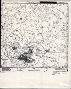
- Description:
- 1873
- Subject:
- Geographic Subject: Selyatyn, Topical Subject: Maps, and Topical Subject: Soviet Union
- Publisher:
- Генеральный штаб Красной Армии
- Language:
- Russian
- Date Created:
- 1939
- Identifier:
- VAC9619-001472
- Genre:
- Military Maps and Topographic Maps
- Geographic Location:
- Coordinates: 47.6667, 25, 48, 25.5
- Related URL:
- Download GeoTIFF: https://drive.google.com/open?id=1v6zIUxpzw2mb5AD7jE4-hVpFfWBpe8B8 and Catalog URL: https://iucat.iu.edu/catalog/5020129
- Abstract:
- Modern area represented: Selyatyn, Chernivtsi oblast, Ukraine
- Call Number:
- G7000 s100 .S7 sheet L-35-3
- Caption:
- Для служебного пользования
- City:
- Селетин (Selyatyn)
- Copyright Holder:
- No Copyright - United States
- Country:
- Румыния (Romania)
- State/Province:
- Украинская ССР (Ukrainian Soviet Socialist Republic) and Черновицкая область (Chernivtsi oblast)
- Physical Description:
- Scale: 1:100,000
- Persistent URL:
- http://purl.dlib.indiana.edu/iudl/images/VAC9619/VAC9619-001472
- Provenance:
- CIA Map Library
-
- Subject:
- Topical Subject: Maps, Geographic Subject: Kumiecie Małe, and Topical Subject: Soviet Union
- Publisher:
- Генеральный штаб Красной Армии
- Language:
- Russian
- Date Created:
- 1941
- Identifier:
- VAC9619-003778
- Genre:
- Topographic Maps and Military Maps
- Geographic Location:
- Coordinates: 54.33333, 22.25, 54.416667, 22.375
- Related URL:
- Catalog URL: https://iucat.iu.edu/catalog/14701157 and Download GeoTIFF: https://drive.google.com/file/d/1j12pjvPCePKzJkTpigHGtx5NAOBSbMzH/view?usp=sharing
- Abstract:
- Modern area represented: abandoned populated place. The nearest populated place is Kumiecie Małe (former Klein Kummetschen), Poland.
- Call Number:
- G7063.K2 s25 .S6 sheet N-34-57-D-c
- City:
- Ропонатшен (Roponatschen)
- Copyright Holder:
- No Copyright - United States
- Country:
- Германия (Восточная Пруссия) (Germany (East Prussia))
- Physical Description:
- Scale: 1:25,000
- Persistent URL:
- http://purl.dlib.indiana.edu/iudl/images/VAC9619/VAC9619-003778
- Provenance:
- CIA Map Library
-
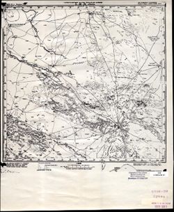
- Description:
- 1875
- Subject:
- Topical Subject: Soviet Union, Geographic Subject: Drohobych, and Topical Subject: Maps
- Publisher:
- Генеральный штаб Красной Армии
- Language:
- Russian
- Date Created:
- 1940
- Identifier:
- VAC9619-003027
- Genre:
- Military Maps and Topographic Maps
- Geographic Location:
- Coordinates: 49.333, 23.5, 49.667, 24
- Related URL:
- Catalog URL: https://iucat.iu.edu/catalog/5020129 and Download GeoTIFF: https://drive.google.com/file/d/10E4Z3oRj75pa2_d4MwidMWMnRE09xm2x/view?usp=sharing
- Abstract:
- Modern area represented: Drohobych, Lviv oblast, Ukraine
- Call Number:
- G7000 s100 .S7 sheet M-34-96
- City:
- Дрогобыч (Drohobych)
- Copyright Holder:
- No Copyright - United States
- Country:
- СССР (USSR)
- State/Province:
- Украинская ССР (Ukrainian Soviet Socialist Republic), Дрогобычская область (Drohobych oblast), and Львовская область (Lviv oblast)
- Physical Description:
- Scale: 1:100,000
- Persistent URL:
- http://purl.dlib.indiana.edu/iudl/images/VAC9619/VAC9619-003027
- Provenance:
- CIA Map Library
-
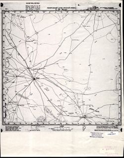
- Description:
- 1934
- Subject:
- Geographic Subject: Tomaszów Lubelski, Topical Subject: Soviet Union, and Topical Subject: Maps
- Publisher:
- Генеральный штаб Красной Армии
- Language:
- Russian
- Date Created:
- 1944
- Identifier:
- VAC9619-002859
- Genre:
- Military Maps and Topographic Maps
- Geographic Location:
- Coordinates: 50.333, 23, 50.667, 23.5
- Related URL:
- Catalog URL: https://iucat.iu.edu/catalog/5020129 and Download GeoTIFF: https://drive.google.com/file/d/1YII3rUEldUE3OnWxXVmL_97jykQAPc7O/view?usp=sharing
- Abstract:
- Modern area represented: Tomaszów Lubelski, Lublin province, Poland
- Call Number:
- G7000 s100 .S7 sheet M-34-59
- City:
- Томашув (Tomaszów)
- Copyright Holder:
- No Copyright - United States
- Country:
- СССР (USSR) and Польша (Poland)
- State/Province:
- Львовская область (Lviv oblast) and Украинская ССР (Ukrainian Soviet Socialist Republic)
- Physical Description:
- Scale: 1:100,000
- Persistent URL:
- http://purl.dlib.indiana.edu/iudl/images/VAC9619/VAC9619-002859
- Provenance:
- CIA Map Library
-
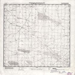
- Description:
- 1886
- Subject:
- Topical Subject: Maps, Topical Subject: Soviet Union, and Geographic Subject: Krotoszyn
- Publisher:
- Генеральный штаб Красной Армии
- Language:
- Russian
- Date Created:
- 1940
- Identifier:
- VAC9619-002601
- Genre:
- Military Maps and Topographic Maps
- Geographic Location:
- Coordinates: 51.667, 17, 52, 17.5
- Related URL:
- Catalog URL: https://iucat.iu.edu/catalog/5020129 and Download GeoTIFF: https://drive.google.com/file/d/1_dL56LQQ7RKKwx98a_coOrEKj2OxyFw1/view?usp=sharing
- Abstract:
- Modern area represented: Krotoszyn, Greater Poland province, Poland
- Call Number:
- G7000 s100 .S7 sheet M-33-11
- City:
- Кротошин (Krotoszyn)
- Copyright Holder:
- No Copyright - United States
- Country:
- Германия (Germany)
- Physical Description:
- Scale: 1:100,000
- Persistent URL:
- http://purl.dlib.indiana.edu/iudl/images/VAC9619/VAC9619-002601
- Provenance:
- CIA Map Library
-
- Description:
- 1940
- Subject:
- Topical Subject: Soviet Union, Topical Subject: Maps, and Geographic Subject: Lagan
- Publisher:
- Генеральный штаб Красной Армии
- Language:
- Russian
- Date Created:
- 1942
- Identifier:
- VAC9619-002597
- Genre:
- Military Maps and Topographic Maps
- Geographic Location:
- Coordinates: 45.333, 47, 45.667, 47.5
- Related URL:
- Catalog URL: https://iucat.iu.edu/catalog/5020129 and Download GeoTIFF: https://drive.google.com/file/d/118xqIxVJbCLMYzPknJMFF-ICTqV1twyN/view?usp=sharing
- Abstract:
- Modern area represented: Lagan, Kalmykiya Republic, Russia
- Call Number:
- G7000 s100 .S7 sheet L-38-95
- Caption:
- Для служебного пользования
- City:
- Лагань (Lagan)
- Copyright Holder:
- No Copyright - United States
- Country:
- СССР (USSR)
- State/Province:
- РСФСР (RSFSR), Сталинградская область (Stalingrad oblast), and Калмыцкая АССР (Kalmyk Autonomous Soviet Socialist Republic)
- Physical Description:
- Scale: 1:100,000
- Persistent URL:
- http://purl.dlib.indiana.edu/iudl/images/VAC9619/VAC9619-002597
- Provenance:
- CIA Map Library
-
- Description:
- 1941
- Subject:
- Topical Subject: Soviet Union, Geographic Subject: Naryn Khuduk, and Topical Subject: Maps
- Publisher:
- Генеральный штаб Красной Армии
- Language:
- Russian
- Date Created:
- 1942
- Identifier:
- VAC9619-002596
- Genre:
- Topographic Maps and Military Maps
- Geographic Location:
- Coordinates: 45.333, 46.5, 45.667, 47
- Related URL:
- Catalog URL: https://iucat.iu.edu/catalog/5020129 and Download GeoTIFF: https://drive.google.com/file/d/1V21zweeUxfPtxEE1eyaHMGOZBg7JZ5Ds/view?usp=sharing
- Abstract:
- Modern area represented: Naryn Khuduk, Kalmykiya Republic, Russia
- Call Number:
- G7000 s100 .S7 sheet L-38-94
- Caption:
- Для служебного пользования
- City:
- Нарын-Худук (Naryn-Khuduk)
- Copyright Holder:
- No Copyright - United States
- Country:
- СССР (USSR)
- State/Province:
- РСФСР (RSFSR) and Калмыцкая АССР (Kalmyk Autonomous Soviet Socialist Republic)
- Physical Description:
- Scale: 1:100,000
- Persistent URL:
- http://purl.dlib.indiana.edu/iudl/images/VAC9619/VAC9619-002596
- Provenance:
- CIA Map Library
-
- Description:
- 1940
- Subject:
- Topical Subject: Soviet Union, Topical Subject: Maps, and Geographic Subject: Vyselki
- Publisher:
- Генеральный штаб Красной Армии
- Language:
- Russian
- Date Created:
- 1941
- Identifier:
- VAC9619-002352
- Genre:
- Topographic Maps and Military Maps
- Geographic Location:
- Coordinates: 45.333, 39.5, 45.667, 40
- Related URL:
- Download GeoTIFF: https://drive.google.com/file/d/1FvtRCQ_lqYSm5lBe4sGeetoWyTjpXu2N/view?usp=sharing and Catalog URL: https://iucat.iu.edu/catalog/5020129
- Abstract:
- Modern area represented: Vyselki, Russia
- Call Number:
- G7000 s100 .S7 sheet L-37-92
- Caption:
- Для служебного пользования
- City:
- Выселки (Vyselki)
- Copyright Holder:
- No Copyright - United States
- Country:
- СССР (USSR)
- State/Province:
- Краснодарский край (Krasnodar kray) and РСФСР (RSFSR)
- Physical Description:
- Scale: 1:100,000
- Persistent URL:
- http://purl.dlib.indiana.edu/iudl/images/VAC9619/VAC9619-002352
- Provenance:
- CIA Map Library
-
- Description:
- 1929
- Subject:
- Geographic Subject: Novopokrovskaya, Topical Subject: Soviet Union, and Topical Subject: Maps
- Publisher:
- Генеральный штаб Красной Армии
- Language:
- Russian
- Date Created:
- 1941
- Identifier:
- VAC9619-002341
- Genre:
- Topographic Maps and Military Maps
- Geographic Location:
- Coordinates: 45.667, 40.5, 46, 41
- Related URL:
- Download GeoTIFF: https://drive.google.com/file/d/19fDUMprNtMR3Orl_Toiy1MMll60YY-HW/view?usp=sharing and Catalog URL: https://iucat.iu.edu/catalog/5020129
- Abstract:
- Modern area represented: Novopokrovskaya, Krasnodar kray, Russia
- Call Number:
- G7000 s100 .S7 sheet L-37-82
- Caption:
- Для служебного пользования
- City:
- Ново-Покровская (Novo-Pokrovskaya)
- Copyright Holder:
- No Copyright - United States
- Country:
- СССР (USSR)
- State/Province:
- Орджоникидзевский край (Ordzhonikidze kray), Краснодарский край (Krasnodar kray), and РСФСР (RSFSR)
- Physical Description:
- Scale: 1:100,000
- Persistent URL:
- http://purl.dlib.indiana.edu/iudl/images/VAC9619/VAC9619-002341
- Provenance:
- CIA Map Library
-
- Description:
- 1940
- Subject:
- Topical Subject: Maps, Topical Subject: Soviet Union, and Geographic Subject: Novorozhdestvenskaya
- Publisher:
- Генеральный штаб Красной Армии
- Language:
- Russian
- Date Created:
- 1941
- Identifier:
- VAC9619-002340
- Genre:
- Topographic Maps and Military Maps
- Geographic Location:
- Coordinates: 45.667, 39.5, 46, 40
- Related URL:
- Download GeoTIFF: https://drive.google.com/file/d/19NQErKnkUWVhRcBjR4daepFJ4dKJ_qLg/view?usp=sharing and Catalog URL: https://iucat.iu.edu/catalog/5020129
- Abstract:
- Modern area represented: Novorozhdestvenskaya, Russia
- Call Number:
- G7000 s100 .S7 sheet L-37-80
- Caption:
- Для служебного пользования
- City:
- Ново-Рождественская (Novo-Rozhdestvenskaya)
- Copyright Holder:
- No Copyright - United States
- Country:
- СССР (USSR)
- State/Province:
- Краснодарский край (Krasnodar kray) and РСФСР (RSFSR)
- Physical Description:
- Scale: 1:100,000
- Persistent URL:
- http://purl.dlib.indiana.edu/iudl/images/VAC9619/VAC9619-002340
- Provenance:
- CIA Map Library
-
- Description:
- 1940
- Subject:
- Geographic Subject: Nezamayevskaya, Topical Subject: Soviet Union, and Topical Subject: Maps
- Publisher:
- Генеральный штаб Красной Армии
- Language:
- Russian
- Date Created:
- 1941
- Identifier:
- VAC9619-002331
- Genre:
- Military Maps and Topographic Maps
- Geographic Location:
- Coordinates: 46, 40, 46.3333, 40.5
- Related URL:
- Catalog URL: https://iucat.iu.edu/catalog/5020129 and Download GeoTIFF: https://drive.google.com/file/d/1KWYrAI3qHrR_O6WF5vmeSjmXKm7q3Sio/view?usp=sharing
- Abstract:
- Modern area represented: Nezamayevskaya, Russia
- Call Number:
- G7000 s100 .S7 sheet L-37-69
- Caption:
- Для служебного пользования
- City:
- Незамаевская (Nezamayevskaya)
- Copyright Holder:
- No Copyright - United States
- Country:
- СССР (USSR)
- State/Province:
- Ростовская область (Rostov oblast), РСФСР (RSFSR), and Краснодарский край (Krasnodar kray)
- Physical Description:
- Scale: 1:100,000
- Persistent URL:
- http://purl.dlib.indiana.edu/iudl/images/VAC9619/VAC9619-002331
- Provenance:
- CIA Map Library
-
- Description:
- 1926
- Subject:
- Topical Subject: Maps, Topical Subject: Soviet Union, and Geographic Subject: Tselina
- Publisher:
- Генеральный штаб Красной Армии
- Language:
- Russian
- Date Created:
- 1941
- Identifier:
- VAC9619-002325
- Genre:
- Topographic Maps and Military Maps
- Geographic Location:
- Coordinates: 46.3333, 41, 46.6667, 41.5
- Related URL:
- Download GeoTIFF: https://drive.google.com/file/d/1YWovwFHZLYltby0LFN3_UH99JWpoipP1/view?usp=sharing and Catalog URL: https://iucat.iu.edu/catalog/5020129
- Abstract:
- Modern area represented: Tselina, Russia
- Call Number:
- G7000 s100 .S7 sheet L-37-59
- Caption:
- Для служебного пользования
- City:
- Целина (Tselina)
- Copyright Holder:
- No Copyright - United States
- Country:
- СССР (USSR)
- State/Province:
- РСФСР (RSFSR) and Ростовская область (Rostov oblast)
- Physical Description:
- Scale: 1:100,000
- Persistent URL:
- http://purl.dlib.indiana.edu/iudl/images/VAC9619/VAC9619-002325
- Provenance:
- CIA Map Library
-
- Description:
- 1925
- Subject:
- Topical Subject: Soviet Union, Geographic Subject: Starominskaya, and Topical Subject: Maps
- Publisher:
- Генеральный штаб Красной Армии
- Language:
- Russian
- Date Created:
- 1941
- Identifier:
- VAC9619-002322
- Genre:
- Topographic Maps and Military Maps
- Geographic Location:
- Coordinates: 46.3333, 39, 46.6667, 39.5
- Related URL:
- Catalog URL: https://iucat.iu.edu/catalog/5020129 and Download GeoTIFF: https://drive.google.com/file/d/1z6KPvOR5zHk3hmEPToNGBw2_VbRE71f-/view?usp=sharing
- Abstract:
- Modern area represented: Starominskaya, Russia
- Call Number:
- G7000 s100 .S7 sheet L-37-55
- Caption:
- Для служебного пользования
- City:
- Старо-Минская (Staro-Minskaya)
- Copyright Holder:
- No Copyright - United States
- Country:
- СССР (USSR)
- State/Province:
- РСФСР (RSFSR), Ростовская область (Rostov oblast), and Краснодарский край (Krasnodar kray)
- Physical Description:
- Scale: 1:100,000
- Persistent URL:
- http://purl.dlib.indiana.edu/iudl/images/VAC9619/VAC9619-002322
- Provenance:
- CIA Map Library
-
- Description:
- 1935
- Subject:
- Topical Subject: Maps, Geographic Subject: Yeyskoye Ukrepleniye, and Topical Subject: Soviet Union
- Publisher:
- Генеральный штаб Красной Армии
- Language:
- Russian
- Date Created:
- 1938
- Identifier:
- VAC9619-002293
- Genre:
- Topographic Maps and Military Maps
- Geographic Location:
- Coordinates: 46.6667, 38.5, 47, 39
- Related URL:
- Catalog URL: https://iucat.iu.edu/catalog/5020129 and Download GeoTIFF: https://drive.google.com/file/d/1l8Y0gwYEf2tBKWG4raDsZHtB57IQK3rB/view?usp=sharing
- Abstract:
- Modern area represented: Yeyskoye Ukrepleniye, Krasnodar kray, Russia
- Call Number:
- G7000 s100 .S7 sheet L-37-42
- Caption:
- Для служебного пользования
- City:
- Ейское Укрепление (Yeyskoye Ukrepleniye)
- Copyright Holder:
- No Copyright - United States
- Country:
- СССР (USSR)
- State/Province:
- Краснодарский край (Krasnodar kray), РСФСР (RSFSR), and Ростовская область (Rostov oblast)
- Physical Description:
- Scale: 1:100,000
- Persistent URL:
- http://purl.dlib.indiana.edu/iudl/images/VAC9619/VAC9619-002293
- Provenance:
- CIA Map Library
-
- Description:
- 1928
- Subject:
- Topical Subject: Soviet Union, Topical Subject: Maps, and Geographic Subject: Bolshaya Orlovka
- Publisher:
- Генеральный штаб Красной Армии
- Language:
- Russian
- Date Created:
- 1941
- Identifier:
- VAC9619-002289
- Genre:
- Topographic Maps and Military Maps
- Geographic Location:
- Coordinates: 47, 41, 47.3333, 41.5
- Related URL:
- Catalog URL: https://iucat.iu.edu/catalog/5020129 and Download GeoTIFF: https://drive.google.com/file/d/1lR13kKQkWmyWUUarjbFsVQ_lp0yc8aya/view?usp=sharing
- Abstract:
- Modern area represented: Bolshaya Orlovka, Russia
- Call Number:
- G7000 s100 .S7 sheet L-37-35
- Caption:
- Для служебного пользования
- City:
- Большая Орловка (Bolshaya Orlovka)
- Copyright Holder:
- No Copyright - United States
- Country:
- СССР (USSR)
- State/Province:
- Ростовская область (Rostov oblast) and РСФСР (RSFSR)
- Physical Description:
- Scale: 1:100,000
- Persistent URL:
- http://purl.dlib.indiana.edu/iudl/images/VAC9619/VAC9619-002289
- Provenance:
- CIA Map Library
-
- Description:
- 1932
- Subject:
- Topical Subject: Soviet Union, Topical Subject: Maps, and Geographic Subject: Veselyy
- Publisher:
- Генеральный штаб Красной Армии
- Language:
- Russian
- Date Created:
- 1941
- Identifier:
- VAC9619-002288
- Genre:
- Topographic Maps and Military Maps
- Geographic Location:
- Coordinates: 47, 40.5, 47.3333, 41
- Related URL:
- Download GeoTIFF: https://drive.google.com/file/d/1x_6moHatJsnMhQhHzqjSPuO0h_az_FsS/view?usp=sharing and Catalog URL: https://iucat.iu.edu/catalog/5020129
- Abstract:
- Modern area represented: Veselyy, Russia
- Call Number:
- G7000 s100 .S7 sheet L-37-34
- Caption:
- Для служебного пользования
- City:
- Веселый (Veselyy)
- Copyright Holder:
- No Copyright - United States
- Country:
- СССР (USSR)
- State/Province:
- Ростовская область (Rostov oblast) and РСФСР (RSFSR)
- Physical Description:
- Scale: 1:100,000
- Persistent URL:
- http://purl.dlib.indiana.edu/iudl/images/VAC9619/VAC9619-002288
- Provenance:
- CIA Map Library
-
- Description:
- 1926
- Subject:
- Topical Subject: Soviet Union, Geographic Subject: Bagayevskaya, and Topical Subject: Maps
- Publisher:
- Генеральный штаб Красной Армии
- Language:
- Russian
- Date Created:
- 1941
- Identifier:
- VAC9619-002287
- Genre:
- Military Maps and Topographic Maps
- Geographic Location:
- Coordinates: 47, 40, 47.3333, 40.5
- Related URL:
- Download GeoTIFF: https://drive.google.com/file/d/1c-tw5VxGi2_8mSBvS9z5V2Q-EtcSlk6D/view?usp=sharing and Catalog URL: https://iucat.iu.edu/catalog/5020129
- Abstract:
- Modern area represented: Bagayevskaya, Russia
- Call Number:
- G7000 s100 .S7 sheet L-37-33
- Caption:
- Для служебного пользования
- City:
- Багаевская (Bagayevskaya)
- Copyright Holder:
- No Copyright - United States
- Country:
- СССР (USSR)
- State/Province:
- Ростовская область (Rostov oblast) and РСФСР (RSFSR)
- Physical Description:
- Scale: 1:100,000
- Persistent URL:
- http://purl.dlib.indiana.edu/iudl/images/VAC9619/VAC9619-002287
- Provenance:
- CIA Map Library
-
- Description:
- 1927
- Subject:
- Topical Subject: Maps, Geographic Subject: Andreyevka, and Topical Subject: Soviet Union
- Publisher:
- Генеральный штаб Красной Армии
- Language:
- Russian
- Date Created:
- 1941
- Identifier:
- VAC9619-002283
- Genre:
- Topographic Maps and Military Maps
- Geographic Location:
- Coordinates: 47, 36.5, 47.3333, 37
- Related URL:
- Download GeoTIFF: https://drive.google.com/file/d/1UF1XjcNneuyF1a5XhDK--2BjtXxrLfsl/view?usp=sharing and Catalog URL: https://iucat.iu.edu/catalog/5020129
- Abstract:
- Modern area represented: Andreyevka, Zaporizhia oblast, Ukraine
- Call Number:
- G7000 s100 .S7 sheet L-37-26
- Caption:
- Для служебного пользования
- City:
- Андреевка (Andreyevka)
- Copyright Holder:
- No Copyright - United States
- Country:
- СССР (USSR)
- State/Province:
- Украинская ССР (Ukrainian Soviet Socialist Republic)
- Physical Description:
- Scale: 1:100,000
- Persistent URL:
- http://purl.dlib.indiana.edu/iudl/images/VAC9619/VAC9619-002283
- Provenance:
- CIA Map Library
-
- Description:
- 1928
- Subject:
- Topical Subject: Maps, Topical Subject: Soviet Union, and Geographic Subject: Chernihivka
- Publisher:
- Генеральный штаб Красной Армии
- Language:
- Russian
- Date Created:
- 1941
- Identifier:
- VAC9619-002282
- Genre:
- Military Maps and Topographic Maps
- Geographic Location:
- Coordinates: 47, 36, 47.3333, 36.5
- Related URL:
- Download GeoTIFF: https://drive.google.com/file/d/1mo9Bpmz48kxlqvW7ySPLp9B3AAterdgn/view?usp=sharing and Catalog URL: https://iucat.iu.edu/catalog/5020129
- Abstract:
- Modern area represented: Chernihivka, Zaporizhia oblast, Ukraine
- Call Number:
- G7000 s100 .S7 sheet L-37-25
- Caption:
- Для служебного пользования
- City:
- Токмачанск (Tokmachansk)
- Copyright Holder:
- No Copyright - United States
- Country:
- СССР (USSR)
- State/Province:
- Украинская ССР (Ukrainian Soviet Socialist Republic)
- Physical Description:
- Scale: 1:100,000
- Persistent URL:
- http://purl.dlib.indiana.edu/iudl/images/VAC9619/VAC9619-002282
- Provenance:
- CIA Map Library
-
- Description:
- 1901
- Subject:
- Geographic Subject: Oguzer, Topical Subject: Soviet Union, and Topical Subject: Maps
- Publisher:
- Генеральный штаб Красной Армии
- Language:
- Russian
- Date Created:
- 1942
- Identifier:
- VAC9619-002251
- Genre:
- Topographic Maps and Military Maps
- Geographic Location:
- Coordinates: 44, 47, 44.3333, 47.5
- Related URL:
- Catalog URL: https://iucat.iu.edu/catalog/5020129 and Download GeoTIFF: https://drive.google.com/file/d/1moC2ogiz5WV2pNVSzg7uRFtGt12SLQWr/view?usp=sharing
- Abstract:
- Modern area represented: Oguzer, Dagestan, Russia
- Call Number:
- G7000 s100 .S7 sheet L-38-143
- Caption:
- Для служебного пользования
- City:
- Огузер (Oguzer)
- Copyright Holder:
- No Copyright - United States
- Country:
- СССР (USSR)
- State/Province:
- Кизлярский округ (Kizlyar district), РСФСР (RSFSR), and Орджоникидзевский край (Ordzhonikidze kray)
- Physical Description:
- Scale: 1:100,000
- Persistent URL:
- http://purl.dlib.indiana.edu/iudl/images/VAC9619/VAC9619-002251
- Provenance:
- CIA Map Library
-
- Description:
- 1935
- Subject:
- Topical Subject: Soviet Union, Topical Subject: Maps, Geographic Subject: Chubutla, and Geographic Subject: Dagestan
- Publisher:
- Генеральный штаб Красной Армии
- Language:
- Russian
- Date Created:
- 1942
- Identifier:
- VAC9619-002248
- Genre:
- Topographic Maps and Military Maps
- Geographic Location:
- Coordinates: 44, 46, 44.3333, 46.5
- Related URL:
- Catalog URL: https://iucat.iu.edu/catalog/5020129 and Download GeoTIFF: https://drive.google.com/file/d/100QQ5ahXVFMaFSsAM9CrZFGoR3oHOl0l/view?usp=sharing
- Abstract:
- Modern area represented: Чубутла (Chubutla), Dagestan, Russia
- Call Number:
- G7000 s100 .S7 sheet L-38-141
- Caption:
- Для cлужебного пользования
- City:
- Аул-Чубутла (Aul-Chubutla)
- Copyright Holder:
- No Copyright - United States
- Country:
- СССР (USSR)
- State/Province:
- Орджоникидзевский край (Ordzhonikidze kray), Кизлярский округ (Kizlyar district), and РСФСР (RSFSR)
- Physical Description:
- Scale: 1:100,000
- Persistent URL:
- http://purl.dlib.indiana.edu/iudl/images/VAC9619/VAC9619-002248
- Provenance:
- CIA Map Library
-
- Description:
- 1928
- Subject:
- Topical Subject: Maps, Geographic Subject: Vorovskolesskaya, Topical Subject: Soviet Union, and Geographic Subject: Stavropol' Krai
- Publisher:
- Генеральный штаб Красной Армии
- Language:
- Russian
- Date Created:
- 1942
- Identifier:
- VAC9619-002207
- Genre:
- Military Maps and Topographic Maps
- Geographic Location:
- Coordinates: 44.3333, 42, 44.6667, 42.5
- Related URL:
- Catalog URL: https://iucat.iu.edu/catalog/5020129 and Download GeoTIFF: https://drive.google.com/file/d/1zWxRfN0S2bbgOMpQplCOmjlyz-MQgi81/view?usp=sharing
- Abstract:
- Modern area represented: Воровсколесская (Vorovskolesskaya), Stavropol' Krai, Russia
- Call Number:
- G7000 s100 .S7 sheet L-38-121
- Caption:
- Для cлужебного пользования
- City:
- Воровсколесская (Vorovskolesskaya)
- Copyright Holder:
- No Copyright - United States
- Country:
- СССР (USSR)
- State/Province:
- РСФСР (RSFSR), Орджоникидзевский край (Ordzhonikidze kray), and Черкесская автономная область (Cherkess Autonomous Oblast)
- Physical Description:
- Scale: 1:100,000
- Persistent URL:
- http://purl.dlib.indiana.edu/iudl/images/VAC9619/VAC9619-002207
- Provenance:
- CIA Map Library
-
- Description:
- 1942
- Subject:
- Geographic Subject: Kalmyk republic, Topical Subject: Maps, and Topical Subject: Soviet Union
- Publisher:
- Генеральный штаб Красной Армии
- Language:
- Russian
- Identifier:
- VAC9619-002206
- Genre:
- Topographic Maps and Military Maps
- Geographic Location:
- Coordinates: 44.6667, 47, 45, 47.5
- Related URL:
- Catalog URL: https://iucat.iu.edu/catalog/5020129 and Download GeoTIFF: https://drive.google.com/file/d/1qQDnnIrEeC0NV8zpHl8WWuHFXIY3NXdN/view?usp=sharing
- Abstract:
- Modern area represented: Kalmyk republic
- Call Number:
- G7000 s100 .S7 sheet L-38-119
- Caption:
- Для служебного пользования
- Copyright Holder:
- No Copyright - United States
- Country:
- СССР (USSR)
- State/Province:
- РСФСР (RSFSR) and Калмыцкая АССР (Kalmyk Autonomous Soviet Socialist Republic)
- Physical Description:
- Scale: 1:100,000
- Persistent URL:
- http://purl.dlib.indiana.edu/iudl/images/VAC9619/VAC9619-002206
- Provenance:
- CIA Map Library
-
- Description:
- 1941
- Subject:
- Topical Subject: Soviet Union, Geographic Subject: Bakres, and Topical Subject: Maps
- Publisher:
- Генеральный штаб Красной Армии
- Language:
- Russian
- Date Created:
- 1942
- Identifier:
- VAC9619-002204
- Genre:
- Topographic Maps and Military Maps
- Geographic Location:
- Coordinates: 44.6667, 45.5, 45, 46
- Related URL:
- Catalog URL: https://iucat.iu.edu/catalog/5020129 and Download GeoTIFF: https://drive.google.com/file/d/1AJLkcZgpYOsDHCtkJc31gv9140nbE6P8/view?usp=sharing
- Abstract:
- Modern area represented: Bakres, Stavropol kray, Russia
- Call Number:
- G7000 s100 .S7 sheet L-38-116
- Caption:
- Для служебного пользования
- City:
- Бакрес (Bakres)
- Copyright Holder:
- No Copyright - United States
- Country:
- СССР (USSR)
- State/Province:
- Калмыцкая АССР (Kalmyk Autonomous Soviet Socialist Republic), Орджоникидзевский край (Ordzhonikidze kray), and РСФСР (RSFSR)
- Physical Description:
- Scale: 1:100,000
- Persistent URL:
- http://purl.dlib.indiana.edu/iudl/images/VAC9619/VAC9619-002204
- Provenance:
- CIA Map Library
-
- Description:
- 1927
- Subject:
- Topical Subject: Soviet Union, Topical Subject: Maps, and Geographic Subject: Levokumskoye
- Publisher:
- Генеральный штаб Красной Армии
- Language:
- Russian
- Date Created:
- 1942
- Identifier:
- VAC9619-002202
- Genre:
- Topographic Maps and Military Maps
- Geographic Location:
- Coordinates: 44.6667, 44.5, 45, 45
- Related URL:
- Catalog URL: https://iucat.iu.edu/catalog/5020129 and Download GeoTIFF: https://drive.google.com/file/d/1SQiPKlpdvjp6G_t_-vG-PKMxxowyxdse/view?usp=sharing
- Abstract:
- Modern area represented: Levokumskoye, Stavropol kray, Russia
- Call Number:
- G7000 s100 .S7 sheet L-38-114
- Caption:
- Для служебного пользования
- City:
- Левокумское (Levokumskoye)
- Copyright Holder:
- No Copyright - United States
- Country:
- СССР (USSR)
- State/Province:
- Кизлярский округ (Kizlyar district), РСФСР (RSFSR), and Орджоникидзевский край (Ordzhonikidze kray)
- Physical Description:
- Scale: 1:100,000
- Persistent URL:
- http://purl.dlib.indiana.edu/iudl/images/VAC9619/VAC9619-002202
- Provenance:
- CIA Map Library
-
- Description:
- 1931
- Subject:
- Topical Subject: Maps, Topical Subject: Soviet Union, and Geographic Subject: Velichayevskoye
- Publisher:
- Генеральный штаб Красной Армии
- Language:
- Russian
- Date Created:
- 1942
- Identifier:
- VAC9619-002203
- Genre:
- Topographic Maps and Military Maps
- Geographic Location:
- Coordinates: 44.6667, 45, 45, 45.5
- Related URL:
- Catalog URL: https://iucat.iu.edu/catalog/5020129 and Download GeoTIFF: https://drive.google.com/file/d/15jc4F933fTkNjpdG0Ktkjk6Aw7pw-u8K/view?usp=sharing
- Abstract:
- Modern area represented: Velichayevskoye, Stavropol kray, Russia
- Call Number:
- G7000 s100 .S7 sheet L-38-115
- Caption:
- Для служебного пользования
- City:
- Величаевское (Velichayevskoye)
- Copyright Holder:
- No Copyright - United States
- Country:
- СССР (USSR)
- State/Province:
- РСФСР (RSFSR), Кизлярский округ (Kizlyar district), and Орджоникидзевский край (Ordzhonikidze kray)
- Physical Description:
- Scale: 1:100,000
- Persistent URL:
- http://purl.dlib.indiana.edu/iudl/images/VAC9619/VAC9619-002203
- Provenance:
- CIA Map Library
-
- Description:
- 1931
- Subject:
- Topical Subject: Soviet Union, Topical Subject: Maps, and Geographic Subject: Severnoye
- Publisher:
- Генеральный штаб Красной Армии
- Language:
- Russian
- Date Created:
- 1938
- Identifier:
- VAC9619-002198
- Genre:
- Military Maps and Topographic Maps
- Geographic Location:
- Coordinates: 44.6667, 42.5, 45, 43
- Related URL:
- Download GeoTIFF: https://drive.google.com/open?id=1CIEQLtqtap9ThU2gHi-PM736XrFSzH4M and Catalog URL: https://iucat.iu.edu/catalog/5020129
- Abstract:
- Modern area represented: Severnoye, Stavropol kray, Russia
- Call Number:
- G7000 s100 .S7 sheet L-38-110
- Caption:
- Для служебного пользования
- City:
- Северное (Severnoye)
- Copyright Holder:
- No Copyright - United States
- Country:
- СССР (USSR)
- State/Province:
- Орджоникидзевский край (Ordzhonikidze kray) and РСФСР (RSFSR)
- Physical Description:
- Scale: 1:100,000
- Persistent URL:
- http://purl.dlib.indiana.edu/iudl/images/VAC9619/VAC9619-002198
- Provenance:
- CIA Map Library
-
- Description:
- 1931
- Subject:
- Topical Subject: Maps, Geographic Subject: Lagansky district, and Topical Subject: Soviet Union
- Publisher:
- Генеральный штаб Красной Армии
- Language:
- Russian
- Date Created:
- 1942
- Identifier:
- VAC9619-002195
- Genre:
- Topographic Maps and Military Maps
- Geographic Location:
- Coordinates: 45, 46.5, 45.3333, 47
- Related URL:
- Catalog URL: https://iucat.iu.edu/catalog/5020129 and Download GeoTIFF: https://drive.google.com/open?id=1cquDByBsE77Gncmns-epYNVca4Y1Yfra
- Abstract:
- Modern area represented: Lagansky district, Kalmykiya Republic, Russia
- Call Number:
- G7000 s100 .S7 sheet L-38-106
- Caption:
- Для служебного пользования
- City:
- Цекерта (Tsekerta)
- Copyright Holder:
- No Copyright - United States
- Country:
- СССР (USSR)
- State/Province:
- Калмыцкая АССР (Kalmyk Autonomous Soviet Socialist Republic) and РСФСР (RSFSR)
- Physical Description:
- Scale: 1:100,000
- Persistent URL:
- http://purl.dlib.indiana.edu/iudl/images/VAC9619/VAC9619-002195
- Provenance:
- CIA Map Library
-
- Description:
- 1931
- Subject:
- Topical Subject: Maps, Geographic Subject: Kalmykia, and Topical Subject: Soviet Union
- Publisher:
- Генеральный штаб Красной Армии
- Language:
- Russian
- Date Created:
- 1942
- Identifier:
- VAC9619-002176
- Genre:
- Military Maps and Topographic Maps
- Geographic Location:
- Coordinates: 45, 46, 45.3333, 46.5
- Related URL:
- Download GeoTIFF: https://drive.google.com/open?id=1MvHSz2jfOIgPqmLdFhOfCUrV3zMi7GDM and Catalog URL: https://iucat.iu.edu/catalog/5020129
- Abstract:
- Modern area represented: Kalmykia, Russia
- Call Number:
- G7000 s100 .S7 sheet L-38-105
- Caption:
- Для служебного пользования
- City:
- Ферма №5 (Farm #5)
- Copyright Holder:
- No Copyright - United States
- Country:
- СССР (USSR)
- State/Province:
- Калмыцкая АССР (Kalmyk Autonomous Soviet Socialist Republic) and РСФСР (RSFSR)
- Physical Description:
- Scale: 1:100,000
- Persistent URL:
- http://purl.dlib.indiana.edu/iudl/images/VAC9619/VAC9619-002176
- Provenance:
- CIA Map Library
-
- Description:
- 1927
- Subject:
- Topical Subject: Soviet Union, Topical Subject: Maps, and Geographic Subject: Prikumskiy
- Publisher:
- Генеральный штаб Красной Армии
- Language:
- Russian
- Date Created:
- 1942
- Identifier:
- VAC9619-002175
- Genre:
- Topographic Maps and Military Maps
- Geographic Location:
- Coordinates: 45, 45.5, 45.3333, 46
- Related URL:
- Download GeoTIFF: https://drive.google.com/open?id=1oNieSvSiim9Nn6Cs0QFvFcMbSpYbCy7x and Catalog URL: https://iucat.iu.edu/catalog/5020129
- Abstract:
- Modern area represented: Prikumskiy, Kalmykiya Republic, Russia
- Call Number:
- G7000 s100 .S7 sheet L-38-104
- Caption:
- Для служебного пользования
- City:
- Свх. №109 Улан Туг (Ulan Tug)
- Copyright Holder:
- No Copyright - United States
- Country:
- СССР (USSR)
- State/Province:
- Калмыцкая АССР (Kalmyk Autonomous Soviet Socialist Republic), РСФСР (RSFSR), Кизлярский округ (Kizlyar district), and Орджоникидзевский край (Ordzhonikidze k...
- Physical Description:
- Scale: 1:100,000
- Persistent URL:
- http://purl.dlib.indiana.edu/iudl/images/VAC9619/VAC9619-002175
- Provenance:
- CIA Map Library
-
- Description:
- 1927
- Subject:
- Topical Subject: Soviet Union, Geographic Subject: Perekrestnyy, and Topical Subject: Maps
- Publisher:
- Генеральный штаб Красной Армии
- Language:
- Russian
- Date Created:
- 1942
- Identifier:
- VAC9619-002174
- Genre:
- Topographic Maps and Military Maps
- Geographic Location:
- Coordinates: 45, 45, 45.3333, 45.5
- Related URL:
- Download GeoTIFF: https://drive.google.com/open?id=1PufmFUSTdGToOsH9jP81y_oUAmZLg9iD and Catalog URL: https://iucat.iu.edu/catalog/5020129
- Abstract:
- Modern area represented: Perekrestnyy, Kalmykiya Republic, Russia
- Call Number:
- G7000 s100 .S7 sheet L-38-103
- Caption:
- Для служебного пользования
- City:
- Перекрестный (Perekrestnyy)
- Copyright Holder:
- No Copyright - United States
- Country:
- СССР (USSR)
- State/Province:
- Орджоникидзевский край (Ordzhonikidze kray), Калмыцкая АССР (Kalmyk Autonomous Soviet Socialist Republic), Кизлярский округ (Kizlyar district), and РСФСР (RS...
- Physical Description:
- Scale: 1:100,000
- Persistent URL:
- http://purl.dlib.indiana.edu/iudl/images/VAC9619/VAC9619-002174
- Provenance:
- CIA Map Library
-
- Description:
- 1927
- Subject:
- Topical Subject: Soviet Union, Geographic Subject: Priozerskoye, and Topical Subject: Maps
- Publisher:
- Генеральный штаб Красной Армии
- Language:
- Russian
- Date Created:
- 1942
- Identifier:
- VAC9619-002173
- Genre:
- Topographic Maps and Military Maps
- Geographic Location:
- Coordinates: 45, 44.5, 45.3333, 45
- Related URL:
- Catalog URL: https://iucat.iu.edu/catalog/5020129 and Download GeoTIFF: https://drive.google.com/open?id=1LlvgkdsTXJ8Qp1nijTGPecjQ-C4DXbIM
- Abstract:
- Modern area represented: Priozerskoye, Stavropol kray, Russia
- Call Number:
- G7000 s100 .S7 sheet L-38-102
- Caption:
- Для служебного пользования
- City:
- Мусса-Аджи (Mussa-Adzhi)
- Copyright Holder:
- No Copyright - United States
- Country:
- СССР (USSR)
- State/Province:
- Орджоникидзевский край (Ordzhonikidze kray) and РСФСР (RSFSR)
- Physical Description:
- Scale: 1:100,000
- Persistent URL:
- http://purl.dlib.indiana.edu/iudl/images/VAC9619/VAC9619-002173
- Provenance:
- CIA Map Library
-
- Description:
- 1941
- Subject:
- Topical Subject: Maps, Topical Subject: Soviet Union, and Geographic Subject: Koltan-Nur lake
- Publisher:
- Генеральный штаб Красной Армии
- Language:
- Russian
- Date Created:
- 1942
- Identifier:
- VAC9619-002166
- Genre:
- Military Maps and Topographic Maps
- Geographic Location:
- Coordinates: 45.3333, 45.5, 45.6667, 46
- Related URL:
- Download GeoTIFF: https://drive.google.com/open?id=1TbdH0pLoQrfNjccE9h9zqh8Dh0XLyveo and Catalog URL: https://iucat.iu.edu/catalog/5020129
- Abstract:
- Modern area represented: Koltan-Nur lake, Kalmykiya Republic, Russia
- Call Number:
- G7000 s100 .S7 sheet L-38-92
- Caption:
- Для служебного пользования
- City:
- Оз. Колтан-Нур (Koltan-Nur lake)
- Copyright Holder:
- No Copyright - United States
- Country:
- СССР (USSR)
- State/Province:
- Калмыцкая АССР (Kalmyk Autonomous Soviet Socialist Republic) and РСФСР (RSFSR)
- Physical Description:
- Scale: 1:100,000
- Persistent URL:
- http://purl.dlib.indiana.edu/iudl/images/VAC9619/VAC9619-002166
- Provenance:
- CIA Map Library
-
- Description:
- 1932
- Subject:
- Topical Subject: Soviet Union, Geographic Subject: Sostinskiy, and Topical Subject: Maps
- Publisher:
- Генеральный штаб Красной Армии
- Language:
- Russian
- Date Created:
- 1942
- Identifier:
- VAC9619-002165
- Genre:
- Topographic Maps and Military Maps
- Geographic Location:
- Coordinates: 45.3333, 45, 45.6667, 45.5
- Related URL:
- Download GeoTIFF: https://drive.google.com/open?id=1mPzTxGKH5jVyadj_6X9zxs5fzkbRDVmU and Catalog URL: https://iucat.iu.edu/catalog/5020129
- Abstract:
- Modern area represented: Sostinskiy, Kalmykiya Republic, Russia
- Call Number:
- G7000 s100 .S7 sheet L-38-91
- Caption:
- Для служебного пользования
- City:
- Ачинеры (Achinery)
- Copyright Holder:
- No Copyright - United States
- Country:
- СССР (USSR)
- State/Province:
- РСФСР (RSFSR), Калмыцкая АССР (Kalmyk Autonomous Soviet Socialist Republic), and Орджоникидзевский край (Ordzhonikidze kray)
- Physical Description:
- Scale: 1:100,000
- Persistent URL:
- http://purl.dlib.indiana.edu/iudl/images/VAC9619/VAC9619-002165
- Provenance:
- CIA Map Library
-
- Description:
- 1941
- Subject:
- Topical Subject: Maps, Topical Subject: Soviet Union, and Geographic Subject: Vorobyovka
- Publisher:
- Генеральный штаб Красной Армии
- Language:
- Russian
- Date Created:
- 1942
- Identifier:
- VAC9619-002154
- Genre:
- Topographic Maps and Military Maps
- Geographic Location:
- Coordinates: 45.6667, 46, 46, 46.5
- Related URL:
- Download GeoTIFF: https://drive.google.com/open?id=1xiydyhp3Q4skE7OWRWkfdU-vydraQ9_H and Catalog URL: https://iucat.iu.edu/catalog/5020129
- Abstract:
- Modern area represented: Vorobyovka, Kalmykiya Republic, Russia
- Call Number:
- G7000 s100 .S7 sheet L-38-81
- Caption:
- Для служебного пользования
- City:
- Зим. Клх. Им. Буденного (Budenny winter collective farm)
- Copyright Holder:
- No Copyright - United States
- Country:
- СССР (USSR)
- State/Province:
- Калмыцкая АССР (Kalmyk Autonomous Soviet Socialist Republic) and РСФСР (RSFSR)
- Physical Description:
- Scale: 1:100,000
- Persistent URL:
- http://purl.dlib.indiana.edu/iudl/images/VAC9619/VAC9619-002154
- Provenance:
- CIA Map Library
-
- Description:
- 1941
- Subject:
- Topical Subject: Soviet Union, Topical Subject: Maps, and Geographic Subject: Adyk
- Publisher:
- Генеральный штаб Красной Армии
- Language:
- Russian
- Date Created:
- 1942
- Identifier:
- VAC9619-002153
- Genre:
- Military Maps and Topographic Maps
- Geographic Location:
- Coordinates: 45.667, 45.5, 46, 46
- Related URL:
- Download GeoTIFF: https://drive.google.com/open?id=1VHY8MomU_2EwUr27MU5fHPiUcVqub7h3 and Catalog URL: https://iucat.iu.edu/catalog/5020129
- Abstract:
- Modern area represented: Adyk, Kalmykiya Republic, Russia
- Call Number:
- G7000 s100 .S7 sheet L-38-80
- Caption:
- Для служебного пользования
- City:
- Адык (Adyk)
- Copyright Holder:
- No Copyright - United States
- Country:
- СССР (USSR)
- State/Province:
- Калмыцкая АССР (Kalmyk Autonomous Soviet Socialist Republic) and РСФСР (RSFSR)
- Physical Description:
- Scale: 1:100,000
- Persistent URL:
- http://purl.dlib.indiana.edu/iudl/images/VAC9619/VAC9619-002153
- Provenance:
- CIA Map Library
-
- Description:
- 1934
- Subject:
- Topical Subject: Maps, Topical Subject: Soviet Union, and Geographic Subject: Ivanivka
- Publisher:
- Генеральный штаб Красной Армии
- Language:
- Russian
- Date Created:
- 1941
- Identifier:
- VAC9619-001891
- Genre:
- Topographic Maps and Military Maps
- Geographic Location:
- Coordinates: 46.6667, 34.5, 47, 35
- Related URL:
- Download GeoTIFF: https://drive.google.com/open?id=14Er3699FOVffHRqDS10Xc_-qDDv9uQcf and Catalog URL: https://iucat.iu.edu/catalog/5020129
- Abstract:
- Modern area represented: Ivanivka, Zaporizhia oblast, Ukraine
- Call Number:
- G7000 s100 .S7 sheet L-36-46
- Caption:
- Для служебного пользования
- City:
- Ивановка (Ivanivka)
- Copyright Holder:
- No Copyright - United States
- Country:
- СССР (USSR)
- State/Province:
- Украинская ССР (Ukrainian Soviet Socialist Republic) and Запорожская область (Zaporizhia oblast)
- Physical Description:
- Scale: 1:100,000
- Persistent URL:
- http://purl.dlib.indiana.edu/iudl/images/VAC9619/VAC9619-001891
- Provenance:
- CIA Map Library
-
- Description:
- 1907
- Subject:
- Topical Subject: Maps, Geographic Subject: Velyka Korenykha, and Topical Subject: Soviet Union
- Publisher:
- Генеральный штаб Красной Армии
- Language:
- Russian
- Date Created:
- 1941
- Identifier:
- VAC9619-001884
- Genre:
- Military Maps and Topographic Maps
- Geographic Location:
- Coordinates: 46.6667, 31.5, 47, 32
- Related URL:
- Download GeoTIFF: https://drive.google.com/open?id=1fNdbJ2rMnjnma3fM8xJgn6ozu_NI6Aox and Catalog URL: https://iucat.iu.edu/catalog/5020129
- Abstract:
- Modern area represented: Velyka Korenykha, Mykolaiv oblast, Ukraine
- Call Number:
- G7000 s100 .S7 sheet L-36-40
- Caption:
- Для служебного пользования
- City:
- Бол. Корениха (Bolshaya Korenikha)
- Copyright Holder:
- No Copyright - United States
- Country:
- СССР (USSR)
- State/Province:
- Украинская ССР (Ukrainian Soviet Socialist Republic)
- Physical Description:
- Scale: 1:100,000
- Persistent URL:
- http://purl.dlib.indiana.edu/iudl/images/VAC9619/VAC9619-001884
- Provenance:
- CIA Map Library
-
- Description:
- 1936
- Subject:
- Topical Subject: Soviet Union, Topical Subject: Maps, and Geographic Subject: Tokmak
- Publisher:
- Генеральный штаб Красной Армии
- Language:
- Russian
- Date Created:
- 1941
- Identifier:
- VAC9619-001879
- Genre:
- Topographic Maps and Military Maps
- Geographic Location:
- Coordinates: 47, 35.5, 47.3333, 36
- Related URL:
- Download GeoTIFF: https://drive.google.com/open?id=1OoowFREJfGMpfVna6ycm9h6wt5I1ph15 and Catalog URL: https://iucat.iu.edu/catalog/5020129
- Abstract:
- Modern area represented: Tokmak, Zaporizhia oblast, Ukraine
- Call Number:
- G7000 s100 .S7 sheet L-36-36
- Caption:
- Для служебного пользования
- City:
- Бол. Токмак (Bolshoy Tokmak)
- Copyright Holder:
- No Copyright - United States
- Country:
- СССР (USSR)
- State/Province:
- Запорожская область (Zaporizhia oblast) and Украинская ССР (Ukrainian Soviet Socialist Republic)
- Physical Description:
- Scale: 1:100,000
- Persistent URL:
- http://purl.dlib.indiana.edu/iudl/images/VAC9619/VAC9619-001879
- Provenance:
- CIA Map Library
-
- Description:
- 1927
- Subject:
- Topical Subject: Soviet Union, Topical Subject: Maps, and Geographic Subject: Vasylivka
- Publisher:
- Генеральный штаб Красной Армии
- Language:
- Russian
- Date Created:
- 1941
- Identifier:
- VAC9619-001869
- Genre:
- Topographic Maps and Military Maps
- Geographic Location:
- Coordinates: 47.3333, 35, 47.6667, 35.5
- Related URL:
- Catalog URL: https://iucat.iu.edu/catalog/5020129 and Download GeoTIFF: https://drive.google.com/open?id=1Ts_iGjiK3duW8I4BKerAnFOxHoZvlOGy
- Abstract:
- Modern area represented: Vasylivka, Zaporizhia oblast, Ukraine
- Call Number:
- G7000 s100 .S7 sheet L-36-23
- Caption:
- Для служебного пользования
- City:
- Васильевка (Vasylivka)
- Copyright Holder:
- No Copyright - United States
- Country:
- СССР (USSR)
- State/Province:
- Запорожская область (Zaporizhia oblast) and Украинская ССР (Ukrainian Soviet Socialist Republic)
- Physical Description:
- Scale: 1:100,000
- Persistent URL:
- http://purl.dlib.indiana.edu/iudl/images/VAC9619/VAC9619-001869
- Provenance:
- CIA Map Library
-

- Description:
- 1926
- Subject:
- Geographic Subject: Balky, Topical Subject: Soviet Union, and Topical Subject: Maps
- Publisher:
- Генеральный штаб Красной Армии
- Language:
- Russian
- Date Created:
- 1941
- Identifier:
- VAC9619-001868
- Genre:
- Topographic Maps and Military Maps
- Geographic Location:
- Coordinates: 47.3333, 34.5, 47.6667, 35
- Related URL:
- Catalog URL: https://iucat.iu.edu/catalog/5020129 and Download GeoTIFF: https://drive.google.com/open?id=1V7PHm7Dg5ABV8yybrFeMKAmxM9f2EO27
- Abstract:
- Modern area represented: Balky, Zaporizhia oblast, Ukraine
- Call Number:
- G7000 s100 .S7 sheet L-36-22
- Caption:
- Для служебного пользования
- City:
- Балки (Balky)
- Copyright Holder:
- No Copyright - United States
- Country:
- СССР (USSR)
- State/Province:
- Украинская ССР (Ukrainian Soviet Socialist Republic)
- Physical Description:
- Scale: 1:100,000
- Persistent URL:
- http://purl.dlib.indiana.edu/iudl/images/VAC9619/VAC9619-001868
- Provenance:
- CIA Map Library
-
- Description:
- 1926
- Subject:
- Topical Subject: Soviet Union, Topical Subject: Maps, and Geographic Subject: Nikopol
- Publisher:
- Генеральный штаб Красной Армии
- Language:
- Russian
- Date Created:
- 1941
- Identifier:
- VAC9619-001867
- Genre:
- Military Maps and Topographic Maps
- Geographic Location:
- Coordinates: 47.3333, 34, 47.6667, 34.5
- Related URL:
- Download GeoTIFF: https://drive.google.com/open?id=1255dfmhEQnsVoMASiJgE0Wqbhh4ks-Bt and Catalog URL: https://iucat.iu.edu/catalog/5020129
- Abstract:
- Modern area represented: Nikopol, Dnipropetrovsk, Ukraine
- Call Number:
- G7000 s100 .S7 sheet L-36-21
- Caption:
- Для служебного пользования
- City:
- Никополь (Nikopol)
- Copyright Holder:
- No Copyright - United States
- Country:
- СССР (USSR)
- State/Province:
- Днепропетровская область (Dnipropetrovsk oblast) and Украинская ССР (Ukrainian Soviet Socialist Republic)
- Physical Description:
- Scale: 1:100,000
- Persistent URL:
- http://purl.dlib.indiana.edu/iudl/images/VAC9619/VAC9619-001867
- Provenance:
- CIA Map Library
-
- Description:
- 1930
- Subject:
- Topical Subject: Maps, Geographic Subject: Novyy Buh, and Topical Subject: Soviet Union
- Publisher:
- Генеральный штаб Красной Армии
- Language:
- Russian
- Date Created:
- 1941
- Identifier:
- VAC9619-001863
- Genre:
- Military Maps and Topographic Maps
- Geographic Location:
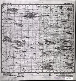
- Coordinates: 47.6667, 32.5, 48, 33
- Related URL:
- Download GeoTIFF: https://drive.google.com/open?id=1T0wPHo0RpDwORrKZXGfpt1IyrZgBA6b4 and Catalog URL: https://iucat.iu.edu/catalog/5020129
- Abstract:
- Modern area represented: Novyy Buh, Mykolaiv, Ukraine
- Call Number:
- G7000 s100 .S7 sheet L-36-6
- Caption:
- Для служебного пользования
- City:
- Новый Буг (Novyy Buh)
- Copyright Holder:
- No Copyright - United States
- Country:
- СССР (USSR)
- State/Province:
- Украинская ССР (Ukrainian Soviet Socialist Republic)
- Physical Description:
- Scale: 1:100,000
- Persistent URL:
- http://purl.dlib.indiana.edu/iudl/images/VAC9619/VAC9619-001863
- Provenance:
- CIA Map Library
-
- Description:
- 1928
- Subject:
- Topical Subject: Maps, Geographic Subject: Bratske, and Topical Subject: Soviet Union
- Publisher:
- Генеральный штаб Красной Армии
- Language:
- Russian
- Date Created:
- 1941
- Identifier:
- VAC9619-001862
- Genre:
- Military Maps and Topographic Maps
- Geographic Location:
- Coordinates: 47.6667, 31.5, 48, 32
- Related URL:
- Catalog URL: https://iucat.iu.edu/catalog/5020129 and Download GeoTIFF: https://drive.google.com/open?id=1CRkSh7sskcbMSmRNTPMYkQvk89B_3WMF
- Abstract:
- Modern area represented: Bratske, Mykolaiv oblast, Ukraine
- Call Number:
- G7000 s100 .S7 sheet L-36-4
- Caption:
- Для служебного пользования
- City:
- Братское (Bratskoye)
- Copyright Holder:
- No Copyright - United States
- Country:
- СССР (USSR)
- State/Province:
- Украинская ССР (Ukrainian Soviet Socialist Republic)
- Physical Description:
- Scale: 1:100,000
- Persistent URL:
- http://purl.dlib.indiana.edu/iudl/images/VAC9619/VAC9619-001862
- Provenance:
- CIA Map Library
-
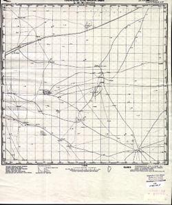
- Description:
- 1928
- Subject:
- Geographic Subject: Voznesensk, Topical Subject: Maps, and Topical Subject: Soviet Union
- Publisher:
- Генеральный штаб Красной Армии
- Language:
- Russian
- Date Created:
- 1941
- Identifier:
- VAC9619-001853
- Genre:
- Topographic Maps and Military Maps
- Geographic Location:
- Coordinates: 47.3333, 31, 47.6667, 31.5
- Related URL:
- Catalog URL: https://iucat.iu.edu/catalog/5020129 and Download GeoTIFF: https://drive.google.com/open?id=1bR3CKUW57AtZTkAsFZhGcwe6LzRifVDw
- Abstract:
- Modern area represented: Voznesensk, Mykolaiv oblast, Ukraine
- Call Number:
- G7000 s100 .S7 sheet L-36-15
- Caption:
- Для служебного пользования
- City:
- Вознесенск (Voznesensk)
- Copyright Holder:
- No Copyright - United States
- Country:
- СССР (USSR)
- State/Province:
- Украинская ССР (Ukrainian Soviet Socialist Republic)
- Physical Description:
- Scale: 1:100,000
- Persistent URL:
- http://purl.dlib.indiana.edu/iudl/images/VAC9619/VAC9619-001853
- Provenance:
- CIA Map Library
-

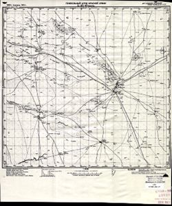
- Description:
- 1939
- Subject:
- Topical Subject: Soviet Union, Geographic Subject: Komyshuvakha, and Topical Subject: Maps
- Publisher:
- Генеральный штаб Красной Армии
- Language:
- Russian
- Date Created:
- 1941
- Identifier:
- VAC9619-001844
- Genre:
- Military Maps and Topographic Maps
- Geographic Location:
- Coordinates: 47.6667, 35.5, 48, 36
- Related URL:
- Download GeoTIFF: https://drive.google.com/open?id=1IiavgxI6IZ79dkMzQI3jHmPsU86TTxOH and Catalog URL: https://iucat.iu.edu/catalog/5020129
- Abstract:
- Modern area represented: Komyshuvakha, Zaporizhia oblast, Ukraine
- Call Number:
- G7000 s100 .S7 sheet L-36-12
- Caption:
- Для служебного пользования
- City:
- Камышуваха (Komyshuvakha)
- Copyright Holder:
- No Copyright - United States
- Country:
- СССР (USSR)
- State/Province:
- Запорожская область (Zaporizhia oblast) and Украинская ССР (Ukrainian Soviet Socialist Republic)
- Physical Description:
- Scale: 1:100,000
- Persistent URL:
- http://purl.dlib.indiana.edu/iudl/images/VAC9619/VAC9619-001844
- Provenance:
- CIA Map Library
-
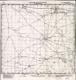
- Description:
- 1927
- Subject:
- Geographic Subject: Zaporizhia, Topical Subject: Soviet Union, and Topical Subject: Maps
- Publisher:
- Генеральный штаб Красной Армии
- Language:
- Russian
- Date Created:
- 1941
- Identifier:
- VAC9619-001831
- Genre:
- Topographic Maps and Military Maps
- Geographic Location:
- Coordinates: 47.6667, 35, 48, 35.5
- Related URL:
- Download GeoTIFF: https://drive.google.com/open?id=16w7gAgD3waAsgFnUeqhZv9WmeLo6ztJn and Catalog URL: https://iucat.iu.edu/catalog/5020129
- Abstract:
- Modern area represented: Zaporizhia, Zaporizhia oblast, Ukraine
- Call Number:
- G7000 s100 .S7 sheet L-36-11
- Caption:
- Для служебного пользования
- City:
- Запорожье (Zaporizhia)
- Copyright Holder:
- No Copyright - United States
- Country:
- СССР (USSR)
- State/Province:
- Украинская ССР (Ukrainian Soviet Socialist Republic) and Запорожская область (Zaporizhia oblast)
- Physical Description:
- Scale: 1:100,000
- Persistent URL:
- http://purl.dlib.indiana.edu/iudl/images/VAC9619/VAC9619-001831
- Provenance:
- CIA Map Library
-
- Description:
- 1926
- Subject:
- Topical Subject: Maps, Geographic Subject: Tomakivka, and Topical Subject: Soviet Union
- Publisher:
- Генеральный штаб Красной Армии
- Language:
- Russian
- Date Created:
- 1941
- Identifier:
- VAC9619-001823
- Genre:
- Topographic Maps and Military Maps
- Geographic Location:
- Coordinates: 47.6667, 34.5, 48, 35
- Related URL:
- Download GeoTIFF: https://drive.google.com/file/d/14Nyu2PujbMSA_GYJjeQF3P2MPNH2zV-g/view?usp=sharing and Catalog URL: https://iucat.iu.edu/catalog/5020129
- Abstract:
- Modern area represented: Tomakivka, Dnipropetrovsk oblast, Ukraine
- Call Number:
- G7000 s100 .S7 sheet L-36-10
- Caption:
- Для служебного пользования
- City:
- Томаковка (Tomakivka)
- Copyright Holder:
- No Copyright - United States
- Country:
- СССР (USSR)
- State/Province:
- Запорожская область (Zaporizhia oblast) and Украинская ССР (Ukrainian Soviet Socialist Republic)
- Physical Description:
- Scale: 1:100,000
- Persistent URL:
- http://purl.dlib.indiana.edu/iudl/images/VAC9619/VAC9619-001823
- Provenance:
- CIA Map Library
-
- Description:
- 1925
- Subject:
- Topical Subject: Maps, Topical Subject: Soviet Union, and Geographic Subject: Kamenka
- Publisher:
- Генеральный штаб Красной Армии
- Language:
- Russian
- Date Created:
- 1941
- Identifier:
- VAC9619-001813
- Genre:
- Topographic Maps and Military Maps
- Geographic Location:
- Coordinates: 47.6667, 33.5, 48, 34
- Related URL:
- Catalog URL: https://iucat.iu.edu/catalog/5020129 and Download GeoTIFF: https://drive.google.com/open?id=1Znt6fiuoSKmhSW96ISNtk6soCbJclKeG
- Abstract:
- Modern area represented: Kamenka, Dnipropetrovsk oblast, Ukraine
- Call Number:
- G7000 s100 .S7 sheet L-36-8
- Caption:
- Для служебного пользования
- City:
- Каменка (Kamenka)
- Copyright Holder:
- No Copyright - United States
- Country:
- СССР (USSR)
- State/Province:
- Украинская ССР (Ukrainian Soviet Socialist Republic)
- Physical Description:
- Scale: 1:100,000
- Persistent URL:
- http://purl.dlib.indiana.edu/iudl/images/VAC9619/VAC9619-001813
- Provenance:
- CIA Map Library
-
- Description:
- 1940
- Subject:
- Geographic Subject: Lineynoye, Topical Subject: Maps, and Topical Subject: Soviet Union
- Publisher:
- Генеральный штаб Красной Армии
- Language:
- Russian
- Date Created:
- 1941
- Identifier:
- VAC9619-002072
- Genre:
- Military Maps and Topographic Maps
- Geographic Location:
- Coordinates: 46, 47, 46.3333, 47.5
- Related URL:
- Catalog URL: https://iucat.iu.edu/catalog/5020129 and Download GeoTIFF: https://drive.google.com/open?id=1MibNB9hpyceu8pM7sN1fkg1uvRwQitcf
- Abstract:
- Modern area represented: Lineynoye, Astrakhan oblast, Russia
- Call Number:
- G7000 s100 .S7 sheet L-38-71
- Caption:
- Для служебного пользования
- City:
- Линейное (Lineynoye)
- Copyright Holder:
- No Copyright - United States
- Country:
- СССР (USSR)
- State/Province:
- Калмыцкая АССР (Kalmyk Autonomous Soviet Socialist Republic), РСФСР (RSFSR), and Сталинградская область (Stalingrad oblast)
- Physical Description:
- Scale: 1:100,000
- Persistent URL:
- http://purl.dlib.indiana.edu/iudl/images/VAC9619/VAC9619-002072
- Provenance:
- CIA Map Library
-
- Description:
- 1929
- Subject:
- Topical Subject: Maps, Geographic Subject: Solyoniy, and Topical Subject: Soviet Union
- Publisher:
- Генеральный штаб Красной Армии
- Language:
- Russian
- Date Created:
- 1942
- Identifier:
- VAC9619-002071
- Genre:
- Topographic Maps and Military Maps
- Geographic Location:
- Coordinates: 46, 46.5, 46.3333, 47
- Related URL:
- Download GeoTIFF: https://drive.google.com/open?id=1sAIdeQ6xECrUg8GZ-dON59KwK9Vyftou and Catalog URL: https://iucat.iu.edu/catalog/5020129
- Abstract:
- Modern area represented: Solyoniy, Astrakhan oblast, Russia
- Call Number:
- G7000 s100 .S7 sheet L-38-70
- Caption:
- Для служебного пользования
- City:
- Давсна (Davsna)
- Copyright Holder:
- No Copyright - United States
- Country:
- СССР (USSR)
- State/Province:
- РСФСР (RSFSR) and Калмыцкая АССР (Kalmyk Autonomous Soviet Socialist Republic)
- Physical Description:
- Scale: 1:100,000
- Persistent URL:
- http://purl.dlib.indiana.edu/iudl/images/VAC9619/VAC9619-002071
- Provenance:
- CIA Map Library
-
- Description:
- 1941
- Subject:
- Topical Subject: Soviet Union, Geographic Subject: Khulkhuta, and Topical Subject: Maps
- Publisher:
- Генеральный штаб Красной Армии
- Language:
- Russian
- Date Created:
- 1942
- Identifier:
- VAC9619-002070
- Genre:
- Topographic Maps and Military Maps
- Geographic Location:
- Coordinates: 46, 46, 46.3333, 46.5
- Related URL:
- Download GeoTIFF: https://drive.google.com/open?id=1SFEm8jSZspvAgnv-n6ccMDfyK_MgrAE0 and Catalog URL: https://iucat.iu.edu/catalog/5020129
- Abstract:
- Modern area represented: Khulkhuta, Kalmykiya Republic, Russia
- Call Number:
- G7000 s100 .S7 sheet L-38-69
- Caption:
- Для служебного пользования
- City:
- Халхута (Khulkhuta)
- Copyright Holder:
- No Copyright - United States
- Country:
- СССР (USSR)
- State/Province:
- Калмыцкая АССР (Kalmyk Autonomous Soviet Socialist Republic) and РСФСР (RSFSR)
- Physical Description:
- Scale: 1:100,000
- Persistent URL:
- http://purl.dlib.indiana.edu/iudl/images/VAC9619/VAC9619-002070
- Provenance:
- CIA Map Library
-
- Description:
- 1941
- Subject:
- Topical Subject: Soviet Union, Topical Subject: Maps, and Geographic Subject: Tavn Gashun
- Publisher:
- Генеральный штаб Красной Армии
- Language:
- Russian
- Date Created:
- 1942
- Identifier:
- VAC9619-002069
- Genre:
- Military Maps and Topographic Maps
- Geographic Location:
- Coordinates: 46, 45.5, 46.3333, 46
- Related URL:
- Catalog URL: https://iucat.iu.edu/catalog/5020129 and Download GeoTIFF: https://drive.google.com/open?id=1qHmSIWo4IbRhPkZTJAdLza2M1_SBeWvN
- Abstract:
- Modern area represented: Tavn Gashun, Kalmykiya Republic, Russia
- Call Number:
- G7000 s100 .S7 sheet L-38-68
- Caption:
- Для служебного пользования
- City:
- Товун-Гашун (Tavn Gashun)
- Copyright Holder:
- No Copyright - United States
- Country:
- СССР (USSR)
- State/Province:
- РСФСР (RSFSR) and Калмыцкая АССР (Kalmyk Autonomous Soviet Socialist Republic)
- Physical Description:
- Scale: 1:100,000
- Persistent URL:
- http://purl.dlib.indiana.edu/iudl/images/VAC9619/VAC9619-002069
- Provenance:
- CIA Map Library
-
- Description:
- 1933
- Subject:
- Topical Subject: Soviet Union, Geographic Subject: Yashkul, and Topical Subject: Maps
- Publisher:
- Генеральный штаб Красной Армии
- Language:
- Russian
- Date Created:
- 1942
- Identifier:
- VAC9619-002068
- Genre:
- Military Maps and Topographic Maps
- Geographic Location:
- Coordinates: 46, 45, 46.3333, 45.5
- Related URL:
- Catalog URL: https://iucat.iu.edu/catalog/5020129 and Download GeoTIFF: https://drive.google.com/open?id=1DjGZcoEmf3lsCMeGFYNDaZ_s_b_L3Tk7
- Abstract:
- Modern area represented: Yashkul, Kalmykiya Republic, Russia
- Call Number:
- G7000 s100 .S7 sheet L-38-67
- Caption:
- Для служебного пользования
- City:
- Яшкуль (Yashkul)
- Copyright Holder:
- No Copyright - United States
- Country:
- СССР (USSR)
- State/Province:
- РСФСР (RSFSR) and Калмыцкая АССР (Kalmyk Autonomous Soviet Socialist Republic)
- Physical Description:
- Scale: 1:100,000
- Persistent URL:
- http://purl.dlib.indiana.edu/iudl/images/VAC9619/VAC9619-002068
- Provenance:
- CIA Map Library
-
- Description:
- 1928
- Subject:
- Topical Subject: Maps, Geographic Subject: Elista, and Topical Subject: Soviet Union
- Publisher:
- Генеральный штаб Красной Армии
- Language:
- Russian
- Date Created:
- 1942
- Identifier:
- VAC9619-002066
- Genre:
- Military Maps and Topographic Maps
- Geographic Location:
- Coordinates: 46, 44, 46.3333, 44.5
- Related URL:
- Catalog URL: https://iucat.iu.edu/catalog/5020129 and Download GeoTIFF: https://drive.google.com/open?id=1Z872nh1rDTs6KSo14cuOrMaCp-DoQXCn
- Abstract:
- Modern area represented: Elista, Kalmykiya Republic, Russia
- Call Number:
- G7000 s100 .S7 sheet L-38-65
- Caption:
- Для служебного пользования
- City:
- Элиста (Elista)
- Copyright Holder:
- No Copyright - United States
- Country:
- СССР (USSR)
- State/Province:
- РСФСР (RSFSR) and Калмыцкая АССР (Kalmyk Autonomous Soviet Socialist Republic)
- Physical Description:
- Scale: 1:100,000
- Persistent URL:
- http://purl.dlib.indiana.edu/iudl/images/VAC9619/VAC9619-002066
- Provenance:
- CIA Map Library
-
- Description:
- 1928
- Subject:
- Geographic Subject: Manychskoye, Topical Subject: Soviet Union, and Topical Subject: Maps
- Publisher:
- Генеральный штаб Красной Армии
- Language:
- Russian
- Date Created:
- 1941
- Identifier:
- VAC9619-002063
- Genre:
- Topographic Maps and Military Maps
- Geographic Location:
- Coordinates: 46, 43, 46.3333, 43.5
- Related URL:
- Download GeoTIFF: https://drive.google.com/open?id=1n-R1bSl6LZW_J3pMeBtQTM79GYtOIJNr and Catalog URL: https://iucat.iu.edu/catalog/5020129
- Abstract:
- Modern area represented: Manychskoye, Stavropol kray, Russia
- Call Number:
- G7000 s100 .S7 sheet L-38-63
- Caption:
- Для служебного пользования
- City:
- Киста (Kista)
- Copyright Holder:
- No Copyright - United States
- Country:
- СССР (USSR)
- State/Province:
- Орджоникидзевский край (Ordzhonikidze kray), Калмыцкая АССР (Kalmyk Autonomous Soviet Socialist Republic), РСФСР (RSFSR), and Ростовская область (Rostov oblast)
- Physical Description:
- Scale: 1:100,000
- Persistent URL:
- http://purl.dlib.indiana.edu/iudl/images/VAC9619/VAC9619-002063
- Provenance:
- CIA Map Library
-
- Description:
- 1925
- Subject:
- Topical Subject: Maps, Topical Subject: Soviet Union, and Geographic Subject: Yashalta
- Publisher:
- Генеральный штаб Красной Армии
- Language:
- Russian
- Date Created:
- 1941
- Identifier:
- VAC9619-002062
- Genre:
- Topographic Maps and Military Maps
- Geographic Location:
- Coordinates: 46, 42.5, 46.3333, 43
- Related URL:
- Download GeoTIFF: https://drive.google.com/open?id=13hdTwWFTIa4e_VQbXW0xtm2cwCRcE5or and Catalog URL: https://iucat.iu.edu/catalog/5020129
- Abstract:
- Modern area represented: Yashalta, Kalmykiya Republic, Russia
- Call Number:
- G7000 s100 .S7 sheet L-38-62
- Caption:
- Для служебного пользования
- City:
- Яшалта (Yashalta)
- Copyright Holder:
- No Copyright - United States
- Country:
- СССР (USSR)
- State/Province:
- РСФСР (RSFSR) and Орджоникидзевский край (Ordzhonikidze kray)
- Physical Description:
- Scale: 1:100,000
- Persistent URL:
- http://purl.dlib.indiana.edu/iudl/images/VAC9619/VAC9619-002062
- Provenance:
- CIA Map Library
-
- Description:
- 1941
- Subject:
- Topical Subject: Maps, Geographic Subject: Utta, and Topical Subject: Soviet Union
- Publisher:
- Генеральный штаб Красной Армии
- Language:
- Russian
- Date Created:
- 1942
- Identifier:
- VAC9619-002057
- Genre:
- Topographic Maps and Military Maps
- Geographic Location:
- Coordinates: 46.3333, 46, 46.6667, 46.5
- Related URL:
- Catalog URL: https://iucat.iu.edu/catalog/5020129 and Download GeoTIFF: https://drive.google.com/open?id=1vXBruwxOZ8ks5mW3YJota2bQY1fSkDZw
- Abstract:
- Modern area represented: Utta, Kalmykiya Republic, Russia
- Call Number:
- G7000 s100 .S7 sheet L-38-57
- Caption:
- Для служебного пользования
- City:
- Утта (Utta)
- Copyright Holder:
- No Copyright - United States
- Country:
- СССР (USSR)
- State/Province:
- Калмыцкая АССР (Kalmyk Autonomous Soviet Socialist Republic) and РСФСР (RSFSR)
- Physical Description:
- Scale: 1:100,000
- Persistent URL:
- http://purl.dlib.indiana.edu/iudl/images/VAC9619/VAC9619-002057
- Provenance:
- CIA Map Library
-
- Description:
- 1932
- Subject:
- Topical Subject: Maps, Topical Subject: Soviet Union, and Geographic Subject: Chilgir
- Publisher:
- Генеральный штаб Красной Армии
- Language:
- Russian
- Date Created:
- 1942
- Identifier:
- VAC9619-002055
- Genre:
- Topographic Maps and Military Maps
- Geographic Location:
- Coordinates: 46.3333, 45, 46.6667, 45.5
- Related URL:
- Download GeoTIFF: https://drive.google.com/open?id=1kW-1BAoZxCGsHq21ekQm7qCer150qW1T and Catalog URL: https://iucat.iu.edu/catalog/5020129
- Abstract:
- Modern area represented: Chilgir, Republic of Kalmykia, Russia
- Call Number:
- G7000 s100 .S7 sheet L-38-55
- Caption:
- Для служебного пользования
- City:
- Чилгир (Chilgir)
- Copyright Holder:
- No Copyright - United States
- Country:
- СССР (USSR)
- State/Province:
- Калмыцкая АССР (Kalmyk Autonomous Soviet Socialist Republic) and РСФСР (RSFSR)
- Physical Description:
- Scale: 1:100,000
- Persistent URL:
- http://purl.dlib.indiana.edu/iudl/images/VAC9619/VAC9619-002055
- Provenance:
- CIA Map Library
-
- Description:
- 1939
- Subject:
- Topical Subject: Soviet Union, Topical Subject: Maps, and Geographic Subject: Rozdolne
- Publisher:
- Генеральный штаб Красной Армии
- Language:
- Russian
- Date Created:
- 1941
- Identifier:
- VAC9619-002003
- Genre:
- Military Maps and Topographic Maps
- Geographic Location:
- Coordinates: 47.3333, 38, 47.6667, 38.5
- Related URL:
- Catalog URL: https://iucat.iu.edu/catalog/5020129 and Download GeoTIFF: https://drive.google.com/open?id=1cdFtj_43ppiv47dkF7XJ1JNspIgopc33
- Abstract:
- Modern area represented: Rozdolne, Donetsk oblast, Ukraine
- Call Number:
- G7000 s100 .S7 sheet L-37-17
- Caption:
- Для служебного пользования
- City:
- Большая Каракуба (Bolshaya Karakuba)
- Copyright Holder:
- No Copyright - United States
- Country:
- СССР (USSR)
- State/Province:
- РСФСР (RSFSR) and Украинская ССР (Ukrainian Soviet Socialist Republic)
- Physical Description:
- Scale: 1:100,000
- Persistent URL:
- http://purl.dlib.indiana.edu/iudl/images/VAC9619/VAC9619-002003
- Provenance:
- CIA Map Library
-
- Description:
- 1928
- Subject:
- Geographic Subject: Polohy, Topical Subject: Maps, and Topical Subject: Soviet Union
- Publisher:
- Генеральный штаб Красной Армии
- Language:
- Russian
- Date Created:
- 1941
- Identifier:
- VAC9619-001999
- Genre:
- Military Maps and Topographic Maps
- Geographic Location:
- Coordinates: 47.3333, 36, 47.6667, 36.5
- Related URL:
- Download GeoTIFF: https://drive.google.com/open?id=1e9fUTgvqBE4EgnDy0hWN7wxWDzLViFdf and Catalog URL: https://iucat.iu.edu/catalog/5020129
- Abstract:
- Modern area represented: Polohy, Zaporizhia Oblast, Ukraine
- Call Number:
- G7000 s100 .S7 sheet L-37-13
- Caption:
- Для служебного пользования
- City:
- Пологи (Pologi)
- Copyright Holder:
- No Copyright - United States
- Country:
- СССР (USSR)
- State/Province:
- Запорожская область (Zaporizhia oblast) and Украинская ССР (Ukrainian Soviet Socialist Republic)
- Physical Description:
- Scale: 1:100,000
- Persistent URL:
- http://purl.dlib.indiana.edu/iudl/images/VAC9619/VAC9619-001999
- Provenance:
- CIA Map Library
-
- Description:
- 1928
- Subject:
- Topical Subject: Maps, Topical Subject: Soviet Union, and Geographic Subject: Ust-Bystryanskaya
- Publisher:
- Генеральный штаб Красной Армии
- Language:
- Russian
- Date Created:
- 1941
- Identifier:
- VAC9619-001997
- Genre:
- Military Maps and Topographic Maps
- Geographic Location:
- Coordinates: 47.6667, 41, 48, 41.5
- Related URL:
- Catalog URL: https://iucat.iu.edu/catalog/5020129 and Download GeoTIFF: https://drive.google.com/open?id=1P-609UFPRyviH1i3-1TFLUVssOyes1C4
- Abstract:
- Modern area represented: Ust-Bystryanskaya, Rostov oblast, Russia
- Call Number:
- G7000 s100 .S7 sheet L-37-11
- Caption:
- Для служебного пользования
- City:
- Усть-Быстрянская (Ust-Bystryanskaya)
- Copyright Holder:
- No Copyright - United States
- Country:
- СССР (USSR)
- State/Province:
- РСФСР (RSFSR) and Ростовская область (Rostov oblast)
- Physical Description:
- Scale: 1:100,000
- Persistent URL:
- http://purl.dlib.indiana.edu/iudl/images/VAC9619/VAC9619-001997
- Provenance:
- CIA Map Library
-
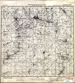
- Description:
- 1904
- Subject:
- Geographic Subject: Novoshakhtinsk, Topical Subject: Soviet Union, and Topical Subject: Maps
- Publisher:
- Генеральный штаб Красной Армии
- Language:
- Russian
- Date Created:
- 1941
- Identifier:
- VAC9619-001994
- Genre:
- Topographic Maps and Military Maps
- Geographic Location:
- Coordinates: 47.6667, 39.5, 48, 40
- Related URL:
- Download GeoTIFF: https://drive.google.com/open?id=1Z71FJW1PPTeU6Zq-xJa1RdMaUeG9VcpI and Catalog URL: https://iucat.iu.edu/catalog/5020129
- Abstract:
- Modern area represented: Novoshakhtinsk, Luhansk oblast, Ukraine
- Call Number:
- G7000 s100 .S7 sheet L-37-8
- Caption:
- Для служебного пользования
- City:
- Новошахтинск (Novoshakhtinsk)
- Copyright Holder:
- No Copyright - United States
- Country:
- СССР (USSR)
- State/Province:
- Ворошиловградская область (Voroshilovgrad oblast), Украинская ССР (Ukrainian Soviet Socialist Republic), Ростовская область (Rostov oblast), and РСФСР (RSFSR)
- Physical Description:
- Scale: 1:100,000
- Persistent URL:
- http://purl.dlib.indiana.edu/iudl/images/VAC9619/VAC9619-001994
- Provenance:
- CIA Map Library
-
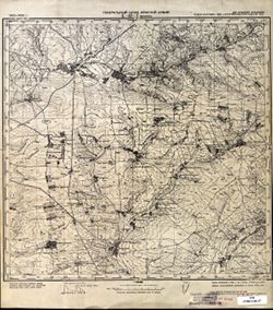
- Description:
- 1902
- Subject:
- Geographic Subject: Dyakove, Topical Subject: Maps, Topical Subject: Soviet Union, and Geographic Subject: Luhansk
- Publisher:
- Генеральный штаб Красной Армии
- Language:
- Russian
- Date Created:
- 1941
- Identifier:
- VAC9619-001993
- Genre:
- Topographic Maps and Military Maps
- Geographic Location:
- Coordinates: 47.6667, 39, 48, 39.5
- Related URL:
- Catalog URL: https://iucat.iu.edu/catalog/5020129 and Download GeoTIFF: https://drive.google.com/open?id=1sq_QopHU0Yotfn_WLpGDPw_5Td4Y2ko5
- Abstract:
- Modern area represented: Dyakove, Luhansk, Ukraine
- Call Number:
- G7000 s100 .S7 sheet L-37-7
- Caption:
- Для служебного пользования
- City:
- Дьяково (Diakovo)
- Copyright Holder:
- No Copyright - United States
- Country:
- СССР (USSR)
- State/Province:
- Украинская ССР (Ukrainian Soviet Socialist Republic), Ростовская область (Rostov oblast), РСФСР (RSFSR), and Ворошиловградская область (Voroshilovgrad oblast)
- Physical Description:
- Scale: 1:100,000
- Persistent URL:
- http://purl.dlib.indiana.edu/iudl/images/VAC9619/VAC9619-001993
- Provenance:
- CIA Map Library
-
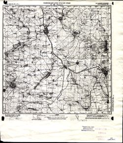
- Description:
- 1895
- Subject:
- Geographic Subject: Ilovays'k, Topical Subject: Soviet Union, and Topical Subject: Maps
- Publisher:
- Генеральный штаб Красной Армии
- Language:
- Russian
- Date Created:
- 1941
- Identifier:
- VAC9619-001991
- Genre:
- Military Maps and Topographic Maps
- Geographic Location:
- Coordinates: 47.6667, 38, 48, 38.5
- Related URL:
- Download GeoTIFF: https://drive.google.com/open?id=1kH7oS86WKdYFUSnKJLcOrEqzxFAZpxdS and Catalog URL: https://iucat.iu.edu/catalog/5020129
- Abstract:
- Modern area represented: Иловайск (Ilovays'k), Ukraine
- Call Number:
- G7000 s100 .S7 sheet L-37-5
- Caption:
- Для cлужебного пользования
- City:
- Иловайск (Ilovaĭsk)
- Copyright Holder:
- No Copyright - United States
- Country:
- СССР (USSR)
- State/Province:
- Украинская ССР (Ukrainian Soviet Socialist Republic) and Сталинская область (Stalino oblast)
- Physical Description:
- Scale: 1:100,000
- Persistent URL:
- http://purl.dlib.indiana.edu/iudl/images/VAC9619/VAC9619-001991
- Provenance:
- CIA Map Library
-
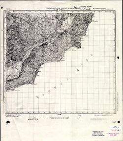
- Description:
- 1889
- Subject:
- Topical Subject: Soviet Union, Geographic Subject: Yalta, Topical Subject: Maps, and Geographic Subject: Republic of Crimea
- Publisher:
- Генеральный штаб Красной Армии
- Language:
- Russian
- Date Created:
- 1941
- Identifier:
- VAC9619-001968
- Genre:
- Military Maps and Topographic Maps
- Geographic Location:
- Coordinates: 44.3333, 34, 44.6667, 34.5
- Related URL:
- Download GeoTIFF: https://drive.google.com/open?id=1bqnvue1x6vK7NQBgS7rVUAY7TfqiMxJ1 and Catalog URL: https://iucat.iu.edu/catalog/5020129
- Abstract:
- Modern area represented: Ялта (Yalta), Republic of Crimea, Ukraine
- Call Number:
- G7000 s100 .S7 sheet L-36-129
- Caption:
- Для cлужебного пользования
- City:
- Ялта (Yalta)
- Copyright Holder:
- No Copyright - United States
- Country:
- СССР (USSR)
- State/Province:
- РСФСР (RSFSR) and Крымская АССР (Crimean Autonomous Soviet Socialist Republic)
- Physical Description:
- Scale: 1:100,000
- Persistent URL:
- http://purl.dlib.indiana.edu/iudl/images/VAC9619/VAC9619-001968
- Provenance:
- CIA Map Library
-
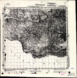
- Description:
- 1886
- Subject:
- Geographic Subject: Republic of Crimea, Topical Subject: Soviet Union, Topical Subject: Maps, and Geographic Subject: Sevastopolʹ
- Publisher:
- Генеральный штаб Красной Армии
- Language:
- Russian
- Date Created:
- 1941
- Identifier:
- VAC9619-001967
- Genre:
- Topographic Maps and Military Maps
- Geographic Location:
- Coordinates: 44.3333, 33.5, 44.6667, 34
- Related URL:
- Catalog URL: https://iucat.iu.edu/catalog/5020129 and Download GeoTIFF: https://drive.google.com/open?id=19Qph3otPZ3oxM7TayXAtAFPDKXxzx8mM
- Abstract:
- Modern area represented: Севастополь (Sevastopolʹ), Republic of Crimea, Ukraine
- Call Number:
- G7000 s100 .S7 sheet L-36-128
- Caption:
- Для cлужебного пользования
- City:
- Севастополь (Sevastopolʹ)
- Copyright Holder:
- No Copyright - United States
- Country:
- СССР (USSR)
- State/Province:
- Крымская АССР (Crimean Autonomous Soviet Socialist Republic) and РСФСР (RSFSR)
- Physical Description:
- Scale: 1:100,000
- Persistent URL:
- http://purl.dlib.indiana.edu/iudl/images/VAC9619/VAC9619-001967
- Provenance:
- CIA Map Library
-
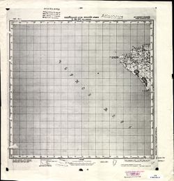
- Description:
- 1886
- Subject:
- Topical Subject: Soviet Union, Geographic Subject: Republic of Crimea, Geographic Subject: Kozacha Bukhta, and Topical Subject: Maps
- Publisher:
- Генеральный штаб Красной Армии
- Language:
- Russian
- Date Created:
- 1941
- Identifier:
- VAC9619-001966
- Genre:
- Military Maps and Topographic Maps
- Geographic Location:
- Coordinates: 44.3333, 33, 44.6667, 33.5
- Related URL:
- Catalog URL: https://iucat.iu.edu/catalog/5020129 and Download GeoTIFF: https://drive.google.com/open?id=1rTxCetecx0VLFlLfe6F9Oq1Ke8pfHb3y
- Abstract:
- Modern area represented: Козача Бухта (Kozacha Bukhta), Republic of Crimea, Ukraine
- Call Number:
- G7000 s100 .S7 sheet L-36-127
- Caption:
- Для cлужебного пользования
- City:
- Бух. Казачья (Bukh. Kazachʹya)
- Copyright Holder:
- No Copyright - United States
- Country:
- СССР (USSR)
- State/Province:
- РСФСР (RSFSR) and Крымская АССР (Crimean Autonomous Soviet Socialist Republic)
- Physical Description:
- Scale: 1:100,000
- Persistent URL:
- http://purl.dlib.indiana.edu/iudl/images/VAC9619/VAC9619-001966
- Provenance:
- CIA Map Library
-
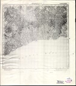
- Description:
- 1893
- Subject:
- Topical Subject: Maps, Geographic Subject: Republic of Crimea, Topical Subject: Soviet Union, and Geographic Subject: Sudak
- Publisher:
- Генеральный штаб Красной Армии
- Language:
- Russian
- Date Created:
- 1941
- Identifier:
- VAC9619-001965
- Genre:
- Military Maps and Topographic Maps
- Geographic Location:
- Coordinates: 44.6667, 34.5, 45, 35
- Related URL:
- Catalog URL: https://iucat.iu.edu/catalog/5020129 and Download GeoTIFF: https://drive.google.com/open?id=1GhztGrCrZpnhgPiIlhQl9-H8NXi_gHr3
- Abstract:
- Modern area represented: Sudak, Republic of Crimea, Ukraine
- Call Number:
- G7000 s100 .S7 sheet L-36-118
- Caption:
- Для служебного пользования
- City:
- Судак (Sudak)
- Copyright Holder:
- No Copyright - United States
- Country:
- СССР (USSR)
- State/Province:
- Крымская АССР (Crimean Autonomous Soviet Socialist Republic) and РСФСР (RSFSR)
- Physical Description:
- Scale: 1:100,000
- Persistent URL:
- http://purl.dlib.indiana.edu/iudl/images/VAC9619/VAC9619-001965
- Provenance:
- CIA Map Library
-
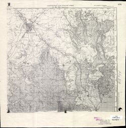
- Description:
- 1889
- Subject:
- Topical Subject: Maps, Geographic Subject: Republic of Crimea, Topical Subject: Soviet Union, and Geographic Subject: Simferopol
- Publisher:
- Генеральный штаб Красной Армии
- Language:
- Russian
- Date Created:
- 1941
- Identifier:
- VAC9619-001963
- Genre:
- Topographic Maps and Military Maps
- Geographic Location:
- Coordinates: 44.6667, 34, 45, 34.5
- Related URL:
- Download GeoTIFF: https://drive.google.com/open?id=1TOUI0x_hdHUWzPPKcEX-0cHUegwFWhCx and Catalog URL: https://iucat.iu.edu/catalog/5020129
- Abstract:
- Modern area represented: Симферополь (Simferopol), Republic of Crimea, Ukraine
- Call Number:
- G7000 s100 .S7 sheet L-36-117
- Caption:
- Для cлужебного пользования
- City:
- Симферополь (Simferopol)
- Copyright Holder:
- No Copyright - United States
- Country:
- СССР (USSR)
- State/Province:
- Крымская АССР (Crimean Autonomous Soviet Socialist Republic) and РСФСР (RSFSR)
- Physical Description:
- Scale: 1:100,000
- Persistent URL:
- http://purl.dlib.indiana.edu/iudl/images/VAC9619/VAC9619-001963
- Provenance:
- CIA Map Library
-
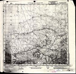
- Description:
- 1889
- Subject:
- Geographic Subject: Republic of Crimea, Geographic Subject: Bakhchisaray, Topical Subject: Maps, and Topical Subject: Soviet Union
- Publisher:
- Генеральный штаб Красной Армии
- Language:
- Russian
- Date Created:
- 1941
- Identifier:
- VAC9619-001962
- Genre:
- Topographic Maps and Military Maps
- Geographic Location:
- Coordinates: 44.6667, 33.5, 45, 34
- Related URL:
- Download GeoTIFF: https://drive.google.com/open?id=1DfDXkMyieH7JsBdvMuTRR8d3wYawQcd9 and Catalog URL: https://iucat.iu.edu/catalog/5020129
- Abstract:
- Modern area represented: Bakhchisaray (Bakhchisaray), Republic of Crimea, Ukraine
- Call Number:
- G7000 s100 .S7 sheet L-36-116
- Caption:
- Для cлужебного пользования
- City:
- Bakhchisaray (Bakhchisaray)
- Copyright Holder:
- No Copyright - United States
- Country:
- СССР (USSR)
- State/Province:
- РСФСР (RSFSR) and Крымская АССР (Crimean Autonomous Soviet Socialist Republic)
- Physical Description:
- Scale: 1:100,000
- Persistent URL:
- http://purl.dlib.indiana.edu/iudl/images/VAC9619/VAC9619-001962
- Provenance:
- CIA Map Library
-
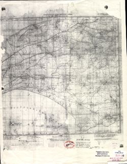
- Description:
- 1889
- Subject:
- Geographic Subject: Lenino, Geographic Subject: Republic of Crimea, Topical Subject: Maps, and Topical Subject: Soviet Union
- Publisher:
- Генеральный штаб Красной Армии
- Language:
- Russian
- Date Created:
- 1941
- Identifier:
- VAC9619-001961
- Genre:
- Military Maps and Topographic Maps
- Geographic Location:
- Coordinates: 45, 35.5, 45.3333, 36
- Related URL:
- Catalog URL: https://iucat.iu.edu/catalog/5020129 and Download GeoTIFF: https://drive.google.com/file/d/1F8w9d0KgUCxo4OSUz7aU9WcBWB-3VFWe/view?usp=sharing
- Abstract:
- Modern area represented: Ленино (Lenino), Republic of Crimea, Ukraine
- Call Number:
- G7000 s100 .S7 sheet L-36-108
- Caption:
- Для cлужебного пользования
- City:
- Семь Колодезей (Semʹ Kolodezeĭ)
- Copyright Holder:
- No Copyright - United States
- Country:
- СССР (USSR)
- State/Province:
- РСФСР (RSFSR) and Крымская АССР (Crimean Autonomous Soviet Socialist Republic)
- Physical Description:
- Scale: 1:100,000
- Persistent URL:
- http://purl.dlib.indiana.edu/iudl/images/VAC9619/VAC9619-001961
- Provenance:
- CIA Map Library
-
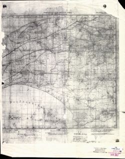
- Description:
- 1889
- Subject:
- Topical Subject: Maps, Topical Subject: Soviet Union, Geographic Subject: Republic of Crimea, and Geographic Subject: Lenino
- Publisher:
- Генеральный штаб Красной Армии
- Language:
- Russian
- Date Created:
- 1941
- Identifier:
- VAC9619-001960
- Genre:
- Topographic Maps and Military Maps
- Geographic Location:
- Coordinates: 45, 35.5, 45.3333, 36
- Related URL:
- Catalog URL: https://iucat.iu.edu/catalog/5020129 and Download GeoTIFF: https://drive.google.com/open?id=1qSuczLfm0jn5nGPeX25LeOWVuRiIlhhe
- Abstract:
- Modern area represented: Ленино (Lenino), Republic of Crimea, Ukraine
- Call Number:
- G7000 s100 .S7 sheet L-36-108
- Caption:
- Для cлужебного пользования
- City:
- Семь Колодезей (Semʹ Kolodezeĭ)
- Copyright Holder:
- No Copyright - United States
- Country:
- СССР (USSR)
- State/Province:
- РСФСР (RSFSR) and Крымская АССР (Crimean Autonomous Soviet Socialist Republic)
- Physical Description:
- Scale: 1:100,000
- Persistent URL:
- http://purl.dlib.indiana.edu/iudl/images/VAC9619/VAC9619-001960
- Provenance:
- CIA Map Library
-
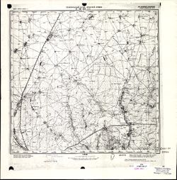
- Description:
- 1894
- Subject:
- Topical Subject: Maps, Topical Subject: Soviet Union, Geographic Subject: Zuya, and Geographic Subject: Republic of Crimea
- Publisher:
- Генеральный штаб Красной Армии
- Language:
- Russian
- Date Created:
- 1941
- Identifier:
- VAC9619-001957
- Genre:
- Military Maps and Topographic Maps
- Geographic Location:
- Coordinates: 45, 34, 45.3333, 34.5
- Related URL:
- Catalog URL: https://iucat.iu.edu/catalog/5020129 and Download GeoTIFF: https://drive.google.com/open?id=1OnZgZa5AYScso5JZKHdHoMlUXdIKTLCN
- Abstract:
- Modern area represented: Зуя (Zuya), Republic of Crimea, Ukraine
- Call Number:
- G7000 s100 .S7 sheet L-36-105
- Caption:
- Для cлужебного пользования
- City:
- Зуя (Zuya)
- Copyright Holder:
- No Copyright - United States
- Country:
- СССР (USSR)
- State/Province:
- РСФСР (RSFSR) and Крымская АССР (Crimean Autonomous Soviet Socialist Republic)
- Physical Description:
- Scale: 1:100,000
- Persistent URL:
- http://purl.dlib.indiana.edu/iudl/images/VAC9619/VAC9619-001957
- Provenance:
- CIA Map Library
-
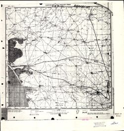
- Description:
- 1895
- Subject:
- Geographic Subject: Republic of Crimea, Geographic Subject: Saki, Topical Subject: Soviet Union, and Topical Subject: Maps
- Publisher:
- Генеральный штаб Красной Армии
- Language:
- Russian
- Date Created:
- 1941
- Identifier:
- VAC9619-001956
- Genre:
- Topographic Maps and Military Maps
- Geographic Location:
- Coordinates: 45, 33.5, 45.3333, 34
- Related URL:
- Download GeoTIFF: https://drive.google.com/open?id=1KeZQMnq0svWW8sbbr2gRu_IXfdHE5Zod and Catalog URL: https://iucat.iu.edu/catalog/5020129
- Abstract:
- Modern area represented: Саки (Saki), Republic of Crimea, Ukraine
- Call Number:
- G7000 s100 .S7 sheet L-36-104
- Caption:
- Для cлужебного пользования
- City:
- Саки (Saki)
- Copyright Holder:
- No Copyright - United States
- Country:
- СССР (USSR)
- State/Province:
- РСФСР (RSFSR)
- Physical Description:
- Scale: 1:100,000
- Persistent URL:
- http://purl.dlib.indiana.edu/iudl/images/VAC9619/VAC9619-001956
- Provenance:
- CIA Map Library
-
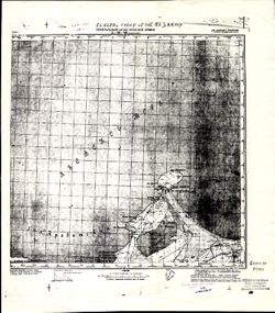
- Description:
- 1934
- Subject:
- Topical Subject: Maps, Topical Subject: Soviet Union, Geographic Subject: Mysovoe, and Geographic Subject: Republic of Crimea
- Publisher:
- Генеральный штаб Красной Армии
- Language:
- Russian
- Date Created:
- 1941
- Identifier:
- VAC9619-001954
- Genre:
- Topographic Maps and Military Maps
- Geographic Location:
- Coordinates: 45.3333, 35.5, 45.6667, 36
- Related URL:
- Catalog URL: https://iucat.iu.edu/catalog/5020129 and Download GeoTIFF: https://drive.google.com/open?id=1jfXKzouzM5qYecIVbrybXX3t61115vIV
- Abstract:
- Modern area represented: Мисове (Mysovoe), Republic of Crimea, Ukraine
- Call Number:
- G7000 s100 .S7 sheet L-36-96
- Caption:
- Для cлужебного пользования
- City:
- Казантип (Kazantip)
- Copyright Holder:
- No Copyright - United States
- Country:
- СССР (USSR)
- State/Province:
- РСФСР (RSFSR) and Крымская АССР (Crimean Autonomous Soviet Socialist Republic)
- Physical Description:
- Scale: 1:100,000
- Persistent URL:
- http://purl.dlib.indiana.edu/iudl/images/VAC9619/VAC9619-001954
- Provenance:
- CIA Map Library
-
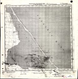
- Description:
- 1896
- Subject:
- Topical Subject: Maps, Geographic Subject: Дмитровка (Dmytrivka), and Topical Subject: Soviet Union
- Publisher:
- Генеральный штаб Красной Армии
- Language:
- Russian
- Date Created:
- 1941
- Identifier:
- VAC9619-001953
- Genre:
- Military Maps and Topographic Maps
- Geographic Location:
- Coordinates: 45.3333, 35, 45.6667, 35.5
- Related URL:
- Download GeoTIFF: https://drive.google.com/open?id=1alsoen4zV_rDxBzBa0ouX2b3Aey42eII and Catalog URL: https://iucat.iu.edu/catalog/5020129
- Abstract:
- Modern area represented: Дмитровка (Dmytrivka), Ukraine
- Call Number:
- G7000 s100 .S7 sheet L-36-95
- Caption:
- Для cлужебного пользования
- City:
- Белый Кош (Belyĭ Kosh)
- Copyright Holder:
- No Copyright - United States
- Country:
- СССР (USSR)
- State/Province:
- Крымская АССР (Crimean Autonomous Soviet Socialist Republic) and РСФСР (RSFSR)
- Physical Description:
- Scale: 1:100,000
- Persistent URL:
- http://purl.dlib.indiana.edu/iudl/images/VAC9619/VAC9619-001953
- Provenance:
- CIA Map Library
-
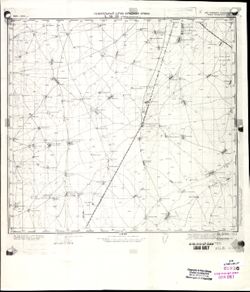
- Description:
- 1901
- Subject:
- Geographic Subject: Krasnogvardeyskoye, Geographic Subject: Republic of Crimea, Topical Subject: Maps, and Topical Subject: Soviet Union
- Publisher:
- Генеральный штаб Красной Армии
- Language:
- Russian
- Date Created:
- 1941
- Identifier:
- VAC9619-001950
- Genre:
- Military Maps and Topographic Maps
- Geographic Location:
- Coordinates: 45.3333, 34, 45.6667, 34.5
- Related URL:
- Download GeoTIFF: https://drive.google.com/open?id=1lM6d3x1RLT7060qqDCk6gvWu-BO--nG1 and Catalog URL: https://iucat.iu.edu/catalog/5020129
- Abstract:
- Modern area represented: Красногвардейское (Krasnogvardeyskoye), Republic of Crimea, Ukraine
- Call Number:
- G7000 s100 .S7 sheet L-36-93
- Caption:
- Для cлужебного пользования
- City:
- Курман-Кемельчи (Kurman-Kemelʹchi)
- Copyright Holder:
- No Copyright - United States
- Country:
- СССР (USSR)
- State/Province:
- Крымская АССР (Crimean Autonomous Soviet Socialist Republic) and РСФСР (RSFSR)
- Physical Description:
- Scale: 1:100,000
- Persistent URL:
- http://purl.dlib.indiana.edu/iudl/images/VAC9619/VAC9619-001950
- Provenance:
- CIA Map Library
-

- Description:
- 1896
- Subject:
- Topical Subject: Maps, Topical Subject: Soviet Union, and Geographic Subject: Sary-Bash
- Publisher:
- Генеральный штаб Красной Армии
- Language:
- Russian
- Date Created:
- 1941
- Identifier:
- VAC9619-001949
- Genre:
- Topographic Maps and Military Maps
- Geographic Location:
- Coordinates: 45.3333, 33.5, 45.6667, 34
- Related URL:
- Catalog URL: https://iucat.iu.edu/catalog/5020129 and Download GeoTIFF: https://drive.google.com/open?id=198a1c5n1y2mIiNpDyuHqRfuTZjmRL7j9
- Abstract:
- Modern area represented: Сары-Баш (Sary-Bash), Republic of Crimea, Ukraine
- Call Number:
- G7000 s100 .S7 sheet L-36-92
- Caption:
- Для cлужебного пользования
- City:
- Сары-Баш (Sary-Bash)
- Copyright Holder:
- No Copyright - United States
- Country:
- СССР (USSR)
- State/Province:
- РСФСР (RSFSR) and Крымская АССР (Crimean Autonomous Soviet Socialist Republic)
- Physical Description:
- Scale: 1:100,000
- Persistent URL:
- http://purl.dlib.indiana.edu/iudl/images/VAC9619/VAC9619-001949
- Provenance:
- CIA Map Library
-
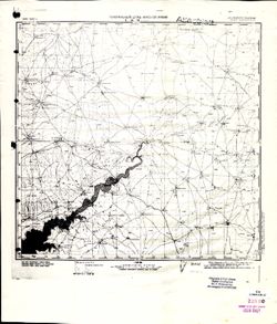
- Description:
- 1898
- Subject:
- Geographic Subject: Republic of Crimea, Topical Subject: Maps, Topical Subject: Soviet Union, and Geographic Subject: Krasnoyars'ke
- Publisher:
- Генеральный штаб Красной Армии
- Language:
- Russian
- Date Created:
- 1941
- Identifier:
- VAC9619-001948
- Genre:
- Military Maps and Topographic Maps
- Geographic Location:
- Coordinates: 45.3333, 33, 45.6667, 33.5
- Related URL:
- Catalog URL: https://iucat.iu.edu/catalog/5020129 and Download GeoTIFF: https://drive.google.com/open?id=1_OvVcz79LJgoJVCaS7m7OxWPt6RbjXde
- Abstract:
- Modern area represented: Красноярське (Krasnoyars'ke), Republic of Crimea, Ukraine
- Call Number:
- G7000 s100 .S7 sheet L-36-91
- Caption:
- Для cлужебного пользования
- City:
- Сачал (Sachal)
- Copyright Holder:
- No Copyright - United States
- Country:
- СССР (USSR)
- State/Province:
- Крымская АССР (Crimean Autonomous Soviet Socialist Republic) and РСФСР (RSFSR)
- Physical Description:
- Scale: 1:100,000
- Persistent URL:
- http://purl.dlib.indiana.edu/iudl/images/VAC9619/VAC9619-001948
- Provenance:
- CIA Map Library
-
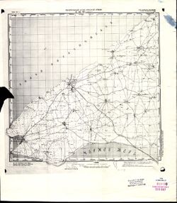
- Description:
- 1898
- Subject:
- Topical Subject: Soviet Union, Geographic Subject: Republic of Crimea, Topical Subject: Maps, and Geographic Subject: Chernomorskoye
- Publisher:
- Генеральный штаб Красной Армии
- Language:
- Russian
- Date Created:
- 1941
- Identifier:
- VAC9619-001946
- Genre:
- Military Maps and Topographic Maps
- Geographic Location:
- Coordinates: 45.3333, 32.5, 45.6667, 33
- Related URL:
- Download GeoTIFF: https://drive.google.com/open?id=1JmGMr0RrP1R4yfruPFTI7M_d-_ezIDnC and Catalog URL: https://iucat.iu.edu/catalog/5020129
- Abstract:
- Modern area represented: Черноморское (Chernomorskoye), Republic of Crimea, Ukraine
- Call Number:
- G7000 s100 .S7 sheet L-36-90
- Caption:
- Для cлужебного пользования
- City:
- Ак-Мечеть (Ak-Mechetʹ)
- Copyright Holder:
- No Copyright - United States
- Country:
- СССР (USSR)
- State/Province:
- РСФСР (RSFSR) and Крымская АССР (Crimean Autonomous Soviet Socialist Republic)
- Physical Description:
- Scale: 1:100,000
- Persistent URL:
- http://purl.dlib.indiana.edu/iudl/images/VAC9619/VAC9619-001946
- Provenance:
- CIA Map Library
-
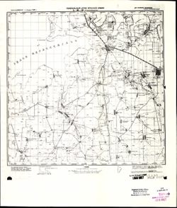
- Description:
- 1900
- Subject:
- Geographic Subject: Krasnoperekopsk, Topical Subject: Soviet Union, Geographic Subject: Republic of Crimea, and Topical Subject: Maps
- Publisher:
- Генеральный штаб Красной Армии
- Language:
- Russian
- Date Created:
- 1941
- Identifier:
- VAC9619-001942
- Genre:
- Military Maps and Topographic Maps
- Geographic Location:
- Coordinates: 45.6667, 33.5, 46, 34
- Related URL:
- Catalog URL: https://iucat.iu.edu/catalog/5020129 and Download GeoTIFF: https://drive.google.com/open?id=19vuJKNo-7ztrGdjs5V7oHyn0x8claJ8V
- Abstract:
- Modern area represented: Красноперекопск (Krasnoperekopsk), Republic of Crimea, Ukraine
- Call Number:
- G7000 s100 .S7 sheet L-36-80
- Caption:
- Для cлужебного пользования
- City:
- Красноперекопск (Krasnoperekopsk)
- Copyright Holder:
- No Copyright - United States
- Country:
- СССР (USSR)
- State/Province:
- РСФСР (RSFSR) and Крымская АССР (Crimean Autonomous Soviet Socialist Republic)
- Physical Description:
- Scale: 1:100,000
- Persistent URL:
- http://purl.dlib.indiana.edu/iudl/images/VAC9619/VAC9619-001942
- Provenance:
- CIA Map Library
-
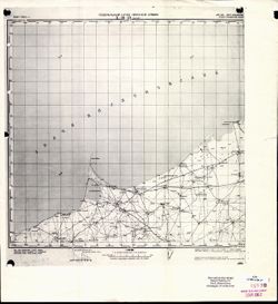
- Description:
- 1899
- Subject:
- Topical Subject: Soviet Union, Topical Subject: Maps, and Geographic Subject: Slavne
- Publisher:
- Генеральный штаб Красной Армии
- Language:
- Russian
- Date Created:
- 1941
- Identifier:
- VAC9619-001927
- Genre:
- Military Maps and Topographic Maps
- Geographic Location:
- Coordinates: 45.6667, 33, 46, 33.5
- Related URL:
- Catalog URL: https://iucat.iu.edu/catalog/5020129 and Download GeoTIFF: https://drive.google.com/open?id=18d2YDe94-hXEd9X6UYYnpuKQUZoK9pxF
- Abstract:
- Modern area represented: Slavne, Republic of Crimea, Ukraine
- Call Number:
- G7000 s100 .S7 sheet L-36-79
- Caption:
- Для cлужебного пользования
- City:
- Бакал (Bakal)
- Copyright Holder:
- No Copyright - United States
- Country:
- СССР (USSR)
- State/Province:
- РСФСР (RSFSR) and Крымская АССР (Crimean Autonomous Soviet Socialist Republic)
- Physical Description:
- Scale: 1:100,000
- Persistent URL:
- http://purl.dlib.indiana.edu/iudl/images/VAC9619/VAC9619-001927
- Provenance:
- CIA Map Library
-
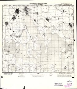
- Description:
- 1933
- Subject:
- Geographic Subject: Hromivka, Topical Subject: Soviet Union, and Topical Subject: Maps
- Publisher:
- Генеральный штаб Красной Армии
- Language:
- Russian
- Date Created:
- 1941
- Identifier:
- VAC9619-001923
- Genre:
- Topographic Maps and Military Maps
- Geographic Location:
- Coordinates: 46, 34, 46.3333, 34.5
- Related URL:
- Download GeoTIFF: https://drive.google.com/open?id=1sOMPSRT5vHzGSJy5FqPqnkWmkwqYR5YH and Catalog URL: https://iucat.iu.edu/catalog/5020129
- Abstract:
- Modern area represented: Hromivka, Kherson oblast, Ukraine
- Call Number:
- G7000 s100 .S7 sheet L-36-69
- Caption:
- Для служебного пользования
- City:
- Громовка (Gromovka)
- Copyright Holder:
- No Copyright - United States
- Country:
- СССР (USSR)
- State/Province:
- Украинская ССР (Ukrainian Soviet Socialist Republic), Крымская АССР (Crimean Autonomous Soviet Socialist Republic), Запорожская область (Zaporizhia oblast), ...
- Physical Description:
- Scale: 1:100,000
- Persistent URL:
- http://purl.dlib.indiana.edu/iudl/images/VAC9619/VAC9619-001923
- Provenance:
- CIA Map Library
-
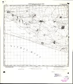
- Description:
- 1921
- Subject:
- Topical Subject: Maps, Geographic Subject: Dolmativka, and Topical Subject: Soviet Union
- Publisher:
- Генеральный штаб Красной Армии
- Language:
- Russian
- Date Created:
- 1941
- Identifier:
- VAC9619-001919
- Genre:
- Military Maps and Topographic Maps
- Geographic Location:
- Coordinates: 46, 32, 46.3333, 32.5
- Related URL:
- Download GeoTIFF: https://drive.google.com/file/d/1L4fNjU1brQervVVFn9QL3UE2i87J8NuW/view?usp=sharing and Catalog URL: https://iucat.iu.edu/catalog/5020129
- Abstract:
- Modern area represented: Dolmativka, Kherson oblast, Ukraine
- Call Number:
- G7000 s100 .S7 sheet L-36-65
- Caption:
- Для служебного пользования
- City:
- Долматовка (Dolmativka)
- Copyright Holder:
- No Copyright - United States
- Country:
- СССР (USSR)
- State/Province:
- Украинская ССР (Ukrainian Soviet Socialist Republic)
- Physical Description:
- Scale: 1:100,000
- Persistent URL:
- http://purl.dlib.indiana.edu/iudl/images/VAC9619/VAC9619-001919
- Provenance:
- CIA Map Library
-
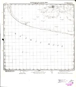
- Description:
- 1921
- Subject:
- Geographic Subject: Svobodnyy Port, Topical Subject: Maps, and Topical Subject: Soviet Union
- Publisher:
- Генеральный штаб Красной Армии
- Language:
- Russian
- Date Created:
- 1941
- Identifier:
- VAC9619-001917
- Genre:
- Military Maps and Topographic Maps
- Geographic Location:
- Coordinates: 46, 31.5, 46.3333, 32
- Related URL:
- Download GeoTIFF: https://drive.google.com/open?id=1Sb_dGRMg0HfrO5ItVnTYcnwkLVx7criG and Catalog URL: https://iucat.iu.edu/catalog/5020129
- Abstract:
- Modern area represented: Svobodnyy Port, Kherson oblast, Ukraine
- Call Number:
- G7000 s100 .S7 sheet L-36-64
- Caption:
- Для служебного пользования
- City:
- Свободный Порт (Svobodnyy Port)
- Copyright Holder:
- No Copyright - United States
- Country:
- СССР (USSR)
- State/Province:
- Украинская ССР (Ukrainian Soviet Socialist Republic)
- Physical Description:
- Scale: 1:100,000
- Persistent URL:
- http://purl.dlib.indiana.edu/iudl/images/VAC9619/VAC9619-001917
- Provenance:
- CIA Map Library
-

- Description:
- 1921
- Subject:
- Geographic Subject: Novotroyitske, Topical Subject: Soviet Union, and Topical Subject: Maps
- Publisher:
- Генеральный штаб Красной Армии
- Language:
- Russian
- Date Created:
- 1941
- Identifier:
- VAC9619-001911
- Genre:
- Military Maps and Topographic Maps
- Geographic Location:
- Coordinates: 46.3333, 34, 46.6667, 34.5
- Related URL:
- Catalog URL: https://iucat.iu.edu/catalog/5020129 and Download GeoTIFF: https://drive.google.com/file/d/1bcJGE9zpja7gYzwVppi-fxI5rlAj7MXB/view?usp=sharing
- Abstract:
- Modern area represented: Novotroyitske, Kherson oblast, Ukraine
- Call Number:
- G7000 s100 .S7 sheet L-36-57
- Caption:
- Для служебного пользования
- City:
- Ново-Троицкое (Novo-Troitskoye)
- Copyright Holder:
- No Copyright - United States
- Country:
- СССР (USSR)
- State/Province:
- Николаевская область (Mykolaiv oblast), Украинская ССР (Ukrainian Soviet Socialist Republic), and Запорожская область (Zaporizhia oblast)
- Physical Description:
- Scale: 1:100,000
- Persistent URL:
- http://purl.dlib.indiana.edu/iudl/images/VAC9619/VAC9619-001911
- Provenance:
- CIA Map Library
-
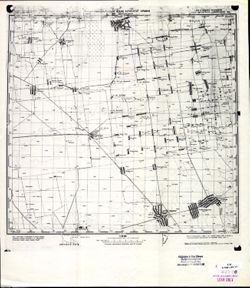
- Description:
- 1921
- Subject:
- Topical Subject: Maps, Geographic Subject: Novotroyitske, and Topical Subject: Soviet Union
- Publisher:
- Генеральный штаб Красной Армии
- Language:
- Russian
- Date Created:
- 1941
- Identifier:
- VAC9619-001910
- Genre:
- Topographic Maps and Military Maps
- Geographic Location:
- Coordinates: 46.3333, 34, 46.6667, 34.5
- Related URL:
- Catalog URL: https://iucat.iu.edu/catalog/5020129 and Download GeoTIFF: https://drive.google.com/open?id=16tAOz1x8-tQ824R-6muIVRvXEhtSQEDe
- Abstract:
- Modern area represented: Novotroyitske, Kherson oblast, Ukraine
- Call Number:
- G7000 s100 .S7 sheet L-36-57
- Caption:
- Для служебного пользования
- City:
- Ново-Троицкое (Novo-Troitskoye)
- Copyright Holder:
- No Copyright - United States
- Country:
- СССР (USSR)
- State/Province:
- Николаевская область (Mykolaiv oblast), Запорожская область (Zaporizhia oblast), and Украинская ССР (Ukrainian Soviet Socialist Republic)
- Physical Description:
- Scale: 1:100,000
- Persistent URL:
- http://purl.dlib.indiana.edu/iudl/images/VAC9619/VAC9619-001910
- Provenance:
- CIA Map Library
-
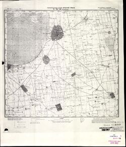
- Description:
- 1921
- Subject:
- Topical Subject: Soviet Union, Topical Subject: Maps, and Geographic Subject: Nova Mayachka
- Publisher:
- Генеральный штаб Красной Армии
- Language:
- Russian
- Date Created:
- 1941
- Identifier:
- VAC9619-001906
- Genre:
- Topographic Maps and Military Maps
- Geographic Location:
- Coordinates: 46.3333, 33, 46.6667, 33.5
- Related URL:
- Download GeoTIFF: https://drive.google.com/open?id=1Yr9vRnGudy0KWOqJTTRm-qy8PGNtqZ5f and Catalog URL: https://iucat.iu.edu/catalog/5020129
- Abstract:
- Modern area represented: Nova Mayachka, Kherson oblast, Ukraine
- Call Number:
- G7000 s100 .S7 sheet L-36-55
- Caption:
- Для служебного пользования
- City:
- Бол. Маячка (Bolshaya Mayachka)
- Copyright Holder:
- No Copyright - United States
- Country:
- СССР (USSR)
- State/Province:
- Украинская ССР (Ukrainian Soviet Socialist Republic) and Николаевская область (Mykolaiv oblast)
- Physical Description:
- Scale: 1:100,000
- Persistent URL:
- http://purl.dlib.indiana.edu/iudl/images/VAC9619/VAC9619-001906
- Provenance:
- CIA Map Library
-
- Description:
- 1891
- Subject:
- Topical Subject: Soviet Union, Topical Subject: Maps, and Geographic Subject: Dragomireşti
- Publisher:
- Генеральный штаб Красной Армии
- Language:
- Russian
- Date Created:
- 1940
- Identifier:
- VAC9619-001755
- Genre:
- Military Maps and Topographic Maps
- Geographic Location:
- Coordinates: 46.3333, 27, 46.6667, 27.5
- Related URL:
- Download GeoTIFF: https://drive.google.com/file/d/1hCPO_hgwRlOoKYWPQdYYSitq_p-y_Ezx/view?usp=sharing and Catalog URL: https://iucat.iu.edu/catalog/5020129
- Abstract:
- Modern area represented: Dragomireşti, Vaslui county, Romania
- Call Number:
- G7000 s100 .S7 sheet L-35-55
- City:
- Драгомирешти (Dragomireşti)
- Copyright Holder:
- No Copyright - United States
- Country:
- Румыния (Romania)
- Physical Description:
- Scale: 1:100,000
- Persistent URL:
- http://purl.dlib.indiana.edu/iudl/images/VAC9619/VAC9619-001755
- Provenance:
- CIA Map Library
-
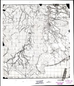
- Subject:
- Topical Subject: Maps, Geographic Subject: Aleksandriyskaya, and Topical Subject: Soviet Union
- Publisher:
- Генеральный штаб Красной Армии
- Language:
- Russian
- Identifier:
- VAC9619-000813
- Genre:
- Topographic Maps and Military Maps
- Related URL:
- Catalog URL: https://iucat.iu.edu/catalog/5020129
- Abstract:
- Modern area represented: Aleksandriyskaya, Dagestan republic, Russia
- Call Number:
- G7000 s100 .S7 sheet K-38-11
- Copyright Holder:
- No Copyright - United States
- Country:
- СССР (USSR)
- Physical Description:
- Scale: 1:100,000
- Persistent URL:
- http://purl.dlib.indiana.edu/iudl/images/VAC9619/VAC9619-000813
- Provenance:
- CIA Map Library
-
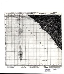
- Description:
- 1905
- Subject:
- Topical Subject: Maps, Topical Subject: Soviet Union, and Geographic Subject: Lazarevskoye
- Publisher:
- Генеральный штаб Красной Армии
- Language:
- Russian
- Date Created:
- 1942
- Identifier:
- VAC9619-000759
- Genre:
- Topographic Maps and Military Maps
- Geographic Location:
- Coordinates: 43.6667, 39, 44, 39.5
- Related URL:
- Catalog URL: https://iucat.iu.edu/catalog/5020129 and Download GeoTIFF: https://drive.google.com/open?id=1OcoSmUSM2ZO6HwjSl9T2sxJaHo8Fbzui
- Abstract:
- Modern area represented: Lazarevskoye, Krasnodar kray, Russia
- Call Number:
- G7000 s100 .S7 sheet K-37-7
- Caption:
- Для служебного пользования
- City:
- Лазаревская (Lazarevskoye)
- Copyright Holder:
- No Copyright - United States
- Country:
- СССР (USSR)
- State/Province:
- Краснодарская область (Krasnodar oblast) and РСФСР (RSFSR)
- Physical Description:
- Scale: 1:100,000
- Persistent URL:
- http://purl.dlib.indiana.edu/iudl/images/VAC9619/VAC9619-000759
- Provenance:
- CIA Map Library
-
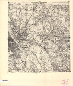
- Subject:
- Topical Subject: Maps, Geographic Subject: Warszawa, and Topical Subject: Soviet Union
- Publisher:
- Генеральный штаб Красной Армии
- Language:
- Russian
- Date Created:
- 1941
- Identifier:
- VAC9619-000325
- Genre:
- Military Maps and Topographic Maps
- Related URL:
- Catalog URL: http://iucat.iu.edu/catalog/5020131
- Abstract:
- Modern area represented: Warszawa, Poland
- Call Number:
- G7000 s50 .S68 sheet N-34-139-A
- City:
- Варшава (Warszawa)
- Copyright Holder:
- No Copyright - United States
- Country:
- Область государственных интересов Германии (Region of German state interest)
- Physical Description:
- Scale: 1:50,000
- Persistent URL:
- http://purl.dlib.indiana.edu/iudl/images/VAC9619/VAC9619-000325
- Provenance:
- CIA Map Library
-
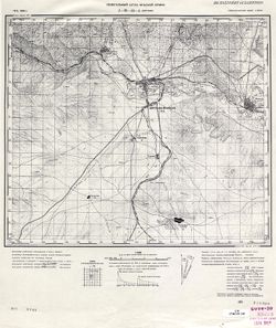
- Subject:
- Topical Subject: Maps, Topical Subject: Soviet Union, and Geographic Subject: Julfa
- Publisher:
- Генеральный штаб Красной Армии
- Language:
- Russian
- Date Created:
- 1940
- Identifier:
- VAC9619-000089
- Genre:
- Topographic Maps and Military Maps
- Geographic Location:
- Coordinates: 38.8333, 45.5, 39, 45.75
- Related URL:
- Download GeoTIFF: https://drive.google.com/open?id=1fZhMoeilfY5E-PsoYnAeUMHJQW6GUmXx and Catalog URL: http://iucat.iu.edu/catalog/5020131
- Abstract:
- Modern area represented: Julfa, Azerbaijan
- Call Number:
- G7000 s50 .S68 sheet J-38-44-A
- Caption:
- Не подлежит оглашению
- City:
- Джульфа (Dzhulfa)
- Copyright Holder:
- No Copyright - United States
- Country:
- Иран (Iran) and СССР (USSR)
- State/Province:
- Нахичеванская АССР (Nakhichevan Autonomous Soviet Socialist Republic)
- Physical Description:
- Scale: 1:50,000
- Persistent URL:
- http://purl.dlib.indiana.edu/iudl/images/VAC9619/VAC9619-000089
- Provenance:
- CIA Map Library
