Search Constraints
You searched for:
Creator
Geological Survey (U.S.)
Remove constraint Creator: Geological Survey (U.S.)
Date Created
1973
Remove constraint Date Created: 1973
Holding Location
B-WELLS
Remove constraint Holding Location: B-WELLS
Collections
Indiana Historic Maps
Remove constraint Collections: Indiana Historic Maps
Provenance
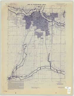
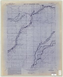
United States Department of the Interior, Geological Survey. Map of flood-prone areas : [Indiana]. Washington, D.C. : The Survey, 1969-.
Remove constraint Provenance: United States Department of the Interior, Geological Survey. Map of flood-prone areas : [Indiana]. Washington, D.C. : The Survey, 1969-.
Publisher
Geological Survey (U.S.)
Remove constraint Publisher: Geological Survey (U.S.)
Subject
Geographic Subject: Madison County (Ind.)
Remove constraint Subject: Geographic Subject: Madison County (Ind.)
State
deposited
Remove constraint State: deposited