Geographic Subject: Gibson County (Ind.), Geographic Subject: Wabash County (Ill.), Geographic Subject: Lawrence County (Ill.), and Geographic Subject: Knox ...
Creator:
Marshall, R. B. (Robert Bradford), 1867-1949, Geological Survey (U.S.), Tweedy, Frank, 1854-1937, United States. Army. Corps of Engineers, Illinois State Geo...
Publisher:
Geological Survey (U.S.)
Date Created:
1944
Identifier:
VAC3073-M-01508
Genre:
Topographic maps, 15 minute topographic maps, and Quadrangle maps
Some charts have imprint: Fort Belvoir, Va.: 30th Engineers by reproduction plant, 1943, or Washington, D.C.: Engineer reproduction plant, U.S. Army, 1929.
Call Number:
G3707.O5 1911 .U55
Caption:
Imprint: Detroit, Michigan : U.S. Lake Survey Office, 1911-1914.
Geographic Subject: Indiana, Topical Subject: Rivers, and Geographic Subject: Wabash River
Creator:
United States. Army. Corps of Engineers
Publisher:
United States. Army. Corps of Engineers. Louisville District
Date Created:
Circa 1931
Identifier:
VAC3073-M-01487
Genre:
Nautical charts
Geographic Location:
Coordinates: W0881100 W0872000 N0392900 N0374700
Related URL:
Catalog URL: https://iucat.iu.edu/catalog/5485820
Abstract:
Surveyed and mapped under the direction of the United States engineer officer, Louisville, Ky. Relief shown by contours and spot heights. Depths shown by s...
Call Number:
G4072.W3 C315 1931 .U55
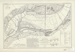
Caption:
Imprint: [Louisville, Ky.? , 1931?]
Physical Description:
Dimensions: sheets 92 x 122 cm and Scale: Approximately 1:24,000
Geographic Subject: Lawrence County (Ill.), Topical Subject: Vegetation mapping, Geographic Subject: Knox County (Ind.), Geographic Subject: Gibson County (I...
Creator:
Tweedy, Frank, 1854-1937, Geological Survey (U.S.), Marshall, R. B. (Robert Bradford), 1867-1949, United States. Army. Corps of Engineers, Herron, W. H. (Wil...
Publisher:
Geological Survey (U.S.)
Date Created:
1915
Identifier:
VAC3073-M-01411
Genre:
15 minute topographic maps, Topographic maps, and Quadrangle maps
Geographic Subject: Lawrence County (Ill.), Geographic Subject: Knox County (Ind.), Geographic Subject: Gibson County (Ind.), and Geographic Subject: Wabash ...
Creator:
Geological Survey (U.S.), U.S. Coast and Geodetic Survey, Tweedy, Frank, 1854-1937, Illinois State Geological Survey, Marshall, R. B. (Robert Bradford), 1867...
Publisher:
Geological Survey (U.S.)
Date Created:
1946
Identifier:
VAC3073-M-01410
Genre:
15 minute topographic maps, Quadrangle maps, and Topographic maps
Geographic Subject: Gibson County (Ind.), Geographic Subject: Knox County (Ind.), Geographic Subject: Lawrence County (Ill.), and Geographic Subject: Wabash ...
Creator:
Tweedy, Frank, 1854-1937, U.S. Coast and Geodetic Survey, Herron, W. H. (William Harrison), 1865-, United States. Army. Corps of Engineers, Geological Survey...
Publisher:
Geological Survey (U.S.)
Date Created:
1934
Identifier:
VAC3073-M-01409
Genre:
Topographic maps, Quadrangle maps, and 15 minute topographic maps
Geographic Subject: Henderson County (Ky.), Geographic Subject: Posey County (Ind.), and Geographic Subject: Union County (Ky.)
Creator:
Gehres, W. S. (Wilmer Sherman), 1887-1963, Goodlove, C. W., U.S. Coast and Geodetic Survey, Ellis, J. R. (Topographer), Geological Survey (U.S.), Herrington,...
Publisher:
Geological Survey (U.S.)
Date Created:
1941
Identifier:
VAC3073-M-01403
Genre:
Quadrangle maps, Topographic maps, and 15 minute topographic maps
R.B. Marshall, chief geographer , W.H. Herron, geographer in charge , topography by C.W. Goodlove, R.M. Herrington and W.S. Gehres , control by U.S. Coast an...
Call Number:
G4090 s62 .G4 Uniontown 1917 rep1941
Caption:
Imprint: [Washington, D.C.] : U.S. Geological Survey, 1941
Physical Description:
Dimensions: 45 x 42 cm or smaller and Scale: 1:62,500
Geographic Subject: Posey County (Ind.), Geographic Subject: Union County (Ky.), Geographic Subject: Henderson County (Ky.), and Topical Subject: Vegetation ...
Creator:
U.S. Coast and Geodetic Survey, Goodlove, C. W., Geological Survey (U.S.), Herron, W. H. (William Harrison), 1865-, Marshall, R. B. (Robert Bradford), 1867-1...
Publisher:
Geological Survey (U.S.)
Date Created:
1917
Identifier:
VAC3073-M-01402
Genre:
Topographic maps, 15 minute topographic maps, and Quadrangle maps
R.B. Marshall, chief geographer , W.H. Herron, geographer in charge , topography by C.W. Goodlove, R.M. Herrington and W.S. Gehres , control by U.S. Coast an...
Call Number:
G4090 s62 .G4 Uniontown 1917
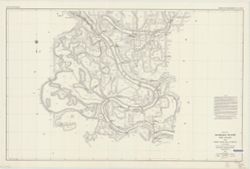
Caption:
Imprint: [Washington, D.C.] : U.S. Geological Survey, [1917]
Physical Description:
Dimensions: 45 x 42 cm or smaller and Scale: 1:62,500
Geographic Subject: Floyd County (Ind.), Geographic Subject: Jefferson County (Ky.), Geographic Subject: Bullitt County (Ky.), Geographic Subject: Harrison C...
Creator:
United States. Army. Corps of Engineers and Geological Survey (U.S.)
Mapped by the Geological Survey and the Army Map Service , published for civil use by the Geological Survey. Filing title: Kosmodale, Ky.-Ind. Polyconic proj...
Geographic Subject: Johnson County (Ind.), Geographic Subject: Bartholomew County (Ind.), Geographic Subject: Brown County (Ind.), and Topical Subject: Veget...
Creator:
Geological Survey (U.S.) and United States. Army. Corps of Engineers
Filing title: Franklin, Ind. Mapped, edited, and published by Geological Survey. Edition of 1950. Polyconic projection. Relief shown by contours and spot hei...

![Indiana-Illinois, Vincennes quadrangle : topography [1944 printing without vegetation]](https://iiif.uits.iu.edu/iiif/2/5425mf004%2Ffiles%2Fed25173c-f2ac-49e5-986c-99cf4220f9c3/full/250,/0/default.jpg)
![Indiana, 15 minute series (topographic), Vincennes quadrangle. [1915 printing with vegetation]](https://iiif.uits.iu.edu/iiif/2/d791tm29s%2Ffiles%2F3ba9ccbe-8be1-48ce-9aac-c0c3b1eb0e6b/full/250,/0/default.jpg)
![Indiana-Illinois, Vincennes quadrangle : topography [1946 reprint with corrections and without vegetation]](https://iiif.uits.iu.edu/iiif/2/n009x521b%2Ffiles%2Fda21d6eb-ada6-4f1f-8c3c-8022f31eb1a9/full/250,/0/default.jpg)
![Indiana, 15 minute series (topographic), Vincennes quadrangle. [1934 reprint without vegetation]](https://iiif.uits.iu.edu/iiif/2/h702rb42n%2Ffiles%2Ff1e13118-9dbf-4ee1-a0ac-56cd2eb3a880/full/250,/0/default.jpg)
![Kentucky-Indiana Uniontown quadrangle [1941 reprint without vegetation]](https://iiif.uits.iu.edu/iiif/2/rx914s94d%2Ffiles%2Fb75fcf05-19c0-4df9-9bed-49261c5f07c0/full/250,/0/default.jpg)
![Kentucky-Indiana Uniontown quadrangle [1917 printing with vegetation]](https://iiif.uits.iu.edu/iiif/2/q811mp029%2Ffiles%2Fff48018f-d5c5-47dc-915f-7a5f1bfd279c/full/250,/0/default.jpg)
![Kosmosdale quadrangle, Kentucky-Indiana : 15 minute series (topographic) [1959 reprint with vegetation]](https://iiif.uits.iu.edu/iiif/2/mk61sm253%2Ffiles%2Fd8ce10eb-c8cf-4182-bd5a-13d2fee0e97a/full/250,/0/default.jpg)
![Franklin Quadrangle Indiana : 15 minute series (topographic) [1964 reprint with vegetation]](https://iiif.uits.iu.edu/iiif/2/73667641k%2Ffiles%2F027698b1-090b-4a4d-a44a-17bb6da9d222/full/250,/0/default.jpg)
