
Search Constraints
You searched for:
Publisher
Управление военных топографов
Remove constraint Publisher: Управление военных топографов
State/Province
Винницкая область (Vinnytsia oblast)
Remove constraint State/Province: Винницкая область (Vinnytsia oblast)
« Previous |
1 - 10 of 23
|
Next »
Search Results
-
- Subject:
- Geographic Subject: Старий Остропіль (Staryy Ostropil’), Topical Subject: Maps, and Topical Subject: Soviet Union
- Publisher:
- Управление военных топографов
- Language:
- Russian
- Identifier:
- VAC9619-000837
- Genre:
- Military Maps and Topographic Maps
- Geographic Location:
- Coordinates: 49.667, 27.5, 49.833, 27.75
- Related URL:
- Download GeoTIFF: https://drive.google.com/open?id=14wAwOlKqK1HWUQmWU-hz_ig-RQCU4h4r and Catalog URL: http://iucat.iu.edu/catalog/5020131
- Abstract:
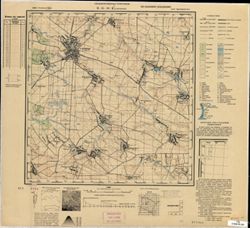
- Modern area represented: Старий Остропіль (Staryy Ostropil’), Khmelnytskyi Oblast, Ukraine
- Call Number:
- G7000 s50 .S68 sheet M-35-80-C
- Caption:
- Не подлежит оглашению
- City:
- Остропиль (Ostropil')
- Copyright Holder:
- No Copyright - United States
- Country:
- СССР (USSR)
- State/Province:
- Украинская ССР (Ukrainian Soviet Socialist Republic) and Винницкая область (Vinnytsia oblast)
- Physical Description:
- Scale: 1:50,000
- Persistent URL:
- http://purl.dlib.indiana.edu/iudl/images/VAC9619/VAC9619-000837
- Provenance:
- CIA Map Branch -- Received
-
- Subject:
- Geographic Subject: Зарічанка (Zarichanka), Topical Subject: Maps, and Topical Subject: Soviet Union
- Publisher:
- Управление военных топографов
- Language:
- Russian
- Identifier:
- VAC9619-000877
- Genre:
- Military Maps and Topographic Maps
- Geographic Location:
- Coordinates: 48.8333, 26.25, 49, 26.5
- Related URL:
- Catalog URL: http://iucat.iu.edu/catalog/5020131 and Download GeoTIFF: https://drive.google.com/open?id=1q7f4o0zCOzXih9xf9t39PFr-bHTtRI6n
- Abstract:
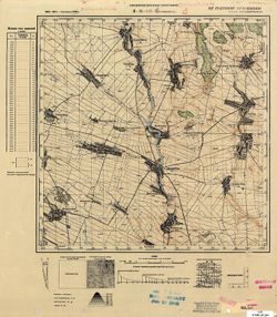
- Modern area represented: Зарічанка (Zarichanka), Khmelnytskyi Oblast, Ukraine
- Call Number:
- G7000 s50 .S68 sheet M-35-113-B
- Caption:
- Не подлежит оглашению
- City:
- Лянцкорунь (Lanckoruń)
- Copyright Holder:
- No Copyright - United States
- Country:
- СССР (USSR)
- State/Province:
- Винницкая область (Vinnytsia oblast) and Украинская ССР (Ukrainian Soviet Socialist Republic)
- Physical Description:
- Scale: 1:50,000
- Persistent URL:
- http://purl.dlib.indiana.edu/iudl/images/VAC9619/VAC9619-000877
- Provenance:
- M. I. Map Library
-
- Subject:
- Topical Subject: Maps, Geographic Subject: Камянець-Подільський (Kamianets-Podilskyi), and Topical Subject: Soviet Union
- Publisher:
- Управление военных топографов
- Language:
- Russian
- Identifier:
- VAC9619-000878
- Genre:
- Military Maps and Topographic Maps
- Geographic Location:
- Coordinates: 48.6667, 26.5, 48.8333, 26.75
- Related URL:
- Download GeoTIFF: https://drive.google.com/open?id=1d9zmDF1aOMAqfbDt_Z1j4-1yPA9Wetkx and Catalog URL: http://iucat.iu.edu/catalog/5020131
- Abstract:
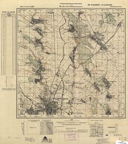
- Modern area represented: Камянець-Подільський (Kamianets-Podilskyi), Khmelnytskyi Oblast, Ukraine
- Call Number:
- G7000 s50 .S68 sheet M-35-114-C
- Caption:
- Не подлежит оглашению
- City:
- Каменец-Подольск (Kamenets-Podol’sk)
- Copyright Holder:
- No Copyright - United States
- Country:
- СССР (USSR)
- State/Province:
- Украинская ССР (Ukrainian Soviet Socialist Republic) and Винницкая область (Vinnytsia oblast)
- Physical Description:
- Scale: 1:50,000
- Persistent URL:
- http://purl.dlib.indiana.edu/iudl/images/VAC9619/VAC9619-000878
- Provenance:
- CIA Map Branch -- Received
-
- Description:
- 1932
- Subject:
- Geographic Subject: Станіславчик (Stanislavchyk), Topical Subject: Soviet Union, and Topical Subject: Maps
- Publisher:
- Управление военных топографов
- Language:
- Russian
- Identifier:
- VAC9619-000879
- Genre:
- Topographic Maps and Military Maps
- Geographic Location:
- Coordinates: 48.8333, 28, 49, 28.25
- Related URL:
- Catalog URL: http://iucat.iu.edu/catalog/5020131 and Download GeoTIFF: https://drive.google.com/open?id=1_FsgCoswKLRsnCYCN99BsMlfBDVMTWq2
- Abstract:
- Modern area represented: Станіславчик (Stanislavchyk), Vinnytsia Oblast, Ukraine
- Call Number:
- G7000 s50 .S68 sheet M-35-117-A
- Caption:
- Не подлежит оглашению
- City:
- Станиславчик (Stanislavchik)
- Copyright Holder:
- No Copyright - United States
- Country:
- СССР (USSR)
- State/Province:
- Винницкая область (Vinnytsia oblast) and Украинская ССР (Ukrainian Soviet Socialist Republic)
- Physical Description:
- Scale: 1:50,000
- Persistent URL:
- http://purl.dlib.indiana.edu/iudl/images/VAC9619/VAC9619-000879
- Provenance:
- DMA Topographic Center, Army Map Service Library, Library of Congress Geography & Map Division
-
- Subject:
- Topical Subject: Maps, Topical Subject: Soviet Union, and Geographic Subject: Красне (Krasne)
- Publisher:
- Управление военных топографов
- Language:
- Russian
- Identifier:
- VAC9619-000880
- Genre:
- Topographic Maps and Military Maps
- Geographic Location:
- Coordinates: 48.8333, 28.25, 49, 28.5
- Related URL:
- Download GeoTIFF: https://drive.google.com/open?id=1eyH0gmhifCmXV2r0JiRqVeqPZUjzRDh0 and Catalog URL: http://iucat.iu.edu/catalog/5020131
- Abstract:
- Modern area represented: Красне (Krasne), Vinnytsia Oblast, Ukraine
- Call Number:
- G7000 s50 .S68 sheet M-35-117-B
- Caption:
- Не подлежит оглашению
- City:
- Красное (Krasnoe)
- Copyright Holder:
- No Copyright - United States
- Country:
- СССР (USSR)
- State/Province:
- Украинская ССР (Ukrainian Soviet Socialist Republic) and Винницкая область (Vinnytsia oblast)
- Physical Description:
- Scale: 1:50,000
- Persistent URL:
- http://purl.dlib.indiana.edu/iudl/images/VAC9619/VAC9619-000880
- Provenance:
- DMA Topographic Center, Army Map Service Library, OMAHA, Library of Congress Geography & Map Division
-
- Description:
- 1932
- Subject:
- Topical Subject: Soviet Union, Topical Subject: Maps, and Geographic Subject: Шаргород (Sharhorod)
- Publisher:
- Управление военных топографов
- Language:
- Russian
- Identifier:
- VAC9619-000881
- Genre:
- Topographic Maps and Military Maps
- Geographic Location:
- Coordinates: 48.6667, 28, 48.8333, 28.25
- Related URL:
- Catalog URL: http://iucat.iu.edu/catalog/5020131 and Download GeoTIFF: https://drive.google.com/open?id=1ygm0JEUYpVVJQessRLJVJKRdG5pstVeX
- Abstract:
- Modern area represented: Шаргород (Sharhorod), Vinnytsia Oblast, Ukraine
- Call Number:
- G7000 s50 .S68 sheet M-35-117-C
- Caption:
- Не подлежит оглашению
- City:
- Шаргород (Shargorod)
- Copyright Holder:
- No Copyright - United States
- Country:
- СССР (USSR)
- State/Province:
- Украинская ССР (Ukrainian Soviet Socialist Republic) and Винницкая область (Vinnytsia oblast)
- Physical Description:
- Scale: 1:50,000
- Persistent URL:
- http://purl.dlib.indiana.edu/iudl/images/VAC9619/VAC9619-000881
- Provenance:
- DMA Topographic Center, Army Map Service Library, OMAHA, Library of Congress Geography & Map Division
-
- Subject:
- Topical Subject: Maps, Geographic Subject: Джурин (Dzhuryn), and Topical Subject: Soviet Union
- Publisher:
- Управление военных топографов
- Language:
- Russian
- Identifier:
- VAC9619-000882
- Genre:
- Topographic Maps and Military Maps
- Geographic Location:
- Coordinates: 48.6667, 28.25, 48.8333, 28.5
- Related URL:
- Download GeoTIFF: https://drive.google.com/open?id=13yPyN2esBfwsg-I9xVUP_ry01VHpDYhv and Catalog URL: http://iucat.iu.edu/catalog/5020131
- Abstract:
- Modern area represented: Джурин (Dzhuryn), Vinnytsia Oblast, Ukraine
- Call Number:
- G7000 s50 .S68 sheet M-35-117-D
- Caption:
- Captured map and Не подлежит оглашению
- City:
- Джурин (Dzhurin)
- Copyright Holder:
- No Copyright - United States
- Country:
- СССР (USSR)
- State/Province:
- Винницкая область (Vinnytsia oblast) and Украинская ССР (Ukrainian Soviet Socialist Republic)
- Physical Description:
- Scale: 1:50,000
- Persistent URL:
- http://purl.dlib.indiana.edu/iudl/images/VAC9619/VAC9619-000882
- Provenance:
- DMA Topographic Center, Army Map Service Library, OMAHA, Library of Congress Geography & Map Division
-
- Subject:
- Topical Subject: Soviet Union, Topical Subject: Maps, and Geographic Subject: Шпиків (Shpykiv)
- Publisher:
- Управление военных топографов
- Language:
- Russian
- Identifier:
- VAC9619-000883
- Genre:
- Military Maps and Topographic Maps
- Geographic Location:
- Coordinates: 48.6667, 28.5, 48.8333, 28.75
- Related URL:
- Download GeoTIFF: https://drive.google.com/open?id=1e9d4l6HndtNXqPJAVy8se6L0EtRjhtDu and Catalog URL: http://iucat.iu.edu/catalog/5020131
- Abstract:
- Modern area represented: Шпиків (Shpykiv), Vinnytsia Oblast, Ukraine
- Call Number:
- G7000 s50 .S68 sheet M-35-118-C
- Caption:
- Не подлежит оглашению
- City:
- Шпиков (Shpikov)
- Copyright Holder:
- No Copyright - United States
- Country:
- СССР (USSR)
- State/Province:
- Украинская ССР (Ukrainian Soviet Socialist Republic) and Винницкая область (Vinnytsia oblast)
- Physical Description:
- Scale: 1:50,000
- Persistent URL:
- http://purl.dlib.indiana.edu/iudl/images/VAC9619/VAC9619-000883
- Provenance:
- DMA Topographic Center, Army Map Service Library, OMAHA, Library of Congress Geography & Map Division
-
- Description:
- 1932
- Subject:
- Topical Subject: Maps, Geographic Subject: Озаринці (Ozaryntsi), and Topical Subject: Soviet Union
- Publisher:
- Управление военных топографов
- Language:
- Russian
- Identifier:
- VAC9619-000885
- Genre:
- Topographic Maps and Military Maps
- Geographic Location:
- Coordinates: 48.5, 27.75, 48.6667, 28
- Related URL:
- Download GeoTIFF: https://drive.google.com/open?id=1clJyxxJUBFb2ek9BOTxSGPGM9AB6GFfx and Catalog URL: http://iucat.iu.edu/catalog/5020131
- Abstract:
- Modern area represented: Озаринці (Ozaryntsi), Vinnytsia Oblast, Ukraine
- Call Number:
- G7000 s50 .S68 sheet M-35-128-B
- Caption:
- Captured map and Не подлежит оглашению
- City:
- Озаринцы (Ozarintsy)
- Copyright Holder:
- No Copyright - United States
- Country:
- СССР (USSR)
- State/Province:
- Украинская ССР (Ukrainian Soviet Socialist Republic) and Винницкая область (Vinnytsia oblast)
- Physical Description:
- Scale: 1:50,000
- Persistent URL:
- http://purl.dlib.indiana.edu/iudl/images/VAC9619/VAC9619-000885
- Provenance:
- DMA Topographic Center, Army Map Service Library, OMAHA, Library of Congress Geography & Map Division
-
- Subject:
- Topical Subject: Soviet Union, Topical Subject: Maps, and Geographic Subject: Серебрія (Serebriya)
- Publisher:
- Управление военных топографов
- Language:
- Russian
- Identifier:
- VAC9619-000886
- Genre:
- Topographic Maps and Military Maps
- Geographic Location:
- Coordinates: 48.3333, 27.5, 48.5, 27.75
- Related URL:
- Download GeoTIFF: https://drive.google.com/open?id=17yCxGZndA6KsXql7aQSzVhiqjz2e4TkR and Catalog URL: http://iucat.iu.edu/catalog/5020131
- Abstract:
- Modern area represented: Серебрія (Serebriya), Vinnytsia Oblast, Ukraine
- Call Number:
- G7000 s50 .S68 sheet M-35-128-C
- Caption:
- Captured map and Не подлежит оглашению
- City:
- Серебрия (Serebriya)
- Copyright Holder:
- No Copyright - United States
- Country:
- СССР (USSR)
- State/Province:
- Бессарабия (Bessarabia), Украинская ССР (Ukrainian Soviet Socialist Republic), and Винницкая область (Vinnytsia oblast)
- Physical Description:
- Scale: 1:50,000
- Persistent URL:
- http://purl.dlib.indiana.edu/iudl/images/VAC9619/VAC9619-000886
- Provenance:
- DMA Topographic Center, Army Map Service Library, OMAHA, Library of Congress Geography & Map Division

- « Previous
- Next »
- 1
- 2
- 3