
Search Constraints
You searched for:
Publisher
Генеральный штаб Красной Армии
Remove constraint Publisher: Генеральный штаб Красной Армии
« Previous |
1 - 100 of 1,420
|
Next »
Search Results
-

- Description:
- 1928
- Subject:
- Geographic Subject: Surazh, Topical Subject: Soviet Union, and Topical Subject: Maps
- Publisher:
- Генеральный штаб Красной Армии
- Language:
- Russian
- Date Created:
- 1941
- Identifier:
- VAC9619-001977
- Genre:
- Topographic Maps and Military Maps
- Geographic Location:
- Coordinates: 53, 32, 53.3333, 32.5
- Related URL:
- Catalog URL: https://iucat.iu.edu/catalog/5020129 and Download GeoTIFF: https://drive.google.com/open?id=1beMyaj-VgbNaVBKPEMNn15PuoGtx7M9s
- Abstract:
- Modern area represented: Surazh, Bryansk oblast, Russia
- Call Number:
- G7000 s100 .S7 sheet N-36-101
- City:
- Сураж (Surazh)
- Copyright Holder:
- No Copyright - United States
- Country:
- СССР (USSR)
- State/Province:
- Могилевская область (Mogilev oblast), Белорусская ССР (Byelorussian Soviet Socialist Republic), РСФСР (RSFSR), and Орловская область (Oryol oblast)
- Physical Description:
- Scale: 1:100,000
- Persistent URL:
- http://purl.dlib.indiana.edu/iudl/images/VAC9619/VAC9619-001977
- Provenance:
- DMA Topographic Center, Army Map Service Library
-
- Description:
- 1936
- Subject:
- Topical Subject: Soviet Union, Geographic Subject: Osipovichi, and Topical Subject: Maps
- Publisher:
- Генеральный штаб Красной Армии
- Language:
- Russian
- Identifier:
- VAC9619-004110
- Genre:
- Topographic Maps and Military Maps
- Geographic Location:
- Coordinates: 53, 28.5, 53.333, 29
- Related URL:
- Catalog URL: https://iucat.iu.edu/catalog/5020129 and Download GeoTIFF: https://drive.google.com/file/d/1QHztwVY5BfNd2v6YqGnUlSEcglWhRTrs/view?usp=sharing
- Abstract:
- Modern area represented: Osipovichi, Belarus
- Call Number:
- G7000 s100 .S7 sheet N-35-106
- Caption:
- Не подлежит оглашению
- City:
- Осиповичи (Osipovichi)
- Copyright Holder:
- No Copyright - United States
- Country:
- СССР (USSR)
- State/Province:
- Полесская область (Polesia oblast), Могилевская область (Mogilev oblast), Белорусская ССР (Byelorussian Soviet Socialist Republic), and Минская область (Mins...
- Physical Description:
- Scale: 1:100,000
- Persistent URL:
- http://purl.dlib.indiana.edu/iudl/images/VAC9619/VAC9619-004110
- Provenance:
- DMA Topographic Center, Army Map Service Library, OMAHA
-

- Description:
- 1926
- Subject:
- Geographic Subject: Wieleń, Topical Subject: Soviet Union, and Topical Subject: Maps
- Publisher:
- Генеральный штаб Красной Армии
- Language:
- Russian
- Date Created:
- 1940
- Identifier:
- VAC9619-003881
- Genre:
- Topographic Maps and Military Maps
- Geographic Location:
- Coordinates: 52.667, 16, 53, 16.5
- Related URL:
- Catalog URL: https://iucat.iu.edu/catalog/5020129 and Download GeoTIFF: https://drive.google.com/file/d/1e0l5gZYZYukW5-SA95MhoYhbK0LMtX5h/view?usp=sharing
- Abstract:
- Modern area represented: Wieleń, Greater Poland, Poland
- Call Number:
- G7000 s100 .S7 sheet N-33-117
- City:
- Филене (Filehne)
- Copyright Holder:
- No Copyright - United States
- Country:
- Германия (Germany)
- Physical Description:
- Scale: 1:100,000
- Persistent URL:
- http://purl.dlib.indiana.edu/iudl/images/VAC9619/VAC9619-003881
- Provenance:
- DMA Topographic Center, Army Map Service Library, OMAHA, Library of Congress Geography & Map Division
-

- Description:
- 1939
- Subject:
- Topical Subject: Maps, Geographic Subject: Yukhnov, and Topical Subject: Soviet Union
- Publisher:
- Генеральный штаб Красной Армии
- Language:
- Russian
- Date Created:
- 1941
- Identifier:
- VAC9619-004187
- Genre:
- Topographic Maps and Military Maps
- Geographic Location:
- Coordinates: 54.667, 35, 55, 35.5
- Related URL:
- Download GeoTIFF: https://drive.google.com/file/d/1cQNBivSSzsjyVCwoyr6v2BrCZDWttVf4/view?usp=sharing and Catalog URL: https://iucat.iu.edu/catalog/5020129
- Abstract:
- Modern area represented: Yukhnov, Kaluga oblast, Russia
- Call Number:
- G7000 s100 .S7 sheet N-36-47
- City:
- Юхнов (Yukhnov)
- Copyright Holder:
- No Copyright - United States
- Country:
- СССР (USSR)
- State/Province:
- Смоленская область (Smolensk oblast) and РСФСР (RSFSR)
- Physical Description:
- Scale: 1:100,000
- Persistent URL:
- http://purl.dlib.indiana.edu/iudl/images/VAC9619/VAC9619-004187
- Provenance:
- DMA Topographic Center, Army Map Service Library, OMAHA
-
- Description:
- 1893
- Subject:
- Geographic Subject: Ostrowiec Świętokrzyski, Topical Subject: Soviet Union, and Topical Subject: Maps
- Publisher:
- Генеральный штаб Красной Армии
- Language:
- Russian
- Date Created:
- 1940
- Identifier:
- VAC9619-002824
- Genre:
- Topographic Maps and Military Maps
- Geographic Location:
- Coordinates: 50.667, 21, 51, 21.5
- Related URL:
- Download GeoTIFF: https://drive.google.com/file/d/1dCs56aJfHbIoqFvjV3G6y_azZfMDjo25/view?usp=sharing and Catalog URL: https://iucat.iu.edu/catalog/5020129
- Abstract:
- Modern area represented: Ostrowiec Świętokrzyski, Świętokrzyskie province, Poland
- Call Number:
- G7000 s100 .S7 sheet M-34-43
- City:
- Островец (Ostrowiec)
- Copyright Holder:
- No Copyright - United States
- State/Province:
- Область государственных интересов Германии (Region of German state interests)
- Physical Description:
- Scale: 1:100,000
- Persistent URL:
- http://purl.dlib.indiana.edu/iudl/images/VAC9619/VAC9619-002824
- Provenance:
- DMA Topographic Center, OMAHA
-

- Description:
- 1940
- Subject:
- Topical Subject: Maps, Geographic Subject: Озерна (Ozerna), and Topical Subject: Soviet Union
- Publisher:
- Генеральный штаб Красной Армии
- Language:
- Russian
- Date Created:
- 1943
- Identifier:
- VAC9619-000866
- Genre:
- Military Maps and Topographic Maps
- Geographic Location:
- Coordinates: 49.5, 25.25, 49.6667, 25.5
- Related URL:
- Download GeoTIFF: https://drive.google.com/open?id=1A_OYe8Hec_uBmt9L7Kk36TJzDvMQY32q and Catalog URL: http://iucat.iu.edu/catalog/5020131
- Abstract:
- Modern area represented: Озерна (Ozerna), Ternopil Oblast, Ukraine
- Call Number:
- G7000 s50 .S68 sheet M-35-87-B
- Caption:
- Для служебного пользования
- City:
- Езерна (Jezierna)
- Copyright Holder:
- No Copyright - United States
- Country:
- СССР (USSR)
- State/Province:
- Тарнопольская область (Tarnopolskaya oblast) and Украинская ССР (Ukrainian Soviet Socialist Republic)
- Physical Description:
- Scale: 1:50,000
- Persistent URL:
- http://purl.dlib.indiana.edu/iudl/images/VAC9619/VAC9619-000866
- Provenance:
- DMA Topographic Center, Army Map Service Library, Library of Congress Geography & Map Division
-
- Description:
- 1931
- Subject:
- Geographic Subject: Berezuvatka, Topical Subject: Maps, and Topical Subject: Soviet Union
- Publisher:
- Генеральный штаб Красной Армии
- Language:
- Russian
- Identifier:
- VAC9619-001168
- Genre:
- Topographic Maps and Military Maps
- Geographic Location:
- Coordinates: 48, 32.5, 48.167, 32.75
- Related URL:
- Download GeoTIFF: https://drive.google.com/open?id=1BeGb1-QilCzwus_0PRIJ69R1eUpbwagh and Catalog URL: http://iucat.iu.edu/catalog/5020131
- Abstract:
- Modern area represented: Berezuvatka, Kirovohrad oblast, Ukraine
- Call Number:
- GM G7000 S50 .S68 M-36-138-B
- Caption:
- Для служебного пользования
- City:
- Израилевка (Izrailevka)
- Copyright Holder:
- No Copyright - United States
- Country:
- СССР (USSR)
- State/Province:
- Кировоградская область (Kirovohrad oblast) and Украинская ССР (Ukrainian Soviet Socialist Republic)
- Physical Description:
- Scale: 1:50,000
- Persistent URL:
- http://purl.dlib.indiana.edu/iudl/images/VAC9619/VAC9619-001168
- Provenance:
- DMA Topographic Center, Army Map Service Library, Library of Congress Geography & Map Division
-

- Description:
- 1933
- Subject:
- Topical Subject: Soviet Union, Geographic Subject: Taman, and Topical Subject: Maps
- Publisher:
- Генеральный штаб Красной Армии
- Language:
- Russian
- Date Created:
- 1941
- Identifier:
- VAC9619-002358
- Genre:
- Topographic Maps and Military Maps
- Geographic Location:
- Coordinates: 45, 36.5, 45.333, 37
- Related URL:
- Download GeoTIFF: https://drive.google.com/file/d/1X763anMOD-wQf-npLvv0Rk-_nGzkuqHb/view?usp=sharing and Catalog URL: https://iucat.iu.edu/catalog/5020129
- Abstract:
- Modern area represented: Taman, Russia
- Call Number:
- G7000 s100 .S7 sheet L-37-98
- Caption:
- Для служебного пользования
- City:
- Тамань (Taman)
- Copyright Holder:
- No Copyright - United States
- Country:
- СССР (USSR)
- State/Province:
- РСФСР (RSFSR) and Краснодарский край (Krasnodar kray)
- Physical Description:
- Scale: 1:100,000
- Persistent URL:
- http://purl.dlib.indiana.edu/iudl/images/VAC9619/VAC9619-002358
- Provenance:
- DMA Topographic Center, Army Map Service Library, Library of Congress Geography & Map Division
-
- Subject:
- Topical Subject: Soviet Union, Geographic Subject: Radzymin, and Topical Subject: Maps
- Publisher:
- Генеральный штаб Красной Армии
- Language:
- Russian
- Date Created:
- 1941
- Identifier:
- VAC9619-000261
- Genre:
- Topographic Maps and Military Maps
- Geographic Location:
- Coordinates: 52.3333, 21, 52.5, 21.25
- Related URL:
- Download GeoTIFF: https://drive.google.com/open?id=1MGqJ3x9il9JlEmFwvpxgnBaQh9vtG1hD and Catalog URL: http://iucat.iu.edu/catalog/5020131
- Abstract:
- Modern area represented: Radzymin, Poland
- Call Number:
- G7000 s50 .S68 sheet N-34-127-C
- Caption:
- Captured map
- City:
- Радзымин (Radzymin)
- Copyright Holder:
- No Copyright - United States
- Country:
- Область государственных интересов Германии (Region of German state interest)
- Physical Description:
- Scale: 1:50,000
- Persistent URL:
- http://purl.dlib.indiana.edu/iudl/images/VAC9619/VAC9619-000261
- Provenance:
- Army Map Service Library, Library of Congress Geography & Map Division
-

- Description:
- 1923
- Subject:
- Topical Subject: Soviet Union, Topical Subject: Maps, and Geographic Subject: Kaniv
- Publisher:
- Генеральный штаб Красной Армии
- Language:
- Russian
- Date Created:
- 1938
- Identifier:
- VAC9619-003298
- Genre:
- Topographic Maps and Military Maps
- Geographic Location:
- Coordinates: 49.667, 31, 50, 31.5
- Related URL:
- Catalog URL: https://iucat.iu.edu/catalog/5020129 and Download GeoTIFF: https://drive.google.com/file/d/18uFdqJKy1Up9JM9AnfY5uG9_XJZ7gI2l/view?usp=sharing
- Abstract:
- Modern area represented: Kaniv, Cherkasy oblast, Ukraine
- Call Number:
- G7000 s100 .S7 sheet M-36-75
- Caption:
- Для служебного пользования
- City:
- Канев (Kaniv)
- Copyright Holder:
- No Copyright - United States
- Country:
- СССР (USSR)
- State/Province:
- Украинская ССР (Ukrainian Soviet Socialist Republic) and Киевская область (Kyiv oblast)
- Physical Description:
- Scale: 1:100,000
- Persistent URL:
- http://purl.dlib.indiana.edu/iudl/images/VAC9619/VAC9619-003298
- Provenance:
- DMA Topographic Center, Army Map Service Library, OMAHA, Library of Congress Geography & Map Division
-
- Subject:
- Topical Subject: Soviet Union, Geographic Subject: Lipitsy, and Topical Subject: Maps
- Publisher:
- Генеральный штаб Красной Армии
- Language:
- Russian
- Date Created:
- 1941
- Identifier:
- VAC9619-003149
- Genre:
- Military Maps and Topographic Maps
- Geographic Location:
- Coordinates: 53.333, 37, 53.667, 37.5
- Related URL:
- Catalog URL: https://iucat.iu.edu/catalog/5020129 and Download GeoTIFF: https://drive.google.com/file/d/1DEJf3klsNOB3iIRfqpOPFMpm2cBBmWTF/view?usp=sharing
- Abstract:
- Modern area represented: Lipitsy, Tula oblast, Russia
- Call Number:
- G7000 s100 .S7 sheet N-37-87
- City:
- Липицы (Lipitsy)
- Copyright Holder:
- No Copyright - United States
- Country:
- СССР (USSR)
- State/Province:
- Тульская область (Tula oblast) and РСФСР (RSFSR)
- Physical Description:
- Scale: 1:100,000
- Persistent URL:
- http://purl.dlib.indiana.edu/iudl/images/VAC9619/VAC9619-003149
- Provenance:
- Army Map Service Library, Library of Congress G & M Division
-
- Subject:
- Topical Subject: Maps, Geographic Subject: Snizhkiv, and Topical Subject: Soviet Union
- Publisher:
- Генеральный штаб Красной Армии
- Language:
- Russian
- Identifier:
- VAC9619-001017
- Genre:
- Topographic Maps and Military Maps
- Geographic Location:
- Coordinates: 49.6667, 35.5, 49.8333, 35.75
- Related URL:
- Catalog URL: http://iucat.iu.edu/catalog/5020131 and Download GeoTIFF: https://drive.google.com/open?id=1V0QEdvoG-Kgn80R6QZ4hs9OY0tEmkfm-
- Abstract:
- Modern area represented: Сніжків (Snizhkiv), Kharkiv oblast, Ukraine
- Call Number:
- G7000 s50 .S68 sheet M-36-84-B
- Caption:
- Для служебного пользования
- City:
- Снежково (Snezhkovo)
- Copyright Holder:
- No Copyright - United States
- Country:
- СССР (USSR)
- State/Province:
- Харьковская область (Kharkiv oblast) and Украинская ССР (Ukrainian Soviet Socialist Republic)
- Physical Description:
- Scale: 1:50,000
- Persistent URL:
- http://purl.dlib.indiana.edu/iudl/images/VAC9619/VAC9619-001017
- Provenance:
- DMA Topographic Center, Army Map Service Library, OMAHA, Library of Congress Geography & Map Division
-

- Description:
- 1939
- Subject:
- Topical Subject: Soviet Union, Geographic Subject: Komyshuvakha, and Topical Subject: Maps
- Publisher:
- Генеральный штаб Красной Армии
- Language:
- Russian
- Date Created:
- 1941
- Identifier:
- VAC9619-001844
- Genre:
- Military Maps and Topographic Maps
- Geographic Location:
- Coordinates: 47.6667, 35.5, 48, 36
- Related URL:
- Download GeoTIFF: https://drive.google.com/open?id=1IiavgxI6IZ79dkMzQI3jHmPsU86TTxOH and Catalog URL: https://iucat.iu.edu/catalog/5020129
- Abstract:
- Modern area represented: Komyshuvakha, Zaporizhia oblast, Ukraine
- Call Number:
- G7000 s100 .S7 sheet L-36-12
- Caption:
- Для служебного пользования
- City:
- Камышуваха (Komyshuvakha)
- Copyright Holder:
- No Copyright - United States
- Country:
- СССР (USSR)
- State/Province:
- Запорожская область (Zaporizhia oblast) and Украинская ССР (Ukrainian Soviet Socialist Republic)
- Physical Description:
- Scale: 1:100,000
- Persistent URL:
- http://purl.dlib.indiana.edu/iudl/images/VAC9619/VAC9619-001844
- Provenance:
- CIA Map Library
-

- Description:
- 1926
- Subject:
- Topical Subject: Soviet Union, Geographic Subject: Sirotskiy, and Topical Subject: Maps
- Publisher:
- Генеральный штаб Красной Армии
- Language:
- Russian
- Date Created:
- 1941
- Identifier:
- VAC9619-002461
- Genre:
- Military Maps and Topographic Maps
- Geographic Location:
- Coordinates: 47, 43, 47.333, 43.5
- Related URL:
- Download GeoTIFF: https://drive.google.com/file/d/1lKyxlwfueH8iSqR8tLrAkEEVeuu5mIWT/view?usp=sharing and Catalog URL: https://iucat.iu.edu/catalog/5020129
- Abstract:
- Modern area represented: Sirotskiy, Russia
- Call Number:
- G7000 s100 .S7 sheet L-38-27
- Caption:
- Для служебного пользования
- City:
- Сиротский (Sirotskiy)
- Copyright Holder:
- No Copyright - United States
- Country:
- СССР (USSR)
- State/Province:
- РСФСР (RSFSR) and Ростовская область (Rostov oblast)
- Physical Description:
- Scale: 1:100,000
- Persistent URL:
- http://purl.dlib.indiana.edu/iudl/images/VAC9619/VAC9619-002461
- Provenance:
- DMA Topographic Center, Army Map Service Library
-

- Description:
- 1931
- Subject:
- Geographic Subject: Ivanitsa, Topical Subject: Soviet Union, and Topical Subject: Maps
- Publisher:
- Генеральный штаб Красной Армии
- Language:
- Russian
- Date Created:
- 1941
- Identifier:
- VAC9619-003284
- Genre:
- Topographic Maps and Military Maps
- Geographic Location:
- Coordinates: 50.667, 32.5, 51, 33
- Related URL:
- Download GeoTIFF: https://drive.google.com/file/d/1gP3A56Jcp0_cOWputIwelkHJ5U_WsUb0/view?usp=sharing and Catalog URL: https://iucat.iu.edu/catalog/5020129
- Abstract:
- Modern area represented: Ivanitsa, Chernihiv oblast, Ukraine
- Call Number:
- G7000 s100 .S7 sheet M-36-42
- City:
- Иваница (Ivanitsa)
- Copyright Holder:
- No Copyright - United States
- Country:
- СССР (USSR)
- State/Province:
- Сумская область (Sumy oblast), Украинская ССР (Ukrainian Soviet Socialist Republic), and Черниговская область (Chernihiv oblast)
- Physical Description:
- Scale: 1:100,000
- Persistent URL:
- http://purl.dlib.indiana.edu/iudl/images/VAC9619/VAC9619-003284
- Provenance:
- DMA Topographic Center, Army Map Service Library, OMAHA, Library of Congress Geography & Map Division
-
- Description:
- 1884
- Subject:
- Topical Subject: Maps, Topical Subject: Soviet Union, and Geographic Subject: Shyroke
- Publisher:
- Генеральный штаб Красной Армии
- Language:
- Russian
- Date Created:
- 1916
- Identifier:
- VAC9619-001926
- Genre:
- Military Maps and Topographic Maps
- Geographic Location:
- Coordinates: 45.6667, 30, 46, 30.5
- Related URL:
- Download GeoTIFF: https://drive.google.com/file/d/1AYaNyRovEw9oylsdtjC4JxGB1IgJmmQs/view?usp=sharing and Catalog URL: https://iucat.iu.edu/catalog/5020129
- Abstract:
- Modern area represented: Shyroke, Odessa oblast, Ukraine
- Call Number:
- G7000 s100 .S7 sheet L-36-73
- Caption:
- Для служебного пользования
- City:
- Кебабча (Kebabcha)
- Copyright Holder:
- No Copyright - United States
- Country:
- СССР (USSR)
- State/Province:
- Украинская ССР (Ukrainian Soviet Socialist Republic) and Аккерманская область (Akkerman oblast)
- Physical Description:
- Scale: 1:100,000
- Persistent URL:
- http://purl.dlib.indiana.edu/iudl/images/VAC9619/VAC9619-001926
- Provenance:
- DMA Topographic Center, Army Map Service Library, OMAHA
-
- Subject:
- Topical Subject: Soviet Union, Geographic Subject: Rautjärvi, and Topical Subject: Maps
- Publisher:
- Генеральный штаб Красной Армии
- Language:
- Russian
- Date Created:
- 1941
- Identifier:
- VAC9619-002384
- Genre:
- Military Maps and Topographic Maps
- Geographic Location:
- Coordinates: 61, 29, 61.333, 29.5
- Related URL:
- Catalog URL: https://iucat.iu.edu/catalog/5020129 and Download GeoTIFF: https://drive.google.com/file/d/1Tv4oKVqMLzdmO-ayAuPAJjqvW7QuUIvs/view?usp=sharing
- Abstract:
- Modern area represented: Rautjärvi, Finland
- Call Number:
- G7000 s100 .S7 sheet P-35-107
- Caption:
- Для служебного пользования
- City:
- Раутярви (Rautjärvi)
- Copyright Holder:
- No Copyright - United States
- Country:
- Финляндия (Finland) and СССР (USSR)
- State/Province:
- Карело-Финская ССР (Karelo-Finnish Soviet Socialist Republic)
- Physical Description:
- Scale: 1:100,000
- Persistent URL:
- http://purl.dlib.indiana.edu/iudl/images/VAC9619/VAC9619-002384
- Provenance:
- DMA Topographic Center, Army Map Service Library, University of Kansas Map Library
-

- Description:
- 1931
- Subject:
- Topical Subject: Soviet Union, Topical Subject: Maps, and Geographic Subject: Buryn
- Publisher:
- Генеральный штаб Красной Армии
- Language:
- Russian
- Date Created:
- 1941
- Identifier:
- VAC9619-003276
- Genre:
- Topographic Maps and Military Maps
- Geographic Location:
- Coordinates: 51, 33.5, 51.333, 34
- Related URL:
- Download GeoTIFF: https://drive.google.com/file/d/10jq_TkKzUvow_gS6D_8zvgSI_5luv7EW/view?usp=sharing and Catalog URL: https://iucat.iu.edu/catalog/5020129
- Abstract:
- Modern area represented: Buryn, Sumy oblast, Ukraine
- Call Number:
- G7000 s100 .S7 sheet M-36-32
- City:
- Бурынь (Buryn)
- Copyright Holder:
- No Copyright - United States
- Country:
- СССР (USSR)
- State/Province:
- Украинская ССР (Ukrainian Soviet Socialist Republic) and Сумская область (Sumy oblast)
- Physical Description:
- Scale: 1:100,000
- Persistent URL:
- http://purl.dlib.indiana.edu/iudl/images/VAC9619/VAC9619-003276
- Provenance:
- DMA Topographic Center, Army Map Service Library, Geographic Names Branch
-
- Description:
- 1870
- Subject:
- Topical Subject: Soviet Union, Topical Subject: Maps, and Geographic Subject: Alagir
- Publisher:
- Генеральный штаб Красной Армии
- Language:
- Russian
- Date Created:
- 1942
- Identifier:
- VAC9619-000786
- Genre:
- Topographic Maps and Military Maps
- Geographic Location:
- Coordinates: 43, 44, 43.3333, 44.5
- Related URL:
- Download GeoTIFF: https://drive.google.com/open?id=1ipwxw4RfPnMQCVYN2bZCXjRGnhJRTiAZ and Catalog URL: https://iucat.iu.edu/catalog/5020129
- Abstract:
- Modern area represented: Alagir, North Ossetia – Alania republic, Russia
- Call Number:
- G7000 s100 .S7 sheet K-38-29
- Caption:
- Для служебного пользования
- City:
- Алагир (Alagir)
- Copyright Holder:
- No Copyright - United States
- Country:
- СССР (USSR)
- State/Province:
- Северо-Осетинская АССР (North Ossetian Autonomous Soviet Socialist Republic), Кабардино-Балкарская АССР (Kabardino-Balkar Autonomous Soviet Socialist Republi...
- Physical Description:
- Scale: 1:100,000
- Persistent URL:
- http://purl.dlib.indiana.edu/iudl/images/VAC9619/VAC9619-000786
- Provenance:
- Army Map Service Library, Geographic Names Branch, Library of Congress G & M Division
-
- Subject:
- Topical Subject: Maps, Topical Subject: Soviet Union, and Geographic Subject: Świętajno
- Publisher:
- Генеральный штаб Красной Армии
- Language:
- Russian
- Date Created:
- 1941
- Identifier:
- VAC9619-000365
- Genre:
- Topographic Maps and Military Maps
- Geographic Location:
- Coordinates: 53.5, 21, 53.6667, 21.25
- Related URL:
- Download GeoTIFF: https://drive.google.com/open?id=1L4ZCvNRBgzhq9zdxWkZu89gYSYTCE_sL and Catalog URL: http://iucat.iu.edu/catalog/5020131
- Abstract:
- Modern area represented: Świętajno, Poland
- Call Number:
- G7000 s50 .S68 sheet N-34-91-A
- Caption:
- Captured map
- City:
- Швентайнен (Schwentainen)
- Copyright Holder:
- No Copyright - United States
- Country:
- Германия (Germany) and Восточная Пруссия (East Prussia)
- Physical Description:
- Scale: 1:50,000
- Persistent URL:
- http://purl.dlib.indiana.edu/iudl/images/VAC9619/VAC9619-000365
- Provenance:
- DMA Topographic Center, Army Map Service Library, OMAHA, Library of Congress Geography & Map Division
-
- Description:
- 1937
- Subject:
- Topical Subject: Soviet Union, Geographic Subject: Dmitriyev-Lgovsky, and Topical Subject: Maps
- Publisher:
- Генеральный штаб Красной Армии
- Language:
- Russian
- Date Created:
- 1941
- Identifier:
- VAC9619-004218
- Genre:
- Military Maps and Topographic Maps
- Geographic Location:
- Coordinates: 52, 35, 52.333, 35.5
- Related URL:
- Download GeoTIFF: https://drive.google.com/file/d/1OU-PVQJtaPUnp5IG0TGZRRUM5u8JC2BC/view?usp=sharing and Catalog URL: https://iucat.iu.edu/catalog/5020129
- Abstract:
- Modern area represented: Dmitriyev-Lgovsky, Kursk oblast, Russia
- Call Number:
- G7000 s100 .S7 sheet N-36-143
- City:
- Дмитриев (Dmitriyev)
- Copyright Holder:
- No Copyright - United States
- Country:
- СССР (USSR)
- State/Province:
- Курская область (Kursk oblast) and РСФСР (RSFSR)
- Physical Description:
- Scale: 1:100,000
- Persistent URL:
- http://purl.dlib.indiana.edu/iudl/images/VAC9619/VAC9619-004218
- Provenance:
- DMA Topographic Center, Army Map Service Library, Atlasblatt
-
- Description:
- 1933
- Subject:
- Geographic Subject: Giaginskaya, Topical Subject: Maps, and Topical Subject: Soviet Union
- Publisher:
- Генеральный штаб Красной Армии
- Language:
- Russian
- Date Created:
- 1941
- Identifier:
- VAC9619-002429
- Genre:
- Topographic Maps and Military Maps
- Geographic Location:
- Coordinates: 44.667, 40, 45, 40.5
- Related URL:
- Catalog URL: https://iucat.iu.edu/catalog/5020129 and Download GeoTIFF: https://drive.google.com/file/d/1ilE77CvJSYYJwuFRMaaQkf38WWzNHYxL/view?usp=sharing
- Abstract:
- Modern area represented: Giaginskaya, Adygeya Republic, Russia
- Call Number:
- G7000 s100 .S7 sheet L-37-117
- Caption:
- Для служебного пользования
- City:
- Гиагинская (Giaginskaya)
- Copyright Holder:
- No Copyright - United States
- Country:
- СССР (USSR)
- State/Province:
- Краснодарский край (Krasnodar kray), Адыгейская автономная область (Adyghe Autonomous oblast), and РСФСР (RSFSR)
- Physical Description:
- Scale: 1:100,000
- Persistent URL:
- http://purl.dlib.indiana.edu/iudl/images/VAC9619/VAC9619-002429
- Provenance:
- DMA Topographic Center, Atlasblatt, Library of Congress Geography & Map Division
-
- Description:
- 1940
- Subject:
- Topical Subject: Soviet Union, Topical Subject: Maps, and Geographic Subject: Kosterevo
- Publisher:
- Генеральный штаб Красной Армии
- Language:
- Russian
- Date Created:
- 1941
- Identifier:
- VAC9619-003145
- Genre:
- Military Maps and Topographic Maps
- Geographic Location:
- Coordinates: 55.667, 39.5, 56, 40
- Related URL:
- Download GeoTIFF: https://drive.google.com/file/d/1lXpt435Ace79w-uhu6oJaImsJHOM7lch/view?usp=sharing and Catalog URL: https://iucat.iu.edu/catalog/5020129
- Abstract:
- Modern area represented: Костерево (Kosterevo), Vladimirskaya oblast, Russia
- Call Number:
- G7000 s100 .S7 sheet N-37-8
- Caption:
- Captured map
- City:
- Костерево (Kosterevo)
- Copyright Holder:
- No Copyright - United States
- Country:
- СССР (USSR)
- State/Province:
- Ивановская область (Ivanovo oblast), Московская область (Moscow oblast), and РСФСР (RSFSR)
- Physical Description:
- Scale: 1:100,000
- Persistent URL:
- http://purl.dlib.indiana.edu/iudl/images/VAC9619/VAC9619-003145
- Provenance:
- DMA Topographic Center, Army Map Service Library, OMAHA, Library of Congress Geography & Map Division
-
- Description:
- 1926
- Subject:
- Topical Subject: Soviet Union, Geographic Subject: Safonovo, and Topical Subject: Maps
- Publisher:
- Генеральный штаб Красной Армии
- Language:
- Russian
- Date Created:
- 1941
- Identifier:
- VAC9619-004170
- Genre:
- Military Maps and Topographic Maps
- Geographic Location:
- Coordinates: 55, 33, 55.333, 33.5
- Related URL:
- Catalog URL: https://iucat.iu.edu/catalog/5020129 and Download GeoTIFF: https://drive.google.com/file/d/1TQfijwWKEjycZNIlL3HYUfQEjrbzAlyp/view?usp=sharing
- Abstract:
- Modern area represented: Safonovo, Smolensk oblast, Russia
- Call Number:
- G7000 s100 .S7 sheet N-36-31
- City:
- Сафоново (Safonovo)
- Copyright Holder:
- No Copyright - United States
- Country:
- СССР (USSR)
- State/Province:
- Смоленская область (Smolensk oblast) and РСФСР (RSFSR)
- Physical Description:
- Scale: 1:100,000
- Persistent URL:
- http://purl.dlib.indiana.edu/iudl/images/VAC9619/VAC9619-004170
- Provenance:
- DMA Topographic Center, Library of Congress Geography & Map Division, OMAHA
-
- Description:
- 1891
- Subject:
- Topical Subject: Soviet Union, Topical Subject: Maps, and Geographic Subject: Dragomireşti
- Publisher:
- Генеральный штаб Красной Армии
- Language:
- Russian
- Date Created:
- 1940
- Identifier:
- VAC9619-001755
- Genre:
- Military Maps and Topographic Maps
- Geographic Location:
- Coordinates: 46.3333, 27, 46.6667, 27.5
- Related URL:
- Download GeoTIFF: https://drive.google.com/file/d/1hCPO_hgwRlOoKYWPQdYYSitq_p-y_Ezx/view?usp=sharing and Catalog URL: https://iucat.iu.edu/catalog/5020129
- Abstract:
- Modern area represented: Dragomireşti, Vaslui county, Romania
- Call Number:
- G7000 s100 .S7 sheet L-35-55
- City:
- Драгомирешти (Dragomireşti)
- Copyright Holder:
- No Copyright - United States
- Country:
- Румыния (Romania)
- Physical Description:
- Scale: 1:100,000
- Persistent URL:
- http://purl.dlib.indiana.edu/iudl/images/VAC9619/VAC9619-001755
- Provenance:
- CIA Map Library
-
- Description:
- 1941
- Subject:
- Topical Subject: Maps, Topical Subject: Soviet Union, and Geographic Subject: Zachepylivka
- Publisher:
- Генеральный штаб Красной Армии
- Language:
- Russian
- Date Created:
- 1942
- Identifier:
- VAC9619-001083
- Genre:
- Topographic Maps and Military Maps
- Geographic Location:
- Coordinates: 49.167, 35, 49.333, 35.25
- Related URL:
- Download GeoTIFF: https://drive.google.com/open?id=1gD8DWOnnelvXp4qj3lPQ_vYPkk8dUxa_ and Catalog URL: http://iucat.iu.edu/catalog/5020131
- Abstract:
- Modern area represented: Zachepylivka, Kharkiv oblast, Ukraine
- Call Number:
- G7000 s50 .S68 М-36-107-А
- Caption:
- Для служебного пользования
- City:
- Зачепиловка (Zachepylivka)
- Copyright Holder:
- No Copyright - United States
- Country:
- СССР (USSR)
- State/Province:
- Днепропетровская область (Dnipropetrovsk oblast), Украинская ССР (Ukrainian Soviet Socialist Republic), Харьковская область (Kharkiv oblast), and Полтавская ...
- Physical Description:
- Scale: 1:50,000
- Persistent URL:
- http://purl.dlib.indiana.edu/iudl/images/VAC9619/VAC9619-001083
- Provenance:
- DMA Topographic Center, Army Map Service Library, OMAHA, Library of Congress Geography & Map Division
-

- Description:
- 1939
- Subject:
- Topical Subject: Soviet Union, Geographic Subject: Karmanovo, and Topical Subject: Maps
- Publisher:
- Генеральный штаб Красной Армии
- Language:
- Russian
- Date Created:
- 1941
- Identifier:
- VAC9619-004150
- Genre:
- Topographic Maps and Military Maps
- Geographic Location:
- Coordinates: 55.667, 34.5, 56, 35
- Related URL:
- Download GeoTIFF: https://drive.google.com/file/d/1gODnEnCNkJ7LsHO8wwP5guFmkhqszNsR/view?usp=sharing and Catalog URL: https://iucat.iu.edu/catalog/5020129
- Abstract:
- Modern area represented: Karmanovo, Russia
- Call Number:
- G7000 s100 .S7 sheet N-36-10
- City:
- Карманово (Karmanovo)
- Copyright Holder:
- No Copyright - United States
- Country:
- СССР (USSR)
- State/Province:
- РСФСР (RSFSR), Калининская область (Kalinin oblast), and Смоленская область (Smolensk oblast)
- Physical Description:
- Scale: 1:100,000
- Persistent URL:
- http://purl.dlib.indiana.edu/iudl/images/VAC9619/VAC9619-004150
- Provenance:
- DMA Topographic Center, Army Map Service Library, OMAHA
-
- Subject:
- Topical Subject: Soviet Union, Topical Subject: Maps, and Geographic Subject: Sterławki Wielkie
- Publisher:
- Генеральный штаб Красной Армии
- Language:
- Russian
- Date Created:
- 1941
- Identifier:
- VAC9619-000351
- Genre:
- Topographic Maps and Military Maps
- Geographic Location:
- Coordinates: 54.0, 21.5, 54.166667, 21.75
- Related URL:
- Download GeoTIFF: https://drive.google.com/open?id=1T5B4PuXgchawYSMbnezcqCR7dder-sx2 and Catalog URL: http://iucat.iu.edu/catalog/5020131
- Abstract:
- Modern area represented: Sterławki Wielkie, Poland
- Call Number:
- G7000 s50 .S68 sheet N-34-68-C
- City:
- Гросс Штюрлак (Gross Stürlack)
- Copyright Holder:
- No Copyright - United States
- Country:
- Восточная Пруссия (East Prussia) and Германия (Germany)
- Physical Description:
- Scale: 1:50,000
- Persistent URL:
- http://purl.dlib.indiana.edu/iudl/images/VAC9619/VAC9619-000351
- Provenance:
- DMA Topographic Center, Army Map Service Library, OMAHA, Library of Congress Geography & Map Division
-

- Description:
- 1882
- Subject:
- Geographic Subject: Racibórz, Topical Subject: Soviet Union, and Topical Subject: Maps
- Publisher:
- Генеральный штаб Красной Армии
- Language:
- Russian
- Date Created:
- 1940
- Identifier:
- VAC9619-002860
- Genre:
- Military Maps and Topographic Maps
- Geographic Location:
- Coordinates: 50, 18, 50.333, 18.5
- Related URL:
- Download GeoTIFF: https://drive.google.com/file/d/1XcG44qM_SkibVzjFK8EuHetzDeu3O5g7/view?usp=sharing and Catalog URL: https://iucat.iu.edu/catalog/5020129
- Abstract:
- Modern area represented: Racibórz, Silesian province, Poland
- Call Number:
- G7000 s100 .S7 sheet M-34-61
- City:
- Ратибор (Ratibor)
- Copyright Holder:
- No Copyright - United States
- Country:
- Германия (Germany)
- Physical Description:
- Scale: 1:100,000
- Persistent URL:
- http://purl.dlib.indiana.edu/iudl/images/VAC9619/VAC9619-002860
- Provenance:
- DMA Topographic Center, Army Map Service Library, Library of Congress Geography & Map Division
-
- Description:
- 1928
- Subject:
- Topical Subject: Soviet Union, Topical Subject: Maps, and Geographic Subject: Manychskoye
- Publisher:
- Генеральный штаб Красной Армии
- Language:
- Russian
- Date Created:
- 1941
- Identifier:
- VAC9619-002064
- Genre:
- Topographic Maps and Military Maps
- Geographic Location:
- Coordinates: 46, 43, 46.3333, 43.5
- Related URL:
- Download GeoTIFF: https://drive.google.com/file/d/1PLQflQVDyBA9NJ-6naJtI9EWyhWo5eFY/view?usp=sharing and Catalog URL: https://iucat.iu.edu/catalog/5020129
- Abstract:
- Modern area represented: Manychskoye, Stavropol kray, Russia
- Call Number:
- G7000 s100 .S7 sheet L-38-63
- Caption:
- Для служебного пользования
- City:
- Киста (Kista)
- Copyright Holder:
- No Copyright - United States
- Country:
- СССР (USSR)
- State/Province:
- Ростовская область (Rostov oblast), Орджоникидзевский край (Ordzhonikidze kray), Калмыцкая АССР (Kalmyk Autonomous Soviet Socialist Republic), and РСФСР (RSFSR)
- Physical Description:
- Scale: 1:100,000
- Persistent URL:
- http://purl.dlib.indiana.edu/iudl/images/VAC9619/VAC9619-002064
- Provenance:
- DMA Topographic Center, Library of Congress Geography & Map Division, Army Map Service Library, OMAHA
-
- Description:
- 1939
- Subject:
- Geographic Subject: Dmitrovskiy Pogost, Topical Subject: Soviet Union, and Topical Subject: Maps
- Publisher:
- Генеральный штаб Красной Армии
- Language:
- Russian
- Date Created:
- 1941
- Identifier:
- VAC9619-003096
- Genre:
- Military Maps and Topographic Maps
- Geographic Location:
- Coordinates: 55, 39.5, 55.333, 40
- Related URL:
- Catalog URL: https://iucat.iu.edu/catalog/5020129 and Download GeoTIFF: https://drive.google.com/file/d/1ciri2FdzxuqiEip8wux7QUrv7QiKZT8Q/view?usp=sharing
- Abstract:
- Modern area represented: Dmitrovskiy Pogost, Russia
- Call Number:
- G7000 s100 .S7 sheet N-37-32
- Caption:
- Для служебного пользования
- City:
- Дмитровский Погост (Dmitrovskiy Pogost)
- Copyright Holder:
- No Copyright - United States
- Country:
- СССР (USSR)
- State/Province:
- Московская область (Moscow oblast), РСФСР (RSFSR), and Рязанская область (Ryazan oblast)
- Physical Description:
- Scale: 1:100,000
- Persistent URL:
- http://purl.dlib.indiana.edu/iudl/images/VAC9619/VAC9619-003096
- Provenance:
- DMA Topographic Center, Army Map Service Library, OMAHA, Library of Congress Geography & Map Division
-

- Description:
- 1935
- Subject:
- Topical Subject: Soviet Union, Geographic Subject: Dagestan, Topical Subject: Maps, and Geographic Subject: Chubutla
- Publisher:
- Генеральный штаб Красной Армии
- Language:
- Russian
- Date Created:
- 1942
- Identifier:
- VAC9619-002249
- Genre:
- Topographic Maps and Military Maps
- Geographic Location:
- Coordinates: 44, 46, 44.3333, 46.5
- Related URL:
- Catalog URL: https://iucat.iu.edu/catalog/5020129 and Download GeoTIFF: https://drive.google.com/file/d/1CtOJbTsOR2cKivui8A9rZyUndxVZuweF/view?usp=sharing
- Abstract:
- Modern area represented: Чубутла (Chubutla), Dagestan, Russia
- Call Number:
- G7000 s100 .S7 sheet L-38-141
- Caption:
- Для cлужебного пользования
- City:
- Аул-Чубутла (Aul-Chubutla)
- Copyright Holder:
- No Copyright - United States
- Country:
- СССР (USSR)
- State/Province:
- Кизлярский округ (Kizlyar district), РСФСР (RSFSR), and Орджоникидзевский край (Ordzhonikidze kray)
- Physical Description:
- Scale: 1:100,000
- Persistent URL:
- http://purl.dlib.indiana.edu/iudl/images/VAC9619/VAC9619-002249
- Provenance:
- DMA Topographic Center, Army Map Service Library
-

- Description:
- 1890
- Subject:
- Topical Subject: Maps, Geographic Subject: Merkinė, and Topical Subject: Soviet Union
- Publisher:
- Генеральный штаб Красной Армии
- Language:
- Russian
- Date Created:
- 1940
- Identifier:
- VAC9619-004062
- Genre:
- Military Maps and Topographic Maps
- Geographic Location:
- Coordinates: 54, 24, 54.333, 24.5
- Related URL:
- Download GeoTIFF: https://drive.google.com/file/d/1y93Q-evfnuFOv1Y5G5Dz9TqcZre99-Eq/view?usp=sharing and Catalog URL: https://iucat.iu.edu/catalog/5020129
- Abstract:
- Modern area represented: Merkinė, Lithuania
- Call Number:
- G7000 s100 .S7 sheet N-35-61
- Caption:
- Для служебного пользования
- City:
- Меречь (Merecz)
- Copyright Holder:
- No Copyright - United States
- Country:
- СССР (USSR)
- State/Province:
- Литовская ССР (Lithuanian Soviet Socialist Republic)
- Physical Description:
- Scale: 1:100,000
- Persistent URL:
- http://purl.dlib.indiana.edu/iudl/images/VAC9619/VAC9619-004062
- Provenance:
- DMA Topographic Center, Army Map Service Library
-
- Description:
- 1940
- Subject:
- Geographic Subject: Pavlovskaya, Topical Subject: Maps, and Topical Subject: Soviet Union
- Publisher:
- Генеральный штаб Красной Армии
- Language:
- Russian
- Date Created:
- 1941
- Identifier:
- VAC9619-002330
- Genre:
- Topographic Maps and Military Maps
- Geographic Location:
- Coordinates: 46, 39.5, 46.3333, 40
- Related URL:
- Download GeoTIFF: https://drive.google.com/file/d/1xbqEApJ5hSLMPVxfU-oodDof-dkkXh20/view?usp=sharing and Catalog URL: https://iucat.iu.edu/catalog/5020129
- Abstract:
- Modern area represented: Pavlovskaya, Russia
- Call Number:
- G7000 s100 .S7 sheet L-37-68
- Caption:
- Для служебного пользования
- City:
- Павловская (Pavlovskaya)
- Copyright Holder:
- No Copyright - United States
- Country:
- СССР (USSR)
- State/Province:
- Краснодарский край (Krasnodar kray) and РСФСР (RSFSR)
- Physical Description:
- Scale: 1:100,000
- Persistent URL:
- http://purl.dlib.indiana.edu/iudl/images/VAC9619/VAC9619-002330
- Provenance:
- DMA Topographic Center, Army Map Service Library
-
- Subject:
- Geographic Subject: Cegłów, Topical Subject: Soviet Union, and Topical Subject: Maps
- Publisher:
- Генеральный штаб Красной Армии
- Language:
- Russian
- Date Created:
- 1941
- Identifier:
- VAC9619-000336
- Genre:
- Military Maps and Topographic Maps
- Geographic Location:
- Coordinates: 52, 21.5, 52.167, 21.75
- Related URL:
- Download GeoTIFF: https://drive.google.com/open?id=1EwlXwAYp5zAgkg8DJ__OMlHFwctYLxzf and Catalog URL: http://iucat.iu.edu/catalog/5020131
- Abstract:
- Modern area represented: Cegłów, Poland
- Call Number:
- G7000 s50 .S68 sheet N-34-140-C
- Caption:
- Captured map
- City:
- Цеглув (Cegłów)
- Copyright Holder:
- No Copyright - United States
- Country:
- Область государственных интересов Германии (Region of German state interest)
- Physical Description:
- Scale: 1:50,000
- Persistent URL:
- http://purl.dlib.indiana.edu/iudl/images/VAC9619/VAC9619-000336
- Provenance:
- Army Map Service Library, OMAHA, Library of Congress Geography & Map Division
-
- Subject:
- Topical Subject: Soviet Union, Topical Subject: Maps, and Geographic Subject: Biesal
- Publisher:
- Генеральный штаб Красной Армии
- Language:
- Russian
- Date Created:
- 1941
- Identifier:
- VAC9619-003838
- Genre:
- Topographic Maps and Military Maps
- Geographic Location:
- Coordinates: 53.667, 20.125, 53.75, 20.25
- Related URL:
- Download GeoTIFF: https://drive.google.com/file/d/1vevnljNJ4E3HJI_kLkPJpL1_JMOzXOXj/view?usp=sharing and Catalog URL: https://iucat.iu.edu/catalog/14701157
- Abstract:
- Modern area represented: Biesal, Poland
- Call Number:
- G7063.K2 s25 .S6 sheet N-34-77-C-d
- City:
- Бисселен (Biessellen)
- Copyright Holder:
- No Copyright - United States
- Country:
- Германия (Восточная Пруссия) (Germany (East Prussia))
- Physical Description:
- Scale: 1:25,000
- Persistent URL:
- http://purl.dlib.indiana.edu/iudl/images/VAC9619/VAC9619-003838
- Provenance:
- Army Map Service Library, Library of Congress Geography & Map Division
-
- Description:
- 1891
- Subject:
- Topical Subject: Maps, Topical Subject: Soviet Union, and Geographic Subject: Piotrków Trybunalski
- Publisher:
- Генеральный штаб Красной Армии
- Language:
- Russian
- Date Created:
- 1940
- Identifier:
- VAC9619-002750
- Genre:
- Military Maps and Topographic Maps
- Geographic Location:
- Coordinates: 51.333, 19.5, 51.667, 20
- Related URL:
- Download GeoTIFF: https://drive.google.com/file/d/1wRwSFQwGKu57AUm2kuh8MYECeZZYxWlG/view?usp=sharing and Catalog URL: https://iucat.iu.edu/catalog/5020129
- Abstract:
- Modern area represented: Piotrków Trybunalski, Łódź province, Poland
- Call Number:
- G7000 s100 .S7 sheet M-34-16
- City:
- Пиотркув (Piotrków)
- Copyright Holder:
- No Copyright - United States
- State/Province:
- Область государственных интересов Германии (Region of German state interests)
- Physical Description:
- Scale: 1:100,000
- Persistent URL:
- http://purl.dlib.indiana.edu/iudl/images/VAC9619/VAC9619-002750
- Provenance:
- DMA Topographic Center, Library of Congress Geography & Map Division, Army Map Service Library, Geographic Names Branch, OMAHA
-
- Description:
- 1923
- Subject:
- Geographic Subject: Kazatskiye Bolsuny, Topical Subject: Maps, and Topical Subject: Soviet Union
- Publisher:
- Генеральный штаб Красной Армии
- Language:
- Russian
- Date Created:
- 1941
- Identifier:
- VAC9619-001986
- Genre:
- Military Maps and Topographic Maps
- Geographic Location:
- Coordinates: 52.6667, 31, 53, 31.5
- Related URL:
- Catalog URL: https://iucat.iu.edu/catalog/5020129 and Download GeoTIFF: https://drive.google.com/open?id=1NGZ48urLJWivl2Kfpc8aCV_5puUGsbqS
- Abstract:
- Modern area represented: Kazatskiye Bolsuny, Homyel voblasc, Belarus
- Call Number:
- G7000 s100 .S7 sheet N-36-111
- Caption:
- Для служебного пользования
- City:
- Казацкие Болсуны (Kazatskiye Bolsuny)
- Copyright Holder:
- No Copyright - United States
- Country:
- СССР (USSR)
- State/Province:
- РСФСР (RSFSR), Орловская область (Oryol oblast), Белорусская ССР (Byelorussian Soviet Socialist Republic), and Гомельская область (Homyel oblast)
- Physical Description:
- Scale: 1:100,000
- Persistent URL:
- http://purl.dlib.indiana.edu/iudl/images/VAC9619/VAC9619-001986
- Provenance:
- DMA Topographic Center, Army Map Service Library, Geographic Names Branch, Atlasblatt, OMAHA
-
- Subject:
- Topical Subject: Maps, Topical Subject: Soviet Union, and Geographic Subject: Gołymin-Ośrodek
- Publisher:
- Генеральный штаб Красной Армии
- Language:
- Russian
- Date Created:
- 1941
- Identifier:
- VAC9619-000380
- Genre:
- Topographic Maps and Military Maps
- Geographic Location:
- Coordinates: 52.6667, 20.75, 52.8333, 21
- Related URL:
- Download GeoTIFF: https://drive.google.com/open?id=1TK2aF8RMGAbdEVm4XuSX3vzj2tJntdbW and Catalog URL: http://iucat.iu.edu/catalog/5020131
- Abstract:
- Modern area represented: Gołymin-Ośrodek, Poland
- Call Number:
- G7000 s50 .S68 sheet N-114-D
- Caption:
- Captured map
- City:
- Голымин Стары
- Copyright Holder:
- No Copyright - United States
- Country:
- Область государственных интересов Германии (Region of German state interest)
- Physical Description:
- Scale: 1:50,000
- Persistent URL:
- http://purl.dlib.indiana.edu/iudl/images/VAC9619/VAC9619-000380
- Provenance:
- Army Map Service Library, OMAHA, Library of Congress Geography & Map Division
-
- Description:
- 1923
- Subject:
- Topical Subject: Soviet Union, Geographic Subject: Homyel, and Topical Subject: Maps
- Publisher:
- Генеральный штаб Красной Армии
- Language:
- Russian
- Identifier:
- VAC9619-004202
- Genre:
- Topographic Maps and Military Maps
- Geographic Location:
- Coordinates: 52.333, 31, 52.667, 31.5
- Related URL:
- Download GeoTIFF: https://drive.google.com/file/d/1pXEq-VaGRQdXV1IiPcXsu6UB79wQxjFi/view?usp=sharing and Catalog URL: https://iucat.iu.edu/catalog/5020129
- Abstract:
- Modern area represented: Homyel, Homyel oblast, Belarus
- Call Number:
- G7000 s100 .S7 sheet N-36-123
- City:
- Гомель (Homyel)
- Copyright Holder:
- No Copyright - United States
- Country:
- СССР (USSR)
- State/Province:
- Гомельская область (Homyel oblast) and Белорусская ССР (Byelorussian Soviet Socialist Republic)
- Physical Description:
- Scale: 1:100,000
- Persistent URL:
- http://purl.dlib.indiana.edu/iudl/images/VAC9619/VAC9619-004202
- Provenance:
- DMA Topographic Center, Auswärtiges Amt. Geographischer Dienst, OMAHA, Army Map Service Library
-

- Description:
- 1928
- Subject:
- Topical Subject: Soviet Union, Geographic Subject: Yahotyn, and Topical Subject: Maps
- Publisher:
- Генеральный штаб Красной Армии
- Language:
- Russian
- Date Created:
- 1941
- Identifier:
- VAC9619-003293
- Genre:
- Topographic Maps and Military Maps
- Geographic Location:
- Coordinates: 50, 31.5, 50.333, 32
- Related URL:
- Catalog URL: https://iucat.iu.edu/catalog/5020129 and Download GeoTIFF: https://drive.google.com/file/d/1LHmrE7SLHHk3jOpjngs2HIPoYbavjsT9/view?usp=sharing
- Abstract:
- Modern area represented: Yahotyn, Kiev oblast, Ukraine
- Call Number:
- G7000 s100 .S7 sheet M-36-64
- City:
- Яготин (Yahotyn)
- Copyright Holder:
- No Copyright - United States
- Country:
- СССР (USSR)
- State/Province:
- Черниговская область (Chernihiv oblast), Киевская область (Kyiv oblast), Украинская ССР (Ukrainian Soviet Socialist Republic), and Полтавская область (Poltav...
- Physical Description:
- Scale: 1:100,000
- Persistent URL:
- http://purl.dlib.indiana.edu/iudl/images/VAC9619/VAC9619-003293
- Provenance:
- DMA Topographic Center, Army Map Service Library, OMAHA, Library of Congress Geography & Map Division
-
- Description:
- 1905
- Subject:
- Topical Subject: Soviet Union, Topical Subject: Maps, and Geographic Subject: Samurskaya
- Publisher:
- Генеральный штаб Красной Армии
- Language:
- Russian
- Date Created:
- 1942
- Identifier:
- VAC9619-002441
- Genre:
- Military Maps and Topographic Maps
- Geographic Location:
- Coordinates: 44, 39.5, 44.333, 40
- Related URL:
- Catalog URL: https://iucat.iu.edu/catalog/5020129 and Download GeoTIFF: https://drive.google.com/file/d/1b7UdBwg6eM3eqXsa4eMiC18jIGU6KjoG/view?usp=sharing
- Abstract:
- Modern area represented: Samurskaya, Russia
- Call Number:
- G7000 s100 .S7 sheet L-37-140
- Caption:
- Для служебного пользования
- City:
- Самурская (Samurskaya)
- Copyright Holder:
- No Copyright - United States
- Country:
- СССР (USSR)
- State/Province:
- Краснодарский край (Krasnodar kray) and РСФСР (RSFSR)
- Physical Description:
- Scale: 1:100,000
- Persistent URL:
- http://purl.dlib.indiana.edu/iudl/images/VAC9619/VAC9619-002441
- Provenance:
- DMA Topographic Center, Library of Congress G & M Division, OMAHA, Army Map Service Library
-
- Subject:
- Topical Subject: Soviet Union, Topical Subject: Maps, and Geographic Subject: Kałuszyn
- Publisher:
- Генеральный штаб Красной Армии
- Language:
- Russian
- Date Created:
- 1941
- Identifier:
- VAC9619-000335
- Genre:
- Military Maps and Topographic Maps
- Geographic Location:
- Coordinates: 52.166667, 21.75, 52.333333, 22.0
- Related URL:
- Download GeoTIFF: https://drive.google.com/open?id=1Sb-EziIgk9d7S9DVnzeYYee0wU_oK9Q9 and Catalog URL: http://iucat.iu.edu/catalog/5020131
- Abstract:
- Modern area represented: Kałuszyn, Poland
- Call Number:
- G7000 s50 .S68 sheet N-34-140-B
- Caption:
- Captured map
- City:
- Калушин (Kałuszyn)
- Copyright Holder:
- No Copyright - United States
- Country:
- Область государственных интересов Германии (Region of German state interest)
- Physical Description:
- Scale: 1:50,000
- Persistent URL:
- http://purl.dlib.indiana.edu/iudl/images/VAC9619/VAC9619-000335
- Provenance:
- Army Map Service Library, OMAHA, Library of Congress Geography & Map Division
-
- Description:
- 1931
- Subject:
- Geographic Subject: Tsatsa, Topical Subject: Maps, and Topical Subject: Soviet Union
- Publisher:
- Генеральный штаб Красной Армии
- Language:
- Russian
- Date Created:
- 1941
- Identifier:
- VAC9619-003445
- Genre:
- Military Maps and Topographic Maps
- Geographic Location:
- Coordinates: 48, 44.5, 48.333, 45
- Related URL:
- Catalog URL: https://iucat.iu.edu/catalog/5020129 and Download GeoTIFF: https://drive.google.com/file/d/1c7mgQhGy3_yLlwnSj3i7E-PDRpAxnEED/view?usp=sharing
- Abstract:
- Modern area represented: Tsatsa, Volgograd oblast, Russia
- Call Number:
- G7000 s100 .S7 sheet M-38-138
- Caption:
- Для служебного пользования
- City:
- Цаца (Tsatsa)
- Copyright Holder:
- No Copyright - United States
- Country:
- СССР (USSR)
- State/Province:
- Калмыцкая АССР (Kalmyk Autonomous Soviet Socialist Republic), РСФСР (RSFSR), and Сталинградская область (Stalingrad oblast)
- Physical Description:
- Scale: 1:100,000
- Persistent URL:
- http://purl.dlib.indiana.edu/iudl/images/VAC9619/VAC9619-003445
- Provenance:
- DMA Topographic Center, Army Map Service Library, Atlasblatt
-
- Description:
- 1925
- Subject:
- Topical Subject: Soviet Union, Geographic Subject: Tsimlyansk, and Topical Subject: Maps
- Publisher:
- Генеральный штаб Красной Армии
- Language:
- Russian
- Date Created:
- 1941
- Identifier:
- VAC9619-002446
- Genre:
- Military Maps and Topographic Maps
- Geographic Location:
- Coordinates: 47.667, 42, 48, 42.5
- Related URL:
- Catalog URL: https://iucat.iu.edu/catalog/5020129 and Download GeoTIFF: https://drive.google.com/file/d/1Fq1CUNGjISP3jwHQkOyng30sRx-ec3HY/view?usp=sharing
- Abstract:
- Modern area represented: Tsimlyansk, Russia
- Call Number:
- G7000 s100 .S7 sheet L-38-1
- Caption:
- Для служебного пользования
- City:
- Цымлянская (Tsimlyanskaya)
- Copyright Holder:
- No Copyright - United States
- Country:
- СССР (USSR)
- State/Province:
- РСФСР (RSFSR) and Ростовская область (Rostov oblast)
- Physical Description:
- Scale: 1:100,000
- Persistent URL:
- http://purl.dlib.indiana.edu/iudl/images/VAC9619/VAC9619-002446
- Provenance:
- Army Map Service Library, Library of Congress G & M Division
-
- Subject:
- Geographic Subject: Ukhorskoye, Topical Subject: Soviet Union, and Topical Subject: Maps
- Publisher:
- Генеральный штаб Красной Армии
- Language:
- Russian
- Date Created:
- 1941
- Identifier:
- VAC9619-003137
- Genre:
- Military Maps and Topographic Maps
- Geographic Location:
- Coordinates: 54, 40, 54.333, 40.5
- Related URL:
- Catalog URL: https://iucat.iu.edu/catalog/5020129 and Download GeoTIFF: https://drive.google.com/file/d/1TfeiMIeVfiVZZyMg4MuD_-OlqnRGrCmk/view?usp=sharing
- Abstract:
- Modern area represented: Ухорское (Ukhorskoye), Ryazanskaya oblast, Russia
- Call Number:
- G7000 s100 .S7 sheet N-37-69
- City:
- Ухорская (Ukhorskaya)
- Copyright Holder:
- No Copyright - United States
- Country:
- СССР (USSR)
- State/Province:
- РСФСР (RSFSR) and Рязанская область (Ryazan oblast)
- Physical Description:
- Scale: 1:100,000
- Persistent URL:
- http://purl.dlib.indiana.edu/iudl/images/VAC9619/VAC9619-003137
- Provenance:
- DMA Topographic Center, Army Map Service Library, Gruppe Archive Auslandskartenarchiv
-
- Description:
- 1930
- Subject:
- Topical Subject: Soviet Union, Geographic Subject: Navlya, and Topical Subject: Maps
- Publisher:
- Генеральный штаб Красной Армии
- Language:
- Russian
- Date Created:
- 1941
- Identifier:
- VAC9619-004196
- Genre:
- Military Maps and Topographic Maps
- Geographic Location:
- Coordinates: 52.667, 34, 53, 34.5
- Related URL:
- Download GeoTIFF: https://drive.google.com/file/d/12YHzNYr3tdcPK9AY8xD-otjolRp85ej1/view?usp=sharing and Catalog URL: https://iucat.iu.edu/catalog/5020129
- Abstract:
- Modern area represented: Navlya, Bryansk oblast, Russia
- Call Number:
- G7000 s100 .S7 sheet N-36-117
- City:
- Навля (Navlya)
- Copyright Holder:
- No Copyright - United States
- Country:
- СССР (USSR)
- State/Province:
- Орловская область (Oryol oblast) and РСФСР (RSFSR)
- Physical Description:
- Scale: 1:100,000
- Persistent URL:
- http://purl.dlib.indiana.edu/iudl/images/VAC9619/VAC9619-004196
- Provenance:
- DMA Topographic Center, Army Map Service Library, OMAHA
-
- Subject:
- Topical Subject: Soviet Union, Topical Subject: Maps, and Geographic Subject: Melykhivka
- Publisher:
- Генеральный штаб Красной Армии
- Language:
- Russian
- Date Created:
- 1942
- Identifier:
- VAC9619-001049
- Genre:
- Topographic Maps and Military Maps
- Geographic Location:
- Coordinates: 49.5, 35.75, 49.6667, 36
- Related URL:
- Catalog URL: http://iucat.iu.edu/catalog/5020131 and Download GeoTIFF: https://drive.google.com/open?id=1U_njyIztDh7j4OtSpiutyC0dRp8k4dO7
- Abstract:
- Modern area represented: Мелихівка (Melykhivka), Kharkiv oblast, Ukraine
- Call Number:
- G7000 s50 .S68 sheet M-36-96-B
- Caption:
- Для служебного пользования
- City:
- Мелиховка (Melihovka)
- Copyright Holder:
- No Copyright - United States
- Country:
- СССР (USSR)
- State/Province:
- Украинская ССР (Ukrainian Soviet Socialist Republic) and Харьковская область (Kharkiv oblast)
- Physical Description:
- Scale: 1:50,000
- Persistent URL:
- http://purl.dlib.indiana.edu/iudl/images/VAC9619/VAC9619-001049
- Provenance:
- DMA Topographic Center, Army Map Service Library, OMAHA, Library of Congress Geography & Map Division
-
- Description:
- 1939
- Subject:
- Geographic Subject: Sukhinichi, Topical Subject: Maps, and Topical Subject: Soviet Union
- Publisher:
- Генеральный штаб Красной Армии
- Language:
- Russian
- Date Created:
- 1941
- Identifier:
- VAC9619-001899
- Genre:
- Topographic Maps and Military Maps
- Geographic Location:
- Coordinates: 54, 35, 54.3333, 35.5
- Related URL:
- Catalog URL: https://iucat.iu.edu/catalog/5020129 and Download GeoTIFF: https://drive.google.com/open?id=1XGjkZ3m9w5I6YreHuiesrh-XU2TxBbbT
- Abstract:
- Modern area represented: Сухиничи (Sukhinichi), Kaluzhskaya oblast, Russia
- Call Number:
- G7000 s100 .S7 sheet N-36-71
- City:
- Сухиничи (Sukhinichi)
- Copyright Holder:
- No Copyright - United States
- Country:
- СССР (USSR)
- State/Province:
- РСФСР (RSFSR) and Смоленская область (Smolensk oblast)
- Physical Description:
- Scale: 1:100,000
- Persistent URL:
- http://purl.dlib.indiana.edu/iudl/images/VAC9619/VAC9619-001899
- Provenance:
- DMA Topographic Center, Army Map Service Library, OMAHA, Library of Congress Geography & Map Division, Auswärtiges Amt. Geographischer Dienst
-
- Subject:
- Geographic Subject: Kārsava, Topical Subject: Soviet Union, and Topical Subject: Maps
- Publisher:
- Генеральный штаб Красной Армии
- Language:
- Russian
- Date Created:
- 1939
- Identifier:
- VAC9619-003202
- Genre:
- Topographic Maps and Military Maps
- Geographic Location:
- Coordinates: 56.667, 27.5, 57, 28
- Related URL:
- Catalog URL: https://iucat.iu.edu/catalog/5020129 and Download GeoTIFF: https://drive.google.com/file/d/1Cvvpi0M0zivDxgeHNrrNK40G9mxiuB_p/view?usp=sharing
- Abstract:
- Modern area represented: Карсава (Kārsava), Latvia
- Call Number:
- G7000 s100 .S7 sheet O-35-116
- City:
- Карсава (Kārsava)
- Copyright Holder:
- No Copyright - United States
- Country:
- СССР (USSR) and Латвия (Latvia)
- State/Province:
- РСФСР (RSFSR) and Калининская область (Kalinin oblast)
- Physical Description:
- Scale: 1:100,000
- Persistent URL:
- http://purl.dlib.indiana.edu/iudl/images/VAC9619/VAC9619-003202
- Provenance:
- DMA Topographic Center, Army Map Service Library, OMAHA
-
- Description:
- 1940
- Subject:
- Geographic Subject: Ozerna, Topical Subject: Soviet Union, and Topical Subject: Maps
- Publisher:
- Генеральный штаб Красной Армии
- Language:
- Russian
- Date Created:
- 1943
- Identifier:
- VAC9619-003229
- Genre:
- Topographic Maps and Military Maps
- Geographic Location:
- Coordinates: 49.333, 25, 49.667, 25.5
- Related URL:
- Catalog URL: https://iucat.iu.edu/catalog/5020129 and Download GeoTIFF: https://drive.google.com/file/d/1oIhAEtx39Pisvi07LTRsFECGV7AUA1t0/view?usp=sharing
- Abstract:
- Modern area represented: Ozerna, Ternopil oblast, Ukraine
- Call Number:
- G7000 s100 .S7 sheet M-35-87
- Caption:
- Для служебного пользования
- City:
- Езерна (Ozerna)
- Copyright Holder:
- No Copyright - United States
- Country:
- СССР (USSR)
- State/Province:
- Тернопольская область (Ternopil oblast) and Украинская ССР (Ukrainian Soviet Socialist Republic)
- Physical Description:
- Scale: 1:100,000
- Persistent URL:
- http://purl.dlib.indiana.edu/iudl/images/VAC9619/VAC9619-003229
- Provenance:
- DMA Topographic Center, Army Map Service Library, OMAHA
-
- Description:
- 1940
- Subject:
- Topical Subject: Soviet Union, Geographic Subject: Bolkhov, and Topical Subject: Maps
- Publisher:
- Генеральный штаб Красной Армии
- Language:
- Russian
- Date Created:
- 1941
- Identifier:
- VAC9619-001972
- Genre:
- Topographic Maps and Military Maps
- Geographic Location:
- Coordinates: 53.3333, 35.5, 53.6667, 36
- Related URL:
- Download GeoTIFF: https://drive.google.com/open?id=18ijvg4xDFn0cRWVFTrYHEi0Qc9iOp0SF and Catalog URL: https://iucat.iu.edu/catalog/5020129
- Abstract:
- Modern area represented: Bolkhov, Russia
- Call Number:
- G7000 s100 .S7 sheet N-36-96
- Caption:
- Captured map
- City:
- Болхов (Bolkhov)
- Copyright Holder:
- No Copyright - United States
- Country:
- СССР (USSR)
- State/Province:
- Орловская область (Oryol oblast) and РСФСР (RSFSR)
- Physical Description:
- Scale: 1:100,000
- Persistent URL:
- http://purl.dlib.indiana.edu/iudl/images/VAC9619/VAC9619-001972
- Provenance:
- DMA Topographic Center, Army Map Service Library, OMAHA, Library of Congress Geography & Map Division
-
- Description:
- 1888
- Subject:
- Topical Subject: Maps, Topical Subject: Soviet Union, and Geographic Subject: Głogów
- Publisher:
- Генеральный штаб Красной Армии
- Language:
- Russian
- Date Created:
- 1940
- Identifier:
- VAC9619-002604
- Genre:
- Topographic Maps and Military Maps
- Geographic Location:
- Coordinates: 51.333, 16, 51.667, 16.5
- Related URL:
- Catalog URL: https://iucat.iu.edu/catalog/5020129 and Download GeoTIFF: https://drive.google.com/file/d/132tQw59_UVYPpS2FHIo-f3fPW2xHrIyq/view?usp=sharing
- Abstract:
- Modern area represented: Głogów, Lower Silesian province, Poland
- Call Number:
- G7000 s100 .S7 sheet M-33-21
- City:
- Глогау (Głogów)
- Copyright Holder:
- No Copyright - United States
- Country:
- Германия (Germany)
- Physical Description:
- Scale: 1:100,000
- Persistent URL:
- http://purl.dlib.indiana.edu/iudl/images/VAC9619/VAC9619-002604
- Provenance:
- DMA Topographic Center, Library of Congress G & M Division, Army Map Service Library, OMAHA
-
- Description:
- 1928
- Subject:
- Topical Subject: Soviet Union, Geographic Subject: Chodzież, and Topical Subject: Maps
- Publisher:
- Генеральный штаб Красной Армии
- Language:
- Russian
- Date Created:
- 1940
- Identifier:
- VAC9619-003882
- Genre:
- Topographic Maps and Military Maps
- Geographic Location:
- Coordinates: 52.667, 16.5, 53, 17
- Related URL:
- Catalog URL: https://iucat.iu.edu/catalog/5020129 and Download GeoTIFF: https://drive.google.com/file/d/1mbXeTAsLJggkazCWMm7_Z3Ds-FAy7vz-/view?usp=sharing
- Abstract:
- Modern area represented: Chodzież, Greater Poland, Poland
- Call Number:
- G7000 s100 .S7 sheet N-33-118
- City:
- Кольмар (Kolmar)
- Copyright Holder:
- No Copyright - United States
- Country:
- Германия (Germany)
- Physical Description:
- Scale: 1:100,000
- Persistent URL:
- http://purl.dlib.indiana.edu/iudl/images/VAC9619/VAC9619-003882
- Provenance:
- DMA Topographic Center, Atlasblatt, Army Map Service Library
-
- Description:
- 1941
- Subject:
- Geographic Subject: Kalmykiya Republic, Topical Subject: Soviet Union, and Topical Subject: Maps
- Publisher:
- Генеральный штаб Красной Армии
- Language:
- Russian
- Date Created:
- 1942
- Identifier:
- VAC9619-002453
- Genre:
- Topographic Maps and Military Maps
- Geographic Location:
- Coordinates: 47.667, 45.5, 48, 46
- Related URL:
- Download GeoTIFF: https://drive.google.com/file/d/1tC44O7PXp2dybU_CL-7iJpMCxYhm_ds1/view?usp=sharing and Catalog URL: https://iucat.iu.edu/catalog/5020129
- Abstract:
- Modern area represented: Kalmykiya Republic, Russia
- Call Number:
- G7000 s100 .S7 sheet L-38-8
- Caption:
- Для служебного пользования
- City:
- Большой Марлын (Bolshoy Marlyn)
- Copyright Holder:
- No Copyright - United States
- Country:
- СССР (USSR)
- State/Province:
- Калмыцкая АССР (Kalmyk Autonomous Soviet Socialist Republic), РСФСР (RSFSR), and Сталинградская область (Stalingrad oblast)
- Physical Description:
- Scale: 1:100,000
- Persistent URL:
- http://purl.dlib.indiana.edu/iudl/images/VAC9619/VAC9619-002453
- Provenance:
- DMA Topographic Center, Library of Congress G & M Division, OMAHA, Army Map Service Library
-
- Description:
- 1941
- Subject:
- Geographic Subject: Sokrutovka, Topical Subject: Soviet Union, and Topical Subject: Maps
- Publisher:
- Генеральный штаб Красной Армии
- Language:
- Russian
- Date Created:
- 1942
- Identifier:
- VAC9619-002454
- Genre:
- Topographic Maps and Military Maps
- Geographic Location:
- Coordinates: 47.667, 46.5, 48, 47
- Related URL:
- Download GeoTIFF: https://drive.google.com/file/d/100G8k_iYTgKOFTmwMfcqQRH-Wyly7vBf/view?usp=sharing and Catalog URL: https://iucat.iu.edu/catalog/5020129
- Abstract:
- Modern area represented: Sokrutovka, Astrakhan oblast, Russia
- Call Number:
- G7000 s100 .S7 sheet L-38-10
- Caption:
- Для служебного пользования
- City:
- Сокрутовка (Sokrutovka)
- Copyright Holder:
- No Copyright - United States
- Country:
- СССР (USSR)
- State/Province:
- Сталинградская область (Stalingrad oblast) and РСФСР (RSFSR)
- Physical Description:
- Scale: 1:100,000
- Persistent URL:
- http://purl.dlib.indiana.edu/iudl/images/VAC9619/VAC9619-002454
- Provenance:
- DMA Topographic Center, Library of Congress G & M Division, OMAHA, Army Map Service Library
-
- Description:
- 1937
- Subject:
- Topical Subject: Maps, Topical Subject: Soviet Union, and Geographic Subject: Peresyp
- Publisher:
- Генеральный штаб Красной Армии
- Language:
- Russian
- Date Created:
- 1941
- Identifier:
- VAC9619-002346
- Genre:
- Military Maps and Topographic Maps
- Geographic Location:
- Coordinates: 45.333, 37, 45.667, 37.5
- Related URL:
- Catalog URL: https://iucat.iu.edu/catalog/5020129 and Download GeoTIFF: https://drive.google.com/file/d/1et56BJZlxN599zRb53buMBYVstda6Ec_/view?usp=sharing
- Abstract:
- Modern area represented: Peresyp, Russia
- Call Number:
- G7000 s100 .S7 sheet L-37-87
- Caption:
- Для служебного пользования
- City:
- Пересыпь (Peresyp)
- Copyright Holder:
- No Copyright - United States
- Country:
- СССР (USSR)
- State/Province:
- Краснодарский край (Krasnodar kray) and РСФСР (RSFSR)
- Physical Description:
- Scale: 1:100,000
- Persistent URL:
- http://purl.dlib.indiana.edu/iudl/images/VAC9619/VAC9619-002346
- Provenance:
- DMA Topographic Center, Army Map Service Library, Library of Congress Geography & Map Division
-
- Description:
- 1939
- Subject:
- Geographic Subject: Boldino, Topical Subject: Soviet Union, and Topical Subject: Maps
- Publisher:
- Генеральный штаб Красной Армии
- Language:
- Russian
- Date Created:
- 1941
- Identifier:
- VAC9619-004183
- Genre:
- Military Maps and Topographic Maps
- Geographic Location:
- Coordinates: 54.667, 33.5, 55, 34
- Related URL:
- Download GeoTIFF: https://drive.google.com/file/d/1ZdOE8E-RdZYHTBsQ0CUY54GuqYB5ylfV/view?usp=sharing and Catalog URL: https://iucat.iu.edu/catalog/5020129
- Abstract:
- Modern area represented: Boldino, Smolensk oblast, Russia
- Call Number:
- G7000 s100 .S7 sheet N-36-44
- City:
- Болдино (Boldino)
- Copyright Holder:
- No Copyright - United States
- Country:
- СССР (USSR)
- State/Province:
- Смоленская область (Smolensk oblast) and РСФСР (RSFSR)
- Physical Description:
- Scale: 1:100,000
- Persistent URL:
- http://purl.dlib.indiana.edu/iudl/images/VAC9619/VAC9619-004183
- Provenance:
- DMA Topographic Center, Library of Congress G & M Division, OMAHA, Army Map Service Library
-
- Description:
- 1903
- Subject:
- Geographic Subject: Brześć Kujawski, Topical Subject: Soviet Union, and Topical Subject: Maps
- Publisher:
- Генеральный штаб Красной Армии
- Language:
- Russian
- Date Created:
- 1940
- Identifier:
- VAC9619-003986
- Genre:
- Military Maps and Topographic Maps
- Geographic Location:
- Coordinates: 52.333, 18.5, 52.667, 19
- Related URL:
- Download GeoTIFF: https://drive.google.com/file/d/1ePKtNsR6U-PtjSqLwG7MH3wV0p2A9pRF/view?usp=sharing and Catalog URL: https://iucat.iu.edu/catalog/5020129
- Abstract:
- Modern area represented: Brześć Kujawski, Kuyavian-Pomeranian Voivodeship, Poland
- Call Number:
- G7000 s100 .S7 sheet N-34-122
- City:
- Бжесьць Куявски (Brześć Kujawski)
- Copyright Holder:
- No Copyright - United States
- State/Province:
- Область государственных интересов Германии (Region of German state interests)
- Physical Description:
- Scale: 1:100,000
- Persistent URL:
- http://purl.dlib.indiana.edu/iudl/images/VAC9619/VAC9619-003986
- Provenance:
- DMA Topographic Center, Army Map Service Library, OMAHA
-
- Description:
- 1916
- Subject:
- Geographic Subject: Bohuslav, Topical Subject: Maps, and Topical Subject: Soviet Union
- Publisher:
- Генеральный штаб Красной Армии
- Language:
- Russian
- Date Created:
- 1941
- Identifier:
- VAC9619-003300
- Genre:
- Military Maps and Topographic Maps
- Geographic Location:
- Coordinates: 51.333, 24.5, 51.667, 25
- Related URL:
- Download GeoTIFF: https://drive.google.com/file/d/1odAb6QmUNYwAarOu4M6GwN34sjA31HHV/view?usp=sharing and Catalog URL: https://iucat.iu.edu/catalog/5020129
- Abstract:
- Modern area represented: Bohuslav, Kiev oblast, Ukraine
- Call Number:
- G7000 s100 .S7 sheet M-36-86
- Caption:
- Для служебного пользования
- City:
- Богуслав (Bohuslav)
- Copyright Holder:
- No Copyright - United States
- Country:
- СССР (USSR)
- State/Province:
- Украинская ССР (Ukrainian Soviet Socialist Republic) and Киевская область (Kyiv oblast)
- Physical Description:
- Scale: 1:100,000
- Persistent URL:
- http://purl.dlib.indiana.edu/iudl/images/VAC9619/VAC9619-003300
- Provenance:
- DMA Topographic Center, Army Map Service Library, OMAHA, Library of Congress Geography & Map Division
-
- Description:
- 1885
- Subject:
- Geographic Subject: Milicz, Topical Subject: Soviet Union, and Topical Subject: Maps
- Publisher:
- Генеральный штаб Красной Армии
- Language:
- Russian
- Date Created:
- 1940
- Identifier:
- VAC9619-002606
- Genre:
- Topographic Maps and Military Maps
- Geographic Location:
- Coordinates: 51.333, 17, 51.667, 17.5
- Related URL:
- Download GeoTIFF: https://drive.google.com/file/d/11cAPL6zvsZLMCrE0g3mRTOEqO4lK5fuh/view?usp=sharing and Catalog URL: https://iucat.iu.edu/catalog/5020129
- Abstract:
- Modern area represented: Milicz, Lower Silesian province, Poland
- Call Number:
- G7000 s100 .S7 sheet M-33-23
- City:
- Милич (Milicz)
- Copyright Holder:
- No Copyright - United States
- Country:
- Германия (Germany)
- Physical Description:
- Scale: 1:100,000
- Persistent URL:
- http://purl.dlib.indiana.edu/iudl/images/VAC9619/VAC9619-002606
- Provenance:
- DMA Topographic Center, Library of Congress G & M Division, Army Map Service Library, OMAHA
-
- Subject:
- Geographic Subject: Błażowa, Topical Subject: Soviet Union, and Topical Subject: Maps
- Publisher:
- Генеральный штаб Красной Армии
- Language:
- Russian
- Date Created:
- 1943
- Identifier:
- VAC9619-000182
- Genre:
- Military Maps and Topographic Maps
- Geographic Location:
- Coordinates: 49.8333, 22, 50, 22.25
- Related URL:
- Download GeoTIFF: https://drive.google.com/open?id=182kuHggLU1gE86FjxDeGbiYTSiIYnqKb and Catalog URL: http://iucat.iu.edu/catalog/5020131
- Abstract:
- Modern area represented: Błażowa, Poland
- Call Number:
- G7000 s50 .S68 sheet M-34-81-A
- City:
- Блажова (Błażowa)
- Copyright Holder:
- No Copyright - United States
- Country:
- Польша (Poland)
- Physical Description:
- Scale: 1:50,000
- Persistent URL:
- http://purl.dlib.indiana.edu/iudl/images/VAC9619/VAC9619-000182
- Provenance:
- DMA Topographic Center, Army Map Service Library, OMAHA, Library of Congress Geography & Map Division
-
- Subject:
- Topical Subject: Soviet Union, Geographic Subject: Kimito, and Topical Subject: Maps
- Publisher:
- Генеральный штаб Красной Армии
- Language:
- Russian
- Date Created:
- 1939
- Identifier:
- VAC9619-002313
- Genre:
- Military Maps and Topographic Maps
- Geographic Location:
- Coordinates: 60, 22.5, 60.3333, 23
- Related URL:
- Download GeoTIFF: https://drive.google.com/file/d/1Uv6Av5VydaEEAn4UVugqUtJ023dNTT4r/view?usp=sharing and Catalog URL: https://iucat.iu.edu/catalog/5020129
- Abstract:
- Modern area represented: Kimito, Finland
- Call Number:
- G7000 s100 .S7 sheet P-34-142
- City:
- Кимито (Kimito)
- Copyright Holder:
- No Copyright - United States
- Country:
- Финляндия (Finland)
- Physical Description:
- Scale: 1:100,000
- Persistent URL:
- http://purl.dlib.indiana.edu/iudl/images/VAC9619/VAC9619-002313
- Provenance:
- DMA Topographic Center, Army Map Service Library, OMAHA
-
- Description:
- 1931
- Subject:
- Topical Subject: Soviet Union, Geographic Subject: Lyashkovka, and Topical Subject: Maps
- Publisher:
- Генеральный штаб Красной Армии
- Language:
- Russian
- Date Created:
- 1942
- Identifier:
- VAC9619-001076
- Genre:
- Military Maps and Topographic Maps
- Geographic Location:
- Coordinates: 49, 34.25, 49.167, 34.5
- Related URL:
- Catalog URL: http://iucat.iu.edu/catalog/5020131 and Download GeoTIFF: https://drive.google.com/open?id=1c8wly2U9bSKSzil34HedbIipq6N_4rrS
- Abstract:
- Modern area represented: Lyashkovka, Dnipropetrovsk oblast, Ukraine
- Call Number:
- G7000 s50 .S68 М-36-105-Г
- Caption:
- Для служебного пользования
- City:
- Лишковка (Lyashkovka)
- Copyright Holder:
- No Copyright - United States
- Country:
- СССР (USSR)
- State/Province:
- Полтавская область (Poltava oblast), Украинская ССР (Ukrainian Soviet Socialist Republic), and Днепропетровская область (Dnipropetrovsk oblast)
- Physical Description:
- Scale: 1:50,000
- Persistent URL:
- http://purl.dlib.indiana.edu/iudl/images/VAC9619/VAC9619-001076
- Provenance:
- DMA Topographic Center, Army Map Service Library, OMAHA, Library of Congress Geography & Map Division
-
- Description:
- 1927
- Subject:
- Topical Subject: Maps, Geographic Subject: Samarskoe, and Topical Subject: Soviet Union
- Publisher:
- Генеральный штаб Красной Армии
- Language:
- Russian
- Date Created:
- 1941
- Identifier:
- VAC9619-002295
- Genre:
- Topographic Maps and Military Maps
- Geographic Location:
- Coordinates: 46.6667, 39.5, 47, 40
- Related URL:
- Download GeoTIFF: https://drive.google.com/file/d/1_26etJDL3qxqsjyI95YqndQ-0poVd8mx/view?usp=sharing and Catalog URL: https://iucat.iu.edu/catalog/5020129
- Abstract:
- Modern area represented: Samarskoe, Rostov oblast, Russia
- Call Number:
- G7000 s100 .S7 sheet L-37-44
- Caption:
- Для служебного пользования
- City:
- Самарское (Samarskoe)
- Copyright Holder:
- No Copyright - United States
- Country:
- СССР (USSR)
- State/Province:
- Ростовская область (Rostov oblast), Краснодарский край (Krasnodar kray), and РСФСР (RSFSR)
- Physical Description:
- Scale: 1:100,000
- Persistent URL:
- http://purl.dlib.indiana.edu/iudl/images/VAC9619/VAC9619-002295
- Provenance:
- DMA Topographic Center, Army Map Service Library, OMAHA, Library of Congress Geography & Map Division
-

- Description:
- 1890
- Subject:
- Topical Subject: Soviet Union, Topical Subject: Maps, and Geographic Subject: Slonim
- Publisher:
- Генеральный штаб Красной Армии
- Language:
- Russian
- Date Created:
- 1940
- Identifier:
- VAC9619-004100
- Genre:
- Military Maps and Topographic Maps
- Geographic Location:
- Coordinates: 53, 25, 53.333, 25.5
- Related URL:
- Download GeoTIFF: https://drive.google.com/file/d/11uIlcuAi2jRjN2zbDtSfPdBrUot13QKy/view?usp=sharing and Catalog URL: https://iucat.iu.edu/catalog/5020129
- Abstract:
- Modern area represented: Slonim, Belarus
- Call Number:
- G7000 s100 .S7 sheet N-35-99
- City:
- Слоним (Slonim)
- Copyright Holder:
- No Copyright - United States
- Country:
- СССР (USSR)
- State/Province:
- Белорусская ССР (Byelorussian Soviet Socialist Republic) and Барановичская область (Baranavichy oblast)
- Physical Description:
- Scale: 1:100,000
- Persistent URL:
- http://purl.dlib.indiana.edu/iudl/images/VAC9619/VAC9619-004100
- Provenance:
- DMA Topographic Center, Army Map Service Library
-
- Description:
- 1888
- Subject:
- Topical Subject: Soviet Union, Geographic Subject: Września, and Topical Subject: Maps
- Publisher:
- Генеральный штаб Красной Армии
- Language:
- Russian
- Date Created:
- 1940
- Identifier:
- VAC9619-003894
- Genre:
- Topographic Maps and Military Maps
- Geographic Location:
- Coordinates: 52, 17.5, 52.333, 18
- Related URL:
- Download GeoTIFF: https://drive.google.com/file/d/1jINk3uZ8cYVXyvOJ9dmpKF5_AzgIjxmD/view?usp=sharing and Catalog URL: https://iucat.iu.edu/catalog/5020129
- Abstract:
- Modern area represented: Września, Greater Poland, Poland
- Call Number:
- G7000 s100 .S7 sheet N-33-144
- City:
- Врешен (Wreschen)
- Copyright Holder:
- No Copyright - United States
- Country:
- Германия (Germany)
- State/Province:
- Область государственных интересов Германии (Region of German state interests)
- Physical Description:
- Scale: 1:100,000
- Persistent URL:
- http://purl.dlib.indiana.edu/iudl/images/VAC9619/VAC9619-003894
- Provenance:
- DMA Topographic Center, Atlasblatt, Army Map Service Library
-
- Subject:
- Geographic Subject: Dubovitsy, Topical Subject: Soviet Union, and Topical Subject: Maps
- Publisher:
- Генеральный штаб Красной Армии
- Language:
- Russian
- Date Created:
- 1941
- Identifier:
- VAC9619-002148
- Genre:
- Topographic Maps and Military Maps
- Geographic Location:
- Coordinates: 58, 31, 58.3333, 31.5
- Related URL:
- Catalog URL: https://iucat.iu.edu/catalog/5020129 and Download GeoTIFF: https://drive.google.com/open?id=1eD-_o3Kadm4H-D-qhb8ncJFfv8kAkzK7
- Abstract:
- Modern area represented: Дубовицы (Dubovitsy), Novgorodskaya oblast, Russia
- Call Number:
- G7000 s100 .S7 sheet O-36-63
- Caption:
- Для служебного пользования
- City:
- Дубовицы (Dubovitsy)
- Copyright Holder:
- No Copyright - United States
- Country:
- СССР (USSR)
- State/Province:
- РСФСР (RSFSR) and Ленинградская область (Leningrad oblast)
- Physical Description:
- Scale: 1:100,000
- Persistent URL:
- http://purl.dlib.indiana.edu/iudl/images/VAC9619/VAC9619-002148
- Provenance:
- DMA Topographic Center, Army Map Service Library, Library of Congress G & M Division
-
- Subject:
- Topical Subject: Soviet Union, Topical Subject: Maps, and Geographic Subject: Skarżysko-Kamienna
- Publisher:
- Генеральный штаб Красной Армии
- Language:
- Russian
- Date Created:
- 1941
- Identifier:
- VAC9619-000161
- Genre:
- Military Maps and Topographic Maps
- Geographic Location:
- Coordinates: 51, 20.75, 51.1667, 21
- Related URL:
- Catalog URL: http://iucat.iu.edu/catalog/5020131 and Download GeoTIFF: https://drive.google.com/open?id=1_FB7zj8hMaLngqxwWH7lqpU5uBIA_GAd
- Abstract:
- Modern area represented: Skarżysko-Kamienna, Poland
- Call Number:
- G7000 s50 .S68 sheet M-34-30-D
- City:
- Скаржиско-Каменна (Skarżysko-Kamienna)
- Copyright Holder:
- No Copyright - United States
- Country:
- Область государственных интересов Германии (Region of German state interest)
- Physical Description:
- Scale: 1:50,000
- Persistent URL:
- http://purl.dlib.indiana.edu/iudl/images/VAC9619/VAC9619-000161
- Provenance:
- DMA Topographic Center, Army Map Service Library, OMAHA, Library of Congress Geography & Map Division
-
- Description:
- 1940
- Subject:
- Topical Subject: Soviet Union, Geographic Subject: Leningradskaya, and Topical Subject: Maps
- Publisher:
- Генеральный штаб Красной Армии
- Language:
- Russian
- Date Created:
- 1941
- Identifier:
- VAC9619-002329
- Genre:
- Military Maps and Topographic Maps
- Geographic Location:
- Coordinates: 46, 39, 46.3333, 39.5
- Related URL:
- Download GeoTIFF: https://drive.google.com/file/d/1O9ZH2ptxPJJ9cDyD-JH5mXSQdZcyF-6n/view?usp=sharing and Catalog URL: https://iucat.iu.edu/catalog/5020129
- Abstract:
- Modern area represented: Leningradskaya, Russia
- Call Number:
- G7000 s100 .S7 sheet L-37-67
- Caption:
- Для служебного пользования
- City:
- Ленинградская (Leningradskaya)
- Copyright Holder:
- No Copyright - United States
- Country:
- СССР (USSR)
- State/Province:
- Краснодарский край (Krasnodar kray) and РСФСР (RSFSR)
- Physical Description:
- Scale: 1:100,000
- Persistent URL:
- http://purl.dlib.indiana.edu/iudl/images/VAC9619/VAC9619-002329
- Provenance:
- DMA Topographic Center, Army Map Service Library
-
- Description:
- 1923
- Subject:
- Topical Subject: Maps, Topical Subject: Soviet Union, and Geographic Subject: Ostër
- Publisher:
- Генеральный штаб Красной Армии
- Language:
- Russian
- Date Created:
- 1941
- Identifier:
- VAC9619-003280
- Genre:
- Topographic Maps and Military Maps
- Geographic Location:
- Coordinates: 50.667, 30.5, 51, 31
- Related URL:
- Catalog URL: https://iucat.iu.edu/catalog/5020129 and Download GeoTIFF: https://drive.google.com/file/d/1m3UY9nYFB44VSTNKxgsH-afaAlial0tG/view?usp=sharing
- Abstract:
- Modern area represented: Ostër, Chernihiv oblast, Ukraine
- Call Number:
- G7000 s100 .S7 sheet M-36-38
- Caption:
- Для служебного пользования
- City:
- Остер (Ostër)
- Copyright Holder:
- No Copyright - United States
- Country:
- СССР (USSR)
- State/Province:
- Киевская область (Kyiv oblast) and Украинская ССР (Ukrainian Soviet Socialist Republic)
- Physical Description:
- Scale: 1:100,000
- Persistent URL:
- http://purl.dlib.indiana.edu/iudl/images/VAC9619/VAC9619-003280
- Provenance:
- DMA Topographic Center, Geographic Names Branch, OMAHA, Army Map Service Library, Library of Congress Geography & Map Division
-
- Description:
- 1938
- Subject:
- Geographic Subject: Kuntsevo district, Topical Subject: Soviet Union, and Topical Subject: Maps
- Publisher:
- Генеральный штаб Красной Армии
- Language:
- Russian
- Date Created:
- 1941
- Identifier:
- VAC9619-003093
- Genre:
- Military Maps and Topographic Maps
- Geographic Location:
- Coordinates: 55.667, 37, 56, 37.5
- Related URL:
- Catalog URL: https://iucat.iu.edu/catalog/5020129 and Download GeoTIFF: https://drive.google.com/file/d/1qGVk0NYPaGWbtY0_Ufutty2gnAZQI8IM/view?usp=sharing
- Abstract:
- Modern area represented: Кунцево (Kuntsevo) is a district of Moscow from 1960
- Call Number:
- G7000 s100 .S7 sheet N-37-3
- Caption:
- Для служебного пользования
- City:
- Кунцево (Kuntsevo)
- Copyright Holder:
- No Copyright - United States
- Country:
- СССР (USSR)
- State/Province:
- Московская область (Moscow oblast)
- Physical Description:
- Scale: 1:100,000
- Persistent URL:
- http://purl.dlib.indiana.edu/iudl/images/VAC9619/VAC9619-003093
- Provenance:
- DMA Topographic Center, Army Map Service Library, OMAHA, Library of Congress Geography & Map Division
-
- Description:
- 1909
- Subject:
- Topical Subject: Soviet Union, Topical Subject: Maps, and Geographic Subject: Novorossiysk
- Publisher:
- Генеральный штаб Красной Армии
- Language:
- Russian
- Date Created:
- 1941
- Identifier:
- VAC9619-002426
- Genre:
- Topographic Maps and Military Maps
- Geographic Location:
- Coordinates: 44.667, 37.5, 45, 38
- Related URL:
- Catalog URL: https://iucat.iu.edu/catalog/5020129 and Download GeoTIFF: https://drive.google.com/file/d/1MPi_7DnarrTtpXXSOZrEqW6eWDWREPr9/view?usp=sharing
- Abstract:
- Modern area represented: Novorossiysk, Russia
- Call Number:
- G7000 s100 .S7 sheet L-37-112
- Caption:
- Секретно
- City:
- Новороссийск (Novorossiysk)
- Copyright Holder:
- No Copyright - United States
- Country:
- СССР (USSR)
- State/Province:
- Краснодарский край (Krasnodar kray) and РСФСР (RSFSR)
- Physical Description:
- Scale: 1:100,000
- Persistent URL:
- http://purl.dlib.indiana.edu/iudl/images/VAC9619/VAC9619-002426
- Provenance:
- Geographic Names Branch, Army Map Service Library, Library of Congress G & M Division
-
- Description:
- 1903
- Subject:
- Topical Subject: Soviet Union, Topical Subject: Maps, and Geographic Subject: Hantsavichy
- Publisher:
- Генеральный штаб Красной Армии
- Language:
- Russian
- Date Created:
- 1938
- Identifier:
- VAC9619-004117
- Genre:
- Topographic Maps and Military Maps
- Geographic Location:
- Coordinates: 52.667, 26, 53, 26.5
- Related URL:
- Download GeoTIFF: https://drive.google.com/file/d/15tK3o5PIrWM_k3EumLzrSPC-XVorngzB/view?usp=sharing and Catalog URL: https://iucat.iu.edu/catalog/5020129
- Abstract:
- Modern area represented: Hantsavichy, Brest oblast, Belarus
- Call Number:
- G7000 s100 .S7 sheet N-35-113
- City:
- Ганцевиче (Hantsavichy)
- Copyright Holder:
- No Copyright - United States
- Country:
- СССР (USSR)
- State/Province:
- Белорусская ССР (Byelorussian Soviet Socialist Republic), Барановичская область (Baranavichy oblast), and Пинская область (Pinsk oblast)
- Physical Description:
- Scale: 1:100,000
- Persistent URL:
- http://purl.dlib.indiana.edu/iudl/images/VAC9619/VAC9619-004117
- Provenance:
- DMA Topographic Center, OMAHA, Geographic Names Branch, Army Map Service Library
-
- Description:
- 1940
- Subject:
- Topical Subject: Maps, Geographic Subject: Shatura, and Topical Subject: Soviet Union
- Publisher:
- Генеральный штаб Красной Армии
- Language:
- Russian
- Date Created:
- 1941
- Identifier:
- VAC9619-003083
- Genre:
- Topographic Maps and Military Maps
- Geographic Location:
- Coordinates: 55.333, 39.5, 55.667, 40
- Related URL:
- Download GeoTIFF: https://drive.google.com/file/d/1dGeZGCHl7u9Xj3yd0I4_I-C3csJbDdBk/view?usp=sharing and Catalog URL: https://iucat.iu.edu/catalog/5020129
- Abstract:
- Modern area represented: Shatura, Moscow oblast, Russia
- Call Number:
- G7000 s100 .S7 sheet N-37-20
- Caption:
- Секретно
- City:
- Шатура (Shatura)
- Copyright Holder:
- No Copyright - United States
- Country:
- СССР (USSR)
- State/Province:
- Московская область (Moscow oblast) and РСФСР (RSFSR)
- Physical Description:
- Scale: 1:100,000
- Persistent URL:
- http://purl.dlib.indiana.edu/iudl/images/VAC9619/VAC9619-003083
- Provenance:
- DMA Topographic Center, Army Map Service Library, OMAHA, Library of Congress Geography & Map Division
-
- Subject:
- Topical Subject: Soviet Union, Geographic Subject: Piaski, and Topical Subject: Maps
- Publisher:
- Генеральный штаб Красной Армии
- Language:
- Russian
- Date Created:
- 1941
- Identifier:
- VAC9619-000164
- Genre:
- Topographic Maps and Military Maps
- Geographic Location:
- Coordinates: 51, 22.75, 51.1667, 23
- Related URL:
- Download GeoTIFF: https://drive.google.com/open?id=12ArBsyPgbSdj2cQq5aN4JqQPb4V8Hi9A and Catalog URL: http://iucat.iu.edu/catalog/5020131
- Abstract:
- Modern area represented: Piaski, Poland
- Call Number:
- G7000 s50 .S68 sheet M-34-34-D
- City:
- Пяски (Piaski)
- Copyright Holder:
- No Copyright - United States
- Country:
- Область государственных интересов Германии (Region of German state interest)
- Physical Description:
- Scale: 1:50,000
- Persistent URL:
- http://purl.dlib.indiana.edu/iudl/images/VAC9619/VAC9619-000164
- Provenance:
- DMA Topographic Center, Army Map Service Library, OMAHA, Library of Congress Geography & Map Division
-

- Subject:
- Geographic Subject: Girkalnis, Topical Subject: Soviet Union, and Topical Subject: Maps
- Publisher:
- Генеральный штаб Красной Армии
- Language:
- Russian
- Date Created:
- 1941
- Identifier:
- VAC9619-000276
- Genre:
- Military Maps and Topographic Maps
- Geographic Location:
- Coordinates: 55.1667, 23, 55.3333, 23.25
- Related URL:
- Download GeoTIFF: https://drive.google.com/open?id=11sOn-wAPsduIJTt0P7fOFpIQ_Ga6mcAg and Catalog URL: http://iucat.iu.edu/catalog/5020131
- Abstract:
- Modern area represented: Girkalnis, Lithuania
- Call Number:
- G7000 s50 .S68 N-34-35-A
- Caption:
- Для служебного пользования
- City:
- Гиртаколь (Girtakol')
- Copyright Holder:
- No Copyright - United States
- Country:
- СССР (USSR)
- State/Province:
- Литовская ССР (Lithuanian Soviet Socialist Republic)
- Physical Description:
- Scale: 1:50,000
- Persistent URL:
- http://purl.dlib.indiana.edu/iudl/images/VAC9619/VAC9619-000276
- Provenance:
- DMA Topographic Center, Army Map Service Library, OMAHA, Library of Congress Geography & Map Division
-
- Description:
- 1896
- Subject:
- Topical Subject: Maps, Geographic Subject: Częstochowa, and Topical Subject: Soviet Union
- Publisher:
- Генеральный штаб Красной Армии
- Language:
- Russian
- Date Created:
- 1940
- Identifier:
- VAC9619-002785
- Genre:
- Topographic Maps and Military Maps
- Geographic Location:
- Coordinates: 50.667, 19, 51, 19.5
- Related URL:
- Download GeoTIFF: https://drive.google.com/file/d/1JSRUFZZT-T_7vFoWYJDHWjtDgb0QJurL/view?usp=sharing and Catalog URL: https://iucat.iu.edu/catalog/5020129
- Abstract:
- Modern area represented: Częstochowa, Silesia province, Poland
- Call Number:
- G7000 s100 .S7 sheet M-34-39
- City:
- Ченстохова (Częstochowa)
- Copyright Holder:
- No Copyright - United States
- State/Province:
- Область государственных интересов Германии (Region of German state interests)
- Physical Description:
- Scale: 1:100,000
- Persistent URL:
- http://purl.dlib.indiana.edu/iudl/images/VAC9619/VAC9619-002785
- Provenance:
- DMA Topographic Center, Army Map Service Library, OMAHA
-
- Description:
- 1911
- Subject:
- Topical Subject: Maps, Geographic Subject: Nakhichivan, and Topical Subject: Soviet Union
- Publisher:
- Генеральный штаб Красной Армии
- Language:
- Russian
- Date Created:
- 1941
- Identifier:
- VAC9619-000168
- Genre:
- Topographic Maps and Military Maps
- Geographic Location:
- Coordinates: 39, 45, 39.3333, 45.5
- Related URL:
- Download GeoTIFF: https://drive.google.com/open?id=1h5_S_6_AlNlCJetMeL_sUoTO5Fdurz2q and Catalog URL: https://iucat.iu.edu/catalog/5020129
- Abstract:
- Modern area represented: Nakhichivan, Nakhchivan autonomous republic, Azerbaijan
- Call Number:
- G7000 s100 .S7 sheet J-38-31
- Caption:
- Для служебного пользования
- City:
- Нахичевань (Nakhichivan)
- Copyright Holder:
- No Copyright - United States
- Country:
- Иран (Iran)
- State/Province:
- Нахичеванская АССР (Nakhichevan Autonomous Soviet Socialist Republic)
- Physical Description:
- Scale: 1:100,000
- Persistent URL:
- http://purl.dlib.indiana.edu/iudl/images/VAC9619/VAC9619-000168
- Provenance:
- Army Map Service Library, Library of Congress G & M Division, Geographic Names Branch
-
- Description:
- 1927
- Subject:
- Topical Subject: Maps, Topical Subject: Soviet Union, and Geographic Subject: Zapadnaya Dvina
- Publisher:
- Генеральный штаб Красной Армии
- Language:
- Russian
- Date Created:
- 1941
- Identifier:
- VAC9619-002233
- Genre:
- Military Maps and Topographic Maps
- Geographic Location:
- Coordinates: 56, 32, 56.3333, 32.5
- Related URL:
- Catalog URL: https://iucat.iu.edu/catalog/5020129 and Download GeoTIFF: https://drive.google.com/file/d/1ilppakufLs2qQPDjQwcVhMDRRILKyH-b/view?usp=sharing
- Abstract:
- Modern area represented: Западная Двина (Zapadnaya Dvina), Tverskaya oblast, Russia
- Call Number:
- G7000 s100 .S7 sheet O-36-137
- Caption:
- Captured map
- City:
- Западная Двина (Zapadnaya Dvina)
- Copyright Holder:
- No Copyright - United States
- Country:
- СССР (USSR)
- State/Province:
- Калининская область (Kalinin oblast), Смоленская область (Smolensk oblast), and РСФСР (RSFSR)
- Physical Description:
- Scale: 1:100,000
- Persistent URL:
- http://purl.dlib.indiana.edu/iudl/images/VAC9619/VAC9619-002233
- Provenance:
- DMA Topographic Center, Army Map Service Library
-
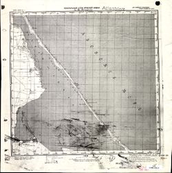
- Description:
- 1896
- Subject:
- Topical Subject: Maps, Geographic Subject: Дмитровка (Dmytrivka), and Topical Subject: Soviet Union
- Publisher:
- Генеральный штаб Красной Армии
- Language:
- Russian
- Date Created:
- 1941
- Identifier:
- VAC9619-001953
- Genre:
- Military Maps and Topographic Maps
- Geographic Location:
- Coordinates: 45.3333, 35, 45.6667, 35.5
- Related URL:
- Download GeoTIFF: https://drive.google.com/open?id=1alsoen4zV_rDxBzBa0ouX2b3Aey42eII and Catalog URL: https://iucat.iu.edu/catalog/5020129
- Abstract:
- Modern area represented: Дмитровка (Dmytrivka), Ukraine
- Call Number:
- G7000 s100 .S7 sheet L-36-95
- Caption:
- Для cлужебного пользования
- City:
- Белый Кош (Belyĭ Kosh)
- Copyright Holder:
- No Copyright - United States
- Country:
- СССР (USSR)
- State/Province:
- Крымская АССР (Crimean Autonomous Soviet Socialist Republic) and РСФСР (RSFSR)
- Physical Description:
- Scale: 1:100,000
- Persistent URL:
- http://purl.dlib.indiana.edu/iudl/images/VAC9619/VAC9619-001953
- Provenance:
- CIA Map Library
-
- Subject:
- Topical Subject: Maps, Geographic Subject: Leszkowice, and Topical Subject: Soviet Union
- Publisher:
- Генеральный штаб Красной Армии
- Language:
- Russian
- Date Created:
- 1941
- Identifier:
- VAC9619-000159
- Genre:
- Military Maps and Topographic Maps
- Geographic Location:
- Coordinates: 51.5, 22.5, 51.6667, 22.75
- Related URL:
- Download GeoTIFF: https://drive.google.com/open?id=1kdbe8EeC_WkzBlHaw3KJK9i5eBXSC9sK, https://drive.google.com/open?id=1n344jZB1PL74c6fw_plE6MFVNKGbpUk4, and...
- Abstract:
- Modern area represented: Leszkowice, Poland
- Call Number:
- G7000 s50 .S68 sheet M-34-22-A
- City:
- Лешковице (Leszkowice)
- Copyright Holder:
- No Copyright - United States
- Country:
- Область государственных интересов Германии (Region of German state interest)
- Physical Description:
- Scale: 1:50,000
- Persistent URL:
- http://purl.dlib.indiana.edu/iudl/images/VAC9619/VAC9619-000159
- Provenance:
- DMA Topographic Center, Army Map Service Library, OMAHA, Library of Congress Geography & Map Division
-
- Description:
- 1940
- Subject:
- Topical Subject: Maps, Topical Subject: Soviet Union, and Geographic Subject: Brno
- Publisher:
- Генеральный штаб Красной Армии
- Language:
- Russian
- Identifier:
- VAC9619-002715
- Genre:
- Military Maps and Topographic Maps
- Geographic Location:
- Coordinates: 49, 16.5, 49.333, 17
- Related URL:
- Catalog URL: https://iucat.iu.edu/catalog/5020129 and Download GeoTIFF: https://drive.google.com/file/d/1iW3RffDSiKo6_3lQeeictlonyz3VD16w/view?usp=sharing
- Abstract:
- Modern area represented: Brno, South Moravian Region, Czech Republic
- Call Number:
- G7000 s100 .S7 sheet M-33-106
- City:
- Брно (Brno)
- Copyright Holder:
- No Copyright - United States
- Country:
- Германия (Germany)
- State/Province:
- Протекторат Богемии и Моравии (Protectorate of Bohemia and Moravia)
- Physical Description:
- Scale: 1:100,000
- Persistent URL:
- http://purl.dlib.indiana.edu/iudl/images/VAC9619/VAC9619-002715
- Provenance:
- DMA Topographic Center, Library of Congress Geography & Map Division, Army Map Service Library, OMAHA
-
- Description:
- 1938
- Subject:
- Topical Subject: Soviet Union, Geographic Subject: Zaraysk, and Topical Subject: Maps
- Publisher:
- Генеральный штаб Красной Армии
- Language:
- Russian
- Date Created:
- 1941
- Identifier:
- VAC9619-003102
- Genre:
- Military Maps and Topographic Maps
- Geographic Location:
- Coordinates: 54.667, 38.5, 55, 39
- Related URL:
- Catalog URL: https://iucat.iu.edu/catalog/5020129 and Download GeoTIFF: https://drive.google.com/file/d/1CmYyVQOnWjiCDq9ktmzhtJHliBIrO_dX/view?usp=sharing
- Abstract:
- Modern area represented: Zaraysk, Russia
- Call Number:
- G7000 s100 .S7 sheet N-37-42
- Caption:
- Для служебного пользования
- City:
- Зарайск (Zaraysk)
- Copyright Holder:
- No Copyright - United States
- Country:
- СССР (USSR)
- State/Province:
- Московская область (Moscow oblast) and РСФСР (RSFSR)
- Physical Description:
- Scale: 1:100,000
- Persistent URL:
- http://purl.dlib.indiana.edu/iudl/images/VAC9619/VAC9619-003102
- Provenance:
- DMA Topographic Center, Army Map Service Library
-
- Subject:
- Topical Subject: Soviet Union, Topical Subject: Maps, and Geographic Subject: Nowy Dwór Mazowiecki
- Publisher:
- Генеральный штаб Красной Армии
- Language:
- Russian
- Date Created:
- 1941
- Identifier:
- VAC9619-000146
- Genre:
- Military Maps and Topographic Maps
- Geographic Location:
- Coordinates: 52.3333, 20.5, 52.5, 20.6667
- Related URL:
- Download GeoTIFF: https://drive.google.com/open?id=1jjJwHRaXBPCIZUG-msLmfYa5McZJk4Zs and Catalog URL: http://iucat.iu.edu/catalog/5020131
- Abstract:
- Modern area represented: Nowy Dwór Mazowiecki, Poland
- Call Number:
- G7000 s50 .S68 sheet N-34-126-C
- Caption:
- Captured map
- City:
- Модлин (Modlin)
- Copyright Holder:
- No Copyright - United States
- Country:
- Область государственных интересов Германии (Region of German state interest)
- Physical Description:
- Scale: 1:50,000
- Persistent URL:
- http://purl.dlib.indiana.edu/iudl/images/VAC9619/VAC9619-000146
- Provenance:
- Army Map Service Library, OMAHA, Library of Congress Geography & Map Division
-
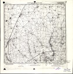
- Description:
- 1894
- Subject:
- Topical Subject: Maps, Topical Subject: Soviet Union, Geographic Subject: Zuya, and Geographic Subject: Republic of Crimea
- Publisher:
- Генеральный штаб Красной Армии
- Language:
- Russian
- Date Created:
- 1941
- Identifier:
- VAC9619-001957
- Genre:
- Military Maps and Topographic Maps
- Geographic Location:
- Coordinates: 45, 34, 45.3333, 34.5
- Related URL:
- Catalog URL: https://iucat.iu.edu/catalog/5020129 and Download GeoTIFF: https://drive.google.com/open?id=1OnZgZa5AYScso5JZKHdHoMlUXdIKTLCN
- Abstract:
- Modern area represented: Зуя (Zuya), Republic of Crimea, Ukraine
- Call Number:
- G7000 s100 .S7 sheet L-36-105
- Caption:
- Для cлужебного пользования
- City:
- Зуя (Zuya)
- Copyright Holder:
- No Copyright - United States
- Country:
- СССР (USSR)
- State/Province:
- РСФСР (RSFSR) and Крымская АССР (Crimean Autonomous Soviet Socialist Republic)
- Physical Description:
- Scale: 1:100,000
- Persistent URL:
- http://purl.dlib.indiana.edu/iudl/images/VAC9619/VAC9619-001957
- Provenance:
- CIA Map Library
-
- Subject:
- Topical Subject: Maps, Topical Subject: Soviet Union, and Geographic Subject: Nova Kochubeivka
- Publisher:
- Генеральный штаб Красной Армии
- Language:
- Russian
- Identifier:
- VAC9619-001009
- Genre:
- Topographic Maps and Military Maps
- Geographic Location:
- Coordinates: 49.6667, 34.75, 49.8333, 35
- Related URL:
- Download GeoTIFF: https://drive.google.com/open?id=1kjamdQzQomJxGNj3vmXltOEeEcc18fwH and Catalog URL: http://iucat.iu.edu/catalog/5020131
- Abstract:
- Modern area represented: Нова Кочубеївка (Nova Kochubeivka), Poltava oblast, Ukraine
- Call Number:
- G7000 s50 .S68 sheet M-36-82-D
- Caption:
- Для служебного пользования
- City:
- Ново-Кочубеевка (Novo-Kochubeyevka)
- Copyright Holder:
- No Copyright - United States
- Country:
- СССР (USSR)
- State/Province:
- Украинская ССР (Ukrainian Soviet Socialist Republic) and Полтавская область (Poltava oblast)
- Physical Description:
- Scale: 1:50,000
- Persistent URL:
- http://purl.dlib.indiana.edu/iudl/images/VAC9619/VAC9619-001009
- Provenance:
- DMA Topographic Center, Army Map Service Library, OMAHA, Library of Congress Geography & Map Division
-
- Description:
- 1907
- Subject:
- Geographic Subject: Gelendzhik, Topical Subject: Soviet Union, and Topical Subject: Maps
- Publisher:
- Генеральный штаб Красной Армии
- Language:
- Russian
- Date Created:
- 1941
- Identifier:
- VAC9619-002433
- Genre:
- Topographic Maps and Military Maps
- Geographic Location:
- Coordinates: 44.333, 38, 44.667, 38.5
- Related URL:
- Catalog URL: https://iucat.iu.edu/catalog/5020129 and Download GeoTIFF: https://drive.google.com/file/d/1EEXSYKQqFySK88Xe-nbSaCzfVEmvgljz/view?usp=sharing
- Abstract:
- Modern area represented: Gelendzhik, Russia
- Call Number:
- G7000 s100 .S7 sheet L-37-125
- Caption:
- Для служебного пользования
- City:
- Геленджик (Gelendzhik)
- Copyright Holder:
- No Copyright - United States
- Country:
- СССР (USSR)
- State/Province:
- Краснодарский край (Krasnodar kray) and РСФСР (RSFSR)
- Physical Description:
- Scale: 1:100,000
- Persistent URL:
- http://purl.dlib.indiana.edu/iudl/images/VAC9619/VAC9619-002433
- Provenance:
- DMA Topographic Center, Library of Congress G & M Division, OMAHA, Army Map Service Library
-
- Description:
- 1881
- Subject:
- Topical Subject: Soviet Union, Geographic Subject: Międzyrzec Podlaski, and Topical Subject: Maps
- Publisher:
- Генеральный штаб Красной Армии
- Language:
- Russian
- Date Created:
- 1940
- Identifier:
- VAC9619-002737
- Genre:
- Topographic Maps and Military Maps
- Geographic Location:
- Coordinates: 51.667, 22.5, 52, 23
- Related URL:
- Catalog URL: https://iucat.iu.edu/catalog/5020129 and Download GeoTIFF: https://drive.google.com/file/d/1SNjEsGdllkgt7h9Jz9huDKoA8nylO0H5/view?usp=sharing
- Abstract:
- Modern area represented: Międzyrzec Podlaski, Lublin province, Poland
- Call Number:
- G7000 s100 .S7 sheet M-34-10
- City:
- Мендзыжец (Międzyrzec)
- Copyright Holder:
- No Copyright - United States
- State/Province:
- Область государственных интересов Германии (Region of German state interests)
- Physical Description:
- Scale: 1:100,000
- Persistent URL:
- http://purl.dlib.indiana.edu/iudl/images/VAC9619/VAC9619-002737
- Provenance:
- DMA Topographic Center, Library of Congress Geography & Map Division, Army Map Service Library, Auswärtiges Amt. Geographischer Dienst, OMAHA
-

- Subject:
- Topical Subject: Maps, Topical Subject: Soviet Union, and Geographic Subject: Krosno
- Publisher:
- Генеральный штаб Красной Армии
- Language:
- Russian
- Date Created:
- 1943
- Identifier:
- VAC9619-000180
- Genre:
- Topographic Maps and Military Maps
- Geographic Location:
- Coordinates: 49.6667, 21.75, 49.8333, 22
- Related URL:
- Catalog URL: http://iucat.iu.edu/catalog/5020131 and Download GeoTIFF: https://drive.google.com/open?id=1i6y6k2A4-v2FgtsWT5txAUDDwEN1bHXq
- Abstract:
- Modern area represented: Krosno, Poland
- Call Number:
- G7000 s50 .S68 sheet M-34-80-D
- City:
- Кросно (Krosno)
- Copyright Holder:
- No Copyright - United States
- Country:
- Польша (Poland)
- Physical Description:
- Scale: 1:50,000
- Persistent URL:
- http://purl.dlib.indiana.edu/iudl/images/VAC9619/VAC9619-000180
- Provenance:
- DMA Topographic Center, Army Map Service Library, Library of Congress Geography & Map Division
-
- Description:
- 1895
- Subject:
- Topical Subject: Soviet Union, Topical Subject: Maps, and Geographic Subject: Novaya Mysh
- Publisher:
- Генеральный штаб Красной Армии
- Language:
- Russian
- Date Created:
- 1940
- Identifier:
- VAC9619-004101
- Genre:
- Military Maps and Topographic Maps
- Geographic Location:
- Coordinates: 53, 25.5, 53.333, 26
- Related URL:
- Download GeoTIFF: https://drive.google.com/file/d/1_U9Fewzw-xMN9DAHx9Kbxa5wSIBHdFy_/view?usp=sharing and Catalog URL: https://iucat.iu.edu/catalog/5020129
- Abstract:
- Modern area represented: Novaya Mysh, Brest oblast, Belarus
- Call Number:
- G7000 s100 .S7 sheet N-35-100
- City:
- Новая Мышь (Novaya Mysh)
- Copyright Holder:
- No Copyright - United States
- Country:
- СССР (USSR)
- State/Province:
- Барановичская область (Baranavichy oblast) and Белорусская ССР (Byelorussian Soviet Socialist Republic)
- Physical Description:
- Scale: 1:100,000
- Persistent URL:
- http://purl.dlib.indiana.edu/iudl/images/VAC9619/VAC9619-004101
- Provenance:
- DMA Topographic Center, Army Map Service Library, OMAHA, Atlasblatt
-
- Subject:
- Geographic Subject: Gołdap, Topical Subject: Maps, and Topical Subject: Soviet Union
- Publisher:
- Генеральный штаб Красной Армии
- Language:
- Russian
- Date Created:
- 1941
- Identifier:
- VAC9619-000352
- Genre:
- Topographic Maps and Military Maps
- Geographic Location:
- Coordinates: 54.16667, 22.25, 54.3333, 22.5
- Related URL:
- Catalog URL: http://iucat.iu.edu/catalog/5020131 and Download GeoTIFF: https://drive.google.com/open?id=1IbAgvZRp84NPgyJq2AVDuXc8tRsaj-mw
- Abstract:
- Modern area represented: Gołdap, Poland
- Call Number:
- G7000 s50 .S68 sheet N-34-69-B
- City:
- Гольдап (Gol'dap)
- Copyright Holder:
- No Copyright - United States
- Country:
- Германия (Germany) and Восточная Пруссия (East Prussia)
- Physical Description:
- Scale: 1:50,000
- Persistent URL:
- http://purl.dlib.indiana.edu/iudl/images/VAC9619/VAC9619-000352
- Provenance:
- DMA Topographic Center, Army Map Service Library, OMAHA, Library of Congress Geography & Map Division
-
- Description:
- 1941
- Subject:
- Topical Subject: Soviet Union, Geographic Subject: Ostrogozhsk, and Topical Subject: Maps
- Publisher:
- Генеральный штаб Красной Армии
- Language:
- Russian
- Identifier:
- VAC9619-003384
- Genre:
- Topographic Maps and Military Maps
- Geographic Location:
- Coordinates: 50.667, 39, 51, 39.5
- Related URL:
- Catalog URL: https://iucat.iu.edu/catalog/5020129 and Download GeoTIFF: https://drive.google.com/file/d/1mEa6VsLQ-QS3Ro98p9AFIYAvBABMRTLL/view?usp=sharing
- Abstract:
- Modern area represented: Ostrogozhsk, Voronezh oblast, Russia
- Call Number:
- G7000 s100 .S7 sheet M-37-43
- Caption:
- Для служебного пользования
- City:
- Острогожск (Ostrogozhsk)
- Copyright Holder:
- No Copyright - United States
- Country:
- СССР (USSR)
- State/Province:
- РСФСР (RSFSR) and Воронежская область (Voronezh oblast)
- Physical Description:
- Scale: 1:100,000
- Persistent URL:
- http://purl.dlib.indiana.edu/iudl/images/VAC9619/VAC9619-003384
- Provenance:
- DMA Topographic Center, Army Map Service Library, OMAHA, Library of Congress Geography & Map Division
-
- Subject:
- Geographic Subject: Orlino, Topical Subject: Soviet Union, and Topical Subject: Maps
- Publisher:
- Генеральный штаб Красной Армии
- Language:
- Russian
- Date Created:
- 1941
- Identifier:
- VAC9619-002127
- Genre:
- Military Maps and Topographic Maps
- Geographic Location:
- Coordinates: 59, 30, 59.3333, 30.5
- Related URL:
- Catalog URL: https://iucat.iu.edu/catalog/5020129 and Download GeoTIFF: https://drive.google.com/open?id=1q8Kxa-EWPRA7GBsUOX4v1OnjNHgLUpaa
- Abstract:
- Modern area represented: Orlino, Leningrad oblast, Russia
- Call Number:
- G7000 s100 .S7 sheet O-36-25
- Caption:
- Для служебного пользования
- City:
- Орлино (Orlino)
- Copyright Holder:
- No Copyright - United States
- Country:
- СССР (USSR)
- State/Province:
- РСФСР (RSFSR) and Ленинградская область (Leningrad oblast)
- Physical Description:
- Scale: 1:100,000
- Persistent URL:
- http://purl.dlib.indiana.edu/iudl/images/VAC9619/VAC9619-002127
- Provenance:
- DMA Topographic Center, Army Map Service Library, OMAHA, Library of Congress Geography & Map Division
-
- Description:
- 1939
- Subject:
- Geographic Subject: Zhukopa, Topical Subject: Maps, and Topical Subject: Soviet Union
- Publisher:
- Генеральный штаб Красной Армии
- Language:
- Russian
- Date Created:
- 1941
- Identifier:
- VAC9619-002230
- Genre:
- Military Maps and Topographic Maps
- Geographic Location:
- Coordinates: 56.3333, 32.5, 56.6667, 33
- Related URL:
- Download GeoTIFF: https://drive.google.com/file/d/1JbQ0x392WGgig6Hw4nVs9oX1CJH5wigp/view?usp=sharing and Catalog URL: https://iucat.iu.edu/catalog/5020129
- Abstract:
- Modern area represented: Жукопа (Zhukopa), Tverskaya oblast, Russia
- Call Number:
- G7000 s100 .S7 sheet O-36-126
- City:
- Жукопа (Zhukopa)
- Copyright Holder:
- No Copyright - United States
- Country:
- СССР (USSR)
- State/Province:
- Калининская область (Kalinin oblast) and РСФСР (RSFSR)
- Physical Description:
- Scale: 1:100,000
- Persistent URL:
- http://purl.dlib.indiana.edu/iudl/images/VAC9619/VAC9619-002230
- Provenance:
- DMA Topographic Center, Army Map Service Library, OMAHA, Library of Congress Geography & Map Division
-
- Description:
- 1935
- Subject:
- Topical Subject: Soviet Union, Geographic Subject: Shyroke, and Topical Subject: Maps
- Publisher:
- Генеральный штаб Красной Армии
- Language:
- Russian
- Date Created:
- 1942
- Identifier:
- VAC9619-001176
- Genre:
- Military Maps and Topographic Maps
- Geographic Location:
- Coordinates: 48, 34.75, 48.167, 35
- Related URL:
- Download GeoTIFF: https://drive.google.com/open?id=1xzNOFibbwdSPajgIDANxV2xynzmodIeL and Catalog URL: http://iucat.iu.edu/catalog/5020131
- Abstract:
- Modern area represented: Shyroke, Zaporizhia oblast, Ukraine
- Call Number:
- GM G7000 S50 .S68 M-36-142-Г
- Caption:
- Для служебного пользования
- City:
- Широкое (Shyroke)
- Copyright Holder:
- No Copyright - United States
- Country:
- СССР (USSR)
- State/Province:
- Запорожская область (Zaporizhia oblast), Украинская ССР (Ukrainian Soviet Socialist Republic), and Днепропетровская область (Dnipropetrovsk oblast)
- Physical Description:
- Scale: 1:50,000
- Persistent URL:
- http://purl.dlib.indiana.edu/iudl/images/VAC9619/VAC9619-001176
- Provenance:
- DMA Topographic Center, Army Map Service Library, OMAHA, Library of Congress Geography & Map Division
-
- Description:
- 1941
- Subject:
- Topical Subject: Soviet Union, Topical Subject: Maps, and Geographic Subject: Solodniki
- Publisher:
- Генеральный штаб Красной Армии
- Language:
- Russian
- Date Created:
- 1942
- Identifier:
- VAC9619-003438
- Genre:
- Military Maps and Topographic Maps
- Geographic Location:
- Coordinates: 48.333, 45, 48.667, 45.5
- Related URL:
- Download GeoTIFF: https://drive.google.com/file/d/1a5TQnKjgcqg2QHo-YuNpfeESpk4HhggC/view?usp=sharing and Catalog URL: https://iucat.iu.edu/catalog/5020129
- Abstract:
- Modern area represented: Solodniki, Astrakhan oblast, Russia
- Call Number:
- G7000 s100 .S7 sheet M-38-127
- Caption:
- Для служебного пользования
- City:
- Солодники (Solodniki)
- Copyright Holder:
- No Copyright - United States
- Country:
- СССР (USSR)
- State/Province:
- РСФСР (RSFSR) and Сталинградская область (Stalingrad oblast)
- Physical Description:
- Scale: 1:100,000
- Persistent URL:
- http://purl.dlib.indiana.edu/iudl/images/VAC9619/VAC9619-003438
- Provenance:
- DMA Topographic Center, Army Map Service Library, OMAHA, Atlasblatt
-
- Description:
- 1888
- Subject:
- Topical Subject: Soviet Union, Topical Subject: Maps, and Geographic Subject: Hrubieszów
- Publisher:
- Генеральный штаб Красной Армии
- Language:
- Russian
- Date Created:
- 1940
- Identifier:
- VAC9619-002828
- Genre:
- Topographic Maps and Military Maps
- Geographic Location:
- Coordinates: 50.667, 23.5, 51, 24
- Related URL:
- Catalog URL: https://iucat.iu.edu/catalog/5020129 and Download GeoTIFF: https://drive.google.com/file/d/1MtYYusftksd1g2h3UGfdgt847CDumZ60/view?usp=sharing
- Abstract:
- Modern area represented: Hrubieszów, Lublin province, Poland
- Call Number:
- G7000 s100 .S7 sheet M-34-48
- City:
- Грубешув (Hrubieszów)
- Copyright Holder:
- No Copyright - United States
- State/Province:
- Область государственных интересов Германии (Region of German state interests), Волынская область (Volyn oblast), and Украинская ССР (Ukrainian Soviet Sociali...
- Physical Description:
- Scale: 1:100,000
- Persistent URL:
- http://purl.dlib.indiana.edu/iudl/images/VAC9619/VAC9619-002828
- Provenance:
- DMA Topographic Center, Army Map Service Library, OMAHA
-
- Description:
- 1889
- Subject:
- Topical Subject: Soviet Union, Geographic Subject: Leba, and Topical Subject: Maps
- Publisher:
- Генеральный штаб Красной Армии
- Language:
- Russian
- Date Created:
- 1940
- Identifier:
- VAC9619-003562
- Genre:
- Topographic Maps and Military Maps
- Geographic Location:
- Coordinates: 54.667, 17.5, 55, 18
- Related URL:
- Catalog URL: https://iucat.iu.edu/catalog/5020129 and Download GeoTIFF: https://drive.google.com/file/d/1yf4uFfcHKh3Kooi-on2xUzOsWHbfo8jL/view?usp=sharing
- Abstract:
- Modern area represented: Leba, Pomerania province, Poland
- Call Number:
- G7000 s100 .S7 sheet N-33-48
- City:
- Леба (Leba)
- Copyright Holder:
- No Copyright - United States
- Country:
- Германия (Germany)
- Physical Description:
- Scale: 1:100,000
- Persistent URL:
- http://purl.dlib.indiana.edu/iudl/images/VAC9619/VAC9619-003562
- Provenance:
- DMA Topographic Center, Army Map Service Library, Geographic Names Branch
-
- Description:
- 1941
- Subject:
- Topical Subject: Maps, Topical Subject: Soviet Union, and Geographic Subject: Krasnoye
- Publisher:
- Генеральный штаб Красной Армии
- Language:
- Russian
- Identifier:
- VAC9619-003069
- Genre:
- Topographic Maps and Military Maps
- Geographic Location:
- Coordinates: 52.667, 38.5, 53, 39
- Related URL:
- Download GeoTIFF: https://drive.google.com/file/d/1gGtaMimC-5weHvo8Mw1g8v9DgorhzlVf/view?usp=sharing and Catalog URL: https://iucat.iu.edu/catalog/5020129
- Abstract:
- Modern area represented: Красное (Krasnoye), Lipetskaya oblast, Russia
- Call Number:
- G7000 s100 .S7 sheet N-37-114
- City:
- Красное (Krasnoye)
- Copyright Holder:
- No Copyright - United States
- Country:
- СССР (USSR)
- State/Province:
- Тульская область (Tula oblast), РСФСР (RSFSR), Орловская область (Oryol oblast), Воронежская область (Voronezh oblast), and Рязанская область (Ryazan oblast)
- Physical Description:
- Scale: 1:100,000
- Persistent URL:
- http://purl.dlib.indiana.edu/iudl/images/VAC9619/VAC9619-003069
- Provenance:
- Army Map Service Library, Library of Congress G & M Division
