
Search Constraints
You searched for:
Provenance
DMA Topographic Center, Army Map Service Library, Library of Congress Geography & Map Division
Remove constraint Provenance: DMA Topographic Center, Army Map Service Library, Library of Congress Geography & Map Division
Search Results
-

- Description:
- 1882
- Subject:
- Geographic Subject: Racibórz, Topical Subject: Soviet Union, and Topical Subject: Maps
- Publisher:
- Генеральный штаб Красной Армии
- Language:
- Russian
- Date Created:
- 1940
- Identifier:
- VAC9619-002860
- Genre:
- Military Maps and Topographic Maps
- Geographic Location:
- Coordinates: 50, 18, 50.333, 18.5
- Related URL:
- Download GeoTIFF: https://drive.google.com/file/d/1XcG44qM_SkibVzjFK8EuHetzDeu3O5g7/view?usp=sharing and Catalog URL: https://iucat.iu.edu/catalog/5020129
- Abstract:
- Modern area represented: Racibórz, Silesian province, Poland
- Call Number:
- G7000 s100 .S7 sheet M-34-61
- City:
- Ратибор (Ratibor)
- Copyright Holder:
- No Copyright - United States
- Country:
- Германия (Germany)
- Physical Description:
- Scale: 1:100,000
- Persistent URL:
- http://purl.dlib.indiana.edu/iudl/images/VAC9619/VAC9619-002860
- Provenance:
- DMA Topographic Center, Army Map Service Library, Library of Congress Geography & Map Division
-
- Description:
- 1893
- Subject:
- Topical Subject: Soviet Union, Geographic Subject: Staszów, and Topical Subject: Maps
- Publisher:
- Генеральный штаб Красной Армии
- Language:
- Russian
- Date Created:
- 1940
- Identifier:
- VAC9619-002856
- Genre:
- Military Maps and Topographic Maps
- Geographic Location:
- Coordinates: 50.333, 21, 50.667, 21.5
- Related URL:
- Download GeoTIFF: https://drive.google.com/file/d/1R2h75uIaVFfookFli0p85iELEPArrEVP/view?usp=sharing and Catalog URL: https://iucat.iu.edu/catalog/5020129
- Abstract:
- Modern area represented: Staszów, Świętokrzyskie province, Poland
- Call Number:
- G7000 s100 .S7 sheet M-34-55
- City:
- Сташув (Staszów)
- Copyright Holder:
- No Copyright - United States
- State/Province:
- Область государственных интересов Германии (Region of German state interests)
- Physical Description:
- Scale: 1:100,000
- Persistent URL:
- http://purl.dlib.indiana.edu/iudl/images/VAC9619/VAC9619-002856
- Provenance:
- DMA Topographic Center, Army Map Service Library, Library of Congress Geography & Map Division
-
- Description:
- 1895
- Subject:
- Topical Subject: Soviet Union, Topical Subject: Maps, and Geographic Subject: Jędrzejów
- Publisher:
- Генеральный штаб Красной Армии
- Language:
- Russian
- Date Created:
- 1940
- Identifier:
- VAC9619-002854
- Genre:
- Military Maps and Topographic Maps
- Geographic Location:
- Coordinates: 50.333, 20, 50.667, 20.5
- Related URL:
- Catalog URL: https://iucat.iu.edu/catalog/5020129 and Download GeoTIFF: https://drive.google.com/file/d/1a3ZFZV7QLg3yM0GPS100bYjRs810vrlM/view?usp=sharing
- Abstract:
- Modern area represented: Jędrzejów, Świętokrzyskie province, Poland
- Call Number:
- G7000 s100 .S7 sheet M-34-53
- City:
- Енджеюв (Jędrzejów)
- Copyright Holder:
- No Copyright - United States
- State/Province:
- Область государственных интересов Германии (Region of German state interests)
- Physical Description:
- Scale: 1:100,000
- Persistent URL:
- http://purl.dlib.indiana.edu/iudl/images/VAC9619/VAC9619-002854
- Provenance:
- DMA Topographic Center, Army Map Service Library, Library of Congress Geography & Map Division
-
- Description:
- 1939
- Subject:
- Topical Subject: Soviet Union, Topical Subject: Maps, and Geographic Subject: Kravotyn'
- Publisher:
- Главное управление геодезии и картографии при СНК СССР
- Language:
- Russian
- Date Created:
- 1941
- Identifier:
- VAC9619-002841
- Genre:
- Topographic Maps and Military Maps
- Geographic Location:
- Coordinates: 57.167, 33, 57.333, 33.25
- Related URL:
- Download GeoTIFF: https://drive.google.com/file/d/1ES4pkCBJt5r7GmAOEju7JNpB3uXWh-H0/view?usp=sharing and Catalog URL: http://iucat.iu.edu/catalog/5020131
- Abstract:
- Modern area represented: Кравотынь (Kravotyn'), Тверская область (Tverskaya oblast), Russia
- Call Number:
- GM G7000 s50 .S68 sheet O-36-103-A
- Caption:
- Captured map and Для служебного пользования
- City:
- Кравотынь (Kravotyn')
- Copyright Holder:
- No Copyright - United States
- Country:
- СССР (USSR)
- State/Province:
- Калининская область (Kalinin oblast) and Осташковский район (Ostashkovsky district)
- Physical Description:
- Scale: 1:50,000
- Persistent URL:
- http://purl.dlib.indiana.edu/iudl/images/VAC9619/VAC9619-002841
- Provenance:
- DMA Topographic Center, Army Map Service Library, Library of Congress Geography & Map Division
-

- Description:
- 1937
- Subject:
- Geographic Subject: Kuzovo, Topical Subject: Maps, and Topical Subject: Soviet Union
- Publisher:
- Генеральный штаб РККА
- Language:
- Russian
- Identifier:
- VAC9619-002811
- Genre:
- Topographic Maps and Military Maps
- Geographic Location:
- Coordinates: 57.833, 29, 58, 29.25
- Related URL:
- Download GeoTIFF: https://drive.google.com/file/d/1P53jKeiFi_S-tfXZmbqUtlxHOII9QM7i/view?usp=sharing and Catalog URL: http://iucat.iu.edu/catalog/5020131
- Abstract:
- Modern area represented: Кузово (Kuzovo), Псковская область (Pskovskaya oblast), Russia
- Call Number:
- GM G7000 s50 .S68 sheet O-35-83-A
- Caption:
- Captured map and Не подлежит оглашению
- City:
- Кузов (Kuzovo)
- Copyright Holder:
- No Copyright - United States
- Country:
- СССР (USSR)
- State/Province:
- РСФСР (RSFSR) and Ленинградская область (Leningrad oblast)
- Physical Description:
- Scale: 1:50,000
- Persistent URL:
- http://purl.dlib.indiana.edu/iudl/images/VAC9619/VAC9619-002811
- Provenance:
- DMA Topographic Center, Army Map Service Library, Library of Congress Geography & Map Division
-
- Description:
- 1937
- Subject:
- Topical Subject: Maps, Geographic Subject: Samolva, and Topical Subject: Soviet Union
- Publisher:
- Генеральный штаб РККА
- Language:
- Russian
- Identifier:
- VAC9619-002697
- Genre:
- Topographic Maps and Military Maps
- Geographic Location:
- Coordinates: 58.167, 27.5, 58.333, 27.75
- Related URL:
- Download GeoTIFF: https://drive.google.com/file/d/19JCM0w1FS9QQGL7EiVHYPhioHEkVjR_9/view?usp=sharing and Catalog URL: http://iucat.iu.edu/catalog/5020131
- Abstract:
- Modern area represented: Самолва (Samolva), Псковская область (Pskovskaya oblast), Russia
- Call Number:
- GM G7000 s50 .S68 sheet O-35-68-A
- Caption:
- Не подлежит оглашению and Captured map
- City:
- Самолва (Samolva)
- Copyright Holder:
- No Copyright - United States
- Country:
- СССР (USSR)
- State/Province:
- Ленинградская область (Leningrad oblast) and РСФСР (RSFSR)
- Physical Description:
- Scale: 1:50,000
- Persistent URL:
- http://purl.dlib.indiana.edu/iudl/images/VAC9619/VAC9619-002697
- Provenance:
- DMA Topographic Center, Army Map Service Library, Library of Congress Geography & Map Division
-
- Subject:
- Geographic Subject: Rannu, Topical Subject: Soviet Union, and Topical Subject: Maps
- Publisher:
- Генеральный штаб РККА
- Language:
- Russian
- Identifier:
- VAC9619-002696
- Genre:
- Military Maps and Topographic Maps
- Geographic Location:
- Coordinates: 58.167, 26, 58.333, 26.25
- Related URL:
- Download GeoTIFF: https://drive.google.com/file/d/1gzUUqNwOVF41k5U2E728HAt33JM1A28u/view?usp=sharing and Catalog URL: http://iucat.iu.edu/catalog/5020131
- Abstract:
- Modern area represented: Rannu, Estonia
- Call Number:
- GM G7000 s50 .S68 sheet O-35-65-A
- Caption:
- Captured map
- City:
- Ранну (Rannu)
- Copyright Holder:
- No Copyright - United States
- Country:
- Эстония (Estonia)
- Physical Description:
- Scale: 1:50,000
- Persistent URL:
- http://purl.dlib.indiana.edu/iudl/images/VAC9619/VAC9619-002696
- Provenance:
- DMA Topographic Center, Army Map Service Library, Library of Congress Geography & Map Division
-

- Description:
- 1937
- Subject:
- Topical Subject: Maps, Geographic Subject: Zovka, and Topical Subject: Soviet Union
- Publisher:
- Генеральный штаб РККА
- Language:
- Russian
- Identifier:
- VAC9619-002682
- Genre:
- Military Maps and Topographic Maps
- Geographic Location:
- Coordinates: 58.3333, 28.75, 58.5, 29.0
- Related URL:
- Catalog URL: http://iucat.iu.edu/catalog/5020131 and Download GeoTIFF: https://drive.google.com/file/d/129TyRSIa5Ccg2pJbyqpXoWTODCTDEgaa/view?usp=sharing
- Abstract:
- Modern area represented: Зовка (Zovka), Псковская область (Pskovskaya oblast), Russia
- Call Number:
- GM G7000 s50 .S68 sheet O-35-58-D
- Caption:
- Не подлежит оглашению
- City:
- Зовка (Zovka)
- Copyright Holder:
- No Copyright - United States
- Country:
- СССР (USSR)
- State/Province:
- РСФСР (RSFSR) and Ленинградская область (Leningrad oblast)
- Physical Description:
- Scale: 1:50,000
- Persistent URL:
- http://purl.dlib.indiana.edu/iudl/images/VAC9619/VAC9619-002682
- Provenance:
- DMA Topographic Center, Army Map Service Library, Library of Congress Geography & Map Division
-
- Description:
- 1881
- Subject:
- Topical Subject: Maps, Geographic Subject: Wałbrzych, and Topical Subject: Soviet Union
- Publisher:
- Генеральный штаб Красной Армии
- Language:
- Russian
- Date Created:
- 1941
- Identifier:
- VAC9619-002612
- Genre:
- Topographic Maps and Military Maps
- Geographic Location:
- Coordinates: 50.66667, 16.0, 51.0, 16.5
- Related URL:
- Download GeoTIFF: https://drive.google.com/file/d/1kFsiMhki6AQE-SCAeAGcI3MVKvGeIKR4/view?usp=sharing and Catalog URL: https://iucat.iu.edu/catalog/5020129
- Abstract:
- Modern area represented: Wałbrzych, Lower Silesian province, Poland
- Call Number:
- G7000 s100 .S7 sheet M-33-45
- City:
- Вальденбург (Waldenburg)
- Copyright Holder:
- No Copyright - United States
- Country:
- Германия (Germany)
- Physical Description:
- Scale: 1:100,000
- Persistent URL:
- http://purl.dlib.indiana.edu/iudl/images/VAC9619/VAC9619-002612
- Provenance:
- DMA Topographic Center, Army Map Service Library, Library of Congress Geography & Map Division
-
- Subject:
- Topical Subject: Soviet Union, Geographic Subject: Tabina, and Topical Subject: Maps
- Publisher:
- Генеральный штаб РККА
- Language:
- Russian
- Identifier:
- VAC9619-002794
- Genre:
- Topographic Maps and Military Maps
- Geographic Location:
- Coordinates: 57.667, 27.25, 57.833, 27.5
- Related URL:
- Download GeoTIFF: https://drive.google.com/file/d/1adQMyYPju1LBrve00pAu1EE49Cn_kHmq/view?usp=sharing and Catalog URL: http://iucat.iu.edu/catalog/5020131
- Abstract:
- Modern area represented: Tabina, Estonia
- Call Number:
- GM G7000 s50 .S68 sheet O-35-79-D
- Caption:
- Captured map
- City:
- Табина (Tabina)
- Copyright Holder:
- No Copyright - United States
- Country:
- Эстония (Estonia)
- Physical Description:
- Scale: 1:50,000
- Persistent URL:
- http://purl.dlib.indiana.edu/iudl/images/VAC9619/VAC9619-002794
- Provenance:
- DMA Topographic Center, Army Map Service Library, Library of Congress Geography & Map Division
-
- Description:
- 1913
- Subject:
- Topical Subject: Maps, Geographic Subject: Viluste, and Topical Subject: Soviet Union
- Publisher:
- Генеральный штаб РККА
- Language:
- Russian
- Identifier:
- VAC9619-002790
- Genre:
- Topographic Maps and Military Maps
- Geographic Location:
- Coordinates: 57.833, 27.25, 58, 27.5
- Related URL:
- Catalog URL: http://iucat.iu.edu/catalog/5020131 and Download GeoTIFF: https://drive.google.com/file/d/1SV1yzYbJEgoE0VBooy0zYs3oMMhz707S/view?usp=sharing
- Abstract:
- Modern area represented: Viluste, Estonia
- Call Number:
- GM G7000 s50 .S68 sheet O-35-79-B
- Caption:
- Captured map
- City:
- Вилусте (Viluste)
- Copyright Holder:
- No Copyright - United States
- Country:
- Эстония (Estonia)
- Physical Description:
- Scale: 1:50,000
- Persistent URL:
- http://purl.dlib.indiana.edu/iudl/images/VAC9619/VAC9619-002790
- Provenance:
- DMA Topographic Center, Army Map Service Library, Library of Congress Geography & Map Division
-

- Description:
- 1933
- Subject:
- Topical Subject: Soviet Union, Geographic Subject: Taman, and Topical Subject: Maps
- Publisher:
- Генеральный штаб Красной Армии
- Language:
- Russian
- Date Created:
- 1941
- Identifier:
- VAC9619-002358
- Genre:
- Topographic Maps and Military Maps
- Geographic Location:
- Coordinates: 45, 36.5, 45.333, 37
- Related URL:
- Download GeoTIFF: https://drive.google.com/file/d/1X763anMOD-wQf-npLvv0Rk-_nGzkuqHb/view?usp=sharing and Catalog URL: https://iucat.iu.edu/catalog/5020129
- Abstract:
- Modern area represented: Taman, Russia
- Call Number:
- G7000 s100 .S7 sheet L-37-98
- Caption:
- Для служебного пользования
- City:
- Тамань (Taman)
- Copyright Holder:
- No Copyright - United States
- Country:
- СССР (USSR)
- State/Province:
- РСФСР (RSFSR) and Краснодарский край (Krasnodar kray)
- Physical Description:
- Scale: 1:100,000
- Persistent URL:
- http://purl.dlib.indiana.edu/iudl/images/VAC9619/VAC9619-002358
- Provenance:
- DMA Topographic Center, Army Map Service Library, Library of Congress Geography & Map Division
-
- Description:
- 1937
- Subject:
- Topical Subject: Maps, Topical Subject: Soviet Union, and Geographic Subject: Peresyp
- Publisher:
- Генеральный штаб Красной Армии
- Language:
- Russian
- Date Created:
- 1941
- Identifier:
- VAC9619-002346
- Genre:
- Military Maps and Topographic Maps
- Geographic Location:
- Coordinates: 45.333, 37, 45.667, 37.5
- Related URL:
- Catalog URL: https://iucat.iu.edu/catalog/5020129 and Download GeoTIFF: https://drive.google.com/file/d/1et56BJZlxN599zRb53buMBYVstda6Ec_/view?usp=sharing
- Abstract:
- Modern area represented: Peresyp, Russia
- Call Number:
- G7000 s100 .S7 sheet L-37-87
- Caption:
- Для служебного пользования
- City:
- Пересыпь (Peresyp)
- Copyright Holder:
- No Copyright - United States
- Country:
- СССР (USSR)
- State/Province:
- Краснодарский край (Krasnodar kray) and РСФСР (RSFSR)
- Physical Description:
- Scale: 1:100,000
- Persistent URL:
- http://purl.dlib.indiana.edu/iudl/images/VAC9619/VAC9619-002346
- Provenance:
- DMA Topographic Center, Army Map Service Library, Library of Congress Geography & Map Division
-
- Description:
- 1926
- Subject:
- Topical Subject: Soviet Union, Topical Subject: Maps, and Geographic Subject: Novokuznetsovka
- Publisher:
- Генеральный штаб Красной Армии
- Language:
- Russian
- Date Created:
- 1941
- Identifier:
- VAC9619-002298
- Genre:
- Military Maps and Topographic Maps
- Geographic Location:
- Coordinates: 46.6667, 40.5, 47, 41
- Related URL:
- Catalog URL: https://iucat.iu.edu/catalog/5020129 and Download GeoTIFF: https://drive.google.com/file/d/1sfqT_AJuBAAUv8hm-9cOJcZvvbSOsD7N/view?usp=sharing
- Abstract:
- Modern area represented: Novokuznetsovka, Russia
- Call Number:
- G7000 s100 .S7 sheet L-37-46
- Caption:
- Для служебного пользования
- City:
- Ново-Кузнецовка (Novo-Kuznetsovka)
- Copyright Holder:
- No Copyright - United States
- Country:
- СССР (USSR)
- State/Province:
- Ростовская область (Rostov oblast) and РСФСР (RSFSR)
- Physical Description:
- Scale: 1:100,000
- Persistent URL:
- http://purl.dlib.indiana.edu/iudl/images/VAC9619/VAC9619-002298
- Provenance:
- DMA Topographic Center, Army Map Service Library, Library of Congress Geography & Map Division
-
- Subject:
- Topical Subject: Soviet Union, Geographic Subject: Teryayevo, and Topical Subject: Maps
- Publisher:
- Генеральный штаб Красной Армии
- Language:
- Russian
- Date Created:
- 1941
- Identifier:
- VAC9619-002274
- Genre:
- Topographic Maps and Military Maps
- Geographic Location:
- Coordinates: 56, 36, 56.3333, 36.5
- Related URL:
- Download GeoTIFF: https://drive.google.com/file/d/1sy_98R_LtHt-1ICUtLvmeh7ZdoLRHyPb/view?usp=sharing and Catalog URL: https://iucat.iu.edu/catalog/5020129
- Abstract:
- Modern area represented: Теряево (Teryayevo), Moscow oblast, Russia
- Call Number:
- G7000 s100 .S7 sheet O-37-133
- Caption:
- Для служебного пользования
- City:
- Теряева Слобода (Teryayeva Sloboda)
- Copyright Holder:
- No Copyright - United States
- Country:
- СССР (USSR)
- State/Province:
- РСФСР (RSFSR) and Московская область (Moscow oblast)
- Physical Description:
- Scale: 1:100,000
- Persistent URL:
- http://purl.dlib.indiana.edu/iudl/images/VAC9619/VAC9619-002274
- Provenance:
- DMA Topographic Center, Army Map Service Library, Library of Congress Geography & Map Division
-
- Description:
- 1936
- Subject:
- Topical Subject: Soviet Union, Topical Subject: Maps, and Geographic Subject: Yuzha
- Publisher:
- Управление военных топографов РККА
- Language:
- Russian
- Identifier:
- VAC9619-002273
- Genre:
- Military Maps and Topographic Maps
- Geographic Location:
- Coordinates: 56.3333, 41.5, 56.6667, 42
- Related URL:
- Catalog URL: https://iucat.iu.edu/catalog/5020129 and Download GeoTIFF: https://drive.google.com/file/d/1hDLQPuP1LxkyICciRVO1IMHEX7eyuA0J/view?usp=sharing
- Abstract:
- Modern area represented: Yuzha, Russia
- Call Number:
- G7000 s100 .S7 sheet O-37-132
- Caption:
- Captured map
- City:
- Южа (Yuzha)
- Copyright Holder:
- No Copyright - United States
- Country:
- СССР (USSR)
- State/Province:
- Ивановская область (Ivanovo oblast) and РСФСР (RSFSR)
- Physical Description:
- Scale: 1:100,000
- Persistent URL:
- http://purl.dlib.indiana.edu/iudl/images/VAC9619/VAC9619-002273
- Provenance:
- DMA Topographic Center, Army Map Service Library, Library of Congress Geography & Map Division
-
- Description:
- 1937
- Subject:
- Geographic Subject: Slavkovichi, Topical Subject: Soviet Union, and Topical Subject: Maps
- Publisher:
- Генеральный штаб РККА
- Language:
- Russian
- Identifier:
- VAC9619-002116
- Genre:
- Topographic Maps and Military Maps
- Geographic Location:
- Coordinates: 57.3333, 29, 57.6667, 29.5
- Related URL:
- Catalog URL: https://iucat.iu.edu/catalog/5020129 and Download GeoTIFF: https://drive.google.com/open?id=1C7ZrfoLRr4C9G51H5m_r3tuocDH7_OS7
- Abstract:
- Modern area represented: Славковичи (Slavkovichi), Pskovskaya oblast, Russia
- Call Number:
- G7000 s100 .S7 sheet O-35-95
- Caption:
- Captured map and Не подлежит оглашению
- City:
- Славковичи (Slavkovichi)
- Copyright Holder:
- No Copyright - United States
- Country:
- СССР (USSR)
- State/Province:
- РСФСР (RSFSR) and Ленинградская область (Leningrad oblast)
- Physical Description:
- Scale: 1:100,000
- Persistent URL:
- http://purl.dlib.indiana.edu/iudl/images/VAC9619/VAC9619-002116
- Provenance:
- DMA Topographic Center, Army Map Service Library, Library of Congress Geography & Map Division
-
- Subject:
- Topical Subject: Soviet Union, Geographic Subject: Kachanovo, and Topical Subject: Maps
- Publisher:
- Генеральный штаб РККА
- Language:
- Russian
- Identifier:
- VAC9619-002113
- Genre:
- Military Maps and Topographic Maps
- Geographic Location:
- Coordinates: 57.3333, 27.5, 57.6667, 28
- Related URL:
- Catalog URL: https://iucat.iu.edu/catalog/5020129 and Download GeoTIFF: https://drive.google.com/open?id=12P5jVobQKjKt9HrsqbWj23eVyERVnNLu
- Abstract:
- Modern area represented: Качаново (Kachanovo), Pskovskaya oblast, Russia
- Call Number:
- G7000 s100 .S7 sheet O-35-92
- Caption:
- Captured map
- City:
- Качанава (Kachanava)
- Copyright Holder:
- No Copyright - United States
- Country:
- Латвия (Latvia), СССР (USSR), and Эстония (Estonia)
- State/Province:
- Ленинградская область (Leningrad oblast) and РСФСР (RSFSR)
- Physical Description:
- Scale: 1:100,000
- Persistent URL:
- http://purl.dlib.indiana.edu/iudl/images/VAC9619/VAC9619-002113
- Provenance:
- DMA Topographic Center, Army Map Service Library, Library of Congress Geography & Map Division
-
- Description:
- 1917
- Subject:
- Geographic Subject: Alūksne, Topical Subject: Soviet Union, and Topical Subject: Maps
- Publisher:
- Генеральный штаб РККА
- Language:
- Russian
- Identifier:
- VAC9619-002112
- Genre:
- Military Maps and Topographic Maps
- Geographic Location:
- Coordinates: 57.3333, 27, 57.6667, 27.5
- Related URL:
- Catalog URL: https://iucat.iu.edu/catalog/5020129 and Download GeoTIFF: https://drive.google.com/open?id=1SELn9RsXWjOIBBTrJxp54IdspQfh-Eex
- Abstract:
- Modern area represented: Alūksne, Latvia
- Call Number:
- G7000 s100 .S7 sheet O-35-91
- Caption:
- Captured map
- City:
- Алукснэ (Alūksne)
- Copyright Holder:
- No Copyright - United States
- Country:
- Латвия (Latvia) and Эстония (Estonia)
- Physical Description:
- Scale: 1:100,000
- Persistent URL:
- http://purl.dlib.indiana.edu/iudl/images/VAC9619/VAC9619-002112
- Provenance:
- DMA Topographic Center, Army Map Service Library, Library of Congress Geography & Map Division
-
- Subject:
- Topical Subject: Soviet Union, Topical Subject: Maps, and Geographic Subject: Tõrva
- Publisher:
- Генеральный штаб РККА
- Language:
- Russian
- Identifier:
- VAC9619-002102
- Genre:
- Topographic Maps and Military Maps
- Geographic Location:
- Coordinates: 57.6667, 25.5, 58, 26
- Related URL:
- Download GeoTIFF: https://drive.google.com/open?id=1m2TbHgiPIVdQzDT9vZD24DfRGCdFdjIO and Catalog URL: https://iucat.iu.edu/catalog/5020129
- Abstract:
- Modern area represented: Tõrva, Estonia
- Call Number:
- G7000 s100 .S7 sheet O-35-76
- City:
- Тырва (Tõrva)
- Copyright Holder:
- No Copyright - United States
- Country:
- Эстония (Estonia) and Латвия (Latvia)
- Physical Description:
- Scale: 1:100,000
- Persistent URL:
- http://purl.dlib.indiana.edu/iudl/images/VAC9619/VAC9619-002102
- Provenance:
- DMA Topographic Center, Army Map Service Library, Library of Congress Geography & Map Division
-
- Subject:
- Geographic Subject: Valga, Topical Subject: Soviet Union, and Topical Subject: Maps
- Publisher:
- Генеральный штаб РККА
- Language:
- Russian
- Identifier:
- VAC9619-002103
- Genre:
- Topographic Maps and Military Maps
- Geographic Location:
- Coordinates: 57.6667, 26, 58, 26.5
- Related URL:
- Download GeoTIFF: https://drive.google.com/open?id=1kDnpYoAOGX99IsUcYGT8yMN84tqetM1Y and Catalog URL: https://iucat.iu.edu/catalog/5020129
- Abstract:
- Modern area represented: Valga, Estonia
- Call Number:
- G7000 s100 .S7 sheet O-35-77
- City:
- Валга (Valga)
- Copyright Holder:
- No Copyright - United States
- Country:
- Эстония (Estonia) and Латвия (Latvia)
- Physical Description:
- Scale: 1:100,000
- Persistent URL:
- http://purl.dlib.indiana.edu/iudl/images/VAC9619/VAC9619-002103
- Provenance:
- DMA Topographic Center, Army Map Service Library, Library of Congress Geography & Map Division
-
- Subject:
- Topical Subject: Soviet Union, Geographic Subject: Võru, and Topical Subject: Maps
- Publisher:
- Генеральный штаб РККА
- Language:
- Russian
- Identifier:
- VAC9619-002104
- Genre:
- Topographic Maps and Military Maps
- Geographic Location:
- Coordinates: 57.6667, 26.5, 58, 27
- Related URL:
- Catalog URL: https://iucat.iu.edu/catalog/5020129 and Download GeoTIFF: https://drive.google.com/open?id=12HNPz2HTtwY00bwjMuog9KyaC9VPf3rf
- Abstract:
- Modern area represented: Võru, Estonia
- Call Number:
- G7000 s100 .S7 sheet O-35-78
- City:
- Выру (Võru)
- Copyright Holder:
- No Copyright - United States
- Country:
- Эстония (Estonia)
- Physical Description:
- Scale: 1:100,000
- Persistent URL:
- http://purl.dlib.indiana.edu/iudl/images/VAC9619/VAC9619-002104
- Provenance:
- DMA Topographic Center, Army Map Service Library, Library of Congress Geography & Map Division
-

- Description:
- 1924
- Subject:
- Geographic Subject: Mstsislaw, Topical Subject: Maps, and Topical Subject: Soviet Union
- Publisher:
- Генеральный штаб Красной Армии
- Language:
- Russian
- Date Created:
- 1941
- Identifier:
- VAC9619-001897
- Genre:
- Topographic Maps and Military Maps
- Geographic Location:
- Coordinates: 54, 31.5, 54.3333, 32
- Related URL:
- Download GeoTIFF: https://drive.google.com/open?id=1cQOJFMLkO5dpaGIkGEO-kIOTaYAKr-az and Catalog URL: https://iucat.iu.edu/catalog/5020129
- Abstract:
- Modern are represented: Мсціслаў (Mstsislaw), Mogilev Region, Belarus
- Call Number:
- G7000 s100 .S7 sheet N-36-64
- Caption:
- Для служебного пользования
- City:
- Мстиславль (Mstsislaw)
- Copyright Holder:
- No Copyright - United States
- Country:
- СССР (USSR)
- State/Province:
- Белорусская ССР (Byelorussian Soviet Socialist Republic), Могилевская область (Mogilev oblast), РСФСР (RSFSR), and Смоленская область (Smolensk oblast)
- Physical Description:
- Scale: 1:100,000
- Persistent URL:
- http://purl.dlib.indiana.edu/iudl/images/VAC9619/VAC9619-001897
- Provenance:
- DMA Topographic Center, Army Map Service Library, Library of Congress Geography & Map Division
-
- Description:
- 1930
- Subject:
- Topical Subject: Maps, Topical Subject: Soviet Union, and Geographic Subject: Velyka Lepetykha
- Publisher:
- Генеральный штаб Красной Армии
- Language:
- Russian
- Date Created:
- 1942
- Identifier:
- VAC9619-001876
- Genre:
- Topographic Maps and Military Maps
- Geographic Location:
- Coordinates: 47, 33.5, 47.3333, 34
- Related URL:
- Catalog URL: https://iucat.iu.edu/catalog/5020129 and Download GeoTIFF: https://drive.google.com/open?id=1KEO4HekmlEItJ6LWmCEklRcW04fJsr0O
- Abstract:
- Modern area represented: Velyka Lepetykha, Kherson oblast, Ukraine
- Call Number:
- G7000 s100 .S7 sheet L-36-32
- Caption:
- Для служебного пользования
- City:
- Бол. Лепатиха (Bolshaya Lepatikha)
- Copyright Holder:
- No Copyright - United States
- Country:
- СССР (USSR)
- State/Province:
- Украинская ССР (Ukrainian Soviet Socialist Republic)
- Physical Description:
- Scale: 1:100,000
- Persistent URL:
- http://purl.dlib.indiana.edu/iudl/images/VAC9619/VAC9619-001876
- Provenance:
- DMA Topographic Center, Army Map Service Library, Library of Congress Geography & Map Division
-
- Description:
- 1929
- Subject:
- Topical Subject: Soviet Union, Geographic Subject: Berezivka, and Topical Subject: Maps
- Publisher:
- Управление военных топографов РККА
- Language:
- Russian
- Date Created:
- 1930
- Identifier:
- VAC9619-001874
- Genre:
- Topographic Maps and Military Maps
- Geographic Location:
- Coordinates: 47, 30.5, 47.3333, 31
- Related URL:
- Catalog URL: https://iucat.iu.edu/catalog/5020129 and Download GeoTIFF: https://drive.google.com/open?id=1tjPZZpubs6FnCKvxrgC4b9CZsV8yHLrS
- Abstract:
- Modern area represented: Berezivka, Odessa oblast, Ukraine
- Call Number:
- G7000 s100 .S7 sheet L-36-26
- Caption:
- Не подлежит оглашению
- City:
- Березовка (Berezivka)
- Copyright Holder:
- No Copyright - United States
- Country:
- СССР (USSR)
- State/Province:
- Одесская область (Odessa oblast) and Украинская ССР (Ukrainian Soviet Socialist Republic)
- Physical Description:
- Scale: 1:100,000
- Persistent URL:
- http://purl.dlib.indiana.edu/iudl/images/VAC9619/VAC9619-001874
- Provenance:
- DMA Topographic Center, Army Map Service Library, Library of Congress Geography & Map Division
-

- Description:
- 1899
- Subject:
- Geographic Subject: Rapla, Topical Subject: Soviet Union, and Topical Subject: Maps
- Publisher:
- Генеральный штаб РККА
- Language:
- Russian
- Identifier:
- VAC9619-001826
- Genre:
- Military Maps and Topographic Maps
- Geographic Location:
- Coordinates: 59, 24.75, 59.167, 25
- Related URL:
- Catalog URL: http://iucat.iu.edu/catalog/5020131 and Download GeoTIFF: https://drive.google.com/open?id=1pWtXcekr2lEA1jJyQnrRB-rwdpxWPUa-
- Abstract:
- Modern area represented: Rapla, Rapla county, Estonia
- Call Number:
- G7000 s50 .S68 sheet O-35-26-Г
- City:
- Рапла (Rapla)
- Copyright Holder:
- No Copyright - United States
- Country:
- Эстония (Estonia)
- Physical Description:
- Scale: 1:50,000
- Persistent URL:
- http://purl.dlib.indiana.edu/iudl/images/VAC9619/VAC9619-001826
- Provenance:
- DMA Topographic Center, Army Map Service Library, Library of Congress Geography & Map Division
-
- Description:
- 1899
- Subject:
- Topical Subject: Soviet Union, Geographic Subject: Saku, and Topical Subject: Maps
- Publisher:
- Генеральный штаб РККА
- Language:
- Russian
- Identifier:
- VAC9619-001824
- Genre:
- Topographic Maps and Military Maps
- Geographic Location:
- Coordinates: 59.167, 24.5, 59.333, 24.75
- Related URL:
- Download GeoTIFF: https://drive.google.com/file/d/1Ljw5VaQYWpiaDU8SNZ1T8Fa6AJYld4xy/view?usp=sharing and Catalog URL: http://iucat.iu.edu/catalog/5020131
- Abstract:
- Modern area represented: Saku, Harju county, Estonia
- Call Number:
- G7000 s50 .S68 sheet O-35-26-A
- City:
- Саку (Saku)
- Copyright Holder:
- No Copyright - United States
- Country:
- Эстония (Estonia)
- Physical Description:
- Scale: 1:50,000
- Persistent URL:
- http://purl.dlib.indiana.edu/iudl/images/VAC9619/VAC9619-001824
- Provenance:
- DMA Topographic Center, Army Map Service Library, Library of Congress Geography & Map Division
-
- Description:
- 1890
- Subject:
- Topical Subject: Maps, Topical Subject: Soviet Union, and Geographic Subject: Vitino
- Publisher:
- Управление военных топографов
- Language:
- Russian
- Date Created:
- 1931
- Identifier:
- VAC9619-001814
- Genre:
- Topographic Maps and Military Maps
- Geographic Location:
- Coordinates: 59.5, 29.5, 59.667, 29.75
- Related URL:
- Catalog URL: http://iucat.iu.edu/catalog/5020131 and Download GeoTIFF: https://drive.google.com/open?id=18aF5a2EXP4k7hMJ4kUjYbdjGZWY7_O2d
- Abstract:
- Modern area represented: Vitino, Leningrad oblast, Russia
- Call Number:
- G7000 s50 .S68 sheet O-35-24-A
- Caption:
- Не подлежит оглашению
- City:
- Витино (Vitino)
- Copyright Holder:
- No Copyright - United States
- Country:
- СССР (USSR)
- State/Province:
- РСФСР (RSFSR) and Ленинградская область (Leningrad oblast)
- Physical Description:
- Scale: 1:50,000
- Persistent URL:
- http://purl.dlib.indiana.edu/iudl/images/VAC9619/VAC9619-001814
- Provenance:
- DMA Topographic Center, Army Map Service Library, Library of Congress Geography & Map Division
-
- Description:
- 1883
- Subject:
- Topical Subject: Maps, Geographic Subject: Drăgăneşti-Vlaşca, and Topical Subject: Soviet Union
- Publisher:
- Генеральный штаб Красной Армии
- Language:
- Russian
- Date Created:
- 1940
- Identifier:
- VAC9619-001808
- Genre:
- Topographic Maps and Military Maps
- Geographic Location:
- Coordinates: 44, 25.5, 44.3333, 26
- Related URL:
- Download GeoTIFF: https://drive.google.com/open?id=1kk3WO5ndJeaX7rwmkETltz7GczrbyMJb and Catalog URL: https://iucat.iu.edu/catalog/5020129
- Abstract:
- Modern area represented: Drăgăneşti-Vlaşca, Giurgiu county, Romania
- Call Number:
- G7000 s100 .S7 sheet L-35-136
- City:
- Дрэгэнешти (Drăgăneşti)
- Copyright Holder:
- No Copyright - United States
- Country:
- Румыния (Romania)
- Physical Description:
- Scale: 1:100,000
- Persistent URL:
- http://purl.dlib.indiana.edu/iudl/images/VAC9619/VAC9619-001808
- Provenance:
- DMA Topographic Center, Army Map Service Library, Library of Congress Geography & Map Division
-
- Description:
- 1893
- Subject:
- Topical Subject: Maps, Topical Subject: Soviet Union, and Geographic Subject: Budeşti
- Publisher:
- Генеральный штаб Красной Армии
- Language:
- Russian
- Date Created:
- 1940
- Identifier:
- VAC9619-001809
- Genre:
- Military Maps and Topographic Maps
- Geographic Location:
- Coordinates: 44, 26, 44.3333, 26.5
- Related URL:
- Catalog URL: https://iucat.iu.edu/catalog/5020129 and Download GeoTIFF: https://drive.google.com/open?id=1tDXhb1hBuYrOkSbvJmeKh7J1IEkm384b
- Abstract:
- Modern area represented: Budeşti, Giurgiu county, Romania
- Call Number:
- G7000 s100 .S7 sheet L-35-137
- City:
- Будешти (Budeşti)
- Copyright Holder:
- No Copyright - United States
- Country:
- Румыния (Romania) and Болгария (Bulgaria)
- Physical Description:
- Scale: 1:100,000
- Persistent URL:
- http://purl.dlib.indiana.edu/iudl/images/VAC9619/VAC9619-001809
- Provenance:
- DMA Topographic Center, Army Map Service Library, Library of Congress Geography & Map Division
-
- Description:
- 1905
- Subject:
- Topical Subject: Soviet Union, Topical Subject: Maps, and Geographic Subject: Roșiorii de Vede
- Publisher:
- Генеральный штаб РККА
- Language:
- Russian
- Date Created:
- 1940
- Identifier:
- VAC9619-001805
- Genre:
- Topographic Maps and Military Maps
- Geographic Location:
- Coordinates: 44, 24.5, 44.3333, 25
- Related URL:
- Catalog URL: https://iucat.iu.edu/catalog/5020129 and Download GeoTIFF: https://drive.google.com/open?id=1FL58q-DJnIMTpAZZgJSsyZUt5SSzmh7X
- Abstract:
- Modern area represented: Roșiorii de Vede, Teleorman county, Romania
- Call Number:
- G7000 s100 .S7 sheet L-35-134
- City:
- Рошиори - Де Веде (Roșiorii de Vede)
- Copyright Holder:
- No Copyright - United States
- Country:
- Румыния (Romania)
- Physical Description:
- Scale: 1:100,000
- Persistent URL:
- http://purl.dlib.indiana.edu/iudl/images/VAC9619/VAC9619-001805
- Provenance:
- DMA Topographic Center, Army Map Service Library, Library of Congress Geography & Map Division
-

- Subject:
- Topical Subject: Soviet Union, Geographic Subject: Seredka, and Topical Subject: Maps
- Publisher:
- Генеральный штаб РККА
- Language:
- Russian
- Identifier:
- VAC9619-002095
- Genre:
- Military Maps and Topographic Maps
- Geographic Location:
- Coordinates: 58, 28, 58.3333, 28.5
- Related URL:
- Download GeoTIFF: https://drive.google.com/open?id=1ZzpYUiBFYeQ4_3NI5o2wgxz9yvhOdJTd and Catalog URL: https://iucat.iu.edu/catalog/5020129
- Abstract:
- Modern area represented: Середка (Seredka), Pskovskaya oblast, Russia
- Call Number:
- G7000 s100 .S7 sheet O-35-69
- Caption:
- Captured map and Не подлежит оглашению
- City:
- Середка (Seredka)
- Copyright Holder:
- No Copyright - United States
- Country:
- СССР (USSR)
- State/Province:
- РСФСР (RSFSR) and Ленинградская область (Leningrad oblast)
- Physical Description:
- Scale: 1:100,000
- Persistent URL:
- http://purl.dlib.indiana.edu/iudl/images/VAC9619/VAC9619-002095
- Provenance:
- DMA Topographic Center, Army Map Service Library, Library of Congress Geography & Map Division
-
- Subject:
- Topical Subject: Maps, Topical Subject: Soviet Union, and Geographic Subject: Põlva
- Publisher:
- Генеральный штаб РККА
- Language:
- Russian
- Identifier:
- VAC9619-002093
- Genre:
- Topographic Maps and Military Maps
- Geographic Location:
- Coordinates: 58, 27, 58.3333, 27.5
- Related URL:
- Download GeoTIFF: https://drive.google.com/open?id=1bAIxAS75h4sW_uj_nJ0uvikpH2zLQZqV and Catalog URL: https://iucat.iu.edu/catalog/5020129
- Abstract:
- Modern area represented: Põlva, Estonia
- Call Number:
- G7000 s100 .S7 sheet O-35-67
- City:
- Пыльва (Põlva)
- Copyright Holder:
- No Copyright - United States
- Country:
- Эстония (Estonia) and СССР (USSR)
- Physical Description:
- Scale: 1:100,000
- Persistent URL:
- http://purl.dlib.indiana.edu/iudl/images/VAC9619/VAC9619-002093
- Provenance:
- DMA Topographic Center, Army Map Service Library, Library of Congress Geography & Map Division
-
- Description:
- 1904
- Subject:
- Topical Subject: Soviet Union, Topical Subject: Maps, and Geographic Subject: Nõo
- Publisher:
- Генеральный штаб РККА
- Language:
- Russian
- Date Created:
- 1938
- Identifier:
- VAC9619-002092
- Genre:
- Military Maps and Topographic Maps
- Geographic Location:
- Coordinates: 58, 26.5, 58.3333, 27
- Related URL:
- Download GeoTIFF: https://drive.google.com/open?id=13w_DxXzkKVQn-aiFU7JrcCe8g8P-nwVL and Catalog URL: https://iucat.iu.edu/catalog/5020129
- Abstract:
- Modern area represented: Nõo, Estonia
- Call Number:
- G7000 s100 .S7 sheet O-35-66
- Caption:
- Captured map
- City:
- Ныо (Nõo)
- Copyright Holder:
- No Copyright - United States
- Country:
- Эстония (Estonia)
- Physical Description:
- Scale: 1:100,000
- Persistent URL:
- http://purl.dlib.indiana.edu/iudl/images/VAC9619/VAC9619-002092
- Provenance:
- DMA Topographic Center, Army Map Service Library, Library of Congress Geography & Map Division
-
- Subject:
- Geographic Subject: Mõisaküla, Topical Subject: Soviet Union, and Topical Subject: Maps
- Publisher:
- Генеральный штаб РККА
- Language:
- Russian
- Identifier:
- VAC9619-002089
- Genre:
- Topographic Maps and Military Maps
- Geographic Location:
- Coordinates: 58, 25, 58.3333, 25.5
- Related URL:
- Download GeoTIFF: https://drive.google.com/open?id=14DRsboHIb6tgG3aRqKZHQ-c6jx-L_t3_ and Catalog URL: https://iucat.iu.edu/catalog/5020129
- Abstract:
- Modern area represented: Mõisaküla, Estonia
- Call Number:
- G7000 s100 .S7 sheet O-35-63
- Caption:
- Captured map
- City:
- Мыйзакюла (Mõisaküla)
- Copyright Holder:
- No Copyright - United States
- Country:
- Латвия (Latvia) and Эстония (Estonia)
- Physical Description:
- Scale: 1:100,000
- Persistent URL:
- http://purl.dlib.indiana.edu/iudl/images/VAC9619/VAC9619-002089
- Provenance:
- DMA Topographic Center, Army Map Service Library, Library of Congress Geography & Map Division
-
- Description:
- 1937
- Subject:
- Geographic Subject: Chernevo, Topical Subject: Maps, and Topical Subject: Soviet Union
- Publisher:
- Генеральный штаб РККА
- Language:
- Russian
- Identifier:
- VAC9619-002083
- Genre:
- Military Maps and Topographic Maps
- Geographic Location:
- Coordinates: 58.3333, 28, 58.6667, 28.5
- Related URL:
- Download GeoTIFF: https://drive.google.com/open?id=1cD6TQYbq1pma_mihL0BlkdWQUj10ap6o and Catalog URL: https://iucat.iu.edu/catalog/5020129
- Abstract:
- Modern area represented: Chernevo, Russia
- Call Number:
- G7000 s100 .S7 sheet O-35-57
- Caption:
- Не подлежит оглашению,Captured map
- City:
- Чернево (Chernevo)
- Copyright Holder:
- No Copyright - United States
- Country:
- СССР (USSR)
- State/Province:
- Ленинградская область (Leningrad oblast) and РСФСР (RSFSR)
- Physical Description:
- Scale: 1:100,000
- Persistent URL:
- http://purl.dlib.indiana.edu/iudl/images/VAC9619/VAC9619-002083
- Provenance:
- DMA Topographic Center, Army Map Service Library, Library of Congress Geography & Map Division
-
- Subject:
- Topical Subject: Maps, Topical Subject: Soviet Union, and Geographic Subject: Sindi
- Publisher:
- Генеральный штаб РККА
- Language:
- Russian
- Identifier:
- VAC9619-002037
- Genre:
- Military Maps and Topographic Maps
- Geographic Location:
- Coordinates: 58.3333, 24.5, 58.6667, 25
- Related URL:
- Catalog URL: https://iucat.iu.edu/catalog/5020129 and Download GeoTIFF: https://drive.google.com/open?id=1mXgVkcXm6JuEgYYF9qc4d8k2bo2LeHBK
- Abstract:
- Modern area represented: Sindi, Estonia
- Call Number:
- G7000 s100 .S7 sheet O-35-50
- City:
- Синди (Sindi)
- Copyright Holder:
- No Copyright - United States
- Country:
- Эстония (Estonia)
- Physical Description:
- Scale: 1:100,000
- Persistent URL:
- http://purl.dlib.indiana.edu/iudl/images/VAC9619/VAC9619-002037
- Provenance:
- DMA Topographic Center, Army Map Service Library, Library of Congress Geography & Map Division
-
- Subject:
- Geographic Subject: Rakvere, Topical Subject: Soviet Union, and Topical Subject: Maps
- Publisher:
- Генеральный штаб РККА
- Language:
- Russian
- Identifier:
- VAC9619-002011
- Genre:
- Military Maps and Topographic Maps
- Geographic Location:
- Coordinates: 59.3333, 26, 59.6667, 26.5
- Related URL:
- Download GeoTIFF: https://drive.google.com/open?id=1vPyA4W5QCX9IU8qt5mlRYeMEFfBponMP and Catalog URL: https://iucat.iu.edu/catalog/5020129
- Abstract:
- Modern area represented: Rakvere, Estonia
- Call Number:
- G7000 s100 .S7 sheet O-35-17
- Caption:
- Captured map
- City:
- Раквере (Rakvere)
- Copyright Holder:
- No Copyright - United States
- Country:
- Эстония (Estonia)
- Physical Description:
- Scale: 1:100,000
- Persistent URL:
- http://purl.dlib.indiana.edu/iudl/images/VAC9619/VAC9619-002011
- Provenance:
- DMA Topographic Center, Army Map Service Library, Library of Congress Geography & Map Division
-
- Description:
- 1928
- Subject:
- Topical Subject: Maps, Topical Subject: Soviet Union, and Geographic Subject: Krasnapollye
- Publisher:
- Генеральный штаб Красной Армии
- Language:
- Russian
- Date Created:
- 1941
- Identifier:
- VAC9619-001975
- Genre:
- Topographic Maps and Military Maps
- Geographic Location:
- Coordinates: 53, 31, 53.3333, 31.5
- Related URL:
- Catalog URL: https://iucat.iu.edu/catalog/5020129 and Download GeoTIFF: https://drive.google.com/open?id=1Z5dBUoWQLQ-zZh5EGMm6plrHEkU-C9l6
- Abstract:
- Modern area represented: Краснаполле (Krasnapollye), Mogilev district, Belarus
- Call Number:
- G7000 s100 .S7 sheet N-36-99
- Caption:
- Для служебного пользования
- City:
- Краснополье (Krasnopol’ye)
- Copyright Holder:
- No Copyright - United States
- Country:
- СССР (USSR)
- State/Province:
- РСФСР (RSFSR), Орловская область (Oryol oblast), Гомельская область (Homyel oblast), Белорусская ССР (Byelorussian Soviet Socialist Republic), and Могилевска...
- Physical Description:
- Scale: 1:100,000
- Persistent URL:
- http://purl.dlib.indiana.edu/iudl/images/VAC9619/VAC9619-001975
- Provenance:
- DMA Topographic Center, Army Map Service Library, Library of Congress Geography & Map Division
-
- Description:
- 1899
- Subject:
- Geographic Subject: Kloogaranna, Topical Subject: Maps, and Topical Subject: Soviet Union
- Publisher:
- Генеральный штаб РККА
- Language:
- Russian
- Identifier:
- VAC9619-001779
- Genre:
- Topographic Maps and Military Maps
- Geographic Location:
- Coordinates: 59.333, 24.25, 59.5, 24.5
- Related URL:
- Download GeoTIFF: https://drive.google.com/open?id=1TRCjHuV6S6TFLdHtOeiUdwO0kmWTtnuq and Catalog URL: http://iucat.iu.edu/catalog/5020131
- Abstract:
- Modern area represented: Kloogaranna, Harju county, Estonia
- Call Number:
- G7000 s50 .S68 sheet O-35-13-Г
- City:
- М. Клога-Ранд (Kloga-Rand)
- Copyright Holder:
- No Copyright - United States
- Country:
- Эстония (Estonia)
- Physical Description:
- Scale: 1:50,000
- Persistent URL:
- http://purl.dlib.indiana.edu/iudl/images/VAC9619/VAC9619-001779
- Provenance:
- DMA Topographic Center, Army Map Service Library, Library of Congress Geography & Map Division
-
- Subject:
- Geographic Subject: Hârseşti, Topical Subject: Soviet Union, and Topical Subject: Maps
- Publisher:
- Генеральный штаб РККА
- Language:
- Russian
- Identifier:
- VAC9619-001777
- Genre:
- Military Maps and Topographic Maps
- Geographic Location:
- Coordinates: 44.3333, 24.5, 44.6667, 25
- Related URL:
- Download GeoTIFF: https://drive.google.com/open?id=1Px5ryFeOWbg1yCr2fCXtOC6VLQimBANV and Catalog URL: https://iucat.iu.edu/catalog/5020129
- Abstract:
- Modern area represented: Hârseşti, Argeş county, Romania
- Call Number:
- G7000 s100 .S7 sheet L-35-122
- City:
- Хырсешти (Hârseşti)
- Copyright Holder:
- No Copyright - United States
- Country:
- Румыния (Romania)
- Physical Description:
- Scale: 1:100,000
- Persistent URL:
- http://purl.dlib.indiana.edu/iudl/images/VAC9619/VAC9619-001777
- Provenance:
- DMA Topographic Center, Army Map Service Library, Library of Congress Geography & Map Division
-
- Description:
- 1894
- Subject:
- Topical Subject: Maps, Geographic Subject: Tătaru, and Topical Subject: Soviet Union
- Publisher:
- Генеральный штаб Красной Армии
- Language:
- Russian
- Date Created:
- 1940
- Identifier:
- VAC9619-001756
- Genre:
- Military Maps and Topographic Maps
- Geographic Location:
- Coordinates: 44.6667, 27, 45, 27.5
- Related URL:
- Catalog URL: https://iucat.iu.edu/catalog/5020129 and Download GeoTIFF: https://drive.google.com/open?id=12-p_BHuRv8fuQGL5nfUTZsaVfPTWOkwj
- Abstract:
- Modern area represented: Tătaru, Brăila county, Romania
- Call Number:
- G7000 s100 .S7 sheet L-35-115
- City:
- Татару (Tătaru)
- Copyright Holder:
- No Copyright - United States
- Country:
- Румыния (Romania)
- Physical Description:
- Scale: 1:100,000
- Persistent URL:
- http://purl.dlib.indiana.edu/iudl/images/VAC9619/VAC9619-001756
- Provenance:
- DMA Topographic Center, Army Map Service Library, Library of Congress Geography & Map Division
-
- Description:
- 1873
- Subject:
- Geographic Subject: Jelgava, Topical Subject: Soviet Union, and Topical Subject: Maps
- Publisher:
- Генеральный штаб РККА
- Language:
- Russian
- Identifier:
- VAC9619-001747
- Genre:
- Topographic Maps and Military Maps
- Geographic Location:
- Coordinates: 56.5, 23.5, 56.667, 23.75
- Related URL:
- Catalog URL: http://iucat.iu.edu/catalog/5020131 and Download GeoTIFF: https://drive.google.com/file/d/1EQvZZ7nE0cO3OY_UMU_5ZZ8vDezC92AA/view?usp=sharing
- Abstract:
- Modern area represented: Jelgava, Zemgale region, Latvia
- Call Number:
- G7000 s50 .S68 sheet O-34-132-A
- City:
- Иелгава (Jelgava)
- Copyright Holder:
- No Copyright - United States
- Country:
- Латвия (Latvia)
- Physical Description:
- Scale: 1:50,000
- Persistent URL:
- http://purl.dlib.indiana.edu/iudl/images/VAC9619/VAC9619-001747
- Provenance:
- DMA Topographic Center, Army Map Service Library, Library of Congress Geography & Map Division
-
- Description:
- 1912
- Subject:
- Topical Subject: Maps, Topical Subject: Soviet Union, and Geographic Subject: Virpe
- Publisher:
- Генеральный штаб РККА
- Language:
- Russian
- Identifier:
- VAC9619-001724
- Genre:
- Military Maps and Topographic Maps
- Geographic Location:
- Coordinates: 57.333, 22, 57.5, 22.25
- Related URL:
- Download GeoTIFF: https://drive.google.com/open?id=1ieq2hF73K_lLAgss1YePe5rpujy0WZFM and Catalog URL: http://iucat.iu.edu/catalog/5020131
- Abstract:
- Modern area represented: Virpe, Latvia
- Call Number:
- G7000 s50 .S68 sheet O-34-93-C
- City:
- Ст. Вирпе (Virpe)
- Copyright Holder:
- No Copyright - United States
- Country:
- Латвия (Latvia)
- Physical Description:
- Scale: 1:50,000
- Persistent URL:
- http://purl.dlib.indiana.edu/iudl/images/VAC9619/VAC9619-001724
- Provenance:
- DMA Topographic Center, Army Map Service Library, Library of Congress Geography & Map Division
-
- Description:
- 1891
- Subject:
- Topical Subject: Soviet Union, Topical Subject: Maps, and Geographic Subject: Ploieşti
- Publisher:
- Генеральный штаб Красной Армии
- Language:
- Russian
- Date Created:
- 1940
- Identifier:
- VAC9619-001710
- Genre:
- Military Maps and Topographic Maps
- Geographic Location:
- Coordinates: 44.6667, 26, 45, 26.5
- Related URL:
- Catalog URL: https://iucat.iu.edu/catalog/5020129 and Download GeoTIFF: https://drive.google.com/open?id=1kbO5Fn1_gAfzsDWVCBnsh83RvgIf2cLC
- Abstract:
- Modern area represented: Ploieşti, Prahova county, Romania
- Call Number:
- G7000 s100 .S7 sheet L-35-113
- City:
- Плоешти (Ploieşti)
- Copyright Holder:
- No Copyright - United States
- Country:
- Румыния (Romania)
- Physical Description:
- Scale: 1:100,000
- Persistent URL:
- http://purl.dlib.indiana.edu/iudl/images/VAC9619/VAC9619-001710
- Provenance:
- DMA Topographic Center, Army Map Service Library, Library of Congress Geography & Map Division
-
- Description:
- 1900
- Subject:
- Topical Subject: Soviet Union, Geographic Subject: Pihla, and Topical Subject: Maps
- Publisher:
- Управление военных топографов
- Language:
- Russian
- Identifier:
- VAC9619-001678
- Genre:
- Topographic Maps and Military Maps
- Geographic Location:
- Coordinates: 58.833, 22.5, 59, 22.75
- Related URL:
- Catalog URL: http://iucat.iu.edu/catalog/5020131 and Download GeoTIFF: https://drive.google.com/open?id=1FZSF1t0mFnqOhbkbH84jBqhVGsj2O_f8
- Abstract:
- Modern area represented: Pihla Raba, Hiiumaa county, Estonia
- Call Number:
- G7000 s50 .S68 sheet O-34-46-A
- City:
- Пихла (Pihla)
- Copyright Holder:
- No Copyright - United States
- Country:
- Эстония (Estonia)
- Physical Description:
- Scale: 1:50,000
- Persistent URL:
- http://purl.dlib.indiana.edu/iudl/images/VAC9619/VAC9619-001678
- Provenance:
- DMA Topographic Center, Army Map Service Library, Library of Congress Geography & Map Division
-

- Description:
- 1900
- Subject:
- Geographic Subject: Suur-Nõmmküla, Topical Subject: Soviet Union, and Topical Subject: Maps
- Publisher:
- Генеральный штаб РККА
- Language:
- Russian
- Identifier:
- VAC9619-001673
- Genre:
- Military Maps and Topographic Maps
- Geographic Location:
- Coordinates: 59, 23.5, 59.167, 23.75
- Related URL:
- Download GeoTIFF: https://drive.google.com/open?id=1jSYfA2c3MCtk_92kFDYX825Js9NLEBh0 and Catalog URL: http://iucat.iu.edu/catalog/5020131
- Abstract:
- Modern area represented: Suur-Nõmmküla, Lääne county, Estonia
- Call Number:
- G7000 s50 .S68 sheet O-34-36-B
- City:
- Сур-Ныммкюла (Suur-Nõmmküla)
- Copyright Holder:
- No Copyright - United States
- Country:
- Эстония (Estonia)
- Physical Description:
- Scale: 1:50,000
- Persistent URL:
- http://purl.dlib.indiana.edu/iudl/images/VAC9619/VAC9619-001673
- Provenance:
- DMA Topographic Center, Army Map Service Library, Library of Congress Geography & Map Division
-
- Description:
- 1940
- Subject:
- Geographic Subject: Sergiyevskoye, Topical Subject: Maps, and Topical Subject: Soviet Union
- Publisher:
- Генеральный штаб Красной Армии
- Language:
- Russian
- Identifier:
- VAC9619-001625
- Genre:
- Topographic Maps and Military Maps
- Geographic Location:
- Coordinates: 53, 38.75, 53.167, 39
- Related URL:
- Download GeoTIFF: https://drive.google.com/open?id=1ziRxQ3tInkWasIqphIire6moV_XzsMCE and Catalog URL: http://iucat.iu.edu/catalog/5020131
- Abstract:
- Modern area represented: Sergiyevskoye, Lipetsk oblast, Russia
- Call Number:
- G7000 s50 .S68 sheet N-37-102-D
- Caption:
- Для служебного пользования
- City:
- Сергиевское (Sergiyevskoye)
- Copyright Holder:
- No Copyright - United States
- Country:
- СССР (USSR)
- State/Province:
- Рязанская область (Ryazan oblast), РСФСР (RSFSR), and Орловская область (Oryol oblast)
- Physical Description:
- Scale: 1:50,000
- Persistent URL:
- http://purl.dlib.indiana.edu/iudl/images/VAC9619/VAC9619-001625
- Provenance:
- DMA Topographic Center, Army Map Service Library, Library of Congress Geography & Map Division
-
- Description:
- 1940
- Subject:
- Topical Subject: Maps, Geographic Subject: Voskresenskoye, and Topical Subject: Soviet Union
- Publisher:
- Главное Управление Геодезии и Картографии при СНК СССР
- Language:
- Russian
- Date Created:
- 1941
- Identifier:
- VAC9619-001621
- Genre:
- Topographic Maps and Military Maps
- Geographic Location:
- Coordinates: 53.167, 38.5, 53.333, 38.75
- Related URL:
- Download GeoTIFF: https://drive.google.com/open?id=1P42W8VzHcjf1s09sLj4-0gdmibUZvSEx and Catalog URL: http://iucat.iu.edu/catalog/5020131
- Abstract:
- Modern area represented: Voskresenskoye, Lipetsk oblast, Russia
- Call Number:
- G7000 s50 .S68 sheet N-37-102-A
- Caption:
- Для служебного пользования
- City:
- Воскресенское (Voskresenskoye)
- Copyright Holder:
- No Copyright - United States
- Country:
- СССР (USSR)
- State/Province:
- РСФСР (RSFSR), Тульская область (Tula oblast), and Рязанская область (Ryazan oblast)
- Physical Description:
- Scale: 1:50,000
- Persistent URL:
- http://purl.dlib.indiana.edu/iudl/images/VAC9619/VAC9619-001621
- Provenance:
- DMA Topographic Center, Army Map Service Library, Library of Congress Geography & Map Division
-
- Description:
- 1932
- Subject:
- Topical Subject: Maps, Geographic Subject: Pleshcheyevo, and Topical Subject: Soviet Union
- Publisher:
- Главное Управление Геодезии и Картографии при СНК СССР
- Language:
- Russian
- Date Created:
- 1941
- Identifier:
- VAC9619-001618
- Genre:
- Military Maps and Topographic Maps
- Geographic Location:
- Coordinates: 53, 36, 53.1667, 36.25
- Related URL:
- Download GeoTIFF: https://drive.google.com/open?id=1KSSYjZXUrx8fj81Xef4z7s0bWsy0M4gY and Catalog URL: http://iucat.iu.edu/catalog/5020131
- Abstract:
- Modern area represented: Pleshcheyevo, Oryol oblast, Russia
- Call Number:
- G7000 s50 .S68 sheet N-37-97-C
- Caption:
- Для служебного пользования
- City:
- Плещеево (Pleshcheyevo)
- Copyright Holder:
- No Copyright - United States
- Country:
- СССР (USSR)
- State/Province:
- РСФСР (RSFSR) and Орловская область (Oryol oblast)
- Physical Description:
- Scale: 1:50,000
- Persistent URL:
- http://purl.dlib.indiana.edu/iudl/images/VAC9619/VAC9619-001618
- Provenance:
- DMA Topographic Center, Army Map Service Library, Library of Congress Geography & Map Division
-
- Description:
- 1938
- Subject:
- Topical Subject: Maps, Geographic Subject: Sloboda, and Topical Subject: Soviet Union
- Publisher:
- Главное Управление Геодезии и Картографии при СНК СССР
- Language:
- Russian
- Date Created:
- 1941
- Identifier:
- VAC9619-001609
- Genre:
- Military Maps and Topographic Maps
- Geographic Location:
- Coordinates: 54, 37, 54.1667, 37.25
- Related URL:
- Download GeoTIFF: https://drive.google.com/open?id=1cZAhz5-Aj9s4fYOpTU40FXCRGHdwEp4S and Catalog URL: http://iucat.iu.edu/catalog/5020131
- Abstract:
- Modern area represented: Sloboda, Tula oblast, Russia
- Call Number:
- G7000 s50 .S68 sheet N-37-63-C
- City:
- Слобода (Sloboda)
- Copyright Holder:
- No Copyright - United States
- Country:
- СССР (USSR)
- State/Province:
- Тульская область (Tula oblast) and РСФСР (RSFSR)
- Physical Description:
- Scale: 1:50,000
- Persistent URL:
- http://purl.dlib.indiana.edu/iudl/images/VAC9619/VAC9619-001609
- Provenance:
- DMA Topographic Center, Army Map Service Library, Library of Congress Geography & Map Division
-
- Description:
- 1938
- Subject:
- Topical Subject: Soviet Union, Topical Subject: Maps, and Geographic Subject: Sudakovo
- Publisher:
- Главное Управление Геодезии и Картографии при СНК СССР
- Language:
- Russian
- Date Created:
- 1941
- Identifier:
- VAC9619-001610
- Genre:
- Topographic Maps and Military Maps
- Geographic Location:
- Coordinates: 54, 37.5, 54.1667, 37.75
- Related URL:
- Download GeoTIFF: https://drive.google.com/open?id=1nvhDcRV-2xd42A4cg7EgXqILwP9d1Yun and Catalog URL: http://iucat.iu.edu/catalog/5020131
- Abstract:
- Modern area represented: Sudakovo, Tula oblast, Russia
- Call Number:
- G7000 s50 .S68 sheet N-37-64-C
- Copyright Holder:
- No Copyright - United States
- Country:
- СССР (USSR)
- State/Province:
- РСФСР (RSFSR) and Тульская область (Tula oblast)
- Physical Description:
- Scale: 1:50,000
- Persistent URL:
- http://purl.dlib.indiana.edu/iudl/images/VAC9619/VAC9619-001610
- Provenance:
- DMA Topographic Center, Army Map Service Library, Library of Congress Geography & Map Division
-
- Description:
- 1939
- Subject:
- Topical Subject: Soviet Union, Geographic Subject: Vorobyevo, and Topical Subject: Maps
- Publisher:
- Управление военных топографов
- Language:
- Russian
- Identifier:
- VAC9619-001284
- Genre:
- Military Maps and Topographic Maps
- Geographic Location:
- Coordinates: 55.1667, 34.75, 55.3333, 35
- Related URL:
- Download GeoTIFF: https://drive.google.com/open?id=1LayhulUP8SrFFvp-1eSPl0T8NZqOu58p and Catalog URL: http://iucat.iu.edu/catalog/5020131
- Abstract:
- Modern area represented: Vorobyevo, Smolensk oblast, Russia
- Call Number:
- GM G7000 S50 .S68 N-36-34-Б
- City:
- Воробьево (Vorobyevo)
- Copyright Holder:
- No Copyright - United States
- Country:
- СССР (USSR)
- State/Province:
- РСФСР (RSFSR) and Смоленская область (Smolensk oblast)
- Physical Description:
- Scale: 1:50,000
- Persistent URL:
- http://purl.dlib.indiana.edu/iudl/images/VAC9619/VAC9619-001284
- Provenance:
- DMA Topographic Center, Army Map Service Library, Library of Congress Geography & Map Division
-
- Description:
- 1939
- Subject:
- Geographic Subject: Bogoroditskoye, Topical Subject: Soviet Union, and Topical Subject: Maps
- Publisher:
- Главное Управление Геодезии и Картографии при СНК СССР
- Language:
- Russian
- Date Created:
- 1941
- Identifier:
- VAC9619-001281
- Genre:
- Military Maps and Topographic Maps
- Geographic Location:
- Coordinates: 55.1667, 34, 55.3333, 34.25
- Related URL:
- Catalog URL: http://iucat.iu.edu/catalog/5020131 and Download GeoTIFF: https://drive.google.com/open?id=1SK9lf6lGSWM1Pqn8J1O0ML_z1HaC0oFT
- Abstract:
- Modern area represented: Bogoroditskoye, Smolensk oblast, Russia
- Call Number:
- GM G7000 S50 .S68 N-36-33-A
- City:
- Богородицкое (Bogoroditskoye)
- Copyright Holder:
- No Copyright - United States
- Country:
- СССР (USSR)
- State/Province:
- Смоленская область (Smolensk oblast) and РСФСР (RSFSR)
- Physical Description:
- Scale: 1:50,000
- Persistent URL:
- http://purl.dlib.indiana.edu/iudl/images/VAC9619/VAC9619-001281
- Provenance:
- DMA Topographic Center, Army Map Service Library, Library of Congress Geography & Map Division
-
- Description:
- 1939
- Subject:
- Topical Subject: Soviet Union, Topical Subject: Maps, and Geographic Subject: Sakulino
- Publisher:
- Главное Управление Геодезии и Картографии при СНК СССР
- Language:
- Russian
- Date Created:
- 1941
- Identifier:
- VAC9619-001280
- Genre:
- Military Maps and Topographic Maps
- Geographic Location:
- Coordinates: 55, 33.75, 55.167, 34
- Related URL:
- Download GeoTIFF: https://drive.google.com/open?id=1yitPhPiZUYOKjL1Msp-CTImBsIecA1Z0 and Catalog URL: http://iucat.iu.edu/catalog/5020131
- Abstract:
- Modern area represented: Sakulino, Smolensk oblast, Russia
- Call Number:
- GM G7000 S50 .S68 N-36-32-Г
- Copyright Holder:
- No Copyright - United States
- Country:
- СССР (USSR)
- State/Province:
- РСФСР (RSFSR) and Смоленская область (Smolensk oblast)
- Physical Description:
- Scale: 1:50,000
- Persistent URL:
- http://purl.dlib.indiana.edu/iudl/images/VAC9619/VAC9619-001280
- Provenance:
- DMA Topographic Center, Army Map Service Library, Library of Congress Geography & Map Division
-
- Description:
- 1927
- Subject:
- Topical Subject: Soviet Union, Topical Subject: Maps, and Geographic Subject: Neyelovo
- Publisher:
- Военно-топографическое управление
- Language:
- Russian
- Identifier:
- VAC9619-001273
- Genre:
- Topographic Maps and Military Maps
- Geographic Location:
- Coordinates: 55.1667, 33, 55.3333, 33.25
- Related URL:
- Catalog URL: http://iucat.iu.edu/catalog/5020131 and Download GeoTIFF: https://drive.google.com/open?id=1U-CYVhWoAK0SogTCCK-qy-strMmp9I88
- Abstract:
- Modern area represented: Neyelovo, Smolensk oblast, Russia
- Call Number:
- GM G7000 S50 .S68 N-36-31-A
- Caption:
- Секретно
- City:
- Неелово (Neyelovo)
- Copyright Holder:
- No Copyright - United States
- Country:
- СССР (USSR)
- State/Province:
- Западная область (Western oblast) and РСФСР (RSFSR)
- Physical Description:
- Scale: 1:50,000
- Persistent URL:
- http://purl.dlib.indiana.edu/iudl/images/VAC9619/VAC9619-001273
- Provenance:
- DMA Topographic Center, Army Map Service Library, Library of Congress Geography & Map Division
-
- Description:
- 1900
- Subject:
- Topical Subject: Maps, Geographic Subject: Deva, and Topical Subject: Soviet Union
- Publisher:
- Генеральный штаб Красной Армии
- Language:
- Russian
- Date Created:
- 1940
- Identifier:
- VAC9619-001255
- Genre:
- Topographic Maps and Military Maps
- Geographic Location:
- Coordinates: 45.6667, 22.5, 46, 23
- Related URL:
- Download GeoTIFF: https://drive.google.com/open?id=15eZ-SSDrKDZRKb7EoGa8LOVMH1kY1aG8 and Catalog URL: https://iucat.iu.edu/catalog/5020129
- Abstract:
- Modern area represented: Deva, Hunedoara county, Romania
- Call Number:
- G7000 s100 .S7 sheet L-34-82
- City:
- Дева (Deva)
- Copyright Holder:
- No Copyright - United States
- Country:
- Румыния (Romania)
- Physical Description:
- Scale: 1:100,000
- Persistent URL:
- http://purl.dlib.indiana.edu/iudl/images/VAC9619/VAC9619-001255
- Provenance:
- DMA Topographic Center, Army Map Service Library, Library of Congress Geography & Map Division
-
- Description:
- 1927
- Subject:
- Geographic Subject: Repino, Topical Subject: Soviet Union, and Topical Subject: Maps
- Publisher:
- Военно-топографическое управление
- Language:
- Russian
- Identifier:
- VAC9619-001237
- Genre:
- Topographic Maps and Military Maps
- Geographic Location:
- Coordinates: 55.333, 32.75, 55.5, 33
- Related URL:
- Download GeoTIFF: https://drive.google.com/open?id=1ZxdMTNgRfAuRlatKqeft1nPgcMH7aszS and Catalog URL: http://iucat.iu.edu/catalog/5020131
- Abstract:
- Modern area represented: Repino, Smolensk oblast, Russia
- Call Number:
- GM G7000 S50 .S68 N-36-18-D
- Caption:
- Секретно
- City:
- Репино (Repino)
- Copyright Holder:
- No Copyright - United States
- Country:
- СССР (USSR)
- State/Province:
- РСФСР (RSFSR) and Западная область (Western oblast)
- Physical Description:
- Scale: 1:50,000
- Persistent URL:
- http://purl.dlib.indiana.edu/iudl/images/VAC9619/VAC9619-001237
- Provenance:
- DMA Topographic Center, Army Map Service Library, Library of Congress Geography & Map Division
-
- Description:
- 1927
- Subject:
- Geographic Subject: Kholopovo, Topical Subject: Soviet Union, and Topical Subject: Maps
- Publisher:
- Военно-топографическое управление
- Language:
- Russian
- Identifier:
- VAC9619-001235
- Genre:
- Military Maps and Topographic Maps
- Geographic Location:
- Coordinates: 55.5, 32.75, 55.667, 33
- Related URL:
- Download GeoTIFF: https://drive.google.com/open?id=1SuR_d5ncREUz9KpVDcv_WG6Pdl9laETi, Catalog URL: http://iucat.iu.edu/catalog/5020131, and https://drive.goo...
- Abstract:
- Modern area represented: Kholopovo, Smolensk oblast, Russia
- Call Number:
- GM G7000 S50 .S68 N-36-18-B
- Caption:
- Секретно
- City:
- Холопово (Kholopovo)
- Copyright Holder:
- No Copyright - United States
- Country:
- СССР (USSR)
- State/Province:
- Западная область (Western oblast) and РСФСР (RSFSR)
- Physical Description:
- Scale: 1:50,000
- Persistent URL:
- http://purl.dlib.indiana.edu/iudl/images/VAC9619/VAC9619-001235
- Provenance:
- DMA Topographic Center, Army Map Service Library, Library of Congress Geography & Map Division
-
- Description:
- 1927
- Subject:
- Topical Subject: Maps, Geographic Subject: Tarasovo, and Topical Subject: Soviet Union
- Publisher:
- Военно-топографическое управление
- Language:
- Russian
- Identifier:
- VAC9619-001232
- Genre:
- Topographic Maps and Military Maps
- Geographic Location:
- Coordinates: 55.333, 32.55.5, 32.25
- Related URL:
- Catalog URL: http://iucat.iu.edu/catalog/5020131 and Download GeoTIFF: https://drive.google.com/open?id=1sAzUBJFf5EIvzfutNGpiq0qiFWzqIKpj
- Abstract:
- Modern area represented: Tarasovo, Smolensk oblast, Russia
- Call Number:
- GM G7000 S50 .S68 N-36-17-C
- Caption:
- Секретно
- City:
- Тарасово (Tarasovo)
- Copyright Holder:
- No Copyright - United States
- Country:
- СССР (USSR)
- State/Province:
- Западная область (Western oblast) and РСФСР (RSFSR)
- Physical Description:
- Scale: 1:50,000
- Persistent URL:
- http://purl.dlib.indiana.edu/iudl/images/VAC9619/VAC9619-001232
- Provenance:
- DMA Topographic Center, Army Map Service Library, Library of Congress Geography & Map Division
-
- Description:
- 1927
- Subject:
- Topical Subject: Maps, Geographic Subject: Zubtsy, and Topical Subject: Soviet Union
- Publisher:
- Военно-топографическое управление
- Language:
- Russian
- Identifier:
- VAC9619-001231
- Genre:
- Military Maps and Topographic Maps
- Geographic Location:
- Coordinates: 55.5, 32.25, 55.667, 32.5
- Related URL:
- Download GeoTIFF: https://drive.google.com/open?id=1sAzUBJFf5EIvzfutNGpiq0qiFWzqIKpj and Catalog URL: http://iucat.iu.edu/catalog/5020131
- Abstract:
- Modern area represented: Zubtsy, Smolensk oblast, Russia
- Call Number:
- GM G7000 S50 .S68 N-36-17-B
- Caption:
- Секретно
- City:
- Зубцы (Zubtsy)
- Copyright Holder:
- No Copyright - United States
- Country:
- СССР (USSR)
- State/Province:
- РСФСР (RSFSR) and Западная область (Western oblast)
- Physical Description:
- Scale: 1:50,000
- Persistent URL:
- http://purl.dlib.indiana.edu/iudl/images/VAC9619/VAC9619-001231
- Provenance:
- DMA Topographic Center, Army Map Service Library, Library of Congress Geography & Map Division
-
- Description:
- 1938
- Subject:
- Topical Subject: Maps, Geographic Subject: Glinishche, and Topical Subject: Soviet Union
- Publisher:
- Главное Управление Геодезии и Картографии при СНК СССР
- Language:
- Russian
- Date Created:
- 1941
- Identifier:
- VAC9619-001207
- Genre:
- Topographic Maps and Military Maps
- Geographic Location:
- Coordinates: 55.8333, 33.5, 56, 33.75
- Related URL:
- Catalog URL: http://iucat.iu.edu/catalog/5020131 and Download GeoTIFF: https://drive.google.com/open?id=1sT9-p8s_a_JEGghYDV2GU1OrA_JINZyU
- Abstract:
- Modern area represented: Glinishche, Tver oblast, Russia
- Call Number:
- GM G7000 S50 .S68 N-36-8-A
- Copyright Holder:
- No Copyright - United States
- Country:
- СССР (USSR)
- State/Province:
- Калининская область (Kalinin oblast), РСФСР (RSFSR), and Смоленская область (Smolensk oblast)
- Physical Description:
- Scale: 1:50,000
- Persistent URL:
- http://purl.dlib.indiana.edu/iudl/images/VAC9619/VAC9619-001207
- Provenance:
- DMA Topographic Center, Army Map Service Library, Library of Congress Geography & Map Division
-
- Description:
- 1938
- Subject:
- Topical Subject: Maps, Topical Subject: Soviet Union, and Geographic Subject: Rydelovo
- Publisher:
- Главное Управление Геодезии и Картографии при СНК СССР
- Language:
- Russian
- Date Created:
- 1941
- Identifier:
- VAC9619-001205
- Genre:
- Military Maps and Topographic Maps
- Geographic Location:
- Coordinates: 55.8333, 33.25, 56, 33.5
- Related URL:
- Download GeoTIFF: https://drive.google.com/open?id=1QB4vYv8ua3rj35GjIUhueXlyBl0DdP-y and Catalog URL: http://iucat.iu.edu/catalog/5020131
- Abstract:
- Modern area represented: Rydelovo, Tver oblast, Russia
- Call Number:
- GM G7000 S50 .S68 N-36-7-Б
- Copyright Holder:
- No Copyright - United States
- Country:
- СССР (USSR)
- State/Province:
- РСФСР (RSFSR), Калининская область (Kalinin oblast), and Смоленская область (Smolensk oblast)
- Physical Description:
- Scale: 1:50,000
- Persistent URL:
- http://purl.dlib.indiana.edu/iudl/images/VAC9619/VAC9619-001205
- Provenance:
- DMA Topographic Center, Army Map Service Library, Library of Congress Geography & Map Division
-
- Subject:
- Geographic Subject: Damaska, Topical Subject: Soviet Union, and Topical Subject: Maps
- Publisher:
- Генеральный штаб Красной Армии
- Language:
- Russian
- Identifier:
- VAC9619-001003
- Genre:
- Topographic Maps and Military Maps
- Geographic Location:
- Coordinates: 49.8333, 34.25, 50, 34.5
- Related URL:
- Catalog URL: http://iucat.iu.edu/catalog/5020131 and Download GeoTIFF: https://drive.google.com/open?id=1NcEqGfTEGAEJ4Y9ZtPrYZoM0GtlPZoSY
- Abstract:
- Modern area represented: Дамаска (Damaska), Poltava oblast, Ukraine
- Call Number:
- G7000 s50 .S68 sheet M-36-81-B
- Caption:
- Для служебного пользования
- City:
- Дамаск (Damask)
- Copyright Holder:
- No Copyright - United States
- Country:
- СССР (USSR)
- State/Province:
- Полтавская область (Poltava oblast) and Украинская ССР (Ukrainian Soviet Socialist Republic)
- Physical Description:
- Scale: 1:50,000
- Persistent URL:
- http://purl.dlib.indiana.edu/iudl/images/VAC9619/VAC9619-001003
- Provenance:
- DMA Topographic Center, Army Map Service Library, Library of Congress Geography & Map Division
-
- Subject:
- Topical Subject: Soviet Union, Topical Subject: Maps, and Geographic Subject: Balyasne
- Publisher:
- Генеральный штаб Красной Армии
- Language:
- Russian
- Identifier:
- VAC9619-001004
- Genre:
- Topographic Maps and Military Maps
- Geographic Location:
- Coordinates: 49.6667, 34.25, 49.8333, 34.5
- Related URL:
- Catalog URL: http://iucat.iu.edu/catalog/5020131 and Download GeoTIFF: https://drive.google.com/open?id=1EWaoxHxGNAW5gw67lx9VODryx6qh9fM4
- Abstract:
- Modern area represented: Балясне (Balyasne), Poltava oblast, Ukraine
- Call Number:
- G7000 s50 .S68 sheet M-36-81-D
- Caption:
- Для служебного пользования
- City:
- Балясное (Balyasnoye)
- Copyright Holder:
- No Copyright - United States
- Country:
- СССР (USSR)
- State/Province:
- Полтавская область (Poltava oblast) and Украинская ССР (Ukrainian Soviet Socialist Republic)
- Physical Description:
- Scale: 1:50,000
- Persistent URL:
- http://purl.dlib.indiana.edu/iudl/images/VAC9619/VAC9619-001004
- Provenance:
- DMA Topographic Center, Army Map Service Library, Library of Congress Geography & Map Division
-
- Subject:
- Topical Subject: Soviet Union, Topical Subject: Maps, and Geographic Subject: Valky
- Publisher:
- Генеральный штаб Красной Армии
- Language:
- Russian
- Identifier:
- VAC9619-001015
- Genre:
- Military Maps and Topographic Maps
- Geographic Location:
- Coordinates: 49.8333, 35.5, 50, 35.75
- Related URL:
- Download GeoTIFF: https://drive.google.com/open?id=1hvPn0rHGLAU2LJCs_TdmHJvrRSb3XlQG and Catalog URL: http://iucat.iu.edu/catalog/5020131
- Abstract:
- Modern area represented: Валки (Valky), Kharkiv oblast, Ukraine
- Call Number:
- G7000 s50 .S68 sheet M-36-84-A
- Caption:
- Для служебного пользования
- City:
- Валки (Valki)
- Copyright Holder:
- No Copyright - United States
- Country:
- СССР (USSR)
- State/Province:
- Украинская ССР (Ukrainian Soviet Socialist Republic) and Харьковская область (Kharkiv oblast)
- Physical Description:
- Scale: 1:50,000
- Persistent URL:
- http://purl.dlib.indiana.edu/iudl/images/VAC9619/VAC9619-001015
- Provenance:
- DMA Topographic Center, Army Map Service Library, Library of Congress Geography & Map Division
-
- Subject:
- Topical Subject: Maps, Geographic Subject: Nova Vodolaha, and Topical Subject: Soviet Union
- Publisher:
- Генеральный штаб Красной Армии
- Language:
- Russian
- Identifier:
- VAC9619-001018
- Genre:
- Military Maps and Topographic Maps
- Geographic Location:
- Coordinates: 49.6667, 35.75, 49.8333, 36
- Related URL:
- Catalog URL: http://iucat.iu.edu/catalog/5020131 and Download GeoTIFF: https://drive.google.com/open?id=1IRBvG9kMCZIoNTgBEKCze92kgc-I4inl
- Abstract:
- Modern area represented: Нова Водолага (Nova Vodolaha), Kharkiv oblast, Ukraine
- Call Number:
- G7000 s50 .S68 sheet M-36-84-D
- Caption:
- Для служебного пользования
- City:
- Новая Водолага (Novaya Vodolaga)
- Copyright Holder:
- No Copyright - United States
- Country:
- СССР (USSR)
- State/Province:
- Украинская ССР (Ukrainian Soviet Socialist Republic) and Харьковская область (Kharkiv oblast)
- Physical Description:
- Scale: 1:50,000
- Persistent URL:
- http://purl.dlib.indiana.edu/iudl/images/VAC9619/VAC9619-001018
- Provenance:
- DMA Topographic Center, Army Map Service Library, Library of Congress Geography & Map Division
-
- Subject:
- Geographic Subject: Hostra Mohyla, Topical Subject: Soviet Union, and Topical Subject: Maps
- Publisher:
- Управление военных топографов
- Language:
- Russian
- Identifier:
- VAC9619-001019
- Genre:
- Topographic Maps and Military Maps
- Geographic Location:
- Coordinates: 49.5, 30, 49.6667, 30.25
- Related URL:
- Download GeoTIFF: https://drive.google.com/open?id=1eYl7-vRY9JYy_vtSrVCZ6cKZ4TbwqjWa and Catalog URL: http://iucat.iu.edu/catalog/5020131
- Abstract:
- Modern area represented: Гостра Могила (Hostra Mohyla), Kyiv oblast, Ukraine
- Call Number:
- G7000 s50 .S68 sheet M-36-85-A
- Caption:
- Не подлежит оглашению
- City:
- Острая Могила (Ostraya Mogila)
- Copyright Holder:
- No Copyright - United States
- Country:
- СССР (USSR)
- State/Province:
- Киевская область (Kyiv oblast) and Украинская ССР (Ukrainian Soviet Socialist Republic)
- Physical Description:
- Scale: 1:50,000
- Persistent URL:
- http://purl.dlib.indiana.edu/iudl/images/VAC9619/VAC9619-001019
- Provenance:
- DMA Topographic Center, Army Map Service Library, Library of Congress Geography & Map Division
-
- Subject:
- Geographic Subject: Stavyshche, Topical Subject: Soviet Union, and Topical Subject: Maps
- Publisher:
- Управление военных топографов
- Language:
- Russian
- Identifier:
- VAC9619-001020
- Genre:
- Military Maps and Topographic Maps
- Geographic Location:
- Coordinates: 49.3333, 30, 49.5, 30.25
- Related URL:
- Catalog URL: http://iucat.iu.edu/catalog/5020131 and Download GeoTIFF: https://drive.google.com/open?id=1b4WvJEyIAg1SsNY4eoNxtasv0DyDdWbc
- Abstract:
- Modern area represented: Ставище (Stavyshche), Kyiv oblast, Ukraine
- Call Number:
- G7000 s50 .S68 sheet M-36-85-C
- Caption:
- Не подлежит оглашению
- City:
- Ставище (Stavishche)
- Copyright Holder:
- No Copyright - United States
- Country:
- СССР (USSR)
- State/Province:
- Киевская область (Kyiv oblast) and Украинская ССР (Ukrainian Soviet Socialist Republic)
- Physical Description:
- Scale: 1:50,000
- Persistent URL:
- http://purl.dlib.indiana.edu/iudl/images/VAC9619/VAC9619-001020
- Provenance:
- DMA Topographic Center, Army Map Service Library, Library of Congress Geography & Map Division
-
- Description:
- 1913
- Subject:
- Geographic Subject: Kishentsy, Topical Subject: Maps, and Topical Subject: Soviet Union
- Publisher:
- Военно-топографическое управление
- Language:
- Russian
- Date Created:
- 1929
- Identifier:
- VAC9619-001053
- Genre:
- Topographic Maps and Military Maps
- Geographic Location:
- Coordinates: 49, 30.25, 49.1667, 30.5
- Related URL:
- Download GeoTIFF: https://drive.google.com/open?id=1you0IeqU7ScjkqhPgr7gBNI5form767m and Catalog URL: http://iucat.iu.edu/catalog/5020131
- Abstract:
- Modern area represented: Kishentsy, Cherkasy oblast, Ukraine
- Call Number:
- G7000 s50 .S68 М-36-97-Г
- Caption:
- Не подлежит оглашению
- City:
- Кищенцы (Kishentsy)
- Copyright Holder:
- No Copyright - United States
- Country:
- СССР (USSR)
- State/Province:
- Украинская ССР (Ukrainian Soviet Socialist Republic)
- Physical Description:
- Scale: 1:50,000
- Persistent URL:
- http://purl.dlib.indiana.edu/iudl/images/VAC9619/VAC9619-001053
- Provenance:
- DMA Topographic Center, Army Map Service Library, Library of Congress Geography & Map Division
-
- Description:
- 1929
- Subject:
- Geographic Subject: Orlovets, Topical Subject: Soviet Union, and Topical Subject: Maps
- Publisher:
- Военно-топографическое управление
- Language:
- Russian
- Identifier:
- VAC9619-001057
- Genre:
- Military Maps and Topographic Maps
- Geographic Location:
- Coordinates: 49.1667, 31.5, 49.3333, 31.75
- Related URL:
- Catalog URL: http://iucat.iu.edu/catalog/5020131 and Download GeoTIFF: https://drive.google.com/open?id=1HBr6AFPlI7ibrZBsw1Wp2DrlhTuBQVAl
- Abstract:
- Modern area represented: Orlovets, Cherkasy oblast, Ukraine
- Call Number:
- G7000 s50 .S68 М-36-100-А
- Caption:
- Для служебного пользования,Секретно
- City:
- Орловец (Orlovets)
- Copyright Holder:
- No Copyright - United States
- Country:
- СССР (USSR)
- State/Province:
- Украинская ССР (Ukrainian Soviet Socialist Republic)
- Physical Description:
- Scale: 1:50,000
- Persistent URL:
- http://purl.dlib.indiana.edu/iudl/images/VAC9619/VAC9619-001057
- Provenance:
- DMA Topographic Center, Army Map Service Library, Library of Congress Geography & Map Division
-
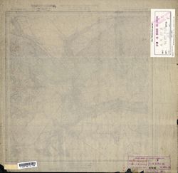
- Description:
- 1929
- Subject:
- Topical Subject: Maps, Geographic Subject: Smila, and Topical Subject: Soviet Union
- Publisher:
- Военно-топографическое управление
- Language:
- Russian
- Identifier:
- VAC9619-001058
- Genre:
- Topographic Maps and Military Maps
- Geographic Location:
- Coordinates: 49.1667, 31.75, 49.3333, 32
- Related URL:
- Download GeoTIFF: https://drive.google.com/open?id=1PJNufrmyRWDUh29Eitn8iu5LvBLsdCev and Catalog URL: http://iucat.iu.edu/catalog/5020131
- Abstract:
- Modern area represented: Smila, Cherkasy oblast, Ukraine
- Call Number:
- G7000 s50 .S68 М-36-100-Б
- Caption:
- Для служебного пользования,Секретно
- City:
- М. Смела (Smila)
- Copyright Holder:
- No Copyright - United States
- Country:
- СССР (USSR)
- State/Province:
- Украинская ССР (Ukrainian Soviet Socialist Republic)
- Physical Description:
- Scale: 1:50,000
- Persistent URL:
- http://purl.dlib.indiana.edu/iudl/images/VAC9619/VAC9619-001058
- Provenance:
- DMA Topographic Center, Army Map Service Library, Library of Congress Geography & Map Division
-
- Description:
- 1929
- Subject:
- Topical Subject: Maps, Topical Subject: Soviet Union, and Geographic Subject: Serdiukivka
- Publisher:
- Управление военных топографов
- Language:
- Russian
- Identifier:
- VAC9619-001059
- Genre:
- Topographic Maps and Military Maps
- Geographic Location:
- Coordinates: 49, 31.75, 49.1667, 32
- Related URL:
- Catalog URL: http://iucat.iu.edu/catalog/5020131 and Download GeoTIFF: https://drive.google.com/open?id=1RSy1XLJ95uJFkdsFwVyoFkaI3ZK0bXKC
- Abstract:
- Modern area represented: Serdiukivka, Cherkasy oblast, Ukraine
- Call Number:
- G7000 s50 .S68 М-36-100-Г
- Caption:
- Не подлежит оглашению
- City:
- Сердюковка (Serdiukivka)
- Copyright Holder:
- No Copyright - United States
- Country:
- СССР (USSR)
- State/Province:
- Украинская ССР (Ukrainian Soviet Socialist Republic)
- Physical Description:
- Scale: 1:50,000
- Persistent URL:
- http://purl.dlib.indiana.edu/iudl/images/VAC9619/VAC9619-001059
- Provenance:
- DMA Topographic Center, Army Map Service Library, Library of Congress Geography & Map Division
-

- Description:
- 1929
- Subject:
- Geographic Subject: Medvedivka, Topical Subject: Maps, and Topical Subject: Soviet Union
- Publisher:
- Управление военных топографов
- Language:
- Russian
- Identifier:
- VAC9619-001061
- Genre:
- Topographic Maps and Military Maps
- Geographic Location:
- Coordinates: 49.1667, 32.25, 49.3333, 32.5
- Related URL:
- Catalog URL: http://iucat.iu.edu/catalog/5020131 and Download GeoTIFF: https://drive.google.com/open?id=17Bc5UuGZ4g6dHEKGcOTL_wAVQleDgpMJ
- Abstract:
- Modern area represented: Medvedivka, Cherkasy oblast, Ukraine
- Call Number:
- G7000 s50 .S68 М-36-101-Б
- Caption:
- Не подлежит оглашению,Рассекречено
- City:
- Медведовка (Medvedivka)
- Copyright Holder:
- No Copyright - United States
- Country:
- СССР (USSR)
- State/Province:
- Украинская ССР (Ukrainian Soviet Socialist Republic)
- Physical Description:
- Scale: 1:50,000
- Persistent URL:
- http://purl.dlib.indiana.edu/iudl/images/VAC9619/VAC9619-001061
- Provenance:
- DMA Topographic Center, Army Map Service Library, Library of Congress Geography & Map Division
-
- Description:
- 1929
- Subject:
- Topical Subject: Maps, Geographic Subject: Podorozhnoye, and Topical Subject: Soviet Union
- Publisher:
- Управление военных топографов
- Language:
- Russian
- Identifier:
- VAC9619-001064
- Genre:
- Topographic Maps and Military Maps
- Geographic Location:
- Coordinates: 49.1667, 32.75, 49.3333, 33
- Related URL:
- Catalog URL: http://iucat.iu.edu/catalog/5020131 and Download GeoTIFF: https://drive.google.com/open?id=1SKnRydLKpG0z6XMXEJsFBCKfhdrQaukk
- Abstract:
- Modern area represented: Podorozhnoye, Kirovohrad oblast, Ukraine
- Call Number:
- G7000 s50 .S68 М-36-102-Б
- Caption:
- Не подлежит оглашению,Рассекречено
- City:
- Подорожное (Podorozhnoye)
- Copyright Holder:
- No Copyright - United States
- Country:
- СССР (USSR)
- State/Province:
- Украинская ССР (Ukrainian Soviet Socialist Republic)
- Physical Description:
- Scale: 1:50,000
- Persistent URL:
- http://purl.dlib.indiana.edu/iudl/images/VAC9619/VAC9619-001064
- Provenance:
- DMA Topographic Center, Army Map Service Library, Library of Congress Geography & Map Division
-
- Description:
- 1929
- Subject:
- Topical Subject: Soviet Union, Geographic Subject: Velikaya Andrusovka, and Topical Subject: Maps
- Publisher:
- Управление военных топографов РККА
- Language:
- Russian
- Identifier:
- VAC9619-001067
- Genre:
- Military Maps and Topographic Maps
- Geographic Location:
- Coordinates: 49, 32.75, 49.1667, 33
- Related URL:
- Download GeoTIFF: https://drive.google.com/open?id=1HkbX0hppWiYmTId9apihye-ITbJ04B_t and Catalog URL: http://iucat.iu.edu/catalog/5020131
- Abstract:
- Modern area represented: Velikaya Andrusovka, Kirovohrad oblast, Ukraine
- Call Number:
- G7000 s50 .S68 М-36-102-Г
- Caption:
- Не подлежит оглашению,Рассекречено
- City:
- Андрусовка (Andrusovka)
- Copyright Holder:
- No Copyright - United States
- Country:
- СССР (USSR)
- State/Province:
- Украинская ССР (Ukrainian Soviet Socialist Republic), Харьковская область (Kharkiv oblast), and Киевская область (Kyiv oblast)
- Physical Description:
- Scale: 1:50,000
- Persistent URL:
- http://purl.dlib.indiana.edu/iudl/images/VAC9619/VAC9619-001067
- Provenance:
- DMA Topographic Center, Army Map Service Library, Library of Congress Geography & Map Division
-
- Description:
- 1929
- Subject:
- Topical Subject: Maps, Geographic Subject: Svitlovodsk, and Topical Subject: Soviet Union
- Publisher:
- Управление военных топографов
- Language:
- Russian
- Identifier:
- VAC9619-001070
- Genre:
- Topographic Maps and Military Maps
- Geographic Location:
- Coordinates: 49, 33, 49.1667, 33.25
- Related URL:
- Catalog URL: http://iucat.iu.edu/catalog/5020131 and Download GeoTIFF: https://drive.google.com/open?id=1x-8InatKz9OMgiQEOw4G9BuQe3yjgzKu
- Abstract:
- Modern area represented: Svitlovodsk, Kirovohrad oblast, Ukraine
- Call Number:
- G7000 s50 .S68 М-36-103-В
- Caption:
- Не подлежит оглашению,Рассекречено
- City:
- Новогеоргиевск (Novogeorgievsk)
- Copyright Holder:
- No Copyright - United States
- Country:
- СССР (USSR)
- State/Province:
- Украинская ССР (Ukrainian Soviet Socialist Republic)
- Physical Description:
- Scale: 1:50,000
- Persistent URL:
- http://purl.dlib.indiana.edu/iudl/images/VAC9619/VAC9619-001070
- Provenance:
- DMA Topographic Center, Army Map Service Library, Library of Congress Geography & Map Division
-
- Description:
- 1931
- Subject:
- Topical Subject: Maps, Geographic Subject: Manzheliya, and Topical Subject: Soviet Union
- Publisher:
- Управление военных топографов
- Language:
- Russian
- Date Created:
- 1932
- Identifier:
- VAC9619-001072
- Genre:
- Topographic Maps and Military Maps
- Geographic Location:
- Coordinates: 49, 32.75, 49.1667, 33
- Related URL:
- Download GeoTIFF: https://iu.box.com/s/dfxio7w6apwlwcyikngbf5besz1h147c and Catalog URL: http://iucat.iu.edu/catalog/5020131
- Abstract:
- Modern area represented: Manzheliya, Poltava oblast,, Ukraine
- Call Number:
- G7000 s50 .S68 М-36-104-А
- Caption:
- Не подлежит оглашению
- City:
- С. Манжелия (Manzheliya)
- Copyright Holder:
- No Copyright - United States
- Country:
- СССР (USSR)
- State/Province:
- Украинская ССР (Ukrainian Soviet Socialist Republic) and Харьковская область (Kharkiv oblast)
- Physical Description:
- Scale: 1:50,000
- Persistent URL:
- http://purl.dlib.indiana.edu/iudl/images/VAC9619/VAC9619-001072
- Provenance:
- DMA Topographic Center, Army Map Service Library, Library of Congress Geography & Map Division
-
- Description:
- 1931
- Subject:
- Topical Subject: Maps, Geographic Subject: Potoky, and Topical Subject: Soviet Union
- Publisher:
- Управление военных топографов
- Language:
- Russian
- Date Created:
- 1932
- Identifier:
- VAC9619-001074
- Genre:
- Military Maps and Topographic Maps
- Geographic Location:
- Coordinates: 49, 33.5, 49.167, 33.75
- Related URL:
- Download GeoTIFF: https://drive.google.com/open?id=1GX0sLo44sRuR3v1OIp04iONd9imkDD8j and Catalog URL: http://iucat.iu.edu/catalog/5020131
- Abstract:
- Modern area represented: Potoky, Poltava oblast, Ukraine
- Call Number:
- G7000 s50 .S68 М-36-104-В
- Caption:
- Не подлежит оглашению
- City:
- Потоки (Potoky)
- Copyright Holder:
- No Copyright - United States
- Country:
- СССР (USSR)
- State/Province:
- Украинская ССР (Ukrainian Soviet Socialist Republic) and Киевская область (Kyiv oblast)
- Physical Description:
- Scale: 1:50,000
- Persistent URL:
- http://purl.dlib.indiana.edu/iudl/images/VAC9619/VAC9619-001074
- Provenance:
- DMA Topographic Center, Army Map Service Library, Library of Congress Geography & Map Division
-
- Description:
- 1941
- Subject:
- Geographic Subject: Nekhvoroshcha, Topical Subject: Soviet Union, and Topical Subject: Maps
- Publisher:
- Генеральный штаб Красной Армии
- Language:
- Russian
- Date Created:
- 1942
- Identifier:
- VAC9619-001079
- Genre:
- Topographic Maps and Military Maps
- Geographic Location:
- Coordinates: 49, 34.5, 49.167, 34.75
- Related URL:
- Catalog URL: http://iucat.iu.edu/catalog/5020131 and Download GeoTIFF: https://drive.google.com/open?id=1WoUW_HZPz6iendZfnCpvuS608s7Ucaas
- Abstract:
- Modern area represented: Nekhvoroshcha, Poltava oblast, Ukraine
- Call Number:
- G7000 s50 .S68 М-36-106-В
- Caption:
- Для служебного пользования
- City:
- Нехвороща (Nekhvoroshcha)
- Copyright Holder:
- No Copyright - United States
- Country:
- СССР (USSR)
- State/Province:
- Днепропетровская область (Dnipropetrovsk oblast), Украинская ССР (Ukrainian Soviet Socialist Republic), and Полтавская область (Poltava oblast)
- Physical Description:
- Scale: 1:50,000
- Persistent URL:
- http://purl.dlib.indiana.edu/iudl/images/VAC9619/VAC9619-001079
- Provenance:
- DMA Topographic Center, Army Map Service Library, Library of Congress Geography & Map Division
-
- Description:
- 1941
- Subject:
- Geographic Subject: Kotovka, Topical Subject: Maps, and Topical Subject: Soviet Union
- Publisher:
- Генеральный штаб Красной Армии
- Language:
- Russian
- Date Created:
- 1942
- Identifier:
- VAC9619-001080
- Genre:
- Topographic Maps and Military Maps
- Geographic Location:
- Coordinates: 49, 34.75, 49.167, 35
- Related URL:
- Download GeoTIFF: https://drive.google.com/open?id=1OazIpWtAvrXaQNOO_-nSmWeWbVbqmOax and Catalog URL: http://iucat.iu.edu/catalog/5020131
- Abstract:
- Modern area represented: Kotovka, Dnipropetrovsk oblast, Ukraine
- Call Number:
- G7000 s50 .S68 М-36-106-Г
- Caption:
- Для служебного пользования
- City:
- Котовка (Kotovka)
- Copyright Holder:
- No Copyright - United States
- Country:
- СССР (USSR)
- State/Province:
- Полтавская область (Poltava oblast), Днепропетровская область (Dnipropetrovsk oblast), and Украинская ССР (Ukrainian Soviet Socialist Republic)
- Physical Description:
- Scale: 1:50,000
- Persistent URL:
- http://purl.dlib.indiana.edu/iudl/images/VAC9619/VAC9619-001080
- Provenance:
- DMA Topographic Center, Army Map Service Library, Library of Congress Geography & Map Division
-
- Description:
- 1929
- Subject:
- Geographic Subject: Ositnyazhka, Topical Subject: Maps, and Topical Subject: Soviet Union
- Publisher:
- Управление военных топографов
- Language:
- Russian
- Identifier:
- VAC9619-001088
- Genre:
- Topographic Maps and Military Maps
- Geographic Location:
- Coordinates: 48.833, 31.75, 49, 32
- Related URL:
- Catalog URL: http://iucat.iu.edu/catalog/5020131 and Download GeoTIFF: https://drive.google.com/open?id=1Xli0kxu2CKegKSf9SkuNNynYBC292OWF
- Abstract:
- Modern area represented: Ositnyazhka, Kirovohrad oblast, Ukraine
- Call Number:
- G7000 s50 .S68 М-36-112-Б
- Caption:
- Не подлежит оглашению
- City:
- Оситняжка (Ositnyazhka)
- Copyright Holder:
- No Copyright - United States
- Country:
- СССР (USSR)
- State/Province:
- Украинская ССР (Ukrainian Soviet Socialist Republic)
- Physical Description:
- Scale: 1:50,000
- Persistent URL:
- http://purl.dlib.indiana.edu/iudl/images/VAC9619/VAC9619-001088
- Provenance:
- DMA Topographic Center, Army Map Service Library, Library of Congress Geography & Map Division
-
- Description:
- 1931
- Subject:
- Topical Subject: Maps, Geographic Subject: Pavlysh, and Topical Subject: Soviet Union
- Publisher:
- Управление военных топографов РККА
- Language:
- Russian
- Date Created:
- 1932
- Identifier:
- VAC9619-001093
- Genre:
- Military Maps and Topographic Maps
- Geographic Location:
- Coordinates: 48.833, 33.25, 49, 33.5
- Related URL:
- Catalog URL: http://iucat.iu.edu/catalog/5020131 and Download GeoTIFF: https://drive.google.com/open?id=1sMRslNs7Ya7e0przcNxz1C8CJMYdNijj
- Abstract:
- Modern area represented: Pavlysh, Kirovohrad oblast, Ukraine
- Call Number:
- G7000 s50 .S68 М-36-115-Б
- Caption:
- Не подлежит оглашению
- City:
- Павлыш (Pavlysh)
- Copyright Holder:
- No Copyright - United States
- Country:
- СССР (USSR)
- State/Province:
- Харьковская область (Kharkiv oblast), Украинская ССР (Ukrainian Soviet Socialist Republic), and Днепропетровская область (Dnipropetrovsk oblast)
- Physical Description:
- Scale: 1:50,000
- Persistent URL:
- http://purl.dlib.indiana.edu/iudl/images/VAC9619/VAC9619-001093
- Provenance:
- DMA Topographic Center, Army Map Service Library, Library of Congress Geography & Map Division
-
- Description:
- 1931
- Subject:
- Geographic Subject: Zolotarivka, Topical Subject: Maps, and Topical Subject: Soviet Union
- Publisher:
- Управление военных топографов РККА
- Language:
- Russian
- Identifier:
- VAC9619-001092
- Genre:
- Military Maps and Topographic Maps
- Geographic Location:
- Coordinates: 48.833, 33, 49, 33.25
- Related URL:
- Catalog URL: http://iucat.iu.edu/catalog/5020131 and Download GeoTIFF: https://drive.google.com/open?id=1ab3yn1y7eIDbRDWKK465vCXrqJ3ZG5HV
- Abstract:
- Modern area represented: Zolotarivka, Kirovohrad oblast, Ukraine
- Call Number:
- G7000 s50 .S68 М-36-115-А
- Caption:
- Не подлежит оглашению
- City:
- Золотаревка (Zolotarivka)
- Copyright Holder:
- No Copyright - United States
- Country:
- СССР (USSR)
- State/Province:
- Украинская ССР (Ukrainian Soviet Socialist Republic), Харьковская область (Kharkiv oblast), and Днепропетровская область (Dnipropetrovsk oblast)
- Physical Description:
- Scale: 1:50,000
- Persistent URL:
- http://purl.dlib.indiana.edu/iudl/images/VAC9619/VAC9619-001092
- Provenance:
- DMA Topographic Center, Army Map Service Library, Library of Congress Geography & Map Division
-
- Description:
- 1930
- Subject:
- Topical Subject: Maps and Topical Subject: Soviet Union
- Publisher:
- Управление военных топографов
- Language:
- Russian
- Date Created:
- 1931
- Identifier:
- VAC9619-001095
- Genre:
- Topographic Maps and Military Maps
- Geographic Location:
- Coordinates: 48.833, 33.5, 49, 33.75
- Related URL:
- Catalog URL: http://iucat.iu.edu/catalog/5020131 and Download GeoTIFF: https://drive.google.com/open?id=1JLV3hDecyJlaCsdEbO7-bXlVlJWjNfGW
- Abstract:
- Modern area represented: Ukraine
- Call Number:
- G7000 s50 .S68 М-36-116-А
- Caption:
- Не подлежит оглашению
- City:
- Каменно-Потоцкое (Kamenno-Pototskoe)
- Copyright Holder:
- No Copyright - United States
- Country:
- СССР (USSR)
- State/Province:
- Украинская ССР (Ukrainian Soviet Socialist Republic) and Киевская область (Kyiv oblast)
- Physical Description:
- Scale: 1:50,000
- Persistent URL:
- http://purl.dlib.indiana.edu/iudl/images/VAC9619/VAC9619-001095
- Provenance:
- DMA Topographic Center, Army Map Service Library, Library of Congress Geography & Map Division
-
- Description:
- 1931
- Subject:
- Topical Subject: Soviet Union, Topical Subject: Maps, and Geographic Subject: Zybkove
- Publisher:
- Управление военных топографов
- Language:
- Russian
- Date Created:
- 1932
- Identifier:
- VAC9619-001094
- Genre:
- Topographic Maps and Military Maps
- Geographic Location:
- Coordinates: 48.667, 33.25, 48.833, 33.5
- Related URL:
- Download GeoTIFF: https://drive.google.com/open?id=1aE2uadlywZNTzYcEC7DpZRlzdnt_EgSI and Catalog URL: http://iucat.iu.edu/catalog/5020131
- Abstract:
- Modern area represented: Zybkove, Kirovohrad oblast, Ukraine
- Call Number:
- G7000 s50 .S68 М-36-115-Г
- Caption:
- Не подлежит оглашению
- City:
- Зыбкое (Zybkove)
- Copyright Holder:
- No Copyright - United States
- Country:
- СССР (USSR)
- State/Province:
- Харьковская область (Kharkiv oblast) and Украинская ССР (Ukrainian Soviet Socialist Republic)
- Physical Description:
- Scale: 1:50,000
- Persistent URL:
- http://purl.dlib.indiana.edu/iudl/images/VAC9619/VAC9619-001094
- Provenance:
- DMA Topographic Center, Army Map Service Library, Library of Congress Geography & Map Division
-
- Description:
- 1931
- Subject:
- Topical Subject: Maps, Topical Subject: Soviet Union, and Geographic Subject: Popelnaste
- Publisher:
- Управление военных топографов
- Language:
- Russian
- Identifier:
- VAC9619-001097
- Genre:
- Military Maps and Topographic Maps
- Geographic Location:
- Coordinates: 48.66667, 33.5, 48.833333, 33.75
- Related URL:
- Download GeoTIFF: https://drive.google.com/open?id=1Z8ZOcM7oiAgJLMUBXXWPQr2uGLxKPkxd and Catalog URL: http://iucat.iu.edu/catalog/5020131
- Abstract:
- Modern area represented: Popelnaste, Kirovohrad oblast, Ukraine
- Call Number:
- G7000 s50 .S68 М-36-116-В
- Caption:
- Не подлежит оглашению
- City:
- Пепельнастое (Popelnastoe)
- Copyright Holder:
- No Copyright - United States
- Country:
- СССР (USSR)
- State/Province:
- Харьковская область (Kharkiv oblast) and Украинская ССР (Ukrainian Soviet Socialist Republic)
- Physical Description:
- Scale: 1:50,000
- Persistent URL:
- http://purl.dlib.indiana.edu/iudl/images/VAC9619/VAC9619-001097
- Provenance:
- DMA Topographic Center, Army Map Service Library, Library of Congress Geography & Map Division
-
- Description:
- 1931
- Subject:
- Geographic Subject: Kyshenky, Topical Subject: Maps, and Topical Subject: Soviet Union
- Publisher:
- Генеральный штаб Красной Армии
- Language:
- Russian
- Date Created:
- 1942
- Identifier:
- VAC9619-001099
- Genre:
- Topographic Maps and Military Maps
- Geographic Location:
- Coordinates: 48.833, 34, 49, 34.25
- Related URL:
- Catalog URL: http://iucat.iu.edu/catalog/5020131 and Download GeoTIFF: https://drive.google.com/open?id=1dNRbHY-iNZtB427mmftmyR6eRSOZLG4v
- Abstract:
- Modern area represented: Kyshenky, Poltava oblast, Ukraine
- Call Number:
- G7000 s50 .S68 М-36-117-А
- Caption:
- Для служебного пользования
- City:
- Лев. Кишеньки (Levie Kyshenky)
- Copyright Holder:
- No Copyright - United States
- Country:
- СССР (USSR)
- State/Province:
- Украинская ССР (Ukrainian Soviet Socialist Republic), Днепропетровская область (Dnipropetrovsk oblast), and Полтавская область (Poltava oblast)
- Physical Description:
- Scale: 1:50,000
- Persistent URL:
- http://purl.dlib.indiana.edu/iudl/images/VAC9619/VAC9619-001099
- Provenance:
- DMA Topographic Center, Army Map Service Library, Library of Congress Geography & Map Division
-
- Description:
- 1930
- Subject:
- Geographic Subject: Lykhivka, Topical Subject: Maps, and Topical Subject: Soviet Union
- Publisher:
- Управление военных топографов
- Language:
- Russian
- Date Created:
- 1931
- Identifier:
- VAC9619-001098
- Genre:
- Topographic Maps and Military Maps
- Geographic Location:
- Coordinates: 48.667, 33.75, 48.833, 34
- Related URL:
- Download GeoTIFF: https://drive.google.com/open?id=19iy7pH5ZUgXvm9R7EsycH_L6CPiEqv-p and Catalog URL: http://iucat.iu.edu/catalog/5020131
- Abstract:
- Modern area represented: Lykhivka, Dnipropetrovsk oblast, Ukraine
- Call Number:
- G7000 s50 .S68 М-36-116-Г
- Caption:
- Не подлежит оглашению
- City:
- Лиховка (Lykhivka)
- Copyright Holder:
- No Copyright - United States
- Country:
- СССР (USSR)
- State/Province:
- Украинская ССР (Ukrainian Soviet Socialist Republic) and Харьковская область (Kharkiv oblast)
- Physical Description:
- Scale: 1:50,000
- Persistent URL:
- http://purl.dlib.indiana.edu/iudl/images/VAC9619/VAC9619-001098
- Provenance:
- DMA Topographic Center, Army Map Service Library, Library of Congress Geography & Map Division
-
- Description:
- 1941
- Subject:
- Topical Subject: Maps, Topical Subject: Soviet Union, and Geographic Subject: Synelnykove
- Publisher:
- Генеральный штаб Красной Армии
- Language:
- Russian
- Date Created:
- 1942
- Identifier:
- VAC9619-001178
- Genre:
- Topographic Maps and Military Maps
- Geographic Location:
- Coordinates: 48.167, 35.5, 48.333, 35.75
- Related URL:
- Catalog URL: http://iucat.iu.edu/catalog/5020131 and Download GeoTIFF: https://drive.google.com/open?id=141GQBeT867kM5Hyrxidt4kJ5m8NmXyy_
- Abstract:
- Modern area represented: Synelnykove, Dnipropetrovsk oblast, Ukraine
- Call Number:
- GM G7000 S50 .S68 M-36-144-A
- Caption:
- Для служебного пользования
- City:
- Синельниково (Synelnykove)
- Copyright Holder:
- No Copyright - United States
- Country:
- СССР (USSR)
- State/Province:
- Днепропетровская область (Dnipropetrovsk oblast) and Украинская ССР (Ukrainian Soviet Socialist Republic)
- Physical Description:
- Scale: 1:50,000
- Persistent URL:
- http://purl.dlib.indiana.edu/iudl/images/VAC9619/VAC9619-001178
- Provenance:
- DMA Topographic Center, Army Map Service Library, Library of Congress Geography & Map Division
-
- Description:
- 1935
- Subject:
- Geographic Subject: Novopokrovka, Topical Subject: Maps, and Topical Subject: Soviet Union
- Publisher:
- Генеральный штаб Красной Армии
- Language:
- Russian
- Date Created:
- 1942
- Identifier:
- VAC9619-001175
- Genre:
- Military Maps and Topographic Maps
- Geographic Location:
- Coordinates: 48, 34.5, 48.167, 34.75
- Related URL:
- Download GeoTIFF: https://drive.google.com/open?id=1uIRCkIch9TufzPrCHo7_ltkPZ9th3O36 and Catalog URL: http://iucat.iu.edu/catalog/5020131
- Abstract:
- Modern area represented: Novopokrovka, Dnipropetrovsk oblast, Ukraine
- Call Number:
- GM G7000 S50 .S68 M-36-142-C
- Caption:
- Для служебного пользования
- City:
- Новопокровское (Novopokrovskoe)
- Copyright Holder:
- No Copyright - United States
- Country:
- СССР (USSR)
- State/Province:
- Украинская ССР (Ukrainian Soviet Socialist Republic) and Днепропетровская область (Dnipropetrovsk oblast)
- Physical Description:
- Scale: 1:50,000
- Persistent URL:
- http://purl.dlib.indiana.edu/iudl/images/VAC9619/VAC9619-001175
- Provenance:
- DMA Topographic Center, Army Map Service Library, Library of Congress Geography & Map Division
-
- Description:
- 1931
- Subject:
- Geographic Subject: Berezuvatka, Topical Subject: Maps, and Topical Subject: Soviet Union
- Publisher:
- Генеральный штаб Красной Армии
- Language:
- Russian
- Identifier:
- VAC9619-001168
- Genre:
- Topographic Maps and Military Maps
- Geographic Location:
- Coordinates: 48, 32.5, 48.167, 32.75
- Related URL:
- Download GeoTIFF: https://drive.google.com/open?id=1BeGb1-QilCzwus_0PRIJ69R1eUpbwagh and Catalog URL: http://iucat.iu.edu/catalog/5020131
- Abstract:
- Modern area represented: Berezuvatka, Kirovohrad oblast, Ukraine
- Call Number:
- GM G7000 S50 .S68 M-36-138-B
- Caption:
- Для служебного пользования
- City:
- Израилевка (Izrailevka)
- Copyright Holder:
- No Copyright - United States
- Country:
- СССР (USSR)
- State/Province:
- Кировоградская область (Kirovohrad oblast) and Украинская ССР (Ukrainian Soviet Socialist Republic)
- Physical Description:
- Scale: 1:50,000
- Persistent URL:
- http://purl.dlib.indiana.edu/iudl/images/VAC9619/VAC9619-001168
- Provenance:
- DMA Topographic Center, Army Map Service Library, Library of Congress Geography & Map Division
-
- Description:
- 1931
- Subject:
- Geographic Subject: Bratolyubivka, Topical Subject: Soviet Union, and Topical Subject: Maps
- Publisher:
- Управление военных топографов РККА
- Language:
- Russian
- Identifier:
- VAC9619-001167
- Genre:
- Military Maps and Topographic Maps
- Geographic Location:
- Coordinates: 48.167, 32.75, 48.333, 33
- Related URL:
- Catalog URL: http://iucat.iu.edu/catalog/5020131 and Download GeoTIFF: https://drive.google.com/open?id=1GH3CUmCSJHQYK6SLaVIwethyrZOI9vJB
- Abstract:
- Modern area represented: Bratolyubivka, Ukraine
- Call Number:
- GM G7000 S50 .S68 M-36-138-Б
- Caption:
- Не подлежит оглашению
- City:
- Братолюбивка (Bratolyubivka)
- Copyright Holder:
- No Copyright - United States
- Country:
- СССР (USSR)
- State/Province:
- Украинская ССР (Ukrainian Soviet Socialist Republic) and Днепропетровская область (Dnipropetrovsk oblast)
- Physical Description:
- Scale: 1:50,000
- Persistent URL:
- http://purl.dlib.indiana.edu/iudl/images/VAC9619/VAC9619-001167
- Provenance:
- DMA Topographic Center, Army Map Service Library, Library of Congress Geography & Map Division
-
- Description:
- 1931
- Subject:
- Topical Subject: Maps, Geographic Subject: Sofiyevka, and Topical Subject: Soviet Union
- Publisher:
- Управление военных топографов РККА
- Language:
- Russian
- Identifier:
- VAC9619-001163
- Genre:
- Military Maps and Topographic Maps
- Geographic Location:
- Coordinates: 48.167, 32, 48.333, 32.25
- Related URL:
- Download GeoTIFF: https://drive.google.com/open?id=1fJGaN-hiiUgRjn8rJKtv7gaubnqp9nEH and Catalog URL: http://iucat.iu.edu/catalog/5020131
- Abstract:
- Modern area represented: Sofiyevka, Kirovohrad oblast, Ukraine
- Call Number:
- GM G7000 S50 .S68 M-36-137-A
- Caption:
- Не подлежит оглашению
- City:
- Софиевка (Sofiyevka)
- Copyright Holder:
- No Copyright - United States
- Country:
- СССР (USSR)
- State/Province:
- Одесская область (Odessa oblast) and Украинская ССР (Ukrainian Soviet Socialist Republic)
- Physical Description:
- Scale: 1:50,000
- Persistent URL:
- http://purl.dlib.indiana.edu/iudl/images/VAC9619/VAC9619-001163
- Provenance:
- DMA Topographic Center, Army Map Service Library, Library of Congress Geography & Map Division
-
- Description:
- 1928
- Subject:
- Topical Subject: Soviet Union, Geographic Subject: Annovka, and Topical Subject: Maps
- Publisher:
- Управление военных топографов
- Language:
- Russian
- Identifier:
- VAC9619-001162
- Genre:
- Military Maps and Topographic Maps
- Geographic Location:
- Coordinates: 48, 31.5, 48.167, 31.75
- Related URL:
- Catalog URL: http://iucat.iu.edu/catalog/5020131 and Download GeoTIFF: https://drive.google.com/open?id=1kdmnN-AZXlDQ3ksr-oevv8wCYj0XLikI
- Abstract:
- Modern area represented: Annovka, Mykolaiv oblast, Ukraine
- Call Number:
- GM G7000 S50 .S68 M-36-136-C
- Caption:
- Не подлежит оглашению
- City:
- Анновка (Annovka)
- Copyright Holder:
- No Copyright - United States
- Country:
- СССР (USSR)
- State/Province:
- Украинская ССР (Ukrainian Soviet Socialist Republic)
- Physical Description:
- Scale: 1:50,000
- Persistent URL:
- http://purl.dlib.indiana.edu/iudl/images/VAC9619/VAC9619-001162
- Provenance:
- DMA Topographic Center, Army Map Service Library, Library of Congress Geography & Map Division
-
- Description:
- 1931
- Subject:
- Topical Subject: Soviet Union, Geographic Subject: Rivne, and Topical Subject: Maps
- Publisher:
- Генеральный штаб РККА
- Language:
- Russian
- Identifier:
- VAC9619-001161
- Genre:
- Military Maps and Topographic Maps
- Geographic Location:
- Coordinates: 48.167, 31.75, 48.333, 32
- Related URL:
- Download GeoTIFF: https://drive.google.com/open?id=1JtGAyBKCMCSFIg8M2eyH3YB7LIDCPAvR and Catalog URL: http://iucat.iu.edu/catalog/5020131
- Abstract:
- Modern area represented: Rivne, Kirovohrad oblast, Ukraine
- Call Number:
- GM G7000 S50 .S68 M-36-136-B
- Caption:
- Не подлежит оглашению
- City:
- Ровное (Rovnoe)
- Copyright Holder:
- No Copyright - United States
- Country:
- СССР (USSR)
- State/Province:
- Украинская ССР (Ukrainian Soviet Socialist Republic) and Одесская область (Odessa oblast)
- Physical Description:
- Scale: 1:50,000
- Persistent URL:
- http://purl.dlib.indiana.edu/iudl/images/VAC9619/VAC9619-001161
- Provenance:
- DMA Topographic Center, Army Map Service Library, Library of Congress Geography & Map Division
-
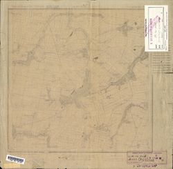
- Description:
- 1927
- Subject:
- Topical Subject: Soviet Union, Topical Subject: Maps, and Geographic Subject: Iosipovka
- Language:
- Russian
- Identifier:
- VAC9619-001160
- Genre:
- Topographic Maps and Military Maps
- Geographic Location:
- Coordinates: 48.167, 30.75, 48.333, 31
- Related URL:
- Catalog URL: http://iucat.iu.edu/catalog/5020131 and Download GeoTIFF: https://drive.google.com/open?id=1sMoFd-pRcQ28UuCB6JzmIDc2S6eswhUX
- Abstract:
- Modern area represented: Iosipovka, Kirovohrad oblast, Ukraine
- Call Number:
- GM G7000 S50 .S68 M-36-134-B
- Caption:
- Секретно
- Copyright Holder:
- No Copyright - United States
- Country:
- СССР (USSR)
- State/Province:
- Украинская ССР (Ukrainian Soviet Socialist Republic)
- Physical Description:
- Scale: 1:50,000
- Persistent URL:
- http://purl.dlib.indiana.edu/iudl/images/VAC9619/VAC9619-001160
- Provenance:
- DMA Topographic Center, Army Map Service Library, Library of Congress Geography & Map Division
-
- Description:
- 1932
- Subject:
- Topical Subject: Maps, Geographic Subject: Dnipro, and Topical Subject: Soviet Union
- Publisher:
- Генеральный штаб Красной Армии
- Language:
- Russian
- Date Created:
- 1942
- Identifier:
- VAC9619-001156
- Genre:
- Military Maps and Topographic Maps
- Geographic Location:
- Coordinates: 48.3333, 35.0, 48.5, 35.25
- Related URL:
- Catalog URL: http://iucat.iu.edu/catalog/5020131 and Download GeoTIFF: https://drive.google.com/open?id=1dWgz3X9ZxGf_9kO9qxqi_gtuwHW02t6r
- Abstract:
- Modern area represented: Dnipro, Dnipropetrovsk oblast, Ukraine
- Call Number:
- GM G7000 s50 .S68 M-36-131-B
- Caption:
- Для служебного пользования
- City:
- Днепропетровск (Dnipropetrovsk)
- Copyright Holder:
- No Copyright - United States
- Country:
- СССР (USSR)
- State/Province:
- Днепропетровская область (Dnipropetrovsk oblast) and Украинская ССР (Ukrainian Soviet Socialist Republic)
- Physical Description:
- Scale: 1:50,000
- Persistent URL:
- http://purl.dlib.indiana.edu/iudl/images/VAC9619/VAC9619-001156
- Provenance:
- DMA Topographic Center, Army Map Service Library, Library of Congress Geography & Map Division
-
- Description:
- 1932
- Subject:
- Geographic Subject: Novomoskovsk, Topical Subject: Soviet Union, and Topical Subject: Maps
- Publisher:
- Генеральный штаб Красной Армии
- Language:
- Russian
- Date Created:
- 1942
- Identifier:
- VAC9619-001155
- Genre:
- Military Maps and Topographic Maps
- Geographic Location:
- Coordinates: 48.5, 35.25, 48.66667, 35.5
- Related URL:
- Download GeoTIFF: https://drive.google.com/open?id=1fz5hTj-wggXnOzOHbHA_Qs2ol5SjSXoR and Catalog URL: http://iucat.iu.edu/catalog/5020131
- Abstract:
- Modern area represented: Novomoskovsk, Dnipropetrovsk oblast, Ukraine
- Call Number:
- GM G7000 s50 .S68 M-36-131-Б
- Caption:
- Для служебного пользования
- City:
- Ново-Московск (Novo-Moskovsk)
- Copyright Holder:
- No Copyright - United States
- Country:
- СССР (USSR)
- State/Province:
- Днепропетровская область (Dnipropetrovsk oblast) and Украинская ССР (Ukrainian Soviet Socialist Republic)
- Physical Description:
- Scale: 1:50,000
- Persistent URL:
- http://purl.dlib.indiana.edu/iudl/images/VAC9619/VAC9619-001155
- Provenance:
- DMA Topographic Center, Army Map Service Library, Library of Congress Geography & Map Division
-
- Description:
- 1933
- Subject:
- Topical Subject: Soviet Union, Geographic Subject: Kamianske, and Topical Subject: Maps
- Publisher:
- Генеральный штаб Красной Армии
- Language:
- Russian
- Date Created:
- 1942
- Identifier:
- VAC9619-001151
- Genre:
- Military Maps and Topographic Maps
- Geographic Location:
- Coordinates: 48.5, 34.5, 48.66667, 34.75
- Related URL:
- Download GeoTIFF: https://drive.google.com/open?id=1UgTvcHsZB7O5nINkPB6FTKzZgAW3bBZL and Catalog URL: http://iucat.iu.edu/catalog/5020131
- Abstract:
- Modern area represented: Kamianske, Dnipropetrovsk oblast, Ukraine
- Call Number:
- G7000 s50 .S68 sheet M-36-130-A
- Caption:
- Для служебного пользования
- City:
- Днепродзержинск (Dniprodzerzhynsk)
- Copyright Holder:
- No Copyright - United States
- Country:
- СССР (USSR)
- State/Province:
- Днепропетровская область (Dnipropetrovsk oblast) and Украинская ССР (Ukrainian Soviet Socialist Republic)
- Physical Description:
- Scale: 1:50,000
- Persistent URL:
- http://purl.dlib.indiana.edu/iudl/images/VAC9619/VAC9619-001151
- Provenance:
- DMA Topographic Center, Army Map Service Library, Library of Congress Geography & Map Division

- « Previous
- Next »
- 1
- 2
- 3