
Search Constraints
You searched for:
Publisher
Генеральный штаб Красной Армии
Remove constraint Publisher: Генеральный штаб Красной Армии
« Previous |
1 - 100 of 1,420
|
Next »
Search Results
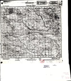
-
- Description:
- 1912
- Subject:
- Topical Subject: Soviet Union, Topical Subject: Maps, and Geographic Subject: Maku
- Publisher:
- Генеральный штаб Красной Армии
- Language:
- Russian
- Date Created:
- 1941
- Identifier:
- VAC9619-000117
- Genre:
- Military Maps and Topographic Maps
- Geographic Location:
- Coordinates: 39, 44.5, 39.3333, 45
- Related URL:
- Catalog URL: https://iucat.iu.edu/catalog/5020129 and Download GeoTIFF: https://drive.google.com/open?id=1yxUNfH1eBFr_XPjkGSrP0UxUjoeZAI1s
- Abstract:
- Modern area represented: Maku, West Azerbaijan province, Iran
- Call Number:
- G7000 s100 .S7 sheet J-38-30
- Caption:
- Для служебного пользования
- City:
- Маку (Maku)
- Copyright Holder:
- No Copyright - United States
- Country:
- Иран (Iran)
- Physical Description:
- Scale: 1:100,000
- Persistent URL:
- http://purl.dlib.indiana.edu/iudl/images/VAC9619/VAC9619-000117
- Provenance:
- DMA Topographic Center, Army Map Service Library, OMAHA, Library of Congress Geography & Map Division
-
- Description:
- 1911
- Subject:
- Topical Subject: Maps, Geographic Subject: Nakhichivan, and Topical Subject: Soviet Union
- Publisher:
- Генеральный штаб Красной Армии
- Language:
- Russian
- Date Created:
- 1941
- Identifier:
- VAC9619-000168
- Genre:
- Topographic Maps and Military Maps
- Geographic Location:
- Coordinates: 39, 45, 39.3333, 45.5
- Related URL:
- Download GeoTIFF: https://drive.google.com/open?id=1h5_S_6_AlNlCJetMeL_sUoTO5Fdurz2q and Catalog URL: https://iucat.iu.edu/catalog/5020129
- Abstract:
- Modern area represented: Nakhichivan, Nakhchivan autonomous republic, Azerbaijan
- Call Number:
- G7000 s100 .S7 sheet J-38-31
- Caption:
- Для служебного пользования
- City:
- Нахичевань (Nakhichivan)
- Copyright Holder:
- No Copyright - United States
- Country:
- Иран (Iran)
- State/Province:
- Нахичеванская АССР (Nakhichevan Autonomous Soviet Socialist Republic)
- Physical Description:
- Scale: 1:100,000
- Persistent URL:
- http://purl.dlib.indiana.edu/iudl/images/VAC9619/VAC9619-000168
- Provenance:
- Army Map Service Library, Library of Congress G & M Division, Geographic Names Branch
-
- Description:
- 1912
- Subject:
- Topical Subject: Soviet Union and Topical Subject: Maps
- Publisher:
- Генеральный штаб Красной Армии
- Language:
- Russian
- Date Created:
- 1941
- Identifier:
- VAC9619-000169
- Genre:
- Topographic Maps and Military Maps
- Geographic Location:
- Coordinates: 38.6667, 44.5, 39, 45
- Related URL:
- Catalog URL: https://iucat.iu.edu/catalog/5020129 and Download GeoTIFF: https://drive.google.com/file/d/1FXM5g0j66ZiEmcLy926Au1ZaXEYYVLlY/view?usp=sharing
- Call Number:
- G7000 s100 .S7 sheet J-38-42
- Caption:
- Для служебного пользования
- City:
- Хыдырлы (Khydyrly)
- Copyright Holder:
- No Copyright - United States
- Country:
- Иран (Iran)
- Physical Description:
- Scale: 1:100,000
- Persistent URL:
- http://purl.dlib.indiana.edu/iudl/images/VAC9619/VAC9619-000169
- Provenance:
- Army Map Service Library, Library of Congress G & M Division, Geographic Names Branch
-
- Description:
- 1912
- Subject:
- Topical Subject: Maps, Topical Subject: Soviet Union, and Geographic Subject: Īvowghlī
- Publisher:
- Генеральный штаб Красной Армии
- Language:
- Russian
- Date Created:
- 1941
- Identifier:
- VAC9619-001041
- Genre:
- Military Maps and Topographic Maps
- Geographic Location:
- Coordinates: 38.6667, 45, 39, 45.5
- Related URL:
- Catalog URL: https://iucat.iu.edu/catalog/5020129 and Download GeoTIFF: https://drive.google.com/open?id=1qpvW4RsmwJh6m1WiJtJXW567d8q67ACe
- Abstract:
- Modern area represented: Īvowghlī, West Azerbaijan province, Iran
- Call Number:
- G7000 s100 .S7 sheet J-38-43
- Caption:
- Для служебного пользования
- City:
- Евоглю (Evoghlu)
- Copyright Holder:
- No Copyright - United States
- Country:
- СССР (USSR) and Иран (Iran)
- State/Province:
- Нахичеванская АССР (Nakhichevan Autonomous Soviet Socialist Republic)
- Physical Description:
- Scale: 1:100,000
- Persistent URL:
- http://purl.dlib.indiana.edu/iudl/images/VAC9619/VAC9619-001041
- Provenance:
- DMA Topographic Center, Army Map Service Library, Library of Congress Geography & Map Division, OMAHA
-
- Description:
- 1910
- Subject:
- Topical Subject: Maps, Topical Subject: Soviet Union, and Geographic Subject: Culfa
- Publisher:
- Генеральный штаб Красной Армии
- Language:
- Russian
- Date Created:
- 1941
- Identifier:
- VAC9619-000702
- Genre:
- Topographic Maps and Military Maps
- Geographic Location:
- Coordinates: 38.6667, 45.5, 39, 46
- Related URL:
- Catalog URL: https://iucat.iu.edu/catalog/5020129 and Download GeoTIFF: https://drive.google.com/open?id=1ciMiII6qDnnJ6WZV49dwofar2Sm3RRBF
- Abstract:
- Modern area represented: Culfa, Nakhchivan Autonomous Republic, Azerbaijan
- Call Number:
- G7000 s100 .S7 sheet J-38-44
- Caption:
- Временное издание,Для служебного пользования
- City:
- Джульфа (Culfa)
- Copyright Holder:
- No Copyright - United States
- Country:
- Иран (Iran)
- State/Province:
- Нахичеванская АССР (Nakhichevan Autonomous Soviet Socialist Republic)
- Physical Description:
- Scale: 1:100,000
- Persistent URL:
- http://purl.dlib.indiana.edu/iudl/images/VAC9619/VAC9619-000702
- Provenance:
- DMA Topographic Center, Army Map Service Library, OMAHA, Library of Congress Geography & Map Division
-
- Subject:
- Topical Subject: Maps, Topical Subject: Soviet Union, and Geographic Subject: Julfa
- Publisher:
- Генеральный штаб Красной Армии
- Language:
- Russian
- Date Created:
- 1940
- Identifier:
- VAC9619-000089
- Genre:
- Topographic Maps and Military Maps
- Geographic Location:
- Coordinates: 38.8333, 45.5, 39, 45.75
- Related URL:
- Download GeoTIFF: https://drive.google.com/open?id=1fZhMoeilfY5E-PsoYnAeUMHJQW6GUmXx and Catalog URL: http://iucat.iu.edu/catalog/5020131
- Abstract:
- Modern area represented: Julfa, Azerbaijan
- Call Number:
- G7000 s50 .S68 sheet J-38-44-A
- Caption:
- Не подлежит оглашению
- City:
- Джульфа (Dzhulfa)
- Copyright Holder:
- No Copyright - United States
- Country:
- Иран (Iran) and СССР (USSR)
- State/Province:
- Нахичеванская АССР (Nakhichevan Autonomous Soviet Socialist Republic)
- Physical Description:
- Scale: 1:50,000
- Persistent URL:
- http://purl.dlib.indiana.edu/iudl/images/VAC9619/VAC9619-000089
- Provenance:
- CIA Map Library
-
- Description:
- 1911
- Subject:
- Topical Subject: Soviet Union, Topical Subject: Maps, and Geographic Subject: Ordubad
- Publisher:
- Генеральный штаб Красной Армии
- Language:
- Russian
- Date Created:
- 1941
- Identifier:
- VAC9619-000887
- Genre:
- Topographic Maps and Military Maps
- Geographic Location:
- Coordinates: 38.6667, 46, 39, 46.5
- Related URL:
- Download GeoTIFF: https://drive.google.com/open?id=1QEhyrdUoV08U5oUYl5odXPXyNlonu_lh and Catalog URL: https://iucat.iu.edu/catalog/5020129
- Abstract:
- Modern area represented: Ordubad, Nakhchivan Autonomous Republic, Azerbaijan
- Call Number:
- G7000 s100 .S7 sheet J-38-45
- Caption:
- Временное издание,Для служебного пользования
- City:
- Ордубад (Ordubad)
- Copyright Holder:
- No Copyright - United States
- Country:
- Иран (Iran)
- State/Province:
- Нахичеванская АССР (Nakhichevan Autonomous Soviet Socialist Republic) and Армянская ССР (Armenian Soviet Socialist Republic)
- Physical Description:
- Scale: 1:100,000
- Persistent URL:
- http://purl.dlib.indiana.edu/iudl/images/VAC9619/VAC9619-000887
- Provenance:
- DMA Topographic Center, Army Map Service Library, OMAHA, Library of Congress Geography & Map Division, Auswärtiges Amt. Geographischer Dienst
-
- Description:
- 1912
- Subject:
- Topical Subject: Maps, Geographic Subject: Valdīān, and Topical Subject: Soviet Union
- Publisher:
- Генеральный штаб Красной Армии
- Language:
- Russian
- Date Created:
- 1941
- Identifier:
- VAC9619-001037
- Genre:
- Topographic Maps and Military Maps
- Geographic Location:
- Coordinates: 38.3333, 45, 38.6667, 45.5
- Related URL:
- Catalog URL: https://iucat.iu.edu/catalog/5020129 and Download GeoTIFF: https://drive.google.com/open?id=172i-zN6WhR7vbpKdGdU37qsjCP5LflAk
- Abstract:
- Modern area represented: Valdīān, West Azerbaijan, Iran
- Call Number:
- G7000 s100 .S7 sheet J-38-55
- Caption:
- Для служебного пользования
- City:
- Валдиан (Valdīān)
- Copyright Holder:
- No Copyright - United States
- Country:
- Иран (Iran)
- Physical Description:
- Scale: 1:100,000
- Persistent URL:
- http://purl.dlib.indiana.edu/iudl/images/VAC9619/VAC9619-001037
- Provenance:
- Army Map Service Library, Library of Congress G & M Division, Geographic Names Branch
-
- Description:
- 1912
- Subject:
- Geographic Subject: Anderyān, Topical Subject: Soviet Union, and Topical Subject: Maps
- Publisher:
- Генеральный штаб Красной Армии
- Language:
- Russian
- Date Created:
- 1941
- Identifier:
- VAC9619-000902
- Genre:
- Military Maps and Topographic Maps
- Geographic Location:
- Coordinates: 38.3333, 46, 38.6667, 46.5
- Related URL:
- Download GeoTIFF: https://drive.google.com/open?id=1k0PqIMTiLBMqIzYfFeLhXaA2eT4gzNX1 and Catalog URL: https://iucat.iu.edu/catalog/5020129
- Abstract:
- Modern area represented: Anderyān, East Azerbaijan, Iran
- Call Number:
- G7000 s100 .S7 sheet J-38-57
- Caption:
- Временное издание
- City:
- Андырджан (Andergan)
- Copyright Holder:
- No Copyright - United States
- Country:
- Иран (Iran)
- Physical Description:
- Scale: 1:100,000
- Persistent URL:
- http://purl.dlib.indiana.edu/iudl/images/VAC9619/VAC9619-000902
- Provenance:
- DMA Topographic Center, Army Map Service Library, OMAHA, Library of Congress Geography & Map Division, Auswärtiges Amt. Geographischer Dienst
-
- Description:
- 1912
- Subject:
- Topical Subject: Maps, Geographic Subject: Tasūj, and Topical Subject: Soviet Union
- Publisher:
- Генеральный штаб Красной Армии
- Language:
- Russian
- Date Created:
- 1941
- Identifier:
- VAC9619-001140
- Genre:
- Topographic Maps and Military Maps
- Geographic Location:
- Coordinates: 38, 45, 38.3333, 45.5
- Related URL:
- Catalog URL: https://iucat.iu.edu/catalog/5020129 and Download GeoTIFF: https://drive.google.com/open?id=1i7JKA676OI5ZuPLGFgPkMrLVZjELVDcx
- Abstract:
- Modern area represented: Tasūj, East Azerbaijan, Iran
- Call Number:
- G7000 s100 .S7 sheet J-38-67
- Caption:
- Для служебного пользования
- City:
- Тасвич (Tasvich)
- Copyright Holder:
- No Copyright - United States
- Country:
- Иран (Iran)
- Physical Description:
- Scale: 1:100,000
- Persistent URL:
- http://purl.dlib.indiana.edu/iudl/images/VAC9619/VAC9619-001140
- Provenance:
- Army Map Service Library, Geographic Names Branch
-
- Description:
- 1909
- Subject:
- Topical Subject: Soviet Union, Geographic Subject: Shabestar, and Topical Subject: Maps
- Publisher:
- Генеральный штаб Красной Армии
- Language:
- Russian
- Date Created:
- 1941
- Identifier:
- VAC9619-001115
- Genre:
- Military Maps and Topographic Maps
- Geographic Location:
- Coordinates: 38, 45.5, 38.3333, 46
- Related URL:
- Catalog URL: https://iucat.iu.edu/catalog/5020129 and Download GeoTIFF: https://drive.google.com/open?id=1W80M4FLMU0wN1-htAcYwssKPeWQeg0hq
- Abstract:
- Modern area represented: Shabestar, East Azerbaijan, Iran
- Call Number:
- G7000 s100 .S7 sheet J-38-68
- Caption:
- Временное издание
- City:
- Чабиастар (Shabestar)
- Copyright Holder:
- No Copyright - United States
- Country:
- Иран (Iran)
- Physical Description:
- Scale: 1:100,000
- Persistent URL:
- http://purl.dlib.indiana.edu/iudl/images/VAC9619/VAC9619-001115
- Provenance:
- DMA Topographic Center, Army Map Service Library, OMAHA, Library of Congress Geography & Map Division
-
- Description:
- 1905
- Subject:
- Topical Subject: Maps, Topical Subject: Soviet Union, and Geographic Subject: Lazarevskoye
- Publisher:
- Генеральный штаб Красной Армии
- Language:
- Russian
- Date Created:
- 1942
- Identifier:
- VAC9619-000759
- Genre:
- Topographic Maps and Military Maps
- Geographic Location:
- Coordinates: 43.6667, 39, 44, 39.5
- Related URL:
- Catalog URL: https://iucat.iu.edu/catalog/5020129 and Download GeoTIFF: https://drive.google.com/open?id=1OcoSmUSM2ZO6HwjSl9T2sxJaHo8Fbzui
- Abstract:
- Modern area represented: Lazarevskoye, Krasnodar kray, Russia
- Call Number:
- G7000 s100 .S7 sheet K-37-7
- Caption:
- Для служебного пользования
- City:
- Лазаревская (Lazarevskoye)
- Copyright Holder:
- No Copyright - United States
- Country:
- СССР (USSR)
- State/Province:
- Краснодарская область (Krasnodar oblast) and РСФСР (RSFSR)
- Physical Description:
- Scale: 1:100,000
- Persistent URL:
- http://purl.dlib.indiana.edu/iudl/images/VAC9619/VAC9619-000759
- Provenance:
- CIA Map Library
-
- Description:
- 1903
- Subject:
- Geographic Subject: Detlyazhka, Topical Subject: Maps, and Topical Subject: Soviet Union
- Publisher:
- Генеральный штаб Красной Армии
- Language:
- Russian
- Identifier:
- VAC9619-000752
- Genre:
- Military Maps and Topographic Maps
- Geographic Location:
- Coordinates: 39.5, 43.6667, 40, 44
- Related URL:
- Download GeoTIFF: https://drive.google.com/open?id=1diaa3kPb__e1IZYQ7bRW53NrZIWTa3bv and Catalog URL: https://iucat.iu.edu/catalog/5020129
- Abstract:
- Modern area represented: Detlyazhka, Krasnodar kray, Russia
- Call Number:
- G7000 s100 .S7 sheet K-37-8
- Caption:
- Для служебного пользования
- Copyright Holder:
- No Copyright - United States
- Country:
- СССР (USSR)
- State/Province:
- Краснодарский край (Krasnodar kray) and РСФСР (RSFSR)
- Physical Description:
- Scale: 1:100,000
- Persistent URL:
- http://purl.dlib.indiana.edu/iudl/images/VAC9619/VAC9619-000752
- Provenance:
- CIA Map Library, Atlasblatt
-
- Subject:
- Topical Subject: Maps, Geographic Subject: Aleksandriyskaya, and Topical Subject: Soviet Union
- Publisher:
- Генеральный штаб Красной Армии
- Language:
- Russian
- Identifier:
- VAC9619-000813
- Genre:
- Topographic Maps and Military Maps
- Related URL:
- Catalog URL: https://iucat.iu.edu/catalog/5020129
- Abstract:
- Modern area represented: Aleksandriyskaya, Dagestan republic, Russia
- Call Number:
- G7000 s100 .S7 sheet K-38-11
- Copyright Holder:
- No Copyright - United States
- Country:
- СССР (USSR)
- Physical Description:
- Scale: 1:100,000
- Persistent URL:
- http://purl.dlib.indiana.edu/iudl/images/VAC9619/VAC9619-000813
- Provenance:
- CIA Map Library
-
- Description:
- 1886
- Subject:
- Topical Subject: Maps, Topical Subject: Soviet Union, and Geographic Subject: Zayukovo
- Publisher:
- Генеральный штаб Красной Армии
- Language:
- Russian
- Date Created:
- 1942
- Identifier:
- VAC9619-000768
- Genre:
- Military Maps and Topographic Maps
- Geographic Location:
- Coordinates: 43.3333, 43, 43.6667, 43.5
- Related URL:
- Download GeoTIFF: https://drive.google.com/open?id=1ZvJc3OHAg6vpcikjFr92BMG60irdKLJA and Catalog URL: https://iucat.iu.edu/catalog/5020129
- Abstract:
- Modern area represented: Zayukovo, Kabardino-Balkariya Republic, Russia
- Call Number:
- G7000 s100 .S7 sheet K-38-15
- Caption:
- Для служебного пользования
- City:
- Заюково (Zayukovo)
- Copyright Holder:
- No Copyright - United States
- Country:
- СССР (USSR)
- State/Province:
- РСФСР (RSFSR) and Кабардино-Балкарская АССР (Kabardino-Balkar Autonomous Soviet Socialist Republic)
- Physical Description:
- Scale: 1:100,000
- Persistent URL:
- http://purl.dlib.indiana.edu/iudl/images/VAC9619/VAC9619-000768
- Provenance:
- DMA Topographic Center, Army Map Service Library, Library of Congress Geography & Map Division
-
- Description:
- 1941
- Subject:
- Geographic Subject: Babayurt, Topical Subject: Maps, and Topical Subject: Soviet Union
- Publisher:
- Генеральный штаб Красной Армии
- Language:
- Russian
- Date Created:
- 1942
- Identifier:
- VAC9619-000784
- Genre:
- Topographic Maps and Military Maps
- Geographic Location:
- Coordinates: 43.3333, 46.5, 43.6667, 47
- Related URL:
- Download GeoTIFF: https://drive.google.com/open?id=1J0-KZD89YETRBJk8JXDeJgXjmkM-Bz0H and Catalog URL: https://iucat.iu.edu/catalog/5020129
- Abstract:
- Modern area represented: Babayurt, Dagestan republic, Russia
- Call Number:
- G7000 s100 .S7 sheet K-38-22
- Caption:
- Для служебного пользования
- City:
- Баба-Юрт (Baba-Yurt)
- Copyright Holder:
- No Copyright - United States
- Country:
- СССР (USSR)
- State/Province:
- Дагестанская АССР (Dagestan Autonomous Soviet Socialist Republic) and РСФСР (RSFSR)
- Physical Description:
- Scale: 1:100,000
- Persistent URL:
- http://purl.dlib.indiana.edu/iudl/images/VAC9619/VAC9619-000784
- Provenance:
- CIA Map Library, Atlasblatt
-
- Description:
- 1870
- Subject:
- Topical Subject: Soviet Union, Topical Subject: Maps, and Geographic Subject: Alagir
- Publisher:
- Генеральный штаб Красной Армии
- Language:
- Russian
- Date Created:
- 1942
- Identifier:
- VAC9619-000786
- Genre:
- Topographic Maps and Military Maps
- Geographic Location:
- Coordinates: 43, 44, 43.3333, 44.5
- Related URL:
- Download GeoTIFF: https://drive.google.com/open?id=1ipwxw4RfPnMQCVYN2bZCXjRGnhJRTiAZ and Catalog URL: https://iucat.iu.edu/catalog/5020129
- Abstract:
- Modern area represented: Alagir, North Ossetia – Alania republic, Russia
- Call Number:
- G7000 s100 .S7 sheet K-38-29
- Caption:
- Для служебного пользования
- City:
- Алагир (Alagir)
- Copyright Holder:
- No Copyright - United States
- Country:
- СССР (USSR)
- State/Province:
- Северо-Осетинская АССР (North Ossetian Autonomous Soviet Socialist Republic), Кабардино-Балкарская АССР (Kabardino-Balkar Autonomous Soviet Socialist Republi...
- Physical Description:
- Scale: 1:100,000
- Persistent URL:
- http://purl.dlib.indiana.edu/iudl/images/VAC9619/VAC9619-000786
- Provenance:
- Army Map Service Library, Geographic Names Branch, Library of Congress G & M Division
-
- Description:
- 1910
- Subject:
- Topical Subject: Soviet Union, Topical Subject: Maps, and Geographic Subject: Malka
- Publisher:
- Генеральный штаб Красной Армии
- Language:
- Russian
- Date Created:
- 1942
- Identifier:
- VAC9619-000774
- Genre:
- Topographic Maps and Military Maps
- Geographic Location:
- Coordinates: 43.6667, 43, 44, 43.5
- Related URL:
- Download GeoTIFF: https://drive.google.com/open?id=1SGbNvHRjKc5EerPHr8nhRF6X8xaL-QxT and Catalog URL: https://iucat.iu.edu/catalog/5020129
- Abstract:
- Modern area represented: Malka, Kabardino-Balkariya republic, Russia
- Call Number:
- G7000 s100 .S7 sheet K-38-3
- Caption:
- Для служебного пользования
- City:
- Малка (Malka)
- Copyright Holder:
- No Copyright - United States
- Country:
- СССР (USSR)
- State/Province:
- РСФСР (RSFSR), Кабардино-Балкарская АССР (Kabardino-Balkar Autonomous Soviet Socialist Republic), and Орджоникидзевский край (Ordzhonikidze kray)
- Physical Description:
- Scale: 1:100,000
- Persistent URL:
- http://purl.dlib.indiana.edu/iudl/images/VAC9619/VAC9619-000774
- Provenance:
- Army Map Service Library, Geographic Names Branch, Library of Congress G & M Division
-
- Description:
- 1865
- Subject:
- Geographic Subject: Vladikavkaz, Topical Subject: Soviet Union, and Topical Subject: Maps
- Publisher:
- Генеральный штаб Красной Армии
- Language:
- Russian
- Date Created:
- 1942
- Identifier:
- VAC9619-000771
- Genre:
- Military Maps and Topographic Maps
- Geographic Location:
- Coordinates: 43, 44.5, 43.3333, 45
- Related URL:
- Catalog URL: https://iucat.iu.edu/catalog/5020129 and Download GeoTIFF: https://drive.google.com/open?id=1kDKKODnPr23wD5i0h8neJQlTz_2AADEd
- Abstract:
- Modern area represented: Vladikavkaz, North Ossetia, Russia
- Call Number:
- G7000 s100 .S7 sheet K-38-30
- Caption:
- Для служебного пользования
- City:
- Орджоникидзе (Ordzhonikidze)
- Copyright Holder:
- No Copyright - United States
- Country:
- СССР (USSR)
- State/Province:
- Северо-Осетинская АССР (North Ossetian Autonomous Soviet Socialist Republic), Чечено-Ингушская АССР (Checheno-Ingush Autonomous Soviet Socialist Republic), a...
- Physical Description:
- Scale: 1:100,000
- Persistent URL:
- http://purl.dlib.indiana.edu/iudl/images/VAC9619/VAC9619-000771
- Provenance:
- DMA Topographic Center, Army Map Service Library, Library of Congress Geography & Map Division
-
- Description:
- 1941
- Subject:
- Topical Subject: Soviet Union, Geographic Subject: Sulak, and Topical Subject: Maps
- Publisher:
- Генеральный штаб Красной Армии
- Language:
- Russian
- Date Created:
- 1942
- Identifier:
- VAC9619-000823
- Genre:
- Topographic Maps and Military Maps
- Geographic Location:
- Coordinates: 43.1667, 47.5, 43.3333, 47.75
- Related URL:
- Download GeoTIFF: https://drive.google.com/open?id=1fi0Y7Zx7hJENqk7HaR288XcwIYbzqak_ and Catalog URL: https://iucat.iu.edu/catalog/5020129
- Abstract:
- Modern area represented: Sulak, Dagestan republic, Russia
- Call Number:
- G7000 s100 .S7 sheet K-38-36
- Caption:
- Для служебного пользования
- City:
- Главный Сулак (Glavniy Sulak)
- Copyright Holder:
- No Copyright - United States
- Country:
- СССР (USSR)
- State/Province:
- Дагестанская АССР (Dagestan Autonomous Soviet Socialist Republic) and РСФСР (RSFSR)
- Physical Description:
- Scale: 1:100,000
- Persistent URL:
- http://purl.dlib.indiana.edu/iudl/images/VAC9619/VAC9619-000823
- Provenance:
- DMA Topographic Center, Atlasblatt, Library of Congress Geography & Map Division, Army Map Service Library
-
- Description:
- 1926
- Subject:
- Geographic Subject: Petropavlovskiy, Topical Subject: Soviet Union, and Topical Subject: Maps
- Publisher:
- Генеральный штаб Красной Армии
- Language:
- Russian
- Date Created:
- 1942
- Identifier:
- VAC9619-000776
- Genre:
- Military Maps and Topographic Maps
- Geographic Location:
- Coordinates: 43.6667, 43.5, 44, 44
- Related URL:
- Catalog URL: https://iucat.iu.edu/catalog/5020129 and Download GeoTIFF: https://drive.google.com/open?id=1dg7f6EBuVklTPJaZtvCy_PTDJEXMZyd5
- Abstract:
- Modern area represented: Petropavlovskiy, Kabardino-Balkariya republic, Russia
- Call Number:
- G7000 s100 .S7 sheet K-38-4
- Caption:
- Для служебного пользования
- City:
- Новопавловская (Petropavlovskaya)
- Copyright Holder:
- No Copyright - United States
- Country:
- СССР (USSR)
- State/Province:
- Орджоникидзевский край (Ordzhonikidze kray), Кабардино-Балкарская АССР (Kabardino-Balkar Autonomous Soviet Socialist Republic), and РСФСР (RSFSR)
- Physical Description:
- Scale: 1:100,000
- Persistent URL:
- http://purl.dlib.indiana.edu/iudl/images/VAC9619/VAC9619-000776
- Provenance:
- DMA Topographic Center, Army Map Service Library, Library of Congress Geography & Map Division
-
- Description:
- 1925
- Subject:
- Topical Subject: Maps, Geographic Subject: Prokhladniy, and Topical Subject: Soviet Union
- Publisher:
- Генеральный штаб Красной Армии
- Language:
- Russian
- Date Created:
- 1942
- Identifier:
- VAC9619-000808
- Genre:
- Topographic Maps and Military Maps
- Geographic Location:
- Coordinates: 43.6667, 44, 44, 44.5
- Related URL:
- Download GeoTIFF: https://drive.google.com/open?id=1OjKt08J0_fPt0XbJ57tpvB64eHbCRPc1 and Catalog URL: https://iucat.iu.edu/catalog/5020129
- Abstract:
- Modern area represented: Prokhladniy, Kabardino-Balkariya republic, Russia
- Call Number:
- G7000 s100 .S7 sheet K-38-5
- Caption:
- Секретно
- City:
- Прохладный (Prokhladniy)
- Copyright Holder:
- No Copyright - United States
- Country:
- СССР (USSR)
- State/Province:
- Орджоникидзевский край (Ordzhonikidze kray), РСФСР (RSFSR), and Кабардино-Балкарская АССР (Kabardino-Balkar Autonomous Soviet Socialist Republic)
- Physical Description:
- Scale: 1:100,000
- Persistent URL:
- http://purl.dlib.indiana.edu/iudl/images/VAC9619/VAC9619-000808
- Provenance:
- DMA Topographic Center, Army Map Service Library, Library of Congress Geography & Map Division
-
- Description:
- 1927
- Subject:
- Topical Subject: Soviet Union, Geographic Subject: Mozdok, and Topical Subject: Maps
- Publisher:
- Генеральный штаб Красной Армии
- Language:
- Russian
- Date Created:
- 1942
- Identifier:
- VAC9619-000781
- Genre:
- Military Maps and Topographic Maps
- Geographic Location:
- Coordinates: 43.6667, 44.5, 44, 45
- Related URL:
- Download GeoTIFF: https://drive.google.com/open?id=1r1SWyJiKpjKXCDKEQG6P9Qc-RYOZ5cX_ and Catalog URL: https://iucat.iu.edu/catalog/5020129
- Abstract:
- Modern area represented: Mozdok, North Ossetia – Alania republic, Russia
- Call Number:
- G7000 s100 .S7 sheet K-38-6
- Caption:
- Для служебного пользования
- City:
- Моздок (Mozdok)
- Copyright Holder:
- No Copyright - United States
- Country:
- СССР (USSR)
- State/Province:
- Орджоникидзевский край (Ordzhonikidze kray), Кабардино-Балкарская АССР (Kabardino-Balkar Autonomous Soviet Socialist Republic), РСФСР (RSFSR), and Чечено-Инг...
- Physical Description:
- Scale: 1:100,000
- Persistent URL:
- http://purl.dlib.indiana.edu/iudl/images/VAC9619/VAC9619-000781
- Provenance:
- Army Map Service Library, Geographic Names Branch, Library of Congress G & M Division
-
- Description:
- 1928
- Subject:
- Geographic Subject: Ishcherskaya, Topical Subject: Maps, and Topical Subject: Soviet Union
- Publisher:
- Генеральный штаб Красной Армии
- Language:
- Russian
- Date Created:
- 1942
- Identifier:
- VAC9619-000713
- Genre:
- Military Maps and Topographic Maps
- Geographic Location:
- Coordinates: 43.6667, 45, 44, 45.5
- Related URL:
- Catalog URL: https://iucat.iu.edu/catalog/5020129 and Download GeoTIFF: https://drive.google.com/open?id=1FvJwKmJFKaVdSLxaBo8WClBaKfF26Pxc
- Abstract:
- Modern area represented: Ishcherskaya, Chechnya, Russia
- Call Number:
- G7000 s100 .S7 sheet K-38-7
- Caption:
- Для служебного пользования
- City:
- Ищерская (Ishcherskaya)
- Copyright Holder:
- No Copyright - United States
- Country:
- СССР (USSR)
- State/Province:
- Орджоникидзевский край (Ordzhonikidze kray), Чечено-Ингушская АССР (Checheno-Ingush Autonomous Soviet Socialist Republic), and РСФСР (RSFSR)
- Physical Description:
- Scale: 1:100,000
- Persistent URL:
- http://purl.dlib.indiana.edu/iudl/images/VAC9619/VAC9619-000713
- Provenance:
- Army Map Service Library, Geographic Names Branch, Library of Congress G & M Division
-
- Description:
- 1907
- Subject:
- Topical Subject: Soviet Union, Geographic Subject: Perekischkjul, and Topical Subject: Maps
- Publisher:
- Генеральный штаб Красной Армии
- Language:
- Russian
- Date Created:
- 1941
- Identifier:
- VAC9619-000892
- Genre:
- Military Maps and Topographic Maps
- Geographic Location:
- Coordinates: 40.3333, 49, 40.6667, 49.5
- Related URL:
- Download GeoTIFF: https://drive.google.com/open?id=1YAs8jfBXsWsytsvHAupvINf6BPXNHt5c and Catalog URL: https://iucat.iu.edu/catalog/5020129
- Abstract:
- Modern area represented: Perekischkjul, Abşeron district, Azerbaijan
- Call Number:
- G7000 s100 .S7 sheet K-39-123
- Caption:
- Для служебного пользования
- City:
- Перекишкюль (Perekischkjul)
- Copyright Holder:
- No Copyright - United States
- Country:
- СССР (USSR)
- State/Province:
- Азербайджанская ССР (Azerbaijan Soviet Socialist Republic)
- Physical Description:
- Scale: 1:100,000
- Persistent URL:
- http://purl.dlib.indiana.edu/iudl/images/VAC9619/VAC9619-000892
- Provenance:
- CIA Map Library, Library of Congress Geography & Map Division, Heeresplankammer Gruppe Archive Auslandskartenarchiv, Atlasblatt
-
- Description:
- 1880
- Subject:
- Topical Subject: Soviet Union, Topical Subject: Maps, and Geographic Subject: Lake Balaton
- Publisher:
- Генеральный штаб Красной Армии
- Language:
- Russian
- Date Created:
- 1944
- Identifier:
- VAC9619-000792
- Genre:
- Military Maps and Topographic Maps
- Geographic Location:
- Coordinates: 46.6667, 17.5, 47, 18
- Related URL:
- Download GeoTIFF: https://drive.google.com/open?id=1ZZQ319ZR-xds01_NM2lMGBsLDIsGS042 and Catalog URL: https://iucat.iu.edu/catalog/5020129
- Abstract:
- Modern area represented: Lake Balaton, Hungary
- Call Number:
- G7000 s100 .S7 sheet L-33-48
- City:
- Оз. Балатон (Lake Balaton)
- Copyright Holder:
- No Copyright - United States
- Country:
- Венгрия (Hungary)
- Physical Description:
- Scale: 1:100,000
- Persistent URL:
- http://purl.dlib.indiana.edu/iudl/images/VAC9619/VAC9619-000792
- Provenance:
- DMA Topographic Center, Army Map Service Library, OMAHA, Library of Congress Geography & Map Division, Atlasblatt
-
- Description:
- 1894
- Subject:
- Topical Subject: Soviet Union, Geographic Subject: Szekszárd, and Topical Subject: Maps
- Publisher:
- Генеральный штаб Красной Армии
- Language:
- Russian
- Date Created:
- 1944
- Identifier:
- VAC9619-001477
- Genre:
- Military Maps and Topographic Maps
- Geographic Location:
- Coordinates: 46.3333, 18.5, 46.6667, 19
- Related URL:
- Catalog URL: https://iucat.iu.edu/catalog/5020129 and Download GeoTIFF: https://drive.google.com/open?id=1f6Ue5ljPNCKXFqdhIJsJgaIrBvs_E0iF
- Abstract:
- Modern area represented: Szekszárd, Tolna county, Hungary
- Call Number:
- G7000 s100 .S7 sheet L-34-50
- City:
- Сексард (Szekszárd)
- Copyright Holder:
- No Copyright - United States
- Country:
- Венгрия (Hungary)
- Physical Description:
- Scale: 1:100,000
- Persistent URL:
- http://purl.dlib.indiana.edu/iudl/images/VAC9619/VAC9619-001477
- Provenance:
- DMA Topographic Center, Army Map Service Library, OMAHA, Atlasblatt, Library of Congress Geography & Map Division
-
- Description:
- 1926
- Subject:
- Topical Subject: Soviet Union, Topical Subject: Maps, and Geographic Subject: Mohács
- Publisher:
- Генеральный штаб Красной Армии
- Language:
- Russian
- Date Created:
- 1944
- Identifier:
- VAC9619-001479
- Genre:
- Topographic Maps and Military Maps
- Geographic Location:
- Coordinates: 45.6667, 18.5, 46, 19
- Related URL:
- Download GeoTIFF: https://drive.google.com/open?id=1QdSehiYsRTM-8M6JCSEAbNibcb9UlCAU and Catalog URL: https://iucat.iu.edu/catalog/5020129
- Abstract:
- Modern area represented: Mohács, Baranya county, Hungary
- Call Number:
- G7000 s100 .S7 sheet L-34-74
- City:
- Мохач (Mohács)
- Copyright Holder:
- No Copyright - United States
- Country:
- Югославия (Yugoslavia) and Венгрия (Hungary)
- Physical Description:
- Scale: 1:100,000
- Persistent URL:
- http://purl.dlib.indiana.edu/iudl/images/VAC9619/VAC9619-001479
- Provenance:
- DMA Topographic Center, Army Map Service Library, OMAHA, Atlasblatt, Library of Congress Geography & Map Division
-
- Description:
- 1929
- Subject:
- Topical Subject: Maps, Topical Subject: Soviet Union, and Geographic Subject: Sombor
- Publisher:
- Генеральный штаб Красной Армии
- Language:
- Russian
- Date Created:
- 1944
- Identifier:
- VAC9619-001000
- Genre:
- Topographic Maps and Military Maps
- Geographic Location:
- Coordinates: 45.6667, 19, 46, 19.5
- Related URL:
- Download GeoTIFF: https://drive.google.com/open?id=1vXpbAT1tpVWfKTjnf35CvwThcOGi5mrf and Catalog URL: https://iucat.iu.edu/catalog/5020129
- Abstract:
- Modern area represented: Sombor, Vojvodina province, Serbia
- Call Number:
- G7000 s100 .S7 sheet L-34-75
- City:
- Сомбор (Sombor)
- Copyright Holder:
- No Copyright - United States
- Country:
- Югославия (Yugoslavia) and Венгрия (Hungary)
- Physical Description:
- Scale: 1:100,000
- Persistent URL:
- http://purl.dlib.indiana.edu/iudl/images/VAC9619/VAC9619-001000
- Provenance:
- DMA Topographic Center, Army Map Service Library, Library of Congress Geography & Map Division, Atlasblatt
-
- Description:
- 1900
- Subject:
- Topical Subject: Maps, Geographic Subject: Deva, and Topical Subject: Soviet Union
- Publisher:
- Генеральный штаб Красной Армии
- Language:
- Russian
- Date Created:
- 1940
- Identifier:
- VAC9619-001255
- Genre:
- Topographic Maps and Military Maps
- Geographic Location:
- Coordinates: 45.6667, 22.5, 46, 23
- Related URL:
- Download GeoTIFF: https://drive.google.com/open?id=15eZ-SSDrKDZRKb7EoGa8LOVMH1kY1aG8 and Catalog URL: https://iucat.iu.edu/catalog/5020129
- Abstract:
- Modern area represented: Deva, Hunedoara county, Romania
- Call Number:
- G7000 s100 .S7 sheet L-34-82
- City:
- Дева (Deva)
- Copyright Holder:
- No Copyright - United States
- Country:
- Румыния (Romania)
- Physical Description:
- Scale: 1:100,000
- Persistent URL:
- http://purl.dlib.indiana.edu/iudl/images/VAC9619/VAC9619-001255
- Provenance:
- DMA Topographic Center, Army Map Service Library, Library of Congress Geography & Map Division
-
- Description:
- 1891
- Subject:
- Topical Subject: Soviet Union, Topical Subject: Maps, and Geographic Subject: Ploieşti
- Publisher:
- Генеральный штаб Красной Армии
- Language:
- Russian
- Date Created:
- 1940
- Identifier:
- VAC9619-001710
- Genre:
- Military Maps and Topographic Maps
- Geographic Location:
- Coordinates: 44.6667, 26, 45, 26.5
- Related URL:
- Catalog URL: https://iucat.iu.edu/catalog/5020129 and Download GeoTIFF: https://drive.google.com/open?id=1kbO5Fn1_gAfzsDWVCBnsh83RvgIf2cLC
- Abstract:
- Modern area represented: Ploieşti, Prahova county, Romania
- Call Number:
- G7000 s100 .S7 sheet L-35-113
- City:
- Плоешти (Ploieşti)
- Copyright Holder:
- No Copyright - United States
- Country:
- Румыния (Romania)
- Physical Description:
- Scale: 1:100,000
- Persistent URL:
- http://purl.dlib.indiana.edu/iudl/images/VAC9619/VAC9619-001710
- Provenance:
- DMA Topographic Center, Army Map Service Library, Library of Congress Geography & Map Division
-
- Description:
- 1894
- Subject:
- Topical Subject: Maps, Geographic Subject: Tătaru, and Topical Subject: Soviet Union
- Publisher:
- Генеральный штаб Красной Армии
- Language:
- Russian
- Date Created:
- 1940
- Identifier:
- VAC9619-001756
- Genre:
- Military Maps and Topographic Maps
- Geographic Location:
- Coordinates: 44.6667, 27, 45, 27.5
- Related URL:
- Catalog URL: https://iucat.iu.edu/catalog/5020129 and Download GeoTIFF: https://drive.google.com/open?id=12-p_BHuRv8fuQGL5nfUTZsaVfPTWOkwj
- Abstract:
- Modern area represented: Tătaru, Brăila county, Romania
- Call Number:
- G7000 s100 .S7 sheet L-35-115
- City:
- Татару (Tătaru)
- Copyright Holder:
- No Copyright - United States
- Country:
- Румыния (Romania)
- Physical Description:
- Scale: 1:100,000
- Persistent URL:
- http://purl.dlib.indiana.edu/iudl/images/VAC9619/VAC9619-001756
- Provenance:
- DMA Topographic Center, Army Map Service Library, Library of Congress Geography & Map Division
-
- Description:
- 1891
- Subject:
- Topical Subject: Soviet Union, Topical Subject: Maps, and Geographic Subject: Bucharest
- Publisher:
- Генеральный штаб Красной Армии
- Language:
- Russian
- Date Created:
- 1940
- Identifier:
- VAC9619-001794
- Genre:
- Military Maps and Topographic Maps
- Geographic Location:
- Coordinates: 44.3333, 26, 44.6667, 26.5
- Related URL:
- Catalog URL: https://iucat.iu.edu/catalog/5020129 and Download GeoTIFF: https://drive.google.com/open?id=1Qp3MYlVquPkot6GrpfLeHpxTWY4p62PS
- Abstract:
- Modern area represented: Bucharest, Bucureşti county, Romania
- Call Number:
- G7000 s100 .S7 sheet L-35-125
- City:
- Бухарест (Bucharest)
- Copyright Holder:
- No Copyright - United States
- Country:
- Румыния (Romania)
- Physical Description:
- Scale: 1:100,000
- Persistent URL:
- http://purl.dlib.indiana.edu/iudl/images/VAC9619/VAC9619-001794
- Provenance:
- DMA Topographic Center, Army Map Service Library, OMAHA, Library of Congress Geography & Map Division
-
- Description:
- 1883
- Subject:
- Topical Subject: Maps, Geographic Subject: Drăgăneşti-Vlaşca, and Topical Subject: Soviet Union
- Publisher:
- Генеральный штаб Красной Армии
- Language:
- Russian
- Date Created:
- 1940
- Identifier:
- VAC9619-001808
- Genre:
- Topographic Maps and Military Maps
- Geographic Location:
- Coordinates: 44, 25.5, 44.3333, 26
- Related URL:
- Download GeoTIFF: https://drive.google.com/open?id=1kk3WO5ndJeaX7rwmkETltz7GczrbyMJb and Catalog URL: https://iucat.iu.edu/catalog/5020129
- Abstract:
- Modern area represented: Drăgăneşti-Vlaşca, Giurgiu county, Romania
- Call Number:
- G7000 s100 .S7 sheet L-35-136
- City:
- Дрэгэнешти (Drăgăneşti)
- Copyright Holder:
- No Copyright - United States
- Country:
- Румыния (Romania)
- Physical Description:
- Scale: 1:100,000
- Persistent URL:
- http://purl.dlib.indiana.edu/iudl/images/VAC9619/VAC9619-001808
- Provenance:
- DMA Topographic Center, Army Map Service Library, Library of Congress Geography & Map Division
-
- Description:
- 1893
- Subject:
- Topical Subject: Maps, Topical Subject: Soviet Union, and Geographic Subject: Budeşti
- Publisher:
- Генеральный штаб Красной Армии
- Language:
- Russian
- Date Created:
- 1940
- Identifier:
- VAC9619-001809
- Genre:
- Military Maps and Topographic Maps
- Geographic Location:
- Coordinates: 44, 26, 44.3333, 26.5
- Related URL:
- Catalog URL: https://iucat.iu.edu/catalog/5020129 and Download GeoTIFF: https://drive.google.com/open?id=1tDXhb1hBuYrOkSbvJmeKh7J1IEkm384b
- Abstract:
- Modern area represented: Budeşti, Giurgiu county, Romania
- Call Number:
- G7000 s100 .S7 sheet L-35-137
- City:
- Будешти (Budeşti)
- Copyright Holder:
- No Copyright - United States
- Country:
- Румыния (Romania) and Болгария (Bulgaria)
- Physical Description:
- Scale: 1:100,000
- Persistent URL:
- http://purl.dlib.indiana.edu/iudl/images/VAC9619/VAC9619-001809
- Provenance:
- DMA Topographic Center, Army Map Service Library, Library of Congress Geography & Map Division
-
- Description:
- 1873
- Subject:
- Geographic Subject: Selyatyn, Topical Subject: Maps, and Topical Subject: Soviet Union
- Publisher:
- Генеральный штаб Красной Армии
- Language:
- Russian
- Date Created:
- 1939
- Identifier:
- VAC9619-001472
- Genre:
- Military Maps and Topographic Maps
- Geographic Location:
- Coordinates: 47.6667, 25, 48, 25.5
- Related URL:
- Download GeoTIFF: https://drive.google.com/open?id=1v6zIUxpzw2mb5AD7jE4-hVpFfWBpe8B8 and Catalog URL: https://iucat.iu.edu/catalog/5020129
- Abstract:
- Modern area represented: Selyatyn, Chernivtsi oblast, Ukraine
- Call Number:
- G7000 s100 .S7 sheet L-35-3
- Caption:
- Для служебного пользования
- City:
- Селетин (Selyatyn)
- Copyright Holder:
- No Copyright - United States
- Country:
- Румыния (Romania)
- State/Province:
- Украинская ССР (Ukrainian Soviet Socialist Republic) and Черновицкая область (Chernivtsi oblast)
- Physical Description:
- Scale: 1:100,000
- Persistent URL:
- http://purl.dlib.indiana.edu/iudl/images/VAC9619/VAC9619-001472
- Provenance:
- CIA Map Library
-
- Description:
- 1891
- Subject:
- Topical Subject: Soviet Union, Topical Subject: Maps, and Geographic Subject: Dragomireşti
- Publisher:
- Генеральный штаб Красной Армии
- Language:
- Russian
- Date Created:
- 1940
- Identifier:
- VAC9619-001755
- Genre:
- Military Maps and Topographic Maps
- Geographic Location:
- Coordinates: 46.3333, 27, 46.6667, 27.5
- Related URL:
- Download GeoTIFF: https://drive.google.com/file/d/1hCPO_hgwRlOoKYWPQdYYSitq_p-y_Ezx/view?usp=sharing and Catalog URL: https://iucat.iu.edu/catalog/5020129
- Abstract:
- Modern area represented: Dragomireşti, Vaslui county, Romania
- Call Number:
- G7000 s100 .S7 sheet L-35-55
- City:
- Драгомирешти (Dragomireşti)
- Copyright Holder:
- No Copyright - United States
- Country:
- Румыния (Romania)
- Physical Description:
- Scale: 1:100,000
- Persistent URL:
- http://purl.dlib.indiana.edu/iudl/images/VAC9619/VAC9619-001755
- Provenance:
- CIA Map Library
-
- Description:
- 1889
- Subject:
- Topical Subject: Soviet Union, Geographic Subject: Făgăraș, and Topical Subject: Maps
- Publisher:
- Генеральный штаб Красной Армии
- Language:
- Russian
- Date Created:
- 1940
- Identifier:
- VAC9619-001652
- Genre:
- Military Maps and Topographic Maps
- Geographic Location:
- Coordinates: 45.6667, 24.5, 46, 25
- Related URL:
- Catalog URL: https://iucat.iu.edu/catalog/5020129 and Download GeoTIFF: https://drive.google.com/open?id=1r58aE53jzC1uEcMtXoMsOM5HyoZ_rRZJ
- Abstract:
- Modern area represented: Făgăraș, Brașov county, Romania
- Call Number:
- G7000 s100 .S7 sheet L-35-74
- City:
- Фэгэраш (Făgăraș)
- Copyright Holder:
- No Copyright - United States
- Country:
- Румыния (Romania)
- Physical Description:
- Scale: 1:100,000
- Persistent URL:
- http://purl.dlib.indiana.edu/iudl/images/VAC9619/VAC9619-001652
- Provenance:
- CIA Map Library, Atlasblatt, Library of Congress Geography & Map Division
-
- Description:
- 1889
- Subject:
- Topical Subject: Maps, Topical Subject: Soviet Union, and Geographic Subject: Şercaia
- Publisher:
- Генеральный штаб Красной Армии
- Language:
- Russian
- Date Created:
- 1940
- Identifier:
- VAC9619-001664
- Genre:
- Topographic Maps and Military Maps
- Geographic Location:
- Coordinates: 45.6667, 25, 46, 25.5
- Related URL:
- Download GeoTIFF: https://drive.google.com/open?id=15sEsGkhtdVQiriI3v_WnvLBxHlw8Fmf4 and Catalog URL: https://iucat.iu.edu/catalog/5020129
- Abstract:
- Modern area represented: Şercaia, Brașov county, Romania
- Call Number:
- G7000 s100 .S7 sheet L-35-75
- City:
- Шеркая (Şercaia)
- Copyright Holder:
- No Copyright - United States
- Country:
- Румыния (Romania)
- Physical Description:
- Scale: 1:100,000
- Persistent URL:
- http://purl.dlib.indiana.edu/iudl/images/VAC9619/VAC9619-001664
- Provenance:
- CIA Map Library, Library of Congress Geography & Map Division
-
- Description:
- 1900
- Subject:
- Topical Subject: Soviet Union, Topical Subject: Maps, and Geographic Subject: Curtea de Argeş
- Publisher:
- Генеральный штаб Красной Армии
- Language:
- Russian
- Date Created:
- 1940
- Identifier:
- VAC9619-001686
- Genre:
- Topographic Maps and Military Maps
- Geographic Location:
- Coordinates: 45, 24.5, 45.3333, 25
- Related URL:
- Catalog URL: https://iucat.iu.edu/catalog/5020129 and Download GeoTIFF: https://drive.google.com/open?id=1xKHUf8r5kzgNfr-nYXFiSmBdlkvyDwU8
- Abstract:
- Modern area represented: Curtea de Argeş, Argeș county, Romania
- Call Number:
- G7000 s100 .S7 sheet L-35-98
- City:
- Куртя де Арджеш (Curtea de Argeş)
- Copyright Holder:
- No Copyright - United States
- Country:
- Румыния (Romania)
- Physical Description:
- Scale: 1:100,000
- Persistent URL:
- http://purl.dlib.indiana.edu/iudl/images/VAC9619/VAC9619-001686
- Provenance:
- DMA Topographic Center, Army Map Service Library, OMAHA, Atlasblatt, Library of Congress Geography & Map Division
-
- Description:
- 1926
- Subject:
- Topical Subject: Maps, Geographic Subject: Tomakivka, and Topical Subject: Soviet Union
- Publisher:
- Генеральный штаб Красной Армии
- Language:
- Russian
- Date Created:
- 1941
- Identifier:
- VAC9619-001823
- Genre:
- Topographic Maps and Military Maps
- Geographic Location:
- Coordinates: 47.6667, 34.5, 48, 35
- Related URL:
- Download GeoTIFF: https://drive.google.com/file/d/14Nyu2PujbMSA_GYJjeQF3P2MPNH2zV-g/view?usp=sharing and Catalog URL: https://iucat.iu.edu/catalog/5020129
- Abstract:
- Modern area represented: Tomakivka, Dnipropetrovsk oblast, Ukraine
- Call Number:
- G7000 s100 .S7 sheet L-36-10
- Caption:
- Для служебного пользования
- City:
- Томаковка (Tomakivka)
- Copyright Holder:
- No Copyright - United States
- Country:
- СССР (USSR)
- State/Province:
- Запорожская область (Zaporizhia oblast) and Украинская ССР (Ukrainian Soviet Socialist Republic)
- Physical Description:
- Scale: 1:100,000
- Persistent URL:
- http://purl.dlib.indiana.edu/iudl/images/VAC9619/VAC9619-001823
- Provenance:
- CIA Map Library
-
- Description:
- 1895
- Subject:
- Topical Subject: Maps, Topical Subject: Soviet Union, Geographic Subject: Republic of Crimea, and Geographic Subject: Yevpatoriya
- Publisher:
- Генеральный штаб Красной Армии
- Language:
- Russian
- Date Created:
- 1941
- Identifier:
- VAC9619-001955
- Genre:
- Topographic Maps and Military Maps
- Geographic Location:
- Coordinates: 45, 33, 45.3333, 33.5
- Related URL:
- Download GeoTIFF: https://drive.google.com/open?id=1BtkwQn0L-XQPkON9n_c9ainj7EtEYvHh and Catalog URL: https://iucat.iu.edu/catalog/5020129
- Abstract:
- Modern area represented: Евпатория (Yevpatoriya), Republic of Crimea, Ukraine
- Call Number:
- G7000 s100 .S7 sheet L-36-103
- Caption:
- Для служебного пользования
- City:
- Евпатория (Yevpatoriya)
- Copyright Holder:
- No Copyright - United States
- Country:
- СССР (USSR)
- State/Province:
- РСФСР (RSFSR) and Крымская АССР (Crimean Autonomous Soviet Socialist Republic)
- Physical Description:
- Scale: 1:100,000
- Persistent URL:
- http://purl.dlib.indiana.edu/iudl/images/VAC9619/VAC9619-001955
- Provenance:
- DMA Topographic Center, OMAHA
-
- Description:
- 1895
- Subject:
- Geographic Subject: Republic of Crimea, Geographic Subject: Saki, Topical Subject: Soviet Union, and Topical Subject: Maps
- Publisher:
- Генеральный штаб Красной Армии
- Language:
- Russian
- Date Created:
- 1941
- Identifier:
- VAC9619-001956
- Genre:
- Topographic Maps and Military Maps
- Geographic Location:
- Coordinates: 45, 33.5, 45.3333, 34
- Related URL:
- Download GeoTIFF: https://drive.google.com/open?id=1KeZQMnq0svWW8sbbr2gRu_IXfdHE5Zod and Catalog URL: https://iucat.iu.edu/catalog/5020129
- Abstract:
- Modern area represented: Саки (Saki), Republic of Crimea, Ukraine
- Call Number:
- G7000 s100 .S7 sheet L-36-104
- Caption:
- Для cлужебного пользования
- City:
- Саки (Saki)
- Copyright Holder:
- No Copyright - United States
- Country:
- СССР (USSR)
- State/Province:
- РСФСР (RSFSR)
- Physical Description:
- Scale: 1:100,000
- Persistent URL:
- http://purl.dlib.indiana.edu/iudl/images/VAC9619/VAC9619-001956
- Provenance:
- CIA Map Library
-
- Description:
- 1894
- Subject:
- Topical Subject: Maps, Topical Subject: Soviet Union, Geographic Subject: Zuya, and Geographic Subject: Republic of Crimea
- Publisher:
- Генеральный штаб Красной Армии
- Language:
- Russian
- Date Created:
- 1941
- Identifier:
- VAC9619-001957
- Genre:
- Military Maps and Topographic Maps
- Geographic Location:
- Coordinates: 45, 34, 45.3333, 34.5
- Related URL:
- Catalog URL: https://iucat.iu.edu/catalog/5020129 and Download GeoTIFF: https://drive.google.com/open?id=1OnZgZa5AYScso5JZKHdHoMlUXdIKTLCN
- Abstract:
- Modern area represented: Зуя (Zuya), Republic of Crimea, Ukraine
- Call Number:
- G7000 s100 .S7 sheet L-36-105
- Caption:
- Для cлужебного пользования
- City:
- Зуя (Zuya)
- Copyright Holder:
- No Copyright - United States
- Country:
- СССР (USSR)
- State/Province:
- РСФСР (RSFSR) and Крымская АССР (Crimean Autonomous Soviet Socialist Republic)
- Physical Description:
- Scale: 1:100,000
- Persistent URL:
- http://purl.dlib.indiana.edu/iudl/images/VAC9619/VAC9619-001957
- Provenance:
- CIA Map Library
-
- Description:
- 1894
- Subject:
- Geographic Subject: Belogorsk, Geographic Subject: Republic of Crimea, Topical Subject: Soviet Union, and Topical Subject: Maps
- Publisher:
- Генеральный штаб Красной Армии
- Language:
- Russian
- Date Created:
- 1941
- Identifier:
- VAC9619-001958
- Genre:
- Topographic Maps and Military Maps
- Geographic Location:
- Coordinates: 45, 34.5, 45.3333, 35
- Related URL:
- Download GeoTIFF: https://drive.google.com/open?id=1nKMezCPbbFtDGWrByhCoLFbMRGzI6CvP and Catalog URL: https://iucat.iu.edu/catalog/5020129
- Abstract:
- Modern area represented: Карасубазар (Karasubazar), Republic of Crimea, Ukraine
- Call Number:
- G7000 s100 .S7 sheet L-36-106
- Caption:
- Для cлужебного пользования
- City:
- Карасубазар (Karasubazar)
- Copyright Holder:
- No Copyright - United States
- Country:
- СССР (USSR)
- State/Province:
- Крымская АССР (Crimean Autonomous Soviet Socialist Republic) and РСФСР (RSFSR)
- Physical Description:
- Scale: 1:100,000
- Persistent URL:
- http://purl.dlib.indiana.edu/iudl/images/VAC9619/VAC9619-001958
- Provenance:
- DMA Topographic Center
-
- Description:
- 1889
- Subject:
- Topical Subject: Maps, Geographic Subject: Republic of Crimea, Topical Subject: Soviet Union, and Geographic Subject: Feodosiya
- Publisher:
- Генеральный штаб Красной Армии
- Language:
- Russian
- Date Created:
- 1941
- Identifier:
- VAC9619-001959
- Genre:
- Military Maps and Topographic Maps
- Geographic Location:
- Coordinates: 45, 35, 45.3333, 35.5
- Related URL:
- Download GeoTIFF: https://drive.google.com/open?id=1zw4CQzIiaF0hYJlTRjCytykSghirEYb2 and Catalog URL: https://iucat.iu.edu/catalog/5020129
- Abstract:
- Modern area represented: Феодосия (Feodosiya), Republic of Crimea, Ukraine
- Call Number:
- G7000 s100 .S7 sheet L-36-107
- Caption:
- Для cлужебного пользования
- City:
- Феодосия (Feodosiya)
- Copyright Holder:
- No Copyright - United States
- Country:
- СССР (USSR)
- State/Province:
- РСФСР (RSFSR) and Крымская АССР (Crimean Autonomous Soviet Socialist Republic)
- Physical Description:
- Scale: 1:100,000
- Persistent URL:
- http://purl.dlib.indiana.edu/iudl/images/VAC9619/VAC9619-001959
- Provenance:
- DMA Topographic Center
-
- Description:
- 1889
- Subject:
- Geographic Subject: Lenino, Geographic Subject: Republic of Crimea, Topical Subject: Maps, and Topical Subject: Soviet Union
- Publisher:
- Генеральный штаб Красной Армии
- Language:
- Russian
- Date Created:
- 1941
- Identifier:
- VAC9619-001961
- Genre:
- Military Maps and Topographic Maps
- Geographic Location:
- Coordinates: 45, 35.5, 45.3333, 36
- Related URL:
- Catalog URL: https://iucat.iu.edu/catalog/5020129 and Download GeoTIFF: https://drive.google.com/file/d/1F8w9d0KgUCxo4OSUz7aU9WcBWB-3VFWe/view?usp=sharing
- Abstract:
- Modern area represented: Ленино (Lenino), Republic of Crimea, Ukraine
- Call Number:
- G7000 s100 .S7 sheet L-36-108
- Caption:
- Для cлужебного пользования
- City:
- Семь Колодезей (Semʹ Kolodezeĭ)
- Copyright Holder:
- No Copyright - United States
- Country:
- СССР (USSR)
- State/Province:
- РСФСР (RSFSR) and Крымская АССР (Crimean Autonomous Soviet Socialist Republic)
- Physical Description:
- Scale: 1:100,000
- Persistent URL:
- http://purl.dlib.indiana.edu/iudl/images/VAC9619/VAC9619-001961
- Provenance:
- CIA Map Library
-
- Description:
- 1889
- Subject:
- Topical Subject: Maps, Topical Subject: Soviet Union, Geographic Subject: Republic of Crimea, and Geographic Subject: Lenino
- Publisher:
- Генеральный штаб Красной Армии
- Language:
- Russian
- Date Created:
- 1941
- Identifier:
- VAC9619-001960
- Genre:
- Topographic Maps and Military Maps
- Geographic Location:
- Coordinates: 45, 35.5, 45.3333, 36
- Related URL:
- Catalog URL: https://iucat.iu.edu/catalog/5020129 and Download GeoTIFF: https://drive.google.com/open?id=1qSuczLfm0jn5nGPeX25LeOWVuRiIlhhe
- Abstract:
- Modern area represented: Ленино (Lenino), Republic of Crimea, Ukraine
- Call Number:
- G7000 s100 .S7 sheet L-36-108
- Caption:
- Для cлужебного пользования
- City:
- Семь Колодезей (Semʹ Kolodezeĭ)
- Copyright Holder:
- No Copyright - United States
- Country:
- СССР (USSR)
- State/Province:
- РСФСР (RSFSR) and Крымская АССР (Crimean Autonomous Soviet Socialist Republic)
- Physical Description:
- Scale: 1:100,000
- Persistent URL:
- http://purl.dlib.indiana.edu/iudl/images/VAC9619/VAC9619-001960
- Provenance:
- CIA Map Library
-
- Description:
- 1927
- Subject:
- Geographic Subject: Zaporizhia, Topical Subject: Soviet Union, and Topical Subject: Maps
- Publisher:
- Генеральный штаб Красной Армии
- Language:
- Russian
- Date Created:
- 1941
- Identifier:
- VAC9619-001831
- Genre:
- Topographic Maps and Military Maps
- Geographic Location:
- Coordinates: 47.6667, 35, 48, 35.5
- Related URL:
- Download GeoTIFF: https://drive.google.com/open?id=16w7gAgD3waAsgFnUeqhZv9WmeLo6ztJn and Catalog URL: https://iucat.iu.edu/catalog/5020129
- Abstract:
- Modern area represented: Zaporizhia, Zaporizhia oblast, Ukraine
- Call Number:
- G7000 s100 .S7 sheet L-36-11
- Caption:
- Для служебного пользования
- City:
- Запорожье (Zaporizhia)
- Copyright Holder:
- No Copyright - United States
- Country:
- СССР (USSR)
- State/Province:
- Украинская ССР (Ukrainian Soviet Socialist Republic) and Запорожская область (Zaporizhia oblast)
- Physical Description:
- Scale: 1:100,000
- Persistent URL:
- http://purl.dlib.indiana.edu/iudl/images/VAC9619/VAC9619-001831
- Provenance:
- CIA Map Library
-
- Description:
- 1889
- Subject:
- Geographic Subject: Republic of Crimea, Geographic Subject: Bakhchisaray, Topical Subject: Maps, and Topical Subject: Soviet Union
- Publisher:
- Генеральный штаб Красной Армии
- Language:
- Russian
- Date Created:
- 1941
- Identifier:
- VAC9619-001962
- Genre:
- Topographic Maps and Military Maps
- Geographic Location:
- Coordinates: 44.6667, 33.5, 45, 34
- Related URL:
- Download GeoTIFF: https://drive.google.com/open?id=1DfDXkMyieH7JsBdvMuTRR8d3wYawQcd9 and Catalog URL: https://iucat.iu.edu/catalog/5020129
- Abstract:
- Modern area represented: Bakhchisaray (Bakhchisaray), Republic of Crimea, Ukraine
- Call Number:
- G7000 s100 .S7 sheet L-36-116
- Caption:
- Для cлужебного пользования
- City:
- Bakhchisaray (Bakhchisaray)
- Copyright Holder:
- No Copyright - United States
- Country:
- СССР (USSR)
- State/Province:
- РСФСР (RSFSR) and Крымская АССР (Crimean Autonomous Soviet Socialist Republic)
- Physical Description:
- Scale: 1:100,000
- Persistent URL:
- http://purl.dlib.indiana.edu/iudl/images/VAC9619/VAC9619-001962
- Provenance:
- CIA Map Library
-
- Description:
- 1889
- Subject:
- Topical Subject: Maps, Geographic Subject: Republic of Crimea, Topical Subject: Soviet Union, and Geographic Subject: Simferopol
- Publisher:
- Генеральный штаб Красной Армии
- Language:
- Russian
- Date Created:
- 1941
- Identifier:
- VAC9619-001963
- Genre:
- Topographic Maps and Military Maps
- Geographic Location:
- Coordinates: 44.6667, 34, 45, 34.5
- Related URL:
- Download GeoTIFF: https://drive.google.com/open?id=1TOUI0x_hdHUWzPPKcEX-0cHUegwFWhCx and Catalog URL: https://iucat.iu.edu/catalog/5020129
- Abstract:
- Modern area represented: Симферополь (Simferopol), Republic of Crimea, Ukraine
- Call Number:
- G7000 s100 .S7 sheet L-36-117
- Caption:
- Для cлужебного пользования
- City:
- Симферополь (Simferopol)
- Copyright Holder:
- No Copyright - United States
- Country:
- СССР (USSR)
- State/Province:
- Крымская АССР (Crimean Autonomous Soviet Socialist Republic) and РСФСР (RSFSR)
- Physical Description:
- Scale: 1:100,000
- Persistent URL:
- http://purl.dlib.indiana.edu/iudl/images/VAC9619/VAC9619-001963
- Provenance:
- CIA Map Library
-
- Description:
- 1889
- Subject:
- Topical Subject: Maps, Topical Subject: Soviet Union, Geographic Subject: Republic of Crimea, and Geographic Subject: Simferopol
- Publisher:
- Генеральный штаб Красной Армии
- Language:
- Russian
- Date Created:
- 1941
- Identifier:
- VAC9619-001964
- Genre:
- Military Maps and Topographic Maps
- Geographic Location:
- Coordinates: 44.6667, 34, 45, 34.5
- Related URL:
- Catalog URL: https://iucat.iu.edu/catalog/5020129 and Download GeoTIFF: https://drive.google.com/file/d/1amvhrChXpoTfj7psOh9J6iw00E8WWa7q/view?usp=sharing
- Abstract:
- Modern area represented: Simferopol, Republic of Crimea, Ukraine
- Call Number:
- G7000 s100 .S7 sheet L-36-117
- Caption:
- Для служебного пользования
- City:
- Симферополь (Simferopol)
- Copyright Holder:
- No Copyright - United States
- Country:
- СССР (USSR)
- State/Province:
- Крымская АССР (Crimean Autonomous Soviet Socialist Republic) and РСФСР (RSFSR)
- Physical Description:
- Scale: 1:100,000
- Persistent URL:
- http://purl.dlib.indiana.edu/iudl/images/VAC9619/VAC9619-001964
- Provenance:
- DMA Topographic Center, Army Map Service Library
-
- Description:
- 1893
- Subject:
- Topical Subject: Maps, Geographic Subject: Republic of Crimea, Topical Subject: Soviet Union, and Geographic Subject: Sudak
- Publisher:
- Генеральный штаб Красной Армии
- Language:
- Russian
- Date Created:
- 1941
- Identifier:
- VAC9619-001965
- Genre:
- Military Maps and Topographic Maps
- Geographic Location:
- Coordinates: 44.6667, 34.5, 45, 35
- Related URL:
- Catalog URL: https://iucat.iu.edu/catalog/5020129 and Download GeoTIFF: https://drive.google.com/open?id=1GhztGrCrZpnhgPiIlhQl9-H8NXi_gHr3
- Abstract:
- Modern area represented: Sudak, Republic of Crimea, Ukraine
- Call Number:
- G7000 s100 .S7 sheet L-36-118
- Caption:
- Для служебного пользования
- City:
- Судак (Sudak)
- Copyright Holder:
- No Copyright - United States
- Country:
- СССР (USSR)
- State/Province:
- Крымская АССР (Crimean Autonomous Soviet Socialist Republic) and РСФСР (RSFSR)
- Physical Description:
- Scale: 1:100,000
- Persistent URL:
- http://purl.dlib.indiana.edu/iudl/images/VAC9619/VAC9619-001965
- Provenance:
- CIA Map Library
-

- Description:
- 1939
- Subject:
- Topical Subject: Soviet Union, Geographic Subject: Komyshuvakha, and Topical Subject: Maps
- Publisher:
- Генеральный штаб Красной Армии
- Language:
- Russian
- Date Created:
- 1941
- Identifier:
- VAC9619-001844
- Genre:
- Military Maps and Topographic Maps
- Geographic Location:
- Coordinates: 47.6667, 35.5, 48, 36
- Related URL:
- Download GeoTIFF: https://drive.google.com/open?id=1IiavgxI6IZ79dkMzQI3jHmPsU86TTxOH and Catalog URL: https://iucat.iu.edu/catalog/5020129
- Abstract:
- Modern area represented: Komyshuvakha, Zaporizhia oblast, Ukraine
- Call Number:
- G7000 s100 .S7 sheet L-36-12
- Caption:
- Для служебного пользования
- City:
- Камышуваха (Komyshuvakha)
- Copyright Holder:
- No Copyright - United States
- Country:
- СССР (USSR)
- State/Province:
- Запорожская область (Zaporizhia oblast) and Украинская ССР (Ukrainian Soviet Socialist Republic)
- Physical Description:
- Scale: 1:100,000
- Persistent URL:
- http://purl.dlib.indiana.edu/iudl/images/VAC9619/VAC9619-001844
- Provenance:
- CIA Map Library
-
- Description:
- 1886
- Subject:
- Topical Subject: Soviet Union, Geographic Subject: Republic of Crimea, Geographic Subject: Kozacha Bukhta, and Topical Subject: Maps
- Publisher:
- Генеральный штаб Красной Армии
- Language:
- Russian
- Date Created:
- 1941
- Identifier:
- VAC9619-001966
- Genre:
- Military Maps and Topographic Maps
- Geographic Location:
- Coordinates: 44.3333, 33, 44.6667, 33.5
- Related URL:
- Catalog URL: https://iucat.iu.edu/catalog/5020129 and Download GeoTIFF: https://drive.google.com/open?id=1rTxCetecx0VLFlLfe6F9Oq1Ke8pfHb3y
- Abstract:
- Modern area represented: Козача Бухта (Kozacha Bukhta), Republic of Crimea, Ukraine
- Call Number:
- G7000 s100 .S7 sheet L-36-127
- Caption:
- Для cлужебного пользования
- City:
- Бух. Казачья (Bukh. Kazachʹya)
- Copyright Holder:
- No Copyright - United States
- Country:
- СССР (USSR)
- State/Province:
- РСФСР (RSFSR) and Крымская АССР (Crimean Autonomous Soviet Socialist Republic)
- Physical Description:
- Scale: 1:100,000
- Persistent URL:
- http://purl.dlib.indiana.edu/iudl/images/VAC9619/VAC9619-001966
- Provenance:
- CIA Map Library
-
- Description:
- 1886
- Subject:
- Geographic Subject: Republic of Crimea, Topical Subject: Soviet Union, Topical Subject: Maps, and Geographic Subject: Sevastopolʹ
- Publisher:
- Генеральный штаб Красной Армии
- Language:
- Russian
- Date Created:
- 1941
- Identifier:
- VAC9619-001967
- Genre:
- Topographic Maps and Military Maps
- Geographic Location:
- Coordinates: 44.3333, 33.5, 44.6667, 34
- Related URL:
- Catalog URL: https://iucat.iu.edu/catalog/5020129 and Download GeoTIFF: https://drive.google.com/open?id=19Qph3otPZ3oxM7TayXAtAFPDKXxzx8mM
- Abstract:
- Modern area represented: Севастополь (Sevastopolʹ), Republic of Crimea, Ukraine
- Call Number:
- G7000 s100 .S7 sheet L-36-128
- Caption:
- Для cлужебного пользования
- City:
- Севастополь (Sevastopolʹ)
- Copyright Holder:
- No Copyright - United States
- Country:
- СССР (USSR)
- State/Province:
- Крымская АССР (Crimean Autonomous Soviet Socialist Republic) and РСФСР (RSFSR)
- Physical Description:
- Scale: 1:100,000
- Persistent URL:
- http://purl.dlib.indiana.edu/iudl/images/VAC9619/VAC9619-001967
- Provenance:
- CIA Map Library
-
- Description:
- 1889
- Subject:
- Topical Subject: Soviet Union, Geographic Subject: Yalta, Topical Subject: Maps, and Geographic Subject: Republic of Crimea
- Publisher:
- Генеральный штаб Красной Армии
- Language:
- Russian
- Date Created:
- 1941
- Identifier:
- VAC9619-001968
- Genre:
- Military Maps and Topographic Maps
- Geographic Location:
- Coordinates: 44.3333, 34, 44.6667, 34.5
- Related URL:
- Download GeoTIFF: https://drive.google.com/open?id=1bqnvue1x6vK7NQBgS7rVUAY7TfqiMxJ1 and Catalog URL: https://iucat.iu.edu/catalog/5020129
- Abstract:
- Modern area represented: Ялта (Yalta), Republic of Crimea, Ukraine
- Call Number:
- G7000 s100 .S7 sheet L-36-129
- Caption:
- Для cлужебного пользования
- City:
- Ялта (Yalta)
- Copyright Holder:
- No Copyright - United States
- Country:
- СССР (USSR)
- State/Province:
- РСФСР (RSFSR) and Крымская АССР (Crimean Autonomous Soviet Socialist Republic)
- Physical Description:
- Scale: 1:100,000
- Persistent URL:
- http://purl.dlib.indiana.edu/iudl/images/VAC9619/VAC9619-001968
- Provenance:
- CIA Map Library
-
- Description:
- 1930
- Subject:
- Topical Subject: Maps, Topical Subject: Soviet Union, and Geographic Subject: Troitskoye
- Publisher:
- Генеральный штаб Красной Армии
- Language:
- Russian
- Identifier:
- VAC9619-001845
- Genre:
- Topographic Maps and Military Maps
- Geographic Location:
- Coordinates: 47.3333, 30, 47.6667, 30.5
- Related URL:
- Catalog URL: https://iucat.iu.edu/catalog/5020129 and Download GeoTIFF: https://drive.google.com/open?id=1aPVFpeU-lxBl0BEdaFYuWT8h_ZsEaGm9
- Abstract:
- Modern area represented: Troitskoye, Odessa oblast, Ukraine
- Call Number:
- G7000 s100 .S7 sheet L-36-13
- Caption:
- Не подлежит оглашению
- City:
- Троицкое (Troitskoye)
- Copyright Holder:
- No Copyright - United States
- Country:
- СССР (USSR)
- State/Province:
- АМССР (Moldavian Autonomous Soviet Socialist Republic), Одесская область (Odessa oblast), and Украинская ССР (Ukrainian Soviet Socialist Republic)
- Physical Description:
- Scale: 1:100,000
- Persistent URL:
- http://purl.dlib.indiana.edu/iudl/images/VAC9619/VAC9619-001845
- Provenance:
- DMA Topographic Center, Army Map Service Library, Atlasblatt, Library of Congress Geography & Map Division
-
- Description:
- 1928
- Subject:
- Geographic Subject: Voznesensk, Topical Subject: Maps, and Topical Subject: Soviet Union
- Publisher:
- Генеральный штаб Красной Армии
- Language:
- Russian
- Date Created:
- 1941
- Identifier:
- VAC9619-001853
- Genre:
- Topographic Maps and Military Maps
- Geographic Location:
- Coordinates: 47.3333, 31, 47.6667, 31.5
- Related URL:
- Catalog URL: https://iucat.iu.edu/catalog/5020129 and Download GeoTIFF: https://drive.google.com/open?id=1bR3CKUW57AtZTkAsFZhGcwe6LzRifVDw
- Abstract:
- Modern area represented: Voznesensk, Mykolaiv oblast, Ukraine
- Call Number:
- G7000 s100 .S7 sheet L-36-15
- Caption:
- Для служебного пользования
- City:
- Вознесенск (Voznesensk)
- Copyright Holder:
- No Copyright - United States
- Country:
- СССР (USSR)
- State/Province:
- Украинская ССР (Ukrainian Soviet Socialist Republic)
- Physical Description:
- Scale: 1:100,000
- Persistent URL:
- http://purl.dlib.indiana.edu/iudl/images/VAC9619/VAC9619-001853
- Provenance:
- CIA Map Library
-
- Description:
- 1928
- Subject:
- Geographic Subject: Kuybyshevka, Topical Subject: Soviet Union, and Topical Subject: Maps
- Publisher:
- Генеральный штаб Красной Армии
- Language:
- Russian
- Date Created:
- 1941
- Identifier:
- VAC9619-001859
- Genre:
- Topographic Maps and Military Maps
- Geographic Location:
- Coordinates: 47.3333, 31.5, 47.6667, 32
- Related URL:
- Download GeoTIFF: https://drive.google.com/open?id=1vCLFl_8xuzcQNwylJ_TnIRppAiZjkAqE and Catalog URL: https://iucat.iu.edu/catalog/5020129
- Abstract:
- Modern area represented: Kuybyshevka, Mykolaiv oblast, Ukraine
- Call Number:
- G7000 s100 .S7 sheet L-36-16
- Caption:
- Для служебного пользования
- City:
- Больш. Солоное (Bolshoye Solonoye)
- Copyright Holder:
- No Copyright - United States
- Country:
- СССР (USSR)
- State/Province:
- Украинская ССР (Ukrainian Soviet Socialist Republic)
- Physical Description:
- Scale: 1:100,000
- Persistent URL:
- http://purl.dlib.indiana.edu/iudl/images/VAC9619/VAC9619-001859
- Provenance:
- DMA Topographic Center, Army Map Service Library, OMAHA, Library of Congress Geography & Map Division
-
- Description:
- 1930
- Subject:
- Geographic Subject: Shesternya, Topical Subject: Soviet Union, and Topical Subject: Maps
- Publisher:
- Генеральный штаб Красной Армии
- Language:
- Russian
- Date Created:
- 1941
- Identifier:
- VAC9619-001864
- Genre:
- Topographic Maps and Military Maps
- Geographic Location:
- Coordinates: 47.3333, 33, 47.6667, 33.5
- Related URL:
- Download GeoTIFF: https://drive.google.com/open?id=10v6rNSmRqiUeQcnPF6pp5pnh6Csl7aE8 and Catalog URL: https://iucat.iu.edu/catalog/5020129
- Abstract:
- Modern area represented: Shesternya, Kherson oblast, Ukraine
- Call Number:
- G7000 s100 .S7 sheet L-36-19
- Caption:
- Для служебного пользования
- City:
- Шестерня (Shesternya)
- Copyright Holder:
- No Copyright - United States
- Country:
- СССР (USSR)
- State/Province:
- Украинская ССР (Ukrainian Soviet Socialist Republic)
- Physical Description:
- Scale: 1:100,000
- Persistent URL:
- http://purl.dlib.indiana.edu/iudl/images/VAC9619/VAC9619-001864
- Provenance:
- CIA Map Library, Atlasblatt
-
- Description:
- 1926
- Subject:
- Topical Subject: Soviet Union, Topical Subject: Maps, and Geographic Subject: Apostolove
- Publisher:
- Генеральный штаб Красной Армии
- Language:
- Russian
- Date Created:
- 1941
- Identifier:
- VAC9619-001866
- Genre:
- Military Maps and Topographic Maps
- Geographic Location:
- Coordinates: 47.3333, 33.5, 47.6667, 34
- Related URL:
- Catalog URL: https://iucat.iu.edu/catalog/5020129 and Download GeoTIFF: https://drive.google.com/file/d/19vU-7kd0gBkHRSMRDc-_C2Jsbp5EDO89/view?usp=sharing
- Abstract:
- Modern area represented: Apostolove, Dnipropetrovsk oblast, Ukraine
- Call Number:
- G7000 s100 .S7 sheet L-36-20
- Caption:
- Для служебного пользования
- City:
- Апостолово (Apostolovo)
- Copyright Holder:
- No Copyright - United States
- Country:
- СССР (USSR)
- State/Province:
- Украинская ССР (Ukrainian Soviet Socialist Republic)
- Physical Description:
- Scale: 1:100,000
- Persistent URL:
- http://purl.dlib.indiana.edu/iudl/images/VAC9619/VAC9619-001866
- Provenance:
- CIA Map Library, Atlasblatt
-
- Description:
- 1926
- Subject:
- Geographic Subject: Apostolove, Topical Subject: Maps, and Topical Subject: Soviet Union
- Publisher:
- Генеральный штаб Красной Армии
- Language:
- Russian
- Date Created:
- 1941
- Identifier:
- VAC9619-001865
- Genre:
- Military Maps and Topographic Maps
- Geographic Location:
- Coordinates: 47.3333, 33.5, 47.6667, 34
- Related URL:
- Download GeoTIFF: https://drive.google.com/open?id=1qtLlkH0o1EGtSackrnvXw4lLRu4x84Mn and Catalog URL: https://iucat.iu.edu/catalog/5020129
- Abstract:
- Modern area represented: Apostolove, Dnipropetrovsk oblast, Ukraine
- Call Number:
- G7000 s100 .S7 sheet L-36-20
- Caption:
- Для служебного пользования
- City:
- Апостолово (Apostolovo)
- Copyright Holder:
- No Copyright - United States
- Country:
- СССР (USSR)
- State/Province:
- Украинская ССР (Ukrainian Soviet Socialist Republic)
- Physical Description:
- Scale: 1:100,000
- Persistent URL:
- http://purl.dlib.indiana.edu/iudl/images/VAC9619/VAC9619-001865
- Provenance:
- DMA Topographic Center, Atlasblatt, Library of Congress Geography & Map Division, Army Map Service Library
-
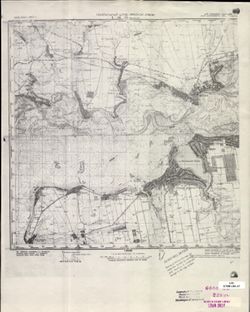
- Description:
- 1926
- Subject:
- Topical Subject: Soviet Union, Topical Subject: Maps, and Geographic Subject: Nikopol
- Publisher:
- Генеральный штаб Красной Армии
- Language:
- Russian
- Date Created:
- 1941
- Identifier:
- VAC9619-001867
- Genre:
- Military Maps and Topographic Maps
- Geographic Location:
- Coordinates: 47.3333, 34, 47.6667, 34.5
- Related URL:
- Download GeoTIFF: https://drive.google.com/open?id=1255dfmhEQnsVoMASiJgE0Wqbhh4ks-Bt and Catalog URL: https://iucat.iu.edu/catalog/5020129
- Abstract:
- Modern area represented: Nikopol, Dnipropetrovsk, Ukraine
- Call Number:
- G7000 s100 .S7 sheet L-36-21
- Caption:
- Для служебного пользования
- City:
- Никополь (Nikopol)
- Copyright Holder:
- No Copyright - United States
- Country:
- СССР (USSR)
- State/Province:
- Днепропетровская область (Dnipropetrovsk oblast) and Украинская ССР (Ukrainian Soviet Socialist Republic)
- Physical Description:
- Scale: 1:100,000
- Persistent URL:
- http://purl.dlib.indiana.edu/iudl/images/VAC9619/VAC9619-001867
- Provenance:
- CIA Map Library
-

- Description:
- 1926
- Subject:
- Geographic Subject: Balky, Topical Subject: Soviet Union, and Topical Subject: Maps
- Publisher:
- Генеральный штаб Красной Армии
- Language:
- Russian
- Date Created:
- 1941
- Identifier:
- VAC9619-001868
- Genre:
- Topographic Maps and Military Maps
- Geographic Location:
- Coordinates: 47.3333, 34.5, 47.6667, 35
- Related URL:
- Catalog URL: https://iucat.iu.edu/catalog/5020129 and Download GeoTIFF: https://drive.google.com/open?id=1V7PHm7Dg5ABV8yybrFeMKAmxM9f2EO27
- Abstract:
- Modern area represented: Balky, Zaporizhia oblast, Ukraine
- Call Number:
- G7000 s100 .S7 sheet L-36-22
- Caption:
- Для служебного пользования
- City:
- Балки (Balky)
- Copyright Holder:
- No Copyright - United States
- Country:
- СССР (USSR)
- State/Province:
- Украинская ССР (Ukrainian Soviet Socialist Republic)
- Physical Description:
- Scale: 1:100,000
- Persistent URL:
- http://purl.dlib.indiana.edu/iudl/images/VAC9619/VAC9619-001868
- Provenance:
- CIA Map Library
-
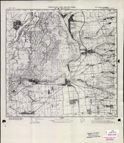
- Description:
- 1927
- Subject:
- Topical Subject: Soviet Union, Topical Subject: Maps, and Geographic Subject: Vasylivka
- Publisher:
- Генеральный штаб Красной Армии
- Language:
- Russian
- Date Created:
- 1941
- Identifier:
- VAC9619-001869
- Genre:
- Topographic Maps and Military Maps
- Geographic Location:
- Coordinates: 47.3333, 35, 47.6667, 35.5
- Related URL:
- Catalog URL: https://iucat.iu.edu/catalog/5020129 and Download GeoTIFF: https://drive.google.com/open?id=1Ts_iGjiK3duW8I4BKerAnFOxHoZvlOGy
- Abstract:
- Modern area represented: Vasylivka, Zaporizhia oblast, Ukraine
- Call Number:
- G7000 s100 .S7 sheet L-36-23
- Caption:
- Для служебного пользования
- City:
- Васильевка (Vasylivka)
- Copyright Holder:
- No Copyright - United States
- Country:
- СССР (USSR)
- State/Province:
- Запорожская область (Zaporizhia oblast) and Украинская ССР (Ukrainian Soviet Socialist Republic)
- Physical Description:
- Scale: 1:100,000
- Persistent URL:
- http://purl.dlib.indiana.edu/iudl/images/VAC9619/VAC9619-001869
- Provenance:
- CIA Map Library
-
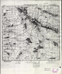
- Description:
- 1940
- Subject:
- Topical Subject: Soviet Union, Geographic Subject: Orikhiv, and Topical Subject: Maps
- Publisher:
- Генеральный штаб Красной Армии
- Language:
- Russian
- Date Created:
- 1941
- Identifier:
- VAC9619-001870
- Genre:
- Topographic Maps and Military Maps
- Geographic Location:
- Coordinates: 47.3333, 35.5, 47.6667, 36
- Related URL:
- Catalog URL: https://iucat.iu.edu/catalog/5020129 and Download GeoTIFF: https://drive.google.com/open?id=1AXZ-XrQdgFQXRG3b8AQpUU8UVELbTcb0
- Abstract:
- Modern area represented: Orikhiv, Zaporizhia oblast, Ukraine
- Call Number:
- G7000 s100 .S7 sheet L-36-24
- Caption:
- Для служебного пользования
- City:
- Орехов (Orikhiv)
- Copyright Holder:
- No Copyright - United States
- Country:
- СССР (USSR)
- State/Province:
- Запорожская область (Zaporizhia oblast) and Украинская ССР (Ukrainian Soviet Socialist Republic)
- Physical Description:
- Scale: 1:100,000
- Persistent URL:
- http://purl.dlib.indiana.edu/iudl/images/VAC9619/VAC9619-001870
- Provenance:
- CIA Map Library, Atlasblatt
-
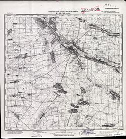
- Description:
- 1940
- Subject:
- Topical Subject: Maps, Topical Subject: Soviet Union, and Geographic Subject: Orikhiv
- Publisher:
- Генеральный штаб Красной Армии
- Language:
- Russian
- Date Created:
- 1941
- Identifier:
- VAC9619-001871
- Genre:
- Topographic Maps and Military Maps
- Geographic Location:
- Coordinates: 47.3333, 35.5, 47.6667, 36
- Related URL:
- Catalog URL: https://iucat.iu.edu/catalog/5020129 and Download GeoTIFF: https://drive.google.com/file/d/18UxavbRP7_3x1JZIEdsgnIP8bzhUcJ3v/view?usp=sharing
- Abstract:
- Modern area represented: Orikhiv, Zaporizhia oblast, Ukraine
- Call Number:
- G7000 s100 .S7 sheet L-36-24
- Caption:
- Для служебного пользования
- City:
- Орехов (Orikhiv)
- Copyright Holder:
- No Copyright - United States
- Country:
- СССР (USSR)
- State/Province:
- Запорожская область (Zaporizhia oblast) and Украинская ССР (Ukrainian Soviet Socialist Republic)
- Physical Description:
- Scale: 1:100,000
- Persistent URL:
- http://purl.dlib.indiana.edu/iudl/images/VAC9619/VAC9619-001871
- Provenance:
- Atlasblatt
-
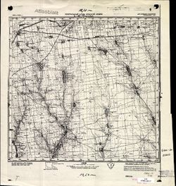
- Description:
- 1923
- Subject:
- Topical Subject: Maps, Topical Subject: Soviet Union, and Geographic Subject: Novosvetlovka
- Publisher:
- Генеральный штаб Красной Армии
- Language:
- Russian
- Date Created:
- 1941
- Identifier:
- VAC9619-001875
- Genre:
- Military Maps and Topographic Maps
- Geographic Location:
- Coordinates: 47, 31, 47.3333, 31.5
- Related URL:
- Catalog URL: https://iucat.iu.edu/catalog/5020129 and Download GeoTIFF: https://drive.google.com/open?id=1EbK0cGpvSMNX1svCUjtHP05b5fU5NuIV
- Abstract:
- Modern area represented: Novosvetlovka, Odessa oblast, Ukraine
- Call Number:
- G7000 s100 .S7 sheet L-36-27
- Caption:
- Для служебного пользования
- City:
- Колония Рорбах (Koloniya Rorbakh)
- Copyright Holder:
- No Copyright - United States
- Country:
- СССР (USSR)
- State/Province:
- Украинская ССР (Ukrainian Soviet Socialist Republic)
- Physical Description:
- Scale: 1:100,000
- Persistent URL:
- http://purl.dlib.indiana.edu/iudl/images/VAC9619/VAC9619-001875
- Provenance:
- CIA Map Library, Atlasblatt, Heeresplankammer Gruppe Archive Auslandskartenarchiv
-
- Description:
- 1930
- Subject:
- Topical Subject: Maps, Topical Subject: Soviet Union, and Geographic Subject: Velyka Lepetykha
- Publisher:
- Генеральный штаб Красной Армии
- Language:
- Russian
- Date Created:
- 1942
- Identifier:
- VAC9619-001876
- Genre:
- Topographic Maps and Military Maps
- Geographic Location:
- Coordinates: 47, 33.5, 47.3333, 34
- Related URL:
- Catalog URL: https://iucat.iu.edu/catalog/5020129 and Download GeoTIFF: https://drive.google.com/open?id=1KEO4HekmlEItJ6LWmCEklRcW04fJsr0O
- Abstract:
- Modern area represented: Velyka Lepetykha, Kherson oblast, Ukraine
- Call Number:
- G7000 s100 .S7 sheet L-36-32
- Caption:
- Для служебного пользования
- City:
- Бол. Лепатиха (Bolshaya Lepatikha)
- Copyright Holder:
- No Copyright - United States
- Country:
- СССР (USSR)
- State/Province:
- Украинская ССР (Ukrainian Soviet Socialist Republic)
- Physical Description:
- Scale: 1:100,000
- Persistent URL:
- http://purl.dlib.indiana.edu/iudl/images/VAC9619/VAC9619-001876
- Provenance:
- DMA Topographic Center, Army Map Service Library, Library of Congress Geography & Map Division
-
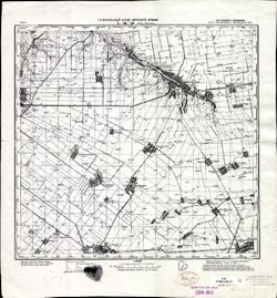
- Description:
- 1941
- Subject:
- Topical Subject: Maps, Topical Subject: Soviet Union, and Geographic Subject: Verkhniy Rohachyk
- Publisher:
- Генеральный штаб Красной Армии
- Language:
- Russian
- Identifier:
- VAC9619-001877
- Genre:
- Military Maps and Topographic Maps
- Geographic Location:
- Coordinates: 47, 34, 47.3333, 34.5
- Related URL:
- Catalog URL: https://iucat.iu.edu/catalog/5020129 and Download GeoTIFF: https://drive.google.com/open?id=1rk9dsqVxr5JAFLbcRoBZQk3GSDAepwK2
- Abstract:
- Modern area represented: Verkhniy Rohachyk, Kherson oblast, Ukraine
- Call Number:
- G7000 s100 .S7 sheet L-36-33
- Caption:
- Для служебного пользования
- City:
- Верх. Рогачик (Verkhniy Rohachyk)
- Copyright Holder:
- No Copyright - United States
- Country:
- СССР (USSR)
- State/Province:
- Украинская ССР (Ukrainian Soviet Socialist Republic), Николаевская область (Mykolaiv oblast), and Запорожская область (Zaporizhia oblast)
- Physical Description:
- Scale: 1:100,000
- Persistent URL:
- http://purl.dlib.indiana.edu/iudl/images/VAC9619/VAC9619-001877
- Provenance:
- CIA Map Library, Library of Congress Geography & Map Division
-
- Description:
- 1941
- Subject:
- Topical Subject: Soviet Union, Geographic Subject: Velyka Bilozerka, and Topical Subject: Maps
- Publisher:
- Генеральный штаб Красной Армии
- Language:
- Russian
- Identifier:
- VAC9619-001878
- Genre:
- Topographic Maps and Military Maps
- Geographic Location:
- Coordinates: 47, 34.5, 47.3333, 35
- Related URL:
- Download GeoTIFF: https://drive.google.com/open?id=1U5NypAHkiQmS1MskZUKLL0Ys4QGu8NY_ and Catalog URL: https://iucat.iu.edu/catalog/5020129
- Abstract:
- Modern area represented: Velyka Bilozerka, Zaporizhia oblast, Ukraine
- Call Number:
- G7000 s100 .S7 sheet L-36-34
- Caption:
- Для служебного пользования
- City:
- Бол. Белозерка (Velyka Bilozerka)
- Copyright Holder:
- No Copyright - United States
- Country:
- СССР (USSR)
- State/Province:
- Запорожская область (Zaporizhia oblast) and Украинская ССР (Ukrainian Soviet Socialist Republic)
- Physical Description:
- Scale: 1:100,000
- Persistent URL:
- http://purl.dlib.indiana.edu/iudl/images/VAC9619/VAC9619-001878
- Provenance:
- DMA Topographic Center, Atlasblatt, Library of Congress Geography & Map Division, Army Map Service Library
-
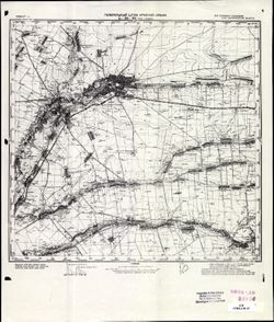
- Description:
- 1936
- Subject:
- Topical Subject: Soviet Union, Topical Subject: Maps, and Geographic Subject: Tokmak
- Publisher:
- Генеральный штаб Красной Армии
- Language:
- Russian
- Date Created:
- 1941
- Identifier:
- VAC9619-001879
- Genre:
- Topographic Maps and Military Maps
- Geographic Location:
- Coordinates: 47, 35.5, 47.3333, 36
- Related URL:
- Download GeoTIFF: https://drive.google.com/open?id=1OoowFREJfGMpfVna6ycm9h6wt5I1ph15 and Catalog URL: https://iucat.iu.edu/catalog/5020129
- Abstract:
- Modern area represented: Tokmak, Zaporizhia oblast, Ukraine
- Call Number:
- G7000 s100 .S7 sheet L-36-36
- Caption:
- Для служебного пользования
- City:
- Бол. Токмак (Bolshoy Tokmak)
- Copyright Holder:
- No Copyright - United States
- Country:
- СССР (USSR)
- State/Province:
- Запорожская область (Zaporizhia oblast) and Украинская ССР (Ukrainian Soviet Socialist Republic)
- Physical Description:
- Scale: 1:100,000
- Persistent URL:
- http://purl.dlib.indiana.edu/iudl/images/VAC9619/VAC9619-001879
- Provenance:
- CIA Map Library
-
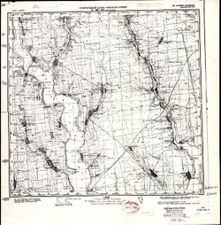
- Description:
- 1923
- Subject:
- Topical Subject: Soviet Union, Geographic Subject: Anatolyevka, and Topical Subject: Maps
- Publisher:
- Генеральный штаб Красной Армии
- Language:
- Russian
- Date Created:
- 1941
- Identifier:
- VAC9619-001883
- Genre:
- Topographic Maps and Military Maps
- Geographic Location:
- Coordinates: 46.6667, 31, 47, 31.5
- Related URL:
- Catalog URL: https://iucat.iu.edu/catalog/5020129 and Download GeoTIFF: https://drive.google.com/open?id=13VfyVaR-q2kWZN6Gos9K23WCuU0PKXNA
- Abstract:
- Modern area represented: Anatolyevka, Mykolaiv oblast, Ukraine
- Call Number:
- G7000 s100 .S7 sheet L-36-39
- Caption:
- Для служебного пользования
- City:
- Анатольевка (Anatolyevka)
- Copyright Holder:
- No Copyright - United States
- Country:
- СССР (USSR)
- State/Province:
- Украинская ССР (Ukrainian Soviet Socialist Republic)
- Physical Description:
- Scale: 1:100,000
- Persistent URL:
- http://purl.dlib.indiana.edu/iudl/images/VAC9619/VAC9619-001883
- Provenance:
- CIA Map Library, Atlasblatt, Library of Congress Geography & Map Division
-
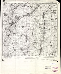
- Description:
- 1928
- Subject:
- Topical Subject: Maps, Geographic Subject: Bratske, and Topical Subject: Soviet Union
- Publisher:
- Генеральный штаб Красной Армии
- Language:
- Russian
- Date Created:
- 1941
- Identifier:
- VAC9619-001862
- Genre:
- Military Maps and Topographic Maps
- Geographic Location:
- Coordinates: 47.6667, 31.5, 48, 32
- Related URL:
- Catalog URL: https://iucat.iu.edu/catalog/5020129 and Download GeoTIFF: https://drive.google.com/open?id=1CRkSh7sskcbMSmRNTPMYkQvk89B_3WMF
- Abstract:
- Modern area represented: Bratske, Mykolaiv oblast, Ukraine
- Call Number:
- G7000 s100 .S7 sheet L-36-4
- Caption:
- Для служебного пользования
- City:
- Братское (Bratskoye)
- Copyright Holder:
- No Copyright - United States
- Country:
- СССР (USSR)
- State/Province:
- Украинская ССР (Ukrainian Soviet Socialist Republic)
- Physical Description:
- Scale: 1:100,000
- Persistent URL:
- http://purl.dlib.indiana.edu/iudl/images/VAC9619/VAC9619-001862
- Provenance:
- CIA Map Library
-
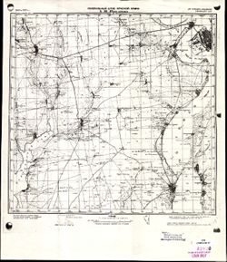
- Description:
- 1907
- Subject:
- Topical Subject: Maps, Geographic Subject: Velyka Korenykha, and Topical Subject: Soviet Union
- Publisher:
- Генеральный штаб Красной Армии
- Language:
- Russian
- Date Created:
- 1941
- Identifier:
- VAC9619-001884
- Genre:
- Military Maps and Topographic Maps
- Geographic Location:
- Coordinates: 46.6667, 31.5, 47, 32
- Related URL:
- Download GeoTIFF: https://drive.google.com/open?id=1fNdbJ2rMnjnma3fM8xJgn6ozu_NI6Aox and Catalog URL: https://iucat.iu.edu/catalog/5020129
- Abstract:
- Modern area represented: Velyka Korenykha, Mykolaiv oblast, Ukraine
- Call Number:
- G7000 s100 .S7 sheet L-36-40
- Caption:
- Для служебного пользования
- City:
- Бол. Корениха (Bolshaya Korenikha)
- Copyright Holder:
- No Copyright - United States
- Country:
- СССР (USSR)
- State/Province:
- Украинская ССР (Ukrainian Soviet Socialist Republic)
- Physical Description:
- Scale: 1:100,000
- Persistent URL:
- http://purl.dlib.indiana.edu/iudl/images/VAC9619/VAC9619-001884
- Provenance:
- CIA Map Library
-
- Description:
- 1907
- Subject:
- Geographic Subject: Velyka Korenykha, Topical Subject: Maps, and Topical Subject: Soviet Union
- Publisher:
- Генеральный штаб Красной Армии
- Language:
- Russian
- Date Created:
- 1941
- Identifier:
- VAC9619-001885
- Genre:
- Topographic Maps and Military Maps
- Geographic Location:
- Coordinates: 46.6667, 31.5, 47, 32
- Related URL:
- Catalog URL: https://iucat.iu.edu/catalog/5020129 and Download GeoTIFF: https://drive.google.com/file/d/1QJqK6upnSULI9t8YF7AmAgEuNuDzIGlL/view?usp=sharing
- Abstract:
- Modern area represented: Velyka Korenykha, Mykolaiv oblast, Ukraine
- Call Number:
- G7000 s100 .S7 sheet L-36-40
- Caption:
- Временное издание,Для служебного пользования
- City:
- Бол. Корениха (Bolshaya Korenikha)
- Copyright Holder:
- No Copyright - United States
- Country:
- СССР (USSR)
- State/Province:
- Украинская ССР (Ukrainian Soviet Socialist Republic)
- Physical Description:
- Scale: 1:100,000
- Persistent URL:
- http://purl.dlib.indiana.edu/iudl/images/VAC9619/VAC9619-001885
- Provenance:
- DMA Topographic Center, Army Map Service Library, OMAHA
-
- Description:
- 1921
- Subject:
- Topical Subject: Soviet Union, Geographic Subject: Mykolayivske, and Topical Subject: Maps
- Publisher:
- Генеральный штаб Красной Армии
- Language:
- Russian
- Date Created:
- 1941
- Identifier:
- VAC9619-001886
- Genre:
- Topographic Maps and Military Maps
- Geographic Location:
- Coordinates: 46.6667, 32, 47, 32.5
- Related URL:
- Catalog URL: https://iucat.iu.edu/catalog/5020129 and Download GeoTIFF: https://drive.google.com/open?id=1QOMkNVvR-7h_AWdDYOEM-KIcapLVEo3_
- Abstract:
- Modern area represented: Mykolayivske, Mykolaiv oblast, Ukraine
- Call Number:
- G7000 s100 .S7 sheet L-36-41
- Caption:
- Для служебного пользования
- City:
- Николаев (Mykolayiv)
- Copyright Holder:
- No Copyright - United States
- Country:
- СССР (USSR)
- State/Province:
- Украинская ССР (Ukrainian Soviet Socialist Republic)
- Physical Description:
- Scale: 1:100,000
- Persistent URL:
- http://purl.dlib.indiana.edu/iudl/images/VAC9619/VAC9619-001886
- Provenance:
- DMA Topographic Center, Army Map Service Library, OMAHA
-
- Description:
- 1923
- Subject:
- Topical Subject: Soviet Union, Topical Subject: Maps, and Geographic Subject: Beryslav
- Publisher:
- Генеральный штаб Красной Армии
- Language:
- Russian
- Date Created:
- 1941
- Identifier:
- VAC9619-001887
- Genre:
- Topographic Maps and Military Maps
- Geographic Location:
- Coordinates: 46.6667, 33, 47, 33.5
- Related URL:
- Catalog URL: https://iucat.iu.edu/catalog/5020129 and Download GeoTIFF: https://drive.google.com/open?id=15CCT7KeDTW2OAhyErSFxC6JA8ziWovVn
- Abstract:
- Modern area represented: Beryslav, Kherson oblast, Ukraine
- Call Number:
- G7000 s100 .S7 sheet L-36-43
- Caption:
- Для служебного пользования
- City:
- Берислав (Beryslav)
- Copyright Holder:
- No Copyright - United States
- Country:
- СССР (USSR)
- State/Province:
- Николаевская область (Mykolaiv oblast) and Украинская ССР (Ukrainian Soviet Socialist Republic)
- Physical Description:
- Scale: 1:100,000
- Persistent URL:
- http://purl.dlib.indiana.edu/iudl/images/VAC9619/VAC9619-001887
- Provenance:
- DMA Topographic Center, Army Map Service Library, OMAHA
-
- Description:
- 1941
- Subject:
- Topical Subject: Maps, Geographic Subject: Nova Kakhovka, and Topical Subject: Soviet Union
- Publisher:
- Генеральный штаб Красной Армии
- Language:
- Russian
- Identifier:
- VAC9619-000114
- Genre:
- Topographic Maps and Military Maps
- Geographic Location:
- Coordinates: 46.6667, 33.25, 46.8333, 33.5
- Related URL:
- Download GeoTIFF: https://drive.google.com/open?id=16WBwJaw7r63n2qsx771Eg868PjIYwkC2 and Catalog URL: http://iucat.iu.edu/catalog/5020131
- Abstract:
- Modern area represented: Nova Kakhovka, Kherson oblast, Ukraine
- Call Number:
- G7000 s50 .S68 sheet L-36-43-D
- Caption:
- Для служебного пользования
- City:
- Каховка (Kakhovka)
- Copyright Holder:
- No Copyright - United States
- Country:
- СССР (USSR)
- State/Province:
- Украинская ССР (Ukrainian Soviet Socialist Republic) and Николаевская область (Mykolaiv oblast)
- Physical Description:
- Scale: 1:50,000
- Persistent URL:
- http://purl.dlib.indiana.edu/iudl/images/VAC9619/VAC9619-000114
- Provenance:
- DMA Topographic Center, Army Map Service Library, OMAHA, Library of Congress Geography & Map Division
-
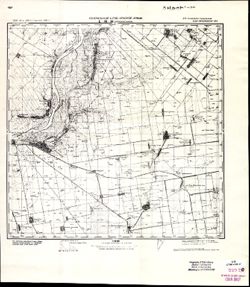
- Description:
- 1928
- Subject:
- Geographic Subject: Kairy, Topical Subject: Maps, and Topical Subject: Soviet Union
- Publisher:
- Генеральный штаб Красной Армии
- Language:
- Russian
- Date Created:
- 1941
- Identifier:
- VAC9619-001889
- Genre:
- Topographic Maps and Military Maps
- Geographic Location:
- Coordinates: 46.6667, 33.5, 47, 34
- Related URL:
- Catalog URL: https://iucat.iu.edu/catalog/5020129 and Download GeoTIFF: https://drive.google.com/file/d/1osSsR-E4nP09v5-wiUbmEixGdIeS0X75/view?usp=sharing
- Abstract:
- Modern area represented: Kayiry, Kherson oblast, Ukraine
- Call Number:
- G7000 s100 .S7 sheet L-36-44
- Caption:
- Для служебного пользования
- City:
- Западные Каиры (Zapadnye Kairy)
- Copyright Holder:
- No Copyright - United States
- Country:
- СССР (USSR)
- State/Province:
- Николаевская область (Mykolaiv oblast) and Украинская ССР (Ukrainian Soviet Socialist Republic)
- Physical Description:
- Scale: 1:100,000
- Persistent URL:
- http://purl.dlib.indiana.edu/iudl/images/VAC9619/VAC9619-001889
- Provenance:
- CIA Map Library, Atlasblatt
-
- Description:
- 1928
- Subject:
- Topical Subject: Soviet Union, Geographic Subject: Kayiry, and Topical Subject: Maps
- Publisher:
- Генеральный штаб Красной Армии
- Language:
- Russian
- Date Created:
- 1941
- Identifier:
- VAC9619-001888
- Genre:
- Military Maps and Topographic Maps
- Geographic Location:
- Coordinates: 46.6667, 33.5, 47, 34
- Related URL:
- Catalog URL: https://iucat.iu.edu/catalog/5020129 and Download GeoTIFF: https://drive.google.com/open?id=1EnPED_7gkuLxMVwpf7GTxL4isK_VLnGr
- Abstract:
- Modern area represented: Kayiry, Kherson oblast, Ukraine
- Call Number:
- G7000 s100 .S7 sheet L-36-44
- Caption:
- Для служебного пользования
- City:
- Западные Каиры (Zapadnye Kairy)
- Copyright Holder:
- No Copyright - United States
- Country:
- СССР (USSR)
- State/Province:
- Украинская ССР (Ukrainian Soviet Socialist Republic) and Николаевская область (Mykolaiv oblast)
- Physical Description:
- Scale: 1:100,000
- Persistent URL:
- http://purl.dlib.indiana.edu/iudl/images/VAC9619/VAC9619-001888
- Provenance:
- DMA Topographic Center, Atlasblatt, OMAHA, Army Map Service Library
-
- Subject:
- Geographic Subject: Lyubymivka, Topical Subject: Soviet Union, and Topical Subject: Maps
- Publisher:
- Генеральный штаб Красной Армии
- Language:
- Russian
- Date Created:
- 1941
- Identifier:
- VAC9619-000115
- Genre:
- Topographic Maps and Military Maps
- Geographic Location:
- Coordinates: 46.6667, 33.5, 46.8333, 33.75
- Related URL:
- Catalog URL: http://iucat.iu.edu/catalog/5020131 and Download GeoTIFF: https://drive.google.com/open?id=1JYqWPPmZeMhc09GlVj9LMj5qMBoeyPLC
- Abstract:
- Modern area represented: Lyubymivka, Kherson oblast, Ukraine
- Call Number:
- G7000 s50 .S68 sheet L-36-44-C
- Caption:
- Для служебного пользования
- City:
- Любимовка (Lyubimovka)
- Copyright Holder:
- No Copyright - United States
- Country:
- СССР (USSR)
- State/Province:
- Николаевская область (Mykolaiv oblast) and Украинская ССР (Ukrainian Soviet Socialist Republic)
- Physical Description:
- Scale: 1:50,000
- Persistent URL:
- http://purl.dlib.indiana.edu/iudl/images/VAC9619/VAC9619-000115
- Provenance:
- DMA Topographic Center, Army Map Service Library, OMAHA, Library of Congress Geography & Map Division
-
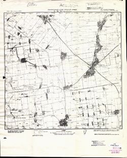
- Description:
- 1933
- Subject:
- Topical Subject: Maps, Geographic Subject: Nyzhni Sirohozy, and Topical Subject: Soviet Union
- Publisher:
- Генеральный штаб Красной Армии
- Language:
- Russian
- Date Created:
- 1941
- Identifier:
- VAC9619-001890
- Genre:
- Topographic Maps and Military Maps
- Geographic Location:
- Coordinates: 46.6667, 34, 47, 34.5
- Related URL:
- Download GeoTIFF: https://drive.google.com/open?id=1Z449zsz78QYAyHVx2ON5W62vEmhcjUFK and Catalog URL: https://iucat.iu.edu/catalog/5020129
- Abstract:
- Modern area represented: Nyzhni Sirohozy, Kherson oblast, Ukraine
- Call Number:
- G7000 s100 .S7 sheet L-36-45
- Caption:
- Для служебного пользования
- City:
- Ниж. Серогозы (Nyzhni Sirohozy)
- Copyright Holder:
- No Copyright - United States
- Country:
- СССР (USSR)
- State/Province:
- Запорожская область (Zaporizhia oblast), Николаевская область (Mykolaiv oblast), and Украинская ССР (Ukrainian Soviet Socialist Republic)
- Physical Description:
- Scale: 1:100,000
- Persistent URL:
- http://purl.dlib.indiana.edu/iudl/images/VAC9619/VAC9619-001890
- Provenance:
- CIA Map Library, Atlasblatt, Heeresplankammer Gruppe Archive Auslandskartenarchiv
-
- Description:
- 1941
- Subject:
- Topical Subject: Soviet Union, Geographic Subject: Rubanivka, and Topical Subject: Maps
- Publisher:
- Генеральный штаб Красной Армии
- Language:
- Russian
- Identifier:
- VAC9619-000116
- Genre:
- Military Maps and Topographic Maps
- Geographic Location:
- Coordinates: 46.8333, 34, 47, 34.25
- Related URL:
- Catalog URL: http://iucat.iu.edu/catalog/5020131 and Download GeoTIFF: https://drive.google.com/open?id=1a8iQP2LjY_ZUUca8oOa2sktYzskRaclq
- Abstract:
- Modern area represented: Rubanivka, Kherson oblast, Ukraine
- Call Number:
- G7000 s50 .S68 sheet L-36-45-A
- Caption:
- Для служебного пользования
- City:
- Новая Рубановка (Novaya Rubanovka)
- Copyright Holder:
- No Copyright - United States
- Country:
- СССР (USSR)
- State/Province:
- Украинская ССР (Ukrainian Soviet Socialist Republic), Запорожская область (Zaporizhia oblast), and Николаевская область (Mykolaiv oblast)
- Physical Description:
- Scale: 1:50,000
- Persistent URL:
- http://purl.dlib.indiana.edu/iudl/images/VAC9619/VAC9619-000116
- Provenance:
- DMA Topographic Center, Army Map Service Library, OMAHA, Library of Congress Geography & Map Division
-
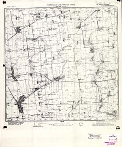
- Description:
- 1934
- Subject:
- Topical Subject: Maps, Topical Subject: Soviet Union, and Geographic Subject: Ivanivka
- Publisher:
- Генеральный штаб Красной Армии
- Language:
- Russian
- Date Created:
- 1941
- Identifier:
- VAC9619-001891
- Genre:
- Topographic Maps and Military Maps
- Geographic Location:
- Coordinates: 46.6667, 34.5, 47, 35
- Related URL:
- Download GeoTIFF: https://drive.google.com/open?id=14Er3699FOVffHRqDS10Xc_-qDDv9uQcf and Catalog URL: https://iucat.iu.edu/catalog/5020129
- Abstract:
- Modern area represented: Ivanivka, Zaporizhia oblast, Ukraine
- Call Number:
- G7000 s100 .S7 sheet L-36-46
- Caption:
- Для служебного пользования
- City:
- Ивановка (Ivanivka)
- Copyright Holder:
- No Copyright - United States
- Country:
- СССР (USSR)
- State/Province:
- Украинская ССР (Ukrainian Soviet Socialist Republic) and Запорожская область (Zaporizhia oblast)
- Physical Description:
- Scale: 1:100,000
- Persistent URL:
- http://purl.dlib.indiana.edu/iudl/images/VAC9619/VAC9619-001891
- Provenance:
- CIA Map Library
-
- Description:
- 1936
- Subject:
- Topical Subject: Maps, Topical Subject: Soviet Union, and Geographic Subject: Kostyantynivka
- Publisher:
- Генеральный штаб Красной Армии
- Language:
- Russian
- Date Created:
- 1941
- Identifier:
- VAC9619-000119
- Genre:
- Military Maps and Topographic Maps
- Geographic Location:
- Coordinates: 46.6667, 35.25, 46.8333, 35.5
- Related URL:
- Catalog URL: http://iucat.iu.edu/catalog/5020131 and Download GeoTIFF: https://drive.google.com/open?id=1cvI6y3nWL3_S1WAgybfQljHxZY24g9Xw
- Abstract:
- Modern area represented: Kostyantynivka, Zaporizhia oblast, Ukraine
- Call Number:
- G7000 s50 .S68 sheet L-36-47-D
- Caption:
- Для служебного пользования
- City:
- Константиновка (Konstantinovka)
- Copyright Holder:
- No Copyright - United States
- Country:
- СССР (USSR)
- State/Province:
- Запорожская область (Zaporizhia oblast) and Украинская ССР (Ukrainian Soviet Socialist Republic)
- Physical Description:
- Scale: 1:50,000
- Persistent URL:
- http://purl.dlib.indiana.edu/iudl/images/VAC9619/VAC9619-000119
- Provenance:
- DMA Topographic Center, Army Map Service Library, Library of Congress Geography & Map Division
-
- Description:
- 1941
- Subject:
- Topical Subject: Maps, Topical Subject: Soviet Union, and Geographic Subject: Sychavka
- Publisher:
- Генеральный штаб Красной Армии
- Language:
- Russian
- Identifier:
- VAC9619-001905
- Genre:
- Topographic Maps and Military Maps
- Geographic Location:
- Coordinates: 46.3333, 31, 46.6667, 31.5
- Related URL:
- Download GeoTIFF: https://drive.google.com/open?id=1NQIWcrpC3ADCn75zh5V7Xl33Ncgtdd73 and Catalog URL: https://iucat.iu.edu/catalog/5020129
- Abstract:
- Modern area represented: Sychavka, Odessa oblast, Ukraine
- Call Number:
- G7000 s100 .S7 sheet L-36-51
- Caption:
- Для служебного пользования
- City:
- Сычавка (Sychavka)
- Copyright Holder:
- No Copyright - United States
- Country:
- СССР (USSR)
- State/Province:
- Украинская ССР (Ukrainian Soviet Socialist Republic)
- Physical Description:
- Scale: 1:100,000
- Persistent URL:
- http://purl.dlib.indiana.edu/iudl/images/VAC9619/VAC9619-001905
- Provenance:
- DMA Topographic Center, Army Map Service Library, OMAHA
-
- Description:
- 1921
- Subject:
- Topical Subject: Soviet Union, Topical Subject: Maps, and Geographic Subject: Nova Mayachka
- Publisher:
- Генеральный штаб Красной Армии
- Language:
- Russian
- Date Created:
- 1941
- Identifier:
- VAC9619-001907
- Genre:
- Topographic Maps and Military Maps
- Geographic Location:
- Coordinates: 46.3333, 33, 46.6667, 33.5
- Related URL:
- Catalog URL: https://iucat.iu.edu/catalog/5020129 and Download GeoTIFF: https://drive.google.com/file/d/1E1UyVuqpFe1YyBPIClr7rUBsuhWfWcdf/view?usp=sharing
- Abstract:
- Modern area represented: Nova Mayachka, Kherson oblast, Ukraine
- Call Number:
- G7000 s100 .S7 sheet L-36-55
- Caption:
- Для служебного пользования
- City:
- Бол. Маячка (Bolshaya Mayachka)
- Copyright Holder:
- No Copyright - United States
- Country:
- СССР (USSR)
- State/Province:
- Украинская ССР (Ukrainian Soviet Socialist Republic) and Николаевская область (Mykolaiv oblast)
- Physical Description:
- Scale: 1:100,000
- Persistent URL:
- http://purl.dlib.indiana.edu/iudl/images/VAC9619/VAC9619-001907
- Provenance:
- DMA Topographic Center, Army Map Service Library, OMAHA, Atlasblatt
-
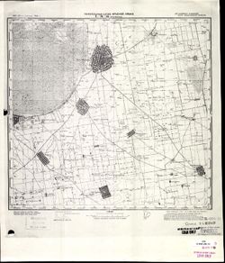
- Description:
- 1921
- Subject:
- Topical Subject: Soviet Union, Topical Subject: Maps, and Geographic Subject: Nova Mayachka
- Publisher:
- Генеральный штаб Красной Армии
- Language:
- Russian
- Date Created:
- 1941
- Identifier:
- VAC9619-001906
- Genre:
- Topographic Maps and Military Maps
- Geographic Location:
- Coordinates: 46.3333, 33, 46.6667, 33.5
- Related URL:
- Download GeoTIFF: https://drive.google.com/open?id=1Yr9vRnGudy0KWOqJTTRm-qy8PGNtqZ5f and Catalog URL: https://iucat.iu.edu/catalog/5020129
- Abstract:
- Modern area represented: Nova Mayachka, Kherson oblast, Ukraine
- Call Number:
- G7000 s100 .S7 sheet L-36-55
- Caption:
- Для служебного пользования
- City:
- Бол. Маячка (Bolshaya Mayachka)
- Copyright Holder:
- No Copyright - United States
- Country:
- СССР (USSR)
- State/Province:
- Украинская ССР (Ukrainian Soviet Socialist Republic) and Николаевская область (Mykolaiv oblast)
- Physical Description:
- Scale: 1:100,000
- Persistent URL:
- http://purl.dlib.indiana.edu/iudl/images/VAC9619/VAC9619-001906
- Provenance:
- CIA Map Library
-
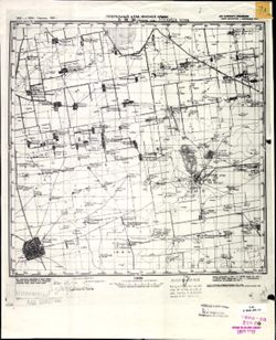
- Description:
- 1921
- Subject:
- Topical Subject: Maps, Geographic Subject: Askania-Nova, and Topical Subject: Soviet Union
- Publisher:
- Генеральный штаб Красной Армии
- Language:
- Russian
- Date Created:
- 1941
- Identifier:
- VAC9619-001908
- Genre:
- Topographic Maps and Military Maps
- Geographic Location:
- Coordinates: 46.3333, 33.5, 46.6667, 34
- Related URL:
- Download GeoTIFF: https://drive.google.com/open?id=1X2zli5lz_FZwB19KYsJ72lmGfakR0GSR and Catalog URL: https://iucat.iu.edu/catalog/5020129
- Abstract:
- Modern area represented: Askania-Nova, Kherson oblast, Ukraine
- Call Number:
- G7000 s100 .S7 sheet L-36-56
- Caption:
- Для служебного пользования
- City:
- Аскания Нова (Askania-Nova)
- Copyright Holder:
- No Copyright - United States
- Country:
- СССР (USSR)
- State/Province:
- Запорожская область (Zaporizhia oblast), Украинская ССР (Ukrainian Soviet Socialist Republic), and Николаевская область (Mykolaiv oblast)
- Physical Description:
- Scale: 1:100,000
- Persistent URL:
- http://purl.dlib.indiana.edu/iudl/images/VAC9619/VAC9619-001908
- Provenance:
- CIA Map Library, Army Map Service Library
-
- Description:
- 1921
- Subject:
- Geographic Subject: Askania-Nova, Topical Subject: Maps, and Topical Subject: Soviet Union
- Publisher:
- Генеральный штаб Красной Армии
- Language:
- Russian
- Date Created:
- 1941
- Identifier:
- VAC9619-001909
- Genre:
- Military Maps and Topographic Maps
- Geographic Location:
- Coordinates: 46.3333, 33.5, 46.6667, 34
- Related URL:
- Download GeoTIFF: https://drive.google.com/file/d/1uUOGJa1XTuz9SZmhTfRxaP5dgRQcnGqt/view?usp=sharing and Catalog URL: https://iucat.iu.edu/catalog/5020129
- Abstract:
- Modern area represented: Askania-Nova, Kherson oblast, Ukraine
- Call Number:
- G7000 s100 .S7 sheet L-36-56
- Caption:
- Для служебного пользования
- City:
- Аскания Нова (Askania-Nova)
- Copyright Holder:
- No Copyright - United States
- Country:
- СССР (USSR)
- State/Province:
- Украинская ССР (Ukrainian Soviet Socialist Republic), Николаевская область (Mykolaiv oblast), and Запорожская область (Zaporizhia oblast)
- Physical Description:
- Scale: 1:100,000
- Persistent URL:
- http://purl.dlib.indiana.edu/iudl/images/VAC9619/VAC9619-001909
- Provenance:
- DMA Topographic Center, Army Map Service Library, OMAHA
-

- Description:
- 1921
- Subject:
- Geographic Subject: Novotroyitske, Topical Subject: Soviet Union, and Topical Subject: Maps
- Publisher:
- Генеральный штаб Красной Армии
- Language:
- Russian
- Date Created:
- 1941
- Identifier:
- VAC9619-001911
- Genre:
- Military Maps and Topographic Maps
- Geographic Location:
- Coordinates: 46.3333, 34, 46.6667, 34.5
- Related URL:
- Catalog URL: https://iucat.iu.edu/catalog/5020129 and Download GeoTIFF: https://drive.google.com/file/d/1bcJGE9zpja7gYzwVppi-fxI5rlAj7MXB/view?usp=sharing
- Abstract:
- Modern area represented: Novotroyitske, Kherson oblast, Ukraine
- Call Number:
- G7000 s100 .S7 sheet L-36-57
- Caption:
- Для служебного пользования
- City:
- Ново-Троицкое (Novo-Troitskoye)
- Copyright Holder:
- No Copyright - United States
- Country:
- СССР (USSR)
- State/Province:
- Николаевская область (Mykolaiv oblast), Украинская ССР (Ukrainian Soviet Socialist Republic), and Запорожская область (Zaporizhia oblast)
- Physical Description:
- Scale: 1:100,000
- Persistent URL:
- http://purl.dlib.indiana.edu/iudl/images/VAC9619/VAC9619-001911
- Provenance:
- CIA Map Library
-
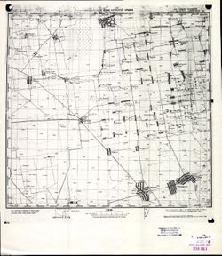
- Description:
- 1921
- Subject:
- Topical Subject: Maps, Geographic Subject: Novotroyitske, and Topical Subject: Soviet Union
- Publisher:
- Генеральный штаб Красной Армии
- Language:
- Russian
- Date Created:
- 1941
- Identifier:
- VAC9619-001910
- Genre:
- Topographic Maps and Military Maps
- Geographic Location:
- Coordinates: 46.3333, 34, 46.6667, 34.5
- Related URL:
- Catalog URL: https://iucat.iu.edu/catalog/5020129 and Download GeoTIFF: https://drive.google.com/open?id=16tAOz1x8-tQ824R-6muIVRvXEhtSQEDe
- Abstract:
- Modern area represented: Novotroyitske, Kherson oblast, Ukraine
- Call Number:
- G7000 s100 .S7 sheet L-36-57
- Caption:
- Для служебного пользования
- City:
- Ново-Троицкое (Novo-Troitskoye)
- Copyright Holder:
- No Copyright - United States
- Country:
- СССР (USSR)
- State/Province:
- Николаевская область (Mykolaiv oblast), Запорожская область (Zaporizhia oblast), and Украинская ССР (Ukrainian Soviet Socialist Republic)
- Physical Description:
- Scale: 1:100,000
- Persistent URL:
- http://purl.dlib.indiana.edu/iudl/images/VAC9619/VAC9619-001910
- Provenance:
- CIA Map Library
-
- Description:
- 1934
- Subject:
- Geographic Subject: Syvaske, Topical Subject: Soviet Union, and Topical Subject: Maps
- Publisher:
- Генеральный штаб Красной Армии
- Language:
- Russian
- Date Created:
- 1941
- Identifier:
- VAC9619-001912
- Genre:
- Topographic Maps and Military Maps
- Geographic Location:
- Coordinates: 46.3333, 34.5, 46.6667, 35
- Related URL:
- Download GeoTIFF: https://drive.google.com/open?id=1_LN9C6wWARDQjhPPt6SpEitdnGYZAIPf and Catalog URL: https://iucat.iu.edu/catalog/5020129
- Abstract:
- Modern area represented: Syvaske, Kherson oblast, Ukraine
- Call Number:
- G7000 s100 .S7 sheet L-36-58
- Caption:
- Для служебного пользования
- City:
- Рождественка (Rozhdestvenka)
- Copyright Holder:
- No Copyright - United States
- Country:
- СССР (USSR)
- State/Province:
- Запорожская область (Zaporizhia oblast) and Украинская ССР (Ukrainian Soviet Socialist Republic)
- Physical Description:
- Scale: 1:100,000
- Persistent URL:
- http://purl.dlib.indiana.edu/iudl/images/VAC9619/VAC9619-001912
- Provenance:
- DMA Topographic Center, Army Map Service Library, OMAHA
-
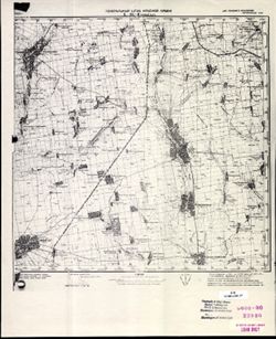
- Description:
- 1930
- Subject:
- Topical Subject: Maps, Geographic Subject: Novyy Buh, and Topical Subject: Soviet Union
- Publisher:
- Генеральный штаб Красной Армии
- Language:
- Russian
- Date Created:
- 1941
- Identifier:
- VAC9619-001863
- Genre:
- Military Maps and Topographic Maps
- Geographic Location:
- Coordinates: 47.6667, 32.5, 48, 33
- Related URL:
- Download GeoTIFF: https://drive.google.com/open?id=1T0wPHo0RpDwORrKZXGfpt1IyrZgBA6b4 and Catalog URL: https://iucat.iu.edu/catalog/5020129
- Abstract:
- Modern area represented: Novyy Buh, Mykolaiv, Ukraine
- Call Number:
- G7000 s100 .S7 sheet L-36-6
- Caption:
- Для служебного пользования
- City:
- Новый Буг (Novyy Buh)
- Copyright Holder:
- No Copyright - United States
- Country:
- СССР (USSR)
- State/Province:
- Украинская ССР (Ukrainian Soviet Socialist Republic)
- Physical Description:
- Scale: 1:100,000
- Persistent URL:
- http://purl.dlib.indiana.edu/iudl/images/VAC9619/VAC9619-001863
- Provenance:
- CIA Map Library
-
- Description:
- 1921
- Subject:
- Geographic Subject: Svobodnyy Port, Topical Subject: Maps, and Topical Subject: Soviet Union
- Publisher:
- Генеральный штаб Красной Армии
- Language:
- Russian
- Date Created:
- 1941
- Identifier:
- VAC9619-001917
- Genre:
- Military Maps and Topographic Maps
- Geographic Location:
- Coordinates: 46, 31.5, 46.3333, 32
- Related URL:
- Download GeoTIFF: https://drive.google.com/open?id=1Sb_dGRMg0HfrO5ItVnTYcnwkLVx7criG and Catalog URL: https://iucat.iu.edu/catalog/5020129
- Abstract:
- Modern area represented: Svobodnyy Port, Kherson oblast, Ukraine
- Call Number:
- G7000 s100 .S7 sheet L-36-64
- Caption:
- Для служебного пользования
- City:
- Свободный Порт (Svobodnyy Port)
- Copyright Holder:
- No Copyright - United States
- Country:
- СССР (USSR)
- State/Province:
- Украинская ССР (Ukrainian Soviet Socialist Republic)
- Physical Description:
- Scale: 1:100,000
- Persistent URL:
- http://purl.dlib.indiana.edu/iudl/images/VAC9619/VAC9619-001917
- Provenance:
- CIA Map Library
-
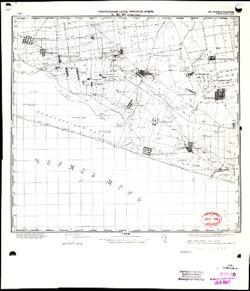
- Description:
- 1921
- Subject:
- Topical Subject: Maps, Topical Subject: Soviet Union, and Geographic Subject: Dolmativka
- Publisher:
- Генеральный штаб Красной Армии
- Language:
- Russian
- Date Created:
- 1941
- Identifier:
- VAC9619-001918
- Genre:
- Topographic Maps and Military Maps
- Geographic Location:
- Coordinates: 46, 32, 46.3333, 32.5
- Related URL:
- Download GeoTIFF: https://drive.google.com/open?id=1Sq-sWBnP30l2i0xJ6VXjO7JpXmW85bcn and Catalog URL: https://iucat.iu.edu/catalog/5020129
- Abstract:
- Modern area represented: Dolmativka, Kherson oblast, Ukraine
- Call Number:
- G7000 s100 .S7 sheet L-36-65
- Caption:
- Для служебного пользования
- City:
- Долматовка (Dolmativka)
- Copyright Holder:
- No Copyright - United States
- Country:
- СССР (USSR)
- State/Province:
- Украинская ССР (Ukrainian Soviet Socialist Republic)
- Physical Description:
- Scale: 1:100,000
- Persistent URL:
- http://purl.dlib.indiana.edu/iudl/images/VAC9619/VAC9619-001918
- Provenance:
- CIA Map Library, Library of Congress Geography & Map Division
-
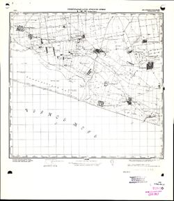
- Description:
- 1921
- Subject:
- Topical Subject: Maps, Geographic Subject: Dolmativka, and Topical Subject: Soviet Union
- Publisher:
- Генеральный штаб Красной Армии
- Language:
- Russian
- Date Created:
- 1941
- Identifier:
- VAC9619-001919
- Genre:
- Military Maps and Topographic Maps
- Geographic Location:
- Coordinates: 46, 32, 46.3333, 32.5
- Related URL:
- Download GeoTIFF: https://drive.google.com/file/d/1L4fNjU1brQervVVFn9QL3UE2i87J8NuW/view?usp=sharing and Catalog URL: https://iucat.iu.edu/catalog/5020129
- Abstract:
- Modern area represented: Dolmativka, Kherson oblast, Ukraine
- Call Number:
- G7000 s100 .S7 sheet L-36-65
- Caption:
- Для служебного пользования
- City:
- Долматовка (Dolmativka)
- Copyright Holder:
- No Copyright - United States
- Country:
- СССР (USSR)
- State/Province:
- Украинская ССР (Ukrainian Soviet Socialist Republic)
- Physical Description:
- Scale: 1:100,000
- Persistent URL:
- http://purl.dlib.indiana.edu/iudl/images/VAC9619/VAC9619-001919
- Provenance:
- CIA Map Library
-
- Description:
- 1921
- Subject:
- Geographic Subject: Dolmativka, Topical Subject: Maps, and Topical Subject: Soviet Union
- Publisher:
- Генеральный штаб Красной Армии
- Language:
- Russian
- Date Created:
- 1941
- Identifier:
- VAC9619-001920
- Genre:
- Military Maps and Topographic Maps
- Geographic Location:
- Coordinates: 46, 32, 46.3333, 32.5
- Related URL:
- Download GeoTIFF: https://drive.google.com/file/d/1-OPrXcbiNY2JC-KFqsYStaBmtIBIsnNi/view?usp=sharing and Catalog URL: https://iucat.iu.edu/catalog/5020129
- Abstract:
- Modern area represented: Dolmativka, Kherson oblast, Ukraine
- Call Number:
- G7000 s100 .S7 sheet L-36-65
- Caption:
- Для служебного пользования
- City:
- Долматовка (Dolmativka)
- Copyright Holder:
- No Copyright - United States
- Country:
- СССР (USSR)
- State/Province:
- Украинская ССР (Ukrainian Soviet Socialist Republic)
- Physical Description:
- Scale: 1:100,000
- Persistent URL:
- http://purl.dlib.indiana.edu/iudl/images/VAC9619/VAC9619-001920
- Provenance:
- DMA Topographic Center, Army Map Service Library, OMAHA
