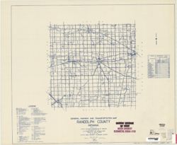
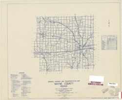
Topical Subject: Roads and Geographic Subject: Randolph County (Ind.)
Creator:
Indiana. State Highway Commission (1919-1953)
Publisher:
State Highway Commission of Indiana
Date Created:
1949
Identifier:
VAC3073-M-00563
Genre:
Road maps
Geographic Location:
Coordinates: W0851300 W0844900 N0401900 N0400000
Related URL:
Catalog URL: https://iucat.iu.edu/catalog/5708597
Abstract:
Blueline. "State roads revised to January 1, 1949.: "1937." Data obtained from State-wide Highway Planning Agency." Includes location ma...
Call Number:
G4093.R3 P2 1949 .I53
Caption:
Imprint: [Indianapolis?] : State Highway Commission of Indiana, 1949.
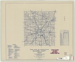
Geographic Subject: Delaware County (Ind.) and Topical Subject: Roads
Creator:
Indiana. State Highway Commission (1919-1953)
Publisher:
Indiana. State Highway Commission (1919-1953)
Date Created:
1937
Identifier:
VAC3073-M-00364
Genre:
Road maps
Geographic Location:
Coordinates: W0853500 W0851300 N0402300 N0400500
Related URL:
Catalog URL: https://iucat.iu.edu/catalog/5361381
Abstract:
Blue line print. "Corrected to January 1, 1937." "Data obtained from Statewide Highway Planning Survey." Includes chart "Culture...
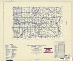
Topical Subject: Roads and Geographic Subject: Greene County (Ind.)
Creator:
Indiana. State Highway Commission (1919-1953)
Publisher:
Indiana. State Highway Commission (1919-1953)
Date Created:
1953
Identifier:
VAC3073-M-00342
Genre:
Road maps
Geographic Location:
Coordinates: W0871400 W0864100 N0391000 N0385400
Related URL:
Catalog URL: www.iucat.iu.edu/catalog/5729005
Abstract:
blueline. "State roads revised to January 1, 1953." "Data obtained from State-wide Highway Planning Survey." Includes chart "Culture...
Call Number:
G4093.G7P2 1953 .I53
Caption:
Imprint: [Indianapolis?] : State Highway Commission of Indiana, 1949.
Physical Description:
Dimensions: 44 x 51 cm and Scale: Approximately 1:130,000
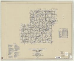
Topical Subject: Roads and Geographic Subject: Owen County (Ind.)
Creator:
Indiana. State Highway Commission (1919-1953)
Publisher:
State Highway Commission of Indiana
Date Created:
1949
Identifier:
VAC3073-M-00310
Genre:
Road maps
Geographic Location:
Coordinates: W0870300 W0863800 N0392800 N0391000
Related URL:
Catalog URL: https://iucat.iu.edu/catalog/5707900
Abstract:
Blueline. "State roads revised to January 1, 1949." "1937." "Data obtained from State-wide Highway Planning Survey." Includes l...
Call Number:
G4093.O8 P2 1949 .I53
Caption:
Imprint: [Indianapolis?] : State Highway Commission of Indiana, 1949.
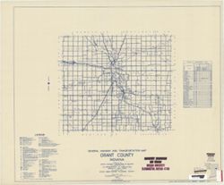
Geographic Subject: Grant County (Ind.) and Topical Subject: Roads
Creator:
Indiana. State Highway Commission (1919-1953)
Publisher:
State Highway Commission of Indiana
Date Created:
1949
Identifier:
VAC3073-M-00309
Genre:
Road maps
Geographic Location:
Coordinates: W0855200 W0852700 N0403900 N0402300
Related URL:
Catalog URL: https://iucat.iu.edu/catalog/5706036
Abstract:
Blueline. "State roads revised to January 1, 1949." "1937." "Data obtained from Statewide Highway Planning Survey." Includes lo...
Call Number:
G4093.G6P2 1949 .I53
Caption:
Imprint: [Indianapolis?] : State Highway Commission of Indiana, 1949.
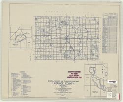
Geographic Subject: LaGrange County (Ind.), Topical Subject: Roads, Geographic Subject: Big Long Lake (Ind.), Topical Subject: Lakes, Geographic Subject: Ada...
Creator:
Indiana. State Highway Commission (1919-1953)
Publisher:
State Highway Commission of Indiana
Date Created:
1949
Identifier:
VAC3073-M-00298
Genre:
Road maps
Geographic Location:
Coordinates: W0853900 W0851200 N0414600 N0413200
Related URL:
Catalog URL: https://iucat.iu.edu/catalog/5706409
Abstract:
Blueline. "State roads revised to January 1, 1949." "1937." "Data obtained from State-wide Highway Planning Survey." Includes l...
Call Number:
G4093.L2 P2 1949 .I53
Caption:
Imprint: [Indianapolis?] : State Highway Commission of Indiana, 1949.