
Search Constraints
You searched for:
Publisher
Управление военных топографов РККА
Remove constraint Publisher: Управление военных топографов РККА
« Previous |
1 - 100 of 462
|
Next »
Search Results
-
- Description:
- 1936
- Subject:
- Geographic Subject: Ubarok, Topical Subject: Soviet Union, and Topical Subject: Maps
- Publisher:
- Управление военных топографов РККА
- Language:
- Russian
- Date Created:
- 1937
- Identifier:
- VAC9619-000567
- Genre:
- Topographic Maps and Military Maps
- Geographic Location:
- Coordinates: 54.5, 28.25, 54.667, 28.5
- Related URL:
- Catalog URL: http://iucat.iu.edu/catalog/5020131 and Download GeoTIFF: https://drive.google.com/open?id=1yIx-TM28JTWHuBhMdWOWkQ0Os1GV8Y7K
- Abstract:
- Modern area represented: Ubarok, Minsk oblast, Belarus
- Call Number:
- G7000 s50 .S68 sheet N-35-57-B
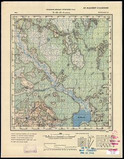
- Caption:
- Не подлежит оглашению
- City:
- Уборок (Uborok)
- Copyright Holder:
- No Copyright - United States
- Country:
- СССР (USSR)
- State/Province:
- Белорусская ССР (Byelorussian Soviet Socialist Republic)
- Physical Description:
- Scale: 1:50,000
- Persistent URL:
- http://purl.dlib.indiana.edu/iudl/images/VAC9619/VAC9619-000567
- Provenance:
- M. I. Map Library, Justus Perthes Kartensammlung, G000-30
-
- Description:
- 1933
- Subject:
- Topical Subject: Maps, Topical Subject: Soviet Union, and Geographic Subject: Zembin
- Publisher:
- Управление военных топографов РККА
- Language:
- Russian
- Date Created:
- 1937
- Identifier:
- VAC9619-000568
- Genre:
- Military Maps and Topographic Maps
- Geographic Location:
- Coordinates: 54.333, 28, 54.5, 28.25
- Related URL:
- Download GeoTIFF: https://drive.google.com/open?id=1rwwVK0vXb4_ePYGis1SCFQTSj3dLIwd5 and Catalog URL: http://iucat.iu.edu/catalog/5020131
- Abstract:
- Modern area represented: Zembin, Minsk oblast, Belarus
- Call Number:
- G7000 s50 .S68 sheet N-35-57-C
- Caption:
- Не подлежит оглашению
- City:
- Зембин (Zembin)
- Copyright Holder:
- No Copyright - United States
- Country:
- СССР (USSR)
- State/Province:
- Белорусская ССР (Byelorussian Soviet Socialist Republic)
- Physical Description:
- Scale: 1:50,000
- Persistent URL:
- http://purl.dlib.indiana.edu/iudl/images/VAC9619/VAC9619-000568
- Provenance:
- Army Map Service Library, OMAHA, Library of Congress Geography & Map Division
-
- Description:
- 1931
- Subject:
- Geographic Subject: Romny, Topical Subject: Maps, and Topical Subject: Soviet Union
- Publisher:
- Управление военных топографов РККА
- Language:
- Russian
- Date Created:
- 1937
- Identifier:
- VAC9619-000955
- Genre:
- Military Maps and Topographic Maps
- Geographic Location:
- Coordinates: 50.666667, 33.5, 50.833333, 33.75
- Related URL:
- Download GeoTIFF: https://drive.google.com/open?id=1rnfkKiB1ABVQkI-6sNsQc61EBpY-hEs5 and Catalog URL: http://iucat.iu.edu/catalog/5020131
- Abstract:
- Modern area represented: Romny, Sumy oblast, Ukraine
- Call Number:
- G7000 s50 .S68 sheet M-36-44-C
- Caption:
- Не подлежит оглашению
- City:
- Засулье (Zasulye)
- Copyright Holder:
- No Copyright - United States
- Country:
- СССР (USSR)
- State/Province:
- Украинская ССР (Ukrainian Soviet Socialist Republic) and Черниговская область (Chernihiv oblast)
- Physical Description:
- Scale: 1:50,000
- Persistent URL:
- http://purl.dlib.indiana.edu/iudl/images/VAC9619/VAC9619-000955
- Provenance:
- DMA Topographic Center, Army Map Service Library, Library of Congress Geography & Map Division
-
- Description:
- 1932
- Subject:
- Topical Subject: Soviet Union, Geographic Subject: Горностайпіль (Hornostaypil'), and Topical Subject: Maps
- Publisher:
- Управление военных топографов РККА
- Language:
- Russian
- Date Created:
- 1937
- Identifier:
- VAC9619-000929
- Genre:
- Military Maps and Topographic Maps
- Geographic Location:
- Coordinates: 51, 30.25, 51.1667, 30.5
- Related URL:
- Catalog URL: http://iucat.iu.edu/catalog/5020131 and Download GeoTIFF: https://drive.google.com/open?id=1p32O1uBhB5Rhso2iI4XobJZ0Td8vNnJ1
- Abstract:
- Modern area represented: Горностайпіль (Hornostaypil'), Kyiv oblast, Ukraine
- Call Number:
- G7000 s50 .S68 sheet M-36-25-D
- Caption:
- Не подлежит оглашению
- City:
- Горностайполь (Gornostaypol')
- Copyright Holder:
- No Copyright - United States
- Country:
- СССР (USSR)
- State/Province:
- Киевская область (Kyiv oblast) and Украинская ССР (Ukrainian Soviet Socialist Republic)
- Physical Description:
- Scale: 1:50,000
- Persistent URL:
- http://purl.dlib.indiana.edu/iudl/images/VAC9619/VAC9619-000929
- Provenance:
- DMA Topographic Center, Army Map Service Library, Library of Congress Geography & Map Division
-
- Description:
- 1909
- Subject:
- Geographic Subject: Stavropol’ Krai, Topical Subject: Maps, Topical Subject: Soviet Union, and Geographic Subject: Pyatigorsk
- Publisher:
- Управление военных топографов РККА
- Language:
- Russian
- Date Created:
- 1936
- Identifier:
- VAC9619-002242
- Genre:
- Military Maps and Topographic Maps
- Geographic Location:
- Coordinates: 44, 43, 44.3333, 43.5
- Related URL:
- Download GeoTIFF: https://drive.google.com/file/d/1b87g1ffiH5tUIIxMUlRAMC1SpRo9sRtq/view?usp=sharing and Catalog URL: https://iucat.iu.edu/catalog/5020129
- Abstract:
- Modern area represented: Пятигорск (Pyatigorsk), Stavropol’ Krai, Russia
- Call Number:
- G7000 s100 .S7 sheet L-38-135
- Caption:
- Для cлужебного пользования
- City:
- Пятигорск (Pyatigorsk)
- Copyright Holder:
- No Copyright - United States
- Country:
- СССР (USSR)
- State/Province:
- Орджоникидзевский край (Ordzhonikidze kray) and РСФСР (RSFSR)
- Physical Description:
- Scale: 1:100,000
- Persistent URL:
- http://purl.dlib.indiana.edu/iudl/images/VAC9619/VAC9619-002242
- Provenance:
- DMA Topographic Center, Army Map Service Library
-
- Description:
- 1913
- Subject:
- Geographic Subject: Baldzhikan, Topical Subject: Maps, and Topical Subject: Soviet Union
- Publisher:
- Управление военных топографов РККА
- Language:
- Russian
- Date Created:
- 1936
- Identifier:
- VAC9619-003551
- Genre:
- Topographic Maps and Military Maps
- Geographic Location:
- Coordinates: 49, 110, 49.333, 110.5
- Related URL:
- Download GeoTIFF: https://drive.google.com/file/d/1EDdpb1Qpq4XTzjSQ3wYTtMmQ_tYdDFSv/view?usp=sharing and Catalog URL: https://iucat.iu.edu/catalog/5020129
- Abstract:
- Modern area represented: Baldzhikan, Transbaikal territory, Russia
- Call Number:
- G7000 s100 .S7 sheet M-49-101
- Caption:
- Не подлежит оглашению
- City:
- Бальджикан (Baldzhikan)
- Copyright Holder:
- No Copyright - United States
- Country:
- СССР (USSR)
- State/Province:
- РСФСР (RSFSR) and Читинская область (Chita oblast)
- Physical Description:
- Scale: 1:100,000
- Persistent URL:
- http://purl.dlib.indiana.edu/iudl/images/VAC9619/VAC9619-003551
- Provenance:
- Library of Congress G & M Division, University of Kansas Map Library
-
- Description:
- 1924
- Subject:
- Topical Subject: Maps, Geographic Subject: Omut, and Topical Subject: Soviet Union
- Publisher:
- Управление военных топографов РККА
- Language:
- Russian
- Date Created:
- 1936
- Identifier:
- VAC9619-000020
- Genre:
- Military Maps and Topographic Maps
- Geographic Location:
- Coordinates: 59, 27.75, 59.167, 28
- Related URL:
- Download GeoTIFF: https://drive.google.com/open?id=1x6coF_bFqa5VyWZ_JSrewAbtpu4RSn_0 and Catalog URL: http://iucat.iu.edu/catalog/5020131
- Abstract:
- Modern area represented: Omut, Russia
- Call Number:
- G7000 s50 .S68 sheet O-35-32-D
- Caption:
- Секретно,Captured map
- City:
- Омути (Omut)
- Copyright Holder:
- No Copyright - United States
- Country:
- СССР (USSR) and Эстония (Estonia)
- State/Province:
- РСФСР (RSFSR) and Ленинградская область (Leningrad oblast)
- Physical Description:
- Scale: 1:50,000
- Persistent URL:
- http://purl.dlib.indiana.edu/iudl/images/VAC9619/VAC9619-000020
- Provenance:
- Army Map Service Library, OMAHA, Library of Congress Geography & Map Division
-
- Description:
- 1933
- Subject:
- Topical Subject: Soviet Union, Geographic Subject: Smilavichy, and Topical Subject: Maps
- Publisher:
- Управление военных топографов РККА
- Language:
- Russian
- Date Created:
- 1936
- Identifier:
- VAC9619-004081
- Genre:
- Military Maps and Topographic Maps
- Geographic Location:
- Coordinates: 53.667, 28, 54, 28.5
- Related URL:
- Download GeoTIFF: https://drive.google.com/file/d/1H8FweVO9LnHfFCQ6pbRGNdMLVVsrPnp4/view?usp=sharing and Catalog URL: https://iucat.iu.edu/catalog/5020129
- Abstract:
- Modern area represented: Smilavichy, Belarus
- Call Number:
- G7000 s100 .S7 sheet N-35-81
- Caption:
- Не подлежит оглашению
- City:
- Смиловичи (Smilavichy)
- Copyright Holder:
- No Copyright - United States
- Country:
- СССР (USSR)
- State/Province:
- Белорусская ССР (Byelorussian Soviet Socialist Republic)
- Physical Description:
- Scale: 1:100,000
- Persistent URL:
- http://purl.dlib.indiana.edu/iudl/images/VAC9619/VAC9619-004081
- Provenance:
- Library of Congress G & M Division
-
- Description:
- 1904
- Subject:
- Topical Subject: Soviet Union, Topical Subject: Maps, and Geographic Subject: Kiyevichi
- Publisher:
- Управление военных топографов РККА
- Language:
- Russian
- Date Created:
- 1936
- Identifier:
- VAC9619-000708
- Genre:
- Military Maps and Topographic Maps
- Geographic Location:
- Coordinates: 52.833, 26.75, 53, 27
- Related URL:
- Catalog URL: http://iucat.iu.edu/catalog/5020131 and Download GeoTIFF: https://drive.google.com/open?id=1tTKI474LW2kDomqmBh1_w15EeaX7m8st
- Abstract:
- Modern area represented: Kiyevichi, Minsk oblast, Belarus
- Call Number:
- GM G7000 s50 .S68 N-35-114-Б
- Caption:
- Не подлежит оглашению
- City:
- Киевичи (Kiyevichi)
- Copyright Holder:
- No Copyright - United States
- Country:
- СССР (USSR) and Польша (Poland)
- State/Province:
- Белорусская ССР (Byelorussian Soviet Socialist Republic)
- Physical Description:
- Scale: 1:50,000
- Persistent URL:
- http://purl.dlib.indiana.edu/iudl/images/VAC9619/VAC9619-000708
- Provenance:
- Army Map Service Library, Auswärtiges Amt. Geographischer Dienst, OMAHA, Library of Congress Geography & Map Division
-
- Description:
- 1917
- Subject:
- Topical Subject: Soviet Union, Topical Subject: Maps, and Geographic Subject: Moroch
- Publisher:
- Управление военных топографов РККА
- Language:
- Russian
- Date Created:
- 1936
- Identifier:
- VAC9619-004130
- Genre:
- Topographic Maps and Military Maps
- Geographic Location:
- Coordinates: 52.333, 27.5, 52.667, 28
- Related URL:
- Catalog URL: https://iucat.iu.edu/catalog/5020129 and Download GeoTIFF: https://drive.google.com/file/d/1HUuzBKcEpGGkMff5L63dHETUlsQCusTP/view?usp=sharing
- Abstract:
- Modern area represented: Moroch, Minsk oblast, Belarus
- Call Number:
- G7000 s100 .S7 sheet N-35-128
- Caption:
- Не подлежит оглашению
- City:
- Морочь (Moroch)
- Copyright Holder:
- No Copyright - United States
- Country:
- Польша (Poland) and СССР (USSR)
- State/Province:
- Белорусская ССР (Byelorussian Soviet Socialist Republic)
- Physical Description:
- Scale: 1:100,000
- Persistent URL:
- http://purl.dlib.indiana.edu/iudl/images/VAC9619/VAC9619-004130
- Provenance:
- DMA Topographic Center, Army Map Service Library
-
- Description:
- 1926
- Subject:
- Geographic Subject: Bogolyubovo, Topical Subject: Maps, and Topical Subject: Soviet Union
- Publisher:
- Управление военных топографов РККА
- Language:
- Russian
- Date Created:
- 1936
- Identifier:
- VAC9619-002277
- Genre:
- Military Maps and Topographic Maps
- Geographic Location:
- Coordinates: 56, 40.5, 56.3333, 41
- Related URL:
- Catalog URL: https://iucat.iu.edu/catalog/5020129 and Download GeoTIFF: https://drive.google.com/file/d/1SHfpY_bvxn3mGrdoWhgp-cce8fDpxMR3/view?usp=sharing
- Abstract:
- Modern area represented: Bogolyubovo, Russia
- Call Number:
- G7000 s100 .S7 sheet O-37-142
- City:
- Боголюбово (Bogolyubovo)
- Copyright Holder:
- No Copyright - United States
- Country:
- СССР (USSR)
- State/Province:
- РСФСР (RSFSR) and Ивановская область (Ivanovo oblast)
- Physical Description:
- Scale: 1:100,000
- Persistent URL:
- http://purl.dlib.indiana.edu/iudl/images/VAC9619/VAC9619-002277
- Provenance:
- DMA Topographic Center, Army Map Service Library, OMAHA, Library of Congress Geography & Map Division
-
- Description:
- 1930
- Subject:
- Topical Subject: Soviet Union, Topical Subject: Maps, and Geographic Subject: Svietlahorsk
- Publisher:
- Управление военных топографов РККА
- Language:
- Russian
- Date Created:
- 1936
- Identifier:
- VAC9619-004134
- Genre:
- Military Maps and Topographic Maps
- Geographic Location:
- Coordinates: 52.333, 29, 52.667, 29.5
- Related URL:
- Catalog URL: https://iucat.iu.edu/catalog/5020129 and Download GeoTIFF: https://drive.google.com/file/d/13N9FLAybZ2nTicCtbfNbknHBgnbTbOlh/view?usp=sharing
- Abstract:
- Modern area represented: Svietlahorsk, Homyel oblast, Belarus
- Call Number:
- G7000 s100 .S7 sheet N-35-132
- Caption:
- Не подлежит оглашению
- City:
- Шацилки (Shatsilki)
- Copyright Holder:
- No Copyright - United States
- Country:
- СССР (USSR)
- State/Province:
- Белорусская ССР (Byelorussian Soviet Socialist Republic)
- Physical Description:
- Scale: 1:100,000
- Persistent URL:
- http://purl.dlib.indiana.edu/iudl/images/VAC9619/VAC9619-004134
- Provenance:
- DMA Topographic Center, Auswärtiges Amt. Geographischer Dienst, OMAHA, Army Map Service Library
-
- Description:
- 1895
- Subject:
- Topical Subject: Maps, Geographic Subject: Slantsy, and Topical Subject: Soviet Union
- Publisher:
- Управление военных топографов РККА
- Language:
- Russian
- Date Created:
- 1936
- Identifier:
- VAC9619-001847
- Genre:
- Topographic Maps and Military Maps
- Geographic Location:
- Coordinates: 59, 28, 59.167, 28.25
- Related URL:
- Download GeoTIFF: https://drive.google.com/open?id=1azu8TWhYFhia79bTs1F23ijf90sJxa8j and Catalog URL: http://iucat.iu.edu/catalog/5020131
- Abstract:
- Modern area represented: Slantsy, Russia
- Call Number:
- G7000 s50 .S68 sheet O-35-33-C
- Caption:
- Не подлежит оглашению,Captured map
- City:
- Сланцы (Slantsy)
- Copyright Holder:
- No Copyright - United States
- Country:
- СССР (USSR) and Эстония (Estonia)
- State/Province:
- Ленинградская область (Leningrad oblast) and РСФСР (RSFSR)
- Physical Description:
- Scale: 1:50,000
- Persistent URL:
- http://purl.dlib.indiana.edu/iudl/images/VAC9619/VAC9619-001847
- Provenance:
- Army Map Service Library, OMAHA, Library of Congress Geography & Map Division
-
- Description:
- 1916
- Subject:
- Geographic Subject: Морач (Morach), Topical Subject: Maps, and Topical Subject: Soviet Union
- Publisher:
- Управление военных топографов РККА
- Language:
- Russian
- Date Created:
- 1936
- Identifier:
- VAC9619-000761
- Genre:
- Topographic Maps and Military Maps
- Geographic Location:
- Coordinates: 52.5, 27.5, 52.667, 27.75
- Related URL:
- Catalog URL: http://iucat.iu.edu/catalog/5020131 and Download GeoTIFF: https://drive.google.com/open?id=1LAByuRyxfjwxyNO78bXbh7EmFF3pEsxW
- Abstract:
- Modern area represented: Морач (Morach), Minsk oblast, Belarus
- Call Number:
- G7000 s50 .s68 sheet N-35-128-A
- Caption:
- Не подлежит оглашению
- City:
- Морочь (Moroch')
- Copyright Holder:
- No Copyright - United States
- Country:
- СССР (USSR) and Польша (Poland)
- State/Province:
- Белорусская ССР (Byelorussian Soviet Socialist Republic)
- Physical Description:
- Scale: 1:50,000
- Persistent URL:
- http://purl.dlib.indiana.edu/iudl/images/VAC9619/VAC9619-000761
- Provenance:
- M. I. Map Library
-
- Description:
- 1931
- Subject:
- Geographic Subject: Zhlobin, Topical Subject: Soviet Union, and Topical Subject: Maps
- Publisher:
- Управление военных топографов РККА
- Language:
- Russian
- Date Created:
- 1936
- Identifier:
- VAC9619-001523
- Genre:
- Topographic Maps and Military Maps
- Geographic Location:
- Coordinates: 52.8667, 30, 53, 30.25
- Related URL:
- Download GeoTIFF: https://drive.google.com/open?id=1fegM38JGNEzEvDxv5geRA4ZAE-L4Nox_ and Catalog URL: http://iucat.iu.edu/catalog/5020131
- Abstract:
- Modern area represented: Zhlobin, Homyel oblast, Belarus
- Call Number:
- G7000 s50 .S68 sheet N-36-109-A
- Caption:
- Не подлежит оглашению
- City:
- Жлобин (Zhlobin)
- Copyright Holder:
- No Copyright - United States
- Country:
- СССР (USSR)
- State/Province:
- Белорусская ССР (Byelorussian Soviet Socialist Republic)
- Physical Description:
- Scale: 1:50,000
- Persistent URL:
- http://purl.dlib.indiana.edu/iudl/images/VAC9619/VAC9619-001523
- Provenance:
- CIA Map Branch -- Received
-

- Description:
- 1926
- Subject:
- Geographic Subject: Gorval, Topical Subject: Maps, and Topical Subject: Soviet Union
- Publisher:
- Управление военных топографов РККА
- Language:
- Russian
- Date Created:
- 1936
- Identifier:
- VAC9619-001547
- Genre:
- Military Maps and Topographic Maps
- Geographic Location:
- Coordinates: 52.5, 30, 52.6667, 30.25
- Related URL:
- Download GeoTIFF: https://drive.google.com/open?id=1SBp1cSyxbsOZzW87Z5z7xzVDLRHTxnom and Catalog URL: http://iucat.iu.edu/catalog/5020131
- Abstract:
- Modern area represented: Gorval, Homyel oblast, Belarus
- Call Number:
- G7000 s50 .S68 sheet N-36-121-A
- Caption:
- Не подлежит оглашению
- City:
- Горваль (Gorval)
- Copyright Holder:
- No Copyright - United States
- Country:
- СССР (USSR)
- State/Province:
- Белорусская ССР (Byelorussian Soviet Socialist Republic)
- Physical Description:
- Scale: 1:50,000
- Persistent URL:
- http://purl.dlib.indiana.edu/iudl/images/VAC9619/VAC9619-001547
- Provenance:
- Army Map Service Library, Library of Congress Geography & Map Division, OMAHA
-
- Description:
- 1931
- Subject:
- Topical Subject: Maps, Geographic Subject: Mingrelskaya, and Topical Subject: Soviet Union
- Publisher:
- Управление военных топографов РККА
- Language:
- Russian
- Date Created:
- 1935
- Identifier:
- VAC9619-000137
- Genre:
- Military Maps and Topographic Maps
- Geographic Location:
- Coordinates: 45, 38.25, 45.167, 38.5
- Related URL:
- Catalog URL: http://iucat.iu.edu/catalog/5020131 and Download GeoTIFF: https://drive.google.com/open?id=1bLzhcgUh8GhgTJT4RxBKFm6tUA0f-6nQ
- Abstract:
- Modern area represented: Mingrelskaya, Krasnodarskiy kray, Russia
- Call Number:
- G7000 s50 .S68 and zsheet L-37-101-D
- Caption:
- Не подлежит оглашению
- City:
- Мингрельская (Mingrelskaya)
- Copyright Holder:
- No Copyright - United States
- Country:
- СССР (USSR)
- State/Province:
- Азово-Черноморский край (Azov-Black Sea kray) and РСФСР (RSFSR)
- Physical Description:
- Scale: 1:50,000
- Persistent URL:
- http://purl.dlib.indiana.edu/iudl/images/VAC9619/VAC9619-000137
- Provenance:
- DMA Topographic Center, Army Map Service Library, OMAHA, Library of Congress Geography & Map Division
-
- Description:
- 1913
- Subject:
- Topical Subject: Maps, Topical Subject: Soviet Union, and Geographic Subject: Partizansk
- Publisher:
- Управление военных топографов РККА
- Language:
- Russian
- Date Created:
- 1934
- Identifier:
- VAC9619-000811
- Genre:
- Topographic Maps and Military Maps
- Geographic Location:
- Coordinates: 43, 133, 43.3333, 133.5
- Related URL:
- Catalog URL: https://iucat.iu.edu/catalog/5020129 and Download GeoTIFF: https://drive.google.com/open?id=1R7GQuqPSC31N6DmuMyrjjbi0qENHsXFB
- Abstract:
- Modern area represented: Partizansk, Primorskiy (Maritime) kray, Russia
- Call Number:
- G7000 s100 .S7 sheet K-53-27
- Caption:
- Не подлежит оглашению
- City:
- Сучан (Suchan)
- Copyright Holder:
- No Copyright - United States
- Country:
- СССР (USSR)
- State/Province:
- РСФСР (RSFSR) and Дальневосточный край (Far Eastern kray)
- Physical Description:
- Scale: 1:100,000
- Persistent URL:
- http://purl.dlib.indiana.edu/iudl/images/VAC9619/VAC9619-000811
- Provenance:
- DMA Topographic Center, Army Map Service Library, Library of Congress Geography & Map Division, Atlasblatt
-
- Description:
- 1908
- Subject:
- Geographic Subject: Ivenets, Topical Subject: Maps, and Topical Subject: Soviet Union
- Publisher:
- Управление военных топографов РККА
- Language:
- Russian
- Date Created:
- 1933
- Identifier:
- VAC9619-004078
- Genre:
- Topographic Maps and Military Maps
- Geographic Location:
- Coordinates: 53.667, 26.5, 54, 27
- Related URL:
- Catalog URL: https://iucat.iu.edu/catalog/5020129 and Download GeoTIFF: https://drive.google.com/file/d/17IBW-4Qy8vDRjL3XAe46WFA6YEoc1hsn/view?usp=sharing
- Abstract:
- Modern area represented: Ivenets, Belarus
- Call Number:
- G7000 s100 .S7 sheet N-35-78
- Caption:
- Не подлежит оглашению
- City:
- Ивенец (Ivenets)
- Copyright Holder:
- No Copyright - United States
- Country:
- Польша (Poland) and СССР (USSR)
- State/Province:
- Белорусская ССР (Byelorussian Soviet Socialist Republic)
- Physical Description:
- Scale: 1:100,000
- Persistent URL:
- http://purl.dlib.indiana.edu/iudl/images/VAC9619/VAC9619-004078
- Provenance:
- DMA Topographic Center, Army Map Service Library, OMAHA
-
- Description:
- 1913
- Subject:
- Topical Subject: Maps, Geographic Subject: Korosten, and Topical Subject: Soviet Union
- Publisher:
- Управление военных топографов РККА
- Language:
- Russian
- Date Created:
- 1933
- Identifier:
- VAC9619-003119
- Genre:
- Military Maps and Topographic Maps
- Geographic Location:
- Coordinates: 50.667, 28.5, 51, 29
- Related URL:
- Catalog URL: https://iucat.iu.edu/catalog/5020129 and Download GeoTIFF: https://drive.google.com/file/d/1r4KaIwlzKRcnmPHpmBYXDKSMN0LMEF56/view?usp=sharing
- Abstract:
- Modern area represented: Korosten, Zhytomyr oblast, Ukraine
- Call Number:
- G7000 s100 .S7 sheet M-35-46
- Caption:
- Не подлежит оглашению
- City:
- Коростень (Korosten)
- Copyright Holder:
- No Copyright - United States
- Country:
- СССР (USSR)
- State/Province:
- Украинская ССР (Ukrainian Soviet Socialist Republic) and Киевская область (Kyiv oblast)
- Physical Description:
- Scale: 1:100,000
- Persistent URL:
- http://purl.dlib.indiana.edu/iudl/images/VAC9619/VAC9619-003119
- Provenance:
- DMA Topographic Center, Army Map Service Library, OMAHA
-
- Description:
- 1913
- Subject:
- Geographic Subject: Ivankiv, Topical Subject: Soviet Union, and Topical Subject: Maps
- Publisher:
- Управление военных топографов РККА
- Language:
- Russian
- Date Created:
- 1933
- Identifier:
- VAC9619-003120
- Genre:
- Topographic Maps and Military Maps
- Geographic Location:
- Coordinates: 50.667, 29.5, 51, 30
- Related URL:
- Download GeoTIFF: https://drive.google.com/file/d/1Ra_HooqAngw0iRatiTrefjd7SIFeN4au/view?usp=sharing and Catalog URL: https://iucat.iu.edu/catalog/5020129
- Abstract:
- Modern area represented: Ivankiv, Kiev oblast, Ukraine
- Call Number:
- G7000 s100 .S7 sheet M-35-48
- Caption:
- Не подлежит оглашению
- City:
- Иванков (Ivankiv)
- Copyright Holder:
- No Copyright - United States
- Country:
- СССР (USSR)
- State/Province:
- Киевская область (Kyiv oblast) and Украинская ССР (Ukrainian Soviet Socialist Republic)
- Physical Description:
- Scale: 1:100,000
- Persistent URL:
- http://purl.dlib.indiana.edu/iudl/images/VAC9619/VAC9619-003120
- Provenance:
- DMA Topographic Center, Army Map Service Library, OMAHA
-
- Description:
- 1913
- Subject:
- Topical Subject: Soviet Union, Topical Subject: Maps, and Geographic Subject: Makariv
- Publisher:
- Управление военных топографов РККА
- Language:
- Russian
- Date Created:
- 1933
- Identifier:
- VAC9619-003123
- Genre:
- Topographic Maps and Military Maps
- Geographic Location:
- Coordinates: 50.333, 29.5, 50.667, 30
- Related URL:
- Catalog URL: https://iucat.iu.edu/catalog/5020129 and Download GeoTIFF: https://drive.google.com/file/d/13LZmOOndyLlk6oJu1Lq5Rp9sPNueEMsP/view?usp=sharing
- Abstract:
- Modern area represented: Makariv, Kiev oblast, Ukraine
- Call Number:
- G7000 s100 .S7 sheet M-35-60
- Caption:
- Не подлежит оглашению
- City:
- Макаров (Makariv)
- Copyright Holder:
- No Copyright - United States
- Country:
- СССР (USSR)
- State/Province:
- Киевская область (Kyiv oblast) and Украинская ССР (Ukrainian Soviet Socialist Republic)
- Physical Description:
- Scale: 1:100,000
- Persistent URL:
- http://purl.dlib.indiana.edu/iudl/images/VAC9619/VAC9619-003123
- Provenance:
- DMA Topographic Center, Army Map Service Library, OMAHA, Library of Congress Geography & Map Division
-
- Description:
- 1908
- Subject:
- Topical Subject: Maps, Geographic Subject: Волма (Volma), and Topical Subject: Soviet Union
- Publisher:
- Управление военных топографов РККА
- Language:
- Russian
- Date Created:
- 1933
- Identifier:
- VAC9619-000613
- Genre:
- Military Maps and Topographic Maps
- Geographic Location:
- Coordinates: 53.833, 26.75, 54, 27
- Related URL:
- Catalog URL: http://iucat.iu.edu/catalog/5020131 and Download GeoTIFF: https://drive.google.com/open?id=1tJbyl0CQWseddDO75ISYRQUXDEkA9On0
- Abstract:
- Modern area represented: Volma, Minsk oblast, Belarus
- Call Number:
- G7000 s50 .S68 sheet N-35-78-B
- Caption:
- Не подлежит оглашению
- City:
- Волма (Volma)
- Copyright Holder:
- No Copyright - United States
- Country:
- СССР (USSR) and Польша (Poland)
- State/Province:
- Белорусская ССР (Byelorussian Soviet Socialist Republic)
- Physical Description:
- Scale: 1:50,000
- Persistent URL:
- http://purl.dlib.indiana.edu/iudl/images/VAC9619/VAC9619-000613
- Provenance:
- M. I. Map Library, G000-30, GS, RA
-
- Description:
- 1908
- Subject:
- Topical Subject: Soviet Union, Topical Subject: Maps, and Geographic Subject: Ракаў (Rakaw)
- Publisher:
- Управление военных топографов РККА
- Language:
- Russian
- Date Created:
- 1933
- Identifier:
- VAC9619-000616
- Genre:
- Topographic Maps and Military Maps
- Geographic Location:
- Coordinates: 53.833, 27, 54, 27.25
- Related URL:
- Catalog URL: http://iucat.iu.edu/catalog/5020131 and Download GeoTIFF: https://drive.google.com/open?id=18Y_zd5QAI_bgmrQq90bC_d6C_jJQYQd3
- Abstract:
- Modern area represented: Rakaw, Minsk oblast, Belarus
- Call Number:
- G7000 s50 .S68 sheet N-35-79-A
- Caption:
- Не подлежит оглашению
- City:
- Ракув (Raków)
- Copyright Holder:
- No Copyright - United States
- Country:
- СССР (USSR) and Польша (Poland)
- State/Province:
- Белорусская ССР (Byelorussian Soviet Socialist Republic)
- Physical Description:
- Scale: 1:50,000
- Persistent URL:
- http://purl.dlib.indiana.edu/iudl/images/VAC9619/VAC9619-000616
- Provenance:
- M. I. Map Library, G000-30, GS, RA
-
- Description:
- 1875
- Subject:
- Topical Subject: Maps and Topical Subject: Soviet Union
- Publisher:
- Управление военных топографов РККА
- Language:
- Russian
- Date Created:
- 1933
- Identifier:
- VAC9619-000086
- Genre:
- Military Maps and Topographic Maps
- Geographic Location:
- Coordinates: 39, 46.75, 39.1667, 47
- Related URL:
- Catalog URL: http://iucat.iu.edu/catalog/5020131 and Download GeoTIFF: https://drive.google.com/open?id=1fZn4zrd1WgW8rpyS-hEuMNJy0gGbAdOE
- Call Number:
- G7000 s50 .S68 sheet J-38-34
- Caption:
- Не подлежит оглашению
- City:
- Шерифан (Sherifan)
- Copyright Holder:
- No Copyright - United States
- Country:
- Иран (Iran) and СССР (USSR)
- State/Province:
- Азербайджанская ССР (Azerbaijan Soviet Socialist Republic)
- Physical Description:
- Scale: 1:50,000
- Persistent URL:
- http://purl.dlib.indiana.edu/iudl/images/VAC9619/VAC9619-000086
- Provenance:
- CIA Map Library
-

- Description:
- 1929
- Subject:
- Geographic Subject: Petrovirivka, Topical Subject: Maps, and Topical Subject: Soviet Union
- Publisher:
- Управление военных топографов РККА
- Language:
- Russian
- Date Created:
- 1933
- Identifier:
- VAC9619-001872
- Genre:
- Military Maps and Topographic Maps
- Geographic Location:
- Coordinates: 47, 30, 47.3333, 30.5
- Related URL:
- Catalog URL: https://iucat.iu.edu/catalog/5020129 and Download GeoTIFF: https://drive.google.com/open?id=1Yp0PmoQ_FhFSY9xYe9Mdj5WFZQ1lZ9L8
- Abstract:
- Modern area represented: Petrovirivka, Odessa oblast, Ukraine
- Call Number:
- G7000 s100 .S7 sheet L-36-25
- Caption:
- Не подлежит оглашению
- City:
- Жовтнево (Zhovtnevo)
- Copyright Holder:
- No Copyright - United States
- Country:
- СССР (USSR)
- State/Province:
- Одесская область (Odessa oblast) and Украинская ССР (Ukrainian Soviet Socialist Republic)
- Physical Description:
- Scale: 1:100,000
- Persistent URL:
- http://purl.dlib.indiana.edu/iudl/images/VAC9619/VAC9619-001872
- Provenance:
- DMA Topographic Center, Atlasblatt, Library of Congress Geography & Map Division, Army Map Service Library
-
- Description:
- 1906
- Subject:
- Geographic Subject: Hunchun, Topical Subject: Soviet Union, and Topical Subject: Maps
- Publisher:
- Управление военных топографов РККА
- Language:
- Russian
- Date Created:
- 1933
- Identifier:
- VAC9619-000914
- Genre:
- Topographic Maps and Military Maps
- Geographic Location:
- Coordinates: 42.6667, 130, 43, 130.5
- Related URL:
- Download GeoTIFF: https://drive.google.com/open?id=14YXbAZgngEEXJeyyh0_6PJ45RyfdxAgg and Catalog URL: https://iucat.iu.edu/catalog/5020129
- Abstract:
- Modern area represented: Hunchun, Jilin province, China
- Call Number:
- G7000 s100 .S7 sheet K-52-45
- Caption:
- Не подлежит оглашению
- City:
- Хунчун (Hunchun)
- Copyright Holder:
- No Copyright - United States
- Country:
- СССР (USSR) and Корея (Korea)
- State/Province:
- Дальневосточный край (Far Eastern kray), Маньчжурия (Manchuria), and РСФСР (RSFSR)
- Physical Description:
- Scale: 1:100,000
- Persistent URL:
- http://purl.dlib.indiana.edu/iudl/images/VAC9619/VAC9619-000914
- Provenance:
- DMA Topographic Center, Army Map Service Library, OMAHA, Library of Congress Geography & Map Division
-
- Description:
- 1931
- Subject:
- Topical Subject: Maps, Geographic Subject: Pavlysh, and Topical Subject: Soviet Union
- Publisher:
- Управление военных топографов РККА
- Language:
- Russian
- Date Created:
- 1932
- Identifier:
- VAC9619-001093
- Genre:
- Military Maps and Topographic Maps
- Geographic Location:
- Coordinates: 48.833, 33.25, 49, 33.5
- Related URL:
- Catalog URL: http://iucat.iu.edu/catalog/5020131 and Download GeoTIFF: https://drive.google.com/open?id=1sMRslNs7Ya7e0przcNxz1C8CJMYdNijj
- Abstract:
- Modern area represented: Pavlysh, Kirovohrad oblast, Ukraine
- Call Number:
- G7000 s50 .S68 М-36-115-Б
- Caption:
- Не подлежит оглашению
- City:
- Павлыш (Pavlysh)
- Copyright Holder:
- No Copyright - United States
- Country:
- СССР (USSR)
- State/Province:
- Харьковская область (Kharkiv oblast), Украинская ССР (Ukrainian Soviet Socialist Republic), and Днепропетровская область (Dnipropetrovsk oblast)
- Physical Description:
- Scale: 1:50,000
- Persistent URL:
- http://purl.dlib.indiana.edu/iudl/images/VAC9619/VAC9619-001093
- Provenance:
- DMA Topographic Center, Army Map Service Library, Library of Congress Geography & Map Division
-
- Description:
- 1908
- Subject:
- Topical Subject: Soviet Union, Topical Subject: Maps, and Geographic Subject: Pohrebyshche
- Publisher:
- Управление военных топографов РККА
- Language:
- Russian
- Date Created:
- 1932
- Identifier:
- VAC9619-003238
- Genre:
- Topographic Maps and Military Maps
- Geographic Location:
- Coordinates: 49.333, 29, 49.667, 29.5
- Related URL:
- Download GeoTIFF: https://drive.google.com/file/d/1GHx_mmI5hvqTaOEWVpNlw-qSYlmo67I7/view?usp=sharing and Catalog URL: https://iucat.iu.edu/catalog/5020129
- Abstract:
- Modern area represented: Pohrebyshche, Vinnytsia oblast, Ukraine
- Call Number:
- G7000 s100 .S7 sheet M-35-95
- Caption:
- Не подлежит оглашению
- City:
- Погребище (Pohrebyshche)
- Copyright Holder:
- No Copyright - United States
- Country:
- СССР (USSR)
- State/Province:
- Житомирская область (Zhytomyr oblast), Украинская ССР (Ukrainian Soviet Socialist Republic), and Винницкая область (Vinnytsia oblast)
- Physical Description:
- Scale: 1:100,000
- Persistent URL:
- http://purl.dlib.indiana.edu/iudl/images/VAC9619/VAC9619-003238
- Provenance:
- DMA Topographic Center, Army Map Service Library, OMAHA, Atlasblatt
-
- Description:
- 1931
- Subject:
- Geographic Subject: Kozelshchyna, Topical Subject: Maps, and Topical Subject: Soviet Union
- Publisher:
- Управление военных топографов РККА
- Language:
- Russian
- Date Created:
- 1932
- Identifier:
- VAC9619-001073
- Genre:
- Topographic Maps and Military Maps
- Geographic Location:
- Coordinates: 49.1667, 33.75, 49.3333, 34
- Related URL:
- Catalog URL: http://iucat.iu.edu/catalog/5020131 and Download GeoTIFF: https://drive.google.com/open?id=1tt-Xia9FHWUxwYWACBwWNudhaxNimLD_
- Abstract:
- Modern area represented: Kozelshchyna, Poltava oblast, Ukraine
- Call Number:
- G7000 s50 .S68 М-36-104-Б
- Caption:
- Не подлежит оглашению
- City:
- Козельщина (Kozelshchyna)
- Copyright Holder:
- No Copyright - United States
- Country:
- СССР (USSR)
- State/Province:
- Украинская ССР (Ukrainian Soviet Socialist Republic) and Харьковская область (Kharkiv oblast)
- Physical Description:
- Scale: 1:50,000
- Persistent URL:
- http://purl.dlib.indiana.edu/iudl/images/VAC9619/VAC9619-001073
- Provenance:
- DMA Topographic Center, Army Map Service Library, OMAHA, Library of Congress Geography & Map Division
-
- Subject:
- Geographic Subject: Kylykyiv, Topical Subject: Soviet Union, and Topical Subject: Maps
- Publisher:
- Управление военных топографов РККА
- Language:
- Russian
- Date Created:
- 1932
- Identifier:
- VAC9619-000222
- Genre:
- Topographic Maps and Military Maps
- Geographic Location:
- Coordinates: 50.5, 27, 50.667, 27.25
- Related URL:
- Download GeoTIFF: https://drive.google.com/open?id=1Y9wUaxz3y48-qxkJlwKX7xLRzY0AHUBF and Catalog URL: http://iucat.iu.edu/catalog/5020131
- Abstract:
- Modern area represented: Kylykyiv, Khmelnytskyi oblast, Ukraine
- Call Number:
- G7000 s50 .S68 sheet M-35-55-A
- Caption:
- Не подлежит оглашению
- City:
- Киликиев (Kilikiyev)
- Copyright Holder:
- No Copyright - United States
- Country:
- СССР (USSR) and Польша (Poland)
- State/Province:
- Киевская область (Kyiv oblast) and Украинская ССР (Ukrainian Soviet Socialist Republic)
- Physical Description:
- Scale: 1:50,000
- Persistent URL:
- http://purl.dlib.indiana.edu/iudl/images/VAC9619/VAC9619-000222
- Provenance:
- DMA Topographic Center, Army Map Service Library, OMAHA, Library of Congress Geography & Map Division
-
- Description:
- 1908
- Subject:
- Topical Subject: Maps, Topical Subject: Soviet Union, and Geographic Subject: Skvyra
- Publisher:
- Управление военных топографов РККА
- Language:
- Russian
- Date Created:
- 1932
- Identifier:
- VAC9619-003226
- Genre:
- Military Maps and Topographic Maps
- Geographic Location:
- Coordinates: 49.667, 29.5, 50, 30
- Related URL:
- Catalog URL: https://iucat.iu.edu/catalog/5020129 and Download GeoTIFF: https://drive.google.com/file/d/1X6k4JhpLWztEqRQl3FXa53tln54PHEVO/view?usp=sharing
- Abstract:
- Modern area represented: Skvyra, Kiev oblast, Ukraine
- Call Number:
- G7000 s100 .S7 sheet M-35-84
- Caption:
- Не подлежит оглашению
- City:
- Сквира (Skvyra)
- Copyright Holder:
- No Copyright - United States
- Country:
- СССР (USSR)
- State/Province:
- Киевская область (Kyiv oblast) and Украинская ССР (Ukrainian Soviet Socialist Republic)
- Physical Description:
- Scale: 1:100,000
- Persistent URL:
- http://purl.dlib.indiana.edu/iudl/images/VAC9619/VAC9619-003226
- Provenance:
- DMA Topographic Center, Army Map Service Library, OMAHA
-
- Description:
- 1907
- Subject:
- Geographic Subject: Dovbysh, Topical Subject: Maps, and Topical Subject: Soviet Union
- Publisher:
- Управление военных топографов РККА
- Language:
- Russian
- Date Created:
- 1932
- Identifier:
- VAC9619-000226
- Genre:
- Military Maps and Topographic Maps
- Geographic Location:
- Coordinates: 50.333, 27.75, 50.5, 28
- Related URL:
- Download GeoTIFF: https://drive.google.com/open?id=1ljvwmMWe-E8NE0bQ7bmBUNbEqBi75_sS and Catalog URL: http://iucat.iu.edu/catalog/5020131
- Abstract:
- Modern area represented: Dovbysh, Zhytomyr oblast, Ukraine
- Call Number:
- G7000 s50 .S68 sheet M-34-56-D
- Caption:
- Не подлежит оглашению,Captured map
- City:
- Мархлевск (Markhlevsk)
- Copyright Holder:
- No Copyright - United States
- Country:
- СССР (USSR)
- State/Province:
- Киевская область (Kyiv oblast) and Украинская ССР (Ukrainian Soviet Socialist Republic)
- Physical Description:
- Scale: 1:50,000
- Persistent URL:
- http://purl.dlib.indiana.edu/iudl/images/VAC9619/VAC9619-000226
- Provenance:
- DMA Topographic Center, Army Map Service Library, Library of Congress Geography & Map Division
-
- Description:
- 1910
- Subject:
- Topical Subject: Maps, Geographic Subject: Khrystynivka, and Topical Subject: Soviet Union
- Publisher:
- Управление военных топографов РККА
- Language:
- Russian
- Date Created:
- 1932
- Identifier:
- VAC9619-003244
- Genre:
- Topographic Maps and Military Maps
- Geographic Location:
- Coordinates: 48.667, 29.5, 49, 30
- Related URL:
- Catalog URL: https://iucat.iu.edu/catalog/5020129 and Download GeoTIFF: https://drive.google.com/file/d/18XiPWIGh6qpclep03S-jZjfpBuTFbG9-/view?usp=sharing
- Abstract:
- Modern area represented: Khrystynivka, Cherkasy oblast, Ukraine
- Call Number:
- G7000 s100 .S7 sheet M-35-120
- Caption:
- Не подлежит оглашению
- City:
- Христинивка (Khrystynivka)
- Copyright Holder:
- No Copyright - United States
- Country:
- СССР (USSR)
- State/Province:
- Украинская ССР (Ukrainian Soviet Socialist Republic), Винницкая область (Vinnytsia oblast), and Киевская область (Kyiv oblast)
- Physical Description:
- Scale: 1:100,000
- Persistent URL:
- http://purl.dlib.indiana.edu/iudl/images/VAC9619/VAC9619-003244
- Provenance:
- DMA Topographic Center, Army Map Service Library, Library of Congress Geography & Map Division, Atlasblatt
-
- Description:
- 1908
- Subject:
- Topical Subject: Soviet Union, Topical Subject: Maps, and Geographic Subject: Chudniv
- Publisher:
- Управление военных топографов РККА
- Language:
- Russian
- Date Created:
- 1932
- Identifier:
- VAC9619-003223
- Genre:
- Topographic Maps and Military Maps
- Geographic Location:
- Coordinates: 50, 28, 50.333, 28.5
- Related URL:
- Catalog URL: https://iucat.iu.edu/catalog/5020129 and Download GeoTIFF: https://drive.google.com/file/d/1SkZk5hQRmHL7hW9Yn3FqmEo2eW42Cg9c/view?usp=sharing
- Abstract:
- Modern area represented: Chudniv, Zhytomyr oblast, Ukraine
- Call Number:
- G7000 s100 .S7 sheet M-35-69
- Caption:
- Не подлежит оглашению
- City:
- Чуднов (Chudniv)
- Copyright Holder:
- No Copyright - United States
- Country:
- СССР (USSR)
- State/Province:
- Винницкая область (Vinnytsia oblast), Украинская ССР (Ukrainian Soviet Socialist Republic), and Киевская область (Kyiv oblast)
- Physical Description:
- Scale: 1:100,000
- Persistent URL:
- http://purl.dlib.indiana.edu/iudl/images/VAC9619/VAC9619-003223
- Provenance:
- DMA Topographic Center, Army Map Service Library, OMAHA, Library of Congress Geography & Map Division
-
- Description:
- 1908
- Subject:
- Topical Subject: Soviet Union, Topical Subject: Maps, and Geographic Subject: Tetiiv
- Publisher:
- Управление военных топографов РККА
- Language:
- Russian
- Date Created:
- 1932
- Identifier:
- VAC9619-003239
- Genre:
- Topographic Maps and Military Maps
- Geographic Location:
- Coordinates: 49.333, 29.5, 49.667, 30
- Related URL:
- Catalog URL: https://iucat.iu.edu/catalog/5020129 and Download GeoTIFF: https://drive.google.com/file/d/15rD4SElGLCQ5CJTIbdpXogtRv0MhdkDX/view?usp=sharing
- Abstract:
- Modern area represented: Tetiiv, Kiev oblast, Ukraine
- Call Number:
- G7000 s100 .S7 sheet M-35-96
- Caption:
- Не подлежит оглашению
- City:
- Тетиев (Tetiiv)
- Copyright Holder:
- No Copyright - United States
- Country:
- СССР (USSR)
- State/Province:
- Киевская область (Kyiv oblast) and Украинская ССР (Ukrainian Soviet Socialist Republic)
- Physical Description:
- Scale: 1:100,000
- Persistent URL:
- http://purl.dlib.indiana.edu/iudl/images/VAC9619/VAC9619-003239
- Provenance:
- DMA Topographic Center, Army Map Service Library, OMAHA
-
- Description:
- 1914
- Subject:
- Topical Subject: Maps, Topical Subject: Soviet Union, and Geographic Subject: Podilsk
- Publisher:
- Управление военных топографов РККА
- Language:
- Russian
- Date Created:
- 1932
- Identifier:
- VAC9619-001503
- Genre:
- Topographic Maps and Military Maps
- Geographic Location:
- Coordinates: 47.6667, 29.5, 48, 30
- Related URL:
- Catalog URL: https://iucat.iu.edu/catalog/5020129 and Download GeoTIFF: https://drive.google.com/open?id=1GY1T_2cRAKuBJomRz9ZEfhqJTuF0vfG8
- Abstract:
- Modern area represented: Podilsk, Odessa oblast, Ukraine
- Call Number:
- G7000 s100 .S7 sheet L-35-12
- Caption:
- Не подлежит оглашению
- City:
- Котовск (Kotovsk)
- Copyright Holder:
- No Copyright - United States
- Country:
- СССР (USSR)
- State/Province:
- Одесская область (Odessa oblast), Украинская ССР (Ukrainian Soviet Socialist Republic), and Молдавская АССР (Moldavian Autonomous Soviet Socialist Republic)
- Physical Description:
- Scale: 1:100,000
- Persistent URL:
- http://purl.dlib.indiana.edu/iudl/images/VAC9619/VAC9619-001503
- Provenance:
- CIA Map Library, Auswärtiges Amt. Geographischer Dienst
-
- Description:
- 1904
- Subject:
- Topical Subject: Maps, Topical Subject: Soviet Union, and Geographic Subject: Narach
- Publisher:
- Управление военных топографов РККА
- Language:
- Russian
- Date Created:
- 1932
- Identifier:
- VAC9619-004044
- Genre:
- Topographic Maps and Military Maps
- Geographic Location:
- Coordinates: 54.667, 26.5, 55, 27
- Related URL:
- Download GeoTIFF: https://drive.google.com/file/d/1ySkPy2U00iCU1rCOyRHLB2101kzdO-CK/view?usp=sharing and Catalog URL: https://iucat.iu.edu/catalog/5020129
- Abstract:
- Modern area represented: Narach, Belarus
- Call Number:
- G7000 s100 .S7 sheet N-35-42
- City:
- Кобыльник (Kobylnik)
- Copyright Holder:
- No Copyright - United States
- Country:
- Польша (Poland)
- Physical Description:
- Scale: 1:100,000
- Persistent URL:
- http://purl.dlib.indiana.edu/iudl/images/VAC9619/VAC9619-004044
- Provenance:
- DMA Topographic Center, Army Map Service Library, OMAHA, Library of Congress Geography & Map Division
-
- Description:
- 1914
- Subject:
- Geographic Subject: Podilsk, Topical Subject: Maps, and Topical Subject: Soviet Union
- Publisher:
- Управление военных топографов РККА
- Language:
- Russian
- Date Created:
- 1932
- Identifier:
- VAC9619-001507
- Genre:
- Topographic Maps and Military Maps
- Geographic Location:
- Coordinates: 47.6667, 29.5, 48, 30
- Related URL:
- Download GeoTIFF: https://drive.google.com/file/d/1yoB4gIhyBxqMxVG2YSUt4dy0IT4GLUCb/view?usp=sharing and Catalog URL: https://iucat.iu.edu/catalog/5020129
- Abstract:
- Modern area represented: Podilsk, Odessa oblast, Ukraine
- Call Number:
- G7000 s100 .S7 sheet L-35-12
- Caption:
- Не подлежит оглашению
- City:
- Котовск (Kotovsk)
- Copyright Holder:
- No Copyright - United States
- Country:
- СССР (USSR)
- State/Province:
- Украинская ССР (Ukrainian Soviet Socialist Republic), Одесская область (Odessa oblast), and Молдавская АССР (Moldavian Autonomous Soviet Socialist Republic)
- Physical Description:
- Scale: 1:100,000
- Persistent URL:
- http://purl.dlib.indiana.edu/iudl/images/VAC9619/VAC9619-001507
- Provenance:
- DMA Topographic Center, Army Map Service Library, OMAHA, Library of Congress Geography & Map Division, Auswärtiges Amt. Geographischer Dienst
-
- Subject:
- Topical Subject: Soviet Union, Topical Subject: Maps, and Geographic Subject: Obinitsa
- Publisher:
- Управление военных топографов РККА
- Language:
- Russian
- Date Created:
- 1931
- Identifier:
- VAC9619-002793
- Genre:
- Military Maps and Topographic Maps
- Geographic Location:
- Coordinates: 57.667, 27.25, 57.833, 27.5
- Related URL:
- Download GeoTIFF: https://drive.google.com/file/d/14CwXMAiUIJxYbCQ9XkEg5ZKN1CgZvip2/view?usp=sharing and Catalog URL: http://iucat.iu.edu/catalog/5020131
- Abstract:
- Modern area represented: Обинитса (Obinitsa), Estonia
- Call Number:
- GM G7000 s50 .S68 sheet O-35-79-D
- City:
- Авинчище (Avinchishche)
- Copyright Holder:
- No Copyright - United States
- Country:
- Эстония (Estonia)
- Physical Description:
- Scale: 1:50,000
- Persistent URL:
- http://purl.dlib.indiana.edu/iudl/images/VAC9619/VAC9619-002793
- Provenance:
- M. I. Map Library
-
- Description:
- 1925
- Subject:
- Topical Subject: Soviet Union, Topical Subject: Maps, and Geographic Subject: Vysotsko
- Publisher:
- Управление военных топографов РККА
- Language:
- Russian
- Date Created:
- 1931
- Identifier:
- VAC9619-002808
- Genre:
- Military Maps and Topographic Maps
- Geographic Location:
- Coordinates: 57.667, 28.75, 57.833, 29
- Related URL:
- Catalog URL: http://iucat.iu.edu/catalog/5020131 and Download GeoTIFF: https://drive.google.com/file/d/1XeSJwqOf9Ci2fYuXX1uBAYFobIcATAhj/view?usp=sharing
- Abstract:
- Modern area represented: Высоцко (Vysotsko), Псковская область (Pskovskaya oblast), Russia
- Call Number:
- GM G7000 s50 .S68 sheet O-35-82-D
- Caption:
- Не подлежит оглашению
- City:
- Высоцкая (Vysotsko)
- Copyright Holder:
- No Copyright - United States
- Country:
- СССР (USSR)
- State/Province:
- Ленинградская область (Leningrad oblast) and РСФСР (RSFSR)
- Physical Description:
- Scale: 1:50,000
- Persistent URL:
- http://purl.dlib.indiana.edu/iudl/images/VAC9619/VAC9619-002808
- Provenance:
- M. I. Map Library, Reichsamt für Landesaufnahme, Kartensammlung
-

- Description:
- 1899
- Subject:
- Geographic Subject: Lėnas, Topical Subject: Maps, and Topical Subject: Soviet Union
- Publisher:
- Управление военных топографов РККА
- Language:
- Russian
- Date Created:
- 1931
- Identifier:
- VAC9619-000438
- Genre:
- Military Maps and Topographic Maps
- Geographic Location:
- Coordinates: 55.3333, 24.5, 55.5, 24.75
- Related URL:
- Catalog URL: http://iucat.iu.edu/catalog/5020131 and Download GeoTIFF: https://drive.google.com/open?id=11BV0OHjrniSQcx8fwYAJo-MUKrQZYsm2
- Abstract:
- Modern area represented: Lėnas, Lithuania
- Call Number:
- G7000 s50 .S68 sheet N-35-14-C
- City:
- Ланы (Lany)
- Copyright Holder:
- No Copyright - United States
- Country:
- Литва (Lithuania)
- Physical Description:
- Scale: 1:50,000
- Persistent URL:
- http://purl.dlib.indiana.edu/iudl/images/VAC9619/VAC9619-000438
- Provenance:
- Army Map Service Library, OMAHA, Library of Congress Geography & Map Division
-
- Description:
- 1929
- Subject:
- Topical Subject: Soviet Union, Geographic Subject: Yelsk, and Topical Subject: Maps
- Publisher:
- Управление военных топографов РККА
- Language:
- Russian
- Date Created:
- 1931
- Identifier:
- VAC9619-003048
- Genre:
- Topographic Maps and Military Maps
- Geographic Location:
- Coordinates: 51.667, 29, 52, 29.5
- Related URL:
- Download GeoTIFF: https://drive.google.com/file/d/1ly2jIDqmS_8iOt2QwCBH2oYCvLx95adN/view?usp=sharing and Catalog URL: https://iucat.iu.edu/catalog/5020129
- Abstract:
- Modern area represented: Yelsk, Gomel oblast, Belarus
- Call Number:
- G7000 s100 .S7 sheet M-35-11
- Caption:
- Не подлежит оглашению
- City:
- Ельск (Yelsk)
- Copyright Holder:
- No Copyright - United States
- Country:
- СССР (USSR)
- State/Province:
- Белорусская ССР (Byelorussian Soviet Socialist Republic)
- Physical Description:
- Scale: 1:100,000
- Persistent URL:
- http://purl.dlib.indiana.edu/iudl/images/VAC9619/VAC9619-003048
- Provenance:
- DMA Topographic Center, Army Map Service Library, OMAHA, Library of Congress Geography & Map Division
-

- Description:
- 1930
- Subject:
- Topical Subject: Soviet Union, Topical Subject: Maps, and Geographic Subject: Volodarsk
- Publisher:
- Управление военных топографов РККА
- Language:
- Russian
- Date Created:
- 1931
- Identifier:
- VAC9619-001550
- Genre:
- Military Maps and Topographic Maps
- Geographic Location:
- Coordinates: 52.3333, 30, 52.5, 30.25
- Related URL:
- Catalog URL: http://iucat.iu.edu/catalog/5020131 and Download GeoTIFF: https://drive.google.com/open?id=14iHQXU-g8T1RMvt81Kvfrqde3lXKwkh5
- Abstract:
- Modern area represented: Volodarsk, Homyel oblast, Belarus
- Call Number:
- G7000 s50 .S68 sheet N-36-121-C
- Caption:
- Не подлежит оглашению
- City:
- Гавеновичи (Gavenovichi)
- Copyright Holder:
- No Copyright - United States
- Country:
- СССР (USSR)
- State/Province:
- Белорусская ССР (Byelorussian Soviet Socialist Republic)
- Physical Description:
- Scale: 1:50,000
- Persistent URL:
- http://purl.dlib.indiana.edu/iudl/images/VAC9619/VAC9619-001550
- Provenance:
- Army Map Service Library, Library of Congress Geography & Map Division, OMAHA
-
- Description:
- 1929
- Subject:
- Topical Subject: Soviet Union, Geographic Subject: Berezivka, and Topical Subject: Maps
- Publisher:
- Управление военных топографов РККА
- Language:
- Russian
- Date Created:
- 1930
- Identifier:
- VAC9619-001874
- Genre:
- Topographic Maps and Military Maps
- Geographic Location:
- Coordinates: 47, 30.5, 47.3333, 31
- Related URL:
- Catalog URL: https://iucat.iu.edu/catalog/5020129 and Download GeoTIFF: https://drive.google.com/open?id=1tjPZZpubs6FnCKvxrgC4b9CZsV8yHLrS
- Abstract:
- Modern area represented: Berezivka, Odessa oblast, Ukraine
- Call Number:
- G7000 s100 .S7 sheet L-36-26
- Caption:
- Не подлежит оглашению
- City:
- Березовка (Berezivka)
- Copyright Holder:
- No Copyright - United States
- Country:
- СССР (USSR)
- State/Province:
- Одесская область (Odessa oblast) and Украинская ССР (Ukrainian Soviet Socialist Republic)
- Physical Description:
- Scale: 1:100,000
- Persistent URL:
- http://purl.dlib.indiana.edu/iudl/images/VAC9619/VAC9619-001874
- Provenance:
- DMA Topographic Center, Army Map Service Library, Library of Congress Geography & Map Division
-

- Description:
- 1928
- Subject:
- Topical Subject: Soviet Union, Topical Subject: Maps, and Geographic Subject: Odessa
- Publisher:
- Управление военных топографов РККА
- Language:
- Russian
- Date Created:
- 1930
- Identifier:
- VAC9619-001904
- Genre:
- Military Maps and Topographic Maps
- Geographic Location:
- Coordinates: 46.3333, 30.5, 46.6667, 31
- Related URL:
- Catalog URL: https://iucat.iu.edu/catalog/5020129 and Download GeoTIFF: https://drive.google.com/file/d/1Uypmq-K0WjG7stanIyRYhQNFVayWvM9b/view?usp=sharing
- Abstract:
- Modern area represented: Odessa, Odessa oblast, Ukraine
- Call Number:
- G7000 s100 .S7 sheet L-36-50
- Caption:
- Не подлежит оглашению
- City:
- Одесса (Odessa)
- Copyright Holder:
- No Copyright - United States
- Country:
- СССР (USSR)
- State/Province:
- Украинская ССР (Ukrainian Soviet Socialist Republic) and Одесская область (Odessa oblast)
- Physical Description:
- Scale: 1:100,000
- Persistent URL:
- http://purl.dlib.indiana.edu/iudl/images/VAC9619/VAC9619-001904
- Provenance:
- DMA Topographic Center, Army Map Service Library, OMAHA
-
- Description:
- 1891
- Subject:
- Topical Subject: Maps, Geographic Subject: Bolshoye Stremleniye, and Topical Subject: Soviet Union
- Publisher:
- Управление военных топографов РККА
- Language:
- Russian
- Date Created:
- 1930
- Identifier:
- VAC9619-001773
- Genre:
- Military Maps and Topographic Maps
- Geographic Location:
- Coordinates: 59.667, 28.5, 59.833, 28.75
- Related URL:
- Download GeoTIFF: https://drive.google.com/open?id=11EdQNWKeFRBzUskIfDv-DHnJOctBhJM2 and Catalog URL: http://iucat.iu.edu/catalog/5020131
- Abstract:
- Modern area represented: Bolshoye Stremleniye, Leningrad oblast, Russia
- Call Number:
- G7000 s50 .S68 sheet O-35-10-B
- Caption:
- Не подлежит оглашению
- City:
- Бол. Стремление (Bolshoye Stremleniye)
- Copyright Holder:
- No Copyright - United States
- Country:
- СССР (USSR)
- State/Province:
- Ленинградская область (Leningrad oblast) and РСФСР (RSFSR)
- Physical Description:
- Scale: 1:50,000
- Persistent URL:
- http://purl.dlib.indiana.edu/iudl/images/VAC9619/VAC9619-001773
- Provenance:
- DMA Topographic Center, Army Map Service Library, OMAHA
-

- Description:
- 1927
- Subject:
- Topical Subject: Soviet Union, Topical Subject: Maps, and Geographic Subject: Püssi
- Publisher:
- Управление военных топографов РККА
- Language:
- Russian
- Date Created:
- 1930
- Identifier:
- VAC9619-001803
- Genre:
- Military Maps and Topographic Maps
- Geographic Location:
- Coordinates: 59.333, 27, 59.5, 27.25
- Related URL:
- Catalog URL: http://iucat.iu.edu/catalog/5020131 and Download GeoTIFF: https://drive.google.com/open?id=1Txf_FXvaxQ-htPrKEzleQgqsVMez6oDt
- Abstract:
- Modern area represented: Püssi, Ida-Viru County, Estonia
- Call Number:
- G7000 s50 .S68 sheet O-35-19-В
- Caption:
- Секретно
- City:
- Пюсси (Püssi)
- Copyright Holder:
- No Copyright - United States
- Country:
- Эстония (Estonia)
- Physical Description:
- Scale: 1:50,000
- Persistent URL:
- http://purl.dlib.indiana.edu/iudl/images/VAC9619/VAC9619-001803
- Provenance:
- DMA Topographic Center, Army Map Service Library, OMAHA, Library of Congress Geography & Map Division
-
- Description:
- 1892
- Subject:
- Topical Subject: Soviet Union, Geographic Subject: Kingisepp, and Topical Subject: Maps
- Publisher:
- Управление военных топографов РККА
- Language:
- Russian
- Date Created:
- 1930
- Identifier:
- VAC9619-000016
- Genre:
- Military Maps and Topographic Maps
- Geographic Location:
- Coordinates: 59.333, 28.5, 59.5, 28.75
- Related URL:
- Download GeoTIFF: https://drive.google.com/open?id=1jLqweQ9ryZwy-nklS3ZZS7eN4uTTcbxg and Catalog URL: http://iucat.iu.edu/catalog/5020131
- Abstract:
- Modern area represented: Kingisepp, Leningrad oblast, Russia
- Call Number:
- G7000 s50 .S68 and zsheet O-35-22-C
- Caption:
- Не подлежит оглашению
- City:
- Кингисепп (Kingisepp)
- Copyright Holder:
- No Copyright - United States
- Country:
- СССР (USSR)
- State/Province:
- РСФСР (RSFSR) and Ленинградская область (Leningrad oblast)
- Physical Description:
- Scale: 1:50,000
- Persistent URL:
- http://purl.dlib.indiana.edu/iudl/images/VAC9619/VAC9619-000016
- Provenance:
- CIA Map Branch -- Received
-
- Description:
- 1913
- Subject:
- Topical Subject: Maps, Topical Subject: Soviet Union, and Geographic Subject: Mankivka
- Publisher:
- Управление военных топографов РККА
- Language:
- Russian
- Date Created:
- 1930
- Identifier:
- VAC9619-001086
- Genre:
- Military Maps and Topographic Maps
- Geographic Location:
- Coordinates: 48.833, 30.25, 49, 30.5
- Related URL:
- Download GeoTIFF: https://drive.google.com/open?id=1APWuNCcewMSB9NcrCO5Z71uoS-X0dyK9 and Catalog URL: http://iucat.iu.edu/catalog/5020131
- Abstract:
- Modern area represented: Mankivka, Cherkasy oblast, Ukraine
- Call Number:
- G7000 s50 .S68 М-36-109-Б
- Caption:
- Не подлежит оглашению
- City:
- Маньковка (Mankivka)
- Copyright Holder:
- No Copyright - United States
- Country:
- СССР (USSR)
- State/Province:
- Украинская ССР (Ukrainian Soviet Socialist Republic) and Киевская область (Kyiv oblast)
- Physical Description:
- Scale: 1:50,000
- Persistent URL:
- http://purl.dlib.indiana.edu/iudl/images/VAC9619/VAC9619-001086
- Provenance:
- DMA Topographic Center, Army Map Service Library, OMAHA, Library of Congress Geography & Map Division
-
- Description:
- 1928
- Subject:
- Topical Subject: Soviet Union, Topical Subject: Maps, and Geographic Subject: Maryanovka
- Publisher:
- Управление военных топографов РККА
- Language:
- Russian
- Date Created:
- 1930
- Identifier:
- VAC9619-001170
- Genre:
- Military Maps and Topographic Maps
- Geographic Location:
- Coordinates: 48.167, 33.5, 48.333, 33.75
- Related URL:
- Catalog URL: http://iucat.iu.edu/catalog/5020131 and Download GeoTIFF: https://drive.google.com/open?id=1TcoQgF6oEgeExR6LG-eMJlucz0cQ0qyl
- Abstract:
- Modern area represented: Maryanovka, Dnipropetrovsk oblast, Ukraine
- Call Number:
- GM G7000 S50 .S68 M-36-140-A
- Caption:
- Не подлежит оглашению
- City:
- Марьяновка (Maryanovka)
- Copyright Holder:
- No Copyright - United States
- Country:
- СССР (USSR)
- State/Province:
- Днепропетровская область (Dnipropetrovsk oblast) and Украинская ССР (Ukrainian Soviet Socialist Republic)
- Physical Description:
- Scale: 1:50,000
- Persistent URL:
- http://purl.dlib.indiana.edu/iudl/images/VAC9619/VAC9619-001170
- Provenance:
- DMA Topographic Center, Army Map Service Library, OMAHA, Library of Congress Geography & Map Division
-
- Description:
- 1928
- Subject:
- Topical Subject: Maps, Topical Subject: Soviet Union, and Geographic Subject: Veseli Terny
- Publisher:
- Управление военных топографов РККА
- Language:
- Russian
- Date Created:
- 1930
- Identifier:
- VAC9619-001172
- Genre:
- Military Maps and Topographic Maps
- Geographic Location:
- Coordinates: 48, 33.5, 48.167, 33.75
- Related URL:
- Download GeoTIFF: https://drive.google.com/open?id=19dpEWiBXPgAt2gvbg9QNHLI_mwDV2MWc and Catalog URL: http://iucat.iu.edu/catalog/5020131
- Abstract:
- Modern area represented: Veseli Terny, Dnipropetrovsk oblast, Ukraine
- Call Number:
- GM G7000 S50 .S68 M-36-140-B
- Caption:
- Не подлежит оглашению
- City:
- Веселые Терны (Veseli Terny)
- Copyright Holder:
- No Copyright - United States
- Country:
- СССР (USSR)
- State/Province:
- Украинская ССР (Ukrainian Soviet Socialist Republic) and Днепропетровская область (Dnipropetrovsk oblast)
- Physical Description:
- Scale: 1:50,000
- Persistent URL:
- http://purl.dlib.indiana.edu/iudl/images/VAC9619/VAC9619-001172
- Provenance:
- DMA Topographic Center, Army Map Service Library, OMAHA, Library of Congress Geography & Map Division
-
- Description:
- 1891
- Subject:
- Topical Subject: Soviet Union, Geographic Subject: Koporye, and Topical Subject: Maps
- Publisher:
- Управление военных топографов РККА
- Language:
- Russian
- Date Created:
- 1930
- Identifier:
- VAC9619-001776
- Genre:
- Military Maps and Topographic Maps
- Geographic Location:
- Coordinates: 59.667, 29, 59.833, 29.25
- Related URL:
- Download GeoTIFF: https://drive.google.com/open?id=1usX8TzQ1gc618k-5asMo6kceICbCWSB9 and Catalog URL: http://iucat.iu.edu/catalog/5020131
- Abstract:
- Modern area represented: Koporye, Leningrad oblast, Russia
- Call Number:
- G7000 s50 .S68 sheet O-35-11-C
- Caption:
- Не подлежит оглашению
- City:
- Копорье (Koporye)
- Copyright Holder:
- No Copyright - United States
- Country:
- СССР (USSR)
- State/Province:
- Ленинградская область (Leningrad oblast) and РСФСР (RSFSR)
- Physical Description:
- Scale: 1:50,000
- Persistent URL:
- http://purl.dlib.indiana.edu/iudl/images/VAC9619/VAC9619-001776
- Provenance:
- Army Map Service Library, Library of Congress Geography & Map Division, OMAHA
-

- Description:
- 1893
- Subject:
- Topical Subject: Soviet Union, Topical Subject: Maps, and Geographic Subject: Kurovitsy
- Publisher:
- Управление военных топографов РККА
- Language:
- Russian
- Date Created:
- 1930
- Identifier:
- VAC9619-000012
- Genre:
- Military Maps and Topographic Maps
- Geographic Location:
- Coordinates: 59.5, 28.25, 59.667, 28.5
- Related URL:
- Catalog URL: http://iucat.iu.edu/catalog/5020131 and Download GeoTIFF: https://drive.google.com/open?id=1NiZhC_WxehcaC74aMQqyxY0K2JcoJrGX
- Abstract:
- Modern area represented: Kurovitsy, Leningrad oblast, Russia
- Call Number:
- G7000 s50 .S68 and zsheet O-35-21-B
- Caption:
- Не подлежит оглашению
- City:
- Куровицы (Kurovitsy)
- Copyright Holder:
- No Copyright - United States
- Country:
- СССР (USSR)
- State/Province:
- Ленинградская область (Leningrad oblast) and РСФСР (RSFSR)
- Physical Description:
- Scale: 1:50,000
- Persistent URL:
- http://purl.dlib.indiana.edu/iudl/images/VAC9619/VAC9619-000012
- Provenance:
- CIA Map Branch -- Received
-
- Description:
- 1894
- Subject:
- Topical Subject: Maps, Topical Subject: Soviet Union, and Geographic Subject: Koshkino
- Publisher:
- Управление военных топографов РККА
- Language:
- Russian
- Date Created:
- 1930
- Identifier:
- VAC9619-000014
- Genre:
- Topographic Maps and Military Maps
- Geographic Location:
- Coordinates: 59.333, 28.25, 59.5, 28.5
- Related URL:
- Catalog URL: http://iucat.iu.edu/catalog/5020131 and Download GeoTIFF: https://drive.google.com/open?id=17mp_nH0tThBiGoSLX2uPR21lG_vtpMaP
- Abstract:
- Modern area represented: Koshkino, Leningrad oblast, Russia
- Call Number:
- zsheet O-35-21-D and G7000 s50 .S68
- Caption:
- Не подлежит оглашению
- City:
- Кошкино (Koshkino)
- Copyright Holder:
- No Copyright - United States
- Country:
- СССР (USSR) and Эстония (Estonia)
- State/Province:
- Ленинградская область (Leningrad oblast) and РСФСР (RSFSR)
- Physical Description:
- Scale: 1:50,000
- Persistent URL:
- http://purl.dlib.indiana.edu/iudl/images/VAC9619/VAC9619-000014
- Provenance:
- CIA Map Branch -- Received
-
- Description:
- 1916
- Subject:
- Topical Subject: Soviet Union, Topical Subject: Maps, and Geographic Subject: Vynohrad
- Publisher:
- Управление военных топографов РККА
- Language:
- Russian
- Date Created:
- 1929
- Identifier:
- VAC9619-001054
- Genre:
- Topographic Maps and Military Maps
- Geographic Location:
- Coordinates: 49.1667, 30.5, 49.3333, 30.75
- Related URL:
- Download GeoTIFF: https://drive.google.com/open?id=1hkvS-243RZQDVtW-yskkKGH9LIMgaEIg and Catalog URL: http://iucat.iu.edu/catalog/5020131
- Abstract:
- Modern area represented: Vynohrad, Cherkasy oblast, Ukraine
- Call Number:
- G7000 s50 .S68 М-36-98-А
- Caption:
- Не подлежит оглашению
- City:
- Виноград (Vynohrad)
- Copyright Holder:
- No Copyright - United States
- Country:
- СССР (USSR)
- State/Province:
- Украинская ССР (Ukrainian Soviet Socialist Republic) and Киевская область (Kyiv oblast)
- Physical Description:
- Scale: 1:50,000
- Persistent URL:
- http://purl.dlib.indiana.edu/iudl/images/VAC9619/VAC9619-001054
- Provenance:
- DMA Topographic Center, Army Map Service Library, OMAHA, Library of Congress Geography & Map Division
-
- Description:
- 1913
- Subject:
- Topical Subject: Soviet Union, Geographic Subject: Katerynopil, and Topical Subject: Maps
- Publisher:
- Управление военных топографов РККА
- Language:
- Russian
- Date Created:
- 1929
- Identifier:
- VAC9619-001087
- Genre:
- Military Maps and Topographic Maps
- Geographic Location:
- Coordinates: 48.833, 30.75, 49, 31
- Related URL:
- Catalog URL: http://iucat.iu.edu/catalog/5020131 and Download GeoTIFF: https://drive.google.com/open?id=1uxixCBcNuzt9I_TxvTDMa0CJ7V1Ggctf
- Abstract:
- Modern area represented: Katerynopil, Cherkasy oblast, Ukraine
- Call Number:
- G7000 s50 .S68 М-36-110-Б
- Caption:
- Не подлежит оглашению
- City:
- Катеринополь (Katerynopil)
- Copyright Holder:
- No Copyright - United States
- Country:
- СССР (USSR)
- State/Province:
- Украинская ССР (Ukrainian Soviet Socialist Republic) and Киевская область (Kyiv oblast)
- Physical Description:
- Scale: 1:50,000
- Persistent URL:
- http://purl.dlib.indiana.edu/iudl/images/VAC9619/VAC9619-001087
- Provenance:
- DMA Topographic Center, Army Map Service Library, OMAHA, Library of Congress Geography & Map Division
-
- Description:
- 1875
- Subject:
- Topical Subject: Soviet Union, Geographic Subject: Belgorod-Dnestrovskiy, and Topical Subject: Maps
- Publisher:
- Управление военных топографов РККА
- Language:
- Russian
- Date Created:
- 1929
- Identifier:
- VAC9619-001914
- Genre:
- Topographic Maps and Military Maps
- Geographic Location:
- Coordinates: 46, 30, 46.3333, 30.5
- Related URL:
- Catalog URL: https://iucat.iu.edu/catalog/5020129 and Download GeoTIFF: https://drive.google.com/open?id=1hYXCNWkmLaHcUNlZSdAoGY5n-v_n5Hd0
- Abstract:
- Modern area represented: Belgorod-Dnestrovskiy, Odessa oblast, Ukraine
- Call Number:
- G7000 s100 .S7 sheet L-36-61
- Caption:
- Не подлежит оглашению
- City:
- Аккерман (Akkerman)
- Copyright Holder:
- No Copyright - United States
- Country:
- СССР (USSR)
- State/Province:
- Бессарабия (Bessarabia) and Украинская ССР (Ukrainian Soviet Socialist Republic)
- Physical Description:
- Scale: 1:100,000
- Persistent URL:
- http://purl.dlib.indiana.edu/iudl/images/VAC9619/VAC9619-001914
- Provenance:
- CIA Map Library
-
- Description:
- 1875
- Subject:
- Geographic Subject: Belgorod-Dnestrovskiy, Topical Subject: Soviet Union, and Topical Subject: Maps
- Publisher:
- Управление военных топографов РККА
- Language:
- Russian
- Date Created:
- 1929
- Identifier:
- VAC9619-001915
- Genre:
- Topographic Maps and Military Maps
- Geographic Location:
- Coordinates: 46, 30, 46.3333, 30.5
- Related URL:
- Catalog URL: https://iucat.iu.edu/catalog/5020129 and Download GeoTIFF: https://drive.google.com/file/d/1xTaeC4RlvKqjCHGORBzShnm74gH5QF17/view?usp=sharing
- Abstract:
- Modern area represented: Belgorod-Dnestrovskiy, Odessa oblast, Ukraine
- Call Number:
- G7000 s100 .S7 sheet L-36-61
- Caption:
- Не подлежит оглашению
- City:
- Аккерман (Akkerman)
- Copyright Holder:
- No Copyright - United States
- Country:
- СССР (USSR)
- State/Province:
- Бессарабия (Bessarabia) and Украинская ССР (Ukrainian Soviet Socialist Republic)
- Physical Description:
- Scale: 1:100,000
- Persistent URL:
- http://purl.dlib.indiana.edu/iudl/images/VAC9619/VAC9619-001915
- Provenance:
- DMA Topographic Center, Army Map Service Library, OMAHA
-
- Description:
- 1910
- Subject:
- Topical Subject: Maps, Geographic Subject: Polessk, and Topical Subject: Soviet Union
- Publisher:
- Управление военных топографов РККА
- Language:
- Russian
- Date Created:
- 1928
- Identifier:
- VAC9619-003913
- Genre:
- Military Maps and Topographic Maps
- Geographic Location:
- Coordinates: 54.667, 21, 55, 21.5
- Related URL:
- Catalog URL: https://iucat.iu.edu/catalog/5020129 and Download GeoTIFF: https://drive.google.com/file/d/1IRnoyrDyqjZkwHrK_XVtXDcMtf29hwAT/view?usp=sharing
- Abstract:
- Modern area represented: Polessk, Kaliningrad oblast, Russia
- Call Number:
- G7000 s100 .S7 sheet N-34-43
- Caption:
- Не подлежит оглашению
- City:
- Лабиау (Labiau)
- Copyright Holder:
- No Copyright - United States
- State/Province:
- Восточная Пруссия (East Prussia) and Кенигсбергская провинция (Königsberg province)
- Physical Description:
- Scale: 1:100,000
- Persistent URL:
- http://purl.dlib.indiana.edu/iudl/images/VAC9619/VAC9619-003913
- Provenance:
- Army Map Service Library, Library of Congress G & M Division, Geographic Names Branch
-

- Description:
- 1908
- Subject:
- Topical Subject: Maps, Geographic Subject: Yantarny, and Topical Subject: Soviet Union
- Publisher:
- Управление военных топографов РККА
- Language:
- Russian
- Date Created:
- 1928
- Identifier:
- VAC9619-003911
- Genre:
- Military Maps and Topographic Maps
- Geographic Location:
- Coordinates: 54.667, 19.5, 55, 20
- Related URL:
- Download GeoTIFF: https://drive.google.com/file/d/1dCJrZ1SuQd812fK7d-NEq2x14iF7ZB72/view?usp=sharing and Catalog URL: https://iucat.iu.edu/catalog/5020129
- Abstract:
- Modern area represented: Yantarny, Kaliningrad oblast, Russia
- Call Number:
- G7000 s100 .S7 sheet N-34-40
- Caption:
- Не подлежит оглашению
- City:
- Кракстепеллен (Kraxtepellen)
- Copyright Holder:
- No Copyright - United States
- State/Province:
- Восточная Пруссия (East Prussia) and Кенигсбергская провинция (Königsberg province)
- Physical Description:
- Scale: 1:100,000
- Persistent URL:
- http://purl.dlib.indiana.edu/iudl/images/VAC9619/VAC9619-003911
- Provenance:
- CIA Map Branch -- Received, CIA Map Library
-
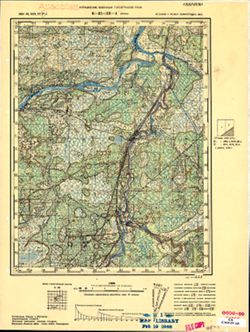
- Description:
- 1894
- Subject:
- Geographic Subject: Nizy, Topical Subject: Soviet Union, and Topical Subject: Maps
- Publisher:
- Управление военных топографов РККА
- Language:
- Russian
- Date Created:
- 1927
- Identifier:
- VAC9619-001846
- Genre:
- Topographic Maps and Military Maps
- Geographic Location:
- Coordinates: 59.167, 28, 59.333, 28.25
- Related URL:
- Download GeoTIFF: https://drive.google.com/open?id=1nHoJTx2yIRluGG2yLGI-d7mZA3xRz94z and Catalog URL: http://iucat.iu.edu/catalog/5020131
- Abstract:
- Modern area represented: Nizy, Russia
- Call Number:
- G7000 s50 .S68 sheet O-35-33-A
- Caption:
- Секретно
- City:
- Низы (Nizy)
- Copyright Holder:
- No Copyright - United States
- Country:
- Эстония (Estonia) and СССР (USSR)
- State/Province:
- Ленинградская область (Leningrad oblast) and РСФСР (RSFSR)
- Physical Description:
- Scale: 1:50,000
- Persistent URL:
- http://purl.dlib.indiana.edu/iudl/images/VAC9619/VAC9619-001846
- Provenance:
- Atlasblatt, M. I. Map Library, GS, RA, G000-30
-
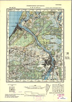
- Description:
- 1894
- Subject:
- Topical Subject: Soviet Union, Topical Subject: Maps, and Geographic Subject: Narva
- Publisher:
- Управление военных топографов РККА
- Language:
- Russian
- Date Created:
- 1926
- Identifier:
- VAC9619-000013
- Genre:
- Topographic Maps and Military Maps
- Geographic Location:
- Coordinates: 59.333, 28, 59.5, 28.25
- Related URL:
- Download GeoTIFF: https://drive.google.com/open?id=1vHEQND9C0ATLRufWnLeiyfSgVzxDsLgm and Catalog URL: http://iucat.iu.edu/catalog/5020131
- Abstract:
- Modern area represented: Narva, Estonia
- Call Number:
- G7000 s50 .S68 and zsheet O-35-21-C
- Caption:
- Секретно
- City:
- Нарва (Narva)
- Copyright Holder:
- No Copyright - United States
- Country:
- СССР (USSR) and Эстония (Estonia)
- State/Province:
- РСФСР (RSFSR) and Ленинградская область (Leningrad oblast)
- Physical Description:
- Scale: 1:50,000
- Persistent URL:
- http://purl.dlib.indiana.edu/iudl/images/VAC9619/VAC9619-000013
- Provenance:
- CIA Map Branch -- Received
-
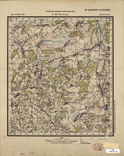
- Description:
- 1923
- Subject:
- Geographic Subject: Sukhary, Topical Subject: Maps, and Topical Subject: Soviet Union
- Publisher:
- Управление военных топографов РККА
- Language:
- Russian
- Date Created:
- 1924
- Identifier:
- VAC9619-001399
- Genre:
- Military Maps and Topographic Maps
- Geographic Location:
- Coordinates: 53.833, 30.5, 54, 30.75
- Related URL:
- Download GeoTIFF: https://drive.google.com/open?id=1dumq5lt2DDdAgLvoJZ0PcqZZMRlFZDzp and Catalog URL: http://iucat.iu.edu/catalog/5020131
- Abstract:
- Modern area represented: Sukhary, Mogilev oblast, Belarus
- Call Number:
- GM G7000 S50 .S68 N-36-74-A
- Caption:
- Не подлежит оглашению
- City:
- Сухари (Sukhary)
- Copyright Holder:
- No Copyright - United States
- Country:
- СССР (USSR)
- State/Province:
- Белорусская ССР (Byelorussian Soviet Socialist Republic)
- Physical Description:
- Scale: 1:50,000
- Persistent URL:
- http://purl.dlib.indiana.edu/iudl/images/VAC9619/VAC9619-001399
- Provenance:
- Library of Congress Geography & Map Division
-
- Description:
- 1923
- Subject:
- Geographic Subject: Ordat, Topical Subject: Maps, and Topical Subject: Soviet Union
- Publisher:
- Управление военных топографов РККА
- Language:
- Russian
- Date Created:
- 1924
- Identifier:
- VAC9619-001365
- Genre:
- Military Maps and Topographic Maps
- Geographic Location:
- Coordinates: 54, 30.5, 54.167, 30.75
- Related URL:
- Catalog URL: http://iucat.iu.edu/catalog/5020131 and Download GeoTIFF: https://drive.google.com/open?id=1jxqpK4WxNHZB4VFSzNUlIzIBL707SBkY
- Abstract:
- Modern area represented: Ordat, Mogilev oblast, Belarus
- Call Number:
- GM G7000 S50 .S68 N-36-62-B
- Caption:
- Не подлежит оглашению
- City:
- Ордат (Ordat)
- Copyright Holder:
- No Copyright - United States
- Country:
- СССР (USSR)
- State/Province:
- Белорусская ССР (Byelorussian Soviet Socialist Republic)
- Physical Description:
- Scale: 1:50,000
- Persistent URL:
- http://purl.dlib.indiana.edu/iudl/images/VAC9619/VAC9619-001365
- Provenance:
- M. I. Map Library, Reichsamt für Landesaufnahme, Kartensammlung
-
- Description:
- 1921
- Subject:
- Geographic Subject: Lyubavichi, Topical Subject: Maps, and Topical Subject: Soviet Union
- Publisher:
- Управление военных топографов РККА
- Language:
- Russian
- Date Created:
- 1923
- Identifier:
- VAC9619-001296
- Genre:
- Military Maps and Topographic Maps
- Geographic Location:
- Coordinates: 54.667, 30.75, 54.833, 31
- Related URL:
- Catalog URL: http://iucat.iu.edu/catalog/5020131 and Download GeoTIFF: https://drive.google.com/open?id=1DUHZ-obrLs5hnBBEXBYjk2YGnXAUpK4z
- Abstract:
- Modern area represented: Lyubavichi, Smolensk oblast, Russia
- Call Number:
- GM G7000 S50 .S68 N-36-38-Г
- Caption:
- Не подлежит оглашению
- City:
- Любавичи (Lyubavichi)
- Copyright Holder:
- No Copyright - United States
- Country:
- СССР (USSR)
- State/Province:
- РСФСР (RSFSR), Смоленская область (Smolensk oblast), and Белорусская ССР (Byelorussian Soviet Socialist Republic)
- Physical Description:
- Scale: 1:50,000
- Persistent URL:
- http://purl.dlib.indiana.edu/iudl/images/VAC9619/VAC9619-001296
- Provenance:
- DMA Topographic Center, Army Map Service Library, OMAHA, Library of Congress Geography & Map Division
-
- Description:
- 1884
- Subject:
- Geographic Subject: Shyroke, Topical Subject: Soviet Union, and Topical Subject: Maps
- Publisher:
- Управление военных топографов РККА
- Language:
- Russian
- Date Created:
- 1916
- Identifier:
- VAC9619-001925
- Genre:
- Military Maps and Topographic Maps
- Geographic Location:
- Coordinates: 45.6667, 30, 46, 30.5
- Related URL:
- Download GeoTIFF: https://drive.google.com/open?id=1iPfmTs__rEimlzKp73T30v5fMa4py_Lz and Catalog URL: https://iucat.iu.edu/catalog/5020129
- Abstract:
- Modern area represented: Shyroke, Odessa oblast, Ukraine
- Call Number:
- G7000 s100 .S7 sheet L-36-73
- City:
- Кебабча (Kebabcha)
- Copyright Holder:
- No Copyright - United States
- State/Province:
- Бессарабия (Bessarabia)
- Physical Description:
- Scale: 1:100,000
- Persistent URL:
- http://purl.dlib.indiana.edu/iudl/images/VAC9619/VAC9619-001925
- Provenance:
- CIA Map Library
-
- Description:
- 1881
- Subject:
- Geographic Subject: Międzyrzec Podlaski, Topical Subject: Soviet Union, and Topical Subject: Maps
- Publisher:
- Управление военных топографов РККА
- Language:
- Russian
- Date Created:
- 1914
- Identifier:
- VAC9619-002738
- Genre:
- Topographic Maps and Military Maps
- Geographic Location:
- Coordinates: 51.667, 22.5, 52, 23
- Related URL:
- Catalog URL: https://iucat.iu.edu/catalog/5020129 and Download GeoTIFF: https://drive.google.com/file/d/1HRydnkILuQSo7gGn8bUUuz4QFgo4aNTn/view?usp=sharing
- Abstract:
- Modern area represented: Międzyrzec Podlaski, Lublin province, Poland
- Call Number:
- G7000 s100 .S7 sheet M-34-10
- City:
- Межиречье (Międzyrzec)
- Copyright Holder:
- No Copyright - United States
- Country:
- Польша (Poland)
- Physical Description:
- Scale: 1:100,000
- Persistent URL:
- http://purl.dlib.indiana.edu/iudl/images/VAC9619/VAC9619-002738
- Provenance:
- CIA Map Library
-
- Description:
- 1894
- Subject:
- Topical Subject: Maps, Topical Subject: Soviet Union, and Geographic Subject: Šilutė
- Publisher:
- Управление военных топографов РККА
- Language:
- Russian
- Date Created:
- 1912
- Identifier:
- VAC9619-003899
- Genre:
- Military Maps and Topographic Maps
- Geographic Location:
- Coordinates: 55.333, 21, 55.667, 21.5
- Related URL:
- Download GeoTIFF: https://drive.google.com/file/d/1IHHnxhC0ySuJTtWCJ48iYBtPYIwl60II/view?usp=sharing and Catalog URL: https://iucat.iu.edu/catalog/5020129
- Abstract:
- Modern area represented: Šilutė, Klaipėda County, Lithuania
- Call Number:
- G7000 s100 .S7 sheet N-34-19
- City:
- Шилутэ (Šilutė)
- Copyright Holder:
- No Copyright - United States
- Country:
- Литва (Lithuania)
- Physical Description:
- Scale: 1:100,000
- Persistent URL:
- http://purl.dlib.indiana.edu/iudl/images/VAC9619/VAC9619-003899
- Provenance:
- Army Map Service Library, Library of Congress G & M Division, Geographic Names Branch
-
- Description:
- 1884
- Subject:
- Geographic Subject: Garwolin, Topical Subject: Maps, and Topical Subject: Soviet Union
- Publisher:
- Управление военных топографов РККА
- Language:
- Russian
- Date Created:
- 1911
- Identifier:
- VAC9619-002734
- Genre:
- Topographic Maps and Military Maps
- Geographic Location:
- Coordinates: 51.667, 21.5, 52, 22
- Related URL:
- Catalog URL: https://iucat.iu.edu/catalog/5020129 and Download GeoTIFF: https://drive.google.com/file/d/1O6NBDeRI7ydg09tm-zOfLmSsczootWdF/view?usp=sharing
- Abstract:
- Modern area represented: Garwolin, Mazovia province, Poland
- Call Number:
- G7000 s100 .S7 sheet M-34-8
- City:
- Гарволин (Garwolin)
- Copyright Holder:
- No Copyright - United States
- Country:
- Польша (Poland)
- Physical Description:
- Scale: 1:100,000
- Persistent URL:
- http://purl.dlib.indiana.edu/iudl/images/VAC9619/VAC9619-002734
- Provenance:
- CIA Map Library
-
- Description:
- 1873
- Subject:
- Topical Subject: Maps, Geographic Subject: Latvia, and Topical Subject: Soviet Union
- Publisher:
- Управление военных топографов РККА
- Language:
- Russian
- Date Created:
- 1911
- Identifier:
- VAC9619-001742
- Genre:
- Topographic Maps and Military Maps
- Geographic Location:
- Coordinates: 56.5, 23, 56.667, 23.25
- Related URL:
- Catalog URL: http://iucat.iu.edu/catalog/5020131 and Download GeoTIFF: https://drive.google.com/open?id=1YMeeAM99JchcvN2yFK5eKaTZIf34nzsP
- Abstract:
- Modern area represented: Latvia
- Call Number:
- G7000 s50 .S68 sheet 34-131-A
- City:
- Яунсэсавас (Jaunszsavas)
- Copyright Holder:
- No Copyright - United States
- Country:
- Латвия (Latvia)
- Physical Description:
- Scale: 1:50,000
- Persistent URL:
- http://purl.dlib.indiana.edu/iudl/images/VAC9619/VAC9619-001742
- Provenance:
- CIA Map Branch -- Received
-
- Description:
- 1873
- Subject:
- Topical Subject: Maps, Geographic Subject: Garoza, and Topical Subject: Soviet Union
- Publisher:
- Управление военных топографов РККА
- Language:
- Russian
- Date Created:
- 1910
- Identifier:
- VAC9619-001749
- Genre:
- Topographic Maps and Military Maps
- Geographic Location:
- Coordinates: 56.5, 23.75, 56.667, 24
- Related URL:
- Download GeoTIFF: https://drive.google.com/open?id=10B4hyXCE4Ayo3oLt_me58NC4INrqQ6c- and Catalog URL: http://iucat.iu.edu/catalog/5020131
- Abstract:
- Modern area represented: Garoza, Ozolnieki municipality, Latvia
- Call Number:
- G7000 s50 .S68 sheet O-34-132-B
- City:
- Гароза (Garoza)
- Copyright Holder:
- No Copyright - United States
- Country:
- Латвия (Latvia)
- Physical Description:
- Scale: 1:50,000
- Persistent URL:
- http://purl.dlib.indiana.edu/iudl/images/VAC9619/VAC9619-001749
- Provenance:
- M. I. Map Library, GS, RA
-
- Description:
- 1894
- Subject:
- Topical Subject: Maps, Geographic Subject: Klaipėda, and Topical Subject: Soviet Union
- Publisher:
- Управление военных топографов РККА
- Language:
- Russian
- Date Created:
- 1910
- Identifier:
- VAC9619-003895
- Genre:
- Military Maps and Topographic Maps
- Geographic Location:
- Coordinates: 55.667, 21, 56, 21.5
- Related URL:
- Download GeoTIFF: https://drive.google.com/file/d/1Ww8-LLBsEzHcY-lFDTijchVNj8HHcVlj/view?usp=sharing and Catalog URL: https://iucat.iu.edu/catalog/5020129
- Abstract:
- Modern area represented: Klaipėda, Klaipėda county, Lithuania
- Call Number:
- G7000 s100 .S7 sheet N-34-7
- City:
- Клайпеда (Klaipėda)
- Copyright Holder:
- No Copyright - United States
- Country:
- Литва (Lithuania)
- Physical Description:
- Scale: 1:100,000
- Persistent URL:
- http://purl.dlib.indiana.edu/iudl/images/VAC9619/VAC9619-003895
- Provenance:
- DMA Topographic Center, Army Map Service Library
-
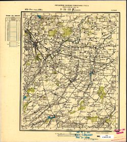
- Description:
- 1873
- Subject:
- Topical Subject: Maps, Topical Subject: Soviet Union, and Geographic Subject: Dobele
- Publisher:
- Управление военных топографов РККА
- Language:
- Russian
- Date Created:
- 1910
- Identifier:
- VAC9619-001743
- Genre:
- Military Maps and Topographic Maps
- Geographic Location:
- Coordinates: 56.5, 23.25, 56.667, 23.5
- Related URL:
- Catalog URL: http://iucat.iu.edu/catalog/5020131 and Download GeoTIFF: https://drive.google.com/open?id=1FQRFs59mPpUQVrhdNMknrOLxNL4sCF1A
- Abstract:
- Modern area represented: Dobele, Zemgale region, Latvia
- Call Number:
- G7000 s50 .S68 sheet O-34-131-B
- City:
- Добэлэ (Dobele)
- Copyright Holder:
- No Copyright - United States
- Country:
- Латвия (Latvia)
- Physical Description:
- Scale: 1:50,000
- Persistent URL:
- http://purl.dlib.indiana.edu/iudl/images/VAC9619/VAC9619-001743
- Provenance:
- M. I. Map Library, GS, RA
-
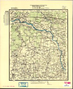
- Description:
- 1873
- Subject:
- Geographic Subject: Garoza, Topical Subject: Maps, and Topical Subject: Soviet Union
- Publisher:
- Управление военных топографов РККА
- Language:
- Russian
- Date Created:
- 1910
- Identifier:
- VAC9619-001750
- Genre:
- Topographic Maps and Military Maps
- Geographic Location:
- Coordinates: 56.5, 23.75, 56.667, 24
- Related URL:
- Download GeoTIFF: https://drive.google.com/file/d/1MK1IhoMCQkmpyy6mbsiYISQoE0tEs34C/view?usp=sharing and Catalog URL: http://iucat.iu.edu/catalog/5020131
- Abstract:
- Modern area represented: Garoza, Ozolnieki municipality, Latvia
- Call Number:
- G7000 s50 .S68 sheet O-34-132-B
- City:
- Гароза (Garoza)
- Copyright Holder:
- No Copyright - United States
- Country:
- Латвия (Latvia)
- Physical Description:
- Scale: 1:50,000
- Persistent URL:
- http://purl.dlib.indiana.edu/iudl/images/VAC9619/VAC9619-001750
- Provenance:
- M. I. Map Library, FEM Austria
-
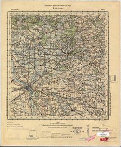
- Description:
- 1900
- Subject:
- Topical Subject: Soviet Union, Geographic Subject: Kalisz, and Topical Subject: Maps
- Publisher:
- Управление военных топографов РККА
- Language:
- Russian
- Date Created:
- 1904
- Identifier:
- VAC9619-002719
- Genre:
- Military Maps and Topographic Maps
- Geographic Location:
- Coordinates: 51.667, 18, 52, 18.5
- Related URL:
- Download GeoTIFF: https://drive.google.com/file/d/13dLPHy_1H2bOo5hON50kKniZuPrKzI1p/view?usp=sharing and Catalog URL: https://iucat.iu.edu/catalog/5020129
- Abstract:
- Modern area represented: Kalisz, Greater Poland province, Poland
- Call Number:
- G7000 s100 .S7 sheet M-34-1
- City:
- Калиш (Kalisz)
- Copyright Holder:
- No Copyright - United States
- Country:
- Польша (Poland)
- Physical Description:
- Scale: 1:100,000
- Persistent URL:
- http://purl.dlib.indiana.edu/iudl/images/VAC9619/VAC9619-002719
- Provenance:
- CIA Map Library
-
- Description:
- 1901
- Subject:
- Geographic Subject: Uniejów, Topical Subject: Maps, and Topical Subject: Soviet Union
- Publisher:
- Управление военных топографов РККА
- Language:
- Russian
- Date Created:
- 1903
- Identifier:
- VAC9619-002721
- Genre:
- Military Maps and Topographic Maps
- Geographic Location:
- Coordinates: 51.667, 18.5, 52, 19
- Related URL:
- Catalog URL: https://iucat.iu.edu/catalog/5020129 and Download GeoTIFF: https://drive.google.com/file/d/1Z2XASPxOuBLm2jcy8DqA1qtSk23vmVjw/view?usp=sharing
- Abstract:
- Modern area represented: Uniejów, Łódź province, Poland
- Call Number:
- G7000 s100 .S7 sheet M-34-2
- City:
- Унейув (Uniejów)
- Copyright Holder:
- No Copyright - United States
- Country:
- Польша (Poland)
- Physical Description:
- Scale: 1:100,000
- Persistent URL:
- http://purl.dlib.indiana.edu/iudl/images/VAC9619/VAC9619-002721
- Provenance:
- CIA Map Library
-
- Description:
- 1890
- Subject:
- Geographic Subject: Brzeziny, Topical Subject: Maps, and Topical Subject: Soviet Union
- Publisher:
- Управление военных топографов РККА
- Language:
- Russian
- Date Created:
- 1902
- Identifier:
- VAC9619-002725
- Genre:
- Military Maps and Topographic Maps
- Geographic Location:
- Coordinates: 51.667, 19.5, 52, 20
- Related URL:
- Catalog URL: https://iucat.iu.edu/catalog/5020129 and Download GeoTIFF: https://drive.google.com/file/d/15lz3-vA1V0dBg-vTebutySku1NEiAaeM/view?usp=sharing
- Abstract:
- Modern area represented: Brzeziny, Łódź province, Poland
- Call Number:
- G7000 s100 .S7 sheet M-34-4
- City:
- Бжезины (Brzeziny)
- Copyright Holder:
- No Copyright - United States
- Country:
- Польша (Poland)
- Physical Description:
- Scale: 1:100,000
- Persistent URL:
- http://purl.dlib.indiana.edu/iudl/images/VAC9619/VAC9619-002725
- Provenance:
- CIA Map Library
-
- Description:
- 1901
- Subject:
- Topical Subject: Soviet Union, Geographic Subject: Łódź, and Topical Subject: Maps
- Publisher:
- Управление военных топографов РККА
- Language:
- Russian
- Date Created:
- 1902
- Identifier:
- VAC9619-002723
- Genre:
- Topographic Maps and Military Maps
- Geographic Location:
- Coordinates: 51.667, 19, 52, 19.5
- Related URL:
- Download GeoTIFF: https://drive.google.com/file/d/1Mp3idgnooJzivr0VRYBpRjKnY9HgZlRG/view?usp=sharing and Catalog URL: https://iucat.iu.edu/catalog/5020129
- Abstract:
- Modern area represented: Łódź, Łódź province, Poland
- Call Number:
- G7000 s100 .S7 sheet M-34-3
- City:
- Лодзь (Łódź)
- Copyright Holder:
- No Copyright - United States
- Country:
- Польша (Poland)
- Physical Description:
- Scale: 1:100,000
- Persistent URL:
- http://purl.dlib.indiana.edu/iudl/images/VAC9619/VAC9619-002723
- Provenance:
- CIA Map Library
-
- Description:
- 1899
- Subject:
- Topical Subject: Soviet Union, Geographic Subject: Pabianice, and Topical Subject: Maps
- Publisher:
- Управление военных топографов РККА
- Language:
- Russian
- Date Created:
- 1901
- Identifier:
- VAC9619-002747
- Genre:
- Military Maps and Topographic Maps
- Geographic Location:
- Coordinates: 51.333, 19, 51.667, 19.5
- Related URL:
- Download GeoTIFF: https://drive.google.com/file/d/1F2jCRCRCFkmivVRaW8AfwwH3viu35wS1/view?usp=sharing and Catalog URL: https://iucat.iu.edu/catalog/5020129
- Abstract:
- Modern area represented: Pabianice, Łódź province, Poland
- Call Number:
- G7000 s100 .S7 sheet M-34-15
- City:
- Пабянице (Pabianice)
- Copyright Holder:
- No Copyright - United States
- Country:
- Польша (Poland)
- Physical Description:
- Scale: 1:100,000
- Persistent URL:
- http://purl.dlib.indiana.edu/iudl/images/VAC9619/VAC9619-002747
- Provenance:
- CIA Map Library
-
- Description:
- 1899
- Subject:
- Topical Subject: Soviet Union, Geographic Subject: Zduńska Wola, and Topical Subject: Maps
- Publisher:
- Управление военных топографов РККА
- Language:
- Russian
- Date Created:
- 1901
- Identifier:
- VAC9619-002745
- Genre:
- Military Maps and Topographic Maps
- Geographic Location:
- Coordinates: 51.333, 18.5, 51.667, 19
- Related URL:
- Download GeoTIFF: https://drive.google.com/file/d/1iDdCe8NMRim_cfPF8V1QFbtWePJh5N63/view?usp=sharing and Catalog URL: https://iucat.iu.edu/catalog/5020129
- Abstract:
- Modern area represented: Zduńska Wola, Łódź province, Poland
- Call Number:
- G7000 s100 .S7 sheet M-34-14
- City:
- Здуньска Воля (Zduńska Wola)
- Copyright Holder:
- No Copyright - United States
- Country:
- Польша (Poland)
- Physical Description:
- Scale: 1:100,000
- Persistent URL:
- http://purl.dlib.indiana.edu/iudl/images/VAC9619/VAC9619-002745
- Provenance:
- CIA Map Library
-
- Description:
- 1891
- Subject:
- Topical Subject: Soviet Union, Geographic Subject: Piotrków Trybunalski, and Topical Subject: Maps
- Publisher:
- Управление военных топографов РККА
- Language:
- Russian
- Date Created:
- 1901
- Identifier:
- VAC9619-002749
- Genre:
- Topographic Maps and Military Maps
- Geographic Location:
- Coordinates: 51.333, 19.5, 51.667, 20
- Related URL:
- Download GeoTIFF: https://drive.google.com/file/d/14ONzOcmLa3MBr_YV5eVDodlf1K31KL6Z/view?usp=sharing and Catalog URL: https://iucat.iu.edu/catalog/5020129
- Abstract:
- Modern area represented: Piotrków Trybunalski, Łódź province, Poland
- Call Number:
- G7000 s100 .S7 sheet M-34-16
- City:
- Пиотркув (Piotrków)
- Copyright Holder:
- No Copyright - United States
- Country:
- Польша (Poland)
- Physical Description:
- Scale: 1:100,000
- Persistent URL:
- http://purl.dlib.indiana.edu/iudl/images/VAC9619/VAC9619-002749
- Provenance:
- CIA Map Library
-
- Description:
- 1889
- Subject:
- Geographic Subject: Wieluń, Topical Subject: Soviet Union, and Topical Subject: Maps
- Publisher:
- Управление военных топографов РККА
- Language:
- Russian
- Date Created:
- 1900
- Identifier:
- VAC9619-002764
- Genre:
- Military Maps and Topographic Maps
- Geographic Location:
- Coordinates: 51, 18.5, 51.333, 19
- Related URL:
- Download GeoTIFF: https://drive.google.com/file/d/1XZ9grC_wlZBMQgyiAbRR4AzZaHUA6PNs/view?usp=sharing and Catalog URL: https://iucat.iu.edu/catalog/5020129
- Abstract:
- Modern area represented: Wieluń, Łódź province, Poland
- Call Number:
- G7000 s100 .S7 sheet M-34-26
- City:
- Велюнь (Wieluń)
- Copyright Holder:
- No Copyright - United States
- Country:
- Польша (Poland) and Германия (Germany)
- Physical Description:
- Scale: 1:100,000
- Persistent URL:
- http://purl.dlib.indiana.edu/iudl/images/VAC9619/VAC9619-002764
- Provenance:
- CIA Map Library, Geogr. Seminar Stuttgart
-
- Description:
- 1893
- Subject:
- Geographic Subject: Gmina Przedbórz, Topical Subject: Maps, and Topical Subject: Soviet Union
- Publisher:
- Управление военных топографов РККА
- Language:
- Russian
- Date Created:
- 1899
- Identifier:
- VAC9619-002768
- Genre:
- Military Maps and Topographic Maps
- Geographic Location:
- Coordinates: 51, 19.5, 51.333, 20
- Related URL:
- Download GeoTIFF: https://drive.google.com/file/d/1M_2ykSCyIgEOuJq47FQzQExuJVUKHDPI/view?usp=sharing and Catalog URL: https://iucat.iu.edu/catalog/5020129
- Abstract:
- Modern area represented: Gmina Przedbórz, Łódź province, Poland
- Call Number:
- G7000 s100 .S7 sheet M-34-28
- City:
- Пшедбуж (Przedbórz)
- Copyright Holder:
- No Copyright - United States
- Country:
- Польша (Poland)
- Physical Description:
- Scale: 1:100,000
- Persistent URL:
- http://purl.dlib.indiana.edu/iudl/images/VAC9619/VAC9619-002768
- Provenance:
- CIA Map Library
-
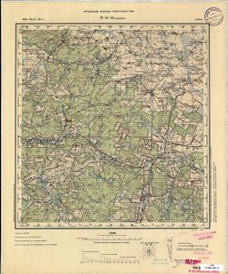
- Description:
- 1894
- Subject:
- Topical Subject: Soviet Union, Geographic Subject: Szydłowiec, and Topical Subject: Maps
- Publisher:
- Управление военных топографов РККА
- Language:
- Russian
- Date Created:
- 1898
- Identifier:
- VAC9619-002772
- Genre:
- Military Maps and Topographic Maps
- Geographic Location:
- Coordinates: 51, 20.5, 51.333, 21
- Related URL:
- Catalog URL: https://iucat.iu.edu/catalog/5020129 and Download GeoTIFF: https://drive.google.com/file/d/1Yr70Rfx37tnwSAVczZeNLS7M3LtaXmlX/view?usp=sharing
- Abstract:
- Modern area represented: Szydłowiec, Mazovia province, Poland
- Call Number:
- G7000 s100 .S7 sheet M-34-30
- City:
- Шидловец (Szydłowiec)
- Copyright Holder:
- No Copyright - United States
- Country:
- Польша (Poland)
- Physical Description:
- Scale: 1:100,000
- Persistent URL:
- http://purl.dlib.indiana.edu/iudl/images/VAC9619/VAC9619-002772
- Provenance:
- CIA Map Library, Geogr. Seminar Stuttgart
-
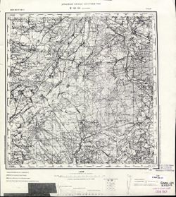
- Description:
- 1894
- Subject:
- Topical Subject: Maps, Geographic Subject: Tarnobrzeg, and Topical Subject: Soviet Union
- Publisher:
- Управление военных топографов РККА
- Language:
- Russian
- Date Created:
- 1898
- Identifier:
- VAC9619-002857
- Genre:
- Topographic Maps and Military Maps
- Geographic Location:
- Coordinates: 50.333, 21.5, 50.667, 22
- Related URL:
- Catalog URL: https://iucat.iu.edu/catalog/5020129 and Download GeoTIFF: https://drive.google.com/file/d/1k5A6_QCVcQAaX7ALA4Azdex9BTzfps-5/view?usp=sharing
- Abstract:
- Modern area represented: Tarnobrzeg, Subcarpathian province, Poland
- Call Number:
- G7000 s100 .S7 sheet M-34-56
- City:
- Тарнобжег (Tarnobrzeg)
- Copyright Holder:
- No Copyright - United States
- Country:
- Польша (Poland)
- Physical Description:
- Scale: 1:100,000
- Persistent URL:
- http://purl.dlib.indiana.edu/iudl/images/VAC9619/VAC9619-002857
- Provenance:
- CIA Map Library
-
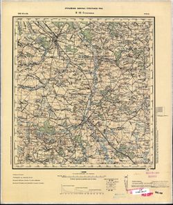
- Description:
- 1888
- Subject:
- Geographic Subject: Skierniewice, Topical Subject: Soviet Union, and Topical Subject: Maps
- Publisher:
- Управление военных топографов РККА
- Language:
- Russian
- Date Created:
- 1898
- Identifier:
- VAC9619-002727
- Genre:
- Topographic Maps and Military Maps
- Geographic Location:
- Coordinates: 51.667, 20, 52, 20.5
- Related URL:
- Download GeoTIFF: https://drive.google.com/file/d/1d93X-UrVxpB-PPGR_2nN2lFdJaYNAI9l/view?usp=sharing and Catalog URL: https://iucat.iu.edu/catalog/5020129
- Abstract:
- Modern area represented: Skierniewice, Łódź province, Poland
- Call Number:
- G7000 s100 .S7 sheet M-34-5
- City:
- Скерневицэ (Skierniewice)
- Copyright Holder:
- No Copyright - United States
- Country:
- Польша (Poland)
- Physical Description:
- Scale: 1:100,000
- Persistent URL:
- http://purl.dlib.indiana.edu/iudl/images/VAC9619/VAC9619-002727
- Provenance:
- CIA Map Library
-
- Description:
- 1892
- Subject:
- Topical Subject: Maps, Topical Subject: Soviet Union, and Geographic Subject: Krakės
- Publisher:
- Управление военных топографов РККА
- Language:
- Russian
- Date Created:
- 1898
- Identifier:
- VAC9619-003904
- Genre:
- Topographic Maps and Military Maps
- Geographic Location:
- Coordinates: 55.333, 23.5, 55.667, 24
- Related URL:
- Catalog URL: https://iucat.iu.edu/catalog/5020129 and Download GeoTIFF: https://drive.google.com/file/d/1eP8FUfuMjxQiuhhZ5NVjCmhrcArwapQv/view?usp=sharing
- Abstract:
- Modern area represented: Krakės, Lithuania
- Call Number:
- G7000 s100 .S7 sheet N-34-24
- City:
- Кроки (Kroki)
- Copyright Holder:
- No Copyright - United States
- Country:
- Литва (Lithuania)
- Physical Description:
- Scale: 1:100,000
- Persistent URL:
- http://purl.dlib.indiana.edu/iudl/images/VAC9619/VAC9619-003904
- Provenance:
- DMA Topographic Center, Army Map Service Library, Auswärtiges Amt. Geographischer Dienst
-
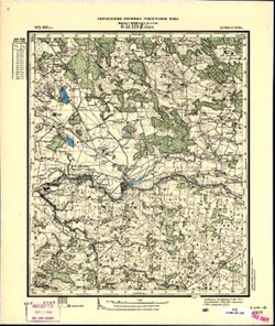
- Description:
- 1875
- Subject:
- Geographic Subject: Ezere, Topical Subject: Maps, and Topical Subject: Soviet Union
- Publisher:
- Управление военных топографов РККА
- Language:
- Russian
- Date Created:
- 1897
- Identifier:
- VAC9619-001739
- Genre:
- Topographic Maps and Military Maps
- Geographic Location:
- Coordinates: 56.333, 22.25, 56.5, 22.5
- Related URL:
- Download GeoTIFF: https://drive.google.com/open?id=1AO8npJGWadw_B5dNv1KXCXPz7ERhNbt6 and Catalog URL: http://iucat.iu.edu/catalog/5020131
- Abstract:
- Modern area represented: Ezere, Latvia
- Call Number:
- G7000 s50 .S68 sheet O-34-129-D
- City:
- Эзерэ (Ezere)
- Copyright Holder:
- No Copyright - United States
- Country:
- Литва (Lithuania) and Латвия (Latvia)
- Physical Description:
- Scale: 1:50,000
- Persistent URL:
- http://purl.dlib.indiana.edu/iudl/images/VAC9619/VAC9619-001739
- Provenance:
- CIA Map Branch -- Received
-
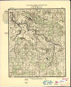
- Description:
- 1896
- Subject:
- Topical Subject: Maps, Topical Subject: Soviet Union, and Geographic Subject: Lithuania
- Publisher:
- Управление военных топографов РККА
- Language:
- Russian
- Date Created:
- 1897
- Identifier:
- VAC9619-001757
- Genre:
- Military Maps and Topographic Maps
- Geographic Location:
- Coordinates: 56.167, 22.25, 56.333, 22.5
- Related URL:
- Catalog URL: http://iucat.iu.edu/catalog/5020131 and Download GeoTIFF: https://drive.google.com/open?id=1y0VI1KA5VHDdq8l92FpQsHS5r_DMT6sV
- Abstract:
- Modern area represented: Lithuania
- Call Number:
- G7000 s50 .S68 sheet O-34-141-Б
- City:
- Тыркшлэ (Tyrkshle)
- Copyright Holder:
- No Copyright - United States
- Country:
- Литва (Lithuania)
- Physical Description:
- Scale: 1:50,000
- Persistent URL:
- http://purl.dlib.indiana.edu/iudl/images/VAC9619/VAC9619-001757
- Provenance:
- M. I. Map Library, GS, RA
-
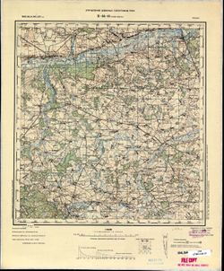
- Description:
- 1885
- Subject:
- Topical Subject: Soviet Union, Topical Subject: Maps, and Geographic Subject: Nowe Miasto nad Pilicą
- Publisher:
- Управление военных топографов РККА
- Language:
- Russian
- Date Created:
- 1897
- Identifier:
- VAC9619-002752
- Genre:
- Topographic Maps and Military Maps
- Geographic Location:
- Coordinates: 51.333, 20.5, 51.667, 21
- Related URL:
- Download GeoTIFF: https://drive.google.com/file/d/1NXYWFqjzav-vrYvT366Qis_7jG4g2Ydq/view?usp=sharing and Catalog URL: https://iucat.iu.edu/catalog/5020129
- Abstract:
- Modern area represented: Nowe Miasto nad Pilicą, Mazovia province, Poland
- Call Number:
- G7000 s100 .S7 sheet M-34-18
- City:
- Новэ Място (Nowe Miasto)
- Copyright Holder:
- No Copyright - United States
- Country:
- Польша (Poland)
- Physical Description:
- Scale: 1:100,000
- Persistent URL:
- http://purl.dlib.indiana.edu/iudl/images/VAC9619/VAC9619-002752
- Provenance:
- CIA Map Library
-
- Description:
- 1894
- Subject:
- Geographic Subject: Târgu Frumos, Topical Subject: Maps, and Topical Subject: Soviet Union
- Publisher:
- Управление военных топографов РККА
- Language:
- Russian
- Date Created:
- 1895
- Identifier:
- VAC9619-001513
- Genre:
- Topographic Maps and Military Maps
- Geographic Location:
- Coordinates: 47, 27, 47.3333, 27.5
- Related URL:
- Catalog URL: https://iucat.iu.edu/catalog/5020129 and Download GeoTIFF: https://drive.google.com/open?id=1LC0U4QZ-lg_KQMIgNHXryuR7uKbf-_vN
- Abstract:
- Modern area represented: Târgu Frumos, Iași county, Romania
- Call Number:
- G7000 s100 .S7 sheet L-35-31
- City:
- Тыргул Фрумос (Târgu Frumos)
- Copyright Holder:
- No Copyright - United States
- Country:
- Румыния (Romania)
- Physical Description:
- Scale: 1:100,000
- Persistent URL:
- http://purl.dlib.indiana.edu/iudl/images/VAC9619/VAC9619-001513
- Provenance:
- DMA Topographic Center, Army Map Service Library, Library of Congress Geography & Map Division
-
- Description:
- 1892
- Subject:
- Geographic Subject: Raseiniai, Topical Subject: Soviet Union, and Topical Subject: Maps
- Publisher:
- Управление военных топографов РККА
- Language:
- Russian
- Date Created:
- 1894
- Identifier:
- VAC9619-003903
- Genre:
- Topographic Maps and Military Maps
- Geographic Location:
- Coordinates: 55.333, 23, 55.667, 23.5
- Related URL:
- Catalog URL: https://iucat.iu.edu/catalog/5020129 and Download GeoTIFF: https://drive.google.com/file/d/1tmXQFHBkCfSkDM6lzkHUehMJPLaPBPTe/view?usp=sharing
- Abstract:
- Modern area represented: Raseiniai, Kaunas, Lithuania
- Call Number:
- G7000 s100 .S7 sheet N-34-23
- City:
- Россиены (Raseiniai)
- Copyright Holder:
- No Copyright - United States
- Country:
- Литва (Lithuania)
- Physical Description:
- Scale: 1:100,000
- Persistent URL:
- http://purl.dlib.indiana.edu/iudl/images/VAC9619/VAC9619-003903
- Provenance:
- DMA Topographic Center, Army Map Service Library
-
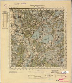
- Description:
- 1887
- Subject:
- Topical Subject: Maps, Geographic Subject: Włodawa, and Topical Subject: Soviet Union
- Publisher:
- Управление военных топографов РККА
- Language:
- Russian
- Date Created:
- 1892
- Identifier:
- VAC9619-002761
- Genre:
- Military Maps and Topographic Maps
- Geographic Location:
- Coordinates: 51.333, 23.5, 51.667, 24
- Related URL:
- Download GeoTIFF: https://drive.google.com/file/d/1-hT4WX0pB3JxbFGLgcy8d5WdCOYjRZct/view?usp=sharing and Catalog URL: https://iucat.iu.edu/catalog/5020129
- Abstract:
- Modern area represented: Włodawa, Lublin province, Poland
- Call Number:
- G7000 s100 .S7 sheet M-34-24
- City:
- Влодава (Włodawa)
- Copyright Holder:
- No Copyright - United States
- Country:
- Польша (Poland)
- Physical Description:
- Scale: 1:100,000
- Persistent URL:
- http://purl.dlib.indiana.edu/iudl/images/VAC9619/VAC9619-002761
- Provenance:
- CIA Map Library, GS, RA, Geographisches Institut der Universität Berlin
-
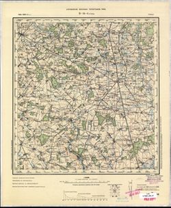
- Description:
- 1885
- Subject:
- Geographic Subject: Grójec, Topical Subject: Maps, and Topical Subject: Soviet Union
- Publisher:
- Управление военных топографов РККА
- Language:
- Russian
- Date Created:
- 1891
- Identifier:
- VAC9619-002729
- Genre:
- Topographic Maps and Military Maps
- Geographic Location:
- Coordinates: 51.667, 20.5, 52, 21
- Related URL:
- Download GeoTIFF: https://drive.google.com/file/d/1p3dH14D5e4ldwbMazt_iZ3bCF1aS8mw-/view?usp=sharing and Catalog URL: https://iucat.iu.edu/catalog/5020129
- Abstract:
- Modern area represented: Grójec, Mazovia province, Poland
- Call Number:
- G7000 s100 .S7 sheet M-34-6
- City:
- Груйец (Grójec)
- Copyright Holder:
- No Copyright - United States
- Country:
- Польша (Poland)
- Physical Description:
- Scale: 1:100,000
- Persistent URL:
- http://purl.dlib.indiana.edu/iudl/images/VAC9619/VAC9619-002729
- Provenance:
- CIA Map Library
-
- Description:
- 1885
- Subject:
- Topical Subject: Soviet Union, Geographic Subject: Raciąż Polka, and Topical Subject: Maps
- Publisher:
- Управление военных топографов РККА
- Language:
- Russian
- Date Created:
- 1888
- Identifier:
- VAC9619-003977
- Genre:
- Topographic Maps and Military Maps
- Geographic Location:
- Coordinates: 52.667, 20, 53, 20.5
- Related URL:
- Download GeoTIFF: https://drive.google.com/file/d/1C3iqxLwwbxcIaKffMdzNGy30BcFpr1JA/view?usp=sharing and Catalog URL: https://iucat.iu.edu/catalog/5020129
- Abstract:
- Modern area represented: Raciąż Polka, Masovian Voivodeship, Poland
- Call Number:
- G7000 s100 .S7 sheet N-34-113
- City:
- Рационж (Raciąż)
- Copyright Holder:
- No Copyright - United States
- Country:
- Польша (Poland)
- Physical Description:
- Scale: 1:100,000
- Persistent URL:
- http://purl.dlib.indiana.edu/iudl/images/VAC9619/VAC9619-003977
- Provenance:
- DMA Topographic Center, Army Map Service Library, Auswärtiges Amt. Geographischer Dienst
-
- Description:
- 1886
- Subject:
- Topical Subject: Soviet Union, Geographic Subject: Damachava, and Topical Subject: Maps
- Publisher:
- Управление военных топографов РККА
- Language:
- Russian
- Date Created:
- 1888
- Identifier:
- VAC9619-002742
- Genre:
- Topographic Maps and Military Maps
- Geographic Location:
- Coordinates: 51.667, 23.5, 52, 24
- Related URL:
- Download GeoTIFF: https://drive.google.com/file/d/1KNwkmvQ3WZvI3ctvyoKkWdGLKm9JS78Y/view?usp=sharing and Catalog URL: https://iucat.iu.edu/catalog/5020129
- Abstract:
- Modern area represented: Damachava, Brest oblast, Belarus
- Call Number:
- G7000 s100 .S7 sheet M-34-12
- City:
- Домачево (Damachava)
- Copyright Holder:
- No Copyright - United States
- Country:
- Польша (Poland)
- Physical Description:
- Scale: 1:100,000
- Persistent URL:
- http://purl.dlib.indiana.edu/iudl/images/VAC9619/VAC9619-002742
- Provenance:
- DMA Topographic Center, Army Map Service Library
-
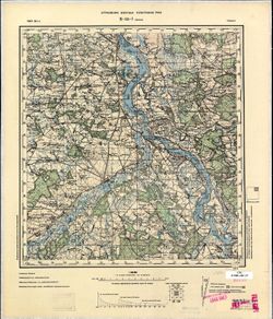
- Description:
- 1884
- Subject:
- Geographic Subject: Warka, Topical Subject: Soviet Union, and Topical Subject: Maps
- Publisher:
- Управление военных топографов РККА
- Language:
- Russian
- Date Created:
- 1885
- Identifier:
- VAC9619-002732
- Genre:
- Topographic Maps and Military Maps
- Geographic Location:
- Coordinates: 51.667, 21, 52, 21.5
- Related URL:
- Catalog URL: https://iucat.iu.edu/catalog/5020129 and Download GeoTIFF: https://drive.google.com/file/d/1dTJ8v70ZCaCYwKfIMpYrVA_dq2ninTlF/view?usp=sharing
- Abstract:
- Modern area represented: Warka, Mazovia province, Poland
- Call Number:
- G7000 s100 .S7 sheet M-34-7
- City:
- Варка (Warka)
- Copyright Holder:
- No Copyright - United States
- Country:
- Польша (Poland)
- Physical Description:
- Scale: 1:100,000
- Persistent URL:
- http://purl.dlib.indiana.edu/iudl/images/VAC9619/VAC9619-002732
- Provenance:
- CIA Map Library
-
- Description:
- 1927
- Subject:
- Topical Subject: Maps, Geographic Subject: Tyntsy, and Topical Subject: Soviet Union
- Publisher:
- Управление военных топографов РККА
- Language:
- Russian
- Identifier:
- VAC9619-002272
- Genre:
- Military Maps and Topographic Maps
- Geographic Location:
- Coordinates: 56.3333, 40.5, 56.6667, 41
- Related URL:
- Download GeoTIFF: https://drive.google.com/file/d/102D4vu1uG3HlLnspP2zmEKvXMZnMEkAk/view?usp=sharing and Catalog URL: https://iucat.iu.edu/catalog/5020129
- Abstract:
- Modern area represented: Тынцы (Tyntsy), Vladimirskaya oblast, Russia
- Call Number:
- G7000 s100 .S7 sheet O-37-130
- City:
- Тынцы (Tyntsy)
- Copyright Holder:
- No Copyright - United States
- Country:
- СССР (USSR)
- State/Province:
- РСФСР (RSFSR) and Ивановская область (Ivanovo oblast)
- Physical Description:
- Scale: 1:100,000
- Persistent URL:
- http://purl.dlib.indiana.edu/iudl/images/VAC9619/VAC9619-002272
- Provenance:
- DMA Topographic Center, Army Map Service Library
-

- Description:
- 1936
- Subject:
- Geographic Subject: Staryya Maksimavichy, Topical Subject: Maps, and Topical Subject: Soviet Union
- Publisher:
- Управление военных топографов РККА
- Language:
- Russian
- Identifier:
- VAC9619-000657
- Genre:
- Topographic Maps and Military Maps
- Geographic Location:
- Coordinates: 53.5, 29, 53.667, 29.25
- Related URL:
- Catalog URL: http://iucat.iu.edu/catalog/5020131 and Download GeoTIFF: https://drive.google.com/open?id=1A2R5hWH6Bx_hws0ztiyXWDWHVavpEUJz
- Abstract:
- Modern area represented: Staryya Maksimavichy, Mogilev oblast, Belarus
- Call Number:
- G7000 s50 .S68 sheet N-35-95-A
- Caption:
- Не подлежит оглашению,Captured map
- City:
- Старые Максимовичи (Starye Maksimovichi)
- Copyright Holder:
- No Copyright - United States
- Country:
- СССР (USSR)
- State/Province:
- Белорусская ССР (Byelorussian Soviet Socialist Republic)
- Physical Description:
- Scale: 1:50,000
- Persistent URL:
- http://purl.dlib.indiana.edu/iudl/images/VAC9619/VAC9619-000657
- Provenance:
- Army Map Service Library, OMAHA, Library of Congress Geography & Map Division
