
Search Constraints
You searched for:
Subject
Trees
Remove constraint Subject: Trees
Subject
Roads
Remove constraint Subject: Roads
« Previous |
1 - 100 of 687
|
Next »
Search Results
-
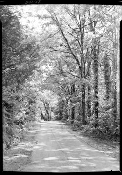
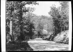
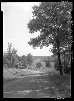
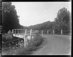
- Subject:
- Hanover College, Roads, and Trees
- Series:
- Hanover College
- Identifier:
- Hoh020.000.0014
- Geographic Location:
- Hanover (Jefferson County, Ind. : Township)
- Call Number:
- Hanover College, Item 14
- Physical Description:
- 5x7
- Persistent URL:
- http://purl.dlib.indiana.edu/iudl/lilly/hohenberger/Hoh020.000.0014
- Holding Location:
- Bloomington - Lilly Library
1200 E. Seventh St
Bloomington, IN 47405
Contact at liblilly@indiana.edu, 812-855-2452
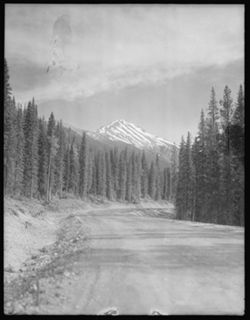
-
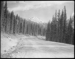
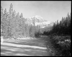
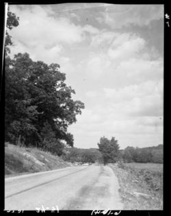
- Subject:
- Canada, 1955, Trees, Roads, and Mountains
- Series:
- Canada, 1955
- Date Created:
- 1905-05-08
- Identifier:
- Hoh013.002.0030
- Genre:
- Landscape photographs
- Geographic Location:
- Canada
- Call Number:
- Canada, 1955, 4x5, Item 30
- Physical Description:
- 4x5
- Persistent URL:
- http://purl.dlib.indiana.edu/iudl/lilly/hohenberger/Hoh013.002.0030
- Holding Location:
- Bloomington - Lilly Library
1200 E. Seventh St
Bloomington, IN 47405
Contact at liblilly@indiana.edu, 812-855-2452
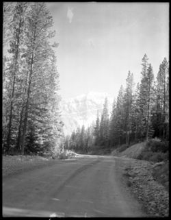
-
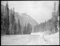
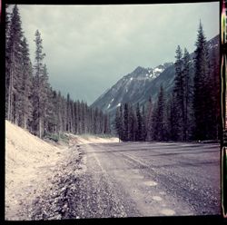
- Subject:
- Trees, Canada, 1955, Roads, and Mountains
- Series:
- Canada, 1955
- Date Created:
- 1905-05-08
- Identifier:
- Hoh013.002.0029
- Genre:
- Landscape photographs
- Geographic Location:
- Canada
- Call Number:
- Canada, 1955, 4x5, Item 29
- Physical Description:
- 4x5
- Persistent URL:
- http://purl.dlib.indiana.edu/iudl/lilly/hohenberger/Hoh013.002.0029
- Holding Location:
- Bloomington - Lilly Library
1200 E. Seventh St
Bloomington, IN 47405
Contact at liblilly@indiana.edu, 812-855-2452
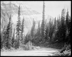
-
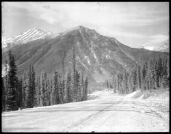
- Subject:
- Trees, Roads, Canada, 1955, and Mountains
- Series:
- Canada, 1955
- Date Created:
- 1905-05-08
- Identifier:
- Hoh013.002.0026
- Genre:
- Landscape photographs
- Geographic Location:
- Canada
- Call Number:
- Canada, 1955, 4x5, Item 26
- Physical Description:
- 4x5
- Persistent URL:
- http://purl.dlib.indiana.edu/iudl/lilly/hohenberger/Hoh013.002.0026
- Holding Location:
- Bloomington - Lilly Library
1200 E. Seventh St
Bloomington, IN 47405
Contact at liblilly@indiana.edu, 812-855-2452
-
- Subject:
- Roads, Trees, Canada, 1955, and Mountains
- Series:
- Canada, 1955
- Date Created:
- 1905-05-08
- Identifier:
- Hoh013.002.0024
- Genre:
- Landscape photographs
- Geographic Location:
- Canada
- Call Number:
- Canada, 1955, 4x5, Item 24
- Physical Description:
- 4x5
- Persistent URL:
- http://purl.dlib.indiana.edu/iudl/lilly/hohenberger/Hoh013.002.0024
- Holding Location:
- Bloomington - Lilly Library
1200 E. Seventh St
Bloomington, IN 47405
Contact at liblilly@indiana.edu, 812-855-2452
-
- Subject:
- Mountains, Canada, 1955, Trees, and Roads
- Series:
- Canada, 1955
- Date Created:
- 1905-05-08
- Identifier:
- Hoh013.002.0020
- Geographic Location:
- Canada
- Call Number:
- Canada, 1955, 4x5, Item 20
- Physical Description:
- 4x5
- Persistent URL:
- http://purl.dlib.indiana.edu/iudl/lilly/hohenberger/Hoh013.002.0020
- Holding Location:
- Bloomington - Lilly Library
1200 E. Seventh St
Bloomington, IN 47405
Contact at liblilly@indiana.edu, 812-855-2452
-
- Subject:
- Trees, Canada, 1955, Mountains, and Roads
- Series:
- Canada, 1955
- Date Created:
- 1905-05-08
- Identifier:
- Hoh013.002.0018
- Genre:
- Landscape photographs
- Geographic Location:
- Canada
- Call Number:
- Canada, 1955, 4x5, Item 18
- Physical Description:
- 4x5
- Persistent URL:
- http://purl.dlib.indiana.edu/iudl/lilly/hohenberger/Hoh013.002.0018
- Holding Location:
- Bloomington - Lilly Library
1200 E. Seventh St
Bloomington, IN 47405
Contact at liblilly@indiana.edu, 812-855-2452
-
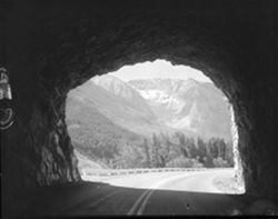
- Subject:
- Trees, Roads, Tunnels, Canada, 1955, and Mountains
- Series:
- Canada, 1955
- Date Created:
- 1905-05-08
- Identifier:
- Hoh013.002.0011
- Genre:
- Landscape photographs
- Geographic Location:
- Canada
- Call Number:
- Canada, 1955, 4x5, Item 11
- Physical Description:
- 4x5
- Persistent URL:
- http://purl.dlib.indiana.edu/iudl/lilly/hohenberger/Hoh013.002.0011
- Holding Location:
- Bloomington - Lilly Library
1200 E. Seventh St
Bloomington, IN 47405
Contact at liblilly@indiana.edu, 812-855-2452
-
- Subject:
- Mountains, Trees, Canada, 1955, and Roads
- Series:
- Canada, 1955
- Date Created:
- 1905-05-08
- Identifier:
- Hoh013.002.0003
- Genre:
- Landscape photographs
- Geographic Location:
- Canada
- Call Number:
- Canada, 1955, 4x5, Item 3
- Physical Description:
- 4x5
- Persistent URL:
- http://purl.dlib.indiana.edu/iudl/lilly/hohenberger/Hoh013.002.0003
- Holding Location:
- Bloomington - Lilly Library
1200 E. Seventh St
Bloomington, IN 47405
Contact at liblilly@indiana.edu, 812-855-2452
-
- Subject:
- Mountains, Trees, Canada, 1955, and Roads
- Series:
- Canada, 1955
- Date Created:
- 1905-05-08
- Identifier:
- Hoh013.001.0013.2
- Genre:
- Landscape photographs
- Geographic Location:
- Canada
- Call Number:
- Canada, 1955, Color transparencies 2x2, Item 13b
- Physical Description:
- 2x2
- Persistent URL:
- http://purl.dlib.indiana.edu/iudl/lilly/hohenberger/Hoh013.001.0013.2
- Holding Location:
- Bloomington - Lilly Library
1200 E. Seventh St
Bloomington, IN 47405
Contact at liblilly@indiana.edu, 812-855-2452
-
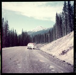
- Subject:
- Women, Automobiles, Mountains, Trees, Roads, and Canada, 1955
- Series:
- Canada, 1955
- Date Created:
- 1905-05-08
- Identifier:
- Hoh013.001.0013.1
- Genre:
- Landscape photographs
- Geographic Location:
- Canada
- Call Number:
- Canada, 1955, Color transparencies 2x2, Item 13a
- Physical Description:
- 2x2
- Persistent URL:
- http://purl.dlib.indiana.edu/iudl/lilly/hohenberger/Hoh013.001.0013.1
- Holding Location:
- Bloomington - Lilly Library
1200 E. Seventh St
Bloomington, IN 47405
Contact at liblilly@indiana.edu, 812-855-2452
-
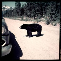
- Subject:
- Automobiles, Bears, Trees, Roads, Mountains, and Canada, 1955
- Series:
- Canada, 1955
- Date Created:
- 1905-05-08
- Identifier:
- Hoh013.001.0011.1
- Geographic Location:
- Canada
- Call Number:
- Canada, 1955, Color transparencies 2x2, Item 11a
- Physical Description:
- 2x2
- Persistent URL:
- http://purl.dlib.indiana.edu/iudl/lilly/hohenberger/Hoh013.001.0011.1
- Holding Location:
- Bloomington - Lilly Library
1200 E. Seventh St
Bloomington, IN 47405
Contact at liblilly@indiana.edu, 812-855-2452
-
- Subject:
- Trees, Roads, Fall foliage, and Brown County Color transparencies
- Series:
- Brown County Color transparencies
- Identifier:
- Hoh012.001.0016.2
- Geographic Location:
- Brown County (Ind.)
- Call Number:
- Brown County Color transparencies, 2x2, Item 16b
- Physical Description:
- 2x2
- Persistent URL:
- http://purl.dlib.indiana.edu/iudl/lilly/hohenberger/Hoh012.001.0016.2
- Holding Location:
- Bloomington - Lilly Library
1200 E. Seventh St
Bloomington, IN 47405
Contact at liblilly@indiana.edu, 812-855-2452
-
- Subject:
- Roads, Fall foliage, Trees, and Brown County Color transparencies
- Series:
- Brown County Color transparencies
- Identifier:
- Hoh012.001.0016.1
- Geographic Location:
- Brown County (Ind.)
- Call Number:
- Brown County Color transparencies, 2x2, Item 16a
- Physical Description:
- 2x2
- Persistent URL:
- http://purl.dlib.indiana.edu/iudl/lilly/hohenberger/Hoh012.001.0016.1
- Holding Location:
- Bloomington - Lilly Library
1200 E. Seventh St
Bloomington, IN 47405
Contact at liblilly@indiana.edu, 812-855-2452
-
- Subject:
- Fall foliage, Brown County Color transparencies, Roads, Scenic overlook, and Trees
- Series:
- Brown County Color transparencies
- Identifier:
- Hoh012.001.0014.2
- Geographic Location:
- Brown County (Ind.)
- Call Number:
- Brown County Color transparencies, 2x2, Item 14b
- Physical Description:
- 2x2
- Persistent URL:
- http://purl.dlib.indiana.edu/iudl/lilly/hohenberger/Hoh012.001.0014.2
- Holding Location:
- Bloomington - Lilly Library
1200 E. Seventh St
Bloomington, IN 47405
Contact at liblilly@indiana.edu, 812-855-2452
-
- Subject:
- Roads, Fall foliage, Trees, and Brown County Color transparencies
- Series:
- Brown County Color transparencies
- Identifier:
- Hoh012.001.0011.1
- Geographic Location:
- Brown County (Ind.)
- Call Number:
- Brown County Color transparencies, 2x2, Item 11a
- Physical Description:
- 2x2
- Persistent URL:
- http://purl.dlib.indiana.edu/iudl/lilly/hohenberger/Hoh012.001.0011.1
- Holding Location:
- Bloomington - Lilly Library
1200 E. Seventh St
Bloomington, IN 47405
Contact at liblilly@indiana.edu, 812-855-2452
-
- Subject:
- Fall foliage, Roads, Brown County Color transparencies, and Trees
- Series:
- Brown County Color transparencies
- Identifier:
- Hoh012.001.0010.2
- Geographic Location:
- Brown County (Ind.)
- Call Number:
- Brown County Color transparencies, 2x2, Item 10b
- Physical Description:
- 2x2
- Persistent URL:
- http://purl.dlib.indiana.edu/iudl/lilly/hohenberger/Hoh012.001.0010.2
- Holding Location:
- Bloomington - Lilly Library
1200 E. Seventh St
Bloomington, IN 47405
Contact at liblilly@indiana.edu, 812-855-2452
-
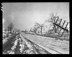
- Subject:
- Roads, Winter, Trees, Snow, and 8x10
- Series:
- 8x10
- Date Created:
- 1944-08-17
- Identifier:
- Hoh009.000.1172
- Genre:
- Landscape photographs
- Geographic Location:
- Washington (Brown County, Ind. : Township)
- Call Number:
- 8x10, Item 1172
- Physical Description:
- 8x10
- Persistent URL:
- http://purl.dlib.indiana.edu/iudl/lilly/hohenberger/Hoh009.000.1172
- Holding Location:
- Bloomington - Lilly Library
1200 E. Seventh St
Bloomington, IN 47405
Contact at liblilly@indiana.edu, 812-855-2452
-
- Subject:
- Pictured corporate name: Crown Hill Cemetery (Marion County, Ind.), Tombs & sepulchral monuments, Lawns, Roads, 8x10, and Trees
- Series:
- 8x10
- Date Created:
- 1927-05-26
- Identifier:
- Hoh009.000.1156
- Geographic Location:
- Indianapolis (Ind.)
- Call Number:
- 8x10, Item 1156
- Physical Description:
- 8x10
- Persistent URL:
- http://purl.dlib.indiana.edu/iudl/lilly/hohenberger/Hoh009.000.1156
- Holding Location:
- Bloomington - Lilly Library
1200 E. Seventh St
Bloomington, IN 47405
Contact at liblilly@indiana.edu, 812-855-2452
-
- Subject:
- Trees, 8x10, Roads, and Hills
- Series:
- 8x10
- Identifier:
- Hoh009.000.1111
- Geographic Location:
- Burke County (N.C.)
- Call Number:
- 8x10, Item 1111
- Physical Description:
- 8x10
- Persistent URL:
- http://purl.dlib.indiana.edu/iudl/lilly/hohenberger/Hoh009.000.1111
- Holding Location:
- Bloomington - Lilly Library
1200 E. Seventh St
Bloomington, IN 47405
Contact at liblilly@indiana.edu, 812-855-2452
-
- Subject:
- 8x10, Trees, Roads, and Hills
- Series:
- 8x10
- Date Created:
- 1941-10-28
- Identifier:
- Hoh009.000.0997
- Geographic Location:
- Brown County (Ind.) and Brown County State Park (Ind.)
- Call Number:
- 8x10, Item 997
- Physical Description:
- 8x10
- Persistent URL:
- http://purl.dlib.indiana.edu/iudl/lilly/hohenberger/Hoh009.000.0997
- Holding Location:
- Bloomington - Lilly Library
1200 E. Seventh St
Bloomington, IN 47405
Contact at liblilly@indiana.edu, 812-855-2452
-
- Subject:
- 8x10, Trees, Clouds, Hills, and Roads
- Series:
- 8x10
- Identifier:
- Hoh009.000.0322
- Geographic Location:
- Washington (Brown County, Ind. : Township)
- Call Number:
- 8x10, Item 322
- Physical Description:
- 8x10
- Persistent URL:
- http://purl.dlib.indiana.edu/iudl/lilly/hohenberger/Hoh009.000.0322
- Holding Location:
- Bloomington - Lilly Library
1200 E. Seventh St
Bloomington, IN 47405
Contact at liblilly@indiana.edu, 812-855-2452
-
- Subject:
- Trees, Snow, Fences, 8x10, and Roads
- Series:
- 8x10
- Identifier:
- Hoh009.000.0289
- Geographic Location:
- Washington (Brown County, Ind. : Township)
- Call Number:
- 8x10, Item 289
- Physical Description:
- 8x10
- Persistent URL:
- http://purl.dlib.indiana.edu/iudl/lilly/hohenberger/Hoh009.000.0289
- Holding Location:
- Bloomington - Lilly Library
1200 E. Seventh St
Bloomington, IN 47405
Contact at liblilly@indiana.edu, 812-855-2452
-
- Subject:
- 8x10, Roads, Trees, and Snow
- Series:
- 8x10
- Date Created:
- 1920-12-28
- Identifier:
- Hoh009.000.0117
- Geographic Location:
- Bloomington (Ind.)
- Call Number:
- 8x10, Item 117
- Physical Description:
- 8x10
- Persistent URL:
- http://purl.dlib.indiana.edu/iudl/lilly/hohenberger/Hoh009.000.0117
- Holding Location:
- Bloomington - Lilly Library
1200 E. Seventh St
Bloomington, IN 47405
Contact at liblilly@indiana.edu, 812-855-2452
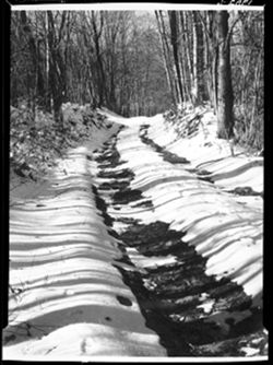
-
- Subject:
- Snow, Trees, Dwellings, 5x7 Copies, Roads, and Winter
- Series:
- 5x7 Copies
- Identifier:
- Hoh007.012.0023
- Call Number:
- 5x7 Copies, 1956, Item 23
- Physical Description:
- 5x7
- Persistent URL:
- http://purl.dlib.indiana.edu/iudl/lilly/hohenberger/Hoh007.012.0023
- Holding Location:
- Bloomington - Lilly Library
1200 E. Seventh St
Bloomington, IN 47405
Contact at liblilly@indiana.edu, 812-855-2452
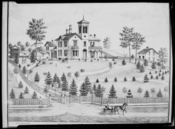
-
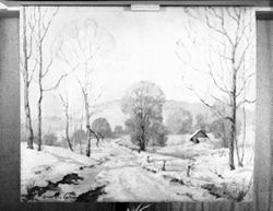
- Subject:
- 5x7 Copies, Snow, Fences, Carts & wagons, Horses, Trees, Roads, and Dwellings
- Series:
- 5x7 Copies
- Identifier:
- Hoh007.012.0008
- Genre:
- Landscape paintings
- Call Number:
- 5x7 Copies, 1956, Item 8
- Physical Description:
- 5x7
- Persistent URL:
- http://purl.dlib.indiana.edu/iudl/lilly/hohenberger/Hoh007.012.0008
- Holding Location:
- Bloomington - Lilly Library
1200 E. Seventh St
Bloomington, IN 47405
Contact at liblilly@indiana.edu, 812-855-2452
-
- Subject:
- Snow, 5x7 Copies, Trees, and Roads
- Series:
- 5x7 Copies
- Identifier:
- Hoh007.011.0020.2
- Geographic Location:
- Nashville (Ind.)
- Call Number:
- 5x7 Copies, 1955, Item 20.
- Physical Description:
- 5x7
- Persistent URL:
- http://purl.dlib.indiana.edu/iudl/lilly/hohenberger/Hoh007.011.0020.2
- Holding Location:
- Bloomington - Lilly Library
1200 E. Seventh St
Bloomington, IN 47405
Contact at liblilly@indiana.edu, 812-855-2452
-
- Subject:
- Trees, Roads, Snow, and 5x7 Copies
- Series:
- 5x7 Copies
- Identifier:
- Hoh007.011.0020.1
- Geographic Location:
- Nashville (Ind.)
- Call Number:
- 5x7 Copies, 1955, Item 20 1
- Physical Description:
- 5x7
- Persistent URL:
- http://purl.dlib.indiana.edu/iudl/lilly/hohenberger/Hoh007.011.0020.1
- Holding Location:
- Bloomington - Lilly Library
1200 E. Seventh St
Bloomington, IN 47405
Contact at liblilly@indiana.edu, 812-855-2452
-
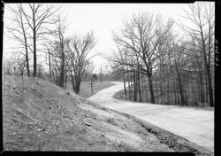
- Subject:
- 5x7 Copies, Hills, Trees, and Roads
- Series:
- 5x7 Copies
- Identifier:
- Hoh007.011.0007
- Geographic Location:
- Brown County (Ind.) and Brown County State Park (Ind.)
- Call Number:
- 5x7 Copies, 1955, Item 7
- Physical Description:
- 5x7
- Persistent URL:
- http://purl.dlib.indiana.edu/iudl/lilly/hohenberger/Hoh007.011.0007
- Holding Location:
- Bloomington - Lilly Library
1200 E. Seventh St
Bloomington, IN 47405
Contact at liblilly@indiana.edu, 812-855-2452
-

- Subject:
- Roads, Trees, 5x7 Copies, and Snow
- Series:
- 5x7 Copies
- Identifier:
- Hoh007.008.0013
- Geographic Location:
- Brown County (Ind.)
- Call Number:
- 5x7 Copies, 1952, Item 13
- Physical Description:
- 5x7
- Persistent URL:
- http://purl.dlib.indiana.edu/iudl/lilly/hohenberger/Hoh007.008.0013
- Holding Location:
- Bloomington - Lilly Library
1200 E. Seventh St
Bloomington, IN 47405
Contact at liblilly@indiana.edu, 812-855-2452
-
- Subject:
- Roads, 5x7 Copies, Trees, and Snow
- Series:
- 5x7 Copies
- Identifier:
- Hoh007.008.0006
- Geographic Location:
- Brown County (Ind.)
- Call Number:
- 5x7 Copies, 1952, Item 6
- Physical Description:
- 5x7
- Persistent URL:
- http://purl.dlib.indiana.edu/iudl/lilly/hohenberger/Hoh007.008.0006
- Holding Location:
- Bloomington - Lilly Library
1200 E. Seventh St
Bloomington, IN 47405
Contact at liblilly@indiana.edu, 812-855-2452
-
- Subject:
- 5x7 Copies, Roads, Carts & wagons, Lawns, Horses, Trees, Dwellings, and Fences
- Series:
- 5x7 Copies
- Identifier:
- Hoh007.002.0026
- Call Number:
- 5x7 Copies, 1946, Item 26
- Physical Description:
- 5x7
- Persistent URL:
- http://purl.dlib.indiana.edu/iudl/lilly/hohenberger/Hoh007.002.0026
- Holding Location:
- Bloomington - Lilly Library
1200 E. Seventh St
Bloomington, IN 47405
Contact at liblilly@indiana.edu, 812-855-2452
-
- Subject:
- Snow, Roads, 5x7 Copies, Winter, and Trees
- Series:
- 5x7 Copies
- Identifier:
- Hoh007.001.0021.1
- Call Number:
- 5x7 Copies, 1945, Item 21
- Physical Description:
- 5x7
- Persistent URL:
- http://purl.dlib.indiana.edu/iudl/lilly/hohenberger/Hoh007.001.0021.1
- Holding Location:
- Bloomington - Lilly Library
1200 E. Seventh St
Bloomington, IN 47405
Contact at liblilly@indiana.edu, 812-855-2452
-
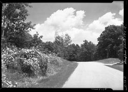
- Subject:
- Roses, Trees, 5x7, Roads, and Clouds
- Series:
- 5x7
- Date Created:
- 1947-07-01
- Identifier:
- Hoh006.009.0029.2
- Geographic Location:
- Brown County State Park (Ind.) and Brown County (Ind.)
- Call Number:
- 5x7, Box 9, Item 29b
- Physical Description:
- 5x7
- Persistent URL:
- http://purl.dlib.indiana.edu/iudl/lilly/hohenberger/Hoh006.009.0029.2
- Holding Location:
- Bloomington - Lilly Library
1200 E. Seventh St
Bloomington, IN 47405
Contact at liblilly@indiana.edu, 812-855-2452
-
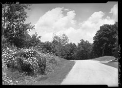
- Subject:
- Roads, 5x7, Clouds, Roses, and Trees
- Series:
- 5x7
- Date Created:
- 1944-07-01
- Identifier:
- Hoh006.009.0029.1
- Geographic Location:
- Brown County State Park (Ind.) and Brown County (Ind.)
- Call Number:
- 5x7, Box 9, Item 29a
- Physical Description:
- 5x7
- Persistent URL:
- http://purl.dlib.indiana.edu/iudl/lilly/hohenberger/Hoh006.009.0029.1
- Holding Location:
- Bloomington - Lilly Library
1200 E. Seventh St
Bloomington, IN 47405
Contact at liblilly@indiana.edu, 812-855-2452
-
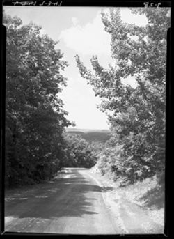
- Subject:
- 5x7, Trees, Hills, and Roads
- Series:
- 5x7
- Date Created:
- 1947-07-03
- Identifier:
- Hoh006.009.0028
- Geographic Location:
- Brown County State Park (Ind.) and Brown County (Ind.)
- Call Number:
- 5x7, Box 9, Item 28
- Physical Description:
- 5x7
- Persistent URL:
- http://purl.dlib.indiana.edu/iudl/lilly/hohenberger/Hoh006.009.0028
- Holding Location:
- Bloomington - Lilly Library
1200 E. Seventh St
Bloomington, IN 47405
Contact at liblilly@indiana.edu, 812-855-2452
-
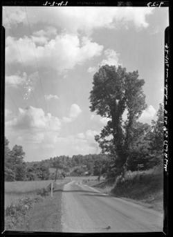
- Subject:
- 5x7, Roads, Clouds, and Trees
- Series:
- 5x7
- Date Created:
- 1947-07-07
- Identifier:
- Hoh006.009.0023
- Geographic Location:
- Van Buren (Brown County, Ind. : Township)
- Call Number:
- 5x7, Box 9, Item 23
- Physical Description:
- 5x7
- Persistent URL:
- http://purl.dlib.indiana.edu/iudl/lilly/hohenberger/Hoh006.009.0023
- Holding Location:
- Bloomington - Lilly Library
1200 E. Seventh St
Bloomington, IN 47405
Contact at liblilly@indiana.edu, 812-855-2452
-
- Subject:
- Roads, 5x7, and Trees
- Series:
- 5x7
- Date Created:
- 1947-07-07
- Identifier:
- Hoh006.009.0022
- Geographic Location:
- Van Buren (Brown County, Ind. : Township)
- Call Number:
- 5x7, Box 9, Item 22
- Physical Description:
- 5x7
- Persistent URL:
- http://purl.dlib.indiana.edu/iudl/lilly/hohenberger/Hoh006.009.0022
- Holding Location:
- Bloomington - Lilly Library
1200 E. Seventh St
Bloomington, IN 47405
Contact at liblilly@indiana.edu, 812-855-2452
-
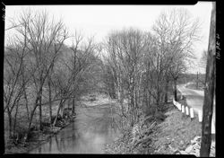
- Subject:
- Streams, Roads, Trees, 5x7, and Riparian areas
- Series:
- 5x7
- Date Created:
- 1947-04-29
- Identifier:
- Hoh006.008.0041
- Genre:
- Landscape photographs
- Geographic Location:
- Brown County (Ind.)
- Call Number:
- 5x7, Box 8, Item 41
- Physical Description:
- 5x7
- Persistent URL:
- http://purl.dlib.indiana.edu/iudl/lilly/hohenberger/Hoh006.008.0041
- Holding Location:
- Bloomington - Lilly Library
1200 E. Seventh St
Bloomington, IN 47405
Contact at liblilly@indiana.edu, 812-855-2452
-
- Subject:
- 5x7, Trees, and Roads
- Series:
- 5x7
- Date Created:
- 1947-04-29
- Identifier:
- Hoh006.008.0042
- Call Number:
- 5x7, Box 8, Item 42
- Physical Description:
- 5x7
- Persistent URL:
- http://purl.dlib.indiana.edu/iudl/lilly/hohenberger/Hoh006.008.0042
- Holding Location:
- Bloomington - Lilly Library
1200 E. Seventh St
Bloomington, IN 47405
Contact at liblilly@indiana.edu, 812-855-2452
-
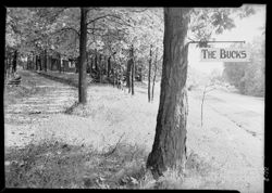
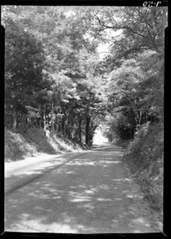
- Subject:
- Roads, Trees, 5x7, and Signs (Notices)
- Series:
- 5x7
- Date Created:
- 1946-09-17
- Identifier:
- Hoh006.008.0035
- Geographic Location:
- Brown County (Ind.)
- Call Number:
- 5x7, Box 8, Item 35
- Physical Description:
- 5x7
- Persistent URL:
- http://purl.dlib.indiana.edu/iudl/lilly/hohenberger/Hoh006.008.0035
- Holding Location:
- Bloomington - Lilly Library
1200 E. Seventh St
Bloomington, IN 47405
Contact at liblilly@indiana.edu, 812-855-2452
-
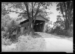
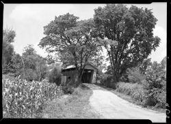
- Subject:
- Covered bridges, 5x7, Roads, and Trees
- Series:
- 5x7
- Date Created:
- 1946-07-30
- Identifier:
- Hoh006.008.0007.7
- Geographic Location:
- Ripley County (Ind.) and Otter Creek Covered Bridge (Ripley County, Ind.)
- Call Number:
- 5x7, Box 8, Item 7g
- Physical Description:
- 5x7
- Persistent URL:
- http://purl.dlib.indiana.edu/iudl/lilly/hohenberger/Hoh006.008.0007.7
- Holding Location:
- Bloomington - Lilly Library
1200 E. Seventh St
Bloomington, IN 47405
Contact at liblilly@indiana.edu, 812-855-2452
-
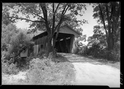
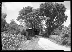
- Subject:
- Trees, 5x7, Covered bridges, and Roads
- Series:
- 5x7
- Date Created:
- 1946-07-30
- Identifier:
- Hoh006.008.0007.6
- Geographic Location:
- Otter Creek Covered Bridge (Ripley County, Ind.) and Ripley County (Ind.)
- Call Number:
- 5x7, Box 8, Item 7f
- Physical Description:
- 5x7
- Persistent URL:
- http://purl.dlib.indiana.edu/iudl/lilly/hohenberger/Hoh006.008.0007.6
- Holding Location:
- Bloomington - Lilly Library
1200 E. Seventh St
Bloomington, IN 47405
Contact at liblilly@indiana.edu, 812-855-2452
-
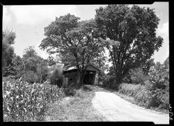
- Subject:
- Roads, Trees, Covered bridges, and 5x7
- Series:
- 5x7
- Date Created:
- 1946-07-30
- Identifier:
- Hoh006.008.0007.5
- Geographic Location:
- Otter Creek Covered Bridge (Ripley County, Ind.) and Ripley County (Ind.)
- Call Number:
- 5x7, Box 8, Item 7e
- Physical Description:
- 5x7
- Persistent URL:
- http://purl.dlib.indiana.edu/iudl/lilly/hohenberger/Hoh006.008.0007.5
- Holding Location:
- Bloomington - Lilly Library
1200 E. Seventh St
Bloomington, IN 47405
Contact at liblilly@indiana.edu, 812-855-2452
-
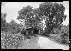
- Subject:
- Covered bridges, Roads, Trees, and 5x7
- Series:
- 5x7
- Date Created:
- 1946-07-30
- Identifier:
- Hoh006.008.0007.4
- Geographic Location:
- Ripley County (Ind.) and Otter Creek Covered Bridge (Ripley County, Ind.)
- Call Number:
- 5x7, Box 8, Item 7d
- Physical Description:
- 5x7
- Persistent URL:
- http://purl.dlib.indiana.edu/iudl/lilly/hohenberger/Hoh006.008.0007.4
- Holding Location:
- Bloomington - Lilly Library
1200 E. Seventh St
Bloomington, IN 47405
Contact at liblilly@indiana.edu, 812-855-2452
-
- Subject:
- Trees, Roads, 5x7, and Covered bridges
- Series:
- 5x7
- Date Created:
- 1946-07-30
- Identifier:
- Hoh006.008.0007.2
- Geographic Location:
- Otter Creek Covered Bridge (Ripley County, Ind.) and Ripley County (Ind.)
- Call Number:
- 5x7, Box 8, Item 7b
- Physical Description:
- 5x7
- Persistent URL:
- http://purl.dlib.indiana.edu/iudl/lilly/hohenberger/Hoh006.008.0007.2
- Holding Location:
- Bloomington - Lilly Library
1200 E. Seventh St
Bloomington, IN 47405
Contact at liblilly@indiana.edu, 812-855-2452
-
- Subject:
- Roads, Covered bridges, Trees, and 5x7
- Series:
- 5x7
- Date Created:
- 1946-07-30
- Identifier:
- Hoh006.008.0007.1
- Geographic Location:
- Ripley County (Ind.) and Otter Creek Covered Bridge (Ripley County, Ind.)
- Call Number:
- 5x7, Box 8, Item 7a
- Physical Description:
- 5x7
- Persistent URL:
- http://purl.dlib.indiana.edu/iudl/lilly/hohenberger/Hoh006.008.0007.1
- Holding Location:
- Bloomington - Lilly Library
1200 E. Seventh St
Bloomington, IN 47405
Contact at liblilly@indiana.edu, 812-855-2452
-
- Subject:
- 5x7, Roads, and Trees
- Series:
- 5x7
- Date Created:
- 1946-07-18
- Identifier:
- Hoh006.007.0050
- Call Number:
- 5x7, Box 7, Item 50
- Physical Description:
- 5x7
- Persistent URL:
- http://purl.dlib.indiana.edu/iudl/lilly/hohenberger/Hoh006.007.0050
- Holding Location:
- Bloomington - Lilly Library
1200 E. Seventh St
Bloomington, IN 47405
Contact at liblilly@indiana.edu, 812-855-2452
-
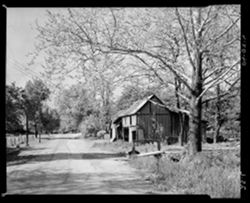
- Subject:
- 4x5, Trees, Roads, and Barns
- Series:
- 4x5
- Date Created:
- 1950-05-20
- Identifier:
- Hoh004.025.0006
- Geographic Location:
- Nashville (Ind.)
- Call Number:
- 4x5, Box 25, Item 6
- Physical Description:
- 4x5
- Persistent URL:
- http://purl.dlib.indiana.edu/iudl/lilly/hohenberger/Hoh004.025.0006
- Holding Location:
- Bloomington - Lilly Library
1200 E. Seventh St
Bloomington, IN 47405
Contact at liblilly@indiana.edu, 812-855-2452
-
- Subject:
- Bridges, Trees, 4x5, and Roads
- Series:
- 4x5
- Date Created:
- 1948-08-11
- Identifier:
- Hoh004.024.0045
- Geographic Location:
- Van Buren (Brown County, Ind. : Township)
- Call Number:
- 4x5, Box 24, Item 45
- Physical Description:
- 4x5
- Persistent URL:
- http://purl.dlib.indiana.edu/iudl/lilly/hohenberger/Hoh004.024.0045
- Holding Location:
- Bloomington - Lilly Library
1200 E. Seventh St
Bloomington, IN 47405
Contact at liblilly@indiana.edu, 812-855-2452
-
- Subject:
- 4x5, Trees, and Roads
- Series:
- 4x5
- Date Created:
- 1947-06-16
- Identifier:
- Hoh004.024.0031
- Genre:
- Landscape photographs
- Geographic Location:
- Brown County (Ind.)
- Call Number:
- 4x5, Box 24, Item 31
- Physical Description:
- 4x5
- Persistent URL:
- http://purl.dlib.indiana.edu/iudl/lilly/hohenberger/Hoh004.024.0031
- Holding Location:
- Bloomington - Lilly Library
1200 E. Seventh St
Bloomington, IN 47405
Contact at liblilly@indiana.edu, 812-855-2452
-
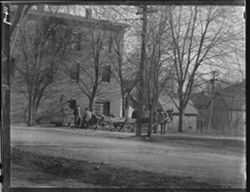
- Subject:
- 4x5, Roads, Cities & towns, Carts & wagons, Horse teams, and Trees
- Series:
- 4x5
- Date Created:
- 1934-01-06
- Identifier:
- Hoh004.014.0009
- Geographic Location:
- Nashville (Ind.)
- Call Number:
- 4x5, Box 14, Item 9
- Physical Description:
- 4x5
- Persistent URL:
- http://purl.dlib.indiana.edu/iudl/lilly/hohenberger/Hoh004.014.0009
- Holding Location:
- Bloomington - Lilly Library
1200 E. Seventh St
Bloomington, IN 47405
Contact at liblilly@indiana.edu, 812-855-2452
-
- Subject:
- Roads, Utility poles, Trees, Winter, and 4x5
- Series:
- 4x5
- Date Created:
- 1928-04-30
- Identifier:
- Hoh004.006.0034
- Genre:
- Landscape photographs
- Call Number:
- 4x5, Box 6, Item 34
- Physical Description:
- 4x5
- Persistent URL:
- http://purl.dlib.indiana.edu/iudl/lilly/hohenberger/Hoh004.006.0034
- Holding Location:
- Bloomington - Lilly Library
1200 E. Seventh St
Bloomington, IN 47405
Contact at liblilly@indiana.edu, 812-855-2452
-
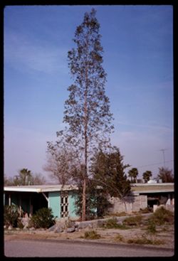
- Description:
- 100 f 11
- Subject:
- Rocks, Houses, Trees, Shrubs, Porches, Palms, and Roads
- Series:
- 3-69
- Creator:
- Cushman, Charles W., 1896-1972
- Date Created:
- 1969-03-18
- Genre:
- Snapshots
- Frame Number:
- 2
- County:
- Riverside
- Abstract:
- Tall spindly tree
- Call Number:
- P15756
- City:
- Palm Springs
- Country:
- United States
- State/Province:
- California
- Alternate Identifier:
- 369.2
- Persistent URL:
- http://purl.dlib.indiana.edu/iudl/archives/cushman/P15756
- Holding Location:
- Bloomington - University Archives
Wells Library E460
1320 E 10th St.
Bloomington, IN 47405
Contact at archives@indiana.edu, 812-855-1127
-
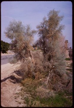
- Description:
- 100 f 11
- Subject:
- Grasses, Roads, Trees, Parkinsonia aculeata, and Palo Verde Valley (Calif.)
- Series:
- 3-69
- Creator:
- Cushman, Charles W., 1896-1972
- Date Created:
- 1969-03-18
- Genre:
- Landscape photographs and Identification photographs
- Frame Number:
- 1
- County:
- Riverside
- Abstract:
- Palo Verde-So. Pa. Sps
- Call Number:
- P15755
- City:
- Palm Springs
- Country:
- United States
- State/Province:
- California
- Alternate Identifier:
- 369.1
- Persistent URL:
- http://purl.dlib.indiana.edu/iudl/archives/cushman/P15755
- Holding Location:
- Bloomington - University Archives
Wells Library E460
1320 E 10th St.
Bloomington, IN 47405
Contact at archives@indiana.edu, 812-855-1127
-
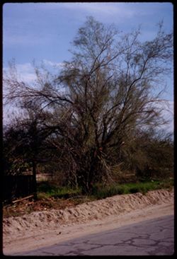
- Description:
- 100 f 11 TL
- Subject:
- Grasses, Roads, Trees, and Tree limbs
- Series:
- 2-69
- Creator:
- Cushman, Charles W., 1896-1972
- Date Created:
- 1969-03-18
- Genre:
- Landscape photographs
- Frame Number:
- 35
- County:
- Riverside
- Call Number:
- P15752
- City:
- Palm Springs
- Country:
- United States
- State/Province:
- California
- Alternate Identifier:
- 269.35
- Persistent URL:
- http://purl.dlib.indiana.edu/iudl/archives/cushman/P15752
- Holding Location:
- Bloomington - University Archives
Wells Library E460
1320 E 10th St.
Bloomington, IN 47405
Contact at archives@indiana.edu, 812-855-1127
-
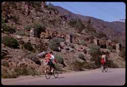
- Description:
- 100 f 11 TL
- Subject:
- Rocks, Families, Children, Valleys, Electric lines, Roads, Trees, Bicycles & tricycles, Palm Canyon (Calif.), Shrubs, and Mountains
- Series:
- 2-69
- Creator:
- Cushman, Charles W., 1896-1972
- Date Created:
- 1969-03-16
- Genre:
- Snapshots
- Frame Number:
- 29
- County:
- Riverside
- Call Number:
- P15746
- Country:
- United States
- State/Province:
- California
- Alternate Identifier:
- 269.29
- Persistent URL:
- http://purl.dlib.indiana.edu/iudl/archives/cushman/P15746
- Holding Location:
- Bloomington - University Archives
Wells Library E460
1320 E 10th St.
Bloomington, IN 47405
Contact at archives@indiana.edu, 812-855-1127
-
- Subject:
- Meadows, Hills, Roads, Trees, Farms, and Fences
- Series:
- 1-69
- Creator:
- Cushman, Charles W., 1896-1972
- Date Created:
- 1969-03-04
- Genre:
- Landscape photographs
- Frame Number:
- 21
- Call Number:
- P15716
- Country:
- United States
- State/Province:
- California
- Alternate Identifier:
- 169.21
- Persistent URL:
- http://purl.dlib.indiana.edu/iudl/archives/cushman/P15716
- Holding Location:
- Bloomington - University Archives
Wells Library E460
1320 E 10th St.
Bloomington, IN 47405
Contact at archives@indiana.edu, 812-855-1127
-
- Description:
- 25 f 2
- Subject:
- Forests, Roads, Trees, and Picture frames
- Series:
- 4-68
- Creator:
- Cushman, Charles W., 1896-1972
- Date Created:
- 1968-12-16
- Genre:
- Paintings and Reproductions
- Frame Number:
- 11
- County:
- Sonoma
- Persons Pictured:
- Latimer, Lorenzo Palmer
- Abstract:
- Lorenz = P. Latimer near Winslow Sonoma Co.
- Call Number:
- P15684
- Country:
- United States
- State/Province:
- California
- Alternate Identifier:
- 468.11
- Persistent URL:
- http://purl.dlib.indiana.edu/iudl/archives/cushman/P15684
- Holding Location:
- Bloomington - University Archives
Wells Library E460
1320 E 10th St.
Bloomington, IN 47405
Contact at archives@indiana.edu, 812-855-1127
-
- Description:
- 100 f 8
- Subject:
- Taverns (Inns), Washoe House (Stony Point, Calif.), Trucks, Terraces, Windows, Utility poles, Electric lines, Trees, Shadows, Signs (Notices), Fences, and Roads
- Series:
- 2-68
- Creator:
- Cushman, Charles W., 1896-1972
- Date Created:
- 1968-05-10
- Genre:
- Architectural photographs
- Frame Number:
- 21
- County:
- Sonoma
- Abstract:
- Washoe Inn- Sonoma county
- Call Number:
- P15653
- City:
- Stony Point
- Country:
- United States
- State/Province:
- California
- Alternate Identifier:
- 268.21
- Persistent URL:
- http://purl.dlib.indiana.edu/iudl/archives/cushman/P15653
- Holding Location:
- Bloomington - University Archives
Wells Library E460
1320 E 10th St.
Bloomington, IN 47405
Contact at archives@indiana.edu, 812-855-1127
-
- Description:
- 100 f 8 tl
- Subject:
- Farmhouses, Roads, Farms, Trees, Fences, and Hills
- Series:
- 2-68
- Creator:
- Cushman, Charles W., 1896-1972
- Date Created:
- 1968-04-19
- Genre:
- Landscape photographs
- Frame Number:
- 2
- County:
- Marin
- Abstract:
- Marin farm scene
- Call Number:
- P15634
- Country:
- United States
- State/Province:
- California
- Alternate Identifier:
- 268.2
- Persistent URL:
- http://purl.dlib.indiana.edu/iudl/archives/cushman/P15634
- Holding Location:
- Bloomington - University Archives
Wells Library E460
1320 E 10th St.
Bloomington, IN 47405
Contact at archives@indiana.edu, 812-855-1127
-
- Description:
- 100 f 8
- Subject:
- Roads, Stilt houses, Trees, Tree limbs, Mountains, Fences, Lakes & ponds, and Hills
- Series:
- 1-68
- Creator:
- Cushman, Charles W., 1896-1972
- Date Created:
- 1968-03-20
- Genre:
- Views
- Frame Number:
- 34
- County:
- Marin
- Abstract:
- Across Bolinas lagoon
- Call Number:
- P15628
- City:
- Bolinas
- Country:
- United States
- State/Province:
- California
- Alternate Identifier:
- 168.34
- Persistent URL:
- http://purl.dlib.indiana.edu/iudl/archives/cushman/P15628
- Holding Location:
- Bloomington - University Archives
Wells Library E460
1320 E 10th St.
Bloomington, IN 47405
Contact at archives@indiana.edu, 812-855-1127
-
- Description:
- 100 f 8 tl
- Subject:
- Rocks, Oceans, Seas, Roads, Trees, Coastlines, Pacific Ocean, Capes (Coasts), Beaches, Pacific Coast (Calif.), Hills, Caspar Creek (Calif.), and Cliffs
- Series:
- 5-67
- Creator:
- Cushman, Charles W., 1896-1972
- Date Created:
- 1967-10-14
- Genre:
- Seascapes
- Frame Number:
- 2
- County:
- Mendocino
- Abstract:
- Vista Pt. off Casper Creek Hwy
- Call Number:
- P15577
- Country:
- United States
- State/Province:
- California
- Alternate Identifier:
- 567.2
- Persistent URL:
- http://purl.dlib.indiana.edu/iudl/archives/cushman/P15577
- Holding Location:
- Bloomington - University Archives
Wells Library E460
1320 E 10th St.
Bloomington, IN 47405
Contact at archives@indiana.edu, 812-855-1127
-
- Description:
- 100 f 9 tl
- Subject:
- Capes (Coasts), Roads, Caspar Creek (Calif.), Pacific Ocean, Pacific Coast (Calif.), Trees, Oceans, Coastlines, Beaches, Seas, Hills, Cliffs, and Rocks
- Series:
- 5-67
- Creator:
- Cushman, Charles W., 1896-1972
- Date Created:
- 1967-10-14
- Genre:
- Seascapes
- Frame Number:
- 1
- County:
- Mendocino
- Abstract:
- Vista Pt. off Casper Creek Hwy
- Call Number:
- P15576
- Country:
- United States
- State/Province:
- California
- Alternate Identifier:
- 567.1
- Persistent URL:
- http://purl.dlib.indiana.edu/iudl/archives/cushman/P15576
- Holding Location:
- Bloomington - University Archives
Wells Library E460
1320 E 10th St.
Bloomington, IN 47405
Contact at archives@indiana.edu, 812-855-1127
-
- Description:
- 100 f 11 tl
- Subject:
- Dairy farming, Farmhouses, Roads, Trees, Meadows, Hills, and Houses
- Series:
- 3-67
- Creator:
- Cushman, Charles W., 1896-1972
- Date Created:
- 1967-04-12
- Genre:
- Landscape photographs and Views
- Frame Number:
- 10
- County:
- Marin
- Abstract:
- Marin dairy farm
- Call Number:
- P15527
- Country:
- United States
- State/Province:
- California
- Alternate Identifier:
- 367.10
- Persistent URL:
- http://purl.dlib.indiana.edu/iudl/archives/cushman/P15527
- Holding Location:
- Bloomington - University Archives
Wells Library E460
1320 E 10th St.
Bloomington, IN 47405
Contact at archives@indiana.edu, 812-855-1127
-
- Description:
- 100 f 11
- Subject:
- Valleys, Hoisting machinery, Roads, Trees, Bridge construction, Bridges, Utility poles, Canyons, and Houses
- Series:
- 1-67
- Creator:
- Cushman, Charles W., 1896-1972
- Date Created:
- 1967-03-07
- Genre:
- Architectural photographs
- Frame Number:
- 3
- Street Address:
- California State Highway 280 and Junipero Serra Freeway
- County:
- San Francisco
- Abstract:
- New high bridge over canyon
- Call Number:
- P15480
- City:
- San Francisco
- Country:
- United States
- State/Province:
- California
- Alternate Identifier:
- 167.3
- Persistent URL:
- http://purl.dlib.indiana.edu/iudl/archives/cushman/P15480
- Holding Location:
- Bloomington - University Archives
Wells Library E460
1320 E 10th St.
Bloomington, IN 47405
Contact at archives@indiana.edu, 812-855-1127
-
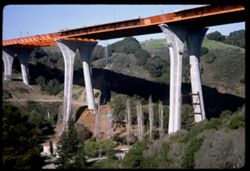
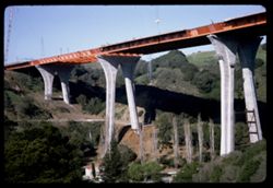
- Description:
- 100 f 11
- Subject:
- Valleys, Houses, Trees, Bridge construction, Mountains, Bridges, Utility poles, Canyons, and Roads
- Series:
- 1-67
- Creator:
- Cushman, Charles W., 1896-1972
- Date Created:
- 1967-03-07
- Genre:
- Architectural photographs
- Frame Number:
- 2
- Street Address:
- California State Highway 280 and Junipero Serra Freeway
- County:
- San Francisco
- Abstract:
- New high bridge over canyon
- Call Number:
- P15479
- City:
- San Francisco
- Country:
- United States
- State/Province:
- California
- Alternate Identifier:
- 167.2
- Persistent URL:
- http://purl.dlib.indiana.edu/iudl/archives/cushman/P15479
- Holding Location:
- Bloomington - University Archives
Wells Library E460
1320 E 10th St.
Bloomington, IN 47405
Contact at archives@indiana.edu, 812-855-1127
-
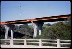
- Description:
- 100 f 11
- Subject:
- Railings, Canyons, Roads, Trees, Bridge construction, Mountains, Bridges, and Valleys
- Series:
- 1-67
- Creator:
- Cushman, Charles W., 1896-1972
- Date Created:
- 1967-03-07
- Genre:
- Architectural photographs
- Frame Number:
- 1
- Street Address:
- California State Highway 280 and Junipero Serra Freeway
- County:
- San Francisco
- Abstract:
- New high bridge over canyon
- Call Number:
- P15478
- City:
- San Francisco
- Country:
- United States
- State/Province:
- California
- Alternate Identifier:
- 167.1
- Persistent URL:
- http://purl.dlib.indiana.edu/iudl/archives/cushman/P15478
- Holding Location:
- Bloomington - University Archives
Wells Library E460
1320 E 10th St.
Bloomington, IN 47405
Contact at archives@indiana.edu, 812-855-1127
-
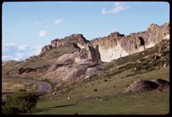
- Description:
- 100 f 11 tl
- Subject:
- Rocks, Cliffs, Grazing, Trees, Mining, Cattle, Mountains, Rock formations, Clouds, Utility poles, and Roads
- Series:
- 9-66
- Creator:
- Cushman, Charles W., 1896-1972
- Date Created:
- 1966-06-14
- Genre:
- Landscape photographs
- Frame Number:
- 23
- Street Address:
- Colorado State Highway 93
- County:
- Jefferson and Boulder
- Call Number:
- P15426
- City:
- Golden and Boulder
- Country:
- United States
- State/Province:
- Colorado
- Alternate Identifier:
- 966.23
- Persistent URL:
- http://purl.dlib.indiana.edu/iudl/archives/cushman/P15426
- Holding Location:
- Bloomington - University Archives
Wells Library E460
1320 E 10th St.
Bloomington, IN 47405
Contact at archives@indiana.edu, 812-855-1127
-
- Subject:
- Snow, Roads, Trees, Mountains, Clouds, Forests, Passes (Landforms), and Loveland Pass (Colo.)
- Series:
- 9-66
- Creator:
- Cushman, Charles W., 1896-1972
- Date Created:
- 1966-06-14
- Genre:
- Landscape photographs
- Frame Number:
- 17
- County:
- Larimer
- Call Number:
- P15420
- Country:
- United States
- State/Province:
- Colorado
- Alternate Identifier:
- 966.17
- Persistent URL:
- http://purl.dlib.indiana.edu/iudl/archives/cushman/P15420
- Holding Location:
- Bloomington - University Archives
Wells Library E460
1320 E 10th St.
Bloomington, IN 47405
Contact at archives@indiana.edu, 812-855-1127
-
- Description:
- 100 f 4.5
- Subject:
- Canyons, Roads, Cliffs, Trees, Rocks, Clear Creek (Clear Creek County, Colo.), Rivers, Clear Creek Canyon (Colo.), and Rock formations
- Series:
- 9-66
- Creator:
- Cushman, Charles W., 1896-1972
- Date Created:
- 1966-06-13
- Genre:
- Landscape photographs
- Frame Number:
- 14
- County:
- Clear Creek
- Call Number:
- P15417
- Country:
- United States
- State/Province:
- Colorado
- Alternate Identifier:
- 966.14
- Persistent URL:
- http://purl.dlib.indiana.edu/iudl/archives/cushman/P15417
- Holding Location:
- Bloomington - University Archives
Wells Library E460
1320 E 10th St.
Bloomington, IN 47405
Contact at archives@indiana.edu, 812-855-1127
-
- Description:
- 100 f 4
- Subject:
- Canyons, Automobiles, Roads, Cliffs, Trees, Rocks, Clear Creek (Clear Creek County, Colo.), Grasses, Clear Creek Canyon (Colo.), and Rivers
- Series:
- 9-66
- Creator:
- Cushman, Charles W., 1896-1972
- Date Created:
- 1966-06-13
- Genre:
- Landscape photographs
- Frame Number:
- 13
- County:
- Clear Creek
- Call Number:
- P15416
- Country:
- United States
- State/Province:
- Colorado
- Alternate Identifier:
- 966.13
- Persistent URL:
- http://purl.dlib.indiana.edu/iudl/archives/cushman/P15416
- Holding Location:
- Bloomington - University Archives
Wells Library E460
1320 E 10th St.
Bloomington, IN 47405
Contact at archives@indiana.edu, 812-855-1127
-
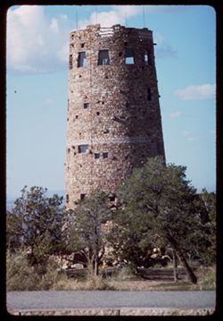
- Description:
- 100 f 16 TL HF
- Subject:
- Towers, Roads, Grand Canyon National Park (Ariz.), National parks & reserves, Clouds, Grand Canyon (Ariz.), Desert View Point (Ariz.), and Trees
- Series:
- 3-66
- Creator:
- Cushman, Charles W., 1896-1972
- Date Created:
- 1966-04-23
- Genre:
- Architectural photographs
- Frame Number:
- 5
- County:
- Coconino
- Abstract:
- The tower
- Call Number:
- P15288
- Country:
- United States
- State/Province:
- Arizona
- Alternate Identifier:
- 366.5
- Persistent URL:
- http://purl.dlib.indiana.edu/iudl/archives/cushman/P15288
- Holding Location:
- Bloomington - University Archives
Wells Library E460
1320 E 10th St.
Bloomington, IN 47405
Contact at archives@indiana.edu, 812-855-1127
-
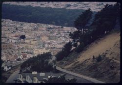
- Description:
- 100 f 5.6 or 4
- Subject:
- Houses, Trees, Chimneys, Roofs, Mountains, Hills, and Roads
- Series:
- 40-65
- Creator:
- Cushman, Charles W., 1896-1972
- Date Created:
- 1965-11-11
- Genre:
- Cityscape photographs
- Frame Number:
- 30
- Street Address:
- Golden Gate Heights
- County:
- San Francisco
- Abstract:
- From Golden Gate Heights- down and westward
- Call Number:
- P15232
- City:
- San Francisco
- Country:
- United States
- State/Province:
- California
- Alternate Identifier:
- 4065.30
- Persistent URL:
- http://purl.dlib.indiana.edu/iudl/archives/cushman/P15232
- Holding Location:
- Bloomington - University Archives
Wells Library E460
1320 E 10th St.
Bloomington, IN 47405
Contact at archives@indiana.edu, 812-855-1127
-
- Description:
- 100 f 11 TL
- Subject:
- Canyons, Forests, Roads, Cliffs, Mountains, Trees, and San Miguel River (Colo.)
- Series:
- 36-65
- Creator:
- Cushman, Charles W., 1896-1972
- Date Created:
- 1965-10-05
- Genre:
- Landscape photographs
- Frame Number:
- 3
- Street Address:
- Colorado State Highway 145
- County:
- San Miguel
- Abstract:
- Rd to Telluride, Colo. Hwy 45.
- Call Number:
- P15071
- City:
- Telluride
- Country:
- United States
- State/Province:
- Colorado
- Alternate Identifier:
- 3665.3
- Persistent URL:
- http://purl.dlib.indiana.edu/iudl/archives/cushman/P15071
- Holding Location:
- Bloomington - University Archives
Wells Library E460
1320 E 10th St.
Bloomington, IN 47405
Contact at archives@indiana.edu, 812-855-1127
-
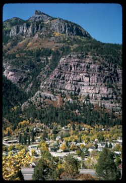
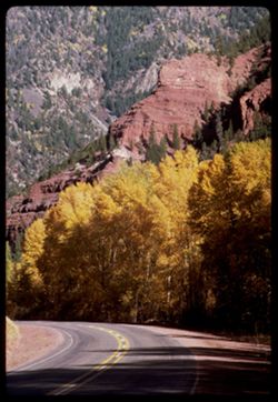
- Description:
- 100 f 11
- Subject:
- Cliffs, Trees, Cities & towns, Buildings, Forests, Roads, Houses, and Mountains
- Series:
- 35-65
- Creator:
- Cushman, Charles W., 1896-1972
- Date Created:
- 1965-10-04
- Genre:
- Landscape photographs and Cityscape photographs
- Frame Number:
- 2
- County:
- Ouray
- Abstract:
- Ouray = cliff NW.
- Call Number:
- P15032
- City:
- Ouray
- Country:
- United States
- State/Province:
- Colorado
- Alternate Identifier:
- 3565.2
- Persistent URL:
- http://purl.dlib.indiana.edu/iudl/archives/cushman/P15032
- Holding Location:
- Bloomington - University Archives
Wells Library E460
1320 E 10th St.
Bloomington, IN 47405
Contact at archives@indiana.edu, 812-855-1127
-
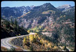
- Description:
- 100 f 8
- Subject:
- Rocks, Roads, Trees, Mountains, and Forests
- Series:
- 35-65
- Creator:
- Cushman, Charles W., 1896-1972
- Date Created:
- 1965-10-04
- Genre:
- Landscape photographs
- Frame Number:
- 1
- County:
- Ouray
- Abstract:
- Ouray - road west.
- Call Number:
- P15031
- City:
- Ouray
- Country:
- United States
- State/Province:
- Colorado
- Alternate Identifier:
- 3565.1
- Persistent URL:
- http://purl.dlib.indiana.edu/iudl/archives/cushman/P15031
- Holding Location:
- Bloomington - University Archives
Wells Library E460
1320 E 10th St.
Bloomington, IN 47405
Contact at archives@indiana.edu, 812-855-1127
-
- Description:
- 200 f 6.3
- Subject:
- Rocks, Roads, Trees, Mountains, Forests, and Cliffs
- Series:
- 34-65
- Creator:
- Cushman, Charles W., 1896-1972
- Date Created:
- 1965-10-04
- Genre:
- Landscape photographs
- Frame Number:
- 37
- County:
- Ouray
- Abstract:
- SW
- Call Number:
- P15029
- City:
- Ouray
- Country:
- United States
- State/Province:
- Colorado
- Alternate Identifier:
- 3465.37
- Persistent URL:
- http://purl.dlib.indiana.edu/iudl/archives/cushman/P15029
- Holding Location:
- Bloomington - University Archives
Wells Library E460
1320 E 10th St.
Bloomington, IN 47405
Contact at archives@indiana.edu, 812-855-1127
-
- Description:
- 100 f 11
- Subject:
- Canyons, Roads, Trees, Uncompahgre Valley (Colo.), Mountains, Forests, and Uncompahgre National Forest (Colo.)
- Series:
- 34-65
- Creator:
- Cushman, Charles W., 1896-1972
- Date Created:
- 1965-10-04
- Genre:
- Landscape photographs
- Frame Number:
- 30
- County:
- Ouray
- Call Number:
- P15022
- City:
- Ouray
- Country:
- United States
- State/Province:
- Colorado
- Alternate Identifier:
- 3465.30
- Persistent URL:
- http://purl.dlib.indiana.edu/iudl/archives/cushman/P15022
- Holding Location:
- Bloomington - University Archives
Wells Library E460
1320 E 10th St.
Bloomington, IN 47405
Contact at archives@indiana.edu, 812-855-1127
-
- Description:
- 100 f 11
- Subject:
- Canyons, Poplars, Roads, Trees, Aspen, Uncompahgre Valley (Colo.), Mountains, National parks & reserves, Forests, and Uncompahgre National Forest (Colo.)
- Series:
- 34-65
- Creator:
- Cushman, Charles W., 1896-1972
- Date Created:
- 1965-10-04
- Genre:
- Landscape photographs
- Frame Number:
- 29
- Street Address:
- United States Highway 550
- County:
- Ouray
- Abstract:
- Canyon.
- Call Number:
- P15021
- City:
- Ouray
- Country:
- United States
- State/Province:
- Colorado
- Alternate Identifier:
- 3465.29
- Persistent URL:
- http://purl.dlib.indiana.edu/iudl/archives/cushman/P15021
- Holding Location:
- Bloomington - University Archives
Wells Library E460
1320 E 10th St.
Bloomington, IN 47405
Contact at archives@indiana.edu, 812-855-1127
-
- Description:
- 100 f 11
- Subject:
- Canyons, Roads, Trees, Mountains, and Uncompahgre River (Colo.)
- Series:
- 34-65
- Creator:
- Cushman, Charles W., 1896-1972
- Date Created:
- 1965-10-04
- Genre:
- Landscape photographs
- Frame Number:
- 27
- Street Address:
- United States Highway 550
- County:
- Ouray
- Call Number:
- P15019
- City:
- Ouray
- Country:
- United States
- State/Province:
- Colorado
- Alternate Identifier:
- 3465.27
- Persistent URL:
- http://purl.dlib.indiana.edu/iudl/archives/cushman/P15019
- Holding Location:
- Bloomington - University Archives
Wells Library E460
1320 E 10th St.
Bloomington, IN 47405
Contact at archives@indiana.edu, 812-855-1127
-
- Description:
- 100 f 11
- Subject:
- Rocks, Canyons, Erosion, Roads, Trees, Mountains, Rapids, Forests, Rivers, and Uncompahgre River (Colo.)
- Series:
- 34-65
- Creator:
- Cushman, Charles W., 1896-1972
- Date Created:
- 1965-10-04
- Genre:
- Landscape photographs
- Frame Number:
- 23
- Street Address:
- United States Highway 550
- County:
- Ouray
- Abstract:
- Canyon.
- Call Number:
- P15015
- Country:
- United States
- State/Province:
- Colorado
- Alternate Identifier:
- 3465.23
- Persistent URL:
- http://purl.dlib.indiana.edu/iudl/archives/cushman/P15015
- Holding Location:
- Bloomington - University Archives
Wells Library E460
1320 E 10th St.
Bloomington, IN 47405
Contact at archives@indiana.edu, 812-855-1127
-
- Description:
- 100 f 11
- Subject:
- Canyons, Roads, Trees, Mountains, and Forests
- Series:
- 34-65
- Creator:
- Cushman, Charles W., 1896-1972
- Date Created:
- 1965-10-04
- Genre:
- Landscape photographs
- Frame Number:
- 21
- Street Address:
- United States Highway 550
- County:
- San Juan and Ouray
- Abstract:
- Canyon
- Call Number:
- P15013
- City:
- Silverton and Ouray
- Country:
- United States
- State/Province:
- Colorado
- Alternate Identifier:
- 3465.21
- Persistent URL:
- http://purl.dlib.indiana.edu/iudl/archives/cushman/P15013
- Holding Location:
- Bloomington - University Archives
Wells Library E460
1320 E 10th St.
Bloomington, IN 47405
Contact at archives@indiana.edu, 812-855-1127
-
- Description:
- 100 f 11
- Subject:
- Rocks, Uncompahgre River (Colo.), Grasses, Roads, Trees, Mountains, Rapids, Rivers, Canyons, Erosion, and Ouray (Colo.)
- Series:
- 34-65
- Creator:
- Cushman, Charles W., 1896-1972
- Date Created:
- 1965-10-04
- Genre:
- Landscape photographs
- Frame Number:
- 22
- Street Address:
- United States Highway 550
- County:
- San Juan and Ouray
- Abstract:
- Canyon
- Call Number:
- P15014
- City:
- Silverton and Ouray
- Country:
- United States
- State/Province:
- Colorado
- Alternate Identifier:
- 3465.22
- Persistent URL:
- http://purl.dlib.indiana.edu/iudl/archives/cushman/P15014
- Holding Location:
- Bloomington - University Archives
Wells Library E460
1320 E 10th St.
Bloomington, IN 47405
Contact at archives@indiana.edu, 812-855-1127
-
- Description:
- 100 f 16 sl
- Subject:
- Snow, Houses, Outbuildings, Trees, Mountains, Forests, and Roads
- Series:
- 33-65
- Creator:
- Cushman, Charles W., 1896-1972
- Date Created:
- 1965-10-02
- Genre:
- Landscape photographs
- Frame Number:
- 27
- Street Address:
- United States Highway 550
- County:
- San Juan and Ouray
- Abstract:
- Red snowy Mtns.
- Call Number:
- P14982
- City:
- Silverton and Ouray
- Country:
- United States
- State/Province:
- Colorado
- Alternate Identifier:
- 3365.27
- Persistent URL:
- http://purl.dlib.indiana.edu/iudl/archives/cushman/P14982
- Holding Location:
- Bloomington - University Archives
Wells Library E460
1320 E 10th St.
Bloomington, IN 47405
Contact at archives@indiana.edu, 812-855-1127
-
- Description:
- 100 f 16 sl
- Subject:
- Snow, Grasses, Roads, Trails & paths, Trees, Mountains, Forests, and Passes (Landforms)
- Series:
- 33-65
- Creator:
- Cushman, Charles W., 1896-1972
- Date Created:
- 1965-10-02
- Genre:
- Landscape photographs
- Frame Number:
- 24
- Street Address:
- United States Highway 550 and Red Mountain Pass
- County:
- San Juan
- Abstract:
- View east
- Call Number:
- P14979
- City:
- Silverton
- Country:
- United States
- State/Province:
- Colorado
- Alternate Identifier:
- 3365.24
- Persistent URL:
- http://purl.dlib.indiana.edu/iudl/archives/cushman/P14979
- Holding Location:
- Bloomington - University Archives
Wells Library E460
1320 E 10th St.
Bloomington, IN 47405
Contact at archives@indiana.edu, 812-855-1127
-
- Description:
- 100 f 11 sl
- Subject:
- Snow, Roads, Trees, Mountains, Forests, and Passes (Landforms)
- Series:
- 33-65
- Creator:
- Cushman, Charles W., 1896-1972
- Date Created:
- 1965-10-02
- Genre:
- Landscape photographs
- Frame Number:
- 19
- Street Address:
- United States Highway 550 and Red Mountain Pass
- County:
- San Juan and Ouray
- Abstract:
- Near Summit
- Call Number:
- P14974
- City:
- Silverton and Ouray
- Country:
- United States
- State/Province:
- Colorado
- Alternate Identifier:
- 3365.19
- Persistent URL:
- http://purl.dlib.indiana.edu/iudl/archives/cushman/P14974
- Holding Location:
- Bloomington - University Archives
Wells Library E460
1320 E 10th St.
Bloomington, IN 47405
Contact at archives@indiana.edu, 812-855-1127
-
- Description:
- 100 f 16 sl
- Subject:
- Snow, Kendall Mountain (Colo.), Trees, Mountains, Fences, Roads, Buildings, and Sidewalks
- Series:
- 33-65
- Creator:
- Cushman, Charles W., 1896-1972
- Date Created:
- 1965-10-02
- Genre:
- Landscape photographs
- Frame Number:
- 17
- County:
- San Juan
- Abstract:
- Mtn. above town
- Call Number:
- P14972
- City:
- Silverton
- Country:
- United States
- State/Province:
- Colorado
- Alternate Identifier:
- 3365.17
- Persistent URL:
- http://purl.dlib.indiana.edu/iudl/archives/cushman/P14972
- Holding Location:
- Bloomington - University Archives
Wells Library E460
1320 E 10th St.
Bloomington, IN 47405
Contact at archives@indiana.edu, 812-855-1127
-
- Description:
- 100 f 13 tl
- Subject:
- Houses, Trees, Mountains, Buildings, Animas River (Colo. and N.M.), Rivers, and Roads
- Series:
- 33-65
- Creator:
- Cushman, Charles W., 1896-1972
- Date Created:
- 1965-10-02
- Genre:
- Cityscape photographs
- Frame Number:
- 8
- County:
- San Juan
- Call Number:
- P14963
- City:
- Silverton
- Country:
- United States
- State/Province:
- Colorado
- Alternate Identifier:
- 3365.8
- Persistent URL:
- http://purl.dlib.indiana.edu/iudl/archives/cushman/P14963
- Holding Location:
- Bloomington - University Archives
Wells Library E460
1320 E 10th St.
Bloomington, IN 47405
Contact at archives@indiana.edu, 812-855-1127
-
- Description:
- 100 f 13 tl
- Subject:
- Houses, Trees, Mountains, Buildings, Animas River (Colo. and N.M.), Railroads, Rivers, and Roads
- Series:
- 33-65
- Creator:
- Cushman, Charles W., 1896-1972
- Date Created:
- 1965-10-02
- Genre:
- Cityscape photographs
- Frame Number:
- 7
- County:
- San Juan
- Call Number:
- P14962
- City:
- Silverton
- Country:
- United States
- State/Province:
- Colorado
- Alternate Identifier:
- 3365.7
- Persistent URL:
- http://purl.dlib.indiana.edu/iudl/archives/cushman/P14962
- Holding Location:
- Bloomington - University Archives
Wells Library E460
1320 E 10th St.
Bloomington, IN 47405
Contact at archives@indiana.edu, 812-855-1127
-
- Description:
- 100 f 16 tl
- Subject:
- Roads, Trees, Mountains, Buildings, Animas River (Colo. and N.M.), Railroads, Rivers, and Houses
- Series:
- 33-65
- Creator:
- Cushman, Charles W., 1896-1972
- Date Created:
- 1965-10-02
- Genre:
- Cityscape photographs
- Frame Number:
- 6
- County:
- San Juan
- Call Number:
- P14961
- City:
- Silverton
- Country:
- United States
- State/Province:
- Colorado
- Alternate Identifier:
- 3365.6
- Persistent URL:
- http://purl.dlib.indiana.edu/iudl/archives/cushman/P14961
- Holding Location:
- Bloomington - University Archives
Wells Library E460
1320 E 10th St.
Bloomington, IN 47405
Contact at archives@indiana.edu, 812-855-1127
-
- Description:
- 100 f 16 tl
- Subject:
- Valleys, Houses, Trees, Mountains, Buildings, Railroads, Rivers, and Roads
- Series:
- 33-65
- Creator:
- Cushman, Charles W., 1896-1972
- Date Created:
- 1965-10-02
- Genre:
- Cityscape photographs
- Frame Number:
- 5
- County:
- San Juan
- Abstract:
- Silverton below
- Call Number:
- P14960
- City:
- Silverton
- Country:
- United States
- State/Province:
- Colorado
- Alternate Identifier:
- 3365.5
- Persistent URL:
- http://purl.dlib.indiana.edu/iudl/archives/cushman/P14960
- Holding Location:
- Bloomington - University Archives
Wells Library E460
1320 E 10th St.
Bloomington, IN 47405
Contact at archives@indiana.edu, 812-855-1127
-
- Description:
- 200 f 11
- Subject:
- Uncompahgre National Forest (Colo.), Forests, Roads, Mountains, Utility poles, Snow, Trees, Grasses, and Fences
- Series:
- 33-65
- Creator:
- Cushman, Charles W., 1896-1972
- Date Created:
- 1965-10-02
- Genre:
- Landscape photographs
- Frame Number:
- 4
- Street Address:
- United States Highway 550
- County:
- San Juan
- Abstract:
- Snow covered Mtn
- Call Number:
- P14959
- Country:
- United States
- State/Province:
- Colorado
- Alternate Identifier:
- 3365.4
- Persistent URL:
- http://purl.dlib.indiana.edu/iudl/archives/cushman/P14959
- Holding Location:
- Bloomington - University Archives
Wells Library E460
1320 E 10th St.
Bloomington, IN 47405
Contact at archives@indiana.edu, 812-855-1127
-
- Description:
- 100 f 16
- Subject:
- Forests, Roads, Mountains, Snow, Trees, Grasses, and Fences
- Series:
- 33-65
- Creator:
- Cushman, Charles W., 1896-1972
- Date Created:
- 1965-10-02
- Genre:
- Landscape photographs
- Frame Number:
- 3
- Street Address:
- United States Highway 550
- County:
- La Plata and San Juan
- Abstract:
- Snow covered Mtn
- Call Number:
- P14958
- City:
- Silverton and Durango
- Country:
- United States
- State/Province:
- Colorado
- Alternate Identifier:
- 3365.3
- Persistent URL:
- http://purl.dlib.indiana.edu/iudl/archives/cushman/P14958
- Holding Location:
- Bloomington - University Archives
Wells Library E460
1320 E 10th St.
Bloomington, IN 47405
Contact at archives@indiana.edu, 812-855-1127
-
- Description:
- 100 f 15 sl
- Subject:
- Aspen, Roads, Cliffs, Mountains, Trees, Poplars, and Fences
- Series:
- 33-65
- Creator:
- Cushman, Charles W., 1896-1972
- Date Created:
- 1965-10-02
- Genre:
- Landscape photographs
- Frame Number:
- 1
- Street Address:
- United States Highway 550
- County:
- La Plata and San Juan
- Abstract:
- Aspen and cliffs
- Call Number:
- P14956
- City:
- Silverton and Durango
- Country:
- United States
- State/Province:
- Colorado
- Alternate Identifier:
- 3365.1
- Persistent URL:
- http://purl.dlib.indiana.edu/iudl/archives/cushman/P14956
- Holding Location:
- Bloomington - University Archives
Wells Library E460
1320 E 10th St.
Bloomington, IN 47405
Contact at archives@indiana.edu, 812-855-1127
-
- Description:
- 100 f 11
- Subject:
- Log buildings, Roads, Railroad locomotives, Trees, Stairways, Windows, Railroad cars, Doors & doorways, and Rio Grande and Southwestern Railroad Company
- Series:
- 32-65
- Creator:
- Cushman, Charles W., 1896-1972
- Date Created:
- 1965-10-02
- Genre:
- Identification photographs
- Frame Number:
- 17
- County:
- La Plata
- Abstract:
- Old Rio Grande locomotive
- Call Number:
- P14935
- City:
- Durango
- Country:
- United States
- State/Province:
- Colorado
- Alternate Identifier:
- 3265.17
- Persistent URL:
- http://purl.dlib.indiana.edu/iudl/archives/cushman/P14935
- Holding Location:
- Bloomington - University Archives
Wells Library E460
1320 E 10th St.
Bloomington, IN 47405
Contact at archives@indiana.edu, 812-855-1127
-
- Description:
- 100 f 11
- Subject:
- Roads, Trees, Chimneys, Roofs, Sidewalks, Shrubs, Houses, and Hedges (Plants)
- Series:
- 32-65
- Creator:
- Cushman, Charles W., 1896-1972
- Date Created:
- 1965-10-02
- Genre:
- Views
- Frame Number:
- 15
- County:
- La Plata
- Abstract:
- Tree nearby
- Call Number:
- P14933
- City:
- Durango
- Country:
- United States
- State/Province:
- Colorado
- Alternate Identifier:
- 3265.15
- Persistent URL:
- http://purl.dlib.indiana.edu/iudl/archives/cushman/P14933
- Holding Location:
- Bloomington - University Archives
Wells Library E460
1320 E 10th St.
Bloomington, IN 47405
Contact at archives@indiana.edu, 812-855-1127
-
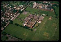
- Description:
- 200 f 2.5
- Subject:
- Roads, Trees, Air travel, Suburban life, and Houses
- Series:
- 25-65
- Creator:
- Cushman, Charles W., 1896-1972
- Date Created:
- 1965-06-02
- Genre:
- Aerial photographs and Cityscape photographs
- Frame Number:
- 17
- County:
- Greater London
- Abstract:
- London suburbs
- Call Number:
- P14740
- City:
- London
- Country:
- United Kingdom
- State/Province:
- England
- Alternate Identifier:
- 2565.17
- Persistent URL:
- http://purl.dlib.indiana.edu/iudl/archives/cushman/P14740
- Holding Location:
- Bloomington - University Archives
Wells Library E460
1320 E 10th St.
Bloomington, IN 47405
Contact at archives@indiana.edu, 812-855-1127
-
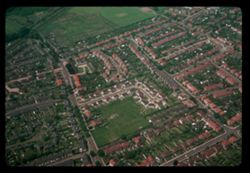
- Description:
- 200 f 2.5
- Subject:
- Heathrow Airport, Roads, Trees, Athletic fields, and Schools
- Series:
- 25-65
- Creator:
- Cushman, Charles W., 1896-1972
- Date Created:
- 1965-06-02
- Genre:
- Aerial photographs and Cityscape photographs
- Frame Number:
- 16
- County:
- Greater London
- Abstract:
- School near London Airport
- Call Number:
- P14739
- City:
- London
- Country:
- United Kingdom
- State/Province:
- England
- Alternate Identifier:
- 2565.16
- Persistent URL:
- http://purl.dlib.indiana.edu/iudl/archives/cushman/P14739
- Holding Location:
- Bloomington - University Archives
Wells Library E460
1320 E 10th St.
Bloomington, IN 47405
Contact at archives@indiana.edu, 812-855-1127
-
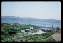
- Description:
- 100 f 11
- Subject:
- Channels, Hills, Hilton Hotels Corporation, Roads, Ferries, Trees, Buildings, Coastlines, and Croplands
- Series:
- 21-65
- Creator:
- Cushman, Charles W., 1896-1972
- Date Created:
- 1965-05-14
- Genre:
- Marine photographs and Landscape photographs
- Frame Number:
- 37
- County:
- Istanbul
- Abstract:
- View from Hilton balcony - the Stella Solerie in Bosporus
- Call Number:
- P14615
- City:
- Istanbul
- Country:
- Turkey
- State/Province:
- Marmara
- Alternate Identifier:
- 2165.37
- Persistent URL:
- http://purl.dlib.indiana.edu/iudl/archives/cushman/P14615
- Holding Location:
- Bloomington - University Archives
Wells Library E460
1320 E 10th St.
Bloomington, IN 47405
Contact at archives@indiana.edu, 812-855-1127
