Indiana University
Indiana University
IU
Skip to Content
Digital Collections
Toggle navigation
Digital
Collections
Switch language
English
Switch language
Deutsch
English
Español
Français
Italiano
Português do Brasil
中文
Login
Home
About
Contact
Search Digital Collections
Go
×
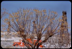
Search Constraints
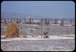
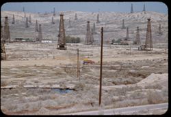
Start Over
You searched for:
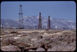
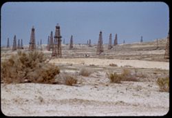
County
Kern
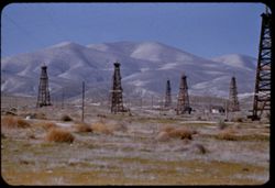
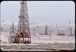
Remove constraint County: Kern
Subject
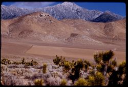
Shrubs
Remove constraint Subject: Shrubs
1
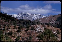
-
55
of
55
Sort by relevance ▼
relevance ▼
recently updated
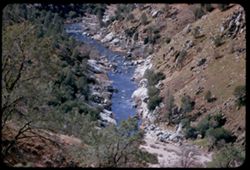
title ▲
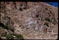
title ▼
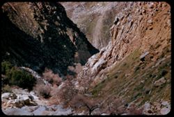
date created ▲
date created ▼
pages ▲
pages ▼
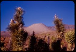
collection size ▲
collection size ▼
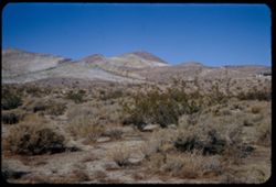
Number of results to display per page
100 per page
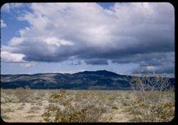
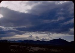
10
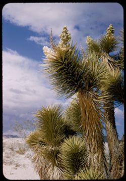
per page
20
per page
50
per page
100
per page
View results as:
List
Gallery
Masonry
Search Results
1.
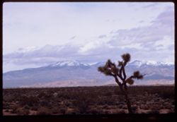
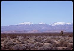
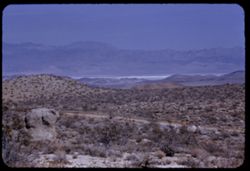
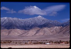
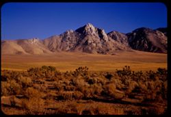
Toward snow-clad mountains across Mojave desert.
2.
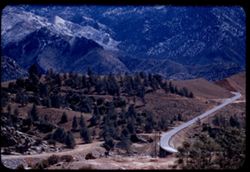
View NW toward Tehachapi Mtns from Hwy 14 south of Mojave, Calif.
3.
Toward Tehachapi Mtns. In morning from Mojave desert south of Mojave (Hwy 14)
4.
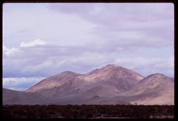
Mountains S-W of Mojave, Calif.
5.
NW from Hwy 14 south of Mojave
6.
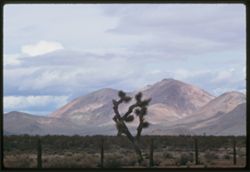
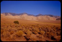
Mountains N.W. of US 6 north of Rosamond, Calif. -Mojave Desert
7.
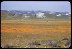
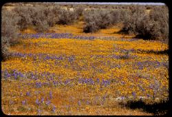
California poppies and foothills of Temblor Range SW of US 466 west of Blackwells Corner, Kern Co.
8.
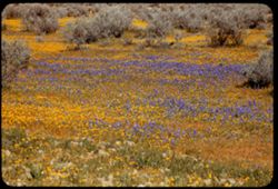
Lupine and yellow wild flowers along US 466 west of Wasco Kern county, Calif.
9.
Lupine and yellow wild flowers along US 466 west of Wasco, Kern Co.
10.
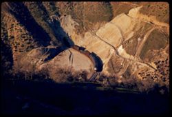
Southern Pacific freight emerges from tunnel on way up toward Keene in Tehachapi Mtns.
11.
Southern Pacific cuts and curves in Tehachapi Mtns. below Keene
12.
Southern Pacific tunnel and curve below Keene in Tehachapi Mtns. (seen from US 466)
13.
Southern Pacific tunnel in Tehachapi near Keene, Kern Co.
14.
Mountain above famous Sou. Pac. loop in the Tehachapi built in 1876 by Wm. Hood
15.
View west across distant Indian Wells Valley from Randsburg - Trona road NW corner Mojave desert
16.
View northward across China (dry) lake toward Argus Mtns in extreme NW corner of Mojave desert and San Bernardino Co. Calif
17.
Northward toward Argus Mtns from Johannesburg - Trona road in NW San Bernardino Co.
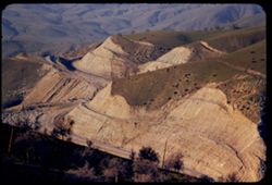
18.
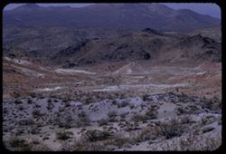
Bad lands along Kern - San Bernardino county line north of Randsburg California
19.
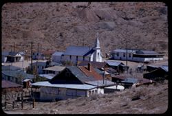
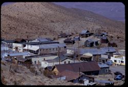
Randsberg, Kern County, California
20.
Eastern section of Randsburg, California eastern Kern County
21.
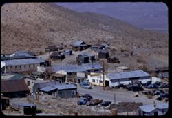
Looking down on center of Randsburg Califonia from school-house hill
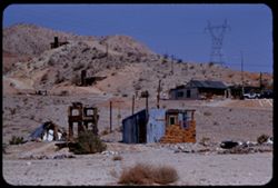
22.
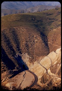
Minard's - on US 6 near Jawbone canyon Eastern Kern county two miles south of Wagon wheel
23.
Mountains near southern end of Sierra Nevada near jawbone Canyon in eastern Kern county from US 6 two miles south of Wagon wheel
24.
Lower end of Sierra Nevada from US 6 near Jawbone canyon in eastern Kern County 2 miles south of Wagon Wheel
25.
EK Chinaberry tree and oil company truck in Midway field north of Fellows
26.
Forest of derricks in Midway oil field north of Fellows, Kern County
27.
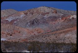
View west from Fellows, Kern County Toward California's Temblor Range
28.
EK Oil derricks northwest of Taft. Hazy morning - in background - Temblor Range
29.
Oil derricks north of Ford City Kern County, Calif.
30.
Oil Derricks in Elk Hills north of Taft. Kern Co. - Calif.
31.
Oil derricks north of Ford City near Taft, Calif.
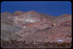
32.
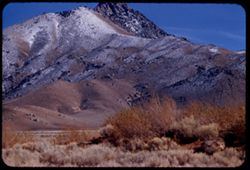
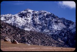
Owens Peak (8475 ft) from Cal 178 near Walker Pass EK CL
33.
A high Sierra (prob. Owens Pk.8475 ft.) seen from Cal. 178 about ten miles N.W. of Walker Pass EK CL
34.
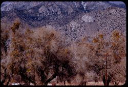
Mistletoe in cottonwoods along Calif. 178 20 miles NW of Walker Pass. Kern co., Calif.
35.
Mountain with frosted north slope between Isabella and Weldon, Kern county Calif.
36.
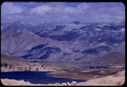
Tops of trees still show above surface of new Isabella Reservoir Kern Co. - Calif.
37.
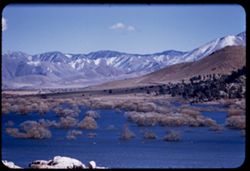
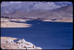
View S by E from Isabella Reservoir at noon. Kern Co., Calif.
38.
View N.E. across Isabella Reservoir Kern co., Calif.
39.
N by E across Isabella Reservoir toward Sierra Kern county, Calif.
40.
Cook peak 5410 ft. from Isabella, Calif. Kern county
41.
Sierra Nevada from Kern river canyon along Cal. 178 about 37 mi. east of Bakersfield Cook Peak 5,410 ft.
42.
View down Kern river canyon
43.
High up on right bank of Kern river canyon
44.
View up Kern river canyon along Cal. 178 east of Bakersfield
45.
KIAVAH Mtns. in NE Kern county seen from Calif. Hwy 178 through Walker Pass.
46.
Kiavah Mtns. seen from Hwy Calif. 178 through Walker Pass NE Kern county.
47.
along Calif. Hwy 178 east of Walker Pass. N-E Kern county.
48.
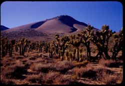
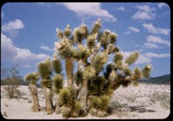
Joshua trees along Calif 178 on edge of Mojave Desert in NE Kern county.
49.
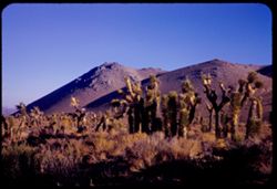
Along Walker Pass. Hwy Calif 178 in NE Kern county on edge of Mojave Desert.
50.
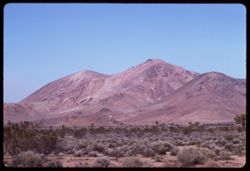
Mojave desert mountains west of US 6 near Rosamond Kern county Calif.
51.
Mojave Desert. From US 6, 10 miles north of Ricardo, Calif.
52.
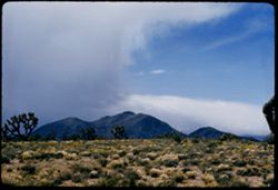
Storm clouds gather over Sierra Nevada. View is west from Ridgecrest-Trona road. California.
53.
Joshua tree. Near Ricardo, Calif. Mojave desert.
54.
Joshua tree along Hwy US 6 near Ricardo in the Mojave Desert.
55.
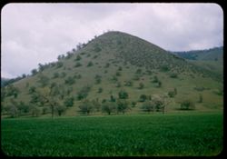
Peaked foothill along Hwy 466 west of Tehachapi Pass.
Toggle facets
Limit your search
Type
Image
55
Creator
Cushman, Charles W., 1896-1972
55
Subject
Shrubs
[remove]
55
Mountains
38
Hills
33
Trees
26
Rocks
18
Utility poles
16
Clouds
14
Deserts
13
Mojave Desert (Calif.)
13
Roads
12
more
Subjects
»
Date Created
1955-02-26
13
1955-03-21
10
1955-03-01
7
1952-04-07
5
1954-09-18
5
1955-03-24
5
1955-03-25
3
1969-03-21
3
1969-03-14
2
1953-11-23
1
more
Date Createds
»
Pages
0-99 pages
55
Collections
Charles W. Cushman Kodachrome Slides
55
State
deposited
55
Campus
IUB
55
Frame Number
15
6
19
5
17
4
18
4
16
3
20
3
21
3
23
3
10
2
11
2
County
Kern
[remove]
55
San Bernardino
4
Series
2-55
13
7-55
10
12-55
8
4-55
7
12-54
5
14-52
5
3-69
3
2-69
2
16-53
1
7-57
1
City
Keene
4
Mojave
4
Randsburg
4
Taft
4
Fellows
3
Lake Isabella
3
Ricardo
3
Bakersfield
2
China Lake
2
Ford City
2
Country
United States
55
State/Province
California
55
Holding Location
B-ARCHIVES
55