
Search Constraints
Search Results
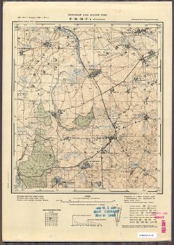
-

- Description:
- 1878
- Subject:
- Topical Subject: Maps, Geographic Subject: Recz, and Topical Subject: Soviet Union
- Publisher:
- Генеральный штаб Красной Армии
- Language:
- Russian
- Date Created:
- 1940
- Identifier:
- VAC9619-003875
- Genre:
- Military Maps and Topographic Maps
- Geographic Location:
- Coordinates: 53, 15.5, 53.333, 16
- Related URL:
- Catalog URL: https://iucat.iu.edu/catalog/5020129 and Download GeoTIFF: https://drive.google.com/file/d/1MtTE-kj8MWEiLVuiHqokFl9o8Kj2sg80/view?usp=sharing
- Abstract:
- Modern area represented: Recz, West Pomerania, Poland
- Call Number:
- G7000 s100 .S7 sheet N-33-104
- City:
- Реетц (Reetz)
- Copyright Holder:
- No Copyright - United States
- Country:
- Германия (Germany)
- Physical Description:
- Scale: 1:100,000
- Persistent URL:
- http://purl.dlib.indiana.edu/iudl/images/VAC9619/VAC9619-003875
- Provenance:
- DMA Topographic Center, Army Map Service Library, OMAHA, Library of Congress Geography & Map Division
-
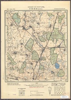
- Description:
- 1921
- Subject:
- Topical Subject: Maps, Geographic Subject: Złotów, and Topical Subject: Soviet Union
- Publisher:
- Генеральный штаб Красной Армии
- Language:
- Russian
- Date Created:
- 1940
- Identifier:
- VAC9619-003874
- Genre:
- Military Maps and Topographic Maps
- Geographic Location:
- Coordinates: 53.333, 17, 53.667, 17.5
- Related URL:
- Download GeoTIFF: https://drive.google.com/file/d/1AypDm9dnc0mRAVtRPsZ5-aVbRQwI_zYe/view?usp=sharing and Catalog URL: https://iucat.iu.edu/catalog/5020129
- Abstract:
- Modern area represented: Złotów, Greater Poland Voivodeship, Poland
- Call Number:
- G7000 s100 .S7 sheet N-33-95
- City:
- Флатов (Flatow)
- Copyright Holder:
- No Copyright - United States
- Country:
- Германия (Germany)
- Physical Description:
- Scale: 1:100,000
- Persistent URL:
- http://purl.dlib.indiana.edu/iudl/images/VAC9619/VAC9619-003874
- Provenance:
- DMA Topographic Center, Army Map Service Library, Auswärtiges Amt. Geographischer Dienst
-
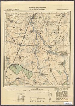
- Description:
- 1926
- Subject:
- Topical Subject: Soviet Union, Topical Subject: Maps, and Geographic Subject: Jastrowie
- Publisher:
- Генеральный штаб Красной Армии
- Language:
- Russian
- Date Created:
- 1940
- Identifier:
- VAC9619-003873
- Genre:
- Topographic Maps and Military Maps
- Geographic Location:
- Coordinates: 53.333, 16.5, 53.667, 17
- Related URL:
- Download GeoTIFF: https://drive.google.com/file/d/1r7LeT0tWHwEpDksLihYHX-InOTIjT-a3/view?usp=sharing and Catalog URL: https://iucat.iu.edu/catalog/5020129
- Abstract:
- Modern area represented: Jastrowie, Greater Poland, Poland
- Call Number:
- G7000 s100 .S7 sheet N-33-94
- City:
- Ястров (Jastrow)
- Copyright Holder:
- No Copyright - United States
- Country:
- Германия (Germany)
- Physical Description:
- Scale: 1:100,000
- Persistent URL:
- http://purl.dlib.indiana.edu/iudl/images/VAC9619/VAC9619-003873
- Provenance:
- DMA Topographic Center, Army Map Service Library, Auswärtiges Amt. Geographischer Dienst
-
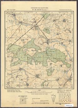
- Description:
- 1875
- Subject:
- Topical Subject: Maps, Geographic Subject: Czaplinek, and Topical Subject: Soviet Union
- Publisher:
- Генеральный штаб Красной Армии
- Language:
- Russian
- Date Created:
- 1940
- Identifier:
- VAC9619-003872
- Genre:
- Military Maps and Topographic Maps
- Geographic Location:
- Coordinates: 53.333, 16, 53.667, 16.5
- Related URL:
- Download GeoTIFF: https://drive.google.com/file/d/1y3DvNbvK3gxo3Rz_myXS1l1CzfphR363/view?usp=sharing and Catalog URL: https://iucat.iu.edu/catalog/5020129
- Abstract:
- Modern area represented: Czaplinek, West Pomeranian Voivodeship, Poland
- Call Number:
- G7000 s100 .S7 sheet N-33-93
- City:
- Темпельбург (Tempelburg)
- Copyright Holder:
- No Copyright - United States
- Country:
- Германия (Germany)
- Physical Description:
- Scale: 1:100,000
- Persistent URL:
- http://purl.dlib.indiana.edu/iudl/images/VAC9619/VAC9619-003872
- Provenance:
- DMA Topographic Center, Army Map Service Library, Auswärtiges Amt. Geographischer Dienst
-
- Description:
- 1877
- Subject:
- Topical Subject: Maps, Geographic Subject: Drawsko Pomorskie, and Topical Subject: Soviet Union
- Publisher:
- Генеральный штаб РККА
- Language:
- Russian
- Date Created:
- 1940
- Identifier:
- VAC9619-003871
- Genre:
- Military Maps and Topographic Maps
- Geographic Location:
- Coordinates: 53.333, 15.5, 53.667, 16
- Related URL:
- Download GeoTIFF: https://drive.google.com/file/d/1kZMEmT3bY-AuXddXUMmGvXRW5Z2BHrgy/view?usp=sharing and Catalog URL: https://iucat.iu.edu/catalog/5020129
- Abstract:
- Modern area represented: Drawsko Pomorskie, West Pomeranian Voivodeship, Poland
- Call Number:
- G7000 s100 .S7 sheet N-33-92
- City:
- Драмбург (Dramburg)
- Copyright Holder:
- No Copyright - United States
- Country:
- Германия (Germany)
- Physical Description:
- Scale: 1:100,000
- Persistent URL:
- http://purl.dlib.indiana.edu/iudl/images/VAC9619/VAC9619-003871
- Provenance:
- DMA Topographic Center, Army Map Service Library, Auswärtiges Amt. Geographischer Dienst
-
- Description:
- 1928
- Subject:
- Geographic Subject: Chojnice, Topical Subject: Maps, and Topical Subject: Soviet Union
- Publisher:
- Генеральный штаб Красной Армии
- Language:
- Russian
- Date Created:
- 1940
- Identifier:
- VAC9619-003870
- Genre:
- Military Maps and Topographic Maps
- Geographic Location:
- Coordinates: 53.667, 17.5, 54, 18
- Related URL:
- Catalog URL: https://iucat.iu.edu/catalog/5020129 and Download GeoTIFF: https://drive.google.com/file/d/1odqQ66BMOV6IjcvCn2etl9a0s3XzeLnB/view?usp=sharing
- Abstract:
- Modern area represented: Chojnice, Pomeranian Voivodeship, Poland
- Call Number:
- G7000 s100 .S7 sheet N-33-84
- City:
- Конитц (Conitz)
- Copyright Holder:
- No Copyright - United States
- Country:
- Германия (Germany)
- Physical Description:
- Scale: 1:100,000
- Persistent URL:
- http://purl.dlib.indiana.edu/iudl/images/VAC9619/VAC9619-003870
- Provenance:
- DMA Topographic Center, Army Map Service Library
-
- Description:
- 1921
- Subject:
- Topical Subject: Maps, Topical Subject: Soviet Union, and Geographic Subject: Pomeranian Voivodeship
- Publisher:
- Генеральный штаб РККА
- Language:
- Russian
- Date Created:
- 1940
- Identifier:
- VAC9619-003869
- Genre:
- Topographic Maps and Military Maps
- Geographic Location:
- Coordinates: 53.667, 17, 54, 17.5
- Related URL:
- Download GeoTIFF: https://drive.google.com/file/d/1ECQb8yIcYW04beF4Fx_4EfgbRIo6n1fH/view?usp=sharing and Catalog URL: https://iucat.iu.edu/catalog/5020129
- Abstract:
- Modern area represented: Pomeranian Voivodeship, Poland
- Call Number:
- G7000 s100 .S7 sheet N-33-83
- City:
- Прехлау (Priechlau)
- Copyright Holder:
- No Copyright - United States
- Country:
- Германия (Germany)
- Physical Description:
- Scale: 1:100,000
- Persistent URL:
- http://purl.dlib.indiana.edu/iudl/images/VAC9619/VAC9619-003869
- Provenance:
- DMA Topographic Center, Army Map Service Library
-
- Description:
- 1924
- Subject:
- Geographic Subject: Szczecinek, Topical Subject: Maps, and Topical Subject: Soviet Union
- Publisher:
- Генеральный штаб Красной Армии
- Language:
- Russian
- Date Created:
- 1940
- Identifier:
- VAC9619-003868
- Genre:
- Military Maps and Topographic Maps
- Geographic Location:
- Coordinates: 53.667, 16.5, 54, 17
- Related URL:
- Catalog URL: https://iucat.iu.edu/catalog/5020129 and Download GeoTIFF: https://drive.google.com/file/d/1snQO_DflCq0ZOLTkYKf6cgtYce4EtyDM/view?usp=sharing
- Abstract:
- Modern area represented: Szczecinek, West Pomerania, Poland
- Call Number:
- G7000 s100 .S7 sheet N-33-82
- City:
- Нойштеттин (Neustettin)
- Copyright Holder:
- No Copyright - United States
- Country:
- Германия (Germany)
- Physical Description:
- Scale: 1:100,000
- Persistent URL:
- http://purl.dlib.indiana.edu/iudl/images/VAC9619/VAC9619-003868
- Provenance:
- DMA Topographic Center, Army Map Service Library, Auswärtiges Amt. Geographischer Dienst
-
- Description:
- 1875
- Subject:
- Topical Subject: Maps, Geographic Subject: Połczyn-Zdrój, and Topical Subject: Soviet Union
- Publisher:
- Генеральный штаб Красной Армии
- Language:
- Russian
- Date Created:
- 1940
- Identifier:
- VAC9619-003867
- Genre:
- Military Maps and Topographic Maps
- Geographic Location:
- Coordinates: 53.667, 16, 54, 16.5
- Related URL:
- Catalog URL: https://iucat.iu.edu/catalog/5020129 and Download GeoTIFF: https://drive.google.com/file/d/1Keo5DhvSXaaA3wxFf6A3x9F73pHENMEn/view?usp=sharing
- Abstract:
- Modern area represented: Połczyn-Zdrój, West Pomerania, Poland
- Call Number:
- G7000 s100 .S7 sheet N-33-81
- City:
- Польцин (Polzin)
- Copyright Holder:
- No Copyright - United States
- Country:
- Германия (Germany)
- Physical Description:
- Scale: 1:100,000
- Persistent URL:
- http://purl.dlib.indiana.edu/iudl/images/VAC9619/VAC9619-003867
- Provenance:
- DMA Topographic Center, Army Map Service Library
-
- Description:
- 1889
- Subject:
- Topical Subject: Maps, Topical Subject: Soviet Union, and Geographic Subject: Świdwin
- Publisher:
- Генеральный штаб РККА
- Language:
- Russian
- Date Created:
- 1940
- Identifier:
- VAC9619-003866
- Genre:
- Topographic Maps and Military Maps
- Geographic Location:
- Coordinates: 53.667, 15.5, 54, 16
- Related URL:
- Catalog URL: https://iucat.iu.edu/catalog/5020129 and Download GeoTIFF: https://drive.google.com/file/d/1Zn5NvbsNWHhQkJYyoLYcf4Z1YKkgoGxD/view?usp=sharing
- Abstract:
- Modern area represented: Świdwin, West Pomerania, Poland
- Call Number:
- G7000 s100 .S7 sheet N-33-80
- City:
- Шифельбайн (Schivelbein)
- Copyright Holder:
- No Copyright - United States
- Country:
- Германия (Germany)
- Physical Description:
- Scale: 1:100,000
- Persistent URL:
- http://purl.dlib.indiana.edu/iudl/images/VAC9619/VAC9619-003866
- Provenance:
- DMA Topographic Center, Army Map Service Library, Auswärtiges Amt. Geographischer Dienst
-
- Description:
- 1928
- Subject:
- Geographic Subject: Kościerzyna, Topical Subject: Maps, and Topical Subject: Soviet Union
- Publisher:
- Генеральный штаб Красной Армии
- Language:
- Russian
- Date Created:
- 1940
- Identifier:
- VAC9619-003865
- Genre:
- Topographic Maps and Military Maps
- Geographic Location:
- Coordinates: 54, 17.5, 54.333, 18
- Related URL:
- Catalog URL: https://iucat.iu.edu/catalog/5020129 and Download GeoTIFF: https://drive.google.com/file/d/1-5SRMq5waAz4GHBNJQcb0A8j4PwwiUL7/view?usp=sharing
- Abstract:
- Modern area represented: Kościerzyna, Pomerania region, Poland
- Call Number:
- G7000 s100 .S7 sheet N-33-72
- City:
- Берент (Berent)
- Copyright Holder:
- No Copyright - United States
- Country:
- Германия (Germany)
- Physical Description:
- Scale: 1:100,000
- Persistent URL:
- http://purl.dlib.indiana.edu/iudl/images/VAC9619/VAC9619-003865
- Provenance:
- DMA Topographic Center, Army Map Service Library
-
- Subject:
- Geographic Subject: Stare Juchy, Topical Subject: Soviet Union, and Topical Subject: Maps
- Publisher:
- Генеральный штаб Красной Армии
- Language:
- Russian
- Date Created:
- 1940
- Identifier:
- VAC9619-003863
- Genre:
- Topographic Maps and Military Maps
- Geographic Location:
- Coordinates: 53.917, 22.125, 54, 22.25
- Related URL:
- Download GeoTIFF: https://drive.google.com/file/d/12cnyPKgpZthYCmmj9nW5JXZbsH_4sU9Z/view?usp=sharing and Catalog URL: https://iucat.iu.edu/catalog/14701157
- Abstract:
- Modern area represented: Stare Juchy, Poland
- Call Number:
- G7063.K2 s25 .S6 sheet N-34-81-A-b
- City:
- Юха (Jucha)
- Copyright Holder:
- No Copyright - United States
- Country:
- Германия (Восточная Пруссия) (Germany (East Prussia))
- Physical Description:
- Scale: 1:25,000
- Persistent URL:
- http://purl.dlib.indiana.edu/iudl/images/VAC9619/VAC9619-003863
- Provenance:
- Army Map Service Library, OMAHA, Library of Congress Geography & Map Division
-
- Subject:
- Topical Subject: Soviet Union, Topical Subject: Maps, and Geographic Subject: Skomack Wielki
- Publisher:
- Генеральный штаб Красной Армии
- Language:
- Russian
- Date Created:
- 1940
- Identifier:
- VAC9619-003862
- Genre:
- Military Maps and Topographic Maps
- Geographic Location:
- Coordinates: 53.833, 22, 53.917, 22.125
- Related URL:
- Download GeoTIFF: https://drive.google.com/file/d/1q8gEM7NNijYQySvuZhs9PiqcGXxDDMvs/view?usp=sharing and Catalog URL: https://iucat.iu.edu/catalog/14701157
- Abstract:
- Modern area represented: Skomack Wielki, Poland
- Call Number:
- G7063.K2 s25 .S6 sheet N-34-81-A-c
- City:
- Скоматцко (Skomatzko)
- Copyright Holder:
- No Copyright - United States
- Country:
- Германия (Восточная Пруссия) (Germany (East Prussia))
- Physical Description:
- Scale: 1:25,000
- Persistent URL:
- http://purl.dlib.indiana.edu/iudl/images/VAC9619/VAC9619-003862
- Provenance:
- Army Map Service Library, OMAHA, Library of Congress Geography & Map Division
-
- Subject:
- Topical Subject: Soviet Union, Topical Subject: Maps, and Geographic Subject: Wydminy
- Publisher:
- Генеральный штаб Красной Армии
- Language:
- Russian
- Date Created:
- 1940
- Identifier:
- VAC9619-003861
- Genre:
- Topographic Maps and Military Maps
- Geographic Location:
- Coordinates: 53.917, 22, 54, 22.125
- Related URL:
- Catalog URL: https://iucat.iu.edu/catalog/14701157 and Download GeoTIFF: https://drive.google.com/file/d/1fxi4NEvJl9k-oai2W2C45LL8ErQrUgBW/view?usp=sharing
- Abstract:
- Modern area represented: Wydminy, Poland
- Call Number:
- G7063.K2 s25 .S6 sheet N-34-81-A-а
- City:
- Видминнен (Widminnen)
- Copyright Holder:
- No Copyright - United States
- Country:
- Германия (Восточная Пруссия) (Germany (East Prussia))
- Physical Description:
- Scale: 1:25,000
- Persistent URL:
- http://purl.dlib.indiana.edu/iudl/images/VAC9619/VAC9619-003861
- Provenance:
- Army Map Service Library, Library of Congress Geography & Map Division
-
- Subject:
- Topical Subject: Maps, Topical Subject: Soviet Union, and Geographic Subject: Rostki
- Publisher:
- Генеральный штаб Красной Армии
- Language:
- Russian
- Date Created:
- 1940
- Identifier:
- VAC9619-003860
- Genre:
- Military Maps and Topographic Maps
- Geographic Location:
- Coordinates: 53.667, 21.875, 53.75, 22
- Related URL:
- Catalog URL: https://iucat.iu.edu/catalog/14701157 and Download GeoTIFF: https://drive.google.com/file/d/1ZbsOReY_gJiiFND4OYgHPe5GP1y011i-/view?usp=sharing
- Abstract:
- Modern area represented: Rostki, Poland
- Call Number:
- G7063.K2 s25 .S6 sheet N-34-80-D-d
- City:
- Росткен (Rostken)
- Copyright Holder:
- No Copyright - United States
- Country:
- Германия (Восточная Пруссия) (Germany (East Prussia))
- Physical Description:
- Scale: 1:25,000
- Persistent URL:
- http://purl.dlib.indiana.edu/iudl/images/VAC9619/VAC9619-003860
- Provenance:
- Army Map Service Library, Library of Congress Geography & Map Division
-
- Subject:
- Topical Subject: Maps, Geographic Subject: Orzysz, and Topical Subject: Soviet Union
- Publisher:
- Генеральный штаб Красной Армии
- Language:
- Russian
- Date Created:
- 1940
- Identifier:
- VAC9619-003858
- Genre:
- Topographic Maps and Military Maps
- Geographic Location:
- Coordinates: 53.75, 21.875, 53.833, 22
- Related URL:
- Catalog URL: https://iucat.iu.edu/catalog/14701157 and Download GeoTIFF: https://drive.google.com/file/d/12PE6RX05z8YGlzrGpbj7YcJ0nBkBp4GB/view?usp=sharing
- Abstract:
- Modern area represented: Orzysz, Poland
- Call Number:
- G7063.K2 s25 .S6 sheet N-34-80-D-b
- City:
- Арис (Arys)
- Copyright Holder:
- No Copyright - United States
- Country:
- Германия (Восточная Пруссия) (Germany (East Prussia))
- Physical Description:
- Scale: 1:25,000
- Persistent URL:
- http://purl.dlib.indiana.edu/iudl/images/VAC9619/VAC9619-003858
- Provenance:
- Army Map Service Library, OMAHA, Library of Congress Geography & Map Division
-
- Subject:
- Topical Subject: Soviet Union, Geographic Subject: Nowe Guty, and Topical Subject: Maps
- Publisher:
- Генеральный штаб Красной Армии
- Language:
- Russian
- Date Created:
- 1940
- Identifier:
- VAC9619-003857
- Genre:
- Military Maps and Topographic Maps
- Geographic Location:
- Coordinates: 53.75, 21.75, 53.833, 21.875
- Related URL:
- Download GeoTIFF: https://drive.google.com/file/d/1nohtqUhVA4hP49Mh0l7EVQ0FlO1TrBZ0/view?usp=sharing and Catalog URL: https://iucat.iu.edu/catalog/14701157
- Abstract:
- Modern area represented: Nowe Guty, Poland
- Call Number:
- G7063.K2 s25 .S6 sheet N-34-80-D-а
- City:
- Гуттен (Gutten)
- Copyright Holder:
- No Copyright - United States
- Country:
- Германия (Восточная Пруссия) (Germany (East Prussia))
- Physical Description:
- Scale: 1:25,000
- Persistent URL:
- http://purl.dlib.indiana.edu/iudl/images/VAC9619/VAC9619-003857
- Provenance:
- Army Map Service Library, OMAHA, Library of Congress Geography & Map Division
-
- Subject:
- Geographic Subject: Kończewo, Topical Subject: Soviet Union, and Topical Subject: Maps
- Publisher:
- Генеральный штаб Красной Армии
- Language:
- Russian
- Date Created:
- 1940
- Identifier:
- VAC9619-003856
- Genre:
- Topographic Maps and Military Maps
- Geographic Location:
- Coordinates: 53.667, 21.625, 53.75, 21.75
- Related URL:
- Download GeoTIFF: https://drive.google.com/file/d/10WYl3LeYylpld-D2biULY2h0Uh5DUgX2/view?usp=sharing and Catalog URL: https://iucat.iu.edu/catalog/14701157
- Abstract:
- Modern area represented: Kończewo, Poland
- Call Number:
- G7063.K2 s25 .S6 sheet N-34-80-C-d
- City:
- Концевен (Konzewen)
- Copyright Holder:
- No Copyright - United States
- Country:
- Германия (Восточная Пруссия) (Germany (East Prussia))
- Physical Description:
- Scale: 1:25,000
- Persistent URL:
- http://purl.dlib.indiana.edu/iudl/images/VAC9619/VAC9619-003856
- Provenance:
- Army Map Service Library, OMAHA, Library of Congress Geography & Map Division
-
- Subject:
- Topical Subject: Maps, Topical Subject: Soviet Union, and Geographic Subject: Wipsowo
- Publisher:
- Генеральный штаб Красной Армии
- Language:
- Russian
- Date Created:
- 1940
- Identifier:
- VAC9619-003848
- Genre:
- Topographic Maps and Military Maps
- Geographic Location:
- Coordinates: 53.833, 20.75, 53.913, 20.875
- Related URL:
- Download GeoTIFF: https://drive.google.com/file/d/1JhRBqsg1tIs_iMj_4P7lUuGTmiI3bTuM/view?usp=sharing and Catalog URL: https://iucat.iu.edu/catalog/14701157
- Abstract:
- Modern area represented: Wipsowo, Poland
- Call Number:
- G7063.K2 s25 .S6 sheet N-34-78-B-c
- City:
- Випс (Wieps)
- Copyright Holder:
- No Copyright - United States
- Country:
- Германия (Восточная Пруссия) (Germany (East Prussia))
- Physical Description:
- Scale: 1:25,000
- Persistent URL:
- http://purl.dlib.indiana.edu/iudl/images/VAC9619/VAC9619-003848
- Provenance:
- Army Map Service Library, OMAHA, Library of Congress Geography & Map Division
-
- Subject:
- Topical Subject: Soviet Union, Topical Subject: Maps, and Geographic Subject: Kolno
- Publisher:
- Генеральный штаб Красной Армии
- Language:
- Russian
- Date Created:
- 1940
- Identifier:
- VAC9619-003847
- Genre:
- Military Maps and Topographic Maps
- Geographic Location:
- Coordinates: 53.913, 20.875, 54, 21
- Related URL:
- Download GeoTIFF: https://drive.google.com/file/d/1uStdeTNr1-57qca3X-EimLVaT_kNL9eV/view?usp=sharing and Catalog URL: https://iucat.iu.edu/catalog/14701157
- Abstract:
- Modern area represented: Kolno, Poland
- Call Number:
- G7063.K2 s25 .S6 sheet N-34-78-B-b
- City:
- Гросс Кёллен (Gross Köllen)
- Copyright Holder:
- No Copyright - United States
- Country:
- Германия (Восточная Пруссия) (Germany (East Prussia))
- Physical Description:
- Scale: 1:25,000
- Persistent URL:
- http://purl.dlib.indiana.edu/iudl/images/VAC9619/VAC9619-003847
- Provenance:
- Army Map Service Library, OMAHA, Library of Congress Geography & Map Division
-
- Subject:
- Topical Subject: Soviet Union, Topical Subject: Maps, and Geographic Subject: Miejska Wieś
- Publisher:
- Генеральный штаб Красной Армии
- Language:
- Russian
- Date Created:
- 1940
- Identifier:
- VAC9619-003846
- Genre:
- Topographic Maps and Military Maps
- Geographic Location:
- Coordinates: 53.913, 20.75, 54, 20.875
- Related URL:
- Catalog URL: https://iucat.iu.edu/catalog/14701157 and Download GeoTIFF: https://drive.google.com/file/d/1WqkOKwlyd7YOTSbtD8mkzjtOpQ3Qs4Dy/view?usp=sharing
- Abstract:
- Modern area represented: Miejska Wieś, Poland
- Call Number:
- G7063.K2 s25 .S6 sheet N-34-78-B-а
- City:
- Бюргерсдорф (Bürgerdorf)
- Copyright Holder:
- No Copyright - United States
- Country:
- Германия (Восточная Пруссия) (Germany (East Prussia))
- Physical Description:
- Scale: 1:25,000
- Persistent URL:
- http://purl.dlib.indiana.edu/iudl/images/VAC9619/VAC9619-003846
- Provenance:
- Army Map Service Library, OMAHA, Library of Congress Geography & Map Division
-
- Description:
- 1925
- Subject:
- Topical Subject: Maps, Topical Subject: Soviet Union, and Geographic Subject: Duły
- Publisher:
- Генеральный штаб Красной Армии
- Language:
- Russian
- Date Created:
- 1940
- Identifier:
- VAC9619-003817
- Genre:
- Topographic Maps and Military Maps
- Geographic Location:
- Coordinates: 54, 22.375, 54.083, 22.5
- Related URL:
- Catalog URL: https://iucat.iu.edu/catalog/14701157 and Download GeoTIFF: https://drive.google.com/file/d/1Y_1UZr1TTMr3K8D4GKgVMSZK1nZtsnSF/view?usp=sharing
- Abstract:
- Modern area represented: Duły, Poland
- Call Number:
- G7063.K2 s25 .S6 sheet N-34-69-D-d
- City:
- Дуллен (Dullen)
- Copyright Holder:
- No Copyright - United States
- Country:
- Германия (Восточная Пруссия) (Germany (East Prussia))
- Physical Description:
- Scale: 1:25,000
- Persistent URL:
- http://purl.dlib.indiana.edu/iudl/images/VAC9619/VAC9619-003817
- Provenance:
- Army Map Service Library, Library of Congress Geography & Map Division
-
- Subject:
- Topical Subject: Soviet Union, Topical Subject: Maps, and Geographic Subject: Skocze
- Publisher:
- Генеральный штаб Красной Армии
- Language:
- Russian
- Date Created:
- 1940
- Identifier:
- VAC9619-003815
- Genre:
- Topographic Maps and Military Maps
- Geographic Location:
- Coordinates: 54.25, 22.125, 54.333, 22.25
- Related URL:
- Catalog URL: https://iucat.iu.edu/catalog/14701157 and Download GeoTIFF: https://drive.google.com/file/d/1ccC3Z_HJ_4W-axdqdzBrgM8g2-JDllgf/view?usp=sharing
- Abstract:
- Modern area represented: Skocze, Poland
- Call Number:
- G7063.K2 s25 .S6 sheet N-34-69-A-b
- City:
- Скетшен (Skötschen)
- Copyright Holder:
- No Copyright - United States
- Country:
- Германия (Восточная Пруссия) (Germany (East Prussia))
- Physical Description:
- Scale: 1:25,000
- Persistent URL:
- http://purl.dlib.indiana.edu/iudl/images/VAC9619/VAC9619-003815
- Provenance:
- Army Map Service Library, OMAHA, Library of Congress Geography & Map Division
-
- Subject:
- Geographic Subject: Gusev, Topical Subject: Maps, and Topical Subject: Soviet Union
- Publisher:
- Генеральный штаб Красной Армии
- Language:
- Russian
- Date Created:
- 1940
- Identifier:
- VAC9619-003777
- Genre:
- Topographic Maps and Military Maps
- Geographic Location:
- Coordinates: 54.5, 22.125, 54.583333, 22.25
- Related URL:
- Catalog URL: https://iucat.iu.edu/catalog/14701157 and Download GeoTIFF: https://drive.google.com/file/d/1NiINW2Xz0KCnGUo8EkN-qSLfafA7z5eK/view?usp=sharing
- Abstract:
- Modern area represented: part of Gusev, Kaliningradskaya oblast, Russia
- Call Number:
- G7063.K2 s25 .S6 sheet N-34-57-A-d
- City:
- Норутшатшен (Norutschatschen)
- Copyright Holder:
- No Copyright - United States
- Country:
- Германия (Восточная Пруссия) (Germany (East Prussia))
- Physical Description:
- Scale: 1:25,000
- Persistent URL:
- http://purl.dlib.indiana.edu/iudl/images/VAC9619/VAC9619-003777
- Provenance:
- CIA Map Branch -- Received
-
- Subject:
- Topical Subject: Soviet Union, Geographic Subject: Mayakovskoye, and Topical Subject: Maps
- Publisher:
- Генеральный штаб РККА
- Language:
- Russian
- Date Created:
- 1940
- Identifier:
- VAC9619-003776
- Genre:
- Topographic Maps and Military Maps
- Geographic Location:
- Coordinates: 54.5, 22.0, 54.58333, 22.125
- Related URL:
- Catalog URL: https://iucat.iu.edu/catalog/14701157 and Download GeoTIFF: https://drive.google.com/file/d/1yIZKl2QoPAjXXlQ6j78DHVFsjlH5n_bQ/view?usp=sharing
- Abstract:
- Modern area represented: Маяковское (Mayakovskoye), Kaliningradskaya oblast, Russia
- Call Number:
- G7063.K2 s25 .S6 sheet N-34-57-A-c
- City:
- Неммерсдорф (Nemmersdorf)
- Copyright Holder:
- No Copyright - United States
- Country:
- Германия (Восточная Пруссия) (Germany (East Prussia))
- Physical Description:
- Scale: 1:25,000
- Persistent URL:
- http://purl.dlib.indiana.edu/iudl/images/VAC9619/VAC9619-003776
- Provenance:
- M. I. Map Library
-
- Subject:
- Topical Subject: Maps, Topical Subject: Soviet Union, and Geographic Subject: Gusev
- Publisher:
- Генеральный штаб Красной Армии
- Language:
- Russian
- Date Created:
- 1940
- Identifier:
- VAC9619-003775
- Genre:
- Military Maps and Topographic Maps
- Geographic Location:
- Coordinates: 54.583333, 22.125, 54.66667, 22.25
- Related URL:
- Catalog URL: https://iucat.iu.edu/catalog/14701157 and Download GeoTIFF: https://drive.google.com/file/d/1hn10OTfJZJitvwnQ6N0qRDwjIUvnMo0w/view?usp=sharing
- Abstract:
- Modern area represented: Гусев (Gusev), Kaliningradskaya oblast, Russia
- Call Number:
- G7063.K2 s25 .S6 sheet N-34-57-A-b
- City:
- Гумбиннен (Gumbinnen)
- Copyright Holder:
- No Copyright - United States
- Country:
- Германия (Восточная Пруссия) (Germany (East Prussia))
- Physical Description:
- Scale: 1:25,000
- Persistent URL:
- http://purl.dlib.indiana.edu/iudl/images/VAC9619/VAC9619-003775
- Provenance:
- M. I. Map Library
-
- Subject:
- Geographic Subject: L’vovskoye, Topical Subject: Maps, and Topical Subject: Soviet Union
- Publisher:
- Генеральный штаб Красной Армии
- Language:
- Russian
- Date Created:
- 1940
- Identifier:
- VAC9619-003774
- Genre:
- Topographic Maps and Military Maps
- Geographic Location:
- Coordinates: 54.33333, 21.875, 54.416667, 22.0
- Related URL:
- Download GeoTIFF: https://drive.google.com/file/d/12an_HxQIfh0ft86PjDpI4ROqoZxgOGFW/view?usp=sharing and Catalog URL: https://iucat.iu.edu/catalog/14701157
- Abstract:
- Modern area represented: Львовское (L’vovskoye), Kaliningradskaya oblast, Russia
- Call Number:
- G7063.K2 s25 .S6 sheet N-34-56-D-d
- City:
- Гудваллен (Gudwallen)
- Copyright Holder:
- No Copyright - United States
- Country:
- Германия (Восточная Пруссия) (Germany (East Prussia))
- Physical Description:
- Scale: 1:25,000
- Persistent URL:
- http://purl.dlib.indiana.edu/iudl/images/VAC9619/VAC9619-003774
- Provenance:
- M. I. Map Library
-
- Subject:
- Geographic Subject: Zaozernoye, Topical Subject: Maps, and Topical Subject: Soviet Union
- Publisher:
- Генеральный штаб Красной Армии
- Language:
- Russian
- Date Created:
- 1940
- Identifier:
- VAC9619-003773
- Genre:
- Military Maps and Topographic Maps
- Geographic Location:
- Coordinates: 54.33333, 21.75, 54.416667, 21.875
- Related URL:
- Catalog URL: https://iucat.iu.edu/catalog/14701157 and Download GeoTIFF: https://drive.google.com/file/d/1_-KY0WiD0y2Zy7akIVlDvZVmfepqE6Gq/view?usp=sharing
- Abstract:
- Modern area represented: Заозерное (Zaozernoye), Kaliningradskaya oblast, Russia
- Call Number:
- G7063.K2 s25 .S6 sheet N-34-56-D-c
- City:
- Коваррен (Kowarren)
- Copyright Holder:
- No Copyright - United States
- Country:
- Германия (Восточная Пруссия) (Germany (East Prussia))
- Physical Description:
- Scale: 1:25,000
- Persistent URL:
- http://purl.dlib.indiana.edu/iudl/images/VAC9619/VAC9619-003773
- Provenance:
- CIA Map Branch -- Received
-
- Subject:
- Geographic Subject: Sadovoye, Topical Subject: Soviet Union, and Topical Subject: Maps
- Publisher:
- Генеральный штаб Красной Армии
- Language:
- Russian
- Date Created:
- 1940
- Identifier:
- VAC9619-003772
- Genre:
- Military Maps and Topographic Maps
- Geographic Location:
- Coordinates: 54.416667, 21.875, 54.5, 22.0
- Related URL:
- Catalog URL: https://iucat.iu.edu/catalog/14701157 and Download GeoTIFF: https://drive.google.com/file/d/1XZEYPE501MjrhLpnm3m9ccyC4L-Vgp1c/view?usp=sharing
- Abstract:
- Modern area represented: Садовое (Sadovoye), Kaliningradskaya oblast, Russia
- Call Number:
- G7063.K2 s25 .S6 sheet N-34-56-D-b
- City:
- Балетхен (Baletkhen)
- Copyright Holder:
- No Copyright - United States
- Country:
- Германия (Восточная Пруссия) (Germany (East Prussia))
- Physical Description:
- Scale: 1:25,000
- Persistent URL:
- http://purl.dlib.indiana.edu/iudl/images/VAC9619/VAC9619-003772
- Provenance:
- M. I. Map Library
-
- Subject:
- Topical Subject: Maps, Geographic Subject: Yudino, and Topical Subject: Soviet Union
- Publisher:
- Генеральный штаб Красной Армии
- Language:
- Russian
- Date Created:
- 1940
- Identifier:
- VAC9619-003771
- Genre:
- Military Maps and Topographic Maps
- Geographic Location:
- Coordinates: 54.625, 21.75, 54.5, 21.875
- Related URL:
- Catalog URL: https://iucat.iu.edu/catalog/14701157 and Download GeoTIFF: https://drive.google.com/file/d/1HICKS0mJ8K-6du3h6Y7YHP-tA74L8hg5/view?usp=sharing
- Abstract:
- Modern area represented: Юдинo (Yudino), Kaliningradskaya oblast, Russia
- Call Number:
- G7063.K2 s25 .S6 sheet N-34-56-D-а
- City:
- Йургайтшен (Jurgaitschen)
- Copyright Holder:
- No Copyright - United States
- Country:
- Германия (Восточная Пруссия) (Germany (East Prussia))
- Physical Description:
- Scale: 1:25,000
- Persistent URL:
- http://purl.dlib.indiana.edu/iudl/images/VAC9619/VAC9619-003771
- Provenance:
- M. I. Map Library
-
- Subject:
- Geographic Subject: Kamenka, Topical Subject: Maps, and Topical Subject: Soviet Union
- Publisher:
- Генеральный штаб Красной Армии
- Language:
- Russian
- Date Created:
- 1940
- Identifier:
- VAC9619-003770
- Genre:
- Topographic Maps and Military Maps
- Geographic Location:
- Coordinates: 54.33333, 21.5, 54.416667, 21.625
- Related URL:
- Catalog URL: https://iucat.iu.edu/catalog/14701157 and Download GeoTIFF: https://drive.google.com/file/d/1usUnzt3AGpv7Pz8LkjduEMpZKCa8qPp3/view?usp=sharing
- Abstract:
- Modern area represented: Каменка (Kamenka), Kaliningradskaya oblast, Russia
- Call Number:
- G7063.K2 s25 .S6 sheet N-34-56-C-c
- City:
- Пентлак (Pentlack)
- Copyright Holder:
- No Copyright - United States
- Country:
- Германия (Восточная Пруссия) (Germany (East Prussia))
- Physical Description:
- Scale: 1:25,000
- Persistent URL:
- http://purl.dlib.indiana.edu/iudl/images/VAC9619/VAC9619-003770
- Provenance:
- CIA Map Branch -- Received
-
- Subject:
- Topical Subject: Maps, Topical Subject: Soviet Union, and Geographic Subject: Volodarovka
- Publisher:
- Генеральный штаб Красной Армии
- Language:
- Russian
- Date Created:
- 1940
- Identifier:
- VAC9619-003769
- Genre:
- Military Maps and Topographic Maps
- Geographic Location:
- Coordinates: 54.416667, 21.625, 54.5, 21.75
- Related URL:
- Catalog URL: https://iucat.iu.edu/catalog/14701157 and Download GeoTIFF: https://drive.google.com/file/d/1HsQVfue3DKYKEO1n4kswkseAKxcDnGMI/view?usp=sharing
- Abstract:
- Modern area represented: Володаровка (Volodarovka), Kaliningradskaya oblast, Russia
- Call Number:
- G7063.K2 s25 .S6 sheet N-34-56-C-b
- City:
- Йодлаукен (Jodlauken)
- Copyright Holder:
- No Copyright - United States
- Country:
- Германия (Восточная Пруссия) (Germany (East Prussia))
- Physical Description:
- Scale: 1:25,000
- Persistent URL:
- http://purl.dlib.indiana.edu/iudl/images/VAC9619/VAC9619-003769
- Provenance:
- CIA Map Branch -- Received
-
- Subject:
- Topical Subject: Soviet Union, Geographic Subject: Frunzenskoye, and Topical Subject: Maps
- Publisher:
- Генеральный штаб Красной Армии
- Language:
- Russian
- Date Created:
- 1940
- Identifier:
- VAC9619-003768
- Genre:
- Military Maps and Topographic Maps
- Geographic Location:
- Coordinates: 54.416667, 21.5, 54.5, 21.675
- Related URL:
- Download GeoTIFF: https://drive.google.com/file/d/18Fhcv4dOn1NqV5yAnoUHbnYugZv0g5HW/view?usp=sharing and Catalog URL: https://iucat.iu.edu/catalog/14701157
- Abstract:
- Modern area represented: Фрунзенское (Frunzenskoye), Kaliningradskaya oblast, Russia
- Call Number:
- G7063.K2 s25 .S6 sheet N-34-56-C-а
- Caption:
- Captured map
- City:
- Бокеллен (Bokellen)
- Copyright Holder:
- No Copyright - United States
- Country:
- Германия (Восточная Пруссия) (Germany (East Prussia))
- Physical Description:
- Scale: 1:25,000
- Persistent URL:
- http://purl.dlib.indiana.edu/iudl/images/VAC9619/VAC9619-003768
- Provenance:
- CIA Map Branch -- Received, Army Map Service Library
-
- Subject:
- Topical Subject: Maps, Geographic Subject: Krasnoyarskoye, and Topical Subject: Soviet Union
- Publisher:
- Генеральный штаб РККА
- Language:
- Russian
- Date Created:
- 1940
- Identifier:
- VAC9619-003767
- Genre:
- Military Maps and Topographic Maps
- Geographic Location:
- Coordinates: 54.5, 21.875, 54.583333, 22.0
- Related URL:
- Download GeoTIFF: https://drive.google.com/file/d/1gDoR4a09I9AGczRACMqkhG73rEy1xji5/view?usp=sharing and Catalog URL: https://iucat.iu.edu/catalog/14701157
- Abstract:
- Modern area represented: Красноярское (Krasnoyarskoye), Kaliningradskaya oblast, Russia
- Call Number:
- G7063.K2 s25 .S6 sheet N-34-56-B-d
- City:
- Зоденен (Sodehnen)
- Copyright Holder:
- No Copyright - United States
- Country:
- Германия (Восточная Пруссия) (Germany (East Prussia))
- Physical Description:
- Scale: 1:25,000
- Persistent URL:
- http://purl.dlib.indiana.edu/iudl/images/VAC9619/VAC9619-003767
- Provenance:
- CIA Map Branch -- Received
-
- Subject:
- Topical Subject: Maps, Geographic Subject: Tel’manovo, and Topical Subject: Soviet Union
- Publisher:
- Генеральный штаб РККА
- Language:
- Russian
- Date Created:
- 1940
- Identifier:
- VAC9619-003766
- Genre:
- Topographic Maps and Military Maps
- Geographic Location:
- Coordinates: 54.5, 21.75, 54.583333, 21.875
- Related URL:
- Download GeoTIFF: https://drive.google.com/file/d/1H2FNsPR9DJfa7zT2eb5RkZ5w1Ee7Q5n8/view?usp=sharing and Catalog URL: https://iucat.iu.edu/catalog/14701157
- Abstract:
- Modern area represented: Тельманово (Tel’manovo), Kaliningradskaya oblast, Russia
- Call Number:
- G7063.K2 s25 .S6 sheet N-34-56-B-c
- City:
- Дидлаккен (Didlacken)
- Copyright Holder:
- No Copyright - United States
- Country:
- Германия (Восточная Пруссия) (Germany (East Prussia))
- Physical Description:
- Scale: 1:25,000
- Persistent URL:
- http://purl.dlib.indiana.edu/iudl/images/VAC9619/VAC9619-003766
- Provenance:
- CIA Map Branch -- Received
-
- Subject:
- Topical Subject: Maps, Topical Subject: Soviet Union, and Geographic Subject: Zverevo
- Publisher:
- Генеральный штаб РККА
- Language:
- Russian
- Date Created:
- 1940
- Identifier:
- VAC9619-003765
- Genre:
- Topographic Maps and Military Maps
- Geographic Location:
- Coordinates: 54.3333, 21.375, 54.416667, 21.5
- Related URL:
- Catalog URL: https://iucat.iu.edu/catalog/14701157 and Download GeoTIFF: https://drive.google.com/file/d/14zHhtIuohakc9cXzCiLjuN7aUHOgICfx/view?usp=sharing
- Abstract:
- Modern area represented: Зверево (Zverevo), Kaliningradskaya oblast, Russia
- Call Number:
- G7063.K2 s25 .S6 sheet N-34-55-D-d
- City:
- Вандлакен (Wandlacken)
- Copyright Holder:
- No Copyright - United States
- Country:
- Германия (Восточная Пруссия) (Germany (East Prussia))
- Physical Description:
- Scale: 1:25,000
- Persistent URL:
- http://purl.dlib.indiana.edu/iudl/images/VAC9619/VAC9619-003765
- Provenance:
- CIA Map Branch -- Received
-
- Subject:
- Geographic Subject: Mozyr', Topical Subject: Soviet Union, and Topical Subject: Maps
- Publisher:
- Генеральный штаб РККА
- Language:
- Russian
- Date Created:
- 1940
- Identifier:
- VAC9619-003764
- Genre:
- Topographic Maps and Military Maps
- Geographic Location:
- Coordinates: 54.416667, 21.375, 54.5, 21.5
- Related URL:
- Download GeoTIFF: https://drive.google.com/file/d/1rzYJ4jELzYhA075PzqMO_6FAlPm9H3TG/view?usp=sharing and Catalog URL: https://iucat.iu.edu/catalog/14701157
- Abstract:
- Modern area represented: Мозырь (Mozyr'), Kaliningradskaya oblast, Russia
- Call Number:
- G7063.K2 s25 .S6 sheet N-34-55-D-b
- City:
- Клайн Гние (Klein Gnie)
- Copyright Holder:
- No Copyright - United States
- Country:
- Германия (Восточная Пруссия) (Germany (East Prussia))
- Physical Description:
- Scale: 1:25,000
- Persistent URL:
- http://purl.dlib.indiana.edu/iudl/images/VAC9619/VAC9619-003764
- Provenance:
- M. I. Map Library
-

- Subject:
- Topical Subject: Soviet Union, Topical Subject: Maps, and Geographic Subject: Novo-Biyskoye
- Publisher:
- Генеральный штаб РККА
- Language:
- Russian
- Date Created:
- 1940
- Identifier:
- VAC9619-003763
- Genre:
- Military Maps and Topographic Maps
- Geographic Location:
- Coordinates: 54.416667, 21.25, 54.5, 21.375
- Related URL:
- Download GeoTIFF: https://drive.google.com/file/d/12ADQ-KwvRsbz_NrkgrhOE6_uEKunq8Ac/view?usp=sharing and Catalog URL: https://iucat.iu.edu/catalog/14701157
- Abstract:
- Modern area represented: Ново-Бийское (Novo-Biyskoye), Kaliningradskaya oblast, Russia
- Call Number:
- G7063.K2 s25 .S6 sheet N-34-55-D-а
- Caption:
- Captured map
- City:
- Фридрихсвальде (Friedrichswalde)
- Copyright Holder:
- No Copyright - United States
- Country:
- Германия (Восточная Пруссия) (Germany (East Prussia))
- Physical Description:
- Scale: 1:25,000
- Persistent URL:
- http://purl.dlib.indiana.edu/iudl/images/VAC9619/VAC9619-003763
- Provenance:
- Army Map Service Library, OMAHA, Library of Congress Geography & Map Division
-
- Subject:
- Topical Subject: Maps, Topical Subject: Soviet Union, and Geographic Subject: Trostniki
- Publisher:
- Генеральный штаб РККА
- Language:
- Russian
- Date Created:
- 1940
- Identifier:
- VAC9619-003762
- Genre:
- Topographic Maps and Military Maps
- Geographic Location:
- Coordinates: 54.33333, 21.125, 54.416667, 21.25
- Related URL:
- Catalog URL: https://iucat.iu.edu/catalog/14701157 and Download GeoTIFF: https://drive.google.com/file/d/1wZcpkvnbScBw9T8OXj-MIwmDbLU_-QpN/view?usp=sharing
- Abstract:
- Modern area represented: Тростники (Trostniki), Kaliningradskaya oblast, Russia
- Call Number:
- G7063.K2 s25 .S6 sheet N-34-55-C-d
- City:
- Шакенхоф (Schakenhof)
- Copyright Holder:
- No Copyright - United States
- Country:
- Германия (Восточная Пруссия) (Germany (East Prussia))
- Physical Description:
- Scale: 1:25,000
- Persistent URL:
- http://purl.dlib.indiana.edu/iudl/images/VAC9619/VAC9619-003762
- Provenance:
- DMA Topographic Center, Army Map Service Library, Library of Congress Geography & Map Division
-
- Subject:
- Geographic Subject: Sevskoye, Topical Subject: Maps, and Topical Subject: Soviet Union
- Publisher:
- Генеральный штаб РККА
- Language:
- Russian
- Date Created:
- 1940
- Identifier:
- VAC9619-003761
- Genre:
- Military Maps and Topographic Maps
- Geographic Location:
- Coordinates: 54.33333, 21.0, 54.416667, 21.125
- Related URL:
- Download GeoTIFF: https://drive.google.com/file/d/1njT50SJERmJ9Vc0pRyiX8Kpf7mFuNjxz/view?usp=sharing and Catalog URL: https://iucat.iu.edu/catalog/14701157
- Abstract:
- Modern area represented: Севское (Sevskoye), Kaliningradskaya oblast, Russia
- Call Number:
- G7063.K2 s25 .S6 sheet N-34-55-C-c
- City:
- Бетхерсдорф (Böttchersdorf)
- Copyright Holder:
- No Copyright - United States
- Country:
- Германия (Восточная Пруссия) (Germany (East Prussia))
- Physical Description:
- Scale: 1:25,000
- Persistent URL:
- http://purl.dlib.indiana.edu/iudl/images/VAC9619/VAC9619-003761
- Provenance:
- Army Map Service Library, OMAHA, Library of Congress Geography & Map Division
-
- Subject:
- Geographic Subject: Druzhba, Topical Subject: Soviet Union, and Topical Subject: Maps
- Publisher:
- Генеральный штаб РККА
- Language:
- Russian
- Date Created:
- 1940
- Identifier:
- VAC9619-003760
- Genre:
- Topographic Maps and Military Maps
- Geographic Location:
- Coordinates: 54.416667, 21.125, 54.5, 21.25
- Related URL:
- Download GeoTIFF: https://drive.google.com/file/d/1kF3QzsNMbMtGYPuboXo-rLwyfW0_be0z/view?usp=sharing and Catalog URL: https://iucat.iu.edu/catalog/14701157
- Abstract:
- Modern area represented: Дружба (Druzhba), Kaliningradskaya oblast, Russia
- Call Number:
- G7063.K2 s25 .S6 sheet N-34-55-C-b
- City:
- Алленбург (Allenburg)
- Copyright Holder:
- No Copyright - United States
- Country:
- Германия (Восточная Пруссия) (Germany (East Prussia))
- Physical Description:
- Scale: 1:25,000
- Persistent URL:
- http://purl.dlib.indiana.edu/iudl/images/VAC9619/VAC9619-003760
- Provenance:
- DMA Topographic Center, Army Map Service Library, Library of Congress Geography & Map Division
-
- Subject:
- Topical Subject: Soviet Union, Topical Subject: Maps, and Geographic Subject: Pravdinsk
- Publisher:
- Генеральный штаб РККА
- Language:
- Russian
- Date Created:
- 1940
- Identifier:
- VAC9619-003759
- Genre:
- Military Maps and Topographic Maps
- Geographic Location:
- Coordinates: 54.416667, 21.0, 54.5, 21.125
- Related URL:
- Download GeoTIFF: https://drive.google.com/file/d/1BdXL6ENsKTclSoQc5t0IDsx_3AT8F3V4/view?usp=sharing and Catalog URL: https://iucat.iu.edu/catalog/14701157
- Abstract:
- Modern area represented: Правдинск (Pravdinsk), Kaliningradskaya oblast, Russia
- Call Number:
- G7063.K2 s25 .S6 sheet N-34-55-C-а
- City:
- Фридланд (Friedland)
- Copyright Holder:
- No Copyright - United States
- Country:
- Германия (Восточная Пруссия) (Germany (East Prussia))
- Physical Description:
- Scale: 1:25,000
- Persistent URL:
- http://purl.dlib.indiana.edu/iudl/images/VAC9619/VAC9619-003759
- Provenance:
- CIA Map Branch -- Received
-
- Subject:
- Topical Subject: Maps, Geographic Subject: Urochishche Svetayevka, and Topical Subject: Soviet Union
- Publisher:
- Генеральный штаб РККА
- Language:
- Russian
- Date Created:
- 1940
- Identifier:
- VAC9619-003758
- Genre:
- Military Maps and Topographic Maps
- Geographic Location:
- Coordinates: 54.5, 21.375, 54.583333, 21.5
- Related URL:
- Catalog URL: https://iucat.iu.edu/catalog/14701157 and Download GeoTIFF: https://drive.google.com/file/d/1M1bDaCeNK4URsLgqX8Q07aHrkRjbDToX/view?usp=sharing
- Abstract:
- Modern area represented: Урочище Светаевка (Urochishche Svetayevka), Kaliningradskaya oblast, Russia
- Call Number:
- G7063.K2 s25 .S6 sheet N-34-55-B-d
- City:
- Гросс Эшенбрух (Gross Eschenbruch)
- Copyright Holder:
- No Copyright - United States
- Country:
- Германия (Восточная Пруссия) (Germany (East Prussia))
- Physical Description:
- Scale: 1:25,000
- Persistent URL:
- http://purl.dlib.indiana.edu/iudl/images/VAC9619/VAC9619-003758
- Provenance:
- DMA Topographic Center, Army Map Service Library, Library of Congress Geography & Map Division
-

- Subject:
- Geographic Subject: Sukhodol’ye, Topical Subject: Soviet Union, and Topical Subject: Maps
- Publisher:
- Генеральный штаб РККА
- Language:
- Russian
- Date Created:
- 1940
- Identifier:
- VAC9619-003757
- Genre:
- Topographic Maps and Military Maps
- Geographic Location:
- Coordinates: 54.5, 21.25, 54.583333, 21.375
- Related URL:
- Download GeoTIFF: https://drive.google.com/file/d/14jGcncKoDrk02oM3Vjf7feRtsNIx-vFJ/view?usp=sharing and Catalog URL: https://iucat.iu.edu/catalog/14701157
- Abstract:
- Modern area represented: Суходолье (Sukhodol’ye), Kaliningradskaya oblast, Russia
- Call Number:
- G7063.K2 s25 .S6 sheet N-34-55-B-c
- City:
- Клайн Нур (Klein Nuhr)
- Copyright Holder:
- No Copyright - United States
- Country:
- Германия (Восточная Пруссия) (Germany (East Prussia))
- Physical Description:
- Scale: 1:25,000
- Persistent URL:
- http://purl.dlib.indiana.edu/iudl/images/VAC9619/VAC9619-003757
- Provenance:
- Army Map Service Library, OMAHA, Library of Congress Geography & Map Division
-
- Subject:
- Topical Subject: Soviet Union, Geographic Subject: Pushkarevo, and Topical Subject: Maps
- Publisher:
- Генеральный штаб РККА
- Language:
- Russian
- Date Created:
- 1940
- Identifier:
- VAC9619-003755
- Genre:
- Topographic Maps and Military Maps
- Geographic Location:
- Coordinates: 54.583333, 21.25, 54.66667, 21.375
- Related URL:
- Catalog URL: https://iucat.iu.edu/catalog/14701157 and Download GeoTIFF: https://drive.google.com/file/d/1qr5bim-YtnPvFyD8-kJ1ZfXlK1vH1t45/view?usp=sharing
- Abstract:
- Modern area represented: Пушкарево (Pushkarevo), Kaliningradskaya oblast, Russia
- Call Number:
- G7063.K2 s25 .S6 sheet N-34-55-B-а
- City:
- Пушдорф (Puschdorf)
- Copyright Holder:
- No Copyright - United States
- Country:
- Германия (Восточная Пруссия) (Germany (East Prussia))
- Physical Description:
- Scale: 1:25,000
- Persistent URL:
- http://purl.dlib.indiana.edu/iudl/images/VAC9619/VAC9619-003755
- Provenance:
- Army Map Service Library, OMAHA, Library of Congress Geography & Map Division
-
- Subject:
- Topical Subject: Maps, Topical Subject: Soviet Union, and Geographic Subject: Fedotovo
- Publisher:
- Генеральный штаб РККА
- Language:
- Russian
- Date Created:
- 1940
- Identifier:
- VAC9619-003754
- Genre:
- Military Maps and Topographic Maps
- Geographic Location:
- Coordinates: 54.5, 21.125, 54.583333, 21.25
- Related URL:
- Download GeoTIFF: https://drive.google.com/file/d/1eCsOgFhFu1GWDUi4E3T13BPpC_cG3vZ9/view?usp=sharing and Catalog URL: https://iucat.iu.edu/catalog/14701157
- Abstract:
- Modern area represented: Федотово (Fedotovo), Kaliningradskaya oblast, Russia
- Call Number:
- G7063.K2 s25 .S6 sheet N-34-55-A-d
- Caption:
- Captured map
- City:
- Гросс Плауен (Gross Plauen)
- Copyright Holder:
- No Copyright - United States
- Country:
- Германия (Восточная Пруссия) (Germany (East Prussia))
- Physical Description:
- Scale: 1:25,000
- Persistent URL:
- http://purl.dlib.indiana.edu/iudl/images/VAC9619/VAC9619-003754
- Provenance:
- DMA Topographic Center, Army Map Service Library, Library of Congress Geography & Map Division
-

- Subject:
- Geographic Subject: Znamensk, Topical Subject: Soviet Union, and Topical Subject: Maps
- Publisher:
- Генеральный штаб РККА
- Language:
- Russian
- Date Created:
- 1940
- Identifier:
- VAC9619-003752
- Genre:
- Military Maps and Topographic Maps
- Geographic Location:
- Coordinates: 54.583333.21.125, 54.66667, 21.25
- Related URL:
- Catalog URL: https://iucat.iu.edu/catalog/14701157 and Download GeoTIFF: https://drive.google.com/file/d/1Z7tlYRGDlqOydlvt9TBgXz9ShcoNbKej/view?usp=sharing
- Abstract:
- Modern area represented: Знаменск (Znamensk), Kaliningradskaya oblast, Russia
- Call Number:
- G7063.K2 s25 .S6 sheet N-34-55-A-b
- Caption:
- Captured map
- City:
- Велау (Wehlau)
- Copyright Holder:
- No Copyright - United States
- Country:
- Германия (Восточная Пруссия) (Germany (East Prussia))
- Physical Description:
- Scale: 1:25,000
- Persistent URL:
- http://purl.dlib.indiana.edu/iudl/images/VAC9619/VAC9619-003752
- Provenance:
- DMA Topographic Center, Army Map Service Library, Library of Congress Geography & Map Division
-
- Subject:
- Geographic Subject: Urochishche Dem’yanovka, Topical Subject: Soviet Union, and Topical Subject: Maps
- Publisher:
- Генеральный штаб РККА
- Language:
- Russian
- Date Created:
- 1940
- Identifier:
- VAC9619-003753
- Genre:
- Topographic Maps and Military Maps
- Geographic Location:
- Coordinates: 54.5, 21.0, 54.583333, 21.125
- Related URL:
- Catalog URL: https://iucat.iu.edu/catalog/14701157 and Download GeoTIFF: https://drive.google.com/file/d/178IYZsBcS9Er_BJ-2oP2kVIj7Qvlasxp/view?usp=sharing
- Abstract:
- Modern area represented: Урочище Демьяновка (Urochishche Dem’yanovka), Kaliningradskaya oblast, Russia
- Call Number:
- G7063.K2 s25 .S6 sheet N-34-55-A-c
- Caption:
- Captured map
- City:
- Гросс Энгелау (Gross Engelau)
- Copyright Holder:
- No Copyright - United States
- Country:
- Германия (Восточная Пруссия) (Germany (East Prussia))
- Physical Description:
- Scale: 1:25,000
- Persistent URL:
- http://purl.dlib.indiana.edu/iudl/images/VAC9619/VAC9619-003753
- Provenance:
- DMA Topographic Center, Army Map Service Library, Library of Congress Geography & Map Division
-

- Subject:
- Geographic Subject: Gvardeysk, Topical Subject: Soviet Union, and Topical Subject: Maps
- Publisher:
- Генеральный штаб РККА
- Language:
- Russian
- Date Created:
- 1940
- Identifier:
- VAC9619-003751
- Genre:
- Topographic Maps and Military Maps
- Geographic Location:
- Coordinates: 54.58333, 21.0, 54.6667, 21.125
- Related URL:
- Download GeoTIFF: https://drive.google.com/file/d/1e74kGDF5qBgQZxesWsztwpgEImRgJpYi/view?usp=sharing and Catalog URL: https://iucat.iu.edu/catalog/14701157
- Abstract:
- Modern area represented: Гвардейск (Gvardeysk), Kaliningradskaya oblast, Russia
- Call Number:
- G7063.K2 s25 .S6 sheet N-34-55-A-а
- City:
- Тапиау (Tapiau)
- Copyright Holder:
- No Copyright - United States
- Country:
- Германия (Восточная Пруссия) (Germany (East Prussia))
- Physical Description:
- Scale: 1:25,000
- Persistent URL:
- http://purl.dlib.indiana.edu/iudl/images/VAC9619/VAC9619-003751
- Provenance:
- Army Map Service Library, OMAHA, Library of Congress Geography & Map Division
-
- Subject:
- Geographic Subject: Zapovednik Ozerskiy, Topical Subject: Maps, and Topical Subject: Soviet Union
- Publisher:
- Генеральный штаб РККА
- Language:
- Russian
- Date Created:
- 1940
- Identifier:
- VAC9619-003742
- Genre:
- Military Maps and Topographic Maps
- Geographic Location:
- Coordinates: 54.5, 20.875, 54.583333, 21.0
- Related URL:
- Catalog URL: https://iucat.iu.edu/catalog/14701157 and Download GeoTIFF: https://drive.google.com/file/d/1SQM97nR68S5YmMH2vmlUBuQhWpn55DgJ/view?usp=sharing
- Abstract:
- Modern area represented: Заповедник Озёрский (Zapovednik Ozerskiy), Kaliningradskaya oblast, Russia
- Call Number:
- G7063.K2 s25 .S6 sheet N-34-54-B-d
- Caption:
- Captured map
- City:
- Заповедник Целяу-Брух (Zapovednik Zehlau-Bruch)
- Copyright Holder:
- No Copyright - United States
- Country:
- Германия (Восточная Пруссия) (Germany (East Prussia))
- Physical Description:
- Scale: 1:25,000
- Persistent URL:
- http://purl.dlib.indiana.edu/iudl/images/VAC9619/VAC9619-003742
- Provenance:
- Army Map Service Library, OMAHA, Library of Congress Geography & Map Division
-
- Subject:
- Geographic Subject: Frisching, Topical Subject: Maps, and Topical Subject: Soviet Union
- Publisher:
- Генеральный штаб РККА
- Language:
- Russian
- Date Created:
- 1940
- Identifier:
- VAC9619-003741
- Genre:
- Topographic Maps and Military Maps
- Geographic Location:
- Coordinates: 54.5, 20.75, 54.583333, 20.875
- Related URL:
- Catalog URL: https://iucat.iu.edu/catalog/14701157 and Download GeoTIFF: https://drive.google.com/file/d/1V-qCC4a4icVgtr4t_cpkrqY8FYD9sX8o/view?usp=sharing
- Abstract:
- Modern area represented: Фрисчинг (Frisching), Kaliningradskaya oblast, Russia
- Call Number:
- G7063.K2 s25 .S6 sheet N-34-54-B-c
- City:
- Фришинг (Frisching)
- Copyright Holder:
- No Copyright - United States
- Country:
- Германия (Восточная Пруссия) (Germany (East Prussia))
- Physical Description:
- Scale: 1:25,000
- Persistent URL:
- http://purl.dlib.indiana.edu/iudl/images/VAC9619/VAC9619-003741
- Provenance:
- CIA Map Branch -- Received
-
- Subject:
- Geographic Subject: Ozerki, Topical Subject: Soviet Union, and Topical Subject: Maps
- Publisher:
- Генеральный штаб РККА
- Language:
- Russian
- Date Created:
- 1940
- Identifier:
- VAC9619-003740
- Genre:
- Topographic Maps and Military Maps
- Geographic Location:
- Coordinates: 54.583333, 20.875, 54.6667, 21.0
- Related URL:
- Catalog URL: https://iucat.iu.edu/catalog/14701157 and Download GeoTIFF: https://drive.google.com/file/d/1T3NW5T0AUNHAwhBHd1-NhyNqyTjWRGiH/view?usp=sharing
- Abstract:
- Modern area represented: Озерки (Ozerki), Kaliningradskaya oblast, Russia
- Call Number:
- G7063.K2 s25 .S6 sheet N-34-54-B-b
- City:
- Гросс Линденау (Gross Lindenau)
- Copyright Holder:
- No Copyright - United States
- Country:
- Германия (Восточная Пруссия) (Germany (East Prussia))
- Physical Description:
- Scale: 1:25,000
- Persistent URL:
- http://purl.dlib.indiana.edu/iudl/images/VAC9619/VAC9619-003740
- Provenance:
- M. I. Map Library
-
- Subject:
- Topical Subject: Maps, Geographic Subject: Chekhovo, and Topical Subject: Soviet Union
- Publisher:
- Генеральный штаб РККА
- Language:
- Russian
- Date Created:
- 1940
- Identifier:
- VAC9619-003739
- Genre:
- Military Maps and Topographic Maps
- Geographic Location:
- Coordinates: 54.5, 20.625, 54.583333, 20.75
- Related URL:
- Catalog URL: https://iucat.iu.edu/catalog/14701157 and Download GeoTIFF: https://drive.google.com/file/d/1bqVsrD--qZAU9N0QxpQYdS0fuppPq_cs/view?usp=sharing
- Abstract:
- Modern area represented: Чехово (Chekhovo), Kaliningradskaya oblast, Russia
- Call Number:
- G7063.K2 s25 .S6 sheet N-34-54-A-d
- City:
- Ундерванген (Uderwangen)
- Copyright Holder:
- No Copyright - United States
- Country:
- Германия (Восточная Пруссия) (Germany (East Prussia))
- Physical Description:
- Scale: 1:25,000
- Persistent URL:
- http://purl.dlib.indiana.edu/iudl/images/VAC9619/VAC9619-003739
- Provenance:
- CIA Map Branch -- Received
-
- Subject:
- Geographic Subject: Nivenskoye, Topical Subject: Maps, and Topical Subject: Soviet Union
- Publisher:
- Генеральный штаб РККА
- Language:
- Russian
- Date Created:
- 1940
- Identifier:
- VAC9619-003738
- Genre:
- Military Maps and Topographic Maps
- Geographic Location:
- Coordinates: 54.5, 20.5, 54.583333, 20.625
- Related URL:
- Catalog URL: https://iucat.iu.edu/catalog/14701157 and Download GeoTIFF: https://drive.google.com/file/d/1b-1Vn7Vn3gMBR1PDw3MX_me8E3dWR1kE/view?usp=sharing
- Abstract:
- Modern area represented: Нивенское (Nivenskoye), Kaliningradskaya oblast, Russia
- Call Number:
- G7063.K2 s25 .S6 sheet N-34-54-A-c
- City:
- Виттенберг (Wittenberg)
- Copyright Holder:
- No Copyright - United States
- Country:
- Германия (Восточная Пруссия) (Germany (East Prussia))
- Physical Description:
- Scale: 1:25,000
- Persistent URL:
- http://purl.dlib.indiana.edu/iudl/images/VAC9619/VAC9619-003738
- Provenance:
- M. I. Map Library
-
- Subject:
- Geographic Subject: Ushakovo, Topical Subject: Soviet Union, and Topical Subject: Maps
- Publisher:
- Генеральный штаб РККА
- Language:
- Russian
- Date Created:
- 1940
- Identifier:
- VAC9619-003736
- Genre:
- Military Maps and Topographic Maps
- Geographic Location:
- Coordinates: 54.583333, 20.25, 54.6667, 20.375
- Related URL:
- Download GeoTIFF: https://drive.google.com/file/d/1PMPgJ10b_4v4k-6FjGMUeU0Jthiq58VT/view?usp=sharing and Catalog URL: https://iucat.iu.edu/catalog/14701157
- Abstract:
- Modern area represented: not marked on the map and the nearest populated place is Ушаково (Ushakovo), former Brandenburg, Kaliningradskaya oblast, Russia
- Call Number:
- G7063.K2 s25 .S6 sheet N-34-53-B-а
- City:
- Тенген (Tengen)
- Copyright Holder:
- No Copyright - United States
- Country:
- Германия (Восточная Пруссия) (Germany (East Prussia))
- Physical Description:
- Scale: 1:25,000
- Persistent URL:
- http://purl.dlib.indiana.edu/iudl/images/VAC9619/VAC9619-003736
- Provenance:
- CIA Map Library
-
- Subject:
- Geographic Subject: Ladushkin, Topical Subject: Maps, and Topical Subject: Soviet Union
- Publisher:
- Генеральный штаб РККА
- Language:
- Russian
- Date Created:
- 1940
- Identifier:
- VAC9619-003735
- Genre:
- Topographic Maps and Military Maps
- Geographic Location:
- Coordinates: 54.5, 20.125, 54.583333, 20.25
- Related URL:
- Download GeoTIFF: https://drive.google.com/file/d/1O85IAxelcb2-LEqoyCtMOhJdDTzdsmKr/view?usp=sharing and Catalog URL: https://iucat.iu.edu/catalog/14701157
- Abstract:
- Modern area represented: Ладушкин (Ladushkin), Kaliningradskaya oblast, Russia
- Call Number:
- G7063.K2 s25 .S6 sheet N-34-53-A-d
- City:
- Людвигсорт (Ludwigsort)
- Copyright Holder:
- No Copyright - United States
- Country:
- Германия (Восточная Пруссия) (Germany (East Prussia))
- Physical Description:
- Scale: 1:25,000
- Persistent URL:
- http://purl.dlib.indiana.edu/iudl/images/VAC9619/VAC9619-003735
- Provenance:
- M. I. Map Library
-
- Subject:
- Topical Subject: Maps, Topical Subject: Soviet Union, and Geographic Subject: Veseloye
- Publisher:
- Генеральный штаб РККА
- Language:
- Russian
- Date Created:
- 1940
- Identifier:
- VAC9619-003730
- Genre:
- Topographic Maps and Military Maps
- Geographic Location:
- Coordinates: 54.5, 19.875, 54.583333, 20.0
- Related URL:
- Download GeoTIFF: https://drive.google.com/file/d/1w7rn0vI-NuNw0_LIhhHjPGVuat8UqTnV/view?usp=sharing and Catalog URL: https://iucat.iu.edu/catalog/14701157
- Abstract:
- Modern area represented: Веселое (Veseloye), Kaliningradskaya oblast, Russia
- Call Number:
- G7063.K2 s25 .S6 sheet N-34-52-B-d
- City:
- Бальга (Bal'ga)
- Copyright Holder:
- No Copyright - United States
- Country:
- Германия (Восточная Пруссия) (Germany (East Prussia))
- Physical Description:
- Scale: 1:25,000
- Persistent URL:
- http://purl.dlib.indiana.edu/iudl/images/VAC9619/VAC9619-003730
- Provenance:
- M. I. Map Library
-
- Subject:
- Topical Subject: Soviet Union, Geographic Subject: Mys Razmytyy, and Topical Subject: Maps
- Publisher:
- Генеральный штаб РККА
- Language:
- Russian
- Date Created:
- 1940
- Identifier:
- VAC9619-003729
- Genre:
- Military Maps and Topographic Maps
- Geographic Location:
- Coordinates: 54.5, 19.75, 54.583333, 19.875
- Related URL:
- Download GeoTIFF: https://drive.google.com/file/d/1Bh4-LJKH2083waWhggb59KrbB2_SPV7l/view?usp=sharing and Catalog URL: https://iucat.iu.edu/catalog/14701157
- Abstract:
- Modern area represented: probably Мыс Размытый (Mys Razmytyy), Kaliningradskaya oblast, Russia
- Call Number:
- G7063.K2 s25 .S6 sheet N-34-52-B-c
- City:
- Гросс Брух (Gross Bruch)
- Copyright Holder:
- No Copyright - United States
- Country:
- Германия (Восточная Пруссия) (Germany (East Prussia))
- Physical Description:
- Scale: 1:25,000
- Persistent URL:
- http://purl.dlib.indiana.edu/iudl/images/VAC9619/VAC9619-003729
- Provenance:
- CIA Map Branch -- Received
-
- Subject:
- Topical Subject: Soviet Union, Geographic Subject: Mys Chayachiy, and Topical Subject: Maps
- Publisher:
- Генеральный штаб РККА
- Language:
- Russian
- Date Created:
- 1940
- Identifier:
- VAC9619-003728
- Genre:
- Military Maps and Topographic Maps
- Geographic Location:
- Coordinates: 54.583333, 19.75, 54.6667, 19.875
- Related URL:
- Download GeoTIFF: https://drive.google.com/file/d/1pueT3RP8SSWI7N5yNopCvlSuNmtMQizw/view?usp=sharing and Catalog URL: https://iucat.iu.edu/catalog/14701157
- Abstract:
- Modern area represented: Мыс Чаячий (Mys Chayachiy), Kaliningradskaya oblast, Russia
- Call Number:
- G7063.K2 s25 .S6 sheet N-34-52-B-а
- City:
- Мёвен-Хакен (Möwen-Haken)
- Copyright Holder:
- No Copyright - United States
- Country:
- Германия (Восточная Пруссия) (Germany (East Prussia))
- Physical Description:
- Scale: 1:25,000
- Persistent URL:
- http://purl.dlib.indiana.edu/iudl/images/VAC9619/VAC9619-003728
- Provenance:
- M. I. Map Library
-
- Subject:
- Geographic Subject: Kosa, Topical Subject: Soviet Union, and Topical Subject: Maps
- Publisher:
- Генеральный штаб РККА
- Language:
- Russian
- Date Created:
- 1940
- Identifier:
- VAC9619-003727
- Genre:
- Military Maps and Topographic Maps
- Geographic Location:
- Coordinates: 54.5, 19.625, 54.583333, 19.75
- Related URL:
- Catalog URL: https://iucat.iu.edu/catalog/14701157 and Download GeoTIFF: https://drive.google.com/file/d/1uRhFbeHl9-dgswPSknIWvNdDvABJY8H9/view?usp=sharing
- Abstract:
- Modern area represented: Kosa, Kaliningrad oblast, Russia
- Call Number:
- G7063.K2 s25 .S6 sheet N-34-52-A-d
- City:
- Штраухбухт
- Copyright Holder:
- No Copyright - United States
- Country:
- Восточная Пруссия (East Prussia) and Германия (Germany)
- Physical Description:
- Scale: 1:25,000
- Persistent URL:
- http://purl.dlib.indiana.edu/iudl/images/VAC9619/VAC9619-003727
- Provenance:
- M. I. Map Library, G000-30, GS, RA
-
- Subject:
- Topical Subject: Maps, Topical Subject: Soviet Union, and Geographic Subject: Vysokoye
- Publisher:
- Генеральный штаб Красной Армии
- Language:
- Russian
- Date Created:
- 1940
- Identifier:
- VAC9619-003721
- Genre:
- Military Maps and Topographic Maps
- Geographic Location:
- Coordinates: 54.667, 22.5, 54.75, 22.625
- Related URL:
- Catalog URL: https://iucat.iu.edu/catalog/14701157 and Download GeoTIFF: https://drive.google.com/file/d/1Fb3tTp_69P5QZiTp2DjyF3fDPgUaXeCm/view?usp=sharing
- Abstract:
- Modern area represented: Высокое (Vysokoye), Kaliningradskaya oblast, Russia
- Call Number:
- G7063.K2 s25 .S6 sheet N-34-46-C-c
- City:
- Шилленингкен (Sсhilleningken)
- Copyright Holder:
- No Copyright - United States
- Country:
- Германия (Восточная Пруссия) (Germany (East Prussia))
- Physical Description:
- Scale: 1:25,000
- Persistent URL:
- http://purl.dlib.indiana.edu/iudl/images/VAC9619/VAC9619-003721
- Provenance:
- M. I. Map Library
-
- Subject:
- Topical Subject: Soviet Union, Topical Subject: Maps, and Geographic Subject: Villyunen
- Publisher:
- Генеральный штаб Красной Армии
- Language:
- Russian
- Date Created:
- 1940
- Identifier:
- VAC9619-003720
- Genre:
- Military Maps and Topographic Maps
- Geographic Location:
- Coordinates: 54.75, 22.625, 54.833, 22.75
- Related URL:
- Download GeoTIFF: https://drive.google.com/file/d/1lO-iLcswkwv3neWiLvkqrG55AAIHJWIp/view?usp=sharing and Catalog URL: https://iucat.iu.edu/catalog/14701157
- Abstract:
- Modern area represented: Villyunen, abandoned populated place, Kaliningradskaya oblast, Russia
- Call Number:
- G7063.K2 s25 .S6 sheet N-34-46-C-b
- City:
- Виллюнен (Willuhnen)
- Copyright Holder:
- No Copyright - United States
- Country:
- Германия (Восточная Пруссия) (Germany (East Prussia))
- Physical Description:
- Scale: 1:25,000
- Persistent URL:
- http://purl.dlib.indiana.edu/iudl/images/VAC9619/VAC9619-003720
- Provenance:
- M. I. Map Library
-
- Subject:
- Topical Subject: Maps, Topical Subject: Soviet Union, and Geographic Subject: Dobrovol'sk
- Publisher:
- Генеральный штаб Красной Армии
- Language:
- Russian
- Date Created:
- 1940
- Identifier:
- VAC9619-003719
- Genre:
- Military Maps and Topographic Maps
- Geographic Location:
- Coordinates: 54.75, 22.5, 54.833, 22.625
- Related URL:
- Download GeoTIFF: https://drive.google.com/file/d/1Qeojpj9lwIONuX9XoJQyITPB-QyJySQl/view?usp=sharing and Catalog URL: https://iucat.iu.edu/catalog/14701157
- Abstract:
- Modern area represented: Добровольск (Dobrovol'sk), Kaliningradskaya oblast, Russia
- Call Number:
- G7063.K2 s25 .S6 sheet N-34-46-C-а
- City:
- Пилькаллен (Pillkallen)
- Copyright Holder:
- No Copyright - United States
- Country:
- Германия (Восточная Пруссия) (Germany (East Prussia))
- Physical Description:
- Scale: 1:25,000
- Persistent URL:
- http://purl.dlib.indiana.edu/iudl/images/VAC9619/VAC9619-003719
- Provenance:
- M. I. Map Library
-

- Subject:
- Geographic Subject: Pravdino, Topical Subject: Maps, and Topical Subject: Soviet Union
- Publisher:
- Генеральный штаб Красной Армии
- Language:
- Russian
- Date Created:
- 1940
- Identifier:
- VAC9619-003716
- Genre:
- Military Maps and Topographic Maps
- Geographic Location:
- Coordinates: 54.833, 22.5, 54.913, 22.625
- Related URL:
- Download GeoTIFF: https://drive.google.com/file/d/1Pj1DR5fQarxZS6xEnJBWhxqS5OgD1i5X/view?usp=sharing and Catalog URL: https://iucat.iu.edu/catalog/14701157
- Abstract:
- Modern area represented: Правдино (Pravdino), Kaliningradskaya oblast, Russia
- Call Number:
- G7063.K2 s25 .S6 sheet N-34-46-A-c
- City:
- Грумбковсфельде (Grumbkowsfelde)
- Copyright Holder:
- No Copyright - United States
- Country:
- Германия (Восточная Пруссия) (Germany (East Prussia))
- Physical Description:
- Scale: 1:25,000
- Persistent URL:
- http://purl.dlib.indiana.edu/iudl/images/VAC9619/VAC9619-003716
- Provenance:
- CIA Map Branch -- Received
-
- Subject:
- Topical Subject: Soviet Union, Geographic Subject: Pobedino, and Topical Subject: Maps
- Publisher:
- Генеральный штаб Красной Армии
- Language:
- Russian
- Date Created:
- 1940
- Identifier:
- VAC9619-003717
- Genre:
- Military Maps and Topographic Maps
- Geographic Location:
- Coordinates: 54.833, 22.625, 54.913, 22.75
- Related URL:
- Catalog URL: https://iucat.iu.edu/catalog/14701157 and Download GeoTIFF: https://drive.google.com/file/d/1eZliDExLHc8viauYwIIMZeK7IS6hl_C1/view?usp=sharing
- Abstract:
- Modern area represented: Победино (Pobedino), Kaliningradskaya oblast, Russia
- Call Number:
- G7063.K2 s25 .S6 sheet N-34-46-A-d
- City:
- Шилленен (Schillehnen)
- Copyright Holder:
- No Copyright - United States
- Country:
- Германия (Восточная Пруссия) (Germany (East Prussia))
- Physical Description:
- Scale: 1:25,000
- Persistent URL:
- http://purl.dlib.indiana.edu/iudl/images/VAC9619/VAC9619-003717
- Provenance:
- CIA Map Branch -- Received
-
- Subject:
- Topical Subject: Maps, Topical Subject: Soviet Union, and Geographic Subject: Kubanovka
- Publisher:
- Генеральный штаб РККА
- Language:
- Russian
- Date Created:
- 1940
- Identifier:
- VAC9619-003713
- Genre:
- Topographic Maps and Military Maps
- Geographic Location:
- Coordinates: 54.667, 22.25, 54.75, 22.375
- Related URL:
- Catalog URL: https://iucat.iu.edu/catalog/14701157 and Download GeoTIFF: https://drive.google.com/file/d/1TQK3eugaK-z4PkI7tLgqFj_4bxhQYoK2/view?usp=sharing
- Abstract:
- Modern area represented: Кубановка (Kubanovka), Kaliningradskaya oblast, Russia
- Call Number:
- G7063.K2 s25 .S6 sheet N-34-45-D-c
- City:
- Бракупенен (Brakupënen)
- Copyright Holder:
- No Copyright - United States
- Country:
- Германия (Восточная Пруссия) (Germany (East Prussia))
- Physical Description:
- Scale: 1:25,000
- Persistent URL:
- http://purl.dlib.indiana.edu/iudl/images/VAC9619/VAC9619-003713
- Provenance:
- CIA Map Branch -- Received
-
- Subject:
- Geographic Subject: Furmanovka, Topical Subject: Maps, and Topical Subject: Soviet Union
- Publisher:
- Генеральный штаб РККА
- Language:
- Russian
- Date Created:
- 1940
- Identifier:
- VAC9619-003714
- Genre:
- Topographic Maps and Military Maps
- Geographic Location:
- Coordinates: 54.667, 22.375, 54.75, 22.5
- Related URL:
- Download GeoTIFF: https://drive.google.com/file/d/1pN7UEQCvu-9dWRRmeE6qgSkf49fzNpUo/view?usp=sharing and Catalog URL: https://iucat.iu.edu/catalog/14701157
- Abstract:
- Modern area represented: Фурмановка (Furmanovka), Kaliningradskaya oblast, Russia
- Call Number:
- G7063.K2 s25 .S6 sheet N-34-45-D-d
- City:
- Каттенау (Kattenau)
- Copyright Holder:
- No Copyright - United States
- Country:
- Германия (Восточная Пруссия) (Germany (East Prussia))
- Physical Description:
- Scale: 1:25,000
- Persistent URL:
- http://purl.dlib.indiana.edu/iudl/images/VAC9619/VAC9619-003714
- Provenance:
- M. I. Map Library
-
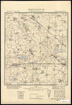
- Subject:
- Topical Subject: Maps and Topical Subject: Soviet Union
- Publisher:
- Генеральный штаб Красной Армии
- Language:
- Russian
- Date Created:
- 1940
- Identifier:
- VAC9619-003712
- Genre:
- Military Maps and Topographic Maps
- Geographic Location:
- Coordinates: 54.75, 22.375, 54.833, 22.5
- Related URL:
- Catalog URL: https://iucat.iu.edu/catalog/14701157 and Download GeoTIFF: https://drive.google.com/file/d/13rm7soV4CVv82p9-ZvRbiEbCsrsK8e7H/view?usp=sharing
- Abstract:
- Modern area represented: abandoned populated place, not marked on the map. The nearest populated place: Желанное (Zhelannoye), former Хенскишкен (Henskischken).
- Call Number:
- G7063.K2 s25 .S6 sheet N-34-45-D-b
- City:
- Гросс Туллен
- Copyright Holder:
- No Copyright - United States
- Country:
- Германия (Восточная Пруссия) (Germany (East Prussia))
- Physical Description:
- Scale: 1:25,000
- Persistent URL:
- http://purl.dlib.indiana.edu/iudl/images/VAC9619/VAC9619-003712
- Provenance:
- CIA Map Branch -- Received
-
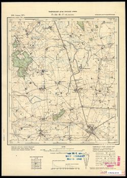
- Subject:
- Topical Subject: Maps, Topical Subject: Soviet Union, and Geographic Subject: Vesnovo
- Publisher:
- Генеральный штаб Красной Армии
- Language:
- Russian
- Date Created:
- 1940
- Identifier:
- VAC9619-003711
- Genre:
- Military Maps and Topographic Maps
- Geographic Location:
- Coordinates: 54.75, 22.25, 54.833, 22.375
- Related URL:
- Catalog URL: https://iucat.iu.edu/catalog/14701157 and Download GeoTIFF: https://drive.google.com/file/d/10sCgRzFJLnu0eF0GiQnWqBfZ8ZsS4sKw/view?usp=sharing
- Abstract:
- Modern area represented: Весново (Vesnovo), Kaliningradskaya oblast, Russia
- Call Number:
- G7063.K2 s25 .S6 sheet N-34-45-D-а
- City:
- Куссен (Kussen)
- Copyright Holder:
- No Copyright - United States
- Country:
- Германия (Восточная Пруссия) (Germany (East Prussia))
- Physical Description:
- Scale: 1:25,000
- Persistent URL:
- http://purl.dlib.indiana.edu/iudl/images/VAC9619/VAC9619-003711
- Provenance:
- M. I. Map Library
-
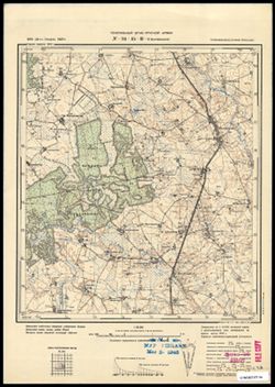
- Subject:
- Geographic Subject: Mayskoye, Topical Subject: Soviet Union, and Topical Subject: Maps
- Publisher:
- Генеральный штаб Красной Армии
- Language:
- Russian
- Date Created:
- 1940
- Identifier:
- VAC9619-003710
- Genre:
- Topographic Maps and Military Maps
- Geographic Location:
- Coordinates: 54.667, 22.125, 54.75, 22.25
- Related URL:
- Download GeoTIFF: https://drive.google.com/file/d/1Zb8H2bx8xu0beiyfvtc21pzVhjOMCUWG/view?usp=sharing and Catalog URL: https://iucat.iu.edu/catalog/14701157
- Abstract:
- Modern area represented: Майское (Mayskoye), Kaliningradskaya oblast, Russia
- Call Number:
- G7063.K2 s25 .S6 sheet N-34-45-C-d
- City:
- Маллвишкен (Mallwischken)
- Copyright Holder:
- No Copyright - United States
- Country:
- Германия (Восточная Пруссия) (Germany (East Prussia))
- Physical Description:
- Scale: 1:25,000
- Persistent URL:
- http://purl.dlib.indiana.edu/iudl/images/VAC9619/VAC9619-003710
- Provenance:
- M. I. Map Library
-
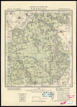
- Subject:
- Geographic Subject: Zagor’yevka, Topical Subject: Soviet Union, and Topical Subject: Maps
- Publisher:
- Генеральный штаб Красной Армии
- Language:
- Russian
- Date Created:
- 1940
- Identifier:
- VAC9619-003709
- Genre:
- Military Maps and Topographic Maps
- Geographic Location:
- Coordinates: 54.667, 22, 54.75, 22.125
- Related URL:
- Download GeoTIFF: https://drive.google.com/file/d/1tFpqXNSPwxaWDfTeqBPRyt2loP85b3bV/view?usp=sharing and Catalog URL: https://iucat.iu.edu/catalog/14701157
- Abstract:
- Modern area represented: not marked on the map. The nearest populated place: Zagor’yevka, Kaliningradskaya oblast, Russia
- Call Number:
- G7063.K2 s25 .S6 sheet N-34-45-C-c
- City:
- Пиллупенен (Pillupöhnen)
- Copyright Holder:
- No Copyright - United States
- Country:
- Германия (Восточная Пруссия) (Germany (East Prussia))
- Physical Description:
- Scale: 1:25,000
- Persistent URL:
- http://purl.dlib.indiana.edu/iudl/images/VAC9619/VAC9619-003709
- Provenance:
- M. I. Map Library
-
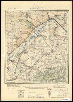
- Subject:
- Topical Subject: Maps, Geographic Subject: Ul'yanovo, and Topical Subject: Soviet Union
- Publisher:
- Генеральный штаб РККА
- Language:
- Russian
- Date Created:
- 1940
- Identifier:
- VAC9619-003707
- Genre:
- Topographic Maps and Military Maps
- Geographic Location:
- Coordinates: 54.75, 22, 54.667, 22.125
- Related URL:
- Catalog URL: https://iucat.iu.edu/catalog/14701157 and Download GeoTIFF: https://drive.google.com/file/d/1qWWDG_2LfmQlhTcUx_rkIBWRT1IzZDhT/view?usp=sharing
- Abstract:
- Modern area represented: Ульяново (Ul'yanovo), Kaliningradskaya oblast, Russia
- Call Number:
- G7063.K2 s25 .S6 sheet N-34-45-C-a
- City:
- Краупишкен (Kraupischken)
- Copyright Holder:
- No Copyright - United States
- Country:
- Германия (Восточная Пруссия) (Germany (East Prussia))
- Physical Description:
- Scale: 1:25,000
- Persistent URL:
- http://purl.dlib.indiana.edu/iudl/images/VAC9619/VAC9619-003707
- Provenance:
- CIA Map Branch -- Received
-
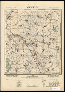
- Description:
- 1913
- Subject:
- Topical Subject: Soviet Union, Topical Subject: Maps, and Geographic Subject: Mezhdurech’ye
- Publisher:
- Генеральный штаб РККА
- Language:
- Russian
- Date Created:
- 1940
- Identifier:
- VAC9619-003708
- Genre:
- Military Maps and Topographic Maps
- Geographic Location:
- Coordinates: 54.75, 22.125, 54.833, 22.25
- Related URL:
- Catalog URL: https://iucat.iu.edu/catalog/14701157 and Download GeoTIFF: https://drive.google.com/file/d/1XeRPkmXa9OfF3szX5UnGYWB4ZfoTucQ0/view?usp=sharing
- Abstract:
- Modern area represented: Междуречье (Mezhdurech’ye), Kaliningradskaya oblast, Russia
- Call Number:
- G7063.K2 s25 .S6 sheet N-34-45-C-b
- City:
- Каушен (Kauschen)
- Copyright Holder:
- No Copyright - United States
- Country:
- Германия (Восточная Пруссия) (Germany (East Prussia))
- Physical Description:
- Scale: 1:25,000
- Persistent URL:
- http://purl.dlib.indiana.edu/iudl/images/VAC9619/VAC9619-003708
- Provenance:
- CIA Map Branch -- Received
-
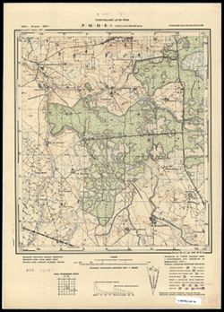
- Subject:
- Topical Subject: Maps, Topical Subject: Soviet Union, and Geographic Subject: Belkino
- Publisher:
- Генеральный штаб РККА
- Language:
- Russian
- Date Created:
- 1940
- Identifier:
- VAC9619-003706
- Genre:
- Military Maps and Topographic Maps
- Geographic Location:
- Coordinates: 54.833, 22.375, 54.913, 22.5
- Related URL:
- Catalog URL: https://iucat.iu.edu/catalog/14701157 and Download GeoTIFF: https://drive.google.com/file/d/1MhH0q8wU3hYp-FMIauSRO4xUyI8AFd94/view?usp=sharing
- Abstract:
- Modern area represented: Белкино (Belkino), Kaliningradskaya oblast, Russia
- Call Number:
- G7063.K2 s25 .S6 sheet N-34-45-B-d
- City:
- Гросс Версменингкен (Gross Versmeningken)
- Copyright Holder:
- No Copyright - United States
- Country:
- Германия (Восточная Пруссия) (Germany (East Prussia))
- Physical Description:
- Scale: 1:25,000
- Persistent URL:
- http://purl.dlib.indiana.edu/iudl/images/VAC9619/VAC9619-003706
- Provenance:
- CIA Map Branch -- Received
-
- Subject:
- Topical Subject: Maps, Geographic Subject: Uzlovoye, and Topical Subject: Soviet Union
- Publisher:
- Генеральный штаб Красной Армии
- Language:
- Russian
- Date Created:
- 1940
- Identifier:
- VAC9619-003705
- Genre:
- Topographic Maps and Military Maps
- Geographic Location:
- Coordinates: 54.833, 22.25, 54.913, 22.375
- Related URL:
- Catalog URL: https://iucat.iu.edu/catalog/14701157 and Download GeoTIFF: https://drive.google.com/file/d/1PMUr3ndiAdwWK19kXCrc3IcS3LSK7pod/view?usp=sharing
- Abstract:
- Modern area represented: Узловое (Uzlovoye), Kaliningradskaya oblast, Russia
- Call Number:
- G7063.K2 s25 .S6 sheet N-34-45-B-c
- City:
- Раутенберг (Rautenberg)
- Copyright Holder:
- No Copyright - United States
- Country:
- Германия (Восточная Пруссия) (Germany (East Prussia))
- Physical Description:
- Scale: 1:25,000
- Persistent URL:
- http://purl.dlib.indiana.edu/iudl/images/VAC9619/VAC9619-003705
- Provenance:
- M. I. Map Library
-
- Subject:
- Geographic Subject: Krasnoznamensk, Topical Subject: Soviet Union, and Topical Subject: Maps
- Publisher:
- Генеральный штаб РККА
- Language:
- Russian
- Date Created:
- 1940
- Identifier:
- VAC9619-003704
- Genre:
- Topographic Maps and Military Maps
- Geographic Location:
- Coordinates: 54.913, 22.375, 55, 22.5
- Related URL:
- Download GeoTIFF: https://drive.google.com/file/d/1bH6IryF7TI7DSAP9i57pQ5_tYtJdUI_Z/view?usp=sharing and Catalog URL: https://iucat.iu.edu/catalog/14701157
- Abstract:
- Modern area represented: Краснознаменск (Krasnoznamensk), Kaliningradskaya oblast, Russia
- Call Number:
- G7063.K2 s25 .S6 sheet N-34-45-B-b
- City:
- Лазденен (Lasdehnen)
- Copyright Holder:
- No Copyright - United States
- Country:
- Германия (Восточная Пруссия) (Germany (East Prussia))
- Physical Description:
- Scale: 1:25,000
- Persistent URL:
- http://purl.dlib.indiana.edu/iudl/images/VAC9619/VAC9619-003704
- Provenance:
- M. I. Map Library
-
- Subject:
- Topical Subject: Soviet Union, Geographic Subject: Berezovka, and Topical Subject: Maps
- Publisher:
- Генеральный штаб РККА
- Language:
- Russian
- Date Created:
- 1940
- Identifier:
- VAC9619-003702
- Genre:
- Military Maps and Topographic Maps
- Geographic Location:
- Coordinates: 54.833, 22.125, 54.913, 22.25
- Related URL:
- Catalog URL: https://iucat.iu.edu/catalog/14701157 and Download GeoTIFF: https://drive.google.com/file/d/1Na6dz6k3pV4O9Fcj-zkaDo7VKOOZvr4h/view?usp=sharing
- Abstract:
- Modern area represented: Березовка (Berezovka), Kaliningradskaya oblast, Russia
- Call Number:
- G7063.K2 s25 .S6 sheet N-34-45-A-d
- City:
- Науйенингкен (Naujeningken)
- Copyright Holder:
- No Copyright - United States
- Country:
- Германия (Восточная Пруссия) (Germany (East Prussia))
- Physical Description:
- Scale: 1:25,000
- Persistent URL:
- http://purl.dlib.indiana.edu/iudl/images/VAC9619/VAC9619-003702
- Provenance:
- CIA Map Branch -- Received
-
- Subject:
- Topical Subject: Maps and Topical Subject: Soviet Union
- Publisher:
- Генеральный штаб РККА
- Language:
- Russian
- Date Created:
- 1940
- Identifier:
- VAC9619-003701
- Genre:
- Military Maps and Topographic Maps
- Geographic Location:
- Coordinates: 54.833, 22, 54.913, 22.125
- Related URL:
- Catalog URL: https://iucat.iu.edu/catalog/14701157 and Download GeoTIFF: https://drive.google.com/file/d/1DlQm3P1J-Jx6RJtWXVjt1OMyQz2wF7rW/view?usp=sharing
- Abstract:
- Modern area represented: not marked on the map and Kaliningradskaya oblast, Russia
- Call Number:
- G7063.K2 s25 .S6 sheet N-34-45-A-c
- City:
- Паллмонен
- Copyright Holder:
- No Copyright - United States
- Country:
- Германия (Восточная Пруссия) (Germany (East Prussia))
- Physical Description:
- Scale: 1:25,000
- Persistent URL:
- http://purl.dlib.indiana.edu/iudl/images/VAC9619/VAC9619-003701
- Provenance:
- M. I. Map Library
-
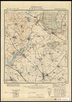
- Subject:
- Geographic Subject: Malomozhayskoye, Topical Subject: Maps, and Topical Subject: Soviet Union
- Publisher:
- Генеральный штаб РККА
- Language:
- Russian
- Date Created:
- 1940
- Identifier:
- VAC9619-003700
- Genre:
- Topographic Maps and Military Maps
- Geographic Location:
- Coordinates: 54.913, 22.125, 55, 22.25
- Related URL:
- Catalog URL: https://iucat.iu.edu/catalog/14701157 and Download GeoTIFF: https://drive.google.com/file/d/1uBNWzrMJZHFMv0W18hvNg7shZoRmvoV8/view?usp=sharing
- Abstract:
- Modern area represented: Маломожайское (Malomozhayskoye), Kaliningradskaya oblast, Russia
- Call Number:
- G7063.K2 s25 .S6 sheet N-34-45-A-b
- City:
- Будветен (Budwethen)
- Copyright Holder:
- No Copyright - United States
- Country:
- Германия (Восточная Пруссия) (Germany (East Prussia))
- Physical Description:
- Scale: 1:25,000
- Persistent URL:
- http://purl.dlib.indiana.edu/iudl/images/VAC9619/VAC9619-003700
- Provenance:
- CIA Map Branch -- Received
-
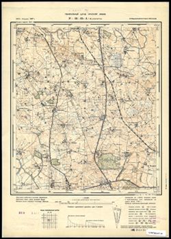
- Subject:
- Topical Subject: Maps, Topical Subject: Soviet Union, and Geographic Subject: Lunino
- Publisher:
- Генеральный штаб Красной Армии
- Language:
- Russian
- Date Created:
- 1940
- Identifier:
- VAC9619-003699
- Genre:
- Military Maps and Topographic Maps
- Geographic Location:
- Coordinates: 54.913, 22, 55, 22.125
- Related URL:
- Download GeoTIFF: https://drive.google.com/file/d/1bHNg9FqA6f7LENY0S9sIpet530SECyBY/view?usp=sharing and Catalog URL: https://iucat.iu.edu/catalog/14701157
- Abstract:
- Modern area represented: Лунино (Lunino), Kaliningradskaya oblast, Russia
- Call Number:
- G7063.K2 s25 .S6 sheet N-34-45-A-а
- City:
- Ленгветен (Lengwethen)
- Copyright Holder:
- No Copyright - United States
- Country:
- Германия (Восточная Пруссия) (Germany (East Prussia))
- Physical Description:
- Scale: 1:25,000
- Persistent URL:
- http://purl.dlib.indiana.edu/iudl/images/VAC9619/VAC9619-003699
- Provenance:
- CIA Map Branch -- Received
-
- Subject:
- Geographic Subject: Privol'noye, Topical Subject: Soviet Union, and Topical Subject: Maps
- Publisher:
- Генеральный штаб Красной Армии
- Language:
- Russian
- Date Created:
- 1940
- Identifier:
- VAC9619-003698
- Genre:
- Military Maps and Topographic Maps
- Geographic Location:
- Coordinates: 54.667, 21.875, 54.75, 22
- Related URL:
- Download GeoTIFF: https://drive.google.com/file/d/1Z2wcTenlwb8KrGEEAu8FIRSuo3vJOaZf/view?usp=sharing and Catalog URL: https://iucat.iu.edu/catalog/14701157
- Abstract:
- Modern area represented: Привольное (Privol'noye), Kaliningradskaya oblast, Russia
- Call Number:
- G7063.K2 s25 .S6 sheet N-34-44-D-d
- City:
- Нойнишкен (Neunischken)
- Copyright Holder:
- No Copyright - United States
- Country:
- Германия (Восточная Пруссия) (Germany (East Prussia))
- Physical Description:
- Scale: 1:25,000
- Persistent URL:
- http://purl.dlib.indiana.edu/iudl/images/VAC9619/VAC9619-003698
- Provenance:
- CIA Map Branch -- Received
-
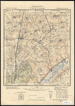
- Subject:
- Topical Subject: Soviet Union, Topical Subject: Maps, and Geographic Subject: Kaluzhskoye
- Publisher:
- Генеральный штаб РККА
- Language:
- Russian
- Date Created:
- 1940
- Identifier:
- VAC9619-003696
- Genre:
- Military Maps and Topographic Maps
- Geographic Location:
- Coordinates: 54.75, 21.875, 54.833, 22
- Related URL:
- Catalog URL: https://iucat.iu.edu/catalog/14701157 and Download GeoTIFF: https://drive.google.com/file/d/1P6I1E5UqLLew7VpkyAFlAFJMd1WFVSLk/view?usp=sharing
- Abstract:
- Modern area represented: Калужское (Kaluzhskoye), Kaliningradskaya oblast, Russia
- Call Number:
- G7063.K2 s25 .S6 sheet N-34-44-D-b
- City:
- Грюнхайде (Grünheide)
- Copyright Holder:
- No Copyright - United States
- Country:
- Германия (Восточная Пруссия) (Germany (East Prussia))
- Physical Description:
- Scale: 1:25,000
- Persistent URL:
- http://purl.dlib.indiana.edu/iudl/images/VAC9619/VAC9619-003696
- Provenance:
- CIA Map Branch -- Received
-
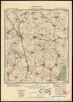
- Subject:
- Topical Subject: Maps, Topical Subject: Soviet Union, and Geographic Subject: Kalinovka
- Publisher:
- Генеральный штаб РККА
- Language:
- Russian
- Date Created:
- 1940
- Identifier:
- VAC9619-003695
- Genre:
- Topographic Maps and Military Maps
- Geographic Location:
- Coordinates: 54.75, 21.75, 54.833, 21.875
- Related URL:
- Download GeoTIFF: https://drive.google.com/file/d/15qG5oPfI-_FhAGYdcyCwRBf2Rtqg7Pdu/view?usp=sharing and Catalog URL: https://iucat.iu.edu/catalog/14701157
- Abstract:
- Modern area represented: Калиновка (Kalinovka), Kaliningradskaya oblast, Russia
- Call Number:
- G7063.K2 s25 .S6 sheet N-34-44-D-а
- City:
- Ауловенен (Aulowönen)
- Copyright Holder:
- No Copyright - United States
- Country:
- Германия (Восточная Пруссия) (Germany (East Prussia))
- Physical Description:
- Scale: 1:25,000
- Persistent URL:
- http://purl.dlib.indiana.edu/iudl/images/VAC9619/VAC9619-003695
- Provenance:
- M. I. Map Library
-
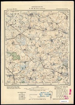
- Subject:
- Topical Subject: Maps, Topical Subject: Soviet Union, and Geographic Subject: Dubrovka
- Publisher:
- Генеральный штаб РККА
- Language:
- Russian
- Date Created:
- 1940
- Identifier:
- VAC9619-003692
- Genre:
- Topographic Maps and Military Maps
- Geographic Location:
- Coordinates: 54.75, 21.625, 54.833, 21.75
- Related URL:
- Download GeoTIFF: https://drive.google.com/file/d/1LUbIF83I2aGJlRjhzhM05nIVINXtR4eh/view?usp=sharing and Catalog URL: https://iucat.iu.edu/catalog/14701157
- Abstract:
- Modern area represented: Дубровка (Dubrovka), Kaliningradskaya oblast, Russia
- Call Number:
- G7063.K2 s25 .S6 sheet N-34-44-C-b
- City:
- Шпаннегельн (Spannegeln)
- Copyright Holder:
- No Copyright - United States
- Country:
- Германия (Восточная Пруссия) (Germany (East Prussia))
- Physical Description:
- Scale: 1:25,000
- Persistent URL:
- http://purl.dlib.indiana.edu/iudl/images/VAC9619/VAC9619-003692
- Provenance:
- M. I. Map Library
-
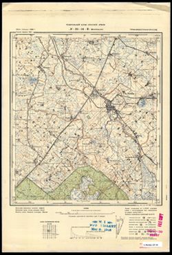
- Subject:
- Topical Subject: Maps, Topical Subject: Soviet Union, and Geographic Subject: Vysokoye
- Publisher:
- Генеральный штаб Красной Армии
- Language:
- Russian
- Date Created:
- 1940
- Identifier:
- VAC9619-003691
- Genre:
- Topographic Maps and Military Maps
- Geographic Location:
- Coordinates: 54.75, 21.5, 54.833, 21.625
- Related URL:
- Catalog URL: https://iucat.iu.edu/catalog/14701157 and Download GeoTIFF: https://drive.google.com/file/d/14U5BZW6jKRHB4242zwUgLBkbVkNZuj46/view?usp=sharing
- Abstract:
- Modern area represented: Высокое (Vysokoye), Kaliningradskaya oblast, Russia
- Call Number:
- G7063.K2 s25 .S6 sheet N-34-44-C-а
- City:
- Попелькен (Popelken)
- Copyright Holder:
- No Copyright - United States
- Country:
- Германия (Восточная Пруссия) (Germany (East Prussia))
- Physical Description:
- Scale: 1:25,000
- Persistent URL:
- http://purl.dlib.indiana.edu/iudl/images/VAC9619/VAC9619-003691
- Provenance:
- M. I. Map Library
-
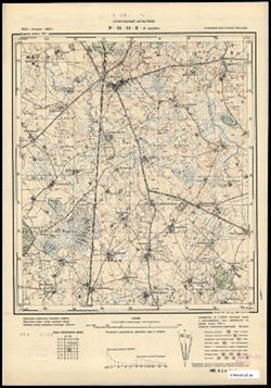
- Subject:
- Geographic Subject: Zhilino, Topical Subject: Soviet Union, and Topical Subject: Maps
- Publisher:
- Генеральный штаб РККА
- Language:
- Russian
- Date Created:
- 1940
- Identifier:
- VAC9619-003690
- Genre:
- Topographic Maps and Military Maps
- Geographic Location:
- Coordinates: 54.833, 21.875, 54.913, 22
- Related URL:
- Download GeoTIFF: https://drive.google.com/file/d/1iClNl4FWFOawJ5J_fgSWUsIW-KxDy9yv/view?usp=sharing and Catalog URL: https://iucat.iu.edu/catalog/14701157
- Abstract:
- Modern area represented: Жилино (Zhilino), Kaliningradskaya oblast, Russia
- Call Number:
- G7063.K2 s25 .S6 sheet N-34-44-B-d
- City:
- Жиллен (Schillen)
- Copyright Holder:
- No Copyright - United States
- Country:
- Германия (Восточная Пруссия) (Germany (East Prussia))
- Physical Description:
- Scale: 1:25,000
- Persistent URL:
- http://purl.dlib.indiana.edu/iudl/images/VAC9619/VAC9619-003690
- Provenance:
- CIA Map Branch -- Received
-
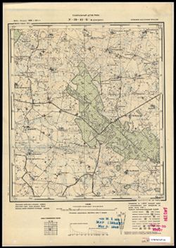
- Subject:
- Topical Subject: Maps, Geographic Subject: Dzerzhinskoye, and Topical Subject: Soviet Union
- Publisher:
- Генеральный штаб РККА
- Language:
- Russian
- Date Created:
- 1940
- Identifier:
- VAC9619-003689
- Genre:
- Topographic Maps and Military Maps
- Geographic Location:
- Coordinates: 54.833, 21.75, 54.913, 21.875
- Related URL:
- Download GeoTIFF: https://drive.google.com/file/d/1b4Se7cZpQleHK4wb50KzJ8Q8jknVZ9A3/view?usp=sharing and Catalog URL: https://iucat.iu.edu/catalog/14701157
- Abstract:
- Modern area represented: not marked on the map. The nearest populated place: Дзержинское (Dzerzhinskoye), Kaliningradskaya oblast, Russia
- Call Number:
- G7063.K2 s25 .S6 sheet N-34-44-B-c
- City:
- Демеджен (Demedzhen)
- Copyright Holder:
- No Copyright - United States
- Country:
- Германия (Восточная Пруссия) (Germany (East Prussia))
- Physical Description:
- Scale: 1:25,000
- Persistent URL:
- http://purl.dlib.indiana.edu/iudl/images/VAC9619/VAC9619-003689
- Provenance:
- M. I. Map Library
-
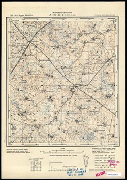
- Subject:
- Geographic Subject: Kanash, Topical Subject: Soviet Union, and Topical Subject: Maps
- Publisher:
- Генеральный штаб РККА
- Language:
- Russian
- Date Created:
- 1940
- Identifier:
- VAC9619-003687
- Genre:
- Military Maps and Topographic Maps
- Geographic Location:
- Coordinates: 54.933, 21.75, 55, 21.875
- Related URL:
- Download GeoTIFF: https://drive.google.com/file/d/1FKYHWQfv3FIInbSykbDHOQhRwCtrvc3n/view?usp=sharing and Catalog URL: https://iucat.iu.edu/catalog/14701157
- Abstract:
- Modern area represented: Канаш (Kanash), Kaliningradskaya oblast, Russia
- Call Number:
- G7063.K2 s25 .S6 sheet N-34-44-B-а
- City:
- Йургайтшен (Jurgaitschen)
- Copyright Holder:
- No Copyright - United States
- Country:
- Германия (Восточная Пруссия) (Germany (East Prussia))
- Physical Description:
- Scale: 1:25,000
- Persistent URL:
- http://purl.dlib.indiana.edu/iudl/images/VAC9619/VAC9619-003687
- Provenance:
- M. I. Map Library
-
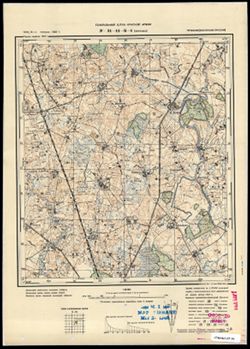
- Subject:
- Geographic Subject: Pushkino, Topical Subject: Soviet Union, and Topical Subject: Maps
- Publisher:
- Генеральный штаб Красной Армии
- Language:
- Russian
- Date Created:
- 1940
- Identifier:
- VAC9619-003688
- Genre:
- Military Maps and Topographic Maps
- Geographic Location:
- Coordinates: 54.933, 21.875, 55, 22
- Related URL:
- Download GeoTIFF: https://drive.google.com/file/d/13iTiwk1-yjkGmyVx8P1nekaVrtP0ewPQ/view?usp=sharing and Catalog URL: https://iucat.iu.edu/catalog/14701157
- Abstract:
- Modern area represented: Пушкино (Pushkino), Kaliningradskaya oblast, Russia
- Call Number:
- G7063.K2 s25 .S6 sheet N-34-44-B-b
- City:
- Бруйжен (Bruischen)
- Copyright Holder:
- No Copyright - United States
- Country:
- Германия (Восточная Пруссия) (Germany (East Prussia))
- Physical Description:
- Scale: 1:25,000
- Persistent URL:
- http://purl.dlib.indiana.edu/iudl/images/VAC9619/VAC9619-003688
- Provenance:
- M. I. Map Library
-
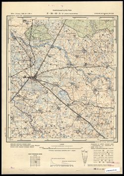
- Subject:
- Geographic Subject: Bol'shakovo, Topical Subject: Maps, and Topical Subject: Soviet Union
- Publisher:
- Генеральный штаб РККА
- Language:
- Russian
- Date Created:
- 1940
- Identifier:
- VAC9619-003686
- Genre:
- Topographic Maps and Military Maps
- Geographic Location:
- Coordinates: 54.833, 21.675, 54.933, 21.75
- Related URL:
- Download GeoTIFF: https://drive.google.com/file/d/1Ybk6EMgyk1EtOJYubA0QZCooourKQz4a/view?usp=sharing and Catalog URL: https://iucat.iu.edu/catalog/14701157
- Abstract:
- Modern area represented: Большаково (Bol'shakovo), Kaliningradskaya oblast, Russia
- Call Number:
- G7063.K2 s25 .S6 sheet N-34-44-A-d
- City:
- Гросс Скайсгиррен (Gross Skaisgirren)
- Copyright Holder:
- No Copyright - United States
- Country:
- Германия (Восточная Пруссия) (Germany (East Prussia))
- Physical Description:
- Scale: 1:25,000
- Persistent URL:
- http://purl.dlib.indiana.edu/iudl/images/VAC9619/VAC9619-003686
- Provenance:
- CIA Map Branch -- Received
-
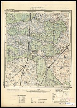
- Subject:
- Topical Subject: Maps, Geographic Subject: Shepetovka, and Topical Subject: Soviet Union
- Publisher:
- Генеральный штаб РККА
- Language:
- Russian
- Date Created:
- 1940
- Identifier:
- VAC9619-003684
- Genre:
- Military Maps and Topographic Maps
- Geographic Location:
- Coordinates: 54.913, 21.675, 55, 21.75
- Related URL:
- Catalog URL: https://iucat.iu.edu/catalog/14701157 and Download GeoTIFF: https://drive.google.com/file/d/1vwGncl0aVX5xD2i0QQPzheOMmGdf-Et_/view?usp=sharing
- Abstract:
- Modern area represented: Шепетовка (Shepetovka), Kaliningradskaya oblast, Russia
- Call Number:
- G7063.K2 s25 .S6 sheet N-34-44-A-b
- City:
- Шиллкойен (Schillkojen)
- Copyright Holder:
- No Copyright - United States
- Country:
- Германия (Восточная Пруссия) (Germany (East Prussia))
- Physical Description:
- Scale: 1:25,000
- Persistent URL:
- http://purl.dlib.indiana.edu/iudl/images/VAC9619/VAC9619-003684
- Provenance:
- CIA Map Branch -- Received
-
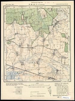
- Subject:
- Geographic Subject: Osinovka, Topical Subject: Maps, and Topical Subject: Soviet Union
- Publisher:
- Генеральный штаб РККА
- Language:
- Russian
- Date Created:
- 1940
- Identifier:
- VAC9619-003668
- Genre:
- Military Maps and Topographic Maps
- Geographic Location:
- Coordinates: 54.667, 20.875, 54.75, 21
- Related URL:
- Catalog URL: https://iucat.iu.edu/catalog/14701157 and Download GeoTIFF: https://drive.google.com/file/d/1DmLI9baCbT3L5oqOEXVELiekcIXZb4AH/view?usp=sharing
- Abstract:
- Modern area represented: Осиновка (Osinovka), Kaliningradskaya oblast, Russia
- Call Number:
- G7063.K2 s25 .S6 sheet N-34-42-D-d
- City:
- Штампелькен (Stampelken)
- Copyright Holder:
- No Copyright - United States
- Country:
- Германия (Восточная Пруссия) (Germany (East Prussia))
- Physical Description:
- Scale: 1:25,000
- Persistent URL:
- http://purl.dlib.indiana.edu/iudl/images/VAC9619/VAC9619-003668
- Provenance:
- CIA Map Branch -- Received
-
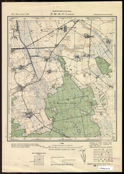
- Subject:
- Geographic Subject: Veselovka, Topical Subject: Soviet Union, and Topical Subject: Maps
- Publisher:
- Генеральный штаб РККА
- Language:
- Russian
- Date Created:
- 1940
- Identifier:
- VAC9619-003666
- Genre:
- Topographic Maps and Military Maps
- Geographic Location:
- Coordinates: 54.75, 20.875, 54.833, 21
- Related URL:
- Download GeoTIFF: https://drive.google.com/file/d/1rKAxO0Igu6EVLfN0w2VaKzw7M7Fcn6jn/view?usp=sharing and Catalog URL: https://iucat.iu.edu/catalog/14701157
- Abstract:
- Modern area represented: Веселовка (Veselovka), Kaliningradskaya oblast, Russia
- Call Number:
- G7063.K2 s25 .S6 sheet N-34-42-D-b
- City:
- Зилькайм (Sielkeim)
- Copyright Holder:
- No Copyright - United States
- Country:
- Германия (Восточная Пруссия) (Germany (East Prussia))
- Physical Description:
- Scale: 1:25,000
- Persistent URL:
- http://purl.dlib.indiana.edu/iudl/images/VAC9619/VAC9619-003666
- Provenance:
- CIA Map Branch -- Received
-
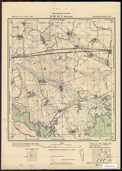
- Subject:
- Geographic Subject: Antonovka, Topical Subject: Soviet Union, and Topical Subject: Maps
- Publisher:
- Генеральный штаб РККА
- Language:
- Russian
- Date Created:
- 1940
- Identifier:
- VAC9619-003665
- Genre:
- Topographic Maps and Military Maps
- Geographic Location:
- Coordinates: 54.75, 20.75, 54.833, 20.875
- Related URL:
- Download GeoTIFF: https://drive.google.com/file/d/1lFS1j0naiFdHz1U8_1wl3dLK_vlNVIQy/view?usp=sharing and Catalog URL: https://iucat.iu.edu/catalog/14701157
- Abstract:
- Modern area represented: Антоновка (Antonovka), Kaliningradskaya oblast, Russia
- Call Number:
- G7063.K2 s25 .S6 sheet N-34-42-D-а
- City:
- Брасдорф (Brasdorf)
- Copyright Holder:
- No Copyright - United States
- Country:
- Германия (Восточная Пруссия) (Germany (East Prussia))
- Physical Description:
- Scale: 1:25,000
- Persistent URL:
- http://purl.dlib.indiana.edu/iudl/images/VAC9619/VAC9619-003665
- Provenance:
- CIA Map Branch -- Received
-
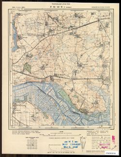
- Subject:
- Topical Subject: Soviet Union, Geographic Subject: Nizov'ye, and Topical Subject: Maps
- Publisher:
- Генеральный штаб РККА
- Language:
- Russian
- Date Created:
- 1940
- Identifier:
- VAC9619-003664
- Genre:
- Topographic Maps and Military Maps
- Geographic Location:
- Coordinates: 54.667, 20.625, 54.75, 20.75
- Related URL:
- Catalog URL: https://iucat.iu.edu/catalog/14701157 and Download GeoTIFF: https://drive.google.com/file/d/1e9OLlsxeiGabRyV4cP9BS3WvafUb2qmI/view?usp=sharing
- Abstract:
- Modern area represented: Низовье (Nizov'ye), Kaliningradskaya oblast, Russia
- Call Number:
- G7063.K2 s25 .S6 sheet N-34-42-C-d
- City:
- Вальдау (Waldau)
- Copyright Holder:
- No Copyright - United States
- Country:
- Германия (Восточная Пруссия) (Germany (East Prussia))
- Physical Description:
- Scale: 1:25,000
- Persistent URL:
- http://purl.dlib.indiana.edu/iudl/images/VAC9619/VAC9619-003664
- Provenance:
- CIA Map Branch -- Received
-
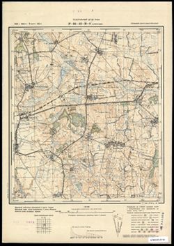
- Description:
- 1906
- Subject:
- Geographic Subject: Yaroslavskoye, Topical Subject: Soviet Union, and Topical Subject: Maps
- Publisher:
- Генеральный штаб РККА
- Language:
- Russian
- Date Created:
- 1940
- Identifier:
- VAC9619-003663
- Genre:
- Military Maps and Topographic Maps
- Geographic Location:
- Coordinates: 54.75, 20.625, 54.833, 20.75
- Related URL:
- Download GeoTIFF: https://drive.google.com/file/d/1YeGowRcHa49rLHsO_nQibeGwRRzDeFMr/view?usp=sharing and Catalog URL: https://iucat.iu.edu/catalog/14701157
- Abstract:
- Modern area represented: Ярославское (Yaroslavskoye), Kaliningradskaya oblast, Russia
- Call Number:
- G7063.K2 s25 .S6 sheet N-34-42-C-b
- City:
- Шенвальде (Schönwalde)
- Copyright Holder:
- No Copyright - United States
- Country:
- Германия (Восточная Пруссия) (Germany (East Prussia))
- Physical Description:
- Scale: 1:25,000
- Persistent URL:
- http://purl.dlib.indiana.edu/iudl/images/VAC9619/VAC9619-003663
- Provenance:
- CIA Map Branch -- Received
-
- Subject:
- Topical Subject: Maps, Geographic Subject: Severnaya Gora, Kaliningrad, and Topical Subject: Soviet Union
- Publisher:
- Генеральный штаб РККА
- Language:
- Russian
- Date Created:
- 1940
- Identifier:
- VAC9619-003662
- Genre:
- Military Maps and Topographic Maps
- Geographic Location:
- Coordinates: 54.75, 20.5, 54.833, 20.625
- Related URL:
- Catalog URL: https://iucat.iu.edu/catalog/14701157 and Download GeoTIFF: https://drive.google.com/file/d/1nHV9aASnnHjpiIcBJImOVw4pB_wEUBJR/view?usp=sharing
- Abstract:
- Modern area represented: Северная Гора (Severnaya Gora), part of the Leningradskiy District in northern Kaliningrad, Russia
- Call Number:
- G7063.K2 s25 .S6 sheet N-34-42-C-а
- City:
- Кведнау (Quednau)
- Copyright Holder:
- No Copyright - United States
- Country:
- Германия (Восточная Пруссия) (Germany (East Prussia))
- Physical Description:
- Scale: 1:25,000
- Persistent URL:
- http://purl.dlib.indiana.edu/iudl/images/VAC9619/VAC9619-003662
- Provenance:
- Army Map Service Library, OMAHA, Library of Congress Geography & Map Division
-
- Subject:
- Geographic Subject: Slavyanskoye, Topical Subject: Maps, and Topical Subject: Soviet Union
- Publisher:
- Генеральный штаб РККА
- Language:
- Russian
- Date Created:
- 1940
- Identifier:
- VAC9619-003661
- Genre:
- Military Maps and Topographic Maps
- Geographic Location:
- Coordinates: 54.833, 20.875, 54.913, 21
- Related URL:
- Catalog URL: https://iucat.iu.edu/catalog/14701157 and Download GeoTIFF: https://drive.google.com/file/d/1hmGFtWaXxCFPMIUWkMgz2-ZQHdgKpdXw/view?usp=sharing
- Abstract:
- Modern area represented: Славянское (Slavyanskoye), Kaliningradskaya oblast, Russia
- Call Number:
- G7063.K2 s25 .S6 sheet N-34-42-B-d
- City:
- Прониттен (Pronitten)
- Copyright Holder:
- No Copyright - United States
- Country:
- Германия (Восточная Пруссия) (Germany (East Prussia))
- Physical Description:
- Scale: 1:25,000
- Persistent URL:
- http://purl.dlib.indiana.edu/iudl/images/VAC9619/VAC9619-003661
- Provenance:
- Army Map Service Library, OMAHA, Library of Congress Geography & Map Division
-
- Subject:
- Topical Subject: Soviet Union, Geographic Subject: Zalivnoye, and Topical Subject: Maps
- Publisher:
- Генеральный штаб РККА
- Language:
- Russian
- Date Created:
- 1940
- Identifier:
- VAC9619-003660
- Genre:
- Military Maps and Topographic Maps
- Geographic Location:
- Coordinates: 54.833, 20.75, 54.913, 20.875
- Related URL:
- Catalog URL: https://iucat.iu.edu/catalog/14701157 and Download GeoTIFF: https://drive.google.com/file/d/1xH82dsY0fzs2LsfQM3IduqqoYKbdHXmu/view?usp=sharing
- Abstract:
- Modern area represented: Заливное (Zalivnoye), Kaliningradskaya oblast, Russia
- Call Number:
- G7063.K2 s25 .S6 sheet N-34-42-B-c
- City:
- Постниккен (Postincken)
- Copyright Holder:
- No Copyright - United States
- Country:
- Германия (Восточная Пруссия) (Germany (East Prussia))
- Physical Description:
- Scale: 1:25,000
- Persistent URL:
- http://purl.dlib.indiana.edu/iudl/images/VAC9619/VAC9619-003660
- Provenance:
- Army Map Service Library, OMAHA, Library of Congress Geography & Map Division
-
- Description:
- 1908
- Subject:
- Topical Subject: Maps and Topical Subject: Soviet Union
- Publisher:
- Генеральный штаб РККА
- Language:
- Russian
- Date Created:
- 1940
- Identifier:
- VAC9619-003659
- Genre:
- Topographic Maps and Military Maps
- Geographic Location:
- Coordinates: 54.913, 20.75, 55, 20.875
- Related URL:
- Download GeoTIFF: https://drive.google.com/file/d/1q7n7Sa5Ja6WSbfXTpmAFADMG7K9CXcJ-/view?usp=sharing and Catalog URL: https://iucat.iu.edu/catalog/14701157
- Abstract:
- Modern area represented: the cape is not marked on the map. It is in Kaliningradskaya oblast, Russia
- Call Number:
- G7063.K2 s25 .S6 sheet N-34-42-B-а
- City:
- Шпитце Пустерорт (Shpitse Pusterort)
- Copyright Holder:
- No Copyright - United States
- Country:
- Германия (Восточная Пруссия) (Germany (East Prussia))
- Physical Description:
- Scale: 1:25,000
- Persistent URL:
- http://purl.dlib.indiana.edu/iudl/images/VAC9619/VAC9619-003659
- Provenance:
- M. I. Map Library
