
Search Constraints
You searched for:
Publisher
Управление военных топографов
Remove constraint Publisher: Управление военных топографов
« Previous |
1 - 10 of 465
|
Next »
Search Results
-
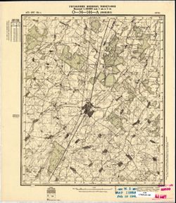
- Description:
- 1873
- Subject:
- Topical Subject: Soviet Union, Geographic Subject: Joniškis, and Topical Subject: Maps
- Publisher:
- Управление военных топографов
- Language:
- Russian
- Date Created:
- 1898
- Identifier:
- VAC9619-001766
- Genre:
- Topographic Maps and Military Maps
- Geographic Location:
- Coordinates: 56.167, 23.5, 56.333, 23.75
- Related URL:
- Catalog URL: http://iucat.iu.edu/catalog/5020131 and Download GeoTIFF: https://drive.google.com/open?id=1OdRsbGC2STlWvnO5t7Q5u04OLoHAWgjo
- Abstract:
- Modern area represented: Joniškis, Lithuania
- Call Number:
- G7000 s50 .S68 sheet O-34-144-A
- City:
- Янишки (Joniškis)
- Copyright Holder:
- No Copyright - United States
- Country:
- Литва (Lithuania)
- Physical Description:
- Scale: 1:50,000
- Persistent URL:
- http://purl.dlib.indiana.edu/iudl/images/VAC9619/VAC9619-001766
- Provenance:
- M. I. Map Library
-
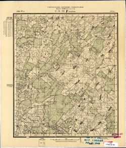
- Description:
- 1896
- Subject:
- Topical Subject: Maps, Topical Subject: Soviet Union, and Geographic Subject: Mažeikiai
- Publisher:
- Управление военных топографов
- Language:
- Russian
- Date Created:
- 1897
- Identifier:
- VAC9619-001764
- Genre:
- Topographic Maps and Military Maps
- Geographic Location:
- Coordinates: 56, 23, 56.167, 23.25
- Related URL:
- Catalog URL: http://iucat.iu.edu/catalog/5020131 and Download GeoTIFF: https://drive.google.com/open?id=1UzmO7gBvQAKv4GTAk8ecuNHfpnVwNalA
- Abstract:
- Modern area represented: Mažeikiai, Lithuania
- Call Number:
- G7000 s50 .S68 sheet O-34-143-C
- City:
- Можейки (Mažeikiai)
- Copyright Holder:
- No Copyright - United States
- Country:
- Литва (Lithuania)
- Physical Description:
- Scale: 1:50,000
- Persistent URL:
- http://purl.dlib.indiana.edu/iudl/images/VAC9619/VAC9619-001764
- Provenance:
- M. I. Map Library
-
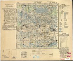
- Description:
- 1931
- Subject:
- Geographic Subject: Тураў (Turow), Topical Subject: Soviet Union, and Topical Subject: Maps
- Publisher:
- Управление военных топографов
- Language:
- Russian
- Identifier:
- VAC9619-000807
- Genre:
- Military Maps and Topographic Maps
- Geographic Location:
- Coordinates: 52, 27.5, 52.167, 27.75
- Related URL:
- Catalog URL: http://iucat.iu.edu/catalog/5020131 and Download GeoTIFF: https://drive.google.com/open?id=1XSod-am5pw3wlcn9E8g_3g3WtxOdNnyD
- Abstract:
- Modern area represented: Тураў (Turow), Homyel' oblast, Belarus
- Call Number:
- G7000 s50 .s68 sheet N-35-140-C
- Caption:
- Не подлежит оглашению
- City:
- Туров (Turov)
- Copyright Holder:
- No Copyright - United States
- Country:
- Польша (Poland) and СССР (USSR)
- State/Province:
- Белорусская ССР (Byelorussian Soviet Socialist Republic)
- Physical Description:
- Scale: 1:50,000
- Persistent URL:
- http://purl.dlib.indiana.edu/iudl/images/VAC9619/VAC9619-000807
- Provenance:
- M. I. Map Library
-
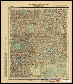
- Description:
- 1927
- Subject:
- Topical Subject: Soviet Union, Geographic Subject: Kovali, and Topical Subject: Maps
- Publisher:
- Управление военных топографов
- Language:
- Russian
- Identifier:
- VAC9619-003494
- Genre:
- Topographic Maps and Military Maps
- Geographic Location:
- Coordinates: 56.0, 31.75, 56.16667, 32.0
- Related URL:
- Download GeoTIFF: https://drive.google.com/file/d/1aUs01744U8z9WJUyVwJHJ7uEfI1G5EIX/view?usp=sharing and Catalog URL: http://iucat.iu.edu/catalog/5020131
- Abstract:
- Modern area represented: Ковали (Kovali), Tverskaya oblast, Russia
- Call Number:
- G7000 s50 .S68 sheet O-36-136-D
- Caption:
- Не подлежит оглашению
- City:
- Ковали (Kovali)
- Copyright Holder:
- No Copyright - United States
- Country:
- СССР (USSR)
- State/Province:
- РСФСР (RSFSR) and Западная область (Western oblast)
- Physical Description:
- Scale: 1:50,000
- Persistent URL:
- http://purl.dlib.indiana.edu/iudl/images/VAC9619/VAC9619-003494
- Provenance:
- M. I. Map Library
-
- Description:
- 1929
- Subject:
- Geographic Subject: Moshny, Topical Subject: Soviet Union, and Topical Subject: Maps
- Publisher:
- Управление военных топографов
- Language:
- Russian
- Date Created:
- 1932
- Identifier:
- VAC9619-001027
- Genre:
- Military Maps and Topographic Maps
- Geographic Location:
- Coordinates: 49.5, 31.5, 49.6667, 31.75
- Related URL:
- Catalog URL: http://iucat.iu.edu/catalog/5020131 and Download GeoTIFF: https://drive.google.com/open?id=1YDdnSgfHB6iMpwwVJPx9zoDfBiEx-g7S
- Abstract:
- Modern area represented: Мошни (Moshny), Cherkasy oblast, Ukraine
- Call Number:
- G7000 s50 .S68 sheet M-36-88-A
- Caption:
- Рассекречено and Не подлежит оглашению
- City:
- Мошны (Moshny)
- Copyright Holder:
- No Copyright - United States
- Country:
- СССР (USSR)
- State/Province:
- Украинская ССР (Ukrainian Soviet Socialist Republic)
- Physical Description:
- Scale: 1:50,000
- Persistent URL:
- http://purl.dlib.indiana.edu/iudl/images/VAC9619/VAC9619-001027
- Provenance:
- M. I. Map Library, Library of Congress Geography & Map Division
-
- Description:
- 1904
- Subject:
- Topical Subject: Soviet Union, Topical Subject: Maps, and Geographic Subject: Stepan
- Publisher:
- Управление военных топографов
- Language:
- Russian
- Identifier:
- VAC9619-000207
- Genre:
- Military Maps and Topographic Maps
- Geographic Location:
- Coordinates: 51, 26.25, 51.167, 26.5
- Related URL:
- Download GeoTIFF: https://drive.google.com/open?id=1bTwttJKED6XJW9TmdPkYHDE5HlwYpswi and Catalog URL: http://iucat.iu.edu/catalog/5020131
- Abstract:
- Modern area represented: Stepan, Rivne oblast, Ukraine
- Call Number:
- G7000 s50 .S68 sheet M-35-29-D
- City:
- Степань (Stepań)
- Copyright Holder:
- No Copyright - United States
- Country:
- Польша (Poland)
- Physical Description:
- Scale: 1:50,000
- Persistent URL:
- http://purl.dlib.indiana.edu/iudl/images/VAC9619/VAC9619-000207
- Provenance:
- M. I. Map Library, G000-30
-
- Subject:
- Topical Subject: Maps, Topical Subject: Soviet Union, and Geographic Subject: Pavoloch
- Publisher:
- Управление военных топографов
- Language:
- Russian
- Identifier:
- VAC9619-000848
- Genre:
- Military Maps and Topographic Maps
- Geographic Location:
- Coordinates: 49.8333, 29.25, 50, 29.5
- Related URL:
- Download GeoTIFF: https://drive.google.com/open?id=1rClY9QwrPg534wZKiLiyAW-wSoq55sEd and Catalog URL: http://iucat.iu.edu/catalog/5020131
- Abstract:
- Modern area represented: Pavoloch, Zhytomyr oblast, Ukraine
- Call Number:
- G7000 s50 .S68 sheet M-35-83-B
- Caption:
- Не подлежит оглашению
- City:
- Паволочь (Pavoloch)
- Copyright Holder:
- No Copyright - United States
- Country:
- СССР (USSR)
- State/Province:
- Украинская ССР (Ukrainian Soviet Socialist Republic) and Киевская область (Kyiv oblast)
- Physical Description:
- Scale: 1:50,000
- Persistent URL:
- http://purl.dlib.indiana.edu/iudl/images/VAC9619/VAC9619-000848
- Provenance:
- CIA Map Branch -- Received
-
- Description:
- 1929
- Subject:
- Geographic Subject: Azarychy, Topical Subject: Maps, and Topical Subject: Soviet Union
- Publisher:
- Управление военных топографов
- Language:
- Russian
- Identifier:
- VAC9619-000790
- Genre:
- Military Maps and Topographic Maps
- Geographic Location:
- Coordinates: 52.333, 29.25, 52.5, 29.5
- Related URL:
- Download GeoTIFF: https://drive.google.com/open?id=1Uqe7-WXNazdS1P1xaQVm59gXsGcZNwg- and Catalog URL: http://iucat.iu.edu/catalog/5020131
- Abstract:
- Modern area represented: Azarychy, Homyel oblast, Belarus
- Call Number:
- G7000 s50 .s68 sheet N-35-131-D
- Caption:
- Не подлежит оглашению
- City:
- Озаричи (Ozarichi)
- Copyright Holder:
- No Copyright - United States
- Country:
- СССР (USSR)
- State/Province:
- Белорусская ССР (Byelorussian Soviet Socialist Republic)
- Physical Description:
- Scale: 1:50,000
- Persistent URL:
- http://purl.dlib.indiana.edu/iudl/images/VAC9619/VAC9619-000790
- Provenance:
- CIA Map Branch -- Received
-
- Description:
- 1909
- Subject:
- Topical Subject: Soviet Union, Topical Subject: Maps, and Geographic Subject: Horodets
- Publisher:
- Управление военных топографов
- Language:
- Russian
- Identifier:
- VAC9619-000205
- Genre:
- Topographic Maps and Military Maps
- Geographic Location:
- Coordinates: 51.167, 26.25, 51.333, 26.5
- Related URL:
- Download GeoTIFF: https://drive.google.com/open?id=1tx_3wEalMcWWEu9yHQWgaoe6iOcYVQAt and Catalog URL: http://iucat.iu.edu/catalog/5020131
- Abstract:
- Modern area represented: Horodets, Rivne oblast, Ukraine
- Call Number:
- G7000 s50 .S68 sheet M-35-29-B
- City:
- Городец (Horodziec)
- Copyright Holder:
- No Copyright - United States
- Country:
- Польша (Poland)
- Physical Description:
- Scale: 1:50,000
- Persistent URL:
- http://purl.dlib.indiana.edu/iudl/images/VAC9619/VAC9619-000205
- Provenance:
- CIA Map Branch -- Received, FEM Austria
-
- Description:
- 1903
- Subject:
- Topical Subject: Soviet Union, Topical Subject: Maps, and Geographic Subject: Orissaare
- Publisher:
- Управление военных топографов
- Language:
- Russian
- Identifier:
- VAC9619-001703
- Genre:
- Topographic Maps and Military Maps
- Geographic Location:
- Coordinates: 58.5, 23, 58.667, 23.25
- Related URL:
- Download GeoTIFF: https://drive.google.com/open?id=15Z9ED5ZxVlWt8gOyKaaqJE25iyBmGXrZ and Catalog URL: http://iucat.iu.edu/catalog/5020131
- Abstract:
- Modern area represented: Orissaare, Saare county, Estonia
- Call Number:
- G7000 s50 .S68 sheet O-34-58-A
- City:
- Оррисаар (Orissaare)
- Copyright Holder:
- No Copyright - United States
- Country:
- Эстония (Estonia)
- Physical Description:
- Scale: 1:50,000
- Persistent URL:
- http://purl.dlib.indiana.edu/iudl/images/VAC9619/VAC9619-001703
- Provenance:
- CIA Map Branch -- Received, CIA Map Library
