
Search Constraints
You searched for:
Provenance
DMA Topographic Center, Army Map Service Library, OMAHA, Library of Congress Geography & Map Division
Remove constraint Provenance: DMA Topographic Center, Army Map Service Library, OMAHA, Library of Congress Geography & Map Division
Publisher
Главное управление геодезии и картографии при СНК СССР
Remove constraint Publisher: Главное управление геодезии и картографии при СНК СССР
« Previous |
71 - 79 of 79
|
Next »
Search Results
-
- Description:
- 1940
- Subject:
- Geographic Subject: Borovichi, Topical Subject: Soviet Union, and Topical Subject: Maps
- Publisher:
- Главное управление геодезии и картографии при СНК СССР
- Language:
- Russian
- Date Created:
- 1941
- Identifier:
- VAC9619-002146
- Genre:
- Topographic Maps and Military Maps
- Geographic Location:
- Coordinates: 58.3333, 33.5, 58.6667, 34
- Related URL:
- Catalog URL: https://iucat.iu.edu/catalog/5020129 and Download GeoTIFF: https://drive.google.com/open?id=1Gr0hJ9XRcuJ0zQtEiY8uv5kMGYHFYW9b
- Abstract:
- Modern area represented: Боровичи (Borovichi), Novgorodskaya oblast, Russia
- Call Number:
- G7000 s100 .S7 sheet O-36-56
- Caption:
- Временное издание and Для служебного пользования
- City:
- Боровичи (Borovichi)
- Copyright Holder:
- No Copyright - United States
- Country:
- СССР (USSR)
- State/Province:
- РСФСР (RSFSR) and Ленинградская область (Leningrad oblast)
- Physical Description:
- Scale: 1:100,000
- Persistent URL:
- http://purl.dlib.indiana.edu/iudl/images/VAC9619/VAC9619-002146
- Provenance:
- DMA Topographic Center, Army Map Service Library, OMAHA, Library of Congress Geography & Map Division
-
- Subject:
- Geographic Subject: Okulovka, Topical Subject: Soviet Union, and Topical Subject: Maps
- Publisher:
- Главное управление геодезии и картографии при СНК СССР
- Language:
- Russian
- Identifier:
- VAC9619-002145
- Genre:
- Military Maps and Topographic Maps
- Geographic Location:
- Coordinates: 58.3333, 33, 58.6667, 33.5
- Related URL:
- Catalog URL: https://iucat.iu.edu/catalog/5020129 and Download GeoTIFF: https://drive.google.com/open?id=15HJxarPedej5mJK6XGU5i8aRVJ4x8aqd
- Abstract:
- Modern area represented: currently is a part of Окуловка (Okulovka), Novgorodskaya oblast, Russia
- Call Number:
- G7000 s100 .S7 sheet O-36-55
- Caption:
- Для служебного пользования
- City:
- Парахино (Parakhino)
- Copyright Holder:
- No Copyright - United States
- Country:
- СССР (USSR)
- State/Province:
- РСФСР (RSFSR) and Ленинградская область (Leningrad oblast)
- Physical Description:
- Scale: 1:100,000
- Persistent URL:
- http://purl.dlib.indiana.edu/iudl/images/VAC9619/VAC9619-002145
- Provenance:
- DMA Topographic Center, Army Map Service Library, OMAHA, Library of Congress Geography & Map Division
-
- Description:
- 1937
- Subject:
- Geographic Subject: Proletariy, Topical Subject: Soviet Union, and Topical Subject: Maps
- Publisher:
- Главное управление геодезии и картографии при СНК СССР
- Language:
- Russian
- Date Created:
- 1941
- Identifier:
- VAC9619-002142
- Genre:
- Military Maps and Topographic Maps
- Geographic Location:
- Coordinates: 58.3333, 31.5, 58.6667, 32
- Related URL:
- Download GeoTIFF: https://drive.google.com/open?id=12L0qcPIAf3-K_BKB7v2_qhW_7lHKoGC- and Catalog URL: https://iucat.iu.edu/catalog/5020129
- Abstract:
- Modern area represented: Пролетарий (Proletariy), Novgorodskaya oblast, Russia
- Call Number:
- G7000 s100 .S7 sheet O-36-52
- Caption:
- Для служебного пользования
- City:
- Пролетарий (Proletariy)
- Copyright Holder:
- No Copyright - United States
- Country:
- СССР (USSR)
- State/Province:
- РСФСР (RSFSR) and Ленинградская область (Leningrad oblast)
- Physical Description:
- Scale: 1:100,000
- Persistent URL:
- http://purl.dlib.indiana.edu/iudl/images/VAC9619/VAC9619-002142
- Provenance:
- DMA Topographic Center, Army Map Service Library, OMAHA, Library of Congress Geography & Map Division
-
- Description:
- 1936
- Subject:
- Geographic Subject: Vereb'ye, Topical Subject: Soviet Union, and Topical Subject: Maps
- Publisher:
- Главное управление геодезии и картографии при СНК СССР
- Language:
- Russian
- Date Created:
- 1941
- Identifier:
- VAC9619-002138
- Genre:
- Military Maps and Topographic Maps
- Geographic Location:
- Coordinates: 58.6667, 32.5, 59, 33
- Related URL:
- Catalog URL: https://iucat.iu.edu/catalog/5020129 and Download GeoTIFF: https://drive.google.com/open?id=1aKSa6fLVfpNJaKkLCH_N2jr2pREw4hrg
- Abstract:
- Modern area represented: Веребье (Vereb'ye), Novgorodskaya oblast, Russia
- Call Number:
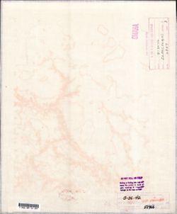
- G7000 s100 .S7 sheet O-36-42
- Caption:
- Для служебного пользования and Captured map
- City:
- Веребье (Vereb'ye)
- Copyright Holder:
- No Copyright - United States
- Country:
- СССР (USSR)
- State/Province:
- РСФСР (RSFSR) and Ленинградская область (Leningrad oblast)
- Physical Description:
- Scale: 1:100,000
- Persistent URL:
- http://purl.dlib.indiana.edu/iudl/images/VAC9619/VAC9619-002138
- Provenance:
- DMA Topographic Center, Army Map Service Library, OMAHA, Library of Congress Geography & Map Division
-
- Description:
- 1936
- Subject:
- Topical Subject: Maps, Topical Subject: Soviet Union, and Geographic Subject: Malaya Vishera
- Publisher:
- Главное управление геодезии и картографии при СНК СССР
- Language:
- Russian
- Date Created:
- 1941
- Identifier:
- VAC9619-002137
- Genre:
- Military Maps and Topographic Maps
- Geographic Location:
- Coordinates: 58.6667, 32, 59, 32.5
- Related URL:
- Catalog URL: https://iucat.iu.edu/catalog/5020129 and Download GeoTIFF: https://drive.google.com/open?id=1WWPpghYiG4M7SU0M6AGkFVGHlE6Wu4RI
- Abstract:
- Modern area represented: Малая Вишера (Malaya Vishera), Novgorodskaya oblast, Russia
- Call Number:
- G7000 s100 .S7 sheet O-36-41
- Caption:
- Для служебного пользования
- City:
- Малая Вишера (Malaya Vishera)
- Copyright Holder:
- No Copyright - United States
- Country:
- СССР (USSR)
- State/Province:
- Ленинградская область (Leningrad oblast), Маловишерский район (Malovishersky district), and РСФСР (RSFSR)
- Physical Description:
- Scale: 1:100,000
- Persistent URL:
- http://purl.dlib.indiana.edu/iudl/images/VAC9619/VAC9619-002137
- Provenance:
- DMA Topographic Center, Army Map Service Library, OMAHA, Library of Congress Geography & Map Division
-
- Description:
- 1937
- Subject:
- Topical Subject: Soviet Union, Geographic Subject: Velegoshchi, and Topical Subject: Maps
- Publisher:
- Главное управление геодезии и картографии при СНК СССР
- Language:
- Russian
- Date Created:
- 1940
- Identifier:
- VAC9619-002136
- Genre:
- Military Maps and Topographic Maps
- Geographic Location:
- Coordinates: 58.6667, 30.5, 59, 31
- Related URL:
- Catalog URL: https://iucat.iu.edu/catalog/5020129 and Download GeoTIFF: https://drive.google.com/open?id=1EQVBYooR8iNdVHlbxUmXDKeDL4lmCEDv
- Abstract:
- Modern area represented: Велегощи (Velegoshchi), Novgorodskaya oblast, Russia
- Call Number:
- G7000 s100 .S7 sheet O-36-38
- Caption:
- Captured map and Для служебного пользования
- City:
- Велегощи (Velegoshchi)
- Copyright Holder:
- No Copyright - United States
- Country:
- СССР (USSR)
- State/Province:
- Новгородский район (Novgorod district), Оредежский район (Oredezhsky district), Батецкий район (Batetsky district), РСФСР (RSFSR), and Ленинградская область ...
- Physical Description:
- Scale: 1:100,000
- Persistent URL:
- http://purl.dlib.indiana.edu/iudl/images/VAC9619/VAC9619-002136
- Provenance:
- DMA Topographic Center, Army Map Service Library, OMAHA, Library of Congress Geography & Map Division
-
- Description:
- 1939
- Subject:
- Geographic Subject: Rudnaya Gorka, Topical Subject: Soviet Union, and Topical Subject: Maps
- Publisher:
- Главное управление геодезии и картографии при СНК СССР
- Language:
- Russian
- Date Created:
- 1941
- Identifier:
- VAC9619-002134
- Genre:
- Topographic Maps and Military Maps
- Geographic Location:
- Coordinates: 59, 33.5, 59.3333, 34
- Related URL:
- Download GeoTIFF: https://drive.google.com/open?id=1ztRyZLG4SS0GSaHJ-aT2waPEKcYJAYyG and Catalog URL: https://iucat.iu.edu/catalog/5020129
- Abstract:
- Modern area represented: Rudnaya Gorka, Leningrad oblast, Russia
- Call Number:
- G7000 s100 .S7 sheet O-36-32
- Caption:
- Для служебного пользования,Временное издание
- City:
- Рудная Горка (Rudnaya Gorka)
- Copyright Holder:
- No Copyright - United States
- Country:
- СССР (USSR)
- State/Province:
- Ленинградская область (Leningrad oblast) and РСФСР (RSFSR)
- Physical Description:
- Scale: 1:100,000
- Persistent URL:
- http://purl.dlib.indiana.edu/iudl/images/VAC9619/VAC9619-002134
- Provenance:
- DMA Topographic Center, Army Map Service Library, OMAHA, Library of Congress Geography & Map Division
-
- Description:
- 1936
- Subject:
- Topical Subject: Maps, Topical Subject: Soviet Union, and Geographic Subject: Goryatino
- Publisher:
- Главное управление геодезии и картографии при СНК СССР
- Language:
- Russian
- Date Created:
- 1941
- Identifier:
- VAC9619-002132
- Genre:
- Military Maps and Topographic Maps
- Geographic Location:
- Coordinates: 59, 32.5, 59.3333, 33
- Related URL:
- Catalog URL: https://iucat.iu.edu/catalog/5020129 and Download GeoTIFF: https://drive.google.com/open?id=17ZyE4IrTIjaZwCDcStK6hwrndEkvbgrM
- Abstract:
- Modern area represented: Goryatino, Leningrad oblast, Russia
- Call Number:
- G7000 s100 .S7 sheet O-36-30
- Caption:
- Для служебного пользования
- City:
- Горятино (Goryatino)
- Copyright Holder:
- No Copyright - United States
- Country:
- СССР (USSR)
- State/Province:
- Дрегельский район (Dregelsky district), РСФСР (RSFSR), Ленинградская область (Leningrad oblast), Киришский район (Kirishsky district), and Маловишерский райо...
- Physical Description:
- Scale: 1:100,000
- Persistent URL:
- http://purl.dlib.indiana.edu/iudl/images/VAC9619/VAC9619-002132
- Provenance:
- DMA Topographic Center, Army Map Service Library, OMAHA, Library of Congress Geography & Map Division
-
- Description:
- 1939
- Subject:
- Topical Subject: Soviet Union, Geographic Subject: Vaskinichi, and Topical Subject: Maps
- Publisher:
- Главное управление геодезии и картографии при СНК СССР
- Language:
- Russian
- Date Created:
- 1941
- Identifier:
- VAC9619-000009
- Genre:
- Topographic Maps and Military Maps
- Geographic Location:
- Coordinates: 59.6667, 32.75, 59.8333, 33
- Related URL:
- DataCORE Dataset Download: https://datacore.iu.edu/concern/data_sets/3j3332901
- Abstract:
- Modern area represented: Vaskinichi, Leningrad oblast, Russia
- Call Number:
- G7000 s50 .S68 sheet O-36-6-D
- Caption:
- Секретно,Captured map
- City:
- Васкеничи (Vaskenichi)
- Copyright Holder:
- No Copyright - United States
- Country:
- СССР (USSR)
- State/Province:
- Тихвинский район (Tikhvin district), Ленинградская область (Leningrad oblast), РСФСР (RSFSR), and Волховский район (Volkhov district)
- Physical Description:
- Scale: 1:50,000
- Persistent URL:
- http://purl.dlib.indiana.edu/iudl/images/VAC9619/VAC9619-000009
- Provenance:
- DMA Topographic Center, Army Map Service Library, OMAHA, Library of Congress Geography & Map Division
