
Search Constraints
You searched for:
Provenance
DMA Topographic Center, Army Map Service Library, OMAHA
Remove constraint Provenance: DMA Topographic Center, Army Map Service Library, OMAHA
« Previous |
1 - 100 of 416
|
Next »
Search Results
-
- Description:
- 1900
- Subject:
- Geographic Subject: Dukla, Topical Subject: Maps, and Topical Subject: Soviet Union
- Publisher:
- Генеральный штаб Красной Армии
- Language:
- Russian
- Date Created:
- 1940
- Identifier:
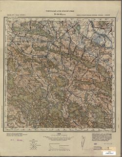
- VAC9619-003026
- Genre:
- Topographic Maps and Military Maps
- Geographic Location:
- Coordinates: 49.333, 21.5, 49.667, 22
- Related URL:
- Catalog URL: https://iucat.iu.edu/catalog/5020129 and Download GeoTIFF: https://drive.google.com/file/d/1e6hl_8RYVtO4gyTqSy4BwZgpUBKrnpPl/view?usp=sharing
- Abstract:
- Modern area represented: Dukla, Subcarpathian province, Poland
- Call Number:
- G7000 s100 .S7 sheet M-34-92
- City:
- Дукля (Dukla)
- Copyright Holder:
- No Copyright - United States
- Country:
- Словакия (Slovakia)
- State/Province:
- Область государственных интересов Германии (Region of German state interests)
- Physical Description:
- Scale: 1:100,000
- Persistent URL:
- http://purl.dlib.indiana.edu/iudl/images/VAC9619/VAC9619-003026
- Provenance:
- DMA Topographic Center, Army Map Service Library, OMAHA
-
- Subject:
- Topical Subject: Soviet Union, Topical Subject: Maps, and Geographic Subject: Aknīste
- Publisher:
- Генеральный штаб РККА
- Language:
- Russian
- Identifier:
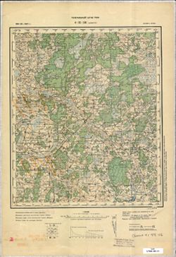
- VAC9619-003216
- Genre:
- Military Maps and Topographic Maps
- Geographic Location:
- Coordinates: 56, 25.5, 56.333, 26
- Related URL:
- Download GeoTIFF: https://drive.google.com/file/d/10j1Gd0wkCBijMKmk6Ew1hBYi12YjrEr9/view?usp=sharing and Catalog URL: https://iucat.iu.edu/catalog/5020129
- Abstract:
- Modern area represented: Aknīste, Latvia
- Call Number:
- G7000 s100 .S7 sheet O-35-136
- Caption:
- Captured map
- City:
- Акнистэ (Aknīste)
- Copyright Holder:
- No Copyright - United States
- Country:
- Латвия (Latvia) and Литва (Lithuania)
- Physical Description:
- Scale: 1:100,000
- Persistent URL:
- http://purl.dlib.indiana.edu/iudl/images/VAC9619/VAC9619-003216
- Provenance:
- DMA Topographic Center, Army Map Service Library, OMAHA
-
- Subject:
- Topical Subject: Maps, Topical Subject: Soviet Union, and Geographic Subject: Povenets
- Publisher:
- Itä-Karjalan kartasto
- Language:
- Russian
- Identifier:
- VAC9619-002500
- Genre:
- Topographic Maps and Military Maps
- Geographic Location:
- Coordinates: 62.667, 34.5, 63, 35
- Related URL:
- Download GeoTIFF: https://drive.google.com/file/d/11CTekGtzM6PCJt9U4WWXhs6PTTfpZKv2/view?usp=sharing and Catalog URL: https://iucat.iu.edu/catalog/5020129
- Abstract:
- Modern area represented: Повенец (Povenets), Медвежьегорский район (Medvezhyegorsky District), Republic of Karelia, Russia
- Call Number:
- G7000 s100 .S7 sheet P-36-46
- Caption:
- Captured map
- City:
- Повенец (Povenets)
- Copyright Holder:
- No Copyright - United States
- Physical Description:
- Scale: 1:100,000
- Persistent URL:
- http://purl.dlib.indiana.edu/iudl/images/VAC9619/VAC9619-002500
- Provenance:
- DMA Topographic Center, Army Map Service Library, OMAHA
-
- Description:
- 1936
- Subject:
- Topical Subject: Soviet Union, Geographic Subject: Osipovichi, and Topical Subject: Maps
- Publisher:
- Генеральный штаб Красной Армии
- Language:
- Russian
- Identifier:
- VAC9619-004110
- Genre:
- Topographic Maps and Military Maps
- Geographic Location:
- Coordinates: 53, 28.5, 53.333, 29
- Related URL:
- Catalog URL: https://iucat.iu.edu/catalog/5020129 and Download GeoTIFF: https://drive.google.com/file/d/1QHztwVY5BfNd2v6YqGnUlSEcglWhRTrs/view?usp=sharing
- Abstract:
- Modern area represented: Osipovichi, Belarus
- Call Number:
- G7000 s100 .S7 sheet N-35-106
- Caption:
- Не подлежит оглашению
- City:
- Осиповичи (Osipovichi)
- Copyright Holder:
- No Copyright - United States
- Country:
- СССР (USSR)
- State/Province:
- Полесская область (Polesia oblast), Могилевская область (Mogilev oblast), Белорусская ССР (Byelorussian Soviet Socialist Republic), and Минская область (Mins...
- Physical Description:
- Scale: 1:100,000
- Persistent URL:
- http://purl.dlib.indiana.edu/iudl/images/VAC9619/VAC9619-004110
- Provenance:
- DMA Topographic Center, Army Map Service Library, OMAHA
-
- Subject:
- Topical Subject: Maps, Geographic Subject: Ostrava, and Topical Subject: Soviet Union
- Publisher:
- Генеральный штаб РККА
- Language:
- Russian
- Identifier:
- VAC9619-002870
- Genre:
- Topographic Maps and Military Maps
- Geographic Location:
- Coordinates: 49.667, 18, 50, 18.5
- Related URL:
- Catalog URL: https://iucat.iu.edu/catalog/5020129 and Download GeoTIFF: https://drive.google.com/file/d/1OjvHezWlaQqX0XjfRTSy9iu_7Zy4fWVy/view?usp=sharing
- Abstract:
- Modern area represented: Ostrava, Moravskoslezský region, Czech Republic
- Call Number:
- G7000 s100 .S7 sheet M-34-73
- City:
- Морав. Острава (Moravian Ostrava)
- Copyright Holder:
- No Copyright - United States
- Country:
- Германия (Germany) and Чехословакия (Czechoslovakia)
- Physical Description:
- Scale: 1:100,000
- Persistent URL:
- http://purl.dlib.indiana.edu/iudl/images/VAC9619/VAC9619-002870
- Provenance:
- DMA Topographic Center, Army Map Service Library, OMAHA
-

- Description:
- 1938
- Subject:
- Topical Subject: Maps, Geographic Subject: Krasnogvardeyskoe, and Topical Subject: Soviet Union
- Publisher:
- Главное управление геодезии и картографии при СНК СССР
- Language:
- Russian
- Date Created:
- 1941
- Identifier:
- VAC9619-002343
- Genre:
- Topographic Maps and Military Maps
- Geographic Location:
- Coordinates: 45.667, 41.5, 46, 42
- Related URL:
- Download GeoTIFF: https://drive.google.com/file/d/1AVr-cwCpH2TyChEw-jxKdVkFJnNQ8ff2/view?usp=sharing and Catalog URL: https://iucat.iu.edu/catalog/5020129
- Abstract:
- Modern area represented: Krasnogvardeyskoe, Stavropol kray, Russia
- Call Number:
- G7000 s100 .S7 sheet L-37-84
- Caption:
- Для служебного пользования
- City:
- Молотовское (Molotovskoe)
- Copyright Holder:
- No Copyright - United States
- Country:
- СССР (USSR)
- State/Province:
- Орджоникидзевский край (Ordzhonikidze kray), Калмыцкая АССР (Kalmyk Autonomous Soviet Socialist Republic), Ростовская область (Rostov oblast), and РСФСР (RSFSR)
- Physical Description:
- Scale: 1:100,000
- Persistent URL:
- http://purl.dlib.indiana.edu/iudl/images/VAC9619/VAC9619-002343
- Provenance:
- DMA Topographic Center, Army Map Service Library, OMAHA
-

- Description:
- 1939
- Subject:
- Topical Subject: Maps, Geographic Subject: Yukhnov, and Topical Subject: Soviet Union
- Publisher:
- Генеральный штаб Красной Армии
- Language:
- Russian
- Date Created:
- 1941
- Identifier:
- VAC9619-004187
- Genre:
- Topographic Maps and Military Maps
- Geographic Location:
- Coordinates: 54.667, 35, 55, 35.5
- Related URL:
- Download GeoTIFF: https://drive.google.com/file/d/1cQNBivSSzsjyVCwoyr6v2BrCZDWttVf4/view?usp=sharing and Catalog URL: https://iucat.iu.edu/catalog/5020129
- Abstract:
- Modern area represented: Yukhnov, Kaluga oblast, Russia
- Call Number:
- G7000 s100 .S7 sheet N-36-47
- City:
- Юхнов (Yukhnov)
- Copyright Holder:
- No Copyright - United States
- Country:
- СССР (USSR)
- State/Province:
- Смоленская область (Smolensk oblast) and РСФСР (RSFSR)
- Physical Description:
- Scale: 1:100,000
- Persistent URL:
- http://purl.dlib.indiana.edu/iudl/images/VAC9619/VAC9619-004187
- Provenance:
- DMA Topographic Center, Army Map Service Library, OMAHA
-
- Description:
- 1927
- Subject:
- Topical Subject: Soviet Union, Topical Subject: Maps, and Geographic Subject: Tarzhepol'
- Publisher:
- Главное геодезическое управление
- Language:
- Russian
- Identifier:
- VAC9619-002556
- Genre:
- Topographic Maps and Military Maps
- Geographic Location:
- Coordinates: 61, 34, 61.333, 34.5
- Related URL:
- Catalog URL: https://iucat.iu.edu/catalog/5020129 and Download GeoTIFF: https://drive.google.com/file/d/1znEaZC6LKaPd3LRQXlzjNsGvDf9zhkGm/view?usp=sharing
- Abstract:
- Modern area represented: Таржеполь (Tarzhepol’), Republic of Karelia, Russia
- Call Number:
- G7000 s100 .S7 sheet P-36-105
- Caption:
- Не подлежит оглашению
- City:
- Таржеполь (Tarzhepol’)
- Copyright Holder:
- No Copyright - United States
- Country:
- СССР (USSR)
- State/Province:
- Ленинградская область (Leningrad oblast), РСФСР (RSFSR), and Карельская АССР (Karelian Autonomous Soviet Socialist Republic)
- Physical Description:
- Scale: 1:100,000
- Persistent URL:
- http://purl.dlib.indiana.edu/iudl/images/VAC9619/VAC9619-002556
- Provenance:
- DMA Topographic Center, Army Map Service Library, OMAHA
-
- Subject:
- Topical Subject: Maps, Geographic Subject: Lyuboml, and Topical Subject: Soviet Union
- Publisher:
- Управление военных топографов
- Language:
- Russian
- Date Created:
- 1891
- Identifier:
- VAC9619-000193
- Genre:
- Military Maps and Topographic Maps
- Geographic Location:
- Coordinates: 51.167, 24, 51.333, 24.25
- Related URL:
- Download GeoTIFF: https://drive.google.com/open?id=1w8ShRr1XZdo9wBCMn-f1ckMGagGqPeY0 and Catalog URL: http://iucat.iu.edu/catalog/5020131
- Abstract:
- Modern area represented: Lyuboml, Ukraine
- Call Number:
- G7000 s50 .S68 sheet M-35-25-A
- City:
- Любомль (Lyuboml)
- Copyright Holder:
- No Copyright - United States
- Country:
- Польша (Poland)
- Physical Description:
- Scale: 1:50,000
- Persistent URL:
- http://purl.dlib.indiana.edu/iudl/images/VAC9619/VAC9619-000193
- Provenance:
- DMA Topographic Center, Army Map Service Library, OMAHA
-
- Description:
- 1879
- Subject:
- Geographic Subject: Pitrags, Topical Subject: Soviet Union, and Topical Subject: Maps
- Publisher:
- Генеральный штаб РККА
- Language:
- Russian
- Identifier:
- VAC9619-003185
- Genre:
- Military Maps and Topographic Maps
- Geographic Location:
- Coordinates: 57.667, 22, 58, 22.5
- Related URL:
- Catalog URL: https://iucat.iu.edu/catalog/5020129 and Download GeoTIFF: https://drive.google.com/file/d/1n1Rn8gHwxZQsFmBAKKFV_WIcShuiaAs6/view?usp=sharing
- Abstract:
- Modern area represented: Питрагс (Pitrags), Latvia
- Call Number:
- G7000 s100 .S7 sheet O-34-81
- Caption:
- Captured map
- City:
- Питрагуциемс (Pitraguciems)
- Copyright Holder:
- No Copyright - United States
- Country:
- Латвия (Latvia) and Эстония (Estonia)
- Physical Description:
- Scale: 1:100,000
- Persistent URL:
- http://purl.dlib.indiana.edu/iudl/images/VAC9619/VAC9619-003185
- Provenance:
- DMA Topographic Center, Army Map Service Library, OMAHA
-
- Description:
- 1884
- Subject:
- Topical Subject: Maps, Topical Subject: Soviet Union, and Geographic Subject: Shyroke
- Publisher:
- Генеральный штаб Красной Армии
- Language:
- Russian
- Date Created:
- 1916
- Identifier:
- VAC9619-001926
- Genre:
- Military Maps and Topographic Maps
- Geographic Location:
- Coordinates: 45.6667, 30, 46, 30.5
- Related URL:
- Download GeoTIFF: https://drive.google.com/file/d/1AYaNyRovEw9oylsdtjC4JxGB1IgJmmQs/view?usp=sharing and Catalog URL: https://iucat.iu.edu/catalog/5020129
- Abstract:
- Modern area represented: Shyroke, Odessa oblast, Ukraine
- Call Number:
- G7000 s100 .S7 sheet L-36-73
- Caption:
- Для служебного пользования
- City:
- Кебабча (Kebabcha)
- Copyright Holder:
- No Copyright - United States
- Country:
- СССР (USSR)
- State/Province:
- Украинская ССР (Ukrainian Soviet Socialist Republic) and Аккерманская область (Akkerman oblast)
- Physical Description:
- Scale: 1:100,000
- Persistent URL:
- http://purl.dlib.indiana.edu/iudl/images/VAC9619/VAC9619-001926
- Provenance:
- DMA Topographic Center, Army Map Service Library, OMAHA
-
- Subject:
- Geographic Subject: Loymola, Topical Subject: Soviet Union, and Topical Subject: Maps
- Publisher:
- Генеральный штаб РККА
- Language:
- Russian
- Identifier:
- VAC9619-002525
- Genre:
- Military Maps and Topographic Maps
- Geographic Location:
- Coordinates: 61.667, 31.5, 62, 32
- Related URL:
- Catalog URL: https://iucat.iu.edu/catalog/5020129 and Download GeoTIFF: https://drive.google.com/file/d/1gV1FKi-RQzjk-6ygmXEF1vcC9kMUxeSh/view?usp=sharing
- Abstract:
- Modern area represented: Лоймола (Loymola), Republic of Karelia, Russia
- Call Number:
- G7000 s100 .S7 sheet P-36-76
- City:
- Лоймола (Loymola)
- Copyright Holder:
- No Copyright - United States
- Country:
- Финляндия (Finland)
- Physical Description:
- Scale: 1:100,000
- Persistent URL:
- http://purl.dlib.indiana.edu/iudl/images/VAC9619/VAC9619-002525
- Provenance:
- DMA Topographic Center, Army Map Service Library, OMAHA
-
- Subject:
- Geographic Subject: Zarya, Topical Subject: Soviet Union, and Topical Subject: Maps
- Publisher:
- Генеральный штаб РККА
- Language:
- Russian
- Identifier:
- VAC9619-002494
- Genre:
- Topographic Maps and Military Maps
- Geographic Location:
- Coordinates: 62.667, 31.5, 63, 32
- Related URL:
- Catalog URL: https://iucat.iu.edu/catalog/5020129 and Download GeoTIFF: https://drive.google.com/file/d/1rRLTjbTB0wOHfFtdkBF5Ln7yeMTWINlC/view?usp=sharing
- Abstract:
- Modern area represented: Заря (Zarya), Republic of Karelia, Russia
- Call Number:
- G7000 s100 .S7 sheet P-36-40
- Caption:
- Не подлежит оглашению,Captured map
- City:
- Свиная Гора (Svinaya Gora)
- Copyright Holder:
- No Copyright - United States
- Country:
- Финляндия (Finland) and СССР (USSR)
- State/Province:
- РСФСР (RSFSR) and Карельская АССР (Karelian Autonomous Soviet Socialist Republic)
- Physical Description:
- Scale: 1:100,000
- Persistent URL:
- http://purl.dlib.indiana.edu/iudl/images/VAC9619/VAC9619-002494
- Provenance:
- DMA Topographic Center, Army Map Service Library, OMAHA
-

- Description:
- 1939
- Subject:
- Topical Subject: Soviet Union, Geographic Subject: Karmanovo, and Topical Subject: Maps
- Publisher:
- Генеральный штаб Красной Армии
- Language:
- Russian
- Date Created:
- 1941
- Identifier:
- VAC9619-004150
- Genre:
- Topographic Maps and Military Maps
- Geographic Location:
- Coordinates: 55.667, 34.5, 56, 35
- Related URL:
- Download GeoTIFF: https://drive.google.com/file/d/1gODnEnCNkJ7LsHO8wwP5guFmkhqszNsR/view?usp=sharing and Catalog URL: https://iucat.iu.edu/catalog/5020129
- Abstract:
- Modern area represented: Karmanovo, Russia
- Call Number:
- G7000 s100 .S7 sheet N-36-10
- City:
- Карманово (Karmanovo)
- Copyright Holder:
- No Copyright - United States
- Country:
- СССР (USSR)
- State/Province:
- РСФСР (RSFSR), Калининская область (Kalinin oblast), and Смоленская область (Smolensk oblast)
- Physical Description:
- Scale: 1:100,000
- Persistent URL:
- http://purl.dlib.indiana.edu/iudl/images/VAC9619/VAC9619-004150
- Provenance:
- DMA Topographic Center, Army Map Service Library, OMAHA
-
- Description:
- 1887
- Subject:
- Topical Subject: Soviet Union, Geographic Subject: Skidzyel, and Topical Subject: Maps
- Publisher:
- Генеральный штаб РККА
- Language:
- Russian
- Date Created:
- 1937
- Identifier:
- VAC9619-004085
- Genre:
- Military Maps and Topographic Maps
- Geographic Location:
- Coordinates: 53.333, 24, 53.667, 24.5
- Related URL:
- Catalog URL: https://iucat.iu.edu/catalog/5020129 and Download GeoTIFF: https://drive.google.com/file/d/1rvAsBsH5sPuyxhSQbegd-5aqfbBNs5qt/view?usp=sharing
- Abstract:
- Modern area represented: Skidzyel, Hrodno oblast, Belarus
- Call Number:
- G7000 s100 .S7 sheet N-35-85
- City:
- Скидэль (Skidzyel)
- Copyright Holder:
- No Copyright - United States
- Country:
- СССР (USSR)
- State/Province:
- Белостокская область (Belastok oblast) and Белорусская ССР (Byelorussian Soviet Socialist Republic)
- Physical Description:
- Scale: 1:100,000
- Persistent URL:
- http://purl.dlib.indiana.edu/iudl/images/VAC9619/VAC9619-004085
- Provenance:
- DMA Topographic Center, Army Map Service Library, OMAHA
-

- Description:
- 1936
- Subject:
- Geographic Subject: Golochin, Topical Subject: Maps, and Topical Subject: Soviet Union
- Publisher:
- Управление военных топографов РККА
- Language:
- Russian
- Identifier:
- VAC9619-004061
- Genre:
- Topographic Maps and Military Maps
- Geographic Location:
- Coordinates: 54.333, 29.5, 54.667, 30
- Related URL:
- Download GeoTIFF: https://drive.google.com/file/d/1b_Z20-vaDKj5kD5kF0COX94rPbY8G7hJ/view?usp=sharing and Catalog URL: https://iucat.iu.edu/catalog/5020129
- Abstract:
- Modern area represented: Golochin, Vitebsk oblast, Belarus
- Call Number:
- G7000 s100 .S7 sheet N-35-60
- Caption:
- Не подлежит оглашению
- City:
- Толочин (Golochin)
- Copyright Holder:
- No Copyright - United States
- Country:
- СССР (USSR)
- State/Province:
- Белорусская ССР (Byelorussian Soviet Socialist Republic)
- Physical Description:
- Scale: 1:100,000
- Persistent URL:
- http://purl.dlib.indiana.edu/iudl/images/VAC9619/VAC9619-004061
- Provenance:
- DMA Topographic Center, Army Map Service Library, OMAHA
-
- Description:
- 1937
- Subject:
- Geographic Subject: Pustoshka, Topical Subject: Soviet Union, and Topical Subject: Maps
- Publisher:
- Генеральный штаб РККА
- Language:
- Russian
- Identifier:
- VAC9619-003212
- Genre:
- Military Maps and Topographic Maps
- Geographic Location:
- Coordinates: 56.333, 29, 56.667, 29.5
- Related URL:
- Catalog URL: https://iucat.iu.edu/catalog/5020129 and Download GeoTIFF: https://drive.google.com/file/d/1IvTgPoVX4qW5U4_7tfyvsRijFDiYBQId/view?usp=sharing
- Abstract:
- Modern area represented: Пустошка (Pustoshka), Pskovskaya oblast, Russia
- Call Number:
- G7000 s100 .S7 sheet O-35-131
- Caption:
- Captured map and Не подлежит оглашению
- City:
- Пустошка (Pustoshka)
- Copyright Holder:
- No Copyright - United States
- Country:
- СССР (USSR)
- State/Province:
- Калининская область (Kalinin oblast) and РСФСР (RSFSR)
- Physical Description:
- Scale: 1:100,000
- Persistent URL:
- http://purl.dlib.indiana.edu/iudl/images/VAC9619/VAC9619-003212
- Provenance:
- DMA Topographic Center, Army Map Service Library, OMAHA
-
- Description:
- 1935
- Subject:
- Geographic Subject: Babya Guba, Topical Subject: Soviet Union, and Topical Subject: Maps
- Publisher:
- Itä-Karjalan kartasto
- Language:
- Russian
- Identifier:
- VAC9619-002619
- Genre:
- Military Maps and Topographic Maps
- Geographic Location:
- Coordinates: 64.333, 30, 64.667, 30.5
- Related URL:
- Download GeoTIFF: https://drive.google.com/file/d/1AA7FyE6sffkeuxva0pcxVZ6e1E7qN4hq/view?usp=sharing and Catalog URL: https://iucat.iu.edu/catalog/5020129
- Abstract:
- Modern area represented: Babya Guba, Republic of Karelia, Russia
- Call Number:
- G7000 s100 .S7 sheet Q-36-121
- City:
- Бабья Губа (Babya Guba)
- Copyright Holder:
- No Copyright - United States
- Country:
- СССР (USSR)
- State/Province:
- РСФСР (RSFSR) and Карельская АССР (Karelian Autonomous Soviet Socialist Republic)
- Physical Description:
- Scale: 1:100,000
- Persistent URL:
- http://purl.dlib.indiana.edu/iudl/images/VAC9619/VAC9619-002619
- Provenance:
- DMA Topographic Center, Army Map Service Library, OMAHA
-
- Description:
- 1933
- Subject:
- Topical Subject: Soviet Union, Geographic Subject: Smalyavichy, and Topical Subject: Maps
- Publisher:
- Генеральный штаб РККА
- Language:
- Russian
- Date Created:
- 1938
- Identifier:
- VAC9619-004070
- Genre:
- Military Maps and Topographic Maps
- Geographic Location:
- Coordinates: 54, 28, 54.333, 28.5
- Related URL:
- Download GeoTIFF: https://drive.google.com/file/d/16asgNlbQYtBgJbOA_pcaodVVP64XsP-b/view?usp=sharing and Catalog URL: https://iucat.iu.edu/catalog/5020129
- Abstract:
- Modern area represented: Smalyavichy, Belarus
- Call Number:
- G7000 s100 .S7 sheet N-35-69
- Caption:
- Не подлежит оглашению
- City:
- Смолевичи (Smalyavichy)
- Copyright Holder:
- No Copyright - United States
- Country:
- СССР (USSR)
- State/Province:
- Минская область (Minsk oblast) and Белорусская ССР (Byelorussian Soviet Socialist Republic)
- Physical Description:
- Scale: 1:100,000
- Persistent URL:
- http://purl.dlib.indiana.edu/iudl/images/VAC9619/VAC9619-004070
- Provenance:
- DMA Topographic Center, Army Map Service Library, OMAHA
-
- Description:
- 1908
- Subject:
- Geographic Subject: Ivenets, Topical Subject: Maps, and Topical Subject: Soviet Union
- Publisher:
- Управление военных топографов РККА
- Language:
- Russian
- Date Created:
- 1933
- Identifier:
- VAC9619-004078
- Genre:
- Topographic Maps and Military Maps
- Geographic Location:
- Coordinates: 53.667, 26.5, 54, 27
- Related URL:
- Catalog URL: https://iucat.iu.edu/catalog/5020129 and Download GeoTIFF: https://drive.google.com/file/d/17IBW-4Qy8vDRjL3XAe46WFA6YEoc1hsn/view?usp=sharing
- Abstract:
- Modern area represented: Ivenets, Belarus
- Call Number:
- G7000 s100 .S7 sheet N-35-78
- Caption:
- Не подлежит оглашению
- City:
- Ивенец (Ivenets)
- Copyright Holder:
- No Copyright - United States
- Country:
- Польша (Poland) and СССР (USSR)
- State/Province:
- Белорусская ССР (Byelorussian Soviet Socialist Republic)
- Physical Description:
- Scale: 1:100,000
- Persistent URL:
- http://purl.dlib.indiana.edu/iudl/images/VAC9619/VAC9619-004078
- Provenance:
- DMA Topographic Center, Army Map Service Library, OMAHA
-
- Description:
- 1908
- Subject:
- Topical Subject: Soviet Union, Topical Subject: Maps, and Geographic Subject: Dzyarzhynsk
- Publisher:
- Генеральный штаб РККА
- Language:
- Russian
- Date Created:
- 1933
- Identifier:
- VAC9619-004079
- Genre:
- Military Maps and Topographic Maps
- Geographic Location:
- Coordinates: 53.667, 27, 54, 27.5
- Related URL:
- Catalog URL: https://iucat.iu.edu/catalog/5020129 and Download GeoTIFF: https://drive.google.com/file/d/1tjboYSTp1DC-Rdz2djVaRt-RniRow98d/view?usp=sharing
- Abstract:
- Modern area represented: Dzyarzhynsk, Belarus
- Call Number:
- G7000 s100 .S7 sheet N-35-79
- Caption:
- Не подлежит оглашению
- City:
- Дзержинск (Dzyarzhynsk)
- Copyright Holder:
- No Copyright - United States
- Country:
- Польша (Poland) and СССР (USSR)
- State/Province:
- Белорусская ССР (Byelorussian Soviet Socialist Republic)
- Physical Description:
- Scale: 1:100,000
- Persistent URL:
- http://purl.dlib.indiana.edu/iudl/images/VAC9619/VAC9619-004079
- Provenance:
- DMA Topographic Center, Army Map Service Library, OMAHA
-
- Description:
- 1930
- Subject:
- Topical Subject: Soviet Union, Geographic Subject: Navlya, and Topical Subject: Maps
- Publisher:
- Генеральный штаб Красной Армии
- Language:
- Russian
- Date Created:
- 1941
- Identifier:
- VAC9619-004196
- Genre:
- Military Maps and Topographic Maps
- Geographic Location:
- Coordinates: 52.667, 34, 53, 34.5
- Related URL:
- Download GeoTIFF: https://drive.google.com/file/d/12YHzNYr3tdcPK9AY8xD-otjolRp85ej1/view?usp=sharing and Catalog URL: https://iucat.iu.edu/catalog/5020129
- Abstract:
- Modern area represented: Navlya, Bryansk oblast, Russia
- Call Number:
- G7000 s100 .S7 sheet N-36-117
- City:
- Навля (Navlya)
- Copyright Holder:
- No Copyright - United States
- Country:
- СССР (USSR)
- State/Province:
- Орловская область (Oryol oblast) and РСФСР (RSFSR)
- Physical Description:
- Scale: 1:100,000
- Persistent URL:
- http://purl.dlib.indiana.edu/iudl/images/VAC9619/VAC9619-004196
- Provenance:
- DMA Topographic Center, Army Map Service Library, OMAHA
-
- Subject:
- Geographic Subject: Kārsava, Topical Subject: Soviet Union, and Topical Subject: Maps
- Publisher:
- Генеральный штаб Красной Армии
- Language:
- Russian
- Date Created:
- 1939
- Identifier:
- VAC9619-003202
- Genre:
- Topographic Maps and Military Maps
- Geographic Location:
- Coordinates: 56.667, 27.5, 57, 28
- Related URL:
- Catalog URL: https://iucat.iu.edu/catalog/5020129 and Download GeoTIFF: https://drive.google.com/file/d/1Cvvpi0M0zivDxgeHNrrNK40G9mxiuB_p/view?usp=sharing
- Abstract:
- Modern area represented: Карсава (Kārsava), Latvia
- Call Number:
- G7000 s100 .S7 sheet O-35-116
- City:
- Карсава (Kārsava)
- Copyright Holder:
- No Copyright - United States
- Country:
- СССР (USSR) and Латвия (Latvia)
- State/Province:
- РСФСР (RSFSR) and Калининская область (Kalinin oblast)
- Physical Description:
- Scale: 1:100,000
- Persistent URL:
- http://purl.dlib.indiana.edu/iudl/images/VAC9619/VAC9619-003202
- Provenance:
- DMA Topographic Center, Army Map Service Library, OMAHA
-
- Description:
- 1940
- Subject:
- Geographic Subject: Ozerna, Topical Subject: Soviet Union, and Topical Subject: Maps
- Publisher:
- Генеральный штаб Красной Армии
- Language:
- Russian
- Date Created:
- 1943
- Identifier:
- VAC9619-003229
- Genre:
- Topographic Maps and Military Maps
- Geographic Location:
- Coordinates: 49.333, 25, 49.667, 25.5
- Related URL:
- Catalog URL: https://iucat.iu.edu/catalog/5020129 and Download GeoTIFF: https://drive.google.com/file/d/1oIhAEtx39Pisvi07LTRsFECGV7AUA1t0/view?usp=sharing
- Abstract:
- Modern area represented: Ozerna, Ternopil oblast, Ukraine
- Call Number:
- G7000 s100 .S7 sheet M-35-87
- Caption:
- Для служебного пользования
- City:
- Езерна (Ozerna)
- Copyright Holder:
- No Copyright - United States
- Country:
- СССР (USSR)
- State/Province:
- Тернопольская область (Ternopil oblast) and Украинская ССР (Ukrainian Soviet Socialist Republic)
- Physical Description:
- Scale: 1:100,000
- Persistent URL:
- http://purl.dlib.indiana.edu/iudl/images/VAC9619/VAC9619-003229
- Provenance:
- DMA Topographic Center, Army Map Service Library, OMAHA
-
- Subject:
- Topical Subject: Maps, Geographic Subject: Kompakovo, and Topical Subject: Soviet Union
- Publisher:
- Itä-Karjalan kartasto
- Language:
- Russian
- Identifier:
- VAC9619-002627
- Genre:
- Military Maps and Topographic Maps
- Geographic Location:
- Coordinates: 64, 33, 64.333, 33.5
- Related URL:
- Catalog URL: https://iucat.iu.edu/catalog/5020129 and Download GeoTIFF: https://drive.google.com/file/d/1JfsOmHZ42nOsXDVN-rgwIAwDgAaX-C-w/view?usp=sharing
- Abstract:
- Modern area represented: Kompakovo, Republic of Karelia, Russia
- Call Number:
- G7000 s100 .S7 sheet Q-36-139
- City:
- Компаково (Kompakovo)
- Copyright Holder:
- No Copyright - United States
- Country:
- СССР (USSR)
- State/Province:
- Карельская АССР (Karelian Autonomous Soviet Socialist Republic) and РСФСР (RSFSR)
- Physical Description:
- Scale: 1:100,000
- Persistent URL:
- http://purl.dlib.indiana.edu/iudl/images/VAC9619/VAC9619-002627
- Provenance:
- DMA Topographic Center, Army Map Service Library, OMAHA
-
- Subject:
- Topical Subject: Maps, Geographic Subject: Dagda, and Topical Subject: Soviet Union
- Publisher:
- Генеральный штаб РККА
- Language:
- Russian
- Identifier:
- VAC9619-003218
- Genre:
- Military Maps and Topographic Maps
- Geographic Location:
- Coordinates: 56, 27.5, 56.333, 28
- Related URL:
- Download GeoTIFF: https://drive.google.com/file/d/1Eohk0RDJQ4rFPqNs12M05IqYtSnMEJNS/view?usp=sharing and Catalog URL: https://iucat.iu.edu/catalog/5020129
- Abstract:
- Modern area represented: Дагда (Dagda), Latvia
- Call Number:
- G7000 s100 .S7 sheet O-35-140
- Caption:
- Captured map and Не подлежит оглашению
- City:
- Дагда (Dagda)
- Copyright Holder:
- No Copyright - United States
- Country:
- Латвия (Latvia) and СССР (USSR)
- State/Province:
- Белорусская ССР (Byelorussian Soviet Socialist Republic) and Витебская область (Vitebsk oblast)
- Physical Description:
- Scale: 1:100,000
- Persistent URL:
- http://purl.dlib.indiana.edu/iudl/images/VAC9619/VAC9619-003218
- Provenance:
- DMA Topographic Center, Army Map Service Library, OMAHA
-
- Description:
- 1903
- Subject:
- Geographic Subject: Brześć Kujawski, Topical Subject: Soviet Union, and Topical Subject: Maps
- Publisher:
- Генеральный штаб Красной Армии
- Language:
- Russian
- Date Created:
- 1940
- Identifier:
- VAC9619-003986
- Genre:
- Military Maps and Topographic Maps
- Geographic Location:
- Coordinates: 52.333, 18.5, 52.667, 19
- Related URL:
- Download GeoTIFF: https://drive.google.com/file/d/1ePKtNsR6U-PtjSqLwG7MH3wV0p2A9pRF/view?usp=sharing and Catalog URL: https://iucat.iu.edu/catalog/5020129
- Abstract:
- Modern area represented: Brześć Kujawski, Kuyavian-Pomeranian Voivodeship, Poland
- Call Number:
- G7000 s100 .S7 sheet N-34-122
- City:
- Бжесьць Куявски (Brześć Kujawski)
- Copyright Holder:
- No Copyright - United States
- State/Province:
- Область государственных интересов Германии (Region of German state interests)
- Physical Description:
- Scale: 1:100,000
- Persistent URL:
- http://purl.dlib.indiana.edu/iudl/images/VAC9619/VAC9619-003986
- Provenance:
- DMA Topographic Center, Army Map Service Library, OMAHA
-
- Description:
- 1935
- Subject:
- Topical Subject: Soviet Union, Geographic Subject: Ondozero, and Topical Subject: Maps
- Publisher:
- Itä-Karjalan kartasto
- Language:
- Russian
- Identifier:
- VAC9619-002474
- Genre:
- Topographic Maps and Military Maps
- Geographic Location:
- Coordinates: 63.667, 33, 64, 33.5
- Related URL:
- Download GeoTIFF: https://drive.google.com/file/d/1G_kLCaKmFqHbXcPnx733qtOiPyZ4YNbr/view?usp=sharing and Catalog URL: https://iucat.iu.edu/catalog/5020129
- Abstract:
- Modern area represented: Ondozero, Republic of Karelia, Russia
- Call Number:
- G7000 s100 .S7 sheet P-36-7
- City:
- Ондозеро (Ondozero)
- Copyright Holder:
- No Copyright - United States
- Country:
- СССР (USSR)
- State/Province:
- Карельская АССР (Karelian Autonomous Soviet Socialist Republic) and РСФСР (RSFSR)
- Physical Description:
- Scale: 1:100,000
- Persistent URL:
- http://purl.dlib.indiana.edu/iudl/images/VAC9619/VAC9619-002474
- Provenance:
- DMA Topographic Center, Army Map Service Library, OMAHA
-
- Description:
- 1938
- Subject:
- Topical Subject: Soviet Union, Topical Subject: Maps, and Geographic Subject: Novoselki
- Publisher:
- Главное управление геодезии и картографии при СНК СССР
- Language:
- Russian
- Date Created:
- 1941
- Identifier:
- VAC9619-003506
- Genre:
- Military Maps and Topographic Maps
- Geographic Location:
- Coordinates: 56, 33.5, 56.167, 33.75
- Related URL:
- Catalog URL: http://iucat.iu.edu/catalog/5020131 and Download GeoTIFF: https://drive.google.com/file/d/1vVOP92j0feg7jZkHpknICQM830yuWRdh/view?usp=sharing
- Abstract:
- Modern area represented: Новоселки (Novoselki), Tverskaya oblast, Russia
- Call Number:
- GM G7000 s50 .S68 sheet O-36-140-C
- City:
- Новоселки (Novoselki)
- Copyright Holder:
- No Copyright - United States
- Country:
- СССР (USSR)
- State/Province:
- Калининская область (Kalinin oblast) and Оленинский район (Oleninsky district)
- Physical Description:
- Scale: 1:50,000
- Persistent URL:
- http://purl.dlib.indiana.edu/iudl/images/VAC9619/VAC9619-003506
- Provenance:
- DMA Topographic Center, Army Map Service Library, OMAHA
-
- Subject:
- Topical Subject: Maps, Geographic Subject: Толвуя (Tolvuya), and Topical Subject: Soviet Union
- Publisher:
- Itä-Karjalan kartasto
- Language:
- Russian
- Identifier:
- VAC9619-002513
- Genre:
- Topographic Maps and Military Maps
- Geographic Location:
- Coordinates: 62.333, 35, 62.667, 35.5
- Related URL:
- Catalog URL: https://iucat.iu.edu/catalog/5020129 and Download GeoTIFF: https://drive.google.com/file/d/1_d1cWUcpgCiASwWs9j6aQyyNZkUwsW2u/view?usp=sharing
- Abstract:
- Modern area represented: Толвуя (Tolvuya), Republic of Karelia, Russia
- Call Number:
- G7000 s100 .S7 sheet P-36-59
- Copyright Holder:
- No Copyright - United States
- Physical Description:
- Scale: 1:100,000
- Persistent URL:
- http://purl.dlib.indiana.edu/iudl/images/VAC9619/VAC9619-002513
- Provenance:
- DMA Topographic Center, Army Map Service Library, OMAHA
-
- Subject:
- Topical Subject: Soviet Union, Geographic Subject: Kimito, and Topical Subject: Maps
- Publisher:
- Генеральный штаб Красной Армии
- Language:
- Russian
- Date Created:
- 1939
- Identifier:
- VAC9619-002313
- Genre:
- Military Maps and Topographic Maps
- Geographic Location:
- Coordinates: 60, 22.5, 60.3333, 23
- Related URL:
- Download GeoTIFF: https://drive.google.com/file/d/1Uv6Av5VydaEEAn4UVugqUtJ023dNTT4r/view?usp=sharing and Catalog URL: https://iucat.iu.edu/catalog/5020129
- Abstract:
- Modern area represented: Kimito, Finland
- Call Number:
- G7000 s100 .S7 sheet P-34-142
- City:
- Кимито (Kimito)
- Copyright Holder:
- No Copyright - United States
- Country:
- Финляндия (Finland)
- Physical Description:
- Scale: 1:100,000
- Persistent URL:
- http://purl.dlib.indiana.edu/iudl/images/VAC9619/VAC9619-002313
- Provenance:
- DMA Topographic Center, Army Map Service Library, OMAHA
-
- Description:
- 1884
- Subject:
- Geographic Subject: Lomza, Topical Subject: Soviet Union, and Topical Subject: Maps
- Publisher:
- Генеральный штаб РККА
- Language:
- Russian
- Date Created:
- 1930
- Identifier:
- VAC9619-004003
- Genre:
- Military Maps and Topographic Maps
- Geographic Location:
- Coordinates: 53, 22, 53.333, 22.5
- Related URL:
- Download GeoTIFF: https://drive.google.com/file/d/1oIYQOvf9T9bGlBoG0SMFcZh7VIar6p8C/view?usp=sharing and Catalog URL: https://iucat.iu.edu/catalog/5020129
- Abstract:
- Modern area represented: Lomza, Podlaskie Voivodeship, Poland
- Call Number:
- G7000 s100 .S7 sheet N-34-105
- City:
- Ломжа (Lomza)
- Copyright Holder:
- No Copyright - United States
- Country:
- Польша (Poland)
- Physical Description:
- Scale: 1:100,000
- Persistent URL:
- http://purl.dlib.indiana.edu/iudl/images/VAC9619/VAC9619-004003
- Provenance:
- DMA Topographic Center, Army Map Service Library, OMAHA
-
- Description:
- 1916
- Subject:
- Topical Subject: Soviet Union, Geographic Subject: Joensuu, and Topical Subject: Maps
- Publisher:
- Генеральный штаб РККА
- Language:
- Russian
- Date Created:
- 1939
- Identifier:
- VAC9619-002317
- Genre:
- Military Maps and Topographic Maps
- Geographic Location:
- Coordinates: 62.3333, 29.5, 62.6667, 30
- Related URL:
- Download GeoTIFF: https://drive.google.com/file/d/1uP_pzBhc6QMROXL-IYnKJ5i9KEs-UYJG/view?usp=sharing and Catalog URL: https://iucat.iu.edu/catalog/5020129
- Abstract:
- Modern area represented: Joensuu, Finland
- Call Number:
- G7000 s100 .S7 sheet P-35-60
- City:
- Йоэнсу (Joensuu)
- Copyright Holder:
- No Copyright - United States
- Country:
- Финляндия (Finland)
- Physical Description:
- Scale: 1:100,000
- Persistent URL:
- http://purl.dlib.indiana.edu/iudl/images/VAC9619/VAC9619-002317
- Provenance:
- DMA Topographic Center, Army Map Service Library, OMAHA
-
- Description:
- 1896
- Subject:
- Topical Subject: Maps, Geographic Subject: Częstochowa, and Topical Subject: Soviet Union
- Publisher:
- Генеральный штаб Красной Армии
- Language:
- Russian
- Date Created:
- 1940
- Identifier:
- VAC9619-002785
- Genre:
- Topographic Maps and Military Maps
- Geographic Location:
- Coordinates: 50.667, 19, 51, 19.5
- Related URL:
- Download GeoTIFF: https://drive.google.com/file/d/1JSRUFZZT-T_7vFoWYJDHWjtDgb0QJurL/view?usp=sharing and Catalog URL: https://iucat.iu.edu/catalog/5020129
- Abstract:
- Modern area represented: Częstochowa, Silesia province, Poland
- Call Number:
- G7000 s100 .S7 sheet M-34-39
- City:
- Ченстохова (Częstochowa)
- Copyright Holder:
- No Copyright - United States
- State/Province:
- Область государственных интересов Германии (Region of German state interests)
- Physical Description:
- Scale: 1:100,000
- Persistent URL:
- http://purl.dlib.indiana.edu/iudl/images/VAC9619/VAC9619-002785
- Provenance:
- DMA Topographic Center, Army Map Service Library, OMAHA
-
- Description:
- 1931
- Subject:
- Geographic Subject: Kushchivka, Topical Subject: Soviet Union, and Topical Subject: Maps
- Publisher:
- Управление военных топографов РККА
- Language:
- Russian
- Identifier:
- VAC9619-001131
- Genre:
- Military Maps and Topographic Maps
- Geographic Location:
- Coordinates: 48.3333, 32.25, 48.5, 32.5
- Related URL:
- Download GeoTIFF: https://drive.google.com/open?id=15NyzaF996Qyx1Yma_k0YySDBcgj6x2q3 and Catalog URL: http://iucat.iu.edu/catalog/5020131
- Abstract:
- Modern area represented: Kushchivka, Kirovohrad oblast, Ukraine
- Call Number:
- G7000 s50 .S68 M-36-125-D
- Caption:
- Не подлежит оглашению
- City:
- Кущовка (Kushchivka)
- Copyright Holder:
- No Copyright - United States
- Country:
- СССР (USSR)
- State/Province:
- Одесская область (Odessa oblast), Украинская ССР (Ukrainian Soviet Socialist Republic), and Днепропетровская область (Dnipropetrovsk oblast)
- Physical Description:
- Scale: 1:50,000
- Persistent URL:
- http://purl.dlib.indiana.edu/iudl/images/VAC9619/VAC9619-001131
- Provenance:
- DMA Topographic Center, Army Map Service Library, OMAHA
-
- Description:
- 1934
- Subject:
- Topical Subject: Soviet Union, Topical Subject: Maps, and Geographic Subject: Semchozero
- Publisher:
- Itä-Karjalan kartasto
- Language:
- Russian
- Identifier:
- VAC9619-002498
- Genre:
- Military Maps and Topographic Maps
- Geographic Location:
- Coordinates: 62.667, 33.5, 63, 34
- Related URL:
- Catalog URL: https://iucat.iu.edu/catalog/5020129 and Download GeoTIFF: https://drive.google.com/file/d/1oN694nczXdITJS_gTb_BqX-r1cs9UY6u/view?usp=sharing
- Abstract:
- Modern area represented: Semchozero, Republic of Karelia, Russia
- Call Number:
- G7000 s100 .S7 sheet P-36-44
- City:
- Семчозеро (Semchozero)
- Copyright Holder:
- No Copyright - United States
- Country:
- СССР (USSR)
- State/Province:
- Карельская АССР (Karelian Autonomous Soviet Socialist Republic) and РСФСР (RSFSR)
- Physical Description:
- Scale: 1:100,000
- Persistent URL:
- http://purl.dlib.indiana.edu/iudl/images/VAC9619/VAC9619-002498
- Provenance:
- DMA Topographic Center, Army Map Service Library, OMAHA
-
- Description:
- 1888
- Subject:
- Topical Subject: Soviet Union, Topical Subject: Maps, and Geographic Subject: Hrubieszów
- Publisher:
- Генеральный штаб Красной Армии
- Language:
- Russian
- Date Created:
- 1940
- Identifier:
- VAC9619-002828
- Genre:
- Topographic Maps and Military Maps
- Geographic Location:
- Coordinates: 50.667, 23.5, 51, 24
- Related URL:
- Catalog URL: https://iucat.iu.edu/catalog/5020129 and Download GeoTIFF: https://drive.google.com/file/d/1MtYYusftksd1g2h3UGfdgt847CDumZ60/view?usp=sharing
- Abstract:
- Modern area represented: Hrubieszów, Lublin province, Poland
- Call Number:
- G7000 s100 .S7 sheet M-34-48
- City:
- Грубешув (Hrubieszów)
- Copyright Holder:
- No Copyright - United States
- State/Province:
- Область государственных интересов Германии (Region of German state interests), Волынская область (Volyn oblast), and Украинская ССР (Ukrainian Soviet Sociali...
- Physical Description:
- Scale: 1:100,000
- Persistent URL:
- http://purl.dlib.indiana.edu/iudl/images/VAC9619/VAC9619-002828
- Provenance:
- DMA Topographic Center, Army Map Service Library, OMAHA
-
- Description:
- 1923
- Subject:
- Topical Subject: Maps, Geographic Subject: Mikulino, and Topical Subject: Soviet Union
- Publisher:
- Генеральный штаб Красной Армии
- Language:
- Russian
- Date Created:
- 1929
- Identifier:
- VAC9619-004166
- Genre:
- Topographic Maps and Military Maps
- Geographic Location:
- Coordinates: 55, 31, 55.333, 31.5
- Related URL:
- Download GeoTIFF: https://drive.google.com/file/d/1AsN_7PHMgiqIo27Jr2t1YGsQSAA7zHEl/view?usp=sharing and Catalog URL: https://iucat.iu.edu/catalog/5020129
- Abstract:
- Modern area represented: Mikulino, Vitebsk oblast, Belarus
- Call Number:
- G7000 s100 .S7 sheet N-36-27
- Caption:
- Для служебного пользования
- City:
- Микулино (Mikulino)
- Copyright Holder:
- No Copyright - United States
- Country:
- СССР (USSR)
- State/Province:
- Белорусская ССР (Byelorussian Soviet Socialist Republic), РСФСР (RSFSR), Смоленская область (Smolensk oblast), and Витебская область (Vitebsk oblast)
- Physical Description:
- Scale: 1:100,000
- Persistent URL:
- http://purl.dlib.indiana.edu/iudl/images/VAC9619/VAC9619-004166
- Provenance:
- DMA Topographic Center, Army Map Service Library, OMAHA
-
- Description:
- 1901
- Subject:
- Topical Subject: Maps, Topical Subject: Soviet Union, and Geographic Subject: Myślenice
- Publisher:
- Генеральный штаб Красной Армии
- Language:
- Russian
- Date Created:
- 1940
- Identifier:
- VAC9619-002872
- Genre:
- Topographic Maps and Military Maps
- Geographic Location:
- Coordinates: 49.667, 19.5, 50, 20
- Related URL:
- Download GeoTIFF: https://drive.google.com/file/d/1i8W5Rov2G2PC8B-kAt5IGRNa_NTKCPlr/view?usp=sharing and Catalog URL: https://iucat.iu.edu/catalog/5020129
- Abstract:
- Modern area represented: Myślenice, Lesser Poland province, Poland
- Call Number:
- G7000 s100 .S7 sheet M-34-76
- City:
- Мысьленице (Myślenice)
- Copyright Holder:
- No Copyright - United States
- State/Province:
- Область государственных интересов Германии (Region of German state interests)
- Physical Description:
- Scale: 1:100,000
- Persistent URL:
- http://purl.dlib.indiana.edu/iudl/images/VAC9619/VAC9619-002872
- Provenance:
- DMA Topographic Center, Army Map Service Library, OMAHA
-
- Description:
- 1923
- Subject:
- Topical Subject: Soviet Union, Topical Subject: Maps, and Geographic Subject: Beryslav
- Publisher:
- Генеральный штаб Красной Армии
- Language:
- Russian
- Date Created:
- 1941
- Identifier:
- VAC9619-001887
- Genre:
- Topographic Maps and Military Maps
- Geographic Location:
- Coordinates: 46.6667, 33, 47, 33.5
- Related URL:
- Catalog URL: https://iucat.iu.edu/catalog/5020129 and Download GeoTIFF: https://drive.google.com/open?id=15CCT7KeDTW2OAhyErSFxC6JA8ziWovVn
- Abstract:
- Modern area represented: Beryslav, Kherson oblast, Ukraine
- Call Number:
- G7000 s100 .S7 sheet L-36-43
- Caption:
- Для служебного пользования
- City:
- Берислав (Beryslav)
- Copyright Holder:
- No Copyright - United States
- Country:
- СССР (USSR)
- State/Province:
- Николаевская область (Mykolaiv oblast) and Украинская ССР (Ukrainian Soviet Socialist Republic)
- Physical Description:
- Scale: 1:100,000
- Persistent URL:
- http://purl.dlib.indiana.edu/iudl/images/VAC9619/VAC9619-001887
- Provenance:
- DMA Topographic Center, Army Map Service Library, OMAHA
-
- Description:
- 1921
- Subject:
- Topical Subject: Soviet Union, Topical Subject: Maps, and Geographic Subject: Великі Копані (Velyki Kopani)
- Publisher:
- Управление военных топографов
- Language:
- Russian
- Date Created:
- 1933
- Identifier:
- VAC9619-000122
- Genre:
- Military Maps and Topographic Maps
- Geographic Location:
- Coordinates: 46.3333, 32.75, 46.5, 33
- Related URL:
- https://drive.google.com/open?id=1YVaxNwv9dRB21t0pKObSeHn__dPVCw7l, Download GeoTIFF: https://drive.google.com/open?id=1PpCBrQtUKhwRBcPpZgQf3aNkYSHRD9F5, and...
- Abstract:
- Modern area represented: Velyki Kopani, Kherson oblast, Ukraine
- Call Number:
- G7000 s50 .S68 sheet L-36-54-D
- Caption:
- Не подлежит оглашению,Секретно
- City:
- Большие Копани (Bolshiye Kopani)
- Copyright Holder:
- No Copyright - United States
- Country:
- СССР (USSR)
- State/Province:
- Украинская ССР (Ukrainian Soviet Socialist Republic)
- Physical Description:
- Scale: 1:50,000
- Persistent URL:
- http://purl.dlib.indiana.edu/iudl/images/VAC9619/VAC9619-000122
- Provenance:
- DMA Topographic Center, Army Map Service Library, OMAHA
-
- Description:
- 1936
- Subject:
- Geographic Subject: Byerazino, Topical Subject: Maps, and Topical Subject: Soviet Union
- Publisher:
- Генеральный штаб Красной Армии
- Language:
- Russian
- Date Created:
- 1939
- Identifier:
- VAC9619-004082
- Genre:
- Military Maps and Topographic Maps
- Geographic Location:
- Coordinates: 53.667, 28.5, 54, 29
- Related URL:
- Catalog URL: https://iucat.iu.edu/catalog/5020129 and Download GeoTIFF: https://drive.google.com/file/d/1N0dzHoCX3MK_EVHX5qxuHNCcjlfdvEZS/view?usp=sharing
- Abstract:
- Modern area represented: Byerazino, Belarus
- Call Number:
- G7000 s100 .S7 sheet N-35-82
- Caption:
- Не подлежит оглашению
- City:
- Березино (Byerazino)
- Copyright Holder:
- No Copyright - United States
- Country:
- СССР (USSR)
- State/Province:
- Минская область (Minsk oblast), Белорусская ССР (Byelorussian Soviet Socialist Republic), and Могилевская область (Mogilev oblast)
- Physical Description:
- Scale: 1:100,000
- Persistent URL:
- http://purl.dlib.indiana.edu/iudl/images/VAC9619/VAC9619-004082
- Provenance:
- DMA Topographic Center, Army Map Service Library, OMAHA
-
- Description:
- 1929
- Subject:
- Topical Subject: Maps, Geographic Subject: Olsztynek, and Topical Subject: Soviet Union
- Publisher:
- Генеральный штаб РККА
- Language:
- Russian
- Date Created:
- 1936
- Identifier:
- VAC9619-003956
- Genre:
- Military Maps and Topographic Maps
- Geographic Location:
- Coordinates: 53.333, 20, 53.667, 20.5
- Related URL:
- Download GeoTIFF: https://drive.google.com/file/d/1buUda318Lq2zsO4SHgHXZckJJuRy45vx/view?usp=sharing and Catalog URL: https://iucat.iu.edu/catalog/5020129
- Abstract:
- Modern area represented: Olsztynek, Warmia-Masuria, Poland
- Call Number:
- G7000 s100 .S7 sheet N-34-89
- City:
- Хохенштайн (Hohenstein)
- Copyright Holder:
- No Copyright - United States
- Country:
- Германия (Germany)
- Physical Description:
- Scale: 1:100,000
- Persistent URL:
- http://purl.dlib.indiana.edu/iudl/images/VAC9619/VAC9619-003956
- Provenance:
- DMA Topographic Center, Army Map Service Library, OMAHA
-
- Description:
- 1931
- Subject:
- Topical Subject: Soviet Union, Geographic Subject: Narodychi, and Topical Subject: Maps
- Publisher:
- Генеральный штаб РККА
- Language:
- Russian
- Identifier:
- VAC9619-003113
- Genre:
- Topographic Maps and Military Maps
- Geographic Location:
- Coordinates: 51, 29, 51.333, 29.5
- Related URL:
- Download GeoTIFF: https://drive.google.com/file/d/1R6r7PVE4FRVtVB2SkSSwB2vzarPEKXmX/view?usp=sharing and Catalog URL: https://iucat.iu.edu/catalog/5020129
- Abstract:
- Modern area represented: Narodychi, Zhytomyr oblast, Ukraine
- Call Number:
- G7000 s100 .S7 sheet M-35-35
- Caption:
- Не подлежит оглашению
- City:
- Народичи (Narodychi)
- Copyright Holder:
- No Copyright - United States
- Country:
- СССР (USSR)
- State/Province:
- Киевская область (Kyiv oblast), Житомирская область (Zhytomyr oblast), and Украинская ССР (Ukrainian Soviet Socialist Republic)
- Physical Description:
- Scale: 1:100,000
- Persistent URL:
- http://purl.dlib.indiana.edu/iudl/images/VAC9619/VAC9619-003113
- Provenance:
- DMA Topographic Center, Army Map Service Library, OMAHA
-
- Subject:
- Topical Subject: Soviet Union, Topical Subject: Maps, and Geographic Subject: Balabanovo
- Publisher:
- Генеральный штаб Красной Армии
- Language:
- Russian
- Date Created:
- 1941
- Identifier:
- VAC9619-003086
- Genre:
- Topographic Maps and Military Maps
- Geographic Location:
- Coordinates: 55, 36.5, 55.333, 37
- Related URL:
- Download GeoTIFF: https://drive.google.com/file/d/1umSkZYiTU3_H_GUy1keqlTU6TjHL6FVN/view?usp=sharing and Catalog URL: https://iucat.iu.edu/catalog/5020129
- Abstract:
- Modern area represented: Балабаново (Balabanovo), Kaluzhskaya oblast, Russia
- Call Number:
- G7000 s100 .S7 sheet N-37-26
- Caption:
- Captured map
- City:
- Балабаново (Balabanovo)
- Copyright Holder:
- No Copyright - United States
- Country:
- СССР (USSR)
- State/Province:
- РСФСР (RSFSR) and Московская область (Moscow oblast)
- Physical Description:
- Scale: 1:100,000
- Persistent URL:
- http://purl.dlib.indiana.edu/iudl/images/VAC9619/VAC9619-003086
- Provenance:
- DMA Topographic Center, Army Map Service Library, OMAHA
-
- Description:
- 1899
- Subject:
- Geographic Subject: Jasło, Topical Subject: Maps, and Topical Subject: Soviet Union
- Publisher:
- Генеральный штаб Красной Армии
- Language:
- Russian
- Date Created:
- 1940
- Identifier:
- VAC9619-003015
- Genre:
- Topographic Maps and Military Maps
- Geographic Location:
- Coordinates: 49.667, 21, 50, 21.5
- Related URL:
- Download GeoTIFF: https://drive.google.com/file/d/1QZb3K1YAe8pH1CvLkhggtJc4ubWnCekj/view?usp=sharing and Catalog URL: https://iucat.iu.edu/catalog/5020129
- Abstract:
- Modern area represented: Jasło, Subcarpathian province, Poland
- Call Number:
- G7000 s100 .S7 sheet M-34-79
- City:
- Ясло (Jasło)
- Copyright Holder:
- No Copyright - United States
- State/Province:
- Область государственных интересов Германии (Region of German state interests)
- Physical Description:
- Scale: 1:100,000
- Persistent URL:
- http://purl.dlib.indiana.edu/iudl/images/VAC9619/VAC9619-003015
- Provenance:
- DMA Topographic Center, Army Map Service Library, OMAHA
-
- Subject:
- Topical Subject: Soviet Union, Geographic Subject: Lyaskelya, and Topical Subject: Maps
- Publisher:
- Генеральный штаб РККА
- Language:
- Russian
- Identifier:
- VAC9619-002524
- Genre:
- Military Maps and Topographic Maps
- Geographic Location:
- Coordinates: 61.667, 31, 62, 31.5
- Related URL:
- Download GeoTIFF: https://drive.google.com/file/d/1htcwFaNm2LfRbz5pwG67vw8ScWl2zz8q/view?usp=sharing and Catalog URL: https://iucat.iu.edu/catalog/5020129
- Abstract:
- Modern area represented: Ляскеля (Lyaskelya), Republic of Karelia, Russia
- Call Number:
- G7000 s100 .S7 sheet P-36-75
- City:
- Ляскеля (Lyaskelya)
- Copyright Holder:
- No Copyright - United States
- Country:
- Финляндия (Finland)
- Physical Description:
- Scale: 1:100,000
- Persistent URL:
- http://purl.dlib.indiana.edu/iudl/images/VAC9619/VAC9619-002524
- Provenance:
- DMA Topographic Center, Army Map Service Library, OMAHA
-
- Description:
- 1936
- Subject:
- Topical Subject: Soviet Union, Topical Subject: Maps, and Geographic Subject: Tikhtozero
- Publisher:
- Itä-Karjalan kartasto
- Language:
- Russian
- Identifier:
- VAC9619-002574
- Genre:
- Military Maps and Topographic Maps
- Geographic Location:
- Coordinates: 65.333, 30.5, 65.667, 31
- Related URL:
- Catalog URL: https://iucat.iu.edu/catalog/5020129 and Download GeoTIFF: https://drive.google.com/file/d/1XOiOrP8V36vocBzW7JEvzK3UL7qMOvFp/view?usp=sharing
- Abstract:
- Modern area represented: Tikhtozero, Republic of Karelia, Russia
- Call Number:
- G7000 s100 .S7 sheet Q-36-86
- Caption:
- Captured map
- City:
- Тихтозеро (Tikhtozero)
- Copyright Holder:
- No Copyright - United States
- Country:
- СССР (USSR)
- State/Province:
- Карельская АССР (Karelian Autonomous Soviet Socialist Republic) and РСФСР (RSFSR)
- Physical Description:
- Scale: 1:100,000
- Persistent URL:
- http://purl.dlib.indiana.edu/iudl/images/VAC9619/VAC9619-002574
- Provenance:
- DMA Topographic Center, Army Map Service Library, OMAHA
-
- Description:
- 1935
- Subject:
- Topical Subject: Maps, Topical Subject: Soviet Union, and Geographic Subject: Padany
- Publisher:
- Itä-Karjalan kartasto
- Language:
- Russian
- Identifier:
- VAC9619-002488
- Genre:
- Topographic Maps and Military Maps
- Geographic Location:
- Coordinates: 63, 33, 63.333, 33.5
- Related URL:
- Download GeoTIFF: https://drive.google.com/file/d/1ELfZz5Mv4EtVLDL9gWj4lqRIsRE1Kzj_/view?usp=sharing and Catalog URL: https://iucat.iu.edu/catalog/5020129
- Abstract:
- Modern area represented: Padany, Republic of Karelia, Russia
- Call Number:
- G7000 s100 .S7 sheet P-36-31
- City:
- Паданы (Padany)
- Copyright Holder:
- No Copyright - United States
- Country:
- СССР (USSR)
- State/Province:
- Карельская АССР (Karelian Autonomous Soviet Socialist Republic) and РСФСР (RSFSR)
- Physical Description:
- Scale: 1:100,000
- Persistent URL:
- http://purl.dlib.indiana.edu/iudl/images/VAC9619/VAC9619-002488
- Provenance:
- DMA Topographic Center, Army Map Service Library, OMAHA
-
- Subject:
- Topical Subject: Maps, Geographic Subject: Zasitino, and Topical Subject: Soviet Union
- Publisher:
- Генеральный штаб РККА
- Language:
- Russian
- Identifier:
- VAC9619-003209
- Genre:
- Topographic Maps and Military Maps
- Geographic Location:
- Coordinates: 56.333, 28, 56.667, 28.5
- Related URL:
- Catalog URL: https://iucat.iu.edu/catalog/5020129 and Download GeoTIFF: https://drive.google.com/file/d/1AOAQLCULXQvqbLdxrG2nd3LND1exNaLn/view?usp=sharing
- Abstract:
- Modern area represented: Заситино (Zasitino), Pskovskaya oblast, Russia
- Call Number:
- G7000 s100 .S7 sheet O-35-129
- Caption:
- Не подлежит оглашению and Captured map
- City:
- Заситино (Zasitino)
- Copyright Holder:
- No Copyright - United States
- Country:
- СССР (USSR) and Латвия (Latvia)
- State/Province:
- Калининская область (Kalinin oblast) and РСФСР (RSFSR)
- Physical Description:
- Scale: 1:100,000
- Persistent URL:
- http://purl.dlib.indiana.edu/iudl/images/VAC9619/VAC9619-003209
- Provenance:
- DMA Topographic Center, Army Map Service Library, OMAHA
-
- Description:
- 1935
- Subject:
- Topical Subject: Maps, Geographic Subject: Lazarevo, and Topical Subject: Soviet Union
- Publisher:
- Itä-Karjalan kartasto
- Language:
- Russian
- Identifier:
- VAC9619-002483
- Genre:
- Military Maps and Topographic Maps
- Geographic Location:
- Coordinates: 63.333, 32.5, 63.667, 33
- Related URL:
- Download GeoTIFF: https://drive.google.com/file/d/13NDXL86dRmNN6HivyuvijTV38_C-gn9E/view?usp=sharing and Catalog URL: https://iucat.iu.edu/catalog/5020129
- Abstract:
- Modern area represented: Lazarevo, Republic of Karelia, Russia
- Call Number:
- G7000 s100 .S7 sheet P-36-18
- City:
- Лазарево (Lazarevo)
- Copyright Holder:
- No Copyright - United States
- Country:
- СССР (USSR)
- State/Province:
- Карельская АССР (Karelian Autonomous Soviet Socialist Republic) and РСФСР (RSFSR)
- Physical Description:
- Scale: 1:100,000
- Persistent URL:
- http://purl.dlib.indiana.edu/iudl/images/VAC9619/VAC9619-002483
- Provenance:
- DMA Topographic Center, Army Map Service Library, OMAHA
-
- Description:
- 1939
- Subject:
- Geographic Subject: Lyuban, Topical Subject: Maps, and Topical Subject: Soviet Union
- Publisher:
- Главное управление геодезии и картографии при СНК СССР
- Language:
- Russian
- Date Created:
- 1941
- Identifier:
- VAC9619-002124
- Genre:
- Military Maps and Topographic Maps
- Geographic Location:
- Coordinates: 59.3333, 31, 59.6667, 31.5
- Related URL:
- Download GeoTIFF: https://drive.google.com/open?id=1XoMqH9A81q94V0iQ2ZXQ0WNYxt3K5y4j and Catalog URL: https://iucat.iu.edu/catalog/5020129
- Abstract:
- Modern area represented: Lyuban, Leningrad oblast, Russia
- Call Number:
- G7000 s100 .S7 sheet O-36-15
- Caption:
- Для служебного пользования
- City:
- Любань (Lyuban)
- Copyright Holder:
- No Copyright - United States
- Country:
- СССР (USSR)
- State/Province:
- РСФСР (RSFSR) and Ленинградская область (Leningrad oblast)
- Physical Description:
- Scale: 1:100,000
- Persistent URL:
- http://purl.dlib.indiana.edu/iudl/images/VAC9619/VAC9619-002124
- Provenance:
- DMA Topographic Center, Army Map Service Library, OMAHA
-
- Description:
- 1898
- Subject:
- Geographic Subject: Drahichyn, Topical Subject: Maps, and Topical Subject: Soviet Union
- Publisher:
- Генеральный штаб РККА
- Language:
- Russian
- Date Created:
- 1931
- Identifier:
- VAC9619-004136
- Genre:
- Military Maps and Topographic Maps
- Geographic Location:
- Coordinates: 52.0, 25.0, 52.3333, 25.5
- Related URL:
- Download GeoTIFF: https://drive.google.com/file/d/1ZKhJJuPiQFbZ7VrlxFNOiTm-0EL7_x6S/view?usp=sharing and Catalog URL: https://iucat.iu.edu/catalog/5020129
- Abstract:
- Modern area represented: Drahichyn, Brest oblast, Belarus
- Call Number:
- G7000 s100 .S7 sheet N-35-135
- City:
- Дрогичин (Drahichyn)
- Copyright Holder:
- No Copyright - United States
- Country:
- Польша (Poland)
- Physical Description:
- Scale: 1:100,000
- Persistent URL:
- http://purl.dlib.indiana.edu/iudl/images/VAC9619/VAC9619-004136
- Provenance:
- DMA Topographic Center, Army Map Service Library, OMAHA
-
- Description:
- 1936
- Subject:
- Geographic Subject: Kapyl, Topical Subject: Soviet Union, and Topical Subject: Maps
- Publisher:
- Генеральный штаб Красной Армии
- Language:
- Russian
- Identifier:
- VAC9619-004105
- Genre:
- Military Maps and Topographic Maps
- Geographic Location:
- Coordinates: 53, 27, 53.333, 27.5
- Related URL:
- Catalog URL: https://iucat.iu.edu/catalog/5020129 and Download GeoTIFF: https://drive.google.com/file/d/1AlCw9r6F79Y1KEdzr1fwweIalklKllEn/view?usp=sharing
- Abstract:
- Modern area represented: Kapyl, Minsk oblast, Belarus
- Call Number:
- G7000 s100 .S7 sheet N-35-103
- Caption:
- Не подлежит оглашению
- City:
- Копыль (Kapyl)
- Copyright Holder:
- No Copyright - United States
- Country:
- СССР (USSR)
- State/Province:
- Белорусская ССР (Byelorussian Soviet Socialist Republic)
- Physical Description:
- Scale: 1:100,000
- Persistent URL:
- http://purl.dlib.indiana.edu/iudl/images/VAC9619/VAC9619-004105
- Provenance:
- DMA Topographic Center, Army Map Service Library, OMAHA
-
- Description:
- 1887
- Subject:
- Topical Subject: Soviet Union, Geographic Subject: Chełm, and Topical Subject: Maps
- Publisher:
- Генеральный штаб Красной Армии
- Language:
- Russian
- Date Created:
- 1940
- Identifier:
- VAC9619-002782
- Genre:
- Military Maps and Topographic Maps
- Geographic Location:
- Coordinates: 51, 23, 51.333, 23.5
- Related URL:
- Catalog URL: https://iucat.iu.edu/catalog/5020129 and Download GeoTIFF: https://drive.google.com/file/d/1Y9V-_cytuvhxmcWxqlf1B2I7byIrmTaA/view?usp=sharing
- Abstract:
- Modern area represented: Chełm, Lublin province, Poland
- Call Number:
- G7000 s100 .S7 sheet M-34-35
- City:
- Холм (Chełm)
- Copyright Holder:
- No Copyright - United States
- State/Province:
- Область государственных интересов Германии (Region of German state interests)
- Physical Description:
- Scale: 1:100,000
- Persistent URL:
- http://purl.dlib.indiana.edu/iudl/images/VAC9619/VAC9619-002782
- Provenance:
- DMA Topographic Center, Army Map Service Library, OMAHA
-
- Description:
- 1928
- Subject:
- Geographic Subject: Sasynivka, Topical Subject: Maps, and Topical Subject: Soviet Union
- Publisher:
- Управление военных топографов
- Language:
- Russian
- Identifier:
- VAC9619-000979
- Genre:
- Topographic Maps and Military Maps
- Geographic Location:
- Coordinates: 50.167, 32.25, 50.333, 32.5
- Related URL:
- Catalog URL: http://iucat.iu.edu/catalog/5020131 and Download GeoTIFF: https://drive.google.com/open?id=1N9Hsz89WqixwzzCZzdetmUZeAejXTjuQ
- Abstract:
- Modern area represented: Сасинівка (Sasynivka), Poltava oblast, Ukraine
- Call Number:
- G7000 s50 .S68 sheet M-36-65-B
- Caption:
- Не подлежит оглашению
- City:
- Сосиновка (Sosinovka)
- Copyright Holder:
- No Copyright - United States
- Country:
- СССР (USSR)
- State/Province:
- Украинская ССР (Ukrainian Soviet Socialist Republic) and Харьковская область (Kharkiv oblast)
- Physical Description:
- Scale: 1:50,000
- Persistent URL:
- http://purl.dlib.indiana.edu/iudl/images/VAC9619/VAC9619-000979
- Provenance:
- DMA Topographic Center, Army Map Service Library, OMAHA
-
- Description:
- 1925
- Subject:
- Topical Subject: Maps, Geographic Subject: Tczew, and Topical Subject: Soviet Union
- Publisher:
- Генеральный штаб Красной Армии
- Language:
- Russian
- Date Created:
- 1940
- Identifier:
- VAC9619-003931
- Genre:
- Military Maps and Topographic Maps
- Geographic Location:
- Coordinates: 54, 18.5, 54.333, 19
- Related URL:
- Download GeoTIFF: https://drive.google.com/file/d/1wmiOysBOQ7SxeeFdFDA7blujWD0900wC/view?usp=sharing and Catalog URL: https://iucat.iu.edu/catalog/5020129
- Abstract:
- Modern area represented: Tczew, Pomerania, Poland
- Call Number:
- G7000 s100 .S7 sheet N-34-62
- City:
- Диршау (Dirschau)
- Copyright Holder:
- No Copyright - United States
- Country:
- Германия (Germany)
- Physical Description:
- Scale: 1:100,000
- Persistent URL:
- http://purl.dlib.indiana.edu/iudl/images/VAC9619/VAC9619-003931
- Provenance:
- DMA Topographic Center, Army Map Service Library, OMAHA
-
- Description:
- 1936
- Subject:
- Topical Subject: Soviet Union, Topical Subject: Maps, and Geographic Subject: Gagarino
- Publisher:
- Itä-Karjalan kartasto
- Language:
- Russian
- Identifier:
- VAC9619-002615
- Genre:
- Military Maps and Topographic Maps
- Geographic Location:
- Coordinates: 65.333, 33.5, 65.667, 34
- Related URL:
- Download GeoTIFF: https://drive.google.com/file/d/1lXw3OLd3xDcUtvnxovZZ7yWn1dLzjxzV/view?usp=sharing and Catalog URL: https://iucat.iu.edu/catalog/5020129
- Abstract:
- Modern area represented: Gagarino, Republic of Karelia, Russia
- Call Number:
- G7000 s100 .S7 sheet Q-36-92
- City:
- Гагарино (Gagarino)
- Copyright Holder:
- No Copyright - United States
- Country:
- СССР (USSR)
- State/Province:
- Карельская АССР (Karelian Autonomous Soviet Socialist Republic)
- Physical Description:
- Scale: 1:100,000
- Persistent URL:
- http://purl.dlib.indiana.edu/iudl/images/VAC9619/VAC9619-002615
- Provenance:
- DMA Topographic Center, Army Map Service Library, OMAHA
-
- Subject:
- Geographic Subject: Mala Pereshchepyna, Topical Subject: Soviet Union, and Topical Subject: Maps
- Publisher:
- Генеральный штаб Красной Армии
- Language:
- Russian
- Identifier:
- VAC9619-001045
- Genre:
- Military Maps and Topographic Maps
- Geographic Location:
- Coordinates: 49.3333, 34.5, 49.5, 34.75
- Related URL:
- Download GeoTIFF: https://drive.google.com/open?id=1r2f7Wm07A_insS3baAZhSG8-z7PhixZ7 and Catalog URL: http://iucat.iu.edu/catalog/5020131
- Abstract:
- Modern area represented: Мала Перещепина (Mala Pereshchepyna), Poltava oblast, Ukraine
- Call Number:
- G7000 s50 .S68 sheet M-36-94-C
- Caption:
- Для служебного пользования
- City:
- Малое Перещепино (Maloye Pereshchepino)
- Copyright Holder:
- No Copyright - United States
- Country:
- СССР (USSR)
- State/Province:
- Украинская ССР (Ukrainian Soviet Socialist Republic) and Полтавская область (Poltava oblast)
- Physical Description:
- Scale: 1:50,000
- Persistent URL:
- http://purl.dlib.indiana.edu/iudl/images/VAC9619/VAC9619-001045
- Provenance:
- DMA Topographic Center, Army Map Service Library, OMAHA
-
- Description:
- 1913
- Subject:
- Topical Subject: Maps, Geographic Subject: Korosten, and Topical Subject: Soviet Union
- Publisher:
- Управление военных топографов РККА
- Language:
- Russian
- Date Created:
- 1933
- Identifier:
- VAC9619-003119
- Genre:
- Military Maps and Topographic Maps
- Geographic Location:
- Coordinates: 50.667, 28.5, 51, 29
- Related URL:
- Catalog URL: https://iucat.iu.edu/catalog/5020129 and Download GeoTIFF: https://drive.google.com/file/d/1r4KaIwlzKRcnmPHpmBYXDKSMN0LMEF56/view?usp=sharing
- Abstract:
- Modern area represented: Korosten, Zhytomyr oblast, Ukraine
- Call Number:
- G7000 s100 .S7 sheet M-35-46
- Caption:
- Не подлежит оглашению
- City:
- Коростень (Korosten)
- Copyright Holder:
- No Copyright - United States
- Country:
- СССР (USSR)
- State/Province:
- Украинская ССР (Ukrainian Soviet Socialist Republic) and Киевская область (Kyiv oblast)
- Physical Description:
- Scale: 1:100,000
- Persistent URL:
- http://purl.dlib.indiana.edu/iudl/images/VAC9619/VAC9619-003119
- Provenance:
- DMA Topographic Center, Army Map Service Library, OMAHA
-
- Description:
- 1939
- Subject:
- Geographic Subject: Shlisselburg, Topical Subject: Maps, and Topical Subject: Soviet Union
- Publisher:
- Главное управление геодезии и картографии при СНК СССР
- Language:
- Russian
- Identifier:
- VAC9619-002119
- Genre:
- Military Maps and Topographic Maps
- Geographic Location:
- Coordinates: 59.6667, 31, 60, 31.5
- Related URL:
- Catalog URL: https://iucat.iu.edu/catalog/5020129 and Download GeoTIFF: https://drive.google.com/open?id=1NWwV1NaoFcHIzMLhQhLljp9dZ5zYBwnX
- Abstract:
- Modern area represented: Shlisselburg, Leningrad oblast, Russia
- Call Number:
- G7000 s100 .S7 sheet O-36-3
- Caption:
- Для служебного пользования,Captured map
- City:
- Шлиссельбург (Shlisselburg)
- Copyright Holder:
- No Copyright - United States
- Country:
- СССР (USSR)
- State/Province:
- Ленинградская область (Leningrad oblast)
- Physical Description:
- Scale: 1:100,000
- Persistent URL:
- http://purl.dlib.indiana.edu/iudl/images/VAC9619/VAC9619-002119
- Provenance:
- DMA Topographic Center, Army Map Service Library, OMAHA
-
- Description:
- 1911
- Subject:
- Geographic Subject: Davyd-Haradok, Topical Subject: Maps, and Topical Subject: Soviet Union
- Publisher:
- Генеральный штаб РККА
- Language:
- Russian
- Date Created:
- 1931
- Identifier:
- VAC9619-004140
- Genre:
- Military Maps and Topographic Maps
- Geographic Location:
- Coordinates: 52, 27, 52.333, 27.5
- Related URL:
- Catalog URL: https://iucat.iu.edu/catalog/5020129 and Download GeoTIFF: https://drive.google.com/file/d/1_7zOt9HGsAgFBNw7MlyMVPR78XpI3-UL/view?usp=sharing
- Abstract:
- Modern area represented: Davyd-Haradok, Brest oblast, Belarus
- Call Number:
- G7000 s100 .S7 sheet N-35-139
- Caption:
- Не подлежит оглашению
- City:
- Давидгрудек (Davidgrodek)
- Copyright Holder:
- No Copyright - United States
- Country:
- СССР (USSR) and Польша (Poland)
- State/Province:
- Белорусская ССР (Byelorussian Soviet Socialist Republic) and Полесская область (Polesia oblast)
- Physical Description:
- Scale: 1:100,000
- Persistent URL:
- http://purl.dlib.indiana.edu/iudl/images/VAC9619/VAC9619-004140
- Provenance:
- DMA Topographic Center, Army Map Service Library, OMAHA
-
- Description:
- 1939
- Subject:
- Topical Subject: Soviet Union, Topical Subject: Maps, and Geographic Subject: Kolpino
- Publisher:
- Генеральный штаб Красной Армии
- Language:
- Russian
- Date Created:
- 1941
- Identifier:
- VAC9619-002118
- Genre:
- Military Maps and Topographic Maps
- Geographic Location:
- Coordinates: 59.6667, 30.5, 60, 31
- Related URL:
- Download GeoTIFF: https://drive.google.com/open?id=1IDeO-8za9YAR09P-vqrkzEiQwncTMJQr and Catalog URL: https://iucat.iu.edu/catalog/5020129
- Abstract:
- Modern area represented: Kolpino, Russia
- Call Number:
- G7000 s100 .S7 sheet O-36-2
- Caption:
- Секретно
- City:
- Колпино (Kolpino)
- Copyright Holder:
- No Copyright - United States
- Country:
- СССР (USSR)
- State/Province:
- РСФСР (RSFSR) and Ленинградская область (Leningrad oblast)
- Physical Description:
- Scale: 1:100,000
- Persistent URL:
- http://purl.dlib.indiana.edu/iudl/images/VAC9619/VAC9619-002118
- Provenance:
- DMA Topographic Center, Army Map Service Library, OMAHA
-
- Description:
- 1938
- Subject:
- Topical Subject: Maps, Geographic Subject: Andreyevskoye, and Topical Subject: Soviet Union
- Publisher:
- Генеральный штаб Красной Армии
- Language:
- Russian
- Date Created:
- 1941
- Identifier:
- VAC9619-004159
- Genre:
- Topographic Maps and Military Maps
- Geographic Location:
- Coordinates: 55.333, 33.5, 55.667, 34
- Related URL:
- Catalog URL: https://iucat.iu.edu/catalog/5020129 and Download GeoTIFF: https://drive.google.com/file/d/1qBk9LMNLh0lxGjqilERQ-73t8rbolINV/view?usp=sharing
- Abstract:
- Modern area represented: Andreyevskoye, Smolensk oblast, Russia
- Call Number:
- G7000 s100 .S7 sheet N-36-20
- City:
- Андреевское (Andreyevskoye)
- Copyright Holder:
- No Copyright - United States
- Country:
- СССР (USSR)
- State/Province:
- РСФСР (RSFSR) and Смоленская область (Smolensk oblast)
- Physical Description:
- Scale: 1:100,000
- Persistent URL:
- http://purl.dlib.indiana.edu/iudl/images/VAC9619/VAC9619-004159
- Provenance:
- DMA Topographic Center, Army Map Service Library, OMAHA
-
- Description:
- 1938
- Subject:
- Topical Subject: Maps, Geographic Subject: Shoyvany, and Topical Subject: Soviet Union
- Publisher:
- Itä-Karjalan kartasto
- Language:
- Russian
- Identifier:
- VAC9619-002501
- Genre:
- Topographic Maps and Military Maps
- Geographic Location:
- Coordinates: 62.667, 35, 63, 35.5
- Related URL:
- Catalog URL: https://iucat.iu.edu/catalog/5020129 and Download GeoTIFF: https://drive.google.com/file/d/1ljwJ_IlQ2_SjFi4dxgBZn_8y6wDU7smH/view?usp=sharing
- Abstract:
- Modern area represented: Шойваны (Shoyvany), Медвежьегорский район (Medvezh’yegorskiy District), Republic of Karelia, Russia
- Call Number:
- G7000 s100 .S7 sheet P-36-47
- City:
- Шойваны (Shoyvany)
- Copyright Holder:
- No Copyright - United States
- Country:
- СССР (USSR)
- State/Province:
- Медвежьегорский район (Medvezhyegorsk district), Карельская АССР (Karelian Autonomous Soviet Socialist Republic), and РСФСР (RSFSR)
- Physical Description:
- Scale: 1:100,000
- Persistent URL:
- http://purl.dlib.indiana.edu/iudl/images/VAC9619/VAC9619-002501
- Provenance:
- DMA Topographic Center, Army Map Service Library, OMAHA
-
- Description:
- 1927
- Subject:
- Topical Subject: Soviet Union, Topical Subject: Maps, and Geographic Subject: Repino
- Publisher:
- Генеральный штаб Красной Армии
- Language:
- Russian
- Date Created:
- 1941
- Identifier:
- VAC9619-004157
- Genre:
- Topographic Maps and Military Maps
- Geographic Location:
- Coordinates: 55.333, 32.5, 55.667, 33
- Related URL:
- Download GeoTIFF: https://drive.google.com/file/d/1H9vtPdTKiAohZy2kmGYyI972NnM80d3M/view?usp=sharing and Catalog URL: https://iucat.iu.edu/catalog/5020129
- Abstract:
- Modern area represented: Repino, Smolensk oblast, Russia
- Call Number:
- G7000 s100 .S7 sheet N-36-18
- City:
- Репино (Repino)
- Copyright Holder:
- No Copyright - United States
- Country:
- СССР (USSR)
- State/Province:
- Смоленская область (Smolensk oblast) and РСФСР (RSFSR)
- Physical Description:
- Scale: 1:100,000
- Persistent URL:
- http://purl.dlib.indiana.edu/iudl/images/VAC9619/VAC9619-004157
- Provenance:
- DMA Topographic Center, Army Map Service Library, OMAHA
-
- Description:
- 1933
- Subject:
- Topical Subject: Maps, Geographic Subject: Zembin, and Topical Subject: Soviet Union
- Publisher:
- Генеральный штаб РККА
- Language:
- Russian
- Date Created:
- 1936
- Identifier:
- VAC9619-004059
- Genre:
- Topographic Maps and Military Maps
- Geographic Location:
- Coordinates: 54.333, 28, 54.667, 28.5
- Related URL:
- Download GeoTIFF: https://drive.google.com/file/d/1eyeaCvD_WB_ldiVhTdQEx3lFGbJSMGoz/view?usp=sharing and Catalog URL: https://iucat.iu.edu/catalog/5020129
- Abstract:
- Modern area represented: Zembin, Belarus
- Call Number:
- G7000 s100 .S7 sheet N-35-57
- Caption:
- Не подлежит оглашению
- City:
- Зембин (Zembin)
- Copyright Holder:
- No Copyright - United States
- Country:
- СССР (USSR)
- State/Province:
- Минская область (Minsk oblast) and Белорусская ССР (Byelorussian Soviet Socialist Republic)
- Physical Description:
- Scale: 1:100,000
- Persistent URL:
- http://purl.dlib.indiana.edu/iudl/images/VAC9619/VAC9619-004059
- Provenance:
- DMA Topographic Center, Army Map Service Library, OMAHA
-
- Subject:
- Geographic Subject: Kamennogorsk, Topical Subject: Soviet Union, and Topical Subject: Maps
- Publisher:
- Генеральный штаб Красной Армии
- Language:
- Russian
- Date Created:
- 1940
- Identifier:
- VAC9619-002396
- Genre:
- Topographic Maps and Military Maps
- Geographic Location:
- Coordinates: 60.667, 29, 61, 29.5
- Related URL:
- Catalog URL: https://iucat.iu.edu/catalog/5020129 and Download GeoTIFF: https://drive.google.com/file/d/1qwxTvuQqhw-LhbzC_Qa27F8g2pcnK7Zs/view?usp=sharing
- Abstract:
- Modern area represented: Каменногорск (Kamennogorsk), Leningradskaya oblast, Russia.
- Call Number:
- G7000 s100 .S7 sheet P-35-119
- Caption:
- Для служебного пользования
- City:
- Антреа (Antrea)
- Copyright Holder:
- No Copyright - United States
- Country:
- СССР (USSR)
- State/Province:
- Карело-Финская ССР (Karelo-Finnish Soviet Socialist Republic)
- Physical Description:
- Scale: 1:100,000
- Persistent URL:
- http://purl.dlib.indiana.edu/iudl/images/VAC9619/VAC9619-002396
- Provenance:
- DMA Topographic Center, Army Map Service Library, OMAHA
-
- Description:
- 1935
- Subject:
- Topical Subject: Maps, Geographic Subject: Reboly, and Topical Subject: Soviet Union
- Publisher:
- Itä-Karjalan kartasto
- Language:
- Russian
- Identifier:
- VAC9619-002420
- Genre:
- Topographic Maps and Military Maps
- Geographic Location:
- Coordinates: 63.667, 30.5, 64, 31
- Related URL:
- Download GeoTIFF: https://drive.google.com/file/d/1144PrQObO8xx9yKTOc0RWeOqGBS8wLKJ/view?usp=sharing and Catalog URL: https://iucat.iu.edu/catalog/5020129
- Abstract:
- Modern area represented: Reboly, Republic of Karelia, Russia
- Call Number:
- G7000 s100 .S7 sheet P-36-2
- City:
- Реболы (Reboly)
- Copyright Holder:
- No Copyright - United States
- Country:
- СССР (USSR)
- State/Province:
- Карельская АССР (Karelian Autonomous Soviet Socialist Republic) and РСФСР (RSFSR)
- Physical Description:
- Scale: 1:100,000
- Persistent URL:
- http://purl.dlib.indiana.edu/iudl/images/VAC9619/VAC9619-002420
- Provenance:
- DMA Topographic Center, Army Map Service Library, OMAHA
-
- Description:
- 1937
- Subject:
- Topical Subject: Maps, Geographic Subject: Idritsa, and Topical Subject: Soviet Union
- Publisher:
- Генеральный штаб РККА
- Language:
- Russian
- Identifier:
- VAC9619-003220
- Genre:
- Military Maps and Topographic Maps
- Geographic Location:
- Coordinates: 56, 28.5, 56.333, 29
- Related URL:
- Download GeoTIFF: https://drive.google.com/file/d/1QGjeHN5NpWevuyhhfqebnmkcCOcFj-fx/view?usp=sharing and Catalog URL: https://iucat.iu.edu/catalog/5020129
- Abstract:
- Modern area represented: Идрица (Idritsa), Pskovskaya oblast, Russia
- Call Number:
- G7000 s100 .S7 sheet O-35-142
- Caption:
- Не подлежит оглашению
- City:
- Идрица (Idritsa)
- Copyright Holder:
- No Copyright - United States
- Country:
- СССР (USSR)
- State/Province:
- Белорусская ССР (Byelorussian Soviet Socialist Republic), Витебская область (Vitebsk oblast), Калининская область (Kalinin oblast), and РСФСР (RSFSR)
- Physical Description:
- Scale: 1:100,000
- Persistent URL:
- http://purl.dlib.indiana.edu/iudl/images/VAC9619/VAC9619-003220
- Provenance:
- DMA Topographic Center, Army Map Service Library, OMAHA
-
- Description:
- 1888
- Subject:
- Topical Subject: Maps, Topical Subject: Soviet Union, and Geographic Subject: Kiselin
- Publisher:
- Генеральный штаб РККА
- Language:
- Russian
- Date Created:
- 1938
- Identifier:
- VAC9619-003115
- Genre:
- Topographic Maps and Military Maps
- Geographic Location:
- Coordinates: 50.667, 24.5, 51, 25
- Related URL:
- Download GeoTIFF: https://drive.google.com/file/d/1gSSRB--uNK0lsOcVeG-9ezcrgkwuseHe/view?usp=sharing and Catalog URL: https://iucat.iu.edu/catalog/5020129
- Abstract:
- Modern area represented: Kiselin, Volyn oblast, Ukraine
- Call Number:
- G7000 s100 .S7 sheet M-35-38
- City:
- Киселин (Kiselin)
- Copyright Holder:
- No Copyright - United States
- Country:
- СССР (USSR)
- State/Province:
- Волынская область (Volyn oblast) and Украинская ССР (Ukrainian Soviet Socialist Republic)
- Physical Description:
- Scale: 1:100,000
- Persistent URL:
- http://purl.dlib.indiana.edu/iudl/images/VAC9619/VAC9619-003115
- Provenance:
- DMA Topographic Center, Army Map Service Library, OMAHA
-
- Subject:
- Geographic Subject: Suoyarvi, Topical Subject: Maps, and Topical Subject: Soviet Union
- Publisher:
- Генеральный штаб РККА
- Language:
- Russian
- Identifier:
- VAC9619-002517
- Genre:
- Military Maps and Topographic Maps
- Geographic Location:
- Coordinates: 62, 32, 62.333, 32.5
- Related URL:
- Download GeoTIFF: https://drive.google.com/file/d/1Ov9h3mR73hzpxQk9ih5IspRlkIA-60n_/view?usp=sharing and Catalog URL: https://iucat.iu.edu/catalog/5020129
- Abstract:
- Modern area represented: Сувилахти (Suvilahti) is currently a part of Суоярви (Suoyarvi), Republic of Karelia, Russia
- Call Number:
- G7000 s100 .S7 sheet P-36-65
- City:
- Сувилахти (Suvilahti)
- Copyright Holder:
- No Copyright - United States
- Country:
- Финляндия (Finland)
- Physical Description:
- Scale: 1:100,000
- Persistent URL:
- http://purl.dlib.indiana.edu/iudl/images/VAC9619/VAC9619-002517
- Provenance:
- DMA Topographic Center, Army Map Service Library, OMAHA
-
- Description:
- 1932
- Subject:
- Topical Subject: Maps, Geographic Subject: Bondarivka, and Topical Subject: Soviet Union
- Publisher:
- Генеральный штаб РККА
- Language:
- Russian
- Date Created:
- 1940
- Identifier:
- VAC9619-003118
- Genre:
- Military Maps and Topographic Maps
- Geographic Location:
- Coordinates: 50.667, 28, 51, 28.5
- Related URL:
- Download GeoTIFF: https://drive.google.com/file/d/1K11mFVkk-iq0dafstl-xc8YcchJ2tvCC/view?usp=sharing and Catalog URL: https://iucat.iu.edu/catalog/5020129
- Abstract:
- Modern area represented: Bondarivka, Zhytomyr oblast, Ukraine
- Call Number:
- G7000 s100 .S7 sheet M-35-45
- Caption:
- Не подлежит оглашению
- City:
- Бондаревка (Bondarivka)
- Copyright Holder:
- No Copyright - United States
- Country:
- СССР (USSR)
- State/Province:
- Украинская ССР (Ukrainian Soviet Socialist Republic) and Житомирская область (Zhytomyr oblast)
- Physical Description:
- Scale: 1:100,000
- Persistent URL:
- http://purl.dlib.indiana.edu/iudl/images/VAC9619/VAC9619-003118
- Provenance:
- DMA Topographic Center, Army Map Service Library, OMAHA
-
- Subject:
- Topical Subject: Soviet Union, Topical Subject: Maps, and Geographic Subject: Kudamaguba
- Publisher:
- Генеральный штаб РККА
- Language:
- Russian
- Identifier:
- VAC9619-002495
- Genre:
- Topographic Maps and Military Maps
- Geographic Location:
- Coordinates: 62.667, 32, 63, 32.5
- Related URL:
- Catalog URL: https://iucat.iu.edu/catalog/5020129 and Download GeoTIFF: https://drive.google.com/file/d/14w8TatKIneRMB5MLlEQl6TMSlO9spc5F/view?usp=sharing
- Abstract:
- Modern area represented: Кудамагуба (Kudamaguba) or Кудамгуба (Kudamguba)
- Call Number:
- G7000 s100 .S7 sheet P-36-41
- Caption:
- Не подлежит оглашению,Captured map
- City:
- Кудом-Губа (Kudom-Guba)
- Copyright Holder:
- No Copyright - United States
- Country:
- Финляндия (Finland) and СССР (USSR)
- State/Province:
- Карельская АССР (Karelian Autonomous Soviet Socialist Republic) and РСФСР (RSFSR)
- Physical Description:
- Scale: 1:100,000
- Persistent URL:
- http://purl.dlib.indiana.edu/iudl/images/VAC9619/VAC9619-002495
- Provenance:
- DMA Topographic Center, Army Map Service Library, OMAHA
-
- Description:
- 1881
- Subject:
- Topical Subject: Soviet Union, Topical Subject: Maps, and Geographic Subject: Bielsk Podlaski
- Publisher:
- Генеральный штаб Красной Армии
- Language:
- Russian
- Date Created:
- 1940
- Identifier:
- VAC9619-003984
- Genre:
- Topographic Maps and Military Maps
- Geographic Location:
- Coordinates: 52.66667, 23.0, 53.0, 23.5
- Related URL:
- Download GeoTIFF: https://drive.google.com/file/d/1A86JaHQlP2KHS39WU0mYi8KFpIIv5SCy/view?usp=sharing and Catalog URL: https://iucat.iu.edu/catalog/5020129
- Abstract:
- Modern area represented: Bielsk Podlaski, Podlaskie Voivodeship, Poland
- Call Number:
- G7000 s100 .S7 sheet N-34-119
- City:
- Бельск (Bielsk)
- Copyright Holder:
- No Copyright - United States
- Country:
- СССР (USSR)
- State/Province:
- Белостокская область (Belastok oblast) and Белорусская ССР (Byelorussian Soviet Socialist Republic)
- Physical Description:
- Scale: 1:100,000
- Persistent URL:
- http://purl.dlib.indiana.edu/iudl/images/VAC9619/VAC9619-003984
- Provenance:
- DMA Topographic Center, Army Map Service Library, OMAHA
-
- Description:
- 1931
- Subject:
- Topical Subject: Maps, Geographic Subject: Donetsk, Geographic Subject: Kalmiuske, and Topical Subject: Soviet Union
- Publisher:
- Генеральный штаб Красной Армии
- Language:
- Russian
- Date Created:
- 1942
- Identifier:
- VAC9619-002004
- Genre:
- Topographic Maps and Military Maps
- Geographic Location:
- Coordinates: 47.3333, 39, 47.6667, 39.5
- Related URL:
- Download GeoTIFF: https://drive.google.com/open?id=1NZxwosLYVa9EAJO1rvzTEoZMt-K31pfv and Catalog URL: https://iucat.iu.edu/catalog/5020129
- Abstract:
- Modern area represented: Кальміуське (Kalmiuske), Donetsk, Ukraine
- Call Number:
- G7000 s100 .S7 sheet L-37-17
- Caption:
- Для cлужебного пользования
- City:
- Каракубстрой (Karakubstroy)
- Copyright Holder:
- No Copyright - United States
- Country:
- СССР (USSR)
- State/Province:
- Украинская ССР (Ukrainian Soviet Socialist Republic), Сталинская область (Stalino oblast), Ростовская область (Rostov oblast), and РСФСР (RSFSR)
- Physical Description:
- Scale: 1:100,000
- Persistent URL:
- http://purl.dlib.indiana.edu/iudl/images/VAC9619/VAC9619-002004
- Provenance:
- DMA Topographic Center, Army Map Service Library, OMAHA
-
- Description:
- 1886
- Subject:
- Topical Subject: Maps, Topical Subject: Soviet Union, and Geographic Subject: Lutsk
- Publisher:
- Генеральный штаб РККА
- Language:
- Russian
- Date Created:
- 1938
- Identifier:
- VAC9619-003116
- Genre:
- Military Maps and Topographic Maps
- Related URL:
- Catalog URL: https://iucat.iu.edu/catalog/5020129
- Abstract:
- Modern area represented: Lutsk, Volyn oblast, Ukraine
- Call Number:
- G7000 s100 .S7 sheet M-35-39
- City:
- Луцк (Lutsk)
- Copyright Holder:
- No Copyright - United States
- Country:
- СССР (USSR)
- State/Province:
- Ровенская область (Rivne oblast), Волынская область (Volyn oblast), and Украинская ССР (Ukrainian Soviet Socialist Republic)
- Physical Description:
- Scale: 1:100,000
- Persistent URL:
- http://purl.dlib.indiana.edu/iudl/images/VAC9619/VAC9619-003116
- Provenance:
- DMA Topographic Center, Army Map Service Library, OMAHA
-
- Description:
- 1937
- Subject:
- Geographic Subject: Bezhanitsy, Topical Subject: Soviet Union, and Topical Subject: Maps
- Publisher:
- Генеральный штаб РККА
- Language:
- Russian
- Identifier:
- VAC9619-003206
- Genre:
- Military Maps and Topographic Maps
- Geographic Location:
- Coordinates: 56.667, 29.5, 57, 30
- Related URL:
- Catalog URL: https://iucat.iu.edu/catalog/5020129 and Download GeoTIFF: https://drive.google.com/file/d/1KZ2suBAjRLkeNDlzWBKJckSPiz9pTs6B/view?usp=sharing
- Abstract:
- Modern area represented: Бежаницы (Bezhanitsy), Pskovskaya oblast, Russia
- Call Number:
- G7000 s100 .S7 sheet O-35-120
- Caption:
- Не подлежит оглашению and Captured map
- City:
- Бежаницы (Bezhanitsy)
- Copyright Holder:
- No Copyright - United States
- Country:
- СССР (USSR)
- State/Province:
- Калининская область (Kalinin oblast) and РСФСР (RSFSR)
- Physical Description:
- Scale: 1:100,000
- Persistent URL:
- http://purl.dlib.indiana.edu/iudl/images/VAC9619/VAC9619-003206
- Provenance:
- DMA Topographic Center, Army Map Service Library, OMAHA
-
- Description:
- 1924
- Subject:
- Topical Subject: Soviet Union, Geographic Subject: Pochinok, and Topical Subject: Maps
- Publisher:
- Генеральный штаб Красной Армии
- Language:
- Russian
- Date Created:
- 1941
- Identifier:
- VAC9619-004192
- Genre:
- Topographic Maps and Military Maps
- Geographic Location:
- Coordinates: 54.333, 32, 54.667, 32.5
- Related URL:
- Catalog URL: https://iucat.iu.edu/catalog/5020129 and Download GeoTIFF: https://drive.google.com/file/d/11NdY04zUeLr81sP6I7Tkp4FSeQRw8LcN/view?usp=sharing
- Abstract:
- Modern area represented: Pochinok, Smolensk oblast, Russia
- Call Number:
- G7000 s100 .S7 sheet N-36-53
- City:
- Починок (Pochinok)
- Copyright Holder:
- No Copyright - United States
- Country:
- СССР (USSR)
- State/Province:
- РСФСР (RSFSR) and Смоленская область (Smolensk oblast)
- Physical Description:
- Scale: 1:100,000
- Persistent URL:
- http://purl.dlib.indiana.edu/iudl/images/VAC9619/VAC9619-004192
- Provenance:
- DMA Topographic Center, Army Map Service Library, OMAHA
-
- Subject:
- Geographic Subject: Parczew, Topical Subject: Soviet Union, and Topical Subject: Maps
- Publisher:
- Генеральный штаб Красной Армии
- Language:
- Russian
- Date Created:
- 1941
- Identifier:
- VAC9619-000160
- Genre:
- Military Maps and Topographic Maps
- Geographic Location:
- Coordinates: 51.5, 22.75, 51.6667, 23
- Related URL:
- https://drive.google.com/open?id=15Btv6D92RiTqA5ZIAcSxVXVjWYFyHGKP, Download GeoTIFF: https://drive.google.com/open?id=1yAUHuqTbUz5iS-v0HbyDJVA2dRiM9p41, and...
- Abstract:
- Modern area represented: Parczew, Poland
- Call Number:
- G7000 s50 .S68 sheet M-34-22-B
- City:
- Парчев (Parczew)
- Copyright Holder:
- No Copyright - United States
- Country:
- Область государственных интересов Германии (Region of German state interest)
- Physical Description:
- Scale: 1:50,000
- Persistent URL:
- http://purl.dlib.indiana.edu/iudl/images/VAC9619/VAC9619-000160
- Provenance:
- DMA Topographic Center, Army Map Service Library, OMAHA
-
- Description:
- 1935
- Subject:
- Topical Subject: Maps, Topical Subject: Soviet Union, and Geographic Subject: Yevzhozero
- Publisher:
- Itä-Karjalan kartasto
- Language:
- Russian
- Identifier:
- VAC9619-002473
- Genre:
- Military Maps and Topographic Maps
- Geographic Location:
- Coordinates: 63.667, 32.5, 64, 33
- Related URL:
- Download GeoTIFF: https://drive.google.com/file/d/1HE4XTpQ9Cmd_SgHBh0J3YdxC4mBmhxBx/view?usp=sharing and Catalog URL: https://iucat.iu.edu/catalog/5020129
- Abstract:
- Modern area represented: Yevzhozero, Republic of Karelia, Russia
- Call Number:
- G7000 s100 .S7 sheet P-36-6
- Caption:
- Captured map
- City:
- Евжозеро (Yevzhozero)
- Copyright Holder:
- No Copyright - United States
- Country:
- СССР (USSR)
- State/Province:
- РСФСР (RSFSR) and Карельская АССР (Karelian Autonomous Soviet Socialist Republic)
- Physical Description:
- Scale: 1:100,000
- Persistent URL:
- http://purl.dlib.indiana.edu/iudl/images/VAC9619/VAC9619-002473
- Provenance:
- DMA Topographic Center, Army Map Service Library, OMAHA
-
- Description:
- 1934
- Subject:
- Topical Subject: Soviet Union, Topical Subject: Maps, and Geographic Subject: Gornaya Proleyka
- Publisher:
- Генеральный штаб Красной Армии
- Language:
- Russian
- Date Created:
- 1941
- Identifier:
- VAC9619-003419
- Genre:
- Military Maps and Topographic Maps
- Geographic Location:
- Coordinates: 49.333, 44.5, 49.667, 45
- Related URL:
- Catalog URL: https://iucat.iu.edu/catalog/5020129 and Download GeoTIFF: https://drive.google.com/file/d/1vuPanTKD_7hJC9YhQu4L_RXf7bWT-cmr/view?usp=sharing
- Abstract:
- Modern area represented: Gornaya Proleyka, Volgograd oblast, Russia
- Call Number:
- G7000 s100 .S7 sheet M-38-90
- Caption:
- Для служебного пользования
- City:
- Горная Пролейка (Gornaya Proleyka)
- Copyright Holder:
- No Copyright - United States
- Country:
- СССР (USSR)
- State/Province:
- Сталинградская область (Stalingrad oblast) and РСФСР (RSFSR)
- Physical Description:
- Scale: 1:100,000
- Persistent URL:
- http://purl.dlib.indiana.edu/iudl/images/VAC9619/VAC9619-003419
- Provenance:
- DMA Topographic Center, Army Map Service Library, OMAHA
-
- Description:
- 1936
- Subject:
- Topical Subject: Maps, Topical Subject: Soviet Union, and Geographic Subject: Marijampolė
- Publisher:
- Генеральный штаб Красной Армии
- Language:
- Russian
- Date Created:
- 1940
- Identifier:
- VAC9619-003928
- Genre:
- Military Maps and Topographic Maps
- Geographic Location:
- Coordinates: 54.333, 23, 54.667, 23.5
- Related URL:
- Catalog URL: https://iucat.iu.edu/catalog/5020129 and Download GeoTIFF: https://drive.google.com/file/d/1Hz6ITSJfEmKl39IP38wb16C_UiIax_ag/view?usp=sharing
- Abstract:
- Modern area represented: Marijampolė, Marijampolė county, Lithuania
- Call Number:
- G7000 s100 .S7 sheet N-34-59
- Caption:
- Не подлежит оглашению
- City:
- Мариамполь (Marijampolė)
- Copyright Holder:
- No Copyright - United States
- Country:
- СССР (USSR)
- State/Province:
- Литовская ССР (Lithuanian Soviet Socialist Republic) and Область государственных интересов Германии (Region of German state interests)
- Physical Description:
- Scale: 1:100,000
- Persistent URL:
- http://purl.dlib.indiana.edu/iudl/images/VAC9619/VAC9619-003928
- Provenance:
- DMA Topographic Center, Army Map Service Library, OMAHA
-
- Subject:
- Geographic Subject: Sortavala, Topical Subject: Maps, and Topical Subject: Soviet Union
- Publisher:
- Генеральный штаб РККА
- Language:
- Russian
- Identifier:
- VAC9619-002523
- Genre:
- Military Maps and Topographic Maps
- Geographic Location:
- Coordinates: 61.667, 30.5, 62, 31
- Related URL:
- Catalog URL: https://iucat.iu.edu/catalog/5020129 and Download GeoTIFF: https://drive.google.com/file/d/1YwSpmq9Zz4tDvgN-oPNNNpm2DrqrtOMS/view?usp=sharing
- Abstract:
- Modern area represented: Сортавала (Sortavala), Republic of Karelia, Russia
- Call Number:
- G7000 s100 .S7 sheet P-36-74
- City:
- Сортавала (Sortavala)
- Copyright Holder:
- No Copyright - United States
- Country:
- Финляндия (Finland)
- Physical Description:
- Scale: 1:100,000
- Persistent URL:
- http://purl.dlib.indiana.edu/iudl/images/VAC9619/VAC9619-002523
- Provenance:
- DMA Topographic Center, Army Map Service Library, OMAHA
-
- Description:
- 1935
- Subject:
- Topical Subject: Maps, Topical Subject: Soviet Union, and Geographic Subject: Pryazha
- Publisher:
- Управление военных топографов РККА
- Language:
- Russian
- Identifier:
- VAC9619-002529
- Genre:
- Topographic Maps and Military Maps
- Geographic Location:
- Coordinates: 61.667, 33.5, 62, 34
- Related URL:
- Catalog URL: https://iucat.iu.edu/catalog/5020129 and Download GeoTIFF: https://drive.google.com/file/d/15gnb_Fn-kpz-imu17RVboIMQ4ebk0w1V/view?usp=sharing
- Abstract:
- Modern area represented: Pryazha, Republic of Karelia, Russia
- Call Number:
- G7000 s100 .S7 sheet P-36-80
- Caption:
- Не подлежит оглашению,Сaptured map
- City:
- Пряжа (Pryazha)
- Copyright Holder:
- No Copyright - United States
- Country:
- СССР (USSR)
- State/Province:
- Карельская АССР (Karelian Autonomous Soviet Socialist Republic)
- Physical Description:
- Scale: 1:100,000
- Persistent URL:
- http://purl.dlib.indiana.edu/iudl/images/VAC9619/VAC9619-002529
- Provenance:
- DMA Topographic Center, Army Map Service Library, OMAHA
-
- Description:
- 1909
- Subject:
- Topical Subject: Maps, Topical Subject: Soviet Union, and Geographic Subject: Prabuty
- Publisher:
- Генеральный штаб Красной Армии
- Language:
- Russian
- Date Created:
- 1936
- Identifier:
- VAC9619-003943
- Genre:
- Military Maps and Topographic Maps
- Geographic Location:
- Coordinates: 53.667, 19, 54, 19.5
- Related URL:
- Download GeoTIFF: https://drive.google.com/file/d/11wrXv_QkIHayrpXhFrfMGiRwtV1AXijK/view?usp=sharing and Catalog URL: https://iucat.iu.edu/catalog/5020129
- Abstract:
- Modern area represented: Prabuty, Pomerania, Poland
- Call Number:
- G7000 s100 .S7 sheet N-34-75
- City:
- Ризенбург (Riesenburg)
- Copyright Holder:
- No Copyright - United States
- Country:
- Германия (Germany)
- State/Province:
- Восточная Пруссия (East Prussia)
- Physical Description:
- Scale: 1:100,000
- Persistent URL:
- http://purl.dlib.indiana.edu/iudl/images/VAC9619/VAC9619-003943
- Provenance:
- DMA Topographic Center, Army Map Service Library, OMAHA
-
- Subject:
- Topical Subject: Soviet Union, Geographic Subject: Pervomayskoye, and Topical Subject: Maps
- Publisher:
- Генеральный штаб Красной Армии
- Language:
- Russian
- Date Created:
- 1941
- Identifier:
- VAC9619-002409
- Genre:
- Military Maps and Topographic Maps
- Geographic Location:
- Coordinates: 60.333, 29.5, 60.667, 30
- Related URL:
- Catalog URL: https://iucat.iu.edu/catalog/5020129 and Download GeoTIFF: https://drive.google.com/file/d/1ZxXZ0CdX_XT_sW3gIQkeCkS0LywCqWv9/view?usp=sharing
- Abstract:
- Modern area represented: Первомайское (Pervomayskoye), Leningradskaya oblast, Russia
- Call Number:
- G7000 s100 .S7 sheet P-35-132
- Caption:
- Для служебного пользования
- City:
- Кивеннапа (Kivennapa)
- Copyright Holder:
- No Copyright - United States
- Country:
- СССР (USSR)
- State/Province:
- РСФСР (RSFSR), Карело-Финская ССР (Karelo-Finnish Soviet Socialist Republic), and Ленинградская область (Leningrad oblast)
- Physical Description:
- Scale: 1:100,000
- Persistent URL:
- http://purl.dlib.indiana.edu/iudl/images/VAC9619/VAC9619-002409
- Provenance:
- DMA Topographic Center, Army Map Service Library, OMAHA
-
- Description:
- 1885
- Subject:
- Topical Subject: Soviet Union, Geographic Subject: Porozovo, and Topical Subject: Maps
- Publisher:
- Генеральный штаб РККА
- Language:
- Russian
- Date Created:
- 1934
- Identifier:
- VAC9619-004113
- Genre:
- Topographic Maps and Military Maps
- Geographic Location:
- Coordinates: 52.667, 24, 53, 24.5
- Related URL:
- Catalog URL: https://iucat.iu.edu/catalog/5020129 and Download GeoTIFF: https://drive.google.com/file/d/1mpzY8QlaNtod8c4ylihm4KTnY3PLtSl2/view?usp=sharing
- Abstract:
- Modern area represented: Porozovo, Hrodno oblast, Belarus
- Call Number:
- G7000 s100 .S7 sheet N-35-109
- City:
- Порозув (Porozuv)
- Copyright Holder:
- No Copyright - United States
- Country:
- СССР (USSR)
- State/Province:
- Белостокская область (Belastok oblast), Брестская область (Brest oblast), and Белорусская ССР (Byelorussian Soviet Socialist Republic)
- Physical Description:
- Scale: 1:100,000
- Persistent URL:
- http://purl.dlib.indiana.edu/iudl/images/VAC9619/VAC9619-004113
- Provenance:
- DMA Topographic Center, Army Map Service Library, OMAHA
-
- Subject:
- Geographic Subject: Zabolotnaya, Topical Subject: Soviet Union, and Topical Subject: Maps
- Language:
- Russian
- Identifier:
- VAC9619-002520
- Genre:
- Military Maps and Topographic Maps
- Geographic Location:
- Coordinates: 62.0, 33.5, 62.3333, 34.0
- Related URL:
- Catalog URL: https://iucat.iu.edu/catalog/5020129 and Download GeoTIFF: https://drive.google.com/file/d/1tIueRA75t4jgB7JUfx04LzUi1vr7wf-Y/view?usp=sharing
- Abstract:
- Modern area represented: Заболотная (Zabolotnaya), Republic of Karelia, Russia
- Call Number:
- G7000 s100 .S7 sheet P-36-68
- Caption:
- Restricted
- Copyright Holder:
- No Copyright - United States
- Physical Description:
- Scale: 1:100,000
- Persistent URL:
- http://purl.dlib.indiana.edu/iudl/images/VAC9619/VAC9619-002520
- Provenance:
- DMA Topographic Center, Army Map Service Library, OMAHA
-
- Description:
- 1874
- Subject:
- Topical Subject: Soviet Union, Topical Subject: Maps, and Geographic Subject: Pyhäjärvi
- Publisher:
- Генеральный штаб РККА
- Language:
- Russian
- Date Created:
- 1940
- Identifier:
- VAC9619-002398
- Genre:
- Military Maps and Topographic Maps
- Geographic Location:
- Coordinates: 60.333, 24, 60.667, 24.5
- Related URL:
- Catalog URL: https://iucat.iu.edu/catalog/5020129 and Download GeoTIFF: https://drive.google.com/file/d/1p9Hzn25uuQJERMheFKeOroS1ZGe_nXsS/view?usp=sharing
- Abstract:
- Modern area represented: Pyhäjärvi, Finland
- Call Number:
- G7000 s100 .S7 sheet P-35-121
- City:
- Пюхяярви (Pyhäjärvi)
- Copyright Holder:
- No Copyright - United States
- Country:
- Финляндия (Finland)
- Physical Description:
- Scale: 1:100,000
- Persistent URL:
- http://purl.dlib.indiana.edu/iudl/images/VAC9619/VAC9619-002398
- Provenance:
- DMA Topographic Center, Army Map Service Library, OMAHA
-
- Description:
- 1935
- Subject:
- Geographic Subject: Klyushina Gora, Topical Subject: Maps, and Topical Subject: Soviet Union
- Publisher:
- Itä-Karjalan kartasto
- Language:
- Russian
- Identifier:
- VAC9619-002487
- Genre:
- Military Maps and Topographic Maps
- Geographic Location:
- Coordinates: 63, 32, 63.333, 32.5
- Related URL:
- Download GeoTIFF: https://drive.google.com/file/d/1fSTsXrY4UibB9uOnCl6zcEyhejv96OXp/view?usp=sharing and Catalog URL: https://iucat.iu.edu/catalog/5020129
- Abstract:
- Modern area represented: Klyushina Gora, Republic of Karelia, Russia
- Call Number:
- G7000 s100 .S7 sheet P-36-29
- Caption:
- Captured map
- City:
- Клюшина-Гора (Klyushina Gora)
- Copyright Holder:
- No Copyright - United States
- Country:
- СССР (USSR)
- State/Province:
- Карельская АССР (Karelian Autonomous Soviet Socialist Republic) and РСФСР (RSFSR)
- Physical Description:
- Scale: 1:100,000
- Persistent URL:
- http://purl.dlib.indiana.edu/iudl/images/VAC9619/VAC9619-002487
- Provenance:
- DMA Topographic Center, Army Map Service Library, OMAHA
-
- Subject:
- Topical Subject: Soviet Union, Topical Subject: Maps, and Geographic Subject: Hamina
- Publisher:
- Генеральный штаб Красной Армии
- Language:
- Russian
- Date Created:
- 1939
- Identifier:
- VAC9619-002404
- Genre:
- Military Maps and Topographic Maps
- Geographic Location:
- Coordinates: 60.333, 27, 60.667, 27.5
- Related URL:
- Catalog URL: https://iucat.iu.edu/catalog/5020129 and Download GeoTIFF: https://drive.google.com/file/d/1fqgwkumlDwELE37ecAjWjDH5LhaBfUxR/view?usp=sharing
- Abstract:
- Modern area represented: Hamina, Finland
- Call Number:
- G7000 s100 .S7 sheet P-35-127
- Caption:
- Captured map
- City:
- Хамина (Hamina)
- Copyright Holder:
- No Copyright - United States
- Country:
- Финляндия (Finland)
- Physical Description:
- Scale: 1:100,000
- Persistent URL:
- http://purl.dlib.indiana.edu/iudl/images/VAC9619/VAC9619-002404
- Provenance:
- DMA Topographic Center, Army Map Service Library, OMAHA
-
- Subject:
- Topical Subject: Maps, Geographic Subject: Nummi, and Topical Subject: Soviet Union
- Publisher:
- Генеральный штаб Красной Армии
- Language:
- Russian
- Date Created:
- 1939
- Identifier:
- VAC9619-002307
- Genre:
- Topographic Maps and Military Maps
- Geographic Location:
- Coordinates: 60.3333, 23.5, 60.6667, 24
- Related URL:
- Catalog URL: https://iucat.iu.edu/catalog/5020129 and Download GeoTIFF: https://drive.google.com/file/d/1j4wB2-BCbMKhJeGoEI_KrRVFplveurUR/view?usp=sharing
- Abstract:
- Modern area represented: Nummi, Finland
- Call Number:
- G7000 s100 .S7 sheet P-34-132
- City:
- Нумми (Nummi)
- Copyright Holder:
- No Copyright - United States
- Country:
- Финляндия (Finland)
- Physical Description:
- Scale: 1:100,000
- Persistent URL:
- http://purl.dlib.indiana.edu/iudl/images/VAC9619/VAC9619-002307
- Provenance:
- DMA Topographic Center, Army Map Service Library, OMAHA
-
- Description:
- 1904
- Subject:
- Topical Subject: Maps, Topical Subject: Soviet Union, and Geographic Subject: Dzyaniskavichy
- Publisher:
- Генеральный штаб РККА
- Language:
- Russian
- Date Created:
- 1936
- Identifier:
- VAC9619-004118
- Genre:
- Topographic Maps and Military Maps
- Geographic Location:
- Coordinates: 52.667, 26.5, 53, 27
- Related URL:
- Download GeoTIFF: https://drive.google.com/file/d/1GVxOrmstQScVR3TCgfspXEaC8y2HGze_/view?usp=sharing and Catalog URL: https://iucat.iu.edu/catalog/5020129
- Abstract:
- Modern area represented: Dzyaniskavichy, Brest oblast, Belarus
- Call Number:
- G7000 s100 .S7 sheet N-35-114
- Caption:
- Не подлежит оглашению
- City:
- Денисковиче (Deniskovichi)
- Copyright Holder:
- No Copyright - United States
- Country:
- Польша (Poland) and СССР (USSR)
- State/Province:
- Белорусская ССР (Byelorussian Soviet Socialist Republic)
- Physical Description:
- Scale: 1:100,000
- Persistent URL:
- http://purl.dlib.indiana.edu/iudl/images/VAC9619/VAC9619-004118
- Provenance:
- DMA Topographic Center, Army Map Service Library, OMAHA
-
- Description:
- 1941
- Subject:
- Topical Subject: Maps, Topical Subject: Soviet Union, and Geographic Subject: Sychavka
- Publisher:
- Генеральный штаб Красной Армии
- Language:
- Russian
- Identifier:
- VAC9619-001905
- Genre:
- Topographic Maps and Military Maps
- Geographic Location:
- Coordinates: 46.3333, 31, 46.6667, 31.5
- Related URL:
- Download GeoTIFF: https://drive.google.com/open?id=1NQIWcrpC3ADCn75zh5V7Xl33Ncgtdd73 and Catalog URL: https://iucat.iu.edu/catalog/5020129
- Abstract:
- Modern area represented: Sychavka, Odessa oblast, Ukraine
- Call Number:
- G7000 s100 .S7 sheet L-36-51
- Caption:
- Для служебного пользования
- City:
- Сычавка (Sychavka)
- Copyright Holder:
- No Copyright - United States
- Country:
- СССР (USSR)
- State/Province:
- Украинская ССР (Ukrainian Soviet Socialist Republic)
- Physical Description:
- Scale: 1:100,000
- Persistent URL:
- http://purl.dlib.indiana.edu/iudl/images/VAC9619/VAC9619-001905
- Provenance:
- DMA Topographic Center, Army Map Service Library, OMAHA
-
- Description:
- 1933
- Subject:
- Geographic Subject: Malaya Selga, Topical Subject: Maps, and Topical Subject: Soviet Union
- Publisher:
- Itä-Karjalan kartasto
- Language:
- Russian
- Identifier:
- VAC9619-002555
- Genre:
- Topographic Maps and Military Maps
- Geographic Location:
- Coordinates: 61, 33, 61.333, 33.5
- Related URL:
- Catalog URL: https://iucat.iu.edu/catalog/5020129 and Download GeoTIFF: https://drive.google.com/file/d/1O7tijwkkADCpzR_YmY_cw1X4pABPxm-H/view?usp=sharing
- Abstract:
- Modern area represented: Malaya Selga, Republic of Karelia, Russia
- Call Number:
- G7000 s100 .S7 sheet P-36-103
- Caption:
- Не подлежит оглашению,Captured map
- City:
- Бол. Сельга (Bolshaya Selga)
- Copyright Holder:
- No Copyright - United States
- Country:
- СССР (USSR)
- State/Province:
- Карельская АССР (Karelian Autonomous Soviet Socialist Republic)
- Physical Description:
- Scale: 1:100,000
- Persistent URL:
- http://purl.dlib.indiana.edu/iudl/images/VAC9619/VAC9619-002555
- Provenance:
- DMA Topographic Center, Army Map Service Library, OMAHA
-
- Subject:
- Topical Subject: Soviet Union, Geographic Subject: Дубровка, and Topical Subject: Maps
- Publisher:
- Генеральный штаб РККА
- Language:
- Russian
- Identifier:
- VAC9619-003211
- Genre:
- Topographic Maps and Military Maps
- Geographic Location:
- Coordinates: 56.333, 28.5, 56.667, 29
- Related URL:
- Download GeoTIFF: https://drive.google.com/file/d/1DiipwF591l1pGVom1gnH68BVEDvty1C7/view?usp=sharing and Catalog URL: https://iucat.iu.edu/catalog/5020129
- Abstract:
- Modern area represented: Дубровка (Дубровка), Pskovskaya oblast, Russia
- Call Number:
- G7000 s100 .S7 sheet O-35-130
- Caption:
- Captured map and Не подлежит оглашению
- City:
- Дубровка (Дубровка)
- Copyright Holder:
- No Copyright - United States
- Country:
- СССР (USSR)
- State/Province:
- РСФСР (RSFSR) and Калининская область (Kalinin oblast)
- Physical Description:
- Scale: 1:100,000
- Persistent URL:
- http://purl.dlib.indiana.edu/iudl/images/VAC9619/VAC9619-003211
- Provenance:
- DMA Topographic Center, Army Map Service Library, OMAHA
-
- Subject:
- Geographic Subject: Kangozero, Topical Subject: Maps, and Topical Subject: Soviet Union
- Publisher:
- Itä-Karjalan kartasto
- Language:
- Russian
- Identifier:
- VAC9619-002518
- Genre:
- Military Maps and Topographic Maps
- Geographic Location:
- Coordinates: 62.0, 32.5, 62.3333, 33.0
- Related URL:
- Download GeoTIFF: https://drive.google.com/file/d/1yjJRPgRm9v9oXIDb-wiXsRo4Jipzyqhf/view?usp=sharing and Catalog URL: https://iucat.iu.edu/catalog/5020129
- Abstract:
- Modern area represented: Kangozero, Republic of Karelia, Russia
- Call Number:
- G7000 s100 .S7 sheet P-36-66
- City:
- Кангозеро (Kangozero)
- Copyright Holder:
- No Copyright - United States
- Country:
- СССР (USSR) and Финляндия (Finland)
- State/Province:
- Карельская АССР (Karelian Autonomous Soviet Socialist Republic) and РСФСР (RSFSR)
- Physical Description:
- Scale: 1:100,000
- Persistent URL:
- http://purl.dlib.indiana.edu/iudl/images/VAC9619/VAC9619-002518
- Provenance:
- DMA Topographic Center, Army Map Service Library, OMAHA
-
- Description:
- 1916
- Subject:
- Geographic Subject: Kiihtelysvaara, Topical Subject: Soviet Union, and Topical Subject: Maps
- Publisher:
- Генеральный штаб РККА
- Language:
- Russian
- Date Created:
- 1939
- Identifier:
- VAC9619-002503
- Genre:
- Topographic Maps and Military Maps
- Geographic Location:
- Coordinates: 62.333, 30, 62.667, 30.5
- Related URL:
- Catalog URL: https://iucat.iu.edu/catalog/5020129 and Download GeoTIFF: https://drive.google.com/file/d/1Sawje8wi8cQNbp_hH5onQ-X7mTXNC4Zh/view?usp=sharing
- Abstract:
- Modern area represented: Kiihtelysvaara, Finland
- Call Number:
- G7000 s100 .S7 sheet P-36-49
- Caption:
- Captured map
- City:
- Кихтелюсвара (Kiihtelysvaara)
- Copyright Holder:
- No Copyright - United States
- Country:
- Финляндия (Finland)
- Physical Description:
- Scale: 1:100,000
- Persistent URL:
- http://purl.dlib.indiana.edu/iudl/images/VAC9619/VAC9619-002503
- Provenance:
- DMA Topographic Center, Army Map Service Library, OMAHA
-
- Description:
- 1891
- Subject:
- Topical Subject: Maps, Topical Subject: Soviet Union, and Geographic Subject: Strzelno
- Publisher:
- Генеральный штаб Красной Армии
- Language:
- Russian
- Date Created:
- 1940
- Identifier:
- VAC9619-003985
- Genre:
- Military Maps and Topographic Maps
- Geographic Location:
- Coordinates: 52.333, 18, 52.667, 18.5
- Related URL:
- Download GeoTIFF: https://drive.google.com/file/d/15hCXZi0c_oWDoRLPMoA-LUfwXnHNk3DI/view?usp=sharing and Catalog URL: https://iucat.iu.edu/catalog/5020129
- Abstract:
- Modern area represented: Strzelno, Kuyavian-Pomeranian Voivodeship, Poland
- Call Number:
- G7000 s100 .S7 sheet N-34-121
- City:
- Стшельно (Strzelno)
- Copyright Holder:
- No Copyright - United States
- Country:
- Германия (Germany)
- State/Province:
- Область государственных интересов Германии (Region of German state interests)
- Physical Description:
- Scale: 1:100,000
- Persistent URL:
- http://purl.dlib.indiana.edu/iudl/images/VAC9619/VAC9619-003985
- Provenance:
- DMA Topographic Center, Army Map Service Library, OMAHA
