
Search Constraints
Search Results
-
- Subject:
- Canyons, Confucius Temple (Ariz.), Trees, Shadows, Shrubs, Bright Angel Lodge, and Grand Canyon (Ariz.)
- Series:
- 9-39
- Creator:
- Cushman, Charles W., 1896-1972
- Date Created:
- 1939-11-30
- Genre:
- Landscape photographs
- Frame Number:
- 19
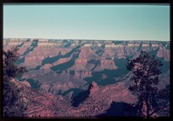
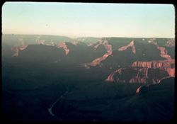
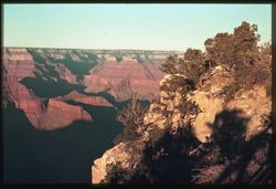
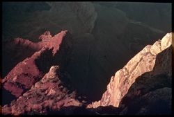
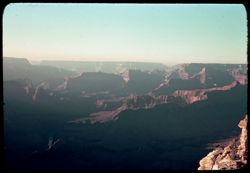
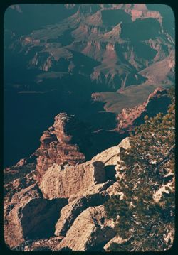
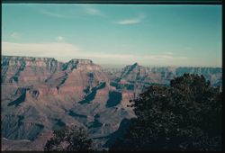
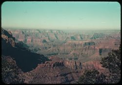
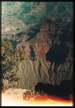
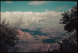
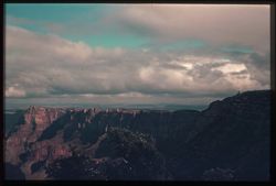
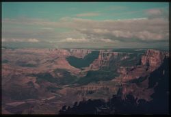
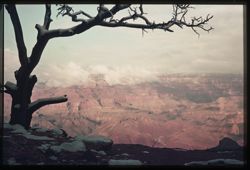
- Abstract:
- S-19: From Bright Angel Lodge, across Canyon, in Morning Sun.
- Call Number:
- P01716
- Country:
- United States
- State/Province:
- Arizona
- Physical Description:
- some dye fading. Image was originally mounted in a glass enclosure. Before digitization, the image was removed and placed in a Wess Plastic, Inc. brand, 2&qu...
- Alternate Identifier:
- 939.19
- Persistent URL:
- http://purl.dlib.indiana.edu/iudl/archives/cushman/P01716
-
- Subject:
- Canyons, Shadows, Bright Angel Canyon (Ariz.), Bright Angel Lodge, and Tree limbs
- Series:
- 9-39
- Creator:
- Cushman, Charles W., 1896-1972
- Date Created:
- 1939-11-30/1939-12-01
- Genre:
- Landscape photographs
- Frame Number:
- 20
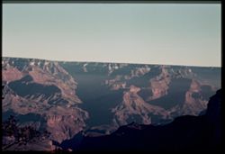
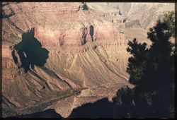
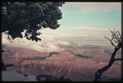
- Abstract:
- S-20: Bright Angle Canyon in deep shadow.
- Call Number:
- P01717
- Country:
- United States
- State/Province:
- Arizona
- Physical Description:
- some dye fading. Image was originally mounted in a glass enclosure. Before digitization, the image was removed and placed in a Wess Plastic, Inc. brand, 2&qu...
- Alternate Identifier:
- 939.20
- Persistent URL:
- http://purl.dlib.indiana.edu/iudl/archives/cushman/P01717
-
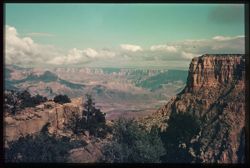
- Subject:
- Rocks, Canyons, Shrubs, and Grand Canyon (Ariz.)
- Series:
- 9-39
- Creator:
- Cushman, Charles W., 1896-1972
- Date Created:
- 1939-11-30
- Genre:
- Landscape photographs
- Frame Number:
- 13
- Street Address:
- Hermit Rim Drive
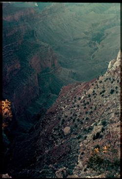
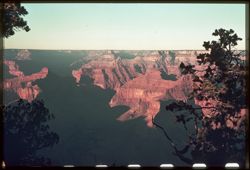
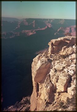
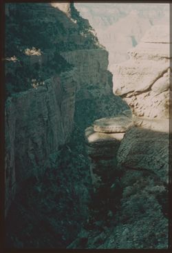
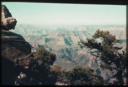
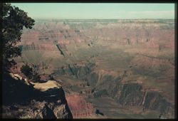
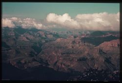
- Abstract:
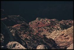
- S-13: Colors in shade in depths of canyon, from Hermit Rim Drive.
- Call Number:
- P01713
- Country:
- United States
- State/Province:
- Arizona
- Physical Description:
- some dye fading. Image was originally mounted in a glass enclosure. Before digitization, the image was removed and placed in a Wess Plastic, Inc. brand, 2&qu...
- Alternate Identifier:
- 939.13
- Persistent URL:
- http://purl.dlib.indiana.edu/iudl/archives/cushman/P01713
-
- Subject:
- Rocks, Canyons, Shadows, Shrubs, and Grand Canyon (Ariz.)
- Series:
- 9-39
- Creator:
- Cushman, Charles W., 1896-1972
- Date Created:
- 1939-11-30
- Genre:
- Landscape photographs
- Frame Number:
- 12
- Street Address:
- Hermit Rim Drive
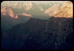
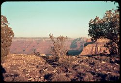
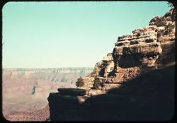
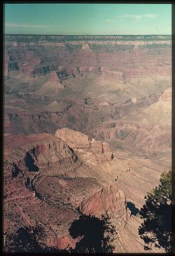
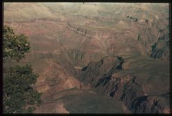
- Abstract:
- S-12: From Hermit Rim Drive, N.E., late afternoon.
- Call Number:
- P01712
- Country:
- United States
- State/Province:
- Arizona
- Physical Description:
- some dye fading.
- Alternate Identifier:
- 939.12
- Persistent URL:
- http://purl.dlib.indiana.edu/iudl/archives/cushman/P01712
-
- Subject:
- Canyons, Shadows, Pima Point (Ariz.), and Rivers
- Series:
- 9-39
- Creator:
- Cushman, Charles W., 1896-1972
- Date Created:
- 1939-11-30
- Genre:
- Landscape photographs
- Frame Number:
- 11
- County:
- Coconino
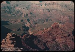
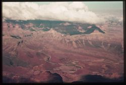
- Abstract:
- S-11: From Pima Pt., downstream
- Call Number:
- P01711
- Country:
- United States
- State/Province:
- Arizona
- Physical Description:
- some dye fading.
- Alternate Identifier:
- 939.11
- Persistent URL:
- http://purl.dlib.indiana.edu/iudl/archives/cushman/P01711
-
- Subject:
- Canyons, Pima Point (Ariz.), Powell Plateau (Ariz.), Shrubs, Trees, and Shadows
- Series:
- 9-39
- Creator:
- Cushman, Charles W., 1896-1972
- Date Created:
- 1939-11-30
- Genre:
- Landscape photographs
- Frame Number:
- 10
- County:
- Coconino
- Abstract:
- S-10: Looking past Pima Pt. toward Powell Plateau
- Call Number:
- P01710
- Country:
- United States
- State/Province:
- Arizona
- Physical Description:
- some dye fading. Image was originally mounted in a glass enclosure. Before digitization, the image was removed and placed in a Wess Plastic, Inc. brand, 2&qu...
- Alternate Identifier:
- 939.10
- Persistent URL:
- http://purl.dlib.indiana.edu/iudl/archives/cushman/P01710
-
- Subject:
- Rocks, Canyons, Shadows, Pima Point (Ariz.), Shrubs, and Grand Canyon (Ariz.)
- Series:
- 9-39
- Creator:
- Cushman, Charles W., 1896-1972
- Date Created:
- 1939-11-30
- Genre:
- Views
- Frame Number:
- 9
- County:
- Coconino
- Abstract:
- S-9: Down into canyon below Pima Pt. 3 Maple
- Call Number:
- P01709
- Country:
- United States
- State/Province:
- Arizona
- Physical Description:
- some dye fading. Image was originally mounted in a glass enclosure. Before digitization, the image was removed and placed in a Wess Plastic, Inc. brand, 2&qu...
- Alternate Identifier:
- 939.9
- Persistent URL:
- http://purl.dlib.indiana.edu/iudl/archives/cushman/P01709
-
- Subject:
- Canyons, Pima Point (Ariz.), Grand Canyon (Ariz.), Shrubs, Rocks, and Shadows
- Series:
- 9-39
- Creator:
- Cushman, Charles W., 1896-1972
- Date Created:
- 1939-11-30
- Genre:
- Views
- Frame Number:
- 9
- County:
- Coconino
- Abstract:
- S-9: Down into canyon below Pima Pt. 3 Maple
- Call Number:
- P01708
- Country:
- United States
- State/Province:
- Arizona
- Physical Description:
- some dye fading. Image was originally mounted in a glass enclosure. Before digitization, the image was removed and placed in a Wess Plastic, Inc. brand, 2&qu...
- Alternate Identifier:
- 939.9
- Persistent URL:
- http://purl.dlib.indiana.edu/iudl/archives/cushman/P01708
-
- Subject:
- Rocks, Canyons, Shadows, Pima Point (Ariz.), and Shrubs
- Series:
- 9-39
- Creator:
- Cushman, Charles W., 1896-1972
- Date Created:
- 1939-11-30
- Genre:
- Views
- Frame Number:
- 9
- County:
- Coconino
- Abstract:
- S-9: Down into canyon below Pima Pt. 3 Maple
- Call Number:
- P01707
- Country:
- United States
- State/Province:
- Arizona
- Physical Description:
- some dye fading. Image was originally mounted in a glass enclosure. Before digitization, the image was removed and placed in a Wess Plastic, Inc. brand, 2&qu...
- Alternate Identifier:
- 939.9
- Persistent URL:
- http://purl.dlib.indiana.edu/iudl/archives/cushman/P01707
-
- Subject:
- Canyons, Shadows, Tree limbs, Grand Canyon (Ariz.), and Pima Point (Ariz.)
- Series:
- 9-39
- Creator:
- Cushman, Charles W., 1896-1972
- Date Created:
- 1939-11-30
- Genre:
- Landscape photographs
- Frame Number:
- 8
- County:
- Coconino
- Abstract:
- S-8: From Pima Pt. down river
- Call Number:
- P01706
- Country:
- United States
- State/Province:
- Arizona
- Physical Description:
- some dye fading. Image was originally mounted in a glass enclosure. Before digitization, the image was removed and placed in a Wess Plastic, Inc. brand, 2&qu...
- Alternate Identifier:
- 939.8
- Persistent URL:
- http://purl.dlib.indiana.edu/iudl/archives/cushman/P01706
-
- Subject:
- Rocks, Canyons, Trees, Pima Point (Ariz.), Shrubs, and Grand Canyon (Ariz.)
- Series:
- 9-39
- Creator:
- Cushman, Charles W., 1896-1972
- Date Created:
- 1939-11-30
- Genre:
- Landscape photographs
- Frame Number:
- 7
- County:
- Coconino
- Abstract:
- S-7: Pima Pt. Scratched
- Call Number:
- P01705
- Country:
- United States
- State/Province:
- Arizona
- Physical Description:
- some dye fading.
- Alternate Identifier:
- 939.7
- Persistent URL:
- http://purl.dlib.indiana.edu/iudl/archives/cushman/P01705
-
- Subject:
- Rocks, Canyons, Mohave Point (Ariz.), and Shrubs
- Series:
- 9-39
- Creator:
- Cushman, Charles W., 1896-1972
- Date Created:
- 1939-11-30/1939-12-01
- Genre:
- Landscape photographs
- Frame Number:
- 5
- Street Address:
- Pima Drive and Hermit Rim Drive
- County:
- Coconino
- Abstract:
- S-5: Looking down into Canyon arm from Mohave Pt.
- Call Number:
- P01704
- Country:
- United States
- State/Province:
- Arizona
- Physical Description:
- some dye fading. Image was originally mounted in a glass enclosure. Before digitization, the image was removed and placed in a Wess Plastic, Inc. brand, 2&qu...
- Alternate Identifier:
- 939.5
- Persistent URL:
- http://purl.dlib.indiana.edu/iudl/archives/cushman/P01704
-
- Subject:
- Canyons, Powell Plateau (Ariz.), Mohave Point (Ariz.), Shadows, and Rivers
- Series:
- 9-39
- Creator:
- Cushman, Charles W., 1896-1972
- Date Created:
- 1939-11-30
- Genre:
- Landscape photographs
- Frame Number:
- 4
- County:
- Coconino
- Abstract:
- S-4: From Mohave Pt. Down river and across to Powell Plateau.
- Call Number:
- P01703
- Country:
- United States
- State/Province:
- Arizona
- Physical Description:
- some dye fading.
- Alternate Identifier:
- 939.4
- Persistent URL:
- http://purl.dlib.indiana.edu/iudl/archives/cushman/P01703
-
- Subject:
- Canyons, Mohave Point (Ariz.), Grand Canyon National Park (Ariz.), Shadows, Hopi Point (Ariz.), Shrubs, Grand Canyon (Ariz.), and Trees
- Series:
- 9-39
- Creator:
- Cushman, Charles W., 1896-1972
- Date Created:
- 1939-11-30
- Genre:
- Landscape photographs
- Frame Number:
- 3
- County:
- Coconino
- Abstract:
- S-3: From Mohave Pt. east past Hopi Pt.
- Call Number:
- P01702
- Country:
- United States
- State/Province:
- Arizona
- Physical Description:
- some dye fading. Image was originally mounted in a glass enclosure. Before digitization, the image was removed and placed in a Wess Plastic, Inc. brand, 2&qu...
- Alternate Identifier:
- 939.3
- Persistent URL:
- http://purl.dlib.indiana.edu/iudl/archives/cushman/P01702
-
- Subject:
- Canyons, Grand Canyon National Park (Ariz.), Hopi Point (Ariz.), Tree limbs, and Grand Canyon (Ariz.)
- Series:
- 9-39
- Creator:
- Cushman, Charles W., 1896-1972
- Date Created:
- 1939-11-30
- Genre:
- Landscape photographs
- Frame Number:
- 1
- County:
- Coconino
- Abstract:
- S-1: Looking east from Hopi Pt. (Half size only) Thanksgiving aft.
- Call Number:
- P01701
- Country:
- United States
- State/Province:
- Arizona
- Physical Description:
- some dye fading, masked.
- Alternate Identifier:
- 939.1
- Persistent URL:
- http://purl.dlib.indiana.edu/iudl/archives/cushman/P01701
-
- Subject:
- Canyons, Roads, Shrubs, Trees, Rocks, Trails & paths, and Shadows
- Series:
- 8-39
- Creator:
- Cushman, Charles W., 1896-1972
- Date Created:
- 1939-11-30
- Genre:
- Landscape photographs
- Frame Number:
- 18
- Street Address:
- Burro Road and Bright Angel Trail
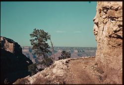
- Abstract:
- R-18: Burro road, Bright Angel Trail.
- Call Number:
- P01699
- Country:
- United States
- State/Province:
- Arizona
- Physical Description:
- some dye fading. Image was originally mounted in a glass enclosure. Before digitization, the image was removed and placed in a Wess Plastic, Inc. brand, 2&qu...
- Alternate Identifier:
- 839.18
- Persistent URL:
- http://purl.dlib.indiana.edu/iudl/archives/cushman/P01699
-
- Subject:
- Canyons, Trees, Yaki Point (Ariz.), and Grand Canyon (Ariz.)
- Series:
- 8-39
- Creator:
- Cushman, Charles W., 1896-1972
- Date Created:
- 1939-11-30
- Genre:
- Landscape photographs
- Frame Number:
- 19
- County:
- Coconino
- Abstract:
- R-19: From Yaki Pt.
- Call Number:
- P01700
- Country:
- United States
- State/Province:
- Arizona
- Physical Description:
- some dye fading.
- Alternate Identifier:
- 839.19
- Persistent URL:
- http://purl.dlib.indiana.edu/iudl/archives/cushman/P01700
-
- Subject:
- Trees, Shadows, Shrubs, Grand Canyon (Ariz.), and Rock formations
- Series:
- 8-39
- Creator:
- Cushman, Charles W., 1896-1972
- Date Created:
- 1939-11-30
- Genre:
- Landscape photographs
- Frame Number:
- 17
- Street Address:
- South Rim Drive and Bright Angel Trail
- Abstract:
- R-17: Heights above Bright Angel Trail.
- Call Number:
- P01698
- Country:
- United States
- State/Province:
- Arizona
- Physical Description:
- some dye fading. Image was originally mounted in a glass enclosure. Before digitization, the image was removed and placed in a Wess Plastic, Inc. brand, 2&qu...
- Alternate Identifier:
- 839.17
- Persistent URL:
- http://purl.dlib.indiana.edu/iudl/archives/cushman/P01698
-
- Subject:
- Canyons, Grand Canyon (Ariz.), Shrubs, and Trees
- Series:
- 8-39
- Creator:
- Cushman, Charles W., 1896-1972
- Date Created:
- 1939-11-30
- Genre:
- Landscape photographs
- Frame Number:
- 16
- Street Address:
- Bright Angel Trail
- Abstract:
- R-16: Looking into depths from Bright Angel Trail.
- Call Number:
- P01697
- Country:
- United States
- State/Province:
- Arizona
- Physical Description:
- some dye fading. Image was originally mounted in a glass enclosure. Before digitization, the image was removed and placed in a Wess Plastic, Inc. brand, 2&qu...
- Alternate Identifier:
- 839.16
- Persistent URL:
- http://purl.dlib.indiana.edu/iudl/archives/cushman/P01697
-
- Subject:
- Canyons, Trails & paths, Trees, Shadows, Shrubs, Dwellings, and Grand Canyon (Ariz.)
- Series:
- 8-39
- Creator:
- Cushman, Charles W., 1896-1972
- Date Created:
- 1939-11-30
- Genre:
- Landscape photographs
- Frame Number:
- 15
- Street Address:
- Bright Angel Trail
- Abstract:
- R-15: Looking back up Bright Angel Trail.
- Call Number:
- P01696
- Country:
- United States
- State/Province:
- Arizona
- Physical Description:
- some dye fading.
- Alternate Identifier:
- 839.15
- Persistent URL:
- http://purl.dlib.indiana.edu/iudl/archives/cushman/P01696
-
- Subject:
- Canyons, Vishnu Temple (Ariz.), Trees, Yaki Point (Ariz.), Grand Canyon (Ariz.), and Wotans Throne (Ariz.)
- Series:
- 8-39
- Creator:
- Cushman, Charles W., 1896-1972
- Date Created:
- 1939-11-29
- Genre:
- Landscape photographs
- Frame Number:
- 13
- County:
- Coconino
- Abstract:
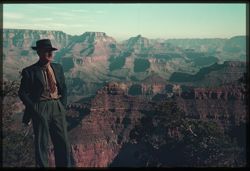
- R-13: From Yaki Pt. Wotan's throne and Vishnu Temple standout.
- Call Number:
- P01695
- Country:
- United States
- State/Province:
- Arizona
- Physical Description:
- some dye fading. Image was originally mounted in a glass enclosure. Before digitization, the image was removed and placed in a Wess Plastic, Inc. brand, 2&qu...
- Alternate Identifier:
- 839.13
- Persistent URL:
- http://purl.dlib.indiana.edu/iudl/archives/cushman/P01695
-
- Subject:
- Canyons, Trees, Boulders, Yaki Point (Ariz.), and Grand Canyon (Ariz.)
- Series:
- 8-39
- Creator:
- Cushman, Charles W., 1896-1972
- Date Created:
- 1939-11-01
- Genre:
- Landscape photographs
- Frame Number:
- 12
- County:
- Coconino
- Abstract:
- R-12: From trail below Yaki Pt.
- Call Number:
- P01694
- Country:
- United States
- State/Province:
- Arizona
- Physical Description:
- some dye fading.
- Alternate Identifier:
- 839.12
- Persistent URL:
- http://purl.dlib.indiana.edu/iudl/archives/cushman/P01694
-
- Subject:
- Canyons, Trees, Yaki Point (Ariz.), and Grand Canyon (Ariz.)
- Series:
- 8-39
- Creator:
- Cushman, Charles W., 1896-1972
- Date Created:
- 1939-11-30
- Genre:
- Landscape photographs
- Frame Number:
- 11
- County:
- Coconino
- Abstract:
- R-11: Across to North Rim from Yaki Pt.
- Call Number:
- P01693
- Country:
- United States
- State/Province:
- Arizona
- Physical Description:
- some dye fading. Image was originally mounted in a glass enclosure. Before digitization, the image was removed and placed in a Wess Plastic, Inc. brand, 2&qu...
- Alternate Identifier:
- 839.11
- Persistent URL:
- http://purl.dlib.indiana.edu/iudl/archives/cushman/P01693
-
- Subject:
- Rocks, Canyons, Yaki Point (Ariz.), Tree limbs, Shrubs, and Grand Canyon (Ariz.)
- Series:
- 8-39
- Creator:
- Cushman, Charles W., 1896-1972
- Date Created:
- 1939-11-30
- Genre:
- Landscape photographs
- Frame Number:
- 10
- County:
- Coconino
- Abstract:
- R-10= Down and across from Yaki Pt.
- Call Number:
- P01692
- Country:
- United States
- State/Province:
- Arizona
- Physical Description:
- some dye fading.
- Alternate Identifier:
- 839.10
- Persistent URL:
- http://purl.dlib.indiana.edu/iudl/archives/cushman/P01692
-
- Subject:
- Rocks, Canyons, Shadows, Yaki Point (Ariz.), Shrubs, and Grand Canyon (Ariz.)
- Series:
- 8-39
- Creator:
- Cushman, Charles W., 1896-1972
- Date Created:
- 1939-11-30
- Genre:
- Views
- Frame Number:
- 9
- County:
- Coconino
- Abstract:
- R-9 Looking down at bottom from Yaki Pt.
- Call Number:
- P01691
- Country:
- United States
- State/Province:
- Arizona
- Physical Description:
- some dye fading. Image was originally mounted in a glass enclosure. Before digitization, the image was removed and placed in a Wess Plastic, Inc. brand, 2&qu...
- Alternate Identifier:
- 839.9
- Persistent URL:
- http://purl.dlib.indiana.edu/iudl/archives/cushman/P01691
-
- Subject:
- Men, Canyons, Trees, Yaki Point (Ariz.), Suits (Clothing), and Grand Canyon (Ariz.)
- Series:
- 8-39
- Creator:
- Cushman, Charles W., 1896-1972
- Date Created:
- 1939-11-29
- Genre:
- Landscape photographs
- Frame Number:
- 8
- County:
- Coconino
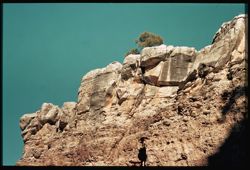
- Persons Pictured:
- Cushman, Charles W. (Charles Weever), 1896-1972
- Abstract:
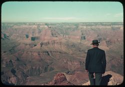
- R-8: C.W.C. at Yaki Pt.
- Call Number:
- P01690
- Country:
- United States
- State/Province:
- Arizona
- Physical Description:
- some dye fading.
- Alternate Identifier:
- 839.8
- Persistent URL:
- http://purl.dlib.indiana.edu/iudl/archives/cushman/P01690
-
- Subject:
- Canyons, Yaki Point (Ariz.), Shrubs, Yavapai Point (Ariz.), and Trees
- Series:
- 8-39
- Creator:
- Cushman, Charles W., 1896-1972
- Date Created:
- 1939-11-01
- Genre:
- Landscape photographs
- Frame Number:
- 7
- County:
- Coconino
- Abstract:
- R-7: Pink Rock below Rim between Yavapai+ Yaqui.
- Call Number:
- P01689
- Country:
- United States
- State/Province:
- Arizona
- Physical Description:
- some dye fading.
- Alternate Identifier:
- 839.7
- Persistent URL:
- http://purl.dlib.indiana.edu/iudl/archives/cushman/P01689
-
- Subject:
- Men, Canyons, Vishnu Temple (Ariz.), Wotans Throne (Ariz.), Yavapai Point (Ariz.), Tree limbs, and Suits (Clothing)
- Series:
- 8-39
- Creator:
- Cushman, Charles W., 1896-1972
- Date Created:
- 1939-11-29
- Genre:
- Landscape photographs
- Frame Number:
- 6
- County:
- Coconino
- Persons Pictured:
- Cushman, Charles W. (Charles Weever), 1896-1972
- Abstract:
- R-6: CWC at Yavapai Pt.
- Call Number:
- P01688
- Country:
- United States
- State/Province:
- Arizona
- Physical Description:
- some dye fading. Image was originally mounted in a glass enclosure. Before digitization, the image was removed and placed in a Wess Plastic, Inc. brand, 2&qu...
- Alternate Identifier:
- 839.6
- Persistent URL:
- http://purl.dlib.indiana.edu/iudl/archives/cushman/P01688
-
- Subject:
- Canyons, Yavapai Point (Ariz.), Trees, and Shadows
- Series:
- 8-39
- Creator:
- Cushman, Charles W., 1896-1972
- Date Created:
- 1939-11-29
- Genre:
- Landscape photographs
- Frame Number:
- 5
- County:
- Coconino
- Abstract:
- R-5: West from Yavapai Pt.
- Call Number:
- P01687
- Country:
- United States
- State/Province:
- Arizona
- Physical Description:
- some dye fading.
- Alternate Identifier:
- 839.5
- Persistent URL:
- http://purl.dlib.indiana.edu/iudl/archives/cushman/P01687
-
- Subject:
- Canyons, Trees, Shadows, Yavapai Point (Ariz.), and Shrubs
- Series:
- 8-39
- Creator:
- Cushman, Charles W., 1896-1972
- Date Created:
- 1939-11-30
- Genre:
- Landscape photographs
- Frame Number:
- 4
- County:
- Coconino
- Abstract:
- R-4: From Yavapai Pt. View is across + upstream.
- Call Number:
- P01686
- Country:
- United States
- State/Province:
- Arizona
- Physical Description:
- some dye fading. Image was originally mounted in a glass enclosure. Before digitization, the image was removed and placed in a Wess Plastic, Inc. brand, 2&qu...
- Alternate Identifier:
- 839.4
- Persistent URL:
- http://purl.dlib.indiana.edu/iudl/archives/cushman/P01686
-
- Subject:
- Yaki Point (Ariz.), Trees, Canyons, Shadows, Shrubs, Yavapai Point (Ariz.), and Grand Canyon (Ariz.)
- Series:
- 8-39
- Creator:
- Cushman, Charles W., 1896-1972
- Date Created:
- 1939-11-30
- Genre:
- Landscape photographs
- Frame Number:
- 3
- County:
- Coconino
- Abstract:
- R-3: Downstream from Yavapai point.
- Call Number:
- P01685
- Country:
- United States
- State/Province:
- Arizona
- Physical Description:
- some dye fading. Image was originally mounted in a glass enclosure. Before digitization, the image was removed and placed in a Wess Plastic, Inc. brand, 2&qu...
- Alternate Identifier:
- 839.3
- Persistent URL:
- http://purl.dlib.indiana.edu/iudl/archives/cushman/P01685
-
- Subject:
- Canyons, Pipe Creek Canyon (Ariz.), Bright Angel Trail (Ariz.), Trails & paths, Trees, Yavapai Point (Ariz.), and Grand Canyon (Ariz.)
- Series:
- 8-39
- Creator:
- Cushman, Charles W., 1896-1972
- Date Created:
- 1939-11-29
- Genre:
- Landscape photographs
- Frame Number:
- 2
- County:
- Coconino
- Abstract:
- R-2: from Yavapai Pt. looking down on Bright Angel Trail
- Call Number:
- P01684
- Country:
- United States
- State/Province:
- Arizona
- Physical Description:
- some dye fading. Image was originally mounted in a glass enclosure. Before digitization, the image was removed and placed in a Wess Plastic, Inc. brand, 2&qu...
- Alternate Identifier:
- 839.2
- Persistent URL:
- http://purl.dlib.indiana.edu/iudl/archives/cushman/P01684
-
- Subject:
- Trees, Canyons, and Yavapai Point (Ariz.)
- Series:
- 8-39
- Creator:
- Cushman, Charles W., 1896-1972
- Date Created:
- 1939-11-01
- Genre:
- Landscape photographs
- Frame Number:
- 1
- County:
- Coconino
- Abstract:
- R-1= from YAVAPAI PT.
- Call Number:
- P01683
- Country:
- United States
- State/Province:
- Arizona
- Physical Description:
- some dye fading, masked. Image was originally mounted in a glass enclosure. Before digitization, the image was removed and placed in a Wess Plastic, Inc. bra...
- Alternate Identifier:
- 839.1
- Persistent URL:
- http://purl.dlib.indiana.edu/iudl/archives/cushman/P01683
-
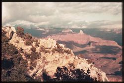
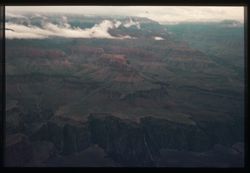
- Subject:
- Canyons, Isis Temple (Ariz.), Powell Plateau (Ariz.), Trees, Shadows, Hopi Point (Ariz.), National parks & reserves, Clouds, Grand Canyon (Ariz.), Grand ...
- Series:
- 7-39
- Creator:
- Cushman, Charles W., 1896-1972
- Date Created:
- 1939-11-29
- Genre:
- Landscape photographs
- Frame Number:
- 20
- County:
- Coconino
- Abstract:
- Q-20: Across and down Canyon from Hopi Pt. toward Powell Plateau.
- Call Number:
- P01682
- Country:
- United States
- State/Province:
- Arizona
- Physical Description:
- some dye fading. Image was originally mounted in a glass enclosure. Before digitization, the image was removed and placed in a Wess Plastic, Inc. brand, 2&qu...
- Alternate Identifier:
- 739.20
- Persistent URL:
- http://purl.dlib.indiana.edu/iudl/archives/cushman/P01682
-
- Subject:
- Canyons, Shadows, Tree limbs, Clouds, and Grand Canyon (Ariz.)
- Series:
- 7-39
- Creator:
- Cushman, Charles W., 1896-1972
- Date Created:
- 1939-11-29
- Genre:
- Landscape photographs
- Frame Number:
- 19
- Street Address:
- Hermit Rim Drive
- Abstract:
- Q-19: View up and across Canyon from Hermit Rim Drive west of Village.
- Call Number:
- P01681
- Country:
- United States
- State/Province:
- Arizona
- Physical Description:
- some dye fading. Image was originally mounted in a glass enclosure. Before digitization, the image was removed and placed in a Wess Plastic, Inc. brand, 2&qu...
- Alternate Identifier:
- 739.19
- Persistent URL:
- http://purl.dlib.indiana.edu/iudl/archives/cushman/P01681
-
- Subject:
- Canyons, Trees, Shadows, Shrubs, Clouds, and Maricopa Point (Ariz.)
- Series:
- 7-39
- Creator:
- Cushman, Charles W., 1896-1972
- Date Created:
- 1939-11-29
- Genre:
- Landscape photographs
- Frame Number:
- 18
- Street Address:
- South Rim Drive
- County:
- Coconino
- Abstract:
- Q-18: From South Rim, past Maricopa Pt. Afternoon.
- Call Number:
- P01680
- Country:
- United States
- State/Province:
- Arizona
- Physical Description:
- some dye fading. Image was originally mounted in a glass enclosure. Before digitization, the image was removed and placed in a Wess Plastic, Inc. brand, 2&qu...
- Alternate Identifier:
- 739.18
- Persistent URL:
- http://purl.dlib.indiana.edu/iudl/archives/cushman/P01680
-
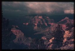
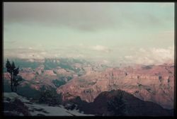
- Subject:
- Snow, Canyons, Cliffs, Mesas, Shadows, Rock formations, Clouds, Grand Canyon (Ariz.), Grandview Point (Ariz.), and Trees
- Series:
- 7-39
- Creator:
- Cushman, Charles W., 1896-1972
- Date Created:
- 1939-11-29
- Genre:
- Landscape photographs
- Frame Number:
- 17
- County:
- Coconino
- Abstract:
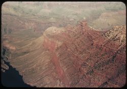
- Q-17: Grand View from Grand View Pt.
- Call Number:
- P01679
- Country:
- United States
- State/Province:
- Arizona
- Physical Description:
- some dye fading. Image was originally mounted in a glass enclosure. Before digitization, the image was removed and placed in a Wess Plastic, Inc. brand, 2&qu...
- Alternate Identifier:
- 739.17
- Persistent URL:
- http://purl.dlib.indiana.edu/iudl/archives/cushman/P01679
-
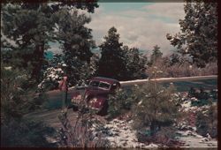
- Subject:
- Snow, Men, Roads, Automobiles, Trees, Shrubs, Clouds, Grand Canyon (Ariz.), and Grandview Point (Ariz.)
- Series:
- 7-39
- Creator:
- Cushman, Charles W., 1896-1972
- Date Created:
- 1939-11-29
- Genre:
- Identification photographs
- Frame Number:
- 16
- County:
- Coconino
- Abstract:
- Grand- View and Q-16: Yesterday's snow clings to Evergreens
- Call Number:
- P01678
- Country:
- United States
- State/Province:
- Arizona
- Physical Description:
- some dye fading. Image was originally mounted in a glass enclosure. Before digitization, the image was removed and placed in a Wess Plastic, Inc. brand, 2&qu...
- Alternate Identifier:
- 739.16
- Persistent URL:
- http://purl.dlib.indiana.edu/iudl/archives/cushman/P01678
-
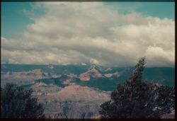
- Subject:
- Canyons, Moran Point (Ariz.), Grand Canyon (Ariz.), Trees, Shadows, and Clouds
- Series:
- 7-39
- Creator:
- Cushman, Charles W., 1896-1972
- Date Created:
- 1939-11-29
- Genre:
- Landscape photographs
- Frame Number:
- 15
- County:
- Coconino
- Abstract:
- Q-15: Temples and billowy clouds, from Moran Pt.
- Call Number:
- P01677
- Country:
- United States
- State/Province:
- Arizona
- Physical Description:
- some dye fading. Image was originally mounted in a glass enclosure. Before digitization, the image was removed and placed in a Wess Plastic, Inc. brand, 2&qu...
- Alternate Identifier:
- 739.15
- Persistent URL:
- http://purl.dlib.indiana.edu/iudl/archives/cushman/P01677
-
- Subject:
- Canyons, Moran Point (Ariz.), Grand Canyon (Ariz.), Shrubs, Trees, Shadows, and Clouds
- Series:
- 7-39
- Creator:
- Cushman, Charles W., 1896-1972
- Date Created:
- 1939-11-29
- Genre:
- Landscape photographs
- Frame Number:
- 14
- County:
- Coconino
- Abstract:
- Q-14: Up and across Canyon from Moran Pt.
- Call Number:
- P01676
- Country:
- United States
- State/Province:
- Arizona
- Physical Description:
- some dye fading. Image was originally mounted in a glass enclosure. Before digitization, the image was removed and placed in a Wess Plastic, Inc. brand, 2&qu...
- Alternate Identifier:
- 739.14
- Persistent URL:
- http://purl.dlib.indiana.edu/iudl/archives/cushman/P01676
-
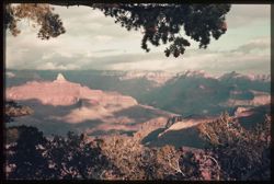
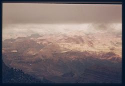
- Subject:
- Canyons, Grand Canyon National Park (Ariz.), Shadows, National parks & reserves, Clouds, Lipan Point (Ariz.), Grand Canyon (Ariz.), Desert View Point (Ar...
- Series:
- 7-39
- Creator:
- Cushman, Charles W., 1896-1972
- Date Created:
- 1939-11-29
- Genre:
- Landscape photographs
- Frame Number:
- 12
- Street Address:
- South Rim Drive
- County:
- Coconino
- Abstract:
- Q-12: Up along South Rim from Lipan Pt.
- Call Number:
- P01675
- Country:
- United States
- State/Province:
- Arizona
- Physical Description:
- some dye fading. Image was originally mounted in a glass enclosure. Before digitization, the image was removed and placed in a Wess Plastic, Inc. brand, 2&qu...
- Alternate Identifier:
- 739.12
- Persistent URL:
- http://purl.dlib.indiana.edu/iudl/archives/cushman/P01675
-
- Subject:
- Snow, Canyons, Grand Canyon National Park (Ariz.), Shadows, Tree limbs, National parks & reserves, Clouds, Lipan Point (Ariz.), Leaves, and Grand Canyon ...
- Series:
- 7-39
- Creator:
- Cushman, Charles W., 1896-1972
- Date Created:
- 1939-11-29
- Genre:
- Landscape photographs
- Frame Number:
- 11
- County:
- Coconino
- Abstract:
- Q-11: View down The Canyon from Lipan Pt.
- Call Number:
- P01674
- Country:
- United States
- State/Province:
- Arizona
- Physical Description:
- some dye fading. Image was originally mounted in a glass enclosure. Before digitization, the image was removed and placed in a Wess Plastic, Inc. brand, 2&qu...
- Alternate Identifier:
- 739.11
- Persistent URL:
- http://purl.dlib.indiana.edu/iudl/archives/cushman/P01674
-
- Subject:
- Canyons, Grand Canyon National Park (Ariz.), Colorado River (Colo.-Mexico), Shadows, National parks & reserves, Clouds, Lipan Point (Ariz.), Grand Canyon...
- Series:
- 7-39
- Creator:
- Cushman, Charles W., 1896-1972
- Date Created:
- 1939-11-29
- Genre:
- Landscape photographs
- Frame Number:
- 10
- County:
- Coconino
- Abstract:
- Q-10: Bend of the river in front of Lipan Pt.
- Call Number:
- P01673
- Country:
- United States
- State/Province:
- Arizona
- Physical Description:
- some dye fading. Image was originally mounted in a glass enclosure. Before digitization, the image was removed and placed in a Wess Plastic, Inc. brand, 2&qu...
- Alternate Identifier:
- 739.10
- Persistent URL:
- http://purl.dlib.indiana.edu/iudl/archives/cushman/P01673
-
- Subject:
- Leaves, Desert View Point (Ariz.), Canyons, Grand Canyon (Ariz.), Snow, Clouds, and Tree limbs
- Series:
- 7-39
- Creator:
- Cushman, Charles W., 1896-1972
- Date Created:
- 1939-11-29
- Genre:
- Landscape photographs
- Frame Number:
- 7
- County:
- Coconino
- Abstract:
- Q-7: Cloud caps over Canyon from Desert View pt.
- Call Number:
- P01671
- City:
- Desert View
- Country:
- United States
- State/Province:
- Arizona
- Physical Description:
- some dye fading. Image was originally mounted in a glass enclosure. Before digitization, the image was removed and placed in a Wess Plastic, Inc. brand, 2&qu...
- Alternate Identifier:
- 739.7
- Persistent URL:
- http://purl.dlib.indiana.edu/iudl/archives/cushman/P01671
-
- Subject:
- Canyons, Trees, Colorado River (Colo.-Mexico), Shadows, Clouds, Grand Canyon (Ariz.), Desert View Point (Ariz.), and Rivers
- Series:
- 7-39
- Creator:
- Cushman, Charles W., 1896-1972
- Date Created:
- 1939-11-29
- Genre:
- Landscape photographs
- Frame Number:
- 9
- County:
- Coconino
- Abstract:
- Q-9: Looking up river again from Desert View.
- Call Number:
- P01672
- City:
- Desert View
- Country:
- United States
- State/Province:
- Arizona
- Physical Description:
- some dye fading. Image was originally mounted in a glass enclosure. Before digitization, the image was removed and placed in a Wess Plastic, Inc. brand, 2&qu...
- Alternate Identifier:
- 739.9
- Persistent URL:
- http://purl.dlib.indiana.edu/iudl/archives/cushman/P01672
-
- Subject:
- Canyons, Clouds, Grand Canyon (Ariz.), and Desert View Point (Ariz.)
- Series:
- 7-39
- Creator:
- Cushman, Charles W., 1896-1972
- Date Created:
- 1939-11-29
- Genre:
- Landscape photographs
- Frame Number:
- 6
- County:
- Coconino
- Abstract:
- Q-6: Temples and Pyramids from Desert View Pt.
- Call Number:
- P01670
- City:
- Desert View
- Country:
- United States
- State/Province:
- Arizona
- Physical Description:
- some dye fading.
- Alternate Identifier:
- 739.6
- Persistent URL:
- http://purl.dlib.indiana.edu/iudl/archives/cushman/P01670
-
- Subject:
- Snow, Canyons, Marble Canyon (Ariz.), Shrubs, Clouds, Grand Canyon (Ariz.), and Trees
- Series:
- 7-39
- Creator:
- Cushman, Charles W., 1896-1972
- Date Created:
- 1939-11-29
- Genre:
- Landscape photographs
- Frame Number:
- 5
- County:
- Coconino
- Abstract:
- Q-5: Looking up the Canyon from Desert View.
- Call Number:
- P01669
- City:
- Desert View
- Country:
- United States
- State/Province:
- Arizona
- Physical Description:
- some dye fading. Image was originally mounted in a glass enclosure. Before digitization, the image was removed and placed in a Wess Plastic, Inc. brand, 2&qu...
- Alternate Identifier:
- 739.5
- Persistent URL:
- http://purl.dlib.indiana.edu/iudl/archives/cushman/P01669
-
- Subject:
- Snow, Canyons, Trees, Shrubs, Clouds, Grand Canyon (Ariz.), and Desert View Point (Ariz.)
- Series:
- 7-39
- Creator:
- Cushman, Charles W., 1896-1972
- Date Created:
- 1939-11-29
- Genre:
- Landscape photographs
- Frame Number:
- 4
- County:
- Coconino
- Abstract:
- Q-4: Looking down Canyon from Desert View.
- Call Number:
- P01668
- City:
- Desert View
- Country:
- United States
- State/Province:
- Arizona
- Physical Description:
- some dye fading. Image was originally mounted in a glass enclosure. Before digitization, the image was removed and placed in a Wess Plastic, Inc. brand, 2&qu...
- Alternate Identifier:
- 739.4
- Persistent URL:
- http://purl.dlib.indiana.edu/iudl/archives/cushman/P01668
-
- Subject:
- Desert View Point (Ariz.), Canyons, Grand Canyon (Ariz.), Snow, Clouds, and Tree limbs
- Series:
- 7-39
- Creator:
- Cushman, Charles W., 1896-1972
- Date Created:
- 1939-11-29
- Genre:
- Landscape photographs
- Frame Number:
- 3
- County:
- Coconino
- Abstract:
- Q-3= Yesterday's snow along rim at Desert View.
- Call Number:
- P01667
- City:
- Desert View
- Country:
- United States
- State/Province:
- Arizona
- Physical Description:
- some dye fading. Image was originally mounted in a glass enclosure. Before digitization, the image was removed and placed in a Wess Plastic, Inc. brand, 2&qu...
- Alternate Identifier:
- 739.3
- Persistent URL:
- http://purl.dlib.indiana.edu/iudl/archives/cushman/P01667
-
- Subject:
- Canyons, Shadows, Tree limbs, Clouds, Grand Canyon (Ariz.), and Desert View Point (Ariz.)
- Series:
- 7-39
- Creator:
- Cushman, Charles W., 1896-1972
- Date Created:
- 1939-11-29
- Genre:
- Landscape photographs
- Frame Number:
- 2
- County:
- Coconino
- Abstract:
- Q-2= Morning Sun strikes Canyon under clouds: From Desert View
- Call Number:
- P01666
- City:
- Desert View
- Country:
- United States
- State/Province:
- Arizona
- Physical Description:
- some dye fading. Image was originally mounted in a glass enclosure. Before digitization, the image was removed and placed in a Wess Plastic, Inc. brand, 2&qu...
- Alternate Identifier:
- 739.2
- Persistent URL:
- http://purl.dlib.indiana.edu/iudl/archives/cushman/P01666
-
- Subject:
- Canyons, Rock formations, Clouds, and Grand Canyon (Ariz.)
- Series:
- 7-39
- Creator:
- Cushman, Charles W., 1896-1972
- Date Created:
- 1939-11-29
- Genre:
- Landscape photographs
- Frame Number:
- 1
- Street Address:
- South Rim Drive
- County:
- Coconino
- Abstract:
- Q-1= Sun breaks through as mist clears.
- Call Number:
- P01665
- City:
- Desert View
- Country:
- United States
- State/Province:
- Arizona
- Physical Description:
- some dye fading. Image was originally mounted in a glass enclosure. Before digitization, the image was removed and placed in a Wess Plastic, Inc. brand, 2&qu...
- Alternate Identifier:
- 739.1
- Persistent URL:
- http://purl.dlib.indiana.edu/iudl/archives/cushman/P01665
-
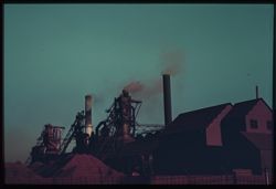
- Subject:
- Smoke, Youngstown Sheet and Tube Company, Facilities, Smokestacks, and Steel industry
- Series:
- 6-39
- Creator:
- Cushman, Charles W., 1896-1972
- Date Created:
- 1939-10-01
- Frame Number:
- 20
- County:
- Cook
- Abstract:
- Sheet+Tube Plant. and P-20: Steel mill smoke
- Call Number:
- P01664
- City:
- Chicago
- Country:
- United States
- State/Province:
- Illinois
- Physical Description:
- some dye fading. Image was originally mounted in a glass enclosure. Before digitization, the image was removed and placed in a Wess Plastic, Inc. brand, 2&qu...
- Alternate Identifier:
- 639.20
- Persistent URL:
- http://purl.dlib.indiana.edu/iudl/archives/cushman/P01664
-
- Subject:
- Piers & wharves, Calumet River (Ill.), Buildings, Ships, Facilities, Carnegie-Illinois Steel Corporation, Steel industry, and Rivers
- Series:
- 6-39
- Creator:
- Cushman, Charles W., 1896-1972
- Date Created:
- 1939-10-01
- Frame Number:
- 19
- County:
- Cook
- Abstract:
- P-19: One dock of Steel Corp, mouth of Calumet river.
- Call Number:
- P01663
- City:
- Chicago
- Country:
- United States
- State/Province:
- Illinois
- Physical Description:
- some dye fading. Image was originally mounted in a glass enclosure. Before digitization, the image was removed and placed in a Wess Plastic, Inc. brand, 2&qu...
- Alternate Identifier:
- 639.19
- Persistent URL:
- http://purl.dlib.indiana.edu/iudl/archives/cushman/P01663
-
- Subject:
- Smokestacks, Smoke, Clouds, and Sunrises & sunsets
- Series:
- 6-39
- Creator:
- Cushman, Charles W., 1896-1972
- Date Created:
- 1939-10-01
- Frame Number:
- 18
- Street Address:
- 1002 Gothic Apartments
- County:
- Cook
- Abstract:
- P-18: Sunset over Chicago's Southwest Side
- Call Number:
- P01662
- City:
- Chicago
- Country:
- United States
- State/Province:
- Illinois
- Physical Description:
- some dye fading. Image was originally mounted in a glass enclosure. Before digitization, the image was removed and placed in a Wess Plastic, Inc. brand, 2&qu...
- Alternate Identifier:
- 639.18
- Persistent URL:
- http://purl.dlib.indiana.edu/iudl/archives/cushman/P01662
-
- Subject:
- Electric lines, Calumet River (Ill.), Boats, Smoke, Smokestacks, Steel industry, and Rivers
- Series:
- 6-39
- Creator:
- Cushman, Charles W., 1896-1972
- Date Created:
- 1939-10-01
- Frame Number:
- 17
- County:
- Cook
- Abstract:
- P-17: Steel Mills at work at mouth of Calumet river
- Call Number:
- P01661
- City:
- Chicago
- Country:
- United States
- State/Province:
- Illinois
- Physical Description:
- some dye fading. Image was originally mounted in a glass enclosure. Before digitization, the image was removed and placed in a Wess Plastic, Inc. brand, 2&qu...
- Alternate Identifier:
- 639.17
- Persistent URL:
- http://purl.dlib.indiana.edu/iudl/archives/cushman/P01661
-
- Subject:
- Lakes & ponds, Reflections, Men, Parks, Shrubs, Trees, Suits (Clothing), West Lagoon (Ill.), and Jackson Park (Chicago, Ill.)
- Series:
- 6-39
- Creator:
- Cushman, Charles W., 1896-1972
- Date Created:
- 1939-10-01
- Genre:
- Landscape photographs
- Frame Number:
- 16
- County:
- Cook
- Persons Pictured:
- Cushman, Charles W. (Charles Weever), 1896-1972
- Abstract:
- P-16: West lagoon, Jackson Park.
- Call Number:
- P01660
- City:
- Chicago
- Country:
- United States
- State/Province:
- Illinois
- Physical Description:
- some dye fading.
- Alternate Identifier:
- 639.16
- Persistent URL:
- http://purl.dlib.indiana.edu/iudl/archives/cushman/P01660
-
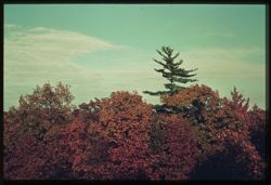
- Subject:
- Evergreens and Clouds
- Series:
- 6-39
- Creator:
- Cushman, Charles W., 1896-1972
- Date Created:
- 1939-10-01
- Genre:
- Identification photographs
- Frame Number:
- 14
- Abstract:
- P-14= High evergreen above leaves of all colors.
- Call Number:
- P01659
- Country:
- United States
- State/Province:
- Indiana
- Physical Description:
- some dye fading. Image was originally mounted in a glass enclosure. Before digitization, the image was removed and placed in a Wess Plastic, Inc. brand, 2&qu...
- Alternate Identifier:
- 639.14
- Persistent URL:
- http://purl.dlib.indiana.edu/iudl/archives/cushman/P01659
-
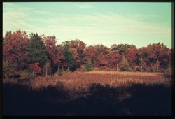
- Subject:
- Evergreens, Maples, Weeds, Oaks, Shrubs, and Clouds
- Series:
- 6-39
- Creator:
- Cushman, Charles W., 1896-1972
- Date Created:
- 1939-10-01
- Genre:
- Identification photographs
- Frame Number:
- 13
- County:
- Dune
- Abstract:
- P-13: Evergreens mingle with oaks and maples - Indiana's dune
- Call Number:
- P01658
- Country:
- United States
- State/Province:
- Indiana
- Physical Description:
- some dye fading. Image was originally mounted in a glass enclosure. Before digitization, the image was removed and placed in a Wess Plastic, Inc. brand, 2&qu...
- Alternate Identifier:
- 639.13
- Persistent URL:
- http://purl.dlib.indiana.edu/iudl/archives/cushman/P01658
-
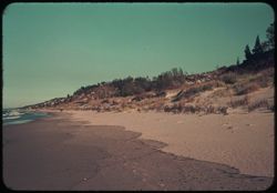
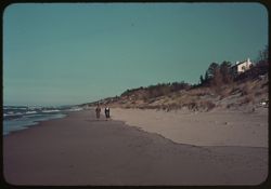
- Subject:
- Lakes & ponds, Michigan, Lake, Weeds, Sand, People, Dwellings, Trees, Beaches, Dunes, Seas, and Shrubs
- Series:
- 6-39
- Creator:
- Cushman, Charles W., 1896-1972
- Date Created:
- 1939-10-01
- Genre:
- Landscape photographs
- Frame Number:
- 12
- County:
- Porter
- Abstract:
- P-12: Where dune meets Lake.
- Call Number:
- P01657
- Country:
- United States
- State/Province:
- Indiana
- Physical Description:
- some dye fading.
- Alternate Identifier:
- 639.12
- Persistent URL:
- http://purl.dlib.indiana.edu/iudl/archives/cushman/P01657
-
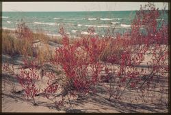
- Subject:
- Lakes & ponds, Michigan, Lake, Weeds, Sand, Coastlines, and Seas
- Series:
- 6-39
- Creator:
- Cushman, Charles W., 1896-1972
- Date Created:
- 1939-10-01
- Genre:
- Seascapes
- Frame Number:
- 11
- County:
- Porter
- Abstract:
- P-11: Bright red leaves against Michigan's white caps.
- Call Number:
- P01656
- Country:
- United States
- State/Province:
- Indiana
- Physical Description:
- some dye fading. Image was originally mounted in a glass enclosure. Before digitization, the image was removed and placed in a Wess Plastic, Inc. brand, 2&qu...
- Alternate Identifier:
- 639.11
- Persistent URL:
- http://purl.dlib.indiana.edu/iudl/archives/cushman/P01656
-
- Subject:
- Seas, Bodies of water, Trees, Dunes, Michigan, Lake, Beaches, Shrubs, Dwellings, People, and Dune Island (Ind.)
- Series:
- 6-39
- Creator:
- Cushman, Charles W., 1896-1972
- Date Created:
- 1939-10-01
- Genre:
- Landscape photographs
- Frame Number:
- 10
- County:
- Porter
- Persons Pictured:
- Reed, Mary, Cushman, Jean, and Reed, Hank
- Abstract:
- P-10: Along duneland's sand shore: Reeds and Jean.
- Call Number:
- P01655
- Country:
- United States
- State/Province:
- Indiana
- Physical Description:
- some dye fading.
- Alternate Identifier:
- 639.10
- Persistent URL:
- http://purl.dlib.indiana.edu/iudl/archives/cushman/P01655
-
- Subject:
- Sand, Trees, Dunes, Michigan, Lake, Shrubs, Lakes & ponds, and Dwellings
- Series:
- 6-39
- Creator:
- Cushman, Charles W., 1896-1972
- Date Created:
- 1939-10-01
- Genre:
- Landscape photographs
- Frame Number:
- 9
- County:
- Porter
- Abstract:
- P-9: Sand dune and swells of blue Lake Michigan.
- Call Number:
- P01654
- City:
- Dune Acres
- Country:
- United States
- State/Province:
- Indiana
- Physical Description:
- some dye fading.
- Alternate Identifier:
- 639.9
- Persistent URL:
- http://purl.dlib.indiana.edu/iudl/archives/cushman/P01654
-
- Subject:
- Roads, Trees, Bridges, and Dwellings
- Series:
- 6-39
- Creator:
- Cushman, Charles W., 1896-1972
- Date Created:
- 1939-10-01
- Genre:
- Landscape photographs
- Frame Number:
- 8
- County:
- Porter
- Abstract:
- P-8: Tops of trees in high autumn color.
- Call Number:
- P01653
- City:
- Dune Acres
- Country:
- United States
- State/Province:
- Indiana
- Physical Description:
- some dye fading.
- Alternate Identifier:
- 639.8
- Persistent URL:
- http://purl.dlib.indiana.edu/iudl/archives/cushman/P01653
-
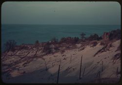
- Subject:
- Sand, Weeds, Dunes, Tree limbs, Michigan, Lake, and Lakes & ponds
- Series:
- 6-39
- Creator:
- Cushman, Charles W., 1896-1972
- Date Created:
- 1939-10-01
- Genre:
- Landscape photographs
- Frame Number:
- 7
- County:
- Porter
- Abstract:
- P-7: Dune and Lake - Best - Duplicated
- Call Number:
- P01652
- City:
- Dune Acres
- Country:
- United States
- State/Province:
- Indiana
- Physical Description:
- some dye fading.
- Alternate Identifier:
- 639.7
- Persistent URL:
- http://purl.dlib.indiana.edu/iudl/archives/cushman/P01652
-
- Subject:
- Trees, Dunes, Michigan, Lake, Lakes & ponds, and Dwellings
- Series:
- 6-39
- Creator:
- Cushman, Charles W., 1896-1972
- Date Created:
- 1939-10-01
- Genre:
- Landscape photographs
- Frame Number:
- 6
- County:
- Porter
- Abstract:
- P-6: Looking past tree-covered dune to Lake Michigan
- Call Number:
- P01650
- City:
- Dune Acres
- Country:
- United States
- State/Province:
- Indiana
- Physical Description:
- some dye fading.
- Alternate Identifier:
- 639.6
- Persistent URL:
- http://purl.dlib.indiana.edu/iudl/archives/cushman/P01650
-
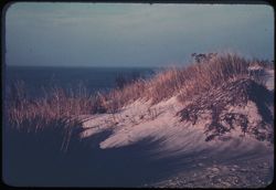
- Subject:
- Sand, Weeds, Dunes, Tree limbs, Michigan, Lake, and Lakes & ponds
- Series:
- 6-39
- Creator:
- Cushman, Charles W., 1896-1972
- Date Created:
- 1939-10-01
- Genre:
- Landscape photographs
- Frame Number:
- 7
- County:
- Porter
- Abstract:
- P-7: Dune and Lake - Best - Duplicated
- Call Number:
- P01651
- City:
- Dune Acres
- Country:
- United States
- State/Province:
- Indiana
- Physical Description:
- some dye fading. Image was originally mounted in a glass enclosure. Before digitization, the image was removed and placed in a Wess Plastic, Inc. brand, 2&qu...
- Alternate Identifier:
- 639.7
- Persistent URL:
- http://purl.dlib.indiana.edu/iudl/archives/cushman/P01651
-
- Subject:
- Trees, Harvesting, Corn shocks, and Shrubs
- Series:
- 6-39
- Creator:
- Cushman, Charles W., 1896-1972
- Date Created:
- 1939-10-01
- Genre:
- Identification photographs
- Frame Number:
- 5
- County:
- Lake
- Abstract:
- P-5: Shocks of tall corn, Lake Co., Indiana.
- Call Number:
- P01649
- Country:
- United States
- State/Province:
- Indiana
- Physical Description:
- some dye fading.
- Alternate Identifier:
- 639.5
- Persistent URL:
- http://purl.dlib.indiana.edu/iudl/archives/cushman/P01649
-
- Subject:
- Evergreens, Weeds, and Dunes
- Series:
- 6-39
- Creator:
- Cushman, Charles W., 1896-1972
- Date Created:
- 1939-10-01
- Genre:
- Identification photographs
- Frame Number:
- 2
- County:
- Porter
- Abstract:
- P-2: Evergreens fringe a high dune and Porter Co., Ind.
- Call Number:
- P01648
- Country:
- United States
- State/Province:
- Indiana
- Physical Description:
- some dye fading.
- Alternate Identifier:
- 639.2
- Persistent URL:
- http://purl.dlib.indiana.edu/iudl/archives/cushman/P01648
-
- Subject:
- Trees, Indiana Dunes State Park (Ind.), Shrubs, and Clouds
- Series:
- 6-39
- Creator:
- Cushman, Charles W., 1896-1972
- Date Created:
- 1939-10-01
- Frame Number:
- 1
- County:
- Dune
- Abstract:
- P-1: Autumn colors in Dune country, Indiana.
- Call Number:
- P01647
- Country:
- United States
- State/Province:
- Indiana
- Physical Description:
- some dye fading.
- Alternate Identifier:
- 639.1
- Persistent URL:
- http://purl.dlib.indiana.edu/iudl/archives/cushman/P01647
-

- Subject:
- Domes, Crosses, Arches, Columns, and Towers
- Series:
- 13-39
- Creator:
- Cushman, Charles W., 1896-1972
- Date Created:
- 1939-05-01
- Genre:
- Architectural photographs
- Frame Number:
- 17
- County:
- Saint Johns
- Abstract:
- 39 N-17=St. Augustine, Fla.
- Call Number:
- P01643
- City:
- Saint Augustine
- Country:
- United States
- State/Province:
- Florida
- Physical Description:
- black & white .
- Alternate Identifier:
- 1339.17
- Persistent URL:
- http://purl.dlib.indiana.edu/iudl/archives/cushman/P01643
-
- Subject:
- Arches, Buildings, and Doors & doorways
- Series:
- 14-39
- Creator:
- Cushman, Charles W., 1896-1972
- Date Created:
- 1939-05-08
- Genre:
- Architectural photographs
- Frame Number:
- 42
- County:
- Charleston
- Abstract:
- 39-P-42=in Charleston, S.C.
- Call Number:
- P01627
- City:
- Charleston
- Country:
- United States
- State/Province:
- South Carolina
- Physical Description:
- black & white .
- Alternate Identifier:
- 1439.42
- Persistent URL:
- http://purl.dlib.indiana.edu/iudl/archives/cushman/P01627
-
- Subject:
- Signs (Notices), Masonry, Doors & doorways, and Taverns (Inns)
- Series:
- 14-39
- Creator:
- Cushman, Charles W., 1896-1972
- Date Created:
- 1939-05-08
- Frame Number:
- 41
- County:
- Charleston
- Abstract:
- 39 P-41=in Charleston, S.C.
- Call Number:
- P01626
- City:
- Charleston
- Country:
- United States
- State/Province:
- South Carolina
- Physical Description:
- black & white .
- Alternate Identifier:
- 1439.41
- Persistent URL:
- http://purl.dlib.indiana.edu/iudl/archives/cushman/P01626
-
- Subject:
- Balconies, Electric lines, Trees, Chimneys, Signs (Notices), Shutters, Buildings, Windows, People, Doors & doorways, and Sidewalks
- Series:
- 14-39
- Creator:
- Cushman, Charles W., 1896-1972
- Date Created:
- 1939-05-08
- Genre:
- Cityscape photographs
- Frame Number:
- 40
- County:
- Charleston
- Abstract:
- 39 P-40= in Charleston, S.C.
- Call Number:
- P01625
- City:
- Charleston
- Country:
- United States
- State/Province:
- South Carolina
- Physical Description:
- black & white .
- Alternate Identifier:
- 1439.40
- Persistent URL:
- http://purl.dlib.indiana.edu/iudl/archives/cushman/P01625
-
- Subject:
- Baskets, Railings, Women, Shutters, Sidewalks, Windows, Doors & doorways, and Buildings
- Series:
- 14-39
- Creator:
- Cushman, Charles W., 1896-1972
- Date Created:
- 1939-05-08
- Frame Number:
- 33
- County:
- Charleston
- Abstract:
- 39-P-33=in Charleston, S.C.
- Call Number:
- P01624
- City:
- Charleston
- Country:
- United States
- State/Province:
- South Carolina
- Physical Description:
- black & white .
- Alternate Identifier:
- 1439.33
- Persistent URL:
- http://purl.dlib.indiana.edu/iudl/archives/cushman/P01624
-
- Subject:
- Shutters, Pails, Houses, Windows, Refuse, Doors & doorways, and Children & adults
- Series:
- 14-39
- Creator:
- Cushman, Charles W., 1896-1972
- Date Created:
- 1939-05-01
- Frame Number:
- 32
- Street Address:
- Calhoun Street
- County:
- Charleston
- Abstract:
- 39-P-32=in Charleston, S.C.
- Call Number:
- P01623
- City:
- Charleston
- Country:
- United States
- State/Province:
- South Carolina
- Physical Description:
- black & white .
- Alternate Identifier:
- 1439.32
- Persistent URL:
- http://purl.dlib.indiana.edu/iudl/archives/cushman/P01623
-
- Subject:
- Railings, Streets, Buildings, Windows, Lampposts, Balconies, and Columns
- Series:
- 14-39
- Creator:
- Cushman, Charles W., 1896-1972
- Date Created:
- 1939-05-01
- Genre:
- Architectural photographs
- Frame Number:
- 31
- County:
- Charleston
- Abstract:
- 39-P-31=in Charleston, S.C.
- Call Number:
- P01622
- City:
- Charleston
- Country:
- United States
- State/Province:
- South Carolina
- Physical Description:
- black & white .
- Alternate Identifier:
- 1439.31
- Persistent URL:
- http://purl.dlib.indiana.edu/iudl/archives/cushman/P01622
-
- Subject:
- Railings, Cotton, Walkways, Signs (Notices), Commodity exchanges, Buildings, Bridges, Windows, Lampposts, and East India Cotton Association
- Series:
- 14-39
- Creator:
- Cushman, Charles W., 1896-1972
- Date Created:
- 1939-05-07
- Genre:
- Architectural photographs
- Frame Number:
- 21
- County:
- Chatham
- Abstract:
- 39 -P-21= Savannah, Ga.
- Call Number:
- P01621
- City:
- Savannah
- Country:
- United States
- State/Province:
- Georgia
- Physical Description:
- black & white .
- Alternate Identifier:
- 1439.21
- Persistent URL:
- http://purl.dlib.indiana.edu/iudl/archives/cushman/P01621
-
- Subject:
- Cotton, Trees, Signs (Notices), Commodity exchanges, Sculpture, Shrubs, Windows, Lampposts, East India Cotton Association, and Doors & doorways
- Series:
- 14-39
- Creator:
- Cushman, Charles W., 1896-1972
- Date Created:
- 1939-05-07
- Genre:
- Architectural photographs
- Frame Number:
- 20
- County:
- Chatham
- Abstract:
- 39 -P - 20= Savannah, Ga.
- Call Number:
- P01620
- City:
- Savannah
- Country:
- United States
- State/Province:
- Georgia
- Physical Description:
- black & white .
- Alternate Identifier:
- 1439.20
- Persistent URL:
- http://purl.dlib.indiana.edu/iudl/archives/cushman/P01620
-
- Subject:
- Balconies, Automobiles, Trees, Shadows, Chimneys, Shutters, Fences, Windows, Dwellings, Columns, Sidewalks, and People
- Series:
- 14-39
- Creator:
- Cushman, Charles W., 1896-1972
- Date Created:
- 1939-05-06
- Genre:
- Architectural photographs
- Frame Number:
- 19
- County:
- Chatham
- Abstract:
- 39 P-19= Savannah, Ga.
- Call Number:
- P01619
- City:
- Savannah
- Country:
- United States
- State/Province:
- Georgia
- Physical Description:
- black & white .
- Alternate Identifier:
- 1439.19
- Persistent URL:
- http://purl.dlib.indiana.edu/iudl/archives/cushman/P01619
-
- Subject:
- Electric lines, Trees, Bicycles & tricycles, Streets, People, Gates, Lampposts, Utility poles, and Stone walls
- Series:
- 13-39
- Creator:
- Cushman, Charles W., 1896-1972
- Date Created:
- 1939-05-05
- Frame Number:
- 15
- County:
- Saint Johns
- Abstract:
- 39-N-15= St. Augustine, Fla.
- Call Number:
- P01618
- City:
- Saint Augustine
- Country:
- United States
- State/Province:
- Florida
- Physical Description:
- black & white .
- Alternate Identifier:
- 1339.15
- Persistent URL:
- http://purl.dlib.indiana.edu/iudl/archives/cushman/P01618
-
- Subject:
- Balconies, Walkways, Windows, Dwellings, Vines, and Doors & doorways
- Series:
- 13-39
- Creator:
- Cushman, Charles W., 1896-1972
- Date Created:
- 1939-05-05
- Genre:
- Architectural photographs
- Frame Number:
- 14
- County:
- Saint Johns
- Abstract:
- 39 - N- 14= St. Augustine, Fla.
- Call Number:
- P01617
- City:
- Saint Augustine
- Country:
- United States
- State/Province:
- Florida
- Physical Description:
- black & white .
- Alternate Identifier:
- 1339.14
- Persistent URL:
- http://purl.dlib.indiana.edu/iudl/archives/cushman/P01617
-
- Subject:
- Aquariums and Octopuses
- Series:
- 12-39
- Creator:
- Cushman, Charles W., 1896-1972
- Date Created:
- 1939-05-04
- Genre:
- Identification photographs
- Frame Number:
- 24
- County:
- Flagler
- Abstract:
- 39 M- 24= Big Devil fish in quarium
- Call Number:
- P01616
- City:
- Marineland
- Country:
- United States
- State/Province:
- Florida
- Physical Description:
- black & white, fingerprint.
- Alternate Identifier:
- 1239.24
- Persistent URL:
- http://purl.dlib.indiana.edu/iudl/archives/cushman/P01616
-
- Subject:
- Aquariums, Dolphins, and Fish
- Series:
- 12-39
- Creator:
- Cushman, Charles W., 1896-1972
- Date Created:
- 1939-05-04
- Genre:
- Identification photographs
- Frame Number:
- 23
- County:
- Flagler
- Abstract:
- 39 M- 23= Porpoise and other fish in Marine land, Fla. A quarium
- Call Number:
- P01615
- City:
- Marineland
- Country:
- United States
- State/Province:
- Florida
- Physical Description:
- black & white .
- Alternate Identifier:
- 1239.23
- Persistent URL:
- http://purl.dlib.indiana.edu/iudl/archives/cushman/P01615
-
- Subject:
- Aquariums and Octopuses
- Series:
- 12-39
- Creator:
- Cushman, Charles W., 1896-1972
- Date Created:
- 1939-05-04
- Genre:
- Identification photographs
- Frame Number:
- 22
- County:
- Flagler
- Abstract:
- 39 M -22= Big Devil fish in quarium.
- Call Number:
- P01614
- City:
- Marineland
- Country:
- United States
- State/Province:
- Florida
- Physical Description:
- black & white .
- Alternate Identifier:
- 1239.22
- Persistent URL:
- http://purl.dlib.indiana.edu/iudl/archives/cushman/P01614
-
- Subject:
- Aquariums, Dolphins, and Fish
- Series:
- 12-39
- Creator:
- Cushman, Charles W., 1896-1972
- Date Created:
- 1939-05-04
- Genre:
- Identification photographs
- Frame Number:
- 12
- County:
- Flagler
- Abstract:
- 39 M-12= Porpoise and other fish in Marine land, Fla. A quarium
- Call Number:
- P01613
- City:
- Marineland
- Country:
- United States
- State/Province:
- Florida
- Physical Description:
- black & white .
- Alternate Identifier:
- 1239.12
- Persistent URL:
- http://purl.dlib.indiana.edu/iudl/archives/cushman/P01613
-
- Subject:
- Aquariums and Octopuses
- Series:
- 12-39
- Creator:
- Cushman, Charles W., 1896-1972
- Date Created:
- 1939-05-04
- Genre:
- Identification photographs
- Frame Number:
- 11
- County:
- Flagler
- Abstract:
- 39 M -11= Big Devil fish in quarium
- Call Number:
- P01612
- City:
- Marineland
- Country:
- United States
- State/Province:
- Florida
- Physical Description:
- black & white .
- Alternate Identifier:
- 1239.11
- Persistent URL:
- http://purl.dlib.indiana.edu/iudl/archives/cushman/P01612
-
- Subject:
- Aquariums, Dolphins, and Fish
- Series:
- 12-39
- Creator:
- Cushman, Charles W., 1896-1972
- Date Created:
- 1939-05-04
- Genre:
- Identification photographs
- Frame Number:
- 10
- County:
- Flagler
- Abstract:
- 39- M- 10= Porpoise and other fish in Marine land, Fla. A quarium
- Call Number:
- P01611
- City:
- Marineland
- Country:
- United States
- State/Province:
- Florida
- Physical Description:
- black & white .
- Alternate Identifier:
- 1239.10
- Persistent URL:
- http://purl.dlib.indiana.edu/iudl/archives/cushman/P01611
-
- Subject:
- Aquariums and Octopuses
- Series:
- 12-39
- Creator:
- Cushman, Charles W., 1896-1972
- Date Created:
- 1939-05-04
- Genre:
- Identification photographs
- Frame Number:
- 9
- County:
- Flagler
- Abstract:
- 39-M-9= Big Devil fish in quarium
- Call Number:
- P01610
- City:
- Marineland
- Country:
- United States
- State/Province:
- Florida
- Physical Description:
- black & white .
- Alternate Identifier:
- 1239.9
- Persistent URL:
- http://purl.dlib.indiana.edu/iudl/archives/cushman/P01610
-
- Subject:
- Shrubs and Banyan trees
- Series:
- 11-39
- Creator:
- Cushman, Charles W., 1896-1972
- Date Created:
- 1939-04-01
- Genre:
- Identification photographs
- Frame Number:
- 34
- County:
- Miami-Dade
- Abstract:
- 39-J-34= Banyan tree in Florida City.
- Call Number:
- P01609
- City:
- Florida City
- Country:
- United States
- State/Province:
- Florida
- Physical Description:
- black & white .
- Alternate Identifier:
- 1139.34
- Persistent URL:
- http://purl.dlib.indiana.edu/iudl/archives/cushman/P01609
-
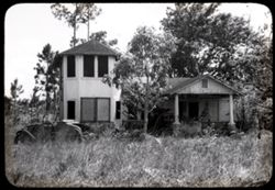
- Subject:
- Automobiles, Trees, Shrubs, Windows, Dwellings, Columns, and Weeds
- Series:
- 11-39
- Creator:
- Cushman, Charles W., 1896-1972
- Date Created:
- 1939-04-01
- Frame Number:
- 33
- County:
- Miami-Dade
- Abstract:
- 39-J-33= Abandone house nr. Fla. City
- Call Number:
- P01608
- City:
- Miami and Florida City
- Country:
- United States
- State/Province:
- Florida
- Physical Description:
- black & white .
- Alternate Identifier:
- 1139.33
- Persistent URL:
- http://purl.dlib.indiana.edu/iudl/archives/cushman/P01608
-
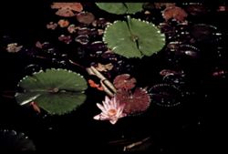
![M-6= [M Copy] Lily Pond Hotel Pancoast](https://iiif.uits.iu.edu/iiif/2/1831ck04j%2Ffiles%2F09ddaf3d-c4a8-4fab-954d-8c3af7cd69c2/full/250,/0/default.jpg)
- Subject:
- Pancoast Hotel (Miami, Fla.) and Lily ponds
- Series:
- 4-39
- Creator:
- Cushman, Charles W., 1896-1972
- Date Created:
- 1939-04-01
- Genre:
- Identification photographs
- Frame Number:
- 6
- County:
- Miami-Dade
- Abstract:
- M-6= Lily Pond= Hotel Pancoast. Original and 3 M copies
- Call Number:
- P01595
- City:
- Miami Beach
- Country:
- United States
- State/Province:
- Florida
- Physical Description:
- some dye fading. Image was originally mounted in a glass enclosure. Before digitization, the image was removed and placed in a Wess Plastic, Inc. brand, 2&qu...
- Alternate Identifier:
- 439.6
- Persistent URL:
- http://purl.dlib.indiana.edu/iudl/archives/cushman/P01595
-
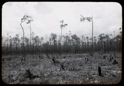
- Subject:
- Trees, Shrubs, and Clearing of land
- Series:
- 11-39
- Creator:
- Cushman, Charles W., 1896-1972
- Date Created:
- 1939-04-01
- Genre:
- Landscape photographs
- Frame Number:
- 32
- County:
- Miami-Dade
- Abstract:
- 39-J-32= Clearing in S.E. Florida.
- Call Number:
- P01607
- City:
- Miami
- Country:
- United States
- State/Province:
- Florida
- Physical Description:
- black & white .
- Alternate Identifier:
- 1139.32
- Persistent URL:
- http://purl.dlib.indiana.edu/iudl/archives/cushman/P01607
-
- Subject:
- Pancoast Hotel (Miami, Fla.) and Lily ponds
- Series:
- 4-39
- Creator:
- Cushman, Charles W., 1896-1972
- Date Created:
- 1939-04-01
- Genre:
- Identification photographs
- Frame Number:
- 6
- County:
- Miami-Dade
- Abstract:
- M-6= Lily Pond= Hotel Pancoast. Original and 3 M copies
- Call Number:
- P01596
- City:
- Miami Beach
- Country:
- United States
- State/Province:
- Florida
- Physical Description:
- some dye fading. Image was originally mounted in a glass enclosure. Before digitization, the image was removed and placed in a Wess Plastic, Inc. brand, 2&qu...
- Alternate Identifier:
- 439.6
- Persistent URL:
- http://purl.dlib.indiana.edu/iudl/archives/cushman/P01596
-

- Subject:
- Seas, Bodies of water, Gulf Stream (Fla.), Chairs, Clouds, Sunrises & sunsets, and Palms
- Series:
- 3-39
- Creator:
- Cushman, Charles W., 1896-1972
- Date Created:
- 1939-03-01
- Genre:
- Seascapes
- Frame Number:
- 7
- County:
- Miami-Dade
- Abstract:
- L-7= Sunrise over The Gulf Stream (Duplicated 2U)
- Call Number:
- P01578
- City:
- Miami Beach
- Country:
- United States
- State/Province:
- Florida
- Physical Description:
- some dye fading. Image was originally mounted in a glass enclosure. Before digitization, the image was removed and placed in a Wess Plastic, Inc. brand, 2&qu...
- Alternate Identifier:
- 339.7
- Persistent URL:
- http://purl.dlib.indiana.edu/iudl/archives/cushman/P01578
-
- Subject:
- Baboquivari Peak Wilderness (Ariz.), Mountains, Shrubs, and Clouds
- Series:
- 22-40
- Creator:
- Cushman, Charles W., 1896-1972
- Date Created:
- 1940-05-01
- Genre:
- Landscape photographs
- Frame Number:
- 25
- County:
- Pima
- Abstract:
- 40-F-25= Baboquivari Peak nr. Ariz. - Sonora line
- Call Number:
- P01511
- Country:
- United States and Mexico
- State/Province:
- Arizona and Sonora
- Physical Description:
- black & white .
- Alternate Identifier:
- 2240.25
- Persistent URL:
- http://purl.dlib.indiana.edu/iudl/archives/cushman/P01511
-
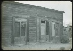
- Subject:
- Trees, Fences, Shrubs, Wooden buildings, and Doors & doorways
- Series:
- 22-40
- Creator:
- Cushman, Charles W., 1896-1972
- Date Created:
- 1940-05-01
- Frame Number:
- 13
- County:
- Cochise
- Abstract:
- 40-F-13= in Tombstone, Ariz.
- Call Number:
- P01508
- City:
- Tombstone
- Country:
- United States
- State/Province:
- Arizona
- Physical Description:
- black & white .
- Alternate Identifier:
- 2240.13
- Persistent URL:
- http://purl.dlib.indiana.edu/iudl/archives/cushman/P01508
-
- Subject:
- Schieffelin House (Tombstone, Ariz.), Windows, Sidewalks, Dirt roads, Shrubs, Electric lines, Trees, Buildings, and Doors & doorways
- Series:
- 22-40
- Creator:
- Cushman, Charles W., 1896-1972
- Date Created:
- 1940-05-01
- Genre:
- Architectural photographs
- Frame Number:
- 15
- County:
- Cochise
- Abstract:
- 40-F-15= in Tombstone, Ariz.
- Call Number:
- P01509
- City:
- Tombstone
- Country:
- United States
- State/Province:
- Arizona
- Physical Description:
- black & white .
- Alternate Identifier:
- 2240.15
- Persistent URL:
- http://purl.dlib.indiana.edu/iudl/archives/cushman/P01509
-
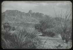
- Subject:
- Baboquivari Peak Wilderness (Ariz.), Mountains, and Shrubs
- Series:
- 22-40
- Creator:
- Cushman, Charles W., 1896-1972
- Date Created:
- 1940-04-01
- Genre:
- Landscape photographs
- Frame Number:
- 24
- County:
- Pima
- Abstract:
- 40-F-24 = Baboquivari Peak nr. Ariz.-Sonora line
- Call Number:
- P01510
- Country:
- United States and Mexico
- State/Province:
- Arizona and Sonora
- Physical Description:
- black & white .
- Alternate Identifier:
- 2240.24
- Persistent URL:
- http://purl.dlib.indiana.edu/iudl/archives/cushman/P01510
-
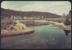
- Subject:
- National parks & reserves, Reflections, Madison River (Wyo. and Mont.), Forests, Shrubs, Trees, Rivers, Yellowstone National Park, Clouds, and Grasses
- Series:
- 6-38
- Creator:
- Cushman, Charles W., 1896-1972
- Date Created:
- 1938-09-29
- Genre:
- Landscape photographs
- Frame Number:
- 9
- Abstract:
- F-9= Madison river in the morning
- Call Number:
- P01496
- Country:
- United States
- State/Province:
- Wyoming and Montana
- Physical Description:
- some dye fading. Image was originally mounted in a glass enclosure. Before digitization, the image was removed and placed in a Wess Plastic, Inc. brand, 2&qu...
- Alternate Identifier:
- 638.9
- Persistent URL:
- http://purl.dlib.indiana.edu/iudl/archives/cushman/P01496
-
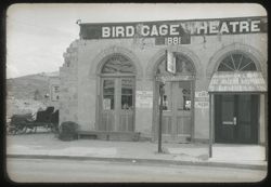
- Subject:
- Bird Cage Theatre (Tombstone, Ariz.), Hills, Automobiles, Sidewalks, Benches, Signs (Notices), Theaters, Streets, and Doors & doorways
- Series:
- 22-40
- Creator:
- Cushman, Charles W., 1896-1972
- Date Created:
- 1940-05-01
- Frame Number:
- 12
- County:
- Cochise
- Abstract:
- 40 -F - 12= in Tombstone, Ariz.
- Call Number:
- P01507
- City:
- Tombstone
- Country:
- United States
- State/Province:
- Arizona
- Physical Description:
- black & white .
- Alternate Identifier:
- 2240.12
- Persistent URL:
- http://purl.dlib.indiana.edu/iudl/archives/cushman/P01507