Indiana University
Indiana University
IU
Skip to Content
Digital Collections
Toggle navigation
Digital
Collections
Switch language
English
Switch language
Deutsch
English
Español
Français
Italiano
Português do Brasil
中文
Login
Home
About
Contact
Search Digital Collections
Go
×
Search Constraints
Start Over
You searched for:
County
Inyo
Remove constraint County: Inyo
« Previous |
1
-
100
of
345
|
Next »
Sort by relevance ▼
relevance ▼
recently updated
title ▲
title ▼
date created ▲
date created ▼
pages ▲
pages ▼
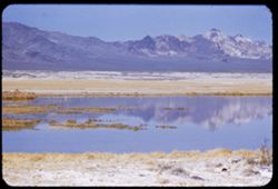
collection size ▲
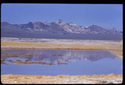
collection size ▼
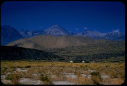
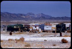
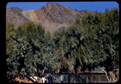
Number of results to display per page
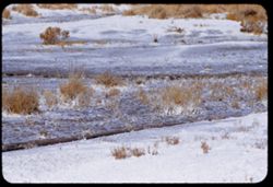
100 per page
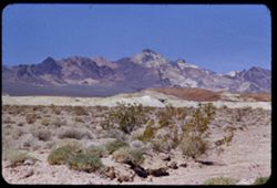
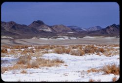
10
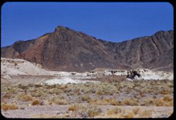
per page
20
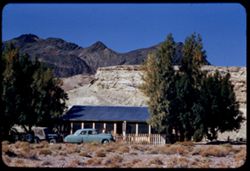
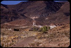
per page
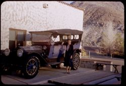
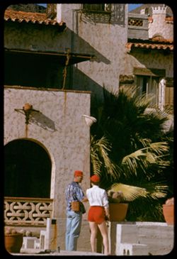
50
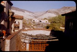
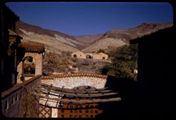
per page
100
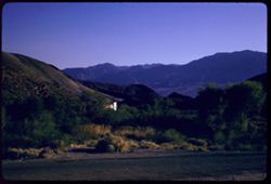
per page
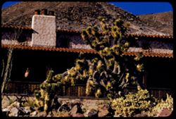
View results as:
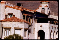
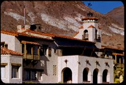
List
Gallery
Masonry
Search Results
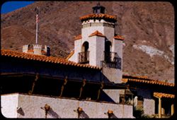
1.
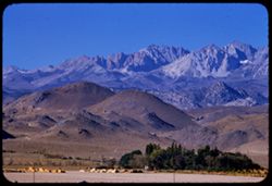
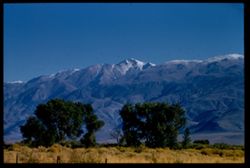
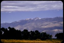
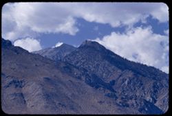
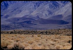
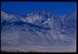
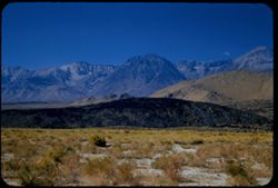
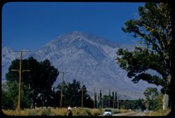
East slope of high Sierra Nevada west of Bishop seen from US 395 north east of Bishop
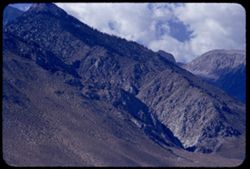
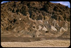
2.
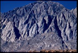
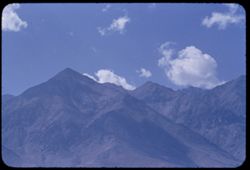
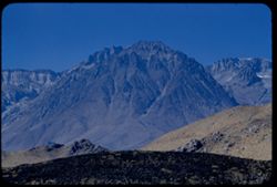
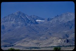
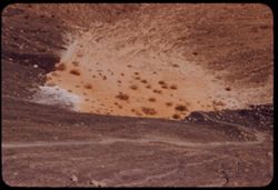
East face of Sierra Nevada NW of Mtn Tom Inyo county EK
3.
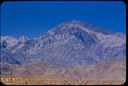
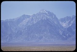
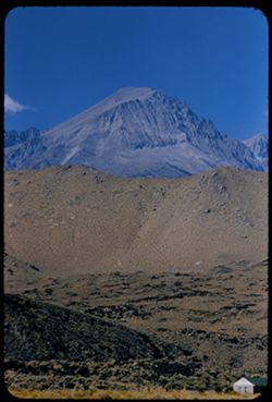
Mt. Tom - from US 395 4 miles NW of Bishop
4.
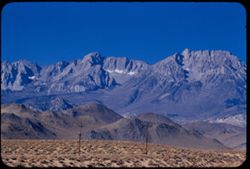
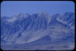
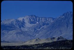
Ridge of Sierra Nevada south of Mt. tom seen from US 395
5.
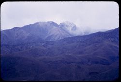
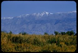
Fresh snow on White Mtn. Peak 14246' from Bishop in morning Cushman
6.
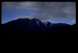
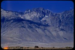
Top ridge of California's White Mountains at sunset seen from Bishop
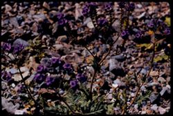
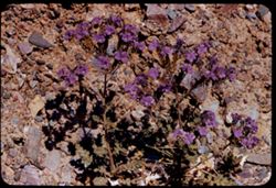
7.
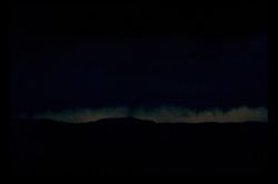
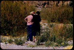
Evening sky at north end of Owens Valley - seen from Bishop
8.
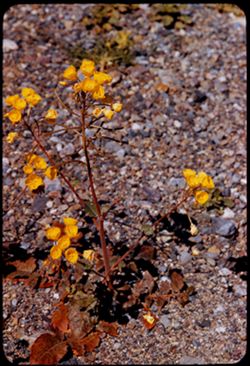
Dark storm clouds gather above Owens Valley South of Bishop, Calif.
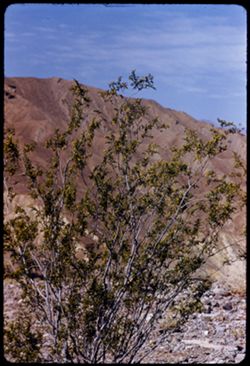
9.
Dark cloud mass above Owens Valley near Bishop
10.
White Mtn. Peak 14246' under heavy sky in evening Cushman EK
11.
White Mountain Peak under heavy clouds from US 6 n.e. of Bishop
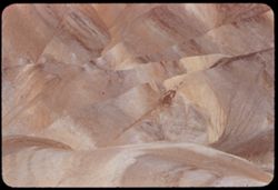
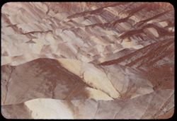
12.
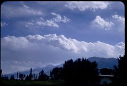
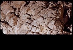
Clouds over high Sierra Nevada - from Bishop view is south in late afternoon
13.
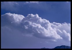
Cloud mass over Sierra Nevada seen from Bishop Calif. Inyo County Cushman EK
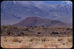
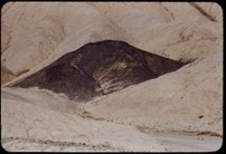
14.
Sunlit White Mtn. Peak seen from bishop in evening
15.
Red mound on east side of Owens Valley below Inyo Mtns. southeast of Big Pine
16.
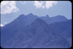
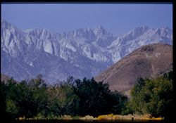
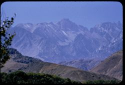
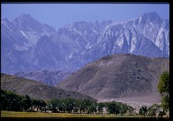
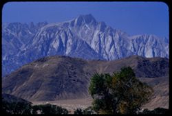
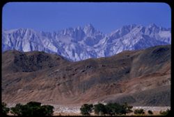
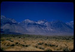
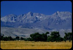
High Sierra in Inyo county seen from Owens Valley between Independence and Big Pine
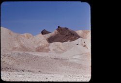
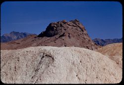
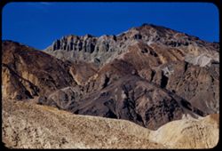
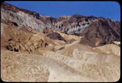
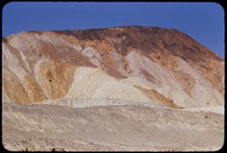
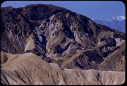
17.
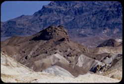
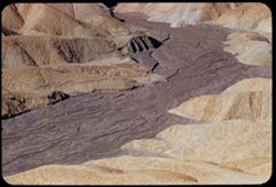
High Sierra in Inyo county seen from US 395 between Independence and Big Pine
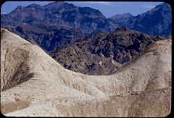
18.
High Sierra seen from US 395 in Inyo county between Independence and Big Pine
19.
High Sierra between Big Pine and Independence CL EK
20.
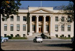
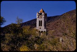
Inyo county Court House
21.
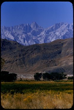
Top of Sierra Nevada seen from US 395 south of Independence
22.
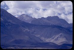
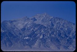
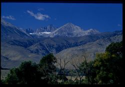
Mount Whitney from Lone Pine at noon EK
23.
High Sierras south of Mt. whitney - perhaps Mt. Corcoran with La Conte at right
24.
High Sierra Nevada to south of Mt. Whitney from Lone Pine EK
25.
Mt. Whitney beyond Alabama Hills
26.
Lone Pine Mtn. back of Alabama Hills Inyo county
27.
Mt. Williamson from Lone Pine
28.
Mt. Whitney from north end of Lone Pine
29.
Mt. Williamson
30.
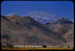
Foothills of Sierra Nevada seen from US 395 between Big Pine and Independence
31.
Mt. Williamson from Independence
32.
High Sierra Nevaga in Inyo county, from US 395 north of Independence
33.
High sierra seen from US 395 - Inyo county
34.
Two-toned peak of High Sierra Nevada between Big Pine and Independence Inyo county EK
35.
Red hill above lava field along US 395, 14 miles south of Big Pine, Calif. View is west toward Sierra
36.
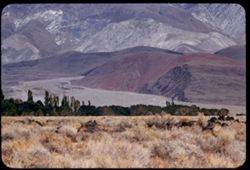
from Owens valley 13 miles south of Big Pine west toward Sierra Nevada
37.
from Owens valley 5 mi. south of Big Pine view west toward Sierra Nevada
38.
from Owens valley 5 mi. south of Big Pine looking S.W. toward Sierra Nevada
39.
from Owens Valley 5 mi. south of Big Pine View west toward Sierra Nevada
40.
Sierra Nevada from Owens Valley 5 mi. south of Big Pine
41.
Sierra Nevada seen from US 395 5 mi. south of Big Pine
42.
SW toward high ridge of Sierra Nevada from Big Pine, Calif.
43.
High ridge of Sierra Nevada Mtns west from Big Pine Inyo county Cushman
44.
Ridge of Sierra Nevada south of Mt. Tom from West side of Bishop
45.
White Mtn. Peak 14,246 ft. From west side of Bishop in morning
46.
Mt. Tom, west of Bishop
47.
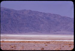
Death Valley's colorful Black Mtns. from highway near Tecopa, Inyo county
48.
Black Mtns. seen across desert lake near Tecopa, Inyo Co.
49.
View NW toward Black Mtns. of Death Valley from desert lake near Tecopa, Inyo Co., Calif. EK C1
50.
Trailer colony near Tecopa Hot Springs in SE Inyo county
51.
Alkali beds along road south of Shoshone in SE Inyo county
52.
Alkali beds south of Shoshone, Inyo Co. Greenwater mtns. in background
53.
Greenwater mtns. from road south of Shoshone, Inyo County
54.
Greenwater Mtns. west of Shoshone
55.
Shoshone in SE Inyo county California
56.
Jean and ancient Packard auto at Scotty's Castle Death Valley
57.
View east from inner court of Scotty's castle Death Valley
58.
View east of Scotty's Castle from inner court. Death Valley
59.
View south from Scotty's castle late evening Death Valley EK C1
60.
Joshua tree at cottage next to Scotty's Castle Death Valley
61.
Scotty's Castle Death Valley
62.
Scotty's Castle Death Valley
63.
Scotty's Castle Death Valley
64.
at Scotty's Castle Death Valley
65.
Bell Tower seen from outer gate of Scotty's Castle Death Valley
66.
First view of Tower at Scotty's Castle Death Valley
67.
Ridges northeast of Ubehebe Crater Death Valley
68.
Strange white ridge in bowl of Ubehebe Crater
69.
Death Valley north from top of Ubehebe Crater
70.
Grapevine Mtns. Seen across top of Ubehebe Crater Death Valley EK C1
71.
East wall of Ubehebe Crater Death Valley
72.
Southeast wall of Ubehebe Crater Death Valley
73.
Top rim of Ubehebe Crater and mountains beyond Death Valley
74.
Looking down into Ubehebe Crater Death Valley
75.
Across Valley floor toward Panamint Mtns. from Hwy near Park Headquarters Death Valley
76.
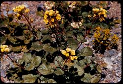
Frost-stemmed Primrose in Furnace Ck. Wash Death Valley
77.
Phacelia, primrose, and Mojavia in Furnace Creek Wash Death Valley
78.
Jean and teacher in Furnace Creek Wash near Tamarisk Death Valley
79.
Phacelia in Furnace Ck. Wash Death Valley
80.
Primrose (golden cups) in bed at Furnace Ck. Wash Death Valley
81.
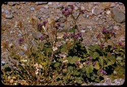
Greasewood in bloom Death Valley EK C1
82.
Death Valley
83.
Death Valley
84.
Death Valley
85.
Buckwheat Death Valley
86.
Phacelia along Hwy 190 east of Furnace Creek Inn - Death Valley
87.
The big Biscuit seen from exit of road through 20-Mule Team Canyon Death Valley
88.
Tel. close-up, from 7 feet, of featherweight rock in 20 Mule Team Canyon - Death Valley
89.
In 20 Mule Team canyon Death Valley Nat'l Mon
90.
in 20-mule team canyon Death Valley Nat'l Mon.
91.
Cinder cone in 20-mule team canyon Death Valley Nat'l Mon.
92.
from 20 Mule Team Canyon Death Valley Nat'l Mon
93.
Up from 20-Mule Team canyon Death Valley Nat'l Mon
94.
above 20-Mule team canyon Death Valley Nat'l Mon
95.
Up from Twenty-Mule-Team canyon Death Valley Nat'l Mon
96.
View in 20-mule Team Canyon
97.
from Zabriskie Point southward with Telescope Pk at upper right
98.
bed of Lava stream below Zabriskie Point
99.
below Zabriskie Point
100.
below Zabriskie Point
« Previous
Next »
1
2
3
4
Toggle facets
Limit your search
Type
Image
345
Creator
Cushman, Charles W., 1896-1972
345
Subject
Mountains
283
Shrubs
164
Valleys
146
Rocks
132
Death Valley (Calif. and Nev.)
121
Hills
84
Trees
83
Sierra Nevada (Calif. and Nev.)
65
Clouds
64
Rock formations
55
more
Subjects
»
Date Created
1955-03-22
67
1955-03-23
53
1955-09-25
41
1952-04-08
31
1955-02-27
26
1952-04-09
25
1954-09-18
23
1954-09-17
21
1955-02-28
21
1955-03-21
14
more
Date Createds
»
Pages
0-99 pages
345
Collections
Charles W. Cushman Kodachrome Slides
345
State
deposited
345
Campus
IUB
345
Frame Number
25
11
6
11
9
11
10
10
17
10
19
10
22
10
23
10
26
10
29
10
County
Inyo
[remove]
345
Mono
2
Esmeralda
1
Placer
1
San Bernardino
1
Series
15-52
36
9-55
35
10-55
34
26-55
34
11-55
33
8-55
29
12-54
27
14-52
24
3-55
24
11-54
19
City
Lone Pine
34
Big Pine
28
Bishop
28
Death Valley Junction
22
Independence
17
Badwater
15
Stovepipe Wells
11
Furnace Creek
7
Ryan
6
Shoshone
5
Country
United States
345
State/Province
California
345
Nevada
2
Holding Location
B-ARCHIVES
345