
Search Constraints
You searched for:
Provenance
DMA Topographic Center, Army Map Service Library, OMAHA, Library of Congress Geography & Map Division
Remove constraint Provenance: DMA Topographic Center, Army Map Service Library, OMAHA, Library of Congress Geography & Map Division
Publisher
Управление военных топографов
Remove constraint Publisher: Управление военных топографов
« Previous |
1 - 50 of 140
|
Next »
Search Results
-
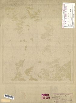
- Description:
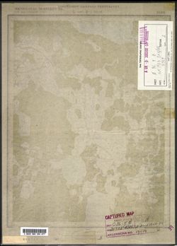
- 1931
- Subject:
- Topical Subject: Soviet Union, Topical Subject: Maps, and Geographic Subject: Korzhovka-Golubovka
- Publisher:
- Управление военных топографов
- Language:
- Russian
- Identifier:
- VAC9619-001539
- Genre:
- Topographic Maps and Military Maps
- Geographic Location:
- Coordinates: 52.6667, 32.25, 52.8667, 32.5
- Related URL:
- Catalog URL: http://iucat.iu.edu/catalog/5020131 and Download GeoTIFF: https://drive.google.com/open?id=1caz06yDhenOXRJOAcQZ0f7DQYtkJfycT
- Abstract:
- Modern area represented: Korzhovka-Golubovka, Bryansk oblast, Russia
- Call Number:
- G7000 s50 .S68 sheet N-36-113-D
- Caption:
- Временное издание,Не подлежит оглашению
- City:
- Коржовка-Голубовка (Korzhovka-Golubovka)
- Copyright Holder:
- No Copyright - United States
- Country:
- СССР (USSR)
- State/Province:
- РСФСР (RSFSR) and Западная область (Western oblast)
- Physical Description:
- Scale: 1:50,000
- Persistent URL:
- http://purl.dlib.indiana.edu/iudl/images/VAC9619/VAC9619-001539
- Provenance:
- DMA Topographic Center, Army Map Service Library, OMAHA, Library of Congress Geography & Map Division
-
- Description:
- 1928
- Subject:
- Geographic Subject: Prisno, Topical Subject: Soviet Union, and Topical Subject: Maps
- Publisher:
- Управление военных топографов
- Language:
- Russian
- Identifier:
- VAC9619-001528
- Genre:
- Topographic Maps and Military Maps
- Geographic Location:
- Coordinates: 52.6667, 30.75, 53, 31
- Related URL:
- Catalog URL: http://iucat.iu.edu/catalog/5020131 and Download GeoTIFF: https://drive.google.com/open?id=1FXKHO5tXHr9fKZjzS1o03TiZjtGCy1Nb
- Abstract:
- Modern area represented: Prisno, Homyel oblast, Belarus
- Call Number:
- G7000 s50 .S68 sheet N-36-110-D
- Caption:
- Не подлежит оглашению
- City:
- Присно (Prisno)
- Copyright Holder:
- No Copyright - United States
- Country:
- СССР (USSR)
- State/Province:
- Белорусская ССР (Byelorussian Soviet Socialist Republic)
- Physical Description:
- Scale: 1:50,000
- Persistent URL:
- http://purl.dlib.indiana.edu/iudl/images/VAC9619/VAC9619-001528
- Provenance:
- DMA Topographic Center, Army Map Service Library, OMAHA, Library of Congress Geography & Map Division
-
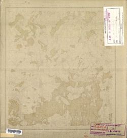
- Description:
- 1931
- Subject:
- Topical Subject: Soviet Union, Topical Subject: Maps, and Geographic Subject: Bolotnya
- Publisher:
- Управление военных топографов
- Language:
- Russian
- Identifier:
- VAC9619-001504
- Genre:
- Military Maps and Topographic Maps
- Geographic Location:
- Coordinates: 53.1667, 32.75, 53.3333, 33
- Related URL:
- Download GeoTIFF: https://drive.google.com/file/d/1DND7UENKh3QT4-FNIuxE4qh94CJeHGgb/view?usp=sharing and Catalog URL: http://iucat.iu.edu/catalog/5020131
- Abstract:
- Modern area represented: Bolotnya, Bryansk oblast, Russia
- Call Number:
- G7000 s50 .S68 sheet N-36-105-B
- Caption:
- Не подлежит оглашению
- City:
- Болотня (Bolotnya)
- Copyright Holder:
- No Copyright - United States
- Country:
- СССР (USSR)
- State/Province:
- РСФСР (RSFSR) and Западная область (Western oblast)
- Physical Description:
- Scale: 1:50,000
- Persistent URL:
- http://purl.dlib.indiana.edu/iudl/images/VAC9619/VAC9619-001504
- Provenance:
- DMA Topographic Center, Army Map Service Library, OMAHA, Library of Congress Geography & Map Division
-
- Description:
- 1928
- Subject:
- Geographic Subject: Slavnya, Topical Subject: Maps, and Topical Subject: Soviet Union
- Publisher:
- Управление военных топографов
- Language:
- Russian
- Identifier:
- VAC9619-001487
- Genre:
- Military Maps and Topographic Maps
- Geographic Location:
- Coordinates: 53.1667, 30.75, 53.3333, 31
- Related URL:
- Download GeoTIFF: https://drive.google.com/open?id=1lVT-0rzh1ByHE3fXveb63ksjcTc8r32b and Catalog URL: http://iucat.iu.edu/catalog/5020131
- Abstract:
- Modern area represented: Slavnya, Mogilev, Belarus
- Call Number:
- G7000 s50 .S68 sheet N-36-98-B
- Caption:
- Не подлежит оглашению
- City:
- Славня (Slavnya)
- Copyright Holder:
- No Copyright - United States
- Country:
- СССР (USSR)
- State/Province:
- Белорусская ССР (Byelorussian Soviet Socialist Republic)
- Physical Description:
- Scale: 1:50,000
- Persistent URL:
- http://purl.dlib.indiana.edu/iudl/images/VAC9619/VAC9619-001487
- Provenance:
- DMA Topographic Center, Army Map Service Library, OMAHA, Library of Congress Geography & Map Division
-
- Description:
- 1931
- Subject:
- Geographic Subject: Razrytoye, Topical Subject: Maps, and Topical Subject: Soviet Union
- Publisher:
- Управление военных топографов
- Language:
- Russian
- Identifier:
- VAC9619-001450
- Genre:
- Topographic Maps and Military Maps
- Geographic Location:
- Coordinates: 53.3333, 32.75, 53.5, 33
- Related URL:
- Download GeoTIFF: https://drive.google.com/open?id=1Ks2FByvEOj90pyqtFjIQtDkk--6HbR4S and Catalog URL: http://iucat.iu.edu/catalog/5020131
- Abstract:
- Modern area represented: Razrytoye, Bryansk oblast, Russia
- Call Number:
- GM G7000 S50 .S68 N-36-90-Г
- Caption:
- Не подлежит оглашению
- City:
- Разрытое (Razrytoye)
- Copyright Holder:
- No Copyright - United States
- Country:
- СССР (USSR)
- State/Province:
- Западная область (Western oblast), Белорусская ССР (Byelorussian Soviet Socialist Republic), and РСФСР (RSFSR)
- Physical Description:
- Scale: 1:50,000
- Persistent URL:
- http://purl.dlib.indiana.edu/iudl/images/VAC9619/VAC9619-001450
- Provenance:
- DMA Topographic Center, Army Map Service Library, OMAHA, Library of Congress Geography & Map Division
-
- Description:
- 1931
- Subject:
- Topical Subject: Maps, Topical Subject: Soviet Union, and Geographic Subject: Galichi
- Publisher:
- Управление военных топографов
- Language:
- Russian
- Identifier:
- VAC9619-001445
- Genre:
- Topographic Maps and Military Maps
- Geographic Location:
- Coordinates: 53.5, 32.25, 53.6667, 32.5
- Related URL:
- Download GeoTIFF: https://drive.google.com/open?id=1qTzU_Ok50JYyqehnESugCq4d044yE3ww and Catalog URL: http://iucat.iu.edu/catalog/5020131
- Abstract:
- Modern area represented: Galichi, Mogilev oblast, Belarus
- Call Number:
- GM G7000 S50 .S68 N-36-89-Б
- City:
- Галичи (Galichi)
- Copyright Holder:
- No Copyright - United States
- Country:
- СССР (USSR)
- State/Province:
- Белорусская ССР (Byelorussian Soviet Socialist Republic), РСФСР (RSFSR), and Западная область (Western oblast)
- Physical Description:
- Scale: 1:50,000
- Persistent URL:
- http://purl.dlib.indiana.edu/iudl/images/VAC9619/VAC9619-001445
- Provenance:
- DMA Topographic Center, Army Map Service Library, OMAHA, Library of Congress Geography & Map Division
-
- Description:
- 1928
- Subject:
- Topical Subject: Soviet Union, Topical Subject: Maps, and Geographic Subject: Rahalina
- Publisher:
- Управление военных топографов
- Language:
- Russian
- Identifier:
- VAC9619-001440
- Genre:
- Topographic Maps and Military Maps
- Geographic Location:
- Coordinates: 53.5, 31, 53.6667, 31.25
- Related URL:
- Download GeoTIFF: https://drive.google.com/open?id=1X2ptppUfVbEjrZyZHhDN7LtsmRaYuxpW and Catalog URL: http://iucat.iu.edu/catalog/5020131
- Abstract:
- Modern area represented: Rahalina, Mogilev oblast, Belarus
- Call Number:
- GM G7000 S50 .S68 N-36-87-A
- Caption:
- Не подлежит оглашению
- City:
- Рогальня (Rogalnya)
- Copyright Holder:
- No Copyright - United States
- Country:
- СССР (USSR)
- State/Province:
- Белорусская ССР (Byelorussian Soviet Socialist Republic)
- Physical Description:
- Scale: 1:50,000
- Persistent URL:
- http://purl.dlib.indiana.edu/iudl/images/VAC9619/VAC9619-001440
- Provenance:
- DMA Topographic Center, Army Map Service Library, OMAHA, Library of Congress Geography & Map Division
-
- Description:
- 1936
- Subject:
- Topical Subject: Soviet Union, Topical Subject: Maps, and Geographic Subject: Bykhaw
- Publisher:
- Управление военных топографов
- Language:
- Russian
- Identifier:
- VAC9619-001433
- Genre:
- Military Maps and Topographic Maps
- Geographic Location:
- Coordinates: 53.5, 30.25, 53.6667, 30.5
- Related URL:
- Download GeoTIFF: https://drive.google.com/open?id=1hj66QADhILcwfpUEOSsjQLpFMou58WAj and Catalog URL: http://iucat.iu.edu/catalog/5020131
- Abstract:
- Modern area represented: Bykhaw, Mogilev oblast, Belarus
- Call Number:
- GM G7000 S50 .S68 N-36-85-Б
- Caption:
- Не подлежит оглашению
- City:
- Быхов (Bykhaw)
- Copyright Holder:
- No Copyright - United States
- Country:
- СССР (USSR)
- State/Province:
- Белорусская ССР (Byelorussian Soviet Socialist Republic)
- Physical Description:
- Scale: 1:50,000
- Persistent URL:
- http://purl.dlib.indiana.edu/iudl/images/VAC9619/VAC9619-001433
- Provenance:
- DMA Topographic Center, Army Map Service Library, OMAHA, Library of Congress Geography & Map Division
-
- Description:
- 1930
- Subject:
- Topical Subject: Maps, Topical Subject: Soviet Union, and Geographic Subject: Ignatovka
- Publisher:
- Управление военных топографов
- Language:
- Russian
- Identifier:
- VAC9619-001421
- Genre:
- Military Maps and Topographic Maps
- Geographic Location:
- Coordinates: 53.833, 34.5, 54, 34.75
- Related URL:
- Catalog URL: http://iucat.iu.edu/catalog/5020131 and Download GeoTIFF: https://drive.google.com/open?id=1kehJGoSb46U_GsxDGDK6yDdgYo86sJiq
- Abstract:
- Modern area represented: Ignatovka, Kaluga oblast, Russia
- Call Number:
- GM G7000 S50 .S68 N-36-82-A
- City:
- Игнатовка (Ignatovka)
- Copyright Holder:
- No Copyright - United States
- Country:
- СССР (USSR)
- State/Province:
- РСФСР (RSFSR) and Западная область (Western oblast)
- Physical Description:
- Scale: 1:50,000
- Persistent URL:
- http://purl.dlib.indiana.edu/iudl/images/VAC9619/VAC9619-001421
- Provenance:
- DMA Topographic Center, Army Map Service Library, OMAHA, Library of Congress Geography & Map Division
-
- Description:
- 1932
- Subject:
- Topical Subject: Maps, Topical Subject: Soviet Union, and Geographic Subject: Poddor'ye
- Publisher:
- Управление военных топографов
- Language:
- Russian
- Identifier:
- VAC9619-003533
- Genre:
- Military Maps and Topographic Maps
- Geographic Location:
- Coordinates: 57.3333, 31.0, 57.5, 31.25
- Related URL:
- Catalog URL: http://iucat.iu.edu/catalog/5020131 and Download GeoTIFF: https://drive.google.com/file/d/1iAyFR8ALMrmCoXPjaR-QZRBpVdP8BLku/view?usp=sharing
- Abstract:
- Modern area represented: Поддорье (Poddor'ye), Novgorodskaya oblast, Russia
- Call Number:
- GM G7000 s50 .S68 sheet O-36-87-C
- Caption:
- Не подлежит оглашению
- City:
- Поддорье (Poddor'ye)
- Copyright Holder:
- No Copyright - United States
- Country:
- СССР (USSR)
- State/Province:
- РСФСР (RSFSR) and Ленинградская область (Leningrad oblast)
- Physical Description:
- Scale: 1:50,000
- Persistent URL:
- http://purl.dlib.indiana.edu/iudl/images/VAC9619/VAC9619-003533
- Provenance:
- DMA Topographic Center, Army Map Service Library, OMAHA, Library of Congress Geography & Map Division
-
- Description:
- 1932
- Subject:
- Topical Subject: Soviet Union, Geographic Subject: Rakhlitsy, and Topical Subject: Maps
- Publisher:
- Управление военных топографов
- Language:
- Russian
- Identifier:
- VAC9619-003532
- Genre:
- Topographic Maps and Military Maps
- Geographic Location:
- Coordinates: 57.5, 31.25, 57.6667, 31.5
- Related URL:
- Download GeoTIFF: https://drive.google.com/file/d/1o_K2Up3S5K7jhomjmsZpP78iQtThrVry/view?usp=sharing and Catalog URL: http://iucat.iu.edu/catalog/5020131
- Abstract:
- Modern area represented: Рахлицы (Rakhlitsy), Novgorodskaya oblast, Russia
- Call Number:
- GM G7000 s50 .S68 sheet O-36-87-B
- Caption:
- Не подлежит оглашению
- City:
- Рахлицы (Rakhlitsy)
- Copyright Holder:
- No Copyright - United States
- Country:
- СССР (USSR)
- State/Province:
- Ленинградская область (Leningrad oblast) and РСФСР (RSFSR)
- Physical Description:
- Scale: 1:50,000
- Persistent URL:
- http://purl.dlib.indiana.edu/iudl/images/VAC9619/VAC9619-003532
- Provenance:
- DMA Topographic Center, Army Map Service Library, OMAHA, Library of Congress Geography & Map Division
-
- Description:
- 1932
- Subject:
- Topical Subject: Soviet Union, Topical Subject: Maps, and Geographic Subject: Zapol'ye
- Publisher:
- Управление военных топографов
- Language:
- Russian
- Date Created:
- 1935
- Identifier:
- VAC9619-003530
- Genre:
- Topographic Maps and Military Maps
- Geographic Location:
- Coordinates: 57.3333, 30.5, 57.5, 30.75
- Related URL:
- Download GeoTIFF: https://drive.google.com/file/d/1abqgMUIx4YwMEuwFrohfNLhOCdIr0eph/view?usp=sharing and Catalog URL: http://iucat.iu.edu/catalog/5020131
- Abstract:
- Modern area represented: Заполье (Zapol'ye), Novgorodskaya oblast, Russia
- Call Number:
- GM G7000 s50 .S68 sheet O-36-86-C
- Caption:
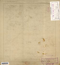
- Для служебного пользования and Captured map
- City:
- Заполье (Zapol'ye)
- Copyright Holder:
- No Copyright - United States
- Country:
- СССР (USSR)
- State/Province:
- РСФСР (RSFSR) and Ленинградская область (Leningrad oblast)
- Physical Description:
- Scale: 1:50,000
- Persistent URL:
- http://purl.dlib.indiana.edu/iudl/images/VAC9619/VAC9619-003530
- Provenance:
- DMA Topographic Center, Army Map Service Library, OMAHA, Library of Congress Geography & Map Division
-
- Description:
- 1932
- Subject:
- Topical Subject: Maps, Topical Subject: Soviet Union, and Geographic Subject: Belebelka
- Publisher:
- Управление военных топографов
- Language:
- Russian
- Date Created:
- 1935
- Identifier:
- VAC9619-003529
- Genre:
- Military Maps and Topographic Maps
- Geographic Location:
- Coordinates: 57.5, 30.75, 57.6667, 31.0
- Related URL:
- Download GeoTIFF: https://drive.google.com/file/d/1MsF7NM8_S3piH2IIQADcekLjZ5KjdXss/view?usp=sharing and Catalog URL: http://iucat.iu.edu/catalog/5020131
- Abstract:
- Modern area represented: Белебелка (Belebelka), Novgorodskaya oblast, Russia
- Call Number:
- GM G7000 s50 .S68 sheet O-36-86-B
- Caption:
- Captured map and Не подлежит оглашению
- City:
- Белебелка (Belebelka)
- Copyright Holder:
- No Copyright - United States
- Country:
- СССР (USSR)
- State/Province:
- РСФСР (RSFSR) and Ленинградская область (Leningrad oblast)
- Physical Description:
- Scale: 1:50,000
- Persistent URL:
- http://purl.dlib.indiana.edu/iudl/images/VAC9619/VAC9619-003529
- Provenance:
- DMA Topographic Center, Army Map Service Library, OMAHA, Library of Congress Geography & Map Division
-
- Description:
- 1932
- Subject:
- Topical Subject: Maps, Geographic Subject: Vidzha, and Topical Subject: Soviet Union
- Publisher:
- Управление военных топографов
- Language:
- Russian
- Identifier:
- VAC9619-003524
- Genre:
- Military Maps and Topographic Maps
- Geographic Location:
- Coordinates: 57.66667, 31.0, 57.83333, 31.25
- Related URL:
- Download GeoTIFF: https://drive.google.com/file/d/1HLU6T17I6ZF-MnPAtxH0sQA-VXBqJxji/view?usp=sharing and Catalog URL: http://iucat.iu.edu/catalog/5020131
- Abstract:
- Modern area represented: Виджа (Vidzha), Novgorodskaya oblast, Russia
- Call Number:
- GM G7000 s50 .S68 sheet O-36-75-C
- Caption:
- Не подлежит оглашению and Captured map
- City:
- Виджа (Vidzha)
- Copyright Holder:
- No Copyright - United States
- Country:
- СССР (USSR)
- State/Province:
- Ленинградская область (Leningrad oblast) and РСФСР (RSFSR)
- Physical Description:
- Scale: 1:50,000
- Persistent URL:
- http://purl.dlib.indiana.edu/iudl/images/VAC9619/VAC9619-003524
- Provenance:
- DMA Topographic Center, Army Map Service Library, OMAHA, Library of Congress Geography & Map Division
-
- Description:
- 1926
- Subject:
- Topical Subject: Soviet Union, Topical Subject: Maps, and Geographic Subject: Zhizhitsa
- Publisher:
- Управление военных топографов
- Language:
- Russian
- Date Created:
- 1933
- Identifier:
- VAC9619-003490
- Genre:
- Topographic Maps and Military Maps
- Geographic Location:
- Coordinates: 56.167, 31.25, 56.333, 31.5
- Related URL:
- Download GeoTIFF: https://drive.google.com/file/d/1akHjhCoHjwS7M9NoqxD_Wge8T9N5pm0n/view?usp=sharing and Catalog URL: http://iucat.iu.edu/catalog/5020131
- Abstract:
- Modern area represented: Жижица (Zhizhitsa), Pskovskaya oblast, Russia
- Call Number:
- G7000 s50 .S68 sheet O-36-135-B
- Caption:
- Captured map and Не подлежит оглашению
- City:
- Жижица (Zhizhitsa)
- Copyright Holder:
- No Copyright - United States
- Country:
- СССР (USSR)
- State/Province:
- Западная область (Western oblast) and РСФСР (RSFSR)
- Physical Description:
- Scale: 1:50,000
- Persistent URL:
- http://purl.dlib.indiana.edu/iudl/images/VAC9619/VAC9619-003490
- Provenance:
- DMA Topographic Center, Army Map Service Library, OMAHA, Library of Congress Geography & Map Division
-
- Subject:
- Topical Subject: Soviet Union, Geographic Subject: Gruzdovo, and Topical Subject: Maps
- Publisher:
- Управление военных топографов
- Language:
- Russian
- Identifier:
- VAC9619-003489
- Genre:
- Military Maps and Topographic Maps
- Geographic Location:
- Coordinates: 56.167, 31, 56.333, 31.25
- Related URL:
- Catalog URL: http://iucat.iu.edu/catalog/5020131 and Download GeoTIFF: https://drive.google.com/file/d/1CMigDyHomt0Hpi1G7k_zN6Skk154K5Hw/view?usp=sharing
- Abstract:
- Modern area represented: Груздово (Gruzdovo), Pskovskaya oblast, Russia
- Call Number:
- G7000 s50 .S68 sheet O-36-135-A
- Caption:
- Не подлежит оглашению
- City:
- Груздово (Gruzdovo)
- Copyright Holder:
- No Copyright - United States
- Country:
- СССР (USSR)
- State/Province:
- Западная область (Western oblast) and РСФСР (RSFSR)
- Physical Description:
- Scale: 1:50,000
- Persistent URL:
- http://purl.dlib.indiana.edu/iudl/images/VAC9619/VAC9619-003489
- Provenance:
- DMA Topographic Center, Army Map Service Library, OMAHA, Library of Congress Geography & Map Division
-
- Description:
- 1926
- Subject:
- Geographic Subject: Toropets, Topical Subject: Soviet Union, and Topical Subject: Maps
- Publisher:
- Управление военных топографов
- Language:
- Russian
- Identifier:
- VAC9619-003464
- Genre:
- Military Maps and Topographic Maps
- Related URL:
- Catalog URL: http://iucat.iu.edu/catalog/5020131
- Abstract:
- Modern area represented: Toropets, Russia
- Call Number:
- GM G7000 s50 .S68 sheet O-36-124-A&C
- Caption:
- Не подлежит оглашению
- City:
- Торопец (Toropets)
- Copyright Holder:
- No Copyright - United States
- Country:
- СССР (USSR)
- Physical Description:
- Scale: 1:50,000
- Persistent URL:
- http://purl.dlib.indiana.edu/iudl/images/VAC9619/VAC9619-003464
- Provenance:
- DMA Topographic Center, Army Map Service Library, OMAHA, Library of Congress Geography & Map Division
-
- Description:
- 1928
- Subject:
- Topical Subject: Soviet Union, Topical Subject: Maps, and Geographic Subject: Borok
- Publisher:
- Управление военных топографов
- Language:
- Russian
- Identifier:
- VAC9619-003365
- Genre:
- Topographic Maps and Military Maps
- Geographic Location:
- Coordinates: 58.333, 30.75, 58.5, 31
- Related URL:
- Download GeoTIFF: https://drive.google.com/file/d/1YRmoHjAn7nVwnWACvJv3p7xxLVoyaYyW/view?usp=sharing and Catalog URL: http://iucat.iu.edu/catalog/5020131
- Abstract:
- Modern area represented: Борок (Borok), Novgorodskaya oblast, Russia
- Call Number:
- G7000 s50 .S68 sheet O-36-6-B
- Caption:
- Не подлежит оглашению
- City:
- Борок (Borok)
- Copyright Holder:
- No Copyright - United States
- Country:
- СССР (USSR)
- State/Province:
- Ленинградская область (Leningrad oblast) and РСФСР (RSFSR)
- Physical Description:
- Scale: 1:50,000
- Persistent URL:
- http://purl.dlib.indiana.edu/iudl/images/VAC9619/VAC9619-003365
- Provenance:
- DMA Topographic Center, Army Map Service Library, OMAHA, Library of Congress Geography & Map Division
-
- Description:
- 1932
- Subject:
- Topical Subject: Soviet Union, Geographic Subject: Lyubyn, and Topical Subject: Maps
- Publisher:
- Управление военных топографов
- Language:
- Russian
- Identifier:
- VAC9619-002906
- Genre:
- Military Maps and Topographic Maps
- Geographic Location:
- Coordinates: 58, 30.5, 58.167, 30.75
- Related URL:
- Download GeoTIFF: https://drive.google.com/file/d/128ujqRn1-NJT7mXO6X6FxWTV2RPADtWI/view?usp=sharing and Catalog URL: http://iucat.iu.edu/catalog/5020131
- Abstract:
- Modern area represented: Lyubyn, Leningrad oblast, Russia
- Call Number:
- GM G7000 s50 .S68 sheet O-36-62-С
- Caption:
- Не подлежит оглашению,Captured map
- City:
- Любынь (Lyubyn)
- Copyright Holder:
- No Copyright - United States
- Country:
- СССР (USSR)
- State/Province:
- Ленинградская область (Leningrad oblast) and РСФСР (RSFSR)
- Physical Description:
- Scale: 1:50,000
- Persistent URL:
- http://purl.dlib.indiana.edu/iudl/images/VAC9619/VAC9619-002906
- Provenance:
- DMA Topographic Center, Army Map Service Library, OMAHA, Library of Congress Geography & Map Division
-
- Description:
- 1932
- Subject:
- Geographic Subject: Nagovo, Topical Subject: Soviet Union, and Topical Subject: Maps
- Publisher:
- Управление военных топографов
- Language:
- Russian
- Identifier:
- VAC9619-002909
- Genre:
- Military Maps and Topographic Maps
- Geographic Location:
- Coordinates: 58, 31, 58.167, 31.25
- Related URL:
- Catalog URL: http://iucat.iu.edu/catalog/5020131 and Download GeoTIFF: https://drive.google.com/file/d/1HraeuZYKsUXJ9iCd0LI2YbXVf0zOekO9/view?usp=sharing
- Abstract:
- Modern area represented: Нагово (Nagovo), Novgorodskaya oblast, Russia
- Call Number:
- GM G7000 s50 .S68 sheet O-36-63-С
- Caption:
- Не подлежит оглашению and Captured map
- City:
- Нагово (Nagovo)
- Copyright Holder:
- No Copyright - United States
- Country:
- СССР (USSR)
- State/Province:
- Ленинградская область (Leningrad oblast) and РСФСР (RSFSR)
- Physical Description:
- Scale: 1:50,000
- Persistent URL:
- http://purl.dlib.indiana.edu/iudl/images/VAC9619/VAC9619-002909
- Provenance:
- DMA Topographic Center, Army Map Service Library, OMAHA, Library of Congress Geography & Map Division
-
- Description:
- 1932
- Subject:
- Topical Subject: Soviet Union, Topical Subject: Maps, and Geographic Subject: Morino
- Publisher:
- Управление военных топографов
- Language:
- Russian
- Identifier:
- VAC9619-002912
- Genre:
- Topographic Maps and Military Maps
- Geographic Location:
- Coordinates: 57.833, 30.25, 58, 30.5
- Related URL:
- Catalog URL: http://iucat.iu.edu/catalog/5020131 and Download GeoTIFF: https://drive.google.com/file/d/1VqyMek8uZ3cLp6KmwAyeZXulTuWrpsir/view?usp=sharing
- Abstract:
- Modern area represented: Морино (Morino), Pskovskaya oblast, Russia
- Call Number:
- GM G7000 s50 .S68 sheet O-36-73-В
- Caption:
- Не подлежит оглашению and Captured map
- City:
- Морино (Morino)
- Copyright Holder:
- No Copyright - United States
- Country:
- СССР (USSR)
- State/Province:
- Ленинградская область (Leningrad oblast) and РСФСР (RSFSR)
- Physical Description:
- Scale: 1:50,000
- Persistent URL:
- http://purl.dlib.indiana.edu/iudl/images/VAC9619/VAC9619-002912
- Provenance:
- DMA Topographic Center, Army Map Service Library, OMAHA, Library of Congress Geography & Map Division
-
- Description:
- 1932
- Subject:
- Topical Subject: Soviet Union, Topical Subject: Maps, and Geographic Subject: Solov'yevo
- Publisher:
- Управление военных топографов
- Language:
- Russian
- Date Created:
- 1935
- Identifier:
- VAC9619-002914
- Genre:
- Topographic Maps and Military Maps
- Geographic Location:
- Coordinates: 57.667, 30.5, 57.833, 30.75
- Related URL:
- Catalog URL: http://iucat.iu.edu/catalog/5020131 and Download GeoTIFF: https://drive.google.com/file/d/1CLxRUBJnLOwI8Yau6rAVhpzupqZ-nCi6/view?usp=sharing
- Abstract:
- Modern area represented: Соловьево (Solov'yevo), Novgorodskaya oblast, Russia
- Call Number:
- GM G7000 s50 .S68 sheet O-36-74-С
- Caption:
- Не подлежит оглашению
- City:
- Соловьево (Solov'yevo)
- Copyright Holder:
- No Copyright - United States
- Country:
- СССР (USSR)
- State/Province:
- РСФСР (RSFSR) and Ленинградская область (Leningrad oblast)
- Physical Description:
- Scale: 1:50,000
- Persistent URL:
- http://purl.dlib.indiana.edu/iudl/images/VAC9619/VAC9619-002914
- Provenance:
- DMA Topographic Center, Army Map Service Library, OMAHA, Library of Congress Geography & Map Division
-
- Subject:
- Geographic Subject: Mustalovo, Topical Subject: Maps, and Topical Subject: Soviet Union
- Publisher:
- Управление военных топографов
- Language:
- Russian
- Identifier:
- VAC9619-002938
- Genre:
- Topographic Maps and Military Maps
- Geographic Location:
- Coordinates: 60.333, 30, 60.5, 30.25
- Related URL:
- Catalog URL: http://iucat.iu.edu/catalog/5020131 and Download GeoTIFF: https://drive.google.com/file/d/1AFVjd15LfogaEX296JNqPh6ai3_6LpHe/view?usp=sharing
- Abstract:
- Modern area represented: Mustalovo, Leningrad oblast, Russia
- Call Number:
- G7000 s50 .S68 sheet P-36-121-C
- Caption:
- Не подлежит оглашению,Временное издание
- City:
- Мусталово (Mustalovo)
- Copyright Holder:
- No Copyright - United States
- Country:
- СССР (USSR) and Финляндия (Finland)
- State/Province:
- РСФСР (RSFSR) and Ленинградская область (Leningrad oblast)
- Physical Description:
- Scale: 1:50,000
- Persistent URL:
- http://purl.dlib.indiana.edu/iudl/images/VAC9619/VAC9619-002938
- Provenance:
- DMA Topographic Center, Army Map Service Library, OMAHA, Library of Congress Geography & Map Division
-
- Subject:
- Topical Subject: Maps, Geographic Subject: Zaporozhskoye, and Topical Subject: Soviet Union
- Publisher:
- Управление военных топографов
- Language:
- Russian
- Identifier:
- VAC9619-002940
- Genre:
- Military Maps and Topographic Maps
- Geographic Location:
- Coordinates: 60.5, 30.5, 60.667, 30.75
- Related URL:
- Download GeoTIFF: https://drive.google.com/file/d/1_YOIbrHnBIVVSrqgk0dp-y_gwogl3qpc/view?usp=sharing and Catalog URL: http://iucat.iu.edu/catalog/5020131
- Abstract:
- Modern area represented: Запорожское (Zaporozhskoye), Leningradskaya oblast, Russia
- Call Number:
- G7000 s50 .S68 sheet P-36-122-A
- Caption:
- Не подлежит оглашению and Временное издание
- City:
- Метсяпиртти (Metsäpirtti)
- Copyright Holder:
- No Copyright - United States
- Country:
- Финляндия (Finland) and СССР (USSR)
- State/Province:
- РСФСР (RSFSR)
- Physical Description:
- Scale: 1:50,000
- Persistent URL:
- http://purl.dlib.indiana.edu/iudl/images/VAC9619/VAC9619-002940
- Provenance:
- DMA Topographic Center, Army Map Service Library, OMAHA, Library of Congress Geography & Map Division
-
- Subject:
- Topical Subject: Maps, Topical Subject: Soviet Union, and Geographic Subject: Nikulyasy
- Publisher:
- Управление военных топографов
- Language:
- Russian
- Identifier:
- VAC9619-002943
- Genre:
- Military Maps and Topographic Maps
- Geographic Location:
- Coordinates: 60.333, 30.75, 60.5, 31
- Related URL:
- Download GeoTIFF: https://drive.google.com/file/d/10TxAaCJC5pg13BWtd2o1LyZJ9n00X-VE/view?usp=sharing and Catalog URL: http://iucat.iu.edu/catalog/5020131
- Abstract:
- Modern area represented: Nikulyasy, Leningrad oblast, Russia
- Call Number:
- G7000 s50 .S68 sheet P-36-122-D
- Caption:
- Не подлежит оглашению,Временное издание
- City:
- Никулясы (Nikulyasy)
- Copyright Holder:
- No Copyright - United States
- Country:
- СССР (USSR)
- State/Province:
- Ленинградская область (Leningrad oblast) and РСФСР (RSFSR)
- Physical Description:
- Scale: 1:50,000
- Persistent URL:
- http://purl.dlib.indiana.edu/iudl/images/VAC9619/VAC9619-002943
- Provenance:
- DMA Topographic Center, Army Map Service Library, OMAHA, Library of Congress Geography & Map Division
-
- Subject:
- Topical Subject: Maps, Geographic Subject: Khittolovo, and Topical Subject: Soviet Union
- Publisher:
- Управление военных топографов
- Language:
- Russian
- Identifier:
- VAC9619-002945
- Genre:
- Topographic Maps and Military Maps
- Geographic Location:
- Coordinates: 60.167, 30.5, 60.333, 30.75
- Related URL:
- Catalog URL: http://iucat.iu.edu/catalog/5020131 and Download GeoTIFF: https://drive.google.com/file/d/1vPiIhN4zg6WzBSf8FecxDK7KZKZGyTpt/view?usp=sharing
- Abstract:
- Modern area represented: Khittolovo, Leningrad oblast, Russia
- Call Number:
- G7000 s50 .S68 sheet P-36-134-A
- Caption:
- Не подлежит оглашению
- City:
- Хиттолово (Khittolovo)
- Copyright Holder:
- No Copyright - United States
- Country:
- СССР (USSR)
- State/Province:
- РСФСР (RSFSR) and Ленинградская область (Leningrad oblast)
- Physical Description:
- Scale: 1:50,000
- Persistent URL:
- http://purl.dlib.indiana.edu/iudl/images/VAC9619/VAC9619-002945
- Provenance:
- DMA Topographic Center, Army Map Service Library, OMAHA, Library of Congress Geography & Map Division
-
- Subject:
- Topical Subject: Soviet Union, Geographic Subject: Voloyarvi, and Topical Subject: Maps
- Publisher:
- Управление военных топографов
- Language:
- Russian
- Identifier:
- VAC9619-002947
- Genre:
- Topographic Maps and Military Maps
- Geographic Location:
- Coordinates: 60.167, 30.75, 60.333, 31
- Related URL:
- Download GeoTIFF: https://drive.google.com/file/d/1z6dVMlW1nDP94cDiG4VGQkIxEfhFfKuF/view?usp=sharing and Catalog URL: http://iucat.iu.edu/catalog/5020131
- Abstract:
- Modern area represented: Voloyarvi, Leningrad oblast, Russia
- Call Number:
- G7000 s50 .S68 sheet P-36-134-B
- Caption:
- Не подлежит оглашению
- City:
- Волоярви (Voloyarvi)
- Copyright Holder:
- No Copyright - United States
- Country:
- СССР (USSR)
- State/Province:
- Ленинградская область (Leningrad oblast) and РСФСР (RSFSR)
- Physical Description:
- Scale: 1:50,000
- Persistent URL:
- http://purl.dlib.indiana.edu/iudl/images/VAC9619/VAC9619-002947
- Provenance:
- DMA Topographic Center, Army Map Service Library, OMAHA, Library of Congress Geography & Map Division
-
- Subject:
- Topical Subject: Maps, Topical Subject: Soviet Union, and Geographic Subject: Vsevolozhsk
- Publisher:
- Управление военных топографов
- Language:
- Russian
- Identifier:
- VAC9619-002948
- Genre:
- Military Maps and Topographic Maps
- Geographic Location:
- Coordinates: 60, 30.5, 60.167, 30.75
- Related URL:
- Catalog URL: http://iucat.iu.edu/catalog/5020131 and Download GeoTIFF: https://drive.google.com/file/d/1PVntuQlolUSH4VWQSurTQqUr4xHo6UvH/view?usp=sharing
- Abstract:
- Modern area represented: Всеволожск (Vsevolozhsk), Leningradskaya oblast, Russia
- Call Number:
- GM G7000 s50 .S68 sheet P-36-134-C
- Caption:
- Не подлежит оглашению
- City:
- Всеволожский (Vsevolozhskiy)
- Copyright Holder:
- No Copyright - United States
- Country:
- СССР (USSR)
- State/Province:
- Ленинградская область (Leningrad oblast) and РСФСР (RSFSR)
- Physical Description:
- Scale: 1:50,000
- Persistent URL:
- http://purl.dlib.indiana.edu/iudl/images/VAC9619/VAC9619-002948
- Provenance:
- DMA Topographic Center, Army Map Service Library, OMAHA, Library of Congress Geography & Map Division
-
- Subject:
- Topical Subject: Maps, Topical Subject: Soviet Union, and Geographic Subject: Irinovka
- Publisher:
- Управление военных топографов
- Language:
- Russian
- Identifier:
- VAC9619-002949
- Genre:
- Topographic Maps and Military Maps
- Geographic Location:
- Coordinates: 60, 30.75, 60.167, 31
- Related URL:
- Download GeoTIFF: https://drive.google.com/file/d/1YwukNDq61qylxq4k7tyE39aSpPwdKGZb/view?usp=sharing and Catalog URL: http://iucat.iu.edu/catalog/5020131
- Abstract:
- Modern area represented: Irinovka, Leningrad oblast, Russia
- Call Number:
- GM G7000 s50 .S68 sheet P-36-134-D
- Caption:
- Не подлежит оглашению
- City:
- Ириновка (Irinovka)
- Copyright Holder:
- No Copyright - United States
- Country:
- СССР (USSR)
- State/Province:
- Ленинградская область (Leningrad oblast) and РСФСР (RSFSR)
- Physical Description:
- Scale: 1:50,000
- Persistent URL:
- http://purl.dlib.indiana.edu/iudl/images/VAC9619/VAC9619-002949
- Provenance:
- DMA Topographic Center, Army Map Service Library, OMAHA, Library of Congress Geography & Map Division
-
- Description:
- 1898
- Subject:
- Topical Subject: Maps, Geographic Subject: Repino, and Topical Subject: Soviet Union
- Publisher:
- Управление военных топографов
- Language:
- Russian
- Identifier:
- VAC9619-002995
- Genre:
- Military Maps and Topographic Maps
- Geographic Location:
- Coordinates: 60.167, 29.75, 60.333, 30
- Related URL:
- Catalog URL: http://iucat.iu.edu/catalog/5020131 and Download GeoTIFF: https://drive.google.com/file/d/1nU3giLml2CU_BSpsj3LPAVG8xEGYYhTB/view?usp=sharing
- Abstract:
- Modern area represented: Репино (Repino), Leningradskaya oblast, Russia
- Call Number:
- G7000 s50 .S68 sheet P-35-144-B
- Caption:
- Не подлежит оглашению, Временное издание, and Captured map
- City:
- Куоккала (Kuokkala)
- Copyright Holder:
- No Copyright - United States
- Country:
- Финляндия (Finland) and СССР (USSR)
- State/Province:
- РСФСР (RSFSR)
- Physical Description:
- Scale: 1:50,000
- Persistent URL:
- http://purl.dlib.indiana.edu/iudl/images/VAC9619/VAC9619-002995
- Provenance:
- DMA Topographic Center, Army Map Service Library, OMAHA, Library of Congress Geography & Map Division
-
- Subject:
- Topical Subject: Maps, Geographic Subject: Saint Petersburg, and Topical Subject: Soviet Union
- Publisher:
- Управление военных топографов
- Language:
- Russian
- Identifier:
- VAC9619-002997
- Genre:
- Military Maps and Topographic Maps
- Geographic Location:
- Coordinates: 59.833, 30.25, 60, 30.5
- Related URL:
- Catalog URL: http://iucat.iu.edu/catalog/5020131 and Download GeoTIFF: https://drive.google.com/file/d/1avlGmzVYE2tjZy1D6-flHLgSCn5JkLXF/view?usp=sharing
- Abstract:
- Modern area represented: Санкт-Петербург (Saint Petersburg), Russia
- Call Number:
- GM G7000 s50 .S68 sheet O-36-1-B
- Caption:
- Не подлежит оглашению
- City:
- Ленинград (Leningrad)
- Copyright Holder:
- No Copyright - United States
- Country:
- СССР (USSR)
- State/Province:
- РСФСР (RSFSR) and Ленинградская область (Leningrad oblast)
- Physical Description:
- Scale: 1:50,000
- Persistent URL:
- http://purl.dlib.indiana.edu/iudl/images/VAC9619/VAC9619-002997
- Provenance:
- DMA Topographic Center, Army Map Service Library, OMAHA, Library of Congress Geography & Map Division
-
- Description:
- 1923
- Subject:
- Topical Subject: Soviet Union, Geographic Subject: Lavrovo, and Topical Subject: Maps
- Publisher:
- Управление военных топографов
- Language:
- Russian
- Identifier:
- VAC9619-002999
- Genre:
- Topographic Maps and Military Maps
- Geographic Location:
- Coordinates: 59.833, 31.5, 60, 31.75
- Related URL:
- Download GeoTIFF: https://drive.google.com/file/d/1rrBU5wmncF3sHbo5ePfXWlU-vjZ9M7ag/view?usp=sharing and Catalog URL: http://iucat.iu.edu/catalog/5020131
- Abstract:
- Modern area represented: Лаврово (Lavrovo), Leningradskaya oblast, Russia
- Call Number:
- GM G7000 s50 .S68 sheet O-36-4-A
- Caption:
- Не подлежит оглашению and Captured map
- City:
- Лаврова (Lavrova)
- Copyright Holder:
- No Copyright - United States
- Country:
- СССР (USSR)
- State/Province:
- Ленинградская область (Leningrad oblast) and РСФСР (RSFSR)
- Physical Description:
- Scale: 1:50,000
- Persistent URL:
- http://purl.dlib.indiana.edu/iudl/images/VAC9619/VAC9619-002999
- Provenance:
- DMA Topographic Center, Army Map Service Library, OMAHA, Library of Congress Geography & Map Division
-
- Description:
- 1923
- Subject:
- Geographic Subject: Gorka, Topical Subject: Maps, and Topical Subject: Soviet Union
- Publisher:
- Управление военных топографов
- Language:
- Russian
- Identifier:
- VAC9619-003000
- Genre:
- Topographic Maps and Military Maps
- Geographic Location:
- Coordinates: 59.833, 31.75, 60, 32
- Related URL:
- Catalog URL: http://iucat.iu.edu/catalog/5020131 and Download GeoTIFF: https://drive.google.com/file/d/13pDGy8cPSlRmvEc1Zg_5m49Mb6gwQ7bJ/view?usp=sharing
- Call Number:
- GM G7000 s50 .S68 sheet O-36-4-B
- Caption:
- Не подлежит оглашению and Captured map
- City:
- Горка (Gorka)
- Copyright Holder:
- No Copyright - United States
- Country:
- СССР (USSR)
- State/Province:
- Ленинградская область (Leningrad oblast) and РСФСР (RSFSR)
- Physical Description:
- Scale: 1:50,000
- Persistent URL:
- http://purl.dlib.indiana.edu/iudl/images/VAC9619/VAC9619-003000
- Provenance:
- DMA Topographic Center, Army Map Service Library, OMAHA, Library of Congress Geography & Map Division
-
- Description:
- 1888
- Subject:
- Geographic Subject: Voyskovitsy, Topical Subject: Maps, and Topical Subject: Soviet Union
- Publisher:
- Управление военных топографов
- Language:
- Russian
- Date Created:
- 1931
- Identifier:
- VAC9619-001815
- Genre:
- Topographic Maps and Military Maps
- Geographic Location:
- Coordinates: 59.5, 29.75, 59.667, 30
- Related URL:
- Download GeoTIFF: https://drive.google.com/open?id=1SgkC34g9WUciNky8m09YCW5gMVy5ZYtm and Catalog URL: http://iucat.iu.edu/catalog/5020131
- Abstract:
- Modern area represented: Voyskovitsy, Leningrad oblast, Russia
- Call Number:
- G7000 s50 .S68 sheet O-35-24-B
- Caption:
- Не подлежит оглашению
- City:
- Ст. Войсковицы (Voyskovitsy)
- Copyright Holder:
- No Copyright - United States
- Country:
- СССР (USSR)
- State/Province:
- РСФСР (RSFSR) and Ленинградская область (Leningrad oblast)
- Physical Description:
- Scale: 1:50,000
- Persistent URL:
- http://purl.dlib.indiana.edu/iudl/images/VAC9619/VAC9619-001815
- Provenance:
- DMA Topographic Center, Army Map Service Library, OMAHA, Library of Congress Geography & Map Division
-
- Description:
- 1894
- Subject:
- Topical Subject: Soviet Union, Topical Subject: Maps, and Geographic Subject: Vaivara Parish
- Publisher:
- Управление военных топографов
- Language:
- Russian
- Date Created:
- 1939
- Identifier:
- VAC9619-001807
- Genre:
- Military Maps and Topographic Maps
- Geographic Location:
- Coordinates: 59.333, 27.75, 59.5, 28
- Related URL:
- Catalog URL: http://iucat.iu.edu/catalog/5020131 and Download GeoTIFF: https://drive.google.com/open?id=1xZRkvws2fTzTf7QBQ5p6dQ2m53SU1f7c
- Abstract:
- Modern area represented: Vaivara Parish, Ida-Viru county, Estonia
- Call Number:
- G7000 s50 .S68 sheet O-35-20-D
- City:
- Вайвара (Vaivara)
- Copyright Holder:
- No Copyright - United States
- Country:
- Эстония (Estonia)
- Physical Description:
- Scale: 1:50,000
- Persistent URL:
- http://purl.dlib.indiana.edu/iudl/images/VAC9619/VAC9619-001807
- Provenance:
- DMA Topographic Center, Army Map Service Library, OMAHA, Library of Congress Geography & Map Division
-
- Description:
- 1903
- Subject:
- Topical Subject: Soviet Union, Topical Subject: Maps, and Geographic Subject: Tagaranna
- Publisher:
- Управление военных топографов
- Language:
- Russian
- Identifier:
- VAC9619-001694
- Genre:
- Military Maps and Topographic Maps
- Geographic Location:
- Coordinates: 58.5, 22, 58.667, 22.25
- Related URL:
- Download GeoTIFF: https://drive.google.com/open?id=13cVDWc-DMju-_nYF1lHMH6dA1XqAKeMQ and Catalog URL: http://iucat.iu.edu/catalog/5020131
- Abstract:
- Modern area represented: Tagaranna, Saare county, Estonia
- Call Number:
- G7000 s50 .S68 sheet O-34-57-A
- City:
- Тагаранна (Tagaranna)
- Copyright Holder:
- No Copyright - United States
- Country:
- Эстония (Estonia)
- Physical Description:
- Scale: 1:50,000
- Persistent URL:
- http://purl.dlib.indiana.edu/iudl/images/VAC9619/VAC9619-001694
- Provenance:
- DMA Topographic Center, Army Map Service Library, OMAHA, Library of Congress Geography & Map Division
-
- Description:
- 1900
- Subject:
- Topical Subject: Soviet Union, Geographic Subject: Hullo, and Topical Subject: Maps
- Publisher:
- Управление военных топографов
- Language:
- Russian
- Identifier:
- VAC9619-001682
- Genre:
- Topographic Maps and Military Maps
- Geographic Location:
- Coordinates: 58.833, 23, 59, 23.25
- Related URL:
- Catalog URL: http://iucat.iu.edu/catalog/5020131 and Download GeoTIFF: https://drive.google.com/open?id=1ebGUjpldcRVD4V1gB1XojKdR9UICUJ9b
- Abstract:
- Modern area represented: Hullo, Lääne county, Estonia
- Call Number:
- G7000 s50 .S68 sheet O-34-47-A
- City:
- Хулло (Hullo)
- Copyright Holder:
- No Copyright - United States
- Country:
- Эстония (Estonia)
- Physical Description:
- Scale: 1:50,000
- Persistent URL:
- http://purl.dlib.indiana.edu/iudl/images/VAC9619/VAC9619-001682
- Provenance:
- DMA Topographic Center, Army Map Service Library, OMAHA, Library of Congress Geography & Map Division
-
- Description:
- 1900
- Subject:
- Topical Subject: Maps, Geographic Subject: Taguküla, and Topical Subject: Soviet Union
- Publisher:
- Управление военных топографов
- Language:
- Russian
- Identifier:
- VAC9619-001681
- Genre:
- Military Maps and Topographic Maps
- Geographic Location:
- Coordinates: 58.667, 22.75, 58.833, 23
- Related URL:
- Download GeoTIFF: https://drive.google.com/open?id=1QVnr3b8BsWhzK2l2UpVzdM5L4ozhsD1T and Catalog URL: http://iucat.iu.edu/catalog/5020131
- Abstract:
- Modern area represented: Taguküla, Hiiumaa county, Estonia
- Call Number:
- G7000 s50 .S68 sheet O-34-46-D
- City:
- Тагокюля (Taguküla)
- Copyright Holder:
- No Copyright - United States
- Country:
- Эстония (Estonia)
- Physical Description:
- Scale: 1:50,000
- Persistent URL:
- http://purl.dlib.indiana.edu/iudl/images/VAC9619/VAC9619-001681
- Provenance:
- DMA Topographic Center, Army Map Service Library, OMAHA, Library of Congress Geography & Map Division
-
- Description:
- 1900
- Subject:
- Geographic Subject: Mudaste, Topical Subject: Soviet Union, and Topical Subject: Maps
- Publisher:
- Управление военных топографов
- Language:
- Russian
- Identifier:
- VAC9619-001669
- Genre:
- Military Maps and Topographic Maps
- Geographic Location:
- Coordinates: 59.0, 22.46667, 59.16667, 22.75
- Related URL:
- Catalog URL: http://iucat.iu.edu/catalog/5020131 and Download GeoTIFF: https://drive.google.com/open?id=1mkWWCJN280tpCEulOiH9ktdRNE8wtYqx
- Abstract:
- Modern area represented: Mudaste, Hiiumaa county, Estonia
- Call Number:
- G7000 s50 .S68 sheet O-34-34-B
- City:
- Мудасте (Mudaste)
- Copyright Holder:
- No Copyright - United States
- Country:
- Эстония (Estonia)
- Physical Description:
- Scale: 1:50,000
- Persistent URL:
- http://purl.dlib.indiana.edu/iudl/images/VAC9619/VAC9619-001669
- Provenance:
- DMA Topographic Center, Army Map Service Library, OMAHA, Library of Congress Geography & Map Division
-
- Description:
- 1924
- Subject:
- Topical Subject: Maps, Topical Subject: Soviet Union, and Geographic Subject: Oblyashovo
- Publisher:
- Управление военных топографов
- Language:
- Russian
- Date Created:
- 1927
- Identifier:
- VAC9619-001338
- Genre:
- Topographic Maps and Military Maps
- Geographic Location:
- Coordinates: 54.5, 32.25, 54.6667, 32.5
- Related URL:
- Download GeoTIFF: https://drive.google.com/open?id=1H6Hxky2RlANfSE5YyqaaWO1VkfLJ3qgH and Catalog URL: http://iucat.iu.edu/catalog/5020131
- Abstract:
- Modern area represented: Oblyashovo, Smolensk oblast, Russia
- Call Number:
- GM G7000 S50 .S68 N-36-53-Б
- Caption:
- Не подлежит оглашению
- City:
- Обляшово (Oblyashovo)
- Copyright Holder:
- No Copyright - United States
- Country:
- СССР (USSR)
- State/Province:
- Западная область (Western oblast) and РСФСР (RSFSR)
- Physical Description:
- Scale: 1:50,000
- Persistent URL:
- http://purl.dlib.indiana.edu/iudl/images/VAC9619/VAC9619-001338
- Provenance:
- DMA Topographic Center, Army Map Service Library, OMAHA, Library of Congress Geography & Map Division
-
- Description:
- 1924
- Subject:
- Topical Subject: Maps, Geographic Subject: Gorodets, and Topical Subject: Soviet Union
- Publisher:
- Управление военных топографов
- Language:
- Russian
- Identifier:
- VAC9619-001332
- Genre:
- Topographic Maps and Military Maps
- Geographic Location:
- Coordinates: 54.3333, 31.25, 54.5, 31.5
- Related URL:
- Catalog URL: http://iucat.iu.edu/catalog/5020131 and Download GeoTIFF: https://drive.google.com/file/d/1Vkoo6gEhtlplQPLMCqy5w6_s0syy8isC/view?usp=sharing
- Abstract:
- Modern area represented: Gorodets, Mogilev oblast, Belarus
- Call Number:
- GM G7000 S50 .S68 N-36-51-Г
- Caption:
- Не подлежит оглашению
- City:
- Городец (Gorodets)
- Copyright Holder:
- No Copyright - United States
- Country:
- СССР (USSR)
- State/Province:
- Белорусская ССР (Byelorussian Soviet Socialist Republic), Западная область (Western oblast), and РСФСР (RSFSR)
- Physical Description:
- Scale: 1:50,000
- Persistent URL:
- http://purl.dlib.indiana.edu/iudl/images/VAC9619/VAC9619-001332
- Provenance:
- DMA Topographic Center, Army Map Service Library, OMAHA, Library of Congress Geography & Map Division
-
- Description:
- 1924
- Subject:
- Topical Subject: Soviet Union, Geographic Subject: Ozerishche, and Topical Subject: Maps
- Publisher:
- Управление военных топографов
- Language:
- Russian
- Identifier:
- VAC9619-001313
- Genre:
- Topographic Maps and Military Maps
- Geographic Location:
- Coordinates: 54.667, 33, 54.833, 33.25
- Related URL:
- Catalog URL: http://iucat.iu.edu/catalog/5020131 and Download GeoTIFF: https://drive.google.com/open?id=1tR64JdLGjbgypGJ19sItLrWk_fPb89fZ
- Abstract:
- Modern area represented: Ozerishche, Smolensk oblast, Russia
- Call Number:
- GM G7000 S50 .S68 N-36-43-C
- Caption:
- Не подлежит оглашению
- City:
- Озерище (Ozerishche)
- Copyright Holder:
- No Copyright - United States
- Country:
- СССР (USSR)
- State/Province:
- Западная область (Western oblast) and РСФСР (RSFSR)
- Physical Description:
- Scale: 1:50,000
- Persistent URL:
- http://purl.dlib.indiana.edu/iudl/images/VAC9619/VAC9619-001313
- Provenance:
- DMA Topographic Center, Army Map Service Library, OMAHA, Library of Congress Geography & Map Division
-
- Description:
- 1924
- Subject:
- Topical Subject: Maps, Geographic Subject: Stabna, and Topical Subject: Soviet Union
- Publisher:
- Управление военных топографов
- Language:
- Russian
- Date Created:
- 1926
- Identifier:
- VAC9619-001304
- Genre:
- Topographic Maps and Military Maps
- Geographic Location:
- Coordinates: 54.833, 32, 55, 32.25
- Related URL:
- Download GeoTIFF: https://drive.google.com/open?id=1cVlm4rZePjmXHTgoHIO281vVZWqp5nF8 and Catalog URL: http://iucat.iu.edu/catalog/5020131
- Abstract:
- Modern area represented: Stabna, Smolensk oblast, Russia
- Call Number:
- GM G7000 S50 .S68 N-36-41-A
- Caption:
- Не подлежит оглашению
- City:
- Стабна (Stabna)
- Copyright Holder:
- No Copyright - United States
- Country:
- СССР (USSR)
- State/Province:
- Западная область (Western oblast) and РСФСР (RSFSR)
- Physical Description:
- Scale: 1:50,000
- Persistent URL:
- http://purl.dlib.indiana.edu/iudl/images/VAC9619/VAC9619-001304
- Provenance:
- DMA Topographic Center, Army Map Service Library, OMAHA, Library of Congress Geography & Map Division
-
- Description:
- 1923
- Subject:
- Geographic Subject: Rudnya, Topical Subject: Maps, and Topical Subject: Soviet Union
- Publisher:
- Управление военных топографов
- Language:
- Russian
- Identifier:
- VAC9619-001297
- Genre:
- Topographic Maps and Military Maps
- Geographic Location:
- Coordinates: 54.833, 31, 55, 31.25
- Related URL:
- Download GeoTIFF: https://drive.google.com/open?id=1n_YwhOhaKG1AHq6vAQwNlb0JV0odSIfQ and Catalog URL: http://iucat.iu.edu/catalog/5020131
- Abstract:
- Modern area represented: Rudnya, Smolensk oblast, Russia
- Call Number:
- GM G7000 S50 .S68 N-36-39-A
- Caption:
- Не подлежит оглашению
- City:
- Рудня (Rudnya)
- Copyright Holder:
- No Copyright - United States
- Country:
- СССР (USSR)
- State/Province:
- РСФСР (RSFSR) and Западная область (Western oblast)
- Physical Description:
- Scale: 1:50,000
- Persistent URL:
- http://purl.dlib.indiana.edu/iudl/images/VAC9619/VAC9619-001297
- Provenance:
- DMA Topographic Center, Army Map Service Library, OMAHA, Library of Congress Geography & Map Division
-
- Description:
- 1925
- Subject:
- Topical Subject: Maps, Geographic Subject: Dobromysl, and Topical Subject: Soviet Union
- Publisher:
- Управление военных топографов
- Language:
- Russian
- Identifier:
- VAC9619-001294
- Genre:
- Military Maps and Topographic Maps
- Geographic Location:
- Coordinates: 54.833, 30.5, 55, 30.75
- Related URL:
- Download GeoTIFF: https://drive.google.com/open?id=1K8lRJoXwkP1JTKpxvIfvEfoOjxIqUPj7 and Catalog URL: http://iucat.iu.edu/catalog/5020131
- Abstract:
- Modern area represented: Dobromysl, Vitebsk oblast, Belarus
- Call Number:
- GM G7000 S50 .S68 N-36-38-A
- Caption:
- Не подлежит оглашению
- City:
- Добромысль (Dobromysl)
- Copyright Holder:
- No Copyright - United States
- Country:
- СССР (USSR)
- State/Province:
- Белорусская ССР (Byelorussian Soviet Socialist Republic)
- Physical Description:
- Scale: 1:50,000
- Persistent URL:
- http://purl.dlib.indiana.edu/iudl/images/VAC9619/VAC9619-001294
- Provenance:
- DMA Topographic Center, Army Map Service Library, OMAHA, Library of Congress Geography & Map Division
-
- Description:
- 1929
- Subject:
- Topical Subject: Soviet Union, Topical Subject: Maps, and Geographic Subject: Vasyutyntsi
- Publisher:
- Управление военных топографов
- Language:
- Russian
- Identifier:
- VAC9619-001034
- Genre:
- Topographic Maps and Military Maps
- Geographic Location:
- Coordinates: 49.3333, 32.25, 49.5, 32.5
- Related URL:
- Catalog URL: http://iucat.iu.edu/catalog/5020131 and Download GeoTIFF: https://drive.google.com/open?id=160E9TKQjJHKCc_oTkIq5sN78-OifQaYB
- Abstract:
- Modern area represented: Васютинці (Vasyutyntsi), Cherkasy oblast, Ukraine
- Call Number:
- G7000 s50 .S68 sheet M-36-89-D
- Caption:
- Не подлежит оглашению (crossed out) and Рассекречено
- City:
- Васютинцы (Vasyutintsy)
- Copyright Holder:
- No Copyright - United States
- Country:
- СССР (USSR)
- State/Province:
- Украинская ССР (Ukrainian Soviet Socialist Republic)
- Physical Description:
- Scale: 1:50,000
- Persistent URL:
- http://purl.dlib.indiana.edu/iudl/images/VAC9619/VAC9619-001034
- Provenance:
- DMA Topographic Center, Army Map Service Library, OMAHA, Library of Congress Geography & Map Division
-
- Description:
- 1931
- Subject:
- Geographic Subject: Радалівка, Topical Subject: Soviet Union, Geographic Subject: Radalivka, and Topical Subject: Maps
- Publisher:
- Управление военных топографов
- Language:
- Russian
- Identifier:
- VAC9619-001040
- Genre:
- Topographic Maps and Military Maps
- Geographic Location:
- Coordinates: 49.5, 33.25, 49.6667, 33.5
- Related URL:
- Download GeoTIFF: https://drive.google.com/open?id=1Enk3MnyFeez4uCvtZQPGS3OzXGkZjL06 and Catalog URL: http://iucat.iu.edu/catalog/5020131
- Abstract:
- Modern area represented: Радалівка (Radalivka), Poltava oblast, Ukraine
- Call Number:
- G7000 s50 .S68 sheet M-36-91-B
- Caption:
- Не подлежит оглашению
- City:
- Радоловка (Radolovka)
- Copyright Holder:
- No Copyright - United States
- Country:
- СССР (USSR)
- State/Province:
- Украинская ССР (Ukrainian Soviet Socialist Republic)
- Physical Description:
- Scale: 1:50,000
- Persistent URL:
- http://purl.dlib.indiana.edu/iudl/images/VAC9619/VAC9619-001040
- Provenance:
- DMA Topographic Center, Army Map Service Library, OMAHA, Library of Congress Geography & Map Division
-
- Description:
- 1931
- Subject:
- Topical Subject: Maps, Geographic Subject: Deriyivka, and Topical Subject: Soviet Union
- Publisher:
- Управление военных топографов
- Language:
- Russian
- Date Created:
- 1932
- Identifier:
- VAC9619-001096
- Genre:
- Topographic Maps and Military Maps
- Geographic Location:
- Coordinates: 48.833, 33.75, 49, 34
- Related URL:
- Catalog URL: http://iucat.iu.edu/catalog/5020131 and Download GeoTIFF: https://drive.google.com/open?id=1LN7i_LoBas4-BCPYShFOW-PILcYQ7657
- Abstract:
- Modern area represented: Deriyivka, Kirovohrad oblast, Ukraine
- Call Number:
- G7000 s50 .S68 М-36-116-Б
- Caption:
- Не подлежит оглашению
- City:
- Дериевка (Deriyivka)
- Copyright Holder:
- No Copyright - United States
- Country:
- СССР (USSR)
- State/Province:
- Киевская область (Kyiv oblast) and Украинская ССР (Ukrainian Soviet Socialist Republic)
- Physical Description:
- Scale: 1:50,000
- Persistent URL:
- http://purl.dlib.indiana.edu/iudl/images/VAC9619/VAC9619-001096
- Provenance:
- DMA Topographic Center, Army Map Service Library, OMAHA, Library of Congress Geography & Map Division
-
- Description:
- 1929
- Subject:
- Geographic Subject: Pancheve, Topical Subject: Soviet Union, and Topical Subject: Maps
- Publisher:
- Управление военных топографов
- Language:
- Russian
- Identifier:
- VAC9619-001089
- Genre:
- Topographic Maps and Military Maps
- Geographic Location:
- Coordinates: 48.667, 31.75, 48.833, 32
- Related URL:
- Catalog URL: http://iucat.iu.edu/catalog/5020131 and Download GeoTIFF: https://drive.google.com/open?id=1ocXT35jK64PNznjS-NCrpPlcENJTzt5D
- Abstract:
- Modern area represented: Pancheve, Kirovohrad oblast, Ukraine
- Call Number:
- G7000 s50 .S68 М-36-112-Г
- Caption:
- Не подлежит оглашению
- City:
- Панчево (Pancheve)
- Copyright Holder:
- No Copyright - United States
- Country:
- СССР (USSR)
- State/Province:
- Украинская ССР (Ukrainian Soviet Socialist Republic)
- Physical Description:
- Scale: 1:50,000
- Persistent URL:
- http://purl.dlib.indiana.edu/iudl/images/VAC9619/VAC9619-001089
- Provenance:
- DMA Topographic Center, Army Map Service Library, OMAHA, Library of Congress Geography & Map Division
-

- Description:
- 1913
- Subject:
- Topical Subject: Maps, Geographic Subject: Lishchynivka, and Topical Subject: Soviet Union
- Publisher:
- Управление военных топографов
- Language:
- Russian
- Date Created:
- 1932
- Identifier:
- VAC9619-001085
- Genre:
- Military Maps and Topographic Maps
- Geographic Location:
- Coordinates: 48.833, 30, 49, 30.25
- Related URL:
- Download GeoTIFF: https://drive.google.com/open?id=1k46AZBd1szSC6Pg88oP_2c41-TvvVgr4 and Catalog URL: http://iucat.iu.edu/catalog/5020131
- Abstract:
- Modern area represented: Lishchynivka, Cherkasy oblast, Ukraine
- Call Number:
- G7000 s50 .S68 М-36-109-А
- Caption:
- Не подлежит оглашению
- City:
- Лещинивка (Lishchynivka)
- Copyright Holder:
- No Copyright - United States
- Country:
- СССР (USSR)
- State/Province:
- Киевская область (Kyiv oblast) and Украинская ССР (Ukrainian Soviet Socialist Republic)
- Physical Description:
- Scale: 1:50,000
- Persistent URL:
- http://purl.dlib.indiana.edu/iudl/images/VAC9619/VAC9619-001085
- Provenance:
- DMA Topographic Center, Army Map Service Library, OMAHA, Library of Congress Geography & Map Division

- « Previous
- Next »
- 1
- 2
- 3