
Search Constraints
You searched for:
Publisher
Генеральный штаб Красной Армии
Remove constraint Publisher: Генеральный штаб Красной Армии
« Previous |
1 - 50 of 1,420
|
Next »
Search Results
-
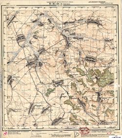
- Description:
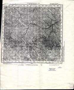
- 1930
- Subject:
- Topical Subject: Soviet Union, Topical Subject: Maps, and Geographic Subject: Pervomayskoye
- Publisher:
- Генеральный штаб Красной Армии
- Language:
- Russian
- Date Created:
- 1934
- Identifier:
- VAC9619-001544
- Genre:
- Topographic Maps and Military Maps
- Geographic Location:
- Coordinates: 52.8667, 33.5, 53, 33.75
- Related URL:
- Download GeoTIFF: https://drive.google.com/open?id=1jvWuFAQ4n_nl6IkEGFq_87wHlKtMxVO5 and Catalog URL: http://iucat.iu.edu/catalog/5020131
- Abstract:
- Modern area represented: Pervomayskoye, Bryansk oblast, Russia
- Call Number:
- G7000 s50 .S68 sheet N-36-116-A
- City:
- Пьяный Рог (Pyany Rog)
- Copyright Holder:
- No Copyright - United States
- Country:
- СССР (USSR)
- State/Province:
- РСФСР (RSFSR) and Орловская область (Oryol oblast)
- Physical Description:
- Scale: 1:50,000
- Persistent URL:
- http://purl.dlib.indiana.edu/iudl/images/VAC9619/VAC9619-001544
- Provenance:
- DMA Topographic Center, Army Map Service Library, OMAHA, Library of Congress Geography & Map Division
-
- Description:
- 1930
- Subject:
- Topical Subject: Soviet Union, Topical Subject: Maps, and Geographic Subject: Savostyany
- Publisher:
- Генеральный штаб Красной Армии
- Language:
- Russian
- Identifier:
- VAC9619-001542
- Genre:
- Topographic Maps and Military Maps
- Geographic Location:
- Coordinates: 52.6667, 33, 52.8667, 33.25
- Related URL:
- Catalog URL: http://iucat.iu.edu/catalog/5020131 and Download GeoTIFF: https://drive.google.com/open?id=1xd688Sbxc6dEaPv1wvCODUkKmmkIUIvR
- Abstract:
- Modern area represented: Savostyany, Bryansk oblast, Russia
- Call Number:
- G7000 s50 .S68 sheet N-36-115-C
- City:
- Севостьяны (Savostyany)
- Copyright Holder:
- No Copyright - United States
- Country:
- СССР (USSR)
- State/Province:
- РСФСР (RSFSR) and Орловская область (Oryol oblast)
- Physical Description:
- Scale: 1:50,000
- Persistent URL:
- http://purl.dlib.indiana.edu/iudl/images/VAC9619/VAC9619-001542
- Provenance:
- DMA Topographic Center, Army Map Service Library, Library of Congress Geography & Map Division
-
- Description:
- 1930
- Subject:
- Topical Subject: Maps, Geographic Subject: Karachev, and Topical Subject: Soviet Union
- Publisher:
- Генеральный штаб Красной Армии
- Language:
- Russian
- Date Created:
- 1934
- Identifier:
- VAC9619-001515
- Genre:
- Military Maps and Topographic Maps
- Geographic Location:
- Coordinates: 53, 34.75, 53.1667, 35
- Related URL:
- Download GeoTIFF: https://drive.google.com/open?id=1-vuslDMvcniebltWqDqKlpmiZ2TicsHw and Catalog URL: http://iucat.iu.edu/catalog/5020131
- Abstract:
- Modern area represented: Karachev, Bryansk oblast, Russia
- Call Number:
- G7000 s50 .S68 sheet N-36-106-D
- City:
- Карачев (Karachev)
- Copyright Holder:
- No Copyright - United States
- Country:
- СССР (USSR)
- State/Province:
- РСФСР (RSFSR) and Орловская область (Oryol oblast)
- Physical Description:
- Scale: 1:50,000
- Persistent URL:
- http://purl.dlib.indiana.edu/iudl/images/VAC9619/VAC9619-001515
- Provenance:
- Army Map Service Library, Library of Congress Geography & Map Division, OMAHA
-
- Description:
- 1930
- Subject:
- Topical Subject: Soviet Union, Topical Subject: Maps, and Geographic Subject: Verkhopolye
- Publisher:
- Генеральный штаб Красной Армии
- Language:
- Russian
- Date Created:
- 1934
- Identifier:
- VAC9619-001514
- Genre:
- Topographic Maps and Military Maps
- Geographic Location:
- Coordinates: 53, 34.5, 53.1667, 34.75
- Related URL:
- Catalog URL: http://iucat.iu.edu/catalog/5020131 and Download GeoTIFF: https://drive.google.com/open?id=1w15QboP6wPbee79SikaUleyski-x_Eeq
- Abstract:
- Modern area represented: Verkhopolye, Bryansk oblast, Russia
- Call Number:
- G7000 s50 .S68 sheet N-36-106-C
- City:
- Верхополье (Verkhopolye)
- Copyright Holder:
- No Copyright - United States
- Country:
- СССР (USSR)
- State/Province:
- Орловская область (Oryol oblast) and РСФСР (RSFSR)
- Physical Description:
- Scale: 1:50,000
- Persistent URL:
- http://purl.dlib.indiana.edu/iudl/images/VAC9619/VAC9619-001514
- Provenance:
- DMA Topographic Center, Army Map Service Library, OMAHA, Library of Congress Geography & Map Division
-
- Description:
- 1930
- Subject:
- Geographic Subject: Pesochnya, Topical Subject: Soviet Union, and Topical Subject: Maps
- Publisher:
- Генеральный штаб Красной Армии
- Language:
- Russian
- Date Created:
- 1934
- Identifier:
- VAC9619-001511
- Genre:
- Military Maps and Topographic Maps
- Geographic Location:
- Coordinates: 53.1667, 34.75, 53.3333, 35
- Related URL:
- Catalog URL: http://iucat.iu.edu/catalog/5020131 and Download GeoTIFF: https://drive.google.com/open?id=1Fv5hKojHT879CoFefVH-sXivVov9Vzam
- Abstract:
- Modern area represented: Pesochnya, Bryansk oblast, Russia
- Call Number:
- G7000 s50 .S68 sheet N-36-106-B
- City:
- Песочня (Pesochnya)
- Copyright Holder:
- No Copyright - United States
- Country:
- СССР (USSR)
- State/Province:
- РСФСР (RSFSR) and Орловская область (Oryol oblast)
- Physical Description:
- Scale: 1:50,000
- Persistent URL:
- http://purl.dlib.indiana.edu/iudl/images/VAC9619/VAC9619-001511
- Provenance:
- DMA Topographic Center, Army Map Service Library, Library of Congress Geography & Map Division
-
- Description:
- 1930
- Subject:
- Topical Subject: Maps, Topical Subject: Soviet Union, and Geographic Subject: Belyye Berega
- Publisher:
- Генеральный штаб Красной Армии
- Language:
- Russian
- Date Created:
- 1934
- Identifier:
- VAC9619-001510
- Genre:
- Military Maps and Topographic Maps
- Geographic Location:
- Coordinates: 53.1667, 34.5, 53.3333, 34.75
- Related URL:
- Catalog URL: http://iucat.iu.edu/catalog/5020131 and Download GeoTIFF: https://drive.google.com/open?id=1pDagSk-xo3nE1gX3nPO98PBZ011Xdi71
- Abstract:
- Modern area represented: Belyye Berega, Bryansk oblast, Russia
- Call Number:
- G7000 s50 .S68 sheet N-36-106-A
- City:
- Ст. Белые Берега (Belyye Berega)
- Copyright Holder:
- No Copyright - United States
- Country:
- СССР (USSR)
- State/Province:
- Орловская область (Oryol oblast) and РСФСР (RSFSR)
- Physical Description:
- Scale: 1:50,000
- Persistent URL:
- http://purl.dlib.indiana.edu/iudl/images/VAC9619/VAC9619-001510
- Provenance:
- DMA Topographic Center, Army Map Service Library, Library of Congress Geography & Map Division
-
- Description:
- 1926
- Subject:
- Topical Subject: Soviet Union, Topical Subject: Maps, and Geographic Subject: Mohács
- Publisher:
- Генеральный штаб Красной Армии
- Language:
- Russian
- Date Created:
- 1944
- Identifier:
- VAC9619-001479
- Genre:
- Topographic Maps and Military Maps
- Geographic Location:
- Coordinates: 45.6667, 18.5, 46, 19
- Related URL:
- Download GeoTIFF: https://drive.google.com/open?id=1QdSehiYsRTM-8M6JCSEAbNibcb9UlCAU and Catalog URL: https://iucat.iu.edu/catalog/5020129
- Abstract:
- Modern area represented: Mohács, Baranya county, Hungary
- Call Number:
- G7000 s100 .S7 sheet L-34-74
- City:
- Мохач (Mohács)
- Copyright Holder:
- No Copyright - United States
- Country:
- Югославия (Yugoslavia) and Венгрия (Hungary)
- Physical Description:
- Scale: 1:100,000
- Persistent URL:
- http://purl.dlib.indiana.edu/iudl/images/VAC9619/VAC9619-001479
- Provenance:
- DMA Topographic Center, Army Map Service Library, OMAHA, Atlasblatt, Library of Congress Geography & Map Division
-
- Description:
- 1894
- Subject:
- Topical Subject: Soviet Union, Geographic Subject: Szekszárd, and Topical Subject: Maps
- Publisher:
- Генеральный штаб Красной Армии
- Language:
- Russian
- Date Created:
- 1944
- Identifier:
- VAC9619-001477
- Genre:
- Military Maps and Topographic Maps
- Geographic Location:
- Coordinates: 46.3333, 18.5, 46.6667, 19
- Related URL:
- Catalog URL: https://iucat.iu.edu/catalog/5020129 and Download GeoTIFF: https://drive.google.com/open?id=1f6Ue5ljPNCKXFqdhIJsJgaIrBvs_E0iF
- Abstract:
- Modern area represented: Szekszárd, Tolna county, Hungary
- Call Number:
- G7000 s100 .S7 sheet L-34-50
- City:
- Сексард (Szekszárd)
- Copyright Holder:
- No Copyright - United States
- Country:
- Венгрия (Hungary)
- Physical Description:
- Scale: 1:100,000
- Persistent URL:
- http://purl.dlib.indiana.edu/iudl/images/VAC9619/VAC9619-001477
- Provenance:
- DMA Topographic Center, Army Map Service Library, OMAHA, Atlasblatt, Library of Congress Geography & Map Division
-
- Description:
- 1873
- Subject:
- Geographic Subject: Selyatyn, Topical Subject: Maps, and Topical Subject: Soviet Union
- Publisher:
- Генеральный штаб Красной Армии
- Language:
- Russian
- Date Created:
- 1939
- Identifier:
- VAC9619-001472
- Genre:
- Military Maps and Topographic Maps
- Geographic Location:
- Coordinates: 47.6667, 25, 48, 25.5
- Related URL:
- Download GeoTIFF: https://drive.google.com/open?id=1v6zIUxpzw2mb5AD7jE4-hVpFfWBpe8B8 and Catalog URL: https://iucat.iu.edu/catalog/5020129
- Abstract:
- Modern area represented: Selyatyn, Chernivtsi oblast, Ukraine
- Call Number:
- G7000 s100 .S7 sheet L-35-3
- Caption:
- Для служебного пользования
- City:
- Селетин (Selyatyn)
- Copyright Holder:
- No Copyright - United States
- Country:
- Румыния (Romania)
- State/Province:
- Украинская ССР (Ukrainian Soviet Socialist Republic) and Черновицкая область (Chernivtsi oblast)
- Physical Description:
- Scale: 1:100,000
- Persistent URL:
- http://purl.dlib.indiana.edu/iudl/images/VAC9619/VAC9619-001472
- Provenance:
- CIA Map Library
-

- Description:
- 1930
- Subject:
- Geographic Subject: Uleml, Topical Subject: Maps, and Topical Subject: Soviet Union
- Publisher:
- Генеральный штаб Красной Армии
- Language:
- Russian
- Identifier:
- VAC9619-001465
- Genre:
- Topographic Maps and Military Maps
- Geographic Location:
- Coordinates: 53.5, 34.5, 53.6667, 34.75
- Related URL:
- Catalog URL: http://iucat.iu.edu/catalog/5020131 and Download GeoTIFF: https://drive.google.com/open?id=1U2PXzsrgKahBGHM3IuYx6EP5TM3z_EsH
- Abstract:
- Modern area represented: Uleml, Kaluga, Russia
- Call Number:
- G7000 s50 .S68 sheet N-36-94-A
- City:
- Улемль (Uleml)
- Copyright Holder:
- No Copyright - United States
- Country:
- СССР (USSR)
- State/Province:
- Западная область (Western oblast) and РСФСР (RSFSR)
- Physical Description:
- Scale: 1:50,000
- Persistent URL:
- http://purl.dlib.indiana.edu/iudl/images/VAC9619/VAC9619-001465
- Provenance:
- Army Map Service Library, Library of Congress Geography & Map Division, OMAHA
-
- Description:
- 1930
- Subject:
- Topical Subject: Soviet Union, Geographic Subject: Dyatkovo, and Topical Subject: Maps
- Publisher:
- Генеральный штаб Красной Армии
- Language:
- Russian
- Date Created:
- 1934
- Identifier:
- VAC9619-001459
- Genre:
- Military Maps and Topographic Maps
- Geographic Location:
- Coordinates: 53.5, 34.25, 53.6667, 34.5
- Related URL:
- Catalog URL: http://iucat.iu.edu/catalog/5020131 and Download GeoTIFF: https://drive.google.com/open?id=1wkEkkdNcz7GldyTFuISJ1O-cn2bTNxDO
- Abstract:
- Modern area represented: Dyatkovo, Bryansk oblast, Russia
- Call Number:
- G7000 s50 .S68 sheet N-36-93-B
- City:
- Дятьково (Dyatkovo)
- Copyright Holder:
- No Copyright - United States
- Country:
- СССР (USSR)
- State/Province:
- Орловская область (Oryol oblast) and РСФСР (RSFSR)
- Physical Description:
- Scale: 1:50,000
- Persistent URL:
- http://purl.dlib.indiana.edu/iudl/images/VAC9619/VAC9619-001459
- Provenance:
- Army Map Service Library, Library of Congress Geography & Map Division, OMAHA
-
- Description:
- 1930
- Subject:
- Topical Subject: Maps, Topical Subject: Soviet Union, and Geographic Subject: Star
- Publisher:
- Генеральный штаб Красной Армии
- Language:
- Russian
- Identifier:
- VAC9619-001457
- Genre:
- Topographic Maps and Military Maps
- Geographic Location:
- Coordinates: 53.5, 34, 53.6667, 34.25
- Related URL:
- Catalog URL: http://iucat.iu.edu/catalog/5020131 and Download GeoTIFF: https://drive.google.com/open?id=1cwSkU0O5TqIj_1CEnBGyBnuygl-HrYzx
- Abstract:
- Modern area represented: Star, Russia
- Call Number:
- GM G7000 S50 .S68 N-36-93-A
- City:
- Старь (Star)
- Copyright Holder:
- No Copyright - United States
- Country:
- СССР (USSR)
- State/Province:
- РСФСР (RSFSR) and Западная область (Western oblast)
- Physical Description:
- Scale: 1:50,000
- Persistent URL:
- http://purl.dlib.indiana.edu/iudl/images/VAC9619/VAC9619-001457
- Provenance:
- Army Map Service Library, Library of Congress Geography & Map Division, OMAHA
-
- Description:
- 1930
- Subject:
- Topical Subject: Soviet Union, Geographic Subject: Ovstug, and Topical Subject: Maps
- Publisher:
- Генеральный штаб Красной Армии
- Language:
- Russian
- Date Created:
- 1934
- Identifier:
- VAC9619-001456
- Genre:
- Topographic Maps and Military Maps
- Geographic Location:
- Coordinates: 53.3333, 33.75, 53.5, 34
- Related URL:
- Download GeoTIFF: https://drive.google.com/open?id=1I6sKteDOcP8aB-wrlDx0H91c_nVlfZhD and Catalog URL: http://iucat.iu.edu/catalog/5020131
- Abstract:
- Modern area represented: Ovstug, Bryansk oblast, Russia
- Call Number:
- GM G7000 S50 .S68 N-36-92-Г
- City:
- Овстуг (Ovstug)
- Copyright Holder:
- No Copyright - United States
- Country:
- СССР (USSR)
- State/Province:
- РСФСР (RSFSR) and Орловская область (Oryol oblast)
- Physical Description:
- Scale: 1:50,000
- Persistent URL:
- http://purl.dlib.indiana.edu/iudl/images/VAC9619/VAC9619-001456
- Provenance:
- DMA Topographic Center, Army Map Service Library, Library of Congress Geography & Map Division
-
- Description:
- 1930
- Subject:
- Topical Subject: Soviet Union, Geographic Subject: Zhukovka, and Topical Subject: Maps
- Publisher:
- Генеральный штаб Красной Армии
- Language:
- Russian
- Date Created:
- 1934
- Identifier:
- VAC9619-001455
- Genre:
- Military Maps and Topographic Maps
- Geographic Location:
- Coordinates: 53.5, 33.5, 53.6667, 33.75
- Related URL:
- Download GeoTIFF: https://drive.google.com/open?id=1weURfFxzgvSsS3ue5gXFoe6joJn-NS4S and Catalog URL: http://iucat.iu.edu/catalog/5020131
- Abstract:
- Modern area represented: Zhukovka, Bryansk oblast, Russia
- Call Number:
- GM G7000 S50 .S68 N-36-92-A
- City:
- Жуковка (Zhukovka)
- Copyright Holder:
- No Copyright - United States
- Country:
- СССР (USSR)
- State/Province:
- Орловская область (Oryol oblast) and РСФСР (RSFSR)
- Physical Description:
- Scale: 1:50,000
- Persistent URL:
- http://purl.dlib.indiana.edu/iudl/images/VAC9619/VAC9619-001455
- Provenance:
- DMA Topographic Center, Army Map Service Library, OMAHA, Library of Congress Geography & Map Division
-
- Description:
- 1930
- Subject:
- Topical Subject: Soviet Union, Geographic Subject: Akulichi, and Topical Subject: Maps
- Publisher:
- Генеральный штаб Красной Армии
- Language:
- Russian
- Identifier:
- VAC9619-001454
- Genre:
- Military Maps and Topographic Maps
- Geographic Location:
- Coordinates: 53.3333, 33.25, 53.5, 33.5
- Related URL:
- Download GeoTIFF: https://drive.google.com/open?id=11jjoV3_-NKSU16yI4PsUEHocu5YYRnWC and Catalog URL: http://iucat.iu.edu/catalog/5020131
- Abstract:
- Modern area represented: Akulichi, Bryansk oblast, Russia
- Call Number:
- GM G7000 S50 .S68 N-36-91-Г
- City:
- Акуличи (Akulichi)
- Copyright Holder:
- No Copyright - United States
- Country:
- СССР (USSR)
- State/Province:
- Орловская область (Oryol oblast) and РСФСР (RSFSR)
- Physical Description:
- Scale: 1:50,000
- Persistent URL:
- http://purl.dlib.indiana.edu/iudl/images/VAC9619/VAC9619-001454
- Provenance:
- Army Map Service Library, Library of Congress Geography & Map Division, OMAHA
-
- Description:
- 1930
- Subject:
- Geographic Subject: Kletnya, Topical Subject: Soviet Union, and Topical Subject: Maps
- Publisher:
- Генеральный штаб Красной Армии
- Language:
- Russian
- Date Created:
- 1934
- Identifier:
- VAC9619-001453
- Genre:
- Topographic Maps and Military Maps
- Geographic Location:
- Coordinates: 53.3333, 33, 53.5, 33.25
- Related URL:
- Catalog URL: http://iucat.iu.edu/catalog/5020131 and Download GeoTIFF: https://drive.google.com/open?id=1oFXwGvIb9ojTDiTojklq9euajSXb2KgV
- Abstract:
- Modern area represented: Kletnya, Bryansk oblast, Russia
- Call Number:
- GM G7000 S50 .S68 N-36-91-В
- City:
- Клетня (Kletnya)
- Copyright Holder:
- No Copyright - United States
- Country:
- СССР (USSR)
- State/Province:
- Орловская область (Oryol oblast), РСФСР (RSFSR), and Смоленская область (Smolensk oblast)
- Physical Description:
- Scale: 1:50,000
- Persistent URL:
- http://purl.dlib.indiana.edu/iudl/images/VAC9619/VAC9619-001453
- Provenance:
- DMA Topographic Center, Army Map Service Library, Library of Congress Geography & Map Division
-
- Description:
- 1931
- Subject:
- Topical Subject: Maps, Topical Subject: Soviet Union, and Geographic Subject: Yershichi
- Publisher:
- Генеральный штаб Красной Армии
- Language:
- Russian
- Identifier:
- VAC9619-001448
- Genre:
- Military Maps and Topographic Maps
- Geographic Location:
- Coordinates: 53.5, 32.75, 53.6667, 33
- Related URL:
- Download GeoTIFF: https://drive.google.com/open?id=1Bl-SNPTfZQkf98UUKHhVOsJI1_LOzEdh and Catalog URL: http://iucat.iu.edu/catalog/5020131
- Abstract:
- Modern area represented: Yershichi, Smolensk oblast, Russia
- Call Number:
- GM G7000 S50 .S68 N-36-90-Б
- Caption:
- Для служебного пользования
- City:
- Ершичи (Yershichi)
- Copyright Holder:
- No Copyright - United States
- Country:
- СССР (USSR)
- State/Province:
- Западная область (Western oblast) and РСФСР (RSFSR)
- Physical Description:
- Scale: 1:50,000
- Persistent URL:
- http://purl.dlib.indiana.edu/iudl/images/VAC9619/VAC9619-001448
- Provenance:
- DMA Topographic Center, Army Map Service Library, OMAHA, Library of Congress Geography & Map Division
-
- Description:
- 1930
- Subject:
- Topical Subject: Maps, Geographic Subject: Slobodka, and Topical Subject: Soviet Union
- Publisher:
- Генеральный штаб Красной Армии
- Language:
- Russian
- Identifier:
- VAC9619-001422
- Genre:
- Military Maps and Topographic Maps
- Geographic Location:
- Coordinates: 53.833, 34.75, 54, 35
- Related URL:
- Download GeoTIFF: https://drive.google.com/open?id=1ibplItmCSV4IKnWbdaTGlQcY36HhnhPY and Catalog URL: http://iucat.iu.edu/catalog/5020131
- Abstract:
- Modern area represented: Slobodka, Kaluga oblast, Russia
- Call Number:
- GM G7000 S50 .S68 N-36-82-Б
- City:
- Слободка (Slobodka)
- Copyright Holder:
- No Copyright - United States
- Country:
- СССР (USSR)
- State/Province:
- РСФСР (RSFSR) and Западная область (Western oblast)
- Physical Description:
- Scale: 1:50,000
- Persistent URL:
- http://purl.dlib.indiana.edu/iudl/images/VAC9619/VAC9619-001422
- Provenance:
- DMA Topographic Center, Army Map Service Library, OMAHA, Library of Congress Geography & Map Division
-

- Description:
- 1930
- Subject:
- Topical Subject: Maps, Topical Subject: Soviet Union, and Geographic Subject: Sukreml
- Publisher:
- Генеральный штаб Красной Армии
- Language:
- Russian
- Identifier:
- VAC9619-001420
- Genre:
- Topographic Maps and Military Maps
- Geographic Location:
- Coordinates: 53.667, 34.25, 53.833, 34.5
- Related URL:
- Catalog URL: http://iucat.iu.edu/catalog/5020131 and Download GeoTIFF: https://drive.google.com/open?id=1gsbyY25Dl8kUgEhpHYFe8phG0chVou_F
- Abstract:
- Modern area represented: Sukreml, Kaluga oblast, Russia
- Call Number:
- GM G7000 S50 .S68 N-36-81-Г
- City:
- Сукремль (Sukreml)
- Copyright Holder:
- No Copyright - United States
- Country:
- СССР (USSR)
- State/Province:
- Орловская область (Oryol oblast) and РСФСР (RSFSR)
- Physical Description:
- Scale: 1:50,000
- Persistent URL:
- http://purl.dlib.indiana.edu/iudl/images/VAC9619/VAC9619-001420
- Provenance:
- DMA Topographic Center, Army Map Service Library, OMAHA, Library of Congress Geography & Map Division
-
- Description:
- 1931
- Subject:
- Topical Subject: Soviet Union, Topical Subject: Maps, and Geographic Subject: Miloslavichi
- Publisher:
- Генеральный штаб Красной Армии
- Language:
- Russian
- Identifier:
- VAC9619-001412
- Genre:
- Topographic Maps and Military Maps
- Geographic Location:
- Coordinates: 53.667, 32.25, 53.833, 32.5
- Related URL:
- Download GeoTIFF: https://drive.google.com/open?id=1zL-EXnQlM5IdgJLn6CzPa4qZntRBCB8i and Catalog URL: http://iucat.iu.edu/catalog/5020131
- Abstract:
- Modern area represented: Miloslavichi, Mogilev oblast, Belarus
- Call Number:
- GM G7000 S50 .S68 N-36-77-Г
- City:
- Милославичи (Miloslavichi)
- Copyright Holder:
- No Copyright - United States
- Country:
- СССР (USSR)
- State/Province:
- Западная область (Western oblast), Белорусская ССР (Byelorussian Soviet Socialist Republic), and РСФСР (RSFSR)
- Physical Description:
- Scale: 1:50,000
- Persistent URL:
- http://purl.dlib.indiana.edu/iudl/images/VAC9619/VAC9619-001412
- Provenance:
- DMA Topographic Center, Army Map Service Library, Library of Congress Geography & Map Division
-
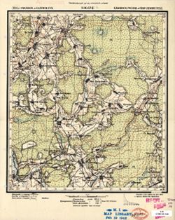
- Description:
- 1924
- Subject:
- Topical Subject: Soviet Union, Geographic Subject: Vederniki, and Topical Subject: Maps
- Publisher:
- Генеральный штаб Красной Армии
- Language:
- Russian
- Identifier:
- VAC9619-001387
- Genre:
- Military Maps and Topographic Maps
- Geographic Location:
- Coordinates: 54.167, 33.25, 54.333, 33.5
- Related URL:
- Download GeoTIFF: https://drive.google.com/open?id=1L55BGJb_yPuVGc6ltY5kP7yi6c9Fs5fa and Catalog URL: http://iucat.iu.edu/catalog/5020131
- Abstract:
- Modern area represented: Vederniki, Smolensk oblast, Russia
- Call Number:
- GM G7000 S50 .S68 N-36-67-Б
- Copyright Holder:
- No Copyright - United States
- Country:
- СССР (USSR)
- State/Province:
- РСФСР (RSFSR), Калужская область (Kaluga oblast), and Смоленская область (Smolensk oblast)
- Physical Description:
- Scale: 1:50,000
- Persistent URL:
- http://purl.dlib.indiana.edu/iudl/images/VAC9619/VAC9619-001387
- Provenance:
- M. I. Map Library, Atlasblatt, Library of Congress Geography & Map Division
-
- Description:
- 1924
- Subject:
- Topical Subject: Maps, Geographic Subject: Berdebyaki, and Topical Subject: Soviet Union
- Publisher:
- Генеральный штаб Красной Армии
- Language:
- Russian
- Identifier:
- VAC9619-001343
- Genre:
- Military Maps and Topographic Maps
- Geographic Location:
- Coordinates: 54.333, 32.5, 54.5, 32.75
- Related URL:
- Download GeoTIFF: https://drive.google.com/open?id=1wbQHX77EAN2QXSvOol7LV4dVscuKxIQc and Catalog URL: http://iucat.iu.edu/catalog/5020131
- Abstract:
- Modern area represented: Berdebyaki, Smolensk oblast, Russia
- Call Number:
- GM G7000 S50 .S68 N-36-54-B
- Copyright Holder:
- No Copyright - United States
- Country:
- СССР (USSR)
- State/Province:
- Смоленская губерния (Smolensk guberniya)
- Physical Description:
- Scale: 1:50,000
- Persistent URL:
- http://purl.dlib.indiana.edu/iudl/images/VAC9619/VAC9619-001343
- Provenance:
- DMA Topographic Center, Army Map Service Library, OMAHA, Library of Congress Geography & Map Division
-
- Description:
- 1924
- Subject:
- Topical Subject: Maps, Geographic Subject: Molokovo, and Topical Subject: Soviet Union
- Publisher:
- Генеральный штаб Красной Армии
- Language:
- Russian
- Date Created:
- 1926
- Identifier:
- VAC9619-001339
- Genre:
- Military Maps and Topographic Maps
- Geographic Location:
- Coordinates: 54.333, 32, 54.5, 32.25
- Related URL:
- Download GeoTIFF: https://drive.google.com/open?id=1v8ZESt8-7E0bW54BUsEES8PNQwN5GI48 and Catalog URL: http://iucat.iu.edu/catalog/5020131
- Abstract:
- Modern area represented: Molokovo, Smolensk oblast, Russia
- Call Number:
- GM G7000 S50 .S68 N-36-53-B
- City:
- Молоково (Molokovo)
- Copyright Holder:
- No Copyright - United States
- Country:
- СССР (USSR)
- State/Province:
- РСФСР (RSFSR) and Смоленская область (Smolensk oblast)
- Physical Description:
- Scale: 1:50,000
- Persistent URL:
- http://purl.dlib.indiana.edu/iudl/images/VAC9619/VAC9619-001339
- Provenance:
- DMA Topographic Center, Army Map Service Library, OMAHA, Library of Congress Geography & Map Division
-
- Description:
- 1929
- Subject:
- Topical Subject: Maps, Topical Subject: Soviet Union, and Geographic Subject: Sombor
- Publisher:
- Генеральный штаб Красной Армии
- Language:
- Russian
- Date Created:
- 1944
- Identifier:
- VAC9619-001000
- Genre:
- Topographic Maps and Military Maps
- Geographic Location:
- Coordinates: 45.6667, 19, 46, 19.5
- Related URL:
- Download GeoTIFF: https://drive.google.com/open?id=1vXpbAT1tpVWfKTjnf35CvwThcOGi5mrf and Catalog URL: https://iucat.iu.edu/catalog/5020129
- Abstract:
- Modern area represented: Sombor, Vojvodina province, Serbia
- Call Number:
- G7000 s100 .S7 sheet L-34-75
- City:
- Сомбор (Sombor)
- Copyright Holder:
- No Copyright - United States
- Country:
- Югославия (Yugoslavia) and Венгрия (Hungary)
- Physical Description:
- Scale: 1:100,000
- Persistent URL:
- http://purl.dlib.indiana.edu/iudl/images/VAC9619/VAC9619-001000
- Provenance:
- DMA Topographic Center, Army Map Service Library, Library of Congress Geography & Map Division, Atlasblatt
-

- Subject:
- Geographic Subject: Trostyanets, Topical Subject: Maps, and Topical Subject: Soviet Union
- Publisher:
- Генеральный штаб Красной Армии
- Language:
- Russian
- Date Created:
- 1941
- Identifier:
- VAC9619-000970
- Genre:
- Topographic Maps and Military Maps
- Geographic Location:
- Coordinates: 50.333333, 34.75, 50.5, 35.0
- Related URL:
- Catalog URL: http://iucat.iu.edu/catalog/5020131 and Download GeoTIFF: https://drive.google.com/open?id=1gc3NDRG7ImgHIVSQULYVrcANQDfApPkL
- Abstract:
- Modern area represented: Trostyanets, Sumy oblast, Ukraine
- Call Number:
- G7000 s50 .S68 sheet M-36-58-D
- Caption:
- Для служебного пользования
- City:
- Тростянец (Trostyanets)
- Copyright Holder:
- No Copyright - United States
- Country:
- СССР (USSR)
- State/Province:
- Украинская ССР (Ukrainian Soviet Socialist Republic) and Сумская область (Sumy oblast)
- Physical Description:
- Scale: 1:50,000
- Persistent URL:
- http://purl.dlib.indiana.edu/iudl/images/VAC9619/VAC9619-000970
- Provenance:
- DMA Topographic Center, Army Map Service Library, OMAHA, Library of Congress Geography & Map Division
-
- Subject:
- Topical Subject: Soviet Union, Geographic Subject: Byshkin, and Topical Subject: Maps
- Publisher:
- Генеральный штаб Красной Армии
- Language:
- Russian
- Identifier:
- VAC9619-000969
- Genre:
- Military Maps and Topographic Maps
- Geographic Location:
- Coordinates: 50.5, 34.5, 50.666667, 34.75
- Related URL:
- Download GeoTIFF: https://drive.google.com/open?id=1CaVr1wU5c0Wbye4EiV7w9MBvKySXEzxS and Catalog URL: http://iucat.iu.edu/catalog/5020131
- Abstract:
- Modern area represented: Byshkin, Sumy oblast, Ukraine
- Call Number:
- G7000 s50 .S68 sheet M-36-58-A
- Caption:
- Для служебного пользования
- City:
- Бишкинь (Bishkin)
- Copyright Holder:
- No Copyright - United States
- Country:
- СССР (USSR)
- State/Province:
- Сумская область (Sumy oblast) and Украинская ССР (Ukrainian Soviet Socialist Republic)
- Physical Description:
- Scale: 1:50,000
- Persistent URL:
- http://purl.dlib.indiana.edu/iudl/images/VAC9619/VAC9619-000969
- Provenance:
- DMA Topographic Center, Army Map Service Library, OMAHA, Library of Congress Geography & Map Division
-
- Subject:
- Topical Subject: Maps, Topical Subject: Soviet Union, and Geographic Subject: Krasnaya Yaruga
- Publisher:
- Генеральный штаб Красной Армии
- Language:
- Russian
- Date Created:
- 1942
- Identifier:
- VAC9619-000959
- Genre:
- Military Maps and Topographic Maps
- Geographic Location:
- Coordinates: 50.666667, 35.5, 50.833333, 35.75
- Related URL:
- Download GeoTIFF: https://drive.google.com/open?id=1BJIPfz02R2AFxruama-IzsC5YbGAZYgh and Catalog URL: http://iucat.iu.edu/catalog/5020131
- Abstract:
- Modern area represented: Krasnaya Yaruga, Belgorod oblast, Russia
- Call Number:
- G7000 s50 .S68 sheet M-36-48-C
- Caption:
- Для служебного пользования
- City:
- Красная Яруга (Krasnaya Yaruga)
- Copyright Holder:
- No Copyright - United States
- Country:
- СССР (USSR)
- State/Province:
- РСФСР (RSFSR) and Курская область (Kursk oblast)
- Physical Description:
- Scale: 1:50,000
- Persistent URL:
- http://purl.dlib.indiana.edu/iudl/images/VAC9619/VAC9619-000959
- Provenance:
- DMA Topographic Center, Army Map Service Library, Library of Congress Geography & Map Division
-
- Subject:
- Topical Subject: Soviet Union, Geographic Subject: Vilshana, and Topical Subject: Maps
- Publisher:
- Генеральный штаб Красной Армии
- Language:
- Russian
- Identifier:
- VAC9619-000958
- Genre:
- Military Maps and Topographic Maps
- Geographic Location:
- Coordinates: 50.666667, 34.0, 50.833333, 34.25
- Related URL:
- Download GeoTIFF: https://drive.google.com/open?id=170err1VYZTEPcmdT0jHPEnFBq7It5W8U and Catalog URL: http://iucat.iu.edu/catalog/5020131
- Abstract:
- Modern area represented: Vilshana, Sumy oblast, Ukraine
- Call Number:
- G7000 s50 .S68 sheet M-36-45-C
- Caption:
- Для служебного пользования
- City:
- Ольшана (Olshana)
- Copyright Holder:
- No Copyright - United States
- Country:
- СССР (USSR)
- State/Province:
- Украинская ССР (Ukrainian Soviet Socialist Republic) and Сумская область (Sumy oblast)
- Physical Description:
- Scale: 1:50,000
- Persistent URL:
- http://purl.dlib.indiana.edu/iudl/images/VAC9619/VAC9619-000958
- Provenance:
- DMA Topographic Center, Army Map Service Library, OMAHA, Library of Congress Geography & Map Division
-

- Description:
- 1938
- Subject:
- Topical Subject: Maps, Geographic Subject: Tovste, and Topical Subject: Soviet Union
- Publisher:
- Генеральный штаб Красной Армии
- Language:
- Russian
- Date Created:
- 1941
- Identifier:
- VAC9619-000956
- Genre:
- Topographic Maps and Military Maps
- Geographic Location:
- Coordinates: 50.83333, 34.0, 51.0, 34.25
- Related URL:
- Download GeoTIFF: https://drive.google.com/open?id=18NrtybSlEFYo6Cbg2zvy_2BEv4G6o9PT and Catalog URL: http://iucat.iu.edu/catalog/5020131
- Abstract:
- Modern area represented: Tovste, Sumy oblast, Ukraine
- Call Number:
- G7000 s50 .S68 sheet M-36-45-A
- Caption:
- Для служебного пользования
- City:
- Толстое (Tolstoe)
- Copyright Holder:
- No Copyright - United States
- Country:
- СССР (USSR)
- State/Province:
- Украинская ССР (Ukrainian Soviet Socialist Republic) and Сумская область (Sumy oblast)
- Physical Description:
- Scale: 1:50,000
- Persistent URL:
- http://purl.dlib.indiana.edu/iudl/images/VAC9619/VAC9619-000956
- Provenance:
- DMA Topographic Center, Army Map Service Library, OMAHA, Library of Congress Geography & Map Division
-
- Description:
- 1939
- Subject:
- Topical Subject: Soviet Union, Topical Subject: Maps, and Geographic Subject: Шерекино (Sherekino)
- Publisher:
- Генеральный штаб Красной Армии
- Language:
- Russian
- Date Created:
- 1941
- Identifier:
- VAC9619-000928
- Genre:
- Military Maps and Topographic Maps
- Geographic Location:
- Coordinates: 51.5, 35, 51.6667, 35.25
- Related URL:
- Download GeoTIFF: https://drive.google.com/open?id=1XH0YQW-4oSKl33cfPH4ETGiTYGet-1Pw and Catalog URL: http://iucat.iu.edu/catalog/5020131
- Abstract:
- Modern area represented: Шерекино (Sherekino), Kursk oblast, Russia
- Call Number:
- G7000 s50 .S68 sheet M-36-23-A
- Caption:
- Для служебного пользования
- City:
- Шерекино (Sherekino)
- Copyright Holder:
- No Copyright - United States
- Country:
- СССР (USSR)
- State/Province:
- РСФСР (RSFSR) and Курская область (Kursk oblast)
- Physical Description:
- Scale: 1:50,000
- Persistent URL:
- http://purl.dlib.indiana.edu/iudl/images/VAC9619/VAC9619-000928
- Provenance:
- DMA Topographic Center, Army Map Service Library, OMAHA, Library of Congress Geography & Map Division
-
- Subject:
- Topical Subject: Soviet Union, Topical Subject: Maps, and Geographic Subject: Крупец (Krupets)
- Publisher:
- Генеральный штаб Красной Армии
- Language:
- Russian
- Identifier:
- VAC9619-000926
- Genre:
- Military Maps and Topographic Maps
- Geographic Location:
- Coordinates: 51.5, 34.25, 51.6667, 34.5
- Related URL:
- Download GeoTIFF: https://drive.google.com/open?id=1lKCs38QnoEF--X-FqVtkL0coGC8vDfh_ and Catalog URL: http://iucat.iu.edu/catalog/5020131
- Abstract:
- Modern area represented: Крупец (Krupets), Kurskaya oblast, Russia
- Call Number:
- G7000 s50 .S68 sheet M-36-21-B
- Caption:
- Для служебного пользования
- City:
- Крупец (Krupets)
- Copyright Holder:
- No Copyright - United States
- Country:
- СССР (USSR)
- State/Province:
- Украинская ССР (Ukrainian Soviet Socialist Republic), РСФСР (RSFSR), Курская область (Kursk oblast), and Сумская область (Sumy oblast)
- Physical Description:
- Scale: 1:50,000
- Persistent URL:
- http://purl.dlib.indiana.edu/iudl/images/VAC9619/VAC9619-000926
- Provenance:
- DMA Topographic Center, Army Map Service Library, OMAHA, Library of Congress Geography & Map Division
-
- Description:
- 1933
- Subject:
- Topical Subject: Soviet Union, Geographic Subject: В’язенка (V'yazenka), and Topical Subject: Maps
- Publisher:
- Генеральный штаб Красной Армии
- Language:
- Russian
- Date Created:
- 1942
- Identifier:
- VAC9619-000925
- Genre:
- Topographic Maps and Military Maps
- Geographic Location:
- Coordinates: 51.3333, 33.75, 51.5, 34
- Related URL:
- Catalog URL: http://iucat.iu.edu/catalog/5020131 and Download GeoTIFF: https://drive.google.com/open?id=1oxdOE7vZvax9I-GTIAlhROXl25X7Nmfj
- Abstract:
- Modern area represented: В’язенка (V'yazenka), Sumy Oblast, Ukraine
- Call Number:
- G7000 s50 .S68 sheet M-36-20-D
- Caption:
- Для служебного пользования
- City:
- Вязенка (Vyazenka)
- Copyright Holder:
- No Copyright - United States
- Country:
- СССР (USSR)
- State/Province:
- Сумская область (Sumy oblast) and Украинская ССР (Ukrainian Soviet Socialist Republic)
- Physical Description:
- Scale: 1:50,000
- Persistent URL:
- http://purl.dlib.indiana.edu/iudl/images/VAC9619/VAC9619-000925
- Provenance:
- DMA Topographic Center, Army Map Service Library, OMAHA, Geographic Names Branch, Library of Congress Geography & Map Division
-
- Description:
- 1939
- Subject:
- Topical Subject: Soviet Union, Topical Subject: Maps, and Geographic Subject: Зазірки (Zazirky)
- Publisher:
- Генеральный штаб Красной Армии
- Language:
- Russian
- Date Created:
- 1941
- Identifier:
- VAC9619-000924
- Genre:
- Military Maps and Topographic Maps
- Geographic Location:
- Coordinates: 51.3333, 33.5, 51.5, 33.75
- Related URL:
- Download GeoTIFF: https://drive.google.com/open?id=1VLeUNunQjzxHKvV63WpBJpDtbTIuUJ85 and Catalog URL: http://iucat.iu.edu/catalog/5020131
- Abstract:
- Modern area represented: Зазірки (Zazirky), Sumy Oblast, Ukraine
- Call Number:
- G7000 s50 .S68 sheet M-36-20-C
- Caption:
- Для служебного пользования
- City:
- Зазирки (Zazirki)
- Copyright Holder:
- No Copyright - United States
- Country:
- СССР (USSR)
- State/Province:
- Украинская ССР (Ukrainian Soviet Socialist Republic) and Сумская область (Sumy oblast)
- Physical Description:
- Scale: 1:50,000
- Persistent URL:
- http://purl.dlib.indiana.edu/iudl/images/VAC9619/VAC9619-000924
- Provenance:
- DMA Topographic Center, Army Map Service Library, Library of Congress Geography & Map Division
-
- Description:
- 1939
- Subject:
- Geographic Subject: Капыстичи (Kapystichi), Topical Subject: Soviet Union, and Topical Subject: Maps
- Publisher:
- Генеральный штаб Красной Армии
- Language:
- Russian
- Date Created:
- 1941
- Identifier:
- VAC9619-000908
- Genre:
- Topographic Maps and Military Maps
- Geographic Location:
- Coordinates: 51.6667, 34.75, 51.8333, 35
- Related URL:
- Download GeoTIFF: https://drive.google.com/open?id=1z7DDXNNUDp0rN1_wVnl0iVUfvnukBl4B and Catalog URL: http://iucat.iu.edu/catalog/5020131
- Abstract:
- Modern area represented: Капыстичи (Kapystichi), Kurskaya oblast, Russia
- Call Number:
- G7000 s50 .S68 sheet M-36-10-D
- Caption:
- Для служебного пользования
- City:
- Капустичи (Kapustichi)
- Copyright Holder:
- No Copyright - United States
- Country:
- СССР (USSR)
- State/Province:
- Курская область (Kursk oblast) and РСФСР (RSFSR)
- Physical Description:
- Scale: 1:50,000
- Persistent URL:
- http://purl.dlib.indiana.edu/iudl/images/VAC9619/VAC9619-000908
- Provenance:
- DMA Topographic Center, Army Map Service Library, OMAHA, Library of Congress Geography & Map Division
-
- Description:
- 1940
- Subject:
- Geographic Subject: Большое Долженково (Bol'shoye Dolzhenkovo), Topical Subject: Soviet Union, and Topical Subject: Maps
- Publisher:
- Генеральный штаб Красной Армии
- Language:
- Russian
- Date Created:
- 1942
- Identifier:
- VAC9619-000909
- Genre:
- Military Maps and Topographic Maps
- Geographic Location:
- Coordinates: 51.6667, 35.75, 51.8333, 36
- Related URL:
- Download GeoTIFF: https://drive.google.com/open?id=1I_PZoicERa23WIF-eI38Fy6a-63UULx5 and Catalog URL: http://iucat.iu.edu/catalog/5020131
- Abstract:
- Modern area represented: Большое Долженково (Bol'shoye Dolzhenkovo), Kurskaya oblast, Russia
- Call Number:
- G7000 s50 .S68 sheet M-36-12-D
- Caption:
- Для служебного пользования
- City:
- Большое Должонково (Bol'shoye Dolzhonkovo)
- Copyright Holder:
- No Copyright - United States
- Country:
- СССР (USSR)
- State/Province:
- РСФСР (RSFSR) and Курская область (Kursk oblast)
- Physical Description:
- Scale: 1:50,000
- Persistent URL:
- http://purl.dlib.indiana.edu/iudl/images/VAC9619/VAC9619-000909
- Provenance:
- DMA Topographic Center, Army Map Service Library, OMAHA, Library of Congress Geography & Map Division
-
- Description:
- 1939
- Subject:
- Topical Subject: Soviet Union, Topical Subject: Maps, and Geographic Subject: Хомутовка (Khomutovka)
- Publisher:
- Генеральный штаб Красной Армии
- Language:
- Russian
- Date Created:
- 1941
- Identifier:
- VAC9619-000906
- Genre:
- Military Maps and Topographic Maps
- Geographic Location:
- Coordinates: 51.8333, 34.5, 52, 34.75
- Related URL:
- Catalog URL: http://iucat.iu.edu/catalog/5020131 and Download GeoTIFF: https://drive.google.com/open?id=1zRz69blepfjelo1KuRfCkbhDcWhmlfs-
- Abstract:
- Modern area represented: Хомутовка (Khomutovka), Kurskaya oblast, Russia
- Call Number:
- G7000 s50 .S68 sheet M-36-10-А
- Caption:
- Для служебного пользования
- City:
- Хомутовка (Khomutovka)
- Copyright Holder:
- No Copyright - United States
- Country:
- СССР (USSR)
- State/Province:
- РСФСР (RSFSR) and Курская область (Kursk oblast)
- Physical Description:
- Scale: 1:50,000
- Persistent URL:
- http://purl.dlib.indiana.edu/iudl/images/VAC9619/VAC9619-000906
- Provenance:
- Library of Congress Geography & Map Division
-
- Description:
- 1912
- Subject:
- Geographic Subject: Anderyān, Topical Subject: Soviet Union, and Topical Subject: Maps
- Publisher:
- Генеральный штаб Красной Армии
- Language:
- Russian
- Date Created:
- 1941
- Identifier:
- VAC9619-000902
- Genre:
- Military Maps and Topographic Maps
- Geographic Location:
- Coordinates: 38.3333, 46, 38.6667, 46.5
- Related URL:
- Download GeoTIFF: https://drive.google.com/open?id=1k0PqIMTiLBMqIzYfFeLhXaA2eT4gzNX1 and Catalog URL: https://iucat.iu.edu/catalog/5020129
- Abstract:
- Modern area represented: Anderyān, East Azerbaijan, Iran
- Call Number:
- G7000 s100 .S7 sheet J-38-57
- Caption:
- Временное издание
- City:
- Андырджан (Andergan)
- Copyright Holder:
- No Copyright - United States
- Country:
- Иран (Iran)
- Physical Description:
- Scale: 1:100,000
- Persistent URL:
- http://purl.dlib.indiana.edu/iudl/images/VAC9619/VAC9619-000902
- Provenance:
- DMA Topographic Center, Army Map Service Library, OMAHA, Library of Congress Geography & Map Division, Auswärtiges Amt. Geographischer Dienst
-
- Description:
- 1881
- Subject:
- Topical Subject: Maps, Geographic Subject: Bytom, and Topical Subject: Soviet Union
- Publisher:
- Генеральный штаб Красной Армии
- Language:
- Russian
- Date Created:
- 1940
- Identifier:
- VAC9619-004221
- Genre:
- Topographic Maps and Military Maps
- Geographic Location:
- Coordinates: 50.33333, 18.5, 50.66667, 19.0
- Related URL:
- Catalog URL: https://iucat.iu.edu/catalog/5020129 and Download GeoTIFF: https://drive.google.com/file/d/1ECBUIcdumZkVhUYVW1ciTwpzQrNkm8dg/view?usp=sharing
- Abstract:
- Modern area represented: Bytom, Silesia, Poland
- Call Number:
- G7000 s100 .S7 sheet M-34-50
- City:
- Беутен (Beuthen)
- Copyright Holder:
- No Copyright - United States
- Country:
- Германия (Germany)
- State/Province:
- Область государственных интересов Германии (Region of German state interests)
- Physical Description:
- Scale: 1:100,000
- Persistent URL:
- http://purl.dlib.indiana.edu/iudl/images/VAC9619/VAC9619-004221
- Provenance:
- DMA Topographic Center, Auswärtiges Amt. Geographischer Dienst, OMAHA, Army Map Service Library
-
- Description:
- 1937
- Subject:
- Topical Subject: Soviet Union, Geographic Subject: Dmitriyev-Lgovsky, and Topical Subject: Maps
- Publisher:
- Генеральный штаб Красной Армии
- Language:
- Russian
- Date Created:
- 1941
- Identifier:
- VAC9619-004218
- Genre:
- Military Maps and Topographic Maps
- Geographic Location:
- Coordinates: 52, 35, 52.333, 35.5
- Related URL:
- Download GeoTIFF: https://drive.google.com/file/d/1OU-PVQJtaPUnp5IG0TGZRRUM5u8JC2BC/view?usp=sharing and Catalog URL: https://iucat.iu.edu/catalog/5020129
- Abstract:
- Modern area represented: Dmitriyev-Lgovsky, Kursk oblast, Russia
- Call Number:
- G7000 s100 .S7 sheet N-36-143
- City:
- Дмитриев (Dmitriyev)
- Copyright Holder:
- No Copyright - United States
- Country:
- СССР (USSR)
- State/Province:
- Курская область (Kursk oblast) and РСФСР (RSFSR)
- Physical Description:
- Scale: 1:100,000
- Persistent URL:
- http://purl.dlib.indiana.edu/iudl/images/VAC9619/VAC9619-004218
- Provenance:
- DMA Topographic Center, Army Map Service Library, Atlasblatt
-
- Description:
- 1938
- Subject:
- Topical Subject: Soviet Union, Topical Subject: Maps, and Geographic Subject: Seredyna-Buda
- Publisher:
- Генеральный штаб Красной Армии
- Language:
- Russian
- Date Created:
- 1940
- Identifier:
- VAC9619-004217
- Genre:
- Military Maps and Topographic Maps
- Geographic Location:
- Coordinates: 52, 34, 52.333, 34.5
- Related URL:
- Download GeoTIFF: https://drive.google.com/file/d/12CMl-5dr0jrOhTKQkJToT1jgUDsmInld/view?usp=sharing and Catalog URL: https://iucat.iu.edu/catalog/5020129
- Abstract:
- Modern area represented: Seredyna-Buda, Sumy oblast, Ukraine
- Call Number:
- G7000 s100 .S7 sheet N-36-141
- City:
- Середина-Буда (Seredyna-Buda)
- Copyright Holder:
- No Copyright - United States
- Country:
- СССР (USSR)
- State/Province:
- РСФСР (RSFSR) and Украинская ССР (Ukrainian Soviet Socialist Republic)
- Physical Description:
- Scale: 1:100,000
- Persistent URL:
- http://purl.dlib.indiana.edu/iudl/images/VAC9619/VAC9619-004217
- Provenance:
- Army Map Service Library, Library of Congress G & M Division
-
- Description:
- 1930
- Subject:
- Topical Subject: Soviet Union, Topical Subject: Maps, and Geographic Subject: Novyy Ropsk
- Publisher:
- Генеральный штаб Красной Армии
- Language:
- Russian
- Identifier:
- VAC9619-004214
- Genre:
- Military Maps and Topographic Maps
- Geographic Location:
- Coordinates: 52, 32, 52.333, 32.5
- Related URL:
- Catalog URL: https://iucat.iu.edu/catalog/5020129 and Download GeoTIFF: https://drive.google.com/file/d/1ygDvmMikKrimtW0Ij306dCFLQr69wqQR/view?usp=sharing
- Abstract:
- Modern area represented: Novyy Ropsk, Bryansk oblast, Russia
- Call Number:
- G7000 s100 .S7 sheet N-36-137
- City:
- Новый Ропск (Novyy Ropsk)
- Copyright Holder:
- No Copyright - United States
- Country:
- СССР (USSR)
- State/Province:
- Украинская ССР (Ukrainian Soviet Socialist Republic), РСФСР (RSFSR), Орловская область (Oryol oblast), and Черниговская область (Chernihiv oblast)
- Physical Description:
- Scale: 1:100,000
- Persistent URL:
- http://purl.dlib.indiana.edu/iudl/images/VAC9619/VAC9619-004214
- Provenance:
- DMA Topographic Center, Army Map Service Library, OMAHA, Library of Congress Geography & Map Division
-

- Description:
- 1923
- Subject:
- Topical Subject: Maps, Topical Subject: Soviet Union, and Geographic Subject: Ogorodnya
- Publisher:
- Генеральный штаб Красной Армии
- Language:
- Russian
- Date Created:
- 1941
- Identifier:
- VAC9619-004213
- Genre:
- Topographic Maps and Military Maps
- Geographic Location:
- Coordinates: 52, 31.5, 52.333, 32
- Related URL:
- Download GeoTIFF: https://drive.google.com/file/d/1MuU_oyIyusePmX5IlnPsAE4zUOKWaE3e/view?usp=sharing and Catalog URL: https://iucat.iu.edu/catalog/5020129
- Abstract:
- Modern area represented: Ogorodnya, Homyel voblasc, Belarus
- Call Number:
- G7000 s100 .S7 sheet N-36-136
- City:
- Огородня-Гомельская (Ogorodnya-Gomelskaya)
- Copyright Holder:
- No Copyright - United States
- Country:
- СССР (USSR)
- State/Province:
- Орловская область (Oryol oblast), Украинская ССР (Ukrainian Soviet Socialist Republic), Белорусская ССР (Byelorussian Soviet Socialist Republic), Черниговска...
- Physical Description:
- Scale: 1:100,000
- Persistent URL:
- http://purl.dlib.indiana.edu/iudl/images/VAC9619/VAC9619-004213
- Provenance:
- DMA Topographic Center, Army Map Service Library
-
- Description:
- 1937
- Subject:
- Topical Subject: Soviet Union, Geographic Subject: Trosna, and Topical Subject: Maps
- Publisher:
- Генеральный штаб Красной Армии
- Language:
- Russian
- Date Created:
- 1941
- Identifier:
- VAC9619-004210
- Genre:
- Topographic Maps and Military Maps
- Geographic Location:
- Coordinates: 52.333, 35.5, 52.667, 36
- Related URL:
- Download GeoTIFF: https://drive.google.com/file/d/1SObrMdlPW93jIi7PNPWF7rb-NcZPRbX-/view?usp=sharing and Catalog URL: https://iucat.iu.edu/catalog/5020129
- Abstract:
- Modern area represented: Trosna, Oryol oblast, Russia
- Call Number:
- G7000 s100 .S7 sheet N-36-132
- City:
- Тросна (Trosna)
- Copyright Holder:
- No Copyright - United States
- Country:
- СССР (USSR)
- State/Province:
- Курская область (Kursk oblast), РСФСР (RSFSR), and Орловская область (Oryol oblast)
- Physical Description:
- Scale: 1:100,000
- Persistent URL:
- http://purl.dlib.indiana.edu/iudl/images/VAC9619/VAC9619-004210
- Provenance:
- DMA Topographic Center, Auswärtiges Amt. Geographischer Dienst, OMAHA, Army Map Service Library, Library of Congress Geography & Map Division
-
- Description:
- 1929
- Subject:
- Topical Subject: Maps, Geographic Subject: Kholmech, and Topical Subject: Soviet Union
- Publisher:
- Генеральный штаб Красной Армии
- Language:
- Russian
- Identifier:
- VAC9619-004212
- Genre:
- Military Maps and Topographic Maps
- Geographic Location:
- Coordinates: 52, 30.5, 52.333, 31
- Related URL:
- Download GeoTIFF: https://drive.google.com/file/d/1sZ4E0O2ydGxqDYrqDX_B7C6U3DK1jkmT/view?usp=sharing and Catalog URL: https://iucat.iu.edu/catalog/5020129
- Abstract:
- Modern area represented: Kholmech, Homyel oblast, Belarus
- Call Number:
- G7000 s100 .S7 sheet N-36-134
- City:
- Холмечь (Kholmech)
- Copyright Holder:
- No Copyright - United States
- Country:
- СССР (USSR)
- State/Province:
- Белорусская ССР (Byelorussian Soviet Socialist Republic)
- Physical Description:
- Scale: 1:100,000
- Persistent URL:
- http://purl.dlib.indiana.edu/iudl/images/VAC9619/VAC9619-004212
- Provenance:
- DMA Topographic Center, Army Map Service Library, Geographic Names Branch, OMAHA, Library of Congress Geography & Map Division
-
- Description:
- 1937
- Subject:
- Topical Subject: Soviet Union, Geographic Subject: Dmitrovsk-Orlovskiy, and Topical Subject: Maps
- Publisher:
- Генеральный штаб Красной Армии
- Language:
- Russian
- Date Created:
- 1941
- Identifier:
- VAC9619-004209
- Genre:
- Military Maps and Topographic Maps
- Geographic Location:
- Coordinates: 52.333, 35, 52.667, 35.5
- Related URL:
- Download GeoTIFF: https://drive.google.com/file/d/109bdr_Kvs4aWF_lC7_XhQ3-WPlXh0_9r/view?usp=sharing and Catalog URL: https://iucat.iu.edu/catalog/5020129
- Abstract:
- Modern area represented: Dmitrovsk-Orlovskiy, Oryol oblast, Russia
- Call Number:
- G7000 s100 .S7 sheet N-36-131
- City:
- Дмитровск (Dmitrovsk-Orlovskiy)
- Copyright Holder:
- No Copyright - United States
- Country:
- СССР (USSR)
- State/Province:
- Орловская область (Oryol oblast), Курская область (Kursk oblast), and РСФСР (RSFSR)
- Physical Description:
- Scale: 1:100,000
- Persistent URL:
- http://purl.dlib.indiana.edu/iudl/images/VAC9619/VAC9619-004209
- Provenance:
- DMA Topographic Center, Army Map Service Library, Geographic Names Branch, Atlasblatt
-
- Description:
- 1937
- Subject:
- Geographic Subject: Lokot, Topical Subject: Soviet Union, and Topical Subject: Maps
- Publisher:
- Генеральный штаб Красной Армии
- Language:
- Russian
- Date Created:
- 1941
- Identifier:
- VAC9619-004208
- Genre:
- Military Maps and Topographic Maps
- Geographic Location:
- Coordinates: 52.333, 34.5, 52.667, 35
- Related URL:
- Download GeoTIFF: https://drive.google.com/file/d/1dYlbw4GTkP_oEsATxRiDM_A91PnKgqrP/view?usp=sharing and Catalog URL: https://iucat.iu.edu/catalog/5020129
- Abstract:
- Modern area represented: Lokot, Bryansk oblast, Russia
- Call Number:
- G7000 s100 .S7 sheet N-36-130
- City:
- Локоть (Lokot)
- Copyright Holder:
- No Copyright - United States
- Country:
- СССР (USSR)
- State/Province:
- Курская область (Kursk oblast), Орловская область (Oryol oblast), and РСФСР (RSFSR)
- Physical Description:
- Scale: 1:100,000
- Persistent URL:
- http://purl.dlib.indiana.edu/iudl/images/VAC9619/VAC9619-004208
- Provenance:
- DMA Topographic Center, Army Map Service Library, OMAHA, Library of Congress Geography & Map Division
-
- Description:
- 1940
- Subject:
- Geographic Subject: Trubchevsk, Topical Subject: Maps, and Topical Subject: Soviet Union
- Publisher:
- Генеральный штаб Красной Армии
- Language:
- Russian
- Date Created:
- 1941
- Identifier:
- VAC9619-004206
- Genre:
- Military Maps and Topographic Maps
- Geographic Location:
- Coordinates: 52.333, 33.5, 52.667, 34
- Related URL:
- Catalog URL: https://iucat.iu.edu/catalog/5020129 and Download GeoTIFF: https://drive.google.com/file/d/1VkrmyXpFWgso3CTd3fcWSVtTAO3Bp7U5/view?usp=sharing
- Abstract:
- Modern area represented: Trubchevsk, Bryansk oblast, Russia
- Call Number:
- G7000 s100 .S7 sheet N-36-128
- City:
- Трубчевск (Trubchevsk)
- Copyright Holder:
- No Copyright - United States
- Country:
- СССР (USSR)
- State/Province:
- Орловская область (Oryol oblast), Украинская ССР (Ukrainian Soviet Socialist Republic), Сумская область (Sumy oblast), and РСФСР (RSFSR)
- Physical Description:
- Scale: 1:100,000
- Persistent URL:
- http://purl.dlib.indiana.edu/iudl/images/VAC9619/VAC9619-004206
- Provenance:
- DMA Topographic Center, Auswärtiges Amt. Geographischer Dienst, OMAHA, Army Map Service Library
-
- Description:
- 1940
- Subject:
- Topical Subject: Soviet Union, Topical Subject: Maps, and Geographic Subject: Kokorevka
- Publisher:
- Генеральный штаб Красной Армии
- Language:
- Russian
- Date Created:
- 1941
- Identifier:
- VAC9619-004207
- Genre:
- Military Maps and Topographic Maps
- Geographic Location:
- Coordinates: 52.333, 34, 52.667, 34.5
- Related URL:
- Download GeoTIFF: https://drive.google.com/file/d/1CdDXPK4iRkp14Oevzjr2qlP9hpMw0YQ_/view?usp=sharing and Catalog URL: https://iucat.iu.edu/catalog/5020129
- Abstract:
- Modern area represented: Kokorevka, Bryansk oblast, Russia
- Call Number:
- G7000 s100 .S7 sheet N-36-129
- City:
- Кокоревка (Kokorevka)
- Copyright Holder:
- No Copyright - United States
- Country:
- СССР (USSR)
- State/Province:
- РСФСР (RSFSR) and Орловская область (Oryol oblast)
- Physical Description:
- Scale: 1:100,000
- Persistent URL:
- http://purl.dlib.indiana.edu/iudl/images/VAC9619/VAC9619-004207
- Provenance:
- DMA Topographic Center, Army Map Service Library, Geographic Names Branch, OMAHA
-

- Description:
- 1940
- Subject:
- Geographic Subject: Pogar, Topical Subject: Soviet Union, and Topical Subject: Maps
- Publisher:
- Генеральный штаб Красной Армии
- Language:
- Russian
- Date Created:
- 1941
- Identifier:
- VAC9619-004205
- Genre:
- Military Maps and Topographic Maps
- Geographic Location:
- Coordinates: 52.333, 33, 52.667, 33.5
- Related URL:
- Download GeoTIFF: https://drive.google.com/file/d/1-kvEoKectn1YvqFHYD5S7pgdDRdK7MO_/view?usp=sharing and Catalog URL: https://iucat.iu.edu/catalog/5020129
- Abstract:
- Modern area represented: Pogar, bryansk Oblast, Russia
- Call Number:
- G7000 s100 .S7 sheet N-36-127
- City:
- Погар (Pogar)
- Copyright Holder:
- No Copyright - United States
- Country:
- СССР (USSR)
- State/Province:
- Орловская область (Oryol oblast), Украинская ССР (Ukrainian Soviet Socialist Republic), РСФСР (RSFSR), Черниговская область (Chernihiv oblast), and Сумская о...
- Physical Description:
- Scale: 1:100,000
- Persistent URL:
- http://purl.dlib.indiana.edu/iudl/images/VAC9619/VAC9619-004205
- Provenance:
- DMA Topographic Center, Army Map Service Library, OMAHA
-
- Description:
- 1923
- Subject:
- Topical Subject: Soviet Union, Geographic Subject: Klimovo, and Topical Subject: Maps
- Publisher:
- Генеральный штаб Красной Армии
- Language:
- Russian
- Date Created:
- 1941
- Identifier:
- VAC9619-004204
- Genre:
- Topographic Maps and Military Maps
- Geographic Location:
- Coordinates: 52.333, 32, 52.667, 32.5
- Related URL:
- Download GeoTIFF: https://drive.google.com/file/d/1Zb60MqhS8TeDqZFeikIrdV6AmkbqBHg4/view?usp=sharing and Catalog URL: https://iucat.iu.edu/catalog/5020129
- Abstract:
- Modern area represented: Klimovo, Bryansk oblast, Russia
- Call Number:
- G7000 s100 .S7 sheet N-36-125
- City:
- Климово (Klimovo)
- Copyright Holder:
- No Copyright - United States
- Country:
- СССР (USSR)
- State/Province:
- Орловская область (Oryol oblast) and РСФСР (RSFSR)
- Physical Description:
- Scale: 1:100,000
- Persistent URL:
- http://purl.dlib.indiana.edu/iudl/images/VAC9619/VAC9619-004204
- Provenance:
- DMA Topographic Center, Army Map Service Library
