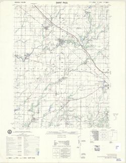
Geographic Subject: Bartholomew County (Ind.), Geographic Subject: Rush County (Ind.), Geographic Subject: Decatur County (Ind.), and Geographic Subject: She...
Creator:
United States. Defense Mapping Agency. Hydrographic/Topographic Center and Geological Survey (U.S.)
Publisher:
United States. Army Map Service
Date Created:
1979
Identifier:
VAC3073-M-01443
Genre:
Quadrangle maps, Topographic maps, and 15 minute topographic maps
Printed with vegetation. Prepared by the U.S. Geological Survey for publication by the Defense Mapping Agency Hydrographic/Topographic Center. Variant tit...
Call Number:
G4090 s50 .U5 Saint Paul 1979 V
Caption:
Imprint: Reston, Virginia : Geological Survey, [1983] and Imprint: Washington, D.C. : Defense Mapping Agency, Hydrographic/Topographic Center, [1983]
Physical Description:
Dimensions: 56 x 45 cm or smaller and Scale: 1:50,000
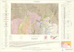
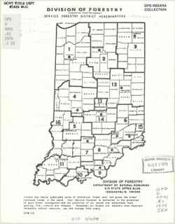
Indiana. Geological Survey, Bleuer, N. K. (Ned Kermit), 1943-, Lineback, Jerry A. (Jerry Alvin), Hill, John R,, Gray, Henry Hamilton, 1922-, and Illinois Sta...
Publisher:
Indiana. Geological Survey
Date Created:
1979
Identifier:
VAC3073-M-01251
Genre:
Quadrangle maps, Geological maps, and Geological cross-sections
Indianapolis sheet. 1979 edition. Transverse Mercator projection. Geology compiled by H. H. Gray (Indiana) and J. A. Lineback (Illinois) from published and o...
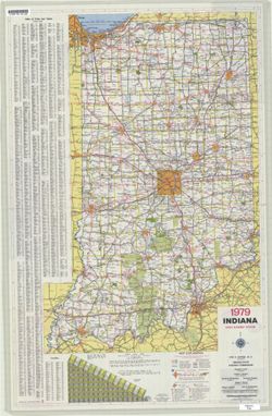
Panel title: Indiana 1979 official highway map. Relief shown by spot heights. Includes index, distance chart, and text. Text, indexed chart of state recreati...
Call Number:
G1403 .S7 1979
Caption:
Imprint: Indianapolis : Indiana State Highway Commission, [1979]
Physical Description:
Scale: Approximately 1:633,600 and Dimensions: 94 x 59 cm
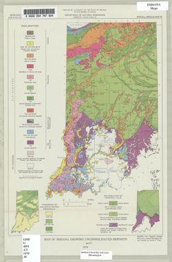
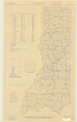
"Modified from Regional Geologic Map Series, Indiana Geological Survey." Includes insets of "Thickness of unconsolidated materials" and &...
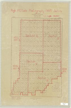
Topical Subject: Aerial photographs and Geographic Subject: Indiana
Creator:
Geological Survey (U.S.). Eastern Mapping Center
Publisher:
Geological Survey (U.S.). Eastern Mapping Center
Date Created:
1979
Identifier:
VAC3073-M-00378
Genre:
Thematic maps and Index maps
Geographic Location:
Coordinates: W0880700 W0844500 N0414500 N0375200
Related URL:
Catalog URL: https://iucat.iu.edu/catalog/5325128
Abstract:
Blue line print. "March 1978." Hand annotated in red ink to show High altitude photography (HAP) sectors for photography in 1977 and 1979 with nota...