
Search Constraints
You searched for:
Provenance
DMA Topographic Center, Army Map Service Library, OMAHA
Remove constraint Provenance: DMA Topographic Center, Army Map Service Library, OMAHA
« Previous |
1 - 100 of 416
|
Next »
Search Results
-
- Description:
- 1940
- Subject:
- Geographic Subject: Yavoriv, Topical Subject: Soviet Union, and Topical Subject: Maps
- Publisher:
- Генеральный штаб Красной Армии
- Language:
- Russian
- Date Created:
- 1944
- Identifier:
- VAC9619-003017
- Genre:
- Topographic Maps and Military Maps
- Geographic Location:
- Coordinates: 49.667, 23, 50, 23.5
- Related URL:
- Catalog URL: https://iucat.iu.edu/catalog/5020129 and Download GeoTIFF: https://drive.google.com/file/d/1HD8uB8w-zuGEnlXBdd8WK2LuwWXZ_Ryt/view?usp=sharing
- Abstract:
- Modern area represented: Yavoriv, Lviv oblast, Ukraine
- Call Number:
- G7000 s100 .S7 sheet M-34-83
- Caption:
- Для служебного пользования
- City:
- Яворов (Yavoriv)
- Copyright Holder:
- No Copyright - United States
- Country:
- СССР (USSR)
- State/Province:
- Украинская ССР (Ukrainian Soviet Socialist Republic), Дрогобычская область (Drohobych oblast), and Львовская область (Lviv oblast)
- Physical Description:
- Scale: 1:100,000
- Persistent URL:
- http://purl.dlib.indiana.edu/iudl/images/VAC9619/VAC9619-003017
- Provenance:
- DMA Topographic Center, Army Map Service Library, OMAHA
-
- Description:
- 1874
- Subject:
- Topical Subject: Soviet Union, Topical Subject: Maps, and Geographic Subject: Horodok
- Publisher:
- Генеральный штаб Красной Армии
- Language:
- Russian
- Date Created:
- 1944
- Identifier:
- VAC9619-003019
- Genre:
- Military Maps and Topographic Maps
- Geographic Location:
- Coordinates: 49.667, 23.5, 50, 24
- Related URL:
- Catalog URL: https://iucat.iu.edu/catalog/5020129 and Download GeoTIFF: https://drive.google.com/file/d/1Zi3_SNdgW5DBQ3nBbEZsprfVc7U05mGs/view?usp=sharing
- Abstract:
- Modern area represented: Horodok, Lviv oblast, Ukraine
- Call Number:
- G7000 s100 .S7 sheet M-34-84
- Caption:
- Для служебного пользования
- City:
- Грудек Ягельоньски (Gródek Jagielloński)
- Copyright Holder:
- No Copyright - United States
- Country:
- СССР (USSR)
- State/Province:
- Львовская область (Lviv oblast) and Украинская ССР (Ukrainian Soviet Socialist Republic)
- Physical Description:
- Scale: 1:100,000
- Persistent URL:
- http://purl.dlib.indiana.edu/iudl/images/VAC9619/VAC9619-003019
- Provenance:
- DMA Topographic Center, Army Map Service Library, OMAHA
-

- Description:
- 1940
- Subject:
- Geographic Subject: Ozerna, Topical Subject: Soviet Union, and Topical Subject: Maps
- Publisher:
- Генеральный штаб Красной Армии
- Language:
- Russian
- Date Created:
- 1943
- Identifier:
- VAC9619-003229
- Genre:
- Topographic Maps and Military Maps
- Geographic Location:
- Coordinates: 49.333, 25, 49.667, 25.5
- Related URL:
- Catalog URL: https://iucat.iu.edu/catalog/5020129 and Download GeoTIFF: https://drive.google.com/file/d/1oIhAEtx39Pisvi07LTRsFECGV7AUA1t0/view?usp=sharing
- Abstract:
- Modern area represented: Ozerna, Ternopil oblast, Ukraine
- Call Number:
- G7000 s100 .S7 sheet M-35-87
- Caption:
- Для служебного пользования
- City:
- Езерна (Ozerna)
- Copyright Holder:
- No Copyright - United States
- Country:
- СССР (USSR)
- State/Province:
- Тернопольская область (Ternopil oblast) and Украинская ССР (Ukrainian Soviet Socialist Republic)
- Physical Description:
- Scale: 1:100,000
- Persistent URL:
- http://purl.dlib.indiana.edu/iudl/images/VAC9619/VAC9619-003229
- Provenance:
- DMA Topographic Center, Army Map Service Library, OMAHA
-
- Subject:
- Geographic Subject: Preiļi, Topical Subject: Soviet Union, and Topical Subject: Maps
- Publisher:
- Генеральный штаб Красной Армии
- Language:
- Russian
- Date Created:
- 1943
- Identifier:
- VAC9619-003217
- Genre:
- Topographic Maps and Military Maps
- Geographic Location:
- Coordinates: 56, 26.5, 56.333, 27
- Related URL:
- Catalog URL: https://iucat.iu.edu/catalog/5020129 and Download GeoTIFF: https://drive.google.com/file/d/122uTDLQNdv52YZhDQXz2EeROojKj5_8Q/view?usp=sharing
- Abstract:
- Modern area represented: Прейли (Preiļi), Latvia
- Call Number:
- G7000 s100 .S7 sheet O-35-138
- Caption:
- Для служебного пользования and Captured map
- City:
- Прейли (Preiļi)
- Copyright Holder:
- No Copyright - United States
- Country:
- СССР (USSR)
- State/Province:
- Латвийская ССР (Latvian Soviet Socialist Republic)
- Physical Description:
- Scale: 1:100,000
- Persistent URL:
- http://purl.dlib.indiana.edu/iudl/images/VAC9619/VAC9619-003217
- Provenance:
- DMA Topographic Center, Army Map Service Library, OMAHA
-
- Description:
- 1931
- Subject:
- Topical Subject: Maps, Geographic Subject: Donetsk, Geographic Subject: Kalmiuske, and Topical Subject: Soviet Union
- Publisher:
- Генеральный штаб Красной Армии
- Language:
- Russian
- Date Created:
- 1942
- Identifier:
- VAC9619-002004
- Genre:
- Topographic Maps and Military Maps
- Geographic Location:
- Coordinates: 47.3333, 39, 47.6667, 39.5
- Related URL:
- Download GeoTIFF: https://drive.google.com/open?id=1NZxwosLYVa9EAJO1rvzTEoZMt-K31pfv and Catalog URL: https://iucat.iu.edu/catalog/5020129
- Abstract:
- Modern area represented: Кальміуське (Kalmiuske), Donetsk, Ukraine
- Call Number:
- G7000 s100 .S7 sheet L-37-17
- Caption:
- Для cлужебного пользования
- City:
- Каракубстрой (Karakubstroy)
- Copyright Holder:
- No Copyright - United States
- Country:
- СССР (USSR)
- State/Province:
- Украинская ССР (Ukrainian Soviet Socialist Republic), Сталинская область (Stalino oblast), Ростовская область (Rostov oblast), and РСФСР (RSFSR)
- Physical Description:
- Scale: 1:100,000
- Persistent URL:
- http://purl.dlib.indiana.edu/iudl/images/VAC9619/VAC9619-002004
- Provenance:
- DMA Topographic Center, Army Map Service Library, OMAHA
-
- Description:
- 1941
- Subject:
- Topical Subject: Maps, Geographic Subject: Zimnyatskiy, and Topical Subject: Soviet Union
- Publisher:
- Генеральный штаб Красной Армии
- Language:
- Russian
- Date Created:
- 1942
- Identifier:
- VAC9619-003412
- Genre:
- Military Maps and Topographic Maps
- Geographic Location:
- Coordinates: 49.667, 42.5, 50, 43
- Related URL:
- Catalog URL: https://iucat.iu.edu/catalog/5020129 and Download GeoTIFF: https://drive.google.com/file/d/1q_AeD7k13JW_DXMeMLlinHDmFTbUx0Xl/view?usp=sharing
- Abstract:
- Modern area represented: Zimnyatskiy, Volgograd oblast, Russia
- Call Number:
- G7000 s100 .S7 sheet M-38-74
- Caption:
- Для служебного пользования
- City:
- Зимняцкий (Zimnyatskiy)
- Copyright Holder:
- No Copyright - United States
- Country:
- СССР (USSR)
- State/Province:
- РСФСР (RSFSR) and Сталинградская область (Stalingrad oblast)
- Physical Description:
- Scale: 1:100,000
- Persistent URL:
- http://purl.dlib.indiana.edu/iudl/images/VAC9619/VAC9619-003412
- Provenance:
- DMA Topographic Center, Army Map Service Library, OMAHA
-

- Description:
- 1938
- Subject:
- Topical Subject: Maps, Geographic Subject: Krasnogvardeyskoe, and Topical Subject: Soviet Union
- Publisher:
- Главное управление геодезии и картографии при СНК СССР
- Language:
- Russian
- Date Created:
- 1941
- Identifier:
- VAC9619-002343
- Genre:
- Topographic Maps and Military Maps
- Geographic Location:
- Coordinates: 45.667, 41.5, 46, 42
- Related URL:
- Download GeoTIFF: https://drive.google.com/file/d/1AVr-cwCpH2TyChEw-jxKdVkFJnNQ8ff2/view?usp=sharing and Catalog URL: https://iucat.iu.edu/catalog/5020129
- Abstract:
- Modern area represented: Krasnogvardeyskoe, Stavropol kray, Russia
- Call Number:
- G7000 s100 .S7 sheet L-37-84
- Caption:
- Для служебного пользования
- City:
- Молотовское (Molotovskoe)
- Copyright Holder:
- No Copyright - United States
- Country:
- СССР (USSR)
- State/Province:
- Орджоникидзевский край (Ordzhonikidze kray), Калмыцкая АССР (Kalmyk Autonomous Soviet Socialist Republic), Ростовская область (Rostov oblast), and РСФСР (RSFSR)
- Physical Description:
- Scale: 1:100,000
- Persistent URL:
- http://purl.dlib.indiana.edu/iudl/images/VAC9619/VAC9619-002343
- Provenance:
- DMA Topographic Center, Army Map Service Library, OMAHA
-

- Description:
- 1939
- Subject:
- Topical Subject: Maps, Geographic Subject: Yukhnov, and Topical Subject: Soviet Union
- Publisher:
- Генеральный штаб Красной Армии
- Language:
- Russian
- Date Created:
- 1941
- Identifier:
- VAC9619-004187
- Genre:
- Topographic Maps and Military Maps
- Geographic Location:
- Coordinates: 54.667, 35, 55, 35.5
- Related URL:
- Download GeoTIFF: https://drive.google.com/file/d/1cQNBivSSzsjyVCwoyr6v2BrCZDWttVf4/view?usp=sharing and Catalog URL: https://iucat.iu.edu/catalog/5020129
- Abstract:
- Modern area represented: Yukhnov, Kaluga oblast, Russia
- Call Number:
- G7000 s100 .S7 sheet N-36-47
- City:
- Юхнов (Yukhnov)
- Copyright Holder:
- No Copyright - United States
- Country:
- СССР (USSR)
- State/Province:
- Смоленская область (Smolensk oblast) and РСФСР (RSFSR)
- Physical Description:
- Scale: 1:100,000
- Persistent URL:
- http://purl.dlib.indiana.edu/iudl/images/VAC9619/VAC9619-004187
- Provenance:
- DMA Topographic Center, Army Map Service Library, OMAHA
-

- Description:
- 1939
- Subject:
- Topical Subject: Soviet Union, Geographic Subject: Karmanovo, and Topical Subject: Maps
- Publisher:
- Генеральный штаб Красной Армии
- Language:
- Russian
- Date Created:
- 1941
- Identifier:
- VAC9619-004150
- Genre:
- Topographic Maps and Military Maps
- Geographic Location:
- Coordinates: 55.667, 34.5, 56, 35
- Related URL:
- Download GeoTIFF: https://drive.google.com/file/d/1gODnEnCNkJ7LsHO8wwP5guFmkhqszNsR/view?usp=sharing and Catalog URL: https://iucat.iu.edu/catalog/5020129
- Abstract:
- Modern area represented: Karmanovo, Russia
- Call Number:
- G7000 s100 .S7 sheet N-36-10
- City:
- Карманово (Karmanovo)
- Copyright Holder:
- No Copyright - United States
- Country:
- СССР (USSR)
- State/Province:
- РСФСР (RSFSR), Калининская область (Kalinin oblast), and Смоленская область (Smolensk oblast)
- Physical Description:
- Scale: 1:100,000
- Persistent URL:
- http://purl.dlib.indiana.edu/iudl/images/VAC9619/VAC9619-004150
- Provenance:
- DMA Topographic Center, Army Map Service Library, OMAHA
-
- Description:
- 1930
- Subject:
- Topical Subject: Soviet Union, Geographic Subject: Navlya, and Topical Subject: Maps
- Publisher:
- Генеральный штаб Красной Армии
- Language:
- Russian
- Date Created:
- 1941
- Identifier:
- VAC9619-004196
- Genre:
- Military Maps and Topographic Maps
- Geographic Location:
- Coordinates: 52.667, 34, 53, 34.5
- Related URL:
- Download GeoTIFF: https://drive.google.com/file/d/12YHzNYr3tdcPK9AY8xD-otjolRp85ej1/view?usp=sharing and Catalog URL: https://iucat.iu.edu/catalog/5020129
- Abstract:
- Modern area represented: Navlya, Bryansk oblast, Russia
- Call Number:
- G7000 s100 .S7 sheet N-36-117
- City:
- Навля (Navlya)
- Copyright Holder:
- No Copyright - United States
- Country:
- СССР (USSR)
- State/Province:
- Орловская область (Oryol oblast) and РСФСР (RSFSR)
- Physical Description:
- Scale: 1:100,000
- Persistent URL:
- http://purl.dlib.indiana.edu/iudl/images/VAC9619/VAC9619-004196
- Provenance:
- DMA Topographic Center, Army Map Service Library, OMAHA
-
- Description:
- 1938
- Subject:
- Topical Subject: Soviet Union, Topical Subject: Maps, and Geographic Subject: Novoselki
- Publisher:
- Главное управление геодезии и картографии при СНК СССР
- Language:
- Russian
- Date Created:
- 1941
- Identifier:
- VAC9619-003506
- Genre:
- Military Maps and Topographic Maps
- Geographic Location:
- Coordinates: 56, 33.5, 56.167, 33.75
- Related URL:
- Catalog URL: http://iucat.iu.edu/catalog/5020131 and Download GeoTIFF: https://drive.google.com/file/d/1vVOP92j0feg7jZkHpknICQM830yuWRdh/view?usp=sharing
- Abstract:
- Modern area represented: Новоселки (Novoselki), Tverskaya oblast, Russia
- Call Number:
- GM G7000 s50 .S68 sheet O-36-140-C
- City:
- Новоселки (Novoselki)
- Copyright Holder:
- No Copyright - United States
- Country:
- СССР (USSR)
- State/Province:
- Калининская область (Kalinin oblast) and Оленинский район (Oleninsky district)
- Physical Description:
- Scale: 1:50,000
- Persistent URL:
- http://purl.dlib.indiana.edu/iudl/images/VAC9619/VAC9619-003506
- Provenance:
- DMA Topographic Center, Army Map Service Library, OMAHA
-
- Description:
- 1923
- Subject:
- Topical Subject: Soviet Union, Topical Subject: Maps, and Geographic Subject: Beryslav
- Publisher:
- Генеральный штаб Красной Армии
- Language:
- Russian
- Date Created:
- 1941
- Identifier:
- VAC9619-001887
- Genre:
- Topographic Maps and Military Maps
- Geographic Location:
- Coordinates: 46.6667, 33, 47, 33.5
- Related URL:
- Catalog URL: https://iucat.iu.edu/catalog/5020129 and Download GeoTIFF: https://drive.google.com/open?id=15CCT7KeDTW2OAhyErSFxC6JA8ziWovVn
- Abstract:
- Modern area represented: Beryslav, Kherson oblast, Ukraine
- Call Number:
- G7000 s100 .S7 sheet L-36-43
- Caption:
- Для служебного пользования
- City:
- Берислав (Beryslav)
- Copyright Holder:
- No Copyright - United States
- Country:
- СССР (USSR)
- State/Province:
- Николаевская область (Mykolaiv oblast) and Украинская ССР (Ukrainian Soviet Socialist Republic)
- Physical Description:
- Scale: 1:100,000
- Persistent URL:
- http://purl.dlib.indiana.edu/iudl/images/VAC9619/VAC9619-001887
- Provenance:
- DMA Topographic Center, Army Map Service Library, OMAHA
-
- Subject:
- Topical Subject: Soviet Union, Topical Subject: Maps, and Geographic Subject: Balabanovo
- Publisher:
- Генеральный штаб Красной Армии
- Language:
- Russian
- Date Created:
- 1941
- Identifier:
- VAC9619-003086
- Genre:
- Topographic Maps and Military Maps
- Geographic Location:
- Coordinates: 55, 36.5, 55.333, 37
- Related URL:
- Download GeoTIFF: https://drive.google.com/file/d/1umSkZYiTU3_H_GUy1keqlTU6TjHL6FVN/view?usp=sharing and Catalog URL: https://iucat.iu.edu/catalog/5020129
- Abstract:
- Modern area represented: Балабаново (Balabanovo), Kaluzhskaya oblast, Russia
- Call Number:
- G7000 s100 .S7 sheet N-37-26
- Caption:
- Captured map
- City:
- Балабаново (Balabanovo)
- Copyright Holder:
- No Copyright - United States
- Country:
- СССР (USSR)
- State/Province:
- РСФСР (RSFSR) and Московская область (Moscow oblast)
- Physical Description:
- Scale: 1:100,000
- Persistent URL:
- http://purl.dlib.indiana.edu/iudl/images/VAC9619/VAC9619-003086
- Provenance:
- DMA Topographic Center, Army Map Service Library, OMAHA
-
- Description:
- 1939
- Subject:
- Geographic Subject: Lyuban, Topical Subject: Maps, and Topical Subject: Soviet Union
- Publisher:
- Главное управление геодезии и картографии при СНК СССР
- Language:
- Russian
- Date Created:
- 1941
- Identifier:
- VAC9619-002124
- Genre:
- Military Maps and Topographic Maps
- Geographic Location:
- Coordinates: 59.3333, 31, 59.6667, 31.5
- Related URL:
- Download GeoTIFF: https://drive.google.com/open?id=1XoMqH9A81q94V0iQ2ZXQ0WNYxt3K5y4j and Catalog URL: https://iucat.iu.edu/catalog/5020129
- Abstract:
- Modern area represented: Lyuban, Leningrad oblast, Russia
- Call Number:
- G7000 s100 .S7 sheet O-36-15
- Caption:
- Для служебного пользования
- City:
- Любань (Lyuban)
- Copyright Holder:
- No Copyright - United States
- Country:
- СССР (USSR)
- State/Province:
- РСФСР (RSFSR) and Ленинградская область (Leningrad oblast)
- Physical Description:
- Scale: 1:100,000
- Persistent URL:
- http://purl.dlib.indiana.edu/iudl/images/VAC9619/VAC9619-002124
- Provenance:
- DMA Topographic Center, Army Map Service Library, OMAHA
-
- Description:
- 1939
- Subject:
- Topical Subject: Soviet Union, Topical Subject: Maps, and Geographic Subject: Kolpino
- Publisher:
- Генеральный штаб Красной Армии
- Language:
- Russian
- Date Created:
- 1941
- Identifier:
- VAC9619-002118
- Genre:
- Military Maps and Topographic Maps
- Geographic Location:
- Coordinates: 59.6667, 30.5, 60, 31
- Related URL:
- Download GeoTIFF: https://drive.google.com/open?id=1IDeO-8za9YAR09P-vqrkzEiQwncTMJQr and Catalog URL: https://iucat.iu.edu/catalog/5020129
- Abstract:
- Modern area represented: Kolpino, Russia
- Call Number:
- G7000 s100 .S7 sheet O-36-2
- Caption:
- Секретно
- City:
- Колпино (Kolpino)
- Copyright Holder:
- No Copyright - United States
- Country:
- СССР (USSR)
- State/Province:
- РСФСР (RSFSR) and Ленинградская область (Leningrad oblast)
- Physical Description:
- Scale: 1:100,000
- Persistent URL:
- http://purl.dlib.indiana.edu/iudl/images/VAC9619/VAC9619-002118
- Provenance:
- DMA Topographic Center, Army Map Service Library, OMAHA
-
- Description:
- 1938
- Subject:
- Topical Subject: Maps, Geographic Subject: Andreyevskoye, and Topical Subject: Soviet Union
- Publisher:
- Генеральный штаб Красной Армии
- Language:
- Russian
- Date Created:
- 1941
- Identifier:
- VAC9619-004159
- Genre:
- Topographic Maps and Military Maps
- Geographic Location:
- Coordinates: 55.333, 33.5, 55.667, 34
- Related URL:
- Catalog URL: https://iucat.iu.edu/catalog/5020129 and Download GeoTIFF: https://drive.google.com/file/d/1qBk9LMNLh0lxGjqilERQ-73t8rbolINV/view?usp=sharing
- Abstract:
- Modern area represented: Andreyevskoye, Smolensk oblast, Russia
- Call Number:
- G7000 s100 .S7 sheet N-36-20
- City:
- Андреевское (Andreyevskoye)
- Copyright Holder:
- No Copyright - United States
- Country:
- СССР (USSR)
- State/Province:
- РСФСР (RSFSR) and Смоленская область (Smolensk oblast)
- Physical Description:
- Scale: 1:100,000
- Persistent URL:
- http://purl.dlib.indiana.edu/iudl/images/VAC9619/VAC9619-004159
- Provenance:
- DMA Topographic Center, Army Map Service Library, OMAHA
-
- Description:
- 1927
- Subject:
- Topical Subject: Soviet Union, Topical Subject: Maps, and Geographic Subject: Repino
- Publisher:
- Генеральный штаб Красной Армии
- Language:
- Russian
- Date Created:
- 1941
- Identifier:
- VAC9619-004157
- Genre:
- Topographic Maps and Military Maps
- Geographic Location:
- Coordinates: 55.333, 32.5, 55.667, 33
- Related URL:
- Download GeoTIFF: https://drive.google.com/file/d/1H9vtPdTKiAohZy2kmGYyI972NnM80d3M/view?usp=sharing and Catalog URL: https://iucat.iu.edu/catalog/5020129
- Abstract:
- Modern area represented: Repino, Smolensk oblast, Russia
- Call Number:
- G7000 s100 .S7 sheet N-36-18
- City:
- Репино (Repino)
- Copyright Holder:
- No Copyright - United States
- Country:
- СССР (USSR)
- State/Province:
- Смоленская область (Smolensk oblast) and РСФСР (RSFSR)
- Physical Description:
- Scale: 1:100,000
- Persistent URL:
- http://purl.dlib.indiana.edu/iudl/images/VAC9619/VAC9619-004157
- Provenance:
- DMA Topographic Center, Army Map Service Library, OMAHA
-
- Description:
- 1924
- Subject:
- Topical Subject: Soviet Union, Geographic Subject: Pochinok, and Topical Subject: Maps
- Publisher:
- Генеральный штаб Красной Армии
- Language:
- Russian
- Date Created:
- 1941
- Identifier:
- VAC9619-004192
- Genre:
- Topographic Maps and Military Maps
- Geographic Location:
- Coordinates: 54.333, 32, 54.667, 32.5
- Related URL:
- Catalog URL: https://iucat.iu.edu/catalog/5020129 and Download GeoTIFF: https://drive.google.com/file/d/11NdY04zUeLr81sP6I7Tkp4FSeQRw8LcN/view?usp=sharing
- Abstract:
- Modern area represented: Pochinok, Smolensk oblast, Russia
- Call Number:
- G7000 s100 .S7 sheet N-36-53
- City:
- Починок (Pochinok)
- Copyright Holder:
- No Copyright - United States
- Country:
- СССР (USSR)
- State/Province:
- РСФСР (RSFSR) and Смоленская область (Smolensk oblast)
- Physical Description:
- Scale: 1:100,000
- Persistent URL:
- http://purl.dlib.indiana.edu/iudl/images/VAC9619/VAC9619-004192
- Provenance:
- DMA Topographic Center, Army Map Service Library, OMAHA
-
- Subject:
- Geographic Subject: Parczew, Topical Subject: Soviet Union, and Topical Subject: Maps
- Publisher:
- Генеральный штаб Красной Армии
- Language:
- Russian
- Date Created:
- 1941
- Identifier:
- VAC9619-000160
- Genre:
- Military Maps and Topographic Maps
- Geographic Location:
- Coordinates: 51.5, 22.75, 51.6667, 23
- Related URL:
- https://drive.google.com/open?id=15Btv6D92RiTqA5ZIAcSxVXVjWYFyHGKP, Download GeoTIFF: https://drive.google.com/open?id=1yAUHuqTbUz5iS-v0HbyDJVA2dRiM9p41, and...
- Abstract:
- Modern area represented: Parczew, Poland
- Call Number:
- G7000 s50 .S68 sheet M-34-22-B
- City:
- Парчев (Parczew)
- Copyright Holder:
- No Copyright - United States
- Country:
- Область государственных интересов Германии (Region of German state interest)
- Physical Description:
- Scale: 1:50,000
- Persistent URL:
- http://purl.dlib.indiana.edu/iudl/images/VAC9619/VAC9619-000160
- Provenance:
- DMA Topographic Center, Army Map Service Library, OMAHA
-
- Description:
- 1934
- Subject:
- Topical Subject: Soviet Union, Topical Subject: Maps, and Geographic Subject: Gornaya Proleyka
- Publisher:
- Генеральный штаб Красной Армии
- Language:
- Russian
- Date Created:
- 1941
- Identifier:
- VAC9619-003419
- Genre:
- Military Maps and Topographic Maps
- Geographic Location:
- Coordinates: 49.333, 44.5, 49.667, 45
- Related URL:
- Catalog URL: https://iucat.iu.edu/catalog/5020129 and Download GeoTIFF: https://drive.google.com/file/d/1vuPanTKD_7hJC9YhQu4L_RXf7bWT-cmr/view?usp=sharing
- Abstract:
- Modern area represented: Gornaya Proleyka, Volgograd oblast, Russia
- Call Number:
- G7000 s100 .S7 sheet M-38-90
- Caption:
- Для служебного пользования
- City:
- Горная Пролейка (Gornaya Proleyka)
- Copyright Holder:
- No Copyright - United States
- Country:
- СССР (USSR)
- State/Province:
- Сталинградская область (Stalingrad oblast) and РСФСР (RSFSR)
- Physical Description:
- Scale: 1:100,000
- Persistent URL:
- http://purl.dlib.indiana.edu/iudl/images/VAC9619/VAC9619-003419
- Provenance:
- DMA Topographic Center, Army Map Service Library, OMAHA
-
- Subject:
- Topical Subject: Soviet Union, Geographic Subject: Pervomayskoye, and Topical Subject: Maps
- Publisher:
- Генеральный штаб Красной Армии
- Language:
- Russian
- Date Created:
- 1941
- Identifier:
- VAC9619-002409
- Genre:
- Military Maps and Topographic Maps
- Geographic Location:
- Coordinates: 60.333, 29.5, 60.667, 30
- Related URL:
- Catalog URL: https://iucat.iu.edu/catalog/5020129 and Download GeoTIFF: https://drive.google.com/file/d/1ZxXZ0CdX_XT_sW3gIQkeCkS0LywCqWv9/view?usp=sharing
- Abstract:
- Modern area represented: Первомайское (Pervomayskoye), Leningradskaya oblast, Russia
- Call Number:
- G7000 s100 .S7 sheet P-35-132
- Caption:
- Для служебного пользования
- City:
- Кивеннапа (Kivennapa)
- Copyright Holder:
- No Copyright - United States
- Country:
- СССР (USSR)
- State/Province:
- РСФСР (RSFSR), Карело-Финская ССР (Karelo-Finnish Soviet Socialist Republic), and Ленинградская область (Leningrad oblast)
- Physical Description:
- Scale: 1:100,000
- Persistent URL:
- http://purl.dlib.indiana.edu/iudl/images/VAC9619/VAC9619-002409
- Provenance:
- DMA Topographic Center, Army Map Service Library, OMAHA
-
- Description:
- 1924
- Subject:
- Topical Subject: Maps, Topical Subject: Soviet Union, and Geographic Subject: Podkholmitsa
- Publisher:
- Генеральный штаб Красной Армии
- Language:
- Russian
- Date Created:
- 1941
- Identifier:
- VAC9619-004181
- Genre:
- Topographic Maps and Military Maps
- Geographic Location:
- Coordinates: 54.667, 32.5, 55, 33
- Related URL:
- Catalog URL: https://iucat.iu.edu/catalog/5020129 and Download GeoTIFF: https://drive.google.com/file/d/1eGEMsutbLPmuynbUEpZPtexhoU0FWD-Y/view?usp=sharing
- Abstract:
- Modern area represented: Podkholmitsa, Smolensk oblast, Russia
- Call Number:
- G7000 s100 .S7 sheet N-36-42
- City:
- Подхолмица (Podkholmitsa)
- Copyright Holder:
- No Copyright - United States
- Country:
- СССР (USSR)
- State/Province:
- Смоленская область (Smolensk oblast) and РСФСР (RSFSR)
- Physical Description:
- Scale: 1:100,000
- Persistent URL:
- http://purl.dlib.indiana.edu/iudl/images/VAC9619/VAC9619-004181
- Provenance:
- DMA Topographic Center, Army Map Service Library, OMAHA
-
- Description:
- 1927
- Subject:
- Topical Subject: Maps and Topical Subject: Soviet Union
- Publisher:
- Генеральный штаб Красной Армии
- Language:
- Russian
- Date Created:
- 1941
- Identifier:
- VAC9619-004155
- Genre:
- Topographic Maps and Military Maps
- Geographic Location:
- Coordinates: 55.333, 31.5, 55.667, 32
- Related URL:
- Download GeoTIFF: https://drive.google.com/file/d/1Dh74y9W0fmG0G6fdwr31XF8aXa-ZZQle/view?usp=sharing and Catalog URL: https://iucat.iu.edu/catalog/5020129
- Abstract:
- Modern area represented: Russia
- Call Number:
- G7000 s100 .S7 sheet N-36-16
- Caption:
- Для служебного пользования
- City:
- Михайловская Дача (Mikhaylov Dacha)
- Copyright Holder:
- No Copyright - United States
- Country:
- СССР (USSR)
- State/Province:
- Смоленская область (Smolensk oblast) and РСФСР (RSFSR)
- Physical Description:
- Scale: 1:100,000
- Persistent URL:
- http://purl.dlib.indiana.edu/iudl/images/VAC9619/VAC9619-004155
- Provenance:
- DMA Topographic Center, Army Map Service Library, OMAHA
-
- Description:
- 1927
- Subject:
- Topical Subject: Maps, Geographic Subject: Mariupol, and Topical Subject: Soviet Union
- Publisher:
- Генеральный штаб Красной Армии
- Language:
- Russian
- Date Created:
- 1941
- Identifier:
- VAC9619-002284
- Genre:
- Topographic Maps and Military Maps
- Geographic Location:
- Coordinates: 47, 37.5, 47.3333, 38
- Related URL:
- Catalog URL: https://iucat.iu.edu/catalog/5020129 and Download GeoTIFF: https://drive.google.com/file/d/1HjhkMdOs2wWf-N-aq-HGri1ohCmeVrI3/view?usp=sharing
- Abstract:
- Modern area represented: Mariupol, Donetsk oblast, Ukraine
- Call Number:
- G7000 s100 .S7 sheet L-37-28
- Caption:
- Для служебного пользования
- City:
- Мариуполь (Mariupol)
- Copyright Holder:
- No Copyright - United States
- Country:
- СССР (USSR)
- State/Province:
- Украинская ССР (Ukrainian Soviet Socialist Republic) and Сталинская область (Stalino oblast)
- Physical Description:
- Scale: 1:100,000
- Persistent URL:
- http://purl.dlib.indiana.edu/iudl/images/VAC9619/VAC9619-002284
- Provenance:
- DMA Topographic Center, Army Map Service Library, OMAHA
-
- Description:
- 1934
- Subject:
- Topical Subject: Maps, Geographic Subject: Okhrimivka, and Topical Subject: Soviet Union
- Publisher:
- Главное Управление Геодезии и Картографии при СНК СССР
- Language:
- Russian
- Date Created:
- 1941
- Identifier:
- VAC9619-001913
- Genre:
- Military Maps and Topographic Maps
- Geographic Location:
- Coordinates: 46.3333, 35, 46.6667, 35.5
- Related URL:
- Catalog URL: https://iucat.iu.edu/catalog/5020129 and Download GeoTIFF: https://drive.google.com/open?id=1eqKwauRt9y66nxYzOrAKEMy6XqSJedsf
- Abstract:
- Modern area represented: Okhrimivka, Zaporizhia oblast, Ukraine
- Call Number:
- G7000 s100 .S7 sheet L-36-59
- Caption:
- Для служебного пользования
- City:
- Ефремовка (Yefremovka)
- Copyright Holder:
- No Copyright - United States
- Country:
- СССР (USSR)
- State/Province:
- Запорожская область (Zaporizhia oblast), Украинская ССР (Ukrainian Soviet Socialist Republic), Приазовский район (Pryazovsky district), Генический район (Hen...
- Physical Description:
- Scale: 1:100,000
- Persistent URL:
- http://purl.dlib.indiana.edu/iudl/images/VAC9619/VAC9619-001913
- Provenance:
- DMA Topographic Center, Army Map Service Library, OMAHA
-
- Description:
- 1929
- Subject:
- Geographic Subject: Shchors, Topical Subject: Maps, and Topical Subject: Soviet Union
- Publisher:
- Генеральный штаб Красной Армии
- Language:
- Russian
- Date Created:
- 1941
- Identifier:
- VAC9619-003256
- Genre:
- Topographic Maps and Military Maps
- Geographic Location:
- Coordinates: 51.667, 31.5, 52, 32
- Related URL:
- Catalog URL: https://iucat.iu.edu/catalog/5020129 and Download GeoTIFF: https://drive.google.com/file/d/15aLZJEOvApmI3BbvTqmPUr7GE_MwSXw2/view?usp=sharing
- Abstract:
- Modern area represented: Shchors, Chernihiv oblast, Ukraine
- Call Number:
- G7000 s100 .S7 sheet M-36-4
- City:
- Щорс (Shchors)
- Copyright Holder:
- No Copyright - United States
- Country:
- СССР (USSR)
- State/Province:
- Украинская ССР (Ukrainian Soviet Socialist Republic) and Черниговская область (Chernihiv oblast)
- Physical Description:
- Scale: 1:100,000
- Persistent URL:
- http://purl.dlib.indiana.edu/iudl/images/VAC9619/VAC9619-003256
- Provenance:
- DMA Topographic Center, Army Map Service Library, OMAHA
-
- Description:
- 1886
- Subject:
- Geographic Subject: Slashchevskaya, Topical Subject: Soviet Union, and Topical Subject: Maps
- Publisher:
- Генеральный штаб Красной Армии
- Language:
- Russian
- Date Created:
- 1941
- Identifier:
- VAC9619-003411
- Genre:
- Military Maps and Topographic Maps
- Geographic Location:
- Coordinates: 49.667, 42, 50, 42.5
- Related URL:
- Catalog URL: https://iucat.iu.edu/catalog/5020129 and Download GeoTIFF: https://drive.google.com/file/d/16sdVuzOrmZ5hBT8dYxYb1_j4lDk58t1H/view?usp=sharing
- Abstract:
- Modern area represented: Slashchevskaya, Volgograd oblast, Russia
- Call Number:
- G7000 s100 .S7 sheet M-38-73
- Caption:
- Для служебного пользования
- City:
- Слащевская (Slashchevskaya)
- Copyright Holder:
- No Copyright - United States
- Country:
- СССР (USSR)
- State/Province:
- Сталинградская область (Stalingrad oblast), Ростовская область (Rostov oblast), and РСФСР (RSFSR)
- Physical Description:
- Scale: 1:100,000
- Persistent URL:
- http://purl.dlib.indiana.edu/iudl/images/VAC9619/VAC9619-003411
- Provenance:
- DMA Topographic Center, Army Map Service Library, OMAHA
-
- Description:
- 1934
- Subject:
- Geographic Subject: Bolshoy, Topical Subject: Maps, and Topical Subject: Soviet Union
- Publisher:
- Генеральный штаб Красной Армии
- Language:
- Russian
- Date Created:
- 1941
- Identifier:
- VAC9619-003414
- Genre:
- Military Maps and Topographic Maps
- Geographic Location:
- Coordinates: 49.333, 42, 49.667, 42.5
- Related URL:
- Download GeoTIFF: https://drive.google.com/file/d/1tb15TtKcT7qvf2fU9AxqCdiHy7emqOu3/view?usp=sharing and Catalog URL: https://iucat.iu.edu/catalog/5020129
- Abstract:
- Modern area represented: Bolshoy, Volgograd oblast, Russia
- Call Number:
- G7000 s100 .S7 sheet M-38-85
- Caption:
- Для служебного пользования
- City:
- Большой (Bolshoy)
- Copyright Holder:
- No Copyright - United States
- Country:
- СССР (USSR)
- State/Province:
- Ростовская область (Rostov oblast), Сталинградская область (Stalingrad oblast), and РСФСР (RSFSR)
- Physical Description:
- Scale: 1:100,000
- Persistent URL:
- http://purl.dlib.indiana.edu/iudl/images/VAC9619/VAC9619-003414
- Provenance:
- DMA Topographic Center, Army Map Service Library, OMAHA
-
- Description:
- 1937
- Subject:
- Topical Subject: Maps, Topical Subject: Soviet Union, and Geographic Subject: Novyye Kirishi
- Publisher:
- Главное управление геодезии и картографии при СНК СССР
- Language:
- Russian
- Date Created:
- 1941
- Identifier:
- VAC9619-002125
- Genre:
- Military Maps and Topographic Maps
- Geographic Location:
- Coordinates: 59.3333, 31.5, 59.6667, 32
- Related URL:
- Download GeoTIFF: https://drive.google.com/open?id=1z4s9Ok-0A6_dZHFUrzlxj6mMz4TNLdp2 and Catalog URL: https://iucat.iu.edu/catalog/5020129
- Abstract:
- Modern area represented: Novyye Kirishi, Leningrad oblast, Russia
- Call Number:
- G7000 s100 .S7 sheet O-36-16
- Caption:
- Для служебного пользования
- City:
- Новые Кириши (Novyye Kirishi)
- Copyright Holder:
- No Copyright - United States
- Country:
- СССР (USSR)
- State/Province:
- Ленинградская область (Leningrad oblast) and РСФСР (RSFSR)
- Physical Description:
- Scale: 1:100,000
- Persistent URL:
- http://purl.dlib.indiana.edu/iudl/images/VAC9619/VAC9619-002125
- Provenance:
- DMA Topographic Center, Army Map Service Library, OMAHA
-
- Description:
- 1931
- Subject:
- Geographic Subject: Gzhatsk, Topical Subject: Maps, and Topical Subject: Soviet Union
- Publisher:
- Генеральный штаб Красной Армии
- Language:
- Russian
- Date Created:
- 1941
- Identifier:
- VAC9619-004161
- Genre:
- Topographic Maps and Military Maps
- Geographic Location:
- Coordinates: 55.333, 34.5, 55.667, 35
- Related URL:
- Download GeoTIFF: https://drive.google.com/file/d/1PXiGn8b8DHQIZkClA9MYwezJrf4FDVuW/view?usp=sharing and Catalog URL: https://iucat.iu.edu/catalog/5020129
- Abstract:
- Modern area represented: Gzhatsk, Smolensk oblast, Russia
- Call Number:
- G7000 s100 .S7 sheet N-36-22
- City:
- Гжатск (Gzhatsk)
- Copyright Holder:
- No Copyright - United States
- Country:
- СССР (USSR)
- State/Province:
- Смоленская область (Smolensk oblast) and РСФСР (RSFSR)
- Physical Description:
- Scale: 1:100,000
- Persistent URL:
- http://purl.dlib.indiana.edu/iudl/images/VAC9619/VAC9619-004161
- Provenance:
- DMA Topographic Center, Army Map Service Library, OMAHA
-
- Description:
- 1937
- Subject:
- Topical Subject: Soviet Union, Topical Subject: Maps, and Geographic Subject: Kirishi
- Publisher:
- Главное управление геодезии и картографии при СНК СССР
- Language:
- Russian
- Date Created:
- 1941
- Identifier:
- VAC9619-002126
- Genre:
- Military Maps and Topographic Maps
- Geographic Location:
- Coordinates: 59.3333, 32, 59.6667, 32.5
- Related URL:
- Download GeoTIFF: https://drive.google.com/open?id=1hWIpw0MyGGjHuqFUukEQ9aC3CzIzOSe2 and Catalog URL: https://iucat.iu.edu/catalog/5020129
- Abstract:
- Modern area represented: Kirishi, Leningrad oblast, Russia
- Call Number:
- G7000 s100 .S7 sheet O-36-17
- Caption:
- Для служебного пользования,Captured map
- City:
- Кириши (Kirishi)
- Copyright Holder:
- No Copyright - United States
- Country:
- СССР (USSR)
- State/Province:
- Ленинградская область (Leningrad oblast) and РСФСР (RSFSR)
- Physical Description:
- Scale: 1:100,000
- Persistent URL:
- http://purl.dlib.indiana.edu/iudl/images/VAC9619/VAC9619-002126
- Provenance:
- DMA Topographic Center, Army Map Service Library, OMAHA
-
- Description:
- 1923
- Subject:
- Geographic Subject: Krasnyy, Topical Subject: Soviet Union, and Topical Subject: Maps
- Publisher:
- Генеральный штаб Красной Армии
- Language:
- Russian
- Date Created:
- 1941
- Identifier:
- VAC9619-004190
- Genre:
- Topographic Maps and Military Maps
- Geographic Location:
- Coordinates: 54.333, 31, 54.667, 31.5
- Related URL:
- Download GeoTIFF: https://drive.google.com/file/d/1Bh0gQboH4s3cm82rITN2Jl30xckewjkF/view?usp=sharing and Catalog URL: https://iucat.iu.edu/catalog/5020129
- Abstract:
- Modern area represented: Krasnyy, Smolensk oblast, Russia
- Call Number:
- G7000 s100 .S7 sheet N-36-51
- City:
- Красный (Krasnyy)
- Copyright Holder:
- No Copyright - United States
- Country:
- СССР (USSR)
- State/Province:
- Белорусская ССР (Byelorussian Soviet Socialist Republic), Витебская область (Vitebsk oblast), Могилевская область (Mogilev oblast), РСФСР (RSFSR), and Смолен...
- Physical Description:
- Scale: 1:100,000
- Persistent URL:
- http://purl.dlib.indiana.edu/iudl/images/VAC9619/VAC9619-004190
- Provenance:
- DMA Topographic Center, Army Map Service Library, OMAHA
-
- Description:
- 1940
- Subject:
- Geographic Subject: Astrakhan Oblast, Topical Subject: Maps, Topical Subject: Soviet Union, and Geographic Subject: Mumra
- Publisher:
- Генеральный штаб Красной Армии
- Language:
- Russian
- Date Created:
- 1941
- Identifier:
- VAC9619-002157
- Genre:
- Topographic Maps and Military Maps
- Geographic Location:
- Coordinates: 45.6667, 47.5, 46, 48
- Related URL:
- Catalog URL: https://iucat.iu.edu/catalog/5020129 and Download GeoTIFF: https://drive.google.com/open?id=1mGsDyu9_oLXIwsGH03ofqOm24_xoz71W
- Abstract:
- Modern area represented: Мумра (Mumra), Astrakhan Oblast, Russia
- Call Number:
- G7000 s100 .S7 sheet L-38-84
- Caption:
- Для cлужебного пользования
- City:
- Мумра (Mumra)
- Copyright Holder:
- No Copyright - United States
- Country:
- СССР (USSR)
- State/Province:
- РСФСР (RSFSR), Калмыцкая АССР (Kalmyk Autonomous Soviet Socialist Republic), and Сталинградская область (Stalingrad oblast)
- Physical Description:
- Scale: 1:100,000
- Persistent URL:
- http://purl.dlib.indiana.edu/iudl/images/VAC9619/VAC9619-002157
- Provenance:
- DMA Topographic Center, Army Map Service Library, OMAHA
-
- Description:
- 1927
- Subject:
- Topical Subject: Soviet Union, Topical Subject: Maps, and Geographic Subject: Konstantinovsk
- Publisher:
- Генеральный штаб Красной Армии
- Language:
- Russian
- Date Created:
- 1941
- Identifier:
- VAC9619-002281
- Genre:
- Military Maps and Topographic Maps
- Geographic Location:
- Coordinates: 47.3333, 41, 47.6667, 41.5
- Related URL:
- Catalog URL: https://iucat.iu.edu/catalog/5020129 and Download GeoTIFF: https://drive.google.com/file/d/1aq7wrbLoi1meDlmoYD_2ih5ENMkkVxBU/view?usp=sharing
- Abstract:
- Modern area represented: Konstantinovsk, Russia
- Call Number:
- G7000 s100 .S7 sheet L-37-23
- Caption:
- Для cлужебного пользования
- City:
- Константиновская (Konstantinovskaya)
- Copyright Holder:
- No Copyright - United States
- Country:
- СССР (USSR)
- State/Province:
- РСФСР (RSFSR) and Ростовская область (Rostov oblast)
- Physical Description:
- Scale: 1:100,000
- Persistent URL:
- http://purl.dlib.indiana.edu/iudl/images/VAC9619/VAC9619-002281
- Provenance:
- DMA Topographic Center, Army Map Service Library, OMAHA
-
- Description:
- 1926
- Subject:
- Topical Subject: Maps, Topical Subject: Soviet Union, and Geographic Subject: Dukhovshchina
- Publisher:
- Генеральный штаб Красной Армии
- Language:
- Russian
- Date Created:
- 1941
- Identifier:
- VAC9619-004168
- Genre:
- Military Maps and Topographic Maps
- Geographic Location:
- Coordinates: 55, 32, 55.333, , 32.5
- Related URL:
- Download GeoTIFF: https://drive.google.com/file/d/1acYxEg0jerGgcD6GbArYdHK_NgRgz4PU/view?usp=sharing and Catalog URL: https://iucat.iu.edu/catalog/5020129
- Abstract:
- Modern area represented: Dukhovshchina, Smolensk oblast, Russia
- Call Number:
- G7000 s100 .S7 sheet N-36-29
- City:
- Духовщина (Dukhovshchina)
- Copyright Holder:
- No Copyright - United States
- Country:
- СССР (USSR)
- State/Province:
- Смоленская область (Smolensk oblast) and РСФСР (RSFSR)
- Physical Description:
- Scale: 1:100,000
- Persistent URL:
- http://purl.dlib.indiana.edu/iudl/images/VAC9619/VAC9619-004168
- Provenance:
- DMA Topographic Center, Army Map Service Library, OMAHA
-
- Description:
- 1928
- Subject:
- Topical Subject: Maps, Topical Subject: Soviet Union, Geographic Subject: Rostov Oblast, and Geographic Subject: Chertkovskaya
- Publisher:
- Генеральный штаб Красной Армии
- Language:
- Russian
- Date Created:
- 1941
- Identifier:
- VAC9619-001998
- Genre:
- Military Maps and Topographic Maps
- Geographic Location:
- Coordinates: 47.6667, 41.5, 48, 42
- Related URL:
- Catalog URL: https://iucat.iu.edu/catalog/5020129 and Download GeoTIFF: https://drive.google.com/open?id=11t80rTxUcV87Za_wnlrRwtL99TJJVgC2
- Abstract:
- Modern area represented: Чертковская (Chertkovskaya), Rostov Oblast, Russia
- Call Number:
- G7000 s100 .S7 sheet L-37-12
- Caption:
- Для cлужебного пользования
- City:
- Чертковская (Chertkovskaya)
- Copyright Holder:
- No Copyright - United States
- Country:
- СССР (USSR)
- State/Province:
- РСФСР (RSFSR) and Ростовская область (Rostov oblast)
- Physical Description:
- Scale: 1:100,000
- Persistent URL:
- http://purl.dlib.indiana.edu/iudl/images/VAC9619/VAC9619-001998
- Provenance:
- DMA Topographic Center, Army Map Service Library, OMAHA
-
- Description:
- 1930
- Subject:
- Topical Subject: Maps, Geographic Subject: Bryansk, and Topical Subject: Soviet Union
- Publisher:
- Генеральный штаб Красной Армии
- Language:
- Russian
- Date Created:
- 1941
- Identifier:
- VAC9619-001980
- Genre:
- Topographic Maps and Military Maps
- Geographic Location:
- Coordinates: 53, 34, 53.3333, 34.5
- Related URL:
- Catalog URL: https://iucat.iu.edu/catalog/5020129 and Download GeoTIFF: https://drive.google.com/open?id=1VYpAS8WFW0lmOXLpURaVC2STsaaA2lOD
- Abstract:
- Modern area represented: Bryansk, Bryansk oblast, Russia
- Call Number:
- G7000 s100 .S7 sheet N-36-105
- City:
- Брянск (Bryansk)
- Copyright Holder:
- No Copyright - United States
- Country:
- СССР (USSR)
- State/Province:
- РСФСР (RSFSR) and Орловская область (Oryol oblast)
- Physical Description:
- Scale: 1:100,000
- Persistent URL:
- http://purl.dlib.indiana.edu/iudl/images/VAC9619/VAC9619-001980
- Provenance:
- DMA Topographic Center, Army Map Service Library, OMAHA
-

- Description:
- 1939
- Subject:
- Topical Subject: Maps, Geographic Subject: Gatchina, and Topical Subject: Soviet Union
- Publisher:
- Генеральный штаб Красной Армии
- Language:
- Russian
- Date Created:
- 1941
- Identifier:
- VAC9619-002122
- Genre:
- Topographic Maps and Military Maps
- Geographic Location:
- Coordinates: 59.3333, 30, 59.6667, 30.5
- Related URL:
- Download GeoTIFF: https://drive.google.com/open?id=1H8w350qmcj82VBrRSso8hPo4JVgFjjRw and Catalog URL: https://iucat.iu.edu/catalog/5020129
- Abstract:
- Modern area represented: Гатчина (Gatchina), Leningradskaya oblast, Russia
- Call Number:
- G7000 s100 .S7 sheet O-36-13
- Caption:
- Секретно and Captured map
- City:
- Красногвардейск (Krasnogvardeysk)
- Copyright Holder:
- No Copyright - United States
- Country:
- СССР (USSR)
- State/Province:
- Ленинградская область (Leningrad oblast) and РСФСР (RSFSR)
- Physical Description:
- Scale: 1:100,000
- Persistent URL:
- http://purl.dlib.indiana.edu/iudl/images/VAC9619/VAC9619-002122
- Provenance:
- DMA Topographic Center, Army Map Service Library, OMAHA
-
- Description:
- 1924
- Subject:
- Geographic Subject: Yazvino, Topical Subject: Maps, and Topical Subject: Soviet Union
- Publisher:
- Генеральный штаб Красной Армии
- Language:
- Russian
- Date Created:
- 1941
- Identifier:
- VAC9619-004193
- Genre:
- Military Maps and Topographic Maps
- Geographic Location:
- Coordinates: 54.333, 32.5, 54.667, 33
- Related URL:
- Catalog URL: https://iucat.iu.edu/catalog/5020129 and Download GeoTIFF: https://drive.google.com/file/d/1ukoLSjMZpstvbNKH3RTs07DK9TpsdcvV/view?usp=sharing
- Abstract:
- Modern area represented: Yazvino, Smolensk oblast, Russia
- Call Number:
- G7000 s100 .S7 sheet N-36-54
- Caption:
- Для служебного пользования
- City:
- Язвено (Yazvino)
- Copyright Holder:
- No Copyright - United States
- Country:
- СССР (USSR)
- State/Province:
- РСФСР (RSFSR) and Смоленская область (Smolensk oblast)
- Physical Description:
- Scale: 1:100,000
- Persistent URL:
- http://purl.dlib.indiana.edu/iudl/images/VAC9619/VAC9619-004193
- Provenance:
- DMA Topographic Center, Army Map Service Library, OMAHA
-
- Description:
- 1939
- Subject:
- Topical Subject: Soviet Union, Topical Subject: Maps, and Geographic Subject: Vskhody
- Publisher:
- Генеральный штаб Красной Армии
- Language:
- Russian
- Date Created:
- 1941
- Identifier:
- VAC9619-004185
- Genre:
- Topographic Maps and Military Maps
- Geographic Location:
- Coordinates: 54.667, 34, 55, 34.5
- Related URL:
- Download GeoTIFF: https://drive.google.com/file/d/16jhnEnkfqmB3Uv7hhlZoNJDJPGXACLn7/view?usp=sharing and Catalog URL: https://iucat.iu.edu/catalog/5020129
- Abstract:
- Modern area represented: Vskhody, Smolensk oblast, Russia
- Call Number:
- G7000 s100 .S7 sheet N-36-45
- Caption:
- Для служебного пользования
- City:
- Всходы (Vskhody)
- Copyright Holder:
- No Copyright - United States
- Country:
- СССР (USSR)
- State/Province:
- Смоленская область (Smolensk oblast) and РСФСР (RSFSR)
- Physical Description:
- Scale: 1:100,000
- Persistent URL:
- http://purl.dlib.indiana.edu/iudl/images/VAC9619/VAC9619-004185
- Provenance:
- DMA Topographic Center, Army Map Service Library, OMAHA
-
- Description:
- 1928
- Subject:
- Geographic Subject: Zaporizhia Oblast, Topical Subject: Maps, Geographic Subject: Bilmak, and Topical Subject: Soviet Union
- Publisher:
- Генеральный штаб Красной Армии
- Language:
- Russian
- Date Created:
- 1941
- Identifier:
- VAC9619-002001
- Genre:
- Topographic Maps and Military Maps
- Geographic Location:
- Coordinates: 47.3333, 36.5, 47.6667, 37
- Related URL:
- Download GeoTIFF: https://drive.google.com/open?id=1ySsSAOHIVCirkO-XklFYUt7jjSRE9JyW and Catalog URL: https://iucat.iu.edu/catalog/5020129
- Abstract:
- Modern area represented: Більмак (Bilmak), Zaporizhia Oblast, Ukraine
- Call Number:
- G7000 s100 .S7 sheet L-37-14
- Caption:
- Для cлужебного пользования
- City:
- Куйбышево (Kuybysheve)
- Copyright Holder:
- No Copyright - United States
- Country:
- СССР (USSR)
- State/Province:
- Украинская ССР (Ukrainian Soviet Socialist Republic), Запорожская область (Zaporizhia oblast), and Сталинская область (Stalino oblast)
- Physical Description:
- Scale: 1:100,000
- Persistent URL:
- http://purl.dlib.indiana.edu/iudl/images/VAC9619/VAC9619-002001
- Provenance:
- DMA Topographic Center, Army Map Service Library, OMAHA
-
- Description:
- 1920
- Subject:
- Geographic Subject: Kalanchak, Topical Subject: Soviet Union, and Topical Subject: Maps
- Publisher:
- Генеральный штаб Красной Армии
- Language:
- Russian
- Date Created:
- 1941
- Identifier:
- VAC9619-001922
- Genre:
- Military Maps and Topographic Maps
- Geographic Location:
- Coordinates: 46, 33, 46.3333, 33.5
- Related URL:
- Download GeoTIFF: https://drive.google.com/open?id=10xl3isSWbQilOsNbPqZ3aF60od59QIm4 and Catalog URL: https://iucat.iu.edu/catalog/5020129
- Abstract:
- Modern area represented: Kalanchak, Kherson oblast, Ukraine
- Call Number:
- G7000 s100 .S7 sheet L-36-67
- Caption:
- Для служебного пользования
- City:
- Каланчак (Kalanchak)
- Copyright Holder:
- No Copyright - United States
- Country:
- СССР (USSR)
- State/Province:
- Украинская ССР (Ukrainian Soviet Socialist Republic) and Николаевская область (Mykolaiv oblast)
- Physical Description:
- Scale: 1:100,000
- Persistent URL:
- http://purl.dlib.indiana.edu/iudl/images/VAC9619/VAC9619-001922
- Provenance:
- DMA Topographic Center, Army Map Service Library, OMAHA
-
- Description:
- 1939
- Subject:
- Topical Subject: Maps, Topical Subject: Soviet Union, and Geographic Subject: Vaganovo
- Publisher:
- Генеральный штаб Красной Армии
- Language:
- Russian
- Date Created:
- 1941
- Identifier:
- VAC9619-002562
- Genre:
- Military Maps and Topographic Maps
- Geographic Location:
- Coordinates: 60, 31, 60.333, 31.5
- Related URL:
- Download GeoTIFF: https://drive.google.com/file/d/1tHbGVqZHZdEJCGXk-kDTi5cgXC54uDTo/view?usp=sharing and Catalog URL: https://iucat.iu.edu/catalog/5020129
- Abstract:
- Modern area represented: Vaganovo, Leningrad oblast, Russia
- Call Number:
- G7000 s100 .S7 sheet P-36-135
- Caption:
- Для служебного пользования
- City:
- Ваганово (Vaganovo)
- Copyright Holder:
- No Copyright - United States
- Country:
- СССР (USSR)
- State/Province:
- Ленинградская область (Leningrad oblast) and РСФСР (RSFSR)
- Physical Description:
- Scale: 1:100,000
- Persistent URL:
- http://purl.dlib.indiana.edu/iudl/images/VAC9619/VAC9619-002562
- Provenance:
- DMA Topographic Center, Army Map Service Library, OMAHA
-
- Subject:
- Topical Subject: Soviet Union, Topical Subject: Maps, and Geographic Subject: Zabiele Wielkie
- Publisher:
- Управление военных топографов
- Language:
- Russian
- Date Created:
- 1941
- Identifier:
- VAC9619-000377
- Genre:
- Military Maps and Topographic Maps
- Geographic Location:
- Coordinates: 53, 21.25, 53.1667, 21.5
- Related URL:
- Download GeoTIFF: https://drive.google.com/open?id=1vBJpy_OOZhPZY7uC8H15kx7WerCnXEjq and Catalog URL: http://iucat.iu.edu/catalog/5020131
- Abstract:
- Modern area represented: Zabiele Wielkie, Poland
- Call Number:
- G7000 s50 .S68 sheet N-34-103-D
- Caption:
- Captured map
- City:
- Забеле Вельке (Zabiele Wielkie)
- Copyright Holder:
- No Copyright - United States
- State/Province:
- Область государственных интересов Германии (Region of German state interests)
- Physical Description:
- Scale: 1:50,000
- Persistent URL:
- http://purl.dlib.indiana.edu/iudl/images/VAC9619/VAC9619-000377
- Provenance:
- DMA Topographic Center, Army Map Service Library, OMAHA
-
- Description:
- 1922
- Subject:
- Topical Subject: Soviet Union, Geographic Subject: Semikarakorsk, and Topical Subject: Maps
- Publisher:
- Генеральный штаб Красной Армии
- Language:
- Russian
- Date Created:
- 1941
- Identifier:
- VAC9619-002280
- Genre:
- Topographic Maps and Military Maps
- Geographic Location:
- Coordinates: 47.3333, 40.5, 47.6667, 41
- Related URL:
- Catalog URL: https://iucat.iu.edu/catalog/5020129 and Download GeoTIFF: https://drive.google.com/file/d/11yBcLo4t8uAgLkBijjPTDKC_3DMJbHBV/view?usp=sharing
- Abstract:
- Modern area represented: Semikarakorsk, Russia
- Call Number:
- G7000 s100 .S7 sheet L-37-22
- City:
- Семикаракорская (Semikarakorskaya)
- Copyright Holder:
- No Copyright - United States
- Country:
- СССР (USSR)
- State/Province:
- Ростовская область (Rostov oblast) and РСФСР (RSFSR)
- Physical Description:
- Scale: 1:100,000
- Persistent URL:
- http://purl.dlib.indiana.edu/iudl/images/VAC9619/VAC9619-002280
- Provenance:
- DMA Topographic Center, Army Map Service Library, OMAHA
-
- Subject:
- Topical Subject: Soviet Union, Topical Subject: Maps, and Geographic Subject: Gromovo
- Publisher:
- Генеральный штаб Красной Армии
- Language:
- Russian
- Date Created:
- 1941
- Identifier:
- VAC9619-002557
- Genre:
- Military Maps and Topographic Maps
- Geographic Location:
- Coordinates: 60.667, 30, 61, 30.5
- Related URL:
- Catalog URL: https://iucat.iu.edu/catalog/5020129 and Download GeoTIFF: https://drive.google.com/file/d/1a-uFUlp9aFDhOORlv0ktp3F1buD-AI0U/view?usp=sharing
- Abstract:
- Modern area represented: Громово (Gromovo), Ленинградская область (Leningradskaya oblast), Russia
- Call Number:
- G7000 s100 .S7 sheet P-36-109
- Caption:
- Для служебного пользования and Captured map
- City:
- Саккола (Sakkola)
- Copyright Holder:
- No Copyright - United States
- Country:
- СССР (USSR)
- State/Province:
- РСФСР (RSFSR) and Карело-Финская ССР (Karelo-Finnish Soviet Socialist Republic)
- Physical Description:
- Scale: 1:100,000
- Persistent URL:
- http://purl.dlib.indiana.edu/iudl/images/VAC9619/VAC9619-002557
- Provenance:
- DMA Topographic Center, Army Map Service Library, OMAHA
-
- Description:
- 1928
- Subject:
- Topical Subject: Soviet Union, Geographic Subject: Verkhnegnutov, and Topical Subject: Maps
- Publisher:
- Генеральный штаб Красной Армии
- Language:
- Russian
- Date Created:
- 1941
- Identifier:
- VAC9619-003440
- Genre:
- Military Maps and Topographic Maps
- Geographic Location:
- Coordinates: 48, 42, 48.333, 42.5
- Related URL:
- Download GeoTIFF: https://drive.google.com/file/d/1N_ycp_hdsiHAQaT5pmPmOuc9JBXDthW7/view?usp=sharing and Catalog URL: https://iucat.iu.edu/catalog/5020129
- Abstract:
- Modern area represented: Verkhnegnutov, Volgograd oblast, Russia
- Call Number:
- G7000 s100 .S7 sheet M-38-133
- Caption:
- Временное издание,Для служебного пользования
- City:
- Верх. Гнутов (Verkhniy Gnutov)
- Copyright Holder:
- No Copyright - United States
- Country:
- СССР (USSR)
- State/Province:
- Ростовская область (Rostov oblast), Сталинградская область (Stalingrad oblast), and РСФСР (RSFSR)
- Physical Description:
- Scale: 1:100,000
- Persistent URL:
- http://purl.dlib.indiana.edu/iudl/images/VAC9619/VAC9619-003440
- Provenance:
- DMA Topographic Center, Army Map Service Library, OMAHA
-
- Subject:
- Topical Subject: Soviet Union, Geographic Subject: Кирпичное (Kirpichnoye), and Topical Subject: Maps
- Publisher:
- Генеральный штаб Красной Армии
- Language:
- Russian
- Date Created:
- 1941
- Identifier:
- VAC9619-002408
- Genre:
- Topographic Maps and Military Maps
- Geographic Location:
- Coordinates: 60.333, 29, 60.667, 29.5
- Related URL:
- Catalog URL: https://iucat.iu.edu/catalog/5020129 and Download GeoTIFF: https://drive.google.com/file/d/1vuyCEn0VmxlYiupW12Q0fPbcEx_0pB7z/view?usp=sharing
- Abstract:
- Modern area represented: Кирпичное (Kirpichnoye), Leningradskaya oblast, Russia
- Call Number:
- G7000 s100 .S7 sheet P-35-131
- Caption:
- Для служебного пользования
- City:
- Перкярви (Perkjärvi)
- Copyright Holder:
- No Copyright - United States
- Country:
- СССР (USSR)
- State/Province:
- РСФСР (RSFSR) and Карело-Финская ССР (Karelo-Finnish Soviet Socialist Republic)
- Physical Description:
- Scale: 1:100,000
- Persistent URL:
- http://purl.dlib.indiana.edu/iudl/images/VAC9619/VAC9619-002408
- Provenance:
- DMA Topographic Center, Army Map Service Library, OMAHA
-
- Description:
- 1939
- Subject:
- Geographic Subject: Izdëshkovo, Topical Subject: Soviet Union, and Topical Subject: Maps
- Publisher:
- Генеральный штаб Красной Армии
- Language:
- Russian
- Date Created:
- 1941
- Identifier:
- VAC9619-004171
- Genre:
- Military Maps and Topographic Maps
- Geographic Location:
- Coordinates: 55, 33.5, 55.333, 34
- Related URL:
- Catalog URL: https://iucat.iu.edu/catalog/5020129 and Download GeoTIFF: https://drive.google.com/file/d/1IgNsUSKeQkcHrDDb3_J39bjg-Iv_OVg6/view?usp=sharing
- Abstract:
- Modern area represented: Izdëshkovo, Smolensk oblast, Russia
- Call Number:
- G7000 s100 .S7 sheet N-36-32
- City:
- Издешково (Izdëshkovo)
- Copyright Holder:
- No Copyright - United States
- Country:
- СССР (USSR)
- State/Province:
- РСФСР (RSFSR) and Смоленская область (Smolensk oblast)
- Physical Description:
- Scale: 1:100,000
- Persistent URL:
- http://purl.dlib.indiana.edu/iudl/images/VAC9619/VAC9619-004171
- Provenance:
- DMA Topographic Center, Army Map Service Library, OMAHA
-
- Description:
- 1938
- Subject:
- Geographic Subject: Oshtomozero, Topical Subject: Soviet Union, and Topical Subject: Maps
- Publisher:
- Itä-Karjalan kartasto
- Language:
- Russian
- Date Created:
- 1941
- Identifier:
- VAC9619-002477
- Genre:
- Military Maps and Topographic Maps
- Geographic Location:
- Coordinates: 63.667, 35.5, 64, 36
- Related URL:
- Download GeoTIFF: https://drive.google.com/file/d/1nJWfuR04LdovrnWxvfRmDxkwhJq5RZdJ/view?usp=sharing and Catalog URL: https://iucat.iu.edu/catalog/5020129
- Abstract:
- Modern area represented: Oshtomozero, Republic of Karelia, Russia
- Call Number:
- G7000 s100 .S7 sheet P-36-12
- Copyright Holder:
- No Copyright - United States
- Country:
- СССР (USSR)
- State/Province:
- Карело-Финская ССР (Karelo-Finnish Soviet Socialist Republic)
- Physical Description:
- Scale: 1:100,000
- Persistent URL:
- http://purl.dlib.indiana.edu/iudl/images/VAC9619/VAC9619-002477
- Provenance:
- DMA Topographic Center, Army Map Service Library, OMAHA
-
- Description:
- 1931
- Subject:
- Topical Subject: Maps, Topical Subject: Soviet Union, and Geographic Subject: Abganerovo
- Publisher:
- Генеральный штаб Красной Армии
- Language:
- Russian
- Date Created:
- 1941
- Identifier:
- VAC9619-003444
- Genre:
- Topographic Maps and Military Maps
- Geographic Location:
- Coordinates: 48, 44, 48.333, 44.5
- Related URL:
- Catalog URL: https://iucat.iu.edu/catalog/5020129 and Download GeoTIFF: https://drive.google.com/file/d/1JulZEbRajVZlkA_fspq9nLkHn1Gdb8Xy/view?usp=sharing
- Abstract:
- Modern area represented: Abganerovo, Volgograd oblast, Russia
- Call Number:
- G7000 s100 .S7 sheet M-38-137
- Caption:
- Для служебного пользования
- City:
- Абганерово (Abganerovo)
- Copyright Holder:
- No Copyright - United States
- Country:
- СССР (USSR)
- State/Province:
- Сталинградская область (Stalingrad oblast), Калмыцкая АССР (Kalmyk Autonomous Soviet Socialist Republic), and РСФСР (RSFSR)
- Physical Description:
- Scale: 1:100,000
- Persistent URL:
- http://purl.dlib.indiana.edu/iudl/images/VAC9619/VAC9619-003444
- Provenance:
- DMA Topographic Center, Army Map Service Library, OMAHA
-
- Description:
- 1939
- Subject:
- Topical Subject: Soviet Union, Topical Subject: Maps, and Geographic Subject: Kondrovo
- Publisher:
- Генеральный штаб Красной Армии
- Language:
- Russian
- Date Created:
- 1941
- Identifier:
- VAC9619-004188
- Genre:
- Topographic Maps and Military Maps
- Geographic Location:
- Coordinates: 54.667, 35.5, 55, 36
- Related URL:
- Catalog URL: https://iucat.iu.edu/catalog/5020129 and Download GeoTIFF: https://drive.google.com/file/d/1WG81XPB4pClkeBGtNkbGjf0mlH5PJurD/view?usp=sharing
- Abstract:
- Modern area represented: Kondrovo, Kaluga oblast, Russia
- Call Number:
- G7000 s100 .S7 sheet N-36-48
- City:
- Кондрово (Kondrovo)
- Copyright Holder:
- No Copyright - United States
- Country:
- СССР (USSR)
- State/Province:
- Смоленская область (Smolensk oblast), Тульская область (Tula oblast), and РСФСР (RSFSR)
- Physical Description:
- Scale: 1:100,000
- Persistent URL:
- http://purl.dlib.indiana.edu/iudl/images/VAC9619/VAC9619-004188
- Provenance:
- DMA Topographic Center, Army Map Service Library, OMAHA
-
- Description:
- 1928
- Subject:
- Geographic Subject: Naberezhne, Topical Subject: Maps, and Topical Subject: Soviet Union
- Publisher:
- Генеральный штаб Красной Армии
- Language:
- Russian
- Date Created:
- 1941
- Identifier:
- VAC9619-002319
- Genre:
- Topographic Maps and Military Maps
- Geographic Location:
- Coordinates: 46.3333, 36, 46.6667, 36.5
- Related URL:
- Download GeoTIFF: https://drive.google.com/file/d/1LALbtu5HV4PEM_o6ktjMqWB6laSYSf6V/view?usp=sharing and Catalog URL: https://iucat.iu.edu/catalog/5020129
- Abstract:
- Modern area represented: Naberezhne, Zaporizhia oblast, Ukraine
- Call Number:
- G7000 s100 .S7 sheet L-37-49
- Caption:
- Для служебного пользования
- City:
- Совхоз Вольный (Volniy State Farm)
- Copyright Holder:
- No Copyright - United States
- Country:
- СССР (USSR)
- State/Province:
- Украинская ССР (Ukrainian Soviet Socialist Republic)
- Physical Description:
- Scale: 1:100,000
- Persistent URL:
- http://purl.dlib.indiana.edu/iudl/images/VAC9619/VAC9619-002319
- Provenance:
- DMA Topographic Center, Army Map Service Library, OMAHA
-
- Subject:
- Geographic Subject: Kamenka, Topical Subject: Soviet Union, and Topical Subject: Maps
- Publisher:
- Главное управление геодезии и картографии при СНК СССР
- Language:
- Russian
- Date Created:
- 1941
- Identifier:
- VAC9619-002128
- Genre:
- Military Maps and Topographic Maps
- Geographic Location:
- Coordinates: 59, 30.5, 59.3333, 31
- Related URL:
- Catalog URL: https://iucat.iu.edu/catalog/5020129 and Download GeoTIFF: https://drive.google.com/open?id=1zs5pbxA3jVLlYEmjv95IzhYHY82G6Fcy
- Abstract:
- Modern area represented: Kamenka, Leningrad oblast, Russia
- Call Number:
- G7000 s100 .S7 sheet O-36-26
- Caption:
- Для служебного пользования,Captured map
- City:
- Каменка (Kamenka)
- Copyright Holder:
- No Copyright - United States
- Country:
- СССР (USSR)
- State/Province:
- РСФСР (RSFSR) and Ленинградская область (Leningrad oblast)
- Physical Description:
- Scale: 1:100,000
- Persistent URL:
- http://purl.dlib.indiana.edu/iudl/images/VAC9619/VAC9619-002128
- Provenance:
- DMA Topographic Center, Army Map Service Library, OMAHA
-
- Description:
- 1931
- Subject:
- Topical Subject: Maps, Geographic Subject: Rostov Oblast, Geographic Subject: Bol'shekrepinskaya, and Topical Subject: Soviet Union
- Publisher:
- Генеральный штаб Красной Армии
- Language:
- Russian
- Date Created:
- 1941
- Identifier:
- VAC9619-002005
- Genre:
- Military Maps and Topographic Maps
- Geographic Location:
- Coordinates: 47.3333, 39, 47.6667, 39.5
- Related URL:
- Download GeoTIFF: https://drive.google.com/file/d/17HbaIGZOELtNFsCQB0-TRkiBY_k3iv3p/view?usp=sharing and Catalog URL: https://iucat.iu.edu/catalog/5020129
- Abstract:
- Modern area represented: Большекрепинская (Bol'shekrepinskaya), Rostov Oblast, Russia
- Call Number:
- G7000 s100 .S7 sheet L-37-19
- Caption:
- Для cлужебного пользования
- City:
- Большекрепинская (Bol'shekrepinskaya)
- Copyright Holder:
- No Copyright - United States
- Country:
- СССР (USSR)
- State/Province:
- Ростовская область (Rostov oblast) and РСФСР (RSFSR)
- Physical Description:
- Scale: 1:100,000
- Persistent URL:
- http://purl.dlib.indiana.edu/iudl/images/VAC9619/VAC9619-002005
- Provenance:
- DMA Topographic Center, Army Map Service Library, OMAHA
-
- Description:
- 1939
- Subject:
- Topical Subject: Soviet Union, Topical Subject: Maps, and Geographic Subject: Kremenskoye
- Publisher:
- Генеральный штаб Красной Армии
- Language:
- Russian
- Date Created:
- 1941
- Identifier:
- VAC9619-004175
- Genre:
- Topographic Maps and Military Maps
- Geographic Location:
- Coordinates: 55, 35.5, 55.333, 36
- Related URL:
- Download GeoTIFF: https://drive.google.com/file/d/1MWrr7MqRfxBL5teV-rJmexDOT9__9Hzu/view?usp=sharing and Catalog URL: https://iucat.iu.edu/catalog/5020129
- Abstract:
- Modern area represented: Kremenskoye, Kaluga oblast, Russia
- Call Number:
- G7000 s100 .S7 sheet N-36-36
- City:
- Кременское (Kremenskoye)
- Copyright Holder:
- No Copyright - United States
- Country:
- СССР (USSR)
- State/Province:
- РСФСР (RSFSR), Московская область (Moscow oblast), and Смоленская область (Smolensk oblast)
- Physical Description:
- Scale: 1:100,000
- Persistent URL:
- http://purl.dlib.indiana.edu/iudl/images/VAC9619/VAC9619-004175
- Provenance:
- DMA Topographic Center, Army Map Service Library, OMAHA
-
- Description:
- 1928
- Subject:
- Topical Subject: Maps, Geographic Subject: Polohy, Geographic Subject: Zaporizhia, and Topical Subject: Soviet Union
- Publisher:
- Генеральный штаб Красной Армии
- Language:
- Russian
- Date Created:
- 1941
- Identifier:
- VAC9619-002000
- Genre:
- Topographic Maps and Military Maps
- Geographic Location:
- Coordinates: 47.3333, 36, 47.6667, 36.5
- Related URL:
- Catalog URL: https://iucat.iu.edu/catalog/5020129 and Download GeoTIFF: https://drive.google.com/file/d/1uJ3-XGXJUXLAboX8-HQjitHwF2kaLFi8/view?usp=sharing
- Abstract:
- Modern area represented: Пологи (Polohy), Zaporizhia, Ukraine
- Call Number:
- G7000 s100 .S7 sheet L-37-13
- Caption:
- Для cлужебного пользования
- City:
- Пологи (Polohy)
- Copyright Holder:
- No Copyright - United States
- Country:
- СССР (USSR)
- State/Province:
- Запорожская область (Zaporizhia oblast) and Украинская ССР (Ukrainian Soviet Socialist Republic)
- Physical Description:
- Scale: 1:100,000
- Persistent URL:
- http://purl.dlib.indiana.edu/iudl/images/VAC9619/VAC9619-002000
- Provenance:
- DMA Topographic Center, Army Map Service Library, OMAHA
-
- Description:
- 1929
- Subject:
- Geographic Subject: Tsimlyansk reservoir, Topical Subject: Soviet Union, and Topical Subject: Maps
- Publisher:
- Генеральный штаб Красной Армии
- Language:
- Russian
- Date Created:
- 1941
- Identifier:
- VAC9619-002447
- Genre:
- Military Maps and Topographic Maps
- Geographic Location:
- Coordinates: 47.667, 42.5, 48, 43
- Related URL:
- Catalog URL: https://iucat.iu.edu/catalog/5020129 and Download GeoTIFF: https://drive.google.com/file/d/1g0LbLWda3uGnBqI3R-77XBrmiDYPoGrv/view?usp=sharing
- Abstract:
- Modern area represented: Tsimlyansk reservoir, Rostov oblast, Russia
- Call Number:
- G7000 s100 .S7 sheet L-38-2
- Caption:
- Для служебного пользования
- City:
- Нижний Курман (Nizhny Kurman)
- Copyright Holder:
- No Copyright - United States
- Country:
- СССР (USSR)
- State/Province:
- Сталинградская область (Stalingrad oblast), РСФСР (RSFSR), and Ростовская область (Rostov oblast)
- Physical Description:
- Scale: 1:100,000
- Persistent URL:
- http://purl.dlib.indiana.edu/iudl/images/VAC9619/VAC9619-002447
- Provenance:
- DMA Topographic Center, Army Map Service Library, OMAHA
-
- Description:
- 1886
- Subject:
- Topical Subject: Soviet Union, Topical Subject: Maps, and Geographic Subject: Virojoki
- Publisher:
- Генеральный штаб Красной Армии
- Language:
- Russian
- Date Created:
- 1941
- Identifier:
- VAC9619-002405
- Genre:
- Topographic Maps and Military Maps
- Geographic Location:
- Coordinates: 60.333, 27.5, 60.667, 28
- Related URL:
- Catalog URL: https://iucat.iu.edu/catalog/5020129 and Download GeoTIFF: https://drive.google.com/file/d/1Byxk8wfg4Nf3GRohjMcZQQce6LqrLkpi/view?usp=sharing
- Abstract:
- Modern area represented: Virojoki, Finland
- Call Number:
- G7000 s100 .S7 sheet P-35-128
- Caption:
- Для служебного пользования
- City:
- Виройоки (Virojoki)
- Copyright Holder:
- No Copyright - United States
- Country:
- СССР (USSR) and Финляндия (Finland)
- State/Province:
- Карело-Финская ССР (Karelo-Finnish Soviet Socialist Republic)
- Physical Description:
- Scale: 1:100,000
- Persistent URL:
- http://purl.dlib.indiana.edu/iudl/images/VAC9619/VAC9619-002405
- Provenance:
- DMA Topographic Center, Army Map Service Library, OMAHA
-

- Description:
- 1939
- Subject:
- Geographic Subject: Novodugino, Topical Subject: Soviet Union, and Topical Subject: Maps
- Publisher:
- Генеральный штаб Красной Армии
- Language:
- Russian
- Date Created:
- 1941
- Identifier:
- VAC9619-004160
- Genre:
- Topographic Maps and Military Maps
- Geographic Location:
- Coordinates: 55.333, 34, 55.667, 34.5
- Related URL:
- Catalog URL: https://iucat.iu.edu/catalog/5020129 and Download GeoTIFF: https://drive.google.com/file/d/1mypN0YTedG_uM4m3Q7RtM071xu0AXoG-/view?usp=sharing
- Abstract:
- Modern area represented: Novodugino, Smolensk oblast, Russia
- Call Number:
- G7000 s100 .S7 sheet N-36-21
- City:
- Ново-Дугино (Novo-Dugino)
- Copyright Holder:
- No Copyright - United States
- Country:
- СССР (USSR)
- State/Province:
- РСФСР (RSFSR) and Смоленская область (Smolensk oblast)
- Physical Description:
- Scale: 1:100,000
- Persistent URL:
- http://purl.dlib.indiana.edu/iudl/images/VAC9619/VAC9619-004160
- Provenance:
- DMA Topographic Center, Army Map Service Library, OMAHA
-
- Description:
- 1939
- Subject:
- Topical Subject: Maps, Geographic Subject: Tosno, and Topical Subject: Soviet Union
- Publisher:
- Генеральный штаб Красной Армии
- Language:
- Russian
- Date Created:
- 1941
- Identifier:
- VAC9619-002123
- Genre:
- Topographic Maps and Military Maps
- Geographic Location:
- Coordinates: 59.3333, 30.5, 59.6667, 31
- Related URL:
- Catalog URL: https://iucat.iu.edu/catalog/5020129 and Download GeoTIFF: https://drive.google.com/open?id=1-POZMVJ7zHj4MNhawQU-EvznSa2J9m1P
- Abstract:
- Modern area represented: Tosno, Leningrad oblast, Russia
- Call Number:
- G7000 s100 .S7 sheet O-36-14
- Caption:
- Для служебного пользования
- City:
- Тосно (Tosno)
- Copyright Holder:
- No Copyright - United States
- Country:
- СССР (USSR)
- State/Province:
- Ленинградская область (Leningrad oblast) and РСФСР (RSFSR)
- Physical Description:
- Scale: 1:100,000
- Persistent URL:
- http://purl.dlib.indiana.edu/iudl/images/VAC9619/VAC9619-002123
- Provenance:
- DMA Topographic Center, Army Map Service Library, OMAHA
-
- Subject:
- Geographic Subject: Приморск (Primorsk), Topical Subject: Maps, and Topical Subject: Soviet Union
- Publisher:
- Генеральный штаб Красной Армии
- Language:
- Russian
- Date Created:
- 1941
- Identifier:
- VAC9619-002407
- Genre:
- Topographic Maps and Military Maps
- Geographic Location:
- Coordinates: 60.333, 28.5, 60.667, 29
- Related URL:
- Download GeoTIFF: https://drive.google.com/file/d/1QS-P-q-j_YOFURCM4NukVUPqZLEZLCx1/view?usp=sharing and Catalog URL: https://iucat.iu.edu/catalog/5020129
- Abstract:
- Modern area represented: Приморск (Primorsk), Leningradskaya oblast, Russia
- Call Number:
- G7000 s100 .S7 sheet P-35-130
- Caption:
- Для служебного пользования
- City:
- Койвисто (Koivisto)
- Copyright Holder:
- No Copyright - United States
- Country:
- СССР (USSR)
- State/Province:
- РСФСР (RSFSR), Ленинградская область (Leningrad oblast), and Карело-Финская ССР (Karelo-Finnish Soviet Socialist Republic)
- Physical Description:
- Scale: 1:100,000
- Persistent URL:
- http://purl.dlib.indiana.edu/iudl/images/VAC9619/VAC9619-002407
- Provenance:
- DMA Topographic Center, Army Map Service Library, OMAHA
-
- Description:
- 1921
- Subject:
- Geographic Subject: Askania-Nova, Topical Subject: Maps, and Topical Subject: Soviet Union
- Publisher:
- Генеральный штаб Красной Армии
- Language:
- Russian
- Date Created:
- 1941
- Identifier:
- VAC9619-001909
- Genre:
- Military Maps and Topographic Maps
- Geographic Location:
- Coordinates: 46.3333, 33.5, 46.6667, 34
- Related URL:
- Download GeoTIFF: https://drive.google.com/file/d/1uUOGJa1XTuz9SZmhTfRxaP5dgRQcnGqt/view?usp=sharing and Catalog URL: https://iucat.iu.edu/catalog/5020129
- Abstract:
- Modern area represented: Askania-Nova, Kherson oblast, Ukraine
- Call Number:
- G7000 s100 .S7 sheet L-36-56
- Caption:
- Для служебного пользования
- City:
- Аскания Нова (Askania-Nova)
- Copyright Holder:
- No Copyright - United States
- Country:
- СССР (USSR)
- State/Province:
- Украинская ССР (Ukrainian Soviet Socialist Republic), Николаевская область (Mykolaiv oblast), and Запорожская область (Zaporizhia oblast)
- Physical Description:
- Scale: 1:100,000
- Persistent URL:
- http://purl.dlib.indiana.edu/iudl/images/VAC9619/VAC9619-001909
- Provenance:
- DMA Topographic Center, Army Map Service Library, OMAHA
-

- Description:
- 1940
- Subject:
- Geographic Subject: Pogar, Topical Subject: Soviet Union, and Topical Subject: Maps
- Publisher:
- Генеральный штаб Красной Армии
- Language:
- Russian
- Date Created:
- 1941
- Identifier:
- VAC9619-004205
- Genre:
- Military Maps and Topographic Maps
- Geographic Location:
- Coordinates: 52.333, 33, 52.667, 33.5
- Related URL:
- Download GeoTIFF: https://drive.google.com/file/d/1-kvEoKectn1YvqFHYD5S7pgdDRdK7MO_/view?usp=sharing and Catalog URL: https://iucat.iu.edu/catalog/5020129
- Abstract:
- Modern area represented: Pogar, bryansk Oblast, Russia
- Call Number:
- G7000 s100 .S7 sheet N-36-127
- City:
- Погар (Pogar)
- Copyright Holder:
- No Copyright - United States
- Country:
- СССР (USSR)
- State/Province:
- Орловская область (Oryol oblast), Украинская ССР (Ukrainian Soviet Socialist Republic), РСФСР (RSFSR), Черниговская область (Chernihiv oblast), and Сумская о...
- Physical Description:
- Scale: 1:100,000
- Persistent URL:
- http://purl.dlib.indiana.edu/iudl/images/VAC9619/VAC9619-004205
- Provenance:
- DMA Topographic Center, Army Map Service Library, OMAHA
-
- Description:
- 1926
- Subject:
- Geographic Subject: Surazh, Topical Subject: Maps, and Topical Subject: Soviet Union
- Publisher:
- Генеральный штаб Красной Армии
- Language:
- Russian
- Date Created:
- 1941
- Identifier:
- VAC9619-004154
- Genre:
- Military Maps and Topographic Maps
- Geographic Location:
- Coordinates: 55.333, 30.5, 55.667, 31
- Related URL:
- Catalog URL: https://iucat.iu.edu/catalog/5020129 and Download GeoTIFF: https://drive.google.com/file/d/1m_vZJCQc1phOGKx4B_EjsN3KiJZsddUD/view?usp=sharing
- Abstract:
- Modern area represented: Surazh, Vitebsk oblast, Belarus
- Call Number:
- G7000 s100 .S7 sheet N-36-14
- Caption:
- Для служебного пользования
- City:
- Сураж-Витебский (Surazh-Vitebskiy)
- Copyright Holder:
- No Copyright - United States
- Country:
- СССР (USSR)
- State/Province:
- Витебская область (Vitebsk oblast), РСФСР (RSFSR), Белорусская ССР (Byelorussian Soviet Socialist Republic), and Смоленская область (Smolensk oblast)
- Physical Description:
- Scale: 1:100,000
- Persistent URL:
- http://purl.dlib.indiana.edu/iudl/images/VAC9619/VAC9619-004154
- Provenance:
- DMA Topographic Center, Army Map Service Library, OMAHA
-
- Description:
- 1924
- Subject:
- Geographic Subject: Yelnya, Topical Subject: Soviet Union, and Topical Subject: Maps
- Publisher:
- Генеральный штаб Красной Армии
- Language:
- Russian
- Date Created:
- 1941
- Identifier:
- VAC9619-001893
- Genre:
- Military Maps and Topographic Maps
- Geographic Location:
- Coordinates: 54.333, 33, 54.667, 33.5
- Related URL:
- Catalog URL: https://iucat.iu.edu/catalog/5020129 and Download GeoTIFF: https://drive.google.com/file/d/1oWuJt9bcSHnqRH5gU9ReL2iokajx3tQn/view?usp=sharing
- Abstract:
- Modern area represented: Yelnya, Smolensk oblast, Russia
- Call Number:
- G7000 s100 .S7 sheet N-36-55
- Caption:
- Для служебного пользования,Captured map
- City:
- Ельня (Yelnya)
- Copyright Holder:
- No Copyright - United States
- Country:
- СССР (USSR)
- State/Province:
- Смоленская область (Smolensk oblast) and РСФСР (RSFSR)
- Physical Description:
- Scale: 1:50,000
- Persistent URL:
- http://purl.dlib.indiana.edu/iudl/images/VAC9619/VAC9619-001893
- Provenance:
- DMA Topographic Center, Army Map Service Library, OMAHA
-
- Description:
- 1934
- Subject:
- Topical Subject: Soviet Union, Topical Subject: Maps, and Geographic Subject: Krasnoye
- Publisher:
- Генеральный штаб Красной Армии
- Language:
- Russian
- Date Created:
- 1941
- Identifier:
- VAC9619-001979
- Genre:
- Topographic Maps and Military Maps
- Geographic Location:
- Coordinates: 53, 33.5, 53.3333, 34
- Related URL:
- Download GeoTIFF: https://drive.google.com/open?id=1b2A-nhCaaosSnVb6n7n5CYbIo6la86Qu and Catalog URL: https://iucat.iu.edu/catalog/5020129
- Abstract:
- Modern area represented: Krasnoye, Bryansk oblast, Russia
- Call Number:
- G7000 s100 .S7 sheet N-36-104
- Caption:
- Для служебного пользования
- City:
- Красное (Krasnoye)
- Copyright Holder:
- No Copyright - United States
- Country:
- СССР (USSR)
- State/Province:
- РСФСР (RSFSR) and Орловская область (Oryol oblast)
- Physical Description:
- Scale: 1:100,000
- Persistent URL:
- http://purl.dlib.indiana.edu/iudl/images/VAC9619/VAC9619-001979
- Provenance:
- DMA Topographic Center, Army Map Service Library, OMAHA
-
- Description:
- 1926
- Subject:
- Topical Subject: Soviet Union, Topical Subject: Maps, and Geographic Subject: Kresty
- Publisher:
- Генеральный штаб Красной Армии
- Language:
- Russian
- Date Created:
- 1941
- Identifier:
- VAC9619-004148
- Genre:
- Topographic Maps and Military Maps
- Geographic Location:
- Coordinates: 55.667, 31, 56, 31.5
- Related URL:
- Catalog URL: https://iucat.iu.edu/catalog/5020129 and Download GeoTIFF: https://drive.google.com/file/d/1DBOiHyZrBWh8V8I6P5E7INGYfjeJLG6s/view?usp=sharing
- Abstract:
- Modern area represented: Kresty, Russia
- Call Number:
- G7000 s100 .S7 sheet N-36-3
- Caption:
- Для служебного пользования
- City:
- Кресты (Kresty)
- Copyright Holder:
- No Copyright - United States
- Country:
- СССР (USSR)
- State/Province:
- Калининская область (Kalinin oblast), Смоленская область (Smolensk oblast), and РСФСР (RSFSR)
- Physical Description:
- Scale: 1:100,000
- Persistent URL:
- http://purl.dlib.indiana.edu/iudl/images/VAC9619/VAC9619-004148
- Provenance:
- DMA Topographic Center, Army Map Service Library, OMAHA
-
- Subject:
- Geographic Subject: Vyborg, Russia, Topical Subject: Maps, and Topical Subject: Soviet Union
- Publisher:
- Генеральный штаб Красной Армии
- Language:
- Russian
- Date Created:
- 1941
- Identifier:
- VAC9619-002395
- Genre:
- Military Maps and Topographic Maps
- Geographic Location:
- Coordinates: 60.667, 28.5, 61, 29
- Related URL:
- Catalog URL: https://iucat.iu.edu/catalog/5020129 and Download GeoTIFF: https://drive.google.com/file/d/1eAU06Lfudrp53eJHHltw9Uur1pzbv5OI/view?usp=sharing
- Abstract:
- Modern area represented: Выборг (Vyborg), Leningradskaya oblast, Russia
- Call Number:
- G7000 s100 .S7 sheet P-35-118
- Caption:
- Для служебного пользования
- City:
- Вийпури (Viipuri)
- Copyright Holder:
- No Copyright - United States
- Country:
- СССР (USSR) and Финляндия (Finland)
- State/Province:
- Карело-Финская ССР (Karelo-Finnish Soviet Socialist Republic)
- Physical Description:
- Scale: 1:100,000
- Persistent URL:
- http://purl.dlib.indiana.edu/iudl/images/VAC9619/VAC9619-002395
- Provenance:
- DMA Topographic Center, Army Map Service Library, OMAHA
-
- Description:
- 1934
- Subject:
- Geographic Subject: Syvaske, Topical Subject: Soviet Union, and Topical Subject: Maps
- Publisher:
- Генеральный штаб Красной Армии
- Language:
- Russian
- Date Created:
- 1941
- Identifier:
- VAC9619-001912
- Genre:
- Topographic Maps and Military Maps
- Geographic Location:
- Coordinates: 46.3333, 34.5, 46.6667, 35
- Related URL:
- Download GeoTIFF: https://drive.google.com/open?id=1_LN9C6wWARDQjhPPt6SpEitdnGYZAIPf and Catalog URL: https://iucat.iu.edu/catalog/5020129
- Abstract:
- Modern area represented: Syvaske, Kherson oblast, Ukraine
- Call Number:
- G7000 s100 .S7 sheet L-36-58
- Caption:
- Для служебного пользования
- City:
- Рождественка (Rozhdestvenka)
- Copyright Holder:
- No Copyright - United States
- Country:
- СССР (USSR)
- State/Province:
- Запорожская область (Zaporizhia oblast) and Украинская ССР (Ukrainian Soviet Socialist Republic)
- Physical Description:
- Scale: 1:100,000
- Persistent URL:
- http://purl.dlib.indiana.edu/iudl/images/VAC9619/VAC9619-001912
- Provenance:
- DMA Topographic Center, Army Map Service Library, OMAHA
-

- Description:
- 1939
- Subject:
- Geographic Subject: Pomeranye, Topical Subject: Soviet Union, and Topical Subject: Maps
- Publisher:
- Главное управление геодезии и картографии при СНК СССР
- Language:
- Russian
- Date Created:
- 1941
- Identifier:
- VAC9619-002129
- Genre:
- Topographic Maps and Military Maps
- Geographic Location:
- Coordinates: 59, 31, 59.3333, 31.5
- Related URL:
- Download GeoTIFF: https://drive.google.com/open?id=1aGT6RIY-ujQjIDVgPeSx5rKBl3w9OREd and Catalog URL: https://iucat.iu.edu/catalog/5020129
- Abstract:
- Modern area represented: Pomeranye, Leningrad oblast, Russia
- Call Number:
- G7000 s100 .S7 sheet O-36-27
- Caption:
- Для служебного пользования,Временное издание
- City:
- Померанье (Pomeranye)
- Copyright Holder:
- No Copyright - United States
- Country:
- СССР (USSR)
- State/Province:
- РСФСР (RSFSR), Новгородский район (Novgorod district), Чудовский район (Chudovsky district), Тосненский район (Tosnensky district), and Ленинградская область...
- Physical Description:
- Scale: 1:100,000
- Persistent URL:
- http://purl.dlib.indiana.edu/iudl/images/VAC9619/VAC9619-002129
- Provenance:
- DMA Topographic Center, Army Map Service Library, OMAHA
-
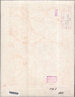
- Description:
- 1939
- Subject:
- Geographic Subject: Ust-Kapsha, Topical Subject: Maps, and Topical Subject: Soviet Union
- Publisher:
- Главное управление геодезии и картографии при СНК СССР
- Language:
- Russian
- Date Created:
- 1941
- Identifier:
- VAC9619-002121
- Genre:
- Topographic Maps and Military Maps
- Geographic Location:
- Coordinates: 59.6667, 33.5, 60, 34
- Related URL:
- Download GeoTIFF: https://drive.google.com/open?id=1v0rUcH43h8lwbjo2V_E6Q0HYc5K3MQC7 and Catalog URL: https://iucat.iu.edu/catalog/5020129
- Abstract:
- Modern area represented: Ust-Kapsha, Leningrad oblast, Russia
- Call Number:
- G7000 s100 .S7 sheet O-36-8
- Caption:
- Для служебного пользования,Captured map
- City:
- Усть-Капша (Ust-Kapsha)
- Copyright Holder:
- No Copyright - United States
- Country:
- СССР (USSR)
- State/Province:
- РСФСР (RSFSR) and Ленинградская область (Leningrad oblast)
- Physical Description:
- Scale: 1:100,000
- Persistent URL:
- http://purl.dlib.indiana.edu/iudl/images/VAC9619/VAC9619-002121
- Provenance:
- DMA Topographic Center, Army Map Service Library, OMAHA
-
- Description:
- 1929
- Subject:
- Topical Subject: Maps, Geographic Subject: Loyew, and Topical Subject: Soviet Union
- Publisher:
- Генеральный штаб Красной Армии
- Language:
- Russian
- Date Created:
- 1941
- Identifier:
- VAC9619-003254
- Genre:
- Topographic Maps and Military Maps
- Geographic Location:
- Coordinates: 51.667, 30.5, 52, 31
- Related URL:
- Catalog URL: https://iucat.iu.edu/catalog/5020129 and Download GeoTIFF: https://drive.google.com/file/d/1pts7bgzSOMFuWGK1hGOGVJSjwKFOPf_0/view?usp=sharing
- Abstract:
- Modern area represented: Loyew, Gomel oblast, Belarus
- Call Number:
- G7000 s100 .S7 sheet M-36-2
- Caption:
- Для служебного пользования
- City:
- Лоев (Loyew)
- Copyright Holder:
- No Copyright - United States
- Country:
- СССР (USSR)
- State/Province:
- Полесская область (Polesia oblast), Гомельская область (Homyel oblast), Украинская ССР (Ukrainian Soviet Socialist Republic), Белорусская ССР (Byelorussian S...
- Physical Description:
- Scale: 1:100,000
- Persistent URL:
- http://purl.dlib.indiana.edu/iudl/images/VAC9619/VAC9619-003254
- Provenance:
- DMA Topographic Center, Army Map Service Library, OMAHA
-
- Description:
- 1921
- Subject:
- Topical Subject: Maps, Topical Subject: Soviet Union, and Geographic Subject: Dobromysl
- Publisher:
- Генеральный штаб Красной Армии
- Language:
- Russian
- Date Created:
- 1941
- Identifier:
- VAC9619-004177
- Genre:
- Military Maps and Topographic Maps
- Geographic Location:
- Coordinates: 54.667, 30.5, 55, 31
- Related URL:
- Download GeoTIFF: https://drive.google.com/file/d/1DxT6VlnyyuTqvLN7VwBKptND_sMxXGKn/view?usp=sharing and Catalog URL: https://iucat.iu.edu/catalog/5020129
- Abstract:
- Modern area represented: Dobromysl, Vitebsk oblast, Belarus
- Call Number:
- G7000 s100 .S7 sheet N-36-38
- City:
- Добромысль (Dobromysl)
- Copyright Holder:
- No Copyright - United States
- Country:
- СССР (USSR)
- State/Province:
- Белорусская ССР (Byelorussian Soviet Socialist Republic), Смоленская область (Smolensk oblast), РСФСР (RSFSR), and Витебская область (Vitebsk oblast)
- Physical Description:
- Scale: 1:100,000
- Persistent URL:
- http://purl.dlib.indiana.edu/iudl/images/VAC9619/VAC9619-004177
- Provenance:
- DMA Topographic Center, Army Map Service Library, OMAHA
-
- Description:
- 1921
- Subject:
- Topical Subject: Soviet Union, Geographic Subject: Mykolayivske, and Topical Subject: Maps
- Publisher:
- Генеральный штаб Красной Армии
- Language:
- Russian
- Date Created:
- 1941
- Identifier:
- VAC9619-001886
- Genre:
- Topographic Maps and Military Maps
- Geographic Location:
- Coordinates: 46.6667, 32, 47, 32.5
- Related URL:
- Catalog URL: https://iucat.iu.edu/catalog/5020129 and Download GeoTIFF: https://drive.google.com/open?id=1QOMkNVvR-7h_AWdDYOEM-KIcapLVEo3_
- Abstract:
- Modern area represented: Mykolayivske, Mykolaiv oblast, Ukraine
- Call Number:
- G7000 s100 .S7 sheet L-36-41
- Caption:
- Для служебного пользования
- City:
- Николаев (Mykolayiv)
- Copyright Holder:
- No Copyright - United States
- Country:
- СССР (USSR)
- State/Province:
- Украинская ССР (Ukrainian Soviet Socialist Republic)
- Physical Description:
- Scale: 1:100,000
- Persistent URL:
- http://purl.dlib.indiana.edu/iudl/images/VAC9619/VAC9619-001886
- Provenance:
- DMA Topographic Center, Army Map Service Library, OMAHA
-
- Description:
- 1936
- Subject:
- Geographic Subject: Stavropol’ Kray, Topical Subject: Soviet Union, Geographic Subject: Trunovskoye, and Topical Subject: Maps
- Publisher:
- Главное управление геодезии и картографии при СНК СССР
- Language:
- Russian
- Date Created:
- 1941
- Identifier:
- VAC9619-002159
- Genre:
- Topographic Maps and Military Maps
- Geographic Location:
- Coordinates: 45.3333, 42, 45.6667, 42.5
- Related URL:
- Catalog URL: https://iucat.iu.edu/catalog/5020129 and Download GeoTIFF: https://drive.google.com/file/d/1tb7KRPgwX3gBKo-gLHWMvbXOeFbelWP1/view?usp=sharing
- Abstract:
- Modern area represented: Труновское (Trunovskoye), Stavropol’ Kray, Russia
- Call Number:
- G7000 s100 .S7 sheet L-38-85
- Caption:
- Для cлужебного пользования
- City:
- Труновское (Trunovskoye)
- Copyright Holder:
- No Copyright - United States
- Country:
- СССР (USSR)
- State/Province:
- Орджоникидзевский край (Ordzhonikidze kray) and РСФСР (RSFSR)
- Physical Description:
- Scale: 1:100,000
- Persistent URL:
- http://purl.dlib.indiana.edu/iudl/images/VAC9619/VAC9619-002159
- Provenance:
- DMA Topographic Center, Army Map Service Library, OMAHA
-
- Description:
- 1921
- Subject:
- Geographic Subject: Dolmativka, Topical Subject: Maps, and Topical Subject: Soviet Union
- Publisher:
- Генеральный штаб Красной Армии
- Language:
- Russian
- Date Created:
- 1941
- Identifier:
- VAC9619-001920
- Genre:
- Military Maps and Topographic Maps
- Geographic Location:
- Coordinates: 46, 32, 46.3333, 32.5
- Related URL:
- Download GeoTIFF: https://drive.google.com/file/d/1-OPrXcbiNY2JC-KFqsYStaBmtIBIsnNi/view?usp=sharing and Catalog URL: https://iucat.iu.edu/catalog/5020129
- Abstract:
- Modern area represented: Dolmativka, Kherson oblast, Ukraine
- Call Number:
- G7000 s100 .S7 sheet L-36-65
- Caption:
- Для служебного пользования
- City:
- Долматовка (Dolmativka)
- Copyright Holder:
- No Copyright - United States
- Country:
- СССР (USSR)
- State/Province:
- Украинская ССР (Ukrainian Soviet Socialist Republic)
- Physical Description:
- Scale: 1:100,000
- Persistent URL:
- http://purl.dlib.indiana.edu/iudl/images/VAC9619/VAC9619-001920
- Provenance:
- DMA Topographic Center, Army Map Service Library, OMAHA
-
- Subject:
- Geographic Subject: Chełm, Topical Subject: Maps, and Topical Subject: Soviet Union
- Publisher:
- Генеральный штаб Красной Армии
- Language:
- Russian
- Date Created:
- 1941
- Identifier:
- VAC9619-000170
- Genre:
- Military Maps and Topographic Maps
- Geographic Location:
- Coordinates: 51, 23.25, 51.1667, 23.5
- Related URL:
- https://drive.google.com/open?id=1rtBbj49BsLz8fiMDNVaszPXCc1cKxe3z, Download GeoTIFF: https://drive.google.com/open?id=1WpVWBg__MnJe9mG7QgTE3NiJKqyvGhaT, and...
- Abstract:
- Modern area represented: Chełm, Poland
- Call Number:
- G7000 s50 .S68 sheet M-34-35-D
- City:
- Холм (Chełm)
- Copyright Holder:
- No Copyright - United States
- Country:
- Область государственных интересов Германии (Region of German state interest)
- Physical Description:
- Scale: 1:50,000
- Persistent URL:
- http://purl.dlib.indiana.edu/iudl/images/VAC9619/VAC9619-000170
- Provenance:
- DMA Topographic Center, Army Map Service Library, OMAHA
-
- Description:
- 1938
- Subject:
- Topical Subject: Soviet Union, Topical Subject: Maps, and Geographic Subject: Tipinitsy
- Publisher:
- Itä-Karjalan kartasto
- Language:
- Russian
- Date Created:
- 1941
- Identifier:
- VAC9619-002521
- Genre:
- Topographic Maps and Military Maps
- Geographic Location:
- Coordinates: 62, 35, 62.333, 35.5
- Related URL:
- Download GeoTIFF: https://drive.google.com/file/d/16n70OB4W7s3AZ038yYTIjX6WxSal2LSA/view?usp=sharing and Catalog URL: https://iucat.iu.edu/catalog/5020129
- Abstract:
- Modern area represented: Типиницы (Tipinitsy), Медвежьегорский район (Medvezh'yegorskiy District), Republic of Karelia, Russia
- Call Number:
- G7000 s100 .S7 sheet P-36-71
- Copyright Holder:
- No Copyright - United States
- Country:
- СССР (USSR)
- State/Province:
- Заонежский район (Zaonezhsky district), РСФСР (RSFSR), and Карельская АССР (Karelian Autonomous Soviet Socialist Republic)
- Physical Description:
- Scale: 1:100,000
- Persistent URL:
- http://purl.dlib.indiana.edu/iudl/images/VAC9619/VAC9619-002521
- Provenance:
- DMA Topographic Center, Army Map Service Library, OMAHA
-
- Description:
- 1936
- Subject:
- Topical Subject: Maps, Geographic Subject: Dor, and Topical Subject: Soviet Union
- Publisher:
- Генеральный штаб Красной Армии
- Language:
- Russian
- Date Created:
- 1941
- Identifier:
- VAC9619-004151
- Genre:
- Military Maps and Topographic Maps
- Geographic Location:
- Coordinates: 55.667, 35.5, 56, 36
- Related URL:
- Download GeoTIFF: https://drive.google.com/file/d/18HGig9riuKnxJgVlSiTWUlIBA2KOa3rZ/view?usp=sharing and Catalog URL: https://iucat.iu.edu/catalog/5020129
- Abstract:
- Modern area represented: Dor, Russia
- Call Number:
- G7000 s100 .S7 sheet N-36-12
- City:
- Дор (Dor)
- Copyright Holder:
- No Copyright - United States
- Country:
- СССР (USSR)
- State/Province:
- Московская область (Moscow oblast) and РСФСР (RSFSR)
- Physical Description:
- Scale: 1:100,000
- Persistent URL:
- http://purl.dlib.indiana.edu/iudl/images/VAC9619/VAC9619-004151
- Provenance:
- DMA Topographic Center, Army Map Service Library, OMAHA
-
- Description:
- 1926
- Subject:
- Geographic Subject: Rostov Oblast, Geographic Subject: Novocherkassk, Topical Subject: Soviet Union, and Topical Subject: Maps
- Publisher:
- Генеральный штаб Красной Армии
- Language:
- Russian
- Date Created:
- 1941
- Identifier:
- VAC9619-002007
- Genre:
- Topographic Maps and Military Maps
- Geographic Location:
- Coordinates: 47.3333, 40, 47.6667, 40.5
- Related URL:
- Catalog URL: https://iucat.iu.edu/catalog/5020129 and Download GeoTIFF: https://drive.google.com/open?id=1GVtjPJc8oKnlyMb15hT_1UZryDtiYZXw
- Abstract:
- Modern area represented: Новочеркасск (Novocherkassk), Rostov Oblast, Russia
- Call Number:
- G7000 s100 .S7 sheet L-37-21
- Caption:
- Для cлужебного пользования
- City:
- Новочеркасск (Novocherkassk)
- Copyright Holder:
- No Copyright - United States
- Country:
- СССР (USSR)
- State/Province:
- РСФСР (RSFSR) and Ростовская область (Rostov oblast)
- Physical Description:
- Scale: 1:100,000
- Persistent URL:
- http://purl.dlib.indiana.edu/iudl/images/VAC9619/VAC9619-002007
- Provenance:
- DMA Topographic Center, Army Map Service Library, OMAHA
-
- Description:
- 1907
- Subject:
- Geographic Subject: Velyka Korenykha, Topical Subject: Maps, and Topical Subject: Soviet Union
- Publisher:
- Генеральный штаб Красной Армии
- Language:
- Russian
- Date Created:
- 1941
- Identifier:
- VAC9619-001885
- Genre:
- Topographic Maps and Military Maps
- Geographic Location:
- Coordinates: 46.6667, 31.5, 47, 32
- Related URL:
- Catalog URL: https://iucat.iu.edu/catalog/5020129 and Download GeoTIFF: https://drive.google.com/file/d/1QJqK6upnSULI9t8YF7AmAgEuNuDzIGlL/view?usp=sharing
- Abstract:
- Modern area represented: Velyka Korenykha, Mykolaiv oblast, Ukraine
- Call Number:
- G7000 s100 .S7 sheet L-36-40
- Caption:
- Временное издание,Для служебного пользования
- City:
- Бол. Корениха (Bolshaya Korenikha)
- Copyright Holder:
- No Copyright - United States
- Country:
- СССР (USSR)
- State/Province:
- Украинская ССР (Ukrainian Soviet Socialist Republic)
- Physical Description:
- Scale: 1:100,000
- Persistent URL:
- http://purl.dlib.indiana.edu/iudl/images/VAC9619/VAC9619-001885
- Provenance:
- DMA Topographic Center, Army Map Service Library, OMAHA
-
- Subject:
- Geographic Subject: Simola, Topical Subject: Soviet Union, and Topical Subject: Maps
- Publisher:
- Генеральный штаб Красной Армии
- Language:
- Russian
- Date Created:
- 1941
- Identifier:
- VAC9619-002394
- Genre:
- Military Maps and Topographic Maps
- Geographic Location:
- Coordinates: 60.667, 28, 61, 28.5
- Related URL:
- Catalog URL: https://iucat.iu.edu/catalog/5020129 and Download GeoTIFF: https://drive.google.com/file/d/1x8d6AX08MPXN28yUa645-kxLyeIIBzi2/view?usp=sharing
- Abstract:
- Modern area represented: Simola, Russia
- Call Number:
- G7000 s100 .S7 sheet P-35-117
- City:
- Симола (Simola)
- Copyright Holder:
- No Copyright - United States
- Country:
- СССР (USSR) and Финляндия (Finland)
- State/Province:
- Карело-Финская ССР (Karelo-Finnish Soviet Socialist Republic)
- Physical Description:
- Scale: 1:100,000
- Persistent URL:
- http://purl.dlib.indiana.edu/iudl/images/VAC9619/VAC9619-002394
- Provenance:
- DMA Topographic Center, Army Map Service Library, OMAHA
-
- Description:
- 1939
- Subject:
- Topical Subject: Maps, Geographic Subject: Beklemishchevo, and Topical Subject: Soviet Union
- Publisher:
- Генеральный штаб Красной Армии
- Language:
- Russian
- Date Created:
- 1941
- Identifier:
- VAC9619-001895
- Genre:
- Military Maps and Topographic Maps
- Geographic Location:
- Coordinates: 54.3333, 35, 54.6667, 35.5
- Related URL:
- Catalog URL: https://iucat.iu.edu/catalog/5020129 and Download GeoTIFF: https://drive.google.com/open?id=1PIsZ7IPfYKXFHWkIKusRW20jzia1KYLw
- Abstract:
- Modern area represented: Беклемищево (Beklemishchevo), Kaluzhskaya oblast, Russia
- Call Number:
- G7000 s100 .S7 sheet N-36-59
- Caption:
- Для служебного пользования
- City:
- Беклемищево (Beklemishchevo)
- Copyright Holder:
- No Copyright - United States
- Country:
- СССР (USSR)
- State/Province:
- Тульская область (Tula oblast), РСФСР (RSFSR), and Смоленская область (Smolensk oblast)
- Physical Description:
- Scale: 1:100,000
- Persistent URL:
- http://purl.dlib.indiana.edu/iudl/images/VAC9619/VAC9619-001895
- Provenance:
- DMA Topographic Center, Army Map Service Library, OMAHA
-
- Description:
- 1903
- Subject:
- Geographic Subject: Brześć Kujawski, Topical Subject: Soviet Union, and Topical Subject: Maps
- Publisher:
- Генеральный штаб Красной Армии
- Language:
- Russian
- Date Created:
- 1940
- Identifier:
- VAC9619-003986
- Genre:
- Military Maps and Topographic Maps
- Geographic Location:
- Coordinates: 52.333, 18.5, 52.667, 19
- Related URL:
- Download GeoTIFF: https://drive.google.com/file/d/1ePKtNsR6U-PtjSqLwG7MH3wV0p2A9pRF/view?usp=sharing and Catalog URL: https://iucat.iu.edu/catalog/5020129
- Abstract:
- Modern area represented: Brześć Kujawski, Kuyavian-Pomeranian Voivodeship, Poland
- Call Number:
- G7000 s100 .S7 sheet N-34-122
- City:
- Бжесьць Куявски (Brześć Kujawski)
- Copyright Holder:
- No Copyright - United States
- State/Province:
- Область государственных интересов Германии (Region of German state interests)
- Physical Description:
- Scale: 1:100,000
- Persistent URL:
- http://purl.dlib.indiana.edu/iudl/images/VAC9619/VAC9619-003986
- Provenance:
- DMA Topographic Center, Army Map Service Library, OMAHA
-
- Description:
- 1896
- Subject:
- Topical Subject: Maps, Geographic Subject: Częstochowa, and Topical Subject: Soviet Union
- Publisher:
- Генеральный штаб Красной Армии
- Language:
- Russian
- Date Created:
- 1940
- Identifier:
- VAC9619-002785
- Genre:
- Topographic Maps and Military Maps
- Geographic Location:
- Coordinates: 50.667, 19, 51, 19.5
- Related URL:
- Download GeoTIFF: https://drive.google.com/file/d/1JSRUFZZT-T_7vFoWYJDHWjtDgb0QJurL/view?usp=sharing and Catalog URL: https://iucat.iu.edu/catalog/5020129
- Abstract:
- Modern area represented: Częstochowa, Silesia province, Poland
- Call Number:
- G7000 s100 .S7 sheet M-34-39
- City:
- Ченстохова (Częstochowa)
- Copyright Holder:
- No Copyright - United States
- State/Province:
- Область государственных интересов Германии (Region of German state interests)
- Physical Description:
- Scale: 1:100,000
- Persistent URL:
- http://purl.dlib.indiana.edu/iudl/images/VAC9619/VAC9619-002785
- Provenance:
- DMA Topographic Center, Army Map Service Library, OMAHA
-
- Description:
- 1888
- Subject:
- Topical Subject: Soviet Union, Topical Subject: Maps, and Geographic Subject: Hrubieszów
- Publisher:
- Генеральный штаб Красной Армии
- Language:
- Russian
- Date Created:
- 1940
- Identifier:
- VAC9619-002828
- Genre:
- Topographic Maps and Military Maps
- Geographic Location:
- Coordinates: 50.667, 23.5, 51, 24
- Related URL:
- Catalog URL: https://iucat.iu.edu/catalog/5020129 and Download GeoTIFF: https://drive.google.com/file/d/1MtYYusftksd1g2h3UGfdgt847CDumZ60/view?usp=sharing
- Abstract:
- Modern area represented: Hrubieszów, Lublin province, Poland
- Call Number:
- G7000 s100 .S7 sheet M-34-48
- City:
- Грубешув (Hrubieszów)
- Copyright Holder:
- No Copyright - United States
- State/Province:
- Область государственных интересов Германии (Region of German state interests), Волынская область (Volyn oblast), and Украинская ССР (Ukrainian Soviet Sociali...
- Physical Description:
- Scale: 1:100,000
- Persistent URL:
- http://purl.dlib.indiana.edu/iudl/images/VAC9619/VAC9619-002828
- Provenance:
- DMA Topographic Center, Army Map Service Library, OMAHA
-
- Description:
- 1901
- Subject:
- Topical Subject: Maps, Topical Subject: Soviet Union, and Geographic Subject: Myślenice
- Publisher:
- Генеральный штаб Красной Армии
- Language:
- Russian
- Date Created:
- 1940
- Identifier:
- VAC9619-002872
- Genre:
- Topographic Maps and Military Maps
- Geographic Location:
- Coordinates: 49.667, 19.5, 50, 20
- Related URL:
- Download GeoTIFF: https://drive.google.com/file/d/1i8W5Rov2G2PC8B-kAt5IGRNa_NTKCPlr/view?usp=sharing and Catalog URL: https://iucat.iu.edu/catalog/5020129
- Abstract:
- Modern area represented: Myślenice, Lesser Poland province, Poland
- Call Number:
- G7000 s100 .S7 sheet M-34-76
- City:
- Мысьленице (Myślenice)
- Copyright Holder:
- No Copyright - United States
- State/Province:
- Область государственных интересов Германии (Region of German state interests)
- Physical Description:
- Scale: 1:100,000
- Persistent URL:
- http://purl.dlib.indiana.edu/iudl/images/VAC9619/VAC9619-002872
- Provenance:
- DMA Topographic Center, Army Map Service Library, OMAHA
-
- Description:
- 1899
- Subject:
- Geographic Subject: Jasło, Topical Subject: Maps, and Topical Subject: Soviet Union
- Publisher:
- Генеральный штаб Красной Армии
- Language:
- Russian
- Date Created:
- 1940
- Identifier:
- VAC9619-003015
- Genre:
- Topographic Maps and Military Maps
- Geographic Location:
- Coordinates: 49.667, 21, 50, 21.5
- Related URL:
- Download GeoTIFF: https://drive.google.com/file/d/1QZb3K1YAe8pH1CvLkhggtJc4ubWnCekj/view?usp=sharing and Catalog URL: https://iucat.iu.edu/catalog/5020129
- Abstract:
- Modern area represented: Jasło, Subcarpathian province, Poland
- Call Number:
- G7000 s100 .S7 sheet M-34-79
- City:
- Ясло (Jasło)
- Copyright Holder:
- No Copyright - United States
- State/Province:
- Область государственных интересов Германии (Region of German state interests)
- Physical Description:
- Scale: 1:100,000
- Persistent URL:
- http://purl.dlib.indiana.edu/iudl/images/VAC9619/VAC9619-003015
- Provenance:
- DMA Topographic Center, Army Map Service Library, OMAHA
-
- Description:
- 1887
- Subject:
- Topical Subject: Soviet Union, Geographic Subject: Chełm, and Topical Subject: Maps
- Publisher:
- Генеральный штаб Красной Армии
- Language:
- Russian
- Date Created:
- 1940
- Identifier:
- VAC9619-002782
- Genre:
- Military Maps and Topographic Maps
- Geographic Location:
- Coordinates: 51, 23, 51.333, 23.5
- Related URL:
- Catalog URL: https://iucat.iu.edu/catalog/5020129 and Download GeoTIFF: https://drive.google.com/file/d/1Y9V-_cytuvhxmcWxqlf1B2I7byIrmTaA/view?usp=sharing
- Abstract:
- Modern area represented: Chełm, Lublin province, Poland
- Call Number:
- G7000 s100 .S7 sheet M-34-35
- City:
- Холм (Chełm)
- Copyright Holder:
- No Copyright - United States
- State/Province:
- Область государственных интересов Германии (Region of German state interests)
- Physical Description:
- Scale: 1:100,000
- Persistent URL:
- http://purl.dlib.indiana.edu/iudl/images/VAC9619/VAC9619-002782
- Provenance:
- DMA Topographic Center, Army Map Service Library, OMAHA
-
- Description:
- 1925
- Subject:
- Topical Subject: Maps, Geographic Subject: Tczew, and Topical Subject: Soviet Union
- Publisher:
- Генеральный штаб Красной Армии
- Language:
- Russian
- Date Created:
- 1940
- Identifier:
- VAC9619-003931
- Genre:
- Military Maps and Topographic Maps
- Geographic Location:
- Coordinates: 54, 18.5, 54.333, 19
- Related URL:
- Download GeoTIFF: https://drive.google.com/file/d/1wmiOysBOQ7SxeeFdFDA7blujWD0900wC/view?usp=sharing and Catalog URL: https://iucat.iu.edu/catalog/5020129
- Abstract:
- Modern area represented: Tczew, Pomerania, Poland
- Call Number:
- G7000 s100 .S7 sheet N-34-62
- City:
- Диршау (Dirschau)
- Copyright Holder:
- No Copyright - United States
- Country:
- Германия (Germany)
- Physical Description:
- Scale: 1:100,000
- Persistent URL:
- http://purl.dlib.indiana.edu/iudl/images/VAC9619/VAC9619-003931
- Provenance:
- DMA Topographic Center, Army Map Service Library, OMAHA
-
- Subject:
- Geographic Subject: Kamennogorsk, Topical Subject: Soviet Union, and Topical Subject: Maps
- Publisher:
- Генеральный штаб Красной Армии
- Language:
- Russian
- Date Created:
- 1940
- Identifier:
- VAC9619-002396
- Genre:
- Topographic Maps and Military Maps
- Geographic Location:
- Coordinates: 60.667, 29, 61, 29.5
- Related URL:
- Catalog URL: https://iucat.iu.edu/catalog/5020129 and Download GeoTIFF: https://drive.google.com/file/d/1qwxTvuQqhw-LhbzC_Qa27F8g2pcnK7Zs/view?usp=sharing
- Abstract:
- Modern area represented: Каменногорск (Kamennogorsk), Leningradskaya oblast, Russia.
- Call Number:
- G7000 s100 .S7 sheet P-35-119
- Caption:
- Для служебного пользования
- City:
- Антреа (Antrea)
- Copyright Holder:
- No Copyright - United States
- Country:
- СССР (USSR)
- State/Province:
- Карело-Финская ССР (Karelo-Finnish Soviet Socialist Republic)
- Physical Description:
- Scale: 1:100,000
- Persistent URL:
- http://purl.dlib.indiana.edu/iudl/images/VAC9619/VAC9619-002396
- Provenance:
- DMA Topographic Center, Army Map Service Library, OMAHA
-
- Description:
- 1932
- Subject:
- Topical Subject: Maps, Geographic Subject: Bondarivka, and Topical Subject: Soviet Union
- Publisher:
- Генеральный штаб РККА
- Language:
- Russian
- Date Created:
- 1940
- Identifier:
- VAC9619-003118
- Genre:
- Military Maps and Topographic Maps
- Geographic Location:
- Coordinates: 50.667, 28, 51, 28.5
- Related URL:
- Download GeoTIFF: https://drive.google.com/file/d/1K11mFVkk-iq0dafstl-xc8YcchJ2tvCC/view?usp=sharing and Catalog URL: https://iucat.iu.edu/catalog/5020129
- Abstract:
- Modern area represented: Bondarivka, Zhytomyr oblast, Ukraine
- Call Number:
- G7000 s100 .S7 sheet M-35-45
- Caption:
- Не подлежит оглашению
- City:
- Бондаревка (Bondarivka)
- Copyright Holder:
- No Copyright - United States
- Country:
- СССР (USSR)
- State/Province:
- Украинская ССР (Ukrainian Soviet Socialist Republic) and Житомирская область (Zhytomyr oblast)
- Physical Description:
- Scale: 1:100,000
- Persistent URL:
- http://purl.dlib.indiana.edu/iudl/images/VAC9619/VAC9619-003118
- Provenance:
- DMA Topographic Center, Army Map Service Library, OMAHA
-
- Description:
- 1881
- Subject:
- Topical Subject: Soviet Union, Topical Subject: Maps, and Geographic Subject: Bielsk Podlaski
- Publisher:
- Генеральный штаб Красной Армии
- Language:
- Russian
- Date Created:
- 1940
- Identifier:
- VAC9619-003984
- Genre:
- Topographic Maps and Military Maps
- Geographic Location:
- Coordinates: 52.66667, 23.0, 53.0, 23.5
- Related URL:
- Download GeoTIFF: https://drive.google.com/file/d/1A86JaHQlP2KHS39WU0mYi8KFpIIv5SCy/view?usp=sharing and Catalog URL: https://iucat.iu.edu/catalog/5020129
- Abstract:
- Modern area represented: Bielsk Podlaski, Podlaskie Voivodeship, Poland
- Call Number:
- G7000 s100 .S7 sheet N-34-119
- City:
- Бельск (Bielsk)
- Copyright Holder:
- No Copyright - United States
- Country:
- СССР (USSR)
- State/Province:
- Белостокская область (Belastok oblast) and Белорусская ССР (Byelorussian Soviet Socialist Republic)
- Physical Description:
- Scale: 1:100,000
- Persistent URL:
- http://purl.dlib.indiana.edu/iudl/images/VAC9619/VAC9619-003984
- Provenance:
- DMA Topographic Center, Army Map Service Library, OMAHA
-
- Description:
- 1936
- Subject:
- Topical Subject: Maps, Topical Subject: Soviet Union, and Geographic Subject: Marijampolė
- Publisher:
- Генеральный штаб Красной Армии
- Language:
- Russian
- Date Created:
- 1940
- Identifier:
- VAC9619-003928
- Genre:
- Military Maps and Topographic Maps
- Geographic Location:
- Coordinates: 54.333, 23, 54.667, 23.5
- Related URL:
- Catalog URL: https://iucat.iu.edu/catalog/5020129 and Download GeoTIFF: https://drive.google.com/file/d/1Hz6ITSJfEmKl39IP38wb16C_UiIax_ag/view?usp=sharing
- Abstract:
- Modern area represented: Marijampolė, Marijampolė county, Lithuania
- Call Number:
- G7000 s100 .S7 sheet N-34-59
- Caption:
- Не подлежит оглашению
- City:
- Мариамполь (Marijampolė)
- Copyright Holder:
- No Copyright - United States
- Country:
- СССР (USSR)
- State/Province:
- Литовская ССР (Lithuanian Soviet Socialist Republic) and Область государственных интересов Германии (Region of German state interests)
- Physical Description:
- Scale: 1:100,000
- Persistent URL:
- http://purl.dlib.indiana.edu/iudl/images/VAC9619/VAC9619-003928
- Provenance:
- DMA Topographic Center, Army Map Service Library, OMAHA
-
- Description:
- 1874
- Subject:
- Topical Subject: Soviet Union, Topical Subject: Maps, and Geographic Subject: Pyhäjärvi
- Publisher:
- Генеральный штаб РККА
- Language:
- Russian
- Date Created:
- 1940
- Identifier:
- VAC9619-002398
- Genre:
- Military Maps and Topographic Maps
- Geographic Location:
- Coordinates: 60.333, 24, 60.667, 24.5
- Related URL:
- Catalog URL: https://iucat.iu.edu/catalog/5020129 and Download GeoTIFF: https://drive.google.com/file/d/1p9Hzn25uuQJERMheFKeOroS1ZGe_nXsS/view?usp=sharing
- Abstract:
- Modern area represented: Pyhäjärvi, Finland
- Call Number:
- G7000 s100 .S7 sheet P-35-121
- City:
- Пюхяярви (Pyhäjärvi)
- Copyright Holder:
- No Copyright - United States
- Country:
- Финляндия (Finland)
- Physical Description:
- Scale: 1:100,000
- Persistent URL:
- http://purl.dlib.indiana.edu/iudl/images/VAC9619/VAC9619-002398
- Provenance:
- DMA Topographic Center, Army Map Service Library, OMAHA
-
- Description:
- 1891
- Subject:
- Topical Subject: Maps, Topical Subject: Soviet Union, and Geographic Subject: Strzelno
- Publisher:
- Генеральный штаб Красной Армии
- Language:
- Russian
- Date Created:
- 1940
- Identifier:
- VAC9619-003985
- Genre:
- Military Maps and Topographic Maps
- Geographic Location:
- Coordinates: 52.333, 18, 52.667, 18.5
- Related URL:
- Download GeoTIFF: https://drive.google.com/file/d/15hCXZi0c_oWDoRLPMoA-LUfwXnHNk3DI/view?usp=sharing and Catalog URL: https://iucat.iu.edu/catalog/5020129
- Abstract:
- Modern area represented: Strzelno, Kuyavian-Pomeranian Voivodeship, Poland
- Call Number:
- G7000 s100 .S7 sheet N-34-121
- City:
- Стшельно (Strzelno)
- Copyright Holder:
- No Copyright - United States
- Country:
- Германия (Germany)
- State/Province:
- Область государственных интересов Германии (Region of German state interests)
- Physical Description:
- Scale: 1:100,000
- Persistent URL:
- http://purl.dlib.indiana.edu/iudl/images/VAC9619/VAC9619-003985
- Provenance:
- DMA Topographic Center, Army Map Service Library, OMAHA
-
- Description:
- 1894
- Subject:
- Geographic Subject: Lida, Topical Subject: Maps, and Topical Subject: Soviet Union
- Publisher:
- Генеральный штаб Красной Армии
- Language:
- Russian
- Date Created:
- 1940
- Identifier:
- VAC9619-004075
- Genre:
- Topographic Maps and Military Maps
- Geographic Location:
- Coordinates: 53.667, 25, 54, 25.5
- Related URL:
- Download GeoTIFF: https://drive.google.com/file/d/1YZNgXinCxjSqdCq4D3APhuYB8EeukWnY/view?usp=sharing and Catalog URL: https://iucat.iu.edu/catalog/5020129
- Abstract:
- Modern area represented: Lida, Hrodna oblast, Belarus
- Call Number:
- G7000 s100 .S7 sheet N-35-75
- Caption:
- Для служебного пользования
- City:
- Лида (Lida)
- Copyright Holder:
- No Copyright - United States
- Country:
- СССР (USSR)
- State/Province:
- Барановичская область (Baranavichy oblast) and Белорусская ССР (Byelorussian Soviet Socialist Republic)
- Physical Description:
- Scale: 1:100,000
- Persistent URL:
- http://purl.dlib.indiana.edu/iudl/images/VAC9619/VAC9619-004075
- Provenance:
- DMA Topographic Center, Army Map Service Library, OMAHA
-
- Description:
- 1908
- Subject:
- Geographic Subject: Gdańsk, Topical Subject: Soviet Union, and Topical Subject: Maps
- Publisher:
- Генеральный штаб Красной Армии
- Language:
- Russian
- Date Created:
- 1940
- Identifier:
- VAC9619-003919
- Genre:
- Military Maps and Topographic Maps
- Geographic Location:
- Coordinates: 54.333, 18.5, 54.667, 19
- Related URL:
- Catalog URL: https://iucat.iu.edu/catalog/5020129 and Download GeoTIFF: https://drive.google.com/file/d/1QqquaMOzje6XUIDNkG-TS6bxXKRpANbw/view?usp=sharing
- Abstract:
- Modern area represented: Gdańsk, Pomerania, Poland
- Call Number:
- G7000 s100 .S7 sheet N-34-50
- City:
- Данциг (Danzig)
- Copyright Holder:
- No Copyright - United States
- Country:
- Германия (Germany)
- Physical Description:
- Scale: 1:100,000
- Persistent URL:
- http://purl.dlib.indiana.edu/iudl/images/VAC9619/VAC9619-003919
- Provenance:
- DMA Topographic Center, Army Map Service Library, OMAHA
-
- Description:
- 1891
- Subject:
- Topical Subject: Maps, Topical Subject: Soviet Union, and Geographic Subject: Orany
- Publisher:
- Генеральный штаб Красной Армии
- Language:
- Russian
- Date Created:
- 1940
- Identifier:
- VAC9619-004063
- Genre:
- Topographic Maps and Military Maps
- Geographic Location:
- Coordinates: 54, 24.5, 54.333, 25
- Related URL:
- Download GeoTIFF: https://drive.google.com/file/d/1ueDvLRNXYOxiG0_D2EP25yRdynUO5q7f/view?usp=sharing and Catalog URL: https://iucat.iu.edu/catalog/5020129
- Abstract:
- Modern area represented: Orany, Hrodno oblast, Belarus
- Call Number:
- G7000 s100 .S7 sheet N-35-62
- City:
- Ораны (Orany)
- Copyright Holder:
- No Copyright - United States
- Country:
- СССР (USSR)
- State/Province:
- Белостокская область (Belastok oblast), Барановичская область (Baranavichy oblast), Литовская ССР (Lithuanian Soviet Socialist Republic), and Белорусская ССР...
- Physical Description:
- Scale: 1:100,000
- Persistent URL:
- http://purl.dlib.indiana.edu/iudl/images/VAC9619/VAC9619-004063
- Provenance:
- DMA Topographic Center, Army Map Service Library, OMAHA
