
Search Constraints
You searched for:
Subject
Topical Subject: Maps
Remove constraint Subject: Topical Subject: Maps
Search Results
-
- Description:
- 1931
- Subject:
- Topical Subject: Soviet Union, Geographic Subject: Tovstyi Lis, and Topical Subject: Maps
- Publisher:
- Управление военных топографов
- Language:
- Russian
- Identifier:
- VAC9619-000192
- Genre:
- Topographic Maps and Military Maps
- Geographic Location:
- Coordinates: 51.333, 29.75, 51.5, 30
- Related URL:
- Catalog URL: http://iucat.iu.edu/catalog/5020131 and Download GeoTIFF: https://drive.google.com/open?id=1VNYar89ax3ofZHmK7pMkpnfLwmpdP3ro
- Abstract:
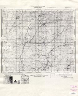
- Modern area represented: Tovstyi Lis, Ukraine and an abandoned populated place (the residents were resettled as the result of the Chernobyl accident)
- Call Number:
- G7000 s50 .S68 sheet M-35-24-D
- Caption:
- Не подлежит оглашению
- City:
- Толстый Лес (Tolstyy Les)
- Copyright Holder:
- No Copyright - United States
- Country:
- СССР (USSR)
- State/Province:
- Белорусская ССР (Byelorussian Soviet Socialist Republic) and Украинская ССР (Ukrainian Soviet Socialist Republic)
- Physical Description:
- Scale: 1:50,000
- Persistent URL:
- http://purl.dlib.indiana.edu/iudl/images/VAC9619/VAC9619-000192
- Provenance:
- DMA Topographic Center, Army Map Service Library, OMAHA, Library of Congress Geography & Map Division
-
- Description:
- 1931
- Subject:
- Geographic Subject: Denysovychi, Topical Subject: Maps, and Topical Subject: Soviet Union
- Publisher:
- Управление военных топографов
- Language:
- Russian
- Identifier:
- VAC9619-000191
- Genre:
- Topographic Maps and Military Maps
- Geographic Location:
- Coordinates: 51.333, 29.5, 51.5, 29.75
- Related URL:
- Catalog URL: http://iucat.iu.edu/catalog/5020131 and Download GeoTIFF: https://drive.google.com/open?id=1OHO2536LziDQohcfqTCZ2x6pDoc3y3uv
- Abstract:
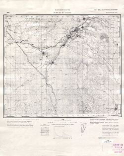
- abandoned populated place (the residents were resettled as the result of the Chernobyl accident) and Modern area represented: Denysovychi, Ukraine
- Call Number:
- G7000 s50 .S68 and zsheet M-35-24-C
- Caption:
- Не подлежит оглашению
- City:
- Денисовичи (Denisovichi)
- Copyright Holder:
- No Copyright - United States
- Country:
- СССР (USSR)
- State/Province:
- Украинская ССР (Ukrainian Soviet Socialist Republic) and Белорусская ССР (Byelorussian Soviet Socialist Republic)
- Physical Description:
- Scale: 1:50,000
- Persistent URL:
- http://purl.dlib.indiana.edu/iudl/images/VAC9619/VAC9619-000191
- Provenance:
- DMA Topographic Center, Army Map Service Library, OMAHA, Library of Congress Geography & Map Division
-
- Subject:
- Topical Subject: Soviet Union, Topical Subject: Maps, and Geographic Subject: Dubienka
- Publisher:
- Управление военных топографов
- Language:
- Russian
- Identifier:
- VAC9619-000190
- Genre:
- Topographic Maps and Military Maps
- Geographic Location:
- Coordinates: 51, 23.75, 51.1667, 24
- Related URL:
- Download GeoTIFF: https://drive.google.com/open?id=1fEUJ8Ynnbr5VP0be0g4NW_7zOlukY-iq, https://drive.google.com/open?id=1yxtVxkWo4jFgOZj0jss1rqprdujqhe_S, and...
- Abstract:
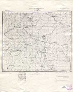
- Modern area represented: Dubienka, Poland
- Call Number:
- G7000 s50 .S68 sheet M-34-36-D
- City:
- Дубенка (Dubienka)
- Copyright Holder:
- No Copyright - United States
- Country:
- Польша (Poland)
- Physical Description:
- Scale: 1:50,000
- Persistent URL:
- http://purl.dlib.indiana.edu/iudl/images/VAC9619/VAC9619-000190
- Provenance:
- DMA Topographic Center, Army Map Service Library, OMAHA
-
- Description:
- 1940
- Subject:
- Geographic Subject: Hirske, Topical Subject: Soviet Union, and Topical Subject: Maps
- Publisher:
- Генеральный штаб Красной Армии
- Language:
- Russian
- Date Created:
- 1943
- Identifier:
- VAC9619-000189
- Genre:
- Military Maps and Topographic Maps
- Geographic Location:
- Coordinates: 49.3333, 23.75, 49.5, 24
- Related URL:
- Catalog URL: http://iucat.iu.edu/catalog/5020131 and Download GeoTIFF: https://drive.google.com/open?id=10lWgN5O-R7CViGknjll3h009WsLeDRcm
- Abstract:
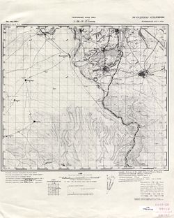
- Modern area represented: Hirske, Ukraine
- Call Number:
- G7000 s50 .S68 sheet M-34-96-D
- Caption:
- Для служебного пользования
- City:
- Горуцко (Gorutsko)
- Copyright Holder:
- No Copyright - United States
- Country:
- СССР (USSR)
- State/Province:
- Дрогобычская область (Drohobych oblast) and Украинская ССР (Ukrainian Soviet Socialist Republic)
- Physical Description:
- Scale: 1:50,000
- Persistent URL:
- http://purl.dlib.indiana.edu/iudl/images/VAC9619/VAC9619-000189
- Provenance:
- DMA Topographic Center, Army Map Service Library, Library of Congress Geography & Map Division
-
- Description:
- 1940
- Subject:
- Geographic Subject: Drohobych, Topical Subject: Maps, and Topical Subject: Soviet Union
- Publisher:
- Генеральный штаб Красной Армии
- Language:
- Russian
- Date Created:
- 1943
- Identifier:
- VAC9619-000188
- Genre:
- Military Maps and Topographic Maps
- Geographic Location:
- Coordinates: 49.3333, 23.5, 49.5, 23.75
- Related URL:
- Download GeoTIFF: https://drive.google.com/open?id=1MEqHst-PaDcmUBcopuEIqbJT1fLMiZ5i and Catalog URL: http://iucat.iu.edu/catalog/5020131
- Abstract:
- Modern area represented: Drohobych, Ukraine
- Call Number:
- G7000 s50 .S68 and zsheet M-34-96-C
- Caption:
- Для служебного пользования
- City:
- Дрогобыч (Drohobych)
- Copyright Holder:
- No Copyright - United States
- Country:
- СССР (USSR)
- State/Province:
- Дрогобычская область (Drohobych oblast) and Украинская ССР (Ukrainian Soviet Socialist Republic)
- Physical Description:
- Scale: 1:50,000
- Persistent URL:
- http://purl.dlib.indiana.edu/iudl/images/VAC9619/VAC9619-000188
- Provenance:
- DMA Topographic Center, Army Map Service Library, OMAHA, Library of Congress Geography & Map Division
-
- Subject:
- Geographic Subject: Przemyśl, Topical Subject: Soviet Union, and Topical Subject: Maps
- Publisher:
- Генеральный штаб Красной Армии
- Language:
- Russian
- Identifier:
- VAC9619-000187
- Genre:
- Topographic Maps and Military Maps
- Geographic Location:
- Coordinates: 49.6667, 22.75, 49.8333, 23
- Related URL:
- Download GeoTIFF: https://drive.google.com/open?id=1pTVYAWxsTFQ1URShfsj5GL7qERL0u0Kz and Catalog URL: http://iucat.iu.edu/catalog/5020131
- Abstract:
- Modern area represented: Przemyśl, Poland
- Call Number:
- zsheet M-34-82-D and G7000 s50 .S68
- Caption:
- Для служебного пользования
- City:
- Перемышль (Peremyshl’)
- Copyright Holder:
- No Copyright - United States
- Country:
- СССР (USSR) and Польша (Poland)
- State/Province:
- Дрогобычская область (Drohobych oblast) and Украинская ССР (Ukrainian Soviet Socialist Republic)
- Physical Description:
- Scale: 1:50,000
- Persistent URL:
- http://purl.dlib.indiana.edu/iudl/images/VAC9619/VAC9619-000187
- Provenance:
- DMA Topographic Center, Army Map Service Library, Library of Congress Geography & Map Division
-
- Subject:
- Geographic Subject: Radymno, Topical Subject: Maps, and Topical Subject: Soviet Union
- Publisher:
- Генеральный штаб Красной Армии
- Language:
- Russian
- Date Created:
- 1943
- Identifier:
- VAC9619-000186
- Genre:
- Topographic Maps and Military Maps
- Geographic Location:
- Coordinates: 49.8333, 22.75, 50, 23
- Related URL:
- Download GeoTIFF: https://drive.google.com/open?id=1pqBU3q09-3jEad3cJnm_hpV3oPYNXXhm and Catalog URL: http://iucat.iu.edu/catalog/5020131
- Abstract:
- Modern area represented: Radymno, Poland
- Call Number:
- G7000 s50 .S68 sheet M-34-82-B
- Caption:
- Для служебного пользования
- City:
- Радымно (Radymno)
- Copyright Holder:
- No Copyright - United States
- Country:
- СССР (USSR) and Польша (Poland)
- State/Province:
- Украинская ССР (Ukrainian Soviet Socialist Republic), Дрогобычская область (Drohobych oblast), and Львовская область (Lviv oblast)
- Physical Description:
- Scale: 1:50,000
- Persistent URL:
- http://purl.dlib.indiana.edu/iudl/images/VAC9619/VAC9619-000186
- Provenance:
- DMA Topographic Center, Army Map Service Library, OMAHA, Library of Congress Geography & Map Division
-
- Subject:
- Topical Subject: Soviet Union, Topical Subject: Maps, and Geographic Subject: Rokietnica
- Publisher:
- Генеральный штаб Красной Армии
- Language:
- Russian
- Date Created:
- 1943
- Identifier:
- VAC9619-000185
- Genre:
- Military Maps and Topographic Maps
- Geographic Location:
- Coordinates: 49.8333, 22.5, 50, 22.75
- Related URL:
- Catalog URL: http://iucat.iu.edu/catalog/5020131 and Download GeoTIFF: https://drive.google.com/open?id=16n9m0aaaa60osaY_BJ5cwasgwGDeIByJ
- Abstract:
- Modern area represented: Rokietnica, Poland
- Call Number:
- G7000 s50 .S68 sheet M-34-82-A
- City:
- Рокетница (Rokietnica)
- Copyright Holder:
- No Copyright - United States
- Country:
- Польша (Poland)
- Physical Description:
- Scale: 1:50,000
- Persistent URL:
- http://purl.dlib.indiana.edu/iudl/images/VAC9619/VAC9619-000185
- Provenance:
- DMA Topographic Center, Army Map Service Library, Library of Congress Geography & Map Division
-

- Subject:
- Geographic Subject: Bircza, Topical Subject: Soviet Union, and Topical Subject: Maps
- Publisher:
- Генеральный штаб Красной Армии
- Language:
- Russian
- Date Created:
- 1943
- Identifier:
- VAC9619-000184
- Genre:
- Military Maps and Topographic Maps
- Geographic Location:
- Coordinates: 49.6667, 22.25, 49.8333, 22.5
- Related URL:
- Download GeoTIFF: https://drive.google.com/open?id=1KQ9mMl-4WzKNSWSqYRqtFgxKC7F8DwZe and Catalog URL: http://iucat.iu.edu/catalog/5020131
- Abstract:
- Modern area represented: Bircza, Poland
- Call Number:
- G7000 s50 .S68 sheet M-34-81-D
- Caption:
- Для служебного пользования
- City:
- Бирча
- Copyright Holder:
- No Copyright - United States
- Country:
- СССР (USSR) and Польша (Poland)
- State/Province:
- Украинская ССР (Ukrainian Soviet Socialist Republic) and Дрогобычская область (Drohobych oblast)
- Physical Description:
- Scale: 1:50,000
- Persistent URL:
- http://purl.dlib.indiana.edu/iudl/images/VAC9619/VAC9619-000184
- Provenance:
- DMA Topographic Center, Army Map Service Library, Library of Congress Geography & Map Division
-
- Subject:
- Topical Subject: Soviet Union, Geographic Subject: Dynów, and Topical Subject: Maps
- Publisher:
- Генеральный штаб Красной Армии
- Language:
- Russian
- Date Created:
- 1943
- Identifier:
- VAC9619-000183
- Genre:
- Military Maps and Topographic Maps
- Geographic Location:
- Coordinates: 49.6667, 22, 49.8333, 22.25
- Related URL:
- Download GeoTIFF: https://drive.google.com/open?id=1QEhZxZW6Eoytn5gTtbbuufDWKvYcjSuH and Catalog URL: http://iucat.iu.edu/catalog/5020131
- Abstract:
- Modern area represented: Dynów, Poland
- Call Number:
- G7000 s50 .S68 sheet M-34-81-C
- Caption:
- Для служебного пользования
- City:
- Дынув
- Copyright Holder:
- No Copyright - United States
- Country:
- СССР (USSR) and Польша (Poland)
- State/Province:
- Украинская ССР (Ukrainian Soviet Socialist Republic) and Дрогобычская область (Drohobych oblast)
- Physical Description:
- Scale: 1:50,000
- Persistent URL:
- http://purl.dlib.indiana.edu/iudl/images/VAC9619/VAC9619-000183
- Provenance:
- DMA Topographic Center, Army Map Service Library, Library of Congress Geography & Map Division
-
- Subject:
- Geographic Subject: Błażowa, Topical Subject: Soviet Union, and Topical Subject: Maps
- Publisher:
- Генеральный штаб Красной Армии
- Language:
- Russian
- Date Created:
- 1943
- Identifier:
- VAC9619-000182
- Genre:
- Military Maps and Topographic Maps
- Geographic Location:
- Coordinates: 49.8333, 22, 50, 22.25
- Related URL:
- Download GeoTIFF: https://drive.google.com/open?id=182kuHggLU1gE86FjxDeGbiYTSiIYnqKb and Catalog URL: http://iucat.iu.edu/catalog/5020131
- Abstract:
- Modern area represented: Błażowa, Poland
- Call Number:
- G7000 s50 .S68 sheet M-34-81-A
- City:
- Блажова (Błażowa)
- Copyright Holder:
- No Copyright - United States
- Country:
- Польша (Poland)
- Physical Description:
- Scale: 1:50,000
- Persistent URL:
- http://purl.dlib.indiana.edu/iudl/images/VAC9619/VAC9619-000182
- Provenance:
- DMA Topographic Center, Army Map Service Library, OMAHA, Library of Congress Geography & Map Division
-
- Subject:
- Topical Subject: Soviet Union, Geographic Subject: Strzyżów, and Topical Subject: Maps
- Publisher:
- Генеральный штаб Красной Армии
- Language:
- Russian
- Date Created:
- 1943
- Identifier:
- VAC9619-000181
- Genre:
- Topographic Maps and Military Maps
- Geographic Location:
- Coordinates: 49.8333, 21.75, 50, 22
- Related URL:
- Catalog URL: http://iucat.iu.edu/catalog/5020131 and Download GeoTIFF: https://drive.google.com/open?id=1IYl9syhOqlAjMnR_3WqBPuQfUHC40fJ1
- Abstract:
- Modern area represented: Strzyżów, Poland
- Call Number:
- G7000 s50 .S68 sheet M-34-80-B
- City:
- Стшижув (Strzyżów)
- Copyright Holder:
- No Copyright - United States
- Country:
- Польша (Poland)
- Physical Description:
- Scale: 1:50,000
- Persistent URL:
- http://purl.dlib.indiana.edu/iudl/images/VAC9619/VAC9619-000181
- Provenance:
- DMA Topographic Center, Army Map Service Library, Library of Congress Geography & Map Division
-
- Subject:
- Topical Subject: Maps, Topical Subject: Soviet Union, and Geographic Subject: Krosno
- Publisher:
- Генеральный штаб Красной Армии
- Language:
- Russian
- Date Created:
- 1943
- Identifier:
- VAC9619-000180
- Genre:
- Topographic Maps and Military Maps
- Geographic Location:
- Coordinates: 49.6667, 21.75, 49.8333, 22
- Related URL:
- Catalog URL: http://iucat.iu.edu/catalog/5020131 and Download GeoTIFF: https://drive.google.com/open?id=1i6y6k2A4-v2FgtsWT5txAUDDwEN1bHXq
- Abstract:
- Modern area represented: Krosno, Poland
- Call Number:
- G7000 s50 .S68 sheet M-34-80-D
- City:
- Кросно (Krosno)
- Copyright Holder:
- No Copyright - United States
- Country:
- Польша (Poland)
- Physical Description:
- Scale: 1:50,000
- Persistent URL:
- http://purl.dlib.indiana.edu/iudl/images/VAC9619/VAC9619-000180
- Provenance:
- DMA Topographic Center, Army Map Service Library, Library of Congress Geography & Map Division
-
- Subject:
- Topical Subject: Maps, Topical Subject: Soviet Union, and Geographic Subject: Frysztak
- Publisher:
- Генеральный штаб Красной Армии
- Language:
- Russian
- Date Created:
- 1943
- Identifier:
- VAC9619-000179
- Genre:
- Military Maps and Topographic Maps
- Geographic Location:
- Coordinates: 49.8333, 21.5, 50, 21.75
- Related URL:
- Download GeoTIFF: https://drive.google.com/open?id=16mENTIlZH45cJpi2Pr7YQ57b0HAKA-Rp and Catalog URL: http://iucat.iu.edu/catalog/5020131
- Abstract:
- Modern area represented: Frysztak, Poland
- Call Number:
- G7000 s50 .S68 sheet M-34-80-A
- City:
- Фрыштак (Frysztak)
- Copyright Holder:
- No Copyright - United States
- Country:
- Польша (Poland)
- Physical Description:
- Scale: 1:50,000
- Persistent URL:
- http://purl.dlib.indiana.edu/iudl/images/VAC9619/VAC9619-000179
- Provenance:
- DMA Topographic Center, Army Map Service Library, Library of Congress Geography & Map Division
-
- Subject:
- Topical Subject: Soviet Union, Geographic Subject: Hrubieszów, and Topical Subject: Maps
- Publisher:
- Управление военных топографов
- Language:
- Russian
- Identifier:
- VAC9619-000174
- Genre:
- Military Maps and Topographic Maps
- Geographic Location:
- Coordinates: 50.6667, 23.75, 50.8333, 24
- Related URL:
- Catalog URL: http://iucat.iu.edu/catalog/5020131 and Download GeoTIFF: https://drive.google.com/open?id=1Rqon8Ta_-JwXwSysOuoY7SwV0ce7Icoe
- Abstract:
- Modern area represented: Hrubieszów, Poland
- Call Number:
- G7000 s50 .S68 sheet M-34-48-D
- City:
- Грубешув (Hrubieszów)
- Copyright Holder:
- No Copyright - United States
- Country:
- Польша (Poland)
- Physical Description:
- Scale: 1:50,000
- Persistent URL:
- http://purl.dlib.indiana.edu/iudl/images/VAC9619/VAC9619-000174
- Provenance:
- DMA Topographic Center, Army Map Service Library, OMAHA, Library of Congress Geography & Map Division
-

- Subject:
- Topical Subject: Maps, Geographic Subject: Rzepiennik Biskupi, and Topical Subject: Soviet Union
- Publisher:
- Генеральный штаб Красной Армии
- Language:
- Russian
- Date Created:
- 1943
- Identifier:
- VAC9619-000176
- Genre:
- Topographic Maps and Military Maps
- Geographic Location:
- Coordinates: 49.6667, 21, 49.8333, 21.25
- Related URL:
- Download GeoTIFF: https://drive.google.com/open?id=1x-cowPv8k6V4uHcs-gvCEMWJId1wYPNp and Catalog URL: http://iucat.iu.edu/catalog/5020131
- Abstract:
- Modern area represented: Rzepiennik Biskupi, Poland
- Call Number:
- G7000 s50 .S68 sheet M-34-79-C
- City:
- Жепенник (Rzepiennik)
- Copyright Holder:
- No Copyright - United States
- Country:
- Польша (Poland)
- Physical Description:
- Scale: 1:50,000
- Persistent URL:
- http://purl.dlib.indiana.edu/iudl/images/VAC9619/VAC9619-000176
- Provenance:
- DMA Topographic Center, Army Map Service Library, OMAHA, Library of Congress Geography & Map Division
-
- Subject:
- Geographic Subject: Jasło, Topical Subject: Maps, and Topical Subject: Soviet Union
- Publisher:
- Генеральный штаб Красной Армии
- Language:
- Russian
- Date Created:
- 1943
- Identifier:
- VAC9619-000178
- Genre:
- Topographic Maps and Military Maps
- Geographic Location:
- Coordinates: 49.6667, 21.25, 49.8333, 21.5
- Related URL:
- Catalog URL: http://iucat.iu.edu/catalog/5020131 and Download GeoTIFF: https://drive.google.com/open?id=1HQRs0pK457yCY1tiMtx2foO5xTSlg9rk
- Abstract:
- Modern area represented: Jasło, Poland
- Call Number:
- G7000 s50 .S68 sheet M-34-79-D
- City:
- Ясло (Jasło)
- Copyright Holder:
- No Copyright - United States
- Country:
- Польша (Poland)
- Physical Description:
- Scale: 1:50,000
- Persistent URL:
- http://purl.dlib.indiana.edu/iudl/images/VAC9619/VAC9619-000178
- Provenance:
- DMA Topographic Center, Army Map Service Library, Library of Congress Geography & Map Division
-
- Description:
- 1940
- Subject:
- Topical Subject: Soviet Union, Geographic Subject: Магерів (Maheriv), and Topical Subject: Maps
- Publisher:
- Генеральный штаб Красной Армии
- Language:
- Russian
- Date Created:
- 1943
- Identifier:
- VAC9619-000175
- Genre:
- Military Maps and Topographic Maps
- Geographic Location:
- Coordinates: 50, 23.5, 50.1667, 23.75
- Related URL:
- Catalog URL: http://iucat.iu.edu/catalog/5020131 and Download GeoTIFF: https://drive.google.com/open?id=1K_LqDFGIDwl-vZiviwCS58MrP1-rg-er
- Abstract:
- Modern area represented: Магерів (Maheriv), Lviv oblast, Ukraine
- Call Number:
- G7000 s50 .S68 sheet M-34-72-C
- Caption:
- Для служебного пользования
- City:
- Магерув (Mageruv)
- Copyright Holder:
- No Copyright - United States
- Country:
- СССР (USSR)
- State/Province:
- Украинская ССР (Ukrainian Soviet Socialist Republic) and Львовская область (Lviv oblast)
- Physical Description:
- Scale: 1:50,000
- Persistent URL:
- http://purl.dlib.indiana.edu/iudl/images/VAC9619/VAC9619-000175
- Provenance:
- DMA Topographic Center, Army Map Service Library, OMAHA, Library of Congress Geography & Map Division
-
- Subject:
- Topical Subject: Maps, Topical Subject: Soviet Union, and Geographic Subject: Strachosław
- Publisher:
- Генеральный штаб Красной Армии
- Language:
- Russian
- Date Created:
- 1941
- Identifier:
- VAC9619-000172
- Genre:
- Military Maps and Topographic Maps
- Geographic Location:
- Coordinates: 51, 23.5, 51.1667, 23.75
- Related URL:
- Download GeoTIFF: https://drive.google.com/open?id=15no3ZdujXmAp5FW_MG7qM7ip9PyrH3hW, https://drive.google.com/open?id=1Sux-uiWg1d8R0nwon756uaesHTRZRAxj, and...
- Abstract:
- Modern area represented: Strachosław, Poland
- Call Number:
- G7000 s50 .S68 sheet M-34-36-C
- City:
- Страхослав (Strachosław)
- Copyright Holder:
- No Copyright - United States
- Country:
- Область государственных интересов Германии (Region of German state interest)
- Physical Description:
- Scale: 1:50,000
- Persistent URL:
- http://purl.dlib.indiana.edu/iudl/images/VAC9619/VAC9619-000172
- Provenance:
- DMA Topographic Center, Army Map Service Library, OMAHA, Library of Congress Geography & Map Division
-
- Subject:
- Topical Subject: Soviet Union, Geographic Subject: Matcze, and Topical Subject: Maps
- Publisher:
- Управление военных топографов
- Language:
- Russian
- Identifier:
- VAC9619-000173
- Genre:
- Topographic Maps and Military Maps
- Geographic Location:
- Coordinates: 50.8333, 23.75, 51, 24
- Related URL:
- Download GeoTIFF: https://drive.google.com/open?id=1w4S5kfabLil1_SK9L226S6jIdRPXVU_6 and Catalog URL: http://iucat.iu.edu/catalog/5020131
- Abstract:
- Modern area represented: Matcze, Poland
- Call Number:
- G7000 s50 .S68 sheet M-34-48-B
- City:
- Матче (Matcze)
- Copyright Holder:
- No Copyright - United States
- Country:
- Польша (Poland)
- Physical Description:
- Scale: 1:50,000
- Persistent URL:
- http://purl.dlib.indiana.edu/iudl/images/VAC9619/VAC9619-000173
- Provenance:
- DMA Topographic Center, Army Map Service Library, Library of Congress Geography & Map Division
-
- Subject:
- Geographic Subject: Chełm, Topical Subject: Maps, and Topical Subject: Soviet Union
- Publisher:
- Генеральный штаб Красной Армии
- Language:
- Russian
- Date Created:
- 1941
- Identifier:
- VAC9619-000170
- Genre:
- Military Maps and Topographic Maps
- Geographic Location:
- Coordinates: 51, 23.25, 51.1667, 23.5
- Related URL:
- https://drive.google.com/open?id=1rtBbj49BsLz8fiMDNVaszPXCc1cKxe3z, Download GeoTIFF: https://drive.google.com/open?id=1WpVWBg__MnJe9mG7QgTE3NiJKqyvGhaT, and...
- Abstract:
- Modern area represented: Chełm, Poland
- Call Number:
- G7000 s50 .S68 sheet M-34-35-D
- City:
- Холм (Chełm)
- Copyright Holder:
- No Copyright - United States
- Country:
- Область государственных интересов Германии (Region of German state interest)
- Physical Description:
- Scale: 1:50,000
- Persistent URL:
- http://purl.dlib.indiana.edu/iudl/images/VAC9619/VAC9619-000170
- Provenance:
- DMA Topographic Center, Army Map Service Library, OMAHA
-
- Subject:
- Geographic Subject: Рівне (Rivne), Topical Subject: Maps, and Topical Subject: Soviet Union
- Publisher:
- Управление военных топографов РККА
- Language:
- Russian
- Identifier:
- VAC9619-000171
- Genre:
- Topographic Maps and Military Maps
- Geographic Location:
- Coordinates: 51.1667, 23.75, 51.3333, 24
- Related URL:
- Download GeoTIFF: https://drive.google.com/open?id=1n9lPW8npnqsPg0Z2PuZi0QWMjWwr3IB_ and Catalog URL: http://iucat.iu.edu/catalog/5020131
- Abstract:
- Modern area represented: Rivne, Ukraine
- Call Number:
- G7000 s50 .S68 sheet M-34-36-B
- City:
- Рувно (Równo)
- Copyright Holder:
- No Copyright - United States
- Country:
- Польша (Poland)
- Physical Description:
- Scale: 1:50,000
- Persistent URL:
- http://purl.dlib.indiana.edu/iudl/images/VAC9619/VAC9619-000171
- Provenance:
- DMA Topographic Center, Army Map Service Library, OMAHA, Library of Congress Geography & Map Division
-
- Description:
- 1912
- Subject:
- Topical Subject: Soviet Union and Topical Subject: Maps
- Publisher:
- Генеральный штаб Красной Армии
- Language:
- Russian
- Date Created:
- 1941
- Identifier:
- VAC9619-000169
- Genre:
- Topographic Maps and Military Maps
- Geographic Location:
- Coordinates: 38.6667, 44.5, 39, 45
- Related URL:
- Catalog URL: https://iucat.iu.edu/catalog/5020129 and Download GeoTIFF: https://drive.google.com/file/d/1FXM5g0j66ZiEmcLy926Au1ZaXEYYVLlY/view?usp=sharing
- Call Number:
- G7000 s100 .S7 sheet J-38-42
- Caption:
- Для служебного пользования
- City:
- Хыдырлы (Khydyrly)
- Copyright Holder:
- No Copyright - United States
- Country:
- Иран (Iran)
- Physical Description:
- Scale: 1:100,000
- Persistent URL:
- http://purl.dlib.indiana.edu/iudl/images/VAC9619/VAC9619-000169
- Provenance:
- Army Map Service Library, Library of Congress G & M Division, Geographic Names Branch
-
- Description:
- 1911
- Subject:
- Topical Subject: Maps, Geographic Subject: Nakhichivan, and Topical Subject: Soviet Union
- Publisher:
- Генеральный штаб Красной Армии
- Language:
- Russian
- Date Created:
- 1941
- Identifier:
- VAC9619-000168
- Genre:
- Topographic Maps and Military Maps
- Geographic Location:
- Coordinates: 39, 45, 39.3333, 45.5
- Related URL:
- Download GeoTIFF: https://drive.google.com/open?id=1h5_S_6_AlNlCJetMeL_sUoTO5Fdurz2q and Catalog URL: https://iucat.iu.edu/catalog/5020129
- Abstract:
- Modern area represented: Nakhichivan, Nakhchivan autonomous republic, Azerbaijan
- Call Number:
- G7000 s100 .S7 sheet J-38-31
- Caption:
- Для служебного пользования
- City:
- Нахичевань (Nakhichivan)
- Copyright Holder:
- No Copyright - United States
- Country:
- Иран (Iran)
- State/Province:
- Нахичеванская АССР (Nakhichevan Autonomous Soviet Socialist Republic)
- Physical Description:
- Scale: 1:100,000
- Persistent URL:
- http://purl.dlib.indiana.edu/iudl/images/VAC9619/VAC9619-000168
- Provenance:
- Army Map Service Library, Library of Congress G & M Division, Geographic Names Branch
-
- Subject:
- Topical Subject: Soviet Union, Topical Subject: Maps, and Geographic Subject: Sawin
- Publisher:
- Генеральный штаб Красной Армии
- Language:
- Russian
- Date Created:
- 1941
- Identifier:
- VAC9619-000166
- Genre:
- Military Maps and Topographic Maps
- Geographic Location:
- Coordinates: 51.1667, 23.25, 51.3333, 23.5
- Related URL:
- Catalog URL: http://iucat.iu.edu/catalog/5020131 and Download GeoTIFF: https://drive.google.com/open?id=1tPC0vO35vZwD0TeX9ExuIXuSK6oZrk0j
- Abstract:
- Modern area represented: Sawin, Poland
- Call Number:
- G7000 s50 .S68 sheet M-34-35-B
- City:
- Савин (Sawin)
- Copyright Holder:
- No Copyright - United States
- Country:
- Область государственных интересов Германии (Region of German state interest)
- Physical Description:
- Scale: 1:50,000
- Persistent URL:
- http://purl.dlib.indiana.edu/iudl/images/VAC9619/VAC9619-000166
- Provenance:
- DMA Topographic Center, Army Map Service Library, OMAHA, Library of Congress Geography & Map Division
-
- Subject:
- Geographic Subject: Pawłów, Topical Subject: Maps, and Topical Subject: Soviet Union
- Publisher:
- Генеральный штаб Красной Армии
- Language:
- Russian
- Date Created:
- 1941
- Identifier:
- VAC9619-000167
- Genre:
- Topographic Maps and Military Maps
- Geographic Location:
- Coordinates: 51, 23, 51.1667, 23.25
- Related URL:
- Catalog URL: http://iucat.iu.edu/catalog/5020131 and Download GeoTIFF: https://drive.google.com/open?id=1F1DQN1AhqZjUh7rlfgqc1v5iu13dC6KX
- Abstract:
- Modern area represented: Pawłów, Poland
- Call Number:
- G7000 s50 .S68 sheet M-34-35-C
- City:
- Павлув (Pawłów)
- Copyright Holder:
- No Copyright - United States
- Country:
- Область государственных интересов Германии (Region of German state interest)
- Physical Description:
- Scale: 1:50,000
- Persistent URL:
- http://purl.dlib.indiana.edu/iudl/images/VAC9619/VAC9619-000167
- Provenance:
- DMA Topographic Center, Army Map Service Library, OMAHA, Library of Congress Geography & Map Division
-
- Subject:
- Topical Subject: Maps, Topical Subject: Soviet Union, and Geographic Subject: Siedliszcze
- Publisher:
- Генеральный штаб Красной Армии
- Language:
- Russian
- Date Created:
- 1941
- Identifier:
- VAC9619-000165
- Genre:
- Topographic Maps and Military Maps
- Geographic Location:
- Coordinates: 51.1667, 23, 51.3333, 23.25
- Related URL:
- Download GeoTIFF: https://drive.google.com/open?id=1cX1PCboYRgaSreMOR_uffEEvYocQJ9so and Catalog URL: http://iucat.iu.edu/catalog/5020131
- Abstract:
- Modern area represented: Siedliszcze, Poland
- Call Number:
- G7000 s50 .S68 sheet M-34-35-A
- City:
- Седлище (Siedliszcze)
- Copyright Holder:
- No Copyright - United States
- Country:
- Область государственных интересов Германии (Region of German state interest)
- Physical Description:
- Scale: 1:50,000
- Persistent URL:
- http://purl.dlib.indiana.edu/iudl/images/VAC9619/VAC9619-000165
- Provenance:
- DMA Topographic Center, Army Map Service Library, OMAHA, Library of Congress Geography & Map Division
-
- Subject:
- Topical Subject: Soviet Union, Geographic Subject: Piaski, and Topical Subject: Maps
- Publisher:
- Генеральный штаб Красной Армии
- Language:
- Russian
- Date Created:
- 1941
- Identifier:
- VAC9619-000164
- Genre:
- Topographic Maps and Military Maps
- Geographic Location:
- Coordinates: 51, 22.75, 51.1667, 23
- Related URL:
- Download GeoTIFF: https://drive.google.com/open?id=12ArBsyPgbSdj2cQq5aN4JqQPb4V8Hi9A and Catalog URL: http://iucat.iu.edu/catalog/5020131
- Abstract:
- Modern area represented: Piaski, Poland
- Call Number:
- G7000 s50 .S68 sheet M-34-34-D
- City:
- Пяски (Piaski)
- Copyright Holder:
- No Copyright - United States
- Country:
- Область государственных интересов Германии (Region of German state interest)
- Physical Description:
- Scale: 1:50,000
- Persistent URL:
- http://purl.dlib.indiana.edu/iudl/images/VAC9619/VAC9619-000164
- Provenance:
- DMA Topographic Center, Army Map Service Library, OMAHA, Library of Congress Geography & Map Division
-
- Subject:
- Topical Subject: Soviet Union, Geographic Subject: Lublin, and Topical Subject: Maps
- Publisher:
- Генеральный штаб Красной Армии
- Language:
- Russian
- Date Created:
- 1941
- Identifier:
- VAC9619-000162
- Genre:
- Military Maps and Topographic Maps
- Geographic Location:
- Coordinates: 51.1667, 22.5, 51.3333, 22.75
- Related URL:
- Download GeoTIFF: https://drive.google.com/open?id=19C3TNBCkaShILnoYvOKmwEOzZLKbIXmy and Catalog URL: http://iucat.iu.edu/catalog/5020131
- Abstract:
- Modern area represented: Lublin, Poland
- Call Number:
- G7000 s50 .S68 sheet M-34-34-A
- City:
- Люблин (Lublin)
- Copyright Holder:
- No Copyright - United States
- Country:
- Область государственных интересов Германии (Region of German state interest)
- Physical Description:
- Scale: 1:50,000
- Persistent URL:
- http://purl.dlib.indiana.edu/iudl/images/VAC9619/VAC9619-000162
- Provenance:
- DMA Topographic Center, Army Map Service Library, OMAHA, Library of Congress Geography & Map Division
-
- Subject:
- Topical Subject: Maps, Geographic Subject: Łęczna, and Topical Subject: Soviet Union
- Publisher:
- Генеральный штаб Красной Армии
- Language:
- Russian
- Date Created:
- 1941
- Identifier:
- VAC9619-000163
- Genre:
- Topographic Maps and Military Maps
- Geographic Location:
- Coordinates: 51.1667, 22.75, 51.3333, 23
- Related URL:
- Download GeoTIFF: https://drive.google.com/open?id=1BXpA6onel2hfz7ENXKIHzEd4_2mBaoi6 and Catalog URL: http://iucat.iu.edu/catalog/5020131
- Abstract:
- Modern area represented: Łęczna, Poland
- Call Number:
- G7000 s50 .S68 sheet M-34-34-Б
- City:
- Ленчна (Łęczna)
- Copyright Holder:
- No Copyright - United States
- Country:
- Область государственных интересов Германии (Region of German state interest)
- Physical Description:
- Scale: 1:50,000
- Persistent URL:
- http://purl.dlib.indiana.edu/iudl/images/VAC9619/VAC9619-000163
- Provenance:
- DMA Topographic Center, Army Map Service Library, OMAHA, Library of Congress Geography & Map Division
-
- Subject:
- Topical Subject: Soviet Union, Topical Subject: Maps, and Geographic Subject: Skarżysko-Kamienna
- Publisher:
- Генеральный штаб Красной Армии
- Language:
- Russian
- Date Created:
- 1941
- Identifier:
- VAC9619-000161
- Genre:
- Military Maps and Topographic Maps
- Geographic Location:
- Coordinates: 51, 20.75, 51.1667, 21
- Related URL:
- Catalog URL: http://iucat.iu.edu/catalog/5020131 and Download GeoTIFF: https://drive.google.com/open?id=1_FB7zj8hMaLngqxwWH7lqpU5uBIA_GAd
- Abstract:
- Modern area represented: Skarżysko-Kamienna, Poland
- Call Number:
- G7000 s50 .S68 sheet M-34-30-D
- City:
- Скаржиско-Каменна (Skarżysko-Kamienna)
- Copyright Holder:
- No Copyright - United States
- Country:
- Область государственных интересов Германии (Region of German state interest)
- Physical Description:
- Scale: 1:50,000
- Persistent URL:
- http://purl.dlib.indiana.edu/iudl/images/VAC9619/VAC9619-000161
- Provenance:
- DMA Topographic Center, Army Map Service Library, OMAHA, Library of Congress Geography & Map Division
-
- Subject:
- Topical Subject: Maps, Geographic Subject: Leszkowice, and Topical Subject: Soviet Union
- Publisher:
- Генеральный штаб Красной Армии
- Language:
- Russian
- Date Created:
- 1941
- Identifier:
- VAC9619-000159
- Genre:
- Military Maps and Topographic Maps
- Geographic Location:
- Coordinates: 51.5, 22.5, 51.6667, 22.75
- Related URL:
- Download GeoTIFF: https://drive.google.com/open?id=1kdbe8EeC_WkzBlHaw3KJK9i5eBXSC9sK, https://drive.google.com/open?id=1n344jZB1PL74c6fw_plE6MFVNKGbpUk4, and...
- Abstract:
- Modern area represented: Leszkowice, Poland
- Call Number:
- G7000 s50 .S68 sheet M-34-22-A
- City:
- Лешковице (Leszkowice)
- Copyright Holder:
- No Copyright - United States
- Country:
- Область государственных интересов Германии (Region of German state interest)
- Physical Description:
- Scale: 1:50,000
- Persistent URL:
- http://purl.dlib.indiana.edu/iudl/images/VAC9619/VAC9619-000159
- Provenance:
- DMA Topographic Center, Army Map Service Library, OMAHA, Library of Congress Geography & Map Division
-
- Subject:
- Geographic Subject: Parczew, Topical Subject: Soviet Union, and Topical Subject: Maps
- Publisher:
- Генеральный штаб Красной Армии
- Language:
- Russian
- Date Created:
- 1941
- Identifier:
- VAC9619-000160
- Genre:
- Military Maps and Topographic Maps
- Geographic Location:
- Coordinates: 51.5, 22.75, 51.6667, 23
- Related URL:
- https://drive.google.com/open?id=15Btv6D92RiTqA5ZIAcSxVXVjWYFyHGKP, Download GeoTIFF: https://drive.google.com/open?id=1yAUHuqTbUz5iS-v0HbyDJVA2dRiM9p41, and...
- Abstract:
- Modern area represented: Parczew, Poland
- Call Number:
- G7000 s50 .S68 sheet M-34-22-B
- City:
- Парчев (Parczew)
- Copyright Holder:
- No Copyright - United States
- Country:
- Область государственных интересов Германии (Region of German state interest)
- Physical Description:
- Scale: 1:50,000
- Persistent URL:
- http://purl.dlib.indiana.edu/iudl/images/VAC9619/VAC9619-000160
- Provenance:
- DMA Topographic Center, Army Map Service Library, OMAHA
-
- Subject:
- Topical Subject: Soviet Union, Topical Subject: Maps, and Geographic Subject: Goleszów
- Publisher:
- Генеральный штаб Красной Армии
- Language:
- Russian
- Date Created:
- 1941
- Identifier:
- VAC9619-000158
- Genre:
- Military Maps and Topographic Maps
- Geographic Location:
- Coordinates: 51.6667, 23.25, 51.8333, 23.5
- Related URL:
- Download GeoTIFF: https://drive.google.com/open?id=1yxlkJozX4ewXl8uERNzW5snCjieE6hTX, https://drive.google.com/open?id=1Sy-e67JcrKG7PIPPjiBRZPget6Vm5yAa, and...
- Abstract:
- Modern area represented: Goleszów, Poland
- Call Number:
- G7000 s50 .S68 sheet M-34-11-D
- City:
- Голешув (Goleszów)
- Copyright Holder:
- No Copyright - United States
- Country:
- Область государственных интересов Германии (Region of German state interest)
- Physical Description:
- Scale: 1:50,000
- Persistent URL:
- http://purl.dlib.indiana.edu/iudl/images/VAC9619/VAC9619-000158
-
- Subject:
- Topical Subject: Maps, Topical Subject: Soviet Union, and Geographic Subject: Wohyń
- Publisher:
- Генеральный штаб Красной Армии
- Language:
- Russian
- Date Created:
- 1941
- Identifier:
- VAC9619-000156
- Genre:
- Military Maps and Topographic Maps
- Geographic Location:
- Coordinates: 51.6667, 22.75, 51.8333, 23
- Related URL:
- Catalog URL: http://iucat.iu.edu/catalog/5020131 and Download GeoTIFF: https://drive.google.com/open?id=1GJdNhkouxSafYlZEg3Kna82YhT_uwOp7
- Abstract:
- Modern area represented: Wohyń, Poland
- Call Number:
- G7000 s50 .S68 sheet M-34-10-D
- City:
- Вогынь (Wohyń)
- Copyright Holder:
- No Copyright - United States
- Country:
- Область государственных интересов Германии (Region of German state interest)
- Physical Description:
- Scale: 1:50,000
- Persistent URL:
- http://purl.dlib.indiana.edu/iudl/images/VAC9619/VAC9619-000156
- Provenance:
- DMA Topographic Center, Army Map Service Library, OMAHA, Library of Congress Geography & Map Division
-
- Subject:
- Topical Subject: Maps, Topical Subject: Soviet Union, and Geographic Subject: Łomazy
- Publisher:
- Генеральный штаб Красной Армии
- Language:
- Russian
- Date Created:
- 1941
- Identifier:
- VAC9619-000157
- Genre:
- Topographic Maps and Military Maps
- Geographic Location:
- Coordinates: 51.8333, 23, 52, 23.25
- Related URL:
- Catalog URL: http://iucat.iu.edu/catalog/5020131 and Download GeoTIFF: https://drive.google.com/open?id=1RgMoSObim2ONZ9V7q6VYeFBoxQ2zK_y7
- Abstract:
- Modern area represented: Łomazy, Poland
- Call Number:
- G7000 s50 .S68 sheet M-34-11-A
- City:
- Ломазы (Łomazy)
- Copyright Holder:
- No Copyright - United States
- Country:
- Область государственных интересов Германии (Region of German state interest)
- Physical Description:
- Scale: 1:50,000
- Persistent URL:
- http://purl.dlib.indiana.edu/iudl/images/VAC9619/VAC9619-000157
- Provenance:
- DMA Topographic Center, Army Map Service Library, OMAHA, Library of Congress Geography & Map Division
-
- Subject:
- Topical Subject: Soviet Union, Topical Subject: Maps, and Geographic Subject: Radzyń Podlaski
- Publisher:
- Генеральный штаб Красной Армии
- Language:
- Russian
- Date Created:
- 1941
- Identifier:
- VAC9619-000155
- Genre:
- Military Maps and Topographic Maps
- Geographic Location:
- Coordinates: 51.6667, 22.5, 51.8333, 22.75
- Related URL:
- Download GeoTIFF: https://drive.google.com/open?id=1DO0EPZSfI30d6AHNCRtVlBRLXU-tVlfI and Catalog URL: http://iucat.iu.edu/catalog/5020131
- Abstract:
- Modern area represented: Radzyń Podlaski, Poland
- Call Number:
- G7000 s50 .S68 sheet M-34-10-C
- City:
- Радзынь (Radzyń)
- Copyright Holder:
- No Copyright - United States
- Country:
- Область государственных интересов Германии (Region of German state interest)
- Physical Description:
- Scale: 1:50,000
- Persistent URL:
- http://purl.dlib.indiana.edu/iudl/images/VAC9619/VAC9619-000155
- Provenance:
- DMA Topographic Center, Army Map Service Library, OMAHA, Library of Congress Geography & Map Division
-
- Subject:
- Geographic Subject: Międzyrzec Podlaski, Topical Subject: Soviet Union, and Topical Subject: Maps
- Publisher:
- Генеральный штаб Красной Армии
- Language:
- Russian
- Date Created:
- 1941
- Identifier:
- VAC9619-000154
- Genre:
- Topographic Maps and Military Maps
- Geographic Location:
- Coordinates: 51.8333, 22.75, 52, 23
- Related URL:
- Catalog URL: http://iucat.iu.edu/catalog/5020131 and Download GeoTIFF: https://drive.google.com/open?id=1DfmAXejWi0hQPO8j6XhfiItgmFR5jeg3
- Abstract:
- Modern area represented: Międzyrzec Podlaski, Poland
- Call Number:
- G7000 s50 .S68 sheet M-34-10-B
- City:
- Мендзыжец (Międzyrzec)
- Copyright Holder:
- No Copyright - United States
- Country:
- Область государственных интересов Германии (Region of German state interest)
- Physical Description:
- Scale: 1:50,000
- Persistent URL:
- http://purl.dlib.indiana.edu/iudl/images/VAC9619/VAC9619-000154
- Provenance:
- DMA Topographic Center, Army Map Service Library, OMAHA, Library of Congress Geography & Map Division
-
- Subject:
- Topical Subject: Soviet Union, Geographic Subject: Kąkolewnica, and Topical Subject: Maps
- Publisher:
- Генеральный штаб Красной Армии
- Language:
- Russian
- Date Created:
- 1941
- Identifier:
- VAC9619-000153
- Genre:
- Topographic Maps and Military Maps
- Geographic Location:
- Coordinates: 51.8333, 22.5, 52, 22.75
- Related URL:
- Download GeoTIFF: https://drive.google.com/open?id=19CkkXHlE8nQuJ8AA3-Q69wmJr7QHjvmC and Catalog URL: http://iucat.iu.edu/catalog/5020131
- Abstract:
- Modern area represented: Kąkolewnica, Poland
- Call Number:
- G7000 s50 .S68 sheet M-34-10-A
- City:
- Конколевница (Kąkolewnica)
- Copyright Holder:
- No Copyright - United States
- Country:
- Область государственных интересов Германии (Region of German state interest)
- Physical Description:
- Scale: 1:50,000
- Persistent URL:
- http://purl.dlib.indiana.edu/iudl/images/VAC9619/VAC9619-000153
- Provenance:
- DMA Topographic Center, Army Map Service Library, OMAHA, Library of Congress Geography & Map Division
-
- Subject:
- Topical Subject: Maps, Geographic Subject: Okrzeja, and Topical Subject: Soviet Union
- Publisher:
- Генеральный штаб Красной Армии
- Language:
- Russian
- Date Created:
- 1941
- Identifier:
- VAC9619-000151
- Genre:
- Topographic Maps and Military Maps
- Geographic Location:
- Coordinates: 51.6667, 22, 51.8333, 22.25
- Related URL:
- Catalog URL: http://iucat.iu.edu/catalog/5020131 and Download GeoTIFF: https://drive.google.com/open?id=1V9nAHHjmqyYmIwZvQR3lZZfnsP3KbSWZ
- Abstract:
- Modern area represented: Okrzeja, Poland
- Call Number:
- G7000 s50 .S68 sheet M-34-9-C
- City:
- Окшея (Okrzeja)
- Copyright Holder:
- No Copyright - United States
- Country:
- Область государственных интересов Германии (Region of German state interest)
- Physical Description:
- Scale: 1:50,000
- Persistent URL:
- http://purl.dlib.indiana.edu/iudl/images/VAC9619/VAC9619-000151
- Provenance:
- DMA Topographic Center, Army Map Service Library, OMAHA, Library of Congress Geography & Map Division
-
- Subject:
- Geographic Subject: Adamów, Topical Subject: Soviet Union, and Topical Subject: Maps
- Publisher:
- Генеральный штаб Красной Армии
- Language:
- Russian
- Date Created:
- 1941
- Identifier:
- VAC9619-000152
- Genre:
- Military Maps and Topographic Maps
- Geographic Location:
- Coordinates: 51.6667, 22.25, 51.8333, 22.5
- Related URL:
- Catalog URL: http://iucat.iu.edu/catalog/5020131 and Download GeoTIFF: https://drive.google.com/open?id=1A-V7YGDpgwqwkoOLI21eRM4SMuIlnrUM
- Abstract:
- Modern area represented: Adamów, Poland
- Call Number:
- G7000 s50 .S68 sheet M-34-9-D
- City:
- Адамув (Adamów)
- Copyright Holder:
- No Copyright - United States
- Country:
- Область государственных интересов Германии (Region of German state interest)
- Physical Description:
- Scale: 1:50,000
- Persistent URL:
- http://purl.dlib.indiana.edu/iudl/images/VAC9619/VAC9619-000152
- Provenance:
- Library of Congress Geography & Map Division
-
- Subject:
- Topical Subject: Maps, Geographic Subject: Łuków, and Topical Subject: Soviet Union
- Publisher:
- Генеральный штаб Красной Армии
- Language:
- Russian
- Date Created:
- 1941
- Identifier:
- VAC9619-000150
- Genre:
- Topographic Maps and Military Maps
- Geographic Location:
- Coordinates: 51.8333, 22.25, 52, 22.5
- Related URL:
- Catalog URL: http://iucat.iu.edu/catalog/5020131 and Download GeoTIFF: https://drive.google.com/open?id=1sVY22nb7fS4CKXtxkjdjvtQnaxd4cO87
- Abstract:
- Modern area represented: Łuków, Poland
- Call Number:
- G7000 s50 .S68 sheet M-34-9-B
- City:
- Луков (Łuków)
- Copyright Holder:
- No Copyright - United States
- Country:
- Область государственных интересов Германии (Region of German state interest)
- Physical Description:
- Scale: 1:50,000
- Persistent URL:
- http://purl.dlib.indiana.edu/iudl/images/VAC9619/VAC9619-000150
- Provenance:
- DMA Topographic Center, Army Map Service Library, OMAHA, Library of Congress Geography & Map Division
-
- Subject:
- Topical Subject: Maps, Geographic Subject: Magnuszew, and Topical Subject: Soviet Union
- Publisher:
- Генеральный штаб Красной Армии
- Language:
- Russian
- Date Created:
- 1941
- Identifier:
- VAC9619-000147
- Genre:
- Military Maps and Topographic Maps
- Geographic Location:
- Coordinates: 51.6667, 21.25, 51.8333, 21.5
- Related URL:
- Download GeoTIFF: https://drive.google.com/open?id=1Cte1Ddv4E2azkPg6vpqzVtkhMnlK4-Gw and Catalog URL: http://iucat.iu.edu/catalog/5020131
- Abstract:
- Modern area represented: Magnuszew, Poland
- Call Number:
- G7000 s50 .S68 sheet M-34-7-D
- City:
- Магнушев (Magnuszew)
- Copyright Holder:
- No Copyright - United States
- Country:
- Область государственных интересов Германии (Region of German state interest)
- Physical Description:
- Scale: 1:50,000
- Persistent URL:
- http://purl.dlib.indiana.edu/iudl/images/VAC9619/VAC9619-000147
- Provenance:
- DMA Topographic Center, Army Map Service Library, OMAHA, Library of Congress Geography & Map Division
-
- Subject:
- Topical Subject: Soviet Union, Topical Subject: Maps, and Geographic Subject: Nowy Dwór Mazowiecki
- Publisher:
- Генеральный штаб Красной Армии
- Language:
- Russian
- Date Created:
- 1941
- Identifier:
- VAC9619-000146
- Genre:
- Military Maps and Topographic Maps
- Geographic Location:
- Coordinates: 52.3333, 20.5, 52.5, 20.6667
- Related URL:
- Download GeoTIFF: https://drive.google.com/open?id=1jjJwHRaXBPCIZUG-msLmfYa5McZJk4Zs and Catalog URL: http://iucat.iu.edu/catalog/5020131
- Abstract:
- Modern area represented: Nowy Dwór Mazowiecki, Poland
- Call Number:
- G7000 s50 .S68 sheet N-34-126-C
- Caption:
- Captured map
- City:
- Модлин (Modlin)
- Copyright Holder:
- No Copyright - United States
- Country:
- Область государственных интересов Германии (Region of German state interest)
- Physical Description:
- Scale: 1:50,000
- Persistent URL:
- http://purl.dlib.indiana.edu/iudl/images/VAC9619/VAC9619-000146
- Provenance:
- Army Map Service Library, OMAHA, Library of Congress Geography & Map Division
-
- Subject:
- Topical Subject: Maps, Topical Subject: Soviet Union, and Geographic Subject: Żelechów
- Publisher:
- Генеральный штаб Красной Армии
- Language:
- Russian
- Date Created:
- 1941
- Identifier:
- VAC9619-000148
- Genre:
- Topographic Maps and Military Maps
- Geographic Location:
- Coordinates: 51.6667, 21.75, 51.8333, 22
- Related URL:
- Download GeoTIFF: https://drive.google.com/open?id=1vF61DI2wuJiPyW85jY0RMnb1dubq2gjD and Catalog URL: http://iucat.iu.edu/catalog/5020131
- Abstract:
- Modern area represented: Żelechów, Poland
- Call Number:
- G7000 s50 .S68 sheet M-34-8-D
- City:
- Желехув (Żelechów)
- Copyright Holder:
- No Copyright - United States
- Country:
- Область государственных интересов Германии (Region of German state interest)
- Physical Description:
- Scale: 1:50,000
- Persistent URL:
- http://purl.dlib.indiana.edu/iudl/images/VAC9619/VAC9619-000148
- Provenance:
- DMA Topographic Center, Army Map Service Library, OMAHA, Library of Congress Geography & Map Division
-
- Subject:
- Geographic Subject: Stanin, Topical Subject: Soviet Union, and Topical Subject: Maps
- Publisher:
- Генеральный штаб Красной Армии
- Language:
- Russian
- Date Created:
- 1941
- Identifier:
- VAC9619-000149
- Genre:
- Military Maps and Topographic Maps
- Geographic Location:
- Coordinates: 51.8333, 22, 52, 22.25
- Related URL:
- Download GeoTIFF: https://drive.google.com/open?id=1KwDIG_y5qJ1ZdhiXD-EPvC2uUltKuYZ5 and Catalog URL: http://iucat.iu.edu/catalog/5020131
- Abstract:
- Modern area represented: Stanin, Poland
- Call Number:
- G7000 s50 .S68 sheet M-34-9-A
- City:
- Станин (Stanin)
- Copyright Holder:
- No Copyright - United States
- Country:
- Область государственных интересов Германии (Region of German state interest)
- Physical Description:
- Scale: 1:50,000
- Persistent URL:
- http://purl.dlib.indiana.edu/iudl/images/VAC9619/VAC9619-000149
- Provenance:
- DMA Topographic Center, Army Map Service Library, OMAHA, Library of Congress Geography & Map Division
-
- Description:
- 1871
- Subject:
- Topical Subject: Soviet Union and Topical Subject: Maps
- Publisher:
- Управление военных топографов
- Language:
- Russian
- Date Created:
- 1933
- Identifier:
- VAC9619-000085
- Genre:
- Military Maps and Topographic Maps
- Geographic Location:
- Coordinates: 39, 46.5, 39.1667, 46.75
- Related URL:
- Catalog URL: http://iucat.iu.edu/catalog/5020131 and Download GeoTIFF: https://drive.google.com/open?id=11Y-tiJbYa2ukpMly-Z1AM7SovrCQDBd5
- Call Number:
- G7000 s50 .S68 sheet J-38-34-C
- Caption:
- Не подлежит оглашению,Временное издание
- City:
- Мирдживан (Mirdzhivan)
- Copyright Holder:
- No Copyright - United States
- Country:
- СССР (USSR) and Персия (Persia)
- State/Province:
- Армянская ССР (Armenian Soviet Socialist Republic) and Азербайджанская ССР (Azerbaijan Soviet Socialist Republic)
- Physical Description:
- Scale: 1:50,000
- Persistent URL:
- http://purl.dlib.indiana.edu/iudl/images/VAC9619/VAC9619-000085
-

- Description:
- 1875
- Subject:
- Topical Subject: Maps and Topical Subject: Soviet Union
- Publisher:
- Управление военных топографов
- Language:
- Russian
- Identifier:
- VAC9619-000084
- Genre:
- Topographic Maps and Military Maps
- Geographic Location:
- Coordinates: 39.1667, 46.75, 39.3333, 47
- Related URL:
- Download GeoTIFF: https://drive.google.com/open?id=1D8EHmLP9nyEkneYeZUiU8Gf8mQAwOIua and Catalog URL: http://iucat.iu.edu/catalog/5020131
- Call Number:
- G7000 s50 .S68 sheet J-38-34-B
- Caption:
- Не подлежит оглашению,Временное издание
- City:
- Агалу (Agalu)
- Copyright Holder:
- No Copyright - United States
- Country:
- Персия (Persia) and СССР (USSR)
- State/Province:
- Азербайджанская ССР (Azerbaijan Soviet Socialist Republic)
- Physical Description:
- Scale: 1:50,000
- Persistent URL:
- http://purl.dlib.indiana.edu/iudl/images/VAC9619/VAC9619-000084
-
- Description:
- 1871
- Subject:
- Topical Subject: Soviet Union and Topical Subject: Maps
- Publisher:
- Управление военных топографов
- Language:
- Russian
- Date Created:
- 1872
- Identifier:
- VAC9619-000083
- Genre:
- Topographic Maps and Military Maps
- Geographic Location:
- Coordinates: 39.1667, 46.5, 39.3333, 46.75
- Related URL:
- Catalog URL: http://iucat.iu.edu/catalog/5020131 and Download GeoTIFF: https://drive.google.com/open?id=1c9QiLDPWvws63T1QR7Htb7w1aW7p2Nsr
- Call Number:
- G7000 s50 .S68 sheet J-38-34-A
- Caption:
- Не подлежит оглашению,Временное издание
- City:
- Ханлых (Khanlykh)
- Copyright Holder:
- No Copyright - United States
- Country:
- СССР (USSR)
- State/Province:
- Азербайджанская ССР (Azerbaijan Soviet Socialist Republic) and Армянская ССР (Armenian Soviet Socialist Republic)
- Physical Description:
- Scale: 1:50,000
- Persistent URL:
- http://purl.dlib.indiana.edu/iudl/images/VAC9619/VAC9619-000083
- Provenance:
- CIA Map Library
-
- Subject:
- Geographic Subject: Shikahogh, Topical Subject: Maps, and Topical Subject: Soviet Union
- Publisher:
- Управление военных топографов РККА
- Language:
- Russian
- Identifier:
- VAC9619-000082
- Genre:
- Topographic Maps and Military Maps
- Geographic Location:
- Coordinates: 39, 46.25, 39.1667, 46.5
- Related URL:
- Download GeoTIFF: https://drive.google.com/open?id=1OuEyyrF_IyGXnl-wlm7amjijokfiBaaW and Catalog URL: http://iucat.iu.edu/catalog/5020131
- Abstract:
- Modern area represented: Shikahogh, Armenia
- Call Number:
- G7000 s50 .S68 sheet J-38-33-D
- Caption:
- Не подлежит оглашению
- City:
- Шихауз (Shikhauz)
- Copyright Holder:
- No Copyright - United States
- Country:
- СССР (USSR)
- State/Province:
- Азербайджанская ССР (Azerbaijan Soviet Socialist Republic) and Армянская ССР (Armenian Soviet Socialist Republic)
- Physical Description:
- Scale: 1:50,000
- Persistent URL:
- http://purl.dlib.indiana.edu/iudl/images/VAC9619/VAC9619-000082
- Provenance:
- CIA Map Library
-
- Description:
- 1932
- Subject:
- Topical Subject: Maps, Geographic Subject: Lichk, and Topical Subject: Soviet Union
- Publisher:
- Управление военных топографов
- Language:
- Russian
- Identifier:
- VAC9619-000081
- Genre:
- Military Maps and Topographic Maps
- Geographic Location:
- Coordinates: 39, 46, 39.1667, 46.25
- Related URL:
- Download GeoTIFF: https://drive.google.com/open?id=167R19qyWdE2ihtV0R2tJxOX5sUEWSAwf and Catalog URL: http://iucat.iu.edu/catalog/5020131
- Abstract:
- Modern area represented: Lichk, Armenia
- Call Number:
- G7000 s50 .S68 sheet J-38-33-C
- Caption:
- Не подлежит оглашению
- City:
- Личик (Lichik)
- Copyright Holder:
- No Copyright - United States
- Country:
- СССР (USSR)
- State/Province:
- Армянская ССР (Armenian Soviet Socialist Republic) and Нахичеванская АССР (Nakhichevan Autonomous Soviet Socialist Republic)
- Physical Description:
- Scale: 1:50,000
- Persistent URL:
- http://purl.dlib.indiana.edu/iudl/images/VAC9619/VAC9619-000081
- Provenance:
- CIA Map Library
-
- Description:
- 1932
- Subject:
- Geographic Subject: Parağa, Topical Subject: Maps, and Topical Subject: Soviet Union
- Publisher:
- Управление военных топографов
- Language:
- Russian
- Identifier:
- VAC9619-000080
- Genre:
- Topographic Maps and Military Maps
- Geographic Location:
- Coordinates: 39, 45.75, 39.1667, 46
- Related URL:
- Catalog URL: http://iucat.iu.edu/catalog/5020131 and Download GeoTIFF: https://drive.google.com/open?id=1_dB1bPeQH9Zf-uzfcR-m8BdAhfRFR2y9
- Abstract:
- Modern area represented: Parağa, Azerbaijan
- Call Number:
- G7000 s50 .S68 sheet J-38-32-D
- Caption:
- Не подлежит оглашению
- City:
- Парага (Paraga)
- Copyright Holder:
- No Copyright - United States
- Country:
- СССР (USSR)
- State/Province:
- Азербайджанская ССР (Azerbaijan Soviet Socialist Republic)
- Physical Description:
- Scale: 1:50,000
- Persistent URL:
- http://purl.dlib.indiana.edu/iudl/images/VAC9619/VAC9619-000080
- Provenance:
- CIA Map Library
-
- Description:
- 1939
- Subject:
- Geographic Subject: Əbrəqunus, Topical Subject: Soviet Union, and Topical Subject: Maps
- Publisher:
- Генеральный штаб РККА
- Language:
- Russian
- Date Created:
- 1940
- Identifier:
- VAC9619-000079
- Genre:
- Military Maps and Topographic Maps
- Geographic Location:
- Coordinates: 39, 45.5, 39.1667, 45.75
- Related URL:
- Download GeoTIFF: https://drive.google.com/open?id=1998swVPJ9QtnYo-IMWGIfroqvaOTFJb9 and Catalog URL: http://iucat.iu.edu/catalog/5020131
- Abstract:
- Modern area represented: Əbrəqunus, Azerbaijan
- Call Number:
- G7000 s50 .S68 sheet J-38-32-C
- Caption:
- Не подлежит оглашению
- City:
- Абракунис
- Copyright Holder:
- No Copyright - United States
- Country:
- СССР (USSR)
- State/Province:
- Нахичеванская АССР (Nakhichevan Autonomous Soviet Socialist Republic)
- Physical Description:
- Scale: 1:50,000
- Persistent URL:
- http://purl.dlib.indiana.edu/iudl/images/VAC9619/VAC9619-000079
- Provenance:
- CIA Map Library
-
- Subject:
- Geographic Subject: Ərəfsə, Topical Subject: Maps, and Topical Subject: Soviet Union
- Publisher:
- Управление военных топографов РККА
- Language:
- Russian
- Identifier:
- VAC9619-000078
- Genre:
- Topographic Maps and Military Maps
- Geographic Location:
- Coordinates: 39.1667, 45.75, 39.3333, 46
- Related URL:
- Download GeoTIFF: https://drive.google.com/open?id=18fc-j1fb45aEoY6tgRNiF_yKJu4aahkG and Catalog URL: http://iucat.iu.edu/catalog/5020131
- Abstract:
- Modern area represented: Ərəfsə, Azerbaijan
- Call Number:
- G7000 s50 .S68 sheet J-38-32-B
- Caption:
- Не подлежит оглашению
- City:
- Арафса (Arafsa)
- Copyright Holder:
- No Copyright - United States
- Country:
- СССР (USSR)
- State/Province:
- Азербайджанская ССР (Azerbaijan Soviet Socialist Republic) and Армянская ССР (Armenian Soviet Socialist Republic)
- Physical Description:
- Scale: 1:50,000
- Persistent URL:
- http://purl.dlib.indiana.edu/iudl/images/VAC9619/VAC9619-000078
- Provenance:
- CIA Map Library
-
- Subject:
- Geographic Subject: Nehrəm, Topical Subject: Maps, and Topical Subject: Soviet Union
- Publisher:
- Генеральный штаб РККА
- Language:
- Russian
- Date Created:
- 1940
- Identifier:
- VAC9619-000076
- Genre:
- Military Maps and Topographic Maps
- Geographic Location:
- Coordinates: 39, 45.25, 39.1667, 45.5
- Related URL:
- Download GeoTIFF: https://drive.google.com/open?id=1mM1VIpCbqqPPt0FAbm9talybksIlvehj and Catalog URL: http://iucat.iu.edu/catalog/5020131
- Abstract:
- Modern area represented: Nehrəm, Azerbaijan
- Call Number:
- G7000 s50 .S68 sheet J-38-31-D
- Caption:
- Не подлежит оглашению
- City:
- Неграм (Negram)
- Copyright Holder:
- No Copyright - United States
- Country:
- Иран (Iran) and СССР (USSR)
- State/Province:
- Нахичеванская АССР (Nakhichevan Autonomous Soviet Socialist Republic)
- Physical Description:
- Scale: 1:50,000
- Persistent URL:
- http://purl.dlib.indiana.edu/iudl/images/VAC9619/VAC9619-000076
- Provenance:
- CIA Map Library
-
- Subject:
- Topical Subject: Soviet Union, Topical Subject: Maps, and Geographic Subject: Sirab
- Publisher:
- Управление военных топографов РККА
- Language:
- Russian
- Identifier:
- VAC9619-000077
- Genre:
- Topographic Maps and Military Maps
- Geographic Location:
- Coordinates: 39.1667, 45.5, 39.3333, 45.75
- Related URL:
- Download GeoTIFF: https://drive.google.com/open?id=15hwIGJ3gQzXM_cV0XkmnN_x1jSKGC5uC and Catalog URL: http://iucat.iu.edu/catalog/5020131
- Abstract:
- Modern area represented: Sirab, Azerbaijan
- Call Number:
- G7000 s50 .S68 sheet J-38-32-A
- Caption:
- Не подлежит оглашению
- City:
- Сураб (Surab)
- Copyright Holder:
- No Copyright - United States
- Country:
- СССР (USSR)
- State/Province:
- Азербайджанская ССР (Azerbaijan Soviet Socialist Republic)
- Physical Description:
- Scale: 1:50,000
- Persistent URL:
- http://purl.dlib.indiana.edu/iudl/images/VAC9619/VAC9619-000077
- Provenance:
- CIA Map Library
-
- Description:
- 1939
- Subject:
- Topical Subject: Maps, Geographic Subject: Naxçıvan, and Topical Subject: Soviet Union
- Publisher:
- Генеральный штаб РККА
- Language:
- Russian
- Date Created:
- 1940
- Identifier:
- VAC9619-000075
- Genre:
- Topographic Maps and Military Maps
- Geographic Location:
- Coordinates: 39.1667, 45.25, 39.3333, 45.5
- Related URL:
- Download GeoTIFF: https://drive.google.com/open?id=1WFbUP-xCIugjZ6sjO9PseZPZVj0V0Bno and Catalog URL: http://iucat.iu.edu/catalog/5020131
- Abstract:
- Modern area represented: Naxçıvan, Azerbaijan
- Call Number:
- G7000 s50 .S68 sheet J-38-31-B
- Caption:
- Не подлежит оглашению
- City:
- Нахичевань (Nakhichevan')
- Copyright Holder:
- No Copyright - United States
- Country:
- СССР (USSR) and Иран (Iran)
- State/Province:
- Нахичеванская АССР (Nakhichevan Autonomous Soviet Socialist Republic)
- Physical Description:
- Scale: 1:50,000
- Persistent URL:
- http://purl.dlib.indiana.edu/iudl/images/VAC9619/VAC9619-000075
- Provenance:
- CIA Map Library
-
- Description:
- 1912
- Subject:
- Topical Subject: Soviet Union, Geographic Subject: Böyükdüz, and Topical Subject: Maps
- Publisher:
- Генеральный штаб РККА
- Language:
- Russian
- Identifier:
- VAC9619-000074
- Genre:
- Topographic Maps and Military Maps
- Geographic Location:
- Coordinates: 39.1667, 45, 39.3333, 45.25
- Related URL:
- Download GeoTIFF: https://drive.google.com/open?id=1ZYQg7jF8MTAsf_2CU4Y1WLDyv2ZaewcX and Catalog URL: http://iucat.iu.edu/catalog/5020131
- Abstract:
- Modern area represented: Böyükdüz, Azerbaijan
- Call Number:
- G7000 s50 .S68 sheet J-38-31-A
- Caption:
- Не подлежит оглашению
- City:
- Беюк-Дюз (Beyuk-Dyuz)
- Copyright Holder:
- No Copyright - United States
- Country:
- Иран (Iran) and СССР (USSR)
- State/Province:
- Нахичеванская АССР (Nakhichevan Autonomous Soviet Socialist Republic)
- Physical Description:
- Scale: 1:50,000
- Persistent URL:
- http://purl.dlib.indiana.edu/iudl/images/VAC9619/VAC9619-000074
- Provenance:
- CIA Map Library
-
- Description:
- 1933
- Subject:
- Topical Subject: Maps, Topical Subject: Soviet Union, and Geographic Subject: Interposelok
- Language:
- Russian
- Identifier:
- VAC9619-000073
- Genre:
- Military Maps and Topographic Maps
- Geographic Location:
- Coordinates: 61.333, 33.25, 61.5, 33.5
- Related URL:
- Download GeoTIFF: https://drive.google.com/open?id=1PCYg0c08-fsvzdNdwwYitPuCTlFijgsU and Catalog URL: http://iucat.iu.edu/catalog/5020131
- Abstract:
- Modern area represented: Interposelok, Republic of Karelia, Russia
- Call Number:
- G7000 s50 .S68 sheet P-36-91-D
- City:
- Задне-Никифоровская Пустынь (Zadne-Nikiforovskaya-Pustyn)
- Copyright Holder:
- No Copyright - United States
- Country:
- СССР (USSR)
- State/Province:
- Карельская АССР (Karelian Autonomous Soviet Socialist Republic)
- Physical Description:
- Scale: 1:50,000
- Persistent URL:
- http://purl.dlib.indiana.edu/iudl/images/VAC9619/VAC9619-000073
- Provenance:
- DMA Topographic Center, Army Map Service Library, OMAHA, Library of Congress Geography & Map Division
-
- Description:
- 1933
- Subject:
- Geographic Subject: Vagvozero, Topical Subject: Soviet Union, and Topical Subject: Maps
- Language:
- Russian
- Identifier:
- VAC9619-000072
- Genre:
- Military Maps and Topographic Maps
- Geographic Location:
- Coordinates: 61.333, 33, 61.5, 33.25
- Related URL:
- Catalog URL: http://iucat.iu.edu/catalog/5020131 and Download GeoTIFF: https://drive.google.com/open?id=1UQPdVJkWmtJP-mLOmlITOpYwZnW7dsYD
- Abstract:
- Modern area represented: Vagvozero, Republic of Karelia, Russia
- Call Number:
- G7000 s50 .S68 sheet P-36-91-C
- City:
- Ваг-Озеро (Vag-Ozero)
- Copyright Holder:
- No Copyright - United States
- Country:
- СССР (USSR)
- State/Province:
- Карельская АССР (Karelian Autonomous Soviet Socialist Republic)
- Physical Description:
- Scale: 1:50,000
- Persistent URL:
- http://purl.dlib.indiana.edu/iudl/images/VAC9619/VAC9619-000072
- Provenance:
- M. I. Map Library, Library of Congress Geography & Map Division, GS, RA, G000-30, Atlasblatt
-
- Description:
- 1933
- Subject:
- Topical Subject: Soviet Union, Topical Subject: Maps, and Geographic Subject: Kaskesnavolok
- Language:
- Russian
- Identifier:
- VAC9619-000071
- Genre:
- Military Maps and Topographic Maps
- Geographic Location:
- Coordinates: 61.5, 33.25, 61.667, 33.5
- Related URL:
- Catalog URL: http://iucat.iu.edu/catalog/5020131 and Download GeoTIFF: https://drive.google.com/open?id=1L_h0oW0zp4cRXAqV5KLqOwHukQMQ6mow
- Abstract:
- Modern area represented: Kaskesnavolok, Republic of Karelia, Russia
- Call Number:
- G7000 s50 .S68 sheet P-36-91-B
- City:
- Ауринга (Auringa)
- Copyright Holder:
- No Copyright - United States
- Country:
- СССР (USSR)
- State/Province:
- Карельская АССР (Karelian Autonomous Soviet Socialist Republic)
- Physical Description:
- Scale: 1:50,000
- Persistent URL:
- http://purl.dlib.indiana.edu/iudl/images/VAC9619/VAC9619-000071
- Provenance:
- DMA Topographic Center, Army Map Service Library, OMAHA, Library of Congress Geography & Map Division
-
- Description:
- 1933
- Subject:
- Geographic Subject: Spiridon-Navolok, Topical Subject: Soviet Union, and Topical Subject: Maps
- Language:
- Russian
- Date Created:
- 1933
- Identifier:
- VAC9619-000070
- Genre:
- Military Maps and Topographic Maps
- Geographic Location:
- Coordinates: 61.5, 33, 61.667, 33.25
- Related URL:
- Download GeoTIFF: https://drive.google.com/open?id=1Fzh200GgaqraLHxy7M-mCtfWnc3JQQgX and Catalog URL: http://iucat.iu.edu/catalog/5020131
- Abstract:
- Modern area represented: Spiridon-Navolok, Republic of Karelia, Russia
- Call Number:
- G7000 s50 .S68 sheet P-36-91-A
- City:
- Спиридон-Наволок (Spiridon-Navolok)
- Copyright Holder:
- No Copyright - United States
- Country:
- СССР (USSR)
- State/Province:
- Карельская АССР (Karelian Autonomous Soviet Socialist Republic)
- Physical Description:
- Scale: 1:50,000
- Persistent URL:
- http://purl.dlib.indiana.edu/iudl/images/VAC9619/VAC9619-000070
- Provenance:
- M. I. Map Library, Library of Congress Geography & Map Division, GS, RA, G000-30, Atlasblatt
-
- Description:
- 1933
- Subject:
- Geographic Subject: Pulcheyla, Topical Subject: Soviet Union, and Topical Subject: Maps
- Language:
- Russian
- Date Created:
- 1933
- Identifier:
- VAC9619-000069
- Genre:
- Military Maps and Topographic Maps
- Geographic Location:
- Coordinates: 61.333, 32.137, 61.5, 32.5
- Related URL:
- Catalog URL: http://iucat.iu.edu/catalog/5020131 and Download GeoTIFF: https://drive.google.com/open?id=1sntEOE0udkFPFBOTe018EIPqgTx8xKkm
- Abstract:
- Modern area represented: Pulcheyla, Republic of Karelia, Russia
- Call Number:
- G7000 s50 .S68 sheet P-36-89-C
- City:
- Пульчейло (Pulcheylo)
- Copyright Holder:
- No Copyright - United States
- Country:
- СССР (USSR)
- State/Province:
- Карельская АССР (Karelian Autonomous Soviet Socialist Republic) and РСФСР (RSFSR)
- Physical Description:
- Scale: 1:50,000
- Persistent URL:
- http://purl.dlib.indiana.edu/iudl/images/VAC9619/VAC9619-000069
- Provenance:
- DMA Topographic Center, Army Map Service Library, OMAHA, Library of Congress Geography & Map Division
-
- Description:
- 1934
- Subject:
- Geographic Subject: Palalakhta, Topical Subject: Soviet Union, and Topical Subject: Maps
- Language:
- Russian
- Identifier:
- VAC9619-000068
- Genre:
- Military Maps and Topographic Maps
- Geographic Location:
- Coordinates: 61.5, 32.25, 61.667, 32.5
- Related URL:
- Download GeoTIFF: https://drive.google.com/open?id=1sIg5wUWBgSKK3BDZC0yTqiIN78_sGLP7 and Catalog URL: http://iucat.iu.edu/catalog/5020131
- Abstract:
- Modern area represented: Palalakhta, Republic of Karelia, Russia
- Call Number:
- G7000 s50 .S68 sheet P-36-89-B
- City:
- Палалахта (Palalakhta)
- Copyright Holder:
- No Copyright - United States
- Country:
- СССР (USSR)
- State/Province:
- Карельская АССР (Karelian Autonomous Soviet Socialist Republic)
- Physical Description:
- Scale: 1:50,000
- Persistent URL:
- http://purl.dlib.indiana.edu/iudl/images/VAC9619/VAC9619-000068
- Provenance:
- DMA Topographic Center, Army Map Service Library, OMAHA, Library of Congress Geography & Map Division
-
- Description:
- 1934
- Subject:
- Topical Subject: Soviet Union, Topical Subject: Maps, and Geographic Subject: Gilkozha
- Language:
- Russian
- Identifier:
- VAC9619-000067
- Genre:
- Topographic Maps and Military Maps
- Geographic Location:
- Coordinates: 61.5, 32, 61.667, 32.25
- Related URL:
- Download GeoTIFF: https://drive.google.com/open?id=1LMufJbthe1GpqewHgRmjdB4VosK-WtJK and Catalog URL: http://iucat.iu.edu/catalog/5020131
- Abstract:
- Modern area represented: Gilkozha, Republic of Karelia, Russia
- Call Number:
- G7000 s50 .S68 sheet P-36-89-A
- City:
- Ювенсу (Yuvensu)
- Copyright Holder:
- No Copyright - United States
- Country:
- СССР (USSR)
- State/Province:
- РСФСР (RSFSR) and Карельская АССР (Karelian Autonomous Soviet Socialist Republic)
- Physical Description:
- Scale: 1:50,000
- Persistent URL:
- http://purl.dlib.indiana.edu/iudl/images/VAC9619/VAC9619-000067
- Provenance:
- M. I. Map Library, G000-30, GS, RA, Atlasblatt
-
- Subject:
- Topical Subject: Maps, Geographic Subject: Pazhilo, and Topical Subject: Soviet Union
- Language:
- Russian
- Identifier:
- VAC9619-000066
- Genre:
- Topographic Maps and Military Maps
- Geographic Location:
- Coordinates: 61.667, 32.25, 61.833, 32.5
- Related URL:
- Download GeoTIFF: https://drive.google.com/open?id=11OfMCa_E44TFwpGOdRsRl1d9twyoNcZQ and Catalog URL: http://iucat.iu.edu/catalog/5020131
- Abstract:
- Modern area represented: Pazhilo, Republic of Karelia, Russia
- Call Number:
- G7000 s50 .S68 sheet P-36-77-G
- City:
- Пажило (Pazhilo)
- Copyright Holder:
- No Copyright - United States
- Country:
- СССР (USSR)
- State/Province:
- Карельская АССР (Karelian Autonomous Soviet Socialist Republic) and РСФСР (RSFSR)
- Physical Description:
- Scale: 1:50,000
- Persistent URL:
- http://purl.dlib.indiana.edu/iudl/images/VAC9619/VAC9619-000066
- Provenance:
- DMA Topographic Center, Army Map Service Library, Library of Congress Geography & Map Division
-
- Description:
- 1934
- Subject:
- Topical Subject: Soviet Union, Geographic Subject: Kolatselga, and Topical Subject: Maps
- Language:
- Russian
- Identifier:
- VAC9619-000065
- Genre:
- Topographic Maps and Military Maps
- Geographic Location:
- Coordinates: 61.667, 32, 61.833, 32.25
- Related URL:
- Catalog URL: http://iucat.iu.edu/catalog/5020131 and Download GeoTIFF: https://drive.google.com/open?id=1JH8SGoiabG5jitcDvA-ayFvLzptmn4nb
- Abstract:
- Modern area represented: Kolatselga, Republic of Karelia, Russia
- Call Number:
- G7000 s50 .S68 sheet P-36-77-B
- City:
- Колат-Сельга (Kolat-Selga)
- Copyright Holder:
- No Copyright - United States
- Country:
- СССР (USSR)
- State/Province:
- Карельская АССР (Karelian Autonomous Soviet Socialist Republic) and РСФСР (RSFSR)
- Physical Description:
- Scale: 1:50,000
- Persistent URL:
- http://purl.dlib.indiana.edu/iudl/images/VAC9619/VAC9619-000065
- Provenance:
- DMA Topographic Center, Army Map Service Library, OMAHA, Library of Congress Geography & Map Division
-
- Description:
- 1934
- Subject:
- Topical Subject: Soviet Union, Topical Subject: Maps, and Geographic Subject: Nishkozero
- Language:
- Russian
- Identifier:
- VAC9619-000064
- Genre:
- Military Maps and Topographic Maps
- Geographic Location:
- Coordinates: 61.833, 32.128, 62, 32.5
- Related URL:
- Catalog URL: http://iucat.iu.edu/catalog/5020131 and Download GeoTIFF: https://drive.google.com/open?id=1jFcONOAbCc57tOkEsGOvp2cxlZFHhi7R
- Abstract:
- Modern area represented: Nishkozero, Republic of Karelia, Russia
- Call Number:
- G7000 s50 .S68 sheet P-36-77-A
- City:
- Нишкозеро (Nishkozero)
- Copyright Holder:
- No Copyright - United States
- Country:
- СССР (USSR)
- State/Province:
- Карельская АССР (Karelian Autonomous Soviet Socialist Republic) and РСФСР (RSFSR)
- Physical Description:
- Scale: 1:50,000
- Persistent URL:
- http://purl.dlib.indiana.edu/iudl/images/VAC9619/VAC9619-000064
- Provenance:
- DMA Topographic Center, Army Map Service Library, Library of Congress Geography & Map Division
-
- Description:
- 1933
- Subject:
- Geographic Subject: Varlov Les, Topical Subject: Soviet Union, and Topical Subject: Maps
- Language:
- Russian
- Identifier:
- VAC9619-000063
- Genre:
- Topographic Maps and Military Maps
- Geographic Location:
- Coordinates: 61.333, 32.75, 61.5, 33
- Related URL:
- Catalog URL: http://iucat.iu.edu/catalog/5020131 and Download GeoTIFF: https://drive.google.com/open?id=1QiVpRDAsC5m1-nHNEI8rrJsyau1DNJ9-
- Abstract:
- Modern area represented: Varlov Les, Republic of Karelia, Russia
- Call Number:
- G7000 s50 .S68 sheet P-36-90-D
- City:
- Варлов Лес (Varlov Les)
- Copyright Holder:
- No Copyright - United States
- Country:
- СССР (USSR)
- State/Province:
- Карельская АССР (Karelian Autonomous Soviet Socialist Republic)
- Physical Description:
- Scale: 1:50,000
- Persistent URL:
- http://purl.dlib.indiana.edu/iudl/images/VAC9619/VAC9619-000063
- Provenance:
- DMA Topographic Center, Army Map Service Library, OMAHA, Library of Congress Geography & Map Division
-
- Description:
- 1933
- Subject:
- Topical Subject: Soviet Union, Topical Subject: Maps, and Geographic Subject: Kinelakhta
- Language:
- Russian
- Identifier:
- VAC9619-000062
- Genre:
- Topographic Maps and Military Maps
- Geographic Location:
- Coordinates: 61.333, 32.5, 61.5, 32.75
- Related URL:
- Catalog URL: http://iucat.iu.edu/catalog/5020131 and Download GeoTIFF: https://drive.google.com/open?id=16EHh65jIQ5CekAen5OHXfKBJdOBYQhfy
- Abstract:
- Modern area represented: Kinelakhta, Republic of Karelia, Russia
- Call Number:
- G7000 s50 .S68 sheet P-36-90-C
- City:
- Кинелахта (Kinelakhta)
- Copyright Holder:
- No Copyright - United States
- Country:
- СССР (USSR)
- State/Province:
- Карельская АССР (Karelian Autonomous Soviet Socialist Republic)
- Physical Description:
- Scale: 1:50,000
- Persistent URL:
- http://purl.dlib.indiana.edu/iudl/images/VAC9619/VAC9619-000062
- Provenance:
- DMA Topographic Center, Army Map Service Library, OMAHA, Library of Congress Geography & Map Division
-
- Description:
- 1933
- Subject:
- Topical Subject: Maps, Geographic Subject: Vedlozero, and Topical Subject: Soviet Union
- Language:
- Russian
- Date Created:
- 1933
- Identifier:
- VAC9619-000061
- Genre:
- Military Maps and Topographic Maps
- Geographic Location:
- Coordinates: 61.5, 32.75, 61.667, 33
- Related URL:
- Download GeoTIFF: https://drive.google.com/open?id=1l8RDiR19bfDJZLvBhIjQkpw_pr6fSjeq and Catalog URL: http://iucat.iu.edu/catalog/5020131
- Abstract:
- Modern area represented: Vedlozero, Republic of Karelia, Russia
- Call Number:
- G7000 s50 .S68 sheet O-36-90-B
- City:
- Ведло-Озеро (Vedlo-Ozero)
- Copyright Holder:
- No Copyright - United States
- Country:
- СССР (USSR)
- State/Province:
- Карельская АССР (Karelian Autonomous Soviet Socialist Republic)
- Physical Description:
- Scale: 1:50,000
- Persistent URL:
- http://purl.dlib.indiana.edu/iudl/images/VAC9619/VAC9619-000061
- Provenance:
- DMA Topographic Center, Army Map Service Library, OMAHA, Library of Congress Geography & Map Division
-

- Description:
- 1933
- Subject:
- Topical Subject: Maps, Geographic Subject: Yurgilitsa, and Topical Subject: Soviet Union
- Language:
- Russian
- Identifier:
- VAC9619-000060
- Genre:
- Military Maps and Topographic Maps
- Geographic Location:
- Coordinates: 61.5, 32.5, 61.667, 32.75
- Related URL:
- Catalog URL: http://iucat.iu.edu/catalog/5020131 and Download GeoTIFF: https://drive.google.com/open?id=1NFKtP5wGUZePj_vl5zWEDVCWMicJ4vwB
- Abstract:
- Modern area represented: Yurgilitsa, Republic of Karelia, Russia
- Call Number:
- G7000 s50 .S68 sheet O-36-90-A
- City:
- Юргилица (Yurgilitsa)
- Copyright Holder:
- No Copyright - United States
- Country:
- СССР (USSR)
- State/Province:
- Карельская АССР (Karelian Autonomous Soviet Socialist Republic)
- Physical Description:
- Scale: 1:50,000
- Persistent URL:
- http://purl.dlib.indiana.edu/iudl/images/VAC9619/VAC9619-000060
- Provenance:
- DMA Topographic Center, Army Map Service Library, OMAHA, Library of Congress Geography & Map Division
-
- Description:
- 1932
- Subject:
- Topical Subject: Soviet Union, Topical Subject: Maps, and Geographic Subject: Rakhlitsy
- Publisher:
- Управление военных топографов
- Language:
- Russian
- Identifier:
- VAC9619-000058
- Genre:
- Military Maps and Topographic Maps
- Geographic Location:
- Coordinates: 57.5, 31.25, 57.6667, 31.5
- Related URL:
- Catalog URL: http://iucat.iu.edu/catalog/5020131 and Download GeoTIFF: https://drive.google.com/open?id=1gFvH37OvUPB8JJNlVW7oqBMW0RBOgpl8
- Abstract:
- Modern area represented: Rakhlitsy, Novgorod oblast, Russia
- Call Number:
- G7000 s50 .S68 sheet O-36-87-B
- Caption:
- Не подлежит оглашению
- City:
- Рахлицы (Rakhlitsy)
- Copyright Holder:
- No Copyright - United States
- Country:
- СССР (USSR)
- State/Province:
- Ленинградская область (Leningrad oblast) and РСФСР (RSFSR)
- Physical Description:
- Scale: 1:50,000
- Persistent URL:
- http://purl.dlib.indiana.edu/iudl/images/VAC9619/VAC9619-000058
- Provenance:
- DMA Topographic Center, Army Map Service Library, OMAHA, Library of Congress Geography & Map Division
-
- Description:
- 1932
- Subject:
- Geographic Subject: Goyki, Topical Subject: Soviet Union, and Topical Subject: Maps
- Publisher:
- Управление военных топографов
- Language:
- Russian
- Identifier:
- VAC9619-000057
- Genre:
- Military Maps and Topographic Maps
- Geographic Location:
- Coordinates: 57.3333, 30.75, 57.5, 31
- Related URL:
- Download GeoTIFF: https://drive.google.com/open?id=1uPHbwDpz3QA4iUnsVAiM-DSIPN3bmQAN and Catalog URL: http://iucat.iu.edu/catalog/5020131
- Abstract:
- Modern area represented: Goyki, Novgorod oblast, Russia
- Call Number:
- G7000 s50 .S68 sheet O-36-86-D
- Caption:
- Не подлежит оглашению
- City:
- Гойки (Goyki)
- Copyright Holder:
- No Copyright - United States
- Country:
- СССР (USSR)
- State/Province:
- РСФСР (RSFSR) and Ленинградская область (Leningrad oblast)
- Physical Description:
- Scale: 1:50,000
- Persistent URL:
- http://purl.dlib.indiana.edu/iudl/images/VAC9619/VAC9619-000057
- Provenance:
- Army Map Service Library, OMAHA, Library of Congress Geography & Map Division
-
- Description:
- 1932
- Subject:
- Topical Subject: Maps, Topical Subject: Soviet Union, and Geographic Subject: Poddorye
- Publisher:
- Управление военных топографов
- Language:
- Russian
- Identifier:
- VAC9619-000059
- Genre:
- Military Maps and Topographic Maps
- Geographic Location:
- Coordinates: 57.3333, 31, 57.5, 31.25
- Related URL:
- Download GeoTIFF: https://drive.google.com/open?id=1KHLiD5Xcgw1Jy9IHEhkvrZ8x0LisRu2N and Catalog URL: http://iucat.iu.edu/catalog/5020131
- Abstract:
- Modern area represented: Poddorye, Novgorod oblast, Russia
- Call Number:
- G7000 s50 .S68 sheet O-36-87-C
- Caption:
- Не подлежит оглашению
- City:
- Поддорье (Poddorye)
- Copyright Holder:
- No Copyright - United States
- Country:
- СССР (USSR)
- State/Province:
- РСФСР (RSFSR) and Ленинградская область (Leningrad oblast)
- Physical Description:
- Scale: 1:50,000
- Persistent URL:
- http://purl.dlib.indiana.edu/iudl/images/VAC9619/VAC9619-000059
- Provenance:
- DMA Topographic Center, Army Map Service Library, OMAHA, Library of Congress Geography & Map Division
-
- Description:
- 1932
- Subject:
- Topical Subject: Soviet Union, Topical Subject: Maps, and Geographic Subject: Zapolye
- Publisher:
- Управление военных топографов
- Language:
- Russian
- Identifier:
- VAC9619-000056
- Genre:
- Topographic Maps and Military Maps
- Geographic Location:
- Coordinates: 57.3333, 30.5, 57.5, 30.75
- Related URL:
- Download GeoTIFF: https://drive.google.com/open?id=17_x28_Z_BDVfOkrBbY4QTkM7htZCIsu8 and Catalog URL: http://iucat.iu.edu/catalog/5020131
- Abstract:
- Modern area represented: Zapolye, Novgorod oblast, Russia
- Call Number:
- G7000 s50 .S68 sheet O-36-86-C
- Caption:
- Не подлежит оглашению
- City:
- Заполье (Zapolye)
- Copyright Holder:
- No Copyright - United States
- Country:
- СССР (USSR)
- State/Province:
- Ленинградская область (Leningrad oblast) and РСФСР (RSFSR)
- Physical Description:
- Scale: 1:50,000
- Persistent URL:
- http://purl.dlib.indiana.edu/iudl/images/VAC9619/VAC9619-000056
- Provenance:
- DMA Topographic Center, Army Map Service Library, OMAHA, Library of Congress Geography & Map Division
-
- Description:
- 1932
- Subject:
- Geographic Subject: Verekhnovo, Topical Subject: Maps, and Topical Subject: Soviet Union
- Publisher:
- Управление военных топографов
- Language:
- Russian
- Identifier:
- VAC9619-000054
- Genre:
- Topographic Maps and Military Maps
- Geographic Location:
- Coordinates: 57.6667, 30.75, 57.8333, 31
- Related URL:
- Download GeoTIFF: https://drive.google.com/open?id=1w0q91rHaSgIKnspCuf5kMtcGTY9A-zZo and Catalog URL: http://iucat.iu.edu/catalog/5020131
- Abstract:
- Modern area represented: Verekhnovo, Novgorod oblast, Russia
- Call Number:
- G7000 s50 .S68 sheet O-36-74-D
- Caption:
- Не подлежит оглашению
- City:
- Колхоз Красная Заря (Kolkhoz Krasnaia Zaria)
- Copyright Holder:
- No Copyright - United States
- Country:
- СССР (USSR)
- State/Province:
- Ленинградская область (Leningrad oblast) and РСФСР (RSFSR)
- Physical Description:
- Scale: 1:50,000
- Persistent URL:
- http://purl.dlib.indiana.edu/iudl/images/VAC9619/VAC9619-000054
- Provenance:
- DMA Topographic Center, Army Map Service Library, Library of Congress Geography & Map Division
-
- Description:
- 1932
- Subject:
- Geographic Subject: Belebelka, Topical Subject: Maps, and Topical Subject: Soviet Union
- Publisher:
- Управление военных топографов
- Language:
- Russian
- Identifier:
- VAC9619-000055
- Genre:
- Topographic Maps and Military Maps
- Geographic Location:
- Coordinates: 57.5, 30.75, 57.6667, 31
- Related URL:
- Catalog URL: http://iucat.iu.edu/catalog/5020131 and Download GeoTIFF: https://drive.google.com/open?id=1C6Cj-kxR2Y0hfswiLv4YWUg4X6cHeUB1
- Abstract:
- Modern area represented: Belebelka, Novgorod oblast, Russia
- Call Number:
- G7000 s50 .S68 sheet O-36-86-B
- Caption:
- Не подлежит оглашению,Captured map
- City:
- Белебелка (Belebelka)
- Copyright Holder:
- No Copyright - United States
- Country:
- СССР (USSR)
- State/Province:
- РСФСР (RSFSR) and Ленинградская область (Leningrad oblast)
- Physical Description:
- Scale: 1:50,000
- Persistent URL:
- http://purl.dlib.indiana.edu/iudl/images/VAC9619/VAC9619-000055
- Provenance:
- DMA Topographic Center, Army Map Service Library, OMAHA, Library of Congress Geography & Map Division
-
- Description:
- 1932
- Subject:
- Geographic Subject: Solovyevo, Topical Subject: Soviet Union, and Topical Subject: Maps
- Publisher:
- Управление военных топографов
- Language:
- Russian
- Identifier:
- VAC9619-000053
- Genre:
- Topographic Maps and Military Maps
- Geographic Location:
- Coordinates: 57.6667, 30.5, 57.8333, 30.75
- Related URL:
- Catalog URL: http://iucat.iu.edu/catalog/5020131 and Download GeoTIFF: https://drive.google.com/open?id=1Ip1HPazYo6lYzKLVx841vLwwLJeWXDfQ
- Abstract:
- Modern area represented: Solovyevo, Novgorod oblast, Russia
- Call Number:
- G7000 s50 .S68 sheet O-36-74-C
- Caption:
- Не подлежит оглашению
- City:
- Соловьево (Solovyevo)
- Copyright Holder:
- No Copyright - United States
- Country:
- СССР (USSR)
- State/Province:
- РСФСР (RSFSR) and Ленинградская область (Leningrad oblast)
- Physical Description:
- Scale: 1:50,000
- Persistent URL:
- http://purl.dlib.indiana.edu/iudl/images/VAC9619/VAC9619-000053
- Provenance:
- DMA Topographic Center, Army Map Service Library, OMAHA, Library of Congress Geography & Map Division
-
- Description:
- 1932
- Subject:
- Topical Subject: Soviet Union, Geographic Subject: Psizha, and Topical Subject: Maps
- Publisher:
- Управление военных топографов
- Language:
- Russian
- Identifier:
- VAC9619-000052
- Genre:
- Topographic Maps and Military Maps
- Geographic Location:
- Coordinates: 58, 30.75, 58.1667, 31
- Related URL:
- Download GeoTIFF: https://drive.google.com/open?id=1tcGRyXevTuhTxqOaIEwaf3_FusCMsQaS and Catalog URL: http://iucat.iu.edu/catalog/5020131
- Abstract:
- Modern area represented: Psizha, Novgorod oblast, Russia
- Call Number:
- G7000 s50 .S68 sheet O-36-62-D
- Caption:
- Не подлежит оглашению,Captured map
- City:
- Псижа (Psizha)
- Copyright Holder:
- No Copyright - United States
- Country:
- СССР (USSR)
- State/Province:
- РСФСР (RSFSR) and Ленинградская область (Leningrad oblast)
- Physical Description:
- Scale: 1:50,000
- Persistent URL:
- http://purl.dlib.indiana.edu/iudl/images/VAC9619/VAC9619-000052
- Provenance:
- DMA Topographic Center, Army Map Service Library, OMAHA, Library of Congress Geography & Map Division
-
- Description:
- 1932
- Subject:
- Geographic Subject: Soltsy, Topical Subject: Maps, and Topical Subject: Soviet Union
- Publisher:
- Управление военных топографов
- Language:
- Russian
- Identifier:
- VAC9619-000050
- Genre:
- Military Maps and Topographic Maps
- Geographic Location:
- Coordinates: 58, 30.25, 58.1667, 30.5
- Related URL:
- Download GeoTIFF: https://drive.google.com/open?id=1aCY_0sUJK5QGDTJ4vTdtMjEjlQPQo3PE and Catalog URL: http://iucat.iu.edu/catalog/5020131
- Abstract:
- Modern area represented: Soltsy, Novgorod oblast, Russia
- Call Number:
- G7000 s50 .S68 sheet O-36-61-D
- Caption:
- Не подлежит оглашению
- City:
- Сольцы (Soltsy)
- Copyright Holder:
- No Copyright - United States
- Country:
- СССР (USSR)
- State/Province:
- Ленинградская область (Leningrad oblast) and РСФСР (RSFSR)
- Physical Description:
- Scale: 1:50,000
- Persistent URL:
- http://purl.dlib.indiana.edu/iudl/images/VAC9619/VAC9619-000050
- Provenance:
- Army Map Service Library, OMAHA, Library of Congress Geography & Map Division
-
- Description:
- 1937
- Subject:
- Topical Subject: Soviet Union, Topical Subject: Maps, and Geographic Subject: Kunino
- Publisher:
- Главное управление государственной съемки и картографии НКВД СССР
- Language:
- Russian
- Identifier:
- VAC9619-000049
- Genre:
- Military Maps and Topographic Maps
- Geographic Location:
- Coordinates: 58.3333, 31.25, 58.5, 31.5
- Related URL:
- Catalog URL: http://iucat.iu.edu/catalog/5020131 and Download GeoTIFF: https://drive.google.com/open?id=16SW5j9ytBliEz0XXx8zciIcvzhTfXs83
- Abstract:
- Modern area represented: Kunino, Novgorod oblast, Russia
- Call Number:
- G7000 s50 .S68 sheet O-36-51-D
- Caption:
- Для служебного пользования,Captured map
- City:
- Кунино (Kunino)
- Copyright Holder:
- No Copyright - United States
- Country:
- СССР (USSR)
- State/Province:
- РСФСР (RSFSR), Новгородский район (Novgorod district), and Ленинградская область (Leningrad oblast)
- Physical Description:
- Scale: 1:50,000
- Persistent URL:
- http://purl.dlib.indiana.edu/iudl/images/VAC9619/VAC9619-000049
- Provenance:
- DMA Topographic Center, Army Map Service Library, OMAHA, Library of Congress Geography & Map Division
-
- Description:
- 1937
- Subject:
- Topical Subject: Soviet Union, Topical Subject: Maps, and Geographic Subject: Sergovo
- Publisher:
- Главное управление государственной съемки и картографии НКВД СССР
- Language:
- Russian
- Identifier:
- VAC9619-000048
- Genre:
- Military Maps and Topographic Maps
- Geographic Location:
- Coordinates: 58.3333, 31, 58.5, 31.25
- Related URL:
- Download GeoTIFF: https://drive.google.com/open?id=1yPXA-9rhz0jzArm-FvAtrBa2cRrIodek and Catalog URL: http://iucat.iu.edu/catalog/5020131
- Abstract:
- Modern area represented: Sergovo, Novgorod oblast, Russia
- Call Number:
- G7000 s50 .S68 sheet O-36-51-C
- Caption:
- Для служебного пользования
- City:
- Сергово (Sergovo)
- Copyright Holder:
- No Copyright - United States
- Country:
- СССР (USSR)
- State/Province:
- РСФСР (RSFSR), Ленинградская область (Leningrad oblast), and Новгородский район (Novgorod district)
- Physical Description:
- Scale: 1:50,000
- Persistent URL:
- http://purl.dlib.indiana.edu/iudl/images/VAC9619/VAC9619-000048
- Provenance:
- DMA Topographic Center, Army Map Service Library, OMAHA, Library of Congress Geography & Map Division
-
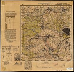
- Description:
- 1931
- Subject:
- Topical Subject: Soviet Union, Topical Subject: Maps, and Geographic Subject: Klintsy
- Publisher:
- Управление военных топографов
- Language:
- Russian
- Identifier:
- VAC9619-000051
- Genre:
- Topographic Maps and Military Maps
- Geographic Location:
- Coordinates: 52.666667, 32, 52.83333, 32.25
- Related URL:
- Download GeoTIFF: https://drive.google.com/open?id=1513MrBr07_WQOrScKAOLLV40ctwVJNvv and Catalog URL: http://iucat.iu.edu/catalog/5020131
- Abstract:
- Modern area represented: Klintsy, Bryansk oblast, Russia
- Call Number:
- G7000 s50 .S68 N-36-113-B
- Caption:
- Не подлежит оглашению,Временное издание
- City:
- Клинцы (Klintsy)
- Copyright Holder:
- No Copyright - United States
- Country:
- СССР (USSR)
- State/Province:
- Западная область (Western oblast) and РСФСР (RSFSR)
- Physical Description:
- Scale: 1:50,000
- Persistent URL:
- http://purl.dlib.indiana.edu/iudl/images/VAC9619/VAC9619-000051
- Provenance:
- Geographic Names Branch, Library of Congress Geography & Map Division
-
- Description:
- 1932
- Subject:
- Topical Subject: Soviet Union, Geographic Subject: Veliky Novgorod, and Topical Subject: Maps
- Publisher:
- Управление военных топографов РККА
- Language:
- Russian
- Identifier:
- VAC9619-000047
- Genre:
- Topographic Maps and Military Maps
- Geographic Location:
- Coordinates: 58.5, 31.25, 58.6667, 31.5
- Related URL:
- Download GeoTIFF: https://drive.google.com/open?id=1cRxd5k5Bef2UXHMEyeJHhVslovNMHpFf and Catalog URL: http://iucat.iu.edu/catalog/5020131
- Abstract:
- Modern area represented: Veliky Novgorod, Novgorod oblast, Russia
- Call Number:
- G7000 s50 .S68 sheet O-36-51-B
- Caption:
- Не подлежит оглашению,Captured map
- City:
- Новгород (Novgorod)
- Copyright Holder:
- No Copyright - United States
- Country:
- СССР (USSR)
- State/Province:
- РСФСР (RSFSR) and Ленинградская область (Leningrad oblast)
- Physical Description:
- Scale: 1:50,000
- Persistent URL:
- http://purl.dlib.indiana.edu/iudl/images/VAC9619/VAC9619-000047
- Provenance:
- Army Map Service Library, OMAHA, Library of Congress Geography & Map Division
-
- Description:
- 1928
- Subject:
- Geographic Subject: Vyazhishchi, Topical Subject: Maps, and Topical Subject: Soviet Union
- Publisher:
- Управление военных топографов
- Language:
- Russian
- Identifier:
- VAC9619-000046
- Genre:
- Topographic Maps and Military Maps
- Geographic Location:
- Coordinates: 58.5, 31, 58.6667, 31.25
- Related URL:
- Download GeoTIFF: https://drive.google.com/open?id=1fTO8da-CzgfqJ7FJX9cFxL8pxyFtmEZO and Catalog URL: http://iucat.iu.edu/catalog/5020131
- Abstract:
- Modern area represented: Vyazhishchi, Novgorod oblast, Russia
- Call Number:
- G7000 s50 .S68 sheet O-36-51-A
- Caption:
- Не подлежит оглашению,Captured map
- City:
- Вяжищи (Vyazhishchi)
- Copyright Holder:
- No Copyright - United States
- Country:
- СССР (USSR)
- State/Province:
- РСФСР (RSFSR) and Ленинградская область (Leningrad oblast)
- Physical Description:
- Scale: 1:50,000
- Persistent URL:
- http://purl.dlib.indiana.edu/iudl/images/VAC9619/VAC9619-000046
- Provenance:
- Army Map Service Library, OMAHA, Library of Congress Geography & Map Division
-
- Description:
- 1937
- Subject:
- Geographic Subject: Sennaya Kerest, Topical Subject: Maps, and Topical Subject: Soviet Union
- Publisher:
- Главное управление государственной съемки и картографии НКВД СССР
- Language:
- Russian
- Date Created:
- 1941
- Identifier:
- VAC9619-000045
- Genre:
- Military Maps and Topographic Maps
- Geographic Location:
- Coordinates: 59, 31.25, 59.1667, 31.5
- Related URL:
- Catalog URL: http://iucat.iu.edu/catalog/5020131 and Download GeoTIFF: https://drive.google.com/open?id=1Xt8g3fvVgQ95j7zy7NFQC1RMN4YRgcmi
- Abstract:
- Modern area represented: Sennaya Kerest, Novgorod oblast, Russia
- Call Number:
- G7000 s50 .S68 sheet O-36-27-D
- Caption:
- Для служебного пользования,Captured map
- City:
- Сенная Кересть (Sennaya Kerest’)
- Copyright Holder:
- No Copyright - United States
- Country:
- СССР (USSR)
- State/Province:
- Тосненский район (Tosnensky district), Ленинградская область (Leningrad oblast), РСФСР (RSFSR), and Чудовский район (Chudovsky district)
- Physical Description:
- Scale: 1:50,000
- Persistent URL:
- http://purl.dlib.indiana.edu/iudl/images/VAC9619/VAC9619-000045
- Provenance:
- DMA Topographic Center, Army Map Service Library, OMAHA, Library of Congress Geography & Map Division
-
- Description:
- 1937
- Subject:
- Topical Subject: Soviet Union, Geographic Subject: Babino, and Topical Subject: Maps
- Publisher:
- Главное управление государственной съемки и картографии НКВД СССР
- Language:
- Russian
- Date Created:
- 1941
- Identifier:
- VAC9619-000044
- Genre:
- Military Maps and Topographic Maps
- Geographic Location:
- Coordinates: 59.1667, 31.25, 59.3333, 31.5
- Related URL:
- Download GeoTIFF: https://drive.google.com/open?id=117pSSxlZhQGDjutRAtCtoaIqVDkp3Xa0 and Catalog URL: http://iucat.iu.edu/catalog/5020131
- Abstract:
- Modern area represented:
- Call Number:
- G7000 s50 .S68 sheet O-36-27-B
- Caption:
- Секретно,Captured map
- City:
- Бабино (Babino)
- Copyright Holder:
- No Copyright - United States
- Country:
- СССР (USSR)
- State/Province:
- Тосненский район (Tosnensky district), РСФСР (RSFSR), Ленинградская область (Leningrad oblast), and Чудовский район (Chudovsky district)
- Physical Description:
- Scale: 1:50,000
- Persistent URL:
- http://purl.dlib.indiana.edu/iudl/images/VAC9619/VAC9619-000044
- Provenance:
- DMA Topographic Center, Army Map Service Library, OMAHA, Library of Congress Geography & Map Division
-
- Description:
- 1937
- Subject:
- Topical Subject: Soviet Union, Geographic Subject: Korkino, and Topical Subject: Maps
- Publisher:
- Главное управление государственной съемки и картографии НКВД СССР
- Language:
- Russian
- Date Created:
- 1941
- Identifier:
- VAC9619-000043
- Genre:
- Topographic Maps and Military Maps
- Geographic Location:
- Coordinates: 59.1667, 31, 59.3333, 31.25
- Related URL:
- Catalog URL: http://iucat.iu.edu/catalog/5020131 and Download GeoTIFF: https://drive.google.com/open?id=1bsTUMvoE0kAKG1XeVu6aZENX9H3qNZIO
- Abstract:
- Modern area represented: Korkino, Russia
- Call Number:
- G7000 s50 .S68 sheet O-36-27-A
- Caption:
- Для служебного пользования
- City:
- Коркино (Korkino)
- Copyright Holder:
- No Copyright - United States
- Country:
- СССР (USSR)
- State/Province:
- РСФСР (RSFSR), Тосненский район (Tosnensky district), and Ленинградская область (Leningrad oblast)
- Physical Description:
- Scale: 1:50,000
- Persistent URL:
- http://purl.dlib.indiana.edu/iudl/images/VAC9619/VAC9619-000043
- Provenance:
- DMA Topographic Center, Army Map Service Library, OMAHA, Library of Congress Geography & Map Division
-
- Description:
- 1937
- Subject:
- Geographic Subject: Kubolovo, Topical Subject: Soviet Union, and Topical Subject: Maps
- Publisher:
- Главное управление государственной съемки и картографии НКВД СССР
- Language:
- Russian
- Date Created:
- 1941
- Identifier:
- VAC9619-000042
- Genre:
- Topographic Maps and Military Maps
- Geographic Location:
- Coordinates: 59, 30.75, 59.1667, 31
- Related URL:
- Download GeoTIFF: https://drive.google.com/open?id=1Zo_O0BWAAl8rG6V8h9VkfMkerMU104rZ and Catalog URL: http://iucat.iu.edu/catalog/5020131
- Abstract:
- Modern area represented: Kubolovo, Russia
- Call Number:
- G7000 s50 .S68 sheet O-36-26-D
- Caption:
- Секретно,Captured map
- City:
- Куболово (Kubolovo)
- Copyright Holder:
- No Copyright - United States
- Country:
- СССР (USSR)
- State/Province:
- Тосненский район (Tosnensky district), Оредежский район (Oredezhsky district), Ленинградская область (Leningrad oblast), Новгородский район (Novgorod distric...
- Physical Description:
- Scale: 1:50,000
- Persistent URL:
- http://purl.dlib.indiana.edu/iudl/images/VAC9619/VAC9619-000042
- Provenance:
- DMA Topographic Center, Army Map Service Library, OMAHA, Library of Congress Geography & Map Division
-
- Description:
- 1937
- Subject:
- Geographic Subject: Nesterkovo, Topical Subject: Maps, and Topical Subject: Soviet Union
- Publisher:
- Главное управление государственной съемки и картографии НКВД СССР
- Language:
- Russian
- Date Created:
- 1941
- Identifier:
- VAC9619-000041
- Genre:
- Topographic Maps and Military Maps
- Geographic Location:
- Coordinates: 59, 30.5, 59.1667, 30.75
- Related URL:
- Catalog URL: http://iucat.iu.edu/catalog/5020131 and Download GeoTIFF: https://drive.google.com/open?id=15zmLpNAtR49LfgQ9suZDHQMWXpE-EEqP
- Abstract:
- Modern area represented: Nesterkovo, Russia
- Call Number:
- G7000 s50 .S68 sheet O-36-26-C
- Caption:
- Секретно,Captured map
- City:
- Нестерково (Nesterkovo)
- Copyright Holder:
- No Copyright - United States
- Country:
- СССР (USSR)
- State/Province:
- РСФСР (RSFSR), Оредежский район (Oredezhsky district), Тосненский район (Tosnensky district), and Ленинградская область (Leningrad oblast)
- Physical Description:
- Scale: 1:50,000
- Persistent URL:
- http://purl.dlib.indiana.edu/iudl/images/VAC9619/VAC9619-000041
- Provenance:
- DMA Topographic Center, Army Map Service Library, OMAHA, Library of Congress Geography & Map Division
-
- Description:
- 1937
- Subject:
- Geographic Subject: Lyuban, Topical Subject: Soviet Union, and Topical Subject: Maps
- Publisher:
- Главное управление государственной съемки и картографии НКВД СССР
- Language:
- Russian
- Date Created:
- 1941
- Identifier:
- VAC9619-000037
- Genre:
- Topographic Maps and Military Maps
- Geographic Location:
- Coordinates: 59.3333, 31, 59.5, 31.25
- Related URL:
- Download GeoTIFF: https://drive.google.com/open?id=1tL7TavgtAjhyMQpivDTR1Q14PmTqYfr3 and Catalog URL: http://iucat.iu.edu/catalog/5020131
- Abstract:
- Modern area represented: Lyuban, Russia
- Call Number:
- G7000 s50 .S68 sheet O-36-15-C
- Caption:
- Для служебного пользования,Captured map
- City:
- Любань (Lyuban)
- Copyright Holder:
- No Copyright - United States
- Country:
- СССР (USSR)
- State/Province:
- Тосненский район (Tosnensky district), Ленинградская область (Leningrad oblast), and РСФСР (RSFSR)
- Physical Description:
- Scale: 1:50,000
- Persistent URL:
- http://purl.dlib.indiana.edu/iudl/images/VAC9619/VAC9619-000037
- Provenance:
- DMA Topographic Center, Army Map Service Library, Library of Congress Geography & Map Division
-

- Description:
- 1937
- Subject:
- Geographic Subject: Lyuban, Topical Subject: Maps, and Topical Subject: Soviet Union
- Publisher:
- Главное управление геодезии и картографии при СНК СССР
- Language:
- Russian
- Date Created:
- 1941
- Identifier:
- VAC9619-000038
- Genre:
- Military Maps and Topographic Maps
- Geographic Location:
- Coordinates: 59.3333, 31.25, 59.5, 31.5
- Related URL:
- Catalog URL: http://iucat.iu.edu/catalog/5020131 and Download GeoTIFF: https://drive.google.com/open?id=1pCEJjO8p7ASUgF6_aNi1rh6126bkDjgo
- Abstract:
- Modern area represented: Lyuban, Russia
- Call Number:
- G7000 s50 .S68 sheet O-36-15-D
- Caption:
- Для служебного пользования,Captured map
- City:
- Любань (Lyuban)
- Copyright Holder:
- No Copyright - United States
- Country:
- СССР (USSR)
- State/Province:
- Ленинградская область (Leningrad oblast), Тосненский район (Tosnensky district), and РСФСР (RSFSR)
- Physical Description:
- Scale: 1:50,000
- Persistent URL:
- http://purl.dlib.indiana.edu/iudl/images/VAC9619/VAC9619-000038
- Provenance:
- DMA Topographic Center, Army Map Service Library, Library of Congress Geography & Map Division
-
- Description:
- 1939
- Subject:
- Topical Subject: Maps, Topical Subject: Soviet Union, and Geographic Subject: Konechki
- Publisher:
- Главное управление геодезии и картографии при СНК СССР
- Language:
- Russian
- Date Created:
- 1941
- Identifier:
- VAC9619-000039
- Genre:
- Topographic Maps and Military Maps
- Geographic Location:
- Coordinates: 59.1667, 30.5, 59.3333, 30.75
- Related URL:
- Download GeoTIFF: https://drive.google.com/open?id=1uFmKSznFMTDRpqtx6S9Qzwgseet02wel and Catalog URL: http://iucat.iu.edu/catalog/5020131
- Abstract:
- Modern area represented: Konechki, Russia
- Call Number:
- G7000 s50 .S68 sheet O-36-26-A
- Caption:
- Для служебного пользования
- City:
- Конечки (Konechki)
- Copyright Holder:
- No Copyright - United States
- Country:
- СССР (USSR)
- State/Province:
- Тосненский район (Tosnensky district), Оредежский район (Oredezhsky district), РСФСР (RSFSR), and Ленинградская область (Leningrad oblast)
- Physical Description:
- Scale: 1:50,000
- Persistent URL:
- http://purl.dlib.indiana.edu/iudl/images/VAC9619/VAC9619-000039
- Provenance:
- Army Map Service Library, OMAHA, Library of Congress Geography & Map Division
-
- Description:
- 1937
- Subject:
- Topical Subject: Maps, Geographic Subject: Berezovka, and Topical Subject: Soviet Union
- Publisher:
- Главное управление геодезии и картографии при СНК СССР
- Language:
- Russian
- Date Created:
- 1941
- Identifier:
- VAC9619-000036
- Genre:
- Military Maps and Topographic Maps
- Geographic Location:
- Coordinates: 59.5, 31.25, 59.6667, 31.5
- Related URL:
- Catalog URL: http://iucat.iu.edu/catalog/5020131 and Download GeoTIFF: https://drive.google.com/open?id=1K-4TaV6ai4Iiu-cWnsRvilhm9aSXLHgI
- Abstract:
- Modern area represented: Berezovka, Russia
- Call Number:
- G7000 s50 .S68 sheet O-36-15-B
- Caption:
- Для служебного пользования,Captured map
- City:
- Березовка (Berezovka)
- Copyright Holder:
- No Copyright - United States
- Country:
- СССР (USSR)
- State/Province:
- Мгинский район (Mginsky district), Тосненский район (Tosnensky district), Ленинградская область (Leningrad oblast), and РСФСР (RSFSR)
- Physical Description:
- Scale: 1:50,000
- Persistent URL:
- http://purl.dlib.indiana.edu/iudl/images/VAC9619/VAC9619-000036
- Provenance:
- DMA Topographic Center, Army Map Service Library, Library of Congress Geography & Map Division
-
- Description:
- 1939
- Subject:
- Geographic Subject: Andrianovo, Topical Subject: Soviet Union, and Topical Subject: Maps
- Publisher:
- Главное управление геодезии и картографии при СНК СССР
- Language:
- Russian
- Date Created:
- 1941
- Identifier:
- VAC9619-000034
- Genre:
- Topographic Maps and Military Maps
- Geographic Location:
- Coordinates: 59.3333, 30.75, 59.5, 31
- Related URL:
- Catalog URL: http://iucat.iu.edu/catalog/5020131 and Download GeoTIFF: https://drive.google.com/open?id=12n12KgfSHveIr-05tKJpNCvVMNJQjba2
- Abstract:
- Modern area represented: Andrianovo, Russia
- Call Number:
- G7000 s50 .S68 sheet O-36-14-D
- Caption:
- Для служебного пользования,Captured map
- City:
- Андрианово (Andrianovo)
- Copyright Holder:
- No Copyright - United States
- Country:
- СССР (USSR)
- State/Province:
- Тосненский район (Tosnensky district), Ленинградская область (Leningrad oblast), and РСФСР (RSFSR)
- Physical Description:
- Scale: 1:50,000
- Persistent URL:
- http://purl.dlib.indiana.edu/iudl/images/VAC9619/VAC9619-000034
- Provenance:
- DMA Topographic Center, Army Map Service Library, Library of Congress Geography & Map Division
-
- Description:
- 1923
- Subject:
- Topical Subject: Maps, Topical Subject: Soviet Union, and Geographic Subject: Shapki
- Publisher:
- Генеральный штаб Красной Армии
- Language:
- Russian
- Identifier:
- VAC9619-000035
- Genre:
- Military Maps and Topographic Maps
- Geographic Location:
- Coordinates: 59.5, 31, 59.6667, 31.25
- Related URL:
- Catalog URL: http://iucat.iu.edu/catalog/5020131 and Download GeoTIFF: https://drive.google.com/open?id=1pnXX5eBFqTSFiO4enlk46tMrYZhszTOu
- Abstract:
- Modern area represented: Shapki, Russia
- Call Number:
- G7000 s50 .S68 sheet O-36-15-A
- Caption:
- Для служебного пользования,Captured map
- City:
- Шапки (Shapki)
- Copyright Holder:
- No Copyright - United States
- Country:
- СССР (USSR)
- State/Province:
- РСФСР (RSFSR) and Ленинградская область (Leningrad oblast)
- Physical Description:
- Scale: 1:50,000
- Persistent URL:
- http://purl.dlib.indiana.edu/iudl/images/VAC9619/VAC9619-000035
- Provenance:
- DMA Topographic Center, Army Map Service Library, Library of Congress Geography & Map Division
-

- Description:
- 1939
- Subject:
- Topical Subject: Maps, Topical Subject: Soviet Union, and Geographic Subject: Nenikyul
- Publisher:
- Главное управление геодезии и картографии при СНК СССР
- Language:
- Russian
- Date Created:
- 1941
- Identifier:
- VAC9619-000033
- Genre:
- Military Maps and Topographic Maps
- Geographic Location:
- Coordinates: 59.3333, 30.5, 59.5, 30.75
- Related URL:
- Download GeoTIFF: https://drive.google.com/open?id=1fzM4KJdQgLjgoSrc_T1claIyyEVQCLRB and Catalog URL: http://iucat.iu.edu/catalog/5020131
- Abstract:
- Modern area represented: Nenikyul, Russia
- Call Number:
- G7000 s50 .S68 sheet O-36-14-C
- Caption:
- Для служебного пользования,Captured map
- City:
- Неникюль (Nenikyul)
- Copyright Holder:
- No Copyright - United States
- Country:
- СССР (USSR)
- State/Province:
- Ленинградская область (Leningrad oblast) and РСФСР (RSFSR)
- Physical Description:
- Scale: 1:50,000
- Persistent URL:
- http://purl.dlib.indiana.edu/iudl/images/VAC9619/VAC9619-000033
- Provenance:
- Army Map Service Library, OMAHA, Library of Congress Geography & Map Division
-
- Subject:
- Geographic Subject: Tosno, Topical Subject: Soviet Union, and Topical Subject: Maps
- Publisher:
- Управление военных топографов
- Language:
- Russian
- Identifier:
- VAC9619-000032
- Genre:
- Military Maps and Topographic Maps
- Geographic Location:
- Coordinates: 59.5, 30.75, 59.6667, 31
- Related URL:
- Download GeoTIFF: https://drive.google.com/open?id=1KasYTJFBj4aMCqxjh4ZYJzfQGHY3uXfO and Catalog URL: http://iucat.iu.edu/catalog/5020131
- Abstract:
- Modern area represented: Tosno, Russia
- Call Number:
- G7000 s50 .S68 sheet O-36-14-B
- Caption:
- Не подлежит оглашению
- City:
- Тосно (Tosno)
- Copyright Holder:
- No Copyright - United States
- Country:
- СССР (USSR)
- State/Province:
- РСФСР (RSFSR) and Ленинградская область (Leningrad oblast)
- Physical Description:
- Scale: 1:50,000
- Persistent URL:
- http://purl.dlib.indiana.edu/iudl/images/VAC9619/VAC9619-000032
- Provenance:
- Army Map Service Library, OMAHA, Library of Congress Geography & Map Division
-
- Description:
- 1937
- Subject:
- Topical Subject: Soviet Union, Geographic Subject: Plyussa, and Topical Subject: Maps
- Publisher:
- Генеральный штаб РККА
- Language:
- Russian
- Identifier:
- VAC9619-000030
- Genre:
- Topographic Maps and Military Maps
- Geographic Location:
- Coordinates: 58.333, 29.25, 58.5, 29.5
- Related URL:
- Catalog URL: http://iucat.iu.edu/catalog/5020131 and Download GeoTIFF: https://drive.google.com/open?id=1OP_m9uayq_QWeJiS3O7i54yLcEGmsrUr
- Abstract:
- Modern area represented: Plyussa, Pskov oblast, Russia
- Call Number:
- G7000 s50 .S68 sheet O-35-59-D
- Caption:
- Не подлежит оглашению,Captured map
- City:
- Плюсса (Plyussa)
- Copyright Holder:
- No Copyright - United States
- Country:
- СССР (USSR)
- State/Province:
- РСФСР (RSFSR) and Ленинградская область (Leningrad oblast)
- Physical Description:
- Scale: 1:50,000
- Persistent URL:
- http://purl.dlib.indiana.edu/iudl/images/VAC9619/VAC9619-000030
- Provenance:
- Army Map Service Library, OMAHA, Library of Congress Geography & Map Division
