Indiana University
Indiana University
IU
Skip to Content
Digital Collections
Toggle navigation
Digital
Collections
Switch language
English
Switch language
Deutsch
English
Español
Français
Italiano
Português do Brasil
中文
Login
Home
About
Contact
Search Digital Collections
Go
×
Search Constraints
Start Over
You searched for:
County
Inyo
Remove constraint County: Inyo
Date Created
1952-04-08
Remove constraint Date Created: 1952-04-08
1
-
31
of
31
Sort by relevance ▼
relevance ▼
recently updated
title ▲
title ▼
date created ▲
date created ▼
pages ▲
pages ▼
collection size ▲
collection size ▼
Number of results to display per page
50 per page
10
per page
20
per page
50
per page
100
per page
View results as:
List
Gallery
Masonry
Search Results
1.
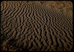
Ripples in a sand dune near Stovepipe Wells, in Death Valley. California.
2.
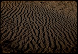
Sand ripples in dune nr. Stovepipe Wells. Death Valley.
3.
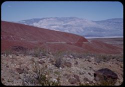
View across Panamint Valley to Panamint Mtns. from Cal. Hwy 190 across Argus Range.
4.
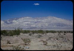
From Panamint Springs across Panamint Valley to Panamint Range.
5.
Panamint Valley and Panamint Range from west. Near Death Valley, Calif.
6.
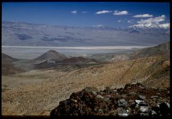
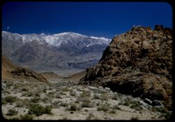
From a canyon in Argus Range view is across upper Panamint Valley toward the Panamint Range. California.
7.
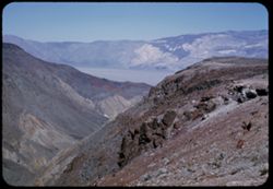
View from Argus Mtns. east across Panamint Valley to Panamint Mtns. - on way to Death Valley.
8.
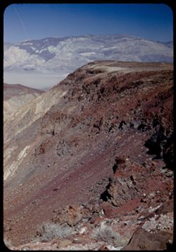
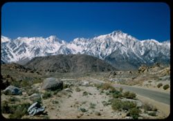
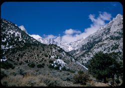
Snow-crowned Panamint Range seen from Cal. Hwy 190 40 mi. S.E. of Lone Pine. Calif.
9.
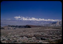
The very high Sierra from Calif. Hwy 190 25 mi. S.E. of Lone Pine.
10.
Lone Pine Peak + neighbors south of Whitney - High Sierra. Calif.
11.
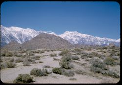
Inyo Mtns. of California seen from Lone Pine.
12.
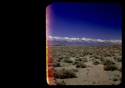
View east across Owens Valley toward Inyo Mtns. From Alabama Hills on the Mt. Whitney road. California.
13.
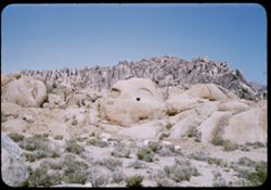
Gorilla and shark. Alabama Hills west of Lone Pine Calif.
14.
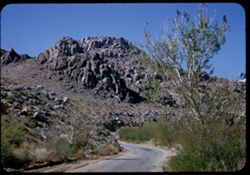
In the Alabama Hills just west of Lone Pine. California.
15.
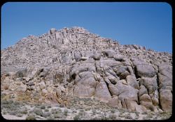
Crazy rocks along lower Mt. Whitney road west of Lone Pine, Calif.
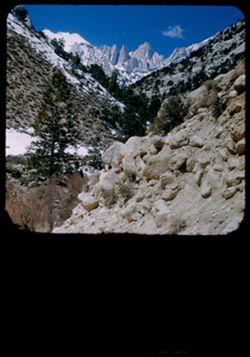
16.
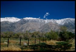
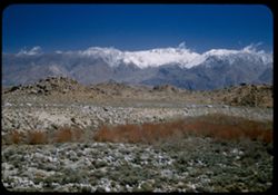
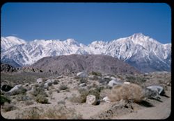
Across Owens Valey to snow-capped Inyo Mtns. From Mt. Whitney road above Lone Pine, Calif.
17.
Owens Valley from Mt. Whitney Road toward Inyo Mtns. California.
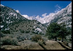
18.
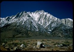
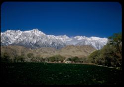
Mount Whitney - 14,495 ft. - with its spires - seen from Portal Station.
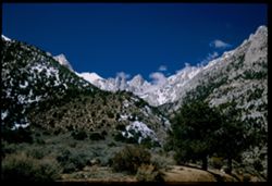
19.
Mount Whitney in the Sierra Nevada, 14,495 ft. = California.
20.
Mt. Whitney and spires from Lone Pine - Whitney rds.
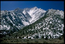
21.
Mt. Langley - 14,042. Sierra Nevada near Lone Pine.
22.
Mount Whitney, 14,495 ft.
23.
Lone Pine Pk. Whitney's neighbor to the south.
24.
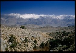
The very high Sierra Nevada to the north of Mount Whitney from the Mt. Whitney road out of Lone Pine.
25.
Crest line of the Sierra Nevada just south of Mount Whitney.
26.
Rocks of the Alabama Hills against backdrop of the High Sierra west of Lone Pine, Calif.
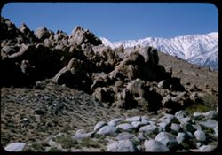
27.
One of the Alabama Hills along the road to Mt. Whitney from Lone Pine, Calif.
28.
Mount Whitney, 14,495 ft. - in exact center - in morning light.
29.
Highest of the Sierra Nevada in early morning - from Lone Pine, Calif.
30.
Clouds along the crest of the highest of the Sierra Nevada west of Lone Pine, Calif.
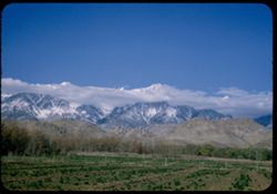
31.
From Lone Pine, Calif. Northwestward across green field to the highest of the Sierra Nevada. Mt. Williamson in center.
Toggle facets
Limit your search
Type
Image
31
Creator
Cushman, Charles W., 1896-1972
31
Subject
Shrubs
27
Mountains
26
Snow
20
Hills
19
Rocks
19
Boulders
16
Sierra Nevada (Calif. and Nev.)
14
Whitney, Mount (Calif.)
13
Trees
12
Rock formations
11
more
Subjects
»
Date Created
1952-04-08
[remove]
31
Pages
0-99 pages
31
Collections
Charles W. Cushman Kodachrome Slides
31
State
deposited
31
Campus
IUB
31
Frame Number
1
1
10
1
11
1
15
1
16
1
17
1
18
1
19
1
2
1
20
1
County
Inyo
[remove]
31
Placer
1
Series
14-52
22
15-52
9
City
Lone Pine
15
Stovepipe Wells
2
Panamint
1
Panamint Springs
1
Country
United States
31
State/Province
California
31
Holding Location
B-ARCHIVES
31