
Search Constraints
You searched for:
Provenance
Part of Geological Survey (U.S.). Indiana 1:62,500.
Remove constraint Provenance: Part of Geological Survey (U.S.). Indiana 1:62,500.
Search Results
-
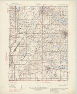
![Indiana-Illinois Princeton quadrangle [1949 printing with minor corrections]](https://iiif.uits.iu.edu/iiif/2/2801qk457%2Ffiles%2Fcc6a6a50-c066-4d88-b5e1-b12fb8789f26/full/250,/0/default.jpg)
- Subject:
- Geographic Subject: Gibson County (Ind.), Geographic Subject: Knox County (Ind.), and Geographic Subject: Wabash County (Ill.)
- Creator:
- Geological Survey (U.S.), Goodlove, C. W., Renshawe, John H., and Hawkins, Geo. T. (George T.)
- Publisher:
- Geological Survey (U.S.)
- Date Created:
- 1949
- Identifier:
- VAC3073-M-01381
- Genre:
- 15 minute topographic maps, Quadrangle maps, and Topographic maps
- Geographic Location:
- Coordinates: W0874500 W0873000 N0383000 N0381500
- Related URL:
- Catalog URL: https://iucat.iu.edu/catalog/18413586
- Abstract:
- Jno. H. Renshawe, geographer in charge , control by Geo. T. Hawkins , topography by Chas. W. Goodlove. Filing title: Princeton, Ind.-Ill. [Edition of] 1901, ...
- Call Number:
- G4090 s62 .G4 Princeton 1901 MC1949
- Caption:
- Imprint: Washington, D.C. : Interior--Geological Survey, 1949.
- Physical Description:
- Dimensions: 45 x 42 cm or smaller and Scale: 1:62,500
- Alternate Identifier:
- Title Control Number: a18413586
- Persistent URL:
- https://purl.dlib.indiana.edu/iudl/images/VAC3073/VAC3073-M-01381
- Provenance:
- Part of Geological Survey (U.S.). Indiana 1:62,500.
-
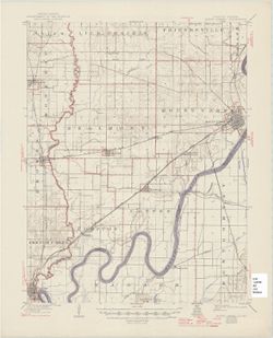
![Indiana Bloomington quadrangle [1948 reprint]](https://iiif.uits.iu.edu/iiif/2/s4656k458%2Ffiles%2F0ca1adeb-7974-4998-98de-951865ae4e02/full/250,/0/default.jpg)
- Subject:
- Geographic Subject: Monroe County (Ind.), Geographic Subject: Owen County (Ind.), and Geographic Subject: Greene County (Ind.)
- Creator:
- Marshall, R. B. (Robert Bradford), 1867-1949, Sadler, C. L., Griffin, W. H. (William H.), and Herron, W. H. (William Harrison), 1865-
- Publisher:
- Geological Survey (U.S.)
- Date Created:
- 1948
- Identifier:
- VAC3073-M-01322
- Genre:
- Topographic maps, Quadrangle maps, and 15 minute topographic maps
- Geographic Location:
- Coordinates: W0864500 W0863000 N0391500 N0390000
- Related URL:
- Catalog URL: https://iucat.iu.edu/catalog/18406221
- Abstract:
- R. B. Marshall, chief geographer , W. H. Herron, Geographer in charge , topography by W. H. Griffin and C. L. Sandler , Control by J. R. Ellis and C. H. Semp...
- Call Number:
- G4090 s62 .G4 Bloomington 1910 rep1948
- Caption:
- Imprint: [Washington, D.C.] : United States, Department of the Interior, Geological Survey, [1948]
- Physical Description:
- Scale: 1:62,500 and Dimensions: 45 x 42 cm or smaller
- Alternate Identifier:
- Title Control Number: a18406221
- Persistent URL:
- https://purl.dlib.indiana.edu/iudl/images/VAC3073/VAC3073-M-01322
- Provenance:
- Part of Geological Survey (U.S.). Indiana 1:62,500.
-
![Indiana Bloomington quadrangle [1948 reprint]](https://iiif.uits.iu.edu/iiif/2/2j62t788s%2Ffiles%2F57d817cb-ee47-4ed5-9f38-24d8a93dcb0b/full/250,/0/default.jpg)
- Subject:
- Geographic Subject: Owen County (Ind.), Geographic Subject: Greene County (Ind.), and Geographic Subject: Monroe County (Ind.)
- Creator:
- Marshall, R. B. (Robert Bradford), 1867-1949, Herron, W. H. (William Harrison), 1865-, Griffin, W. H. (William H.), and Sadler, C. L.
- Publisher:
- Geological Survey (U.S.)
- Date Created:
- 1948
- Identifier:
- VAC3073-M-01219
- Genre:
- Topographic maps, 15 minute topographic maps, and Quadrangle maps
- Geographic Location:
- Coordinates: W0880000 W0844500 N0414500 N0375200
- Related URL:
- Catalog URL: https://iucat.iu.edu/catalog/18406221
- Abstract:
- R. B. Marshall, chief geographer , W. H. Herron, Geographer in charge , topography by W. H. Griffin and C. L. Sandler , Control by J. R. Ellis and C. H. Semp...
- Call Number:
- G4090 s62 .G4 Bloomington 1910 R1948
- Caption:
- Imprint: [Washington, D.C.] : United States, Department of the Interior, Geological Survey, [1948]
- Physical Description:
- Dimensions: 45 x 42 cm or smaller and Scale: 1:62,500
- Alternate Identifier:
- Title Control Number: a18406221
- Persistent URL:
- https://purl.dlib.indiana.edu/iudl/images/VAC3073/VAC3073-M-01219
- Provenance:
- Part of Geological Survey (U.S.). Indiana 1:62,500.
-
- Subject:
- Geographic Subject: Cass County (Ind.) and Geographic Subject: Berrien County (Mich.)
- Creator:
- Geological Survey (U.S.)
- Publisher:
- Geological Survey (U.S.)
- Date Created:
- 1947
- Identifier:
- VAC3073-M-01325
- Genre:
- Quadrangle maps, Topographic maps, and 15 minute topographic maps
- Geographic Location:
- Coordinates: W0861500 W0860000 N0420000 N0414500
- Related URL:
- Catalog URL: https://iucat.iu.edu/catalog/18408371
- Abstract:
- Filing title: Cassopolis, Mich.--Ind. Edition of 1947. Polyconic projection. Indiana portion not shown, shown on 1:24,000 scale maps of South Bend West and O...
- Call Number:
- G4090 s62 .G4 Cassopolis 1947
- Caption:
- Imprint: Washington, D.C. : U.S. Geological Survey, 1947.
- Physical Description:
- Dimensions: 45 x 42 cm or smaller and Scale: 1:62,500
- Alternate Identifier:
- Title Control Number: a18408371
- Persistent URL:
- https://purl.dlib.indiana.edu/iudl/images/VAC3073/VAC3073-M-01325
- Provenance:
- Part of Geological Survey (U.S.). Indiana 1:62,500.
-
![Kentucky-Indiana Henderson quadrangle [1947 reprint]](https://iiif.uits.iu.edu/iiif/2/8g84nq007%2Ffiles%2F1905d7bd-1124-4f85-864e-258fad082d25/full/250,/0/default.jpg)
- Subject:
- Geographic Subject: Hendricks County (Ind.), Geographic Subject: Posey County (Ind.), and Geographic Subject: Vanderburgh County (Ind.)
- Creator:
- Kentucky Geological Survey, United States. Army, Herrington, R. M. (Russell McKee), 1890-1977, Goodlove, C. W., Gehres, W. S. (Wilmer Sherman), 1887-1963, Ge...
- Publisher:
- Geological Survey (U.S.)
- Date Created:
- 1947
- Identifier:
- VAC3073-M-01344
- Genre:
- 15 minute topographic maps, Quadrangle maps, and Topographic maps
- Geographic Location:
- Coordinates: W0874500 W0873000 N0380000 N0374500
- Related URL:
- Catalog URL: https://iucat.iu.edu/catalog/18408409
- Abstract:
- Filing title: Henderson, Ky.-Ind. Edition of 1916. Relief shown by contours and spot heights. Shows Henderson and Vandergurgh counties in Kentucky and Posey ...
- Call Number:
- G4090 s62 .G4 1916 rep 1947
- Caption:
- Imprint: [Washington, D.C.] : Department of the Interior, U.S. Geological Survey, [1947]
- Physical Description:
- Dimensions: 45 x 42 cm or smaller and Scale: 1:62,500
- Alternate Identifier:
- Title Control Number: a18408409
- Persistent URL:
- https://purl.dlib.indiana.edu/iudl/images/VAC3073/VAC3073-M-01344
- Provenance:
- Part of Geological Survey (U.S.). Indiana 1:62,500.
-
![Illinois-Indiana, Ridge Farm quadrangle : 15-minute series [1947 printing]](https://iiif.uits.iu.edu/iiif/2/s4656k47t%2Ffiles%2F1b742aea-c167-4972-8ac1-b0b7bb864c42/full/250,/0/default.jpg)
- Subject:
- Geographic Subject: Edgar County (Ill.) and Geographic Subject: Vermilion County (Ill.)
- Creator:
- Geological Survey (U.S.) and Illinois State Geological Survey
- Publisher:
- Geological Survey (U.S.)
- Date Created:
- 1947
- Identifier:
- VAC3073-M-01391
- Genre:
- Topographic maps, 15 minute topographic maps, and Quadrangle maps
- Geographic Location:
- Coordinates: W0874500 W0873000 N0400000 N0394500
- Related URL:
- Catalog URL: https://iucat.iu.edu/catalog/18413964
- Abstract:
- Mapped by the Geological Survey. Filing title: Ridge Farm, Ill.-Ind. Edition of 1947. Polyconic projection. Relief shown by contours and spot heights. Contou...
- Call Number:
- G4090 s62 .G4 Ridge Farm 1947
- Caption:
- Imprint: [Washington, D.C.] : U.S. Geological Survey, [1947]
- Physical Description:
- Scale: 1:62,500 and Dimensions: 45 x 42 cm or smaller
- Alternate Identifier:
- Title Control Number: a18413964
- Persistent URL:
- https://purl.dlib.indiana.edu/iudl/images/VAC3073/VAC3073-M-01391
- Provenance:
- Part of Geological Survey (U.S.). Indiana 1:62,500.
-
![Indiana-Illinois, Vincennes quadrangle : topography [1946 reprint with corrections and without vegetation]](https://iiif.uits.iu.edu/iiif/2/n009x521b%2Ffiles%2Fda21d6eb-ada6-4f1f-8c3c-8022f31eb1a9/full/250,/0/default.jpg)
- Subject:
- Geographic Subject: Lawrence County (Ill.), Geographic Subject: Knox County (Ind.), Geographic Subject: Gibson County (Ind.), and Geographic Subject: Wabash ...
- Creator:
- Geological Survey (U.S.), U.S. Coast and Geodetic Survey, Tweedy, Frank, 1854-1937, Illinois State Geological Survey, Marshall, R. B. (Robert Bradford), 1867...
- Publisher:
- Geological Survey (U.S.)
- Date Created:
- 1946
- Identifier:
- VAC3073-M-01410
- Genre:
- 15 minute topographic maps, Quadrangle maps, and Topographic maps
- Geographic Location:
- Coordinates: W0874500 W0873000 N0384500 N0383000
- Related URL:
- Catalog URL: https://iucat.iu.edu/catalog/18415510
- Abstract:
- R.B. Marshall, chief geographer , W.H. Herron, geographer in charge , topography by Frank Tweedy, C.L. Sadler, Chas. Hartmann, Jr., L.L. Lee, W.S. Gehres, an...
- Call Number:
- G4090 s62 .G4 Vincennes 1915 rep1946
- Caption:
- Imprint: [Washington, D.C.] : U.S. Geological Survey, 1946
- Physical Description:
- Scale: 1:62,500 and Dimensions: 45 x 42 cm or smaller
- Alternate Identifier:
- Title Control Number: a18415510
- Persistent URL:
- https://purl.dlib.indiana.edu/iudl/images/VAC3073/VAC3073-M-01410
- Provenance:
- Part of Geological Survey (U.S.). Indiana 1:62,500.
-
![Indiana Bloomington quadrangle [1946 reprint with 21 indexed cave locations]](https://iiif.uits.iu.edu/iiif/2/dz011t645%2Ffiles%2Fbb3033b6-3144-4af2-a6c7-a5710771ff06/full/250,/0/default.jpg)
- Subject:
- Geographic Subject: Owen County (Ind.), Geographic Subject: Monroe County (Ind.), Topical Subject: Caves, and Geographic Subject: Greene County (Ind.)
- Creator:
- Griffin, W. H. (William H.), Marshall, R. B. (Robert Bradford), 1867-1949, Sadler, C. L., and Herron, W. H. (William Harrison), 1865-
- Publisher:
- Geological Survey (U.S.)
- Date Created:
- 1946
- Identifier:
- VAC3073-M-01218
- Genre:
- Topographic maps, Quadrangle maps, and 15 minute topographic maps
- Geographic Location:
- Coordinates: W0864500 W0863000 N0391500 N0390000
- Related URL:
- Catalog URL: https://iucat.iu.edu/catalog/18406221
- Abstract:
- R. B. Marshall, chief geographer , W. H. Herron, Geographer in charge , topography by W. H. Griffin and C. L. Sandler , Control by J. R. Ellis and C. H. Semp...
- Call Number:
- G4090 s62 .G4 Bloomington 1910 R1946
- Caption:
- Imprint: [Washington, D.C.] : United States, Department of the Interior, Geological Survey, [1946]
- Physical Description:
- Scale: 1:62,500 and Dimensions: 45 x 42 cm or smaller
- Alternate Identifier:
- Title Control Number: a18406221
- Persistent URL:
- https://purl.dlib.indiana.edu/iudl/images/VAC3073/VAC3073-M-01218
- Provenance:
- Part of Geological Survey (U.S.). Indiana 1:62,500.
-
![Danville quadrangle, Illinois-Indiana : topographic sheet [1946 reprint]](https://iiif.uits.iu.edu/iiif/2/dz011t65f%2Ffiles%2F0d88511d-4915-434c-875f-219d4a99befe/full/250,/0/default.jpg)
- Subject:
- Geographic Subject: Danville Region (Ill.), Geographic Subject: Vermillion County (Ind.), and Geographic Subject: Vermilion County (Ill.)
- Creator:
- Lloyd, W. J. (Topographer), Illinois. Department of Registration and Education, Geological Survey (U.S.), Illinois State Geological Survey, Hawkins, Geo. T. ...
- Publisher:
- Geological Survey (U.S.)
- Date Created:
- 1946
- Identifier:
- VAC3073-M-01311
- Genre:
- 15 minute topographic maps, Quadrangle maps, and Topographic maps
- Geographic Location:
- Coordinates: W0874500 W0873000 N0401500 N0400000
- Related URL:
- Catalog URL: https://iucat.iu.edu/catalog/18409392
- Abstract:
- Jno. H. Renshawe, geographer in charge , control by U.S. Lake Survey and Geo. T. Hawkins , topography by W. J. Lloyd. Edition of Nov. 1900, reprinted 1946 wi...
- Call Number:
- G4090 s62 .G4 Danville 1900 R1946
- Caption:
- Imprint: [Washington, D.C.] : Geological Survey, [1946]
- Physical Description:
- Scale: 1:62,500 and Dimensions: 45 x 42 cm or smaller
- Alternate Identifier:
- Title Control Number: a18409392
- Persistent URL:
- https://purl.dlib.indiana.edu/iudl/images/VAC3073/VAC3073-M-01311
- Provenance:
- Part of Geological Survey (U.S.). Indiana 1:62,500.
-
- Subject:
- Geographic Subject: Gibson County (Ind.), Geographic Subject: Edwards County (Ill.), and Geographic Subject: Wabash County (Ind.)
- Creator:
- Geological Survey (U.S.)
- Publisher:
- Geological Survey (U.S.)
- Date Created:
- 1946
- Identifier:
- VAC3073-M-01351
- Genre:
- Topographic maps, 15 minute topographic maps, and Quadrangle maps
- Geographic Location:
- Coordinates: W0880000 W0874500 N0383000 N0381500
- Related URL:
- Catalog URL: https://iucat.iu.edu/catalog/18412720
- Abstract:
- Filing title: Mount Carmel, Ill.-Ind. Edition of 1904, reprinted 1946 with corrections. Polyconic projection. Relief shown by contours and spot heights. Cont...
- Call Number:
- G4090 s62 .G4 Mount Carmel 1904 rep 1946
- Caption:
- Imprint: [Washington, D.C.] : U.S. Geological Survey, 1946
- Physical Description:
- Scale: 1:62,500 and Dimensions: 45 x 42 cm or smaller
- Alternate Identifier:
- Title Control Number: a18412720
- Persistent URL:
- https://purl.dlib.indiana.edu/iudl/images/VAC3073/VAC3073-M-01351
- Provenance:
- Part of Geological Survey (U.S.). Indiana 1:62,500.
