
Search Constraints
You searched for:
Provenance
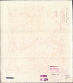
DMA Topographic Center, Army Map Service Library, OMAHA
Remove constraint Provenance: DMA Topographic Center, Army Map Service Library, OMAHA
Search Results
-
- Description:
- 1923
- Subject:
- Topical Subject: Soviet Union, Topical Subject: Maps, and Geographic Subject: Beryslav
- Publisher:
- Генеральный штаб Красной Армии
- Language:
- Russian
- Date Created:
- 1941
- Identifier:
- VAC9619-001887
- Genre:
- Topographic Maps and Military Maps
- Geographic Location:
- Coordinates: 46.6667, 33, 47, 33.5
- Related URL:
- Catalog URL: https://iucat.iu.edu/catalog/5020129 and Download GeoTIFF: https://drive.google.com/open?id=15CCT7KeDTW2OAhyErSFxC6JA8ziWovVn
- Abstract:
- Modern area represented: Beryslav, Kherson oblast, Ukraine
- Call Number:
- G7000 s100 .S7 sheet L-36-43
- Caption:
- Для служебного пользования
- City:
- Берислав (Beryslav)
- Copyright Holder:
- No Copyright - United States
- Country:
- СССР (USSR)
- State/Province:
- Николаевская область (Mykolaiv oblast) and Украинская ССР (Ukrainian Soviet Socialist Republic)
- Physical Description:
- Scale: 1:100,000
- Persistent URL:
- http://purl.dlib.indiana.edu/iudl/images/VAC9619/VAC9619-001887
- Provenance:
- DMA Topographic Center, Army Map Service Library, OMAHA
-
- Description:
- 1921
- Subject:
- Topical Subject: Soviet Union, Topical Subject: Maps, and Geographic Subject: Великі Копані (Velyki Kopani)
- Publisher:
- Управление военных топографов
- Language:
- Russian
- Date Created:
- 1933
- Identifier:
- VAC9619-000122
- Genre:
- Military Maps and Topographic Maps
- Geographic Location:
- Coordinates: 46.3333, 32.75, 46.5, 33
- Related URL:
- https://drive.google.com/open?id=1YVaxNwv9dRB21t0pKObSeHn__dPVCw7l, Download GeoTIFF: https://drive.google.com/open?id=1PpCBrQtUKhwRBcPpZgQf3aNkYSHRD9F5, and...
- Abstract:
- Modern area represented: Velyki Kopani, Kherson oblast, Ukraine
- Call Number:
- G7000 s50 .S68 sheet L-36-54-D
- Caption:
- Не подлежит оглашению,Секретно
- City:
- Большие Копани (Bolshiye Kopani)
- Copyright Holder:
- No Copyright - United States
- Country:
- СССР (USSR)
- State/Province:
- Украинская ССР (Ukrainian Soviet Socialist Republic)
- Physical Description:
- Scale: 1:50,000
- Persistent URL:
- http://purl.dlib.indiana.edu/iudl/images/VAC9619/VAC9619-000122
- Provenance:
- DMA Topographic Center, Army Map Service Library, OMAHA
-
- Description:
- 1936
- Subject:
- Geographic Subject: Byerazino, Topical Subject: Maps, and Topical Subject: Soviet Union
- Publisher:
- Генеральный штаб Красной Армии
- Language:
- Russian
- Date Created:
- 1939
- Identifier:
- VAC9619-004082
- Genre:
- Military Maps and Topographic Maps
- Geographic Location:
- Coordinates: 53.667, 28.5, 54, 29
- Related URL:
- Catalog URL: https://iucat.iu.edu/catalog/5020129 and Download GeoTIFF: https://drive.google.com/file/d/1N0dzHoCX3MK_EVHX5qxuHNCcjlfdvEZS/view?usp=sharing
- Abstract:
- Modern area represented: Byerazino, Belarus
- Call Number:
- G7000 s100 .S7 sheet N-35-82
- Caption:
- Не подлежит оглашению
- City:
- Березино (Byerazino)
- Copyright Holder:
- No Copyright - United States
- Country:
- СССР (USSR)
- State/Province:
- Минская область (Minsk oblast), Белорусская ССР (Byelorussian Soviet Socialist Republic), and Могилевская область (Mogilev oblast)
- Physical Description:
- Scale: 1:100,000
- Persistent URL:
- http://purl.dlib.indiana.edu/iudl/images/VAC9619/VAC9619-004082
- Provenance:
- DMA Topographic Center, Army Map Service Library, OMAHA
-
- Description:
- 1929
- Subject:
- Topical Subject: Maps, Geographic Subject: Olsztynek, and Topical Subject: Soviet Union
- Publisher:
- Генеральный штаб РККА
- Language:
- Russian
- Date Created:
- 1936
- Identifier:
- VAC9619-003956
- Genre:
- Military Maps and Topographic Maps
- Geographic Location:
- Coordinates: 53.333, 20, 53.667, 20.5
- Related URL:
- Download GeoTIFF: https://drive.google.com/file/d/1buUda318Lq2zsO4SHgHXZckJJuRy45vx/view?usp=sharing and Catalog URL: https://iucat.iu.edu/catalog/5020129
- Abstract:
- Modern area represented: Olsztynek, Warmia-Masuria, Poland
- Call Number:
- G7000 s100 .S7 sheet N-34-89
- City:
- Хохенштайн (Hohenstein)
- Copyright Holder:
- No Copyright - United States
- Country:
- Германия (Germany)
- Physical Description:
- Scale: 1:100,000
- Persistent URL:
- http://purl.dlib.indiana.edu/iudl/images/VAC9619/VAC9619-003956
- Provenance:
- DMA Topographic Center, Army Map Service Library, OMAHA
-
- Description:
- 1931
- Subject:
- Topical Subject: Soviet Union, Geographic Subject: Narodychi, and Topical Subject: Maps
- Publisher:
- Генеральный штаб РККА
- Language:
- Russian
- Identifier:
- VAC9619-003113
- Genre:
- Topographic Maps and Military Maps
- Geographic Location:
- Coordinates: 51, 29, 51.333, 29.5
- Related URL:
- Download GeoTIFF: https://drive.google.com/file/d/1R6r7PVE4FRVtVB2SkSSwB2vzarPEKXmX/view?usp=sharing and Catalog URL: https://iucat.iu.edu/catalog/5020129
- Abstract:
- Modern area represented: Narodychi, Zhytomyr oblast, Ukraine
- Call Number:
- G7000 s100 .S7 sheet M-35-35
- Caption:
- Не подлежит оглашению
- City:
- Народичи (Narodychi)
- Copyright Holder:
- No Copyright - United States
- Country:
- СССР (USSR)
- State/Province:
- Киевская область (Kyiv oblast), Житомирская область (Zhytomyr oblast), and Украинская ССР (Ukrainian Soviet Socialist Republic)
- Physical Description:
- Scale: 1:100,000
- Persistent URL:
- http://purl.dlib.indiana.edu/iudl/images/VAC9619/VAC9619-003113
- Provenance:
- DMA Topographic Center, Army Map Service Library, OMAHA
-
- Subject:
- Topical Subject: Soviet Union, Topical Subject: Maps, and Geographic Subject: Balabanovo
- Publisher:
- Генеральный штаб Красной Армии
- Language:
- Russian
- Date Created:
- 1941
- Identifier:
- VAC9619-003086
- Genre:
- Topographic Maps and Military Maps
- Geographic Location:
- Coordinates: 55, 36.5, 55.333, 37
- Related URL:
- Download GeoTIFF: https://drive.google.com/file/d/1umSkZYiTU3_H_GUy1keqlTU6TjHL6FVN/view?usp=sharing and Catalog URL: https://iucat.iu.edu/catalog/5020129
- Abstract:
- Modern area represented: Балабаново (Balabanovo), Kaluzhskaya oblast, Russia
- Call Number:
- G7000 s100 .S7 sheet N-37-26
- Caption:
- Captured map
- City:
- Балабаново (Balabanovo)
- Copyright Holder:
- No Copyright - United States
- Country:
- СССР (USSR)
- State/Province:
- РСФСР (RSFSR) and Московская область (Moscow oblast)
- Physical Description:
- Scale: 1:100,000
- Persistent URL:
- http://purl.dlib.indiana.edu/iudl/images/VAC9619/VAC9619-003086
- Provenance:
- DMA Topographic Center, Army Map Service Library, OMAHA
-
- Description:
- 1899
- Subject:
- Geographic Subject: Jasło, Topical Subject: Maps, and Topical Subject: Soviet Union
- Publisher:
- Генеральный штаб Красной Армии
- Language:
- Russian
- Date Created:
- 1940
- Identifier:
- VAC9619-003015
- Genre:
- Topographic Maps and Military Maps
- Geographic Location:
- Coordinates: 49.667, 21, 50, 21.5
- Related URL:
- Download GeoTIFF: https://drive.google.com/file/d/1QZb3K1YAe8pH1CvLkhggtJc4ubWnCekj/view?usp=sharing and Catalog URL: https://iucat.iu.edu/catalog/5020129
- Abstract:
- Modern area represented: Jasło, Subcarpathian province, Poland
- Call Number:
- G7000 s100 .S7 sheet M-34-79
- City:
- Ясло (Jasło)
- Copyright Holder:
- No Copyright - United States
- State/Province:
- Область государственных интересов Германии (Region of German state interests)
- Physical Description:
- Scale: 1:100,000
- Persistent URL:
- http://purl.dlib.indiana.edu/iudl/images/VAC9619/VAC9619-003015
- Provenance:
- DMA Topographic Center, Army Map Service Library, OMAHA
-
- Subject:
- Topical Subject: Soviet Union, Geographic Subject: Lyaskelya, and Topical Subject: Maps
- Publisher:
- Генеральный штаб РККА
- Language:
- Russian
- Identifier:
- VAC9619-002524
- Genre:
- Military Maps and Topographic Maps
- Geographic Location:
- Coordinates: 61.667, 31, 62, 31.5
- Related URL:
- Download GeoTIFF: https://drive.google.com/file/d/1htcwFaNm2LfRbz5pwG67vw8ScWl2zz8q/view?usp=sharing and Catalog URL: https://iucat.iu.edu/catalog/5020129
- Abstract:
- Modern area represented: Ляскеля (Lyaskelya), Republic of Karelia, Russia
- Call Number:
- G7000 s100 .S7 sheet P-36-75
- City:
- Ляскеля (Lyaskelya)
- Copyright Holder:
- No Copyright - United States
- Country:
- Финляндия (Finland)
- Physical Description:
- Scale: 1:100,000
- Persistent URL:
- http://purl.dlib.indiana.edu/iudl/images/VAC9619/VAC9619-002524
- Provenance:
- DMA Topographic Center, Army Map Service Library, OMAHA
-
- Description:
- 1936
- Subject:
- Topical Subject: Soviet Union, Topical Subject: Maps, and Geographic Subject: Tikhtozero
- Publisher:
- Itä-Karjalan kartasto
- Language:
- Russian
- Identifier:
- VAC9619-002574
- Genre:
- Military Maps and Topographic Maps
- Geographic Location:
- Coordinates: 65.333, 30.5, 65.667, 31
- Related URL:
- Catalog URL: https://iucat.iu.edu/catalog/5020129 and Download GeoTIFF: https://drive.google.com/file/d/1XOiOrP8V36vocBzW7JEvzK3UL7qMOvFp/view?usp=sharing
- Abstract:
- Modern area represented: Tikhtozero, Republic of Karelia, Russia
- Call Number:
- G7000 s100 .S7 sheet Q-36-86
- Caption:
- Captured map
- City:
- Тихтозеро (Tikhtozero)
- Copyright Holder:
- No Copyright - United States
- Country:
- СССР (USSR)
- State/Province:
- Карельская АССР (Karelian Autonomous Soviet Socialist Republic) and РСФСР (RSFSR)
- Physical Description:
- Scale: 1:100,000
- Persistent URL:
- http://purl.dlib.indiana.edu/iudl/images/VAC9619/VAC9619-002574
- Provenance:
- DMA Topographic Center, Army Map Service Library, OMAHA
-
- Description:
- 1935
- Subject:
- Topical Subject: Maps, Topical Subject: Soviet Union, and Geographic Subject: Padany
- Publisher:
- Itä-Karjalan kartasto
- Language:
- Russian
- Identifier:
- VAC9619-002488
- Genre:
- Topographic Maps and Military Maps
- Geographic Location:
- Coordinates: 63, 33, 63.333, 33.5
- Related URL:
- Download GeoTIFF: https://drive.google.com/file/d/1ELfZz5Mv4EtVLDL9gWj4lqRIsRE1Kzj_/view?usp=sharing and Catalog URL: https://iucat.iu.edu/catalog/5020129
- Abstract:
- Modern area represented: Padany, Republic of Karelia, Russia
- Call Number:
- G7000 s100 .S7 sheet P-36-31
- City:
- Паданы (Padany)
- Copyright Holder:
- No Copyright - United States
- Country:
- СССР (USSR)
- State/Province:
- Карельская АССР (Karelian Autonomous Soviet Socialist Republic) and РСФСР (RSFSR)
- Physical Description:
- Scale: 1:100,000
- Persistent URL:
- http://purl.dlib.indiana.edu/iudl/images/VAC9619/VAC9619-002488
- Provenance:
- DMA Topographic Center, Army Map Service Library, OMAHA
