Indiana University
Indiana University
IU
Skip to Content
Digital Collections
Toggle navigation
Digital
Collections
Switch language
English
Switch language
Deutsch
English
Español
Français
Italiano
Português do Brasil
中文
Login
Home
About
Contact
Search Digital Collections
Go
×
Search Constraints
Start Over
You searched for:
Creator
United States. Army Map Service
Remove constraint Creator: United States. Army Map Service
« Previous |
1
-
10
of
28
|
Next »
Sort by relevance ▼
relevance ▼
recently updated
title ▲
title ▼
date created ▲
date created ▼
pages ▲
pages ▼
collection size ▲
collection size ▼
Number of results to display per page
10 per page
10
per page
20
per page
50
per page
100
per page
View results as:
List
Gallery
Masonry
Search Results
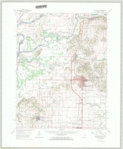
Princeton quadrangle, Indiana-Illinois : 15 minute series (topographic) [1965 reprint ...
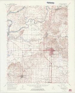
Princeton quadrangle, Indiana-Illinois : 15 minute series (topographic) [1965 printing...
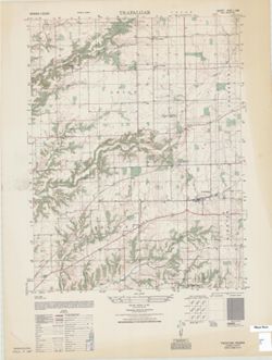
Trafalgar : Indiana 1:25,000
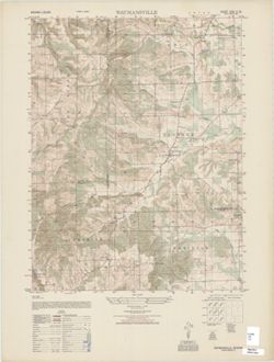
Waymansville : Indiana 1:25,000
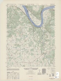
Rock Haven : Kentucky 1:25,000 (Metric series) , Kentucky photo maps 1:25,000
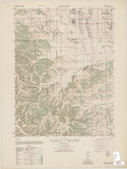
Nineveh : Indiana 1:25,000
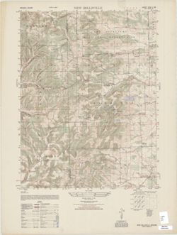
New Bellsville : Indiana 1:25,000
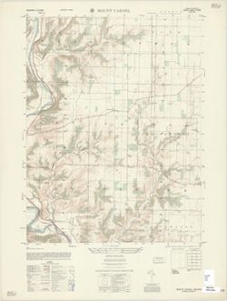
Mount Carmel : Indiana 1:25,000
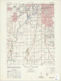
Maywood : Indiana 1:25,000
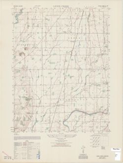
Lewis Creek : Indiana 1:25,000
« Previous
Next »
1
2
3
Toggle facets
Limit your search
Type
Image
28
Creator
United States. Army Map Service
[remove]
28
Geological Survey (U.S.)
26
Illinois State Geological Survey
5
United States. Army Air Forces
1
Subject
Topical Subject: Vegetation mapping
7
Geographic Subject: Johnson County (Ind.)
6
Geographic Subject: Bartholomew County (Ind.)
5
Geographic Subject: Gibson County (Ind.)
5
Geographic Subject: Knox County (Ind.)
5
Geographic Subject: Wabash County (Ill.)
5
Geographic Subject: Brown County (Ind.)
4
Geographic Subject: Harrison County (Ind.)
4
Geographic Subject: Meade County (Ky.)
4
Geographic Subject: Breckinridge County (Ky.)
3
more
Subjects
»
Publisher
United States. Army Map Service
19
Geological Survey (U.S.)
9
Date Created
1948
12
1959
5
1965
3
1949
2
1958
2
1964
2
1943
1
1947
1
Pages
0-99 pages
28
Collections
Indiana Historic Maps
28
State
deposited
28
Campus
IUB
28
Holding Location
B-WELLS
28
Provenance
Part of United States. Army Map Service, Indiana 1:25,000.
19
Part of Geological Survey (U.S.). Indiana 1:62,500.
9