
Search Constraints
Search Results
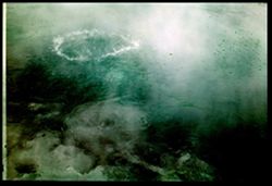
-
- Subject:
- Tables, Stone walls, Atlantic Coast (Fla.), Umbrellas, Tents, Oceans, Cabanas, Palms, Chairs, Seas, People, Lawns, and Walkways
- Series:
- 2-39
- Creator:
- Cushman, Charles W., 1896-1972
- Date Created:
- 1939-03-01
- Genre:
- Seascapes and Snapshots
- Frame Number:
- 12
- Street Address:
- Ocean Avenue
- County:
- Miami-Dade
- Abstract:
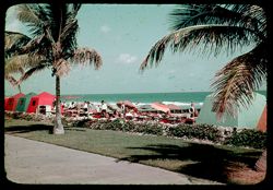
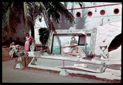
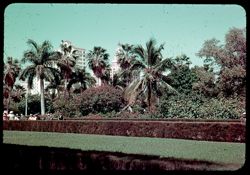
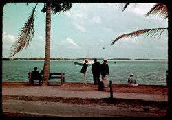
- K-12= Cabanas along the Promenade
- Call Number:
- P01567
- City:
- Miami Beach
- Country:
- United States
- State/Province:
- Florida
- Physical Description:
- Color corrected: magenta cast [fading of yellow dye].
- Alternate Identifier:
- 239.12
- Persistent URL:
- http://purl.dlib.indiana.edu/iudl/archives/cushman/P01567
- Holding Location:
- Bloomington - University Archives
Wells Library E460
1320 E 10th St.
Bloomington, IN 47405
Contact at archives@indiana.edu, 812-855-1127
-
- Subject:
- Men, Tents, Carts & wagons, Cabanas, Lawns, People, Atlantic Coast (Fla.), Palms, Stone walls, Walkways, and Sidewalks
- Series:
- 2-39
- Creator:
- Cushman, Charles W., 1896-1972
- Date Created:
- 1939-03-01
- Genre:
- Snapshots and Identification photographs
- Frame Number:
- 11
- Street Address:
- Ocean Avenue
- County:
- Miami-Dade
- Abstract:
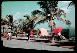
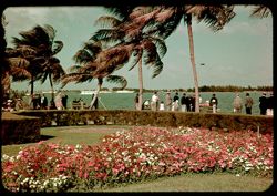
- K-11= Cabanas along the Promenade
- Call Number:
- P01566
- City:
- Miami Beach
- Country:
- United States
- State/Province:
- Florida
- Physical Description:
- Color corrected: magenta cast [fading of yellow dye], masked.
- Alternate Identifier:
- 239.11
- Persistent URL:
- http://purl.dlib.indiana.edu/iudl/archives/cushman/P01566
- Holding Location:
- Bloomington - University Archives
Wells Library E460
1320 E 10th St.
Bloomington, IN 47405
Contact at archives@indiana.edu, 812-855-1127
-
- Subject:
- Atlantic Coast (Fla.), Awnings, Plant containers, People, Benches, Wofford Hotel (Miami Beach, Fla.), Oceans, Palms, Beaches, Chairs, Walkways, Fences, Umbre...
- Series:
- 2-39
- Creator:
- Cushman, Charles W., 1896-1972
- Date Created:
- 1939-03-01
- Genre:
- Snapshots
- Frame Number:
- 10
- County:
- Miami-Dade
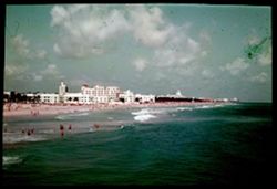
- Abstract:
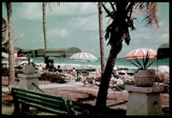
- K-10= Wofford Hotel Beach from sidewalk
- Call Number:
- P01565
- City:
- Miami Beach
- Country:
- United States
- State/Province:
- Florida
- Physical Description:
- Color corrected: magenta cast [fading of yellow dye]. Image was originally mounted in a glass enclosure. Before digitization, the image was removed and place...
- Alternate Identifier:
- 239.10
- Persistent URL:
- http://purl.dlib.indiana.edu/iudl/archives/cushman/P01565
- Holding Location:
- Bloomington - University Archives
Wells Library E460
1320 E 10th St.
Bloomington, IN 47405
Contact at archives@indiana.edu, 812-855-1127
-
- Subject:
- Oceans, Wading, Coastlines, Airships, Beaches, Clouds, Waterfronts, Million Dollar Pier (Miami Beach, Fla.), People, Piers & wharves, Seas, Buildings, an...
- Series:
- 2-39
- Creator:
- Cushman, Charles W., 1896-1972
- Date Created:
- 1939-03-01
- Genre:
- Seascapes and Cityscape photographs
- Frame Number:
- 9
- County:
- Miami-Dade
- Abstract:
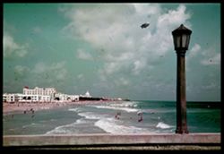
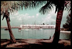
- K-9= Looking up Beach from Mil. $ Pier. Blimp.
- Call Number:
- P01564
- City:
- Miami Beach
- Country:
- United States
- State/Province:
- Florida
- Physical Description:
- Color corrected: magenta cast [fading of yellow dye]. Image was originally mounted in a glass enclosure. Before digitization, the image was removed and place...
- Alternate Identifier:
- 239.9
- Persistent URL:
- http://purl.dlib.indiana.edu/iudl/archives/cushman/P01564
- Holding Location:
- Bloomington - University Archives
Wells Library E460
1320 E 10th St.
Bloomington, IN 47405
Contact at archives@indiana.edu, 812-855-1127
-
- Subject:
- Atlantic Coast (Fla.), Wading, Waterfronts, Million Dollar Pier (Miami Beach, Fla.), Buildings, Coastlines, Beaches, Clouds, Seas, Airships, People, and Oceans
- Series:
- 2-39
- Creator:
- Cushman, Charles W., 1896-1972
- Date Created:
- 1939-03-01
- Genre:
- Seascapes and Cityscape photographs
- Frame Number:
- 8
- County:
- Miami-Dade
- Abstract:
- K-8= The stretch of Beach from the Million $ Pier.
- Call Number:
- P01563
- City:
- Miami Beach
- Country:
- United States
- State/Province:
- Florida
- Physical Description:
- Color corrected: magenta cast [fading of yellow dye], masked. Image was originally mounted in a glass enclosure. Before digitization, the image was removed a...
- Alternate Identifier:
- 239.8
- Persistent URL:
- http://purl.dlib.indiana.edu/iudl/archives/cushman/P01563
- Holding Location:
- Bloomington - University Archives
Wells Library E460
1320 E 10th St.
Bloomington, IN 47405
Contact at archives@indiana.edu, 812-855-1127
-
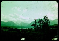
- Subject:
- Bays (Bodies of water), Piers & wharves, Trees, Coastlines, Clouds, Waterfronts, Islands, Dwellings, Biscayne Bay (Fla.), Palms, and Boats
- Series:
- 2-39
- Creator:
- Cushman, Charles W., 1896-1972
- Date Created:
- 1939-03-01
- Genre:
- Marine photographs
- Frame Number:
- 7
- County:
- Miami-Dade
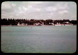
- Abstract:
- K-7= Star Island in Bay Biscayne
- Call Number:
- P01562
- City:
- Star Island and Miami
- Country:
- United States
- State/Province:
- Florida
- Physical Description:
- Color corrected: magenta cast [fading of yellow dye].
- Alternate Identifier:
- 239.7
- Persistent URL:
- http://purl.dlib.indiana.edu/iudl/archives/cushman/P01562
- Holding Location:
- Bloomington - University Archives
Wells Library E460
1320 E 10th St.
Bloomington, IN 47405
Contact at archives@indiana.edu, 812-855-1127
-
- Subject:
- Rocks, Bays (Bodies of water), Trees, Boulders, Cities & towns, Buildings, Clouds, Waterfronts, Biscayne Bay (Fla.), and Coastlines
- Series:
- 2-39
- Creator:
- Cushman, Charles W., 1896-1972
- Date Created:
- 1939-03-01
- Genre:
- Seascapes and Cityscape photographs
- Frame Number:
- 6
- Street Address:
- County Causeway and MacArthur Causeway
- County:
- Miami-Dade
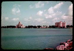
- Abstract:
- K-6= Bay side of Miami Beach
- Call Number:
- P01561
- City:
- Miami Beach
- Country:
- United States
- State/Province:
- Florida
- Physical Description:
- Color corrected: magenta cast [fading of yellow dye].
- Alternate Identifier:
- 239.6
- Persistent URL:
- http://purl.dlib.indiana.edu/iudl/archives/cushman/P01561
- Holding Location:
- Bloomington - University Archives
Wells Library E460
1320 E 10th St.
Bloomington, IN 47405
Contact at archives@indiana.edu, 812-855-1127
-
- Subject:
- Lampposts, Sky, Miami Beach Pier (Miami Beach, Fla.), and Clouds
- Series:
- 2-39
- Creator:
- Cushman, Charles W., 1896-1972
- Date Created:
- 1939-03-05
- Genre:
- Snapshots
- Frame Number:
- 4
- County:
- Miami-Dade
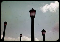
- Abstract:
- K-4= Lamp Posts on Miami Beach Pier
- Call Number:
- P01559
- City:
- Miami Beach
- Country:
- United States
- State/Province:
- Florida
- Physical Description:
- Color corrected: magenta cast [fading of yellow dye].
- Alternate Identifier:
- 239.4
- Persistent URL:
- http://purl.dlib.indiana.edu/iudl/archives/cushman/P01559
- Holding Location:
- Bloomington - University Archives
Wells Library E460
1320 E 10th St.
Bloomington, IN 47405
Contact at archives@indiana.edu, 812-855-1127
-
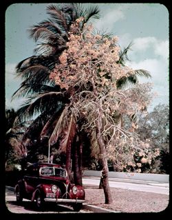
- Subject:
- Flowers, Streets, Automobiles, Sidewalks, Trees, Palms, and Clouds
- Series:
- 2-39
- Creator:
- Cushman, Charles W., 1896-1972
- Date Created:
- 1939-03-01
- Genre:
- Identification photographs
- Frame Number:
- 5
- Street Address:
- Brickell Avenue
- County:
- Miami-Dade
- Abstract:
- K-5= Yellow Tree in Miami
- Call Number:
- P01560
- City:
- Miami
- Country:
- United States
- State/Province:
- Florida
- Physical Description:
- Color corrected: magenta cast [fading of yellow dye], masked.
- Alternate Identifier:
- 239.5
- Persistent URL:
- http://purl.dlib.indiana.edu/iudl/archives/cushman/P01560
- Holding Location:
- Bloomington - University Archives
Wells Library E460
1320 E 10th St.
Bloomington, IN 47405
Contact at archives@indiana.edu, 812-855-1127
-
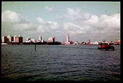
- Subject:
- Bays (Bodies of water), Tugboats, Skyscrapers, Coastlines, Buildings, Clouds, Waterfronts, Biscayne Bay (Fla.), and Billboards
- Series:
- 2-39
- Creator:
- Cushman, Charles W., 1896-1972
- Date Created:
- 1939-03-01
- Genre:
- Marine photographs, Seascapes, and Cityscape photographs
- Frame Number:
- 3
- Street Address:
- County Causeway and MacArthur Causeway
- County:
- Miami-Dade
- Abstract:
- K-3= Miami Skyline from County Causeway.
- Call Number:
- P01558
- City:
- Miami
- Country:
- United States
- State/Province:
- Florida
- Physical Description:
- Color corrected: magenta cast [fading of yellow dye]. Image was originally mounted in a glass enclosure. Before digitization, the image was removed and place...
- Alternate Identifier:
- 239.3
- Persistent URL:
- http://purl.dlib.indiana.edu/iudl/archives/cushman/P01558
- Holding Location:
- Bloomington - University Archives
Wells Library E460
1320 E 10th St.
Bloomington, IN 47405
Contact at archives@indiana.edu, 812-855-1127
-
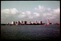
- Subject:
- Cities & towns, Biscayne Bay (Fla.), Skyscrapers, Bays (Bodies of water), Waterfronts, Buildings, Coastlines, and Clouds
- Series:
- 2-39
- Creator:
- Cushman, Charles W., 1896-1972
- Date Created:
- 1939-03-01
- Genre:
- Marine photographs, Seascapes, and Cityscape photographs
- Frame Number:
- 2
- Street Address:
- MacArthur Causeway and County Causeway
- County:
- Miami-Dade
- Abstract:
- K-2= Miami Skyline from County Causeway.
- Call Number:
- P01557
- City:
- Miami
- Country:
- United States
- State/Province:
- Florida
- Physical Description:
- Color corrected: magenta cast [fading of yellow dye]. Image was originally mounted in a glass enclosure. Before digitization, the image was removed and place...
- Alternate Identifier:
- 239.2
- Persistent URL:
- http://purl.dlib.indiana.edu/iudl/archives/cushman/P01557
- Holding Location:
- Bloomington - University Archives
Wells Library E460
1320 E 10th St.
Bloomington, IN 47405
Contact at archives@indiana.edu, 812-855-1127
-
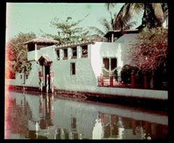
- Subject:
- Railings, Pylons (Gateways), Patios, Tree limbs, Waterfronts, Collins Canal (Miami-Dade County, Fla.), Pediments, Reflections, Canals, Doors & doorways, ...
- Series:
- 2-39
- Creator:
- Cushman, Charles W., 1896-1972
- Date Created:
- 1939-03-01
- Genre:
- Architectural photographs
- Frame Number:
- 0
- County:
- Miami-Dade
- Abstract:
- K-0= A Venetian canal scene.
- Call Number:
- P01556
- City:
- Miami Beach
- Country:
- United States
- State/Province:
- Florida
- Physical Description:
- Color corrected: magenta cast [fading of yellow dye], masked. Image was originally mounted in a glass enclosure. Before digitization, the image was removed a...
- Alternate Identifier:
- 239.0
- Persistent URL:
- http://purl.dlib.indiana.edu/iudl/archives/cushman/P01556
- Holding Location:
- Bloomington - University Archives
Wells Library E460
1320 E 10th St.
Bloomington, IN 47405
Contact at archives@indiana.edu, 812-855-1127
-
- Subject:
- Lions, Gargoyles, Penguins, Women, Fishermen, Picture frames, Kitsch, Mermaids, Sand sculpture, Helping Hand, The, Portholes, Rowboats, and Palms
- Series:
- 1-39
- Creator:
- Cushman, Charles W., 1896-1972
- Date Created:
- 1939-03-01
- Genre:
- Reproductions
- Frame Number:
- 18
- County:
- Miami-Dade
- Persons Pictured:
- Renouf, Emile, 1845-1894
- Abstract:
- J-18= Sand Sculptors.
- Call Number:
- P01555
- City:
- Miami
- Country:
- United States
- State/Province:
- Florida
- Physical Description:
- Color corrected: magenta cast [fading of yellow dye]. Image was originally mounted in a glass enclosure. Before digitization, the image was removed and place...
- Alternate Identifier:
- 139.18
- Persistent URL:
- http://purl.dlib.indiana.edu/iudl/archives/cushman/P01555
- Holding Location:
- Bloomington - University Archives
Wells Library E460
1320 E 10th St.
Bloomington, IN 47405
Contact at archives@indiana.edu, 812-855-1127
-
- Subject:
- Vessels, Bodies of water, Boats, Shadows, Buildings, Shrubs, Miami Harbor (Fla.), Clouds, Palms, Hoisting machinery, Trees, and Harbors
- Series:
- 1-39
- Creator:
- Cushman, Charles W., 1896-1972
- Date Created:
- 1939-03-01
- Genre:
- Marine photographs
- Frame Number:
- 17
- County:
- Miami-Dade
- Abstract:
- J-17= Miami Harbor.
- Call Number:
- P01554
- City:
- Miami
- Country:
- United States
- State/Province:
- Florida
- Physical Description:
- Color corrected: magenta cast [fading of yellow dye]. Image was originally mounted in a glass enclosure. Before digitization, the image was removed and place...
- Alternate Identifier:
- 139.17
- Persistent URL:
- http://purl.dlib.indiana.edu/iudl/archives/cushman/P01554
- Holding Location:
- Bloomington - University Archives
Wells Library E460
1320 E 10th St.
Bloomington, IN 47405
Contact at archives@indiana.edu, 812-855-1127
-
- Subject:
- Bays (Bodies of water), Benches, Parks, Flowers, Walkways, Shrubs, Bayfront Park (Miami, Fla.), Lampposts, Palms, and People
- Series:
- 1-39
- Creator:
- Cushman, Charles W., 1896-1972
- Date Created:
- 1939-03-01
- Frame Number:
- 16
- Street Address:
- Flagler Street
- County:
- Miami-Dade
- Abstract:
- J-16= Bay Front Pk.- foot of Flagler St.
- Call Number:
- P01553
- City:
- Miami
- Country:
- United States
- State/Province:
- Florida
- Physical Description:
- Color corrected: magenta cast [fading of yellow dye].
- Alternate Identifier:
- 139.16
- Persistent URL:
- http://purl.dlib.indiana.edu/iudl/archives/cushman/P01553
- Holding Location:
- Bloomington - University Archives
Wells Library E460
1320 E 10th St.
Bloomington, IN 47405
Contact at archives@indiana.edu, 812-855-1127
-
- Subject:
- Pigeons, Sand, Shadows, and Boys
- Series:
- 1-39
- Creator:
- Cushman, Charles W., 1896-1972
- Date Created:
- 1939-02-01
- Genre:
- Identification photographs
- Frame Number:
- 14
- County:
- Miami-Dade
- Abstract:
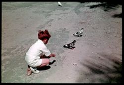
- J-14= Red-head and pigeons.
- Call Number:
- P01551
- City:
- Miami
- Country:
- United States
- State/Province:
- Florida
- Physical Description:
- Color corrected: magenta cast [fading of yellow dye]. Image was originally mounted in a glass enclosure. Before digitization, the image was removed and place...
- Alternate Identifier:
- 139.14
- Persistent URL:
- http://purl.dlib.indiana.edu/iudl/archives/cushman/P01551
- Holding Location:
- Bloomington - University Archives
Wells Library E460
1320 E 10th St.
Bloomington, IN 47405
Contact at archives@indiana.edu, 812-855-1127
-
- Subject:
- Towers, Benches, Parks, Trees, Flowers, Buildings, Shrubs, Bayfront Park (Miami, Fla.), People, Palms, and Lampposts
- Series:
- 1-39
- Creator:
- Cushman, Charles W., 1896-1972
- Date Created:
- 1939-02-01
- Genre:
- Cityscape photographs
- Frame Number:
- 15
- Street Address:
- Flagler Street
- County:
- Miami-Dade
- Abstract:
- J-15= Bay Front Pk.- foot of Flagler St.
- Call Number:
- P01552
- City:
- Miami
- Country:
- United States
- State/Province:
- Florida
- Physical Description:
- Color corrected: magenta cast [fading of yellow dye].
- Alternate Identifier:
- 139.15
- Persistent URL:
- http://purl.dlib.indiana.edu/iudl/archives/cushman/P01552
- Holding Location:
- Bloomington - University Archives
Wells Library E460
1320 E 10th St.
Bloomington, IN 47405
Contact at archives@indiana.edu, 812-855-1127
-
- Subject:
- Flowers, Bayfront Park (Miami, Fla.), Shrubs, and Bougainvillea
- Series:
- 1-39
- Creator:
- Cushman, Charles W., 1896-1972
- Date Created:
- 1939-02-01
- Genre:
- Identification photographs
- Frame Number:
- 13
- County:
- Miami-Dade
- Abstract:
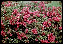
- Bay Front Pk. and J-13= Purple Bougainvillea
- Call Number:
- P01550
- City:
- Miami
- Country:
- United States
- State/Province:
- Florida
- Physical Description:
- Color corrected: magenta cast [fading of yellow dye].
- Alternate Identifier:
- 139.13
- Persistent URL:
- http://purl.dlib.indiana.edu/iudl/archives/cushman/P01550
- Holding Location:
- Bloomington - University Archives
Wells Library E460
1320 E 10th St.
Bloomington, IN 47405
Contact at archives@indiana.edu, 812-855-1127
-
- Subject:
- Towers, Piers & wharves, Bodies of water, Automobiles, Boats, Birds, Signs (Notices), Buildings, Clouds, Flagpoles, Domes, and Palms
- Series:
- 1-39
- Creator:
- Cushman, Charles W., 1896-1972
- Date Created:
- 1939-02-01
- Genre:
- Marine photographs
- Frame Number:
- 12
- County:
- Miami-Dade
- Abstract:
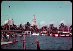
- J-12= Miami from fishing boat piers
- Call Number:
- P01549
- City:
- Miami
- Country:
- United States
- State/Province:
- Florida
- Physical Description:
- Color corrected: magenta cast [fading of yellow dye].
- Alternate Identifier:
- 139.12
- Persistent URL:
- http://purl.dlib.indiana.edu/iudl/archives/cushman/P01549
- Holding Location:
- Bloomington - University Archives
Wells Library E460
1320 E 10th St.
Bloomington, IN 47405
Contact at archives@indiana.edu, 812-855-1127
-
- Subject:
- Benches, Erythrina, Trees, Flowers, People, and Palms
- Series:
- 1-39
- Creator:
- Cushman, Charles W., 1896-1972
- Date Created:
- 1939-02-01
- Genre:
- Portraits and Identification photographs
- Frame Number:
- 11
- County:
- Miami-Dade
- Persons Pictured:
- Cushman, Jean
- Abstract:
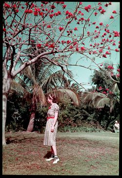
- J-11= Jean at Erythrina Tree.
- Call Number:
- P01548
- City:
- Miami
- Country:
- United States
- State/Province:
- Florida
- Physical Description:
- Color corrected: magenta cast [fading of yellow dye]. Image was originally mounted in a glass enclosure. Before digitization, the image was removed and place...
- Alternate Identifier:
- 139.11
- Persistent URL:
- http://purl.dlib.indiana.edu/iudl/archives/cushman/P01548
- Holding Location:
- Bloomington - University Archives
Wells Library E460
1320 E 10th St.
Bloomington, IN 47405
Contact at archives@indiana.edu, 812-855-1127
-
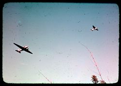
- Subject:
- Airplanes
- Series:
- 1-39
- Creator:
- Cushman, Charles W., 1896-1972
- Date Created:
- 1939-02-01
- Frame Number:
- 10
- County:
- Miami-Dade
- Abstract:
- J-10= Airplanes over Miami.
- Call Number:
- P01547
- City:
- Miami
- Country:
- United States
- State/Province:
- Florida
- Physical Description:
- Color corrected: magenta cast [fading of yellow dye].
- Alternate Identifier:
- 139.10
- Persistent URL:
- http://purl.dlib.indiana.edu/iudl/archives/cushman/P01547
- Holding Location:
- Bloomington - University Archives
Wells Library E460
1320 E 10th St.
Bloomington, IN 47405
Contact at archives@indiana.edu, 812-855-1127
-
- Subject:
- Piers & wharves, Vessels, Bodies of water, Trees, Birds, Signs (Notices), People, Benches, and Boats
- Series:
- 1-39
- Creator:
- Cushman, Charles W., 1896-1972
- Date Created:
- 1939-02-01
- Genre:
- Marine photographs
- Frame Number:
- 9
- County:
- Miami-Dade
- Abstract:
- J-9= A Sunday crowd at Miami's Fishing Pier
- Call Number:
- P01546
- City:
- Miami
- Country:
- United States
- State/Province:
- Florida
- Physical Description:
- Color corrected: magenta cast [fading of yellow dye].
- Alternate Identifier:
- 139.9
- Persistent URL:
- http://purl.dlib.indiana.edu/iudl/archives/cushman/P01546
- Holding Location:
- Bloomington - University Archives
Wells Library E460
1320 E 10th St.
Bloomington, IN 47405
Contact at archives@indiana.edu, 812-855-1127
-
- Subject:
- Piers & wharves, Vessels, Bodies of water, Fishing boats, Trees, Birds, and Facilities
- Series:
- 1-39
- Creator:
- Cushman, Charles W., 1896-1972
- Date Created:
- 1939-02-01
- Genre:
- Marine photographs
- Frame Number:
- 8
- County:
- Miami-Dade
- Abstract:
- J-8= Fishing boats and birds- Miami
- Call Number:
- P01545
- City:
- Miami
- Country:
- United States
- State/Province:
- Florida
- Physical Description:
- Color corrected: magenta cast [fading of yellow dye].
- Alternate Identifier:
- 139.8
- Persistent URL:
- http://purl.dlib.indiana.edu/iudl/archives/cushman/P01545
- Holding Location:
- Bloomington - University Archives
Wells Library E460
1320 E 10th St.
Bloomington, IN 47405
Contact at archives@indiana.edu, 812-855-1127
-
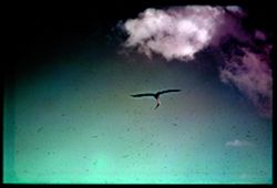
- Subject:
- Pelicans, Clouds, and Biscayne Bay (Fla.)
- Series:
- 1-39
- Creator:
- Cushman, Charles W., 1896-1972
- Date Created:
- 1939-02-01
- Genre:
- Identification photographs
- Frame Number:
- 7
- County:
- Miami-Dade
- Abstract:
- J-7= Pelican over Bay Biscayne
- Call Number:
- P01544
- City:
- Miami
- Country:
- United States
- State/Province:
- Florida
- Physical Description:
- Color corrected: magenta cast [fading of yellow dye]. Image was originally mounted in a glass enclosure. Before digitization, the image was removed and place...
- Alternate Identifier:
- 139.7
- Persistent URL:
- http://purl.dlib.indiana.edu/iudl/archives/cushman/P01544
- Holding Location:
- Bloomington - University Archives
Wells Library E460
1320 E 10th St.
Bloomington, IN 47405
Contact at archives@indiana.edu, 812-855-1127
-
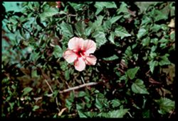
- Subject:
- Hibiscus, Flowers, and Bayfront Park (Miami, Fla.)
- Series:
- 1-39
- Creator:
- Cushman, Charles W., 1896-1972
- Date Created:
- 1939-02-01
- Genre:
- Identification photographs
- Frame Number:
- 3
- County:
- Miami-Dade
- Abstract:
- J-6= Yellow Hibiscus in Bay Front Park
- Call Number:
- P01543
- City:
- Miami
- Country:
- United States
- State/Province:
- Florida
- Physical Description:
- Color corrected: magenta cast [fading of yellow dye]. Image was originally mounted in a glass enclosure. Before digitization, the image was removed and place...
- Alternate Identifier:
- 139.6
- Persistent URL:
- http://purl.dlib.indiana.edu/iudl/archives/cushman/P01543
- Holding Location:
- Bloomington - University Archives
Wells Library E460
1320 E 10th St.
Bloomington, IN 47405
Contact at archives@indiana.edu, 812-855-1127
-
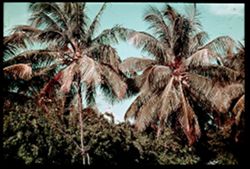
- Subject:
- Trees, Flowers, Shrubs, Bayfront Park (Miami, Fla.), and Palms
- Series:
- 1-39
- Creator:
- Cushman, Charles W., 1896-1972
- Date Created:
- 1939-02-01
- Genre:
- Identification photographs
- Frame Number:
- 5
- County:
- Miami-Dade
- Abstract:
- J-5= Palm trees like wind mills in Bay Front Park
- Call Number:
- P01542
- City:
- Miami
- Country:
- United States
- State/Province:
- Florida
- Physical Description:
- Color corrected: magenta cast [fading of yellow dye]. Image was originally mounted in a glass enclosure. Before digitization, the image was removed and place...
- Alternate Identifier:
- 139.5
- Persistent URL:
- http://purl.dlib.indiana.edu/iudl/archives/cushman/P01542
- Holding Location:
- Bloomington - University Archives
Wells Library E460
1320 E 10th St.
Bloomington, IN 47405
Contact at archives@indiana.edu, 812-855-1127
-
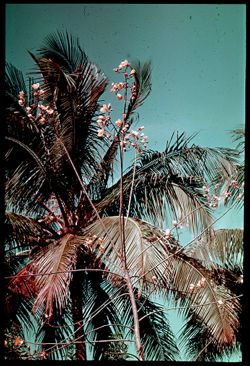
- Subject:
- Trees, Flowers, Bayfront Park (Miami, Fla.), and Palms
- Series:
- 1-39
- Creator:
- Cushman, Charles W., 1896-1972
- Date Created:
- 1939-02-01
- Genre:
- Identification photographs
- Frame Number:
- 4
- County:
- Miami-Dade
- Abstract:
- J-4= Yellow blossoms on Tree in Bay Front Park
- Call Number:
- P01541
- City:
- Miami
- Country:
- United States
- State/Province:
- Florida
- Physical Description:
- Color corrected: magenta cast [fading of yellow dye]. Image was originally mounted in a glass enclosure. Before digitization, the image was removed and place...
- Alternate Identifier:
- 139.4
- Persistent URL:
- http://purl.dlib.indiana.edu/iudl/archives/cushman/P01541
- Holding Location:
- Bloomington - University Archives
Wells Library E460
1320 E 10th St.
Bloomington, IN 47405
Contact at archives@indiana.edu, 812-855-1127
-
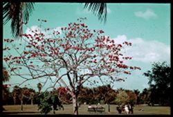
- Subject:
- Parks, Bayfront Park (Miami, Fla.), Erythrina, People, Benches, Trees, Palms, and Clouds
- Series:
- 1-39
- Creator:
- Cushman, Charles W., 1896-1972
- Date Created:
- 1939-02-01
- Genre:
- Identification photographs
- Frame Number:
- 3
- County:
- Miami-Dade
- Abstract:
- Bay Front Park and J-3= Erythrina Tree in Bloom
- Call Number:
- P01540
- City:
- Miami
- Country:
- United States
- State/Province:
- Florida
- Physical Description:
- Color corrected: magenta cast [fading of yellow dye]. Image was originally mounted in a glass enclosure. Before digitization, the image was removed and place...
- Alternate Identifier:
- 139.3
- Persistent URL:
- http://purl.dlib.indiana.edu/iudl/archives/cushman/P01540
- Holding Location:
- Bloomington - University Archives
Wells Library E460
1320 E 10th St.
Bloomington, IN 47405
Contact at archives@indiana.edu, 812-855-1127
-
- Subject:
- Biscayne Bay (Fla.), Bayfront Park (Miami, Fla.), Bays (Bodies of water), People, Boats, Trees, Coastlines, Palms, Clouds, and Benches
- Series:
- 1-39
- Creator:
- Cushman, Charles W., 1896-1972
- Date Created:
- 1939-02-01
- Genre:
- Landscape photographs
- Frame Number:
- 2
- County:
- Miami-Dade
- Abstract:
- J-2= Biscayne Bay at Bay Front Park
- Call Number:
- P01539
- City:
- Miami
- Country:
- United States
- State/Province:
- Florida
- Physical Description:
- Color corrected: magenta cast [fading of yellow dye].
- Alternate Identifier:
- 139.2
- Persistent URL:
- http://purl.dlib.indiana.edu/iudl/archives/cushman/P01539
- Holding Location:
- Bloomington - University Archives
Wells Library E460
1320 E 10th St.
Bloomington, IN 47405
Contact at archives@indiana.edu, 812-855-1127
-
- Subject:
- Bays (Bodies of water), Vessels, Trees, Flowers, Shrubs, Clouds, Bayfront Park (Miami, Fla.), People, Palms, and Benches
- Series:
- 1-39
- Creator:
- Cushman, Charles W., 1896-1972
- Date Created:
- 1939-02-01
- Genre:
- Landscape photographs
- Frame Number:
- 1
- County:
- Miami-Dade
- Abstract:
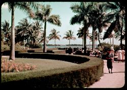
- J-1= Sunday in Bay Front Park
- Call Number:
- P01538
- City:
- Miami
- Country:
- United States
- State/Province:
- Florida
- Physical Description:
- Color corrected: magenta cast [fading of yellow dye].
- Alternate Identifier:
- 139.1
- Persistent URL:
- http://purl.dlib.indiana.edu/iudl/archives/cushman/P01538
- Holding Location:
- Bloomington - University Archives
Wells Library E460
1320 E 10th St.
Bloomington, IN 47405
Contact at archives@indiana.edu, 812-855-1127
-
- Subject:
- Shadows, Walkways, Shrubs, Clouds, Bayfront Park (Miami, Fla.), and Palms
- Series:
- 1-39
- Creator:
- Cushman, Charles W., 1896-1972
- Date Created:
- 1939-02-01
- Genre:
- Identification photographs
- Frame Number:
- 0
- County:
- Miami-Dade
- Abstract:
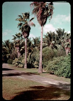
- J-0= Palms in Bay Front Park
- Call Number:
- P01537
- City:
- Miami
- Country:
- United States
- State/Province:
- Florida
- Physical Description:
- Color corrected: magenta cast [fading of yellow dye].
- Alternate Identifier:
- 139.0
- Persistent URL:
- http://purl.dlib.indiana.edu/iudl/archives/cushman/P01537
- Holding Location:
- Bloomington - University Archives
Wells Library E460
1320 E 10th St.
Bloomington, IN 47405
Contact at archives@indiana.edu, 812-855-1127
-
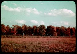
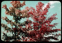
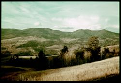
- Subject:
- Leaves, Tree limbs, Forests, Autumn, and Trees
- Series:
- 8-38
- Creator:
- Cushman, Charles W., 1896-1972
- Date Created:
- 1938-11-01
- Genre:
- Identification photographs and Landscape photographs
- Frame Number:
- 16
- Street Address:
- Mount Vernon-New Harmony Road
- County:
- Posey
- Abstract:
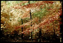
- H-16= A wood wild with color= Posey Co.
- Call Number:
- P01535
- City:
- New Harmony and Mount Vernon
- Country:
- United States
- State/Province:
- Indiana
- Physical Description:
- Color corrected: magenta cast [fading of yellow dye]. Image was originally mounted in a glass enclosure. Before digitization, the image was removed and place...
- Alternate Identifier:
- 838.16
- Persistent URL:
- http://purl.dlib.indiana.edu/iudl/archives/cushman/P01535
- Holding Location:
- Bloomington - University Archives
Wells Library E460
1320 E 10th St.
Bloomington, IN 47405
Contact at archives@indiana.edu, 812-855-1127
-
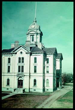
- Subject:
- Domes, Parapets, Windows, Stairways, Courthouses, Towers, Walkways, Doors & doorways, Streets, Flagpoles, Pediments, Posey County Courthouse, and Cornices
- Series:
- 8-38
- Creator:
- Cushman, Charles W., 1896-1972
- Date Created:
- 1938-11-06
- Genre:
- Architectural photographs
- Frame Number:
- 19
- County:
- Posey
- Abstract:
- H-19= Posey County Court House.
- Call Number:
- P01536
- City:
- Mount Vernon
- Country:
- United States
- State/Province:
- Indiana
- Physical Description:
- Color corrected: magenta cast [fading of yellow dye]. Image was originally mounted in a glass enclosure. Before digitization, the image was removed and place...
- Alternate Identifier:
- 838.19
- Persistent URL:
- http://purl.dlib.indiana.edu/iudl/archives/cushman/P01536
- Holding Location:
- Bloomington - University Archives
Wells Library E460
1320 E 10th St.
Bloomington, IN 47405
Contact at archives@indiana.edu, 812-855-1127
-
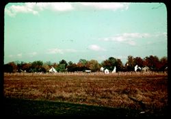
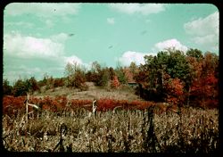
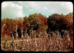
- Subject:
- Croplands, Meadows, Cities & towns, Houses, Cornstalks, Trees, and Corn
- Series:
- 8-38
- Creator:
- Cushman, Charles W., 1896-1972
- Date Created:
- 1938-11-01
- Genre:
- Cityscape photographs and Views
- Frame Number:
- 14
- County:
- Posey
- Abstract:
- H-14= Poseyville
- Call Number:
- P01534
- City:
- Poseyville
- Country:
- United States
- State/Province:
- Indiana
- Physical Description:
- Color corrected: magenta cast [fading of yellow dye].
- Alternate Identifier:
- 838.14
- Persistent URL:
- http://purl.dlib.indiana.edu/iudl/archives/cushman/P01534
- Holding Location:
- Bloomington - University Archives
Wells Library E460
1320 E 10th St.
Bloomington, IN 47405
Contact at archives@indiana.edu, 812-855-1127
-
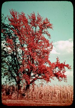
- Subject:
- Croplands, Barbed wire, Cornstalks, Trees, Corn, Clouds, Fences, and Autumn
- Series:
- 8-38
- Creator:
- Cushman, Charles W., 1896-1972
- Date Created:
- 1938-11-01
- Genre:
- Identification photographs
- Frame Number:
- 13
- Street Address:
- New Harmony-Poseyville Road
- County:
- Posey
- Abstract:
- H-13= Marriage of blonde + brunette
- Call Number:
- P01533
- City:
- Poseyville and New Harmony
- Country:
- United States
- State/Province:
- Indiana
- Physical Description:
- Color corrected: magenta cast [fading of yellow dye]. Image was originally mounted in a glass enclosure. Before digitization, the image was removed and place...
- Alternate Identifier:
- 838.13
- Persistent URL:
- http://purl.dlib.indiana.edu/iudl/archives/cushman/P01533
- Holding Location:
- Bloomington - University Archives
Wells Library E460
1320 E 10th St.
Bloomington, IN 47405
Contact at archives@indiana.edu, 812-855-1127
-
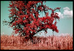
- Subject:
- Corn, Cornstalks, Croplands, Fences, Clouds, Autumn, Barbed wire, and Trees
- Series:
- 8-38
- Creator:
- Cushman, Charles W., 1896-1972
- Date Created:
- 1938-11-01
- Genre:
- Identification photographs
- Frame Number:
- 12
- County:
- Posey
- Abstract:
- H-12= A blonde tree and a brunette
- Call Number:
- P01532
- City:
- Poseyville
- Country:
- United States
- State/Province:
- Indiana
- Physical Description:
- Color corrected: magenta cast [fading of yellow dye].
- Alternate Identifier:
- 838.12
- Persistent URL:
- http://purl.dlib.indiana.edu/iudl/archives/cushman/P01532
- Holding Location:
- Bloomington - University Archives
Wells Library E460
1320 E 10th St.
Bloomington, IN 47405
Contact at archives@indiana.edu, 812-855-1127
-
- Subject:
- Trees, Meadows, Shrubs, and Clouds
- Series:
- 8-38
- Creator:
- Cushman, Charles W., 1896-1972
- Date Created:
- 1938-11-01
- Genre:
- Landscape photographs
- Frame Number:
- 11
- Street Address:
- Poseyville-New Harmony Road
- County:
- Posey
- Abstract:
- H-11= Field + trees 2 1/2 mi. west of P'ville.
- Call Number:
- P01531
- City:
- New Harmony and Poseyville
- Country:
- United States
- State/Province:
- Indiana
- Physical Description:
- Color corrected: magenta cast [fading of yellow dye].
- Alternate Identifier:
- 838.11
- Persistent URL:
- http://purl.dlib.indiana.edu/iudl/archives/cushman/P01531
- Holding Location:
- Bloomington - University Archives
Wells Library E460
1320 E 10th St.
Bloomington, IN 47405
Contact at archives@indiana.edu, 812-855-1127
-
- Subject:
- Walls, Trees, Harmony Society, Tombs & sepulchral monuments, Cemeteries, Capitals (Columns), and Columns
- Series:
- 8-38
- Creator:
- Cushman, Charles W., 1896-1972
- Date Created:
- 1938-11-01
- Genre:
- Snapshots and Identification photographs
- Frame Number:
- 8
- County:
- Posey
- Abstract:
- H-8= In old Rappite Cemetary. N. H.
- Call Number:
- P01530
- City:
- New Harmony
- Country:
- United States
- State/Province:
- Indiana
- Physical Description:
- Color corrected: magenta cast [fading of yellow dye].
- Alternate Identifier:
- 838.8
- Persistent URL:
- http://purl.dlib.indiana.edu/iudl/archives/cushman/P01530
- Holding Location:
- Bloomington - University Archives
Wells Library E460
1320 E 10th St.
Bloomington, IN 47405
Contact at archives@indiana.edu, 812-855-1127
-
- Subject:
- Corn, Trees, Log cabins, Croplands, Clouds, Facilities, Cabins, and Cornstalks
- Series:
- 8-38
- Creator:
- Cushman, Charles W., 1896-1972
- Date Created:
- 1938-11-01
- Genre:
- Landscape photographs
- Frame Number:
- 7
- Street Address:
- Lower Mount Vernon-New Harmony Road
- County:
- Posey
- Persons Pictured:
- McCorkle
- Abstract:
- H-7= Mr. McCorkle's Acres.
- Call Number:
- P01529
- City:
- New Harmony and Mount Vernon
- Country:
- United States
- State/Province:
- Indiana
- Physical Description:
- Color corrected: magenta cast [fading of yellow dye].
- Alternate Identifier:
- 838.7
- Persistent URL:
- http://purl.dlib.indiana.edu/iudl/archives/cushman/P01529
- Holding Location:
- Bloomington - University Archives
Wells Library E460
1320 E 10th St.
Bloomington, IN 47405
Contact at archives@indiana.edu, 812-855-1127
-
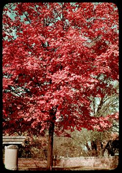
- Subject:
- Leaves, Tree limbs, Maples, Autumn, and Clouds
- Series:
- 8-38
- Creator:
- Cushman, Charles W., 1896-1972
- Date Created:
- 1938-11-01
- Genre:
- Identification photographs
- Frame Number:
- 5
- Street Address:
- Lower Mount Vernon-New Harmony Road and Lower New Harmony Road
- County:
- Posey
- Abstract:
- H-5= An All- Yellow Maple Lower N.H. Road
- Call Number:
- P01528
- City:
- New Harmony and Mount Vernon
- Country:
- United States
- State/Province:
- Indiana
- Physical Description:
- Color corrected: magenta cast [fading of yellow dye]. Image was originally mounted in a glass enclosure. Before digitization, the image was removed and place...
- Alternate Identifier:
- 838.5
- Persistent URL:
- http://purl.dlib.indiana.edu/iudl/archives/cushman/P01528
- Holding Location:
- Bloomington - University Archives
Wells Library E460
1320 E 10th St.
Bloomington, IN 47405
Contact at archives@indiana.edu, 812-855-1127
-
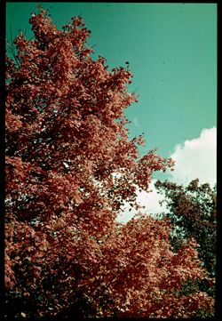
- Subject:
- Leaves, Tree limbs, Autumn, and Clouds
- Series:
- 8-38
- Creator:
- Cushman, Charles W., 1896-1972
- Date Created:
- 1938-11-03
- Genre:
- Identification photographs
- Frame Number:
- 4
- Street Address:
- Lower New Harmony-Mount Vernon Road and Lower New Harmony Road
- County:
- Posey
- Abstract:
- H-4= Tops of Colored Trees. Lower N.H. Road
- Call Number:
- P01527
- City:
- New Harmony and Mount Vernon
- Country:
- United States
- State/Province:
- Indiana
- Physical Description:
- Color corrected: magenta cast [fading of yellow dye].
- Alternate Identifier:
- 838.4
- Persistent URL:
- http://purl.dlib.indiana.edu/iudl/archives/cushman/P01527
- Holding Location:
- Bloomington - University Archives
Wells Library E460
1320 E 10th St.
Bloomington, IN 47405
Contact at archives@indiana.edu, 812-855-1127
-
- Subject:
- Dirt roads, Corn, Cornstalks, Wabash Bottoms, Croplands, Grand Chain Farm, Clouds, Autumn, Farms, and Trees
- Series:
- 8-38
- Creator:
- Cushman, Charles W., 1896-1972
- Date Created:
- 1938-11-01
- Genre:
- Identification photographs
- Frame Number:
- 3
- County:
- Posey
- Abstract:
- H-3= Corn Field and Autumn clolrs. = Grand Chain
- Call Number:
- P01526
- Country:
- United States
- State/Province:
- Indiana
- Physical Description:
- Color corrected: magenta cast [fading of yellow dye].
- Alternate Identifier:
- 838.3
- Persistent URL:
- http://purl.dlib.indiana.edu/iudl/archives/cushman/P01526
- Holding Location:
- Bloomington - University Archives
Wells Library E460
1320 E 10th St.
Bloomington, IN 47405
Contact at archives@indiana.edu, 812-855-1127
-
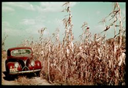
- Subject:
- Farms, Corn, Cornstalks, Wabash Bottoms, License plates, Croplands, Grand Chain Farm, Dirt roads, and Automobiles
- Series:
- 8-38
- Creator:
- Cushman, Charles W., 1896-1972
- Date Created:
- 1938-11-01
- Genre:
- Identification photographs
- Frame Number:
- 3
- County:
- Posey
- Abstract:
- H-2= Posey Co., where Tall Corn Really Grows.
- Call Number:
- P01525
- Country:
- United States
- State/Province:
- Indiana
- Physical Description:
- Color corrected: magenta cast [fading of yellow dye]. Image was originally mounted in a glass enclosure. Before digitization, the image was removed and place...
- Alternate Identifier:
- 838.2
- Persistent URL:
- http://purl.dlib.indiana.edu/iudl/archives/cushman/P01525
- Holding Location:
- Bloomington - University Archives
Wells Library E460
1320 E 10th St.
Bloomington, IN 47405
Contact at archives@indiana.edu, 812-855-1127
-
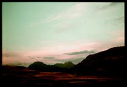
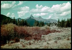
- Subject:
- Trees, Abiathar Peak (Wyo.), Mountains, National parks & reserves, Clouds, Sunrises & sunsets, Hills, Yellowstone National Park, and Thunderer, The (...
- Series:
- 7-38
- Creator:
- Cushman, Charles W., 1896-1972
- Date Created:
- 1938-09-30
- Genre:
- Landscape photographs
- Frame Number:
- 45
- County:
- Park
- Abstract:
- G-45= Abiathar Pk and The Thunderer at sunset
- Call Number:
- P01524
- Country:
- United States
- State/Province:
- Wyoming
- Physical Description:
- Color corrected: magenta cast [fading of yellow dye]. Image was originally mounted in a glass enclosure. Before digitization, the image was removed and place...
- Alternate Identifier:
- 738.45
- Persistent URL:
- http://purl.dlib.indiana.edu/iudl/archives/cushman/P01524
- Holding Location:
- Bloomington - University Archives
Wells Library E460
1320 E 10th St.
Bloomington, IN 47405
Contact at archives@indiana.edu, 812-855-1127
-
- Subject:
- Hills, Mountains, Grasses, Trees, National parks & reserves, Shadows, Mammoth Hot Springs (Wyo.), Yellowstone National Park, and Clouds
- Series:
- 7-38
- Creator:
- Cushman, Charles W., 1896-1972
- Date Created:
- 1938-09-30
- Genre:
- Landscape photographs
- Frame Number:
- 44
- County:
- Park
- Abstract:
- G-44= Panorama ( north from Mammoth )
- Call Number:
- P01523
- Country:
- United States
- State/Province:
- Wyoming
- Physical Description:
- Color corrected: magenta cast [fading of yellow dye]. Image was originally mounted in a glass enclosure. Before digitization, the image was removed and place...
- Alternate Identifier:
- 738.44
- Persistent URL:
- http://purl.dlib.indiana.edu/iudl/archives/cushman/P01523
- Holding Location:
- Bloomington - University Archives
Wells Library E460
1320 E 10th St.
Bloomington, IN 47405
Contact at archives@indiana.edu, 812-855-1127
-
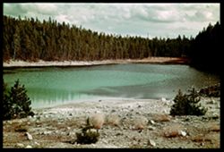
- Subject:
- Lakes & ponds, National parks & reserves, Norris Geyser Basin (Wyo.), Forests, Nuphar Lake (Wyo.), Shrubs, Trees, Rocks, Clouds, and Yellowstone Nati...
- Series:
- 7-38
- Creator:
- Cushman, Charles W., 1896-1972
- Date Created:
- 1938-09-30
- Genre:
- Landscape photographs
- Frame Number:
- 41
- County:
- Park
- Abstract:
- G-41= Nuphar Lake, near Norris
- Call Number:
- P01522
- Country:
- United States
- State/Province:
- Wyoming
- Physical Description:
- Color corrected: magenta cast [fading of yellow dye], sprockets showing. Image was originally mounted in a glass enclosure. Before digitization, the image wa...
- Alternate Identifier:
- 738.41
- Persistent URL:
- http://purl.dlib.indiana.edu/iudl/archives/cushman/P01522
- Holding Location:
- Bloomington - University Archives
Wells Library E460
1320 E 10th St.
Bloomington, IN 47405
Contact at archives@indiana.edu, 812-855-1127
-
- Subject:
- Minerals, National parks & reserves, Norris Geyser Basin (Wyo.), Valleys, Springs, Yellowstone National Park, Mineral deposits, and Steam
- Series:
- 7-38
- Creator:
- Cushman, Charles W., 1896-1972
- Date Created:
- 1938-09-30
- Genre:
- Identification photographs and Landscape photographs
- Frame Number:
- 40
- County:
- Park
- Abstract:
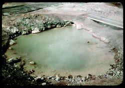
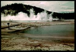
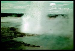
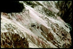
- G-40= Several small hot pools NORRIS GEYSER BASIN
- Call Number:
- P01521
- Country:
- United States
- State/Province:
- Wyoming
- Physical Description:
- Color corrected: magenta cast [fading of yellow dye].
- Alternate Identifier:
- 738.40
- Persistent URL:
- http://purl.dlib.indiana.edu/iudl/archives/cushman/P01521
- Holding Location:
- Bloomington - University Archives
Wells Library E460
1320 E 10th St.
Bloomington, IN 47405
Contact at archives@indiana.edu, 812-855-1127
-
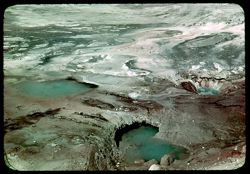
- Subject:
- Minerals, National parks & reserves, Norris Geyser Basin (Wyo.), Valleys, Springs, Forests, Geysers, Shrubs, Trees, Trails & paths, Mineral deposits,...
- Series:
- 7-38
- Creator:
- Cushman, Charles W., 1896-1972
- Date Created:
- 1938-09-30
- Genre:
- Landscape photographs
- Frame Number:
- 39
- County:
- Park
- Abstract:
- G-39= Panorama ( with steam ) NORRIS GEYSER BASIN
- Call Number:
- P01520
- Country:
- United States
- State/Province:
- Wyoming
- Physical Description:
- Color corrected: magenta cast [fading of yellow dye]. Image was originally mounted in a glass enclosure. Before digitization, the image was removed and place...
- Alternate Identifier:
- 738.39
- Persistent URL:
- http://purl.dlib.indiana.edu/iudl/archives/cushman/P01520
- Holding Location:
- Bloomington - University Archives
Wells Library E460
1320 E 10th St.
Bloomington, IN 47405
Contact at archives@indiana.edu, 812-855-1127
-
- Subject:
- Rocks, Valleys, Trails & paths, Minerals, Springs, National parks & reserves, Mineral deposits, Yellowstone National Park, Steam, and Norris Geyser B...
- Series:
- 7-38
- Creator:
- Cushman, Charles W., 1896-1972
- Date Created:
- 1938-09-30
- Genre:
- Landscape photographs and Identification photographs
- Frame Number:
- 36
- County:
- Park
- Abstract:
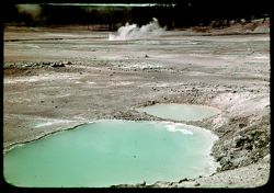
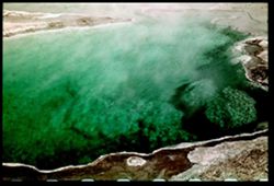
- G-36= Quiet Green Pool NORRIS GEYSER BASIN
- Call Number:
- P01518
- Country:
- United States
- State/Province:
- Wyoming
- Physical Description:
- Color corrected: magenta cast [fading of yellow dye].
- Alternate Identifier:
- 738.36
- Persistent URL:
- http://purl.dlib.indiana.edu/iudl/archives/cushman/P01518
- Holding Location:
- Bloomington - University Archives
Wells Library E460
1320 E 10th St.
Bloomington, IN 47405
Contact at archives@indiana.edu, 812-855-1127
-
- Subject:
- Minerals, National parks & reserves, Norris Geyser Basin (Wyo.), Valleys, Springs, Yellowstone National Park, Geysers, Trees, Rocks, Steam, and Mineral d...
- Series:
- 7-38
- Creator:
- Cushman, Charles W., 1896-1972
- Date Created:
- 1938-09-30
- Genre:
- Landscape photographs
- Frame Number:
- 38
- County:
- Park
- Abstract:
- G-38= NORRIS GEYSER BASIN Big and little green pool
- Call Number:
- P01519
- Country:
- United States
- State/Province:
- Wyoming
- Physical Description:
- Color corrected: magenta cast [fading of yellow dye].
- Alternate Identifier:
- 738.38
- Persistent URL:
- http://purl.dlib.indiana.edu/iudl/archives/cushman/P01519
- Holding Location:
- Bloomington - University Archives
Wells Library E460
1320 E 10th St.
Bloomington, IN 47405
Contact at archives@indiana.edu, 812-855-1127
-
- Description:
- f 10 ?
- Subject:
- Mud, Trees, Minerals, Springs, Fences, National parks & reserves, Mineral deposits, Fountain Paint Pots (Yellowstone National Park), Lower Geyser Basin (...
- Series:
- 7-38
- Creator:
- Cushman, Charles W., 1896-1972
- Date Created:
- 1938-09-29
- Genre:
- Landscape photographs and Identification photographs
- Frame Number:
- 35
- County:
- Teton
- Abstract:
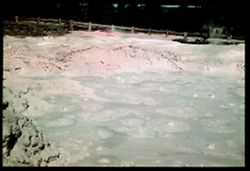
- G-35 = Paint Pots ( also F 10 )
- Call Number:
- P01517
- Country:
- United States
- State/Province:
- Wyoming
- Physical Description:
- Color corrected: magenta cast [fading of yellow dye]. Image was originally mounted in a glass enclosure. Before digitization, the image was removed and place...
- Alternate Identifier:
- 738.35
- Persistent URL:
- http://purl.dlib.indiana.edu/iudl/archives/cushman/P01517
- Holding Location:
- Bloomington - University Archives
Wells Library E460
1320 E 10th St.
Bloomington, IN 47405
Contact at archives@indiana.edu, 812-855-1127
-
- Subject:
- Minerals, Springs, National parks & reserves, Mineral deposits, Leather Pool (Yellowstone National Park), Fountain Paint Pots (Yellowstone National Park)...
- Series:
- 7-38
- Creator:
- Cushman, Charles W., 1896-1972
- Date Created:
- 1938-09-30
- Genre:
- Landscape photographs and Identification photographs
- Frame Number:
- 34
- County:
- Teton
- Abstract:
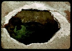
- G-34= Leather Pool A dark brown hot spring next to Paint Pots
- Call Number:
- P01516
- Country:
- United States
- State/Province:
- Wyoming
- Physical Description:
- Color corrected: magenta cast [fading of yellow dye].
- Alternate Identifier:
- 738.34
- Persistent URL:
- http://purl.dlib.indiana.edu/iudl/archives/cushman/P01516
- Holding Location:
- Bloomington - University Archives
Wells Library E460
1320 E 10th St.
Bloomington, IN 47405
Contact at archives@indiana.edu, 812-855-1127
-
- Subject:
- Lakes & ponds, National parks & reserves, Springs, Yellowstone National Park, Firehole Lake (Wyo.), and Steam
- Series:
- 7-38
- Creator:
- Cushman, Charles W., 1896-1972
- Date Created:
- 1938-09-28
- Genre:
- Identification photographs and Landscape photographs
- Frame Number:
- 33
- County:
- Teton
- Abstract:
- G-33= Firehole Pool
- Call Number:
- P01515
- Country:
- United States
- State/Province:
- Wyoming
- Physical Description:
- Color corrected: magenta cast [fading of yellow dye]. Image was originally mounted in a glass enclosure. Before digitization, the image was removed and place...
- Alternate Identifier:
- 738.33
- Persistent URL:
- http://purl.dlib.indiana.edu/iudl/archives/cushman/P01515
- Holding Location:
- Bloomington - University Archives
Wells Library E460
1320 E 10th St.
Bloomington, IN 47405
Contact at archives@indiana.edu, 812-855-1127
-
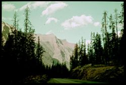
- Subject:
- Construction equipment, Hills, Automobiles, Roads, Shrubs, Trees, Construction workers, Road construction, Beartooth Mountains (Mont. and Wyo.), Tractors, an...
- Series:
- 7-38
- Creator:
- Cushman, Charles W., 1896-1972
- Date Created:
- 1938-10-01
- Genre:
- Landscape photographs
- Frame Number:
- 4
- Street Address:
- Cooke-Red Lodge Highway and Cooke City-Red Lodge Highway
- County:
- Park and Carbon
- Abstract:
- G-4= Cooke - Red Lodge Hwy in Autumn.
- Call Number:
- P01514
- City:
- Red Lodge and Cooke City
- Country:
- United States
- State/Province:
- Montana
- Physical Description:
- Color corrected: magenta cast [fading of yellow dye]. Image was originally mounted in a glass enclosure. Before digitization, the image was removed and place...
- Alternate Identifier:
- 738.4
- Persistent URL:
- http://purl.dlib.indiana.edu/iudl/archives/cushman/P01514
- Holding Location:
- Bloomington - University Archives
Wells Library E460
1320 E 10th St.
Bloomington, IN 47405
Contact at archives@indiana.edu, 812-855-1127
-
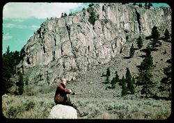
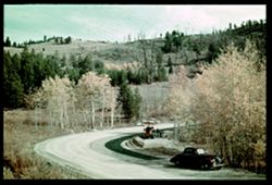
- Subject:
- Rocks, Men, Cliffs, Trees, Boulders, Mountains, Shrubs, and Hills
- Series:
- 7-38
- Creator:
- Cushman, Charles W., 1896-1972
- Date Created:
- 1938-10-01
- Genre:
- Landscape photographs and Portraits
- Frame Number:
- 3
- Street Address:
- Red Lodge Highway and Cooke-Red Lodge Highway
- County:
- Park and Carbon
- Persons Pictured:
- Cushman, Charles W. (Charles Weever), 1896-1972
- Abstract:
- G-3= Roadside scene along Cooke - Red Lodge Hwy.
- Call Number:
- P01513
- City:
- Cooke City and Red Lodge
- Country:
- United States
- State/Province:
- Montana
- Physical Description:
- Color corrected: magenta cast [fading of yellow dye].
- Alternate Identifier:
- 738.3
- Persistent URL:
- http://purl.dlib.indiana.edu/iudl/archives/cushman/P01513
- Holding Location:
- Bloomington - University Archives
Wells Library E460
1320 E 10th St.
Bloomington, IN 47405
Contact at archives@indiana.edu, 812-855-1127
-
- Subject:
- Trees, Red Lodge (Mont.), Mountains, Index Peak (Wyo.), Clouds, Yellowstone National Park, Pilot Peak (Wyo.), and Shrubs
- Series:
- 7-38
- Creator:
- Cushman, Charles W., 1896-1972
- Date Created:
- 1938-10-01
- Genre:
- Landscape photographs
- Frame Number:
- 2
- Street Address:
- Cooke-Red Lodge Highway
- County:
- Park and Carbon
- Abstract:
- G-2= Index and Pilot Pks. from distance
- Call Number:
- P01512
- City:
- Cooke City
- Country:
- United States
- State/Province:
- Wyoming and Montana
- Physical Description:
- Color corrected: magenta cast [fading of yellow dye]. Image was originally mounted in a glass enclosure. Before digitization, the image was removed and place...
- Alternate Identifier:
- 738.2
- Persistent URL:
- http://purl.dlib.indiana.edu/iudl/archives/cushman/P01512
- Holding Location:
- Bloomington - University Archives
Wells Library E460
1320 E 10th St.
Bloomington, IN 47405
Contact at archives@indiana.edu, 812-855-1127
-
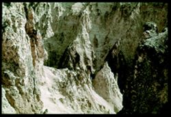
- Subject:
- Valleys, Tree limbs, Trees, Canyons, Yellowstone River, Grand Canyon of the Yellowstone (Wyo.), National parks & reserves, Cliffs, Yellowstone National P...
- Series:
- 6-38
- Creator:
- Cushman, Charles W., 1896-1972
- Date Created:
- 1938-09-28
- Genre:
- Landscape photographs
- Frame Number:
- 45
- County:
- Park
- Abstract:
- F-45= The inside of the Canyon
- Call Number:
- P01505
- Country:
- United States
- State/Province:
- Wyoming
- Physical Description:
- Color corrected: magenta cast [fading of yellow dye]. Image was originally mounted in a glass enclosure. Before digitization, the image was removed and place...
- Alternate Identifier:
- 638.45
- Persistent URL:
- http://purl.dlib.indiana.edu/iudl/archives/cushman/P01505
- Holding Location:
- Bloomington - University Archives
Wells Library E460
1320 E 10th St.
Bloomington, IN 47405
Contact at archives@indiana.edu, 812-855-1127
-
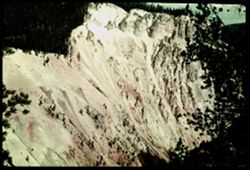
- Subject:
- Canyons, Scenic overlooks, Artist's Point (Wyo.), Trees, Shadows, Yellowstone River, Tree limbs, National parks & reserves, Forests, Yellowstone Nati...
- Series:
- 6-38
- Creator:
- Cushman, Charles W., 1896-1972
- Date Created:
- 1938-09-28
- Genre:
- Landscape photographs
- Frame Number:
- 43
- County:
- Park
- Abstract:
- F-43= Grand Canyon of the Yellowstone River
- Call Number:
- P01504
- Country:
- United States
- State/Province:
- Wyoming
- Physical Description:
- Color corrected: magenta cast [fading of yellow dye]. Image was originally mounted in a glass enclosure. Before digitization, the image was removed and place...
- Alternate Identifier:
- 638.43
- Persistent URL:
- http://purl.dlib.indiana.edu/iudl/archives/cushman/P01504
- Holding Location:
- Bloomington - University Archives
Wells Library E460
1320 E 10th St.
Bloomington, IN 47405
Contact at archives@indiana.edu, 812-855-1127
-
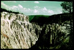
- Subject:
- Canyons, Cliffs, Grand Canyon of the Yellowstone (Wyo.), Yellowstone River, Tree limbs, National parks & reserves, Clouds, Forests, Yellowstone National ...
- Series:
- 6-38
- Creator:
- Cushman, Charles W., 1896-1972
- Date Created:
- 1938-09-28
- Genre:
- Landscape photographs
- Frame Number:
- 42
- County:
- Park
- Abstract:
- F-42= Grand Canyon of the Yellowstone River
- Call Number:
- P01503
- Country:
- United States
- State/Province:
- Wyoming
- Physical Description:
- Color corrected: magenta cast [fading of yellow dye], sprockets showing. Image was originally mounted in a glass enclosure. Before digitization, the image wa...
- Alternate Identifier:
- 638.42
- Persistent URL:
- http://purl.dlib.indiana.edu/iudl/archives/cushman/P01503
- Holding Location:
- Bloomington - University Archives
Wells Library E460
1320 E 10th St.
Bloomington, IN 47405
Contact at archives@indiana.edu, 812-855-1127
-
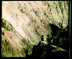
- Subject:
- Valleys, Cliffs, Grand Canyon of the Yellowstone (Wyo.), Shadows, Yellowstone River, Tree limbs, National parks & reserves, Yellowstone National Park, Ca...
- Series:
- 6-38
- Creator:
- Cushman, Charles W., 1896-1972
- Date Created:
- 1938-09-28
- Genre:
- Landscape photographs
- Frame Number:
- 41
- County:
- Park
- Abstract:
- F-41= Steep bank of Yellowstone Grand Canyon.
- Call Number:
- P01502
- Country:
- United States
- State/Province:
- Wyoming
- Physical Description:
- Color corrected: magenta cast [fading of yellow dye], masked. Image was originally mounted in a glass enclosure. Before digitization, the image was removed a...
- Alternate Identifier:
- 638.41
- Persistent URL:
- http://purl.dlib.indiana.edu/iudl/archives/cushman/P01502
- Holding Location:
- Bloomington - University Archives
Wells Library E460
1320 E 10th St.
Bloomington, IN 47405
Contact at archives@indiana.edu, 812-855-1127
-
F-15= North across Midway Geyser Basin & Prismatic Lake in foreground. Excelsior Geyser in distance.
- Subject:
- Steam, Excelsior Geyser (Yellowstone National Park), Midway Geyser Basin (Wyo.), Trails & paths, Trees, Springs, Mountains, Grand Prismatic Spring (Wyo.)...
- Series:
- 6-38
- Creator:
- Cushman, Charles W., 1896-1972
- Date Created:
- 1938-09-29
- Genre:
- Landscape photographs
- Frame Number:
- 15
- County:
- Teton
- Abstract:
- F-15= North past Prismatic Lake Across Mid. Gey. Bsn.
- Call Number:
- P01501
- Country:
- United States
- State/Province:
- Wyoming
- Physical Description:
- Color corrected: magenta cast [fading of yellow dye]. Image was originally mounted in a glass enclosure. Before digitization, the image was removed and place...
- Alternate Identifier:
- 638.15
- Persistent URL:
- http://purl.dlib.indiana.edu/iudl/archives/cushman/P01501
- Holding Location:
- Bloomington - University Archives
Wells Library E460
1320 E 10th St.
Bloomington, IN 47405
Contact at archives@indiana.edu, 812-855-1127
-
- Subject:
- Midway Geyser Basin (Wyo.), Trees, Springs, Mountains, National parks & reserves, Lakes & ponds, Clouds, Forests, Reflections, Turquoise Pool (Wyo.),...
- Series:
- 6-38
- Creator:
- Cushman, Charles W., 1896-1972
- Date Created:
- 1938-09-28
- Genre:
- Landscape photographs
- Frame Number:
- 14
- County:
- Teton
- Abstract:
- F-14= Turquoise Pool = Mid. Gey. Bas.
- Call Number:
- P01500
- Country:
- United States
- State/Province:
- Wyoming
- Physical Description:
- Color corrected: magenta cast [fading of yellow dye].
- Alternate Identifier:
- 638.14
- Persistent URL:
- http://purl.dlib.indiana.edu/iudl/archives/cushman/P01500
- Holding Location:
- Bloomington - University Archives
Wells Library E460
1320 E 10th St.
Bloomington, IN 47405
Contact at archives@indiana.edu, 812-855-1127
-
- Subject:
- Steam, Excelsior Geyser (Yellowstone National Park), Midway Geyser Basin (Wyo.), National parks & reserves, Geysers, Valleys, and Yellowstone National Park
- Series:
- 6-38
- Creator:
- Cushman, Charles W., 1896-1972
- Date Created:
- 1938-09-28/1938-09-29
- Genre:
- Snapshots and Identification photographs
- Frame Number:
- 13
- County:
- Teton
- Abstract:
- F-13= Excelsior Geyser = Midway Geyser Basin
- Call Number:
- P01499
- Country:
- United States
- State/Province:
- Wyoming
- Physical Description:
- Color corrected: magenta cast [fading of yellow dye]. Image was originally mounted in a glass enclosure. Before digitization, the image was removed and place...
- Alternate Identifier:
- 638.13
- Persistent URL:
- http://purl.dlib.indiana.edu/iudl/archives/cushman/P01499
- Holding Location:
- Bloomington - University Archives
Wells Library E460
1320 E 10th St.
Bloomington, IN 47405
Contact at archives@indiana.edu, 812-855-1127
-
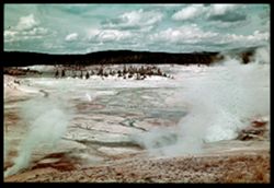
- Subject:
- Fountain Geyser (Yellowstone National Park), Valleys, Minerals, Springs, National parks & reserves, Mineral deposits, Lower Geyser Basin (Wyo.), Geysers,...
- Series:
- 6-38
- Creator:
- Cushman, Charles W., 1896-1972
- Date Created:
- 1938-09-28
- Genre:
- Landscape photographs and Identification photographs
- Frame Number:
- 11
- County:
- Teton
- Abstract:
- F-11= Fountain Geyser - now placid
- Call Number:
- P01497
- Country:
- United States
- State/Province:
- Wyoming
- Physical Description:
- Color corrected: magenta cast [fading of yellow dye], sprockets showing. Image was originally mounted in a glass enclosure. Before digitization, the image wa...
- Alternate Identifier:
- 638.11
- Persistent URL:
- http://purl.dlib.indiana.edu/iudl/archives/cushman/P01497
- Holding Location:
- Bloomington - University Archives
Wells Library E460
1320 E 10th St.
Bloomington, IN 47405
Contact at archives@indiana.edu, 812-855-1127
-
- Subject:
- Minerals, National parks & reserves, Lower Geyser Basin (Wyo.), Springs, Forests, Mountains, Geysers, Steam, Clouds, Valleys, Fountain Geyser (Yellowston...
- Series:
- 6-38
- Creator:
- Cushman, Charles W., 1896-1972
- Date Created:
- 1938-09-28/1938-09-29
- Genre:
- Landscape photographs
- Frame Number:
- 12
- County:
- Teton
- Abstract:
- F-12= Small geyser erupting - in Lower Basin
- Call Number:
- P01498
- Country:
- United States
- State/Province:
- Wyoming
- Physical Description:
- Color corrected: magenta cast [fading of yellow dye]. Image was originally mounted in a glass enclosure. Before digitization, the image was removed and place...
- Alternate Identifier:
- 638.12
- Persistent URL:
- http://purl.dlib.indiana.edu/iudl/archives/cushman/P01498
- Holding Location:
- Bloomington - University Archives
Wells Library E460
1320 E 10th St.
Bloomington, IN 47405
Contact at archives@indiana.edu, 812-855-1127
-
- Subject:
- Canyons, Cliffs, Trees, Shadows, Golden Gate Canyon, Mountains, National parks & reserves, Forests, Passes (Landforms), and Yellowstone National Park
- Series:
- 6-38
- Creator:
- Cushman, Charles W., 1896-1972
- Date Created:
- 1938-09-28
- Genre:
- Landscape photographs
- Frame Number:
- 8
- County:
- Park
- Abstract:
- F-8= yellowstone's Golden gate near sundown
- Call Number:
- P01495
- Country:
- United States
- State/Province:
- Wyoming
- Physical Description:
- Color corrected: magenta cast [fading of yellow dye]. Image was originally mounted in a glass enclosure. Before digitization, the image was removed and place...
- Alternate Identifier:
- 638.8
- Persistent URL:
- http://purl.dlib.indiana.edu/iudl/archives/cushman/P01495
- Holding Location:
- Bloomington - University Archives
Wells Library E460
1320 E 10th St.
Bloomington, IN 47405
Contact at archives@indiana.edu, 812-855-1127
-
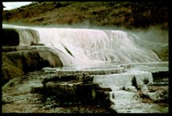
- Subject:
- Terraces, Waterfalls, Minerals, Springs, Rock formations, Mineral deposits, Hills, Mammoth Hot Springs (Wyo.), Yellowstone National Park, and National parks ...
- Series:
- 6-38
- Creator:
- Cushman, Charles W., 1896-1972
- Date Created:
- 1938-09-28
- Genre:
- Landscape photographs
- Frame Number:
- 2
- County:
- Park
- Abstract:
- F-2= A small terrace at Mammoth
- Call Number:
- P01494
- Country:
- United States
- State/Province:
- Wyoming
- Physical Description:
- Color corrected: magenta cast [fading of yellow dye]. Image was originally mounted in a glass enclosure. Before digitization, the image was removed and place...
- Alternate Identifier:
- 638.2
- Persistent URL:
- http://purl.dlib.indiana.edu/iudl/archives/cushman/P01494
- Holding Location:
- Bloomington - University Archives
Wells Library E460
1320 E 10th St.
Bloomington, IN 47405
Contact at archives@indiana.edu, 812-855-1127
-
- Subject:
- Valleys, Cliffs, Grand Canyon of the Yellowstone (Wyo.), Yellowstone River, National parks & reserves, Forests, Yellowstone National Park, Canyons, Trees...
- Series:
- 6-38
- Creator:
- Cushman, Charles W., 1896-1972
- Date Created:
- 1938-09-29
- Genre:
- Landscape photographs
- Frame Number:
- 1
- County:
- Park
- Abstract:
- F-1= Looking down at the right side of Canyon.
- Call Number:
- P01493
- Country:
- United States
- State/Province:
- Wyoming
- Physical Description:
- Color corrected: magenta cast [fading of yellow dye]. Image was originally mounted in a glass enclosure. Before digitization, the image was removed and place...
- Alternate Identifier:
- 638.1
- Persistent URL:
- http://purl.dlib.indiana.edu/iudl/archives/cushman/P01493
- Holding Location:
- Bloomington - University Archives
Wells Library E460
1320 E 10th St.
Bloomington, IN 47405
Contact at archives@indiana.edu, 812-855-1127
-
- Subject:
- Trees, Glacier National Park (Mont.), Mountains, Shrubs, Lakes & ponds, Clouds, Sunrises & sunsets, Saint Marys Lake (Mont.), and National parks &...
- Series:
- 5-38
- Creator:
- Cushman, Charles W., 1896-1972
- Date Created:
- 1938-09-23/1938-09-24
- Genre:
- Landscape photographs
- Frame Number:
- 42
- County:
- Lake
- Abstract:
- E-42= Peaks at sunset from St Mary's Lake
- Call Number:
- P01492
- Country:
- United States
- State/Province:
- Montana
- Physical Description:
- Color corrected: magenta cast [fading of yellow dye].
- Alternate Identifier:
- 538.42
- Persistent URL:
- http://purl.dlib.indiana.edu/iudl/archives/cushman/P01492
- Holding Location:
- Bloomington - University Archives
Wells Library E460
1320 E 10th St.
Bloomington, IN 47405
Contact at archives@indiana.edu, 812-855-1127
-
- Subject:
- National parks & reserves, Red Eagle Mountain (Mont.), Forests, Roads, Mountains, Trees, Clouds, and Glacier National Park (Mont.)
- Series:
- 5-38
- Creator:
- Cushman, Charles W., 1896-1972
- Date Created:
- 1938-09-23/1938-09-24
- Genre:
- Landscape photographs
- Frame Number:
- 41
- County:
- Glacier
- Abstract:
- E- 41= Looking down Going-To-The-Sun Hwy to Red Eagle Mtn.
- Call Number:
- P01491
- Country:
- United States
- State/Province:
- Montana
- Physical Description:
- Color corrected: magenta cast [fading of yellow dye]. Image was originally mounted in a glass enclosure. Before digitization, the image was removed and place...
- Alternate Identifier:
- 538.41
- Persistent URL:
- http://purl.dlib.indiana.edu/iudl/archives/cushman/P01491
- Holding Location:
- Bloomington - University Archives
Wells Library E460
1320 E 10th St.
Bloomington, IN 47405
Contact at archives@indiana.edu, 812-855-1127
-
- Subject:
- Cliffs, Glacier National Park (Mont.), Mountains, National parks & reserves, Clouds, and Clements Mountain (Mont.)
- Series:
- 5-38
- Creator:
- Cushman, Charles W., 1896-1972
- Date Created:
- 1938-09-24
- Genre:
- Landscape photographs
- Frame Number:
- 40
- Street Address:
- Logan Pass
- Abstract:
- E-40 = The top of Mount Clements from Logan Pass Mtn Peak reaches toward white cloud.
- Call Number:
- P01490
- Country:
- United States
- State/Province:
- Montana
- Physical Description:
- Color corrected: magenta cast [fading of yellow dye]. Image was originally mounted in a glass enclosure. Before digitization, the image was removed and place...
- Alternate Identifier:
- 538.40
- Persistent URL:
- http://purl.dlib.indiana.edu/iudl/archives/cushman/P01490
- Holding Location:
- Bloomington - University Archives
Wells Library E460
1320 E 10th St.
Bloomington, IN 47405
Contact at archives@indiana.edu, 812-855-1127
-
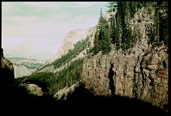
E-39 = View from vicinity of Logan Pass back toward mountains along Garden and Glacier walls Cushman
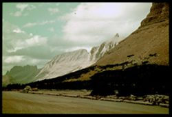
- Subject:
- Cliffs, Trees, Shadows, Glacier National Park (Mont.), Mountains, Shrubs, Clouds, Garden Wall (Mont.), Roads, and National parks & reserves
- Series:
- 5-38
- Creator:
- Cushman, Charles W., 1896-1972
- Date Created:
- 1938-09-24
- Genre:
- Landscape photographs
- Frame Number:
- 39
- Street Address:
- Logan Pass
- Abstract:
- E- 39= Looking North from Logan Pass
- Call Number:
- P01489
- Country:
- United States
- State/Province:
- Montana
- Physical Description:
- Color corrected: magenta cast [fading of yellow dye]. Image was originally mounted in a glass enclosure. Before digitization, the image was removed and place...
- Alternate Identifier:
- 538.39
- Persistent URL:
- http://purl.dlib.indiana.edu/iudl/archives/cushman/P01489
- Holding Location:
- Bloomington - University Archives
Wells Library E460
1320 E 10th St.
Bloomington, IN 47405
Contact at archives@indiana.edu, 812-855-1127
-
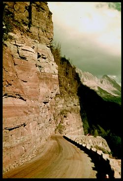
- Subject:
- Walls, Railings, Cliffs, Trees, Shadows, Glacier National Park (Mont.), Mountains, National parks & reserves, Clouds, Garden Wall (Mont.), and Roads
- Series:
- 5-38
- Creator:
- Cushman, Charles W., 1896-1972
- Date Created:
- 1938-09-23/1938-09-24
- Genre:
- Landscape photographs
- Frame Number:
- 35
- Abstract:
- E- 35= Road narrows , along Garden Wall
- Call Number:
- P01487
- Country:
- United States
- State/Province:
- Montana
- Physical Description:
- Color corrected: magenta cast [fading of yellow dye]. Image was originally mounted in a glass enclosure. Before digitization, the image was removed and place...
- Alternate Identifier:
- 538.35
- Persistent URL:
- http://purl.dlib.indiana.edu/iudl/archives/cushman/P01487
- Holding Location:
- Bloomington - University Archives
Wells Library E460
1320 E 10th St.
Bloomington, IN 47405
Contact at archives@indiana.edu, 812-855-1127
-

- Subject:
- National parks & reserves, Forests, Roads, Mountains, Shrubs, Sun Mountain (Mont.), Shadows, Clouds, Glacier National Park (Mont.), and Trees
- Series:
- 5-38
- Creator:
- Cushman, Charles W., 1896-1972
- Date Created:
- 1938-09-24
- Genre:
- Landscape photographs
- Frame Number:
- 37
- Street Address:
- Logan Pass
- County:
- Cascade
- Abstract:
- E-37= Eastward from Logan Pass Going to the Sun Mtn. At left.
- Call Number:
- P01488
- Country:
- United States
- State/Province:
- Montana
- Physical Description:
- Color corrected: magenta cast [fading of yellow dye]. Image was originally mounted in a glass enclosure. Before digitization, the image was removed and place...
- Alternate Identifier:
- 538.37
- Persistent URL:
- http://purl.dlib.indiana.edu/iudl/archives/cushman/P01488
- Holding Location:
- Bloomington - University Archives
Wells Library E460
1320 E 10th St.
Bloomington, IN 47405
Contact at archives@indiana.edu, 812-855-1127
-
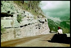
- Subject:
- Walls, Men, Cliffs, Trees, Glacier National Park (Mont.), Mountains, Shrubs, Garden Wall (Mont.), Roads, and National parks & reserves
- Series:
- 5-38
- Creator:
- Cushman, Charles W., 1896-1972
- Date Created:
- 1938-09-24
- Genre:
- Landscape photographs
- Frame Number:
- 34
- Street Address:
- Logan Pass
- Persons Pictured:
- Cushman, Charles W. (Charles Weever), 1896-1972
- Abstract:
- E- 34= Looking up along Garden Wall to mountains near Logan Pass.
- Call Number:
- P01486
- Country:
- United States
- State/Province:
- Montana
- Physical Description:
- Color corrected: magenta cast [fading of yellow dye]. Image was originally mounted in a glass enclosure. Before digitization, the image was removed and place...
- Alternate Identifier:
- 538.34
- Persistent URL:
- http://purl.dlib.indiana.edu/iudl/archives/cushman/P01486
- Holding Location:
- Bloomington - University Archives
Wells Library E460
1320 E 10th St.
Bloomington, IN 47405
Contact at archives@indiana.edu, 812-855-1127
-
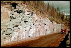
- Subject:
- Cliffs, Automobiles, Trees, Glacier National Park (Mont.), Mountains, National parks & reserves, Garden Wall (Mont.), and Roads
- Series:
- 5-38
- Creator:
- Cushman, Charles W., 1896-1972
- Date Created:
- 1938-09-24
- Genre:
- Landscape photographs
- Frame Number:
- 33
- Abstract:
- E-33= Road leads up, along [Garden ] Wall.
- Call Number:
- P01485
- Country:
- United States
- State/Province:
- Montana
- Physical Description:
- Color corrected: magenta cast [fading of yellow dye]. Image was originally mounted in a glass enclosure. Before digitization, the image was removed and place...
- Alternate Identifier:
- 538.33
- Persistent URL:
- http://purl.dlib.indiana.edu/iudl/archives/cushman/P01485
- Holding Location:
- Bloomington - University Archives
Wells Library E460
1320 E 10th St.
Bloomington, IN 47405
Contact at archives@indiana.edu, 812-855-1127
-
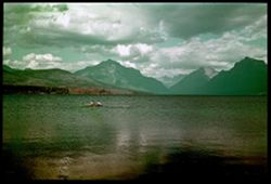
- Subject:
- Mountains, Trees, Glacier National Park (Mont.), National parks & reserves, Coastlines, People, McDonald, Lake (Mont.), Lakes & ponds, Clouds, Boats,...
- Series:
- 5-38
- Creator:
- Cushman, Charles W., 1896-1972
- Date Created:
- 1938-09-24
- Genre:
- Landscape photographs
- Frame Number:
- 38
- County:
- Park
- Abstract:
- E-32.= Across lake McDonald to Glacier's Peaks
- Call Number:
- P01484
- Country:
- United States
- State/Province:
- Montana
- Physical Description:
- Color corrected: magenta cast [fading of yellow dye]. Image was originally mounted in a glass enclosure. Before digitization, the image was removed and place...
- Alternate Identifier:
- 538.32
- Persistent URL:
- http://purl.dlib.indiana.edu/iudl/archives/cushman/P01484
- Holding Location:
- Bloomington - University Archives
Wells Library E460
1320 E 10th St.
Bloomington, IN 47405
Contact at archives@indiana.edu, 812-855-1127
-
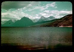
- Subject:
- Trees, Coastlines, Glacier National Park (Mont.), Mountains, McDonald, Lake (Mont.), Lakes & ponds, Clouds, Forests, and National parks & reserves
- Series:
- 5-38
- Creator:
- Cushman, Charles W., 1896-1972
- Date Created:
- 1938-09-23
- Genre:
- Landscape photographs
- Frame Number:
- 31
- County:
- Park
- Abstract:
- E-31. = Across lake McDonald to Glacier's Peaks
- Call Number:
- P01483
- Country:
- United States
- State/Province:
- Montana
- Physical Description:
- Color corrected: magenta cast [fading of yellow dye].
- Alternate Identifier:
- 538.31
- Persistent URL:
- http://purl.dlib.indiana.edu/iudl/archives/cushman/P01483
- Holding Location:
- Bloomington - University Archives
Wells Library E460
1320 E 10th St.
Bloomington, IN 47405
Contact at archives@indiana.edu, 812-855-1127
-
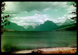
- Subject:
- Mountains, Tree limbs, Glacier Peak (Mont.), Glacier National Park (Mont.), National parks & reserves, Snow, Coastlines, McDonald, Lake (Mont.), Lakes &a...
- Series:
- 5-38
- Creator:
- Cushman, Charles W., 1896-1972
- Date Created:
- 1938-09-23/1938-09-24
- Genre:
- Landscape photographs
- Frame Number:
- 30
- County:
- Park
- Abstract:
- E-30= Across lake McDonald to Glacier's Peaks
- Call Number:
- P01482
- Country:
- United States
- State/Province:
- Montana
- Physical Description:
- Color corrected: magenta cast [fading of yellow dye].
- Alternate Identifier:
- 538.30
- Persistent URL:
- http://purl.dlib.indiana.edu/iudl/archives/cushman/P01482
- Holding Location:
- Bloomington - University Archives
Wells Library E460
1320 E 10th St.
Bloomington, IN 47405
Contact at archives@indiana.edu, 812-855-1127
-
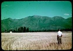
- Subject:
- Rocky Mountains, Men, Wheat, Glacier Peak (Mont.), Trees, Croplands, Clouds, Dwellings, and Mountains
- Series:
- 5-38
- Creator:
- Cushman, Charles W., 1896-1972
- Date Created:
- 1938-09-23
- Genre:
- Landscape photographs
- Frame Number:
- 29
- County:
- Park
- Persons Pictured:
- Cushman, Charles W. (Charles Weever), 1896-1972
- Abstract:
- E-29= C in cut-over wheat field looks at High Rockies.
- Call Number:
- P01481
- Country:
- United States
- State/Province:
- Montana
- Physical Description:
- Color corrected: magenta cast [fading of yellow dye].
- Alternate Identifier:
- 538.29
- Persistent URL:
- http://purl.dlib.indiana.edu/iudl/archives/cushman/P01481
- Holding Location:
- Bloomington - University Archives
Wells Library E460
1320 E 10th St.
Bloomington, IN 47405
Contact at archives@indiana.edu, 812-855-1127
-
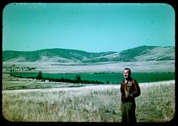
- Subject:
- Men, Grasses, Trees, Coastlines, Flathead Lake (Mont.), Mountains, and Lakes & ponds
- Series:
- 5-38
- Creator:
- Cushman, Charles W., 1896-1972
- Date Created:
- 1938-09-24
- Genre:
- Landscape photographs
- Frame Number:
- 28
- County:
- Lake
- Persons Pictured:
- Cushman, Charles W. (Charles Weever), 1896-1972
- Abstract:
- E-28: C at north end of Flathead Lake.
- Call Number:
- P01480
- Country:
- United States
- State/Province:
- Montana
- Physical Description:
- Color corrected: magenta cast [fading of yellow dye].
- Alternate Identifier:
- 538.28
- Persistent URL:
- http://purl.dlib.indiana.edu/iudl/archives/cushman/P01480
- Holding Location:
- Bloomington - University Archives
Wells Library E460
1320 E 10th St.
Bloomington, IN 47405
Contact at archives@indiana.edu, 812-855-1127
-
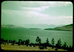
- Subject:
- Rocky Mountains, Trees, Coastlines, Flathead Lake (Mont.), Mountains, Shrubs, Lakes & ponds, and Islands
- Series:
- 5-38
- Creator:
- Cushman, Charles W., 1896-1972
- Date Created:
- 1938-09-23
- Genre:
- Landscape photographs
- Frame Number:
- 27
- County:
- Lake
- Abstract:
- E-27: East across flathead Lake to rugged Rockies.
- Call Number:
- P01479
- Country:
- United States
- State/Province:
- Montana
- Physical Description:
- Color corrected: magenta cast [fading of yellow dye].
- Alternate Identifier:
- 538.27
- Persistent URL:
- http://purl.dlib.indiana.edu/iudl/archives/cushman/P01479
- Holding Location:
- Bloomington - University Archives
Wells Library E460
1320 E 10th St.
Bloomington, IN 47405
Contact at archives@indiana.edu, 812-855-1127
-
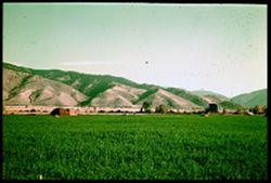
- Subject:
- Croplands, Meadows, Mountains, Trees, and Glacier National Park (Mont.)
- Series:
- 5-38
- Creator:
- Cushman, Charles W., 1896-1972
- Date Created:
- 1938-09-23
- Genre:
- Landscape photographs
- Frame Number:
- 26
- County:
- Missoula
- Abstract:
- E-26: Green fields north of Missoula, Mont.
- Call Number:
- P01478
- City:
- Missoula
- Country:
- United States
- State/Province:
- Montana
- Physical Description:
- Color corrected: magenta cast [fading of yellow dye]. Image was originally mounted in a glass enclosure. Before digitization, the image was removed and place...
- Alternate Identifier:
- 538.26
- Persistent URL:
- http://purl.dlib.indiana.edu/iudl/archives/cushman/P01478
- Holding Location:
- Bloomington - University Archives
Wells Library E460
1320 E 10th St.
Bloomington, IN 47405
Contact at archives@indiana.edu, 812-855-1127
-
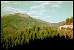
- Subject:
- Bitterroot Range (Idaho and Mont.), Trees, Shadows, Mountains, Clouds, Forests, and Utility poles
- Series:
- 5-38
- Creator:
- Cushman, Charles W., 1896-1972
- Date Created:
- 1938-09-23/1938-09-24
- Genre:
- Landscape photographs
- Frame Number:
- 23
- County:
- Missoula and Shoshone
- Abstract:
- E-23: Hwy near Idaho-Mont. Line.
- Call Number:
- P01476
- City:
- Missoula and Kellogg
- Country:
- United States
- State/Province:
- Idaho and Montana
- Physical Description:
- Color corrected: magenta cast [fading of yellow dye]. Image was originally mounted in a glass enclosure. Before digitization, the image was removed and place...
- Alternate Identifier:
- 538.23
- Persistent URL:
- http://purl.dlib.indiana.edu/iudl/archives/cushman/P01476
- Holding Location:
- Bloomington - University Archives
Wells Library E460
1320 E 10th St.
Bloomington, IN 47405
Contact at archives@indiana.edu, 812-855-1127
-
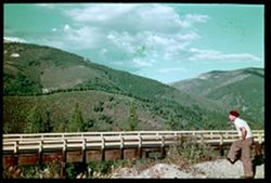
- Subject:
- Men, Bitterroot Range (Idaho and Mont.), Trees, Mountains, Shrubs, Clouds, Forests, and Bridges
- Series:
- 5-38
- Creator:
- Cushman, Charles W., 1896-1972
- Date Created:
- 1938-09-23
- Genre:
- Landscape photographs
- Frame Number:
- 22
- County:
- Shoshone
- Persons Pictured:
- Cushman, Charles W. (Charles Weever), 1896-1972
- Abstract:
- E- 22: Bitterroot Mtns east of Kellogg, Ida.
- Call Number:
- P01475
- City:
- Kellogg
- Country:
- United States
- State/Province:
- Idaho
- Physical Description:
- Color corrected: magenta cast [fading of yellow dye]. Image was originally mounted in a glass enclosure. Before digitization, the image was removed and place...
- Alternate Identifier:
- 538.22
- Persistent URL:
- http://purl.dlib.indiana.edu/iudl/archives/cushman/P01475
- Holding Location:
- Bloomington - University Archives
Wells Library E460
1320 E 10th St.
Bloomington, IN 47405
Contact at archives@indiana.edu, 812-855-1127
-
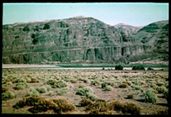
- Subject:
- Columbia River, Cliffs, Trees, Mountains, Shrubs, and Rivers
- Series:
- 4-38
- Creator:
- Cushman, Charles W., 1896-1972
- Date Created:
- 1938-09-22
- Genre:
- Landscape photographs
- Frame Number:
- 45
- Abstract:
- * D-45= Red cliffs of Columbia's west bank.
- Call Number:
- P01474
- Country:
- United States
- State/Province:
- Washington
- Physical Description:
- Color corrected: magenta cast [fading of yellow dye]. Image was originally mounted in a glass enclosure. Before digitization, the image was removed and place...
- Alternate Identifier:
- 438.45
- Persistent URL:
- http://purl.dlib.indiana.edu/iudl/archives/cushman/P01474
- Holding Location:
- Bloomington - University Archives
Wells Library E460
1320 E 10th St.
Bloomington, IN 47405
Contact at archives@indiana.edu, 812-855-1127
-
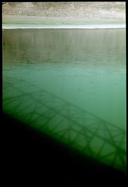
- Subject:
- Columbia River, Coastlines, Shadows, Bridges, and Rivers
- Series:
- 4-38
- Creator:
- Cushman, Charles W., 1896-1972
- Date Created:
- 1938-09-22
- Genre:
- Snapshots
- Frame Number:
- 44
- Abstract:
- D-44= Shadow of bridge on water.
- Call Number:
- P01473
- Country:
- United States
- State/Province:
- Washington
- Physical Description:
- Color corrected: magenta cast [fading of yellow dye]. Image was originally mounted in a glass enclosure. Before digitization, the image was removed and place...
- Alternate Identifier:
- 438.44
- Persistent URL:
- http://purl.dlib.indiana.edu/iudl/archives/cushman/P01473
- Holding Location:
- Bloomington - University Archives
Wells Library E460
1320 E 10th St.
Bloomington, IN 47405
Contact at archives@indiana.edu, 812-855-1127
-
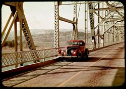
- Subject:
- Columbia River, Roads, Automobiles, Trees, Mountains, Shrubs, Bridges, Rivers, and Mesas
- Series:
- 4-38
- Creator:
- Cushman, Charles W., 1896-1972
- Date Created:
- 1938-09-21/1938-09-22
- Genre:
- Views
- Frame Number:
- 43
- Abstract:
- D-43=Hwy bridge over Columbia , central Washington.
- Call Number:
- P01472
- Country:
- United States
- State/Province:
- Washington
- Physical Description:
- Color corrected: magenta cast [fading of yellow dye].
- Alternate Identifier:
- 438.43
- Persistent URL:
- http://purl.dlib.indiana.edu/iudl/archives/cushman/P01472
- Holding Location:
- Bloomington - University Archives
Wells Library E460
1320 E 10th St.
Bloomington, IN 47405
Contact at archives@indiana.edu, 812-855-1127
-
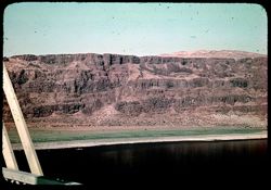
- Subject:
- Columbia River, Cliffs, Bridges, Coastlines, Rock formations, Mesas, and Rivers
- Series:
- 4-38
- Creator:
- Cushman, Charles W., 1896-1972
- Date Created:
- 1938-09-21/1938-09-22
- Genre:
- Landscape photographs
- Frame Number:
- 42
- Abstract:
- D-42= west bank Columbia river, from bridge
- Call Number:
- P01471
- Country:
- United States
- State/Province:
- Washington
- Physical Description:
- Color corrected: magenta cast [fading of yellow dye].
- Alternate Identifier:
- 438.42
- Persistent URL:
- http://purl.dlib.indiana.edu/iudl/archives/cushman/P01471
- Holding Location:
- Bloomington - University Archives
Wells Library E460
1320 E 10th St.
Bloomington, IN 47405
Contact at archives@indiana.edu, 812-855-1127
-
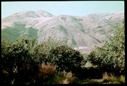
- Subject:
- Mountains, Dirt roads, Shrubs, Apple trees, Grasses, and Apple orchards
- Series:
- 4-38
- Creator:
- Cushman, Charles W., 1896-1972
- Date Created:
- 1938-09-21
- Genre:
- Landscape photographs
- Frame Number:
- 40
- County:
- Yakima
- Abstract:
- D-40= Mtns behind apple orchard
- Call Number:
- P01469
- City:
- Yakima
- Country:
- United States
- State/Province:
- Washington
- Physical Description:
- Color corrected: magenta cast [fading of yellow dye]. Image was originally mounted in a glass enclosure. Before digitization, the image was removed and place...
- Alternate Identifier:
- 438.40
- Persistent URL:
- http://purl.dlib.indiana.edu/iudl/archives/cushman/P01469
- Holding Location:
- Bloomington - University Archives
Wells Library E460
1320 E 10th St.
Bloomington, IN 47405
Contact at archives@indiana.edu, 812-855-1127
-
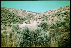
- Subject:
- Grasses, Ginkgo Petrified Forest State Park (Wash.), State parks & reserves, Shrubs, and Hills
- Series:
- 4-38
- Creator:
- Cushman, Charles W., 1896-1972
- Date Created:
- 1938-09-22
- Genre:
- Landscape photographs
- Frame Number:
- 41
- Abstract:
- D-41= In Gingko State Park, Central Washington
- Call Number:
- P01470
- Country:
- United States
- State/Province:
- Washington
- Physical Description:
- Color corrected: magenta cast [fading of yellow dye]. Image was originally mounted in a glass enclosure. Before digitization, the image was removed and place...
- Alternate Identifier:
- 438.41
- Persistent URL:
- http://purl.dlib.indiana.edu/iudl/archives/cushman/P01470
- Holding Location:
- Bloomington - University Archives
Wells Library E460
1320 E 10th St.
Bloomington, IN 47405
Contact at archives@indiana.edu, 812-855-1127
-
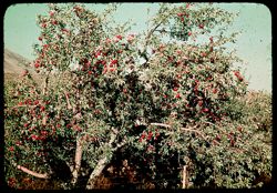
- Subject:
- Apple trees, Mountains, Fences, and Apples
- Series:
- 4-38
- Creator:
- Cushman, Charles W., 1896-1972
- Date Created:
- 1938-09-21/1938-09-22
- Genre:
- Identification photographs
- Frame Number:
- 39
- County:
- Yakima
- Abstract:
- D-39=Apple trees near Yakima
- Call Number:
- P01468
- City:
- Yakima
- Country:
- United States
- State/Province:
- Washington
- Physical Description:
- Color corrected: magenta cast [fading of yellow dye].
- Alternate Identifier:
- 438.39
- Persistent URL:
- http://purl.dlib.indiana.edu/iudl/archives/cushman/P01468
- Holding Location:
- Bloomington - University Archives
Wells Library E460
1320 E 10th St.
Bloomington, IN 47405
Contact at archives@indiana.edu, 812-855-1127
-
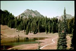
- Subject:
- Roads, Trees, Mountains, Shrubs, Lakes & ponds, Forests, Reflections, Mount Rainier National Park (Wash.), and National parks & reserves
- Series:
- 4-38
- Creator:
- Cushman, Charles W., 1896-1972
- Date Created:
- 1938-09-21/1938-09-22
- Genre:
- Landscape photographs
- Frame Number:
- 37
- Street Address:
- Chinook Pass
- Abstract:
- D-37 = Lake, Evergreens, & Mtns. Westside Chinook Pass
- Call Number:
- P01466
- Country:
- United States
- State/Province:
- Washington
- Physical Description:
- Color corrected: magenta cast [fading of yellow dye]. Image was originally mounted in a glass enclosure. Before digitization, the image was removed and place...
- Alternate Identifier:
- 438.37
- Persistent URL:
- http://purl.dlib.indiana.edu/iudl/archives/cushman/P01466
- Holding Location:
- Bloomington - University Archives
Wells Library E460
1320 E 10th St.
Bloomington, IN 47405
Contact at archives@indiana.edu, 812-855-1127
-
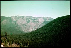
- Subject:
- Rocks, Trees, Flowers, Mountains, National parks & reserves, Passes (Landforms), Mount Rainier National Park (Wash.), and Shrubs
- Series:
- 4-38
- Creator:
- Cushman, Charles W., 1896-1972
- Date Created:
- 1938-09-21/1938-09-22
- Genre:
- Landscape photographs
- Frame Number:
- 38
- Street Address:
- Chinook Pass
- Abstract:
- D-38=East side Chinook Pass.
- Call Number:
- P01467
- Country:
- United States
- State/Province:
- Washington
- Physical Description:
- Color corrected: magenta cast [fading of yellow dye]. Image was originally mounted in a glass enclosure. Before digitization, the image was removed and place...
- Alternate Identifier:
- 438.38
- Persistent URL:
- http://purl.dlib.indiana.edu/iudl/archives/cushman/P01467
- Holding Location:
- Bloomington - University Archives
Wells Library E460
1320 E 10th St.
Bloomington, IN 47405
Contact at archives@indiana.edu, 812-855-1127
-
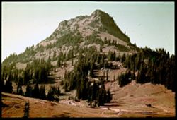
- Subject:
- Mount Rainier National Park (Wash.), National parks & reserves, Forests, Roads, Mountains, Shrubs, Trees, and Rocks
- Series:
- 4-38
- Creator:
- Cushman, Charles W., 1896-1972
- Date Created:
- 1938-09-21/1938-09-22
- Genre:
- Landscape photographs
- Frame Number:
- 36
- Abstract:
- D-36= A mountain east of Rainier
- Call Number:
- P01465
- Country:
- United States
- State/Province:
- Washington
- Physical Description:
- Color corrected: magenta cast [fading of yellow dye]. Image was originally mounted in a glass enclosure. Before digitization, the image was removed and place...
- Alternate Identifier:
- 438.36
- Persistent URL:
- http://purl.dlib.indiana.edu/iudl/archives/cushman/P01465
- Holding Location:
- Bloomington - University Archives
Wells Library E460
1320 E 10th St.
Bloomington, IN 47405
Contact at archives@indiana.edu, 812-855-1127
-
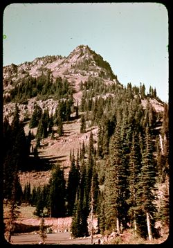
- Subject:
- Mount Rainier National Park (Wash.), National parks & reserves, Automobiles, Forests, Roads, Mountains, Shrubs, Trees, and Rocks
- Series:
- 4-38
- Creator:
- Cushman, Charles W., 1896-1972
- Date Created:
- 1938-09-01
- Genre:
- Landscape photographs
- Frame Number:
- 35
- Abstract:
- D-35=Evergreens on mountain side
- Call Number:
- P01464
- Country:
- United States
- State/Province:
- Washington
- Physical Description:
- Color corrected: magenta cast [fading of yellow dye].
- Alternate Identifier:
- 438.35
- Persistent URL:
- http://purl.dlib.indiana.edu/iudl/archives/cushman/P01464
- Holding Location:
- Bloomington - University Archives
Wells Library E460
1320 E 10th St.
Bloomington, IN 47405
Contact at archives@indiana.edu, 812-855-1127
-
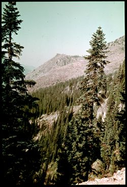
- Subject:
- Mount Rainier National Park (Wash.), National parks & reserves, Forests, Mountains, Shrubs, Trees, and Rocks
- Series:
- 4-38
- Creator:
- Cushman, Charles W., 1896-1972
- Date Created:
- 1938-09-21/1938-09-22
- Genre:
- Landscape photographs
- Frame Number:
- 34
- Abstract:
- D-34= Mountain scene near Chinook Pass.
- Call Number:
- P01463
- Country:
- United States
- State/Province:
- Washington
- Physical Description:
- Color corrected: magenta cast [fading of yellow dye]. Image was originally mounted in a glass enclosure. Before digitization, the image was removed and place...
- Alternate Identifier:
- 438.34
- Persistent URL:
- http://purl.dlib.indiana.edu/iudl/archives/cushman/P01463
- Holding Location:
- Bloomington - University Archives
Wells Library E460
1320 E 10th St.
Bloomington, IN 47405
Contact at archives@indiana.edu, 812-855-1127
-

- Subject:
- Mount Rainier National Park (Wash.), National parks & reserves, Flowers, Mountains, Shrubs, Trees, and Rocks
- Series:
- 4-38
- Creator:
- Cushman, Charles W., 1896-1972
- Date Created:
- 1938-09-21
- Genre:
- Identification photographs
- Frame Number:
- 33
- Abstract:
- D-33=Flowers along mountain road
- Call Number:
- P01462
- Country:
- United States
- State/Province:
- Washington
- Physical Description:
- Color corrected: magenta cast [fading of yellow dye]. Image was originally mounted in a glass enclosure. Before digitization, the image was removed and place...
- Alternate Identifier:
- 438.33
- Persistent URL:
- http://purl.dlib.indiana.edu/iudl/archives/cushman/P01462
- Holding Location:
- Bloomington - University Archives
Wells Library E460
1320 E 10th St.
Bloomington, IN 47405
Contact at archives@indiana.edu, 812-855-1127
-
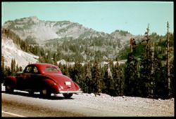
- Subject:
- Roads, Automobiles, Trees, Mount Rainier National Park (Wash.), National parks & reserves, Forests, and Mountains
- Series:
- 4-38
- Creator:
- Cushman, Charles W., 1896-1972
- Date Created:
- 1938-09-21
- Genre:
- Landscape photographs
- Frame Number:
- 32
- Street Address:
- Chinook Pass
- Abstract:
- D-32= Leaving Mr. Rainier Natl Park
- Call Number:
- P01461
- Country:
- United States
- State/Province:
- Washington
- Physical Description:
- Color corrected: magenta cast [fading of yellow dye]. Image was originally mounted in a glass enclosure. Before digitization, the image was removed and place...
- Alternate Identifier:
- 438.32
- Persistent URL:
- http://purl.dlib.indiana.edu/iudl/archives/cushman/P01461
- Holding Location:
- Bloomington - University Archives
Wells Library E460
1320 E 10th St.
Bloomington, IN 47405
Contact at archives@indiana.edu, 812-855-1127
-
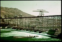
- Subject:
- Hills, Dam construction, Hoisting machinery, Rocks, Facilities, Rivers, Grand Coulee Dam (Wash.), and Rapids
- Series:
- 4-38
- Creator:
- Cushman, Charles W., 1896-1972
- Date Created:
- 1938-09-22
- Genre:
- Architectural photographs
- Frame Number:
- 6
- County:
- Grant
- Abstract:
- * D-6= Coulee Dam under construction
- Call Number:
- P01460
- City:
- Grand Coulee
- Country:
- United States
- State/Province:
- Washington
- Physical Description:
- Color corrected: magenta cast [fading of yellow dye]. Image was originally mounted in a glass enclosure. Before digitization, the image was removed and place...
- Alternate Identifier:
- 438.6
- Persistent URL:
- http://purl.dlib.indiana.edu/iudl/archives/cushman/P01460
- Holding Location:
- Bloomington - University Archives
Wells Library E460
1320 E 10th St.
Bloomington, IN 47405
Contact at archives@indiana.edu, 812-855-1127