Topical Subject: Vegetation mapping, Geographic Subject: Gibson County (Ind.), Geographic Subject: Posey County (Ind.), and Geographic Subject: White County ...
Creator:
Geological Survey (U.S.) and Illinois State Geological Survey
Publisher:
Geological Survey (U.S.)
Date Created:
1963
Identifier:
VAC3073-M-01356
Genre:
Topographic maps, Quadrangle maps, and 15 minute topographic maps
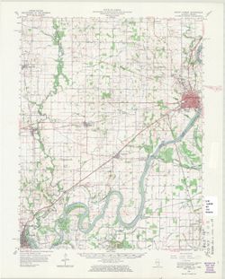
Mapped, edited, and published by the Geological Survey , Illinois area mapped in cooperation with State of Illinois Geological Survey. Filing title: New Harm...
Geographic Subject: Edwards County (Ill.), Geographic Subject: Gibson County (Ind.), Geographic Subject: Wabash County (Ill.), and Topical Subject: Vegetatio...
Creator:
Geological Survey (U.S.)
Publisher:
Geological Survey (U.S.)
Date Created:
1963
Identifier:
VAC3073-M-01353
Genre:
15 minute topographic maps, Quadrangle maps, and Topographic maps
Mapped, edited, and published by the Geological Survey. Filing title: Mount Carmel, Ill.-Ind. Standard map series designation: AMS (Series) V763 3460 IV. Pol...
Call Number:
G4090 s62 .G4 Mount Carmel 1959 rep 1963 V
Caption:
Imprint: Washington, D.C. : The Survey, 1963.
Physical Description:
Dimensions: 45 x 42 cm or smaller and Scale: 1:62,500
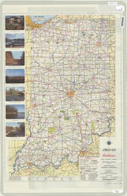
Panel title: 1963-64 Indiana official highway map. Includes index, distance chart, color illustrations, and text. Index, distance chart, index and chart of s...
Call Number:
G1403.S7 1963-64
Caption:
Imprint: Indianapolis, Ind. : Indiana State Highway Commission, [1963?]
Physical Description:
Dimensions: 94 x 59 cm and Scale: Approximately 1:633,600
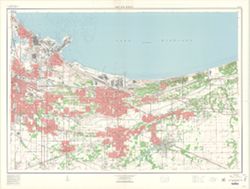
Relief shown by contours and spot heights. Depths by contours and soundings. "Contour interval 5 and 10 feet." Red tint indicates areas in which on...
Bloomington - Indiana University Museum of Archaeology and Anthropology 416 North Indiana Avenue Bloomington, IN 47408 Contact at iumaa@indiana.edu, 812-855-6873


![New Harmony quadrangle, Indiana--Illinois, 1959 : 15 minute series (topographic) [1963 reprint with vegetation]](https://iiif.uits.iu.edu/iiif/2/n296z235w%2Ffiles%2Faf8714ac-51b2-4e50-bb3a-3e3e07d338a7/full/250,/0/default.jpg)