
Search Constraints
You searched for:
Date Created
1941
Remove constraint Date Created: 1941
State/Province
Украинская ССР (Ukrainian Soviet Socialist Republic)
Remove constraint State/Province: Украинская ССР (Ukrainian Soviet Socialist Republic)
« Previous |
1 - 100 of 119
|
Next »
Search Results
-

- Description:
- 1938
- Subject:
- Geographic Subject: Novhorod-Siverskyy, Topical Subject: Maps, and Topical Subject: Soviet Union
- Publisher:
- Главное Управление Геодезии и Картографии при СНК СССР
- Language:
- Russian
- Date Created:
- 1941
- Identifier:
- VAC9619-004216
- Genre:
- Military Maps and Topographic Maps
- Geographic Location:
- Coordinates: 52, 33, 52.333, 33.5
- Related URL:
- Download GeoTIFF: https://drive.google.com/file/d/1kaJZgYyUS6Hj_BGfB5UeL-vO4ElM_lO7/view?usp=sharing and Catalog URL: https://iucat.iu.edu/catalog/5020129
- Abstract:
- Modern area represented: Novhorod-Siverskyy, Chernihiv oblast, Ukraine
- Call Number:
- G7000 s100 .S7 sheet N-36-139
- Caption:
- Для служебного пользования
- City:
- Новгород-Северский (Novhorod-Siverskyy)
- Copyright Holder:
- No Copyright - United States
- Country:
- СССР (USSR)
- State/Province:
- Черниговская область (Chernihiv oblast), Украинская ССР (Ukrainian Soviet Socialist Republic), Сумская область (Sumy oblast), РСФСР (RSFSR), and Орловская об...
- Physical Description:
- Scale: 1:100,000
- Persistent URL:
- http://purl.dlib.indiana.edu/iudl/images/VAC9619/VAC9619-004216
- Provenance:
- DMA Topographic Center, Army Map Service Library, OMAHA, Library of Congress Geography & Map Division
-

- Description:
- 1923
- Subject:
- Topical Subject: Maps, Topical Subject: Soviet Union, and Geographic Subject: Ogorodnya
- Publisher:
- Генеральный штаб Красной Армии
- Language:
- Russian
- Date Created:
- 1941
- Identifier:
- VAC9619-004213
- Genre:
- Topographic Maps and Military Maps
- Geographic Location:
- Coordinates: 52, 31.5, 52.333, 32
- Related URL:
- Download GeoTIFF: https://drive.google.com/file/d/1MuU_oyIyusePmX5IlnPsAE4zUOKWaE3e/view?usp=sharing and Catalog URL: https://iucat.iu.edu/catalog/5020129
- Abstract:
- Modern area represented: Ogorodnya, Homyel voblasc, Belarus
- Call Number:
- G7000 s100 .S7 sheet N-36-136
- City:
- Огородня-Гомельская (Ogorodnya-Gomelskaya)
- Copyright Holder:
- No Copyright - United States
- Country:
- СССР (USSR)
- State/Province:
- Орловская область (Oryol oblast), Украинская ССР (Ukrainian Soviet Socialist Republic), Белорусская ССР (Byelorussian Soviet Socialist Republic), Черниговска...
- Physical Description:
- Scale: 1:100,000
- Persistent URL:
- http://purl.dlib.indiana.edu/iudl/images/VAC9619/VAC9619-004213
- Provenance:
- DMA Topographic Center, Army Map Service Library
-
- Description:
- 1940
- Subject:
- Geographic Subject: Trubchevsk, Topical Subject: Maps, and Topical Subject: Soviet Union
- Publisher:
- Генеральный штаб Красной Армии
- Language:
- Russian
- Date Created:
- 1941
- Identifier:
- VAC9619-004206
- Genre:
- Military Maps and Topographic Maps
- Geographic Location:
- Coordinates: 52.333, 33.5, 52.667, 34
- Related URL:
- Catalog URL: https://iucat.iu.edu/catalog/5020129 and Download GeoTIFF: https://drive.google.com/file/d/1VkrmyXpFWgso3CTd3fcWSVtTAO3Bp7U5/view?usp=sharing
- Abstract:
- Modern area represented: Trubchevsk, Bryansk oblast, Russia
- Call Number:
- G7000 s100 .S7 sheet N-36-128
- City:
- Трубчевск (Trubchevsk)
- Copyright Holder:
- No Copyright - United States
- Country:
- СССР (USSR)
- State/Province:
- Орловская область (Oryol oblast), Украинская ССР (Ukrainian Soviet Socialist Republic), Сумская область (Sumy oblast), and РСФСР (RSFSR)
- Physical Description:
- Scale: 1:100,000
- Persistent URL:
- http://purl.dlib.indiana.edu/iudl/images/VAC9619/VAC9619-004206
- Provenance:
- DMA Topographic Center, Auswärtiges Amt. Geographischer Dienst, OMAHA, Army Map Service Library
-

- Description:
- 1940
- Subject:
- Geographic Subject: Pogar, Topical Subject: Soviet Union, and Topical Subject: Maps
- Publisher:
- Генеральный штаб Красной Армии
- Language:
- Russian
- Date Created:
- 1941
- Identifier:
- VAC9619-004205
- Genre:
- Military Maps and Topographic Maps
- Geographic Location:
- Coordinates: 52.333, 33, 52.667, 33.5
- Related URL:
- Download GeoTIFF: https://drive.google.com/file/d/1-kvEoKectn1YvqFHYD5S7pgdDRdK7MO_/view?usp=sharing and Catalog URL: https://iucat.iu.edu/catalog/5020129
- Abstract:
- Modern area represented: Pogar, bryansk Oblast, Russia
- Call Number:
- G7000 s100 .S7 sheet N-36-127
- City:
- Погар (Pogar)
- Copyright Holder:
- No Copyright - United States
- Country:
- СССР (USSR)
- State/Province:
- Орловская область (Oryol oblast), Украинская ССР (Ukrainian Soviet Socialist Republic), РСФСР (RSFSR), Черниговская область (Chernihiv oblast), and Сумская о...
- Physical Description:
- Scale: 1:100,000
- Persistent URL:
- http://purl.dlib.indiana.edu/iudl/images/VAC9619/VAC9619-004205
- Provenance:
- DMA Topographic Center, Army Map Service Library, OMAHA
-
- Description:
- 1907
- Subject:
- Geographic Subject: Kamensk-Shakhtinskiy, Topical Subject: Soviet Union, and Topical Subject: Maps
- Publisher:
- Генеральный штаб Красной Армии
- Language:
- Russian
- Date Created:
- 1941
- Identifier:
- VAC9619-003406
- Genre:
- Military Maps and Topographic Maps
- Geographic Location:
- Coordinates: 48, 40, 48.333, 40.5
- Related URL:
- Catalog URL: https://iucat.iu.edu/catalog/5020129 and Download GeoTIFF: https://drive.google.com/file/d/1n2jN8aP5eSGKDTcV11KUHk6Jyp717mkK/view?usp=sharing
- Abstract:
- Modern area represented: Kamensk-Shakhtinskiy, Rostov oblast, Russia
- Call Number:
- G7000 s100 .S7 sheet M-37-141
- Caption:
- Для служебного пользования
- City:
- Каменск (Kamensk)
- Copyright Holder:
- No Copyright - United States
- Country:
- СССР (USSR)
- State/Province:
- Ростовская область (Rostov oblast), РСФСР (RSFSR), Ворошиловградская область (Voroshilovgrad oblast), and Украинская ССР (Ukrainian Soviet Socialist Republic)
- Physical Description:
- Scale: 1:100,000
- Persistent URL:
- http://purl.dlib.indiana.edu/iudl/images/VAC9619/VAC9619-003406
- Provenance:
- DMA Topographic Center, Army Map Service Library
-
- Description:
- 1930
- Subject:
- Geographic Subject: Rovenki, Topical Subject: Soviet Union, and Topical Subject: Maps
- Publisher:
- Генеральный штаб Красной Армии
- Language:
- Russian
- Date Created:
- 1941
- Identifier:
- VAC9619-003405
- Genre:
- Military Maps and Topographic Maps
- Geographic Location:
- Coordinates: 48, 39, 48.333, 39.5
- Related URL:
- Catalog URL: https://iucat.iu.edu/catalog/5020129 and Download GeoTIFF: https://drive.google.com/file/d/1OQqFM3__QT6U6Fqh4eB268pIXvLpWpIX/view?usp=sharing
- Abstract:
- Modern area represented: Rovenki, Luhansk oblast, Ukraine
- Call Number:
- G7000 s100 .S7 sheet M-37-139
- Caption:
- Для служебного пользования
- City:
- Ровеньки (Rovenki)
- Copyright Holder:
- No Copyright - United States
- Country:
- СССР (USSR)
- State/Province:
- Украинская ССР (Ukrainian Soviet Socialist Republic) and Ворошиловградская область (Voroshilovgrad oblast)
- Physical Description:
- Scale: 1:100,000
- Persistent URL:
- http://purl.dlib.indiana.edu/iudl/images/VAC9619/VAC9619-003405
- Provenance:
- DMA Topographic Center, Army Map Service Library
-
- Description:
- 1938
- Subject:
- Geographic Subject: Bakhmut, Topical Subject: Maps, and Topical Subject: Soviet Union
- Publisher:
- Главное Управление Геодезии и Картографии при СНК СССР
- Language:
- Russian
- Date Created:
- 1941
- Identifier:
- VAC9619-003402
- Genre:
- Topographic Maps and Military Maps
- Geographic Location:
- Coordinates: 48.333, 38, 48.667, 38.5
- Related URL:
- Catalog URL: https://iucat.iu.edu/catalog/5020129 and Download GeoTIFF: https://drive.google.com/file/d/1veqRoyXKWLTyGzEBtYxvII6h1ZdoVJBC/view?usp=sharing
- Abstract:
- Modern area represented: Bakhmut, Donetsk oblast, Ukraine
- Call Number:
- G7000 s100 .S7 sheet M-37-125
- Caption:
- Для служебного пользования
- City:
- Артемовск (Artemivsk)
- Copyright Holder:
- No Copyright - United States
- Country:
- СССР (USSR)
- State/Province:
- Сталинская область (Stalino oblast), Украинская ССР (Ukrainian Soviet Socialist Republic), and Ворошиловградская область (Voroshilovgrad oblast)
- Physical Description:
- Scale: 1:100,000
- Persistent URL:
- http://purl.dlib.indiana.edu/iudl/images/VAC9619/VAC9619-003402
- Provenance:
- Army Map Service Library, Library of Congress G & M Division, Geographic Names Branch
-
- Description:
- 1927
- Subject:
- Topical Subject: Soviet Union, Topical Subject: Maps, and Geographic Subject: Alchevsk
- Publisher:
- Генеральный штаб Красной Армии
- Language:
- Russian
- Date Created:
- 1941
- Identifier:
- VAC9619-003403
- Genre:
- Military Maps and Topographic Maps
- Geographic Location:
- Coordinates: 48.333, 38.5, 48.667, 39
- Related URL:
- Download GeoTIFF: https://drive.google.com/file/d/1ViriAyN5381mVoCSQlf1v4qW6YICLFIW/view?usp=sharing and Catalog URL: https://iucat.iu.edu/catalog/5020129
- Abstract:
- Modern area represented: Alchevsk, Luhansk oblast, Ukraine
- Call Number:
- G7000 s100 .S7 sheet M-37-126
- Caption:
- Для служебного пользования
- City:
- Ворошиловск (Voroshilovsk)
- Copyright Holder:
- No Copyright - United States
- Country:
- СССР (USSR)
- State/Province:
- Украинская ССР (Ukrainian Soviet Socialist Republic) and Ворошиловградская область (Voroshilovgrad oblast)
- Physical Description:
- Scale: 1:100,000
- Persistent URL:
- http://purl.dlib.indiana.edu/iudl/images/VAC9619/VAC9619-003403
- Provenance:
- DMA Topographic Center, Army Map Service Library, OMAHA, Library of Congress Geography & Map Division
-
- Description:
- 1938
- Subject:
- Topical Subject: Soviet Union, Topical Subject: Maps, and Geographic Subject: Barvinkove
- Publisher:
- Генеральный штаб Красной Армии
- Language:
- Russian
- Date Created:
- 1941
- Identifier:
- VAC9619-003399
- Genre:
- Topographic Maps and Military Maps
- Geographic Location:
- Coordinates: 48.667, 37, 49, 37.5
- Related URL:
- Download GeoTIFF: https://drive.google.com/file/d/1Xtfch9cqViOCWOH3HX487QHUIFpGvrCV/view?usp=sharing and Catalog URL: https://iucat.iu.edu/catalog/5020129
- Abstract:
- Modern area represented: Barvinkove, Kharkiv oblast, Ukraine
- Call Number:
- G7000 s100 .S7 sheet M-37-111
- Caption:
- Для служебного пользования
- City:
- Барвенково (Barvinkove)
- Copyright Holder:
- No Copyright - United States
- Country:
- СССР (USSR)
- State/Province:
- Украинская ССР (Ukrainian Soviet Socialist Republic), Харьковская область (Kharkiv oblast), and Сталинская область (Stalino oblast)
- Physical Description:
- Scale: 1:100,000
- Persistent URL:
- http://purl.dlib.indiana.edu/iudl/images/VAC9619/VAC9619-003399
- Provenance:
- Army Map Service Library, Library of Congress G & M Division, Geographic Names Branch
-
- Description:
- 1939
- Subject:
- Topical Subject: Maps, Geographic Subject: Kreminna, and Topical Subject: Soviet Union
- Publisher:
- Генеральный штаб Красной Армии
- Language:
- Russian
- Date Created:
- 1941
- Identifier:
- VAC9619-003397
- Genre:
- Military Maps and Topographic Maps
- Geographic Location:
- Coordinates: 49, 38, 49.333, 38.5
- Related URL:
- Download GeoTIFF: https://drive.google.com/file/d/1yIKyGd3Ec7FPZE33HpEtK4M9fYvE61Ub/view?usp=sharing and Catalog URL: https://iucat.iu.edu/catalog/5020129
- Abstract:
- Modern area represented: Kreminna, Luhansk oblast, Ukraine
- Call Number:
- G7000 s100 .S7 sheet M-37-101
- Caption:
- Для служебного пользования
- City:
- Кременная (Kreminna)
- Copyright Holder:
- No Copyright - United States
- Country:
- СССР (USSR)
- State/Province:
- Украинская ССР (Ukrainian Soviet Socialist Republic)
- Physical Description:
- Scale: 1:100,000
- Persistent URL:
- http://purl.dlib.indiana.edu/iudl/images/VAC9619/VAC9619-003397
- Provenance:
- DMA Topographic Center, Army Map Service Library, OMAHA, Library of Congress Geography & Map Division
-
- Description:
- 1930
- Subject:
- Topical Subject: Soviet Union, Geographic Subject: Krasnopavlivka, and Topical Subject: Maps
- Publisher:
- Генеральный штаб Красной Армии
- Language:
- Russian
- Date Created:
- 1941
- Identifier:
- VAC9619-003396
- Genre:
- Military Maps and Topographic Maps
- Geographic Location:
- Coordinates: 49, 36, 49.333, 36.5
- Related URL:
- Catalog URL: https://iucat.iu.edu/catalog/5020129 and Download GeoTIFF: https://drive.google.com/file/d/1L9JwL8EhWzf2Jg5kPcpE5Tp6l0jzzwg9/view?usp=sharing
- Abstract:
- Modern area represented: Krasnopavlivka, Kharkiv oblast, Ukraine
- Call Number:
- G7000 s100 .S7 sheet M-37-97
- Caption:
- Для служебного пользования
- City:
- Краснопавловка (Krasnopavlivka)
- Copyright Holder:
- No Copyright - United States
- Country:
- СССР (USSR)
- State/Province:
- Украинская ССР (Ukrainian Soviet Socialist Republic)
- Physical Description:
- Scale: 1:100,000
- Persistent URL:
- http://purl.dlib.indiana.edu/iudl/images/VAC9619/VAC9619-003396
- Provenance:
- Army Map Service Library, Library of Congress G & M Division
-
- Description:
- 1938
- Subject:
- Topical Subject: Maps, Topical Subject: Soviet Union, and Geographic Subject: Vilkhuvatka
- Publisher:
- Главное Управление Геодезии и Картографии при СНК СССР
- Language:
- Russian
- Date Created:
- 1941
- Identifier:
- VAC9619-003389
- Genre:
- Topographic Maps and Military Maps
- Geographic Location:
- Coordinates: 50, 37.5, 50.333, 38
- Related URL:
- Catalog URL: https://iucat.iu.edu/catalog/5020129 and Download GeoTIFF: https://drive.google.com/file/d/1I0vQLmxbNuv6OkkXNI5DLf5ve3-7MBIK/view?usp=sharing
- Abstract:
- Modern area represented: Vilkhuvatka, Kharkiv oblast, Ukraine
- Call Number:
- G7000 s100 .S7 sheet M-37-64
- Caption:
- Для служебного пользования
- City:
- Ольховатка (Olkhovatka)
- Copyright Holder:
- No Copyright - United States
- Country:
- СССР (USSR)
- State/Province:
- Харьковская область (Kharkiv oblast), Украинская ССР (Ukrainian Soviet Socialist Republic), РСФСР (RSFSR), and Курская область (Kursk oblast)
- Physical Description:
- Scale: 1:100,000
- Persistent URL:
- http://purl.dlib.indiana.edu/iudl/images/VAC9619/VAC9619-003389
- Provenance:
- DMA Topographic Center, Army Map Service Library, Library of Congress Geography & Map Division
-
- Description:
- 1929
- Subject:
- Geographic Subject: Derhachi, Topical Subject: Soviet Union, and Topical Subject: Maps
- Publisher:
- Генеральный штаб Красной Армии
- Language:
- Russian
- Date Created:
- 1941
- Identifier:
- VAC9619-003388
- Genre:
- Topographic Maps and Military Maps
- Geographic Location:
- Coordinates: 50, 36, 50.333, 36.5
- Related URL:
- Catalog URL: https://iucat.iu.edu/catalog/5020129 and Download GeoTIFF: https://drive.google.com/file/d/1_5nhCPC3E-jfDcJk-rDeFvngeE9VgOZG/view?usp=sharing
- Abstract:
- Modern area represented: Derhachi, Kharkiv oblast, Ukraine
- Call Number:
- G7000 s100 .S7 sheet M-37-61
- Caption:
- Секретно
- City:
- Дергачи (Derhachi)
- Copyright Holder:
- No Copyright - United States
- Country:
- СССР (USSR)
- State/Province:
- Курская область (Kursk oblast), Украинская ССР (Ukrainian Soviet Socialist Republic), РСФСР (RSFSR), and Харьковская область (Kharkiv oblast)
- Physical Description:
- Scale: 1:100,000
- Persistent URL:
- http://purl.dlib.indiana.edu/iudl/images/VAC9619/VAC9619-003388
- Provenance:
- Army Map Service Library, Library of Congress G & M Division, Geographic Names Branch
-
- Description:
- 1940
- Subject:
- Geographic Subject: Bolshetroitskoye, Topical Subject: Soviet Union, and Topical Subject: Maps
- Publisher:
- Главное Управление Геодезии и Картографии при СНК СССР
- Language:
- Russian
- Date Created:
- 1941
- Identifier:
- VAC9619-003387
- Genre:
- Military Maps and Topographic Maps
- Geographic Location:
- Coordinates: 50.333, 37, 50.667, 37.5
- Related URL:
- Download GeoTIFF: https://drive.google.com/file/d/1Sy1mBMGYvqqz0pzlHcvGjxKjo3ANez5Y/view?usp=sharing and Catalog URL: https://iucat.iu.edu/catalog/5020129
- Abstract:
- Modern area represented: Bolshetroitskoye, Belgorod oblast, Russia
- Call Number:
- G7000 s100 .S7 sheet M-37-51
- City:
- Больше-Троицкое (Bolshe-Troitskoye)
- Copyright Holder:
- No Copyright - United States
- Country:
- СССР (USSR)
- State/Province:
- Харьковская область (Kharkiv oblast), Курская область (Kursk oblast), Украинская ССР (Ukrainian Soviet Socialist Republic), and РСФСР (RSFSR)
- Physical Description:
- Scale: 1:100,000
- Persistent URL:
- http://purl.dlib.indiana.edu/iudl/images/VAC9619/VAC9619-003387
- Provenance:
- Army Map Service Library, Library of Congress G & M Division, Geographic Names Branch
-
- Description:
- 1929
- Subject:
- Geographic Subject: Kropyvnytskyi, Topical Subject: Maps, and Topical Subject: Soviet Union
- Publisher:
- Генеральный штаб Красной Армии
- Language:
- Russian
- Date Created:
- 1941
- Identifier:
- VAC9619-003306
- Genre:
- Topographic Maps and Military Maps
- Geographic Location:
- Coordinates: 48.333, 32, 48.667, 32.5
- Related URL:
- Catalog URL: https://iucat.iu.edu/catalog/5020129 and Download GeoTIFF: https://drive.google.com/file/d/1k7iBK8ifYXHJbN_6qN3O3HAUfuq6W9FC/view?usp=sharing
- Abstract:
- Modern area represented: Kropyvnytskyi, Kirovohrad oblast, Ukraine
- Call Number:
- G7000 s100 .S7 sheet M-36-125
- Caption:
- Для служебного пользования
- City:
- Кировоград (Kirovohrad)
- Copyright Holder:
- No Copyright - United States
- Country:
- СССР (USSR)
- State/Province:
- Украинская ССР (Ukrainian Soviet Socialist Republic)
- Physical Description:
- Scale: 1:100,000
- Persistent URL:
- http://purl.dlib.indiana.edu/iudl/images/VAC9619/VAC9619-003306
- Provenance:
- DMA Topographic Center, Army Map Service Library, OMAHA, Library of Congress Geography & Map Division
-
- Description:
- 1932
- Subject:
- Geographic Subject: Pavlohrad, Topical Subject: Soviet Union, and Topical Subject: Maps
- Publisher:
- Генеральный штаб Красной Армии
- Language:
- Russian
- Date Created:
- 1941
- Identifier:
- VAC9619-003307
- Genre:
- Topographic Maps and Military Maps
- Geographic Location:
- Coordinates: 48.333, 35.5, 48.667, 36
- Related URL:
- Download GeoTIFF: https://drive.google.com/file/d/1NobqFmlY1wgm4sjbbmPZp3tKMnnjHY7t/view?usp=sharing and Catalog URL: https://iucat.iu.edu/catalog/5020129
- Abstract:
- Modern area represented: Pavlohrad, Dnipropetrovsk oblast, Ukraine
- Call Number:
- G7000 s100 .S7 sheet M-36-132
- Caption:
- Для служебного пользования
- City:
- Павлоград (Pavlohrad)
- Copyright Holder:
- No Copyright - United States
- Country:
- СССР (USSR)
- State/Province:
- Украинская ССР (Ukrainian Soviet Socialist Republic)
- Physical Description:
- Scale: 1:100,000
- Persistent URL:
- http://purl.dlib.indiana.edu/iudl/images/VAC9619/VAC9619-003307
- Provenance:
- Atlasblatt, Library of Congress G & M Division, Army Map Service Library
-
- Description:
- 1928
- Subject:
- Geographic Subject: Zlynka, Topical Subject: Maps, and Topical Subject: Soviet Union
- Publisher:
- Генеральный штаб Красной Армии
- Language:
- Russian
- Date Created:
- 1941
- Identifier:
- VAC9619-003305
- Genre:
- Topographic Maps and Military Maps
- Geographic Location:
- Coordinates: 48.3333, 31.5, 48.6667, 32.0
- Related URL:
- Download GeoTIFF: https://drive.google.com/file/d/14oUC0uuu4lOchjOSQIUjpbso3m8XsvOe/view?usp=sharing and Catalog URL: https://iucat.iu.edu/catalog/5020129
- Abstract:
- Modern area represented: Zlynka, Kirovohrad oblast, Ukraine
- Call Number:
- G7000 s100 .S7 sheet M-36-124
- Caption:
- Для служебного пользования
- City:
- Злынка (Zlynka)
- Copyright Holder:
- No Copyright - United States
- Country:
- СССР (USSR)
- State/Province:
- Кировоградская область (Kirovohrad oblast) and Украинская ССР (Ukrainian Soviet Socialist Republic)
- Physical Description:
- Scale: 1:100,000
- Persistent URL:
- http://purl.dlib.indiana.edu/iudl/images/VAC9619/VAC9619-003305
- Provenance:
- DMA Topographic Center, Army Map Service Library, Library of Congress Geography & Map Division
-
- Description:
- 1929
- Subject:
- Topical Subject: Soviet Union, Geographic Subject: Oleksandrivka, and Topical Subject: Maps
- Publisher:
- Генеральный штаб Красной Армии
- Language:
- Russian
- Date Created:
- 1941
- Identifier:
- VAC9619-003303
- Genre:
- Military Maps and Topographic Maps
- Geographic Location:
- Coordinates: 48.6667, 32.0, 49.0, 32.5
- Related URL:
- Download GeoTIFF: https://drive.google.com/file/d/17CYndFHHZthXYXSHRjdk3ND7evn1ALSl/view?usp=sharing and Catalog URL: https://iucat.iu.edu/catalog/5020129
- Abstract:
- Modern area represented: Oleksandrivka, Kirovohrad oblast, Ukraine
- Call Number:
- G7000 s100 .S7 sheet M-36-113
- Caption:
- Для служебного пользования
- City:
- Александровка (Oleksandrivka)
- Copyright Holder:
- No Copyright - United States
- Country:
- СССР (USSR)
- State/Province:
- Украинская ССР (Ukrainian Soviet Socialist Republic)
- Physical Description:
- Scale: 1:100,000
- Persistent URL:
- http://purl.dlib.indiana.edu/iudl/images/VAC9619/VAC9619-003303
- Provenance:
- DMA Topographic Center, Army Map Service Library, OMAHA, Library of Congress Geography & Map Division
-
- Description:
- 1923
- Subject:
- Geographic Subject: Korsun-Shevchenkivskyi, Topical Subject: Soviet Union, and Topical Subject: Maps
- Publisher:
- Генеральный штаб Красной Армии
- Language:
- Russian
- Date Created:
- 1941
- Identifier:
- VAC9619-003301
- Genre:
- Military Maps and Topographic Maps
- Geographic Location:
- Coordinates: 49.333, 31, 49.667, 31.5
- Related URL:
- Download GeoTIFF: https://drive.google.com/file/d/1lHWYAPWBnwAvkGXgIXVut3VJBRaI0vGU/view?usp=sharing and Catalog URL: https://iucat.iu.edu/catalog/5020129
- Abstract:
- Modern area represented: Korsun-Shevchenkivskyi, Cherkasy oblast, Ukraine
- Call Number:
- G7000 s100 .S7 sheet M-36-87
- Caption:
- Для служебного пользования
- City:
- Корсунь (Korsun)
- Copyright Holder:
- No Copyright - United States
- Country:
- СССР (USSR)
- State/Province:
- Киевская область (Kyiv oblast) and Украинская ССР (Ukrainian Soviet Socialist Republic)
- Physical Description:
- Scale: 1:100,000
- Persistent URL:
- http://purl.dlib.indiana.edu/iudl/images/VAC9619/VAC9619-003301
- Provenance:
- DMA Topographic Center, Army Map Service Library, OMAHA, Library of Congress Geography & Map Division
-
- Description:
- 1913
- Subject:
- Topical Subject: Soviet Union, Topical Subject: Maps, and Geographic Subject: Talne
- Publisher:
- Генеральный штаб Красной Армии
- Language:
- Russian
- Date Created:
- 1941
- Identifier:
- VAC9619-003302
- Genre:
- Topographic Maps and Military Maps
- Geographic Location:
- Coordinates: 48.6667, 30.5, 49.0, 31.0
- Related URL:
- Catalog URL: https://iucat.iu.edu/catalog/5020129 and Download GeoTIFF: https://drive.google.com/file/d/1kVcrU9Rc9fw4oC0Jogv2oe4oL_GF_4sr/view?usp=sharing
- Abstract:
- Modern area represented: Talne, Cherkasy oblast, Ukraine
- Call Number:
- G7000 s100 .S7 sheet M-36-110
- Caption:
- Для служебного пользования
- City:
- Тальное (Talnoe)
- Copyright Holder:
- No Copyright - United States
- Country:
- СССР (USSR)
- State/Province:
- Киевская область (Kyiv oblast), Кировоградская область (Kirovohrad oblast), and Украинская ССР (Ukrainian Soviet Socialist Republic)
- Physical Description:
- Scale: 1:100,000
- Persistent URL:
- http://purl.dlib.indiana.edu/iudl/images/VAC9619/VAC9619-003302
- Provenance:
- DMA Topographic Center, Army Map Service Library, OMAHA, Library of Congress Geography & Map Division
-
- Description:
- 1934
- Subject:
- Geographic Subject: Petrykivka, Topical Subject: Soviet Union, and Topical Subject: Maps
- Publisher:
- Генеральный штаб Красной Армии
- Language:
- Russian
- Date Created:
- 1941
- Identifier:
- VAC9619-003304
- Genre:
- Topographic Maps and Military Maps
- Geographic Location:
- Coordinates: 48.6667, 34.5, 49.0, 35.0
- Related URL:
- Catalog URL: https://iucat.iu.edu/catalog/5020129 and Download GeoTIFF: https://drive.google.com/file/d/11z2DMlksuDKufENNV8VDcmEMUKBot09o/view?usp=sharing
- Abstract:
- Modern area represented: Petrykivka, Dnipropetrovsk oblast, Ukraine
- Call Number:
- G7000 s100 .S7 sheet M-36-118
- Caption:
- Для служебного пользования
- City:
- Петриковка (Petrykivka)
- Copyright Holder:
- No Copyright - United States
- Country:
- СССР (USSR)
- State/Province:
- Днепропетровская область (Dnipropetrovsk oblast) and Украинская ССР (Ukrainian Soviet Socialist Republic)
- Physical Description:
- Scale: 1:100,000
- Persistent URL:
- http://purl.dlib.indiana.edu/iudl/images/VAC9619/VAC9619-003304
- Provenance:
- DMA Topographic Center, Army Map Service Library, OMAHA, Library of Congress Geography & Map Division
-
- Description:
- 1916
- Subject:
- Geographic Subject: Bohuslav, Topical Subject: Maps, and Topical Subject: Soviet Union
- Publisher:
- Генеральный штаб Красной Армии
- Language:
- Russian
- Date Created:
- 1941
- Identifier:
- VAC9619-003300
- Genre:
- Military Maps and Topographic Maps
- Geographic Location:
- Coordinates: 51.333, 24.5, 51.667, 25
- Related URL:
- Download GeoTIFF: https://drive.google.com/file/d/1odAb6QmUNYwAarOu4M6GwN34sjA31HHV/view?usp=sharing and Catalog URL: https://iucat.iu.edu/catalog/5020129
- Abstract:
- Modern area represented: Bohuslav, Kiev oblast, Ukraine
- Call Number:
- G7000 s100 .S7 sheet M-36-86
- Caption:
- Для служебного пользования
- City:
- Богуслав (Bohuslav)
- Copyright Holder:
- No Copyright - United States
- Country:
- СССР (USSR)
- State/Province:
- Украинская ССР (Ukrainian Soviet Socialist Republic) and Киевская область (Kyiv oblast)
- Physical Description:
- Scale: 1:100,000
- Persistent URL:
- http://purl.dlib.indiana.edu/iudl/images/VAC9619/VAC9619-003300
- Provenance:
- DMA Topographic Center, Army Map Service Library, OMAHA, Library of Congress Geography & Map Division
-
- Description:
- 1916
- Subject:
- Topical Subject: Maps, Topical Subject: Soviet Union, and Geographic Subject: Stavishche
- Publisher:
- Генеральный штаб Красной Армии
- Language:
- Russian
- Date Created:
- 1941
- Identifier:
- VAC9619-003299
- Genre:
- Topographic Maps and Military Maps
- Geographic Location:
- Coordinates: 51.333, 24, 51.667, 24.5
- Related URL:
- Catalog URL: https://iucat.iu.edu/catalog/5020129 and Download GeoTIFF: https://drive.google.com/file/d/1SyfPEGMvnxF2kmxo2OIir7gXTPMzO2jA/view?usp=sharing
- Abstract:
- Modern area represented: Stavishche, Kiev oblast, Ukraine
- Call Number:
- G7000 s100 .S7 sheet M-36-85
- Caption:
- Для служебного пользования
- City:
- Ставище (Stavishche)
- Copyright Holder:
- No Copyright - United States
- Country:
- СССР (USSR)
- State/Province:
- Киевская область (Kyiv oblast) and Украинская ССР (Ukrainian Soviet Socialist Republic)
- Physical Description:
- Scale: 1:100,000
- Persistent URL:
- http://purl.dlib.indiana.edu/iudl/images/VAC9619/VAC9619-003299
- Provenance:
- DMA Topographic Center, Army Map Service Library, OMAHA, Library of Congress Geography & Map Division
-
- Description:
- 1931
- Subject:
- Topical Subject: Soviet Union, Geographic Subject: Velyki Sorochyntsi, and Topical Subject: Maps
- Publisher:
- Генеральный штаб Красной Армии
- Language:
- Russian
- Date Created:
- 1941
- Identifier:
- VAC9619-003297
- Genre:
- Topographic Maps and Military Maps
- Geographic Location:
- Coordinates: 50, 33.5, 50.333, 34
- Related URL:
- Catalog URL: https://iucat.iu.edu/catalog/5020129 and Download GeoTIFF: https://drive.google.com/file/d/1qDvVPmrcSf6D1G2_0mVthF1MJMKHSLXb/view?usp=sharing
- Abstract:
- Modern area represented: Velyki Sorochyntsi, Poltava oblast, Ukraine
- Call Number:
- G7000 s100 .S7 sheet M-36-68
- City:
- Сорочинцы (Sorochyntsi)
- Copyright Holder:
- No Copyright - United States
- Country:
- СССР (USSR)
- State/Province:
- Украинская ССР (Ukrainian Soviet Socialist Republic) and Полтавская область (Poltava oblast)
- Physical Description:
- Scale: 1:100,000
- Persistent URL:
- http://purl.dlib.indiana.edu/iudl/images/VAC9619/VAC9619-003297
- Provenance:
- DMA Topographic Center, Army Map Service Library, OMAHA, Library of Congress Geography & Map Division
-
- Description:
- 1931
- Subject:
- Topical Subject: Maps, Geographic Subject: Lubny, and Topical Subject: Soviet Union
- Publisher:
- Генеральный штаб Красной Армии
- Language:
- Russian
- Date Created:
- 1941
- Identifier:
- VAC9619-003296
- Genre:
- Topographic Maps and Military Maps
- Geographic Location:
- Coordinates: 50, 33, 50.333, 33.5
- Related URL:
- Catalog URL: https://iucat.iu.edu/catalog/5020129 and Download GeoTIFF: https://drive.google.com/file/d/1aCmmT142IH6eTopGWA96mJuxqrZheVAF/view?usp=sharing
- Abstract:
- Modern area represented: Lubny, Poltava oblast, Ukraine
- Call Number:
- G7000 s100 .S7 sheet M-36-67
- City:
- Лубны (Lubny)
- Copyright Holder:
- No Copyright - United States
- Country:
- СССР (USSR)
- State/Province:
- Полтавская область (Poltava oblast) and Украинская ССР (Ukrainian Soviet Socialist Republic)
- Physical Description:
- Scale: 1:100,000
- Persistent URL:
- http://purl.dlib.indiana.edu/iudl/images/VAC9619/VAC9619-003296
- Provenance:
- DMA Topographic Center, Army Map Service Library
-
- Description:
- 1931
- Subject:
- Geographic Subject: Pyryatyn, Topical Subject: Soviet Union, and Topical Subject: Maps
- Publisher:
- Генеральный штаб Красной Армии
- Language:
- Russian
- Date Created:
- 1941
- Identifier:
- VAC9619-003295
- Genre:
- Military Maps and Topographic Maps
- Geographic Location:
- Coordinates: 50, 32.5, 50.333, 33
- Related URL:
- Catalog URL: https://iucat.iu.edu/catalog/5020129 and Download GeoTIFF: https://drive.google.com/file/d/1HdqPsI9WrCB8MDCw6W1C7HsKViFRcI5T/view?usp=sharing
- Abstract:
- Modern area represented: Pyryatyn, Poltava oblast, Ukraine
- Call Number:
- G7000 s100 .S7 sheet M-36-66
- City:
- Пирятин (Pyryatyn)
- Copyright Holder:
- No Copyright - United States
- Country:
- СССР (USSR)
- State/Province:
- Украинская ССР (Ukrainian Soviet Socialist Republic) and Полтавская область (Poltava oblast)
- Physical Description:
- Scale: 1:100,000
- Persistent URL:
- http://purl.dlib.indiana.edu/iudl/images/VAC9619/VAC9619-003295
- Provenance:
- DMA Topographic Center, Army Map Service Library, OMAHA, Library of Congress Geography & Map Division
-

- Description:
- 1928
- Subject:
- Topical Subject: Soviet Union, Geographic Subject: Yahotyn, and Topical Subject: Maps
- Publisher:
- Генеральный штаб Красной Армии
- Language:
- Russian
- Date Created:
- 1941
- Identifier:
- VAC9619-003293
- Genre:
- Topographic Maps and Military Maps
- Geographic Location:
- Coordinates: 50, 31.5, 50.333, 32
- Related URL:
- Catalog URL: https://iucat.iu.edu/catalog/5020129 and Download GeoTIFF: https://drive.google.com/file/d/1LHmrE7SLHHk3jOpjngs2HIPoYbavjsT9/view?usp=sharing
- Abstract:
- Modern area represented: Yahotyn, Kiev oblast, Ukraine
- Call Number:
- G7000 s100 .S7 sheet M-36-64
- City:
- Яготин (Yahotyn)
- Copyright Holder:
- No Copyright - United States
- Country:
- СССР (USSR)
- State/Province:
- Черниговская область (Chernihiv oblast), Киевская область (Kyiv oblast), Украинская ССР (Ukrainian Soviet Socialist Republic), and Полтавская область (Poltav...
- Physical Description:
- Scale: 1:100,000
- Persistent URL:
- http://purl.dlib.indiana.edu/iudl/images/VAC9619/VAC9619-003293
- Provenance:
- DMA Topographic Center, Army Map Service Library, OMAHA, Library of Congress Geography & Map Division
-
- Description:
- 1939
- Subject:
- Topical Subject: Maps, Topical Subject: Soviet Union, and Geographic Subject: Lebedyn
- Publisher:
- Главное Управление Геодезии и Картографии при СНК СССР
- Language:
- Russian
- Date Created:
- 1941
- Identifier:
- VAC9619-003291
- Genre:
- Topographic Maps and Military Maps
- Geographic Location:
- Coordinates: 50.333, 34, 50.667, 34.5
- Related URL:
- Download GeoTIFF: https://drive.google.com/file/d/1LH-VIY4AgCDRAVv0BsyXHDXLxYcQ3MnF/view?usp=sharing and Catalog URL: https://iucat.iu.edu/catalog/5020129
- Abstract:
- Modern area represented: Lebedyn, Sumy oblast, Ukraine
- Call Number:
- G7000 s100 .S7 sheet M-36-57
- City:
- Лебедин (Lebedyn)
- Copyright Holder:
- No Copyright - United States
- Country:
- СССР (USSR)
- State/Province:
- Полтавская область (Poltava oblast), Украинская ССР (Ukrainian Soviet Socialist Republic), and Сумская область (Sumy oblast)
- Physical Description:
- Scale: 1:100,000
- Persistent URL:
- http://purl.dlib.indiana.edu/iudl/images/VAC9619/VAC9619-003291
- Provenance:
- DMA Topographic Center, Army Map Service Library, University of Kansas Map Library
-
- Description:
- 1931
- Subject:
- Topical Subject: Maps, Topical Subject: Soviet Union, and Geographic Subject: Lokhvytsya
- Publisher:
- Генеральный штаб Красной Армии
- Language:
- Russian
- Date Created:
- 1941
- Identifier:
- VAC9619-003289
- Genre:
- Military Maps and Topographic Maps
- Geographic Location:
- Coordinates: 50.333, 33, 50.667, 33.5
- Related URL:
- Catalog URL: https://iucat.iu.edu/catalog/5020129 and Download GeoTIFF: https://drive.google.com/file/d/1vQ4TVNti6c1j_gpBtUWit3JYm7KLx1sT/view?usp=sharing
- Abstract:
- Modern area represented: Lokhvytsya, Poltava oblast, Ukraine
- Call Number:
- G7000 s100 .S7 sheet M-36-55
- City:
- Лохвица (Lokhvytsya)
- Copyright Holder:
- No Copyright - United States
- Country:
- СССР (USSR)
- State/Province:
- Полтавская область (Poltava oblast), Украинская ССР (Ukrainian Soviet Socialist Republic), Сумская область (Sumy oblast), and Черниговская область (Chernihiv...
- Physical Description:
- Scale: 1:100,000
- Persistent URL:
- http://purl.dlib.indiana.edu/iudl/images/VAC9619/VAC9619-003289
- Provenance:
- DMA Topographic Center, Army Map Service Library, OMAHA, Library of Congress Geography & Map Division
-
- Description:
- 1931
- Subject:
- Topical Subject: Soviet Union, Geographic Subject: Varva, and Topical Subject: Maps
- Publisher:
- Генеральный штаб Красной Армии
- Language:
- Russian
- Date Created:
- 1941
- Identifier:
- VAC9619-003288
- Genre:
- Topographic Maps and Military Maps
- Geographic Location:
- Coordinates: 50.333, 32.5, 50.667, 33
- Related URL:
- Catalog URL: https://iucat.iu.edu/catalog/5020129 and Download GeoTIFF: https://drive.google.com/file/d/1pUKue2pn01xmXAeW2Qd77ZzV9hkBaf5f/view?usp=sharing
- Abstract:
- Modern area represented: Varva, Chernihiv oblast, Ukraine
- Call Number:
- G7000 s100 .S7 sheet M-36-54
- City:
- Варва (Varva)
- Copyright Holder:
- No Copyright - United States
- Country:
- СССР (USSR)
- State/Province:
- Украинская ССР (Ukrainian Soviet Socialist Republic), Черниговская область (Chernihiv oblast), and Полтавская область (Poltava oblast)
- Physical Description:
- Scale: 1:100,000
- Persistent URL:
- http://purl.dlib.indiana.edu/iudl/images/VAC9619/VAC9619-003288
- Provenance:
- DMA Topographic Center, Army Map Service Library, OMAHA, Library of Congress Geography & Map Division
-
- Description:
- 1931
- Subject:
- Topical Subject: Soviet Union, Geographic Subject: Romny, and Topical Subject: Maps
- Publisher:
- Генеральный штаб Красной Армии
- Language:
- Russian
- Date Created:
- 1941
- Identifier:
- VAC9619-003285
- Genre:
- Military Maps and Topographic Maps
- Geographic Location:
- Coordinates: 50.667, 33, 51, 33.5
- Related URL:
- Download GeoTIFF: https://drive.google.com/file/d/1FW6CWXi29eADIbfLr_jJTfo851suSqQs/view?usp=sharing and Catalog URL: https://iucat.iu.edu/catalog/5020129
- Abstract:
- Modern area represented: Romny, Sumy oblast, Ukraine
- Call Number:
- G7000 s100 .S7 sheet M-36-43
- City:
- Ромны (Romny)
- Copyright Holder:
- No Copyright - United States
- Country:
- СССР (USSR)
- State/Province:
- Черниговская область (Chernihiv oblast), Сумская область (Sumy oblast), and Украинская ССР (Ukrainian Soviet Socialist Republic)
- Physical Description:
- Scale: 1:100,000
- Persistent URL:
- http://purl.dlib.indiana.edu/iudl/images/VAC9619/VAC9619-003285
- Provenance:
- DMA Topographic Center, Army Map Service Library, OMAHA, Library of Congress Geography & Map Division
-

- Description:
- 1931
- Subject:
- Geographic Subject: Ivanitsa, Topical Subject: Soviet Union, and Topical Subject: Maps
- Publisher:
- Генеральный штаб Красной Армии
- Language:
- Russian
- Date Created:
- 1941
- Identifier:
- VAC9619-003284
- Genre:
- Topographic Maps and Military Maps
- Geographic Location:
- Coordinates: 50.667, 32.5, 51, 33
- Related URL:
- Download GeoTIFF: https://drive.google.com/file/d/1gP3A56Jcp0_cOWputIwelkHJ5U_WsUb0/view?usp=sharing and Catalog URL: https://iucat.iu.edu/catalog/5020129
- Abstract:
- Modern area represented: Ivanitsa, Chernihiv oblast, Ukraine
- Call Number:
- G7000 s100 .S7 sheet M-36-42
- City:
- Иваница (Ivanitsa)
- Copyright Holder:
- No Copyright - United States
- Country:
- СССР (USSR)
- State/Province:
- Сумская область (Sumy oblast), Украинская ССР (Ukrainian Soviet Socialist Republic), and Черниговская область (Chernihiv oblast)
- Physical Description:
- Scale: 1:100,000
- Persistent URL:
- http://purl.dlib.indiana.edu/iudl/images/VAC9619/VAC9619-003284
- Provenance:
- DMA Topographic Center, Army Map Service Library, OMAHA, Library of Congress Geography & Map Division
-
- Description:
- 1928
- Subject:
- Topical Subject: Maps, Topical Subject: Soviet Union, and Geographic Subject: Ichnya
- Publisher:
- Генеральный штаб Красной Армии
- Language:
- Russian
- Date Created:
- 1941
- Identifier:
- VAC9619-003283
- Genre:
- Topographic Maps and Military Maps
- Geographic Location:
- Coordinates: 50.667, 32, 51, 32.5
- Related URL:
- Catalog URL: https://iucat.iu.edu/catalog/5020129 and Download GeoTIFF: https://drive.google.com/file/d/1Ac29ODFpGjgWmzV6weqS5xHNFSvVVWYm/view?usp=sharing
- Abstract:
- Modern area represented: Ichnya, Chernihiv oblast, Ukraine
- Call Number:
- G7000 s100 .S7 sheet M-36-41
- City:
- Ичня (Ichnya)
- Copyright Holder:
- No Copyright - United States
- Country:
- СССР (USSR)
- State/Province:
- Украинская ССР (Ukrainian Soviet Socialist Republic) and Черниговская область (Chernihiv oblast)
- Physical Description:
- Scale: 1:100,000
- Persistent URL:
- http://purl.dlib.indiana.edu/iudl/images/VAC9619/VAC9619-003283
- Provenance:
- DMA Topographic Center, Army Map Service Library
-
- Description:
- 1928
- Subject:
- Topical Subject: Maps, Geographic Subject: Nosivka, and Topical Subject: Soviet Union
- Publisher:
- Генеральный штаб Красной Армии
- Language:
- Russian
- Date Created:
- 1941
- Identifier:
- VAC9619-003282
- Genre:
- Topographic Maps and Military Maps
- Geographic Location:
- Coordinates: 50.667, 31.5, 51, 32
- Related URL:
- Download GeoTIFF: https://drive.google.com/file/d/10MygBybi2xuqc14bonfjkweaMqUlhu2F/view?usp=sharing and Catalog URL: https://iucat.iu.edu/catalog/5020129
- Abstract:
- Modern area represented: Nosivka, Chernihiv oblast, Ukraine
- Call Number:
- G7000 s100 .S7 sheet M-36-40
- City:
- Носовка (Nosivka)
- Copyright Holder:
- No Copyright - United States
- Country:
- СССР (USSR)
- State/Province:
- Черниговская область (Chernihiv oblast) and Украинская ССР (Ukrainian Soviet Socialist Republic)
- Physical Description:
- Scale: 1:100,000
- Persistent URL:
- http://purl.dlib.indiana.edu/iudl/images/VAC9619/VAC9619-003282
- Provenance:
- DMA Topographic Center, Army Map Service Library, Geographic Names Branch
-
- Description:
- 1928
- Subject:
- Geographic Subject: Kozelets, Topical Subject: Soviet Union, and Topical Subject: Maps
- Publisher:
- Генеральный штаб Красной Армии
- Language:
- Russian
- Date Created:
- 1941
- Identifier:
- VAC9619-003281
- Genre:
- Topographic Maps and Military Maps
- Geographic Location:
- Coordinates: 50.667, 31, 51, 31.5
- Related URL:
- Catalog URL: https://iucat.iu.edu/catalog/5020129 and Download GeoTIFF: https://drive.google.com/file/d/1bdLuMKmcu_wAyoVyB1BdVrrGMEDr-I9g/view?usp=sharing
- Abstract:
- Modern area represented: Kozelets, Chernihiv oblast, Ukraine
- Call Number:
- G7000 s100 .S7 sheet M-36-39
- Caption:
- Для служебного пользования
- City:
- Козелец (Kozelets)
- Copyright Holder:
- No Copyright - United States
- Country:
- СССР (USSR)
- State/Province:
- Черниговская область (Chernihiv oblast) and Украинская ССР (Ukrainian Soviet Socialist Republic)
- Physical Description:
- Scale: 1:100,000
- Persistent URL:
- http://purl.dlib.indiana.edu/iudl/images/VAC9619/VAC9619-003281
- Provenance:
- DMA Topographic Center, Army Map Service Library, OMAHA, Atlasblatt, Library of Congress Geography & Map Division
-
- Description:
- 1923
- Subject:
- Topical Subject: Maps, Topical Subject: Soviet Union, and Geographic Subject: Ostër
- Publisher:
- Генеральный штаб Красной Армии
- Language:
- Russian
- Date Created:
- 1941
- Identifier:
- VAC9619-003280
- Genre:
- Topographic Maps and Military Maps
- Geographic Location:
- Coordinates: 50.667, 30.5, 51, 31
- Related URL:
- Catalog URL: https://iucat.iu.edu/catalog/5020129 and Download GeoTIFF: https://drive.google.com/file/d/1m3UY9nYFB44VSTNKxgsH-afaAlial0tG/view?usp=sharing
- Abstract:
- Modern area represented: Ostër, Chernihiv oblast, Ukraine
- Call Number:
- G7000 s100 .S7 sheet M-36-38
- Caption:
- Для служебного пользования
- City:
- Остер (Ostër)
- Copyright Holder:
- No Copyright - United States
- Country:
- СССР (USSR)
- State/Province:
- Киевская область (Kyiv oblast) and Украинская ССР (Ukrainian Soviet Socialist Republic)
- Physical Description:
- Scale: 1:100,000
- Persistent URL:
- http://purl.dlib.indiana.edu/iudl/images/VAC9619/VAC9619-003280
- Provenance:
- DMA Topographic Center, Geographic Names Branch, OMAHA, Army Map Service Library, Library of Congress Geography & Map Division
-
- Description:
- 1939
- Subject:
- Geographic Subject: Sudzha, Topical Subject: Maps, and Topical Subject: Soviet Union
- Publisher:
- Главное Управление Геодезии и Картографии при СНК СССР
- Language:
- Russian
- Date Created:
- 1941
- Identifier:
- VAC9619-003278
- Genre:
- Military Maps and Topographic Maps
- Geographic Location:
- Coordinates: 51, 35, 51.333, 35.5
- Related URL:
- Download GeoTIFF: https://drive.google.com/file/d/1YEenHdsfsIBhqW-cICrUl7cvUJePSbJO/view?usp=sharing and Catalog URL: https://iucat.iu.edu/catalog/5020129
- Abstract:
- Modern area represented: Sudzha, Kursk oblast, Russia
- Call Number:
- G7000 s100 .S7 sheet M-36-35
- City:
- Суджа (Sudzha)
- Copyright Holder:
- No Copyright - United States
- Country:
- СССР (USSR)
- State/Province:
- РСФСР (RSFSR), Сумская область (Sumy oblast), Украинская ССР (Ukrainian Soviet Socialist Republic), and Курская область (Kursk oblast)
- Physical Description:
- Scale: 1:100,000
- Persistent URL:
- http://purl.dlib.indiana.edu/iudl/images/VAC9619/VAC9619-003278
- Provenance:
- DMA Topographic Center, Auswärtiges Amt. Geographischer Dienst, Army Map Service Library
-
- Description:
- 1938
- Subject:
- Geographic Subject: Khotin, Topical Subject: Soviet Union, and Topical Subject: Maps
- Publisher:
- Главное Управление Геодезии и Картографии при СНК СССР
- Language:
- Russian
- Date Created:
- 1941
- Identifier:
- VAC9619-003277
- Genre:
- Military Maps and Topographic Maps
- Geographic Location:
- Coordinates: 51, 34.5, 51.333, 35
- Related URL:
- Download GeoTIFF: https://drive.google.com/file/d/13__g-nTLeVPp1DfWoC52MRNrfC4Ny2Q1/view?usp=sharing and Catalog URL: https://iucat.iu.edu/catalog/5020129
- Abstract:
- Modern area represented: Khotin, Sumy oblast, Ukraine
- Call Number:
- G7000 s100 .S7 sheet M-36-34
- City:
- Хотень (Khotin)
- Copyright Holder:
- No Copyright - United States
- Country:
- СССР (USSR)
- State/Province:
- Сумская область (Sumy oblast), Курская область (Kursk oblast), Украинская ССР (Ukrainian Soviet Socialist Republic), and РСФСР (RSFSR)
- Physical Description:
- Scale: 1:100,000
- Persistent URL:
- http://purl.dlib.indiana.edu/iudl/images/VAC9619/VAC9619-003277
- Provenance:
- DMA Topographic Center, Army Map Service Library
-

- Description:
- 1931
- Subject:
- Topical Subject: Soviet Union, Topical Subject: Maps, and Geographic Subject: Buryn
- Publisher:
- Генеральный штаб Красной Армии
- Language:
- Russian
- Date Created:
- 1941
- Identifier:
- VAC9619-003276
- Genre:
- Topographic Maps and Military Maps
- Geographic Location:
- Coordinates: 51, 33.5, 51.333, 34
- Related URL:
- Download GeoTIFF: https://drive.google.com/file/d/10jq_TkKzUvow_gS6D_8zvgSI_5luv7EW/view?usp=sharing and Catalog URL: https://iucat.iu.edu/catalog/5020129
- Abstract:
- Modern area represented: Buryn, Sumy oblast, Ukraine
- Call Number:
- G7000 s100 .S7 sheet M-36-32
- City:
- Бурынь (Buryn)
- Copyright Holder:
- No Copyright - United States
- Country:
- СССР (USSR)
- State/Province:
- Украинская ССР (Ukrainian Soviet Socialist Republic) and Сумская область (Sumy oblast)
- Physical Description:
- Scale: 1:100,000
- Persistent URL:
- http://purl.dlib.indiana.edu/iudl/images/VAC9619/VAC9619-003276
- Provenance:
- DMA Topographic Center, Army Map Service Library, Geographic Names Branch
-
- Description:
- 1931
- Subject:
- Geographic Subject: Konotop, Topical Subject: Soviet Union, and Topical Subject: Maps
- Publisher:
- Генеральный штаб Красной Армии
- Language:
- Russian
- Date Created:
- 1941
- Identifier:
- VAC9619-003275
- Genre:
- Military Maps and Topographic Maps
- Geographic Location:
- Coordinates: 51, 33, 51.333, 33.5
- Related URL:
- Catalog URL: https://iucat.iu.edu/catalog/5020129 and Download GeoTIFF: https://drive.google.com/file/d/1r8ohms6j7-oroetF4RNsMqiHtG6Ch7pC/view?usp=sharing
- Abstract:
- Modern area represented: Konotop, Sumy oblast, Ukraine
- Call Number:
- G7000 s100 .S7 sheet M-36-31
- City:
- Конотоп (Konotop)
- Copyright Holder:
- No Copyright - United States
- Country:
- СССР (USSR)
- State/Province:
- Сумская область (Sumy oblast), Украинская ССР (Ukrainian Soviet Socialist Republic), and Черниговская область (Chernihiv oblast)
- Physical Description:
- Scale: 1:100,000
- Persistent URL:
- http://purl.dlib.indiana.edu/iudl/images/VAC9619/VAC9619-003275
- Provenance:
- DMA Topographic Center, Auswärtiges Amt. Geographischer Dienst, Army Map Service Library
-
- Description:
- 1929
- Subject:
- Topical Subject: Maps, Geographic Subject: Bakhmach, and Topical Subject: Soviet Union
- Publisher:
- Генеральный штаб Красной Армии
- Language:
- Russian
- Date Created:
- 1941
- Identifier:
- VAC9619-003274
- Genre:
- Topographic Maps and Military Maps
- Geographic Location:
- Coordinates: 51, 32.5, 51.333, 33
- Related URL:
- Download GeoTIFF: https://drive.google.com/file/d/1umoYAQWJnajCte-zrkNIKjSDraw3Xa0p/view?usp=sharing and Catalog URL: https://iucat.iu.edu/catalog/5020129
- Abstract:
- Modern area represented: Bakhmach, Chernihiv oblast, Ukraine
- Call Number:
- G7000 s100 .S7 sheet M-36-30
- City:
- Бахмач (Bakhmach)
- Copyright Holder:
- No Copyright - United States
- Country:
- СССР (USSR)
- State/Province:
- Украинская ССР (Ukrainian Soviet Socialist Republic) and Черниговская область (Chernihiv oblast)
- Physical Description:
- Scale: 1:100,000
- Persistent URL:
- http://purl.dlib.indiana.edu/iudl/images/VAC9619/VAC9619-003274
- Provenance:
- DMA Topographic Center, Army Map Service Library
-
- Description:
- 1928
- Subject:
- Geographic Subject: Borzna, Topical Subject: Maps, and Topical Subject: Soviet Union
- Publisher:
- Генеральный штаб Красной Армии
- Language:
- Russian
- Date Created:
- 1941
- Identifier:
- VAC9619-003273
- Genre:
- Military Maps and Topographic Maps
- Geographic Location:
- Coordinates: 51, 32, 51.333, 32.5
- Related URL:
- Download GeoTIFF: https://drive.google.com/file/d/13YqIm9xaOOdjoo3fARgPJiTT8XKQoa22/view?usp=sharing and Catalog URL: https://iucat.iu.edu/catalog/5020129
- Abstract:
- Modern area represented: Borzna, Chernihiv oblast, Ukraine
- Call Number:
- G7000 s100 .S7 sheet M-36-29
- City:
- Борзна (Borzna)
- Copyright Holder:
- No Copyright - United States
- Country:
- СССР (USSR)
- State/Province:
- Черниговская область (Chernihiv oblast) and Украинская ССР (Ukrainian Soviet Socialist Republic)
- Physical Description:
- Scale: 1:100,000
- Persistent URL:
- http://purl.dlib.indiana.edu/iudl/images/VAC9619/VAC9619-003273
- Provenance:
- DMA Topographic Center, Army Map Service Library, OMAHA, Library of Congress Geography & Map Division
-
- Description:
- 1928
- Subject:
- Geographic Subject: Olishëvka, Topical Subject: Maps, and Topical Subject: Soviet Union
- Publisher:
- Генеральный штаб Красной Армии
- Language:
- Russian
- Date Created:
- 1941
- Identifier:
- VAC9619-003272
- Genre:
- Military Maps and Topographic Maps
- Geographic Location:
- Coordinates: 51, 31, 51.333, 31.5
- Related URL:
- Catalog URL: https://iucat.iu.edu/catalog/5020129 and Download GeoTIFF: https://drive.google.com/file/d/1gDn0qrpzVUse2_HrwBAGXhhsuSxCOu6I/view?usp=sharing
- Abstract:
- Modern area represented: Olishëvka, Chernihiv oblast, Ukraine
- Call Number:
- G7000 s100 .S7 sheet M-36-27
- Caption:
- Для служебного пользования
- City:
- Олишевка (Olishëvka)
- Copyright Holder:
- No Copyright - United States
- Country:
- СССР (USSR)
- State/Province:
- Черниговская область (Chernihiv oblast) and Украинская ССР (Ukrainian Soviet Socialist Republic)
- Physical Description:
- Scale: 1:100,000
- Persistent URL:
- http://purl.dlib.indiana.edu/iudl/images/VAC9619/VAC9619-003272
- Provenance:
- DMA Topographic Center, Army Map Service Library
-
- Description:
- 1924
- Subject:
- Topical Subject: Maps, Topical Subject: Soviet Union, and Geographic Subject: Sorokoshichi
- Publisher:
- Генеральный штаб Красной Армии
- Language:
- Russian
- Date Created:
- 1941
- Identifier:
- VAC9619-003271
- Genre:
- Topographic Maps and Military Maps
- Geographic Location:
- Coordinates: 51, 30.5, 51.333, 31
- Related URL:
- Download GeoTIFF: https://drive.google.com/file/d/1KxaQ7Xoh_2tWdxEvMRNheFDM8vAmtddO/view?usp=sharing and Catalog URL: https://iucat.iu.edu/catalog/5020129
- Abstract:
- Modern area represented: Sorokoshichi, Chernihiv oblast, Ukraine
- Call Number:
- G7000 s100 .S7 sheet M-36-26
- Caption:
- Для служебного пользования
- City:
- Сорокошичи (Sorokoshichi)
- Copyright Holder:
- No Copyright - United States
- Country:
- СССР (USSR)
- State/Province:
- Полесская область (Polesia oblast), Белорусская ССР (Byelorussian Soviet Socialist Republic), Украинская ССР (Ukrainian Soviet Socialist Republic), and Черни...
- Physical Description:
- Scale: 1:100,000
- Persistent URL:
- http://purl.dlib.indiana.edu/iudl/images/VAC9619/VAC9619-003271
- Provenance:
- DMA Topographic Center, Army Map Service Library
-
- Description:
- 1928
- Subject:
- Geographic Subject: Mena, Topical Subject: Maps, and Topical Subject: Soviet Union
- Publisher:
- Генеральный штаб Красной Армии
- Language:
- Russian
- Date Created:
- 1941
- Identifier:
- VAC9619-003267
- Genre:
- Topographic Maps and Military Maps
- Geographic Location:
- Coordinates: 51.333, 32, 51.667, 32.5
- Related URL:
- Download GeoTIFF: https://drive.google.com/file/d/1phkCWfZcewvaUbgcNfhmuGCrKQ8b1AQV/view?usp=sharing and Catalog URL: https://iucat.iu.edu/catalog/5020129
- Abstract:
- Modern area represented: Mena, Chernihiv oblast, Ukraine
- Call Number:
- G7000 s100 .S7 sheet M-36-17
- City:
- Мена (Mena)
- Copyright Holder:
- No Copyright - United States
- Country:
- СССР (USSR)
- State/Province:
- Украинская ССР (Ukrainian Soviet Socialist Republic) and Черниговская область (Chernihiv oblast)
- Physical Description:
- Scale: 1:100,000
- Persistent URL:
- http://purl.dlib.indiana.edu/iudl/images/VAC9619/VAC9619-003267
- Provenance:
- Army Map Service Library, Library of Congress G & M Division
-
- Description:
- 1928
- Subject:
- Geographic Subject: Berezna, Topical Subject: Maps, and Topical Subject: Soviet Union
- Publisher:
- Генеральный штаб Красной Армии
- Language:
- Russian
- Date Created:
- 1941
- Identifier:
- VAC9619-003266
- Genre:
- Military Maps and Topographic Maps
- Geographic Location:
- Coordinates: 51.333, 31.5, 51.667, 32
- Related URL:
- Catalog URL: https://iucat.iu.edu/catalog/5020129 and Download GeoTIFF: https://drive.google.com/file/d/1FLzzsNWznVVtjxEYHYJBOazbHuJiKN2f/view?usp=sharing
- Abstract:
- Modern area represented: Berezna, Chernihiv oblast, Ukraine
- Call Number:
- G7000 s100 .S7 sheet M-36-16
- Caption:
- Для служебного пользования
- City:
- Березка (Berezna)
- Copyright Holder:
- No Copyright - United States
- Country:
- СССР (USSR)
- State/Province:
- Украинская ССР (Ukrainian Soviet Socialist Republic) and Черниговская область (Chernihiv oblast)
- Physical Description:
- Scale: 1:100,000
- Persistent URL:
- http://purl.dlib.indiana.edu/iudl/images/VAC9619/VAC9619-003266
- Provenance:
- DMA Topographic Center, Army Map Service Library, OMAHA, Geographic Names Branch
-
- Description:
- 1929
- Subject:
- Topical Subject: Soviet Union, Geographic Subject: Chernihiv, and Topical Subject: Maps
- Publisher:
- Генеральный штаб Красной Армии
- Language:
- Russian
- Date Created:
- 1941
- Identifier:
- VAC9619-003265
- Genre:
- Military Maps and Topographic Maps
- Geographic Location:
- Coordinates: 51.333, 31, 51.667, 31.5
- Related URL:
- Download GeoTIFF: https://drive.google.com/file/d/1BO_uFzmTT3oWS-h7opNBfatVzgRF59jx/view?usp=sharing and Catalog URL: https://iucat.iu.edu/catalog/5020129
- Abstract:
- Modern area represented: Chernihiv, Chernihiv oblast, Ukraine
- Call Number:
- G7000 s100 .S7 sheet M-36-15
- Caption:
- Для служебного пользования
- City:
- Чернигов (Chernihiv)
- Copyright Holder:
- No Copyright - United States
- Country:
- СССР (USSR)
- State/Province:
- Украинская ССР (Ukrainian Soviet Socialist Republic) and Черниговская область (Chernihiv oblast)
- Physical Description:
- Scale: 1:100,000
- Persistent URL:
- http://purl.dlib.indiana.edu/iudl/images/VAC9619/VAC9619-003265
- Provenance:
- DMA Topographic Center, Army Map Service Library, OMAHA, Geographic Names Branch
-
- Description:
- 1929
- Subject:
- Topical Subject: Soviet Union, Topical Subject: Maps, and Geographic Subject: Kolpyta
- Publisher:
- Генеральный штаб Красной Армии
- Language:
- Russian
- Date Created:
- 1941
- Identifier:
- VAC9619-003264
- Genre:
- Topographic Maps and Military Maps
- Geographic Location:
- Coordinates: 51.333, 30.5, 51.667, 31
- Related URL:
- Download GeoTIFF: https://drive.google.com/file/d/1cL08hadD7DN7oxpKr2WVT0UmORBrZC4q/view?usp=sharing and Catalog URL: https://iucat.iu.edu/catalog/5020129
- Abstract:
- Modern area represented: Kolpyta, Chernihiv oblast, Ukraine
- Call Number:
- G7000 s100 .S7 sheet M-36-14
- Caption:
- Для служебного пользования
- City:
- Колпыта (Kolpyta)
- Copyright Holder:
- No Copyright - United States
- Country:
- СССР (USSR)
- State/Province:
- Белорусская ССР (Byelorussian Soviet Socialist Republic) and Украинская ССР (Ukrainian Soviet Socialist Republic)
- Physical Description:
- Scale: 1:100,000
- Persistent URL:
- http://purl.dlib.indiana.edu/iudl/images/VAC9619/VAC9619-003264
- Provenance:
- DMA Topographic Center, Army Map Service Library, OMAHA, Auswärtiges Amt. Geographischer Dienst
-
- Description:
- 1939
- Subject:
- Topical Subject: Soviet Union, Topical Subject: Maps, and Geographic Subject: Voronezh
- Publisher:
- Главное управление геодезии и картографии при СНК СССР
- Language:
- Russian
- Date Created:
- 1941
- Identifier:
- VAC9619-003259
- Genre:
- Topographic Maps and Military Maps
- Geographic Location:
- Coordinates: 51.667, 33, 52, 33.5
- Related URL:
- Catalog URL: https://iucat.iu.edu/catalog/5020129 and Download GeoTIFF: https://drive.google.com/file/d/1wkzHfaQ0hqJWsSKZl0nr7EeOORHorj2j/view?usp=sharing
- Abstract:
- Modern area represented: Voronezh, Sumy oblast, Ukraine
- Call Number:
- G7000 s100 .S7 sheet M-36-7
- City:
- Воронеж (Voronezh)
- Copyright Holder:
- No Copyright - United States
- Country:
- СССР (USSR)
- State/Province:
- Украинская ССР (Ukrainian Soviet Socialist Republic), Сумская область (Sumy oblast), and Черниговская область (Chernihiv oblast)
- Physical Description:
- Scale: 1:100,000
- Persistent URL:
- http://purl.dlib.indiana.edu/iudl/images/VAC9619/VAC9619-003259
- Provenance:
- DMA Topographic Center, Army Map Service Library, OMAHA, Atlasblatt
-
- Description:
- 1938
- Subject:
- Topical Subject: Soviet Union, Topical Subject: Maps, and Geographic Subject: Ponornitsa
- Publisher:
- Главное управление геодезии и картографии при СНК СССР
- Language:
- Russian
- Date Created:
- 1941
- Identifier:
- VAC9619-003258
- Genre:
- Topographic Maps and Military Maps
- Geographic Location:
- Coordinates: 51.667, 32.5, 52, 33
- Related URL:
- Download GeoTIFF: https://drive.google.com/file/d/1jcMqiw4doviC_niimFRwaVdI-Gcl6YTQ/view?usp=sharing and Catalog URL: https://iucat.iu.edu/catalog/5020129
- Abstract:
- Modern area represented: Ponornitsa, Chernihiv oblast, Ukraine
- Call Number:
- G7000 s100 .S7 sheet M-36-6
- City:
- Понорница (Ponornitsa)
- Copyright Holder:
- No Copyright - United States
- Country:
- СССР (USSR)
- State/Province:
- Черниговская область (Chernihiv oblast) and Украинская ССР (Ukrainian Soviet Socialist Republic)
- Physical Description:
- Scale: 1:100,000
- Persistent URL:
- http://purl.dlib.indiana.edu/iudl/images/VAC9619/VAC9619-003258
- Provenance:
- DMA Topographic Center, Army Map Service Library, OMAHA, Auswärtiges Amt. Geographischer Dienst
-
- Description:
- 1930
- Subject:
- Topical Subject: Soviet Union, Topical Subject: Maps, and Geographic Subject: Koryukivka
- Publisher:
- Генеральный штаб Красной Армии
- Language:
- Russian
- Date Created:
- 1941
- Identifier:
- VAC9619-003257
- Genre:
- Military Maps and Topographic Maps
- Geographic Location:
- Coordinates: 51.667, 32, 52, 32.5
- Related URL:
- Catalog URL: https://iucat.iu.edu/catalog/5020129 and Download GeoTIFF: https://drive.google.com/file/d/1K3jDpaldJvEyjHgmBYxt-MGTAO3FqX7R/view?usp=sharing
- Abstract:
- Modern area represented: Koryukivka, Chernihiv oblast, Ukraine
- Call Number:
- G7000 s100 .S7 sheet M-36-5
- City:
- Корюковка (Koryukivka)
- Copyright Holder:
- No Copyright - United States
- Country:
- СССР (USSR)
- State/Province:
- Черниговская область (Chernihiv oblast) and Украинская ССР (Ukrainian Soviet Socialist Republic)
- Physical Description:
- Scale: 1:100,000
- Persistent URL:
- http://purl.dlib.indiana.edu/iudl/images/VAC9619/VAC9619-003257
- Provenance:
- DMA Topographic Center, Army Map Service Library, OMAHA, Auswärtiges Amt. Geographischer Dienst
-
- Description:
- 1929
- Subject:
- Geographic Subject: Shchors, Topical Subject: Maps, and Topical Subject: Soviet Union
- Publisher:
- Генеральный штаб Красной Армии
- Language:
- Russian
- Date Created:
- 1941
- Identifier:
- VAC9619-003256
- Genre:
- Topographic Maps and Military Maps
- Geographic Location:
- Coordinates: 51.667, 31.5, 52, 32
- Related URL:
- Catalog URL: https://iucat.iu.edu/catalog/5020129 and Download GeoTIFF: https://drive.google.com/file/d/15aLZJEOvApmI3BbvTqmPUr7GE_MwSXw2/view?usp=sharing
- Abstract:
- Modern area represented: Shchors, Chernihiv oblast, Ukraine
- Call Number:
- G7000 s100 .S7 sheet M-36-4
- City:
- Щорс (Shchors)
- Copyright Holder:
- No Copyright - United States
- Country:
- СССР (USSR)
- State/Province:
- Украинская ССР (Ukrainian Soviet Socialist Republic) and Черниговская область (Chernihiv oblast)
- Physical Description:
- Scale: 1:100,000
- Persistent URL:
- http://purl.dlib.indiana.edu/iudl/images/VAC9619/VAC9619-003256
- Provenance:
- DMA Topographic Center, Army Map Service Library, OMAHA
-
- Description:
- 1928
- Subject:
- Topical Subject: Soviet Union, Topical Subject: Maps, and Geographic Subject: Ripky
- Publisher:
- Генеральный штаб Красной Армии
- Language:
- Russian
- Date Created:
- 1941
- Identifier:
- VAC9619-003255
- Genre:
- Topographic Maps and Military Maps
- Geographic Location:
- Coordinates: 51.667, 31, 52, 31.5
- Related URL:
- Catalog URL: https://iucat.iu.edu/catalog/5020129 and Download GeoTIFF: https://drive.google.com/file/d/10P935UlXmDuSi-VJYY_5DmCufRo7zhm3/view?usp=sharing
- Abstract:
- Modern area represented: Ripky, Chernihiv oblast, Ukraine
- Call Number:
- G7000 s100 .S7 sheet M-36-3
- Caption:
- Для служебного пользования
- City:
- Репки (Ripky)
- Copyright Holder:
- No Copyright - United States
- Country:
- СССР (USSR)
- State/Province:
- Черниговская область (Chernihiv oblast) and Украинская ССР (Ukrainian Soviet Socialist Republic)
- Physical Description:
- Scale: 1:100,000
- Persistent URL:
- http://purl.dlib.indiana.edu/iudl/images/VAC9619/VAC9619-003255
- Provenance:
- DMA Topographic Center, Army Map Service Library, OMAHA, Geographic Names Branch, Atlasblatt
-
- Description:
- 1929
- Subject:
- Topical Subject: Maps, Geographic Subject: Loyew, and Topical Subject: Soviet Union
- Publisher:
- Генеральный штаб Красной Армии
- Language:
- Russian
- Date Created:
- 1941
- Identifier:
- VAC9619-003254
- Genre:
- Topographic Maps and Military Maps
- Geographic Location:
- Coordinates: 51.667, 30.5, 52, 31
- Related URL:
- Catalog URL: https://iucat.iu.edu/catalog/5020129 and Download GeoTIFF: https://drive.google.com/file/d/1pts7bgzSOMFuWGK1hGOGVJSjwKFOPf_0/view?usp=sharing
- Abstract:
- Modern area represented: Loyew, Gomel oblast, Belarus
- Call Number:
- G7000 s100 .S7 sheet M-36-2
- Caption:
- Для служебного пользования
- City:
- Лоев (Loyew)
- Copyright Holder:
- No Copyright - United States
- Country:
- СССР (USSR)
- State/Province:
- Полесская область (Polesia oblast), Гомельская область (Homyel oblast), Украинская ССР (Ukrainian Soviet Socialist Republic), Белорусская ССР (Byelorussian S...
- Physical Description:
- Scale: 1:100,000
- Persistent URL:
- http://purl.dlib.indiana.edu/iudl/images/VAC9619/VAC9619-003254
- Provenance:
- DMA Topographic Center, Army Map Service Library, OMAHA
-
- Description:
- 1928
- Subject:
- Geographic Subject: Naberezhne, Topical Subject: Maps, and Topical Subject: Soviet Union
- Publisher:
- Генеральный штаб Красной Армии
- Language:
- Russian
- Date Created:
- 1941
- Identifier:
- VAC9619-002319
- Genre:
- Topographic Maps and Military Maps
- Geographic Location:
- Coordinates: 46.3333, 36, 46.6667, 36.5
- Related URL:
- Download GeoTIFF: https://drive.google.com/file/d/1LALbtu5HV4PEM_o6ktjMqWB6laSYSf6V/view?usp=sharing and Catalog URL: https://iucat.iu.edu/catalog/5020129
- Abstract:
- Modern area represented: Naberezhne, Zaporizhia oblast, Ukraine
- Call Number:
- G7000 s100 .S7 sheet L-37-49
- Caption:
- Для служебного пользования
- City:
- Совхоз Вольный (Volniy State Farm)
- Copyright Holder:
- No Copyright - United States
- Country:
- СССР (USSR)
- State/Province:
- Украинская ССР (Ukrainian Soviet Socialist Republic)
- Physical Description:
- Scale: 1:100,000
- Persistent URL:
- http://purl.dlib.indiana.edu/iudl/images/VAC9619/VAC9619-002319
- Provenance:
- DMA Topographic Center, Army Map Service Library, OMAHA
-
- Description:
- 1927
- Subject:
- Topical Subject: Soviet Union, Topical Subject: Maps, and Geographic Subject: Yalta
- Publisher:
- Генеральный штаб Красной Армии
- Language:
- Russian
- Date Created:
- 1941
- Identifier:
- VAC9619-002292
- Genre:
- Topographic Maps and Military Maps
- Geographic Location:
- Coordinates: 46.6667, 37, 47, 37.5
- Related URL:
- Catalog URL: https://iucat.iu.edu/catalog/5020129 and Download GeoTIFF: https://drive.google.com/file/d/19PedEQGX0vn51WZcTAgn2QjDCaBotV87/view?usp=sharing
- Abstract:
- Modern area represented: Yalta, Donetsk oblast, Ukraine
- Call Number:
- G7000 s100 .S7 sheet L-37-39
- Caption:
- Для служебного пользования
- City:
- Ялта (Yalta)
- Copyright Holder:
- No Copyright - United States
- Country:
- СССР (USSR)
- State/Province:
- Украинская ССР (Ukrainian Soviet Socialist Republic)
- Physical Description:
- Scale: 1:100,000
- Persistent URL:
- http://purl.dlib.indiana.edu/iudl/images/VAC9619/VAC9619-002292
- Provenance:
- DMA Topographic Center, Army Map Service Library, Library of Congress Geography & Map Division, Heeresplankammer Auslandskartenarchiv, OMAHA, Atlasblatt
-
- Description:
- 1925
- Subject:
- Topical Subject: Maps, Topical Subject: Soviet Union, and Geographic Subject: Berdyansk
- Publisher:
- Генеральный штаб Красной Армии
- Language:
- Russian
- Date Created:
- 1941
- Identifier:
- VAC9619-002291
- Genre:
- Military Maps and Topographic Maps
- Geographic Location:
- Coordinates: 46.6667, 36.5, 47, 37
- Related URL:
- Catalog URL: https://iucat.iu.edu/catalog/5020129 and Download GeoTIFF: https://drive.google.com/file/d/1K1dhxKyGJ-Jt6JIxe-CvpYvS4qiZZwsk/view?usp=sharing
- Abstract:
- Modern area represented: Berdyansk, Zaporizhia oblast, Ukraine
- Call Number:
- G7000 s100 .S7 sheet L-37-38
- Caption:
- Для служебного пользования
- City:
- Осипенко (Osypenko)
- Copyright Holder:
- No Copyright - United States
- Country:
- СССР (USSR)
- State/Province:
- Украинская ССР (Ukrainian Soviet Socialist Republic)
- Physical Description:
- Scale: 1:100,000
- Persistent URL:
- http://purl.dlib.indiana.edu/iudl/images/VAC9619/VAC9619-002291
- Provenance:
- DMA Topographic Center, OMAHA
-
- Description:
- 1927
- Subject:
- Topical Subject: Soviet Union, Topical Subject: Maps, and Geographic Subject: Prymorsk
- Publisher:
- Генеральный штаб Красной Армии
- Language:
- Russian
- Date Created:
- 1941
- Identifier:
- VAC9619-002290
- Genre:
- Military Maps and Topographic Maps
- Geographic Location:
- Coordinates: 46.6667, 36, 47, 36.5
- Related URL:
- Catalog URL: https://iucat.iu.edu/catalog/5020129 and Download GeoTIFF: https://drive.google.com/file/d/1dLyyN-aVF5srfqnvyqxnRQA1uEDpqf19/view?usp=sharing
- Abstract:
- Modern area represented: Prymorsk, Ukraine
- Call Number:
- G7000 s100 .S7 sheet L-37-37
- Caption:
- Для служебного пользования
- City:
- Ногайск (Nogaysk)
- Copyright Holder:
- No Copyright - United States
- Country:
- СССР (USSR)
- State/Province:
- Запорожская область (Zaporizhia oblast) and Украинская ССР (Ukrainian Soviet Socialist Republic)
- Physical Description:
- Scale: 1:100,000
- Persistent URL:
- http://purl.dlib.indiana.edu/iudl/images/VAC9619/VAC9619-002290
- Provenance:
- DMA Topographic Center, Army Map Service Library, OMAHA, Library of Congress Geography & Map Division
-
- Description:
- 1927
- Subject:
- Topical Subject: Maps, Geographic Subject: Mariupol, and Topical Subject: Soviet Union
- Publisher:
- Генеральный штаб Красной Армии
- Language:
- Russian
- Date Created:
- 1941
- Identifier:
- VAC9619-002284
- Genre:
- Topographic Maps and Military Maps
- Geographic Location:
- Coordinates: 47, 37.5, 47.3333, 38
- Related URL:
- Catalog URL: https://iucat.iu.edu/catalog/5020129 and Download GeoTIFF: https://drive.google.com/file/d/1HjhkMdOs2wWf-N-aq-HGri1ohCmeVrI3/view?usp=sharing
- Abstract:
- Modern area represented: Mariupol, Donetsk oblast, Ukraine
- Call Number:
- G7000 s100 .S7 sheet L-37-28
- Caption:
- Для служебного пользования
- City:
- Мариуполь (Mariupol)
- Copyright Holder:
- No Copyright - United States
- Country:
- СССР (USSR)
- State/Province:
- Украинская ССР (Ukrainian Soviet Socialist Republic) and Сталинская область (Stalino oblast)
- Physical Description:
- Scale: 1:100,000
- Persistent URL:
- http://purl.dlib.indiana.edu/iudl/images/VAC9619/VAC9619-002284
- Provenance:
- DMA Topographic Center, Army Map Service Library, OMAHA
-
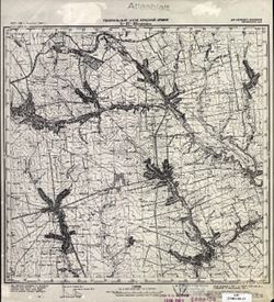
- Description:
- 1927
- Subject:
- Topical Subject: Maps, Geographic Subject: Andreyevka, and Topical Subject: Soviet Union
- Publisher:
- Генеральный штаб Красной Армии
- Language:
- Russian
- Date Created:
- 1941
- Identifier:
- VAC9619-002283
- Genre:
- Topographic Maps and Military Maps
- Geographic Location:
- Coordinates: 47, 36.5, 47.3333, 37
- Related URL:
- Download GeoTIFF: https://drive.google.com/file/d/1UF1XjcNneuyF1a5XhDK--2BjtXxrLfsl/view?usp=sharing and Catalog URL: https://iucat.iu.edu/catalog/5020129
- Abstract:
- Modern area represented: Andreyevka, Zaporizhia oblast, Ukraine
- Call Number:
- G7000 s100 .S7 sheet L-37-26
- Caption:
- Для служебного пользования
- City:
- Андреевка (Andreyevka)
- Copyright Holder:
- No Copyright - United States
- Country:
- СССР (USSR)
- State/Province:
- Украинская ССР (Ukrainian Soviet Socialist Republic)
- Physical Description:
- Scale: 1:100,000
- Persistent URL:
- http://purl.dlib.indiana.edu/iudl/images/VAC9619/VAC9619-002283
- Provenance:
- CIA Map Library
-
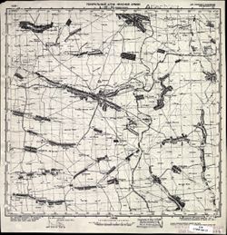
- Description:
- 1928
- Subject:
- Topical Subject: Maps, Topical Subject: Soviet Union, and Geographic Subject: Chernihivka
- Publisher:
- Генеральный штаб Красной Армии
- Language:
- Russian
- Date Created:
- 1941
- Identifier:
- VAC9619-002282
- Genre:
- Military Maps and Topographic Maps
- Geographic Location:
- Coordinates: 47, 36, 47.3333, 36.5
- Related URL:
- Download GeoTIFF: https://drive.google.com/file/d/1mo9Bpmz48kxlqvW7ySPLp9B3AAterdgn/view?usp=sharing and Catalog URL: https://iucat.iu.edu/catalog/5020129
- Abstract:
- Modern area represented: Chernihivka, Zaporizhia oblast, Ukraine
- Call Number:
- G7000 s100 .S7 sheet L-37-25
- Caption:
- Для служебного пользования
- City:
- Токмачанск (Tokmachansk)
- Copyright Holder:
- No Copyright - United States
- Country:
- СССР (USSR)
- State/Province:
- Украинская ССР (Ukrainian Soviet Socialist Republic)
- Physical Description:
- Scale: 1:100,000
- Persistent URL:
- http://purl.dlib.indiana.edu/iudl/images/VAC9619/VAC9619-002282
- Provenance:
- CIA Map Library
-
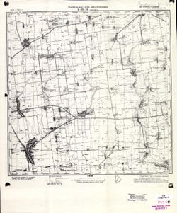
- Description:
- 1934
- Subject:
- Topical Subject: Maps, Topical Subject: Soviet Union, and Geographic Subject: Ivanivka
- Publisher:
- Генеральный штаб Красной Армии
- Language:
- Russian
- Date Created:
- 1941
- Identifier:
- VAC9619-001891
- Genre:
- Topographic Maps and Military Maps
- Geographic Location:
- Coordinates: 46.6667, 34.5, 47, 35
- Related URL:
- Download GeoTIFF: https://drive.google.com/open?id=14Er3699FOVffHRqDS10Xc_-qDDv9uQcf and Catalog URL: https://iucat.iu.edu/catalog/5020129
- Abstract:
- Modern area represented: Ivanivka, Zaporizhia oblast, Ukraine
- Call Number:
- G7000 s100 .S7 sheet L-36-46
- Caption:
- Для служебного пользования
- City:
- Ивановка (Ivanivka)
- Copyright Holder:
- No Copyright - United States
- Country:
- СССР (USSR)
- State/Province:
- Украинская ССР (Ukrainian Soviet Socialist Republic) and Запорожская область (Zaporizhia oblast)
- Physical Description:
- Scale: 1:100,000
- Persistent URL:
- http://purl.dlib.indiana.edu/iudl/images/VAC9619/VAC9619-001891
- Provenance:
- CIA Map Library
-
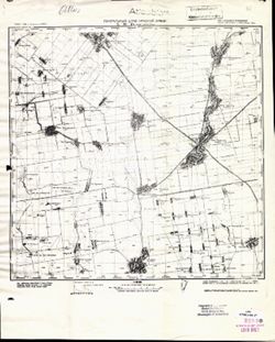
- Description:
- 1933
- Subject:
- Topical Subject: Maps, Geographic Subject: Nyzhni Sirohozy, and Topical Subject: Soviet Union
- Publisher:
- Генеральный штаб Красной Армии
- Language:
- Russian
- Date Created:
- 1941
- Identifier:
- VAC9619-001890
- Genre:
- Topographic Maps and Military Maps
- Geographic Location:
- Coordinates: 46.6667, 34, 47, 34.5
- Related URL:
- Download GeoTIFF: https://drive.google.com/open?id=1Z449zsz78QYAyHVx2ON5W62vEmhcjUFK and Catalog URL: https://iucat.iu.edu/catalog/5020129
- Abstract:
- Modern area represented: Nyzhni Sirohozy, Kherson oblast, Ukraine
- Call Number:
- G7000 s100 .S7 sheet L-36-45
- Caption:
- Для служебного пользования
- City:
- Ниж. Серогозы (Nyzhni Sirohozy)
- Copyright Holder:
- No Copyright - United States
- Country:
- СССР (USSR)
- State/Province:
- Запорожская область (Zaporizhia oblast), Николаевская область (Mykolaiv oblast), and Украинская ССР (Ukrainian Soviet Socialist Republic)
- Physical Description:
- Scale: 1:100,000
- Persistent URL:
- http://purl.dlib.indiana.edu/iudl/images/VAC9619/VAC9619-001890
- Provenance:
- CIA Map Library, Atlasblatt, Heeresplankammer Gruppe Archive Auslandskartenarchiv
-
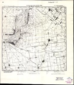
- Description:
- 1928
- Subject:
- Geographic Subject: Kairy, Topical Subject: Maps, and Topical Subject: Soviet Union
- Publisher:
- Генеральный штаб Красной Армии
- Language:
- Russian
- Date Created:
- 1941
- Identifier:
- VAC9619-001889
- Genre:
- Topographic Maps and Military Maps
- Geographic Location:
- Coordinates: 46.6667, 33.5, 47, 34
- Related URL:
- Catalog URL: https://iucat.iu.edu/catalog/5020129 and Download GeoTIFF: https://drive.google.com/file/d/1osSsR-E4nP09v5-wiUbmEixGdIeS0X75/view?usp=sharing
- Abstract:
- Modern area represented: Kayiry, Kherson oblast, Ukraine
- Call Number:
- G7000 s100 .S7 sheet L-36-44
- Caption:
- Для служебного пользования
- City:
- Западные Каиры (Zapadnye Kairy)
- Copyright Holder:
- No Copyright - United States
- Country:
- СССР (USSR)
- State/Province:
- Николаевская область (Mykolaiv oblast) and Украинская ССР (Ukrainian Soviet Socialist Republic)
- Physical Description:
- Scale: 1:100,000
- Persistent URL:
- http://purl.dlib.indiana.edu/iudl/images/VAC9619/VAC9619-001889
- Provenance:
- CIA Map Library, Atlasblatt
-
- Description:
- 1928
- Subject:
- Topical Subject: Soviet Union, Geographic Subject: Kayiry, and Topical Subject: Maps
- Publisher:
- Генеральный штаб Красной Армии
- Language:
- Russian
- Date Created:
- 1941
- Identifier:
- VAC9619-001888
- Genre:
- Military Maps and Topographic Maps
- Geographic Location:
- Coordinates: 46.6667, 33.5, 47, 34
- Related URL:
- Catalog URL: https://iucat.iu.edu/catalog/5020129 and Download GeoTIFF: https://drive.google.com/open?id=1EnPED_7gkuLxMVwpf7GTxL4isK_VLnGr
- Abstract:
- Modern area represented: Kayiry, Kherson oblast, Ukraine
- Call Number:
- G7000 s100 .S7 sheet L-36-44
- Caption:
- Для служебного пользования
- City:
- Западные Каиры (Zapadnye Kairy)
- Copyright Holder:
- No Copyright - United States
- Country:
- СССР (USSR)
- State/Province:
- Украинская ССР (Ukrainian Soviet Socialist Republic) and Николаевская область (Mykolaiv oblast)
- Physical Description:
- Scale: 1:100,000
- Persistent URL:
- http://purl.dlib.indiana.edu/iudl/images/VAC9619/VAC9619-001888
- Provenance:
- DMA Topographic Center, Atlasblatt, OMAHA, Army Map Service Library
-
- Description:
- 1923
- Subject:
- Topical Subject: Soviet Union, Topical Subject: Maps, and Geographic Subject: Beryslav
- Publisher:
- Генеральный штаб Красной Армии
- Language:
- Russian
- Date Created:
- 1941
- Identifier:
- VAC9619-001887
- Genre:
- Topographic Maps and Military Maps
- Geographic Location:
- Coordinates: 46.6667, 33, 47, 33.5
- Related URL:
- Catalog URL: https://iucat.iu.edu/catalog/5020129 and Download GeoTIFF: https://drive.google.com/open?id=15CCT7KeDTW2OAhyErSFxC6JA8ziWovVn
- Abstract:
- Modern area represented: Beryslav, Kherson oblast, Ukraine
- Call Number:
- G7000 s100 .S7 sheet L-36-43
- Caption:
- Для служебного пользования
- City:
- Берислав (Beryslav)
- Copyright Holder:
- No Copyright - United States
- Country:
- СССР (USSR)
- State/Province:
- Николаевская область (Mykolaiv oblast) and Украинская ССР (Ukrainian Soviet Socialist Republic)
- Physical Description:
- Scale: 1:100,000
- Persistent URL:
- http://purl.dlib.indiana.edu/iudl/images/VAC9619/VAC9619-001887
- Provenance:
- DMA Topographic Center, Army Map Service Library, OMAHA
-
- Description:
- 1921
- Subject:
- Topical Subject: Soviet Union, Geographic Subject: Mykolayivske, and Topical Subject: Maps
- Publisher:
- Генеральный штаб Красной Армии
- Language:
- Russian
- Date Created:
- 1941
- Identifier:
- VAC9619-001886
- Genre:
- Topographic Maps and Military Maps
- Geographic Location:
- Coordinates: 46.6667, 32, 47, 32.5
- Related URL:
- Catalog URL: https://iucat.iu.edu/catalog/5020129 and Download GeoTIFF: https://drive.google.com/open?id=1QOMkNVvR-7h_AWdDYOEM-KIcapLVEo3_
- Abstract:
- Modern area represented: Mykolayivske, Mykolaiv oblast, Ukraine
- Call Number:
- G7000 s100 .S7 sheet L-36-41
- Caption:
- Для служебного пользования
- City:
- Николаев (Mykolayiv)
- Copyright Holder:
- No Copyright - United States
- Country:
- СССР (USSR)
- State/Province:
- Украинская ССР (Ukrainian Soviet Socialist Republic)
- Physical Description:
- Scale: 1:100,000
- Persistent URL:
- http://purl.dlib.indiana.edu/iudl/images/VAC9619/VAC9619-001886
- Provenance:
- DMA Topographic Center, Army Map Service Library, OMAHA
-
- Description:
- 1907
- Subject:
- Geographic Subject: Velyka Korenykha, Topical Subject: Maps, and Topical Subject: Soviet Union
- Publisher:
- Генеральный штаб Красной Армии
- Language:
- Russian
- Date Created:
- 1941
- Identifier:
- VAC9619-001885
- Genre:
- Topographic Maps and Military Maps
- Geographic Location:
- Coordinates: 46.6667, 31.5, 47, 32
- Related URL:
- Catalog URL: https://iucat.iu.edu/catalog/5020129 and Download GeoTIFF: https://drive.google.com/file/d/1QJqK6upnSULI9t8YF7AmAgEuNuDzIGlL/view?usp=sharing
- Abstract:
- Modern area represented: Velyka Korenykha, Mykolaiv oblast, Ukraine
- Call Number:
- G7000 s100 .S7 sheet L-36-40
- Caption:
- Временное издание,Для служебного пользования
- City:
- Бол. Корениха (Bolshaya Korenikha)
- Copyright Holder:
- No Copyright - United States
- Country:
- СССР (USSR)
- State/Province:
- Украинская ССР (Ukrainian Soviet Socialist Republic)
- Physical Description:
- Scale: 1:100,000
- Persistent URL:
- http://purl.dlib.indiana.edu/iudl/images/VAC9619/VAC9619-001885
- Provenance:
- DMA Topographic Center, Army Map Service Library, OMAHA
-
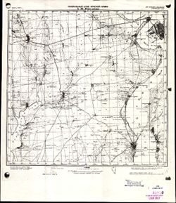
- Description:
- 1907
- Subject:
- Topical Subject: Maps, Geographic Subject: Velyka Korenykha, and Topical Subject: Soviet Union
- Publisher:
- Генеральный штаб Красной Армии
- Language:
- Russian
- Date Created:
- 1941
- Identifier:
- VAC9619-001884
- Genre:
- Military Maps and Topographic Maps
- Geographic Location:
- Coordinates: 46.6667, 31.5, 47, 32
- Related URL:
- Download GeoTIFF: https://drive.google.com/open?id=1fNdbJ2rMnjnma3fM8xJgn6ozu_NI6Aox and Catalog URL: https://iucat.iu.edu/catalog/5020129
- Abstract:
- Modern area represented: Velyka Korenykha, Mykolaiv oblast, Ukraine
- Call Number:
- G7000 s100 .S7 sheet L-36-40
- Caption:
- Для служебного пользования
- City:
- Бол. Корениха (Bolshaya Korenikha)
- Copyright Holder:
- No Copyright - United States
- Country:
- СССР (USSR)
- State/Province:
- Украинская ССР (Ukrainian Soviet Socialist Republic)
- Physical Description:
- Scale: 1:100,000
- Persistent URL:
- http://purl.dlib.indiana.edu/iudl/images/VAC9619/VAC9619-001884
- Provenance:
- CIA Map Library
-
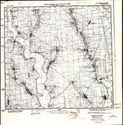
- Description:
- 1923
- Subject:
- Topical Subject: Soviet Union, Geographic Subject: Anatolyevka, and Topical Subject: Maps
- Publisher:
- Генеральный штаб Красной Армии
- Language:
- Russian
- Date Created:
- 1941
- Identifier:
- VAC9619-001883
- Genre:
- Topographic Maps and Military Maps
- Geographic Location:
- Coordinates: 46.6667, 31, 47, 31.5
- Related URL:
- Catalog URL: https://iucat.iu.edu/catalog/5020129 and Download GeoTIFF: https://drive.google.com/open?id=13VfyVaR-q2kWZN6Gos9K23WCuU0PKXNA
- Abstract:
- Modern area represented: Anatolyevka, Mykolaiv oblast, Ukraine
- Call Number:
- G7000 s100 .S7 sheet L-36-39
- Caption:
- Для служебного пользования
- City:
- Анатольевка (Anatolyevka)
- Copyright Holder:
- No Copyright - United States
- Country:
- СССР (USSR)
- State/Province:
- Украинская ССР (Ukrainian Soviet Socialist Republic)
- Physical Description:
- Scale: 1:100,000
- Persistent URL:
- http://purl.dlib.indiana.edu/iudl/images/VAC9619/VAC9619-001883
- Provenance:
- CIA Map Library, Atlasblatt, Library of Congress Geography & Map Division
-
- Description:
- 1936
- Subject:
- Topical Subject: Soviet Union, Topical Subject: Maps, and Geographic Subject: Tokmak
- Publisher:
- Генеральный штаб Красной Армии
- Language:
- Russian
- Date Created:
- 1941
- Identifier:
- VAC9619-001879
- Genre:
- Topographic Maps and Military Maps
- Geographic Location:
- Coordinates: 47, 35.5, 47.3333, 36
- Related URL:
- Download GeoTIFF: https://drive.google.com/open?id=1OoowFREJfGMpfVna6ycm9h6wt5I1ph15 and Catalog URL: https://iucat.iu.edu/catalog/5020129
- Abstract:
- Modern area represented: Tokmak, Zaporizhia oblast, Ukraine
- Call Number:
- G7000 s100 .S7 sheet L-36-36
- Caption:
- Для служебного пользования
- City:
- Бол. Токмак (Bolshoy Tokmak)
- Copyright Holder:
- No Copyright - United States
- Country:
- СССР (USSR)
- State/Province:
- Запорожская область (Zaporizhia oblast) and Украинская ССР (Ukrainian Soviet Socialist Republic)
- Physical Description:
- Scale: 1:100,000
- Persistent URL:
- http://purl.dlib.indiana.edu/iudl/images/VAC9619/VAC9619-001879
- Provenance:
- CIA Map Library
-
- Description:
- 1923
- Subject:
- Topical Subject: Maps, Topical Subject: Soviet Union, and Geographic Subject: Novosvetlovka
- Publisher:
- Генеральный штаб Красной Армии
- Language:
- Russian
- Date Created:
- 1941
- Identifier:
- VAC9619-001875
- Genre:
- Military Maps and Topographic Maps
- Geographic Location:
- Coordinates: 47, 31, 47.3333, 31.5
- Related URL:
- Catalog URL: https://iucat.iu.edu/catalog/5020129 and Download GeoTIFF: https://drive.google.com/open?id=1EbK0cGpvSMNX1svCUjtHP05b5fU5NuIV
- Abstract:
- Modern area represented: Novosvetlovka, Odessa oblast, Ukraine
- Call Number:
- G7000 s100 .S7 sheet L-36-27
- Caption:
- Для служебного пользования
- City:
- Колония Рорбах (Koloniya Rorbakh)
- Copyright Holder:
- No Copyright - United States
- Country:
- СССР (USSR)
- State/Province:
- Украинская ССР (Ukrainian Soviet Socialist Republic)
- Physical Description:
- Scale: 1:100,000
- Persistent URL:
- http://purl.dlib.indiana.edu/iudl/images/VAC9619/VAC9619-001875
- Provenance:
- CIA Map Library, Atlasblatt, Heeresplankammer Gruppe Archive Auslandskartenarchiv
-
- Description:
- 1940
- Subject:
- Topical Subject: Maps, Topical Subject: Soviet Union, and Geographic Subject: Orikhiv
- Publisher:
- Генеральный штаб Красной Армии
- Language:
- Russian
- Date Created:
- 1941
- Identifier:
- VAC9619-001871
- Genre:
- Topographic Maps and Military Maps
- Geographic Location:
- Coordinates: 47.3333, 35.5, 47.6667, 36
- Related URL:
- Catalog URL: https://iucat.iu.edu/catalog/5020129 and Download GeoTIFF: https://drive.google.com/file/d/18UxavbRP7_3x1JZIEdsgnIP8bzhUcJ3v/view?usp=sharing
- Abstract:
- Modern area represented: Orikhiv, Zaporizhia oblast, Ukraine
- Call Number:
- G7000 s100 .S7 sheet L-36-24
- Caption:
- Для служебного пользования
- City:
- Орехов (Orikhiv)
- Copyright Holder:
- No Copyright - United States
- Country:
- СССР (USSR)
- State/Province:
- Запорожская область (Zaporizhia oblast) and Украинская ССР (Ukrainian Soviet Socialist Republic)
- Physical Description:
- Scale: 1:100,000
- Persistent URL:
- http://purl.dlib.indiana.edu/iudl/images/VAC9619/VAC9619-001871
- Provenance:
- Atlasblatt
-
- Description:
- 1940
- Subject:
- Topical Subject: Soviet Union, Geographic Subject: Orikhiv, and Topical Subject: Maps
- Publisher:
- Генеральный штаб Красной Армии
- Language:
- Russian
- Date Created:
- 1941
- Identifier:
- VAC9619-001870
- Genre:
- Topographic Maps and Military Maps
- Geographic Location:
- Coordinates: 47.3333, 35.5, 47.6667, 36
- Related URL:
- Catalog URL: https://iucat.iu.edu/catalog/5020129 and Download GeoTIFF: https://drive.google.com/open?id=1AXZ-XrQdgFQXRG3b8AQpUU8UVELbTcb0
- Abstract:
- Modern area represented: Orikhiv, Zaporizhia oblast, Ukraine
- Call Number:
- G7000 s100 .S7 sheet L-36-24
- Caption:
- Для служебного пользования
- City:
- Орехов (Orikhiv)
- Copyright Holder:
- No Copyright - United States
- Country:
- СССР (USSR)
- State/Province:
- Запорожская область (Zaporizhia oblast) and Украинская ССР (Ukrainian Soviet Socialist Republic)
- Physical Description:
- Scale: 1:100,000
- Persistent URL:
- http://purl.dlib.indiana.edu/iudl/images/VAC9619/VAC9619-001870
- Provenance:
- CIA Map Library, Atlasblatt
-
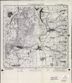
- Description:
- 1927
- Subject:
- Topical Subject: Soviet Union, Topical Subject: Maps, and Geographic Subject: Vasylivka
- Publisher:
- Генеральный штаб Красной Армии
- Language:
- Russian
- Date Created:
- 1941
- Identifier:
- VAC9619-001869
- Genre:
- Topographic Maps and Military Maps
- Geographic Location:
- Coordinates: 47.3333, 35, 47.6667, 35.5
- Related URL:
- Catalog URL: https://iucat.iu.edu/catalog/5020129 and Download GeoTIFF: https://drive.google.com/open?id=1Ts_iGjiK3duW8I4BKerAnFOxHoZvlOGy
- Abstract:
- Modern area represented: Vasylivka, Zaporizhia oblast, Ukraine
- Call Number:
- G7000 s100 .S7 sheet L-36-23
- Caption:
- Для служебного пользования
- City:
- Васильевка (Vasylivka)
- Copyright Holder:
- No Copyright - United States
- Country:
- СССР (USSR)
- State/Province:
- Запорожская область (Zaporizhia oblast) and Украинская ССР (Ukrainian Soviet Socialist Republic)
- Physical Description:
- Scale: 1:100,000
- Persistent URL:
- http://purl.dlib.indiana.edu/iudl/images/VAC9619/VAC9619-001869
- Provenance:
- CIA Map Library
-

- Description:
- 1926
- Subject:
- Geographic Subject: Balky, Topical Subject: Soviet Union, and Topical Subject: Maps
- Publisher:
- Генеральный штаб Красной Армии
- Language:
- Russian
- Date Created:
- 1941
- Identifier:
- VAC9619-001868
- Genre:
- Topographic Maps and Military Maps
- Geographic Location:
- Coordinates: 47.3333, 34.5, 47.6667, 35
- Related URL:
- Catalog URL: https://iucat.iu.edu/catalog/5020129 and Download GeoTIFF: https://drive.google.com/open?id=1V7PHm7Dg5ABV8yybrFeMKAmxM9f2EO27
- Abstract:
- Modern area represented: Balky, Zaporizhia oblast, Ukraine
- Call Number:
- G7000 s100 .S7 sheet L-36-22
- Caption:
- Для служебного пользования
- City:
- Балки (Balky)
- Copyright Holder:
- No Copyright - United States
- Country:
- СССР (USSR)
- State/Province:
- Украинская ССР (Ukrainian Soviet Socialist Republic)
- Physical Description:
- Scale: 1:100,000
- Persistent URL:
- http://purl.dlib.indiana.edu/iudl/images/VAC9619/VAC9619-001868
- Provenance:
- CIA Map Library
-
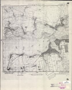
- Description:
- 1926
- Subject:
- Topical Subject: Soviet Union, Topical Subject: Maps, and Geographic Subject: Nikopol
- Publisher:
- Генеральный штаб Красной Армии
- Language:
- Russian
- Date Created:
- 1941
- Identifier:
- VAC9619-001867
- Genre:
- Military Maps and Topographic Maps
- Geographic Location:
- Coordinates: 47.3333, 34, 47.6667, 34.5
- Related URL:
- Download GeoTIFF: https://drive.google.com/open?id=1255dfmhEQnsVoMASiJgE0Wqbhh4ks-Bt and Catalog URL: https://iucat.iu.edu/catalog/5020129
- Abstract:
- Modern area represented: Nikopol, Dnipropetrovsk, Ukraine
- Call Number:
- G7000 s100 .S7 sheet L-36-21
- Caption:
- Для служебного пользования
- City:
- Никополь (Nikopol)
- Copyright Holder:
- No Copyright - United States
- Country:
- СССР (USSR)
- State/Province:
- Днепропетровская область (Dnipropetrovsk oblast) and Украинская ССР (Ukrainian Soviet Socialist Republic)
- Physical Description:
- Scale: 1:100,000
- Persistent URL:
- http://purl.dlib.indiana.edu/iudl/images/VAC9619/VAC9619-001867
- Provenance:
- CIA Map Library
-
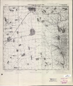
- Description:
- 1926
- Subject:
- Topical Subject: Soviet Union, Topical Subject: Maps, and Geographic Subject: Apostolove
- Publisher:
- Генеральный штаб Красной Армии
- Language:
- Russian
- Date Created:
- 1941
- Identifier:
- VAC9619-001866
- Genre:
- Military Maps and Topographic Maps
- Geographic Location:
- Coordinates: 47.3333, 33.5, 47.6667, 34
- Related URL:
- Catalog URL: https://iucat.iu.edu/catalog/5020129 and Download GeoTIFF: https://drive.google.com/file/d/19vU-7kd0gBkHRSMRDc-_C2Jsbp5EDO89/view?usp=sharing
- Abstract:
- Modern area represented: Apostolove, Dnipropetrovsk oblast, Ukraine
- Call Number:
- G7000 s100 .S7 sheet L-36-20
- Caption:
- Для служебного пользования
- City:
- Апостолово (Apostolovo)
- Copyright Holder:
- No Copyright - United States
- Country:
- СССР (USSR)
- State/Province:
- Украинская ССР (Ukrainian Soviet Socialist Republic)
- Physical Description:
- Scale: 1:100,000
- Persistent URL:
- http://purl.dlib.indiana.edu/iudl/images/VAC9619/VAC9619-001866
- Provenance:
- CIA Map Library, Atlasblatt
-
- Description:
- 1926
- Subject:
- Geographic Subject: Apostolove, Topical Subject: Maps, and Topical Subject: Soviet Union
- Publisher:
- Генеральный штаб Красной Армии
- Language:
- Russian
- Date Created:
- 1941
- Identifier:
- VAC9619-001865
- Genre:
- Military Maps and Topographic Maps
- Geographic Location:
- Coordinates: 47.3333, 33.5, 47.6667, 34
- Related URL:
- Download GeoTIFF: https://drive.google.com/open?id=1qtLlkH0o1EGtSackrnvXw4lLRu4x84Mn and Catalog URL: https://iucat.iu.edu/catalog/5020129
- Abstract:
- Modern area represented: Apostolove, Dnipropetrovsk oblast, Ukraine
- Call Number:
- G7000 s100 .S7 sheet L-36-20
- Caption:
- Для служебного пользования
- City:
- Апостолово (Apostolovo)
- Copyright Holder:
- No Copyright - United States
- Country:
- СССР (USSR)
- State/Province:
- Украинская ССР (Ukrainian Soviet Socialist Republic)
- Physical Description:
- Scale: 1:100,000
- Persistent URL:
- http://purl.dlib.indiana.edu/iudl/images/VAC9619/VAC9619-001865
- Provenance:
- DMA Topographic Center, Atlasblatt, Library of Congress Geography & Map Division, Army Map Service Library
-
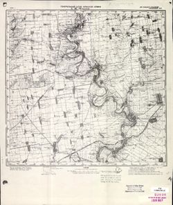
- Description:
- 1930
- Subject:
- Geographic Subject: Shesternya, Topical Subject: Soviet Union, and Topical Subject: Maps
- Publisher:
- Генеральный штаб Красной Армии
- Language:
- Russian
- Date Created:
- 1941
- Identifier:
- VAC9619-001864
- Genre:
- Topographic Maps and Military Maps
- Geographic Location:
- Coordinates: 47.3333, 33, 47.6667, 33.5
- Related URL:
- Download GeoTIFF: https://drive.google.com/open?id=10v6rNSmRqiUeQcnPF6pp5pnh6Csl7aE8 and Catalog URL: https://iucat.iu.edu/catalog/5020129
- Abstract:
- Modern area represented: Shesternya, Kherson oblast, Ukraine
- Call Number:
- G7000 s100 .S7 sheet L-36-19
- Caption:
- Для служебного пользования
- City:
- Шестерня (Shesternya)
- Copyright Holder:
- No Copyright - United States
- Country:
- СССР (USSR)
- State/Province:
- Украинская ССР (Ukrainian Soviet Socialist Republic)
- Physical Description:
- Scale: 1:100,000
- Persistent URL:
- http://purl.dlib.indiana.edu/iudl/images/VAC9619/VAC9619-001864
- Provenance:
- CIA Map Library, Atlasblatt
-
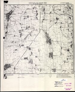
- Description:
- 1930
- Subject:
- Topical Subject: Maps, Geographic Subject: Novyy Buh, and Topical Subject: Soviet Union
- Publisher:
- Генеральный штаб Красной Армии
- Language:
- Russian
- Date Created:
- 1941
- Identifier:
- VAC9619-001863
- Genre:
- Military Maps and Topographic Maps
- Geographic Location:
- Coordinates: 47.6667, 32.5, 48, 33
- Related URL:
- Download GeoTIFF: https://drive.google.com/open?id=1T0wPHo0RpDwORrKZXGfpt1IyrZgBA6b4 and Catalog URL: https://iucat.iu.edu/catalog/5020129
- Abstract:
- Modern area represented: Novyy Buh, Mykolaiv, Ukraine
- Call Number:
- G7000 s100 .S7 sheet L-36-6
- Caption:
- Для служебного пользования
- City:
- Новый Буг (Novyy Buh)
- Copyright Holder:
- No Copyright - United States
- Country:
- СССР (USSR)
- State/Province:
- Украинская ССР (Ukrainian Soviet Socialist Republic)
- Physical Description:
- Scale: 1:100,000
- Persistent URL:
- http://purl.dlib.indiana.edu/iudl/images/VAC9619/VAC9619-001863
- Provenance:
- CIA Map Library
-
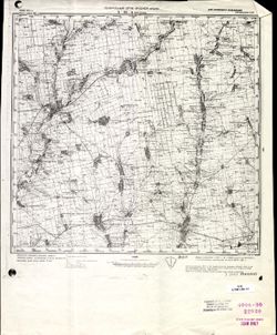
- Description:
- 1928
- Subject:
- Topical Subject: Maps, Geographic Subject: Bratske, and Topical Subject: Soviet Union
- Publisher:
- Генеральный штаб Красной Армии
- Language:
- Russian
- Date Created:
- 1941
- Identifier:
- VAC9619-001862
- Genre:
- Military Maps and Topographic Maps
- Geographic Location:
- Coordinates: 47.6667, 31.5, 48, 32
- Related URL:
- Catalog URL: https://iucat.iu.edu/catalog/5020129 and Download GeoTIFF: https://drive.google.com/open?id=1CRkSh7sskcbMSmRNTPMYkQvk89B_3WMF
- Abstract:
- Modern area represented: Bratske, Mykolaiv oblast, Ukraine
- Call Number:
- G7000 s100 .S7 sheet L-36-4
- Caption:
- Для служебного пользования
- City:
- Братское (Bratskoye)
- Copyright Holder:
- No Copyright - United States
- Country:
- СССР (USSR)
- State/Province:
- Украинская ССР (Ukrainian Soviet Socialist Republic)
- Physical Description:
- Scale: 1:100,000
- Persistent URL:
- http://purl.dlib.indiana.edu/iudl/images/VAC9619/VAC9619-001862
- Provenance:
- CIA Map Library
-
- Description:
- 1928
- Subject:
- Geographic Subject: Kuybyshevka, Topical Subject: Soviet Union, and Topical Subject: Maps
- Publisher:
- Генеральный штаб Красной Армии
- Language:
- Russian
- Date Created:
- 1941
- Identifier:
- VAC9619-001859
- Genre:
- Topographic Maps and Military Maps
- Geographic Location:
- Coordinates: 47.3333, 31.5, 47.6667, 32
- Related URL:
- Download GeoTIFF: https://drive.google.com/open?id=1vCLFl_8xuzcQNwylJ_TnIRppAiZjkAqE and Catalog URL: https://iucat.iu.edu/catalog/5020129
- Abstract:
- Modern area represented: Kuybyshevka, Mykolaiv oblast, Ukraine
- Call Number:
- G7000 s100 .S7 sheet L-36-16
- Caption:
- Для служебного пользования
- City:
- Больш. Солоное (Bolshoye Solonoye)
- Copyright Holder:
- No Copyright - United States
- Country:
- СССР (USSR)
- State/Province:
- Украинская ССР (Ukrainian Soviet Socialist Republic)
- Physical Description:
- Scale: 1:100,000
- Persistent URL:
- http://purl.dlib.indiana.edu/iudl/images/VAC9619/VAC9619-001859
- Provenance:
- DMA Topographic Center, Army Map Service Library, OMAHA, Library of Congress Geography & Map Division
-
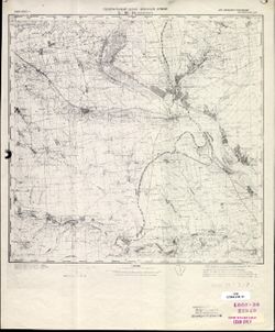
- Description:
- 1928
- Subject:
- Geographic Subject: Voznesensk, Topical Subject: Maps, and Topical Subject: Soviet Union
- Publisher:
- Генеральный штаб Красной Армии
- Language:
- Russian
- Date Created:
- 1941
- Identifier:
- VAC9619-001853
- Genre:
- Topographic Maps and Military Maps
- Geographic Location:
- Coordinates: 47.3333, 31, 47.6667, 31.5
- Related URL:
- Catalog URL: https://iucat.iu.edu/catalog/5020129 and Download GeoTIFF: https://drive.google.com/open?id=1bR3CKUW57AtZTkAsFZhGcwe6LzRifVDw
- Abstract:
- Modern area represented: Voznesensk, Mykolaiv oblast, Ukraine
- Call Number:
- G7000 s100 .S7 sheet L-36-15
- Caption:
- Для служебного пользования
- City:
- Вознесенск (Voznesensk)
- Copyright Holder:
- No Copyright - United States
- Country:
- СССР (USSR)
- State/Province:
- Украинская ССР (Ukrainian Soviet Socialist Republic)
- Physical Description:
- Scale: 1:100,000
- Persistent URL:
- http://purl.dlib.indiana.edu/iudl/images/VAC9619/VAC9619-001853
- Provenance:
- CIA Map Library
-

- Description:
- 1939
- Subject:
- Topical Subject: Soviet Union, Geographic Subject: Komyshuvakha, and Topical Subject: Maps
- Publisher:
- Генеральный штаб Красной Армии
- Language:
- Russian
- Date Created:
- 1941
- Identifier:
- VAC9619-001844
- Genre:
- Military Maps and Topographic Maps
- Geographic Location:
- Coordinates: 47.6667, 35.5, 48, 36
- Related URL:
- Download GeoTIFF: https://drive.google.com/open?id=1IiavgxI6IZ79dkMzQI3jHmPsU86TTxOH and Catalog URL: https://iucat.iu.edu/catalog/5020129
- Abstract:
- Modern area represented: Komyshuvakha, Zaporizhia oblast, Ukraine
- Call Number:
- G7000 s100 .S7 sheet L-36-12
- Caption:
- Для служебного пользования
- City:
- Камышуваха (Komyshuvakha)
- Copyright Holder:
- No Copyright - United States
- Country:
- СССР (USSR)
- State/Province:
- Запорожская область (Zaporizhia oblast) and Украинская ССР (Ukrainian Soviet Socialist Republic)
- Physical Description:
- Scale: 1:100,000
- Persistent URL:
- http://purl.dlib.indiana.edu/iudl/images/VAC9619/VAC9619-001844
- Provenance:
- CIA Map Library
-
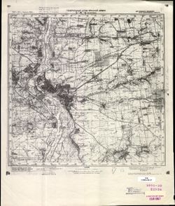
- Description:
- 1927
- Subject:
- Geographic Subject: Zaporizhia, Topical Subject: Soviet Union, and Topical Subject: Maps
- Publisher:
- Генеральный штаб Красной Армии
- Language:
- Russian
- Date Created:
- 1941
- Identifier:
- VAC9619-001831
- Genre:
- Topographic Maps and Military Maps
- Geographic Location:
- Coordinates: 47.6667, 35, 48, 35.5
- Related URL:
- Download GeoTIFF: https://drive.google.com/open?id=16w7gAgD3waAsgFnUeqhZv9WmeLo6ztJn and Catalog URL: https://iucat.iu.edu/catalog/5020129
- Abstract:
- Modern area represented: Zaporizhia, Zaporizhia oblast, Ukraine
- Call Number:
- G7000 s100 .S7 sheet L-36-11
- Caption:
- Для служебного пользования
- City:
- Запорожье (Zaporizhia)
- Copyright Holder:
- No Copyright - United States
- Country:
- СССР (USSR)
- State/Province:
- Украинская ССР (Ukrainian Soviet Socialist Republic) and Запорожская область (Zaporizhia oblast)
- Physical Description:
- Scale: 1:100,000
- Persistent URL:
- http://purl.dlib.indiana.edu/iudl/images/VAC9619/VAC9619-001831
- Provenance:
- CIA Map Library
-
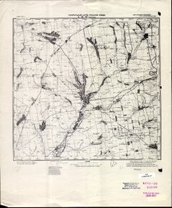
- Description:
- 1926
- Subject:
- Topical Subject: Maps, Geographic Subject: Tomakivka, and Topical Subject: Soviet Union
- Publisher:
- Генеральный штаб Красной Армии
- Language:
- Russian
- Date Created:
- 1941
- Identifier:
- VAC9619-001823
- Genre:
- Topographic Maps and Military Maps
- Geographic Location:
- Coordinates: 47.6667, 34.5, 48, 35
- Related URL:
- Download GeoTIFF: https://drive.google.com/file/d/14Nyu2PujbMSA_GYJjeQF3P2MPNH2zV-g/view?usp=sharing and Catalog URL: https://iucat.iu.edu/catalog/5020129
- Abstract:
- Modern area represented: Tomakivka, Dnipropetrovsk oblast, Ukraine
- Call Number:
- G7000 s100 .S7 sheet L-36-10
- Caption:
- Для служебного пользования
- City:
- Томаковка (Tomakivka)
- Copyright Holder:
- No Copyright - United States
- Country:
- СССР (USSR)
- State/Province:
- Запорожская область (Zaporizhia oblast) and Украинская ССР (Ukrainian Soviet Socialist Republic)
- Physical Description:
- Scale: 1:100,000
- Persistent URL:
- http://purl.dlib.indiana.edu/iudl/images/VAC9619/VAC9619-001823
- Provenance:
- CIA Map Library
-
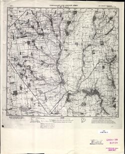
- Description:
- 1925
- Subject:
- Topical Subject: Maps, Topical Subject: Soviet Union, and Geographic Subject: Kamenka
- Publisher:
- Генеральный штаб Красной Армии
- Language:
- Russian
- Date Created:
- 1941
- Identifier:
- VAC9619-001813
- Genre:
- Topographic Maps and Military Maps
- Geographic Location:
- Coordinates: 47.6667, 33.5, 48, 34
- Related URL:
- Catalog URL: https://iucat.iu.edu/catalog/5020129 and Download GeoTIFF: https://drive.google.com/open?id=1Znt6fiuoSKmhSW96ISNtk6soCbJclKeG
- Abstract:
- Modern area represented: Kamenka, Dnipropetrovsk oblast, Ukraine
- Call Number:
- G7000 s100 .S7 sheet L-36-8
- Caption:
- Для служебного пользования
- City:
- Каменка (Kamenka)
- Copyright Holder:
- No Copyright - United States
- Country:
- СССР (USSR)
- State/Province:
- Украинская ССР (Ukrainian Soviet Socialist Republic)
- Physical Description:
- Scale: 1:100,000
- Persistent URL:
- http://purl.dlib.indiana.edu/iudl/images/VAC9619/VAC9619-001813
- Provenance:
- CIA Map Library
-
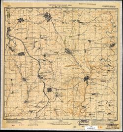
- Description:
- 1939
- Subject:
- Geographic Subject: Donetsk, Topical Subject: Soviet Union, Geographic Subject: Platonovka, and Topical Subject: Maps
- Publisher:
- Генеральный штаб Красной Армии
- Language:
- Russian
- Date Created:
- 1941
- Identifier:
- VAC9619-002002
- Genre:
- Topographic Maps and Military Maps
- Geographic Location:
- Coordinates: 47.3333, 37.5, 47.6667, 37.5
- Related URL:
- Catalog URL: https://iucat.iu.edu/catalog/5020129 and Download GeoTIFF: https://drive.google.com/open?id=1rcAVudLKQYH89ByRQ8FaN6st2evLxa46
- Abstract:
- Modern area represented: Платоновка (Platonovka), Donetsk, Ukraine
- Call Number:
- G7000 s100 .S7 sheet L-37-16
- Caption:
- Для cлужебного пользования
- City:
- Платоновка (Platonovka)
- Copyright Holder:
- No Copyright - United States
- Country:
- СССР (USSR)
- State/Province:
- Украинская ССР (Ukrainian Soviet Socialist Republic) and Сталинская область (Stalino oblast)
- Physical Description:
- Scale: 1:100,000
- Persistent URL:
- http://purl.dlib.indiana.edu/iudl/images/VAC9619/VAC9619-002002
- Provenance:
- Geographic Names Branch
-
- Description:
- 1928
- Subject:
- Geographic Subject: Zaporizhia Oblast, Topical Subject: Maps, Geographic Subject: Bilmak, and Topical Subject: Soviet Union
- Publisher:
- Генеральный штаб Красной Армии
- Language:
- Russian
- Date Created:
- 1941
- Identifier:
- VAC9619-002001
- Genre:
- Topographic Maps and Military Maps
- Geographic Location:
- Coordinates: 47.3333, 36.5, 47.6667, 37
- Related URL:
- Download GeoTIFF: https://drive.google.com/open?id=1ySsSAOHIVCirkO-XklFYUt7jjSRE9JyW and Catalog URL: https://iucat.iu.edu/catalog/5020129
- Abstract:
- Modern area represented: Більмак (Bilmak), Zaporizhia Oblast, Ukraine
- Call Number:
- G7000 s100 .S7 sheet L-37-14
- Caption:
- Для cлужебного пользования
- City:
- Куйбышево (Kuybysheve)
- Copyright Holder:
- No Copyright - United States
- Country:
- СССР (USSR)
- State/Province:
- Украинская ССР (Ukrainian Soviet Socialist Republic), Запорожская область (Zaporizhia oblast), and Сталинская область (Stalino oblast)
- Physical Description:
- Scale: 1:100,000
- Persistent URL:
- http://purl.dlib.indiana.edu/iudl/images/VAC9619/VAC9619-002001
- Provenance:
- DMA Topographic Center, Army Map Service Library, OMAHA
-
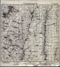
- Description:
- 1939
- Subject:
- Topical Subject: Soviet Union, Topical Subject: Maps, and Geographic Subject: Rozdolne
- Publisher:
- Генеральный штаб Красной Армии
- Language:
- Russian
- Date Created:
- 1941
- Identifier:
- VAC9619-002003
- Genre:
- Military Maps and Topographic Maps
- Geographic Location:
- Coordinates: 47.3333, 38, 47.6667, 38.5
- Related URL:
- Catalog URL: https://iucat.iu.edu/catalog/5020129 and Download GeoTIFF: https://drive.google.com/open?id=1cdFtj_43ppiv47dkF7XJ1JNspIgopc33
- Abstract:
- Modern area represented: Rozdolne, Donetsk oblast, Ukraine
- Call Number:
- G7000 s100 .S7 sheet L-37-17
- Caption:
- Для служебного пользования
- City:
- Большая Каракуба (Bolshaya Karakuba)
- Copyright Holder:
- No Copyright - United States
- Country:
- СССР (USSR)
- State/Province:
- РСФСР (RSFSR) and Украинская ССР (Ukrainian Soviet Socialist Republic)
- Physical Description:
- Scale: 1:100,000
- Persistent URL:
- http://purl.dlib.indiana.edu/iudl/images/VAC9619/VAC9619-002003
- Provenance:
- CIA Map Library
-
- Description:
- 1928
- Subject:
- Topical Subject: Maps, Geographic Subject: Polohy, Geographic Subject: Zaporizhia, and Topical Subject: Soviet Union
- Publisher:
- Генеральный штаб Красной Армии
- Language:
- Russian
- Date Created:
- 1941
- Identifier:
- VAC9619-002000
- Genre:
- Topographic Maps and Military Maps
- Geographic Location:
- Coordinates: 47.3333, 36, 47.6667, 36.5
- Related URL:
- Catalog URL: https://iucat.iu.edu/catalog/5020129 and Download GeoTIFF: https://drive.google.com/file/d/1uJ3-XGXJUXLAboX8-HQjitHwF2kaLFi8/view?usp=sharing
- Abstract:
- Modern area represented: Пологи (Polohy), Zaporizhia, Ukraine
- Call Number:
- G7000 s100 .S7 sheet L-37-13
- Caption:
- Для cлужебного пользования
- City:
- Пологи (Polohy)
- Copyright Holder:
- No Copyright - United States
- Country:
- СССР (USSR)
- State/Province:
- Запорожская область (Zaporizhia oblast) and Украинская ССР (Ukrainian Soviet Socialist Republic)
- Physical Description:
- Scale: 1:100,000
- Persistent URL:
- http://purl.dlib.indiana.edu/iudl/images/VAC9619/VAC9619-002000
- Provenance:
- DMA Topographic Center, Army Map Service Library, OMAHA
-
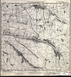
- Description:
- 1928
- Subject:
- Geographic Subject: Polohy, Topical Subject: Maps, and Topical Subject: Soviet Union
- Publisher:
- Генеральный штаб Красной Армии
- Language:
- Russian
- Date Created:
- 1941
- Identifier:
- VAC9619-001999
- Genre:
- Military Maps and Topographic Maps
- Geographic Location:
- Coordinates: 47.3333, 36, 47.6667, 36.5
- Related URL:
- Download GeoTIFF: https://drive.google.com/open?id=1e9fUTgvqBE4EgnDy0hWN7wxWDzLViFdf and Catalog URL: https://iucat.iu.edu/catalog/5020129
- Abstract:
- Modern area represented: Polohy, Zaporizhia Oblast, Ukraine
- Call Number:
- G7000 s100 .S7 sheet L-37-13
- Caption:
- Для служебного пользования
- City:
- Пологи (Pologi)
- Copyright Holder:
- No Copyright - United States
- Country:
- СССР (USSR)
- State/Province:
- Запорожская область (Zaporizhia oblast) and Украинская ССР (Ukrainian Soviet Socialist Republic)
- Physical Description:
- Scale: 1:100,000
- Persistent URL:
- http://purl.dlib.indiana.edu/iudl/images/VAC9619/VAC9619-001999
- Provenance:
- CIA Map Library
-
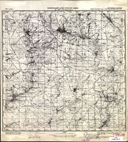
- Description:
- 1904
- Subject:
- Geographic Subject: Novoshakhtinsk, Topical Subject: Soviet Union, and Topical Subject: Maps
- Publisher:
- Генеральный штаб Красной Армии
- Language:
- Russian
- Date Created:
- 1941
- Identifier:
- VAC9619-001994
- Genre:
- Topographic Maps and Military Maps
- Geographic Location:
- Coordinates: 47.6667, 39.5, 48, 40
- Related URL:
- Download GeoTIFF: https://drive.google.com/open?id=1Z71FJW1PPTeU6Zq-xJa1RdMaUeG9VcpI and Catalog URL: https://iucat.iu.edu/catalog/5020129
- Abstract:
- Modern area represented: Novoshakhtinsk, Luhansk oblast, Ukraine
- Call Number:
- G7000 s100 .S7 sheet L-37-8
- Caption:
- Для служебного пользования
- City:
- Новошахтинск (Novoshakhtinsk)
- Copyright Holder:
- No Copyright - United States
- Country:
- СССР (USSR)
- State/Province:
- Ворошиловградская область (Voroshilovgrad oblast), Украинская ССР (Ukrainian Soviet Socialist Republic), Ростовская область (Rostov oblast), and РСФСР (RSFSR)
- Physical Description:
- Scale: 1:100,000
- Persistent URL:
- http://purl.dlib.indiana.edu/iudl/images/VAC9619/VAC9619-001994
- Provenance:
- CIA Map Library
-
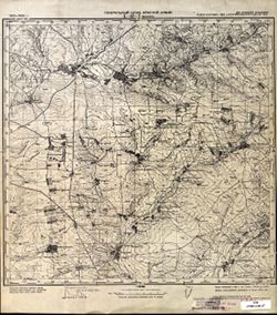
- Description:
- 1902
- Subject:
- Geographic Subject: Dyakove, Topical Subject: Maps, Topical Subject: Soviet Union, and Geographic Subject: Luhansk
- Publisher:
- Генеральный штаб Красной Армии
- Language:
- Russian
- Date Created:
- 1941
- Identifier:
- VAC9619-001993
- Genre:
- Topographic Maps and Military Maps
- Geographic Location:
- Coordinates: 47.6667, 39, 48, 39.5
- Related URL:
- Catalog URL: https://iucat.iu.edu/catalog/5020129 and Download GeoTIFF: https://drive.google.com/open?id=1sq_QopHU0Yotfn_WLpGDPw_5Td4Y2ko5
- Abstract:
- Modern area represented: Dyakove, Luhansk, Ukraine
- Call Number:
- G7000 s100 .S7 sheet L-37-7
- Caption:
- Для служебного пользования
- City:
- Дьяково (Diakovo)
- Copyright Holder:
- No Copyright - United States
- Country:
- СССР (USSR)
- State/Province:
- Украинская ССР (Ukrainian Soviet Socialist Republic), Ростовская область (Rostov oblast), РСФСР (RSFSR), and Ворошиловградская область (Voroshilovgrad oblast)
- Physical Description:
- Scale: 1:100,000
- Persistent URL:
- http://purl.dlib.indiana.edu/iudl/images/VAC9619/VAC9619-001993
- Provenance:
- CIA Map Library
-
- Description:
- 1939
- Subject:
- Geographic Subject: Rostov, Geographic Subject: Kuybyshevo, Topical Subject: Soviet Union, and Topical Subject: Maps
- Publisher:
- Генеральный штаб Красной Армии
- Language:
- Russian
- Date Created:
- 1941
- Identifier:
- VAC9619-001992
- Genre:
- Topographic Maps and Military Maps
- Geographic Location:
- Coordinates: 47.6667, 38.5, 48, 39
- Related URL:
- Catalog URL: https://iucat.iu.edu/catalog/5020129 and Download GeoTIFF: https://drive.google.com/open?id=1BEDbT8LJBcGKTIxNNAWxHLz71wfCVjwA
- Abstract:
- Modern area represented: Куйбышево (Kuybyshevo), Rostov, Russia
- Call Number:
- G7000 s100 .S7 sheet L-37-6
- Caption:
- Для cлужебного пользования
- City:
- Куйбышево (Kuĭbyshevo)
- Copyright Holder:
- No Copyright - United States
- Country:
- СССР (USSR)
- State/Province:
- Ворошиловградская область (Voroshilovgrad oblast) and Украинская ССР (Ukrainian Soviet Socialist Republic)
- Physical Description:
- Scale: 1:100,000
- Persistent URL:
- http://purl.dlib.indiana.edu/iudl/images/VAC9619/VAC9619-001992
- Provenance:
- DMA Topographic Center
-
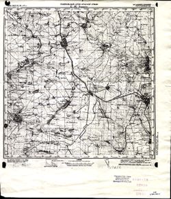
- Description:
- 1895
- Subject:
- Geographic Subject: Ilovays'k, Topical Subject: Soviet Union, and Topical Subject: Maps
- Publisher:
- Генеральный штаб Красной Армии
- Language:
- Russian
- Date Created:
- 1941
- Identifier:
- VAC9619-001991
- Genre:
- Military Maps and Topographic Maps
- Geographic Location:
- Coordinates: 47.6667, 38, 48, 38.5
- Related URL:
- Download GeoTIFF: https://drive.google.com/open?id=1kH7oS86WKdYFUSnKJLcOrEqzxFAZpxdS and Catalog URL: https://iucat.iu.edu/catalog/5020129
- Abstract:
- Modern area represented: Иловайск (Ilovays'k), Ukraine
- Call Number:
- G7000 s100 .S7 sheet L-37-5
- Caption:
- Для cлужебного пользования
- City:
- Иловайск (Ilovaĭsk)
- Copyright Holder:
- No Copyright - United States
- Country:
- СССР (USSR)
- State/Province:
- Украинская ССР (Ukrainian Soviet Socialist Republic) and Сталинская область (Stalino oblast)
- Physical Description:
- Scale: 1:100,000
- Persistent URL:
- http://purl.dlib.indiana.edu/iudl/images/VAC9619/VAC9619-001991
- Provenance:
- CIA Map Library
-
- Description:
- 1928
- Subject:
- Topical Subject: Soviet Union, Topical Subject: Maps, Geographic Subject: Donetsk oblast, and Geographic Subject: Konstantinovka
- Publisher:
- Генеральный штаб Красной Армии
- Language:
- Russian
- Date Created:
- 1941
- Identifier:
- VAC9619-001971
- Genre:
- Military Maps and Topographic Maps
- Geographic Location:
- Coordinates: 47.6667, 37, 48, 37.5
- Related URL:
- Download GeoTIFF: https://drive.google.com/open?id=1B3Wc8M8AC0QfOl6X9QeEYxSF33PO27MZ and Catalog URL: https://iucat.iu.edu/catalog/5020129
- Abstract:
- Modern area represented: Константиновка (Konstantinovka), Donetsk oblast, Ukraine
- Call Number:
- G7000 s100 .S7 sheet L-37-3
- Caption:
- Для служебного пользования
- City:
- Константиновка (Konstantinovka)
- Copyright Holder:
- No Copyright - United States
- Country:
- СССР (USSR)
- State/Province:
- Украинская ССР (Ukrainian Soviet Socialist Republic)
- Physical Description:
- Scale: 1:100,000
- Persistent URL:
- http://purl.dlib.indiana.edu/iudl/images/VAC9619/VAC9619-001971
- Provenance:
- DMA Topographic Center, OMAHA
-

- Description:
- 1903
- Subject:
- Geographic Subject: Dzhankoi, Topical Subject: Soviet Union, Topical Subject: Maps, and Geographic Subject: Republic of Crimea
- Publisher:
- Генеральный штаб Красной Армии
- Language:
- Russian
- Date Created:
- 1941
- Identifier:
- VAC9619-001944
- Genre:
- Military Maps and Topographic Maps
- Geographic Location:
- Coordinates: 45.6667, 34, 46, 34.5
- Related URL:
- Download GeoTIFF: https://drive.google.com/file/d/1IYgb5gSCs_Mlieru0V4EbduHgPq3hkzr/view?usp=sharing and Catalog URL: https://iucat.iu.edu/catalog/5020129
- Abstract:
- Modern area represented: Джанкой (Dzhankoi), Republic of Crimea, Ukraine
- Call Number:
- G7000 s100 .S7 sheet L-36-81
- Caption:
- Для cлужебного пользования
- City:
- Джанкой (Dzhankoi)
- Copyright Holder:
- No Copyright - United States
- Country:
- СССР (USSR)
- State/Province:
- Украинская ССР (Ukrainian Soviet Socialist Republic), РСФСР (RSFSR), and Крымская АССР (Crimean Autonomous Soviet Socialist Republic)
- Physical Description:
- Scale: 1:100,000
- Persistent URL:
- http://purl.dlib.indiana.edu/iudl/images/VAC9619/VAC9619-001944
- Provenance:
- DMA Topographic Center
-
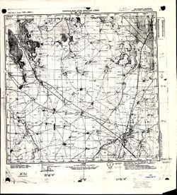
- Description:
- 1903
- Subject:
- Geographic Subject: Dzhankoi, Topical Subject: Soviet Union, and Topical Subject: Maps
- Publisher:
- Генеральный штаб Красной Армии
- Language:
- Russian
- Date Created:
- 1941
- Identifier:
- VAC9619-001943
- Genre:
- Topographic Maps and Military Maps
- Geographic Location:
- Coordinates: 45.6667, 34, 46, 34.5
- Related URL:
- Download GeoTIFF: https://drive.google.com/open?id=1Uezem1DTHm_K_ar57W6lultAdVkJlsj1 and Catalog URL: https://iucat.iu.edu/catalog/5020129
- Abstract:
- Modern area represented: Dzhankoi, Republic of Crimea, Ukraine
- Call Number:
- G7000 s100 .S7 sheet L-36-81
- Caption:
- Для cлужебного пользования
- City:
- Джанкой (Dzhankoi)
- Copyright Holder:
- No Copyright - United States
- Country:
- СССР (USSR)
- State/Province:
- Крымская АССР (Crimean Autonomous Soviet Socialist Republic), РСФСР (RSFSR), and Украинская ССР (Ukrainian Soviet Socialist Republic)
- Physical Description:
- Scale: 1:100,000
- Persistent URL:
- http://purl.dlib.indiana.edu/iudl/images/VAC9619/VAC9619-001943
- Provenance:
- G000-30
