
Search Constraints
You searched for:
Provenance
DMA Topographic Center, Army Map Service Library
Remove constraint Provenance: DMA Topographic Center, Army Map Service Library
Search Results
-
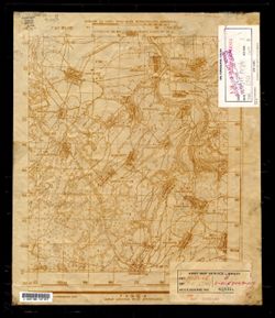
- Description:
- 1941
- Subject:
- Topical Subject: Maps, Topical Subject: Soviet Union, and Geographic Subject: Chernyshkovskiy
- Publisher:
- Генеральный штаб Красной Армии
- Language:
- Russian
- Identifier:
- VAC9619-003433
- Genre:
- Military Maps and Topographic Maps
- Geographic Location:
- Coordinates: 48.333, 42, 48.667, 42.5
- Related URL:
- Catalog URL: https://iucat.iu.edu/catalog/5020129 and Download GeoTIFF: https://drive.google.com/file/d/1mIYG4N1AfOOgcmXUO24aiWkckSo1dF9N/view?usp=sharing
- Abstract:
- Modern area represented: Chernyshkovskiy, Volgograd oblast, Russia
- Call Number:
- G7000 s100 .S7 sheet M-38-121
- Caption:
- Для служебного пользования
- City:
- Чернышковский (Chernyshkovskiy)
- Copyright Holder:
- No Copyright - United States
- Country:
- СССР (USSR)
- State/Province:
- РСФСР (RSFSR), Сталинградская область (Stalingrad oblast), and Ростовская область (Rostov oblast)
- Physical Description:
- Scale: 1:100,000
- Persistent URL:
- http://purl.dlib.indiana.edu/iudl/images/VAC9619/VAC9619-003433
- Provenance:
- DMA Topographic Center, Army Map Service Library
-
- Description:
- 1941
- Subject:
- Geographic Subject: Leninsk, Topical Subject: Maps, and Topical Subject: Soviet Union
- Publisher:
- Генеральный штаб Красной Армии
- Language:
- Russian
- Identifier:
- VAC9619-003431
- Genre:
- Military Maps and Topographic Maps
- Geographic Location:
- Coordinates: 48.667, 45, 49, 45.5
- Related URL:
- Download GeoTIFF: https://drive.google.com/file/d/14EYfkdULRIlxvozjlAms3exjHySNtHr5/view?usp=sharing and Catalog URL: https://iucat.iu.edu/catalog/5020129
- Abstract:
- Modern area represented: Leninsk, Volgograd oblast, Russia
- Call Number:
- G7000 s100 .S7 sheet M-38-115
- Caption:
- Для служебного пользования
- City:
- Ленинск (Leninsk)
- Copyright Holder:
- No Copyright - United States
- Country:
- СССР (USSR)
- State/Province:
- РСФСР (RSFSR) and Сталинградская область (Stalingrad oblast)
- Physical Description:
- Scale: 1:100,000
- Persistent URL:
- http://purl.dlib.indiana.edu/iudl/images/VAC9619/VAC9619-003431
- Provenance:
- DMA Topographic Center, Army Map Service Library
-
- Description:
- 1937
- Subject:
- Geographic Subject: Volgograd, Topical Subject: Soviet Union, and Topical Subject: Maps
- Publisher:
- Генеральный штаб Красной Армии
- Language:
- Russian
- Date Created:
- 1941
- Identifier:
- VAC9619-003430
- Genre:
- Topographic Maps and Military Maps
- Geographic Location:
- Coordinates: 48.667, 44.5, 49, 45
- Related URL:
- Download GeoTIFF: https://drive.google.com/file/d/1pSushqCujGGi2k5j2BUnaiJxaMU1GnZa/view?usp=sharing and Catalog URL: https://iucat.iu.edu/catalog/5020129
- Abstract:
- Modern area represented: Volgograd, Volgograd oblast, Russia
- Call Number:
- G7000 s100 .S7 sheet M-38-114
- Caption:
- Секретно
- City:
- Сталинград (Stalingrad)
- Copyright Holder:
- No Copyright - United States
- Country:
- СССР (USSR)
- State/Province:
- РСФСР (RSFSR) and Сталинградская область (Stalingrad oblast)
- Physical Description:
- Scale: 1:100,000
- Persistent URL:
- http://purl.dlib.indiana.edu/iudl/images/VAC9619/VAC9619-003430
- Provenance:
- DMA Topographic Center, Army Map Service Library
-
- Description:
- 1939
- Subject:
- Geographic Subject: Kalach-Kurtlak, Topical Subject: Maps, and Topical Subject: Soviet Union
- Publisher:
- Генеральный штаб Красной Армии
- Language:
- Russian
- Date Created:
- 1941
- Identifier:
- VAC9619-003425
- Genre:
- Topographic Maps and Military Maps
- Geographic Location:
- Coordinates: 48.667, 42, 49, 42.5
- Related URL:
- Catalog URL: https://iucat.iu.edu/catalog/5020129 and Download GeoTIFF: https://drive.google.com/file/d/1LhwC-Jpz1ffc5h6r3428J5_sXuupOlRT/view?usp=sharing
- Abstract:
- Modern area represented: Kalach-Kurtlak, Rostov oblast, Russia
- Call Number:
- G7000 s100 .S7 sheet M-38-109
- Caption:
- Для служебного пользования
- City:
- Калач-Куртлак (Kalach-Kurtlak)
- Copyright Holder:
- No Copyright - United States
- Country:
- СССР (USSR)
- State/Province:
- Ростовская область (Rostov oblast), Сталинградская область (Stalingrad oblast), and РСФСР (RSFSR)
- Physical Description:
- Scale: 1:100,000
- Persistent URL:
- http://purl.dlib.indiana.edu/iudl/images/VAC9619/VAC9619-003425
- Provenance:
- DMA Topographic Center, Army Map Service Library
-
- Description:
- 1886
- Subject:
- Topical Subject: Soviet Union, Geographic Subject: Slashchevskaya, and Topical Subject: Maps
- Publisher:
- Генеральный штаб Красной Армии
- Language:
- Russian
- Date Created:
- 1941
- Identifier:
- VAC9619-003410
- Genre:
- Topographic Maps and Military Maps
- Geographic Location:
- Coordinates: 49.667, 42, 50, 42.5
- Related URL:
- Download GeoTIFF: https://drive.google.com/file/d/1MtCqnUt9UAghcR0eExtQ1pfzlaSMZb-g/view?usp=sharing and Catalog URL: https://iucat.iu.edu/catalog/5020129
- Abstract:
- Modern area represented: Slashchevskaya, Volgograd oblast, Russia
- Call Number:
- G7000 s100 .S7 sheet M-38-73
- Caption:
- Для служебного пользования
- City:
- Слащевская (Slashchevskaya)
- Copyright Holder:
- No Copyright - United States
- Country:
- СССР (USSR)
- State/Province:
- Ростовская область (Rostov oblast), Сталинградская область (Stalingrad oblast), and РСФСР (RSFSR)
- Physical Description:
- Scale: 1:100,000
- Persistent URL:
- http://purl.dlib.indiana.edu/iudl/images/VAC9619/VAC9619-003410
- Provenance:
- DMA Topographic Center, Army Map Service Library
-
- Description:
- 1907
- Subject:
- Geographic Subject: Kamensk-Shakhtinskiy, Topical Subject: Soviet Union, and Topical Subject: Maps
- Publisher:
- Генеральный штаб Красной Армии
- Language:
- Russian
- Date Created:
- 1941
- Identifier:
- VAC9619-003406
- Genre:
- Military Maps and Topographic Maps
- Geographic Location:
- Coordinates: 48, 40, 48.333, 40.5
- Related URL:
- Catalog URL: https://iucat.iu.edu/catalog/5020129 and Download GeoTIFF: https://drive.google.com/file/d/1n2jN8aP5eSGKDTcV11KUHk6Jyp717mkK/view?usp=sharing
- Abstract:
- Modern area represented: Kamensk-Shakhtinskiy, Rostov oblast, Russia
- Call Number:
- G7000 s100 .S7 sheet M-37-141
- Caption:
- Для служебного пользования
- City:
- Каменск (Kamensk)
- Copyright Holder:
- No Copyright - United States
- Country:
- СССР (USSR)
- State/Province:
- Ростовская область (Rostov oblast), РСФСР (RSFSR), Ворошиловградская область (Voroshilovgrad oblast), and Украинская ССР (Ukrainian Soviet Socialist Republic)
- Physical Description:
- Scale: 1:100,000
- Persistent URL:
- http://purl.dlib.indiana.edu/iudl/images/VAC9619/VAC9619-003406
- Provenance:
- DMA Topographic Center, Army Map Service Library
-
- Description:
- 1930
- Subject:
- Geographic Subject: Rovenki, Topical Subject: Soviet Union, and Topical Subject: Maps
- Publisher:
- Генеральный штаб Красной Армии
- Language:
- Russian
- Date Created:
- 1941
- Identifier:
- VAC9619-003405
- Genre:
- Military Maps and Topographic Maps
- Geographic Location:
- Coordinates: 48, 39, 48.333, 39.5
- Related URL:
- Catalog URL: https://iucat.iu.edu/catalog/5020129 and Download GeoTIFF: https://drive.google.com/file/d/1OQqFM3__QT6U6Fqh4eB268pIXvLpWpIX/view?usp=sharing
- Abstract:
- Modern area represented: Rovenki, Luhansk oblast, Ukraine
- Call Number:
- G7000 s100 .S7 sheet M-37-139
- Caption:
- Для служебного пользования
- City:
- Ровеньки (Rovenki)
- Copyright Holder:
- No Copyright - United States
- Country:
- СССР (USSR)
- State/Province:
- Украинская ССР (Ukrainian Soviet Socialist Republic) and Ворошиловградская область (Voroshilovgrad oblast)
- Physical Description:
- Scale: 1:100,000
- Persistent URL:
- http://purl.dlib.indiana.edu/iudl/images/VAC9619/VAC9619-003405
- Provenance:
- DMA Topographic Center, Army Map Service Library
-
- Description:
- 1931
- Subject:
- Topical Subject: Maps, Geographic Subject: Lubny, and Topical Subject: Soviet Union
- Publisher:
- Генеральный штаб Красной Армии
- Language:
- Russian
- Date Created:
- 1941
- Identifier:
- VAC9619-003296
- Genre:
- Topographic Maps and Military Maps
- Geographic Location:
- Coordinates: 50, 33, 50.333, 33.5
- Related URL:
- Catalog URL: https://iucat.iu.edu/catalog/5020129 and Download GeoTIFF: https://drive.google.com/file/d/1aCmmT142IH6eTopGWA96mJuxqrZheVAF/view?usp=sharing
- Abstract:
- Modern area represented: Lubny, Poltava oblast, Ukraine
- Call Number:
- G7000 s100 .S7 sheet M-36-67
- City:
- Лубны (Lubny)
- Copyright Holder:
- No Copyright - United States
- Country:
- СССР (USSR)
- State/Province:
- Полтавская область (Poltava oblast) and Украинская ССР (Ukrainian Soviet Socialist Republic)
- Physical Description:
- Scale: 1:100,000
- Persistent URL:
- http://purl.dlib.indiana.edu/iudl/images/VAC9619/VAC9619-003296
- Provenance:
- DMA Topographic Center, Army Map Service Library
-
- Subject:
- Topical Subject: Maps, Geographic Subject: Hrebinka, and Topical Subject: Soviet Union
- Publisher:
- Генеральный штаб Красной Армии
- Language:
- Russian
- Identifier:
- VAC9619-003294
- Genre:
- Military Maps and Topographic Maps
- Geographic Location:
- Coordinates: 50, 32, 50.5, 32.5
- Related URL:
- Catalog URL: https://iucat.iu.edu/catalog/5020129 and Download GeoTIFF: https://drive.google.com/file/d/1o_CCKouW8G2bUf6ptlUF8Am6lslsladg/view?usp=sharing
- Abstract:
- Modern area represented: Hrebinka, Poltava oblast, Ukraine
- Call Number:
- G7000 s100 .S7 sheet M-36-65
- City:
- Гребенка (Hrebinka)
- Copyright Holder:
- No Copyright - United States
- Country:
- СССР (USSR)
- State/Province:
- Полтавская область (Poltava oblast) and Украинская ССР (Ukrainian Soviet Socialist Republic)
- Physical Description:
- Scale: 1:100,000
- Persistent URL:
- http://purl.dlib.indiana.edu/iudl/images/VAC9619/VAC9619-003294
- Provenance:
- DMA Topographic Center, Army Map Service Library
-
- Description:
- 1928
- Subject:
- Topical Subject: Maps, Topical Subject: Soviet Union, and Geographic Subject: Ichnya
- Publisher:
- Генеральный штаб Красной Армии
- Language:
- Russian
- Date Created:
- 1941
- Identifier:
- VAC9619-003283
- Genre:
- Topographic Maps and Military Maps
- Geographic Location:
- Coordinates: 50.667, 32, 51, 32.5
- Related URL:
- Catalog URL: https://iucat.iu.edu/catalog/5020129 and Download GeoTIFF: https://drive.google.com/file/d/1Ac29ODFpGjgWmzV6weqS5xHNFSvVVWYm/view?usp=sharing
- Abstract:
- Modern area represented: Ichnya, Chernihiv oblast, Ukraine
- Call Number:
- G7000 s100 .S7 sheet M-36-41
- City:
- Ичня (Ichnya)
- Copyright Holder:
- No Copyright - United States
- Country:
- СССР (USSR)
- State/Province:
- Украинская ССР (Ukrainian Soviet Socialist Republic) and Черниговская область (Chernihiv oblast)
- Physical Description:
- Scale: 1:100,000
- Persistent URL:
- http://purl.dlib.indiana.edu/iudl/images/VAC9619/VAC9619-003283
- Provenance:
- DMA Topographic Center, Army Map Service Library
