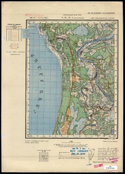
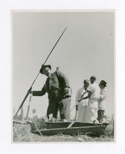
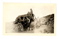
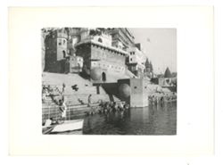
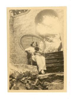
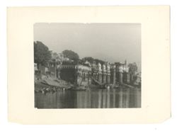
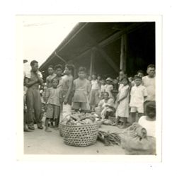
Ganges River (India and Bangladesh) and Ghats (Architecture)
Date Created:
1930
Identifier:
VAD9735-000719
Abstract:
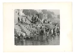
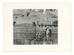
Photograph of people on steps of a Ghat in Varanasi leading into the Ganges. Some are sitting or standing on the steps and some are wading in the river.
Topical: Flowers, Topical: Angels, and Topical: Graves
Series:
Groups
Creator:
Montgomery, Pauline
Date Created:
1930
Identifier:
VAE0886-000712
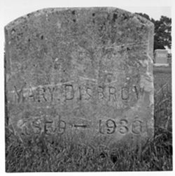
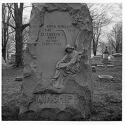
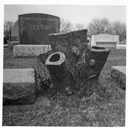
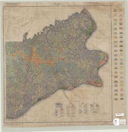
Geographic Location:
Rushville cemetery
Caption:
Personal Name, Age/Gender: Winship, Amos, 68/M, Death Date: 1930, Personal Name, Age/Gender: Winship, Elizabeth J. Hunt, 81/F, Ledger Page/ Entry Number: 63/...
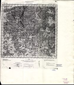
Geographic Subject: Switzerland County (Ind.), Topical Subject: Classification, Geographic Subject: Ohio County (Ind.), and Topical Subject: Soils
Creator:
Hendrickson, B. H. (Bertram Higbie), 1892-
Publisher:
United States. Bureau of Soils
Date Created:
1930
Identifier:
VAC3073-M-00959
Genre:
Thematic maps
Geographic Location:
Coordinates: W0851200 W0844700 N0390200 N0384200
Related URL:
Catalog URL: https://iucat.iu.edu/catalog/2873819
Abstract:
Shows soil types classification by colors and symbols. "Field Operations, Bureau of Chemistry and Soils, 1930." "Lith Eastern Offset Inc., Bal...
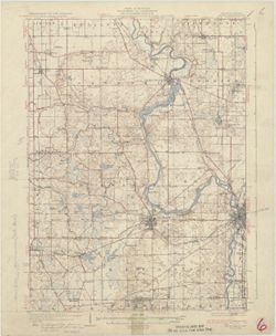
Geographic Subject: Berrien County (Mich.) and Geographic Subject: Saint Joseph County (Ind.)
Creator:
Gehres, W. S. (Wilmer Sherman), 1887-1963, Geological Survey (U.S.), Plushnick, A. W. (Andrew Winfield), 1898-1980, U.S. Lake Survey, Michigan. Geological Su...
Publisher:
Geological Survey (U.S.)
Date Created:
1930
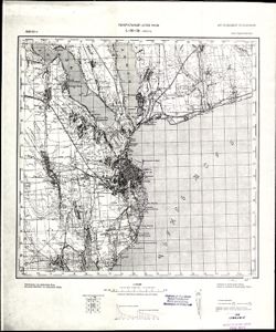
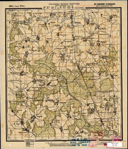
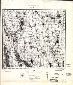
Identifier:
VAC3073-M-01363
Genre:
15 minute topographic maps, Quadrangle maps, and Topographic maps
Topography by W.S. Gehres and A.W. Plushnick. Filing title: Niles, Mich.-Ind. Edition of 1930. Polyconic projection. Relief shown by contours and spot height...
Call Number:
G4090 s62 .G4 Niles 1930
Caption:
Imprint: Washington, D.C. : Dept. of the Interior, U.S. Geological Survey, 1930
Physical Description:
Dimensions: 45 x 42 cm or smaller and Scale: 1:62,500
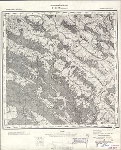
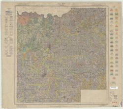
Geographic Subject: Dubois County (Ind.), Topical Subject: Soils, and Topical Subject: Classification
Creator:
Simmons, C. S. (Charles Shaffer), 1900-
Publisher:
United States. Bureau of Chemistry and Soils
Date Created:
1930
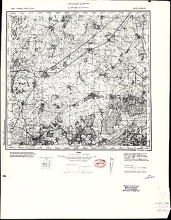
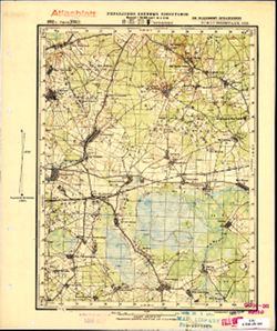
Identifier:
VAC3073-M-00729
Genre:
Thematic maps
Geographic Location:
Coordinates: W0870400 W0864100 N0383200 N0381200
Related URL:
Catalog URL: https://iucat.iu.edu/catalog/2867189
Abstract:
Shows soil types classification by colors and symbols. "Field operations Bureau of Chemistry and Soils 1930. "Williams & Heintz Co. Wash. D.C.&...
Call Number:
G4093 .D8J3 1930 .S56
Caption:
Imprint: [Washington, D.C.] : Bureau of Soils, 1930?
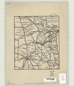
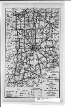
Caption title: Sub-district & road section map. Shows roads by surface and composition type as well as official highway markers, boundaries and headquart...
Call Number:
G4091.P2 1929 .I5
Caption:
Imprint: [Indianapolis] : [Wm. B. Burford, contractor for state printing and binding], [1930] and Imprint: [Indianapolis] : [The Legislative Bureau], [1930]
Physical Description:
Scale: Approximately 1:1,370,000 and Dimensions: 38 x 23 cm, on sheet 43 x 26 cm
Alternate Identifier:
Alternate ID: 397754IP and Title Control Number: a18455618
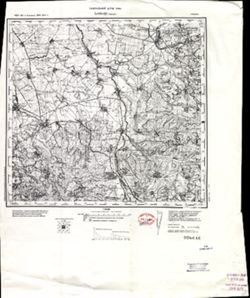
Geographic Subject: Saint Joseph County (Ind.), Geographic Subject: Berrien County (Mich.), and Geographic Subject: LaPorte County (Ind.)
Creator:
Geological Survey (U.S.), Michigan. Geological Survey Division, Plushnick, A. W. (Andrew Winfield), 1898-1980, Gehres, W. S. (Wilmer Sherman), 1887-1963, and...
Publisher:
Geological Survey (U.S.)
Date Created:
1930
Identifier:
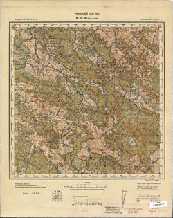
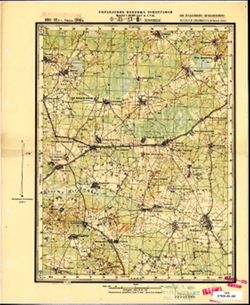
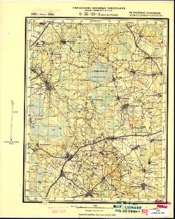
VAC3073-M-01395
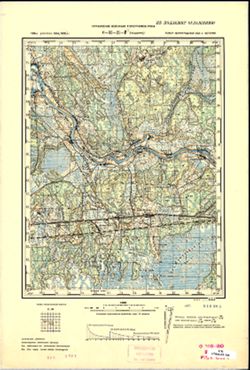
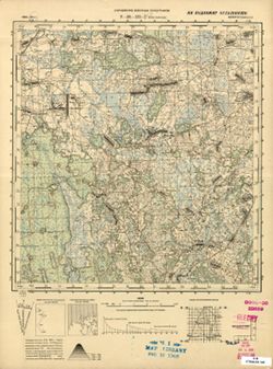
Genre:
Topographic maps, 15 minute topographic maps, and Quadrangle maps
Topography by W.S. Gehres and A.W. Plushnick , culture and drainage in part compiled from aerial photographs taken by Air Corps, U.S. Army , control by U.S. ...
Call Number:
G4090 s62 .G4 Three Oaks 1930
Caption:
Imprint: Washington, D.C. : U.S. Geological Survey, [1930]
Physical Description:
Scale: 1:62,500 and Dimensions: 45 x 42 cm or smaller


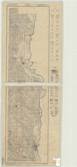
![Michigan-Indiana Three Oaks quadrangle [1930 printing]](https://iiif.uits.iu.edu/iiif/2/s1785q22x%2Ffiles%2Fdf050288-4fd9-4056-bb9e-e2b44d32511e/full/250,/0/default.jpg)