
Search Constraints
You searched for:
Collections
Russian Military Topographic Map Collection
Remove constraint Collections: Russian Military Topographic Map Collection
« Previous |
1 - 100 of 4,131
|
Next »
Search Results
-
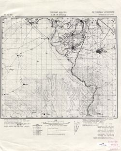
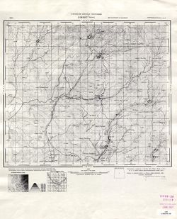
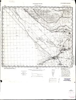
- Description:
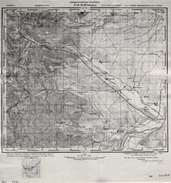
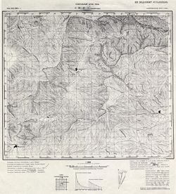
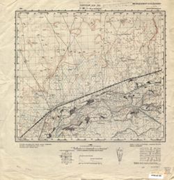
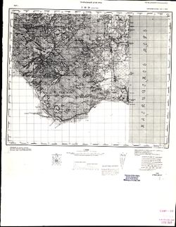
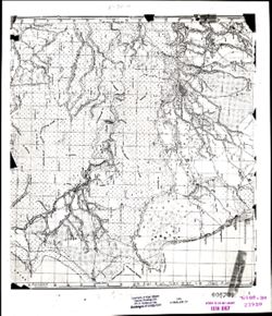
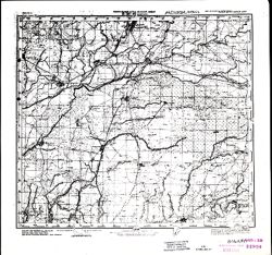
- 1912
- Subject:
- Topical Subject: Soviet Union, Topical Subject: Maps, and Geographic Subject: Maku
- Publisher:
- Генеральный штаб Красной Армии
- Language:
- Russian
- Date Created:
- 1941
- Identifier:
- VAC9619-000117
- Genre:
- Military Maps and Topographic Maps
- Geographic Location:
- Coordinates: 39, 44.5, 39.3333, 45
- Related URL:
- Catalog URL: https://iucat.iu.edu/catalog/5020129 and Download GeoTIFF: https://drive.google.com/open?id=1yxUNfH1eBFr_XPjkGSrP0UxUjoeZAI1s
- Abstract:
- Modern area represented: Maku, West Azerbaijan province, Iran
- Call Number:
- G7000 s100 .S7 sheet J-38-30
- Caption:
- Для служебного пользования
- City:
- Маку (Maku)
- Copyright Holder:
- No Copyright - United States
- Country:
- Иран (Iran)
- Physical Description:
- Scale: 1:100,000
- Persistent URL:
- http://purl.dlib.indiana.edu/iudl/images/VAC9619/VAC9619-000117
- Provenance:
- DMA Topographic Center, Army Map Service Library, OMAHA, Library of Congress Geography & Map Division
-
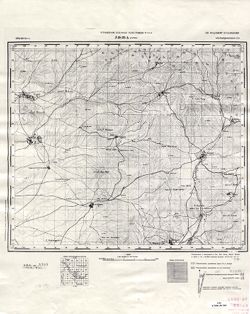
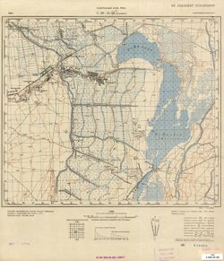
- Description:
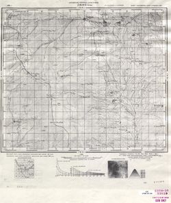
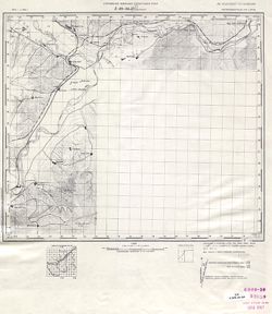
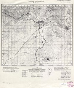
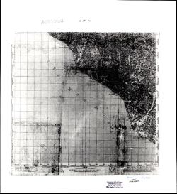
- 1911
- Subject:
- Topical Subject: Maps, Geographic Subject: Nakhichivan, and Topical Subject: Soviet Union
- Publisher:
- Генеральный штаб Красной Армии
- Language:
- Russian
- Date Created:
- 1941
- Identifier:
- VAC9619-000168
- Genre:
- Topographic Maps and Military Maps
- Geographic Location:
- Coordinates: 39, 45, 39.3333, 45.5
- Related URL:
- Download GeoTIFF: https://drive.google.com/open?id=1h5_S_6_AlNlCJetMeL_sUoTO5Fdurz2q and Catalog URL: https://iucat.iu.edu/catalog/5020129
- Abstract:
- Modern area represented: Nakhichivan, Nakhchivan autonomous republic, Azerbaijan
- Call Number:
- G7000 s100 .S7 sheet J-38-31
- Caption:
- Для служебного пользования
- City:
- Нахичевань (Nakhichivan)
- Copyright Holder:
- No Copyright - United States
- Country:
- Иран (Iran)
- State/Province:
- Нахичеванская АССР (Nakhichevan Autonomous Soviet Socialist Republic)
- Physical Description:
- Scale: 1:100,000
- Persistent URL:
- http://purl.dlib.indiana.edu/iudl/images/VAC9619/VAC9619-000168
- Provenance:
- Army Map Service Library, Library of Congress G & M Division, Geographic Names Branch
-
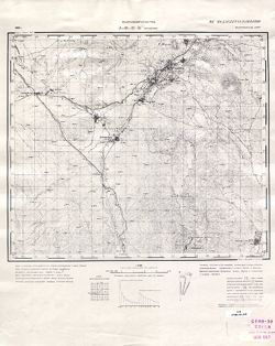
- Description:
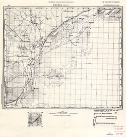
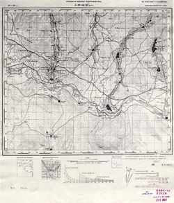
- 1912
- Subject:
- Topical Subject: Soviet Union, Geographic Subject: Böyükdüz, and Topical Subject: Maps
- Publisher:
- Генеральный штаб РККА
- Language:
- Russian
- Identifier:
- VAC9619-000074
- Genre:
- Topographic Maps and Military Maps
- Geographic Location:
- Coordinates: 39.1667, 45, 39.3333, 45.25
- Related URL:
- Download GeoTIFF: https://drive.google.com/open?id=1ZYQg7jF8MTAsf_2CU4Y1WLDyv2ZaewcX and Catalog URL: http://iucat.iu.edu/catalog/5020131
- Abstract:
- Modern area represented: Böyükdüz, Azerbaijan
- Call Number:
- G7000 s50 .S68 sheet J-38-31-A
- Caption:
- Не подлежит оглашению
- City:
- Беюк-Дюз (Beyuk-Dyuz)
- Copyright Holder:
- No Copyright - United States
- Country:
- Иран (Iran) and СССР (USSR)
- State/Province:
- Нахичеванская АССР (Nakhichevan Autonomous Soviet Socialist Republic)
- Physical Description:
- Scale: 1:50,000
- Persistent URL:
- http://purl.dlib.indiana.edu/iudl/images/VAC9619/VAC9619-000074
- Provenance:
- CIA Map Library
-
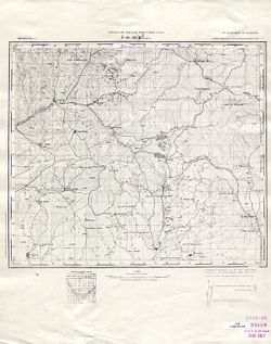
- Description:
- 1939
- Subject:
- Topical Subject: Maps, Geographic Subject: Naxçıvan, and Topical Subject: Soviet Union
- Publisher:
- Генеральный штаб РККА
- Language:
- Russian
- Date Created:
- 1940
- Identifier:
- VAC9619-000075
- Genre:
- Topographic Maps and Military Maps
- Geographic Location:
- Coordinates: 39.1667, 45.25, 39.3333, 45.5
- Related URL:
- Download GeoTIFF: https://drive.google.com/open?id=1WFbUP-xCIugjZ6sjO9PseZPZVj0V0Bno and Catalog URL: http://iucat.iu.edu/catalog/5020131
- Abstract:
- Modern area represented: Naxçıvan, Azerbaijan
- Call Number:
- G7000 s50 .S68 sheet J-38-31-B
- Caption:
- Не подлежит оглашению
- City:
- Нахичевань (Nakhichevan')
- Copyright Holder:
- No Copyright - United States
- Country:
- СССР (USSR) and Иран (Iran)
- State/Province:
- Нахичеванская АССР (Nakhichevan Autonomous Soviet Socialist Republic)
- Physical Description:
- Scale: 1:50,000
- Persistent URL:
- http://purl.dlib.indiana.edu/iudl/images/VAC9619/VAC9619-000075
- Provenance:
- CIA Map Library
-
- Subject:
- Geographic Subject: Nehrəm, Topical Subject: Maps, and Topical Subject: Soviet Union
- Publisher:
- Генеральный штаб РККА
- Language:
- Russian
- Date Created:
- 1940
- Identifier:
- VAC9619-000076
- Genre:
- Military Maps and Topographic Maps
- Geographic Location:
- Coordinates: 39, 45.25, 39.1667, 45.5
- Related URL:
- Download GeoTIFF: https://drive.google.com/open?id=1mM1VIpCbqqPPt0FAbm9talybksIlvehj and Catalog URL: http://iucat.iu.edu/catalog/5020131
- Abstract:
- Modern area represented: Nehrəm, Azerbaijan
- Call Number:
- G7000 s50 .S68 sheet J-38-31-D
- Caption:
- Не подлежит оглашению
- City:
- Неграм (Negram)
- Copyright Holder:
- No Copyright - United States
- Country:
- Иран (Iran) and СССР (USSR)
- State/Province:
- Нахичеванская АССР (Nakhichevan Autonomous Soviet Socialist Republic)
- Physical Description:
- Scale: 1:50,000
- Persistent URL:
- http://purl.dlib.indiana.edu/iudl/images/VAC9619/VAC9619-000076
- Provenance:
- CIA Map Library
-
- Subject:
- Topical Subject: Soviet Union, Topical Subject: Maps, and Geographic Subject: Sirab
- Publisher:
- Управление военных топографов РККА
- Language:
- Russian
- Identifier:
- VAC9619-000077
- Genre:
- Topographic Maps and Military Maps
- Geographic Location:
- Coordinates: 39.1667, 45.5, 39.3333, 45.75
- Related URL:
- Download GeoTIFF: https://drive.google.com/open?id=15hwIGJ3gQzXM_cV0XkmnN_x1jSKGC5uC and Catalog URL: http://iucat.iu.edu/catalog/5020131
- Abstract:
- Modern area represented: Sirab, Azerbaijan
- Call Number:
- G7000 s50 .S68 sheet J-38-32-A
- Caption:
- Не подлежит оглашению
- City:
- Сураб (Surab)
- Copyright Holder:
- No Copyright - United States
- Country:
- СССР (USSR)
- State/Province:
- Азербайджанская ССР (Azerbaijan Soviet Socialist Republic)
- Physical Description:
- Scale: 1:50,000
- Persistent URL:
- http://purl.dlib.indiana.edu/iudl/images/VAC9619/VAC9619-000077
- Provenance:
- CIA Map Library
-
- Description:
- 1939
- Subject:
- Geographic Subject: Əbrəqunus, Topical Subject: Soviet Union, and Topical Subject: Maps
- Publisher:
- Генеральный штаб РККА
- Language:
- Russian
- Date Created:
- 1940
- Identifier:
- VAC9619-000079
- Genre:
- Military Maps and Topographic Maps
- Geographic Location:
- Coordinates: 39, 45.5, 39.1667, 45.75
- Related URL:
- Download GeoTIFF: https://drive.google.com/open?id=1998swVPJ9QtnYo-IMWGIfroqvaOTFJb9 and Catalog URL: http://iucat.iu.edu/catalog/5020131
- Abstract:
- Modern area represented: Əbrəqunus, Azerbaijan
- Call Number:
- G7000 s50 .S68 sheet J-38-32-C
- Caption:
- Не подлежит оглашению
- City:
- Абракунис
- Copyright Holder:
- No Copyright - United States
- Country:
- СССР (USSR)
- State/Province:
- Нахичеванская АССР (Nakhichevan Autonomous Soviet Socialist Republic)
- Physical Description:
- Scale: 1:50,000
- Persistent URL:
- http://purl.dlib.indiana.edu/iudl/images/VAC9619/VAC9619-000079
- Provenance:
- CIA Map Library
-
- Subject:
- Geographic Subject: Ərəfsə, Topical Subject: Maps, and Topical Subject: Soviet Union
- Publisher:
- Управление военных топографов РККА
- Language:
- Russian
- Identifier:
- VAC9619-000078
- Genre:
- Topographic Maps and Military Maps
- Geographic Location:
- Coordinates: 39.1667, 45.75, 39.3333, 46
- Related URL:
- Download GeoTIFF: https://drive.google.com/open?id=18fc-j1fb45aEoY6tgRNiF_yKJu4aahkG and Catalog URL: http://iucat.iu.edu/catalog/5020131
- Abstract:
- Modern area represented: Ərəfsə, Azerbaijan
- Call Number:
- G7000 s50 .S68 sheet J-38-32-B
- Caption:
- Не подлежит оглашению
- City:
- Арафса (Arafsa)
- Copyright Holder:
- No Copyright - United States
- Country:
- СССР (USSR)
- State/Province:
- Азербайджанская ССР (Azerbaijan Soviet Socialist Republic) and Армянская ССР (Armenian Soviet Socialist Republic)
- Physical Description:
- Scale: 1:50,000
- Persistent URL:
- http://purl.dlib.indiana.edu/iudl/images/VAC9619/VAC9619-000078
- Provenance:
- CIA Map Library
-
- Description:
- 1932
- Subject:
- Geographic Subject: Parağa, Topical Subject: Maps, and Topical Subject: Soviet Union
- Publisher:
- Управление военных топографов
- Language:
- Russian
- Identifier:
- VAC9619-000080
- Genre:
- Topographic Maps and Military Maps
- Geographic Location:
- Coordinates: 39, 45.75, 39.1667, 46
- Related URL:
- Catalog URL: http://iucat.iu.edu/catalog/5020131 and Download GeoTIFF: https://drive.google.com/open?id=1_dB1bPeQH9Zf-uzfcR-m8BdAhfRFR2y9
- Abstract:
- Modern area represented: Parağa, Azerbaijan
- Call Number:
- G7000 s50 .S68 sheet J-38-32-D
- Caption:
- Не подлежит оглашению
- City:
- Парага (Paraga)
- Copyright Holder:
- No Copyright - United States
- Country:
- СССР (USSR)
- State/Province:
- Азербайджанская ССР (Azerbaijan Soviet Socialist Republic)
- Physical Description:
- Scale: 1:50,000
- Persistent URL:
- http://purl.dlib.indiana.edu/iudl/images/VAC9619/VAC9619-000080
- Provenance:
- CIA Map Library
-
- Description:
- 1932
- Subject:
- Topical Subject: Maps, Geographic Subject: Lichk, and Topical Subject: Soviet Union
- Publisher:
- Управление военных топографов
- Language:
- Russian
- Identifier:
- VAC9619-000081
- Genre:
- Military Maps and Topographic Maps
- Geographic Location:
- Coordinates: 39, 46, 39.1667, 46.25
- Related URL:
- Download GeoTIFF: https://drive.google.com/open?id=167R19qyWdE2ihtV0R2tJxOX5sUEWSAwf and Catalog URL: http://iucat.iu.edu/catalog/5020131
- Abstract:
- Modern area represented: Lichk, Armenia
- Call Number:
- G7000 s50 .S68 sheet J-38-33-C
- Caption:
- Не подлежит оглашению
- City:
- Личик (Lichik)
- Copyright Holder:
- No Copyright - United States
- Country:
- СССР (USSR)
- State/Province:
- Армянская ССР (Armenian Soviet Socialist Republic) and Нахичеванская АССР (Nakhichevan Autonomous Soviet Socialist Republic)
- Physical Description:
- Scale: 1:50,000
- Persistent URL:
- http://purl.dlib.indiana.edu/iudl/images/VAC9619/VAC9619-000081
- Provenance:
- CIA Map Library
-
- Subject:
- Geographic Subject: Shikahogh, Topical Subject: Maps, and Topical Subject: Soviet Union
- Publisher:
- Управление военных топографов РККА
- Language:
- Russian
- Identifier:
- VAC9619-000082
- Genre:
- Topographic Maps and Military Maps
- Geographic Location:
- Coordinates: 39, 46.25, 39.1667, 46.5
- Related URL:
- Download GeoTIFF: https://drive.google.com/open?id=1OuEyyrF_IyGXnl-wlm7amjijokfiBaaW and Catalog URL: http://iucat.iu.edu/catalog/5020131
- Abstract:
- Modern area represented: Shikahogh, Armenia
- Call Number:
- G7000 s50 .S68 sheet J-38-33-D
- Caption:
- Не подлежит оглашению
- City:
- Шихауз (Shikhauz)
- Copyright Holder:
- No Copyright - United States
- Country:
- СССР (USSR)
- State/Province:
- Азербайджанская ССР (Azerbaijan Soviet Socialist Republic) and Армянская ССР (Armenian Soviet Socialist Republic)
- Physical Description:
- Scale: 1:50,000
- Persistent URL:
- http://purl.dlib.indiana.edu/iudl/images/VAC9619/VAC9619-000082
- Provenance:
- CIA Map Library
-
- Description:
- 1871
- Subject:
- Topical Subject: Soviet Union and Topical Subject: Maps
- Publisher:
- Управление военных топографов
- Language:
- Russian
- Date Created:
- 1872
- Identifier:
- VAC9619-000083
- Genre:
- Topographic Maps and Military Maps
- Geographic Location:
- Coordinates: 39.1667, 46.5, 39.3333, 46.75
- Related URL:
- Catalog URL: http://iucat.iu.edu/catalog/5020131 and Download GeoTIFF: https://drive.google.com/open?id=1c9QiLDPWvws63T1QR7Htb7w1aW7p2Nsr
- Call Number:
- G7000 s50 .S68 sheet J-38-34-A
- Caption:
- Не подлежит оглашению,Временное издание
- City:
- Ханлых (Khanlykh)
- Copyright Holder:
- No Copyright - United States
- Country:
- СССР (USSR)
- State/Province:
- Азербайджанская ССР (Azerbaijan Soviet Socialist Republic) and Армянская ССР (Armenian Soviet Socialist Republic)
- Physical Description:
- Scale: 1:50,000
- Persistent URL:
- http://purl.dlib.indiana.edu/iudl/images/VAC9619/VAC9619-000083
- Provenance:
- CIA Map Library
-
- Description:
- 1871
- Subject:
- Topical Subject: Soviet Union and Topical Subject: Maps
- Publisher:
- Управление военных топографов
- Language:
- Russian
- Date Created:
- 1933
- Identifier:
- VAC9619-000085
- Genre:
- Military Maps and Topographic Maps
- Geographic Location:
- Coordinates: 39, 46.5, 39.1667, 46.75
- Related URL:
- Catalog URL: http://iucat.iu.edu/catalog/5020131 and Download GeoTIFF: https://drive.google.com/open?id=11Y-tiJbYa2ukpMly-Z1AM7SovrCQDBd5
- Call Number:
- G7000 s50 .S68 sheet J-38-34-C
- Caption:
- Не подлежит оглашению,Временное издание
- City:
- Мирдживан (Mirdzhivan)
- Copyright Holder:
- No Copyright - United States
- Country:
- СССР (USSR) and Персия (Persia)
- State/Province:
- Армянская ССР (Armenian Soviet Socialist Republic) and Азербайджанская ССР (Azerbaijan Soviet Socialist Republic)
- Physical Description:
- Scale: 1:50,000
- Persistent URL:
- http://purl.dlib.indiana.edu/iudl/images/VAC9619/VAC9619-000085
-
- Description:
- 1875
- Subject:
- Topical Subject: Maps and Topical Subject: Soviet Union
- Publisher:
- Управление военных топографов РККА
- Language:
- Russian
- Date Created:
- 1933
- Identifier:
- VAC9619-000086
- Genre:
- Military Maps and Topographic Maps
- Geographic Location:
- Coordinates: 39, 46.75, 39.1667, 47
- Related URL:
- Catalog URL: http://iucat.iu.edu/catalog/5020131 and Download GeoTIFF: https://drive.google.com/open?id=1fZn4zrd1WgW8rpyS-hEuMNJy0gGbAdOE
- Call Number:
- G7000 s50 .S68 sheet J-38-34
- Caption:
- Не подлежит оглашению
- City:
- Шерифан (Sherifan)
- Copyright Holder:
- No Copyright - United States
- Country:
- Иран (Iran) and СССР (USSR)
- State/Province:
- Азербайджанская ССР (Azerbaijan Soviet Socialist Republic)
- Physical Description:
- Scale: 1:50,000
- Persistent URL:
- http://purl.dlib.indiana.edu/iudl/images/VAC9619/VAC9619-000086
- Provenance:
- CIA Map Library
-
- Description:
- 1872
- Subject:
- Topical Subject: Maps, Topical Subject: Soviet Union, and Geographic Subject: Kovshutlu
- Publisher:
- Управление военных топографов РККА
- Language:
- Russian
- Identifier:
- VAC9619-000087
- Genre:
- Topographic Maps and Military Maps
- Geographic Location:
- Coordinates: 39.1667, 47, 39.3333, 47.25
- Related URL:
- Download GeoTIFF: https://drive.google.com/open?id=1EU4ziheoeAfs54SUPW__rCtyqLYBsMmq and Catalog URL: http://iucat.iu.edu/catalog/5020131
- Abstract:
- Modern area represented: Kovshutlu, Azerbaijan
- Call Number:
- G7000 s50 .S68 sheet J-38-35-A
- Caption:
- Не подлежит оглашению
- City:
- Ковшутлу (Kovshutlu)
- Copyright Holder:
- No Copyright - United States
- Country:
- Иран (Iran) and СССР (USSR)
- State/Province:
- Азербайджанская ССР (Azerbaijan Soviet Socialist Republic)
- Physical Description:
- Scale: 1:50,000
- Persistent URL:
- http://purl.dlib.indiana.edu/iudl/images/VAC9619/VAC9619-000087
- Provenance:
- CIA Map Library
-

- Description:
- 1875
- Subject:
- Topical Subject: Maps and Topical Subject: Soviet Union
- Publisher:
- Управление военных топографов
- Language:
- Russian
- Identifier:
- VAC9619-000084
- Genre:
- Topographic Maps and Military Maps
- Geographic Location:
- Coordinates: 39.1667, 46.75, 39.3333, 47
- Related URL:
- Download GeoTIFF: https://drive.google.com/open?id=1D8EHmLP9nyEkneYeZUiU8Gf8mQAwOIua and Catalog URL: http://iucat.iu.edu/catalog/5020131
- Call Number:
- G7000 s50 .S68 sheet J-38-34-B
- Caption:
- Не подлежит оглашению,Временное издание
- City:
- Агалу (Agalu)
- Copyright Holder:
- No Copyright - United States
- Country:
- Персия (Persia) and СССР (USSR)
- State/Province:
- Азербайджанская ССР (Azerbaijan Soviet Socialist Republic)
- Physical Description:
- Scale: 1:50,000
- Persistent URL:
- http://purl.dlib.indiana.edu/iudl/images/VAC9619/VAC9619-000084
-

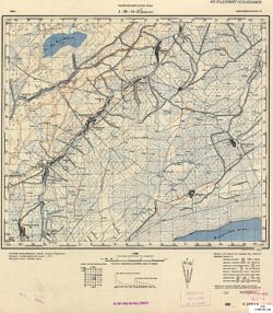
- Description:
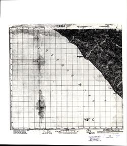
- 1912
- Subject:
- Topical Subject: Soviet Union and Topical Subject: Maps
- Publisher:
- Генеральный штаб Красной Армии
- Language:
- Russian
- Date Created:
- 1941
- Identifier:
- VAC9619-000169
- Genre:
- Topographic Maps and Military Maps
- Geographic Location:
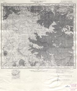
- Coordinates: 38.6667, 44.5, 39, 45
- Related URL:
- Catalog URL: https://iucat.iu.edu/catalog/5020129 and Download GeoTIFF: https://drive.google.com/file/d/1FXM5g0j66ZiEmcLy926Au1ZaXEYYVLlY/view?usp=sharing
- Call Number:
- G7000 s100 .S7 sheet J-38-42
- Caption:
- Для служебного пользования
- City:
- Хыдырлы (Khydyrly)
- Copyright Holder:
- No Copyright - United States
- Country:
- Иран (Iran)
- Physical Description:
- Scale: 1:100,000
- Persistent URL:
- http://purl.dlib.indiana.edu/iudl/images/VAC9619/VAC9619-000169
- Provenance:
- Army Map Service Library, Library of Congress G & M Division, Geographic Names Branch
-
- Description:
- 1912
- Subject:
- Topical Subject: Maps, Topical Subject: Soviet Union, and Geographic Subject: Īvowghlī
- Publisher:
- Генеральный штаб Красной Армии
- Language:
- Russian
- Date Created:
- 1941
- Identifier:
- VAC9619-001041
- Genre:
- Military Maps and Topographic Maps
- Geographic Location:
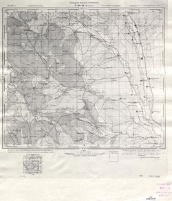
- Coordinates: 38.6667, 45, 39, 45.5
- Related URL:
- Catalog URL: https://iucat.iu.edu/catalog/5020129 and Download GeoTIFF: https://drive.google.com/open?id=1qpvW4RsmwJh6m1WiJtJXW567d8q67ACe
- Abstract:
- Modern area represented: Īvowghlī, West Azerbaijan province, Iran
- Call Number:
- G7000 s100 .S7 sheet J-38-43
- Caption:
- Для служебного пользования
- City:
- Евоглю (Evoghlu)
- Copyright Holder:
- No Copyright - United States
- Country:
- СССР (USSR) and Иран (Iran)
- State/Province:
- Нахичеванская АССР (Nakhichevan Autonomous Soviet Socialist Republic)
- Physical Description:
- Scale: 1:100,000
- Persistent URL:
- http://purl.dlib.indiana.edu/iudl/images/VAC9619/VAC9619-001041
- Provenance:
- DMA Topographic Center, Army Map Service Library, Library of Congress Geography & Map Division, OMAHA
-
- Description:
- 1912
- Subject:
- Topical Subject: Soviet Union and Topical Subject: Maps
- Publisher:
- Генеральный штаб РККА
- Language:
- Russian
- Date Created:
- 1940
- Identifier:
- VAC9619-000088
- Genre:
- Military Maps and Topographic Maps
- Geographic Location:
- Coordinates: 38.8333, 45.25, 39, 45.5
- Related URL:
- Catalog URL: http://iucat.iu.edu/catalog/5020131 and Download GeoTIFF: https://drive.google.com/open?id=1Oy-smGi4yZi1PkUg9SECDFKap9ehGyxn
- Call Number:
- G7000 s50 .S68 sheet J-38-39-B
- Caption:
- Не подлежит оглашению
- City:
- Гюльферадж (Gyulferadzh)
- Copyright Holder:
- No Copyright - United States
- Country:
- СССР (USSR) and Иран (Iran)
- State/Province:
- Нахичеванская АССР (Nakhichevan Autonomous Soviet Socialist Republic)
- Physical Description:
- Scale: 1:50,000
- Persistent URL:
- http://purl.dlib.indiana.edu/iudl/images/VAC9619/VAC9619-000088
-
- Description:
- 1910
- Subject:
- Topical Subject: Maps, Topical Subject: Soviet Union, and Geographic Subject: Culfa
- Publisher:
- Генеральный штаб Красной Армии
- Language:
- Russian
- Date Created:
- 1941
- Identifier:
- VAC9619-000702
- Genre:
- Topographic Maps and Military Maps
- Geographic Location:
- Coordinates: 38.6667, 45.5, 39, 46
- Related URL:
- Catalog URL: https://iucat.iu.edu/catalog/5020129 and Download GeoTIFF: https://drive.google.com/open?id=1ciMiII6qDnnJ6WZV49dwofar2Sm3RRBF
- Abstract:
- Modern area represented: Culfa, Nakhchivan Autonomous Republic, Azerbaijan
- Call Number:
- G7000 s100 .S7 sheet J-38-44
- Caption:
- Временное издание,Для служебного пользования
- City:
- Джульфа (Culfa)
- Copyright Holder:
- No Copyright - United States
- Country:
- Иран (Iran)
- State/Province:
- Нахичеванская АССР (Nakhichevan Autonomous Soviet Socialist Republic)
- Physical Description:
- Scale: 1:100,000
- Persistent URL:
- http://purl.dlib.indiana.edu/iudl/images/VAC9619/VAC9619-000702
- Provenance:
- DMA Topographic Center, Army Map Service Library, OMAHA, Library of Congress Geography & Map Division
-
- Subject:
- Topical Subject: Maps, Topical Subject: Soviet Union, and Geographic Subject: Julfa
- Publisher:
- Генеральный штаб Красной Армии
- Language:
- Russian
- Date Created:
- 1940
- Identifier:
- VAC9619-000089
- Genre:
- Topographic Maps and Military Maps
- Geographic Location:
- Coordinates: 38.8333, 45.5, 39, 45.75
- Related URL:
- Download GeoTIFF: https://drive.google.com/open?id=1fZhMoeilfY5E-PsoYnAeUMHJQW6GUmXx and Catalog URL: http://iucat.iu.edu/catalog/5020131
- Abstract:
- Modern area represented: Julfa, Azerbaijan
- Call Number:
- G7000 s50 .S68 sheet J-38-44-A
- Caption:
- Не подлежит оглашению
- City:
- Джульфа (Dzhulfa)
- Copyright Holder:
- No Copyright - United States
- Country:
- Иран (Iran) and СССР (USSR)
- State/Province:
- Нахичеванская АССР (Nakhichevan Autonomous Soviet Socialist Republic)
- Physical Description:
- Scale: 1:50,000
- Persistent URL:
- http://purl.dlib.indiana.edu/iudl/images/VAC9619/VAC9619-000089
- Provenance:
- CIA Map Library
-
- Subject:
- Topical Subject: Maps, Geographic Subject: Dəstə, and Topical Subject: Soviet Union
- Publisher:
- Управление военных топографов РККА
- Language:
- Russian
- Identifier:
- VAC9619-000090
- Genre:
- Topographic Maps and Military Maps
- Geographic Location:
- Coordinates: 38.8333, 45.75, 39, 46
- Related URL:
- Catalog URL: http://iucat.iu.edu/catalog/5020131 and Download GeoTIFF: https://drive.google.com/open?id=1pFD5b_LTz9_uPfPztyc3ps6TCSBVhjob
- Abstract:
- Modern area represented: Dəstə, Azerbaijan
- Call Number:
- G7000 s50 .S68 sheet J-38-44-B
- Caption:
- Не подлежит оглашению
- City:
- Даста (Dasta)
- Copyright Holder:
- No Copyright - United States
- Country:
- СССР (USSR) and Иран (Iran)
- State/Province:
- Азербайджанская ССР (Azerbaijan Soviet Socialist Republic)
- Physical Description:
- Scale: 1:50,000
- Persistent URL:
- http://purl.dlib.indiana.edu/iudl/images/VAC9619/VAC9619-000090
- Provenance:
- CIA Map Library
-
- Description:
- 1911
- Subject:
- Topical Subject: Soviet Union, Topical Subject: Maps, and Geographic Subject: Ordubad
- Publisher:
- Генеральный штаб Красной Армии
- Language:
- Russian
- Date Created:
- 1941
- Identifier:
- VAC9619-000887
- Genre:
- Topographic Maps and Military Maps
- Geographic Location:
- Coordinates: 38.6667, 46, 39, 46.5
- Related URL:
- Download GeoTIFF: https://drive.google.com/open?id=1QEhyrdUoV08U5oUYl5odXPXyNlonu_lh and Catalog URL: https://iucat.iu.edu/catalog/5020129
- Abstract:
- Modern area represented: Ordubad, Nakhchivan Autonomous Republic, Azerbaijan
- Call Number:
- G7000 s100 .S7 sheet J-38-45
- Caption:
- Временное издание,Для служебного пользования
- City:
- Ордубад (Ordubad)
- Copyright Holder:
- No Copyright - United States
- Country:
- Иран (Iran)
- State/Province:
- Нахичеванская АССР (Nakhichevan Autonomous Soviet Socialist Republic) and Армянская ССР (Armenian Soviet Socialist Republic)
- Physical Description:
- Scale: 1:100,000
- Persistent URL:
- http://purl.dlib.indiana.edu/iudl/images/VAC9619/VAC9619-000887
- Provenance:
- DMA Topographic Center, Army Map Service Library, OMAHA, Library of Congress Geography & Map Division, Auswärtiges Amt. Geographischer Dienst
-
- Subject:
- Topical Subject: Maps, Topical Subject: Soviet Union, and Geographic Subject: Ordubad
- Publisher:
- Управление военных топографов РККА
- Language:
- Russian
- Identifier:
- VAC9619-000091
- Genre:
- Military Maps and Topographic Maps
- Geographic Location:
- Coordinates: 38.8333, 46, 39, 46.25
- Related URL:
- Download GeoTIFF: https://drive.google.com/open?id=1zAcZQJFXb-_KyDe_3Tzm1fiWRkc9hJYG and Catalog URL: http://iucat.iu.edu/catalog/5020131
- Abstract:
- Modern area represented: Ordubad, Azerbaijan
- Call Number:
- G7000 s50 .S68 sheet J-38-45-A
- Caption:
- Не подлежит оглашению
- City:
- Ордубад (Ordubad)
- Copyright Holder:
- No Copyright - United States
- Country:
- СССР (USSR) and Иран (Iran)
- State/Province:
- Армянская ССР (Armenian Soviet Socialist Republic) and Азербайджанская ССР (Azerbaijan Soviet Socialist Republic)
- Physical Description:
- Scale: 1:50,000
- Persistent URL:
- http://purl.dlib.indiana.edu/iudl/images/VAC9619/VAC9619-000091
- Provenance:
- G000-30
-
- Description:
- 1912
- Subject:
- Topical Subject: Maps, Geographic Subject: Valdīān, and Topical Subject: Soviet Union
- Publisher:
- Генеральный штаб Красной Армии
- Language:
- Russian
- Date Created:
- 1941
- Identifier:
- VAC9619-001037
- Genre:
- Topographic Maps and Military Maps
- Geographic Location:
- Coordinates: 38.3333, 45, 38.6667, 45.5
- Related URL:
- Catalog URL: https://iucat.iu.edu/catalog/5020129 and Download GeoTIFF: https://drive.google.com/open?id=172i-zN6WhR7vbpKdGdU37qsjCP5LflAk
- Abstract:
- Modern area represented: Valdīān, West Azerbaijan, Iran
- Call Number:
- G7000 s100 .S7 sheet J-38-55
- Caption:
- Для служебного пользования
- City:
- Валдиан (Valdīān)
- Copyright Holder:
- No Copyright - United States
- Country:
- Иран (Iran)
- Physical Description:
- Scale: 1:100,000
- Persistent URL:
- http://purl.dlib.indiana.edu/iudl/images/VAC9619/VAC9619-001037
- Provenance:
- Army Map Service Library, Library of Congress G & M Division, Geographic Names Branch
-
- Description:
- 1912
- Subject:
- Geographic Subject: Anderyān, Topical Subject: Soviet Union, and Topical Subject: Maps
- Publisher:
- Генеральный штаб Красной Армии
- Language:
- Russian
- Date Created:
- 1941
- Identifier:
- VAC9619-000902
- Genre:
- Military Maps and Topographic Maps
- Geographic Location:
- Coordinates: 38.3333, 46, 38.6667, 46.5
- Related URL:
- Download GeoTIFF: https://drive.google.com/open?id=1k0PqIMTiLBMqIzYfFeLhXaA2eT4gzNX1 and Catalog URL: https://iucat.iu.edu/catalog/5020129
- Abstract:
- Modern area represented: Anderyān, East Azerbaijan, Iran
- Call Number:
- G7000 s100 .S7 sheet J-38-57
- Caption:
- Временное издание
- City:
- Андырджан (Andergan)
- Copyright Holder:
- No Copyright - United States
- Country:
- Иран (Iran)
- Physical Description:
- Scale: 1:100,000
- Persistent URL:
- http://purl.dlib.indiana.edu/iudl/images/VAC9619/VAC9619-000902
- Provenance:
- DMA Topographic Center, Army Map Service Library, OMAHA, Library of Congress Geography & Map Division, Auswärtiges Amt. Geographischer Dienst
-
- Description:
- 1912
- Subject:
- Topical Subject: Maps, Geographic Subject: Tasūj, and Topical Subject: Soviet Union
- Publisher:
- Генеральный штаб Красной Армии
- Language:
- Russian
- Date Created:
- 1941
- Identifier:
- VAC9619-001140
- Genre:
- Topographic Maps and Military Maps
- Geographic Location:
- Coordinates: 38, 45, 38.3333, 45.5
- Related URL:
- Catalog URL: https://iucat.iu.edu/catalog/5020129 and Download GeoTIFF: https://drive.google.com/open?id=1i7JKA676OI5ZuPLGFgPkMrLVZjELVDcx
- Abstract:
- Modern area represented: Tasūj, East Azerbaijan, Iran
- Call Number:
- G7000 s100 .S7 sheet J-38-67
- Caption:
- Для служебного пользования
- City:
- Тасвич (Tasvich)
- Copyright Holder:
- No Copyright - United States
- Country:
- Иран (Iran)
- Physical Description:
- Scale: 1:100,000
- Persistent URL:
- http://purl.dlib.indiana.edu/iudl/images/VAC9619/VAC9619-001140
- Provenance:
- Army Map Service Library, Geographic Names Branch
-
- Description:
- 1909
- Subject:
- Topical Subject: Soviet Union, Geographic Subject: Shabestar, and Topical Subject: Maps
- Publisher:
- Генеральный штаб Красной Армии
- Language:
- Russian
- Date Created:
- 1941
- Identifier:
- VAC9619-001115
- Genre:
- Military Maps and Topographic Maps
- Geographic Location:
- Coordinates: 38, 45.5, 38.3333, 46
- Related URL:
- Catalog URL: https://iucat.iu.edu/catalog/5020129 and Download GeoTIFF: https://drive.google.com/open?id=1W80M4FLMU0wN1-htAcYwssKPeWQeg0hq
- Abstract:
- Modern area represented: Shabestar, East Azerbaijan, Iran
- Call Number:
- G7000 s100 .S7 sheet J-38-68
- Caption:
- Временное издание
- City:
- Чабиастар (Shabestar)
- Copyright Holder:
- No Copyright - United States
- Country:
- Иран (Iran)
- Physical Description:
- Scale: 1:100,000
- Persistent URL:
- http://purl.dlib.indiana.edu/iudl/images/VAC9619/VAC9619-001115
- Provenance:
- DMA Topographic Center, Army Map Service Library, OMAHA, Library of Congress Geography & Map Division
-
- Description:
- 1936
- Subject:
- Topical Subject: Soviet Union, Topical Subject: Maps, and Geographic Subject: Qaradonlu
- Publisher:
- Генеральный штаб РККА
- Language:
- Russian
- Identifier:
- VAC9619-001559
- Genre:
- Military Maps and Topographic Maps
- Geographic Location:
- Coordinates: 39.66667, 48.0, 40.0, 48.5
- Related URL:
- Catalog URL: https://iucat.iu.edu/catalog/5020129 and Download GeoTIFF: https://drive.google.com/open?id=1YkiF1tKuoAu3wohR74kqHDCggG6h4elJ
- Abstract:
- Modern area represented: Qaradonlu, Imishli district, Azerbaijan
- Call Number:
- G7000 s100 .S7 sheet J-39-1
- Caption:
- Не подлежит оглашению
- City:
- Карадонлы (Qaradonlu)
- Copyright Holder:
- No Copyright - United States
- Country:
- Иран (Iran)
- State/Province:
- Азербайджанская ССР (Azerbaijan Soviet Socialist Republic)
- Physical Description:
- Scale: 1:100,000
- Persistent URL:
- http://purl.dlib.indiana.edu/iudl/images/VAC9619/VAC9619-001559
- Provenance:
- DMA Topographic Center, Auswärtiges Amt. Geographischer Dienst, OMAHA, Army Map Service Library, Library of Congress Geography & Map Division
-
- Description:
- 1936
- Subject:
- Geographic Subject: İmişli, Topical Subject: Soviet Union, and Topical Subject: Maps
- Publisher:
- Генеральный штаб РККА
- Language:
- Russian
- Identifier:
- VAC9619-000691
- Genre:
- Topographic Maps and Military Maps
- Geographic Location:
- Coordinates: 39.8333, 48, 40, 48.25
- Related URL:
- Download GeoTIFF: https://drive.google.com/open?id=1x6NhBpaQEZC3o6ePFluKJ9-Mc4Jykk9N and Catalog URL: http://iucat.iu.edu/catalog/5020131
- Abstract:
- Modern area represented: İmişli, Azerbaijan
- Call Number:
- G7000 s50 .S68 sheet J-39-1-A
- Caption:
- Не подлежит оглашению
- City:
- Станция Карадонлы (Stantsiya Karadonly)
- Copyright Holder:
- No Copyright - United States
- Country:
- СССР (USSR)
- State/Province:
- Азербайджанская ССР (Azerbaijan Soviet Socialist Republic)
- Physical Description:
- Scale: 1:50,000
- Persistent URL:
- http://purl.dlib.indiana.edu/iudl/images/VAC9619/VAC9619-000691
-
- Description:
- 1936
- Subject:
- Topical Subject: Maps, Geographic Subject: Bilyasuvar, and Topical Subject: Soviet Union
- Publisher:
- Генеральный штаб РККА
- Language:
- Russian
- Identifier:
- VAC9619-000709
- Genre:
- Topographic Maps and Military Maps
- Geographic Location:
- Coordinates: 39.3333, 48, 39.6667, 48.5
- Related URL:
- Catalog URL: https://iucat.iu.edu/catalog/5020129 and Download GeoTIFF: https://drive.google.com/open?id=1tcLGn63XjKgWqnsnezfGB1KJJiUl79pr
- Abstract:
- Modern area represented: Bilyasuvar, Bilǝsuvar district, Azerbaijan
- Call Number:
- G7000 s100 .S7 sheet J-39-13
- Caption:
- Не подлежит оглашению
- City:
- Белясувар (Bilyasuvar)
- Copyright Holder:
- No Copyright - United States
- Country:
- Иран (Iran)
- State/Province:
- Азербайджанская ССР (Azerbaijan Soviet Socialist Republic)
- Physical Description:
- Scale: 1:100,000
- Persistent URL:
- http://purl.dlib.indiana.edu/iudl/images/VAC9619/VAC9619-000709
- Provenance:
- CIA Map Library, Auswärtiges Amt. Geographischer Dienst
-
- Description:
- 1936
- Subject:
- Topical Subject: Soviet Union, Topical Subject: Maps, and Geographic Subject: Salyan
- Publisher:
- Генеральный штаб РККА
- Language:
- Russian
- Identifier:
- VAC9619-000744
- Genre:
- Topographic Maps and Military Maps
- Geographic Location:
- Coordinates: 39.3333, 48.5, 39.6667, 49
- Related URL:
- Catalog URL: https://iucat.iu.edu/catalog/5020129 and Download GeoTIFF: https://drive.google.com/open?id=1-Kw1Su5BuNCcI79o2cNifJ25TerU4mcT
- Abstract:
- Modern area represented: Salyan, Salyan district, Azerbaijan
- Call Number:
- G7000 s100 .S7 sheet J-39-14
- Caption:
- Не подлежит оглашению
- City:
- Сальяны (Salyan)
- Copyright Holder:
- No Copyright - United States
- Country:
- СССР (USSR)
- State/Province:
- Азербайджанская ССР (Azerbaijan Soviet Socialist Republic)
- Physical Description:
- Scale: 1:100,000
- Persistent URL:
- http://purl.dlib.indiana.edu/iudl/images/VAC9619/VAC9619-000744
- Provenance:
- Army Map Service Library, Library of Congress G & M Division, Geographic Names Branch
-
- Description:
- 1936
- Subject:
- Geographic Subject: Biləsuvar, Topical Subject: Soviet Union, and Topical Subject: Maps
- Publisher:
- Генеральный штаб РККА
- Language:
- Russian
- Identifier:
- VAC9619-000092
- Genre:
- Topographic Maps and Military Maps
- Geographic Location:
- Coordinates: 39.3333, 48.5, 39.5, 48.75
- Related URL:
- Download GeoTIFF: https://drive.google.com/open?id=1YWUmqwuOqweWKFM6qAJsUE-O2MnR71Gz and Catalog URL: http://iucat.iu.edu/catalog/5020131
- Abstract:
- Modern area represented: Biləsuvar, Azerbaijan
- Call Number:
- G7000 s50 .S68 sheet J-39-14-C
- Caption:
- Не подлежит оглашению
- City:
- Пушкино (Pushkino)
- Copyright Holder:
- No Copyright - United States
- Country:
- СССР (USSR)
- State/Province:
- Азербайджанская ССР (Azerbaijan Soviet Socialist Republic)
- Physical Description:
- Scale: 1:50,000
- Persistent URL:
- http://purl.dlib.indiana.edu/iudl/images/VAC9619/VAC9619-000092
- Provenance:
- CIA Map Branch -- Received, G000-30
-
- Description:
- 1936
- Subject:
- Topical Subject: Soviet Union, Topical Subject: Maps, and Geographic Subject: Şorsulu
- Publisher:
- Генеральный штаб РККА
- Language:
- Russian
- Identifier:
- VAC9619-000093
- Genre:
- Topographic Maps and Military Maps
- Geographic Location:
- Coordinates: 39.3333, 48.75, 39.5, 49
- Related URL:
- Catalog URL: http://iucat.iu.edu/catalog/5020131 and Download GeoTIFF: https://drive.google.com/open?id=1ZNPJ3zRqTQBdnWQw3JHcZOMwZjjoLTDa
- Abstract:
- Modern area represented: Şorsulu, Azerbaijan
- Call Number:
- G7000 s50 .S68 sheet J-39-14-D
- Caption:
- Не подлежит оглашению
- City:
- Шорсулы (Shorsuly)
- Copyright Holder:
- No Copyright - United States
- Country:
- СССР (USSR)
- State/Province:
- Азербайджанская ССР (Azerbaijan Soviet Socialist Republic)
- Physical Description:
- Scale: 1:50,000
- Persistent URL:
- http://purl.dlib.indiana.edu/iudl/images/VAC9619/VAC9619-000093
- Provenance:
- CIA Map Branch -- Received, G000-30
-
- Description:
- 1936
- Subject:
- Topical Subject: Soviet Union, Geographic Subject: Severo-Vostotchniy Bank, and Topical Subject: Maps
- Publisher:
- Генеральный штаб РККА
- Language:
- Russian
- Date Created:
- 1938
- Identifier:
- VAC9619-000703
- Genre:
- Military Maps and Topographic Maps
- Geographic Location:
- Coordinates: 39.3333, 49, 39.6667, 49.5
- Related URL:
- Download GeoTIFF: https://drive.google.com/open?id=1HOzW0uYJbq0-VXAANvgVEp_5GSg3IWt1 and Catalog URL: https://iucat.iu.edu/catalog/5020129
- Abstract:
- Modern area represented: Severo-Vostotchniy Bank, Neftçala district, Azerbaijan
- Call Number:
- G7000 s100 .S7 sheet J-39-15
- Caption:
- Не подлежит оглашению
- City:
- Сев. Вост. Банк (Severo-Vostotchnyi Bank)
- Copyright Holder:
- No Copyright - United States
- Country:
- СССР (USSR)
- State/Province:
- Азербайджанская ССР (Azerbaijan Soviet Socialist Republic)
- Physical Description:
- Scale: 1:100,000
- Persistent URL:
- http://purl.dlib.indiana.edu/iudl/images/VAC9619/VAC9619-000703
- Provenance:
- CIA Map Library
-
- Description:
- 1936
- Subject:
- Topical Subject: Maps, Topical Subject: Soviet Union, and Geographic Subject: Xıllı
- Publisher:
- Генеральный штаб РККА
- Language:
- Russian
- Identifier:
- VAC9619-000094
- Genre:
- Military Maps and Topographic Maps
- Geographic Location:
- Coordinates: 39.3333, 49, 39.5, 49.25
- Related URL:
- Download GeoTIFF: https://drive.google.com/open?id=1g3lgH2KmHtb_cqa1nqrk8t79C-YHIXlP and Catalog URL: http://iucat.iu.edu/catalog/5020131
- Abstract:
- Modern area represented: Xıllı, Azerbaijan
- Call Number:
- G7000 s50 .S68 sheet J-39-15-C
- Caption:
- Не подлежит оглашению
- City:
- Юхари-Хиллы (Yukhari-Khilly)
- Copyright Holder:
- No Copyright - United States
- Country:
- СССР (USSR)
- State/Province:
- Азербайджанская ССР (Azerbaijan Soviet Socialist Republic)
- Physical Description:
- Scale: 1:50,000
- Persistent URL:
- http://purl.dlib.indiana.edu/iudl/images/VAC9619/VAC9619-000094
- Provenance:
- CIA Map Branch -- Received, G000-30, CIA Map Library
-
- Description:
- 1938
- Subject:
- Topical Subject: Maps, Geographic Subject: Bankə, and Topical Subject: Soviet Union
- Publisher:
- Генеральный штаб РККА
- Language:
- Russian
- Identifier:
- VAC9619-000095
- Genre:
- Military Maps and Topographic Maps
- Geographic Location:
- Coordinates: 39.3333, 49.25, 39.5, 49.5
- Related URL:
- Download GeoTIFF: https://drive.google.com/open?id=1bbdRwRKBykPlCuDOVj1mQwA7arIXfgyO and Catalog URL: http://iucat.iu.edu/catalog/5020131
- Abstract:
- Modern area represented: Bankə, Azerbaijan
- Call Number:
- G7000 s50 .S68 sheet J-39-15-D
- Caption:
- Не подлежит оглашению
- City:
- Сев. Вост. Банк (Северо-Восточный Банк) -- Severo-Vostochnyi Bank
- Copyright Holder:
- No Copyright - United States
- Country:
- СССР (USSR)
- State/Province:
- Азербайджанская ССР (Azerbaijan Soviet Socialist Republic)
- Physical Description:
- Scale: 1:50,000
- Persistent URL:
- http://purl.dlib.indiana.edu/iudl/images/VAC9619/VAC9619-000095
- Provenance:
- CIA Map Branch -- Received, G000-30
-
- Description:
- 1936
- Subject:
- Topical Subject: Soviet Union, Topical Subject: Maps, and Geographic Subject: Şirvan
- Publisher:
- Генеральный штаб РККА
- Language:
- Russian
- Identifier:
- VAC9619-000696
- Genre:
- Military Maps and Topographic Maps
- Geographic Location:
- Coordinates: 39.6667, 48.5, 40, 49
- Related URL:
- Download GeoTIFF: https://drive.google.com/open?id=1b9G7BDI2it7VKHhbM_NhZuxWQKJmxfME and Catalog URL: https://iucat.iu.edu/catalog/5020129
- Abstract:
- Modern area represented: Şirvan, Shirvan district, Azerbaijan
- Call Number:
- G7000 s100 .S7 sheet J-39-2
- Caption:
- Не подлежит оглашению
- City:
- Али-Байрамли (Ali-Bayramli)
- Copyright Holder:
- No Copyright - United States
- Country:
- СССР (USSR)
- State/Province:
- Азербайджанская ССР (Azerbaijan Soviet Socialist Republic)
- Physical Description:
- Scale: 1:100,000
- Persistent URL:
- http://purl.dlib.indiana.edu/iudl/images/VAC9619/VAC9619-000696
- Provenance:
- Army Map Service Library, Library of Congress G & M Division, Geographic Names Branch
-
- Description:
- 1876
- Subject:
- Topical Subject: Maps, Geographic Subject: Jalilabad, and Topical Subject: Soviet Union
- Publisher:
- Генеральный штаб РККА
- Language:
- Russian
- Date Created:
- 1937
- Identifier:
- VAC9619-000727
- Genre:
- Military Maps and Topographic Maps
- Geographic Location:
- Coordinates: 39, 48, 39.3333, 48.5
- Related URL:
- Catalog URL: https://iucat.iu.edu/catalog/5020129 and Download GeoTIFF: https://drive.google.com/open?id=1KLl3t6vNZjImVbH7dzxbTHSLhKj9ZRNJ
- Abstract:
- Modern area represented: Jalilabad, Azerbaijan
- Call Number:
- G7000 s100 .S7 sheet J-39-25
- Caption:
- Не подлежит оглашению
- City:
- Астрахан-Базар (Astrakhan-Bazar)
- Copyright Holder:
- No Copyright - United States
- Country:
- Иран (Iran)
- State/Province:
- Азербайджанская ССР (Azerbaijan Soviet Socialist Republic)
- Physical Description:
- Scale: 1:100,000
- Persistent URL:
- http://purl.dlib.indiana.edu/iudl/images/VAC9619/VAC9619-000727
- Provenance:
- CIA Map Library, Auswärtiges Amt. Geographischer Dienst
-
- Description:
- 1937
- Subject:
- Topical Subject: Soviet Union, Geographic Subject: Ləkin, and Topical Subject: Maps
- Publisher:
- Генеральный штаб РККА
- Language:
- Russian
- Identifier:
- VAC9619-000692
- Genre:
- Topographic Maps and Military Maps
- Geographic Location:
- Coordinates: 39, 48.25, 39.167, 48.5
- Related URL:
- Catalog URL: http://iucat.iu.edu/catalog/5020131 and Download GeoTIFF: https://drive.google.com/open?id=15ZOvf2UoNGni-fGWz2-ngw5nnj0tvolK
- Abstract:
- Modern area represented: Ləkin, Azerbaijan
- Call Number:
- G7000 s50 .S68 sheet J-39-25-D
- Caption:
- Не подлежит оглашению
- City:
- Лякин (Lyakin)
- Copyright Holder:
- No Copyright - United States
- Country:
- Иран (Iran) and СССР (USSR)
- State/Province:
- Азербайджанская ССР (Azerbaijan Soviet Socialist Republic)
- Physical Description:
- Scale: 1:50,000
- Persistent URL:
- http://purl.dlib.indiana.edu/iudl/images/VAC9619/VAC9619-000692
-
- Description:
- 1936
- Subject:
- Topical Subject: Maps, Geographic Subject: Prishibinskoye, and Topical Subject: Soviet Union
- Publisher:
- Генеральный штаб РККА
- Language:
- Russian
- Identifier:
- VAC9619-000736
- Genre:
- Military Maps and Topographic Maps
- Geographic Location:
- Coordinates: 39, 48.5, 39.3333, 49
- Related URL:
- Catalog URL: https://iucat.iu.edu/catalog/5020129 and Download GeoTIFF: https://drive.google.com/open?id=1IhJty8U_-2MfnSOJXZcZ-9fN7_Wm73mV
- Abstract:
- Modern area represented: Prishibinskoye, Jalilabad district, Azerbaijan
- Call Number:
- G7000 s100 .S7 sheet J-39-26
- Caption:
- Не подлежит оглашению
- City:
- Пришибинское (Prishibinskoye)
- Copyright Holder:
- No Copyright - United States
- Country:
- СССР (USSR)
- State/Province:
- Азербайджанская ССР (Azerbaijan Soviet Socialist Republic)
- Physical Description:
- Scale: 1:100,000
- Persistent URL:
- http://purl.dlib.indiana.edu/iudl/images/VAC9619/VAC9619-000736
- Provenance:
- DMA Topographic Center, Army Map Service Library, OMAHA, Library of Congress Geography & Map Division
-
- Description:
- 1936
- Subject:
- Topical Subject: Soviet Union, Geographic Subject: Göytəpə, and Topical Subject: Maps
- Publisher:
- Генеральный штаб РККА
- Language:
- Russian
- Identifier:
- VAC9619-000096
- Genre:
- Military Maps and Topographic Maps
- Geographic Location:
- Coordinates: 39, 48.5, 39.1667, 48.75
- Related URL:
- Catalog URL: http://iucat.iu.edu/catalog/5020131 and Download GeoTIFF: https://drive.google.com/open?id=1-wD0KnPsqFCOK5d_jCN5zmHHyhmOg42s
- Abstract:
- Modern area represented: Göytəpə, Azerbaijan
- Call Number:
- G7000 s50 .S68 sheet J-39-26-C
- Caption:
- Не подлежит оглашению
- City:
- Пришибинское
- Copyright Holder:
- No Copyright - United States
- Country:
- СССР (USSR)
- State/Province:
- Азербайджанская ССР (Azerbaijan Soviet Socialist Republic)
- Physical Description:
- Scale: 1:50,000
- Persistent URL:
- http://purl.dlib.indiana.edu/iudl/images/VAC9619/VAC9619-000096
- Provenance:
- CIA Map Branch -- Received, G000-30
-
- Description:
- 1936
- Subject:
- Geographic Subject: Neftçala, Topical Subject: Soviet Union, and Topical Subject: Maps
- Publisher:
- Генеральный штаб РККА
- Language:
- Russian
- Date Created:
- 1938
- Identifier:
- VAC9619-000764
- Genre:
- Military Maps and Topographic Maps
- Geographic Location:
- Coordinates: 39, 49, 39.3333, 49.5
- Related URL:
- Download GeoTIFF: https://drive.google.com/open?id=1fJ9QG8wJyFfrqofNPNo-uSmDOy0B4u1s and Catalog URL: https://iucat.iu.edu/catalog/5020129
- Abstract:
- Modern area represented: Neftçala, Neftchala district, Azerbaijan
- Call Number:
- G7000 s100 .S7 sheet J-39-27
- Caption:
- Не подлежит оглашению
- City:
- Нефте-Чала (Neft-Cala)
- Copyright Holder:
- No Copyright - United States
- Country:
- СССР (USSR)
- State/Province:
- Азербайджанская ССР (Azerbaijan Soviet Socialist Republic)
- Physical Description:
- Scale: 1:100,000
- Persistent URL:
- http://purl.dlib.indiana.edu/iudl/images/VAC9619/VAC9619-000764
- Provenance:
- Army Map Service Library, Library of Congress G & M Division, Geographic Names Branch
-
- Description:
- 1935
- Subject:
- Topical Subject: Maps, Geographic Subject: Alyaty, and Topical Subject: Soviet Union
- Publisher:
- Генеральный штаб РККА
- Language:
- Russian
- Identifier:
- VAC9619-000512
- Genre:
- Military Maps and Topographic Maps
- Geographic Location:
- Coordinates: 39.6667, 49, 40, 49.5
- Related URL:
- Download GeoTIFF: https://drive.google.com/open?id=1thXNAZgQOY6cyuKzY6_hqN1qSN1REE2m and Catalog URL: https://iucat.iu.edu/catalog/5020129
- Abstract:
- Modern area represented: Alyaty, Baku, Azerbaijan.
- Call Number:
- G7000 s100 .S7 sheet J-39-3
- Caption:
- Не подлежит оглашению
- City:
- Алят-Пристань (Alyat-Pristan)
- Copyright Holder:
- No Copyright - United States
- Country:
- СССР (USSR)
- State/Province:
- Азербайджанская ССР (Azerbaijan Soviet Socialist Republic)
- Physical Description:
- Scale: 1:100,000
- Persistent URL:
- http://purl.dlib.indiana.edu/iudl/images/VAC9619/VAC9619-000512
- Provenance:
- DMA Topographic Center, Army Map Service Library, Library of Congress Geography & Map Division
-
- Description:
- 1937
- Subject:
- Geographic Subject: Lerik, Topical Subject: Soviet Union, and Topical Subject: Maps
- Publisher:
- Генеральный штаб РККА
- Language:
- Russian
- Identifier:
- VAC9619-000762
- Genre:
- Military Maps and Topographic Maps
- Geographic Location:
- Coordinates: 38.6667, 48, 39, 48.5
- Related URL:
- Download GeoTIFF: https://drive.google.com/open?id=1kpXyMc00KycnyRxN1-7DOywGDB_hbddp and Catalog URL: https://iucat.iu.edu/catalog/5020129
- Abstract:
- Modern area represented: Lerik, Lerik district, Azerbaijan
- Call Number:
- G7000 s100 .S7 sheet J-39-37
- Caption:
- Не подлежит оглашению
- City:
- Лерик (Lerik)
- Copyright Holder:
- No Copyright - United States
- Country:
- Иран (Iran)
- State/Province:
- Азербайджанская ССР (Azerbaijan Soviet Socialist Republic)
- Physical Description:
- Scale: 1:100,000
- Persistent URL:
- http://purl.dlib.indiana.edu/iudl/images/VAC9619/VAC9619-000762
- Provenance:
- Army Map Service Library, Library of Congress G & M Division, Geographic Names Branch
-
- Description:
- 1937
- Subject:
- Topical Subject: Maps, Topical Subject: Soviet Union, and Geographic Subject: Lerik
- Publisher:
- Генеральный штаб РККА
- Language:
- Russian
- Identifier:
- VAC9619-000098
- Genre:
- Military Maps and Topographic Maps
- Geographic Location:
- Coordinates: 38.6667, 48.25, 38.8333, 48.5
- Related URL:
- Download GeoTIFF: https://drive.google.com/open?id=1WBQANgxRj92H6pvC1yxfnA1uTmmkQCoI and Catalog URL: http://iucat.iu.edu/catalog/5020131
- Abstract:
- Modern area represented: Lerik, Azerbaijan
- Call Number:
- G7000 s50 .S68 sheet J-39-37-D
- Caption:
- Не подлежит оглашению
- City:
- Лерик (Lerik)
- Copyright Holder:
- No Copyright - United States
- Country:
- СССР (USSR) and Иран (Iran)
- State/Province:
- Азербайджанская ССР (Azerbaijan Soviet Socialist Republic)
- Physical Description:
- Scale: 1:50,000
- Persistent URL:
- http://purl.dlib.indiana.edu/iudl/images/VAC9619/VAC9619-000098
- Provenance:
- DMA Topographic Center, Army Map Service Library, OMAHA, Library of Congress Geography & Map Division
-
- Description:
- 1936
- Subject:
- Topical Subject: Maps, Topical Subject: Soviet Union, and Geographic Subject: Lankaran
- Publisher:
- Генеральный штаб РККА
- Language:
- Russian
- Date Created:
- 1937
- Identifier:
- VAC9619-000747
- Genre:
- Military Maps and Topographic Maps
- Geographic Location:
- Coordinates: 38.6667, 48.5, 39, 49
- Related URL:
- Catalog URL: https://iucat.iu.edu/catalog/5020129 and Download GeoTIFF: https://drive.google.com/open?id=1PhXlN4LsQ5dzEk3Q7VzZkF-HsuyiSG43
- Abstract:
- Modern area represented: Lankaran, Lənkəran district, Azerbaijan
- Call Number:
- G7000 s100 .S7 sheet J-39-38
- Caption:
- Не подлежит оглашению
- City:
- Ленкорань (Lankaran)
- Copyright Holder:
- No Copyright - United States
- Country:
- СССР (USSR)
- State/Province:
- Азербайджанская ССР (Azerbaijan Soviet Socialist Republic)
- Physical Description:
- Scale: 1:100,000
- Persistent URL:
- http://purl.dlib.indiana.edu/iudl/images/VAC9619/VAC9619-000747
- Provenance:
- Army Map Service Library, Library of Congress G & M Division, Geographic Names Branch
-
- Description:
- 1937
- Subject:
- Topical Subject: Maps, Geographic Subject: Vilvan, and Topical Subject: Soviet Union
- Publisher:
- Генеральный штаб РККА
- Language:
- Russian
- Identifier:
- VAC9619-000097
- Genre:
- Topographic Maps and Military Maps
- Geographic Location:
- Coordinates: 38.6667, 48.5, 38.8333, 48.75
- Related URL:
- Download GeoTIFF: https://drive.google.com/open?id=1S0vc960VaWs7FzbQ5_nwV1wmz9VOZAIx and Catalog URL: http://iucat.iu.edu/catalog/5020131
- Abstract:
- Modern area represented: Vilvan, Azerbaijan
- Call Number:
- G7000 s50 .S68 sheet J-39-38-C
- Caption:
- Не подлежит оглашению
- City:
- Вильван (Vil'van)
- Copyright Holder:
- No Copyright - United States
- Country:
- СССР (USSR)
- State/Province:
- Азербайджанская ССР (Azerbaijan Soviet Socialist Republic)
- Physical Description:
- Scale: 1:50,000
- Persistent URL:
- http://purl.dlib.indiana.edu/iudl/images/VAC9619/VAC9619-000097
- Provenance:
- DMA Topographic Center, Army Map Service Library, OMAHA, Library of Congress Geography & Map Division
-
- Description:
- 1936
- Subject:
- Topical Subject: Soviet Union, Geographic Subject: Liman, and Topical Subject: Maps
- Publisher:
- Генеральный штаб РККА
- Language:
- Russian
- Identifier:
- VAC9619-000099
- Genre:
- Military Maps and Topographic Maps
- Geographic Location:
- Coordinates: 38.8333, 48.75, 39, 49
- Related URL:
- Catalog URL: http://iucat.iu.edu/catalog/5020131 and Download GeoTIFF: https://drive.google.com/open?id=1ZLAzim9q8LcV0FCXgvdKKD32Q34ElHD3
- Abstract:
- Modern area represented: Liman, Azerbaijan
- Call Number:
- G7000 s50 .S68 sheet J-39-38-B
- Caption:
- Не подлежит оглашению
- City:
- Порт Ильича (Port Ilicha)
- Copyright Holder:
- No Copyright - United States
- Country:
- СССР (USSR)
- State/Province:
- Азербайджанская ССР (Azerbaijan Soviet Socialist Republic)
- Physical Description:
- Scale: 1:50,000
- Persistent URL:
- http://purl.dlib.indiana.edu/iudl/images/VAC9619/VAC9619-000099
- Provenance:
- Library of Congress Geography & Map Division
-
- Description:
- 1937
- Subject:
- Geographic Subject: Mistan, Topical Subject: Maps, and Topical Subject: Soviet Union
- Publisher:
- Генеральный штаб РККА
- Language:
- Russian
- Identifier:
- VAC9619-000766
- Genre:
- Military Maps and Topographic Maps
- Geographic Location:
- Coordinates: 38.3333, 48, 38.6667, 48.5
- Related URL:
- Catalog URL: https://iucat.iu.edu/catalog/5020129 and Download GeoTIFF: https://drive.google.com/open?id=1n2qIMeayRu5nEF1_JSMU95ROoOGsbEJp
- Abstract:
- Modern area represented: Mistan, Lerik district, Azerbaijan
- Call Number:
- G7000 s100 .S7 sheet J-39-49
- Caption:
- Не подлежит оглашению
- City:
- Мистан (Mistan)
- Copyright Holder:
- No Copyright - United States
- Country:
- Иран (Iran)
- State/Province:
- Азербайджанская ССР (Azerbaijan Soviet Socialist Republic)
- Physical Description:
- Scale: 1:100,000
- Persistent URL:
- http://purl.dlib.indiana.edu/iudl/images/VAC9619/VAC9619-000766
- Provenance:
- CIA Map Library, Atlasblatt
-
- Description:
- 1937
- Subject:
- Topical Subject: Maps, Geographic Subject: Astara, and Topical Subject: Soviet Union
- Publisher:
- Генеральный штаб РККА
- Language:
- Russian
- Identifier:
- VAC9619-000725
- Genre:
- Topographic Maps and Military Maps
- Geographic Location:
- Coordinates: 38.3333, 48.5, 38.6667, 49
- Related URL:
- Download GeoTIFF: https://drive.google.com/open?id=1ajZ_qTkkt--5Ug3YN3kUgBsa3aGAOS3v and Catalog URL: https://iucat.iu.edu/catalog/5020129
- Abstract:
- Modern area represented: Astara, Astara district, Azerbaijan
- Call Number:
- G7000 s100 .S7 sheet J-39-50
- Caption:
- Не подлежит оглашению
- City:
- Аз.Астара (Astara)
- Copyright Holder:
- No Copyright - United States
- Country:
- Иран (Iran)
- State/Province:
- Азербайджанская ССР (Azerbaijan Soviet Socialist Republic)
- Physical Description:
- Scale: 1:100,000
- Persistent URL:
- http://purl.dlib.indiana.edu/iudl/images/VAC9619/VAC9619-000725
- Provenance:
- CIA Map Library
-
- Description:
- 1937
- Subject:
- Topical Subject: Maps, Geographic Subject: Astara, and Topical Subject: Soviet Union
- Publisher:
- Генеральный штаб РККА
- Language:
- Russian
- Identifier:
- VAC9619-000100
- Genre:
- Topographic Maps and Military Maps
- Geographic Location:
- Coordinates: 38.3333, 48.75, 38.5, 49
- Related URL:
- Download GeoTIFF: https://drive.google.com/open?id=1qMKTw-KI8YqOSxFNFB3JEqFapSBbd5NY and Catalog URL: http://iucat.iu.edu/catalog/5020131
- Abstract:
- Modern area represented: Astara, Azerbaijan
- Call Number:
- G7000 s50 .S68 sheet J-39-50-D
- Caption:
- Не подлежит оглашению
- City:
- Astara
- Copyright Holder:
- No Copyright - United States
- Country:
- СССР (USSR)
- State/Province:
- Азербайджанская ССР (Azerbaijan Soviet Socialist Republic)
- Physical Description:
- Scale: 1:50,000
- Persistent URL:
- http://purl.dlib.indiana.edu/iudl/images/VAC9619/VAC9619-000100
- Provenance:
- DMA Topographic Center, Army Map Service Library, OMAHA, Library of Congress Geography & Map Division
-
- Description:
- 1903
- Subject:
- Topical Subject: Maps, Geographic Subject: Moldovka, and Topical Subject: Soviet Union
- Language:
- Russian
- Date Created:
- 1942
- Identifier:
- VAC9619-000700
- Genre:
- Military Maps and Topographic Maps
- Geographic Location:
- Coordinates: 43.3333, 39.5, 43.66667, 40
- Related URL:
- Catalog URL: https://iucat.iu.edu/catalog/5020129 and Download GeoTIFF: https://drive.google.com/open?id=1r4wrudvCFo-1owLTiUHpZAG77_1FPzbC
- Abstract:
- Modern area represented: Moldovka, Krasnodar kray, Russia
- Call Number:
- G7000 s100 .S7 sheet K-37-20
- Copyright Holder:
- No Copyright - United States
- Country:
- СССР (USSR)
- Physical Description:
- Scale: 1:100,000
- Persistent URL:
- http://purl.dlib.indiana.edu/iudl/images/VAC9619/VAC9619-000700
- Provenance:
- Atlasblatt, G000-30
-
- Description:
- 1905
- Subject:
- Topical Subject: Maps, Topical Subject: Soviet Union, and Geographic Subject: Lazarevskoye
- Publisher:
- Генеральный штаб Красной Армии
- Language:
- Russian
- Date Created:
- 1942
- Identifier:
- VAC9619-000759
- Genre:
- Topographic Maps and Military Maps
- Geographic Location:
- Coordinates: 43.6667, 39, 44, 39.5
- Related URL:
- Catalog URL: https://iucat.iu.edu/catalog/5020129 and Download GeoTIFF: https://drive.google.com/open?id=1OcoSmUSM2ZO6HwjSl9T2sxJaHo8Fbzui
- Abstract:
- Modern area represented: Lazarevskoye, Krasnodar kray, Russia
- Call Number:
- G7000 s100 .S7 sheet K-37-7
- Caption:
- Для служебного пользования
- City:
- Лазаревская (Lazarevskoye)
- Copyright Holder:
- No Copyright - United States
- Country:
- СССР (USSR)
- State/Province:
- Краснодарская область (Krasnodar oblast) and РСФСР (RSFSR)
- Physical Description:
- Scale: 1:100,000
- Persistent URL:
- http://purl.dlib.indiana.edu/iudl/images/VAC9619/VAC9619-000759
- Provenance:
- CIA Map Library
-
- Description:
- 1903
- Subject:
- Geographic Subject: Detlyazhka, Topical Subject: Maps, and Topical Subject: Soviet Union
- Publisher:
- Генеральный штаб Красной Армии
- Language:
- Russian
- Identifier:
- VAC9619-000752
- Genre:
- Military Maps and Topographic Maps
- Geographic Location:
- Coordinates: 39.5, 43.6667, 40, 44
- Related URL:
- Download GeoTIFF: https://drive.google.com/open?id=1diaa3kPb__e1IZYQ7bRW53NrZIWTa3bv and Catalog URL: https://iucat.iu.edu/catalog/5020129
- Abstract:
- Modern area represented: Detlyazhka, Krasnodar kray, Russia
- Call Number:
- G7000 s100 .S7 sheet K-37-8
- Caption:
- Для служебного пользования
- Copyright Holder:
- No Copyright - United States
- Country:
- СССР (USSR)
- State/Province:
- Краснодарский край (Krasnodar kray) and РСФСР (RSFSR)
- Physical Description:
- Scale: 1:100,000
- Persistent URL:
- http://purl.dlib.indiana.edu/iudl/images/VAC9619/VAC9619-000752
- Provenance:
- CIA Map Library, Atlasblatt
-
- Description:
- 1908
- Subject:
- Topical Subject: Soviet Union, Geographic Subject: Dzheguta, and Topical Subject: Maps
- Publisher:
- НКЗ СССР Сельхозаэросъемка
- Language:
- Russian
- Date Created:
- 1941
- Identifier:
- VAC9619-000718
- Genre:
- Topographic Maps and Military Maps
- Geographic Location:
- Coordinates: 43.6667, 42, 44, 42.5
- Related URL:
- Catalog URL: https://iucat.iu.edu/catalog/5020129 and Download GeoTIFF: https://drive.google.com/open?id=1kp0kGErywYJdw2pwrWDo3C-X9cu0C8Xk
- Abstract:
- Modern area represented: Dzheguta, Karachayevo-Cherkesiya Republic, Russia
- Call Number:
- G7000 s100 .S7 sheet K-38-1
- Caption:
- Временное издание,Для служебного пользования
- City:
- Джегутинский (Dzhegutinskiy)
- Copyright Holder:
- No Copyright - United States
- Country:
- СССР (USSR)
- State/Province:
- Орджоникидзевский край (Ordzhonikidze kray) and РСФСР (RSFSR)
- Physical Description:
- Scale: 1:100,000
- Persistent URL:
- http://purl.dlib.indiana.edu/iudl/images/VAC9619/VAC9619-000718
- Provenance:
- DMA Topographic Center, Army Map Service Library, OMAHA, Library of Congress Geography & Map Division
-
- Description:
- 1936
- Subject:
- Topical Subject: Soviet Union, Geographic Subject: Şǝki, and Topical Subject: Maps
- Publisher:
- Даг. Водхоз
- Language:
- Russian
- Identifier:
- VAC9619-000817
- Genre:
- Military Maps and Topographic Maps
- Geographic Location:
- Coordinates: 41, 47, 41.3333, 47.5
- Related URL:
- Catalog URL: https://iucat.iu.edu/catalog/5020129 and Download GeoTIFF: https://drive.google.com/open?id=1c6nxY2kfBPOUTDNfuEZcq4Tq78EEvbf7
- Abstract:
- Modern area represented: Şǝki, Azerbaijan
- Call Number:
- G7000 s100 .S7 sheet K-38-107
- Copyright Holder:
- No Copyright - United States
- Country:
- СССР (USSR)
- State/Province:
- Азербайджанская ССР (Azerbaijan Soviet Socialist Republic) and Дагестанская АССР (Dagestan Autonomous Soviet Socialist Republic)
- Physical Description:
- Scale: 1:100,000
- Persistent URL:
- http://purl.dlib.indiana.edu/iudl/images/VAC9619/VAC9619-000817
- Provenance:
- DMA Topographic Center, Army Map Service Library, Library of Congress Geography & Map Division
-
- Description:
- 1936
- Subject:
- Topical Subject: Maps, Geographic Subject: Xaçmaz, and Topical Subject: Soviet Union
- Publisher:
- Даг. Водхоз
- Language:
- Russian
- Identifier:
- VAC9619-000788
- Genre:
- Topographic Maps and Military Maps
- Geographic Location:
- Coordinates: 41, 47.5, 41.3333, 48
- Related URL:
- Download GeoTIFF: https://drive.google.com/open?id=1oAbQEfccsKQfpeydd9HG8SpzThNWvahL and Catalog URL: https://iucat.iu.edu/catalog/5020129
- Abstract:
- Modern area represented: Xaçmaz, Oğuz rayon, Azerbaijan
- Call Number:
- G7000 s100 .S7 sheet K-38-108
- Copyright Holder:
- No Copyright - United States
- Country:
- СССР (USSR)
- State/Province:
- Докузпаринский район (Dokuzparinsky district), Ахтынский район (Akhtynsky district), Азербайджанская ССР (Azerbaijan Soviet Socialist Republic), and Дагестан...
- Physical Description:
- Scale: 1:100,000
- Persistent URL:
- http://purl.dlib.indiana.edu/iudl/images/VAC9619/VAC9619-000788
- Provenance:
- DMA Topographic Center, Army Map Service Library, Library of Congress Geography & Map Division
-
- Subject:
- Topical Subject: Maps, Geographic Subject: Aleksandriyskaya, and Topical Subject: Soviet Union
- Publisher:
- Генеральный штаб Красной Армии
- Language:
- Russian
- Identifier:
- VAC9619-000813
- Genre:
- Topographic Maps and Military Maps
- Related URL:
- Catalog URL: https://iucat.iu.edu/catalog/5020129
- Abstract:
- Modern area represented: Aleksandriyskaya, Dagestan republic, Russia
- Call Number:
- G7000 s100 .S7 sheet K-38-11
- Copyright Holder:
- No Copyright - United States
- Country:
- СССР (USSR)
- Physical Description:
- Scale: 1:100,000
- Persistent URL:
- http://purl.dlib.indiana.edu/iudl/images/VAC9619/VAC9619-000813
- Provenance:
- CIA Map Library
-
- Description:
- 1887
- Subject:
- Topical Subject: Maps, Geographic Subject: Mount Elbrus, and Topical Subject: Soviet Union
- Publisher:
- Государственный Бальнеологический Институт Н.К. ЗДР. СССР
- Language:
- Russian
- Date Created:
- 1934
- Identifier:
- VAC9619-000779
- Genre:
- Topographic Maps and Military Maps
- Geographic Location:
- Coordinates: 43.3333, 42, 43.6667, 42.5
- Related URL:
- Catalog URL: https://iucat.iu.edu/catalog/5020129 and Download GeoTIFF: https://drive.google.com/open?id=1uvQ6jHUyvIoUP4Kx8w2Gk5OM3HIpqFa6
- Abstract:
- Modern area represented: Mount Elbrus, Kabardino-Balkariya Republic, Russia
- Call Number:
- G7000 s100 .S7 sheet K-38-13
- City:
- Г.Эльбрус (Mount Elbrus)
- Copyright Holder:
- No Copyright - United States
- Country:
- СССР (USSR)
- State/Province:
- Кабардино-Балкарская АССР (Kabardino-Balkar Autonomous Soviet Socialist Republic), Карачаевская автономная область (Karachay Autonomous Oblast), and РСФСР (R...
- Physical Description:
- Scale: 1:100,000
- Persistent URL:
- http://purl.dlib.indiana.edu/iudl/images/VAC9619/VAC9619-000779
- Provenance:
- Army Map Service Library, Atlasblatt, Library of Congress G & M Division
-
- Description:
- 1886
- Subject:
- Topical Subject: Maps, Topical Subject: Soviet Union, and Geographic Subject: Zayukovo
- Publisher:
- Генеральный штаб Красной Армии
- Language:
- Russian
- Date Created:
- 1942
- Identifier:
- VAC9619-000768
- Genre:
- Military Maps and Topographic Maps
- Geographic Location:
- Coordinates: 43.3333, 43, 43.6667, 43.5
- Related URL:
- Download GeoTIFF: https://drive.google.com/open?id=1ZvJc3OHAg6vpcikjFr92BMG60irdKLJA and Catalog URL: https://iucat.iu.edu/catalog/5020129
- Abstract:
- Modern area represented: Zayukovo, Kabardino-Balkariya Republic, Russia
- Call Number:
- G7000 s100 .S7 sheet K-38-15
- Caption:
- Для служебного пользования
- City:
- Заюково (Zayukovo)
- Copyright Holder:
- No Copyright - United States
- Country:
- СССР (USSR)
- State/Province:
- РСФСР (RSFSR) and Кабардино-Балкарская АССР (Kabardino-Balkar Autonomous Soviet Socialist Republic)
- Physical Description:
- Scale: 1:100,000
- Persistent URL:
- http://purl.dlib.indiana.edu/iudl/images/VAC9619/VAC9619-000768
- Provenance:
- DMA Topographic Center, Army Map Service Library, Library of Congress Geography & Map Division
-
- Description:
- 1908
- Subject:
- Geographic Subject: Kislovodsk, Topical Subject: Soviet Union, and Topical Subject: Maps
- Publisher:
- НКЗ СССР Сельхозаэросъемка
- Language:
- Russian
- Date Created:
- 1941
- Identifier:
- VAC9619-000730
- Genre:
- Military Maps and Topographic Maps
- Geographic Location:
- Coordinates: 43.6667, 42.5, 44, 43
- Related URL:
- Catalog URL: https://iucat.iu.edu/catalog/5020129 and Download GeoTIFF: https://drive.google.com/open?id=1hE8Lj11I3DMGaxuNgdEk19cXKHishQi_
- Abstract:
- Modern area represented: Kislovodsk, Stavropol kray, Russia
- Call Number:
- G7000 s100 .S7 sheet K-38-2
- Caption:
- Для служебного пользования
- City:
- Кисловодск (Kislovodsk)
- Copyright Holder:
- No Copyright - United States
- Country:
- СССР (USSR)
- State/Province:
- Карачаевская автономная область (Karachay Autonomous Oblast), Орджоникидзевский край (Ordzhonikidze kray), РСФСР (RSFSR), and Кабардино-Балкарская АССР (Kaba...
- Physical Description:
- Scale: 1:100,000
- Persistent URL:
- http://purl.dlib.indiana.edu/iudl/images/VAC9619/VAC9619-000730
- Provenance:
- DMA Topographic Center, Atlasblatt, Army Map Service Library, Library of Congress Geography & Map Division, OMAHA
-
- Description:
- 1941
- Subject:
- Geographic Subject: Babayurt, Topical Subject: Maps, and Topical Subject: Soviet Union
- Publisher:
- Генеральный штаб Красной Армии
- Language:
- Russian
- Date Created:
- 1942
- Identifier:
- VAC9619-000784
- Genre:
- Topographic Maps and Military Maps
- Geographic Location:
- Coordinates: 43.3333, 46.5, 43.6667, 47
- Related URL:
- Download GeoTIFF: https://drive.google.com/open?id=1J0-KZD89YETRBJk8JXDeJgXjmkM-Bz0H and Catalog URL: https://iucat.iu.edu/catalog/5020129
- Abstract:
- Modern area represented: Babayurt, Dagestan republic, Russia
- Call Number:
- G7000 s100 .S7 sheet K-38-22
- Caption:
- Для служебного пользования
- City:
- Баба-Юрт (Baba-Yurt)
- Copyright Holder:
- No Copyright - United States
- Country:
- СССР (USSR)
- State/Province:
- Дагестанская АССР (Dagestan Autonomous Soviet Socialist Republic) and РСФСР (RSFSR)
- Physical Description:
- Scale: 1:100,000
- Persistent URL:
- http://purl.dlib.indiana.edu/iudl/images/VAC9619/VAC9619-000784
- Provenance:
- CIA Map Library, Atlasblatt
-
- Description:
- 1870
- Subject:
- Topical Subject: Soviet Union, Topical Subject: Maps, and Geographic Subject: Alagir
- Publisher:
- Генеральный штаб Красной Армии
- Language:
- Russian
- Date Created:
- 1942
- Identifier:
- VAC9619-000786
- Genre:
- Topographic Maps and Military Maps
- Geographic Location:
- Coordinates: 43, 44, 43.3333, 44.5
- Related URL:
- Download GeoTIFF: https://drive.google.com/open?id=1ipwxw4RfPnMQCVYN2bZCXjRGnhJRTiAZ and Catalog URL: https://iucat.iu.edu/catalog/5020129
- Abstract:
- Modern area represented: Alagir, North Ossetia – Alania republic, Russia
- Call Number:
- G7000 s100 .S7 sheet K-38-29
- Caption:
- Для служебного пользования
- City:
- Алагир (Alagir)
- Copyright Holder:
- No Copyright - United States
- Country:
- СССР (USSR)
- State/Province:
- Северо-Осетинская АССР (North Ossetian Autonomous Soviet Socialist Republic), Кабардино-Балкарская АССР (Kabardino-Balkar Autonomous Soviet Socialist Republi...
- Physical Description:
- Scale: 1:100,000
- Persistent URL:
- http://purl.dlib.indiana.edu/iudl/images/VAC9619/VAC9619-000786
- Provenance:
- Army Map Service Library, Geographic Names Branch, Library of Congress G & M Division
-
- Description:
- 1910
- Subject:
- Topical Subject: Soviet Union, Topical Subject: Maps, and Geographic Subject: Malka
- Publisher:
- Генеральный штаб Красной Армии
- Language:
- Russian
- Date Created:
- 1942
- Identifier:
- VAC9619-000774
- Genre:
- Topographic Maps and Military Maps
- Geographic Location:
- Coordinates: 43.6667, 43, 44, 43.5
- Related URL:
- Download GeoTIFF: https://drive.google.com/open?id=1SGbNvHRjKc5EerPHr8nhRF6X8xaL-QxT and Catalog URL: https://iucat.iu.edu/catalog/5020129
- Abstract:
- Modern area represented: Malka, Kabardino-Balkariya republic, Russia
- Call Number:
- G7000 s100 .S7 sheet K-38-3
- Caption:
- Для служебного пользования
- City:
- Малка (Malka)
- Copyright Holder:
- No Copyright - United States
- Country:
- СССР (USSR)
- State/Province:
- РСФСР (RSFSR), Кабардино-Балкарская АССР (Kabardino-Balkar Autonomous Soviet Socialist Republic), and Орджоникидзевский край (Ordzhonikidze kray)
- Physical Description:
- Scale: 1:100,000
- Persistent URL:
- http://purl.dlib.indiana.edu/iudl/images/VAC9619/VAC9619-000774
- Provenance:
- Army Map Service Library, Geographic Names Branch, Library of Congress G & M Division
-
- Description:
- 1865
- Subject:
- Geographic Subject: Vladikavkaz, Topical Subject: Soviet Union, and Topical Subject: Maps
- Publisher:
- Генеральный штаб Красной Армии
- Language:
- Russian
- Date Created:
- 1942
- Identifier:
- VAC9619-000771
- Genre:
- Military Maps and Topographic Maps
- Geographic Location:
- Coordinates: 43, 44.5, 43.3333, 45
- Related URL:
- Catalog URL: https://iucat.iu.edu/catalog/5020129 and Download GeoTIFF: https://drive.google.com/open?id=1kDKKODnPr23wD5i0h8neJQlTz_2AADEd
- Abstract:
- Modern area represented: Vladikavkaz, North Ossetia, Russia
- Call Number:
- G7000 s100 .S7 sheet K-38-30
- Caption:
- Для служебного пользования
- City:
- Орджоникидзе (Ordzhonikidze)
- Copyright Holder:
- No Copyright - United States
- Country:
- СССР (USSR)
- State/Province:
- Северо-Осетинская АССР (North Ossetian Autonomous Soviet Socialist Republic), Чечено-Ингушская АССР (Checheno-Ingush Autonomous Soviet Socialist Republic), a...
- Physical Description:
- Scale: 1:100,000
- Persistent URL:
- http://purl.dlib.indiana.edu/iudl/images/VAC9619/VAC9619-000771
- Provenance:
- DMA Topographic Center, Army Map Service Library, Library of Congress Geography & Map Division
-
- Description:
- 1941
- Subject:
- Topical Subject: Soviet Union, Geographic Subject: Sulak, and Topical Subject: Maps
- Publisher:
- Генеральный штаб Красной Армии
- Language:
- Russian
- Date Created:
- 1942
- Identifier:
- VAC9619-000823
- Genre:
- Topographic Maps and Military Maps
- Geographic Location:
- Coordinates: 43.1667, 47.5, 43.3333, 47.75
- Related URL:
- Download GeoTIFF: https://drive.google.com/open?id=1fi0Y7Zx7hJENqk7HaR288XcwIYbzqak_ and Catalog URL: https://iucat.iu.edu/catalog/5020129
- Abstract:
- Modern area represented: Sulak, Dagestan republic, Russia
- Call Number:
- G7000 s100 .S7 sheet K-38-36
- Caption:
- Для служебного пользования
- City:
- Главный Сулак (Glavniy Sulak)
- Copyright Holder:
- No Copyright - United States
- Country:
- СССР (USSR)
- State/Province:
- Дагестанская АССР (Dagestan Autonomous Soviet Socialist Republic) and РСФСР (RSFSR)
- Physical Description:
- Scale: 1:100,000
- Persistent URL:
- http://purl.dlib.indiana.edu/iudl/images/VAC9619/VAC9619-000823
- Provenance:
- DMA Topographic Center, Atlasblatt, Library of Congress Geography & Map Division, Army Map Service Library
-
- Description:
- 1926
- Subject:
- Geographic Subject: Petropavlovskiy, Topical Subject: Soviet Union, and Topical Subject: Maps
- Publisher:
- Генеральный штаб Красной Армии
- Language:
- Russian
- Date Created:
- 1942
- Identifier:
- VAC9619-000776
- Genre:
- Military Maps and Topographic Maps
- Geographic Location:
- Coordinates: 43.6667, 43.5, 44, 44
- Related URL:
- Catalog URL: https://iucat.iu.edu/catalog/5020129 and Download GeoTIFF: https://drive.google.com/open?id=1dg7f6EBuVklTPJaZtvCy_PTDJEXMZyd5
- Abstract:
- Modern area represented: Petropavlovskiy, Kabardino-Balkariya republic, Russia
- Call Number:
- G7000 s100 .S7 sheet K-38-4
- Caption:
- Для служебного пользования
- City:
- Новопавловская (Petropavlovskaya)
- Copyright Holder:
- No Copyright - United States
- Country:
- СССР (USSR)
- State/Province:
- Орджоникидзевский край (Ordzhonikidze kray), Кабардино-Балкарская АССР (Kabardino-Balkar Autonomous Soviet Socialist Republic), and РСФСР (RSFSR)
- Physical Description:
- Scale: 1:100,000
- Persistent URL:
- http://purl.dlib.indiana.edu/iudl/images/VAC9619/VAC9619-000776
- Provenance:
- DMA Topographic Center, Army Map Service Library, Library of Congress Geography & Map Division
-
- Description:
- 1925
- Subject:
- Topical Subject: Maps, Geographic Subject: Prokhladniy, and Topical Subject: Soviet Union
- Publisher:
- Генеральный штаб Красной Армии
- Language:
- Russian
- Date Created:
- 1942
- Identifier:
- VAC9619-000808
- Genre:
- Topographic Maps and Military Maps
- Geographic Location:
- Coordinates: 43.6667, 44, 44, 44.5
- Related URL:
- Download GeoTIFF: https://drive.google.com/open?id=1OjKt08J0_fPt0XbJ57tpvB64eHbCRPc1 and Catalog URL: https://iucat.iu.edu/catalog/5020129
- Abstract:
- Modern area represented: Prokhladniy, Kabardino-Balkariya republic, Russia
- Call Number:
- G7000 s100 .S7 sheet K-38-5
- Caption:
- Секретно
- City:
- Прохладный (Prokhladniy)
- Copyright Holder:
- No Copyright - United States
- Country:
- СССР (USSR)
- State/Province:
- Орджоникидзевский край (Ordzhonikidze kray), РСФСР (RSFSR), and Кабардино-Балкарская АССР (Kabardino-Balkar Autonomous Soviet Socialist Republic)
- Physical Description:
- Scale: 1:100,000
- Persistent URL:
- http://purl.dlib.indiana.edu/iudl/images/VAC9619/VAC9619-000808
- Provenance:
- DMA Topographic Center, Army Map Service Library, Library of Congress Geography & Map Division
-
- Description:
- 1927
- Subject:
- Topical Subject: Soviet Union, Geographic Subject: Mozdok, and Topical Subject: Maps
- Publisher:
- Генеральный штаб Красной Армии
- Language:
- Russian
- Date Created:
- 1942
- Identifier:
- VAC9619-000781
- Genre:
- Military Maps and Topographic Maps
- Geographic Location:
- Coordinates: 43.6667, 44.5, 44, 45
- Related URL:
- Download GeoTIFF: https://drive.google.com/open?id=1r1SWyJiKpjKXCDKEQG6P9Qc-RYOZ5cX_ and Catalog URL: https://iucat.iu.edu/catalog/5020129
- Abstract:
- Modern area represented: Mozdok, North Ossetia – Alania republic, Russia
- Call Number:
- G7000 s100 .S7 sheet K-38-6
- Caption:
- Для служебного пользования
- City:
- Моздок (Mozdok)
- Copyright Holder:
- No Copyright - United States
- Country:
- СССР (USSR)
- State/Province:
- Орджоникидзевский край (Ordzhonikidze kray), Кабардино-Балкарская АССР (Kabardino-Balkar Autonomous Soviet Socialist Republic), РСФСР (RSFSR), and Чечено-Инг...
- Physical Description:
- Scale: 1:100,000
- Persistent URL:
- http://purl.dlib.indiana.edu/iudl/images/VAC9619/VAC9619-000781
- Provenance:
- Army Map Service Library, Geographic Names Branch, Library of Congress G & M Division
-
- Description:
- 1928
- Subject:
- Geographic Subject: Ishcherskaya, Topical Subject: Maps, and Topical Subject: Soviet Union
- Publisher:
- Генеральный штаб Красной Армии
- Language:
- Russian
- Date Created:
- 1942
- Identifier:
- VAC9619-000713
- Genre:
- Military Maps and Topographic Maps
- Geographic Location:
- Coordinates: 43.6667, 45, 44, 45.5
- Related URL:
- Catalog URL: https://iucat.iu.edu/catalog/5020129 and Download GeoTIFF: https://drive.google.com/open?id=1FvJwKmJFKaVdSLxaBo8WClBaKfF26Pxc
- Abstract:
- Modern area represented: Ishcherskaya, Chechnya, Russia
- Call Number:
- G7000 s100 .S7 sheet K-38-7
- Caption:
- Для служебного пользования
- City:
- Ищерская (Ishcherskaya)
- Copyright Holder:
- No Copyright - United States
- Country:
- СССР (USSR)
- State/Province:
- Орджоникидзевский край (Ordzhonikidze kray), Чечено-Ингушская АССР (Checheno-Ingush Autonomous Soviet Socialist Republic), and РСФСР (RSFSR)
- Physical Description:
- Scale: 1:100,000
- Persistent URL:
- http://purl.dlib.indiana.edu/iudl/images/VAC9619/VAC9619-000713
- Provenance:
- Army Map Service Library, Geographic Names Branch, Library of Congress G & M Division
-

- Description:
- 1936
- Subject:
- Topical Subject: Maps, Geographic Subject: Charodinsky district, and Topical Subject: Soviet Union
- Publisher:
- Даг. Водхоз
- Language:
- Russian
- Identifier:
- VAC9619-000717
- Genre:
- Topographic Maps and Military Maps
- Geographic Location:
- Coordinates: 42, 46.5, 42.3333, 47
- Related URL:
- Download GeoTIFF: https://drive.google.com/open?id=1d3jgo21mJU2-OudzfCLm4uF5qmeIvdO9 and Catalog URL: https://iucat.iu.edu/catalog/5020129
- Abstract:
- Modern area represented: Charodinsky district, Republic of Dagestan, Russia
- Call Number:
- G7000 s100 .S7 sheet K-38-70
- Copyright Holder:
- No Copyright - United States
- Country:
- СССР (USSR)
- State/Province:
- Дагестанская АССР (Dagestan Autonomous Soviet Socialist Republic) and Чародинский район (Charodinsky district)
- Physical Description:
- Scale: 1:100,000
- Persistent URL:
- http://purl.dlib.indiana.edu/iudl/images/VAC9619/VAC9619-000717
- Provenance:
- DMA Topographic Center, Army Map Service Library, OMAHA, Library of Congress Geography & Map Division
-
- Description:
- 1936
- Subject:
- Topical Subject: Soviet Union, Topical Subject: Maps, and Geographic Subject: Balkhar
- Publisher:
- Даг. Водхоз
- Language:
- Russian
- Identifier:
- VAC9619-000746
- Genre:
- Topographic Maps and Military Maps
- Geographic Location:
- Coordinates: 42, 47, 42.3333, 47.5
- Related URL:
- Download GeoTIFF: https://drive.google.com/open?id=1nhuMrJ7zwaKN5-fUbTJBhVedcYf6rEDh and Catalog URL: https://iucat.iu.edu/catalog/5020129
- Abstract:
- Modern area represented: Balkhar, Republic of Dagestan, Russia
- Call Number:
- G7000 s100 .S7 sheet K-38-71
- Copyright Holder:
- No Copyright - United States
- Country:
- СССР (USSR)
- State/Province:
- Акущинский район (Akushinsky district), Лакский район (Laksky district), and Дагестанская АССР (Dagestan Autonomous Soviet Socialist Republic)
- Physical Description:
- Scale: 1:100,000
- Persistent URL:
- http://purl.dlib.indiana.edu/iudl/images/VAC9619/VAC9619-000746
- Provenance:
- DMA Topographic Center, Army Map Service Library, OMAHA, Library of Congress Geography & Map Division
-
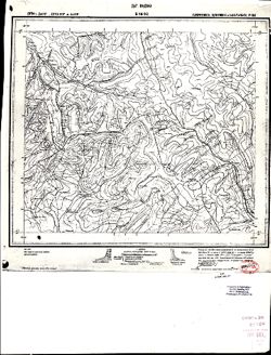
- Description:
- 1936
- Subject:
- Topical Subject: Maps and Topical Subject: Soviet Union
- Publisher:
- Даг. Водхоз
- Language:
- Russian
- Identifier:
- VAC9619-000701
- Genre:
- Topographic Maps and Military Maps
- Geographic Location:
- Coordinates: 41.6667, 46.5, 42, 47
- Related URL:
- Catalog URL: https://iucat.iu.edu/catalog/5020129 and Download GeoTIFF: https://drive.google.com/open?id=1AV4-2I-6ENe5qGrTxUnjaZVZBaXEFnKn
- Call Number:
- G7000 s100 .S7 sheet K-38-82
- Copyright Holder:
- No Copyright - United States
- Country:
- СССР (USSR)
- State/Province:
- Загатальский район (Zaqatala district), Цунтинский район (Tsuntinsky district), Грузинская ССР (Georgian Soviet Socialist Republic), Дагестанская АССР (Dages...
- Physical Description:
- Scale: 1:100,000
- Persistent URL:
- http://purl.dlib.indiana.edu/iudl/images/VAC9619/VAC9619-000701
- Provenance:
- Library of Congress Geography & Map Division, G000-30
-
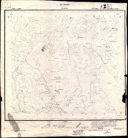
- Description:
- 1936
- Subject:
- Topical Subject: Maps and Topical Subject: Soviet Union
- Publisher:
- Даг. Водхоз
- Language:
- Russian
- Identifier:
- VAC9619-000814
- Genre:
- Topographic Maps and Military Maps
- Geographic Location:
- Coordinates: 41.6667, 47, 42, 47.5
- Related URL:
- Catalog URL: https://iucat.iu.edu/catalog/5020129 and Download GeoTIFF: https://drive.google.com/open?id=1yjkoyRmqdLE8IwS0LFxmljpJpCg5cpZB
- Call Number:
- G7000 s100 .S7 sheet K-38-83
- Copyright Holder:
- No Copyright - United States
- Country:
- СССР (USSR)
- State/Province:
- Рутульский район (Rutulsky district), Кулинский район (Kulinsky district), Дагестанская АССР (Dagestan Autonomous Soviet Socialist Republic), and Агульский р...
- Physical Description:
- Scale: 1:100,000
- Persistent URL:
- http://purl.dlib.indiana.edu/iudl/images/VAC9619/VAC9619-000814
- Provenance:
- Library of Congress Geography & Map Division
-
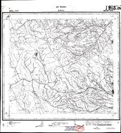
- Description:
- 1936
- Subject:
- Geographic Subject: Khivsky district, Topical Subject: Maps, and Topical Subject: Soviet Union
- Publisher:
- Даг. Водхоз
- Language:
- Russian
- Identifier:
- VAC9619-000756
- Genre:
- Military Maps and Topographic Maps
- Geographic Location:
- Coordinates: 41.6667, 47.5, 42, 48
- Related URL:
- Catalog URL: https://iucat.iu.edu/catalog/5020129 and Download GeoTIFF: https://drive.google.com/open?id=18FFJTURuuCjCoanRfDW1z9QVADzEzwnW
- Abstract:
- Modern area represented: Khivsky district, Republic of Dagestan, Russia
- Call Number:
- G7000 s100 .S7 sheet K-38-84
- Copyright Holder:
- No Copyright - United States
- Country:
- СССР (USSR)
- State/Province:
- Дагестанская АССР (Dagestan Autonomous Soviet Socialist Republic) and Хивский район (Khivsky district)
- Physical Description:
- Scale: 1:100,000
- Persistent URL:
- http://purl.dlib.indiana.edu/iudl/images/VAC9619/VAC9619-000756
- Provenance:
- Library of Congress Geography & Map Division
-
- Description:
- 1936
- Subject:
- Topical Subject: Soviet Union, Topical Subject: Maps, and Geographic Subject: Rutulsky district
- Publisher:
- Даг. Водхоз
- Language:
- Russian
- Identifier:
- VAC9619-000819
- Genre:
- Topographic Maps and Military Maps
- Geographic Location:
- Coordinates: 41.3333, 47, 41.6667, 47.5
- Related URL:
- Download GeoTIFF: https://drive.google.com/open?id=1PiAsff5fOgXSzRwK5X1LM4OxLrqNxhbm and Catalog URL: https://iucat.iu.edu/catalog/5020129
- Abstract:
- Modern area represented: Rutulsky district, Republic of Dagestan, Russia
- Call Number:
- G7000 s100 .S7 sheet K-38-95
- Copyright Holder:
- No Copyright - United States
- Country:
- СССР (USSR)
- State/Province:
- Азербайджанская ССР (Azerbaijan Soviet Socialist Republic), Дагестанская АССР (Dagestan Autonomous Soviet Socialist Republic), and Рутульский район (Rutulsky...
- Physical Description:
- Scale: 1:100,000
- Persistent URL:
- http://purl.dlib.indiana.edu/iudl/images/VAC9619/VAC9619-000819
- Provenance:
- DMA Topographic Center, Army Map Service Library, OMAHA, Library of Congress Geography & Map Division
-
- Description:
- 1936
- Subject:
- Topical Subject: Maps and Topical Subject: Soviet Union
- Publisher:
- Даг. Водхоз
- Language:
- Russian
- Identifier:
- VAC9619-000772
- Genre:
- Topographic Maps and Military Maps
- Geographic Location:
- Coordinates: 41.3333, 47.5, 41.6667, 48
- Related URL:
- Download GeoTIFF: https://drive.google.com/open?id=1kQKHZZZPe8TQw3T5gDkNi8cCUREBa3cE and Catalog URL: https://iucat.iu.edu/catalog/5020129
- Call Number:
- G7000 s100 .S7 sheet K-38-96
- Copyright Holder:
- No Copyright - United States
- Country:
- СССР (USSR)
- State/Province:
- Ахтынский район (Akhtynsky district), Азербайджанская ССР (Azerbaijan Soviet Socialist Republic), Курахский район (Kurakhsky district), and Дагестанская АССР...
- Physical Description:
- Scale: 1:100,000
- Persistent URL:
- http://purl.dlib.indiana.edu/iudl/images/VAC9619/VAC9619-000772
- Provenance:
- DMA Topographic Center, Army Map Service Library, Library of Congress Geography & Map Division
-
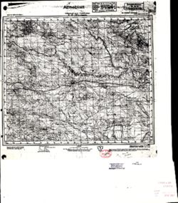
- Description:
- 1907
- Subject:
- Topical Subject: Soviet Union, Geographic Subject: Perekischkjul, and Topical Subject: Maps
- Publisher:
- Генеральный штаб Красной Армии
- Language:
- Russian
- Date Created:
- 1941
- Identifier:
- VAC9619-000892
- Genre:
- Military Maps and Topographic Maps
- Geographic Location:
- Coordinates: 40.3333, 49, 40.6667, 49.5
- Related URL:
- Download GeoTIFF: https://drive.google.com/open?id=1YAs8jfBXsWsytsvHAupvINf6BPXNHt5c and Catalog URL: https://iucat.iu.edu/catalog/5020129
- Abstract:
- Modern area represented: Perekischkjul, Abşeron district, Azerbaijan
- Call Number:
- G7000 s100 .S7 sheet K-39-123
- Caption:
- Для служебного пользования
- City:
- Перекишкюль (Perekischkjul)
- Copyright Holder:
- No Copyright - United States
- Country:
- СССР (USSR)
- State/Province:
- Азербайджанская ССР (Azerbaijan Soviet Socialist Republic)
- Physical Description:
- Scale: 1:100,000
- Persistent URL:
- http://purl.dlib.indiana.edu/iudl/images/VAC9619/VAC9619-000892
- Provenance:
- CIA Map Library, Library of Congress Geography & Map Division, Heeresplankammer Gruppe Archive Auslandskartenarchiv, Atlasblatt
-

- Description:
- 1935
- Subject:
- Geographic Subject: Navahı, Topical Subject: Maps, and Topical Subject: Soviet Union
- Publisher:
- Управление военных топографов РККА
- Language:
- Russian
- Identifier:
- VAC9619-000106
- Genre:
- Topographic Maps and Military Maps
- Geographic Location:
- Coordinates: 40, 49, 40.1667, 49.25
- Related URL:
- Download GeoTIFF: https://drive.google.com/open?id=1_xvFg3nhaFPZqCW3dumjv79m9FX1OeE7 and Catalog URL: http://iucat.iu.edu/catalog/5020131
- Abstract:
- Modern area represented: Navahı, Azerbaijan
- Call Number:
- G7000 s50 .S68 sheet K-39-135-C
- Caption:
- Не подлежит оглашению
- City:
- Наваги (Navagi)
- Copyright Holder:
- No Copyright - United States
- Country:
- СССР (USSR)
- State/Province:
- Азербайджанская ССР (Azerbaijan Soviet Socialist Republic)
- Physical Description:
- Scale: 1:50,000
- Persistent URL:
- http://purl.dlib.indiana.edu/iudl/images/VAC9619/VAC9619-000106
- Provenance:
- DMA Topographic Center, Army Map Service Library, OMAHA, Library of Congress Geography & Map Division
-

- Description:
- 1928
- Subject:
- Topical Subject: Maps, Topical Subject: Soviet Union, and Geographic Subject: Sharapkhana
- Language:
- Russian
- Identifier:
- VAC9619-000800
- Genre:
- Topographic Maps and Military Maps
- Geographic Location:
- Coordinates: 41.6667, 69, 42, 69.5
- Related URL:
- Download GeoTIFF: https://drive.google.com/open?id=1j5UHu1aPu3VmPh-XlLoPJlRn72rf5TSn and Catalog URL: https://iucat.iu.edu/catalog/5020129
- Abstract:
- Modern area represented: Sharapkhana, Turkistan region, Kazakhstan
- Call Number:
- G7000 s100 .S7 sheet K-42-79
- Copyright Holder:
- No Copyright - United States
- Country:
- СССР (USSR)
- State/Province:
- Ташкентско-Казакский уезд (Tashkent-Kazakh uyezd), Сырдарьинская губерния (Syr Darya governorate), and Казахская Автономная Республика (Kazakh Autonomous Rep...
- Physical Description:
- Scale: 1:100,000
- Persistent URL:
- http://purl.dlib.indiana.edu/iudl/images/VAC9619/VAC9619-000800
- Provenance:
- DMA Topographic Center, Army Map Service Library, OMAHA, Library of Congress Geography & Map Division
-

- Description:
- 1928
- Subject:
- Topical Subject: Maps, Geographic Subject: Turbat, and Topical Subject: Soviet Union
- Language:
- Russian
- Identifier:
- VAC9619-000917
- Genre:
- Topographic Maps and Military Maps
- Geographic Location:
- Coordinates: 41.6667, 69.5, 42, 70
- Related URL:
- Catalog URL: https://iucat.iu.edu/catalog/5020129 and Download GeoTIFF: https://drive.google.com/open?id=1ZCeGbcg5jpHF3eQOyR_i0o9l8mP9qpB4
- Abstract:
- Modern area represented: Turbat, Turkistan region, Kazakhstan
- Call Number:
- G7000 s100 .S7 sheet K-42-80
- Copyright Holder:
- No Copyright - United States
- Country:
- СССР (USSR)
- State/Province:
- Казахская Автономная Республика (Kazakh Autonomous Republic) and Ташкентско-Казакский уезд (Tashkent-Kazakh uyezd)
- Physical Description:
- Scale: 1:100,000
- Persistent URL:
- http://purl.dlib.indiana.edu/iudl/images/VAC9619/VAC9619-000917
- Provenance:
- DMA Topographic Center, Auswärtiges Amt. Geographischer Dienst, OMAHA, Library of Congress Geography & Map Division, Army Map Service Library
-

- Description:
- 1928
- Subject:
- Topical Subject: Maps and Topical Subject: Soviet Union
- Language:
- Russian
- Identifier:
- VAC9619-000911
- Genre:
- Topographic Maps and Military Maps
- Geographic Location:
- Coordinates: 41.3333, 68, 41.6667, 68.5
- Related URL:
- Download GeoTIFF: https://drive.google.com/open?id=122zpLWfMd6_xTZlsQdTGduMqaEY4Oovv and Catalog URL: https://iucat.iu.edu/catalog/5020129
- Call Number:
- G7000 s100 .S7 sheet K-42-89
- Copyright Holder:
- No Copyright - United States
- Country:
- СССР (USSR)
- State/Province:
- Ташкентско-Казакский уезд (Tashkent-Kazakh uyezd), Казахская Автономная Республика (Kazakh Autonomous Republic), and Сырдарьинская губерния (Syr Darya govern...
- Physical Description:
- Scale: 1:100,000
- Persistent URL:
- http://purl.dlib.indiana.edu/iudl/images/VAC9619/VAC9619-000911
- Provenance:
- DMA Topographic Center, Army Map Service Library, OMAHA, Library of Congress Geography & Map Division
-
- Subject:
- Topical Subject: Maps, Geographic Subject: Minzhu, and Topical Subject: Soviet Union
- Language:
- Russian
- Identifier:
- VAC9619-000867
- Genre:
- Military Maps and Topographic Maps
- Geographic Location:
- Coordinates: 43.6667, 127, 44, 127.5
- Related URL:
- Catalog URL: https://iucat.iu.edu/catalog/5020129 and Download GeoTIFF: https://drive.google.com/open?id=1sRu7iY9GXBrkJbPF8-XiGHefCk2YCi8x
- Abstract:
- Modern area represented: Minzhu, Jilin province, China
- Call Number:
- G7000 s100 .S7 sheet K-52-3
- City:
- Цзяохэ (Jiaohe)
- Copyright Holder:
- No Copyright - United States
- Country:
- Китай (China)
- State/Province:
- Маньчжурия (Manchuria)
- Physical Description:
- Scale: 1:100,000
- Persistent URL:
- http://purl.dlib.indiana.edu/iudl/images/VAC9619/VAC9619-000867
- Provenance:
- DMA Topographic Center, Army Map Service Library, Library of Congress Geography & Map Division, Atlasblatt
-

- Description:
- 1906
- Subject:
- Topical Subject: Maps and Topical Subject: Soviet Union
- Publisher:
- Генеральный штаб РККА
- Language:
- Russian
- Date Created:
- 1940
- Identifier:
- VAC9619-000854
- Genre:
- Military Maps and Topographic Maps
- Related URL:
- Catalog URL: https://iucat.iu.edu/catalog/5020129
- Call Number:
- G7000 s100 .S7 sheet K-52-31
- City:
- Ст. Чатяогоу
- Copyright Holder:
- No Copyright - United States
- Physical Description:
- Scale: 1:100,000
- Persistent URL:
- http://purl.dlib.indiana.edu/iudl/images/VAC9619/VAC9619-000854
- Provenance:
- DMA Topographic Center, Army Map Service Library, Library of Congress Geography & Map Division, Atlasblatt
-
- Description:
- 1906
- Subject:
- Geographic Subject: Hunchun, Topical Subject: Soviet Union, and Topical Subject: Maps
- Publisher:
- Управление военных топографов РККА
- Language:
- Russian
- Date Created:
- 1933
- Identifier:
- VAC9619-000914
- Genre:
- Topographic Maps and Military Maps
- Geographic Location:
- Coordinates: 42.6667, 130, 43, 130.5
- Related URL:
- Download GeoTIFF: https://drive.google.com/open?id=14YXbAZgngEEXJeyyh0_6PJ45RyfdxAgg and Catalog URL: https://iucat.iu.edu/catalog/5020129
- Abstract:
- Modern area represented: Hunchun, Jilin province, China
- Call Number:
- G7000 s100 .S7 sheet K-52-45
- Caption:
- Не подлежит оглашению
- City:
- Хунчун (Hunchun)
- Copyright Holder:
- No Copyright - United States
- Country:
- СССР (USSR) and Корея (Korea)
- State/Province:
- Дальневосточный край (Far Eastern kray), Маньчжурия (Manchuria), and РСФСР (RSFSR)
- Physical Description:
- Scale: 1:100,000
- Persistent URL:
- http://purl.dlib.indiana.edu/iudl/images/VAC9619/VAC9619-000914
- Provenance:
- DMA Topographic Center, Army Map Service Library, OMAHA, Library of Congress Geography & Map Division
-
- Description:
- 1940
- Subject:
- Topical Subject: Soviet Union and Topical Subject: Maps
- Language:
- Russian
- Identifier:
- VAC9619-000899
- Genre:
- Topographic Maps and Military Maps
- Related URL:
- Catalog URL: https://iucat.iu.edu/catalog/5020129
- Call Number:
- G7000 s100 .S7 sheet K-52-52
- Copyright Holder:
- No Copyright - United States
- Physical Description:
- Scale: 1:100,000
- Persistent URL:
- http://purl.dlib.indiana.edu/iudl/images/VAC9619/VAC9619-000899
- Provenance:
- DMA Topographic Center, Army Map Service Library, OMAHA, Atlasblatt, Library of Congress Geography & Map Division
-

- Description:
- 1935
- Subject:
- Topical Subject: Soviet Union, Topical Subject: Maps, and Geographic Subject: Sergeyevka
- Publisher:
- Управление военных топографов РККА
- Language:
- Russian
- Identifier:
- VAC9619-000822
- Genre:
- Military Maps and Topographic Maps
- Geographic Location:
- Coordinates: 43.3333, 133, 43.6667, 133.5
- Related URL:
- Download GeoTIFF: https://drive.google.com/open?id=1CRxpKntUT0SQjGYFGsZAgqrl0lOMN9eg and Catalog URL: https://iucat.iu.edu/catalog/5020129
- Abstract:
- Modern area represented: Sergeyevka, Primorskiy (Maritime) kray, Russia
- Call Number:
- G7000 s100 .S7 sheet K-53-15
- Caption:
- Не подлежит оглашению
- City:
- Сергеевка (Sergeyevka)
- Copyright Holder:
- No Copyright - United States
- Country:
- СССР (USSR)
- State/Province:
- РСФСР (RSFSR) and Дальневосточный край (Far Eastern kray)
- Physical Description:
- Scale: 1:100,000
- Persistent URL:
- http://purl.dlib.indiana.edu/iudl/images/VAC9619/VAC9619-000822
- Provenance:
- DMA Topographic Center, Library of Congress G & M Division, Army Map Service Library, Atlasblatt
-
- Description:
- 1913
- Subject:
- Topical Subject: Maps, Topical Subject: Soviet Union, and Geographic Subject: Partizansk
- Publisher:
- Управление военных топографов РККА
- Language:
- Russian
- Date Created:
- 1934
- Identifier:
- VAC9619-000811
- Genre:
- Topographic Maps and Military Maps
- Geographic Location:
- Coordinates: 43, 133, 43.3333, 133.5
- Related URL:
- Catalog URL: https://iucat.iu.edu/catalog/5020129 and Download GeoTIFF: https://drive.google.com/open?id=1R7GQuqPSC31N6DmuMyrjjbi0qENHsXFB
- Abstract:
- Modern area represented: Partizansk, Primorskiy (Maritime) kray, Russia
- Call Number:
- G7000 s100 .S7 sheet K-53-27
- Caption:
- Не подлежит оглашению
- City:
- Сучан (Suchan)
- Copyright Holder:
- No Copyright - United States
- Country:
- СССР (USSR)
- State/Province:
- РСФСР (RSFSR) and Дальневосточный край (Far Eastern kray)
- Physical Description:
- Scale: 1:100,000
- Persistent URL:
- http://purl.dlib.indiana.edu/iudl/images/VAC9619/VAC9619-000811
- Provenance:
- DMA Topographic Center, Army Map Service Library, Library of Congress Geography & Map Division, Atlasblatt
-
- Description:
- 1880
- Subject:
- Topical Subject: Soviet Union, Topical Subject: Maps, and Geographic Subject: Lake Balaton
- Publisher:
- Генеральный штаб Красной Армии
- Language:
- Russian
- Date Created:
- 1944
- Identifier:
- VAC9619-000792
- Genre:
- Military Maps and Topographic Maps
- Geographic Location:
- Coordinates: 46.6667, 17.5, 47, 18
- Related URL:
- Download GeoTIFF: https://drive.google.com/open?id=1ZZQ319ZR-xds01_NM2lMGBsLDIsGS042 and Catalog URL: https://iucat.iu.edu/catalog/5020129
- Abstract:
- Modern area represented: Lake Balaton, Hungary
- Call Number:
- G7000 s100 .S7 sheet L-33-48
- City:
- Оз. Балатон (Lake Balaton)
- Copyright Holder:
- No Copyright - United States
- Country:
- Венгрия (Hungary)
- Physical Description:
- Scale: 1:100,000
- Persistent URL:
- http://purl.dlib.indiana.edu/iudl/images/VAC9619/VAC9619-000792
- Provenance:
- DMA Topographic Center, Army Map Service Library, OMAHA, Library of Congress Geography & Map Division, Atlasblatt
-

- Description:
- 1940
- Subject:
- Geographic Subject: Komárno, Topical Subject: Maps, and Topical Subject: Soviet Union
- Publisher:
- Генеральный штаб РККА
- Language:
- Russian
- Identifier:
- VAC9619-000698
- Genre:
- Military Maps and Topographic Maps
- Geographic Location:
- Coordinates: 47.6667, 18, 48, 18.5
- Related URL:
- Catalog URL: https://iucat.iu.edu/catalog/5020129 and Download GeoTIFF: https://drive.google.com/open?id=10mfWpI7rZp_VwJk_LlZNN_vX_beLLyEk
- Abstract:
- Modern area represented: Komárno, Nitriansky region, Slovakia
- Call Number:
- G7000 s100 .S7 sheet L-34-1
- City:
- Комарно (Komárno)
- Copyright Holder:
- No Copyright - United States
- Country:
- Венгрия (Hungary)
- Physical Description:
- Scale: 1:100,000
- Persistent URL:
- http://purl.dlib.indiana.edu/iudl/images/VAC9619/VAC9619-000698
- Provenance:
- DMA Topographic Center, Army Map Service Library, OMAHA, Atlasblatt, Library of Congress Geography & Map Division
-
- Description:
- 1894
- Subject:
- Geographic Subject: Sighetu Marmaţiei, Topical Subject: Maps, and Topical Subject: Soviet Union
- Publisher:
- Генеральный штаб РККА
- Language:
- Russian
- Date Created:
- 1927
- Identifier:
- VAC9619-001052
- Genre:
- Topographic Maps and Military Maps
- Geographic Location:
- Coordinates: 47.6667, 23.5, 48, 24
- Related URL:
- Download GeoTIFF: https://drive.google.com/open?id=1YhAH1tPcb68rrVgZ0rbRsmXVdujV5C6C and Catalog URL: https://iucat.iu.edu/catalog/5020129
- Abstract:
- Modern area represented: Sighetu Marmaţiei, Maramureş county, Romania
- Call Number:
- G7000 s100 .S7 sheet L-34-12
- City:
- Сигет (Sighet)
- Copyright Holder:
- No Copyright - United States
- Country:
- Чехословакия (Czechoslovakia) and Румыния (Romania)
- Physical Description:
- Scale: 1:100,000
- Persistent URL:
- http://purl.dlib.indiana.edu/iudl/images/VAC9619/VAC9619-001052
- Provenance:
- DMA Topographic Center, Army Map Service Library, Library of Congress Geography & Map Division, Atlasblatt
-
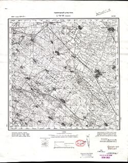
- Description:
- 1894
- Subject:
- Geographic Subject: Jászberény, Topical Subject: Maps, and Topical Subject: Soviet Union
- Publisher:
- Генеральный штаб РККА
- Language:
- Russian
- Date Created:
- 1927
- Identifier:
- VAC9619-000986
- Genre:
- Military Maps and Topographic Maps
- Geographic Location:
- Coordinates: 47.3333, 19.5, 47.6667, 20
- Related URL:
- Catalog URL: https://iucat.iu.edu/catalog/5020129 and Download GeoTIFF: https://drive.google.com/open?id=1JqWYoASabo-X-TovI29uk8m00d6nPS3R
- Abstract:
- Modern area represented: Jászberény, Jász-Nagykun-Szolnok county, Hungary
- Call Number:
- G7000 s100 .S7 sheet L-34-16
- City:
- Ясберень (Jászberény)
- Copyright Holder:
- No Copyright - United States
- Country:
- Венгрия (Hungary)
- Physical Description:
- Scale: 1:100,000
- Persistent URL:
- http://purl.dlib.indiana.edu/iudl/images/VAC9619/VAC9619-000986
- Provenance:
- CIA Map Library, Atlasblatt, Library of Congress Geography & Map Division
-
- Description:
- 1884
- Subject:
- Topical Subject: Maps, Geographic Subject: Jászapáti, and Topical Subject: Soviet Union
- Publisher:
- Генеральный штаб РККА
- Language:
- Russian
- Date Created:
- 1928
- Identifier:
- VAC9619-000949
- Genre:
- Military Maps and Topographic Maps
- Geographic Location:
- Coordinates: 47.3333, 20, 47.6667, 20.5
- Related URL:
- Download GeoTIFF: https://drive.google.com/open?id=1n8peEi0zk_J8u62vqaPBzNjG-nZfNU4G and Catalog URL: https://iucat.iu.edu/catalog/5020129
- Abstract:
- Modern area represented: Jászapáti, Jász-Nagykun-Szolnok county, Hungary
- Call Number:
- G7000 s100 .S7 sheet L-34-17
- City:
- Ясапати (Jászapáti)
- Copyright Holder:
- No Copyright - United States
- Country:
- Венгрия (Hungary)
- Physical Description:
- Scale: 1:100,000
- Persistent URL:
- http://purl.dlib.indiana.edu/iudl/images/VAC9619/VAC9619-000949
- Provenance:
- DMA Topographic Center, Army Map Service Library, OMAHA, Atlasblatt, Library of Congress Geography & Map Division
-
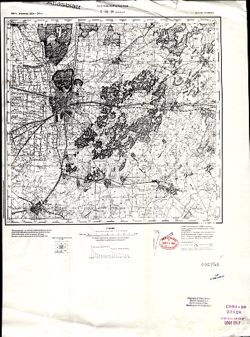
- Description:
- 1884
- Subject:
- Topical Subject: Soviet Union, Topical Subject: Maps, and Geographic Subject: Debrecen
- Publisher:
- Генеральный штаб РККА
- Language:
- Russian
- Date Created:
- 1934
- Identifier:
- VAC9619-001063
- Genre:
- Topographic Maps and Military Maps
- Geographic Location:
- Coordinates: 47.3333, 21.5, 47.6667, 22
- Related URL:
- Download GeoTIFF: https://drive.google.com/open?id=1r3pE29Q0wjoe_oUiQuovRQFdu0gXPCPN and Catalog URL: https://iucat.iu.edu/catalog/5020129
- Abstract:
- Modern area represented: Debrecen, Hajdú-Bihar county, Hungary
- Call Number:
- G7000 s100 .S7 sheet L-34-20
- City:
- Дебрецен (Debrecen)
- Copyright Holder:
- No Copyright - United States
- Country:
- Румыния (Romania) and Венгрия (Hungary)
- Physical Description:
- Scale: 1:100,000
- Persistent URL:
- http://purl.dlib.indiana.edu/iudl/images/VAC9619/VAC9619-001063
- Provenance:
- CIA Map Library, Atlasblatt, Library of Congress Geography & Map Division
-
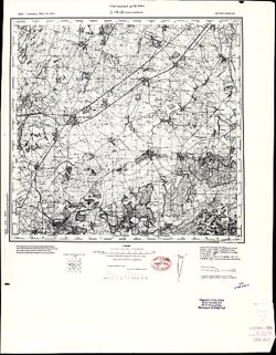
- Description:
- 1884
- Subject:
- Topical Subject: Maps, Geographic Subject: Valea lui Mihai, and Topical Subject: Soviet Union
- Publisher:
- Генеральный штаб РККА
- Language:
- Russian
- Date Created:
- 1930
- Identifier:
- VAC9619-000782
- Genre:
- Military Maps and Topographic Maps
- Geographic Location:
- Coordinates: 47.3333, 22, 47.6667, 22.5
- Related URL:
- Catalog URL: https://iucat.iu.edu/catalog/5020129 and Download GeoTIFF: https://drive.google.com/open?id=1CRzaW5Rk97ndXjhrNAiwsNpLwNOkc60K
- Abstract:
- Modern area represented: Valea lui Mihai, Bihor county, Romania
- Call Number:
- G7000 s100 .S7 sheet L-34-21
- City:
- Валеа-Луй-Михай (Valea lui Mihai)
- Copyright Holder:
- No Copyright - United States
- Country:
- Венгрия (Hungary) and Румыния (Romania)
- Physical Description:
- Scale: 1:100,000
- Persistent URL:
- http://purl.dlib.indiana.edu/iudl/images/VAC9619/VAC9619-000782
- Provenance:
- CIA Map Library, Library of Congress Geography & Map Division
-
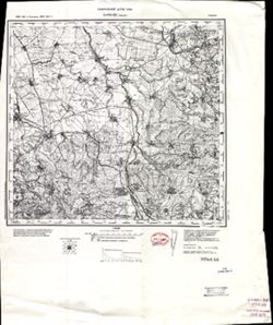
- Description:
- 1883
- Subject:
- Topical Subject: Soviet Union, Geographic Subject: Tășnad, and Topical Subject: Maps
- Publisher:
- Генеральный штаб РККА
- Language:
- Russian
- Date Created:
- 1930
- Identifier:
- VAC9619-001461
- Genre:
- Military Maps and Topographic Maps
- Geographic Location:
- Coordinates: 47.3333, 22.5, 47.6667, 23
- Related URL:
- Download GeoTIFF: https://drive.google.com/open?id=1k8qkUtzCZ2Jxn-mGGkXXacO87N-pZgZF and Catalog URL: https://iucat.iu.edu/catalog/5020129
- Abstract:
- Modern area represented: Tășnad, Satu Mare county, Romania
- Call Number:
- G7000 s100 .S7 sheet L-34-22
- City:
- Ташнад (Tășnad)
- Copyright Holder:
- No Copyright - United States
- Country:
- Румыния (Romania)
- Physical Description:
- Scale: 1:100,000
- Persistent URL:
- http://purl.dlib.indiana.edu/iudl/images/VAC9619/VAC9619-001461
- Provenance:
- CIA Map Library, Library of Congress Geography & Map Division
-
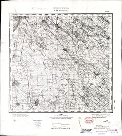
- Subject:
- Topical Subject: Soviet Union, Topical Subject: Maps, and Geographic Subject: Kunszentmiklós
- Publisher:
- Генеральный штаб РККА
- Language:
- Russian
- Identifier:
- VAC9619-001011
- Genre:
- Military Maps and Topographic Maps
- Geographic Location:
- Coordinates: 47, 19, 47.3333, 19.5
- Related URL:
- Catalog URL: https://iucat.iu.edu/catalog/5020129 and Download GeoTIFF: https://drive.google.com/open?id=12DG6uPlSUA3LbQEzReKsle6jcJSQFPKx
- Abstract:
- Modern area represented: Kunszentmiklós, Bács-Kiskun county, Hungary
- Call Number:
- G7000 s100 .S7 sheet L-34-27
- City:
- Кунсентмиклош (Kunszentmiklós)
- Copyright Holder:
- No Copyright - United States
- Country:
- Венгрия (Hungary)
- Physical Description:
- Scale: 1:100,000
- Persistent URL:
- http://purl.dlib.indiana.edu/iudl/images/VAC9619/VAC9619-001011
- Provenance:
- CIA Map Library, Atlasblatt, Library of Congress Geography & Map Division
-

- Subject:
- Geographic Subject: Oradea-Mare, Topical Subject: Maps, and Topical Subject: Soviet Union
- Language:
- Russian
- Identifier:
- VAC9619-001104
- Genre:
- Topographic Maps and Military Maps
- Geographic Location:
- Coordinates: 47, 21.5, 47.3333, 22
- Related URL:
- Download GeoTIFF: https://drive.google.com/open?id=1sb_2M0iE9r8mDeHLfJTpzhpaOBWDZgY8 and Catalog URL: https://iucat.iu.edu/catalog/5020129
- Abstract:
- Modern area represented: Oradea-Mare, Bihor county, Romania
- Call Number:
- G7000 s100 .S7 sheet L-34-32
- Copyright Holder:
- No Copyright - United States
- Physical Description:
- Scale: 1:100,000
- Persistent URL:
- http://purl.dlib.indiana.edu/iudl/images/VAC9619/VAC9619-001104
- Provenance:
- DMA Topographic Center, Army Map Service Library, OMAHA, Atlasblatt, Library of Congress Geography & Map Division
-

- Description:
- 1883
- Subject:
- Topical Subject: Maps, Topical Subject: Soviet Union, and Geographic Subject: Tileagd
- Publisher:
- Генеральный штаб РККА
- Language:
- Russian
- Date Created:
- 1929
- Identifier:
- VAC9619-001158
- Genre:
- Topographic Maps and Military Maps
- Geographic Location:
- Coordinates: 47, 22, 47.3333, 22.5
- Related URL:
- Catalog URL: https://iucat.iu.edu/catalog/5020129 and Download GeoTIFF: https://drive.google.com/open?id=1fS4M5u613E32B4SkP-PjSC-BU-4OXaz2
- Abstract:
- Modern area represented: Tileagd, Bihor county, Romania
- Call Number:
- G7000 s100 .S7 sheet L-34-33
- City:
- Тилягд (Tileagd)
- Copyright Holder:
- No Copyright - United States
- Country:
- Румыния (Romania)
- Physical Description:
- Scale: 1:100,000
- Persistent URL:
- http://purl.dlib.indiana.edu/iudl/images/VAC9619/VAC9619-001158
- Provenance:
- DMA Topographic Center, Army Map Service Library, OMAHA, Atlasblatt, Library of Congress Geography & Map Division
