
Search Constraints
« Previous |
1 - 100 of 1,113
|
Next »
Search Results
-
- Description:
- 1939
- Subject:
- Topical Subject: Soviet Union, Geographic Subject: Vaskinichi, and Topical Subject: Maps
- Publisher:
- Главное управление геодезии и картографии при СНК СССР
- Language:
- Russian
- Date Created:
- 1941
- Identifier:
- VAC9619-000009
- Genre:
- Topographic Maps and Military Maps
- Geographic Location:
- Coordinates: 59.6667, 32.75, 59.8333, 33
- Related URL:
- Download GeoTIFF: https://drive.google.com/open?id=1EY2ej2jtqUigE6OtBp8sxn3kYNf80HIT and Catalog URL: http://iucat.iu.edu/catalog/5020131
- Abstract:
- Modern area represented: Vaskinichi, Leningrad oblast, Russia
- Call Number:
- G7000 s50 .S68 sheet O-36-6-D
- Caption:
- Секретно,Captured map
- City:
- Васкеничи (Vaskenichi)
- Copyright Holder:
- No Copyright - United States
- Country:
- СССР (USSR)
- State/Province:
- Тихвинский район (Tikhvin district), Ленинградская область (Leningrad oblast), РСФСР (RSFSR), and Волховский район (Volkhov district)
- Physical Description:
- Scale: 1:50,000
- Persistent URL:
- http://purl.dlib.indiana.edu/iudl/images/VAC9619/VAC9619-000009
- Provenance:
- DMA Topographic Center, Army Map Service Library, OMAHA, Library of Congress Geography & Map Division
-
- Description:
- 1939
- Subject:
- Geographic Subject: Bezovo and Topical Subject: Soviet Union
- Publisher:
- Главное управление геодезии и картографии при СНК СССР
- Language:
- Russian
- Date Created:
- 1941
- Identifier:
- VAC9619-000002
- Genre:
- Topographic Maps and Military Maps
- Geographic Location:
- Coordinates: 59.6667, 32.5, 59.8333, 32.75
- Related URL:
- Download GeoTIFF: https://drive.google.com/open?id=1mChk164lKHS7pE139ijCnFaNrOaNCvUp and Catalog URL: http://iucat.iu.edu/catalog/5020131
- Abstract:
- Modern area represented: Bezovo, Russia
- Call Number:
- G7000 s50 .S68 sheet O-36-6-C
- Caption:
- Секретно,Captured map
- City:
- Безово (Bezovo)
- Copyright Holder:
- No Copyright - United States
- Country:
- СССР (USSR)
- State/Province:
- Ленинградская область (Leningrad oblast), РСФСР (RSFSR), Тихвинский район (Tikhvin district), and Волховский район (Volkhov district)
- Physical Description:
- Scale: 1:50,000
- Persistent URL:
- http://purl.dlib.indiana.edu/iudl/images/VAC9619/VAC9619-000002
- Provenance:
- DMA Topographic Center, Army Map Service Library, Library of Congress Geography & Map Division
-
- Description:
- 1939
- Subject:
- Topical Subject: Maps, Topical Subject: Soviet Union, and Geographic Subject: Prokshenitsy
- Publisher:
- Главное управление геодезии и картографии при СНК СССР
- Language:
- Russian
- Date Created:
- 1941
- Identifier:
- VAC9619-000008
- Genre:
- Topographic Maps and Military Maps
- Geographic Location:
- Coordinates: 59.8333, 32.75, 60, 33
- Related URL:
- Download GeoTIFF: https://drive.google.com/open?id=1uLy73UPhqeb3yZsZ_KDxD-EeVzGdgz3Q and Catalog URL: http://iucat.iu.edu/catalog/5020131
- Abstract:
- Modern area represented: Prokshenitsy, Russia
- Call Number:
- G7000 s50 .S68 sheet O-36-6-B
- Caption:
- Секретно,Captured map
- City:
- Прокшеницы (Prokshenitsy)
- Copyright Holder:
- No Copyright - United States
- Country:
- СССР (USSR)
- State/Province:
- Волховский район (Volkhov district), РСФСР (RSFSR), Ленинградская область (Leningrad oblast), and Тихвинский район (Tikhvin district)
- Physical Description:
- Scale: 1:50,000
- Persistent URL:
- http://purl.dlib.indiana.edu/iudl/images/VAC9619/VAC9619-000008
- Provenance:
- DMA Topographic Center, Army Map Service Library, Library of Congress Geography & Map Division
-
- Description:
- 1937
- Subject:
- Topical Subject: Soviet Union, Geographic Subject: Babino, and Topical Subject: Maps
- Publisher:
- Главное управление государственной съемки и картографии НКВД СССР
- Language:
- Russian
- Date Created:
- 1941
- Identifier:
- VAC9619-000044
- Genre:
- Military Maps and Topographic Maps
- Geographic Location:
- Coordinates: 59.1667, 31.25, 59.3333, 31.5
- Related URL:
- Download GeoTIFF: https://drive.google.com/open?id=117pSSxlZhQGDjutRAtCtoaIqVDkp3Xa0 and Catalog URL: http://iucat.iu.edu/catalog/5020131
- Abstract:
- Modern area represented:
- Call Number:
- G7000 s50 .S68 sheet O-36-27-B
- Caption:
- Секретно,Captured map
- City:
- Бабино (Babino)
- Copyright Holder:
- No Copyright - United States
- Country:
- СССР (USSR)
- State/Province:
- Тосненский район (Tosnensky district), РСФСР (RSFSR), Ленинградская область (Leningrad oblast), and Чудовский район (Chudovsky district)
- Physical Description:
- Scale: 1:50,000
- Persistent URL:
- http://purl.dlib.indiana.edu/iudl/images/VAC9619/VAC9619-000044
- Provenance:
- DMA Topographic Center, Army Map Service Library, OMAHA, Library of Congress Geography & Map Division
-
- Description:
- 1937
- Subject:
- Topical Subject: Soviet Union, Geographic Subject: Korkino, and Topical Subject: Maps
- Publisher:
- Главное управление государственной съемки и картографии НКВД СССР
- Language:
- Russian
- Date Created:
- 1941
- Identifier:
- VAC9619-000043
- Genre:
- Topographic Maps and Military Maps
- Geographic Location:
- Coordinates: 59.1667, 31, 59.3333, 31.25
- Related URL:
- Catalog URL: http://iucat.iu.edu/catalog/5020131 and Download GeoTIFF: https://drive.google.com/open?id=1bsTUMvoE0kAKG1XeVu6aZENX9H3qNZIO
- Abstract:
- Modern area represented: Korkino, Russia
- Call Number:
- G7000 s50 .S68 sheet O-36-27-A
- Caption:
- Для служебного пользования
- City:
- Коркино (Korkino)
- Copyright Holder:
- No Copyright - United States
- Country:
- СССР (USSR)
- State/Province:
- РСФСР (RSFSR), Тосненский район (Tosnensky district), and Ленинградская область (Leningrad oblast)
- Physical Description:
- Scale: 1:50,000
- Persistent URL:
- http://purl.dlib.indiana.edu/iudl/images/VAC9619/VAC9619-000043
- Provenance:
- DMA Topographic Center, Army Map Service Library, OMAHA, Library of Congress Geography & Map Division
-
- Description:
- 1937
- Subject:
- Geographic Subject: Kubolovo, Topical Subject: Soviet Union, and Topical Subject: Maps
- Publisher:
- Главное управление государственной съемки и картографии НКВД СССР
- Language:
- Russian
- Date Created:
- 1941
- Identifier:
- VAC9619-000042
- Genre:
- Topographic Maps and Military Maps
- Geographic Location:
- Coordinates: 59, 30.75, 59.1667, 31
- Related URL:
- Download GeoTIFF: https://drive.google.com/open?id=1Zo_O0BWAAl8rG6V8h9VkfMkerMU104rZ and Catalog URL: http://iucat.iu.edu/catalog/5020131
- Abstract:
- Modern area represented: Kubolovo, Russia
- Call Number:
- G7000 s50 .S68 sheet O-36-26-D
- Caption:
- Секретно,Captured map
- City:
- Куболово (Kubolovo)
- Copyright Holder:
- No Copyright - United States
- Country:
- СССР (USSR)
- State/Province:
- Тосненский район (Tosnensky district), Оредежский район (Oredezhsky district), Ленинградская область (Leningrad oblast), Новгородский район (Novgorod distric...
- Physical Description:
- Scale: 1:50,000
- Persistent URL:
- http://purl.dlib.indiana.edu/iudl/images/VAC9619/VAC9619-000042
- Provenance:
- DMA Topographic Center, Army Map Service Library, OMAHA, Library of Congress Geography & Map Division
-
- Description:
- 1937
- Subject:
- Geographic Subject: Nesterkovo, Topical Subject: Maps, and Topical Subject: Soviet Union
- Publisher:
- Главное управление государственной съемки и картографии НКВД СССР
- Language:
- Russian
- Date Created:
- 1941
- Identifier:
- VAC9619-000041
- Genre:
- Topographic Maps and Military Maps
- Geographic Location:
- Coordinates: 59, 30.5, 59.1667, 30.75
- Related URL:
- Catalog URL: http://iucat.iu.edu/catalog/5020131 and Download GeoTIFF: https://drive.google.com/open?id=15zmLpNAtR49LfgQ9suZDHQMWXpE-EEqP
- Abstract:
- Modern area represented: Nesterkovo, Russia
- Call Number:
- G7000 s50 .S68 sheet O-36-26-C
- Caption:
- Секретно,Captured map
- City:
- Нестерково (Nesterkovo)
- Copyright Holder:
- No Copyright - United States
- Country:
- СССР (USSR)
- State/Province:
- РСФСР (RSFSR), Оредежский район (Oredezhsky district), Тосненский район (Tosnensky district), and Ленинградская область (Leningrad oblast)
- Physical Description:
- Scale: 1:50,000
- Persistent URL:
- http://purl.dlib.indiana.edu/iudl/images/VAC9619/VAC9619-000041
- Provenance:
- DMA Topographic Center, Army Map Service Library, OMAHA, Library of Congress Geography & Map Division
-

- Description:
- 1937
- Subject:
- Geographic Subject: Gummolovo and Topical Subject: Soviet Union
- Publisher:
- Главное управление государственной съемки и картографии НКВД СССР
- Language:
- Russian
- Date Created:
- 1941
- Identifier:
- VAC9619-000040
- Genre:
- Military Maps and Topographic Maps
- Geographic Location:
- Coordinates: 59.1667, 30.75, 59.3333, 31
- Related URL:
- Catalog URL: http://iucat.iu.edu/catalog/5020131 and Download GeoTIFF: https://drive.google.com/open?id=1Thglq8S3ntpZfPmHWFNFQ1QHmQpoR5Lu
- Abstract:
- Modern area represented: Gummolovo, Russia
- Call Number:
- G7000 s50 .S68 sheet O-36-26-B
- Caption:
- Для служебного пользования
- City:
- Гуммолово (Gummolovo)
- Copyright Holder:
- No Copyright - United States
- Country:
- СССР (USSR)
- State/Province:
- Ленинградская область (Leningrad oblast), Тосненский район (Tosnensky district), and РСФСР (RSFSR)
- Physical Description:
- Scale: 1:50,000
- Persistent URL:
- http://purl.dlib.indiana.edu/iudl/images/VAC9619/VAC9619-000040
- Provenance:
- Army Map Service Library, OMAHA, Library of Congress Geography & Map Division
-
- Description:
- 1939
- Subject:
- Topical Subject: Maps, Topical Subject: Soviet Union, and Geographic Subject: Konechki
- Publisher:
- Главное управление геодезии и картографии при СНК СССР
- Language:
- Russian
- Date Created:
- 1941
- Identifier:
- VAC9619-000039
- Genre:
- Topographic Maps and Military Maps
- Geographic Location:
- Coordinates: 59.1667, 30.5, 59.3333, 30.75
- Related URL:
- Download GeoTIFF: https://drive.google.com/open?id=1uFmKSznFMTDRpqtx6S9Qzwgseet02wel and Catalog URL: http://iucat.iu.edu/catalog/5020131
- Abstract:
- Modern area represented: Konechki, Russia
- Call Number:
- G7000 s50 .S68 sheet O-36-26-A
- Caption:
- Для служебного пользования
- City:
- Конечки (Konechki)
- Copyright Holder:
- No Copyright - United States
- Country:
- СССР (USSR)
- State/Province:
- Тосненский район (Tosnensky district), Оредежский район (Oredezhsky district), РСФСР (RSFSR), and Ленинградская область (Leningrad oblast)
- Physical Description:
- Scale: 1:50,000
- Persistent URL:
- http://purl.dlib.indiana.edu/iudl/images/VAC9619/VAC9619-000039
- Provenance:
- Army Map Service Library, OMAHA, Library of Congress Geography & Map Division
-
- Description:
- 1939
- Subject:
- Topical Subject: Soviet Union, Geographic Subject: Otradnoye, and Topical Subject: Maps
- Publisher:
- Генеральный штаб Красной Армии
- Language:
- Russian
- Date Created:
- 1941
- Identifier:
- VAC9619-000006
- Genre:
- Military Maps and Topographic Maps
- Geographic Location:
- Coordinates: 59.6667, 30.75, 59.8333, 31
- Related URL:
- Catalog URL: http://iucat.iu.edu/catalog/5020131 and Download GeoTIFF: https://drive.google.com/open?id=13COc5AgGZxXZZGDEvwCTHdGopCfnaIpJ
- Abstract:
- Modern area represented: Otradnoye, Russia
- Call Number:
- G7000 s50 .S68 sheet O-36-2-D
- Caption:
- Секретно
- City:
- Отрадное (Otradnoye)
- Copyright Holder:
- No Copyright - United States
- Country:
- СССР (USSR)
- State/Province:
- Ленинградская область (Leningrad oblast) and РСФСР (RSFSR)
- Physical Description:
- Scale: 1:50,000
- Persistent URL:
- http://purl.dlib.indiana.edu/iudl/images/VAC9619/VAC9619-000006
- Provenance:
- DMA Topographic Center, Army Map Service Library, OMAHA, Library of Congress Geography & Map Division
-
- Description:
- 1939
- Subject:
- Topical Subject: Maps, Geographic Subject: Kolpino, and Topical Subject: Soviet Union
- Publisher:
- Генеральный штаб Красной Армии
- Language:
- Russian
- Date Created:
- 1941
- Identifier:
- VAC9619-000005
- Genre:
- Topographic Maps and Military Maps
- Geographic Location:
- Coordinates: 59.6667, 30.5, 59.8333, 30.75
- Related URL:
- Download GeoTIFF: https://drive.google.com/open?id=1kGu3hZQppIl96eGP8w6F_llnnTJlbJhM and Catalog URL: http://iucat.iu.edu/catalog/5020131
- Abstract:
- Modern area represented: Kolpino, Russia
- Call Number:
- G7000 s50 .S68 sheet O-36-2-C
- Caption:
- Секретно,Captured map
- City:
- Колпино (Kolpino)
- Copyright Holder:
- No Copyright - United States
- Country:
- СССР (USSR)
- State/Province:
- РСФСР (RSFSR) and Ленинградская область (Leningrad oblast)
- Physical Description:
- Scale: 1:50,000
- Persistent URL:
- http://purl.dlib.indiana.edu/iudl/images/VAC9619/VAC9619-000005
- Provenance:
- Army Map Service Library, OMAHA, Library of Congress Geography & Map Division
-
- Description:
- 1939
- Subject:
- Geographic Subject: Andrianovo, Topical Subject: Soviet Union, and Topical Subject: Maps
- Publisher:
- Главное управление геодезии и картографии при СНК СССР
- Language:
- Russian
- Date Created:
- 1941
- Identifier:
- VAC9619-000034
- Genre:
- Topographic Maps and Military Maps
- Geographic Location:
- Coordinates: 59.3333, 30.75, 59.5, 31
- Related URL:
- Catalog URL: http://iucat.iu.edu/catalog/5020131 and Download GeoTIFF: https://drive.google.com/open?id=12n12KgfSHveIr-05tKJpNCvVMNJQjba2
- Abstract:
- Modern area represented: Andrianovo, Russia
- Call Number:
- G7000 s50 .S68 sheet O-36-14-D
- Caption:
- Для служебного пользования,Captured map
- City:
- Андрианово (Andrianovo)
- Copyright Holder:
- No Copyright - United States
- Country:
- СССР (USSR)
- State/Province:
- Тосненский район (Tosnensky district), Ленинградская область (Leningrad oblast), and РСФСР (RSFSR)
- Physical Description:
- Scale: 1:50,000
- Persistent URL:
- http://purl.dlib.indiana.edu/iudl/images/VAC9619/VAC9619-000034
- Provenance:
- DMA Topographic Center, Army Map Service Library, Library of Congress Geography & Map Division
-

- Description:
- 1939
- Subject:
- Topical Subject: Maps, Topical Subject: Soviet Union, and Geographic Subject: Nenikyul
- Publisher:
- Главное управление геодезии и картографии при СНК СССР
- Language:
- Russian
- Date Created:
- 1941
- Identifier:
- VAC9619-000033
- Genre:
- Military Maps and Topographic Maps
- Geographic Location:
- Coordinates: 59.3333, 30.5, 59.5, 30.75
- Related URL:
- Download GeoTIFF: https://drive.google.com/open?id=1fzM4KJdQgLjgoSrc_T1claIyyEVQCLRB and Catalog URL: http://iucat.iu.edu/catalog/5020131
- Abstract:
- Modern area represented: Nenikyul, Russia
- Call Number:
- G7000 s50 .S68 sheet O-36-14-C
- Caption:
- Для служебного пользования,Captured map
- City:
- Неникюль (Nenikyul)
- Copyright Holder:
- No Copyright - United States
- Country:
- СССР (USSR)
- State/Province:
- Ленинградская область (Leningrad oblast) and РСФСР (RSFSR)
- Physical Description:
- Scale: 1:50,000
- Persistent URL:
- http://purl.dlib.indiana.edu/iudl/images/VAC9619/VAC9619-000033
- Provenance:
- Army Map Service Library, OMAHA, Library of Congress Geography & Map Division
-

- Description:
- 1939
- Subject:
- Topical Subject: Maps, Geographic Subject: Vyshegorod, and Topical Subject: Soviet Union
- Publisher:
- Главное управление геодезии и картографии при СНК СССР
- Language:
- Russian
- Date Created:
- 1941
- Identifier:
- VAC9619-002897
- Genre:
- Military Maps and Topographic Maps
- Geographic Location:
- Coordinates: 56.6667, 33.5, 56.8333, 33.75
- Related URL:
- Catalog URL: http://iucat.iu.edu/catalog/5020131 and Download GeoTIFF: https://drive.google.com/file/d/1Yz4ZBUF-IvzvEjei_et63zhO83cB3S2-/view?usp=sharing
- Abstract:
- Modern area represented: Вышегород (Vyshegorod), Tverskaya oblast, Russia
- Call Number:
- GM G7000 s50 .S68 sheet О-36-116-C
- Caption:
- Для служебного пользования
- City:
- Вышегород (Vyshegorod)
- Copyright Holder:
- No Copyright - United States
- Country:
- СССР (USSR)
- State/Province:
- Калининская область (Kalinin oblast) and Кировский район (Kirov district)
- Physical Description:
- Scale: 1:50,000
- Persistent URL:
- http://purl.dlib.indiana.edu/iudl/images/VAC9619/VAC9619-002897
- Provenance:
- DMA Topographic Center, Army Map Service Library, OMAHA, Library of Congress Geography & Map Division
-
- Description:
- 1939
- Subject:
- Topical Subject: Soviet Union, Topical Subject: Maps, and Geographic Subject: Pushkin
- Publisher:
- Генеральный штаб Красной Армии
- Language:
- Russian
- Date Created:
- 1941
- Identifier:
- VAC9619-000004
- Genre:
- Military Maps and Topographic Maps
- Geographic Location:
- Coordinates: 59.6667, 30.25, 59.8333, 30.5
- Related URL:
- Catalog URL: http://iucat.iu.edu/catalog/5020131 and Download GeoTIFF: https://drive.google.com/open?id=1xwf8d0kvCigjOtqFgrlqyY6TvkRzyFLT
- Abstract:
- Modern area represented: Pushkin, Russia
- Call Number:
- G7000 s50 .S68 sheet O-36-1-D
- Caption:
- Секретно
- City:
- Пушкин (Pushkin)
- Copyright Holder:
- No Copyright - United States
- Country:
- СССР (USSR)
- State/Province:
- РСФСР (RSFSR) and Ленинградская область (Leningrad oblast)
- Physical Description:
- Scale: 1:50,000
- Persistent URL:
- http://purl.dlib.indiana.edu/iudl/images/VAC9619/VAC9619-000004
- Provenance:
- Army Map Service Library, OMAHA, Library of Congress Geography & Map Division
-
- Description:
- 1939
- Subject:
- Topical Subject: Soviet Union, Geographic Subject: Krasnoye Selo, and Topical Subject: Maps
- Publisher:
- Генеральный штаб Красной Армии
- Language:
- Russian
- Date Created:
- 1941
- Identifier:
- VAC9619-000003
- Genre:
- Military Maps and Topographic Maps
- Geographic Location:
- Coordinates: 59.6667, 30, 59.8333, 30.25
- Related URL:
- Download GeoTIFF: https://drive.google.com/open?id=1GxWxJcbV7f4_Ezt52rTMQv35FunPPL9f and Catalog URL: http://iucat.iu.edu/catalog/5020131
- Abstract:
- Modern area represented: Krasnoye Selo, Russia
- Call Number:
- G7000 s50 .S68 sheet O-36-1-С
- Caption:
- Секретно
- City:
- Красное Село (Krasnoye Selo)
- Copyright Holder:
- No Copyright - United States
- Country:
- СССР (USSR)
- State/Province:
- Ленинградская область (Leningrad oblast) and РСФСР (RSFSR)
- Physical Description:
- Scale: 1:50,000
- Persistent URL:
- http://purl.dlib.indiana.edu/iudl/images/VAC9619/VAC9619-000003
- Provenance:
- DMA Topographic Center, Army Map Service Library, OMAHA, Library of Congress Geography & Map Division
-

- Subject:
- Geographic Subject: Trostyanets, Topical Subject: Maps, and Topical Subject: Soviet Union
- Publisher:
- Генеральный штаб Красной Армии
- Language:
- Russian
- Date Created:
- 1941
- Identifier:
- VAC9619-000970
- Genre:
- Topographic Maps and Military Maps
- Geographic Location:
- Coordinates: 50.333333, 34.75, 50.5, 35.0
- Related URL:
- Catalog URL: http://iucat.iu.edu/catalog/5020131 and Download GeoTIFF: https://drive.google.com/open?id=1gc3NDRG7ImgHIVSQULYVrcANQDfApPkL
- Abstract:
- Modern area represented: Trostyanets, Sumy oblast, Ukraine
- Call Number:
- G7000 s50 .S68 sheet M-36-58-D
- Caption:
- Для служебного пользования
- City:
- Тростянец (Trostyanets)
- Copyright Holder:
- No Copyright - United States
- Country:
- СССР (USSR)
- State/Province:
- Украинская ССР (Ukrainian Soviet Socialist Republic) and Сумская область (Sumy oblast)
- Physical Description:
- Scale: 1:50,000
- Persistent URL:
- http://purl.dlib.indiana.edu/iudl/images/VAC9619/VAC9619-000970
- Provenance:
- DMA Topographic Center, Army Map Service Library, OMAHA, Library of Congress Geography & Map Division
-

- Description:
- 1938
- Subject:
- Topical Subject: Maps, Geographic Subject: Tovste, and Topical Subject: Soviet Union
- Publisher:
- Генеральный штаб Красной Армии
- Language:
- Russian
- Date Created:
- 1941
- Identifier:
- VAC9619-000956
- Genre:
- Topographic Maps and Military Maps
- Geographic Location:
- Coordinates: 50.83333, 34.0, 51.0, 34.25
- Related URL:
- Download GeoTIFF: https://drive.google.com/open?id=18NrtybSlEFYo6Cbg2zvy_2BEv4G6o9PT and Catalog URL: http://iucat.iu.edu/catalog/5020131
- Abstract:
- Modern area represented: Tovste, Sumy oblast, Ukraine
- Call Number:
- G7000 s50 .S68 sheet M-36-45-A
- Caption:
- Для служебного пользования
- City:
- Толстое (Tolstoe)
- Copyright Holder:
- No Copyright - United States
- Country:
- СССР (USSR)
- State/Province:
- Украинская ССР (Ukrainian Soviet Socialist Republic) and Сумская область (Sumy oblast)
- Physical Description:
- Scale: 1:50,000
- Persistent URL:
- http://purl.dlib.indiana.edu/iudl/images/VAC9619/VAC9619-000956
- Provenance:
- DMA Topographic Center, Army Map Service Library, OMAHA, Library of Congress Geography & Map Division
-
- Description:
- 1939
- Subject:
- Topical Subject: Soviet Union, Topical Subject: Maps, and Geographic Subject: Шерекино (Sherekino)
- Publisher:
- Генеральный штаб Красной Армии
- Language:
- Russian
- Date Created:
- 1941
- Identifier:
- VAC9619-000928
- Genre:
- Military Maps and Topographic Maps
- Geographic Location:
- Coordinates: 51.5, 35, 51.6667, 35.25
- Related URL:
- Download GeoTIFF: https://drive.google.com/open?id=1XH0YQW-4oSKl33cfPH4ETGiTYGet-1Pw and Catalog URL: http://iucat.iu.edu/catalog/5020131
- Abstract:
- Modern area represented: Шерекино (Sherekino), Kursk oblast, Russia
- Call Number:
- G7000 s50 .S68 sheet M-36-23-A
- Caption:
- Для служебного пользования
- City:
- Шерекино (Sherekino)
- Copyright Holder:
- No Copyright - United States
- Country:
- СССР (USSR)
- State/Province:
- РСФСР (RSFSR) and Курская область (Kursk oblast)
- Physical Description:
- Scale: 1:50,000
- Persistent URL:
- http://purl.dlib.indiana.edu/iudl/images/VAC9619/VAC9619-000928
- Provenance:
- DMA Topographic Center, Army Map Service Library, OMAHA, Library of Congress Geography & Map Division
-
- Description:
- 1939
- Subject:
- Topical Subject: Soviet Union, Topical Subject: Maps, and Geographic Subject: Зазірки (Zazirky)
- Publisher:
- Генеральный штаб Красной Армии
- Language:
- Russian
- Date Created:
- 1941
- Identifier:
- VAC9619-000924
- Genre:
- Military Maps and Topographic Maps
- Geographic Location:
- Coordinates: 51.3333, 33.5, 51.5, 33.75
- Related URL:
- Download GeoTIFF: https://drive.google.com/open?id=1VLeUNunQjzxHKvV63WpBJpDtbTIuUJ85 and Catalog URL: http://iucat.iu.edu/catalog/5020131
- Abstract:
- Modern area represented: Зазірки (Zazirky), Sumy Oblast, Ukraine
- Call Number:
- G7000 s50 .S68 sheet M-36-20-C
- Caption:
- Для служебного пользования
- City:
- Зазирки (Zazirki)
- Copyright Holder:
- No Copyright - United States
- Country:
- СССР (USSR)
- State/Province:
- Украинская ССР (Ukrainian Soviet Socialist Republic) and Сумская область (Sumy oblast)
- Physical Description:
- Scale: 1:50,000
- Persistent URL:
- http://purl.dlib.indiana.edu/iudl/images/VAC9619/VAC9619-000924
- Provenance:
- DMA Topographic Center, Army Map Service Library, Library of Congress Geography & Map Division
-
- Description:
- 1939
- Subject:
- Geographic Subject: Капыстичи (Kapystichi), Topical Subject: Soviet Union, and Topical Subject: Maps
- Publisher:
- Генеральный штаб Красной Армии
- Language:
- Russian
- Date Created:
- 1941
- Identifier:
- VAC9619-000908
- Genre:
- Topographic Maps and Military Maps
- Geographic Location:
- Coordinates: 51.6667, 34.75, 51.8333, 35
- Related URL:
- Download GeoTIFF: https://drive.google.com/open?id=1z7DDXNNUDp0rN1_wVnl0iVUfvnukBl4B and Catalog URL: http://iucat.iu.edu/catalog/5020131
- Abstract:
- Modern area represented: Капыстичи (Kapystichi), Kurskaya oblast, Russia
- Call Number:
- G7000 s50 .S68 sheet M-36-10-D
- Caption:
- Для служебного пользования
- City:
- Капустичи (Kapustichi)
- Copyright Holder:
- No Copyright - United States
- Country:
- СССР (USSR)
- State/Province:
- Курская область (Kursk oblast) and РСФСР (RSFSR)
- Physical Description:
- Scale: 1:50,000
- Persistent URL:
- http://purl.dlib.indiana.edu/iudl/images/VAC9619/VAC9619-000908
- Provenance:
- DMA Topographic Center, Army Map Service Library, OMAHA, Library of Congress Geography & Map Division
-
- Description:
- 1939
- Subject:
- Geographic Subject: Zvenyachka, Topical Subject: Soviet Union, and Topical Subject: Maps
- Language:
- Russian
- Date Created:
- 1941
- Identifier:
- VAC9619-000907
- Genre:
- Military Maps and Topographic Maps
- Geographic Location:
- Coordinates: 51.8333, 34.75, 52, 35
- Related URL:
- Download GeoTIFF: https://drive.google.com/open?id=123gD-VcqRGntadIMTiKuhMHe1SZU26Wd and Catalog URL: http://iucat.iu.edu/catalog/5020131
- Abstract:
- Modern area represented: Zvenyachka, Kursk oblast, Russia
- Call Number:
- G7000 s50 .S68 sheet M-36-10-B
- City:
- Звенячка (Zvenyachka)
- Copyright Holder:
- No Copyright - United States
- Country:
- СССР (USSR)
- State/Province:
- РСФСР (RSFSR) and Курская область (Kursk oblast)
- Physical Description:
- Scale: 1:50,000
- Persistent URL:
- http://purl.dlib.indiana.edu/iudl/images/VAC9619/VAC9619-000907
- Provenance:
- DMA Topographic Center, Army Map Service Library, OMAHA, Library of Congress Geography & Map Division
-
- Description:
- 1939
- Subject:
- Topical Subject: Soviet Union, Topical Subject: Maps, and Geographic Subject: Хомутовка (Khomutovka)
- Publisher:
- Генеральный штаб Красной Армии
- Language:
- Russian
- Date Created:
- 1941
- Identifier:
- VAC9619-000906
- Genre:
- Military Maps and Topographic Maps
- Geographic Location:
- Coordinates: 51.8333, 34.5, 52, 34.75
- Related URL:
- Catalog URL: http://iucat.iu.edu/catalog/5020131 and Download GeoTIFF: https://drive.google.com/open?id=1zRz69blepfjelo1KuRfCkbhDcWhmlfs-
- Abstract:
- Modern area represented: Хомутовка (Khomutovka), Kurskaya oblast, Russia
- Call Number:
- G7000 s50 .S68 sheet M-36-10-А
- Caption:
- Для служебного пользования
- City:
- Хомутовка (Khomutovka)
- Copyright Holder:
- No Copyright - United States
- Country:
- СССР (USSR)
- State/Province:
- РСФСР (RSFSR) and Курская область (Kursk oblast)
- Physical Description:
- Scale: 1:50,000
- Persistent URL:
- http://purl.dlib.indiana.edu/iudl/images/VAC9619/VAC9619-000906
- Provenance:
- Library of Congress Geography & Map Division
-

- Subject:
- Topical: Graves
- Series:
- Groups
- Creator:
- Montgomery, Pauline
- Date Created:
- 1941
- Identifier:
- VAE0886-001975
- Geographic Location:
- Riverside Cemetery
- Abstract:
- There is no image for this record.
- Caption:
- Death Date: 1941, Donor's Image Number: None, Personal Name, Age/Gender: Huddleston, Rollin M., -/M, and Ledger Page/ Entry Number: 142/4
- City:
- Cambridge City
- Copyright Holder:
- Indiana University
- Country:
- United States
- State/Province:
- Indiana
- Alternate Identifier:
- C386
- Persistent URL:
- http://purl.dlib.indiana.edu/iudl/archives/VAE0886/VAE0886-001975
- Holding Location:
- Bloomington - University Archives
Wells Library E460
1320 E 10th St.
Bloomington, IN 47405
Contact at archives@indiana.edu, 812-855-1127
-
- Description:
- 1938
- Subject:
- Geographic Subject: Kolezhma, Topical Subject: Maps, and Topical Subject: Soviet Union
- Publisher:
- Главное Управление Геодезии и Картографии при СНК СССР
- Language:
- Russian
- Date Created:
- 1941
- Identifier:
- VAC9619-002629
- Genre:
- Military Maps and Topographic Maps
- Geographic Location:
- Coordinates: 64, 35.5, 64.333, 36
- Related URL:
- Catalog URL: https://iucat.iu.edu/catalog/5020129 and Download GeoTIFF: https://drive.google.com/file/d/1UTip26nPXX54soudKYxJfU64NIEZnnyK/view?usp=sharing
- Abstract:
- Modern area represented: Kolezhma, Republic of Karelia, Russia
- Call Number:
- G7000 s100 .S7 sheet Q-36-144
- Caption:
- Для служебного пользования
- City:
- Колежма (Kolezhma)
- Copyright Holder:
- No Copyright - United States
- Country:
- СССР (USSR)
- State/Province:
- Карело-Финская ССР (Karelo-Finnish Soviet Socialist Republic)
- Physical Description:
- Scale: 1:100,000
- Persistent URL:
- http://purl.dlib.indiana.edu/iudl/images/VAC9619/VAC9619-002629
- Provenance:
- DMA Topographic Center, Army Map Service Library, OMAHA, Geographic Names Branch
-
- Description:
- 1938
- Subject:
- Topical Subject: Soviet Union, Topical Subject: Maps, and Geographic Subject: Tipinitsy
- Publisher:
- Itä-Karjalan kartasto
- Language:
- Russian
- Date Created:
- 1941
- Identifier:
- VAC9619-002521
- Genre:
- Topographic Maps and Military Maps
- Geographic Location:
- Coordinates: 62, 35, 62.333, 35.5
- Related URL:
- Download GeoTIFF: https://drive.google.com/file/d/16n70OB4W7s3AZ038yYTIjX6WxSal2LSA/view?usp=sharing and Catalog URL: https://iucat.iu.edu/catalog/5020129
- Abstract:
- Modern area represented: Типиницы (Tipinitsy), Медвежьегорский район (Medvezh'yegorskiy District), Republic of Karelia, Russia
- Call Number:
- G7000 s100 .S7 sheet P-36-71
- Copyright Holder:
- No Copyright - United States
- Country:
- СССР (USSR)
- State/Province:
- Заонежский район (Zaonezhsky district), РСФСР (RSFSR), and Карельская АССР (Karelian Autonomous Soviet Socialist Republic)
- Physical Description:
- Scale: 1:100,000
- Persistent URL:
- http://purl.dlib.indiana.edu/iudl/images/VAC9619/VAC9619-002521
- Provenance:
- DMA Topographic Center, Army Map Service Library, OMAHA
-
- Description:
- 1939
- Subject:
- Topical Subject: Soviet Union, Topical Subject: Maps, and Geographic Subject: Ostrov
- Publisher:
- Главное управление геодезии и картографии при СНК СССР
- Language:
- Russian
- Date Created:
- 1941
- Identifier:
- VAC9619-002957
- Genre:
- Military Maps and Topographic Maps
- Geographic Location:
- Coordinates: 60, 31.75, 60.167, 32
- Related URL:
- Catalog URL: http://iucat.iu.edu/catalog/5020131 and Download GeoTIFF: https://drive.google.com/file/d/17pBS93leK5HdBIyVCAHPECmK_QwD68KD/view?usp=sharing
- Abstract:
- Modern area represented: Ostrov, Russia
- Call Number:
- GM G7000 s50 .S68 sheet P-36-136-D
- Caption:
- Для служебного пользования
- City:
- Остров (Ostrov)
- Copyright Holder:
- No Copyright - United States
- Country:
- СССР (USSR)
- State/Province:
- Волховский район (Volkhov district), Мгинский район (Mginsky district), РСФСР (RSFSR), and Ленинградская область (Leningrad oblast)
- Physical Description:
- Scale: 1:50,000
- Persistent URL:
- http://purl.dlib.indiana.edu/iudl/images/VAC9619/VAC9619-002957
- Provenance:
- DMA Topographic Center, Army Map Service Library, OMAHA, Library of Congress Geography & Map Division
-
- Description:
- 1939
- Subject:
- Geographic Subject: Ostrov, Topical Subject: Maps, and Topical Subject: Soviet Union
- Publisher:
- Главное управление геодезии и картографии при СНК СССР
- Language:
- Russian
- Date Created:
- 1941
- Identifier:
- VAC9619-002959
- Genre:
- Topographic Maps and Military Maps
- Geographic Location:
- Coordinates: 60, 31.75, 60.167, 32
- Related URL:
- Download GeoTIFF: https://drive.google.com/file/d/1wwXjUQIb6R-FLzm89tMBlchTUaRkJ9jq/view?usp=sharing and Catalog URL: http://iucat.iu.edu/catalog/5020131
- Abstract:
- Modern area represented: Ostrov, Russia
- Call Number:
- G7000 s100 .S7 sheet P-36-136-D
- Caption:
- Для служебного пользования
- City:
- Остров (Ostrov)
- Copyright Holder:
- No Copyright - United States
- Country:
- СССР (USSR)
- State/Province:
- Волховский район (Volkhov district), РСФСР (RSFSR), Ленинградская область (Leningrad oblast), and Мгинский район (Mginsky district)
- Physical Description:
- Scale: 1:50,000
- Persistent URL:
- http://purl.dlib.indiana.edu/iudl/images/VAC9619/VAC9619-002959
- Provenance:
- Army Map Service Library, OMAHA, Library of Congress Geography & Map Division
-
- Description:
- 1939
- Subject:
- Topical Subject: Maps, Geographic Subject: Dubno, and Topical Subject: Soviet Union
- Publisher:
- Главное управление геодезии и картографии при СНК СССР
- Language:
- Russian
- Date Created:
- 1941
- Identifier:
- VAC9619-002958
- Genre:
- Topographic Maps and Military Maps
- Geographic Location:
- Coordinates: 60.167, 31.75, 60.333, 32
- Related URL:
- Catalog URL: http://iucat.iu.edu/catalog/5020131 and Download GeoTIFF: https://drive.google.com/file/d/1_oN_nUdwzyKSSGP5NvG4HkudzQzWBekR/view?usp=sharing
- Abstract:
- Modern area represented: Dubno, Russia
- Call Number:
- GM G7000 s50 .S68 sheet P-36-136-Б
- Caption:
- Для служебного пользования
- City:
- Дубно (Dubno)
- Copyright Holder:
- No Copyright - United States
- Country:
- СССР (USSR)
- State/Province:
- Мгинский район (Mginsky district), Ленинградская область (Leningrad oblast), Волховский район (Volkhov district), and РСФСР (RSFSR)
- Physical Description:
- Scale: 1:50,000
- Persistent URL:
- http://purl.dlib.indiana.edu/iudl/images/VAC9619/VAC9619-002958
- Provenance:
- Army Map Service Library, OMAHA, Library of Congress Geography & Map Division
-
- Description:
- 1939
- Subject:
- Topical Subject: Soviet Union, Topical Subject: Maps, and Geographic Subject: Dubno
- Publisher:
- Главное управление геодезии и картографии при СНК СССР
- Language:
- Russian
- Date Created:
- 1941
- Identifier:
- VAC9619-002955
- Genre:
- Topographic Maps and Military Maps
- Geographic Location:
- Coordinates: 60.16667, 31.75, 60.3333, 32.0
- Related URL:
- Download GeoTIFF: https://drive.google.com/file/d/1uIZ1zrQmo44Nz8EzHTws5XvPlG2YxEEn/view?usp=sharing and Catalog URL: http://iucat.iu.edu/catalog/5020131
- Abstract:
- Modern area represented: Dubno, Russia
- Call Number:
- GM G7000 s50 .S68 sheet P-36-136-B
- Caption:
- Для служебного пользования
- City:
- Дубно (Dubno)
- Copyright Holder:
- No Copyright - United States
- Country:
- СССР (USSR)
- State/Province:
- Волховский район (Volkhov district), Ленинградская область (Leningrad oblast), Мгинский район (Mginsky district), and РСФСР (RSFSR)
- Physical Description:
- Scale: 1:50,000
- Persistent URL:
- http://purl.dlib.indiana.edu/iudl/images/VAC9619/VAC9619-002955
- Provenance:
- DMA Topographic Center, Army Map Service Library, OMAHA, Library of Congress Geography & Map Division
-
- Description:
- 1939
- Subject:
- Topical Subject: Soviet Union, Geographic Subject: Kobona, and Topical Subject: Maps
- Publisher:
- Главное управление геодезии и картографии при СНК СССР
- Language:
- Russian
- Date Created:
- 1941
- Identifier:
- VAC9619-002956
- Genre:
- Military Maps and Topographic Maps
- Geographic Location:
- Coordinates: 60, 31.5, 60.167, 31.75
- Related URL:
- Catalog URL: http://iucat.iu.edu/catalog/5020131 and Download GeoTIFF: https://drive.google.com/file/d/1SOrZp1G2IEVT-xqbNGQCYjxtglsAbxBK/view?usp=sharing
- Abstract:
- Modern area represented: Kobona, Leningrad oblast, Russia
- Call Number:
- GM G7000 s50 .S68 sheet P-36-136-C
- Caption:
- Секретно
- City:
- Кобона (Kobona)
- Copyright Holder:
- No Copyright - United States
- Country:
- СССР (USSR)
- State/Province:
- Ленинградская область (Leningrad oblast), РСФСР (RSFSR), and Мгинский район (Mginsky district)
- Physical Description:
- Scale: 1:50,000
- Persistent URL:
- http://purl.dlib.indiana.edu/iudl/images/VAC9619/VAC9619-002956
- Provenance:
- DMA Topographic Center, Army Map Service Library, Library of Congress Geography & Map Division
-
- Description:
- 1939
- Subject:
- Topical Subject: Maps, Topical Subject: Soviet Union, and Geographic Subject: Kivgoda
- Publisher:
- Главное управление геодезии и картографии при СНК СССР
- Language:
- Russian
- Date Created:
- 1941
- Identifier:
- VAC9619-002954
- Genre:
- Topographic Maps and Military Maps
- Geographic Location:
- Coordinates: 60.167, 31.5, 60.333, 31.75
- Related URL:
- Catalog URL: http://iucat.iu.edu/catalog/5020131 and Download GeoTIFF: https://drive.google.com/file/d/1HsZDdQuQheN0ew-UwCH5ZNS1wdJthYzl/view?usp=sharing
- Abstract:
- Modern area represented: Kivgoda, Leningrad oblast, Russia
- Call Number:
- GM G7000 s50 .S68 sheet P-36-136-A
- Caption:
- Для служебного пользования
- City:
- Кивгода (Kivgoda)
- Copyright Holder:
- No Copyright - United States
- Country:
- СССР (USSR)
- State/Province:
- РСФСР (RSFSR), Ленинградская область (Leningrad oblast), Мгинский район (Mginsky district), and Волховский район (Volkhov district)
- Physical Description:
- Scale: 1:50,000
- Persistent URL:
- http://purl.dlib.indiana.edu/iudl/images/VAC9619/VAC9619-002954
- Provenance:
- Army Map Service Library, OMAHA, Library of Congress Geography & Map Division
-
- Description:
- 1939
- Subject:
- Geographic Subject: Kivgoda, Topical Subject: Soviet Union, and Topical Subject: Maps
- Publisher:
- Главное управление геодезии и картографии при СНК СССР
- Language:
- Russian
- Date Created:
- 1941
- Identifier:
- VAC9619-002953
- Genre:
- Military Maps and Topographic Maps
- Geographic Location:
- Coordinates: 60.167, 31.5, 60.333, 31.75
- Related URL:
- Catalog URL: http://iucat.iu.edu/catalog/5020131 and Download GeoTIFF: https://drive.google.com/file/d/1-NTMMBhpjvV0-U9w20hI8f4U0XiFpXDC/view?usp=sharing
- Abstract:
- Modern area represented: Kivgoda, Leningrad oblast, Russia
- Call Number:
- GM G7000 s50 .S68 sheet P-36-136-A
- Caption:
- Для служебного пользования
- City:
- Кивгода (Kivgoda)
- Copyright Holder:
- No Copyright - United States
- Country:
- СССР (USSR)
- State/Province:
- Ленинградская область (Leningrad oblast), Мгинский район (Mginsky district), РСФСР (RSFSR), and Волховский район (Volkhov district)
- Physical Description:
- Scale: 1:50,000
- Persistent URL:
- http://purl.dlib.indiana.edu/iudl/images/VAC9619/VAC9619-002953
- Provenance:
- DMA Topographic Center, Army Map Service Library, OMAHA, Library of Congress Geography & Map Division
-
- Description:
- 1939
- Subject:
- Topical Subject: Soviet Union, Geographic Subject: ostrov Karedzhi, and Topical Subject: Maps
- Publisher:
- Главное управление геодезии и картографии при СНК СССР
- Language:
- Russian
- Date Created:
- 1941
- Identifier:
- VAC9619-002952
- Genre:
- Military Maps and Topographic Maps
- Geographic Location:
- Coordinates: 60, 31.25, 60.167, 31.5
- Related URL:
- Catalog URL: http://iucat.iu.edu/catalog/5020131 and Download GeoTIFF: https://drive.google.com/file/d/1VwB1YlJ8nRbE3bZAbWP7nSesMwmFUrRU/view?usp=sharing
- Abstract:
- Modern area represented: остров Кареджи (ostrov Karedzhi)
- Call Number:
- GM G7000 s50 .S68 sheet P-36-135-D
- Caption:
- Для служебного пользования
- City:
- остров Кареджский (ostrov Karedzhskiy)
- Copyright Holder:
- No Copyright - United States
- Country:
- СССР (USSR)
- State/Province:
- Ленинградская область (Leningrad oblast), РСФСР (RSFSR), and Мгинский район (Mginsky district)
- Physical Description:
- Scale: 1:50,000
- Persistent URL:
- http://purl.dlib.indiana.edu/iudl/images/VAC9619/VAC9619-002952
- Provenance:
- DMA Topographic Center, Army Map Service Library, OMAHA, Library of Congress Geography & Map Division
-
- Description:
- 1939
- Subject:
- Topical Subject: Maps, Topical Subject: Soviet Union, and Geographic Subject: Vaganovo
- Publisher:
- Генеральный штаб Красной Армии
- Language:
- Russian
- Date Created:
- 1941
- Identifier:
- VAC9619-002562
- Genre:
- Military Maps and Topographic Maps
- Geographic Location:
- Coordinates: 60, 31, 60.333, 31.5
- Related URL:
- Download GeoTIFF: https://drive.google.com/file/d/1tHbGVqZHZdEJCGXk-kDTi5cgXC54uDTo/view?usp=sharing and Catalog URL: https://iucat.iu.edu/catalog/5020129
- Abstract:
- Modern area represented: Vaganovo, Leningrad oblast, Russia
- Call Number:
- G7000 s100 .S7 sheet P-36-135
- Caption:
- Для служебного пользования
- City:
- Ваганово (Vaganovo)
- Copyright Holder:
- No Copyright - United States
- Country:
- СССР (USSR)
- State/Province:
- Ленинградская область (Leningrad oblast) and РСФСР (RSFSR)
- Physical Description:
- Scale: 1:100,000
- Persistent URL:
- http://purl.dlib.indiana.edu/iudl/images/VAC9619/VAC9619-002562
- Provenance:
- DMA Topographic Center, Army Map Service Library, OMAHA
-
- Description:
- 1938
- Subject:
- Geographic Subject: Oshtomozero, Topical Subject: Soviet Union, and Topical Subject: Maps
- Publisher:
- Itä-Karjalan kartasto
- Language:
- Russian
- Date Created:
- 1941
- Identifier:
- VAC9619-002477
- Genre:
- Military Maps and Topographic Maps
- Geographic Location:
- Coordinates: 63.667, 35.5, 64, 36
- Related URL:
- Download GeoTIFF: https://drive.google.com/file/d/1nJWfuR04LdovrnWxvfRmDxkwhJq5RZdJ/view?usp=sharing and Catalog URL: https://iucat.iu.edu/catalog/5020129
- Abstract:
- Modern area represented: Oshtomozero, Republic of Karelia, Russia
- Call Number:
- G7000 s100 .S7 sheet P-36-12
- Copyright Holder:
- No Copyright - United States
- Country:
- СССР (USSR)
- State/Province:
- Карело-Финская ССР (Karelo-Finnish Soviet Socialist Republic)
- Physical Description:
- Scale: 1:100,000
- Persistent URL:
- http://purl.dlib.indiana.edu/iudl/images/VAC9619/VAC9619-002477
- Provenance:
- DMA Topographic Center, Army Map Service Library, OMAHA
-
- Description:
- 1938
- Subject:
- Geographic Subject: Oshtomozero, Topical Subject: Maps, and Topical Subject: Soviet Union
- Publisher:
- Itä-Karjalan kartasto
- Language:
- Russian
- Date Created:
- 1941
- Identifier:
- VAC9619-002478
- Genre:
- Topographic Maps and Military Maps
- Geographic Location:
- Coordinates: 63.667, 35.5, 64, 36
- Related URL:
- Catalog URL: https://iucat.iu.edu/catalog/5020129 and Download GeoTIFF: https://drive.google.com/file/d/1WoShYoULNk17wOvfGLQvbRo-sY35QiIL/view?usp=sharing
- Abstract:
- Modern area represented: Oshtomozero, Republic of Karelia, Russia
- Call Number:
- G7000 s100 .S7 sheet P-36-12
- City:
- Oshtomozero
- Copyright Holder:
- No Copyright - United States
- Country:
- СССР (USSR)
- State/Province:
- Карело-Финская ССР (Karelo-Finnish Soviet Socialist Republic)
- Physical Description:
- Scale: 1:100,000
- Persistent URL:
- http://purl.dlib.indiana.edu/iudl/images/VAC9619/VAC9619-002478
- Provenance:
- DMA Topographic Center, Army Map Service Library
-
- Subject:
- Topical Subject: Soviet Union, Topical Subject: Maps, and Geographic Subject: Gromovo
- Publisher:
- Генеральный штаб Красной Армии
- Language:
- Russian
- Date Created:
- 1941
- Identifier:
- VAC9619-002557
- Genre:
- Military Maps and Topographic Maps
- Geographic Location:
- Coordinates: 60.667, 30, 61, 30.5
- Related URL:
- Catalog URL: https://iucat.iu.edu/catalog/5020129 and Download GeoTIFF: https://drive.google.com/file/d/1a-uFUlp9aFDhOORlv0ktp3F1buD-AI0U/view?usp=sharing
- Abstract:
- Modern area represented: Громово (Gromovo), Ленинградская область (Leningradskaya oblast), Russia
- Call Number:
- G7000 s100 .S7 sheet P-36-109
- Caption:
- Для служебного пользования and Captured map
- City:
- Саккола (Sakkola)
- Copyright Holder:
- No Copyright - United States
- Country:
- СССР (USSR)
- State/Province:
- РСФСР (RSFSR) and Карело-Финская ССР (Karelo-Finnish Soviet Socialist Republic)
- Physical Description:
- Scale: 1:100,000
- Persistent URL:
- http://purl.dlib.indiana.edu/iudl/images/VAC9619/VAC9619-002557
- Provenance:
- DMA Topographic Center, Army Map Service Library, OMAHA
-
- Subject:
- Geographic Subject: Krasnoostrovskiy, Topical Subject: Maps, and Topical Subject: Soviet Union
- Publisher:
- Генеральный штаб Красной Армии
- Language:
- Russian
- Date Created:
- 1941
- Identifier:
- VAC9619-002415
- Genre:
- Topographic Maps and Military Maps
- Geographic Location:
- Coordinates: 60, 28.5, 60.333, 29
- Related URL:
- Download GeoTIFF: https://drive.google.com/file/d/1yKr2OpF2CTtuHlCuJC0zV7q2AzZHr7B2/view?usp=sharing and Catalog URL: https://iucat.iu.edu/catalog/5020129
- Abstract:
- Modern area represented: Красноостровский (Krasnoostrovskiy), Leningradskaya oblast, Russia
- Call Number:
- G7000 s100 .S7 sheet P-35-142 и 141
- Caption:
- Для служебного пользования
- City:
- Саренпя (Saarenpää)
- Copyright Holder:
- No Copyright - United States
- Country:
- СССР (USSR)
- State/Province:
- РСФСР (RSFSR) and Карело-Финская ССР (Karelo-Finnish Soviet Socialist Republic)
- Physical Description:
- Scale: 1:100,000
- Persistent URL:
- http://purl.dlib.indiana.edu/iudl/images/VAC9619/VAC9619-002415
- Provenance:
- DMA Topographic Center, Army Map Service Library, OMAHA, Auswärtiges Amt. Geographischer Dienst
-
- Subject:
- Topical Subject: Soviet Union, Geographic Subject: Pervomayskoye, and Topical Subject: Maps
- Publisher:
- Генеральный штаб Красной Армии
- Language:
- Russian
- Date Created:
- 1941
- Identifier:
- VAC9619-002409
- Genre:
- Military Maps and Topographic Maps
- Geographic Location:
- Coordinates: 60.333, 29.5, 60.667, 30
- Related URL:
- Catalog URL: https://iucat.iu.edu/catalog/5020129 and Download GeoTIFF: https://drive.google.com/file/d/1ZxXZ0CdX_XT_sW3gIQkeCkS0LywCqWv9/view?usp=sharing
- Abstract:
- Modern area represented: Первомайское (Pervomayskoye), Leningradskaya oblast, Russia
- Call Number:
- G7000 s100 .S7 sheet P-35-132
- Caption:
- Для служебного пользования
- City:
- Кивеннапа (Kivennapa)
- Copyright Holder:
- No Copyright - United States
- Country:
- СССР (USSR)
- State/Province:
- РСФСР (RSFSR), Карело-Финская ССР (Karelo-Finnish Soviet Socialist Republic), and Ленинградская область (Leningrad oblast)
- Physical Description:
- Scale: 1:100,000
- Persistent URL:
- http://purl.dlib.indiana.edu/iudl/images/VAC9619/VAC9619-002409
- Provenance:
- DMA Topographic Center, Army Map Service Library, OMAHA
-
- Subject:
- Topical Subject: Soviet Union, Geographic Subject: Кирпичное (Kirpichnoye), and Topical Subject: Maps
- Publisher:
- Генеральный штаб Красной Армии
- Language:
- Russian
- Date Created:
- 1941
- Identifier:
- VAC9619-002408
- Genre:
- Topographic Maps and Military Maps
- Geographic Location:
- Coordinates: 60.333, 29, 60.667, 29.5
- Related URL:
- Catalog URL: https://iucat.iu.edu/catalog/5020129 and Download GeoTIFF: https://drive.google.com/file/d/1vuyCEn0VmxlYiupW12Q0fPbcEx_0pB7z/view?usp=sharing
- Abstract:
- Modern area represented: Кирпичное (Kirpichnoye), Leningradskaya oblast, Russia
- Call Number:
- G7000 s100 .S7 sheet P-35-131
- Caption:
- Для служебного пользования
- City:
- Перкярви (Perkjärvi)
- Copyright Holder:
- No Copyright - United States
- Country:
- СССР (USSR)
- State/Province:
- РСФСР (RSFSR) and Карело-Финская ССР (Karelo-Finnish Soviet Socialist Republic)
- Physical Description:
- Scale: 1:100,000
- Persistent URL:
- http://purl.dlib.indiana.edu/iudl/images/VAC9619/VAC9619-002408
- Provenance:
- DMA Topographic Center, Army Map Service Library, OMAHA
-
- Subject:
- Geographic Subject: Приморск (Primorsk), Topical Subject: Maps, and Topical Subject: Soviet Union
- Publisher:
- Генеральный штаб Красной Армии
- Language:
- Russian
- Date Created:
- 1941
- Identifier:
- VAC9619-002407
- Genre:
- Topographic Maps and Military Maps
- Geographic Location:
- Coordinates: 60.333, 28.5, 60.667, 29
- Related URL:
- Download GeoTIFF: https://drive.google.com/file/d/1QS-P-q-j_YOFURCM4NukVUPqZLEZLCx1/view?usp=sharing and Catalog URL: https://iucat.iu.edu/catalog/5020129
- Abstract:
- Modern area represented: Приморск (Primorsk), Leningradskaya oblast, Russia
- Call Number:
- G7000 s100 .S7 sheet P-35-130
- Caption:
- Для служебного пользования
- City:
- Койвисто (Koivisto)
- Copyright Holder:
- No Copyright - United States
- Country:
- СССР (USSR)
- State/Province:
- РСФСР (RSFSR), Ленинградская область (Leningrad oblast), and Карело-Финская ССР (Karelo-Finnish Soviet Socialist Republic)
- Physical Description:
- Scale: 1:100,000
- Persistent URL:
- http://purl.dlib.indiana.edu/iudl/images/VAC9619/VAC9619-002407
- Provenance:
- DMA Topographic Center, Army Map Service Library, OMAHA
-
- Description:
- 1886
- Subject:
- Topical Subject: Soviet Union, Topical Subject: Maps, and Geographic Subject: Virojoki
- Publisher:
- Генеральный штаб Красной Армии
- Language:
- Russian
- Date Created:
- 1941
- Identifier:
- VAC9619-002405
- Genre:
- Topographic Maps and Military Maps
- Geographic Location:
- Coordinates: 60.333, 27.5, 60.667, 28
- Related URL:
- Catalog URL: https://iucat.iu.edu/catalog/5020129 and Download GeoTIFF: https://drive.google.com/file/d/1Byxk8wfg4Nf3GRohjMcZQQce6LqrLkpi/view?usp=sharing
- Abstract:
- Modern area represented: Virojoki, Finland
- Call Number:
- G7000 s100 .S7 sheet P-35-128
- Caption:
- Для служебного пользования
- City:
- Виройоки (Virojoki)
- Copyright Holder:
- No Copyright - United States
- Country:
- СССР (USSR) and Финляндия (Finland)
- State/Province:
- Карело-Финская ССР (Karelo-Finnish Soviet Socialist Republic)
- Physical Description:
- Scale: 1:100,000
- Persistent URL:
- http://purl.dlib.indiana.edu/iudl/images/VAC9619/VAC9619-002405
- Provenance:
- DMA Topographic Center, Army Map Service Library, OMAHA
-
- Subject:
- Geographic Subject: Vyborg, Russia, Topical Subject: Maps, and Topical Subject: Soviet Union
- Publisher:
- Генеральный штаб Красной Армии
- Language:
- Russian
- Date Created:
- 1941
- Identifier:
- VAC9619-002395
- Genre:
- Military Maps and Topographic Maps
- Geographic Location:
- Coordinates: 60.667, 28.5, 61, 29
- Related URL:
- Catalog URL: https://iucat.iu.edu/catalog/5020129 and Download GeoTIFF: https://drive.google.com/file/d/1eAU06Lfudrp53eJHHltw9Uur1pzbv5OI/view?usp=sharing
- Abstract:
- Modern area represented: Выборг (Vyborg), Leningradskaya oblast, Russia
- Call Number:
- G7000 s100 .S7 sheet P-35-118
- Caption:
- Для служебного пользования
- City:
- Вийпури (Viipuri)
- Copyright Holder:
- No Copyright - United States
- Country:
- СССР (USSR) and Финляндия (Finland)
- State/Province:
- Карело-Финская ССР (Karelo-Finnish Soviet Socialist Republic)
- Physical Description:
- Scale: 1:100,000
- Persistent URL:
- http://purl.dlib.indiana.edu/iudl/images/VAC9619/VAC9619-002395
- Provenance:
- DMA Topographic Center, Army Map Service Library, OMAHA
-
- Subject:
- Geographic Subject: Simola, Topical Subject: Soviet Union, and Topical Subject: Maps
- Publisher:
- Генеральный штаб Красной Армии
- Language:
- Russian
- Date Created:
- 1941
- Identifier:
- VAC9619-002394
- Genre:
- Military Maps and Topographic Maps
- Geographic Location:
- Coordinates: 60.667, 28, 61, 28.5
- Related URL:
- Catalog URL: https://iucat.iu.edu/catalog/5020129 and Download GeoTIFF: https://drive.google.com/file/d/1x8d6AX08MPXN28yUa645-kxLyeIIBzi2/view?usp=sharing
- Abstract:
- Modern area represented: Simola, Russia
- Call Number:
- G7000 s100 .S7 sheet P-35-117
- City:
- Симола (Simola)
- Copyright Holder:
- No Copyright - United States
- Country:
- СССР (USSR) and Финляндия (Finland)
- State/Province:
- Карело-Финская ССР (Karelo-Finnish Soviet Socialist Republic)
- Physical Description:
- Scale: 1:100,000
- Persistent URL:
- http://purl.dlib.indiana.edu/iudl/images/VAC9619/VAC9619-002394
- Provenance:
- DMA Topographic Center, Army Map Service Library, OMAHA
-
- Subject:
- Topical Subject: Soviet Union, Geographic Subject: Rautjärvi, and Topical Subject: Maps
- Publisher:
- Генеральный штаб Красной Армии
- Language:
- Russian
- Date Created:
- 1941
- Identifier:
- VAC9619-002384
- Genre:
- Military Maps and Topographic Maps
- Geographic Location:
- Coordinates: 61, 29, 61.333, 29.5
- Related URL:
- Catalog URL: https://iucat.iu.edu/catalog/5020129 and Download GeoTIFF: https://drive.google.com/file/d/1Tv4oKVqMLzdmO-ayAuPAJjqvW7QuUIvs/view?usp=sharing
- Abstract:
- Modern area represented: Rautjärvi, Finland
- Call Number:
- G7000 s100 .S7 sheet P-35-107
- Caption:
- Для служебного пользования
- City:
- Раутярви (Rautjärvi)
- Copyright Holder:
- No Copyright - United States
- Country:
- Финляндия (Finland) and СССР (USSR)
- State/Province:
- Карело-Финская ССР (Karelo-Finnish Soviet Socialist Republic)
- Physical Description:
- Scale: 1:100,000
- Persistent URL:
- http://purl.dlib.indiana.edu/iudl/images/VAC9619/VAC9619-002384
- Provenance:
- DMA Topographic Center, Army Map Service Library, University of Kansas Map Library
-
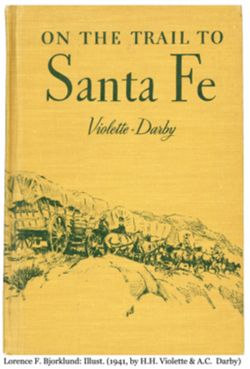
- Description:
- Cover illustrated in green on yellow/brown, covered wagon train, with line of horses, some with riders (?), in rocky terrain
- Creator:
- Bjorklund, Lorence F.
- Contributor:
- Darby, A.C. and Violette, H.H.
- Language:
- English
- Date Created:
- 1941
- Rights Statement:
- http://rightsstatements.org/vocab/NoC-US/1.0/
- Publication Place:
- Houghton Mifflin, Boston, MA
- Physical Description:
- W 13.5" x H 9.75" and Hardcover book with wrap-around illustrated cover
- Alternate Identifier:
- Lorence F. Bjorklund 98. Front
- Rights Notes:
- This work is not subject to copyright, as its copyright has not been renewed. For questions please contact Eiteljorg Museum management.
- Holding Location:
- Indianapolis - Eiteljorg Museum of American Indians and Western Art
500 West Washington Street
Indianapolis, IN 46204
Contact at 317-636-9378
-
- Description:
- 1928
- Subject:
- Topical Subject: Soviet Union, Geographic Subject: Krasnoyarsk, and Topical Subject: Maps
- Publisher:
- Генеральный штаб Красной Армии
- Language:
- Russian
- Date Created:
- 1941
- Identifier:
- VAC9619-002303
- Genre:
- Military Maps and Topographic Maps
- Geographic Location:
- Coordinates: 56, 92.5, 56.3333, 93
- Related URL:
- Download GeoTIFF: https://drive.google.com/file/d/1eXtP8NDTo5NVf4XFV5a0XOlQl2LFRv9s/view?usp=sharing and Catalog URL: https://iucat.iu.edu/catalog/5020129
- Abstract:
- Modern area represented: Krasnoyarsk, Russia
- Call Number:
- G7000 s100 .S7 sheet O-46-138
- Caption:
- Секретно,Для служебного пользования
- City:
- Красноярск (Krasnoyarsk)
- Copyright Holder:
- No Copyright - United States
- Country:
- СССР (USSR)
- State/Province:
- РСФСР (RSFSR) and Красноярский край (Krasnoyarsk kray)
- Physical Description:
- Scale: 1:100,000
- Persistent URL:
- http://purl.dlib.indiana.edu/iudl/images/VAC9619/VAC9619-002303
- Provenance:
- DMA Topographic Center
-
- Subject:
- Topical Subject: Soviet Union, Geographic Subject: Yaroslavl, and Topical Subject: Maps
- Publisher:
- Генеральный штаб Красной Армии
- Language:
- Russian
- Date Created:
- 1941
- Identifier:
- VAC9619-002239
- Genre:
- Topographic Maps and Military Maps
- Geographic Location:
- Coordinates: 57.3333, 39.5, 57.6667, 40
- Related URL:
- Catalog URL: https://iucat.iu.edu/catalog/5020129 and Download GeoTIFF: https://drive.google.com/file/d/1s1X2JX-UlHkHlKMosuECdWUBwvDsqFQ1/view?usp=sharing
- Abstract:
- Modern area represented: Yaroslavl, Yaroslavl oblast, Russia
- Call Number:
- G7000 s100 .S7 sheet O-37-92
- Caption:
- Для служебного пользования,Captured map
- City:
- Ярославль (Yaroslavl')
- Copyright Holder:
- No Copyright - United States
- Country:
- СССР (USSR)
- State/Province:
- Ярославская область (Yaroslavl oblast) and РСФСР (RSFSR)
- Physical Description:
- Scale: 1:100,000
- Persistent URL:
- http://purl.dlib.indiana.edu/iudl/images/VAC9619/VAC9619-002239
- Provenance:
- DMA Topographic Center, Army Map Service Library
-
- Subject:
- Topical Subject: Maps, Geographic Subject: Klementyevo, and Topical Subject: Soviet Union
- Publisher:
- Генеральный штаб Красной Армии
- Language:
- Russian
- Date Created:
- 1941
- Identifier:
- VAC9619-002238
- Genre:
- Military Maps and Topographic Maps
- Geographic Location:
- Coordinates: 57.3333, 38.5, 57.6667, 39
- Related URL:
- Catalog URL: https://iucat.iu.edu/catalog/5020129 and Download GeoTIFF: https://drive.google.com/file/d/1joiqfo3Ali_JYasCpXjRrv-qIQhrTwDA/view?usp=sharing
- Abstract:
- Modern area represented: Klementyevo, Yaroslavl oblast, Russia
- Call Number:
- G7000 s100 .S7 sheet O-37-90
- City:
- Клементьево (Klementyevo)
- Copyright Holder:
- No Copyright - United States
- Country:
- СССР (USSR)
- State/Province:
- РСФСР (RSFSR) and Ярославская область (Yaroslavl oblast)
- Physical Description:
- Scale: 1:100,000
- Persistent URL:
- http://purl.dlib.indiana.edu/iudl/images/VAC9619/VAC9619-002238
- Provenance:
- DMA Topographic Center, Army Map Service Library, University of Kansas Map Library
-
- Description:
- 1940
- Subject:
- Geographic Subject: Myshkin, Topical Subject: Maps, and Topical Subject: Soviet Union
- Publisher:
- Генеральный штаб Красной Армии
- Language:
- Russian
- Date Created:
- 1941
- Identifier:
- VAC9619-002236
- Genre:
- Military Maps and Topographic Maps
- Geographic Location:
- Coordinates: 57.6667, 38, 58, 38.5
- Related URL:
- Download GeoTIFF: https://drive.google.com/file/d/1oDZnjFtMtP6X8UNKiCsr8XExnCrpmU89/view?usp=sharing and Catalog URL: https://iucat.iu.edu/catalog/5020129
- Abstract:
- Modern area represented: Мышкин (Myshkin), Yaroslavskaya oblast, Russia
- Call Number:
- G7000 s100 .S7 sheet O-37-77
- Caption:
- Для служебного пользования
- City:
- Мышкино (Myshkino)
- Copyright Holder:
- No Copyright - United States
- Country:
- СССР (USSR)
- State/Province:
- Ярославская область (Yaroslavl oblast) and РСФСР (RSFSR)
- Physical Description:
- Scale: 1:100,000
- Persistent URL:
- http://purl.dlib.indiana.edu/iudl/images/VAC9619/VAC9619-002236
- Provenance:
- DMA Topographic Center, Army Map Service Library
-
- Description:
- 1938
- Subject:
- Topical Subject: Maps, Topical Subject: Soviet Union, and Geographic Subject: Klin
- Publisher:
- Главное управление геодезии и картографии при СНК СССР
- Language:
- Russian
- Date Created:
- 1941
- Identifier:
- VAC9619-003517
- Genre:
- Topographic Maps and Military Maps
- Geographic Location:
- Coordinates: 56.167, 36.5, 56.333, 36.75
- Related URL:
- Catalog URL: http://iucat.iu.edu/catalog/5020131 and Download GeoTIFF: https://drive.google.com/file/d/1ZMLM09iyeI7_y2lx4RQCcTHNIRjBbZTL/view?usp=sharing
- Abstract:
- Modern area represented: Klin, Russia
- Call Number:
- GM G7000 s50 .S68 sheet O-37-134-A
- City:
- Клин (Klin)
- Copyright Holder:
- No Copyright - United States
- Country:
- СССР (USSR)
- State/Province:
- Солнечногорский район (Solnechnogorsky district), Московская область (Moscow oblast), and Клинский район (Klinsky district)
- Physical Description:
- Scale: 1:50,000
- Persistent URL:
- http://purl.dlib.indiana.edu/iudl/images/VAC9619/VAC9619-003517
- Provenance:
- DMA Topographic Center, Army Map Service Library, Library of Congress Geography & Map Division
-
- Description:
- 1938
- Subject:
- Topical Subject: Maps, Geographic Subject: Denkovo, and Topical Subject: Soviet Union
- Publisher:
- Главное управление геодезии и картографии при СНК СССР
- Language:
- Russian
- Date Created:
- 1941
- Identifier:
- VAC9619-003516
- Genre:
- Topographic Maps and Military Maps
- Geographic Location:
- Coordinates: 56, 36.25, 56.167, 36.5
- Related URL:
- Catalog URL: http://iucat.iu.edu/catalog/5020131 and Download GeoTIFF: https://drive.google.com/file/d/15_6DpZjY9YjpGrhF-Le1L8fdxmap_zTB/view?usp=sharing
- Abstract:
- Modern area represented: Denkovo, Russia
- Call Number:
- GM G7000 s50 .S68 sheet O-37-133-D
- City:
- Деньково (Denkovo)
- Copyright Holder:
- No Copyright - United States
- Country:
- СССР (USSR)
- State/Province:
- Волоколамский район (Volokolamsky district), Клинский район (Klinsky district), Ново-Петровский (Novopetrovsky district), and Московская область (Moscow oblast)
- Physical Description:
- Scale: 1:50,000
- Persistent URL:
- http://purl.dlib.indiana.edu/iudl/images/VAC9619/VAC9619-003516
- Provenance:
- DMA Topographic Center, Army Map Service Library, Library of Congress Geography & Map Division
-
- Subject:
- Geographic Subject: Teryayevo, Topical Subject: Soviet Union, and Topical Subject: Maps
- Publisher:
- Главное управление геодезии и картографии при СНК СССР
- Language:
- Russian
- Date Created:
- 1941
- Identifier:
- VAC9619-003515
- Genre:
- Topographic Maps and Military Maps
- Geographic Location:
- Coordinates: 56.167, 36, 56.333, 36.25
- Related URL:
- Download GeoTIFF: https://drive.google.com/file/d/10M8uz-wV7Uejy6zTPeWDdLEvJ1CG2-O-/view?usp=sharing and Catalog URL: http://iucat.iu.edu/catalog/5020131
- Abstract:
- Modern area represented: Теряево (Teryayevo), Moscow oblast, Russia
- Call Number:
- GM G7000 s50 .S68 sheet O-37-133-A
- City:
- Теряева Слобода (Teryayeva Sloboda)
- Copyright Holder:
- No Copyright - United States
- Country:
- СССР (USSR)
- State/Province:
- Волоколамский район (Volokolamsky district), Клинский район (Klinsky district), Московская область (Moscow oblast), and Лотошинский район (Lotoshinsky district)
- Physical Description:
- Scale: 1:50,000
- Persistent URL:
- http://purl.dlib.indiana.edu/iudl/images/VAC9619/VAC9619-003515
- Provenance:
- DMA Topographic Center, Army Map Service Library, Library of Congress Geography & Map Division
-
- Subject:
- Topical Subject: Soviet Union, Geographic Subject: Teryayevo, and Topical Subject: Maps
- Publisher:
- Генеральный штаб Красной Армии
- Language:
- Russian
- Date Created:
- 1941
- Identifier:
- VAC9619-002274
- Genre:
- Topographic Maps and Military Maps
- Geographic Location:
- Coordinates: 56, 36, 56.3333, 36.5
- Related URL:
- Download GeoTIFF: https://drive.google.com/file/d/1sy_98R_LtHt-1ICUtLvmeh7ZdoLRHyPb/view?usp=sharing and Catalog URL: https://iucat.iu.edu/catalog/5020129
- Abstract:
- Modern area represented: Теряево (Teryayevo), Moscow oblast, Russia
- Call Number:
- G7000 s100 .S7 sheet O-37-133
- Caption:
- Для служебного пользования
- City:
- Теряева Слобода (Teryayeva Sloboda)
- Copyright Holder:
- No Copyright - United States
- Country:
- СССР (USSR)
- State/Province:
- РСФСР (RSFSR) and Московская область (Moscow oblast)
- Physical Description:
- Scale: 1:100,000
- Persistent URL:
- http://purl.dlib.indiana.edu/iudl/images/VAC9619/VAC9619-002274
- Provenance:
- DMA Topographic Center, Army Map Service Library, Library of Congress Geography & Map Division
-
- Description:
- 1940
- Subject:
- Topical Subject: Maps, Topical Subject: Soviet Union, and Geographic Subject: Konstantinovo
- Publisher:
- Генеральный штаб Красной Армии
- Language:
- Russian
- Date Created:
- 1941
- Identifier:
- VAC9619-002270
- Genre:
- Topographic Maps and Military Maps
- Geographic Location:
- Coordinates: 56.3333, 38, 56.6667, 38.5
- Related URL:
- Catalog URL: https://iucat.iu.edu/catalog/5020129 and Download GeoTIFF: https://drive.google.com/file/d/18TKm-zzpCkazemDPv8SYfhfO8Ynm9ivL/view?usp=sharing
- Abstract:
- Modern area represented: Konstantinovo, Russia
- Call Number:
- G7000 s100 .S7 sheet O-37-125
- Caption:
- Для служебного пользования
- City:
- Константиново (Konstantinovo)
- Copyright Holder:
- No Copyright - United States
- Country:
- СССР (USSR)
- State/Province:
- Ивановская область (Ivanovo oblast), Московская область (Moscow oblast), and Ярославская область (Yaroslavl oblast)
- Physical Description:
- Scale: 1:100,000
- Persistent URL:
- http://purl.dlib.indiana.edu/iudl/images/VAC9619/VAC9619-002270
- Provenance:
- DMA Topographic Center, Army Map Service Library
-
- Subject:
- Topical Subject: Maps, Geographic Subject: Dmitrov, and Topical Subject: Soviet Union
- Publisher:
- Генеральный штаб Красной Армии
- Language:
- Russian
- Date Created:
- 1941
- Identifier:
- VAC9619-002269
- Genre:
- Military Maps and Topographic Maps
- Geographic Location:
- Coordinates: 56.3333, 37.5, 56.6667, 38
- Related URL:
- Catalog URL: https://iucat.iu.edu/catalog/5020129 and Download GeoTIFF: https://drive.google.com/file/d/17fda1Gv37GoO70UekfBLwpwDzWKOPect/view?usp=sharing
- Abstract:
- Modern area represented: Dmitrov, Moscow oblast, Russia
- Call Number:
- G7000 s100 .S7 sheet O-37-124
- Caption:
- Captured map
- City:
- Дмитров (Dmitrov)
- Copyright Holder:
- No Copyright - United States
- Country:
- СССР (USSR)
- State/Province:
- РСФСР (RSFSR) and Московская область (Moscow oblast)
- Physical Description:
- Scale: 1:100,000
- Persistent URL:
- http://purl.dlib.indiana.edu/iudl/images/VAC9619/VAC9619-002269
- Provenance:
- DMA Topographic Center, Army Map Service Library
-
- Description:
- 1938
- Subject:
- Topical Subject: Maps, Topical Subject: Soviet Union, and Geographic Subject: Sloboda
- Publisher:
- Главное управление геодезии и картографии при СНК СССР
- Language:
- Russian
- Date Created:
- 1941
- Identifier:
- VAC9619-003514
- Genre:
- Topographic Maps and Military Maps
- Geographic Location:
- Coordinates: 56.333, 36.75, 56.5, 37
- Related URL:
- Download GeoTIFF: https://drive.google.com/file/d/1FIM5aUANKvW41Va_K16TJ3TTeA1rgXmo/view?usp=sharing and Catalog URL: http://iucat.iu.edu/catalog/5020131
- Abstract:
- Modern area represented: Sloboda, Russia
- Call Number:
- GM G7000 s50 .S68 sheet O-37-122-D
- City:
- Слобода (Sloboda)
- Copyright Holder:
- No Copyright - United States
- Country:
- СССР (USSR)
- State/Province:
- Солнечногорский район (Solnechnogorsky district), Клинский район (Klinsky district), and Московская область (Moscow oblast)
- Physical Description:
- Scale: 1:50,000
- Persistent URL:
- http://purl.dlib.indiana.edu/iudl/images/VAC9619/VAC9619-003514
- Provenance:
- DMA Topographic Center, Army Map Service Library, OMAHA, Library of Congress Geography & Map Division
-
- Description:
- 1938
- Subject:
- Geographic Subject: Selikhovo, Topical Subject: Maps, and Topical Subject: Soviet Union
- Publisher:
- Главное управление геодезии и картографии при СНК СССР
- Language:
- Russian
- Date Created:
- 1941
- Identifier:
- VAC9619-003523
- Genre:
- Topographic Maps and Military Maps
- Geographic Location:
- Coordinates: 56.5, 36.75, 56.667, 37
- Related URL:
- Catalog URL: http://iucat.iu.edu/catalog/5020131 and Download GeoTIFF: https://drive.google.com/file/d/1rCotVjjaQLPnjUbK9attztcgGVRXarAQ/view?usp=sharing
- Abstract:
- Modern area represented: Селихово (Selikhovo), Tverskaya oblast, Russia
- Call Number:
- GM G7000 s50 .S68 sheet O-37-122-B
- City:
- Селехово (Selekhovo)
- Copyright Holder:
- No Copyright - United States
- Country:
- СССР (USSR)
- State/Province:
- Калининская область (Kalinin oblast), Клинский район (Klinsky district), Московская область (Moscow oblast), Конаковский район (Konakovsky district), and Зав...
- Physical Description:
- Scale: 1:50,000
- Persistent URL:
- http://purl.dlib.indiana.edu/iudl/images/VAC9619/VAC9619-003523
- Provenance:
- DMA Topographic Center, Army Map Service Library, OMAHA, Library of Congress Geography & Map Division
-
- Description:
- 1938
- Subject:
- Topical Subject: Maps, Topical Subject: Soviet Union, and Geographic Subject: Novozavidovskiy
- Publisher:
- Генеральный штаб Красной Армии
- Language:
- Russian
- Date Created:
- 1941
- Identifier:
- VAC9619-002268
- Genre:
- Topographic Maps and Military Maps
- Geographic Location:
- Coordinates: 56.3333, 36, 56.6667, 36.5
- Related URL:
- Download GeoTIFF: https://drive.google.com/file/d/1HeMYrioh-yKFu9soZycFgrmJ2jFSSWRu/view?usp=sharing and Catalog URL: https://iucat.iu.edu/catalog/5020129
- Abstract:
- Modern area represented: Новозавидовский (Novozavidovskiy), Tverskaya oblast, Russia
- Call Number:
- G7000 s100 .S7 sheet O-37-121
- Caption:
- Для служебного пользования
- City:
- Ново-Завидовский (Novo-Zavidovskiy)
- Copyright Holder:
- No Copyright - United States
- Country:
- СССР (USSR)
- State/Province:
- Московская область (Moscow oblast), Калининская область (Kalinin oblast), and РСФСР (RSFSR)
- Physical Description:
- Scale: 1:100,000
- Persistent URL:
- http://purl.dlib.indiana.edu/iudl/images/VAC9619/VAC9619-002268
- Provenance:
- DMA Topographic Center, Army Map Service Library, OMAHA, Library of Congress Geography & Map Division
-
- Description:
- 1941
- Subject:
- Topical Subject: Soviet Union, Geographic Subject: Teykovo, and Topical Subject: Maps
- Publisher:
- Генеральный штаб Красной Армии
- Language:
- Russian
- Date Created:
- 1941
- Identifier:
- VAC9619-002267
- Genre:
- Topographic Maps and Military Maps
- Geographic Location:
- Coordinates: 56.6667, 40.5, 57, 41
- Related URL:
- Download GeoTIFF: https://drive.google.com/file/d/1RjM2rC6M3gF57M03QhrF9yCakUvILk10/view?usp=sharing and Catalog URL: https://iucat.iu.edu/catalog/5020129
- Abstract:
- Modern area represented: Teykovo, Ivanovo oblast, Russia
- Call Number:
- G7000 s100 .S7 sheet O-37-118
- Caption:
- Для служебного пользования
- City:
- Тейково (Teykovo)
- Copyright Holder:
- No Copyright - United States
- Country:
- СССР (USSR)
- State/Province:
- Ивановская область (Ivanovo oblast) and РСФСР (RSFSR)
- Physical Description:
- Scale: 1:100,000
- Persistent URL:
- http://purl.dlib.indiana.edu/iudl/images/VAC9619/VAC9619-002267
- Provenance:
- DMA Topographic Center, Army Map Service Library
-
- Description:
- 1941
- Subject:
- Topical Subject: Maps, Geographic Subject: Krapivnovo, and Topical Subject: Soviet Union
- Publisher:
- Генеральный штаб Красной Армии
- Language:
- Russian
- Date Created:
- 1941
- Identifier:
- VAC9619-002266
- Genre:
- Topographic Maps and Military Maps
- Geographic Location:
- Coordinates: 56.6667, 40, 57, 40.5
- Related URL:
- Download GeoTIFF: https://drive.google.com/file/d/1mY9jXc-TeeSJliLq7FHC3H7qhXfNXT3T/view?usp=sharing and Catalog URL: https://iucat.iu.edu/catalog/5020129
- Abstract:
- Modern area represented: Krapivnovo, Ivanovo oblast, Russia
- Call Number:
- G7000 s100 .S7 sheet O-37-117
- City:
- Крапивново (Krapivnovo)
- Copyright Holder:
- No Copyright - United States
- Country:
- СССР (USSR)
- State/Province:
- Ивановская область (Ivanovo oblast) and РСФСР (RSFSR)
- Physical Description:
- Scale: 1:100,000
- Persistent URL:
- http://purl.dlib.indiana.edu/iudl/images/VAC9619/VAC9619-002266
- Provenance:
- DMA Topographic Center, Army Map Service Library, Auswärtiges Amt. Geographischer Dienst
-
- Description:
- 1940
- Subject:
- Topical Subject: Soviet Union, Topical Subject: Maps, and Geographic Subject: Nagorye
- Publisher:
- Генеральный штаб Красной Армии
- Language:
- Russian
- Date Created:
- 1941
- Identifier:
- VAC9619-002264
- Genre:
- Topographic Maps and Military Maps
- Geographic Location:
- Coordinates: 56.6667, 38, 57, 38.5
- Related URL:
- Download GeoTIFF: https://drive.google.com/file/d/1E9gNjqa3wTL-m9_slbTl-39r5-bE3Ube/view?usp=sharing and Catalog URL: https://iucat.iu.edu/catalog/5020129
- Abstract:
- Modern area represented: Nagorye, Yaroslavl oblast, Russia
- Call Number:
- G7000 s100 .S7 sheet O-37-113
- Caption:
- Для служебного пользования
- City:
- Нагорье (Nagorye)
- Copyright Holder:
- No Copyright - United States
- Country:
- СССР (USSR)
- State/Province:
- Калининская область (Kalinin oblast), РСФСР (RSFSR), Московская область (Moscow oblast), Ярославская область (Yaroslavl oblast), and Ивановская область (Ivan...
- Physical Description:
- Scale: 1:100,000
- Persistent URL:
- http://purl.dlib.indiana.edu/iudl/images/VAC9619/VAC9619-002264
- Provenance:
- DMA Topographic Center, Army Map Service Library, OMAHA, Library of Congress Geography & Map Division, Geographic Names Branch
-
- Description:
- 1939
- Subject:
- Topical Subject: Soviet Union, Topical Subject: Maps, and Geographic Subject: Taldom
- Publisher:
- Генеральный штаб Красной Армии
- Language:
- Russian
- Date Created:
- 1941
- Identifier:
- VAC9619-002263
- Genre:
- Military Maps and Topographic Maps
- Geographic Location:
- Coordinates: 56.6667, 37.5, 57, 38
- Related URL:
- Download GeoTIFF: https://drive.google.com/file/d/1kkC5vgWVE3gr7QP3IYjqvPllOmUXgL6V/view?usp=sharing and Catalog URL: https://iucat.iu.edu/catalog/5020129
- Abstract:
- Modern area represented: Taldom, Moscow oblast, Russia
- Call Number:
- G7000 s100 .S7 sheet O-37-112
- Caption:
- Для служебного пользования
- City:
- Талдом (Taldom)
- Copyright Holder:
- No Copyright - United States
- Country:
- СССР (USSR)
- State/Province:
- Московская область (Moscow oblast), РСФСР (RSFSR), and Калининская область (Kalinin oblast)
- Physical Description:
- Scale: 1:100,000
- Persistent URL:
- http://purl.dlib.indiana.edu/iudl/images/VAC9619/VAC9619-002263
- Provenance:
- DMA Topographic Center, Army Map Service Library, OMAHA, Library of Congress Geography & Map Division, Auswärtiges Amt. Geographischer Dienst, Geographic...
-
- Subject:
- Topical Subject: Maps, Geographic Subject: Kimry, and Topical Subject: Soviet Union
- Publisher:
- Генеральный штаб Красной Армии
- Language:
- Russian
- Date Created:
- 1941
- Identifier:
- VAC9619-002262
- Genre:
- Military Maps and Topographic Maps
- Geographic Location:
- Coordinates: 56.6667, 37, 57, 37.5
- Related URL:
- Download GeoTIFF: https://drive.google.com/file/d/1TQHCU93JrRDEdONTzJmYwAkk8JMrHVcG/view?usp=sharing and Catalog URL: https://iucat.iu.edu/catalog/5020129
- Abstract:
- Modern area represented: Кимры (Kimry), Tverskaya oblast, Russia
- Call Number:
- G7000 s100 .S7 sheet O-37-111
- Caption:
- Captured map
- City:
- Кимры (Kimry)
- Copyright Holder:
- No Copyright - United States
- Country:
- СССР (USSR)
- State/Province:
- Московская область (Moscow oblast) and Калининская область (Kalinin oblast)
- Physical Description:
- Scale: 1:100,000
- Persistent URL:
- http://purl.dlib.indiana.edu/iudl/images/VAC9619/VAC9619-002262
- Provenance:
- DMA Topographic Center, Army Map Service Library
-
- Description:
- 1938
- Subject:
- Topical Subject: Maps, Geographic Subject: Konakovo, and Topical Subject: Soviet Union
- Publisher:
- Главное управление государственной съемки и картографии НКВД СССР
- Language:
- Russian
- Date Created:
- 1941
- Identifier:
- VAC9619-003522
- Genre:
- Topographic Maps and Military Maps
- Geographic Location:
- Coordinates: 56.667, 36.75, 56.833, 37
- Related URL:
- Download GeoTIFF: https://drive.google.com/file/d/113GolZU0LWI5CWw31Rws39j5ikise7Gi/view?usp=sharing and Catalog URL: http://iucat.iu.edu/catalog/5020131
- Abstract:
- Modern area represented: Конаково (Konakovo), Tverskaya oblast, Russia
- Call Number:
- GM G7000 s50 .S68 sheet O-37-110-D
- City:
- Конаково (Konakovo)
- Copyright Holder:
- No Copyright - United States
- Country:
- СССР (USSR)
- State/Province:
- Калининская область (Kalinin oblast), Оршинский район (Orshinsky district), Конаковский район (Konakovsky district), and Кимрский район (Kimrsky district)
- Physical Description:
- Scale: 1:50,000
- Persistent URL:
- http://purl.dlib.indiana.edu/iudl/images/VAC9619/VAC9619-003522
- Provenance:
- DMA Topographic Center, Army Map Service Library, OMAHA, Library of Congress Geography & Map Division
-
- Description:
- 1941
- Subject:
- Geographic Subject: Ivanovo, Topical Subject: Maps, and Topical Subject: Soviet Union
- Publisher:
- Генеральный штаб Красной Армии
- Language:
- Russian
- Date Created:
- 1941
- Identifier:
- VAC9619-002261
- Genre:
- Military Maps and Topographic Maps
- Geographic Location:
- Coordinates: 57, 40.5, 57.3333, 41
- Related URL:
- Download GeoTIFF: https://drive.google.com/file/d/1r75JJDLugCEjO7_buBFVzTeMY1z62dbA/view?usp=sharing and Catalog URL: https://iucat.iu.edu/catalog/5020129
- Abstract:
- Modern area represented: Ivanovo, Russia
- Call Number:
- G7000 s100 .S7 sheet O-37-106
- Caption:
- Для служебного пользования
- City:
- Иваново (Ivanovo)
- Copyright Holder:
- No Copyright - United States
- Country:
- СССР (USSR)
- State/Province:
- Ивановская область (Ivanovo oblast) and Ярославская область (Yaroslavl oblast)
- Physical Description:
- Scale: 1:100,000
- Persistent URL:
- http://purl.dlib.indiana.edu/iudl/images/VAC9619/VAC9619-002261
- Provenance:
- DMA Topographic Center, Army Map Service Library, University of Kansas Map Library
-
- Subject:
- Topical Subject: Maps, Topical Subject: Soviet Union, and Geographic Subject: Komsomol'sk
- Publisher:
- Генеральный штаб Красной Армии
- Language:
- Russian
- Date Created:
- 1941
- Identifier:
- VAC9619-002260
- Genre:
- Military Maps and Topographic Maps
- Geographic Location:
- Coordinates: 57, 40, 57.3333, 40.5
- Related URL:
- Catalog URL: https://iucat.iu.edu/catalog/5020129 and Download GeoTIFF: https://drive.google.com/file/d/14tRLuYnJAQUsHpoXw8ZLFqoMR0eBn57k/view?usp=sharing
- Abstract:
- Modern area represented: Комсомольск (Komsomol'sk), Ivanovskaya oblast, Russia
- Call Number:
- G7000 s100 .S7 sheet O-37-105
- City:
- Комсомольск (Komsomol'sk)
- Copyright Holder:
- No Copyright - United States
- Country:
- СССР (USSR)
- State/Province:
- РСФСР (RSFSR), Ярославская область (Yaroslavl oblast), and Ивановская область (Ivanovo oblast)
- Physical Description:
- Scale: 1:100,000
- Persistent URL:
- http://purl.dlib.indiana.edu/iudl/images/VAC9619/VAC9619-002260
- Provenance:
- DMA Topographic Center, Army Map Service Library
-
- Subject:
- Geographic Subject: Kalyazin, Topical Subject: Soviet Union, and Topical Subject: Maps
- Publisher:
- Генеральный штаб Красной Армии
- Language:
- Russian
- Date Created:
- 1941
- Identifier:
- VAC9619-002240
- Genre:
- Military Maps and Topographic Maps
- Geographic Location:
- Coordinates: 57, 37.5, 57.3333, 38
- Related URL:
- Download GeoTIFF: https://drive.google.com/file/d/1W4tD9KPybJWJ3eX1HIuJOrPOTP7KNdqb/view?usp=sharing and Catalog URL: https://iucat.iu.edu/catalog/5020129
- Abstract:
- Modern area represented: Калязин (Kalyazin), Tverskaya oblast, Russia
- Call Number:
- G7000 s100 .S7 sheet O-37-100
- City:
- Калязин (Kalyazin)
- Copyright Holder:
- No Copyright - United States
- Country:
- СССР (USSR)
- State/Province:
- Калининская область (Kalinin oblast) and РСФСР (RSFSR)
- Physical Description:
- Scale: 1:100,000
- Persistent URL:
- http://purl.dlib.indiana.edu/iudl/images/VAC9619/VAC9619-002240
- Provenance:
- DMA Topographic Center, Army Map Service Library, OMAHA, Library of Congress Geography & Map Division
-
- Description:
- 1938
- Subject:
- Topical Subject: Maps, Geographic Subject: Bol’shoye Ploskoye, and Topical Subject: Soviet Union
- Publisher:
- Главное управление геодезии и картографии при СНК СССР
- Language:
- Russian
- Date Created:
- 1941
- Identifier:
- VAC9619-003537
- Genre:
- Topographic Maps and Military Maps
- Geographic Location:
- Coordinates: 57.5, 35.25, 57.667, 35.5
- Related URL:
- Catalog URL: http://iucat.iu.edu/catalog/5020131 and Download GeoTIFF: https://drive.google.com/file/d/1EeF7OKrRaKRbnTsGiQ8gRl4d03khsSsn/view?usp=sharing
- Abstract:
- Modern area represented: Bolshoye Ploskoye, Tverskaya oblast, Russia
- Call Number:
- GM G7000 s50 .S68 sheet O-36-95-B
- Caption:
- Для служебного пользования
- City:
- Большое Плоское (Bolshoye Ploskoye)
- Copyright Holder:
- No Copyright - United States
- Country:
- СССР (USSR)
- State/Province:
- Калининская область (Kalinin oblast)
- Physical Description:
- Scale: 1:50,000
- Persistent URL:
- http://purl.dlib.indiana.edu/iudl/images/VAC9619/VAC9619-003537
- Provenance:
- Army Map Service Library, Library of Congress International Exchange Division of Maps
-
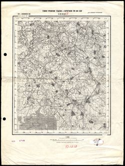
- Description:
- 1938
- Subject:
- Topical Subject: Soviet Union, Geographic Subject: Bolshoye Ploskoye, and Topical Subject: Maps
- Publisher:
- Главное Управление Геодезии и Картографии при СНК СССР
- Language:
- Russian
- Date Created:
- 1941
- Identifier:
- VAC9619-002730
- Genre:
- Topographic Maps and Military Maps
- Geographic Location:
- 57.666667, 35.5 and Coordinates: 57.5, 35.25
- Related URL:
- Download GeoTIFF: https://drive.google.com/file/d/1O9oNQ-2N946R7PqSKefXi5RLKUZDzqDx/view?usp=sharing and Catalog URL: http://iucat.iu.edu/catalog/5020131
- Abstract:
- Modern area represented: Bolshoye Ploskoye, Tver oblast, Russia
- Call Number:
- G7000 s50 .S68 sheet O-36-95-B
- Caption:
- Для служебного пользования
- Copyright Holder:
- No Copyright - United States
- Country:
- СССР (USSR)
- State/Province:
- РСФСР (RSFSR) and Калининская область (Kalinin oblast)
- Physical Description:
- Scale: 1:50,000
- Persistent URL:
- http://purl.dlib.indiana.edu/iudl/images/VAC9619/VAC9619-002730
- Provenance:
- Library of Congress Geography & Map Division
-
- Description:
- 1938
- Subject:
- Geographic Subject: Zhilotkovo, Topical Subject: Maps, and Topical Subject: Soviet Union
- Publisher:
- Главное управление геодезии и картографии при СНК СССР
- Language:
- Russian
- Date Created:
- 1941
- Identifier:
- VAC9619-003536
- Genre:
- Military Maps and Topographic Maps
- Geographic Location:
- Coordinates: 57.5, 34, 57.667, 34.25
- Related URL:
- Download GeoTIFF: https://drive.google.com/file/d/1Pe-aFLW2Qa6vUmm_dwALhMl2GYKWwbBC/view?usp=sharing and Catalog URL: http://iucat.iu.edu/catalog/5020131
- Abstract:
- Modern area represented: Жилотково (Zhilotkovo), Tverskaya oblast, Russia
- Call Number:
- GM G7000 s50 .S68 sheet O-36-93-A
- City:
- Жилотково (Zhilotkovo)
- Copyright Holder:
- No Copyright - United States
- Country:
- СССР (USSR)
- State/Province:
- Бологовский район (Bologovsky district), Вышневолоцкий район (Vyshnevolotsky district), and Калининская область (Kalinin oblast)
- Physical Description:
- Scale: 1:50,000
- Persistent URL:
- http://purl.dlib.indiana.edu/iudl/images/VAC9619/VAC9619-003536
- Provenance:
- DMA Topographic Center, Army Map Service Library, OMAHA, Library of Congress Geography & Map Division
-
- Description:
- 1939
- Subject:
- Topical Subject: Maps, Geographic Subject: Kostruble, and Topical Subject: Soviet Union
- Publisher:
- Главное управление геодезии и картографии при СНК СССР
- Language:
- Russian
- Date Created:
- 1941
- Identifier:
- VAC9619-003535
- Genre:
- Topographic Maps and Military Maps
- Geographic Location:
- Coordinates: 57.3333, 33.5, 57.5, 33.75
- Related URL:
- Catalog URL: http://iucat.iu.edu/catalog/5020131 and Download GeoTIFF: https://drive.google.com/file/d/1QDlMGkmv8VYRkMLbUljh11YMjbuAlbNM/view?usp=sharing
- Abstract:
- Modern area represented: Кострубле (Kostruble), Tverskaya oblast, Russia
- Call Number:
- GM G7000 s50 .S68 sheet O-36-92-C
- Caption:
- Для служебного пользования
- City:
- Каструбли (Kastrubli)
- Copyright Holder:
- No Copyright - United States
- Country:
- СССР (USSR)
- State/Province:
- Фировский район (Firovsky district), Калининская область (Kalinin oblast), and Осташковский район (Ostashkovsky district)
- Physical Description:
- Scale: 1:50,000
- Persistent URL:
- http://purl.dlib.indiana.edu/iudl/images/VAC9619/VAC9619-003535
- Provenance:
- DMA Topographic Center, Army Map Service Library, OMAHA, Library of Congress Geography & Map Division
-
- Description:
- 1939
- Subject:
- Geographic Subject: Shishkovo, Topical Subject: Soviet Union, and Topical Subject: Maps
- Publisher:
- Главное управление геодезии и картографии при СНК СССР
- Language:
- Russian
- Date Created:
- 1941
- Identifier:
- VAC9619-002187
- Genre:
- Military Maps and Topographic Maps
- Geographic Location:
- Coordinates: 57.3333, 32.5, 57.6667, 33
- Related URL:
- Download GeoTIFF: https://drive.google.com/open?id=1t9eliFe23sv-tiuF09y-YiGhMD-CSu9x and Catalog URL: https://iucat.iu.edu/catalog/5020129
- Abstract:
- Modern area represented: Шишково (Shishkovo), Novgorodskaya oblast, Russia
- Call Number:
- G7000 s100 .S7 sheet O-36-90
- Caption:
- Для служебного пользования
- City:
- Шишково (Shishkovo)
- Copyright Holder:
- No Copyright - United States
- Country:
- СССР (USSR)
- State/Province:
- Калининская область (Kalinin oblast), РСФСР (RSFSR), and Ленинградская область (Leningrad oblast)
- Physical Description:
- Scale: 1:100,000
- Persistent URL:
- http://purl.dlib.indiana.edu/iudl/images/VAC9619/VAC9619-002187
- Provenance:
- DMA Topographic Center, Army Map Service Library, OMAHA, Library of Congress Geography & Map Division
-
- Description:
- 1938
- Subject:
- Topical Subject: Soviet Union, Geographic Subject: Demyansk, and Topical Subject: Maps
- Publisher:
- Главное управление геодезии и картографии при СНК СССР
- Language:
- Russian
- Date Created:
- 1941
- Identifier:
- VAC9619-002186
- Genre:
- Topographic Maps and Military Maps
- Geographic Location:
- Coordinates: 57.3333, 32, 57.6667, 32.5
- Related URL:
- Catalog URL: https://iucat.iu.edu/catalog/5020129 and Download GeoTIFF: https://drive.google.com/open?id=1BZn8_6UHOHxS9rXqkXT9DxmFIAG4rdVd
- Abstract:
- Modern area represented: Демянск (Demyansk), Novgorodskaya oblast, Russia
- Call Number:
- G7000 s100 .S7 sheet O-36-89
- Caption:
- Для служебного пользования
- City:
- Демянск (Demyansk)
- Copyright Holder:
- No Copyright - United States
- Country:
- СССР (USSR)
- State/Province:
- Ленинградская область (Leningrad oblast) and РСФСР (RSFSR)
- Physical Description:
- Scale: 1:100,000
- Persistent URL:
- http://purl.dlib.indiana.edu/iudl/images/VAC9619/VAC9619-002186
- Provenance:
- DMA Topographic Center, Army Map Service Library, OMAHA, Library of Congress Geography & Map Division
-
- Description:
- 1932
- Subject:
- Topical Subject: Soviet Union, Geographic Subject: Peregino, and Topical Subject: Maps
- Publisher:
- Генеральный штаб Красной Армии
- Language:
- Russian
- Date Created:
- 1941
- Identifier:
- VAC9619-002185
- Genre:
- Military Maps and Topographic Maps
- Geographic Location:
- Coordinates: 57.3333, 31, 57.6667, 31.5
- Related URL:
- Catalog URL: https://iucat.iu.edu/catalog/5020129 and Download GeoTIFF: https://drive.google.com/open?id=18RcyBRveLXeOsc5-pyIWB4uSnsi22MwM
- Abstract:
- Modern area represented: Перегино (Peregino), Novgorodskaya oblast, Russia
- Call Number:
- G7000 s100 .S7 sheet O-36-87
- Caption:
- Для служебного пользования and Временное издание
- City:
- Перегино (Peregino)
- Copyright Holder:
- No Copyright - United States
- Country:
- СССР (USSR)
- State/Province:
- Ленинградская область (Leningrad oblast) and РСФСР (RSFSR)
- Physical Description:
- Scale: 1:100,000
- Persistent URL:
- http://purl.dlib.indiana.edu/iudl/images/VAC9619/VAC9619-002185
- Provenance:
- DMA Topographic Center, Army Map Service Library, OMAHA, Library of Congress Geography & Map Division
-
- Description:
- 1938
- Subject:
- Geographic Subject: Berezayka, Topical Subject: Maps, and Topical Subject: Soviet Union
- Publisher:
- Генеральный штаб Красной Армии
- Language:
- Russian
- Date Created:
- 1941
- Identifier:
- VAC9619-002182
- Genre:
- Topographic Maps and Military Maps
- Geographic Location:
- Coordinates: 57.6667, 33.5, 58, 34
- Related URL:
- Download GeoTIFF: https://drive.google.com/open?id=1QiAfmg3ZSX3aKbq6-f147Zao2OA2Em5V and Catalog URL: https://iucat.iu.edu/catalog/5020129
- Abstract:
- Modern area represented: Березайка (Berezayka), Tverskaya oblast, Russia
- Call Number:
- G7000 s100 .S7 sheet O-36-80
- Caption:
- Для служебного пользования
- City:
- Березайка (Berezayka)
- Copyright Holder:
- No Copyright - United States
- Country:
- СССР (USSR)
- State/Province:
- Ленинградская область (Leningrad oblast), Калининская область (Kalinin oblast), and РСФСР (RSFSR)
- Physical Description:
- Scale: 1:100,000
- Persistent URL:
- http://purl.dlib.indiana.edu/iudl/images/VAC9619/VAC9619-002182
- Provenance:
- DMA Topographic Center, Army Map Service Library, OMAHA, Library of Congress Geography & Map Division
-
- Description:
- 1939
- Subject:
- Geographic Subject: Ust-Kapsha, Topical Subject: Maps, and Topical Subject: Soviet Union
- Publisher:
- Главное управление геодезии и картографии при СНК СССР
- Language:
- Russian
- Date Created:
- 1941
- Identifier:
- VAC9619-002121
- Genre:
- Topographic Maps and Military Maps
- Geographic Location:
- Coordinates: 59.6667, 33.5, 60, 34
- Related URL:
- Download GeoTIFF: https://drive.google.com/open?id=1v0rUcH43h8lwbjo2V_E6Q0HYc5K3MQC7 and Catalog URL: https://iucat.iu.edu/catalog/5020129
- Abstract:
- Modern area represented: Ust-Kapsha, Leningrad oblast, Russia
- Call Number:
- G7000 s100 .S7 sheet O-36-8
- Caption:
- Для служебного пользования,Captured map
- City:
- Усть-Капша (Ust-Kapsha)
- Copyright Holder:
- No Copyright - United States
- Country:
- СССР (USSR)
- State/Province:
- РСФСР (RSFSR) and Ленинградская область (Leningrad oblast)
- Physical Description:
- Scale: 1:100,000
- Persistent URL:
- http://purl.dlib.indiana.edu/iudl/images/VAC9619/VAC9619-002121
- Provenance:
- DMA Topographic Center, Army Map Service Library, OMAHA
-
- Description:
- 1939
- Subject:
- Topical Subject: Soviet Union, Topical Subject: Maps, and Geographic Subject: Valday
- Publisher:
- Главное управление геодезии и картографии при СНК СССР
- Language:
- Russian
- Date Created:
- 1941
- Identifier:
- VAC9619-002181
- Genre:
- Topographic Maps and Military Maps
- Geographic Location:
- Coordinates: 57.6667, 33, 58, 33.5
- Related URL:
- Catalog URL: https://iucat.iu.edu/catalog/5020129 and Download GeoTIFF: https://drive.google.com/open?id=1sMdJu5ffvYiEo-vdAAiLA3cOunomG5ma
- Abstract:
- Modern area represented: Валдай (Valday), Novgorodskaya oblast, Russia
- Call Number:
- G7000 s100 .S7 sheet O-36-79
- Caption:
- Для служебного пользования
- City:
- Валдай (Valday)
- Copyright Holder:
- No Copyright - United States
- Country:
- СССР (USSR)
- State/Province:
- Калининская область (Kalinin oblast), Ленинградская область (Leningrad oblast), and РСФСР (RSFSR)
- Physical Description:
- Scale: 1:100,000
- Persistent URL:
- http://purl.dlib.indiana.edu/iudl/images/VAC9619/VAC9619-002181
- Provenance:
- DMA Topographic Center, Army Map Service Library, OMAHA, Library of Congress Geography & Map Division
-
- Description:
- 1938
- Subject:
- Topical Subject: Soviet Union, Topical Subject: Maps, and Geographic Subject: Semenovshchina
- Publisher:
- Главное управление геодезии и картографии при СНК СССР
- Language:
- Russian
- Date Created:
- 1941
- Identifier:
- VAC9619-002180
- Genre:
- Topographic Maps and Military Maps
- Geographic Location:
- Coordinates: 57.6667, 32.5, 58, 33
- Related URL:
- Catalog URL: https://iucat.iu.edu/catalog/5020129 and Download GeoTIFF: https://drive.google.com/open?id=1IuWKZFYlg0ERFxDENwk3hpui7Kl6umeq
- Abstract:
- Modern area represented: Семеновщина (Semenovshchina), Novgorodskaya oblast, Russia
- Call Number:
- G7000 s100 .S7 sheet O-36-78
- Caption:
- Для служебного пользования and Captured map
- City:
- Семеновщина (Semenovshchina)
- Copyright Holder:
- No Copyright - United States
- Country:
- СССР (USSR)
- State/Province:
- РСФСР (RSFSR) and Ленинградская область (Leningrad oblast)
- Physical Description:
- Scale: 1:100,000
- Persistent URL:
- http://purl.dlib.indiana.edu/iudl/images/VAC9619/VAC9619-002180
- Provenance:
- DMA Topographic Center, Army Map Service Library, Library of Congress G & M Division
-
- Description:
- 1938
- Subject:
- Topical Subject: Maps, Topical Subject: Soviet Union, and Geographic Subject: Pola
- Publisher:
- Главное управление геодезии и картографии при СНК СССР
- Language:
- Russian
- Date Created:
- 1941
- Identifier:
- VAC9619-002179
- Genre:
- Topographic Maps and Military Maps
- Geographic Location:
- Coordinates: 57.6667, 31.5, 58, 32
- Related URL:
- Download GeoTIFF: https://drive.google.com/open?id=1zZnyMHQgQK-baO9C0ftoFCyAmTtGdxBD and Catalog URL: https://iucat.iu.edu/catalog/5020129
- Abstract:
- Modern area represented: Пола (Pola), Novgorodskaya oblast, Russia
- Call Number:
- G7000 s100 .S7 sheet O-36-76
- Caption:
- Captured map and Для служебного пользования
- City:
- Пола (Pola)
- Copyright Holder:
- No Copyright - United States
- Country:
- СССР (USSR)
- State/Province:
- РСФСР (RSFSR) and Ленинградская область (Leningrad oblast)
- Physical Description:
- Scale: 1:100,000
- Persistent URL:
- http://purl.dlib.indiana.edu/iudl/images/VAC9619/VAC9619-002179
- Provenance:
- DMA Topographic Center, Army Map Service Library, OMAHA, Library of Congress Geography & Map Division
-
- Description:
- 1932
- Subject:
- Topical Subject: Maps, Topical Subject: Soviet Union, and Geographic Subject: Gorodtsy
- Publisher:
- Генеральный штаб Красной Армии
- Language:
- Russian
- Date Created:
- 1941
- Identifier:
- VAC9619-002178
- Genre:
- Topographic Maps and Military Maps
- Geographic Location:
- Coordinates: 57.6667, 30.5, 58, 31
- Related URL:
- Download GeoTIFF: https://drive.google.com/open?id=1QAgY2xhAalQhjh9UzwOLfFQR3KY04YLz and Catalog URL: https://iucat.iu.edu/catalog/5020129
- Abstract:
- Modern area represented: Городцы (Gorodtsy), Novgorodskaya oblast, Russia
- Call Number:
- G7000 s100 .S7 sheet O-36-74
- Caption:
- Для служебного пользования and Временное издание
- City:
- Городцы (Gorodtsy)
- Copyright Holder:
- No Copyright - United States
- Country:
- СССР (USSR)
- State/Province:
- Ленинградская область (Leningrad oblast) and РСФСР (RSFSR)
- Physical Description:
- Scale: 1:100,000
- Persistent URL:
- http://purl.dlib.indiana.edu/iudl/images/VAC9619/VAC9619-002178
- Provenance:
- DMA Topographic Center, Army Map Service Library, OMAHA, Library of Congress Geography & Map Division
-
- Description:
- 1939
- Subject:
- Geographic Subject: Uglovka, Topical Subject: Soviet Union, and Topical Subject: Maps
- Publisher:
- Генеральный штаб Красной Армии
- Language:
- Russian
- Date Created:
- 1941
- Identifier:
- VAC9619-002152
- Genre:
- Topographic Maps and Military Maps
- Geographic Location:
- Coordinates: 58.0, 33.5, 58.3333, 34.0
- Related URL:
- Download GeoTIFF: https://drive.google.com/open?id=1mxAaHlaRDx4VCUOZMY9evdbT9-rp5E1T and Catalog URL: https://iucat.iu.edu/catalog/5020129
- Abstract:
- Modern area represented: Угловка (Uglovka), Novgorodskaya oblast, Russia
- Call Number:
- G7000 s100 .S7 sheet O-36-68
- Caption:
- Captured map and Для служебного пользования
- City:
- Угловка (Uglovka)
- Copyright Holder:
- No Copyright - United States
- Country:
- СССР (USSR)
- State/Province:
- Калининская область (Kalinin oblast), Ленинградская область (Leningrad oblast), and РСФСР (RSFSR)
- Physical Description:
- Scale: 1:100,000
- Persistent URL:
- http://purl.dlib.indiana.edu/iudl/images/VAC9619/VAC9619-002152
- Provenance:
- DMA Topographic Center, Army Map Service Library, OMAHA, Library of Congress Geography & Map Division
-
- Description:
- 1939
- Subject:
- Topical Subject: Soviet Union, Geographic Subject: Shuya, and Topical Subject: Maps
- Publisher:
- Главное управление геодезии и картографии при СНК СССР
- Language:
- Russian
- Date Created:
- 1941
- Identifier:
- VAC9619-002151
- Genre:
- Topographic Maps and Military Maps
- Geographic Location:
- Coordinates: 58, 33, 58.3333, 33.5
- Related URL:
- Catalog URL: https://iucat.iu.edu/catalog/5020129 and Download GeoTIFF: https://drive.google.com/open?id=12B3cJ_5IrjQRm_PXq7FKNN4Nd9o_O4NM
- Abstract:
- Modern area represented: Шуя (Shuya), Novgorodskaya oblast, Russia
- Call Number:
- G7000 s100 .S7 sheet O-36-67
- Caption:
- Captured map and Для служебного пользования
- City:
- Шуя (Shuya)
- Copyright Holder:
- No Copyright - United States
- Country:
- СССР (USSR)
- State/Province:
- РСФСР (RSFSR) and Ленинградская область (Leningrad oblast)
- Physical Description:
- Scale: 1:100,000
- Persistent URL:
- http://purl.dlib.indiana.edu/iudl/images/VAC9619/VAC9619-002151
- Provenance:
- DMA Topographic Center, Army Map Service Library, OMAHA, Library of Congress Geography & Map Division
-
- Description:
- 1938
- Subject:
- Topical Subject: Maps, Geographic Subject: Kresttsy, and Topical Subject: Soviet Union
- Publisher:
- Главное управление геодезии и картографии при СНК СССР
- Language:
- Russian
- Date Created:
- 1941
- Identifier:
- VAC9619-002150
- Genre:
- Topographic Maps and Military Maps
- Geographic Location:
- Coordinates: 58, 32.5, 58.3333, 33
- Related URL:
- Download GeoTIFF: https://drive.google.com/open?id=147LZZhyDbb9NfmWMNJ_lGbrc1Fuv3XV5 and Catalog URL: https://iucat.iu.edu/catalog/5020129
- Abstract:
- Modern area represented: Крестцы (Kresttsy), Novgorodskaya oblast, Russia
- Call Number:
- G7000 s100 .S7 sheet O-36-66
- Caption:
- Для служебного пользования
- City:
- Крестцы (Kresttsy)
- Copyright Holder:
- No Copyright - United States
- Country:
- СССР (USSR)
- State/Province:
- Ленинградская область (Leningrad oblast) and РСФСР (RSFSR)
- Physical Description:
- Scale: 1:100,000
- Persistent URL:
- http://purl.dlib.indiana.edu/iudl/images/VAC9619/VAC9619-002150
- Provenance:
- DMA Topographic Center, Army Map Service Library, OMAHA, Library of Congress Geography & Map Division
-
- Subject:
- Geographic Subject: Dubovitsy, Topical Subject: Soviet Union, and Topical Subject: Maps
- Publisher:
- Генеральный штаб Красной Армии
- Language:
- Russian
- Date Created:
- 1941
- Identifier:
- VAC9619-002148
- Genre:
- Topographic Maps and Military Maps
- Geographic Location:
- Coordinates: 58, 31, 58.3333, 31.5
- Related URL:
- Catalog URL: https://iucat.iu.edu/catalog/5020129 and Download GeoTIFF: https://drive.google.com/open?id=1eD-_o3Kadm4H-D-qhb8ncJFfv8kAkzK7
- Abstract:
- Modern area represented: Дубовицы (Dubovitsy), Novgorodskaya oblast, Russia
- Call Number:
- G7000 s100 .S7 sheet O-36-63
- Caption:
- Для служебного пользования
- City:
- Дубовицы (Dubovitsy)
- Copyright Holder:
- No Copyright - United States
- Country:
- СССР (USSR)
- State/Province:
- РСФСР (RSFSR) and Ленинградская область (Leningrad oblast)
- Physical Description:
- Scale: 1:100,000
- Persistent URL:
- http://purl.dlib.indiana.edu/iudl/images/VAC9619/VAC9619-002148
- Provenance:
- DMA Topographic Center, Army Map Service Library, Library of Congress G & M Division
-
- Description:
- 1939
- Subject:
- Topical Subject: Soviet Union, Geographic Subject: Moshenskoye, and Topical Subject: Maps
- Publisher:
- Главное управление геодезии и картографии при СНК СССР
- Language:
- Russian
- Date Created:
- 1941
- Identifier:
- VAC9619-002147
- Genre:
- Topographic Maps and Military Maps
- Geographic Location:
- Coordinates: 58.3333, 34.5, 58.6667, 35
- Related URL:
- Catalog URL: https://iucat.iu.edu/catalog/5020129 and Download GeoTIFF: https://drive.google.com/open?id=1H1PDXO20HVacaK1QpFLYROOYQkRPAt9M
- Abstract:
- Modern area represented: Мошенское (Moshenskoye), Novgorodskaya oblast, Russia
- Call Number:
- G7000 s100 .S7 sheet O-36-58
- Caption:
- Captured map
- City:
- Мошенское (Moshenskoye)
- Copyright Holder:
- No Copyright - United States
- Country:
- СССР (USSR)
- State/Province:
- Ленинградская область (Leningrad oblast) and РСФСР (RSFSR)
- Physical Description:
- Scale: 1:100,000
- Persistent URL:
- http://purl.dlib.indiana.edu/iudl/images/VAC9619/VAC9619-002147
- Provenance:
- DMA Topographic Center, Army Map Service Library, OMAHA, Library of Congress Geography & Map Division
-
- Description:
- 1940
- Subject:
- Geographic Subject: Borovichi, Topical Subject: Soviet Union, and Topical Subject: Maps
- Publisher:
- Главное управление геодезии и картографии при СНК СССР
- Language:
- Russian
- Date Created:
- 1941
- Identifier:
- VAC9619-002146
- Genre:
- Topographic Maps and Military Maps
- Geographic Location:
- Coordinates: 58.3333, 33.5, 58.6667, 34
- Related URL:
- Catalog URL: https://iucat.iu.edu/catalog/5020129 and Download GeoTIFF: https://drive.google.com/open?id=1Gr0hJ9XRcuJ0zQtEiY8uv5kMGYHFYW9b
- Abstract:
- Modern area represented: Боровичи (Borovichi), Novgorodskaya oblast, Russia
- Call Number:
- G7000 s100 .S7 sheet O-36-56
- Caption:
- Временное издание and Для служебного пользования
- City:
- Боровичи (Borovichi)
- Copyright Holder:
- No Copyright - United States
- Country:
- СССР (USSR)
- State/Province:
- РСФСР (RSFSR) and Ленинградская область (Leningrad oblast)
- Physical Description:
- Scale: 1:100,000
- Persistent URL:
- http://purl.dlib.indiana.edu/iudl/images/VAC9619/VAC9619-002146
- Provenance:
- DMA Topographic Center, Army Map Service Library, OMAHA, Library of Congress Geography & Map Division
-
- Description:
- 1939
- Subject:
- Topical Subject: Maps, Geographic Subject: Torbino, and Topical Subject: Soviet Union
- Publisher:
- Главное управление геодезии и картографии при СНК СССР
- Language:
- Russian
- Date Created:
- 1941
- Identifier:
- VAC9619-003374
- Genre:
- Military Maps and Topographic Maps
- Geographic Location:
- Coordinates: 58.5, 32.75, 58.667, 33
- Related URL:
- Download GeoTIFF: https://drive.google.com/file/d/1REcpv4d51hjjI3DlbpCjUEu2PCsUgHsu/view?usp=sharing and Catalog URL: http://iucat.iu.edu/catalog/5020131
- Abstract:
- Modern area represented: Торбино (Torbino), Novgorodskaya oblast, Russia
- Call Number:
- G7000 s50 .S68 sheet O-36-54-B
- Caption:
- Для служебного пользования and Captured map
- City:
- Торбино (Torbino)
- Copyright Holder:
- No Copyright - United States
- Country:
- СССР (USSR)
- State/Province:
- Ленинградская область (Leningrad oblast)
- Physical Description:
- Scale: 1:50,000
- Persistent URL:
- http://purl.dlib.indiana.edu/iudl/images/VAC9619/VAC9619-003374
- Provenance:
- DMA Topographic Center, Army Map Service Library, OMAHA, Library of Congress Geography & Map Division
-
- Description:
- 1938
- Subject:
- Geographic Subject: Viny, Topical Subject: Soviet Union, and Topical Subject: Maps
- Publisher:
- Главное управление геодезии и картографии при СНК СССР
- Language:
- Russian
- Date Created:
- 1941
- Identifier:
- VAC9619-002143
- Genre:
- Military Maps and Topographic Maps
- Geographic Location:
- Coordinates: 58.3333, 32, 58.6667, 32.5
- Related URL:
- Download GeoTIFF: https://drive.google.com/open?id=1TaTH0nGmQsOXpSeUztnllF_WVdJnA9ok and Catalog URL: https://iucat.iu.edu/catalog/5020129
- Abstract:
- Modern area represented: Вины (Viny), Novgorodskaya oblast, Russia
- Call Number:
- G7000 s100 .S7 sheet O-36-53
- Caption:
- Временное издание and Для служебного пользования
- City:
- Вины (Viny)
- Copyright Holder:
- No Copyright - United States
- Country:
- СССР (USSR)
- State/Province:
- РСФСР (RSFSR) and Ленинградская область (Leningrad oblast)
- Physical Description:
- Scale: 1:100,000
- Persistent URL:
- http://purl.dlib.indiana.edu/iudl/images/VAC9619/VAC9619-002143
- Provenance:
- DMA Topographic Center, Army Map Service Library, Library of Congress G & M Division
-
- Description:
- 1937
- Subject:
- Geographic Subject: Proletariy, Topical Subject: Soviet Union, and Topical Subject: Maps
- Publisher:
- Главное управление геодезии и картографии при СНК СССР
- Language:
- Russian
- Date Created:
- 1941
- Identifier:
- VAC9619-002142
- Genre:
- Military Maps and Topographic Maps
- Geographic Location:
- Coordinates: 58.3333, 31.5, 58.6667, 32
- Related URL:
- Download GeoTIFF: https://drive.google.com/open?id=12L0qcPIAf3-K_BKB7v2_qhW_7lHKoGC- and Catalog URL: https://iucat.iu.edu/catalog/5020129
- Abstract:
- Modern area represented: Пролетарий (Proletariy), Novgorodskaya oblast, Russia
- Call Number:
- G7000 s100 .S7 sheet O-36-52
- Caption:
- Для служебного пользования
- City:
- Пролетарий (Proletariy)
- Copyright Holder:
- No Copyright - United States
- Country:
- СССР (USSR)
- State/Province:
- РСФСР (RSFSR) and Ленинградская область (Leningrad oblast)
- Physical Description:
- Scale: 1:100,000
- Persistent URL:
- http://purl.dlib.indiana.edu/iudl/images/VAC9619/VAC9619-002142
- Provenance:
- DMA Topographic Center, Army Map Service Library, OMAHA, Library of Congress Geography & Map Division
-
- Description:
- 1937
- Subject:
- Topical Subject: Soviet Union, Geographic Subject: Lyubolyady, and Topical Subject: Maps
- Publisher:
- Главное управление геодезии и картографии при СНК СССР
- Language:
- Russian
- Date Created:
- 1941
- Identifier:
- VAC9619-003363
- Genre:
- Military Maps and Topographic Maps
- Geographic Location:
- Coordinates: 58.5, 30.75, 58.667, 31
- Related URL:
- Catalog URL: http://iucat.iu.edu/catalog/5020131 and Download GeoTIFF: https://drive.google.com/file/d/1ZDggAdZ_3laR_snLCNc-7jxa2T1MoShO/view?usp=sharing
- Abstract:
- Modern area represented: Люболяды (Lyubolyady), Novgorodskaya oblast, Russia
- Call Number:
- G7000 s50 .S68 sheet O-36-50-B
- Caption:
- Для служебного пользования and Captured map
- City:
- Люболяды (Lyubolyady)
- Copyright Holder:
- No Copyright - United States
- Country:
- СССР (USSR)
- State/Province:
- Новгородский район (Novgorod district), Ленинградская область (Leningrad oblast), РСФСР (RSFSR), and Батецкий район (Batetsky district)
- Physical Description:
- Scale: 1:50,000
- Persistent URL:
- http://purl.dlib.indiana.edu/iudl/images/VAC9619/VAC9619-003363
- Provenance:
- DMA Topographic Center, Army Map Service Library, OMAHA, Library of Congress Geography & Map Division
-
- Description:
- 1939
- Subject:
- Geographic Subject: Vyndin Ostrov, Topical Subject: Maps, and Topical Subject: Soviet Union
- Publisher:
- Главное управление геодезии и картографии при СНК СССР
- Language:
- Russian
- Date Created:
- 1941
- Identifier:
- VAC9619-003004
- Genre:
- Military Maps and Topographic Maps
- Geographic Location:
- Coordinates: 59.667, 32.25, 59.833, 32.5
- Related URL:
- Download GeoTIFF: https://drive.google.com/file/d/1hytAurvFfDscj_JnoC02Ncqrt2UfUir5/view?usp=sharing and Catalog URL: http://iucat.iu.edu/catalog/5020131
- Abstract:
- Modern area represented: Vyndin Ostrov, Leningrad oblast, Russia
- Call Number:
- GM G7000 s50 .S68 sheet O-36-5-D
- Caption:
- Секретно,Captured map
- City:
- Вындин Остров (Vyndin Ostrov)
- Copyright Holder:
- No Copyright - United States
- Country:
- СССР (USSR)
- State/Province:
- Волховский район (Volkhov district), РСФСР (RSFSR), and Ленинградская область (Leningrad oblast)
- Physical Description:
- Scale: 1:50,000
- Persistent URL:
- http://purl.dlib.indiana.edu/iudl/images/VAC9619/VAC9619-003004
- Provenance:
- DMA Topographic Center, Army Map Service Library, OMAHA, Library of Congress Geography & Map Division
-
- Description:
- 1939
- Subject:
- Geographic Subject: Antsiferovo, Topical Subject: Maps, and Topical Subject: Soviet Union
- Publisher:
- Главное управление геодезии и картографии при СНК СССР
- Language:
- Russian
- Date Created:
- 1941
- Identifier:
- VAC9619-002139
- Genre:
- Military Maps and Topographic Maps
- Geographic Location:
- Coordinates: 58.6667, 33.5, 59, 34
- Related URL:
- Download GeoTIFF: https://drive.google.com/open?id=1reMLcMwPh-i8CvoHxYbXFRANnH7FPI5z and Catalog URL: https://iucat.iu.edu/catalog/5020129
- Abstract:
- Modern area represented: Анциферово (Antsiferovo), Novgorodskaya oblast, Russia
- Call Number:
- G7000 s100 .S7 sheet O-36-44
- Caption:
- Captured map and Для служебного пользования
- City:
- Анциферово (Antsiferovo)
- Copyright Holder:
- No Copyright - United States
- Country:
- СССР (USSR)
- State/Province:
- РСФСР (RSFSR) and Ленинградская область (Leningrad oblast)
- Physical Description:
- Scale: 1:100,000
- Persistent URL:
- http://purl.dlib.indiana.edu/iudl/images/VAC9619/VAC9619-002139
- Provenance:
- DMA Topographic Center, Army Map Service Library, Library of Congress G & M Division
-
- Description:
- 1936
- Subject:
- Geographic Subject: Vereb'ye, Topical Subject: Soviet Union, and Topical Subject: Maps
- Publisher:
- Главное управление геодезии и картографии при СНК СССР
- Language:
- Russian
- Date Created:
- 1941
- Identifier:
- VAC9619-002138
- Genre:
- Military Maps and Topographic Maps
- Geographic Location:
- Coordinates: 58.6667, 32.5, 59, 33
- Related URL:
- Catalog URL: https://iucat.iu.edu/catalog/5020129 and Download GeoTIFF: https://drive.google.com/open?id=1aKSa6fLVfpNJaKkLCH_N2jr2pREw4hrg
- Abstract:
- Modern area represented: Веребье (Vereb'ye), Novgorodskaya oblast, Russia
- Call Number:
- G7000 s100 .S7 sheet O-36-42
- Caption:
- Для служебного пользования and Captured map
- City:
- Веребье (Vereb'ye)
- Copyright Holder:
- No Copyright - United States
- Country:
- СССР (USSR)
- State/Province:
- РСФСР (RSFSR) and Ленинградская область (Leningrad oblast)
- Physical Description:
- Scale: 1:100,000
- Persistent URL:
- http://purl.dlib.indiana.edu/iudl/images/VAC9619/VAC9619-002138
- Provenance:
- DMA Topographic Center, Army Map Service Library, OMAHA, Library of Congress Geography & Map Division
-
- Description:
- 1936
- Subject:
- Topical Subject: Soviet Union, Topical Subject: Maps, and Geographic Subject: Burga
- Publisher:
- Главное управление государственной съемки и картографии НКВД СССР
- Language:
- Russian
- Date Created:
- 1941
- Identifier:
- VAC9619-003353
- Genre:
- Military Maps and Topographic Maps
- Geographic Location:
- Coordinates: 58.667, 32.25, 58.833, 32.5
- Related URL:
- Download GeoTIFF: https://drive.google.com/file/d/1jDFXLd8FB4_pZaY0B9_cVM1Zh4ibtoky/view?usp=sharing and Catalog URL: http://iucat.iu.edu/catalog/5020131
- Abstract:
- Modern area represented: Бурга (Burga), Novgorodskaya oblast, Russia
- Call Number:
- G7000 s50 .S68 sheet O-36-41-D
- Caption:
- Captured map and Для служебного пользования
- City:
- Бурга (Burga)
- Copyright Holder:
- No Copyright - United States
- Country:
- СССР (USSR)
- State/Province:
- РСФСР (RSFSR), Ленинградская область (Leningrad oblast), and Маловишерский район (Malovishersky district)
- Physical Description:
- Scale: 1:50,000
- Persistent URL:
- http://purl.dlib.indiana.edu/iudl/images/VAC9619/VAC9619-003353
- Provenance:
- Army Map Service Library, OMAHA, Library of Congress Geography & Map Division
-
- Description:
- 1936
- Subject:
- Topical Subject: Maps, Geographic Subject: Pustaya Visherka, and Topical Subject: Soviet Union
- Publisher:
- Главное управление государственной съемки и картографии НКВД СССР
- Language:
- Russian
- Date Created:
- 1941
- Identifier:
- VAC9619-003351
- Genre:
- Military Maps and Topographic Maps
- Geographic Location:
- Coordinates: 58.833, 32.25, 59, 32.5
- Related URL:
- Catalog URL: http://iucat.iu.edu/catalog/5020131 and Download GeoTIFF: https://drive.google.com/file/d/1HAbz9xPIPMxBjtR5SOgZydbei2skVOnc/view?usp=sharing
- Abstract:
- Modern area represented: Пустая Вишерка (Pustaya Visherka), Novgorodskaya oblast, Russia
- Call Number:
- G7000 s50 .S68 sheet O-36-41-B
- Caption:
- Captured map and Для служебного пользования
- City:
- Пустая Вишерка (Pustaya Visherka)
- Copyright Holder:
- No Copyright - United States
- Country:
- СССР (USSR)
- State/Province:
- Ленинградская область (Leningrad oblast), Маловишерский район (Malovishersky district), and РСФСР (RSFSR)
- Physical Description:
- Scale: 1:50,000
- Persistent URL:
- http://purl.dlib.indiana.edu/iudl/images/VAC9619/VAC9619-003351
- Provenance:
- Army Map Service Library, OMAHA, Library of Congress Geography & Map Division
-
- Description:
- 1936
- Subject:
- Topical Subject: Soviet Union, Topical Subject: Maps, and Geographic Subject: Glutno
- Publisher:
- Главное управление государственной съемки и картографии НКВД СССР
- Language:
- Russian
- Date Created:
- 1941
- Identifier:
- VAC9619-003352
- Genre:
- Military Maps and Topographic Maps
- Geographic Location:
- Coordinates: 58.667, 32, 58.833, 32.25
- Related URL:
- Download GeoTIFF: https://drive.google.com/file/d/1--cVDDhZJZlZhbOr4z4CmcrTGL8dblq0/view?usp=sharing and Catalog URL: http://iucat.iu.edu/catalog/5020131
- Abstract:
- Modern area represented: Глутно (Glutno), Novgorodskaya oblast, Russia
- Call Number:
- G7000 s50 .S68 sheet O-36-41-C
- Caption:
- Для служебного пользования and Captured map
- City:
- Глутно (Glutno)
- Copyright Holder:
- No Copyright - United States
- Country:
- СССР (USSR)
- State/Province:
- Маловишерский район (Malovishersky district), РСФСР (RSFSR), and Ленинградская область (Leningrad oblast)
- Physical Description:
- Scale: 1:50,000
- Persistent URL:
- http://purl.dlib.indiana.edu/iudl/images/VAC9619/VAC9619-003352
- Provenance:
- Army Map Service Library, OMAHA, Library of Congress Geography & Map Division
-
- Description:
- 1936
- Subject:
- Topical Subject: Maps, Topical Subject: Soviet Union, and Geographic Subject: Malaya Vishera
- Publisher:
- Главное управление геодезии и картографии при СНК СССР
- Language:
- Russian
- Date Created:
- 1941
- Identifier:
- VAC9619-002137
- Genre:
- Military Maps and Topographic Maps
- Geographic Location:
- Coordinates: 58.6667, 32, 59, 32.5
- Related URL:
- Catalog URL: https://iucat.iu.edu/catalog/5020129 and Download GeoTIFF: https://drive.google.com/open?id=1WWPpghYiG4M7SU0M6AGkFVGHlE6Wu4RI
- Abstract:
- Modern area represented: Малая Вишера (Malaya Vishera), Novgorodskaya oblast, Russia
- Call Number:
- G7000 s100 .S7 sheet O-36-41
- Caption:
- Для служебного пользования
- City:
- Малая Вишера (Malaya Vishera)
- Copyright Holder:
- No Copyright - United States
- Country:
- СССР (USSR)
- State/Province:
- Ленинградская область (Leningrad oblast), Маловишерский район (Malovishersky district), and РСФСР (RSFSR)
- Physical Description:
- Scale: 1:100,000
- Persistent URL:
- http://purl.dlib.indiana.edu/iudl/images/VAC9619/VAC9619-002137
- Provenance:
- DMA Topographic Center, Army Map Service Library, OMAHA, Library of Congress Geography & Map Division
-
- Description:
- 1937
- Subject:
- Geographic Subject: Gryady, Topical Subject: Soviet Union, and Topical Subject: Maps
- Publisher:
- Главное управление государственной съемки и картографии НКВД СССР
- Language:
- Russian
- Date Created:
- 1941
- Identifier:
- VAC9619-003347
- Genre:
- Military Maps and Topographic Maps
- Geographic Location:
- Coordinates: 58.8333, 31.75, 59.0, 32.0
- Related URL:
- Catalog URL: http://iucat.iu.edu/catalog/5020131 and Download GeoTIFF: https://drive.google.com/file/d/1aeiZH_9uDvFMa2A_cDn0OgJXzFkZbzux/view?usp=sharing
- Abstract:
- Modern area represented: Гряды (Gryady), Novgorodskaya oblast, Russia
- Call Number:
- G7000 s50 .S68 sheet O-36-40-B
- Caption:
- Captured map and Для служебного пользования
- City:
- Гряды (Gryady)
- Copyright Holder:
- No Copyright - United States
- Country:
- СССР (USSR)
- State/Province:
- Чудовский район (Chudovsky district), Ленинградская область (Leningrad oblast), Маловишерский район (Malovishersky district), and РСФСР (RSFSR)
- Physical Description:
- Scale: 1:50,000
- Persistent URL:
- http://purl.dlib.indiana.edu/iudl/images/VAC9619/VAC9619-003347
- Provenance:
- Army Map Service Library, OMAHA, Library of Congress Geography & Map Division
